Category Archives: Wirral

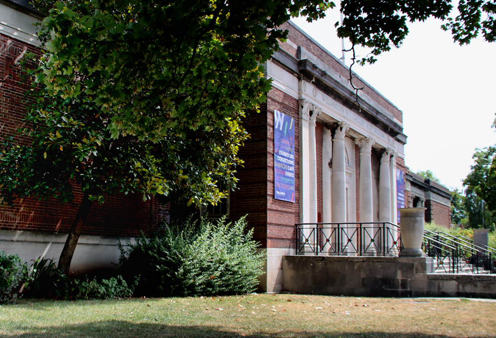
Georgia O’Keefe, Small Wonders and three other temporary exhibitions at the Williamson Art Gallery and Museum, Birkenhead

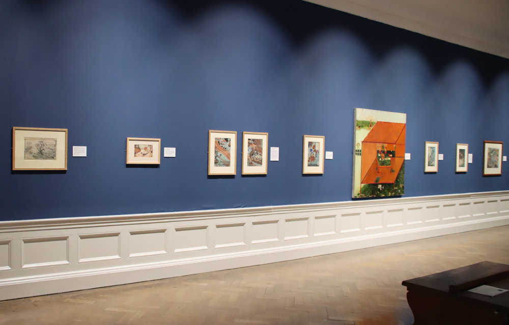
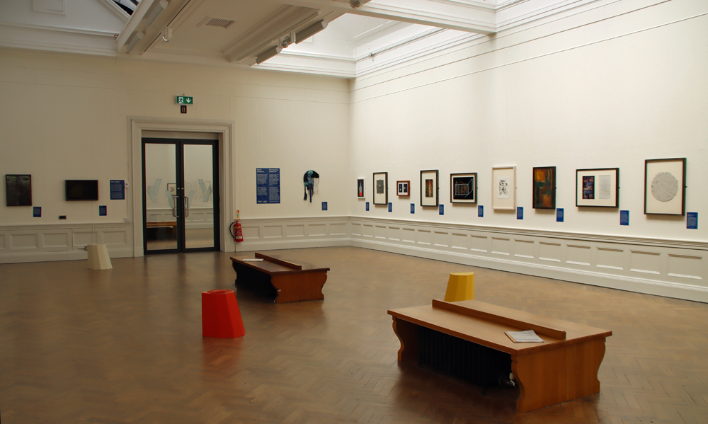
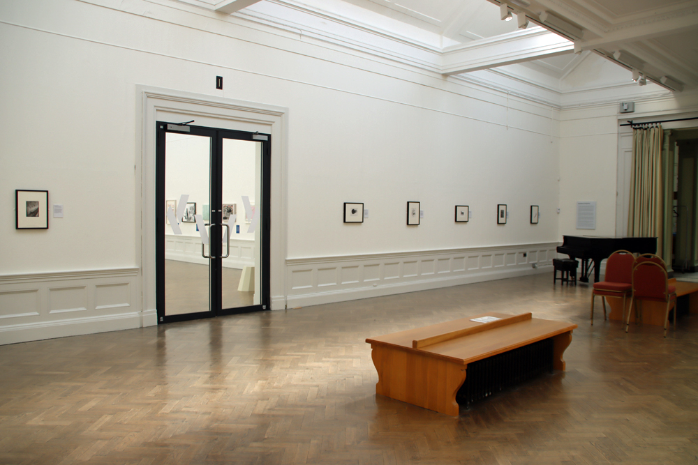
I’ll start with a time alert.  Very sorry for the ridiculously short notice, but if you want to see the Georgia O’Keefe exhibition, a touring exhibition from the Hayward Gallery in London’s South Bank complex you will need to take a trip to Birkenhead before the exhibition closes next Saturday, the 25th July.  Make haste!  The O’Keefe exhibition is part of the Small Wonders. Reimagining British Art exhibition, also curated by the Hayward Gallery, and also on until Saturday 25th.  The three in-house exhibitions are The Garden As A Muse also on until the 25th, Beyond the Brotherhood: The Legacies of the Pre-Raphaelites, on until 7th November, and Echoes of the Floating World on until 6th February 2027.  All the exhibitions are free of charge and all are very well worth visiting.

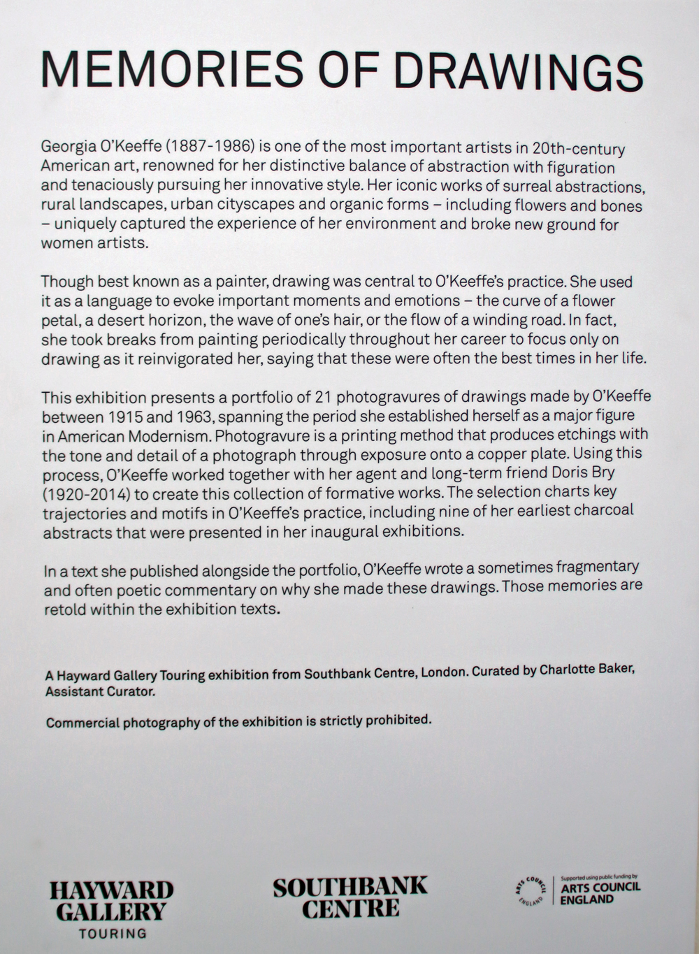
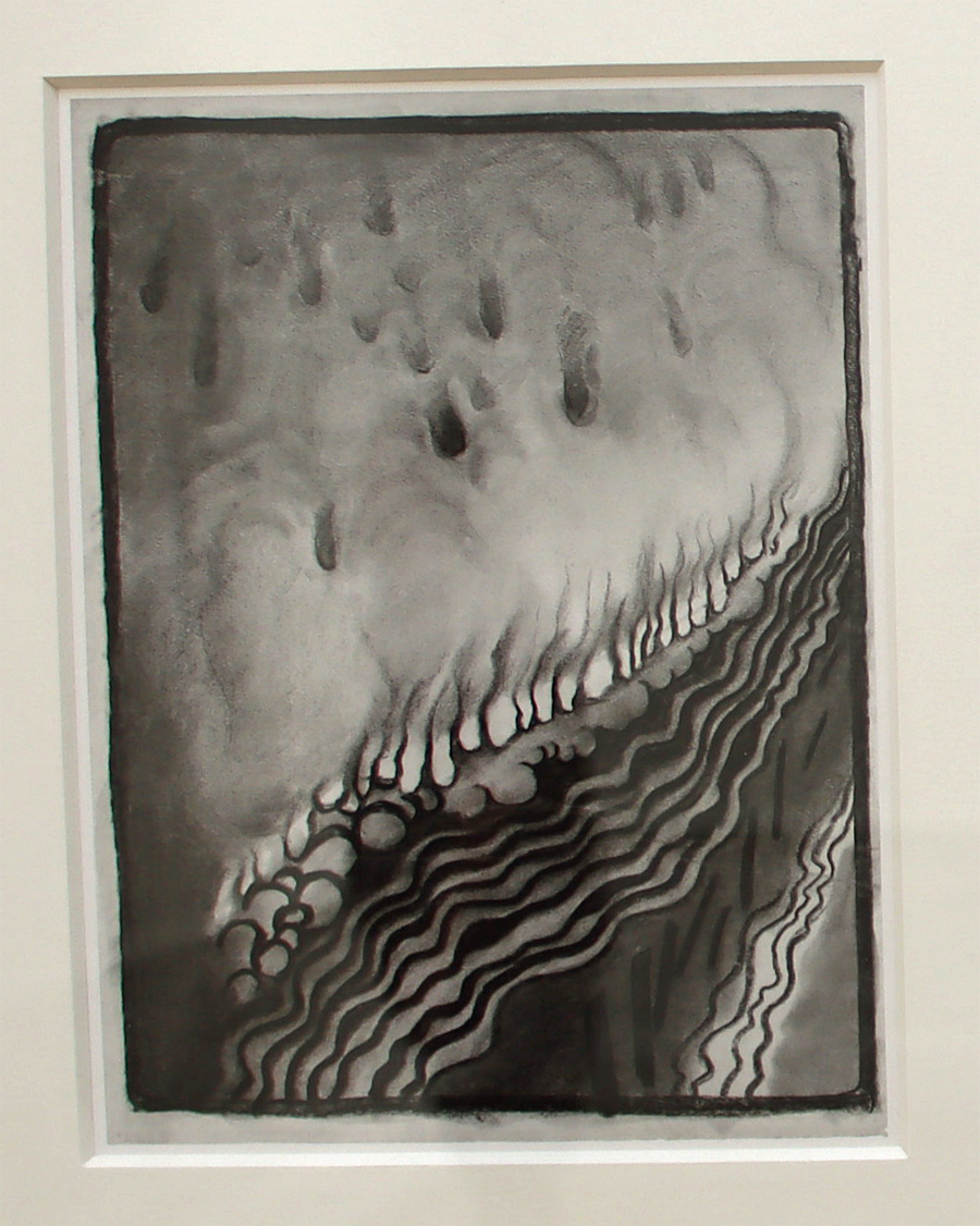
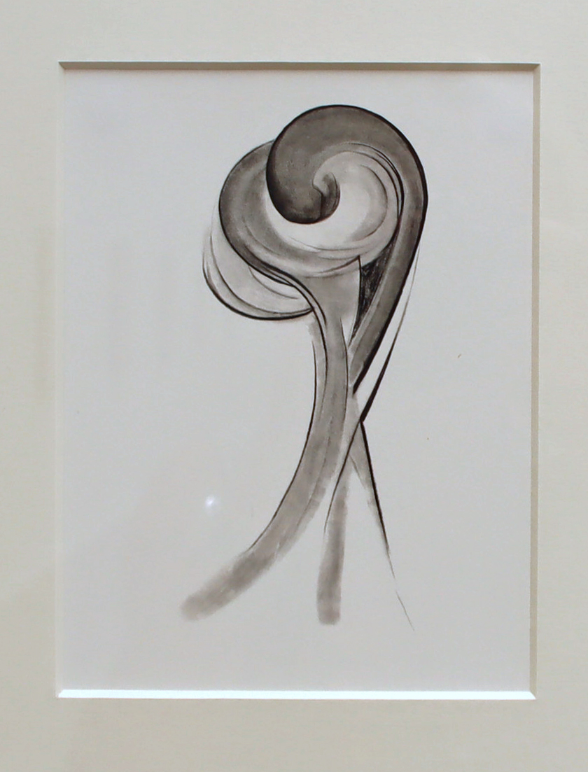
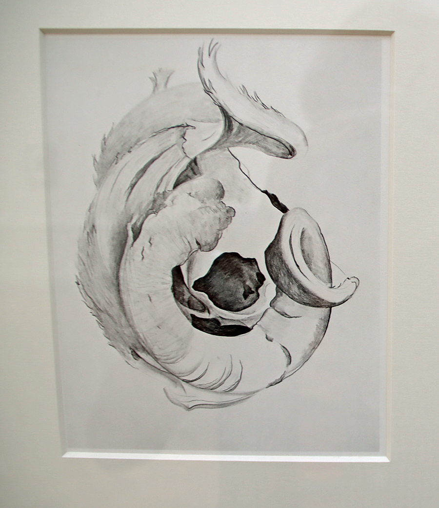
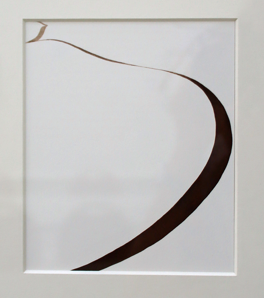
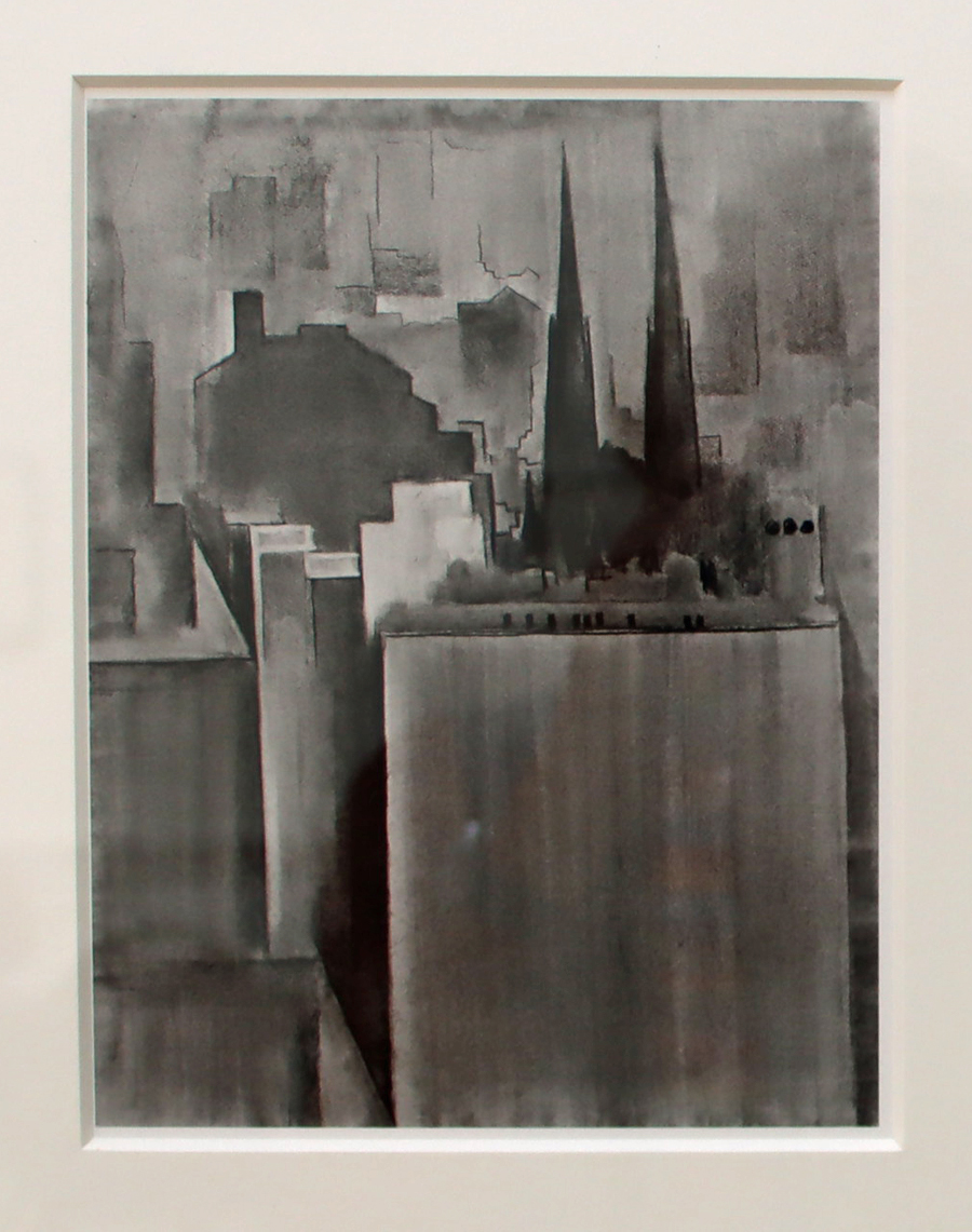
If a Georgia O’Keefe exhibition comes to a local gallery it is a matter for celebration, and the Memories of Drawing exhibition offers 21 small pieces drawn by O’Keefe between 1915 and 1963 and prepared for publication with her agent and friend Doris Bry.  Photogravures are images created by a sophisticated and highly accurate printing process.  They are a complete delight, like fabulous little sound-bites, and it is wonderful to see them all together in one room.  O’Keefe is best known for large, delicately rendered paintings and drawings of flowers, seashells, animal skulls and desert landscapes, which are so inherently vital and dramatic that they often appear to be in the process of metamorphosing into something much less easy to define.  The photogravures display the concentrated essence of O’Keefe’s work, containing all the gorgeous draughtsmanship, the organic, the semi-abstract and sometimes wholly abstract, and each one is all the more fascinating for being so small and minimalist.  All but two are in graded shades and textures of black and grey, and all share the sense that at any second they might shape-shift in tiny, imperceptible ways.

Georgia O'Keefe's Drawing No.9 (1915)

Georgia O’Keefe’s Drawing No.9 (1915)

O’Keefe’s work is always dynamic and frequently seems to be alive; the photogravures capture that beautifully.  The depth of O’Keefe’s dedication to the development of her artwork is demonstrated by “Blue Lines” (1916) of which she commented “It was in the fall of 1915 that I decided not to use any colour until I couldn’t get along without it and I believe it was June before I needed blue.”   Her humour comes across vividly in “Drawing No.9” (1915 – shown right) about which she said “Well, I had the headache, why not do something with it?”  From the barely-present representation of a seashell, “Drawing No.40” (1934) to the spiky, stark lines of a New York skyline “The City – New York Rooftops” (1930s), she is able, with real elegance and understated drama, to convey the complexity of both natural and unnatural worlds.  My photos do absolutely no justice to the detail and texture in each image.  You just need to see them for yourself.  The exhibition is a treat – don’t miss it!


As if Georgia O’Keefe on her own was not enough, there is another visiting exhibition and three temporary mini-exhibitions drawn from the Williamson’s own collections.

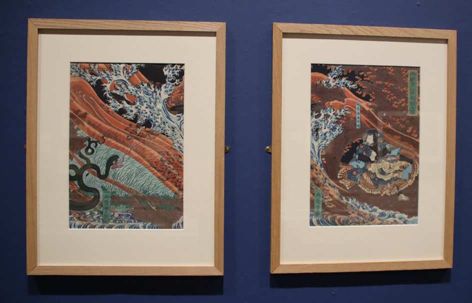
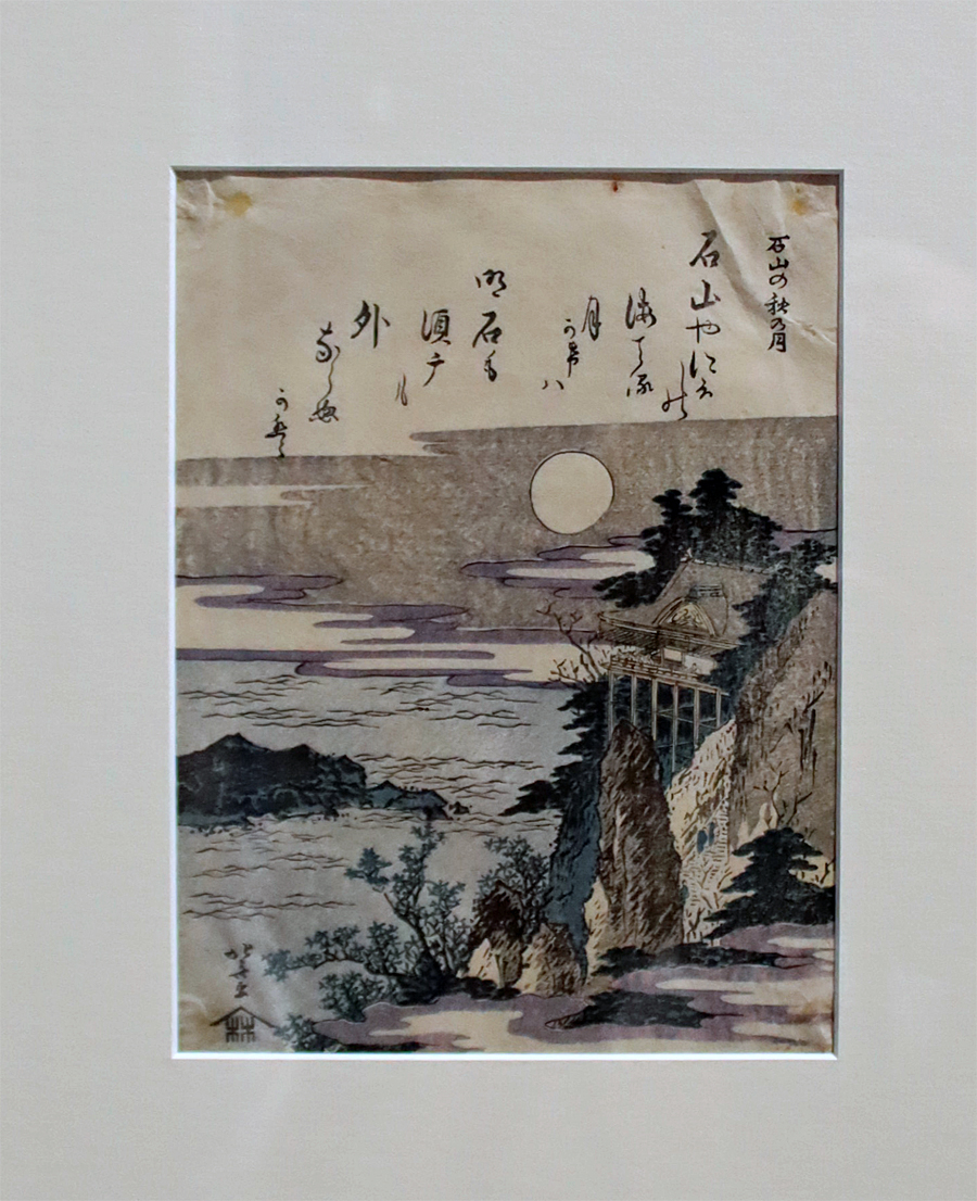
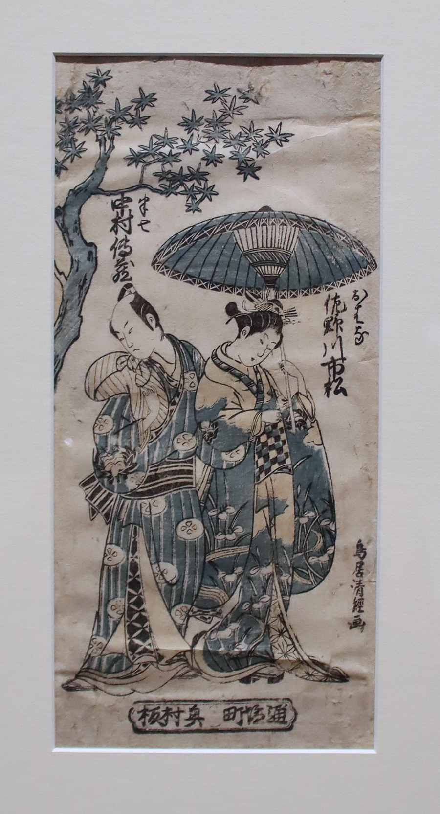
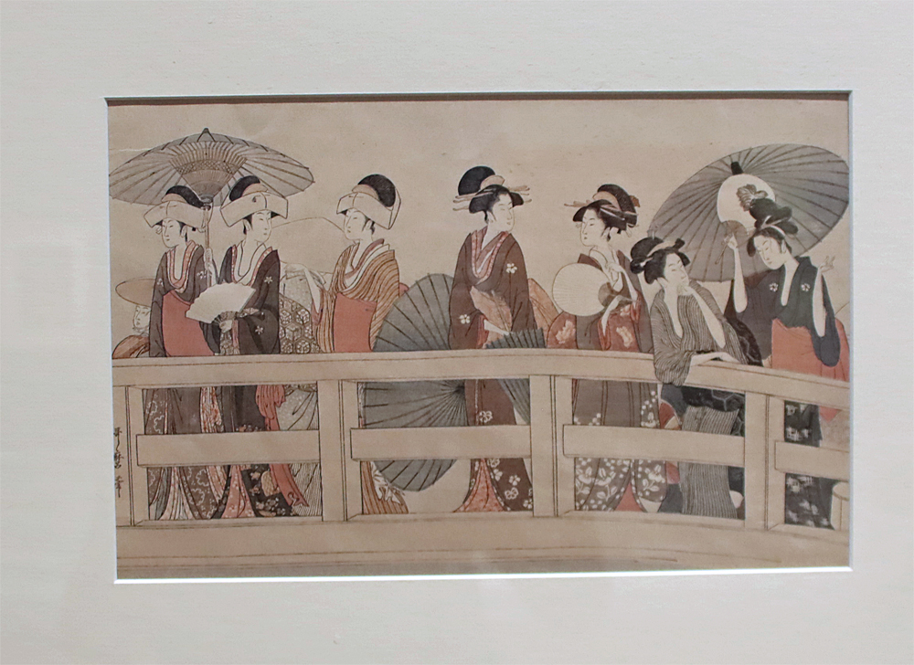
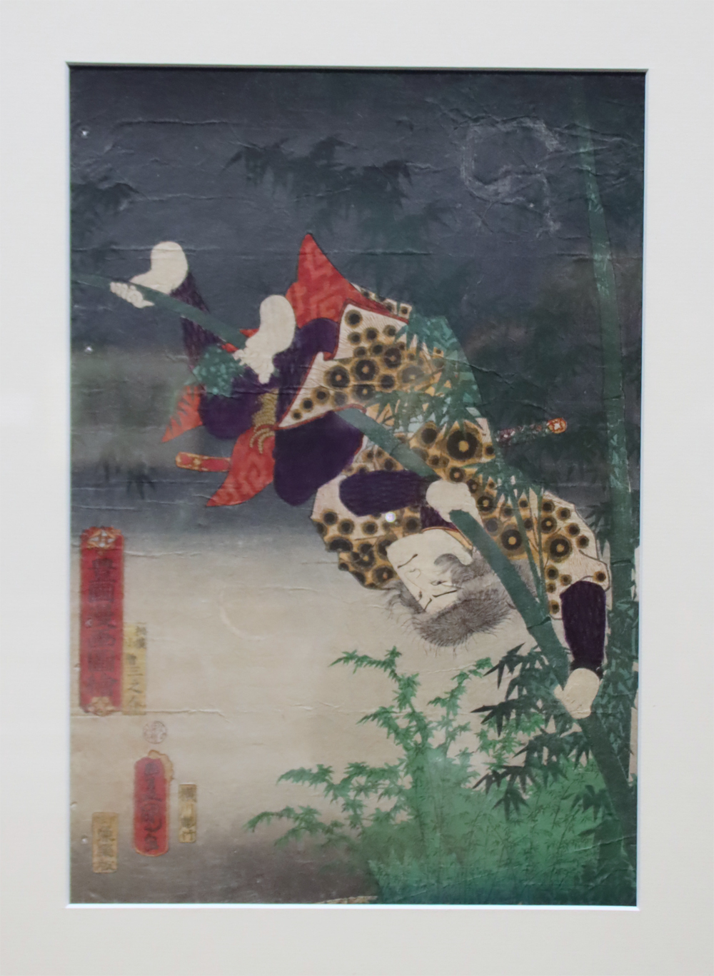
The Echoes of the Floating World exhibition, in one room focused on Ukiyo-e was a particularly lovely surprise.  As the Williamson website says, “[t]heir motifs of flat perspectives, high vantage points, and bold colour distinctions, were a radical influence across European art” and the premise of the exhibition is to show the 19th century woodblock works juxtaposed against artworks that were influenced by the Japanese art.  It was interesting to see the more modern artworks, with the surprising range of ways in which composition, colour and subject-matter were adopted and transformed.

Of course the real stars were the Japanese works, with some very contrasting pieces chosen for the display.  From almost monochrome examples, to highly coloured pieces, the exhibition managed, in a confined space, to give a very good sense of range of the style and expression produced by the woodblock artists.  The oldest example of Ukiyo-e in the Williamson’s collections is a lovely depiction of a man and woman coloured only in mid-blue and black, dating to before the wider palette of colours became available.  Images in full colour included rich and vibrant pigments, which complemented scenes that were full of motion and narrative intensity, as well as those that captured intimate moments of everyday life in subtle and delicate shades.  A lot of people, right now in all this California-type weather, will relate to the splendid row of ladies with their parasols standing on a bridge over a river to help them cool down.


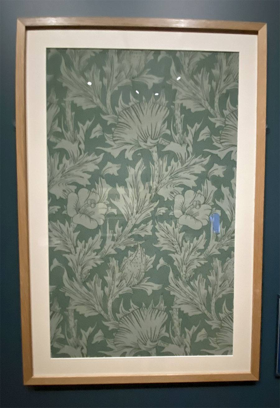
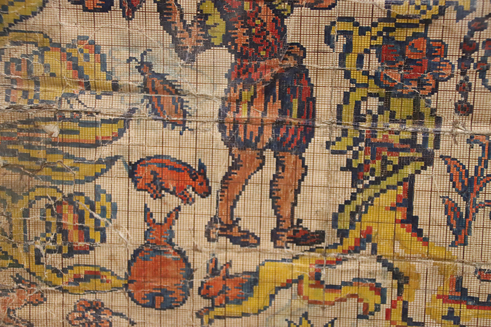
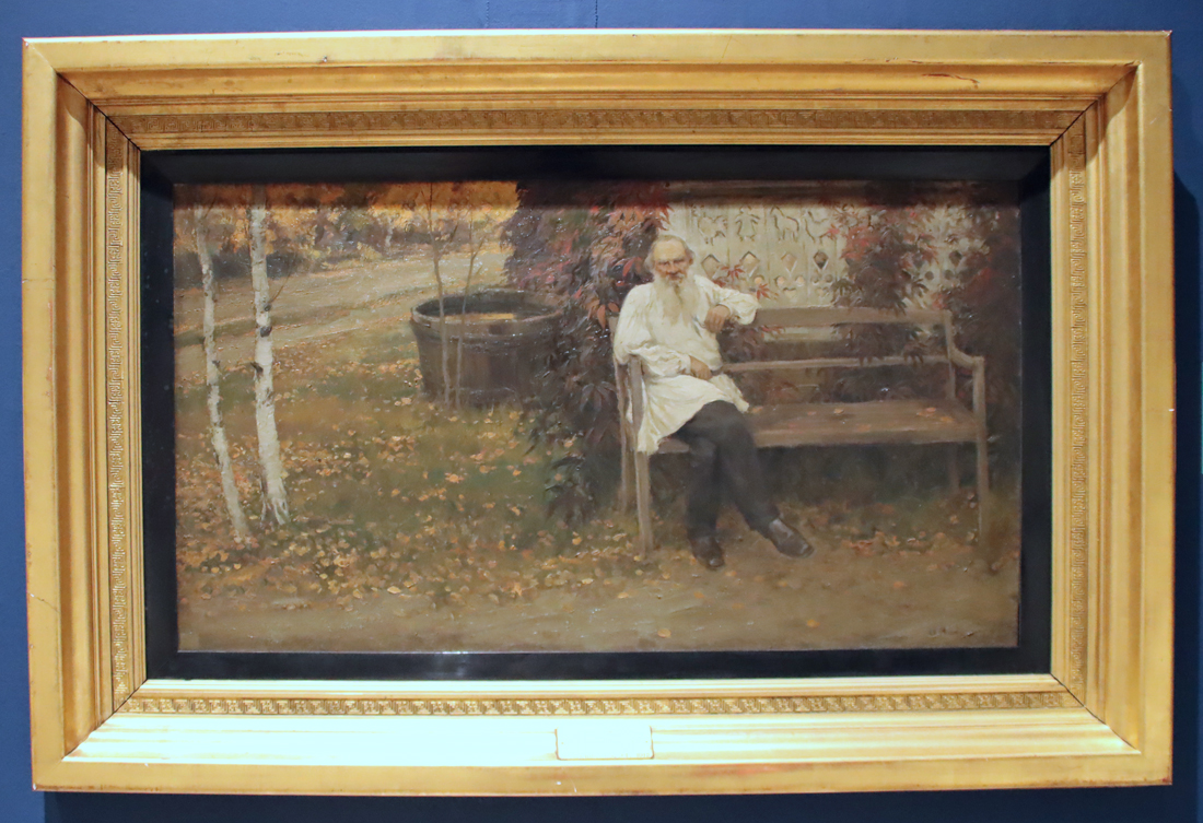
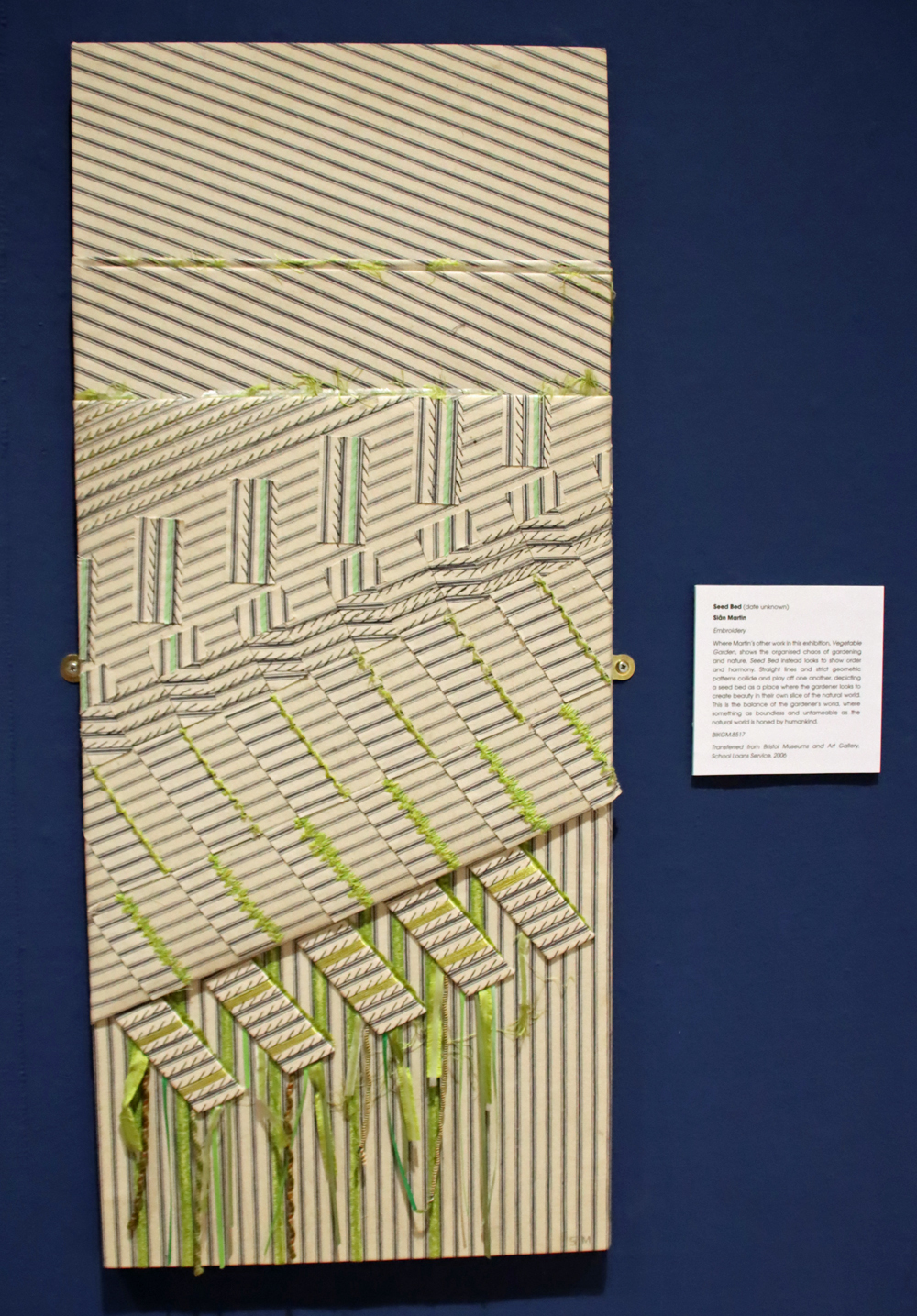
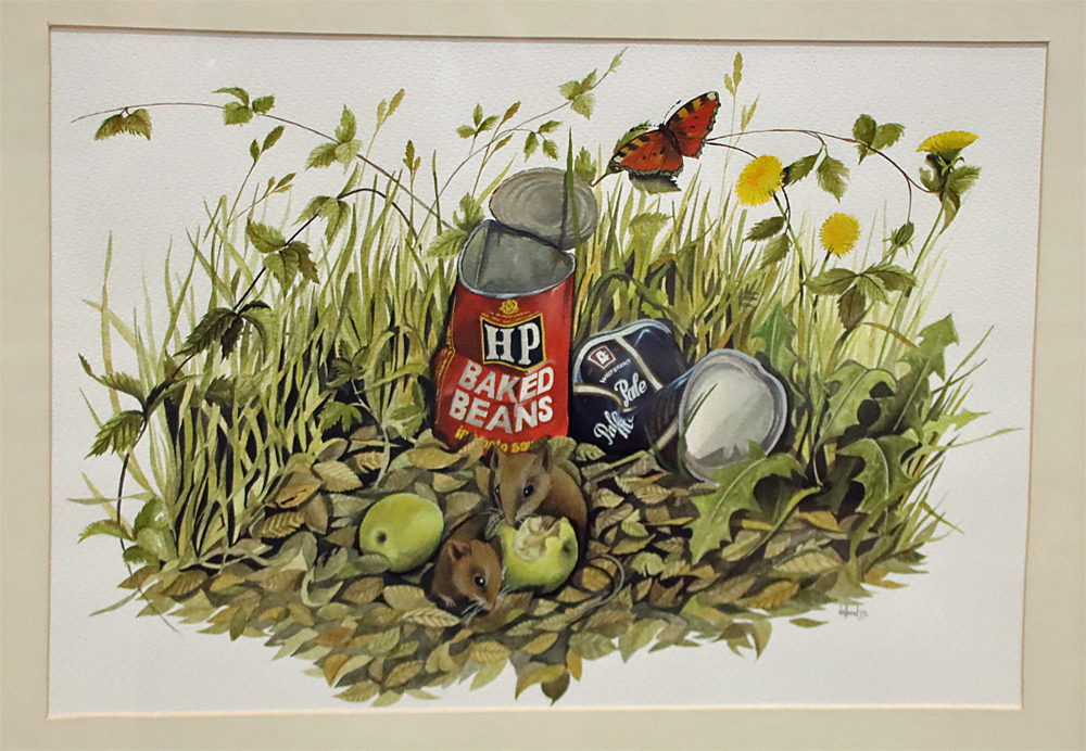
The Garden As a Muse exhibition “traces how artists across time have interpreted gardens not merely as physical spaces, but as symbols of creativity and solace. From delicate, nostalgic studies to immersive and grand paintings, these pieces reveal how gardens can function both as sanctuaries and laboratories of artistic experimentation.”  As a thoroughly committed gardener I very much enjoyed this insight into different perceptions of what gardens can or should be.  Sentiment was unsurprisingly present, but there was a thorough mix of styles and there were some very unexpected pieces too.   I was particularly amused to find myself staring at Tolstoy who seemed improbably relaxed, although very dour.  The two Arthur Lee textile designs, produced at their Birkenhead factory and mapped out with precision on graph paper were fascinating to see, ready to be converted into tapestry, embroidery and even printed fabrics.  Sian Martin’s fabric-based abstract representations of such contrasting horticultural arrangements as seed beds and vegetable patches were incredibly effective.  The entire ensemble of images was both witty and engaging, and nicely drew attention to the British fascination with garden places.


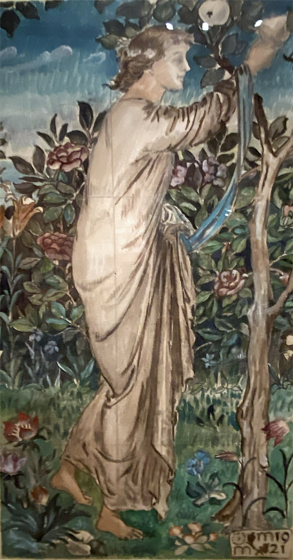
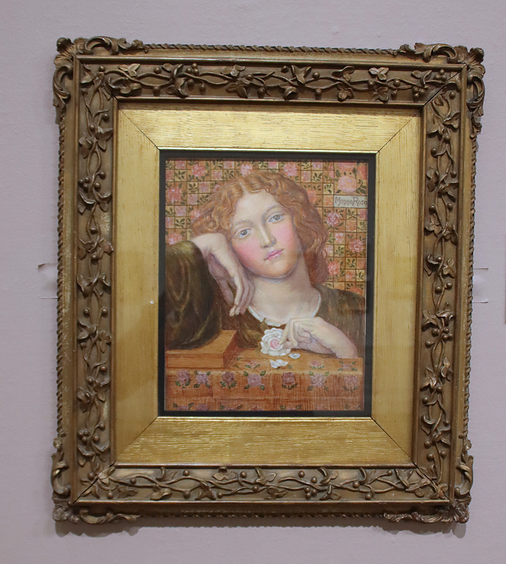
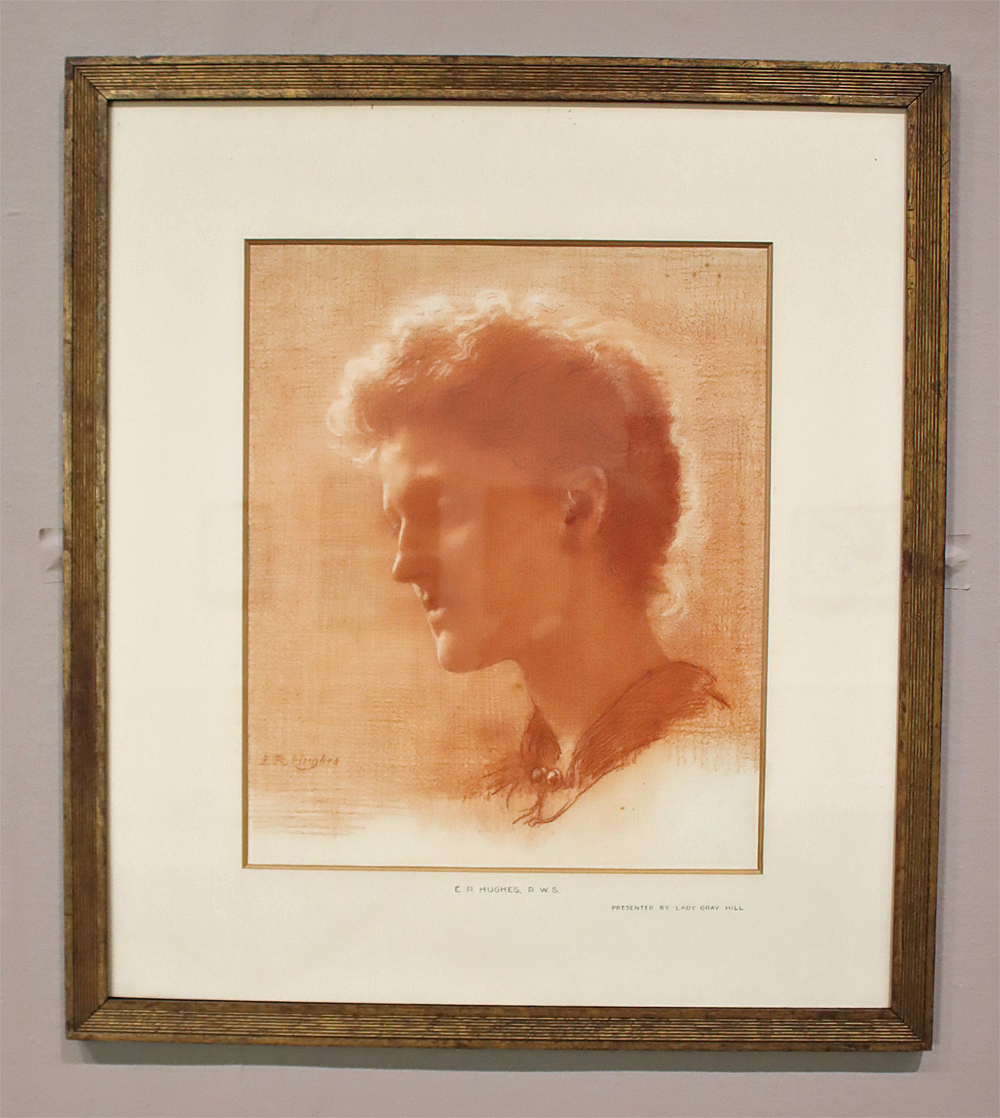
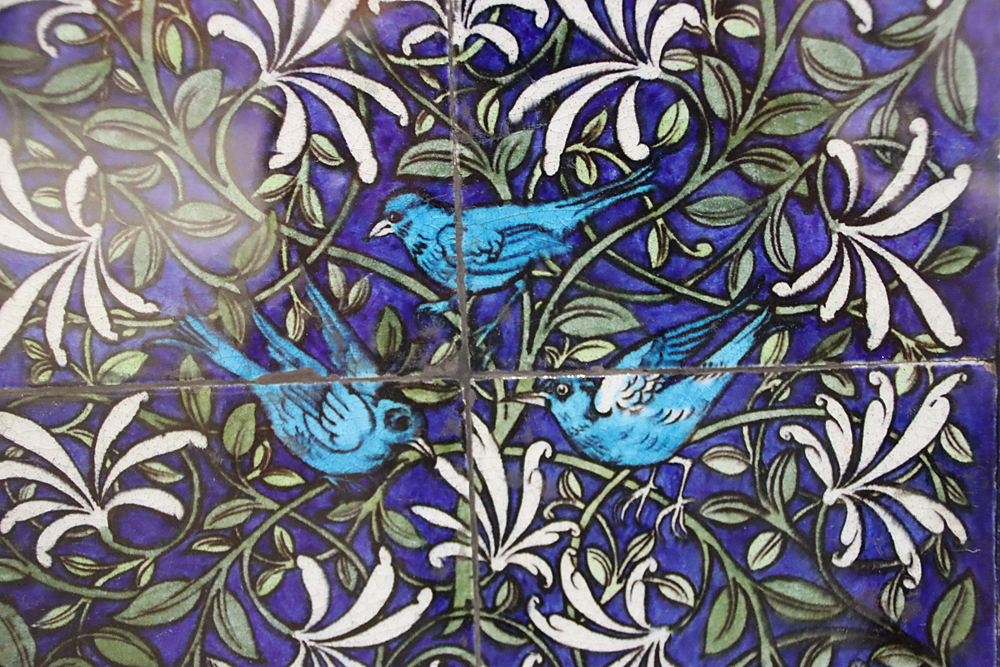
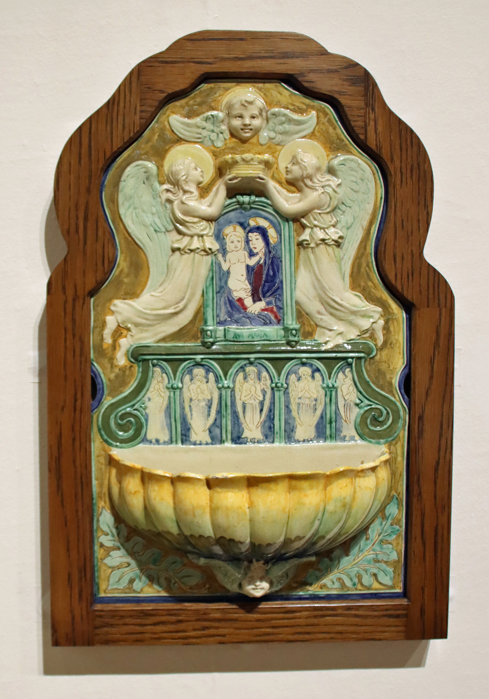
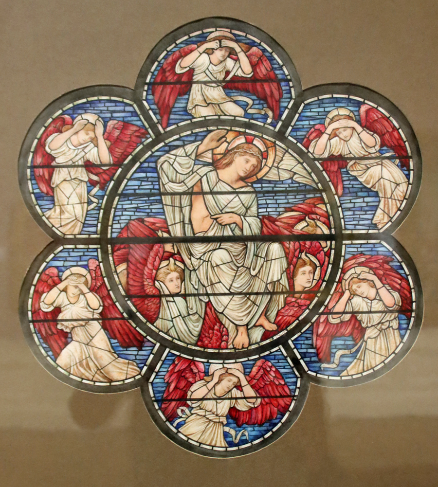
The Beyond the Brotherhood: The Legacies of the Pre-Raphaelites exhibition presents some of the original works produced by the Pre-Raphaelite brotherhood but also introduces some of their followers, who built on their legacy to create works of their own in the same broad style.  This included examples from the so-called Liverpool School of landscape painters as well as elaborate pieces by the sculptors of Birkenhead’s Della Robbia Pottery Company, some locally produced stained glass, and it was delightful to find some William de Morgan tiles on display.


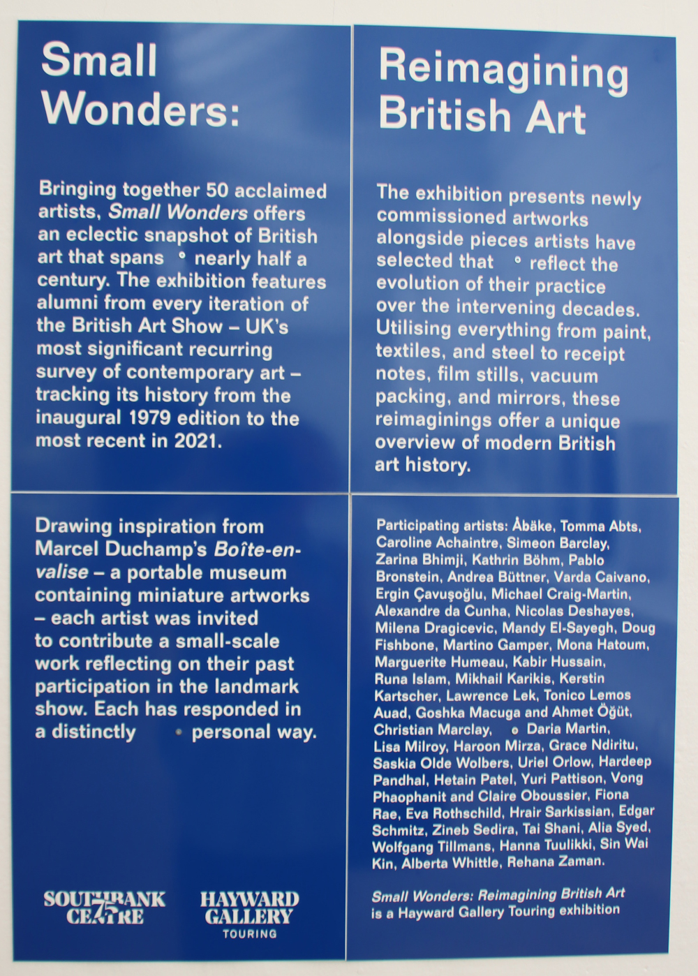
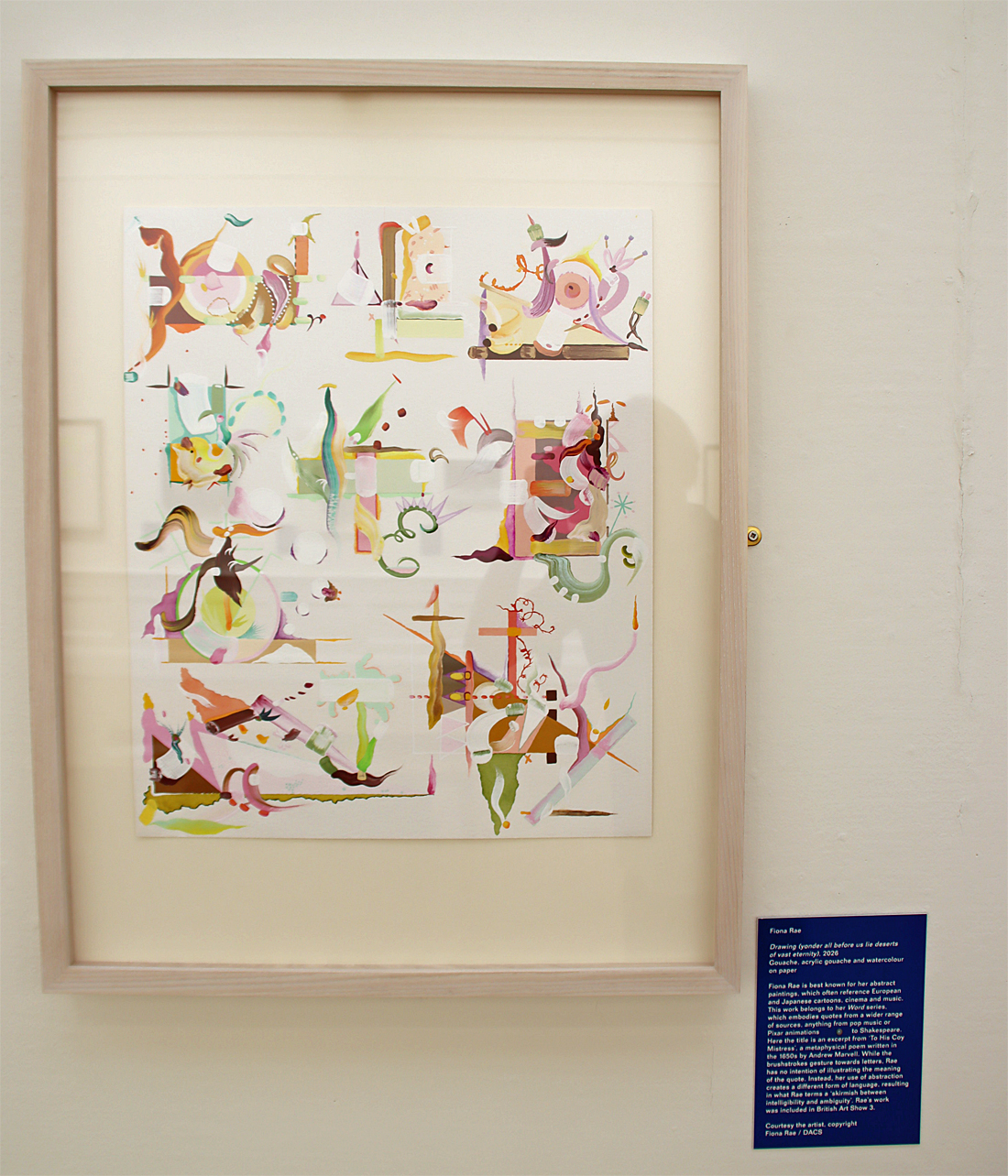
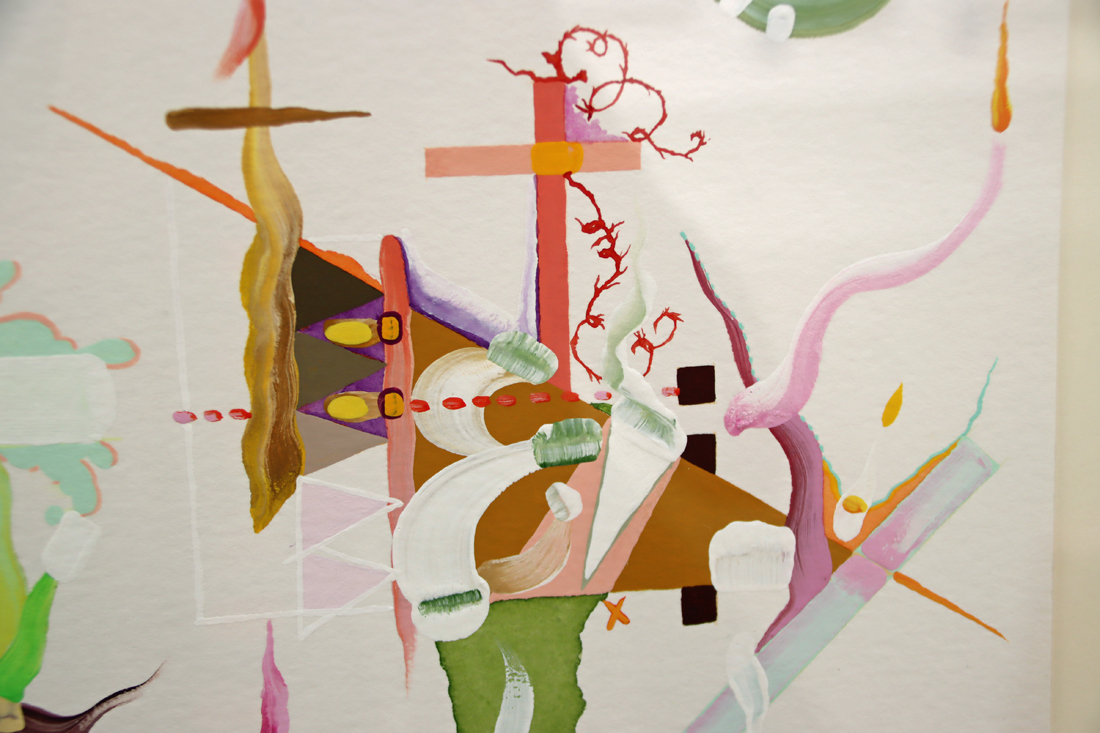
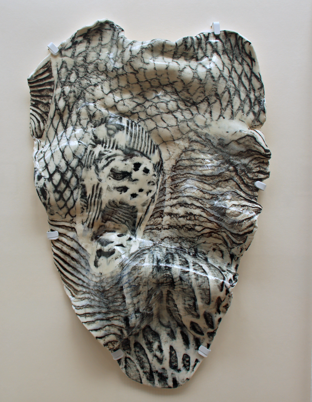
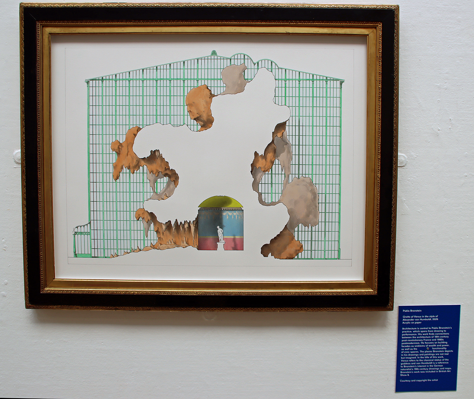
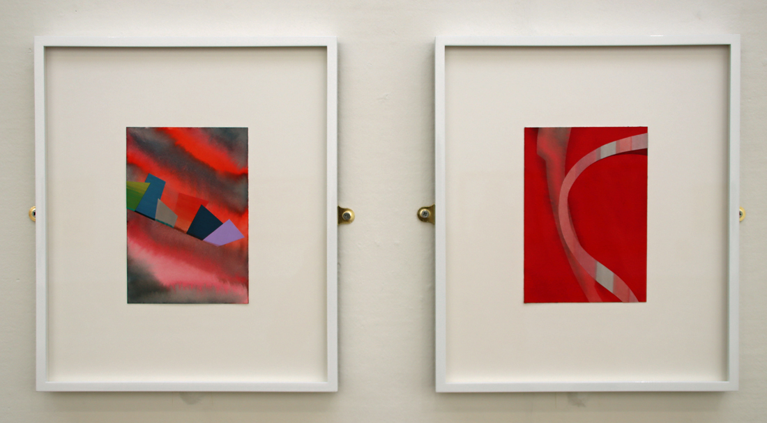
The Small Wonders exhibition was the most difficult to describe, mainly because I found so little about it relatable, which is unusual for me.  It is a travelling exhibition curated by London’s Hayward Gallery, and brings together work by fifty artists, to provide a snapshot of British art over the last 45 years.  I have been visiting and enjoying modern and contemporary art for decades, but although there are always some pieces that leave me cold, I found this was more frustrating than usual.  Before I go on, I should say that I may be alone in my response to what is clearly a popular exhibtion.

One piece, which for me was engaging thought-provoking, was a video with a voice-over, but the rest were all static, framed artworks, although most of the artists, according to their biographical data, work in various forms of media including including 3-D installations and cinematic work.  Perhaps the artists are better understood in other media but for me most of the artworks failed to engage me either emotionally or intellectually.  I could see that there is technical skill and creativity, and found some of it visually attractive, but a lot of it was very derivative of previous styles and although the multicultural mix was a positive element, I found none of it deeply gripping.  Apart from Saskia Olde Wolber’s video artwork “Centrifuge,” which was compelling for both its narrative and its constantly evolving  organic semi-abstract imagery, there was nothing with sufficient depth for me to sink my teeth into, and I came away longing to have had a teachable moment, something from which I could have learned, or which had at the very least moved me to empathy, laughter, annoyance or simple admiration.  But of course, to each their own.  Having said all of that, I am sincerely grateful for being given the chance to see a London exhibition without having to travel to London to do it.


The Williamson is a splendid resource to have for the Wirral and so near to Chester.  I very much admire their policy of retaining part of the museum for their permanent collection and the other, larger part for temporary exhibitions.  It means that local people can always expect to come in and find something new to see, whilst those of us driving from elsewhere find that the trip is more worthwhile when there are new artworks to see from the Williamson’s own stores. You can find out more about the Williamson’s events on their web pages.  I signed up for their newsletter after my first visit and that is an excellent prompt not to miss anything.  You can sign up for it at the end of every page.

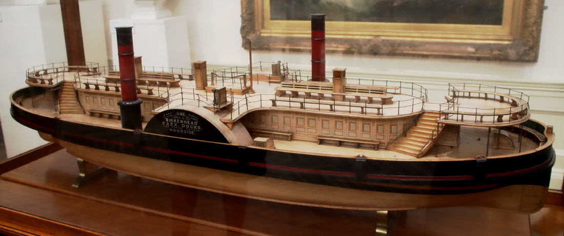
On my previous post about the Williamson’s permanent and temporary collections I mentioned the café.  It is comfortable and spacious, with excellent coffee and some good-looking lunches being produced in large numbers, and as you imbibe you can enjoy more art because the walls of the café are used as additional hanging space for art works, and these too had changed since our last visit.  And don’t forget to visit the model ships, which are stunning.  Who wouldn’t want to cross the Mersey on a ridiculously curvaceous Art Deco ferry like this one?  Bliss.


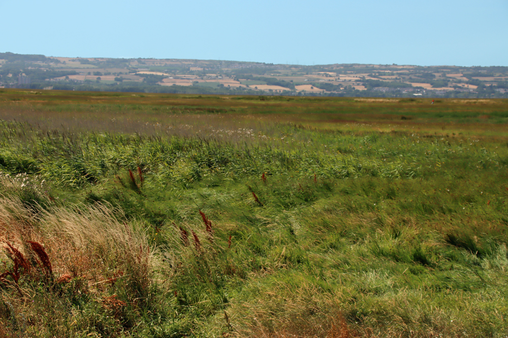
Because of that big yellow sun and the vast acres of blue sky, we opted for The Harp Inn at Ness, parking at Denhall Quay, both of which I posted about last week, and here too there was much loveliness to be enjoyed across the acres of green marshes reaching towards the Welsh foothills and Moel Fammau, with a fabulous breeze coming off the estuary.  We were both ravenous, so ordered one haddock and chips with garden peas and one cheese and ham ploughman’s (the latter, mine, was absolutely huge and truly heavenly).  It was a really super way to round off a superbly satisfying morning.

The lovely Harp Inn and the chunky remains of Ness Colliery’s Denhall Quay, south Wirral

The Harp Inn, Little Neston

The Harp Inn, Little Neston

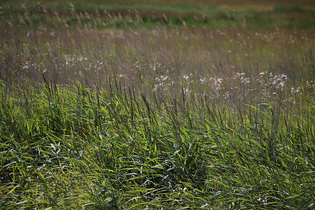
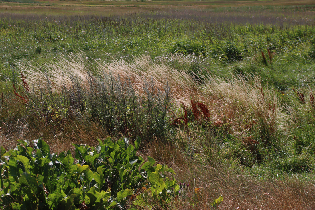
One of the most mellow, blue-skied and sunny afternoons that I have enjoyed in a long time was a sublimely relaxed and chatty visit to The Harp Inn on the Dee estuary, just outside Little Neston.  It is a super little pub dating to the 1700s with lovely views over the marshes towards the impressively long line of the Welsh foothills.  The pub’s official opening time is 12 noon, but we arrived to find it open at 1145 because due to queues outside their doors at 12 they are currently opening at 11. Very gratifying!  The beers and ciders change from time to time (just check their website), there are plenty of soft drinks on offer and the lunches that were being paraded past us as the afternoon advanced looked gorgeous.  The staff are lovely, and the atmosphere is great.  There are lots of tables perched on the grassland at the edge of the lush green estuary, and on a stiflingly hot day, a wonderfully warm but cooling breeze came off the Dee to make the peaceful, endless vistas a delectable place to linger, interrupted only by birdsong.  The breeze was so perfect.  I do love the heat, but it is lovely to be able to sit in the sunshine without dripping like a tap.  Update:  We went back the following week to have lunch after a visit to the Williamson Art Gallery and Museum in Birkenhead, and the food (haddock, chunky chips, tartare sauce and garden peas for one of us and an enormous ham and cheese ploughman’s with all the trimmings and more for the other) was just as good as it had looked as it was passing us on trays the previous week.

Most of the photos taken on my aged iPhone. Enlarge at your own risk!

View from The Harp

View from The Harp


Denhall Quay

Denhall Quay

According to the pub’s website, the building has stood there since the 1750s, when it was originally built as three coal-miners’ cottages, before being converted to an inn in 1780 to serve the expanding coal-mining community at Ness.  This segues nicely into the second major benefit of the pub, which is its location a stone’s throw from Denhall Quay, an intriguing and picturesque line of wall, made of massive red sandstone blocks, that stretches out into the marshland, and is clearly the remaining echo of a substantial structure.  In fact, the wall is what remains of a long pier that served the Ness Colliery, built in 1839 to replace an earlier quay in the same location.  The wall was much deeper than it is now, its lower tiers lying beneath 200 years of silt accumulation, but it it sufficient to give an idea of how impressive the structure originally was.

This was not the most obvious location for a quay because the river did not run past the colliery, veering towards Wales just before Little Neston, meaning that a channel had to be created to link the quay to the main river, which became known as the Colliery Gutter.  It was not ideal, as vessels often had to wait for two tides to turn before being able to navigate all the way to the quay, forcing colliers to beach on the muds in the interval between tides.

Denhall Quay c.1839 Annakin-Smith p170

Denhall Quay c.1839 showing the quay, with its distinctive shape, surrounded by subterranean tunnels. Source: Annakin-Smith “The Neston Collieries, 1759-1855” 2019, p.170, fig.10.6

There were two collieries at Ness:  Ness Colliery, which opened in 1759, and Little Neston Colliery immediately to the north, which opened in 1820.  Most people, myself included, would not automatically associate coal mining with the Wirral, although it is a very familiar industry from North Wales.  Fortunately, Anthony Annakin-Smith wrote an excellent book on the subject in 2019, which I read shortly after its publication, and he gave a really enjoyable lecture about the collieries at the Festival of Ideas this year (July 2026).  The Wirral coal seams are an extension of the Welsh ones, but although a slither of the seams can be found on the Wirral landmass itself, most of them lie under the estuary, and it was here that most of the mining took place.  A whole network of tunnels was built below the estuary, and subterranean canals were added to help remove the coal in long narrow vessels called “starvationers.”  Both the tunnels and the canals lead back to shafts where the coal was hoisted to the surface.  It was a dangerous and sometimes tragic business.  Once extracted and processed the coal was transported to ports in Britain, Ireland, France, Spain and as far away as America and even Barbados.

Starvationer

A “starvationer” of the sort used in the canals beneath the Dee estuary, now in the National Waterways Museum at Ellesmere Port (my photo)

The two collieries were located either side of a border dividing land between two different family interests.  The original colliery, Ness, owned by the Stanley family, handled the arrival of the new colliery very badly, and its owner, Sir Thomas Stanley, who sounds like an absolute monster of a man, pursued a course of aggression that eventually, on several occasions, erupted into blatant sabotage, including destruction of machinery, flooding of their rival’s tunnels and, on one particularly violent occasion, an attempt to use explosives to completely obliterate the opposition.  The collieries were both closed between 1845 and 1855 due to silting of the estuary, but they were revived in 1875, and the last coal was worked in 1927.

It is difficult to assess just how the collieries initially impacted local people, because most of the coal miners were brought in from North Wales and Lancashire, with Wirral residents only working in minor and administrative roles.  But both the collieries and the miners became part of the community, and Denhall Quay is an important reminder of the unexpected industrial and social heritage of this small corner of the Wirral.

The Harp Inn, on Quayside in Little Neston, is at the end of a residential lane, Marshlands Road, turning left along the Quayside, before it eventually becomes a track and then a footpath.  There are three main parking areas, first just as you round the bend to turn left from Marshlands Road onto Quayside (What3Words ///regarding.solving.mirroring, about a two minute walk, heading in the same direction), then at the pub itself where there is parking for about 10 cars (What3Words ///when.grumbling.kicks), and finally at Denhall Quay (///bike.outcasts.tarred, about a two minute walk back to the pub).

If you are interested in finding out more about the Wirral collieries I sincerely recommend Anthony Annakin-Smith’s The Neston Collieries, 1759–1855: An Industrial Revolution in Rural Cheshire published by the University of Chester Press (a second edition was released in 2023), and also check out his website at https://www.nestoncollieries.org.

At the entrance to Denhall Quay there are two helpful information boards that are faded but still just about legible, covering the earlier and later colliery phases, and you can walk out into the marshland along well-worn paths (dry in a hot summer, but probably not as foot-friendly in the autumn and winter).

Both the pub and the quay are on the King Charles III England Coast Path, and would make a great destination if you are visiting either Ness Botanic Gardens or the RSPB reserve at Burton Mere

Other posts on this blog re the southwest Wirral area:


The verdant Hampston’s Well, Burton village, Wirral

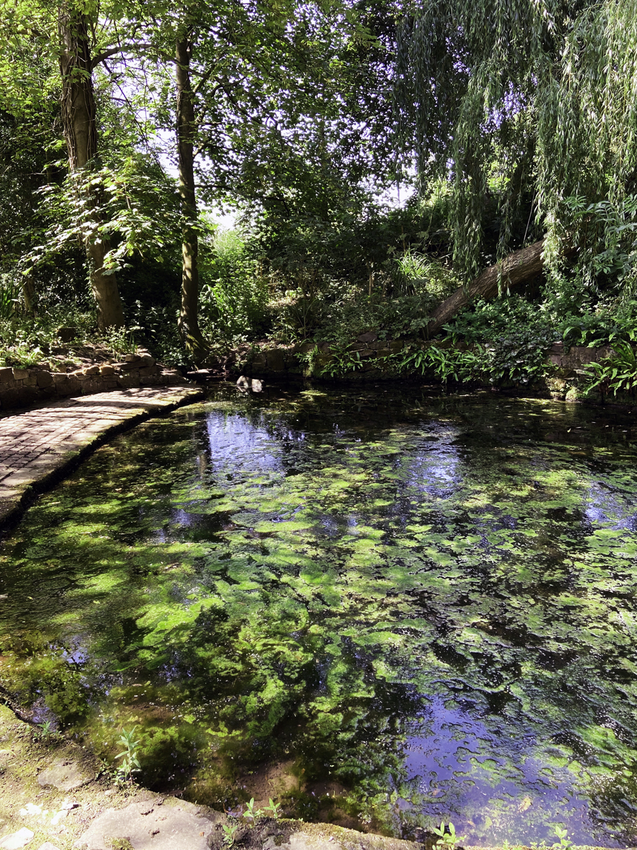
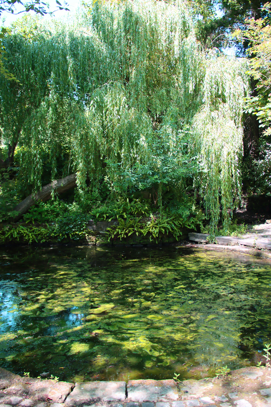
I must have driven past Hampston’s Well several times without noticing it, although when I mentioned an earlier visit to the RSPB Burton Mere, a friend mentioned that there was a well somewhere in the Burton village area.  I was not quite sure what to expect when I remembered it on the way to Ness Gardens, and tapped it into the SatNav.  On a sunny day, the light filtered through the dense woodland leaves, creating an enchanting dappled effect.

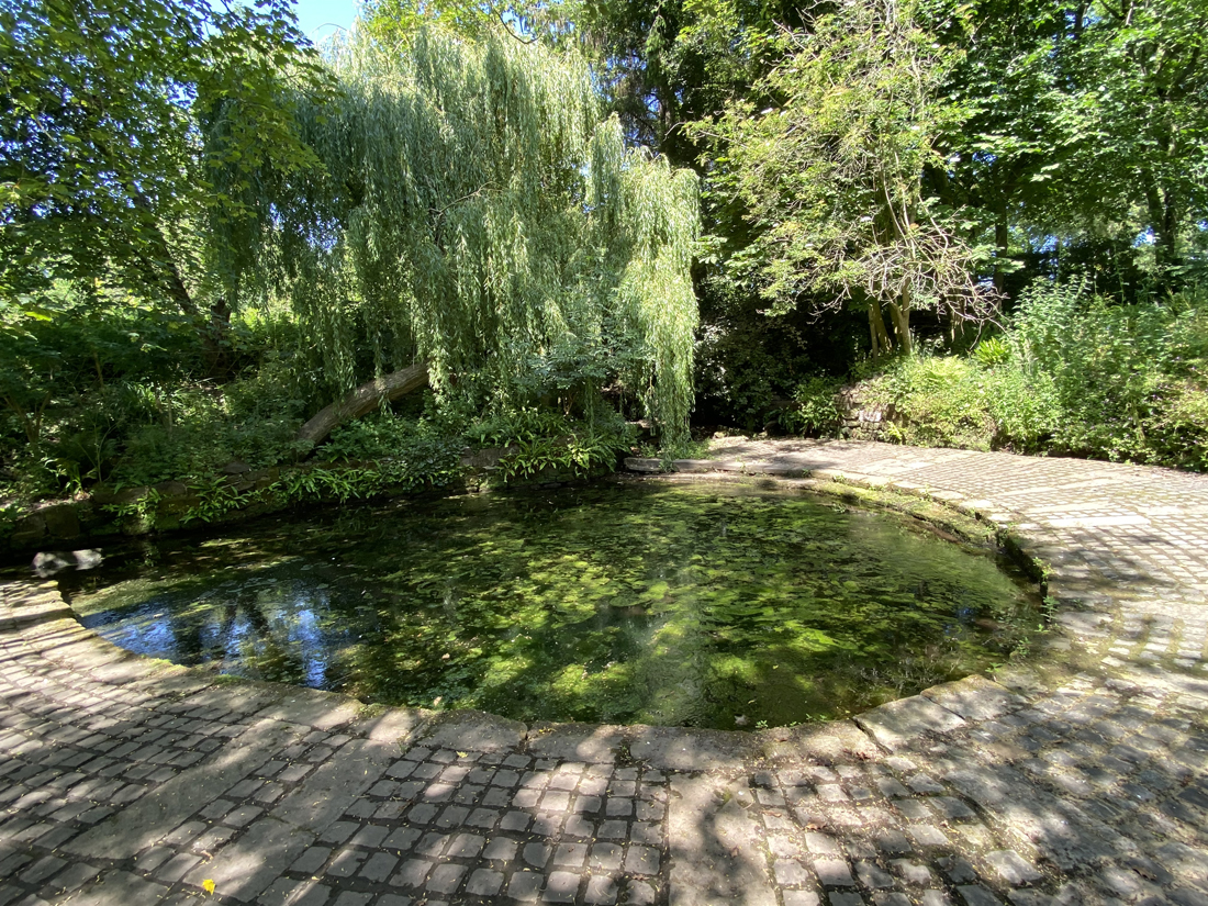
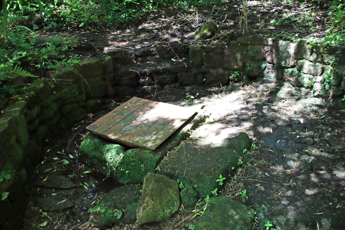
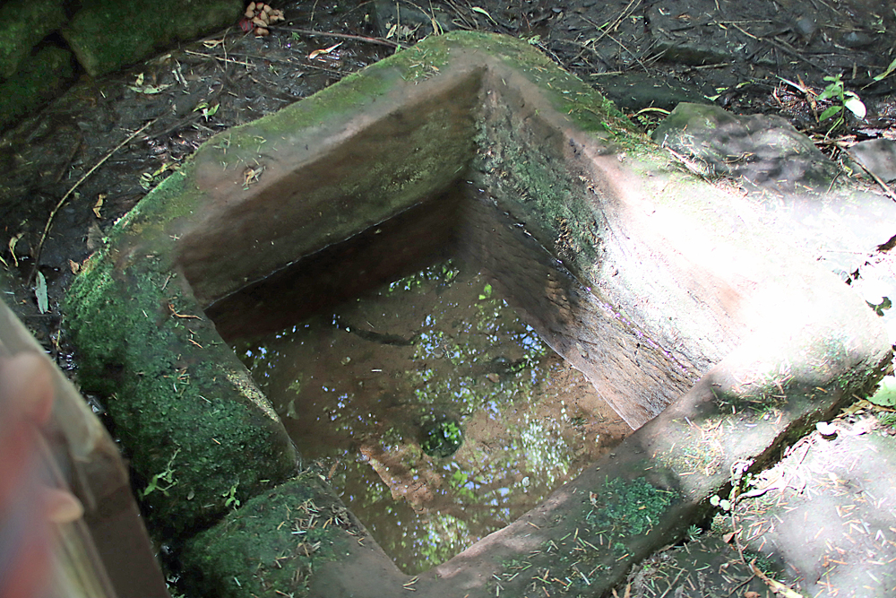
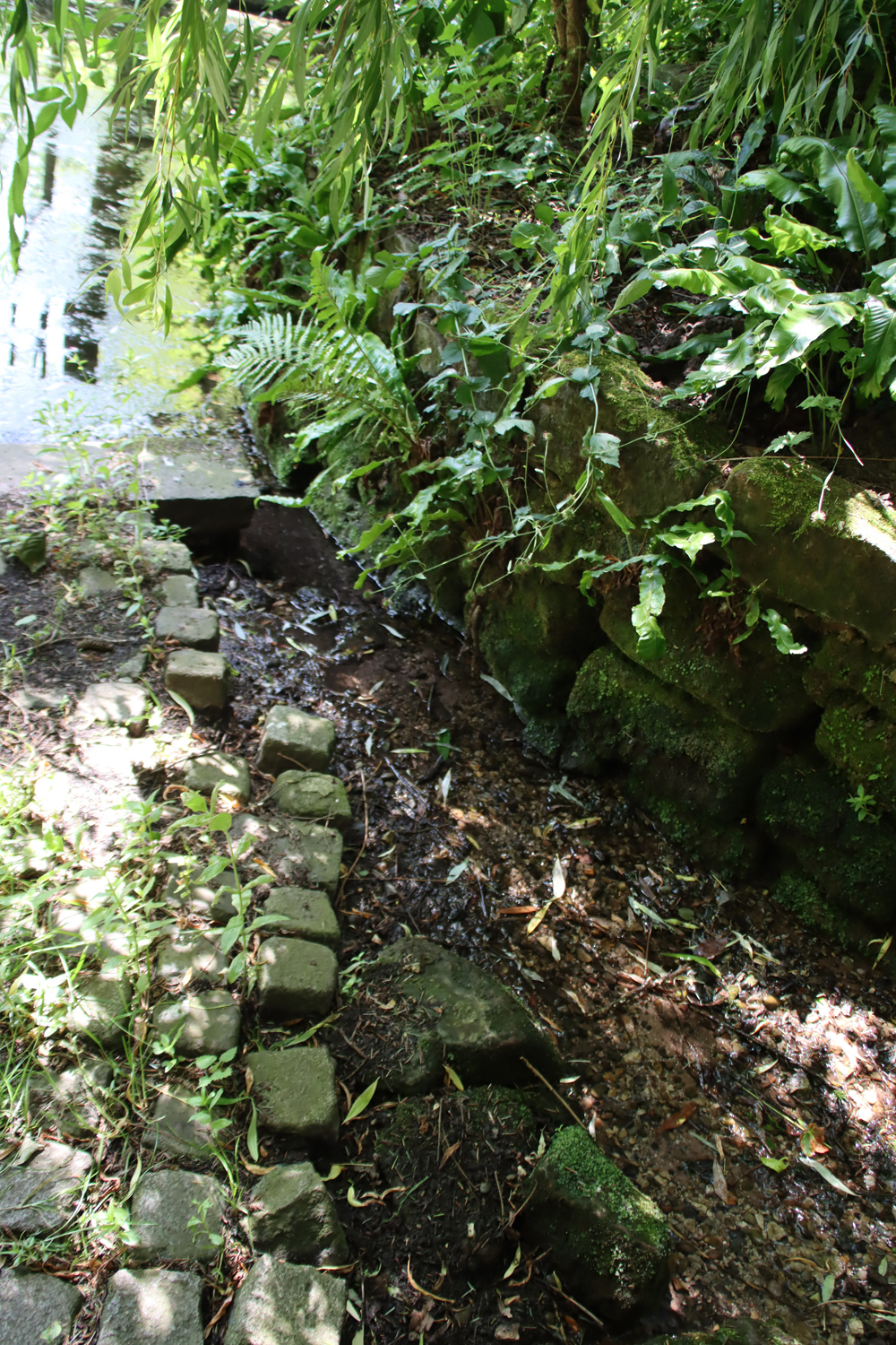
The well is a natural spring now in a stone container with a wooden lid that is easily removed.  From here it trickles elegantly down a channel into a big pool, surrounded by radiating lines of block paving.  The well has been restored by the Friends of Hampston’s Well, who also maintain it. It is on the south side of Station Road, where there is parking for around two to three cars.  The What3Words location is: ///professes.outsmart.deflate.

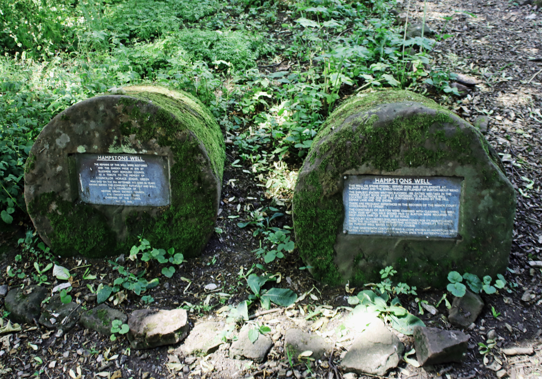
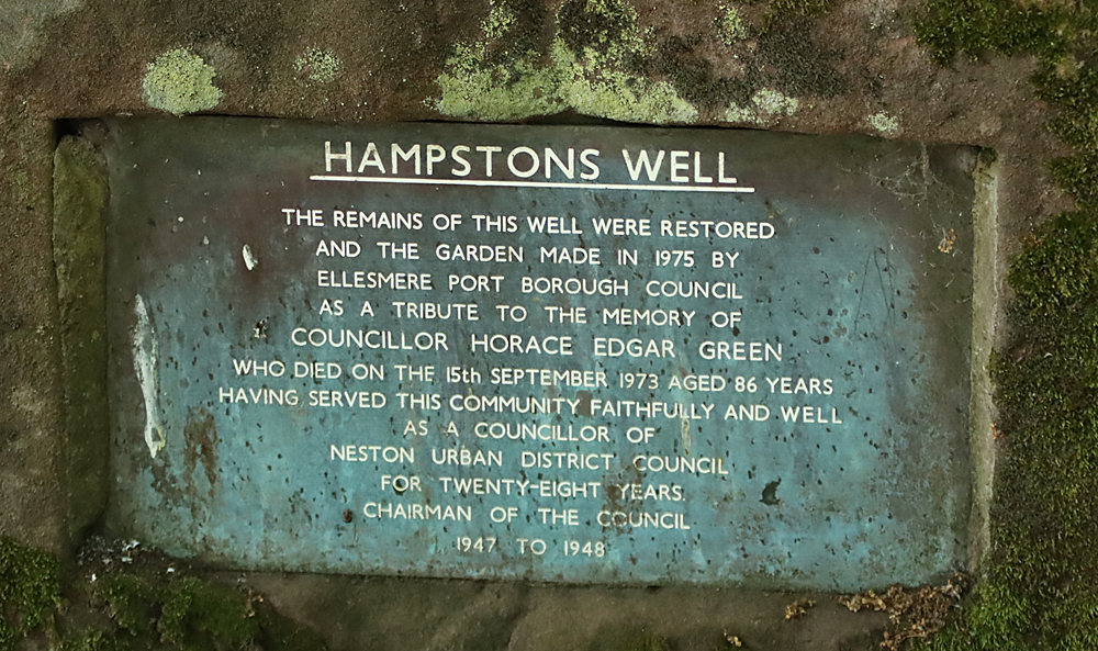
A flight of steps leads down from the road level, at the top of which there is a bench, some very faded information posters in a noticeboard display, and two prone sandstone columns with plaques containing information about the well.

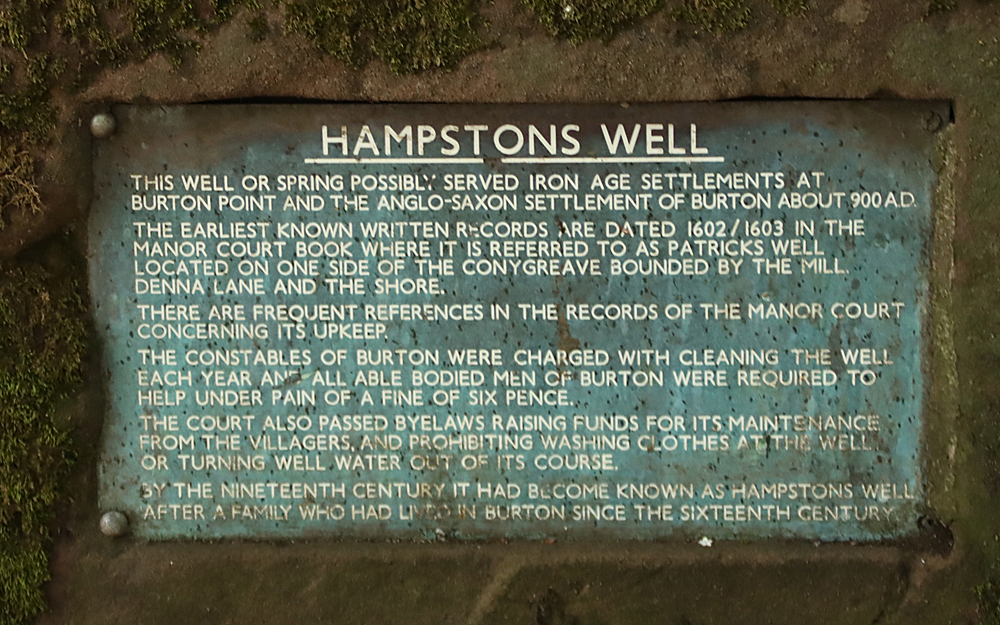
According to an entry on Facebook (but otherwise unverified) a dedication document for the well in 1975 stated that the sandstone columns are cores from the sinking of another well nearby.  Here are the plaques:

There is some more information on the OldWirral.net website, with some photos of how it looked before restoration.


Late June at Ness Botanic Garden on the Wirral

On one of those days last week when I had a list of a hundred other things I ought to have been doing, and when the sun was blasting down from the heavens like an impending judgement, I jumped in the car and went to Ness Botanic Gardens on the Wirral.  Even on a seriously hot day, there was a breeze coming up off the Dee estuary, there were plenty of shaded and wooded areas to enjoy, and Ness is notable for the sheer quantity of seating and benches available throughout. I was there for three hours, so taking water was essential, but if you forget to bring any with you, the shop is well stocked with bottled water.

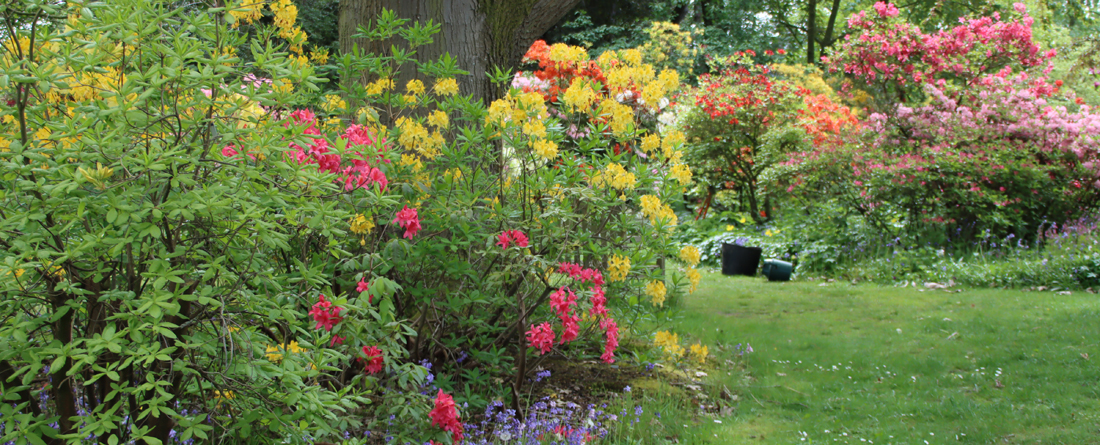
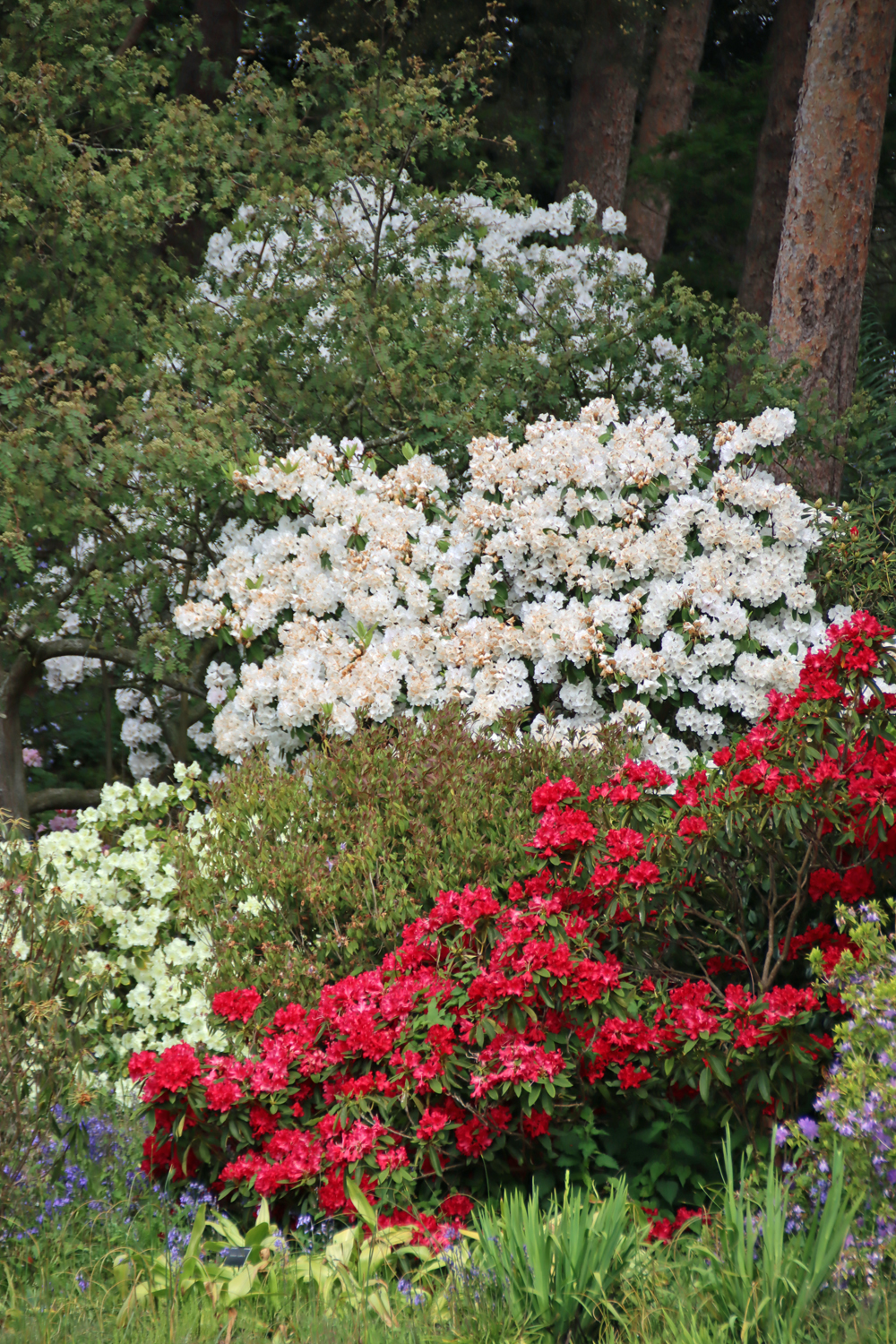
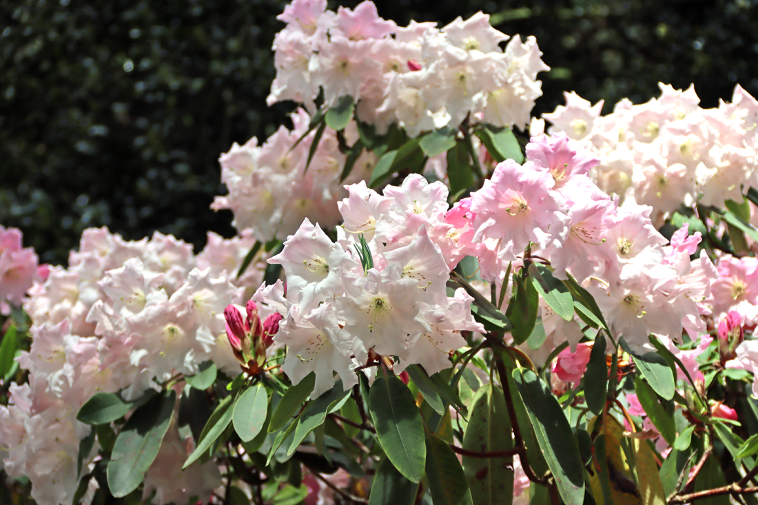
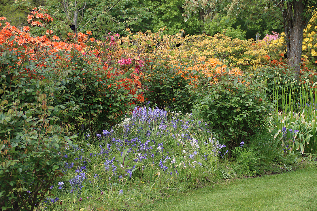
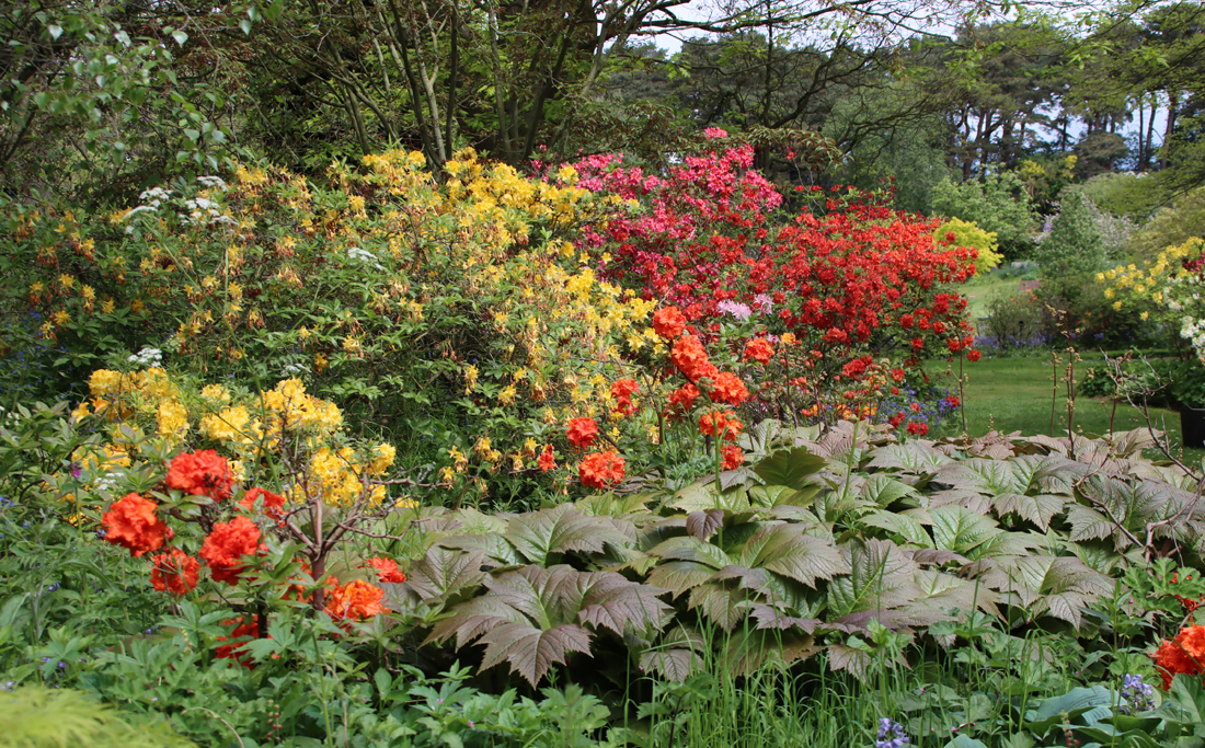
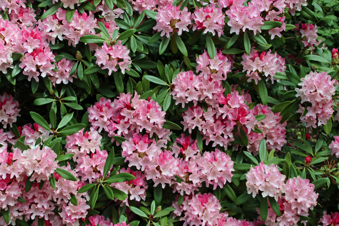
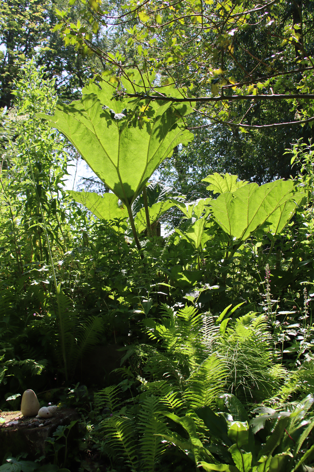
My previous visit, during rhododendron and azalea season, was only six weeks ago, but the change was absolute.  The brightly coloured floral effusions of shrubberies, woodland edges and wending pathways had gone over for the season, but in their place both sun- and shade-loving extravaganzas had emerged and were doing a fabulous job of ornamenting large areas of the gardens.  Water features are a significant aspect of Ness, and even though drought conditions were in play, the ponds and wending channels were looking good, supporting numerous water-adapted plant species, some of them with leaves as large as parasols, as well as dragonflies and damson flies.  The herbaceous borders in the big open expanse below the main building are being re-done and were not the extravaganza of colour I had been expecting, and the rose border had gone over, but what I learned on this visit is how much there is to see beyond the core areas.  The gardens extend into shaded wooded areas with winding trails and great views over the Dee and the north Wales coast, and there are extensive wildflower meadows.

There is plenty of parking.  Visitors are provided with a map of the site with the entrance ticket.  Ness has a nice, well attended café which does excellent coffee and a good range of sandwiches, hot food and cold drinks, with both indoors and outside tables available.  There is a small plant sales centre outside the shop, with excellent quality plants that are kept well-watered (mine are doing well in their new homes), and a shop indoors selling gifts.  The Ness Botanic Gardens website with full visitor details is here.

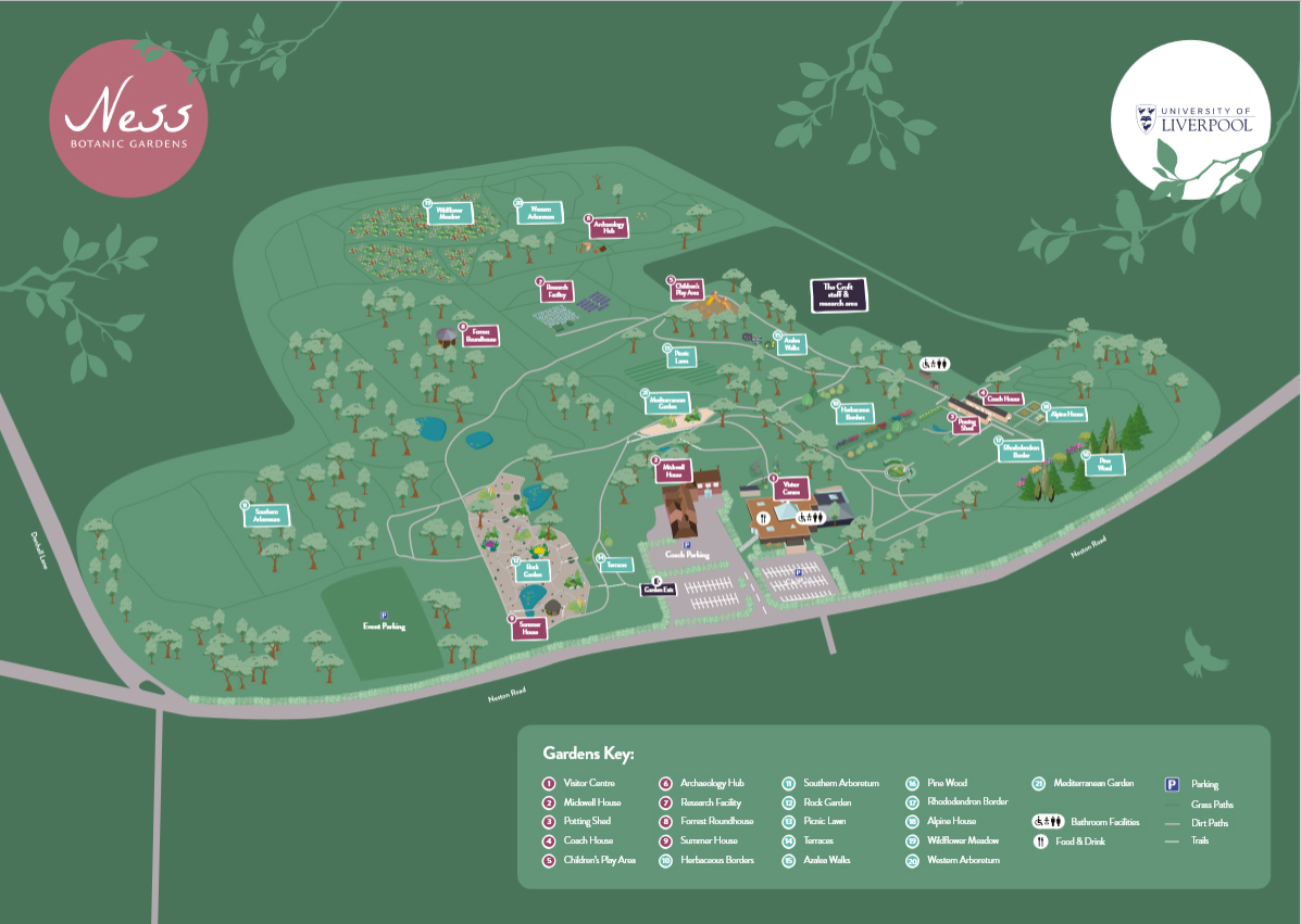
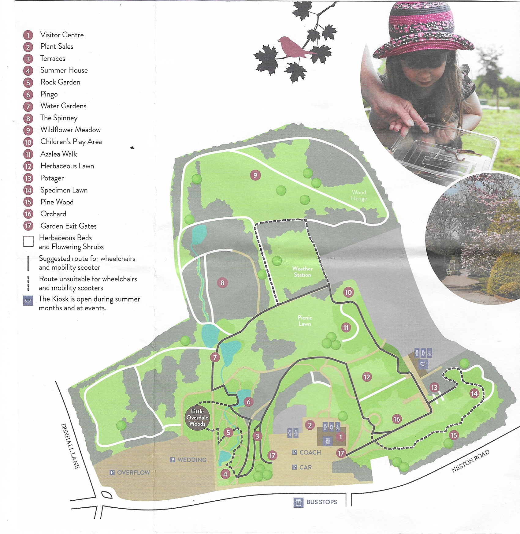
Available to download from the Ness Gardens website at https://www.liverpool.ac.uk/media/livacuk/nessbotanicgardens/Ness;,Map,3_2_26.pdf, but I have not found a way of rendering it easy to print. You are given a copy, however, with your ticket

For a very enjoyable day out, this could be combined very easily with the RSPB Burton Mere nature reserve, which is just 10 minutes away.


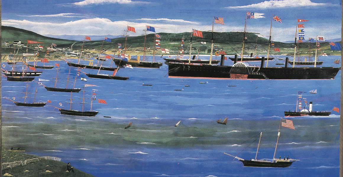
Brunel’s magnificent “Great Eastern” arriving this day in New York from Liverpool in 1860: The Illustrated London News

On 17th June 1860 the fabulous S.S Great Eastern left Liverpool and set sail on her maiden voyage for New York. She arrived there this day, 28th June. Her designer and architect was Isambard Kingdom Brunel whose pet name for the ship during construction was “Great Babe.”

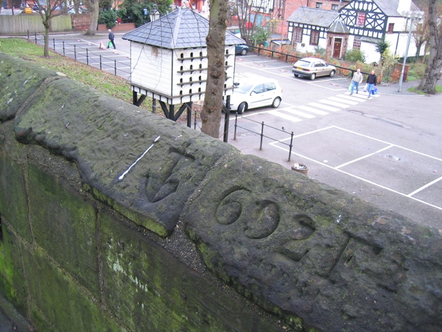
There is a nice nod to Great Eastern on the Chester City Walls, where the length of the ship (692ft) was carved quite deeply into one of the coping stones at Kaleyard, near the pigeon coop, preceded by an engraved anchor.  It is also the measurement between that point and the King Charles Tower, also known as the Phoenix Tower.   You can see a photograph of it at the end of this post.

I have written previously about the Great Eastern and her relationship with the Mersey, and above is a splendid engraving from the 21st July 1860 Supplement of the Illustrated London News showing her June arrival in New York.

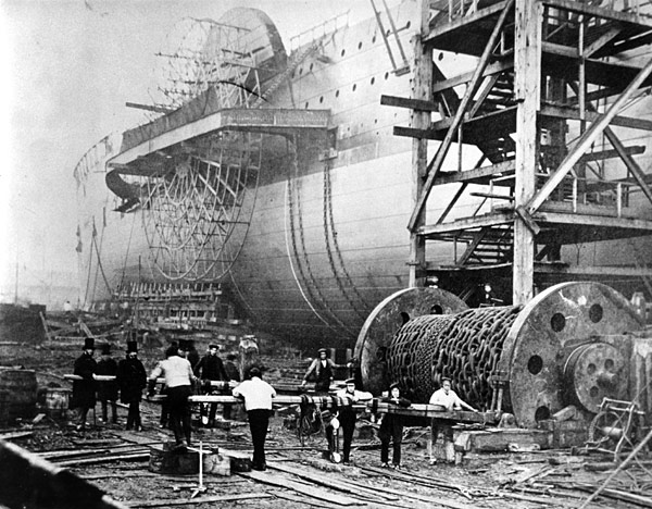
Great Eastern shortly before launch 1858

Great Eastern shortly before launch in 1858 by Robert Howlett. Source: Wikimedia

With a capacity for 4000 passengers, she left Liverpool on her maiden voyage with only 35 passengers and 8 company overseers, both of which were far exceeded by a crew of 418.  She was equipped to run under sail or steam, via paddles or propeller, had four decks, and could carry 15,000 tons of coal.  Sadly she was never given the opportunity to meet the long-distance goals of India, China and Australia intended for her by Brunel and her builders and investors and was never competitive on the busy cross-Atlantic passenger service to which she was initially confined.

The fortunes of  Brunel’s astonishing S.S. Great Eastern swung between greatness and near-disaster like an enormous, record-breaking pendulum.  She was all too often something of a gigantic white elephant, but she became an invaluable resource for laying cables across the Atlantic, and was always a great public attraction.

Great Eastern at Hearts Content Cable Station

Painting by Charles James Lewis of the Atlantic Telegraph Expedition landing of the cable in Hearts Content Cable Station in Newfoundland, Canada, on July 27 1866, which he witnessed. Source: PK Porthcurno

After a traumatic roller-coaster of a career, the enormous ship was sold to be broken up in 1889, the work to take place on the Mersey.

Great Eastern, beached in advance of being broken up on the Mersey in late 1888, Wirral side.  Source: Liverpool Echo

Throughout her history, Great Eastern was the subject of curiosity and fascination, and people lined up to buy souvenir pieces of the ship before the breaking work began on 1st January 1889.  The photograph above shows her beached on the Mersey, ready to be broken up, and she continued to challenge even after the breaking work began.  Not only was it a very sad episode for posterity but also, as it turned out, for the ship breaker.  The company directors had estimated that it would take 200 men to break up the ship in a year, but she was so well built that it took nearly two years, requiring the costs of ongoing labour and additional machinery, including much more substantial wrecking balls, to finish the job.  Substantial profits had been anticipated from her scrap value, but she was broken up at a considerable loss.  Brunel had built her to last.

One of Robert Howlett’s famous photographs of Brunel with Great Eastern in 1857 prior to launch. Source: Wikimedia

Brunel had died in 1859 whilst the ship was still undergoing sea trials and had suffered an engineering accident during which five stokers died, and although the consensus is that the emotional stress of the ship’s construction and the difficulties of her launch undoubtedly contributed to his death, he was already suffering from a debilitating kidney disease.

It is perhaps thankful that he did not live to witness this drawn-out demise of his grandly imagined, fabulously realized and much-loved “Great Babe.”

Great Eastern was such a colossal, record-breaking chunk of maritime, industrial and national heritage that I find it more than slightly difficult to forgive the universe for allowing her to be broken up.

Infographic of Great Eastern

Infographic comparing ship sizes, in chronological order from left to right. Click to expand. Source: JF Ptak Science Books.


The length of Great Eastern carved into the City walls in the 19th century. Source: Geograph. By John Turner, CC BY-SA 2.0

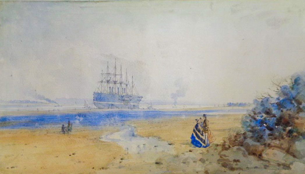
The watercolour of Great Eastern, shows her beached on the Wirral side of the Mersey for repairs, although the painting is very sadly not on display.  It was painted three years after the illustration at the top of the post, in 1863, by  William Gawin Herdman (1805-1882).


Great Eastern watercolour showing the ship on the gridiron for repairs just off the Wirral on the Mersey in 1863. By W.G. Herdman (in the collection of the Williamson Art Gallery, not currently on display). Source: Williamson Art Gallery Collection at Birkenhead.

Cooling walks at RSPB Burton Mere on a seethingly hot day

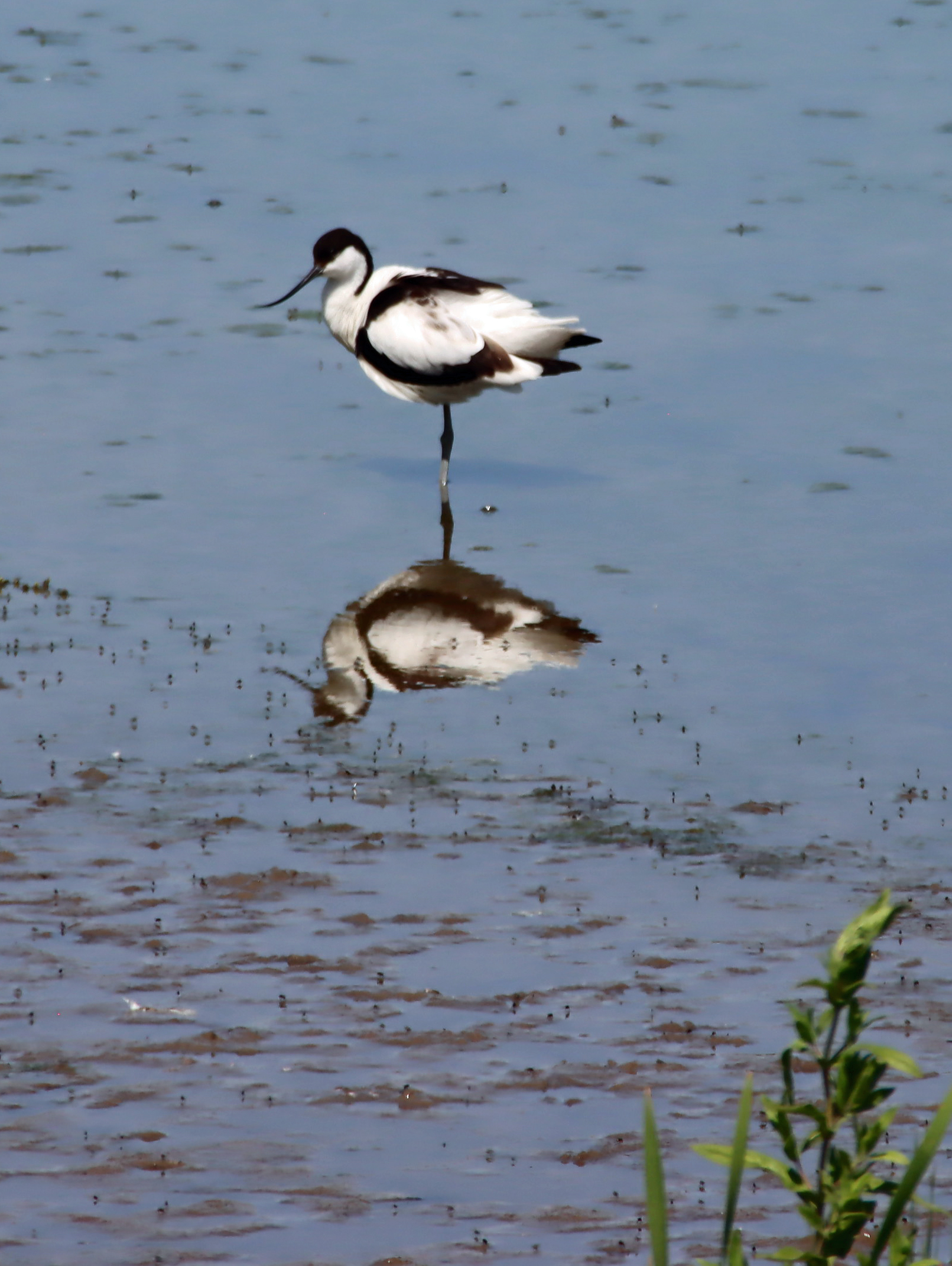
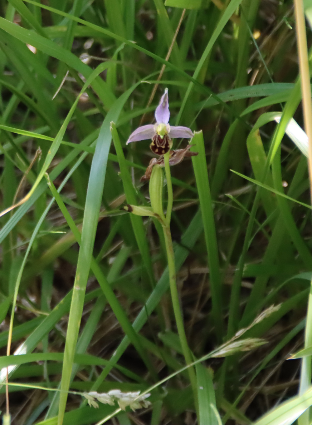
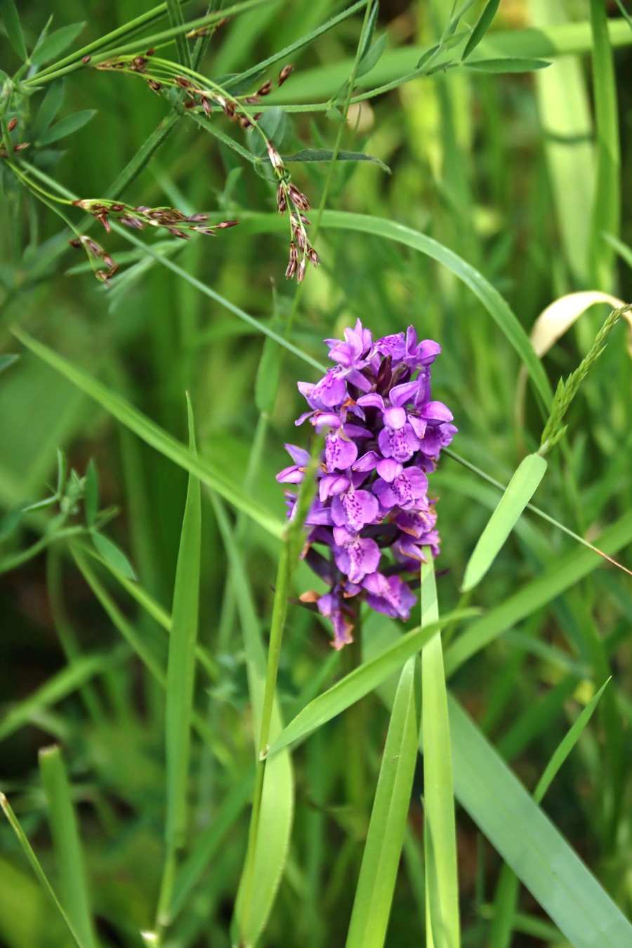
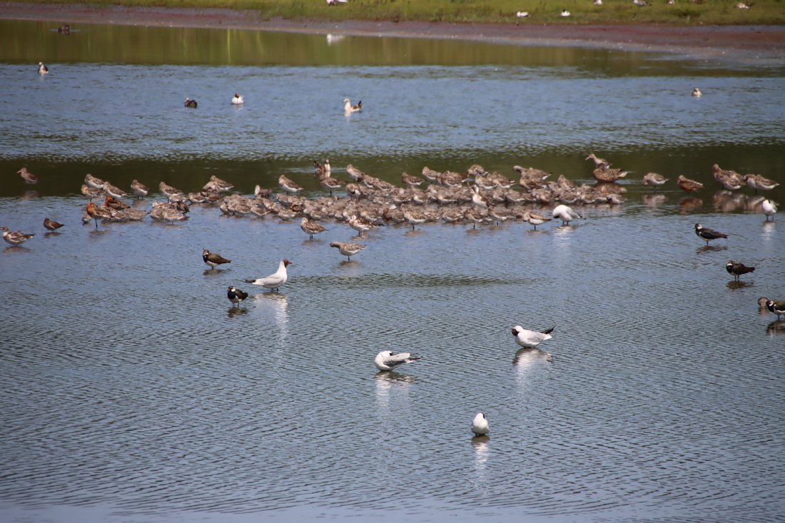
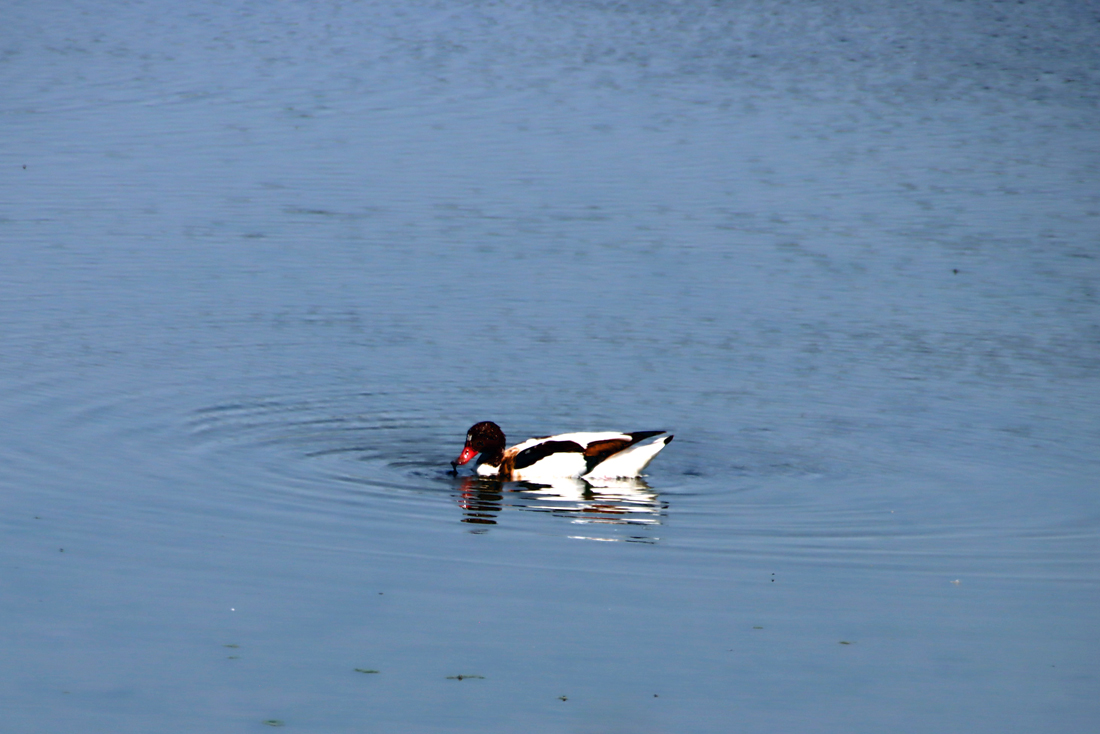
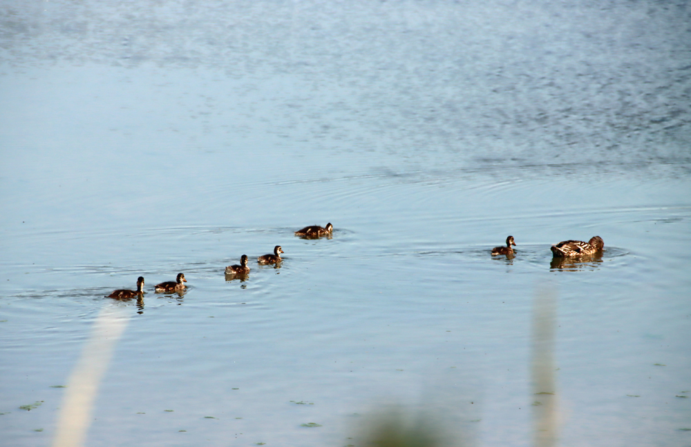
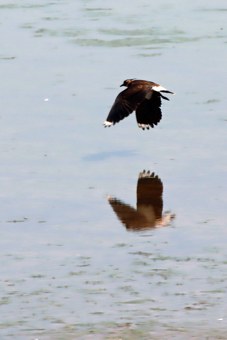
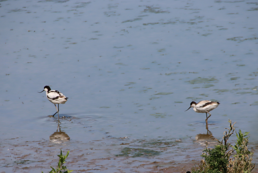
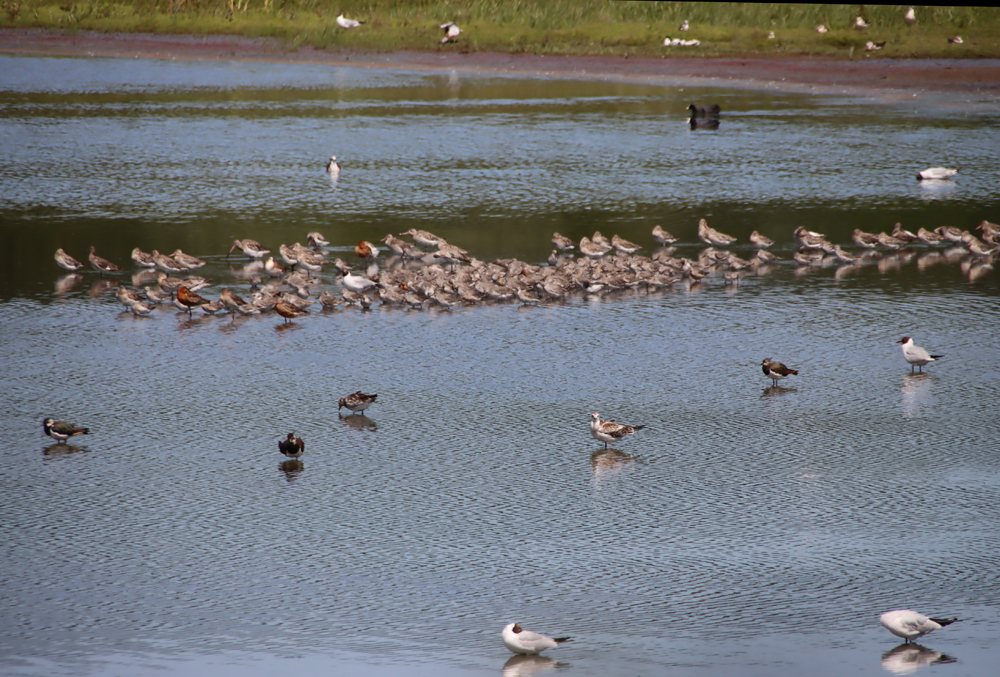
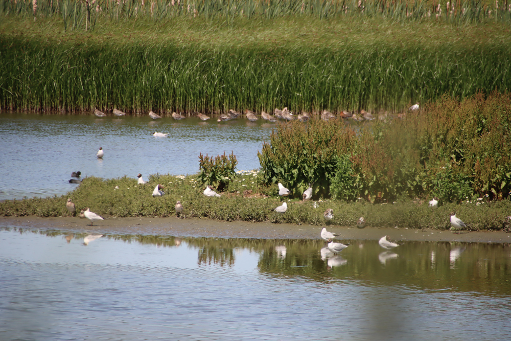
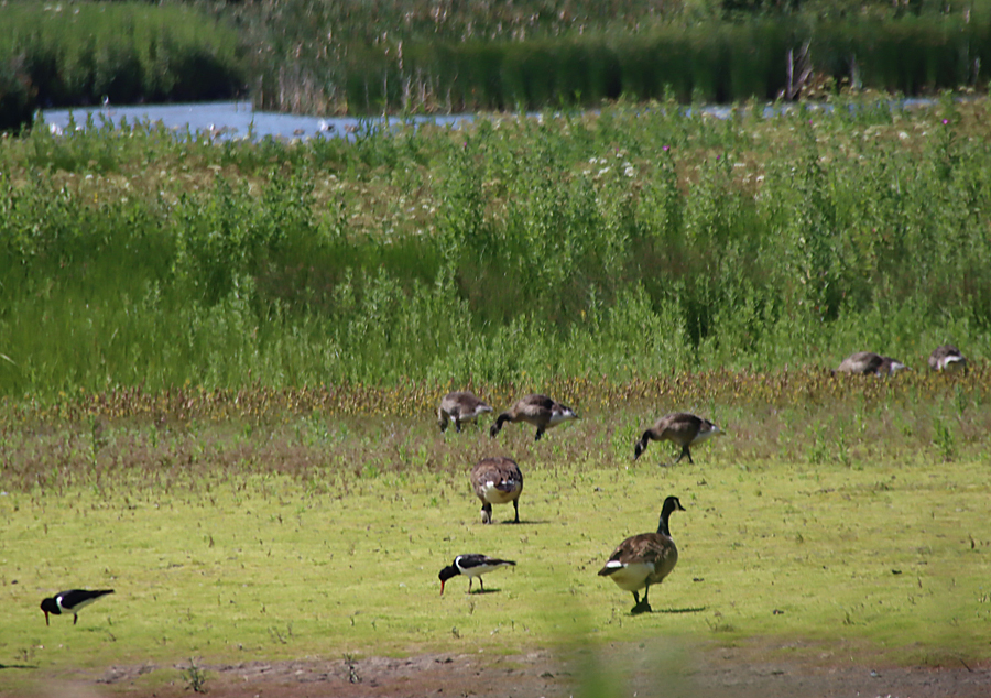
My third visit to the RSPB nature reserve at Burton Mere on the southwest Wirral was made particularly remarkable by the unprecedented and indeed record-breaking levels of heat in late June.  Thankfully, Burton Mere offers an excellent balance of sunny board walks and leafy pathways and tracks, as well as cool hides, and there was a slight breeze from the Dee even where other areas locally were perfectly still.  The reed beds and woodland walks were delightful on such a hot day, and there were two different types of wild orchid in flower, which were something of a treat.  There were plenty of birds to see cooling down in the water, with the furthest hide,  Border Hide, as busy with a wide range of wading birds as it had been on both my earlier visits.  Apologies for the wildfowl photographs, which are at the absolute limit of the range of my camera lens.  A full daily list of what has been spotted is always posted on the RSPB Burton Mere’s Facebook page to give an idea of what to look out for.   I was particularly glad to see the avocets with their upward-curving beaks and distinctive black and white plumage.  Avocets had become extinct as residential breeding birds in Britain prior to their reintroduction in 1947.  According to the RSPB website, over half of those breeding in the UK today are still on managed wetland reserves.  There were plenty of them at Burton Mere this week.

There were only a few other human visitors, and when I paused at the welcoming café on my way out, for a delicious latte and an ice cream at an outside table in the shade, I was in splendid isolation, accompanied only by a small jackdaw, which eyed my ice cream with all the optimism of one who is regularly fed by visitors.  The heat has clearly deterred many visitors, but it was easy enough to avoid extensive periods of exposure to the sun.  Because of the heat, taking water is a strongly recommended precaution, but if you forget to take your own the café sells bottled water as well as other cold drinks.

Visiting details can be found on the RSPB Burton Mere website here.  If combined with the Ness Botanic Gardens, only 10 minutes away, this could make a good day out.  Both have cafés for lunches and other refreshments, and both have plenty of parking.

My previous post about RSPB Burton Mere, with much better photographs of the bird life, is on the blog here.


Bee orchid

Bee orchid


Southern marsh orchid

Southern marsh orchid


View across the marshes to Burton Point, where the purported hillfort is located on the RSPB land (look out for the sign posts)

My somewhat shaky video of the view from the Border Hide at Burton Mere, taken on my camera balanced on one of the Border Hide window sills.  I love the cacophony of bird calls (just under 2 minutes long).


A delightful and colourful visit to Ness Botanic Gardens on the Wirral

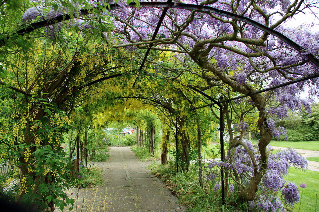
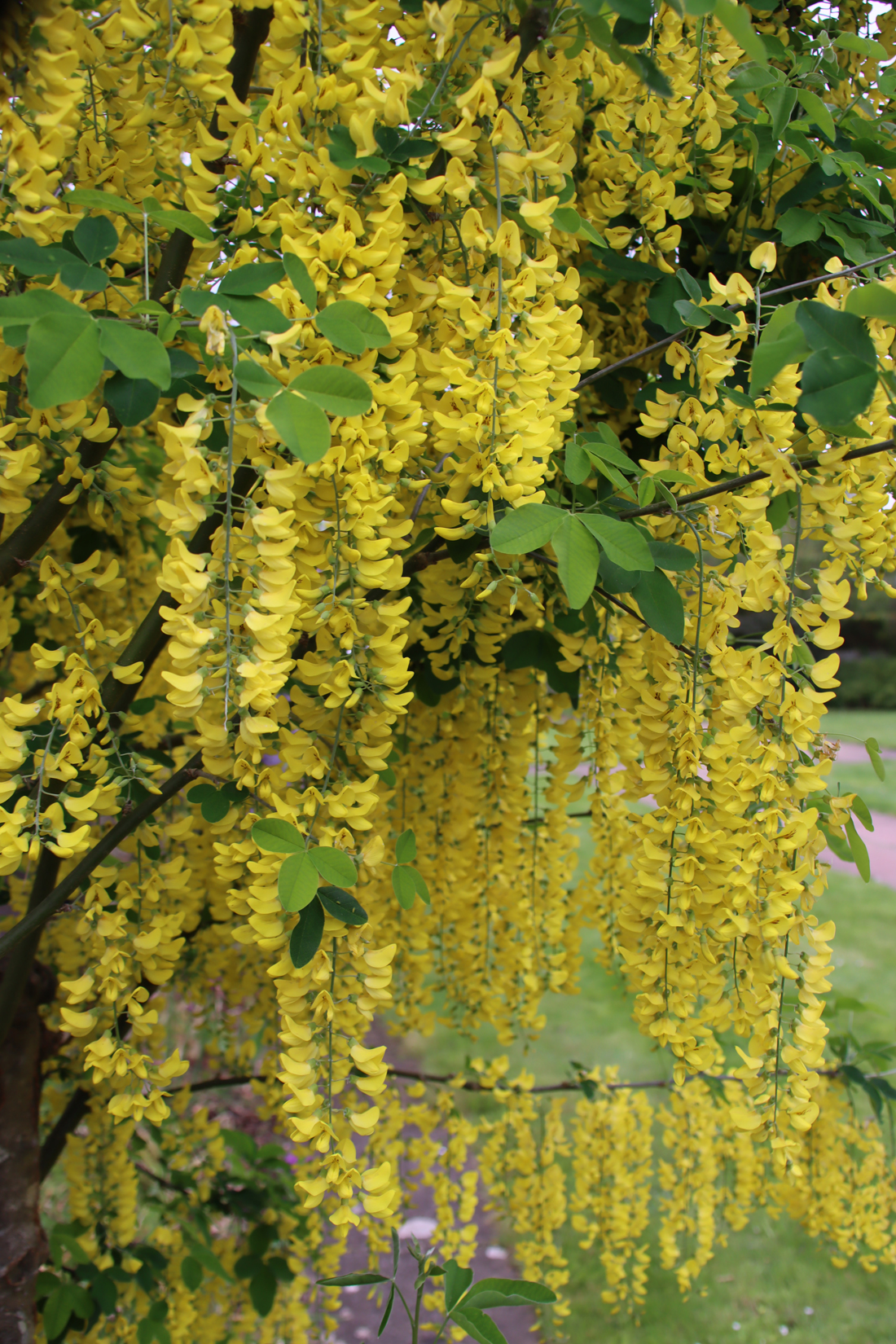
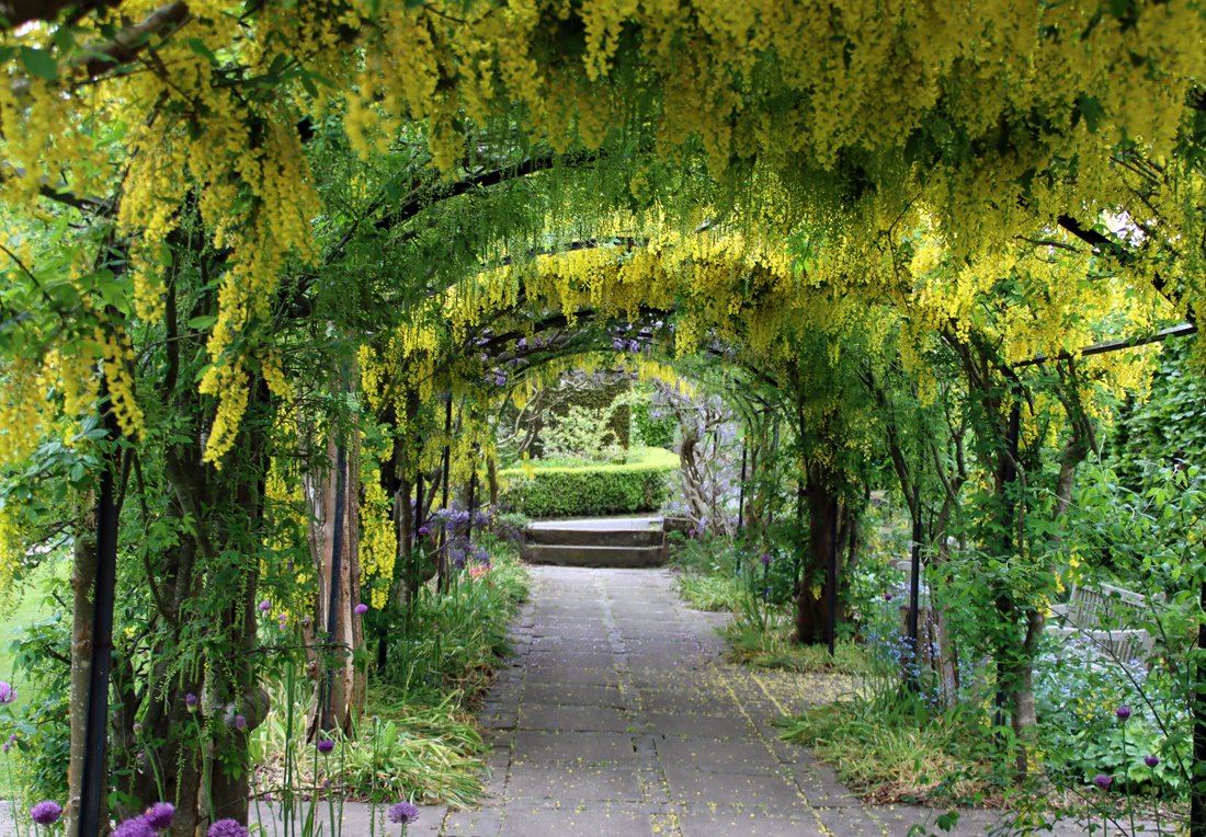
Following his purchase of land in Ness in 1898, Arthur Kilpin Bulley, the son of a wealthy Liverpool cotton importer, created Bees Ltd, a nursery specializing in exotic seed and plant imports, at the same time financing planned collection expeditions to far off destinations like the Himalayas and China.  He died in 1942, and in 1898 his daughter gifted the garden to the University of Liverpool.  The University continues to manage the gardens, now totally 64 acres, with areas of rockery, woodland, water gardens, specimen lawns, an orchard, a small greenhouse with succulents, a laburnum and wisteria arch, and of course there are lovely views over the Dee estuary to north Wales.

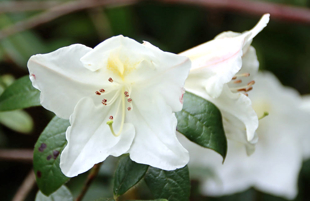
Ness Botanic Gardens are open from March to October.  When I went with my friend Katie yesterday it was with the hope of seeing a lot of rhododendrons and azaleas as well as the laburnum and wisteria arch, and we were in luck.  It was overcast but dry, and the floral extravaganza brought delicious colour and light into the otherwise rather dull day.

There is plenty of parking.  Visitors are provided with a map of the site with the entrance ticket.  My battered copy is shown right (click to enlarge).  I did look to see if there was a printer-friendly copy to download on the Ness Gardens website, but I couldn’t find one.  There is a different style of map, but it all on a green background and not printer-friendly.   The Gardens has a nice cafe which does excellent coffee and a good range of sandwiches, hot food and cold drinks, and both indoors and outside tables are available.  There is a small plant sales centre outside, and a shop indoors selling gifts.


William Hesketh Lever’s Port Sunlight Village – industry, architectural diversity and social responsibility

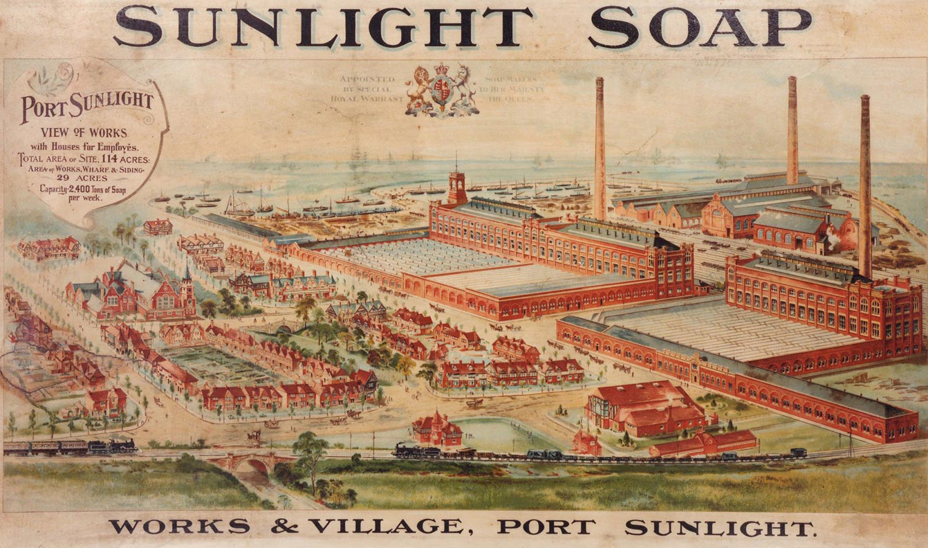
Port Sunlight. Source: Unilever Archives

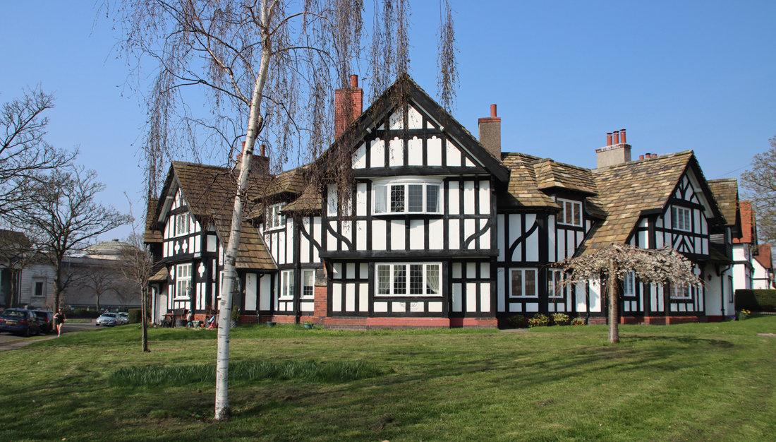
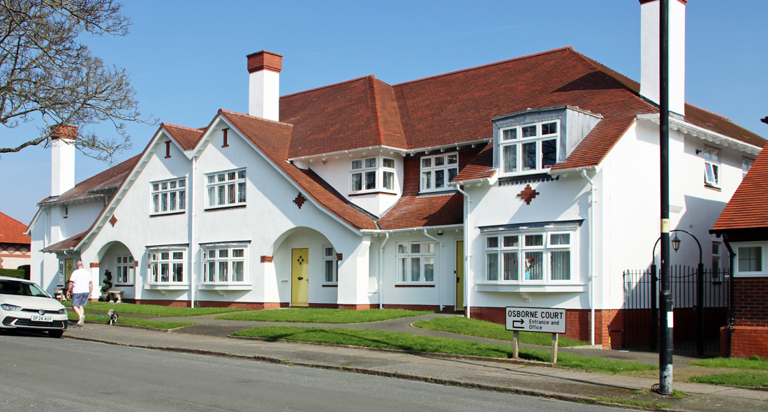
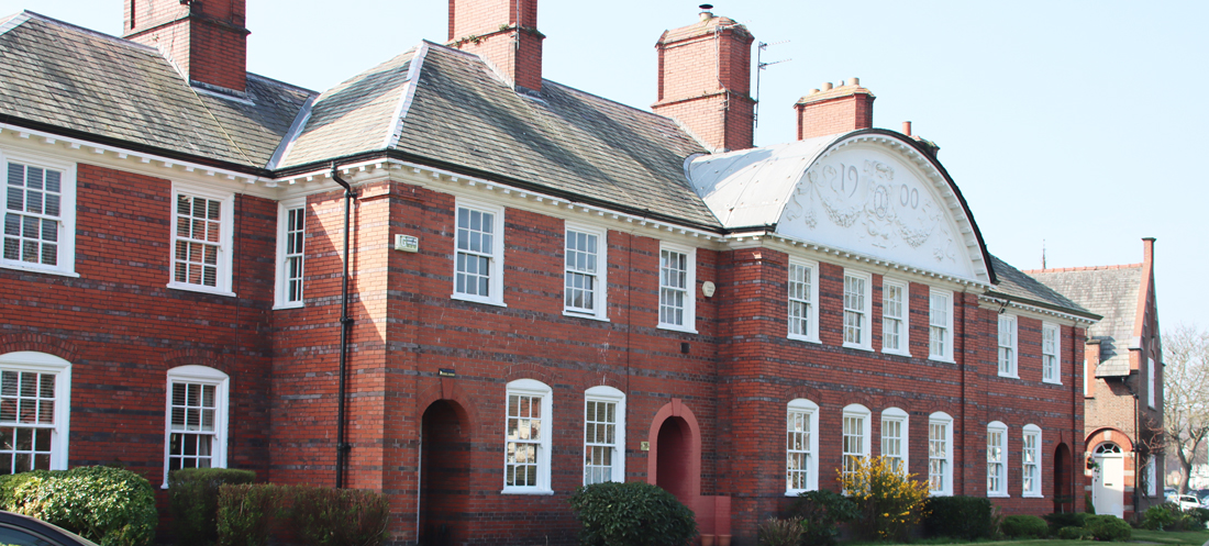
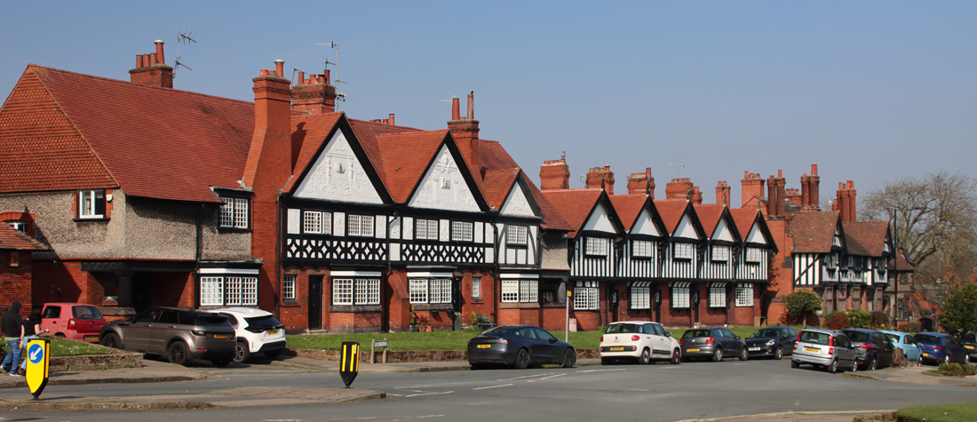
It is quite a story.  When William Hesketh Lever purchased land for a new factory and decided to build a village for the workers and their families in 1888, he wanted it to be a place where people would enjoy living, to be a thing of beauty, to offer educational and leisure facilities, and to celebrate the best of both vernacular and formal British architecture.  Port Sunlight is often referred to as a model village, but this implies something rather effete, a bit of a vanity project, whereas the village was intended to offer all the benefits of a real, thriving, supportive community, as well as an educational and cultural hub.  Port Sunlight was to be the very antithesis of the slum housing and overcrowding that had crushed so many workers in industrial areas and enterprises of the northwest.
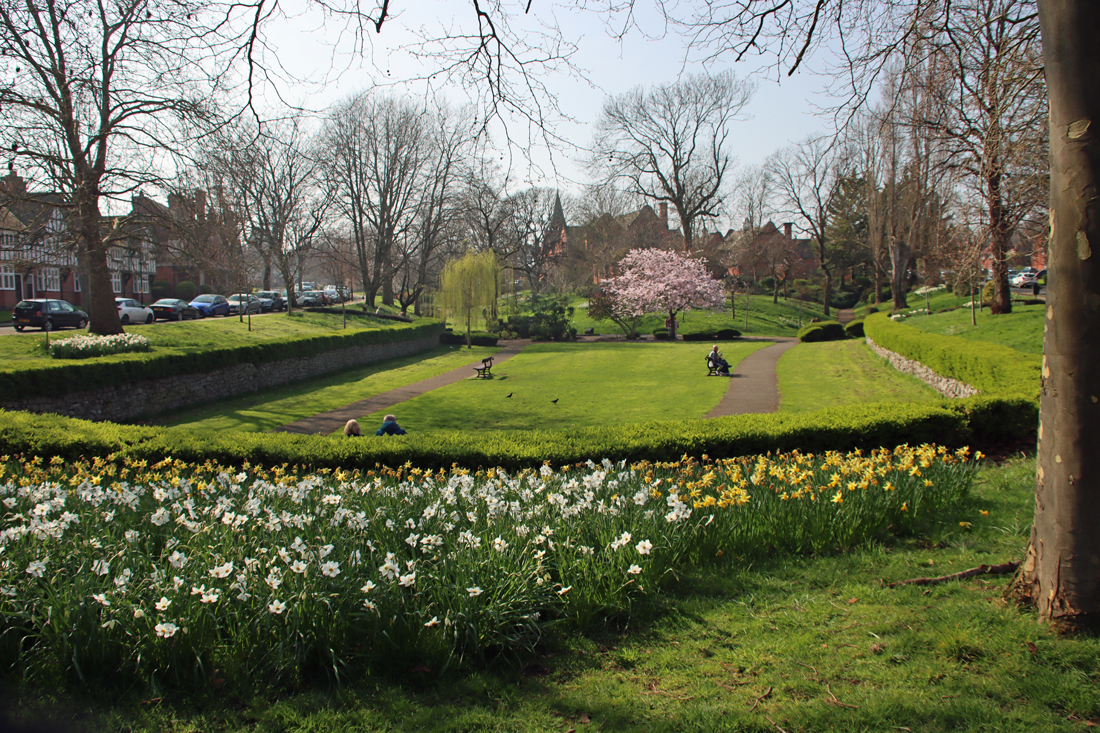
View down part of the Dell

View down a section of the Dell, once an inlet of the Mersey

To ensure that there was real architectural diversity, over 30 architects were employed.  Central roads were based on boulevards.  All streets were wide and the houses, all with a minimum of two bedrooms, were fronted with lawns.   As it grew during the late 19th and early 20th centuries there were open green areas, a formal garden based around an old inlet of the Mersey now called the Dell, cricket lawns, a bowling green, tennis courts, a theatre, an open-air swimming pool (ingeniously heated with surplus heat from the soap factory), schools, a church, a cottage hospital, a private fire brigade, a village shop and various improving societies and clubs, including a girls’ institute.  There were even plenty of allotments.  To top it off, a library was built with a small display area to share a changing selection of Lever’s ever-expanding collection of antiques and antiquities, which were eventually moved into a custom-made art gallery within the village, which still attracts hundreds of visitors a year.  Lever believed in prosperity sharing.  Instead of profit sharing, in which additional cash is put into pay packets, he shared the prosperity of the company by using it to maintain the village and continue expansion and to add improvements to living conditions.  The benefits to villagers came with risk, as anyone not caring for their home, or who fell short of Lever’s high moral standards could be ousted from their homes.  His attitude to the village and his workers has been termed paternalistic.  Today the village is managed and cared for by the Port Sunlight Village Trust, an independent charitable trust set up by Unilever in 1999.

William Hesketh Lever. Source: Wikipedia

William Hesketh Lever (1851-1925) was born in Bolton, the son of a grocer.  Although he and his younger brother James went into business together, providing the company with the name Lever Brothers, it was William who had the innovative flair that made the company a household name.  His commercial successes earned him the title baronet in 1911, after which he was Lord Lever and baron in 1917, becoming Lord Leverhulme (combining his own surname with that of his late wife).  In 1922, following the death of his wife in 1913, he was further honoured with the hereditary rank of Viscount.  He named his village after his best-selling product, the subject of his genius for branding and marketing, Sunlight soap.  The soap factory and related buildings sat behind the long low frontage of office buildings, which eventually became the Lever Brothers headquarters, on the very edge of the village.  It was featured in the Illustrated London News in 1898, clearly the focus of considerable wonder. Today, with its beautiful homes, its art gallery, its community hall, its green spaces and formal flower beds, and even its more recent garden centre, it really merits the term oasis, sitting between a busy, industrial and commercial part of the Wirral built around the A41, and the Chester-Liverpool railway line.
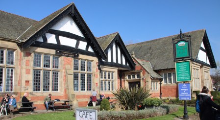
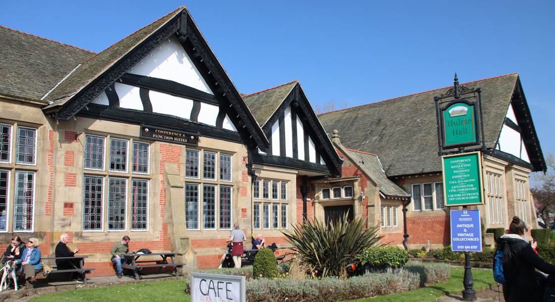
Hulme Hall

Hulme Hall

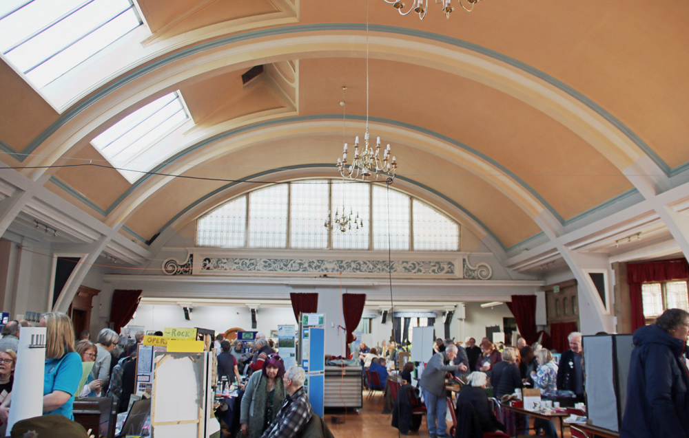
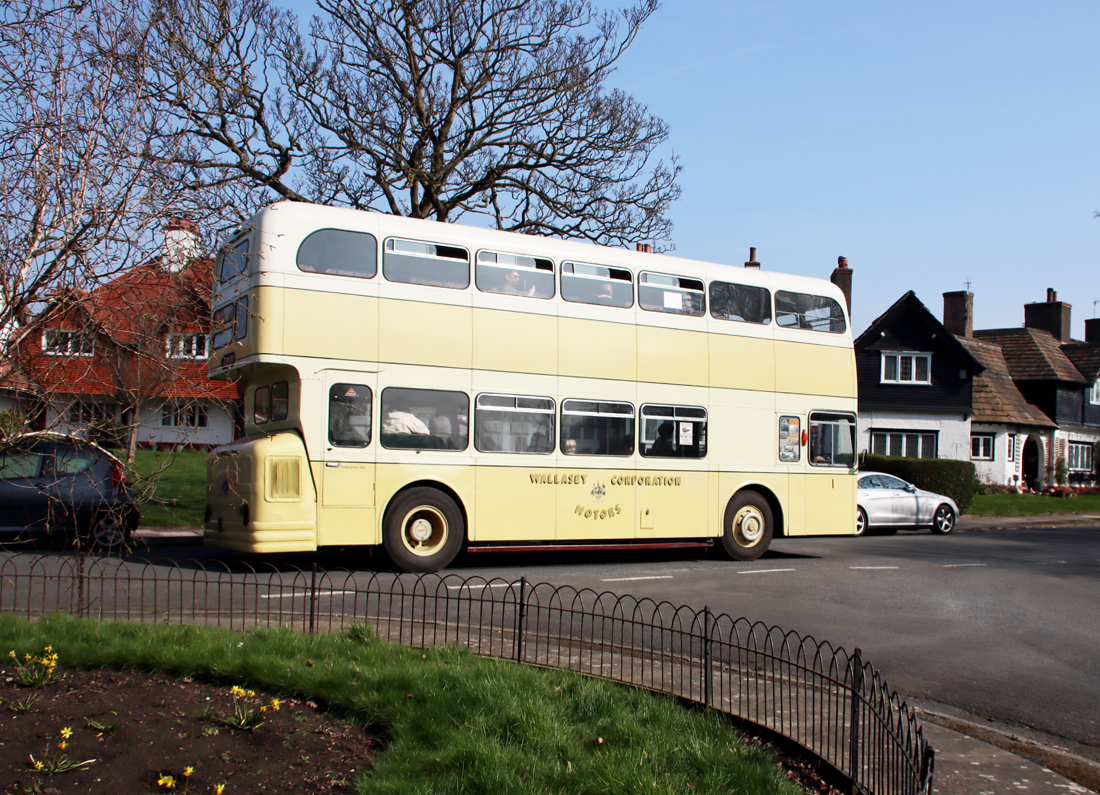
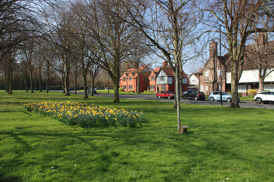
I was incredibly lucky to live in Port Sunlight for six months in the early 1990s, but apart from an enjoyable foray into the Lady Lever Art Gallery last year, had not had a wander around the village since moving back up to the area a few years ago.  It was huge fun to visit the Wirral History Festival on 21st March 2026.  It was a bright and sunny day, and the turnout was enormous.  There was a vintage double decker bus doing tours of the village, and the gorgeous 1901 Hulme Hall that hosted the event (originally built as a ladies / girls’ dining hall and named after Lever’s wife and designed by William and Segar Owen) was filled with a vast swathe of stalls. Entry to the Festival was free of charge but it inevitably ended up costing me a small fortune in purchases of books and journals 🙂  After its stint as a dining hall, and a temporary display area for Lever’s art collection, Hulme Hall housed Dutch and Belgian refugees in the First World War, later becoming a military hospital, and went on to be used by the American army in the Second World War. According to the Unilever Archives booklet the Beatles played there in 1962 and for the last few decades it has been it has been used for various community events.
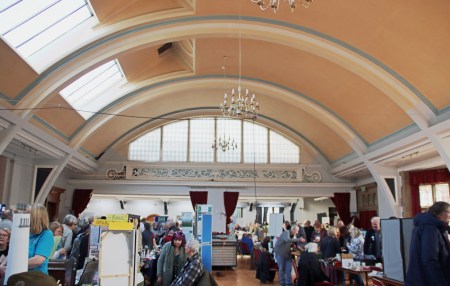
Interior of Hulme Hall

Interior of Hulme Hall with the Wirral History Festival in full flow
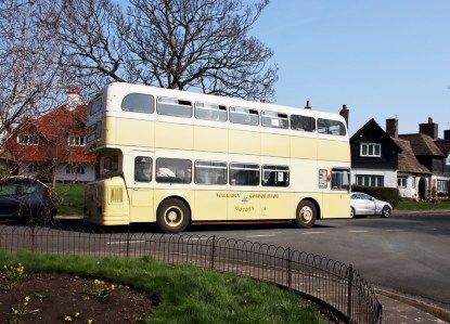
The History Festival's village tour bus

The History Festival’s village tour bus doing the rounds near the Lady Lever art gallery
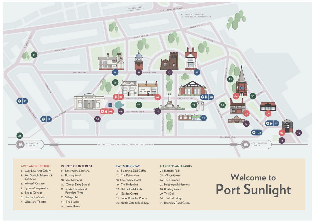
The subsequent walk around the beautifully maintained village, looking fabulous against blue skies and busy with visitors, was delightful.  Today the village, within a 130 acre estate, is home to more than 900 Grade II listed buildings.  It is impossible to do full justice to them here so I have picked out a few buildings to talk about, and have added snapshots of several others to give a sense of the village and its splendid character.  Although the buildings looked great in the sunshine, many of the photographs simply didn’t work, even with the help of Photoshop either because I was shooting straight into the sun or because buildings were in deep shade, and there are some notable omissions.  Hopefully I will take those on another visit. See the tourist map at the end of this post for some of the more prominent buildings.
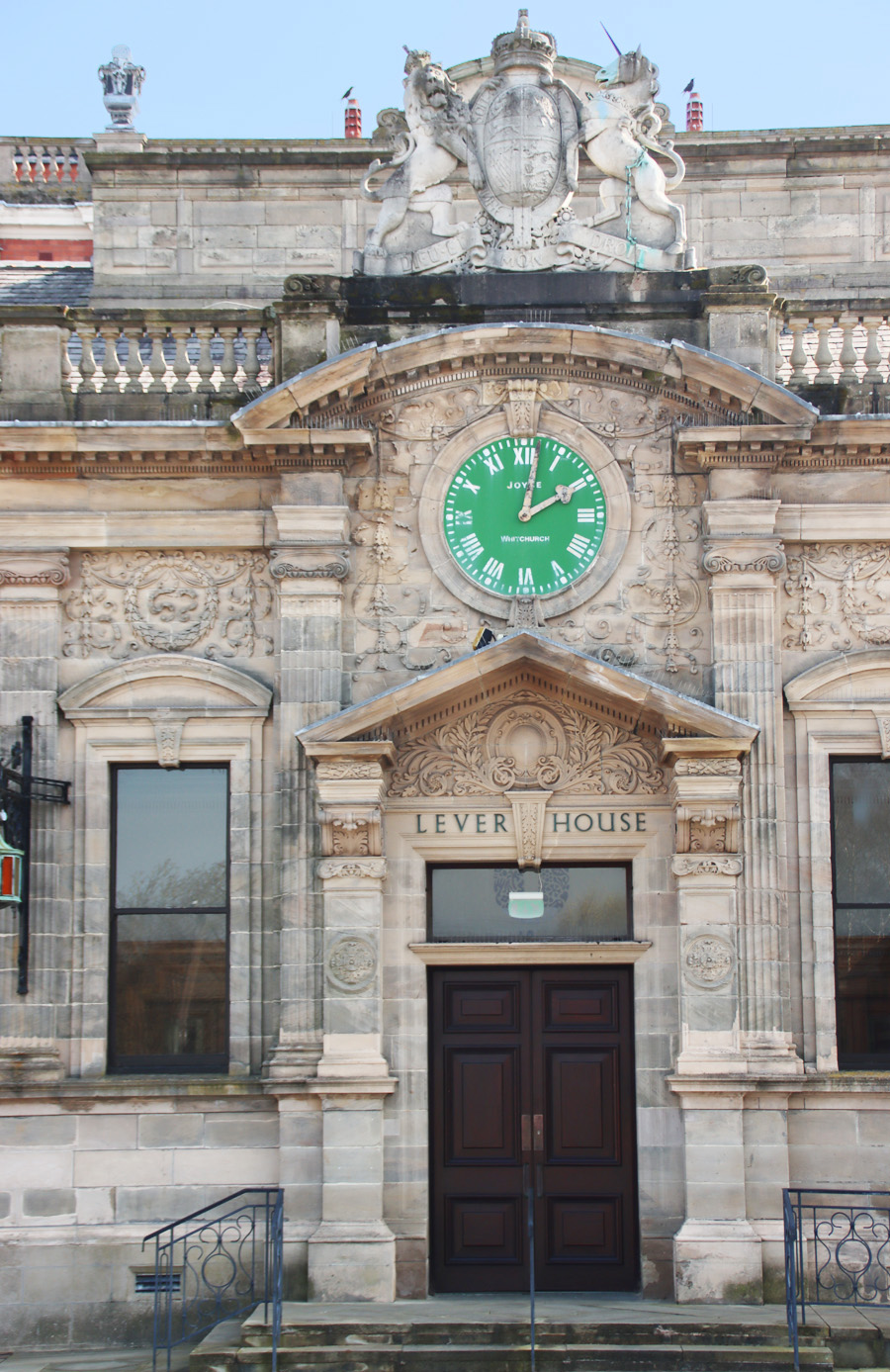
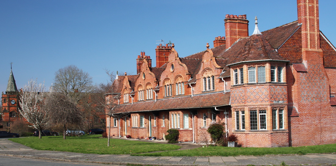
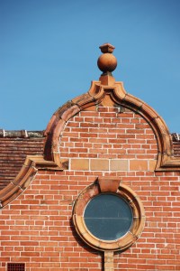
As the image at the top of the post shows so clearly, Port Sunlight was a story of two distinct parts:  the factory buildings that were focused on the production of soap, and the village that housed the workers and their families.  The long low brick frontage of the office buildings along Wood Street served as something of a liminal area between the splendid village and the industrial buildings, including the soap factory, accessed via Central Road beyond the gates.  The original main entrance to the offices of Lever House, with its 1895 ornamental stone façade by William and Segar Owen, and the Royal coat of arms above is still in situ, proudly welcoming visitors to Lever Brothers. Lever Brothers amalgamated with Dutch margarine producer Margarine Unie in 1929, becoming Unilever, today one of the world’s biggest multinationals.  Unilever Merseyside Ltd (UML) was based in the same Wood Street offices well into the 1990s.
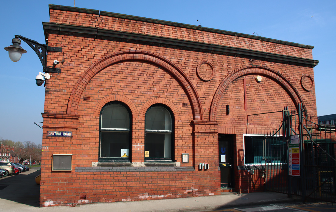
Central Road, Port Sunlight

Part of Central Road, Port Sunlight, leading past the office buildings and through the gates into the factory zone
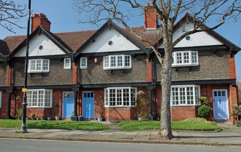
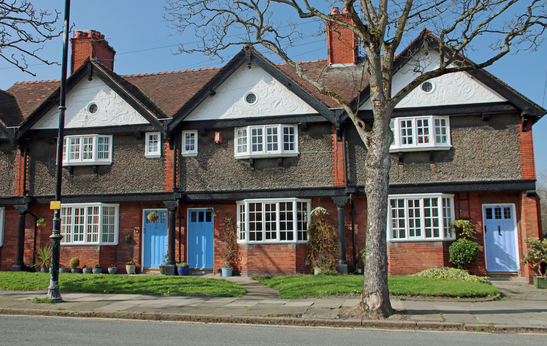
Houses on Wood Street, opposite the entrance to the factory area

Houses on Wood Street, nearly opposite the entrance to the factory area. By Douglas and Fordham, 1894
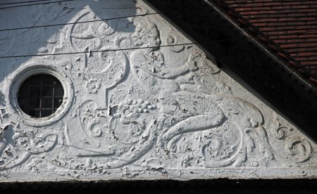
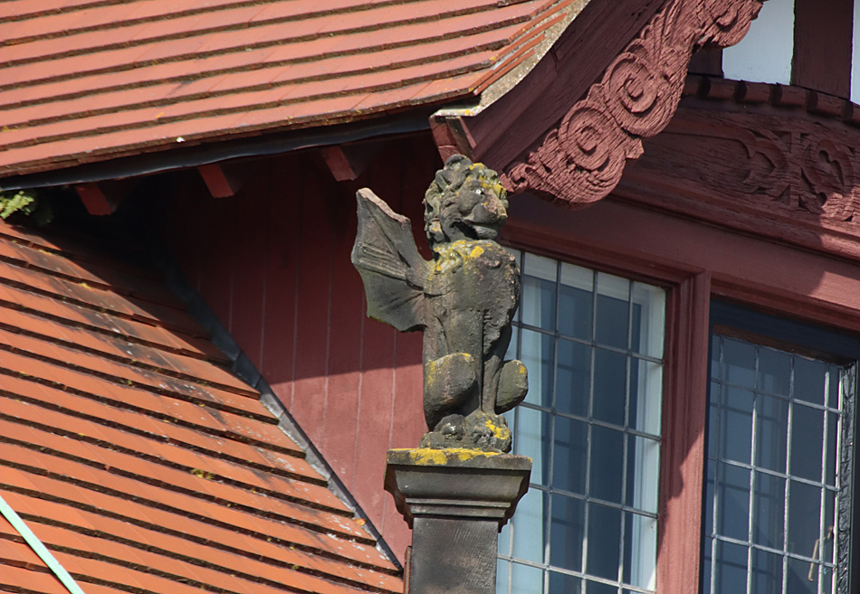
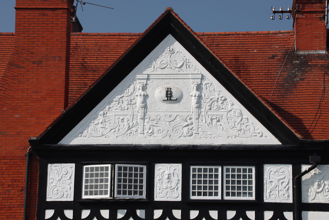
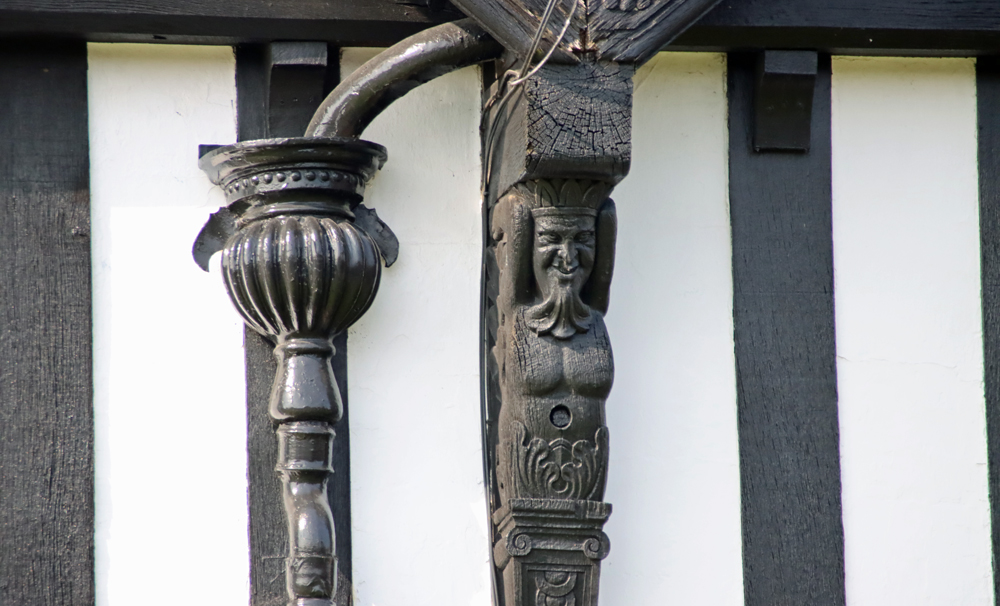
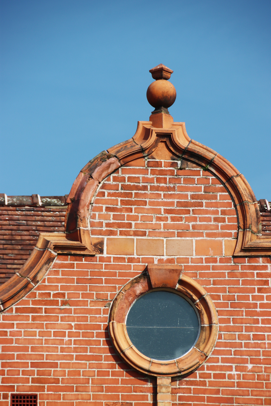
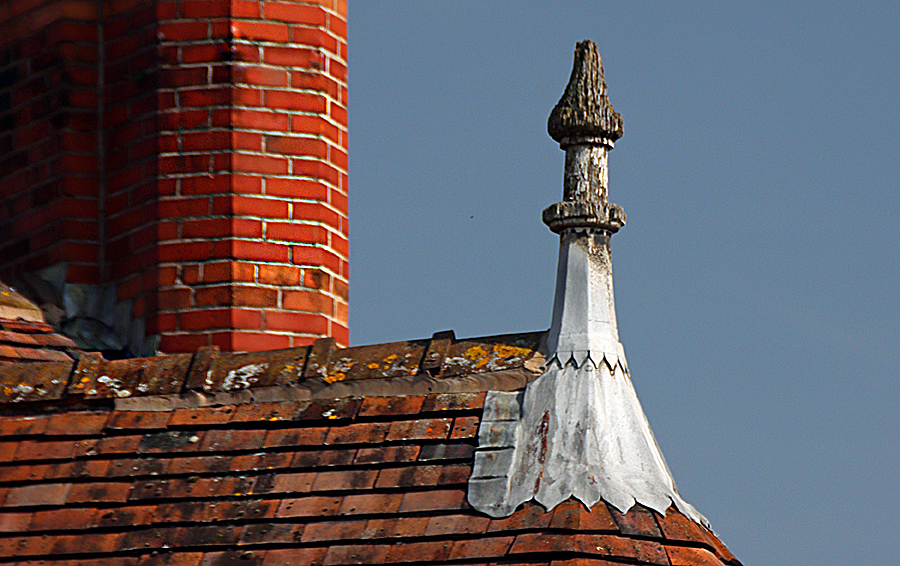
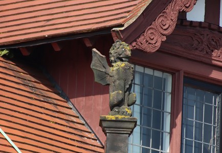
Decorative detail on the above building
Decorative detail on the above building


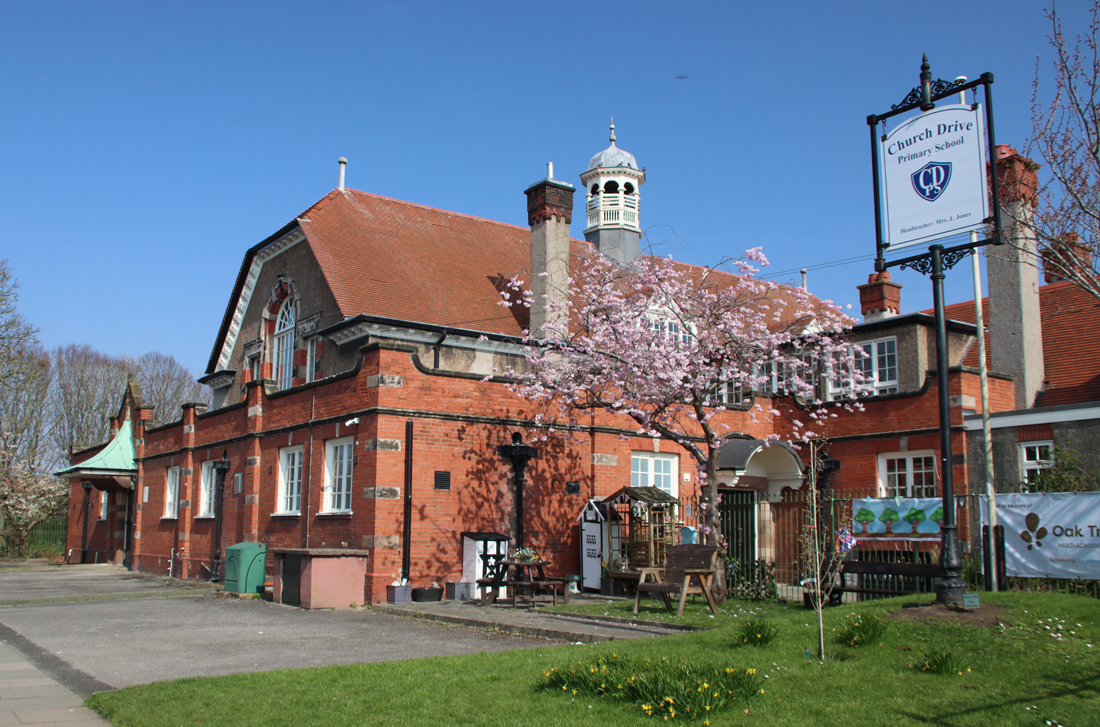
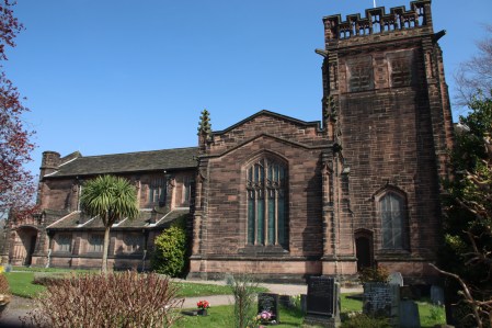
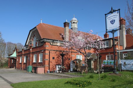
Community buildings were of fundamental importance to the development of the village.  Next to the large 1902-04 Gothic Revival church designed by William and Segar Owen is the splendid Church Drive School designed by Grayson and Ould. Dating to 1902-03, it was built to supplement the Park Road Schools in the building now known as the Lyceum, eventually replacing it.  The Lyceum, particularly enterprising and imaginative, was built 1894-96 and sits next to the Dell and its attractive bridge.  Designed by Douglas and Fordham it was enlarged in 1898 and had the capacity for 350 boys and girls and 150 infants.  It became a Lever Brothers training facility in 1917, eventually becoming the Unilever Archives between 1904 and 2006.  Today it serves as a community space, and also hosts an interactive exhibition about the production of soap.
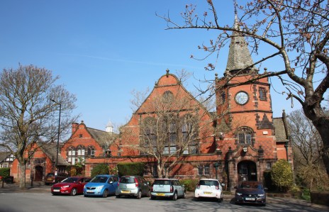
The Lyceum
The Lyceum

Church Drive School

Church Drive School

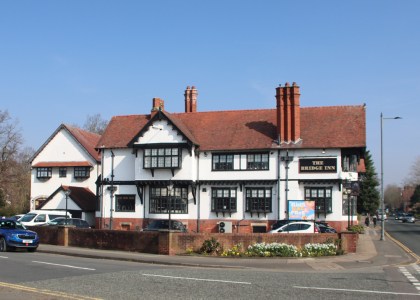
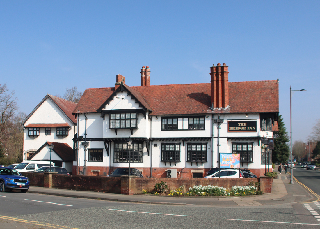
The Bridge Inn

The Bridge Inn intrigued me because Lever’s family were Congregational and were dedicated teetotallers.  According to the guide to the village produced by Unilever, it was built in 1900, having been designed by Grayson and Ould who also designed the rather more adventurous Church Drive School.  It was named for the 1897 Victoria Bridge, since demolished:  “It was originally opened as a temperance hotel with dining and tea rooms and a few guest bedrooms but, in 1903, a deputation of villagers requested that a licence be applied for. Lever had to agree to a referendum and over 80% voted in favour of a licensed public house!”
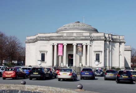
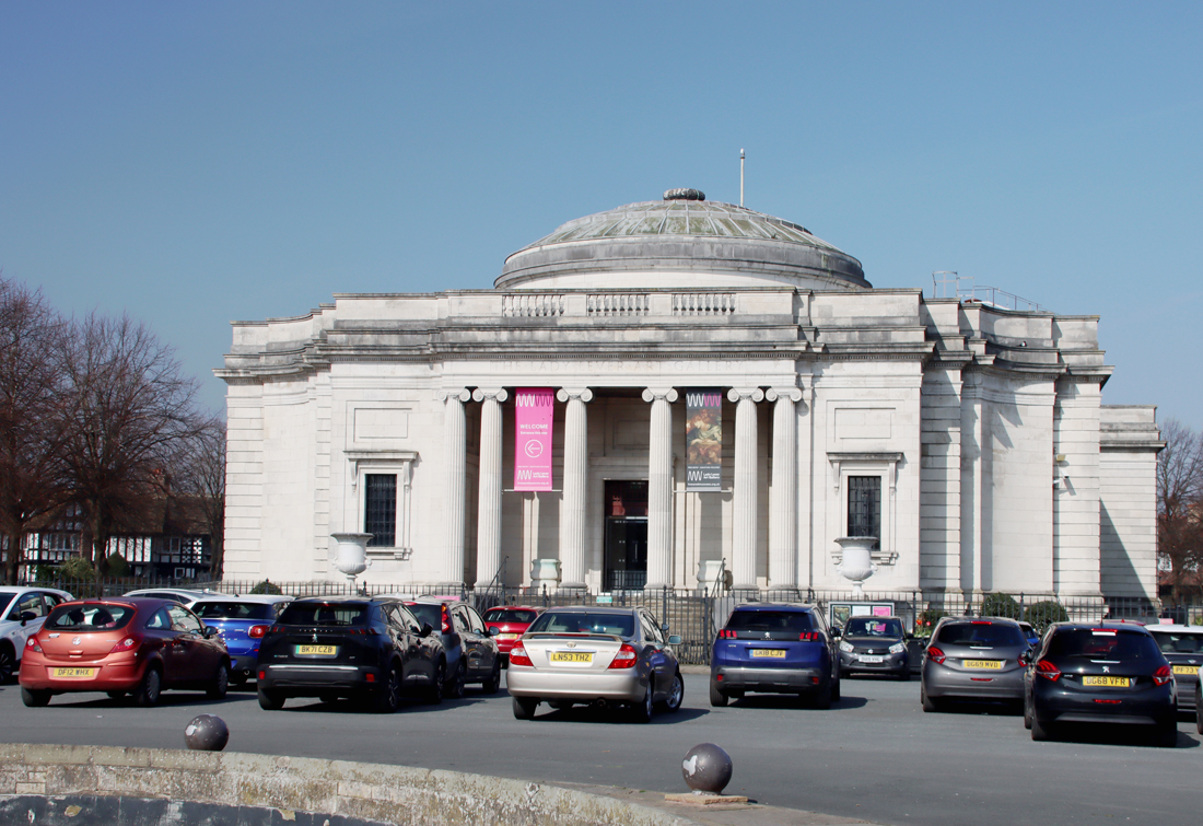
The Classically-inspired Lady Lever Art Gallery was not part of Lord Lever’s original vision for the village but having filled his several homes to capacity, and finding the display areas of Port Sunlight’s library and other public buildings insufficient, he decided to build a gallery so that he could properly share his collections with the general public.  He was one of the first British industrialist to create a gallery for his personal collections, although it was a practice very much in vogue in America, where he had visited with his wife and son.

Turner, Joseph Mallord William; The Falls of the Clyde; Lady Lever Art Gallery. Source: Art UK

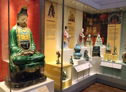
The art gallery was named in the memory of his wife Elizabeth née Hulme who had died in 1913 before Lever became Lord Leverhulme.  Work began on the museum in 1914, with George V in attendance, and was opened in 1922 by Queen Victoria’s youngest daughter Princess Beatrice.  The items on display, from all periods of history and many different countries, were selected by Lever personally and included works purchased specially to cater for broader tastes than his own, as well as art that he commissioned.  When he died in 1926, a substantial proportion of Lever’s private collections was sold at auction, but the items in the Lady Lever represent some of the the best of his years of collecting.  The museum was handed to the nation in 1986. I visited last year, and posted about that visit here.
 

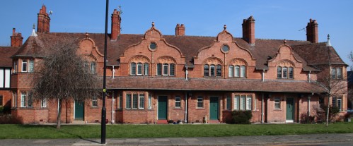
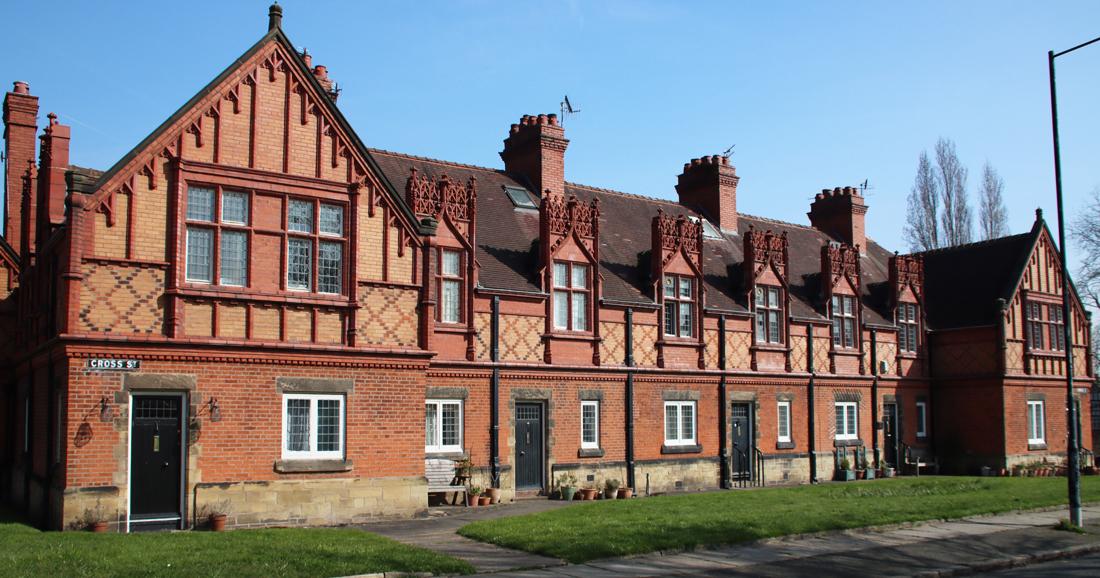
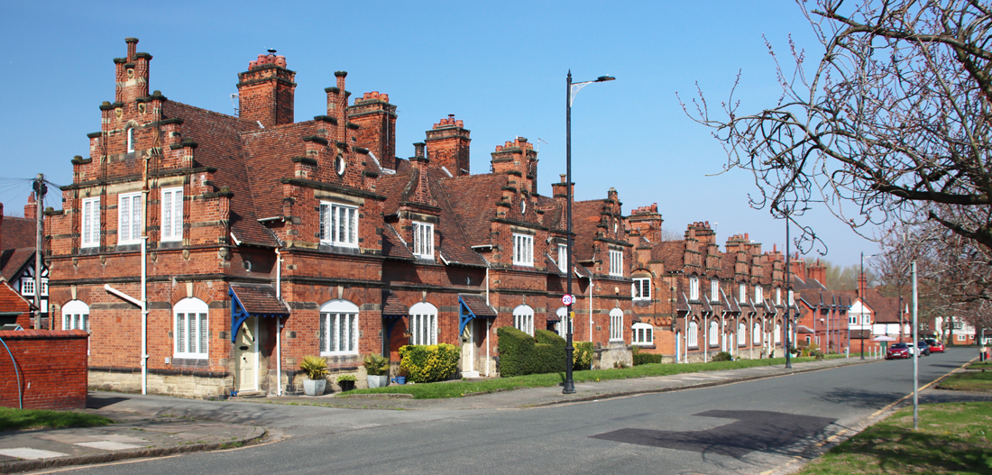
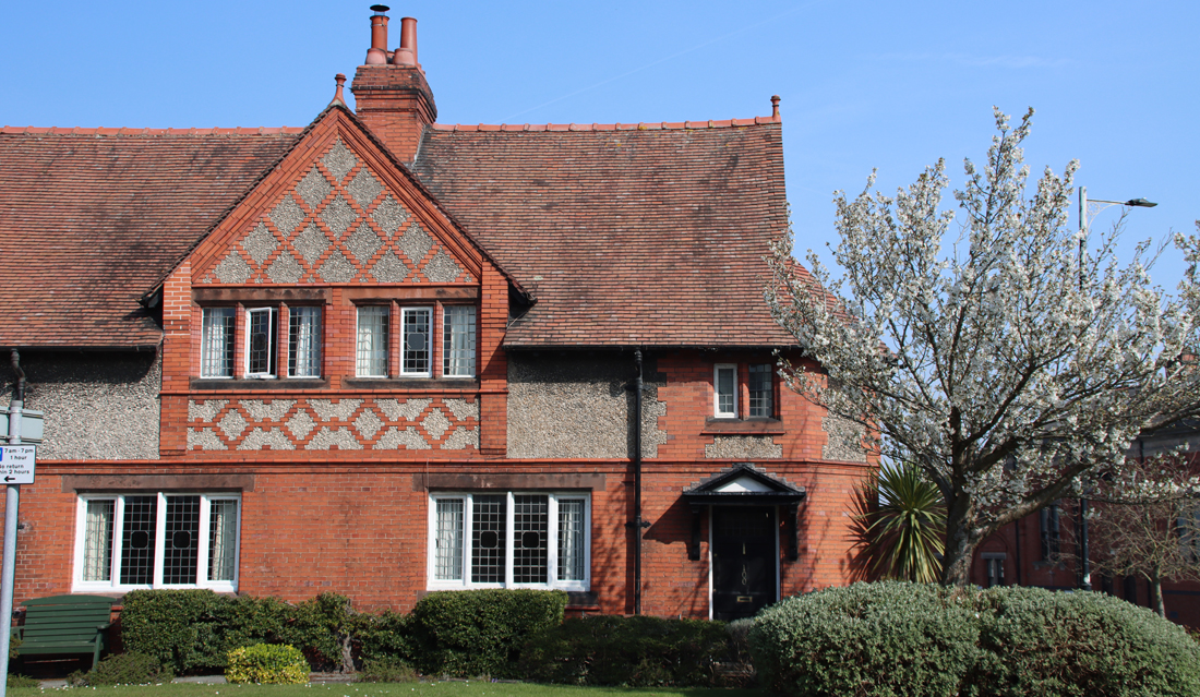
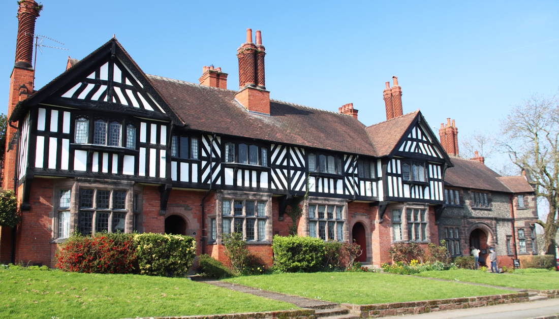
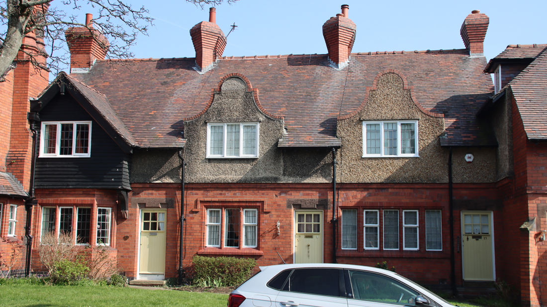
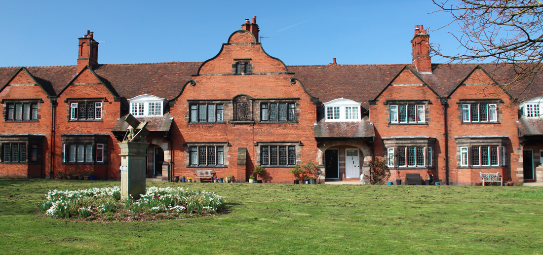
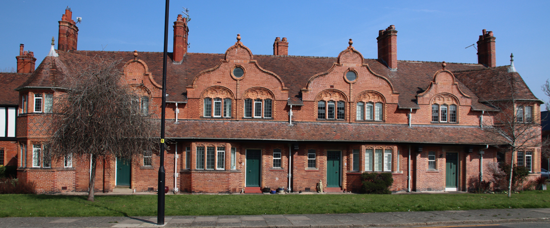
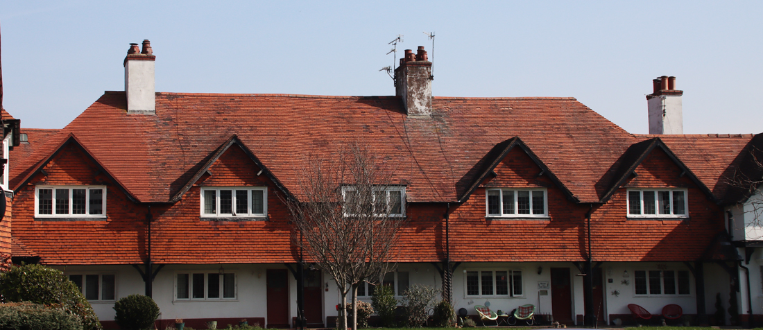
There is a huge mixture of housing styles and types in the village, some of them based on actual historical buildings, the others designed specially for Port Sunlight.
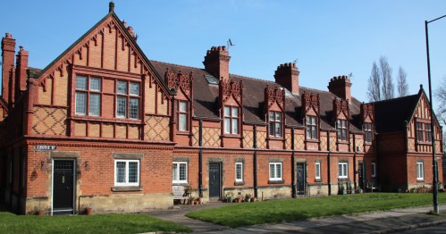
Cross Street, by Grayson and Ould 1896
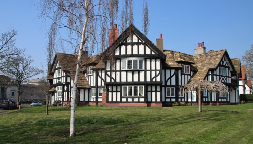
On the corner of Lower Road and Central Road, by Lomax Simpson 1906
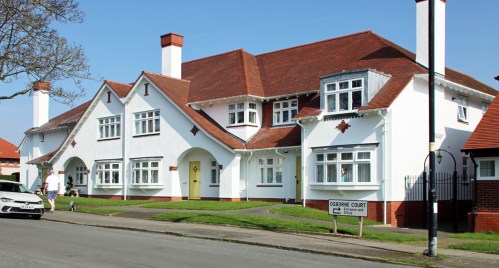
Central Road
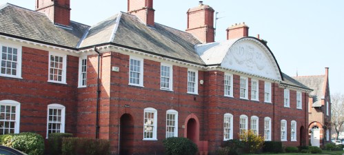
Church Drive, by Grayson and Ould 1900-02
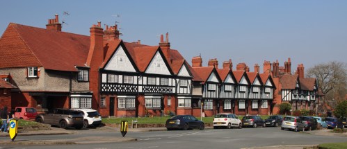
Park Road

Park Road.  The first set at far left were by William Owen, 1892-4
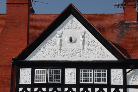
 

Detail of the above picture
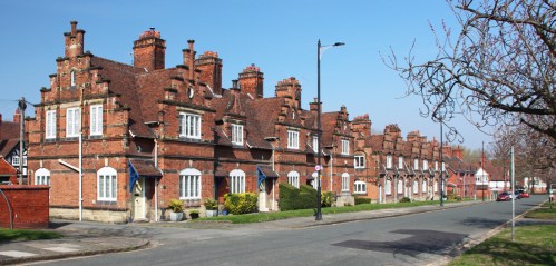
Wood Street by Grayson and Ould, 1895
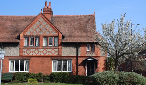
Greendale Road by William and Segar Owen, 1894
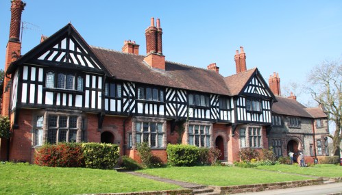
Park Street, by Douglas and Fordham 1895
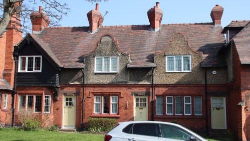
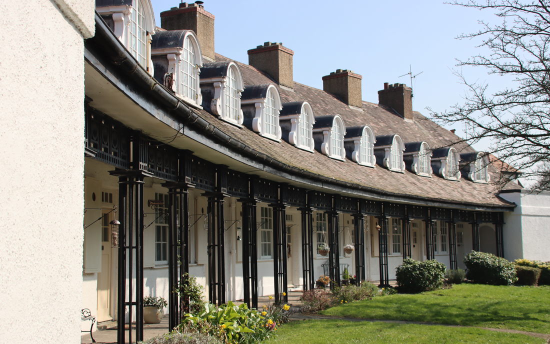
Lower Road, by C.H. Reilly, 1906
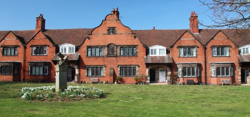
Bath Street, by Talbot 1895-97
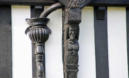
3-9 Bridge Street by Douglas and Fordham
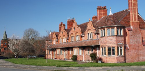
3-9 Bridge Street by Douglas and Fordham
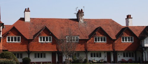
Wood Street
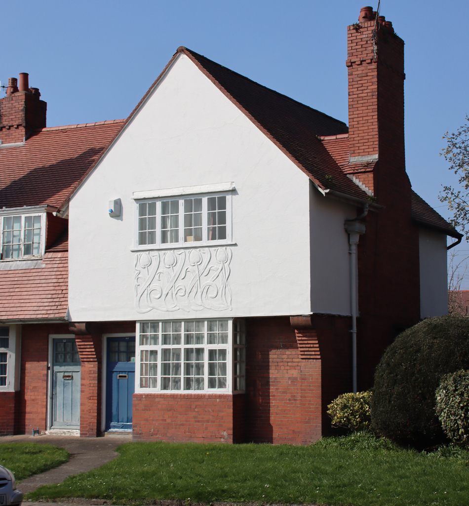
Primrose Hill by Jonathan Simpson, 1899
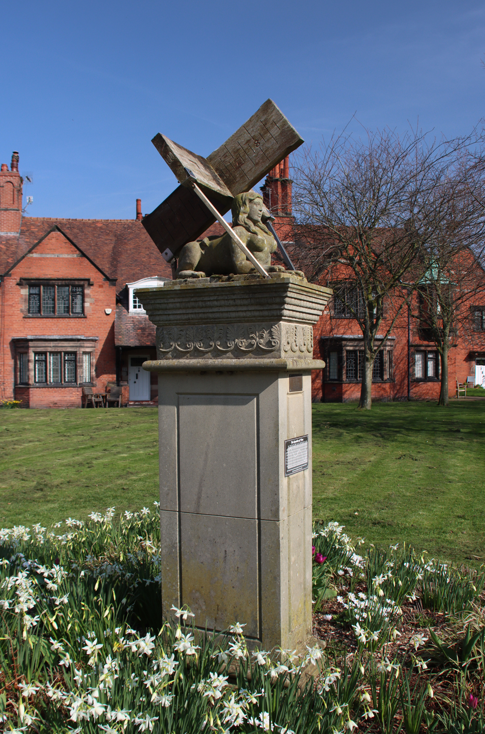
Port Sunlight's alternative sun dial

Port Sunlight’s alternative sun dial

The war memorial is one of the unifying components of the village.  Built between 1919 and 1921, and designed by Sir William Goscombe John, a friend of Lever’s, its theme was defence of the home.  Inside the memorial is a copy of a book containing names of Port Sunlight residents and Lever Brothers employees worldwide who served in the forces during the First World War.
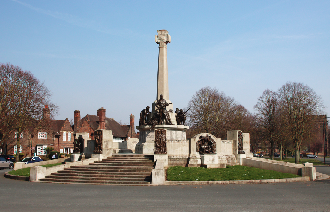
The War Memorial
The empty boating pond in front of the Lady Lever was not added until the 1930s.  In spite of several attempts to restore it to its former glory, the original construction of the pond, which used to include a fountain with a statue, was not sufficiently robust to survive the best part of a century, and solutions are now being sought to implement a long term repair to enable the pond to be re-filled and the statue and its fountain to be restored to their original positions.

The successful garden centre is on the site of the open air swimming pool near Port Sunlight railway station and the Gladstone Theatre, and is a rather good use of the space.  I daresay that Lord Leverhulme would have approved of something that combined commercial enterprise with a product that would bring pleasure in both the village and neighbouring areas.
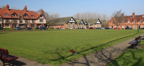
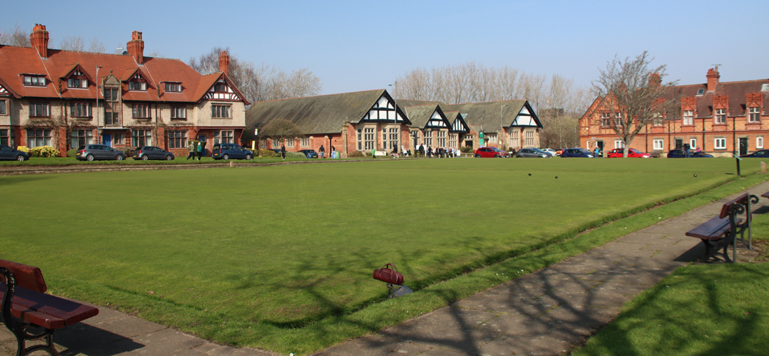
The bowling green with Hulme hall in the background

One of the two bowling greens, with Hulme hall in the background, Cross Street on the right and the 1890 William Owen buildings on Bolton Road to the left
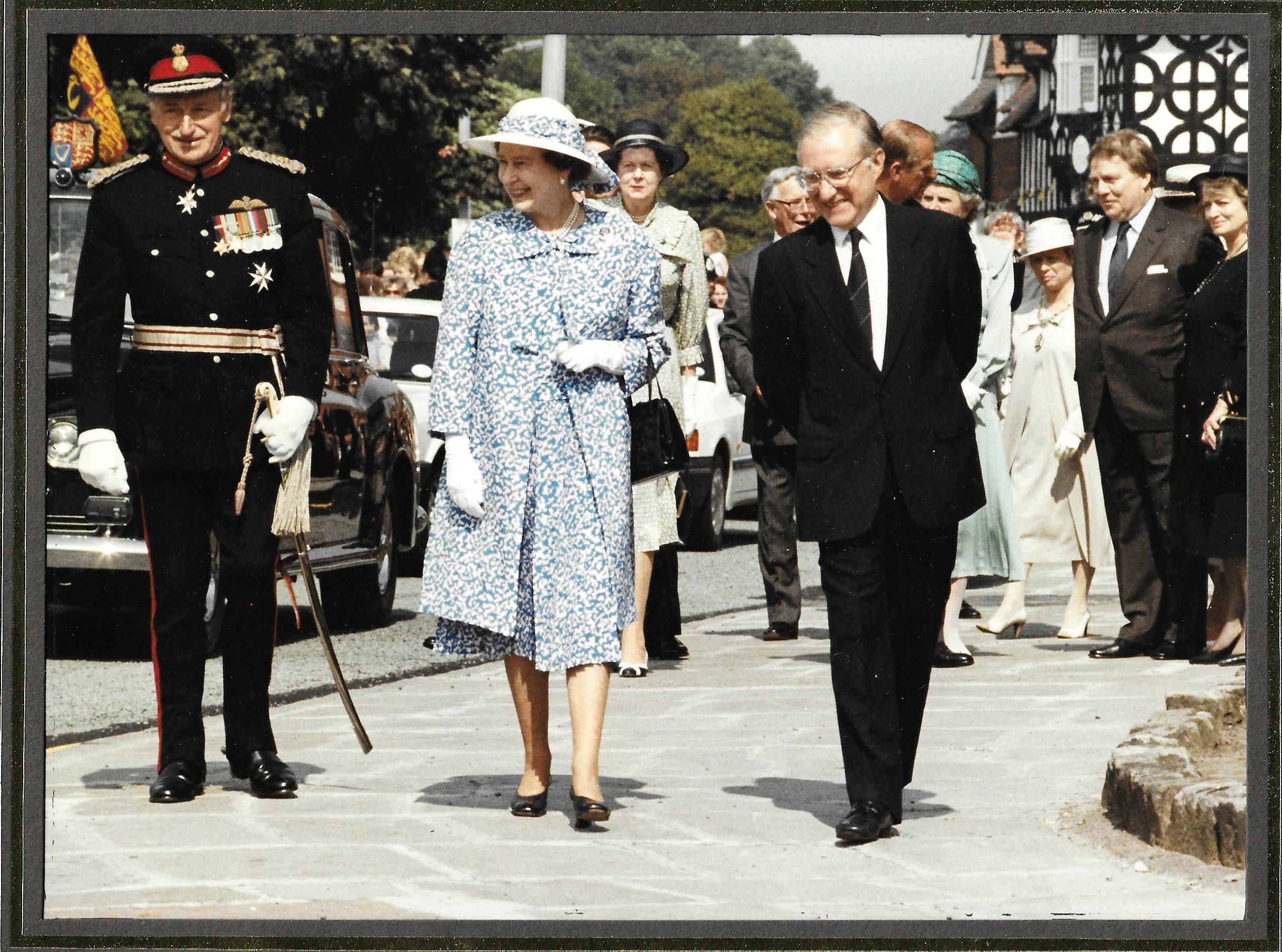
The Queen's visit to Port Sunlight in 1988 during a visit to celebrate the village's 100th birthday, with the then Managing Director of UML.

The Queen’s visit to Port Sunlight in 1988 during a visit to celebrate the village’s 100th birthday, with the then Managing Director of Unilever Merseyside Ltd (UML).

Sources:

Books

Hubbard, Edward and Michael Shippobottom 2019 (third edition). A Guide to Port Sunlight Village.  Liverpool University Press

MacQueen, A. 2004. The King of Sunlight. How William Lever Cleaned Up the World. Corgi.

Websites

Based in Churton
Lord Leverhulme’s multifarious collections at the Lady Lever Art Gallery in Port Sunlight, Wirral
https://wp.me/pcZwQK-70x

An Institutional History of Internal Communications in the UK
Domestos and Domestics: The Family Metaphor at Lever Brothers. By Joe Chick, August 2023
https://historyofinternalcomms.org/internal-communication-unilever-family/

National Museums Liverpool
Lady Lever Art Gallery
https://www.liverpoolmuseums.org.uk/lady-lever-art-gallery

Port Sunlight Village Trust
Home page
https://portsunlightvillage.com/
About Us
https://portsunlightvillage.com/about-us/
Renewing the Boating Pond
https://portsunlightvillage.com/renewing-the-boating-pond-project/
Racism, the Belgian Congo, and William Lever. Second edition, June 2022
https://portsunlightvillage.com/wp-content/uploads/2024/07/PSVT-Racism-the-Belgian-Congo-and-William-Lever-Booklet-July-2022.pdf

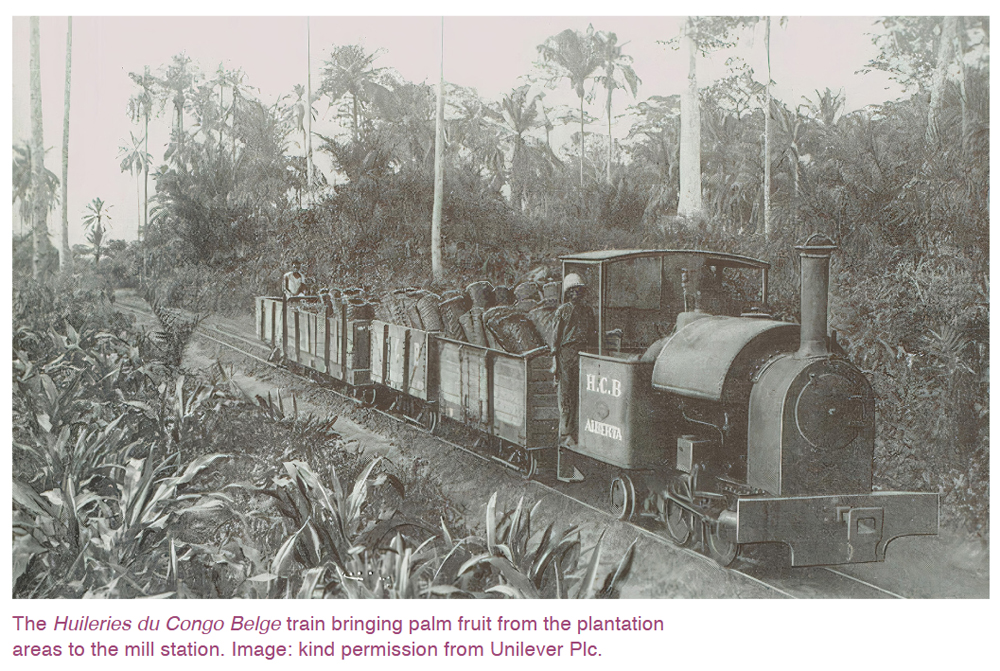
Lever Brothers in the Congo. Source: Port Sunlight Village Trust

Lever Brothers in the Congo. Source: Port Sunlight Village Trust

Unilever Archives
Port Sunlight Village booklet and guide (PDF)
https://archives-unilever.com/media/_file/website-documents/port%20sunlight%20village%20booklet.pdf

Wikipedia
Listed Buildings in Port Sunlight (list with photographs)
https://en.wikipedia.org/wiki/Listed_buildings_in_Port_Sunlight
 

Tourist map of some of the main non-residential buildings of Port Sunlight. Source and full-sized version: Port Sunlight Village Trust


The small and rather puzzling Burton Point Iron Age promontory fort on the Wirral

Burton Point from below

Burton Point from below

The earthworks at Burton Point have been consistently dated to the Iron Age, and the site has usually been described as a promontory hillfort. This post is about the prehistoric, medieval and post-medieval history of the site, with a particular focus on the Iron Age.

Burton Point footpaths and earthworks

The footpath over the railway leading to the viewing platform in the wooded area within the RSPB wildlife reserve, and the earthworks below. Source:  Google Maps

The site is located on a former promontory at the end of a headland at the western edge of the RSPB Burton Wetlands nature reserve.  You may see older websites saying that Burton Point is on private land, but this has now changed and entry to the viewing point over the defences now simply requires a ticket via the RSPB reception area.  The site is served by good footpaths and signposting and includes basic interpretation signage to give visitors some idea of what might have been there during the Iron Age.  As the RSPB reserve is really excellent (I have written about it here) it makes for a great day out even for people who are not particular bird aficionados.

Burton Point fortifications as seen from the footpath in the above imgae

Burton Point fortifications as seen from the approach along the footpath from the RSPB reserve, highlighted in red

Do note that on the whole, there is not a lot to actually see.  The Iron Age defences are on the other side of a fence, with notices not to cross the fence, so exploring the bank and ditch would be trespass.  Even though you are overlooking the defences, it is not at all easy to make out what is going on.  The other approach is to take the cycle track that runs near the base of Burton Point to try and get a look at it from below, but here again it is difficult to make out where the defences are located and how they would have been deployed to protect an Iron Age settlement.  The best way to get a good look of the site is from above, and you can do this by viewing the Mister Drone UK video of the site, which is by far the most effective way of understanding the relationship between the different parts of the site and the modern landscape and former riverscape.


Archaeological phases

Between 2005 and 2006 the University of Chester undertook three field surveys:  contour, topographical and geophysical, as well as a documentary review to track down any historical reference to the site in contemporary records.  These were reported by Gary Crawford-Coupe in the Journal of Chester Archaeological Society in 2006.

As you can see in the 1689 map above, it was a very noticeable promontory, with the river channel running along its base, offering clear views upriver towards Chester, and downriver towards Hilbre Island, which we could see on the day.  The visibility of Hilbre will depend to a great degree on the weather, but this was the hottest day of the year to date, and there was not a cloud in the sky.  Opposite, on the Welsh side, is Flint Castle which, like Burton Point, is now set back from the river by a long margin of accumulated silt, but was right on the water’s edge when it was built in 1277.

The four main periods of archaeological evidence proposed for the site are Neolithic, Iron Age, Medieval and 17th century.  The site was quarried extensively for red sandstone, which has caused changes to its appearance.  These are discussed by Gary Crawford-Coupe’s 2006 paper, based on the University of Chester’s field surveys, which is the best source of collated information, and can be downloaded free of charge from the Archaeological Data Service (see Sources at the end).

Neolithic

View along the Dee Estuary to the northwest

View along the Dee Estuary to the northwest towards the coast from the former riverbed under Burton Point

Although there are scatters of Mesolithic lithic finds on the Wirral dating to the earlier and later Mesolithic, examples of which were found in the nearby village of Burton, there is nothing dating to this period at Burton Point.  Three interesting finds dating to the Neolithic were, however, found, discussed in Crawford-Coupe’s paper.  There were two arrowheads, one tanged and one transverse, and a polished axe head from Graig Lwyd in Penmaenmawr.  Graig Lwyd axes were found over a wide area and represent a successful trading network.

Iron Age

The site

Fortification at Burton Point

Fortification at Burton Point, consisting of a bank and ditch

The site has not been excavated so recognition of a site and its interpretation as an Iron Age promontory fort has mainly been a matter of the presence of a bank and ditch.  The bank and ditch arrangement is referred to as a glacis type (in which the bank runs directly on a diagonal slope into the ditch).   The site has produced no further late prehistoric information, and no diagnostic artefacts have been recovered although it should be noted that the lack of finds from the Iron Age in the Cheshire area is entirely typical.  The main object type discovered from Iron Age sites is VCP (Very Coarse Pottery), a distinctive coarse pottery used for transporting salt, but none of this has been found at Burton Point to date.  In spite of this lack of corroborating evidence, most of those who have inspected and commented on the site have been confident that this is indeed a small Iron Age promontory hillfort that could have supported a small population, perhaps little larger than an extended family.  It was first registered as a Scheduled Monument in 1913 and in 1979 the schedule was modified to include a larger area.

Maiden Castle, Bickerton Hill, Cheshire

Artist’s impression of Maiden Castle on Bickerton Hill, overlooking the Cheshire Plain to the west, which in an interesting experiment had a clear line of sight to Burton Point. Produced by the Habitats and Hillforts Project 2008-2012. Source: Sandstone Ridge Trust

There is good circumstantial evidence to suggest an Iron Age date for the Burton area.  Burton Point was also well positioned for visual communication with contemporary sites, as discussed by David Matthews in 2006 and Erin Lloyd Jones  in 2019.  A 2011 experiment, the Hilltop Glow event, organized by the former Heather and Hillforts project, demonstrated that Burton Point and reported on the BBC (BBC News March 2011) was one of ten Iron Age hillfort sites (on the Clwydian Range, Halkyn Mountain, the mid-Cheshire Sandstone Ridge, and at Burton Point) that determined which sites could be seen from one another when torches were lit.  The BBC report of the experiment quoted Heather and Hilltops representative Erin Robinson, stating that Burton Point was visible as far away as Maiden Castle at Bickerton Hill, 25km /15.5 miles (shown above), as well as nearer sites on the Clwydian Range.  Burton Point would also have been in the proximity of Iron Age sites 129 and 154  at Puddington Lane in nearby Burton Village, which confirm that a later Bronze Age and Iron Age presence were in this area.  By boat, Iron Age settlements in both Chester and Meols would have been within easy reach:  Iron Age settlement features were found during the excavations of the Roman amphitheatre in Chester; and at Meols a number of Iron Age finds, including coins, have lead to suggestions that Meols may have been a trading port with connections to both north and south along the coast at that time.

Burton Point LiDAR image from the Atlas of Iron Age of Britain and Ireland (EN3190).

Burton Point LiDAR image from the Atlas of Iron Age of Britain and Ireland (EN3190). The line leading diagonally from northeast to southwest is the footpath leading to the viewing area.

There are however some features that remain puzzling.  If this is supposed to be a settlement on a promontory, separated from the rest of the headland by a bank and ditch, it is remarkably difficult to understand its form from what remains, whether you are overlooking the site, looking up at it from below, or examining maps, LiDAR imaging or aerial photographs.  This is partly due to quarrying and erosion, but also because it is impossible to walk over what remains of the site, which is fenced off.  However, what may have been the Iron Age defences appear to be set below what remains of the headland.  This means that the settlement on the promontory would have been lower than the headland behind it, a strategic disadvantage if the bank and ditch were defensive rather than merely statements of territory or prestige.  On my first visit it seemed  counter-intuitive that this was a promontory hillfort because the defences were only around 20ft above the river bed.  Once the term “fort” is removed from the equation, it is still puzzling, and although a short stretch of bank and ditch were visible, they were below the level at which we were standing on the headland behind the defences, a few feet higher than the defences.  Faint heart never won fair hillfort, so a few days later I parked up near the cycle track that runs around the base of Burton Point and had another look from what would have been the Dee riverbed, from where the headland clearly rises above the level of the defences.  The Mister Drone footage and the above LiDAR image, which I found only later also indicate that the defences were below the headland behind it.

Even so, the bank and ditch may have been more symbolic than actually defensive.  Speculating wildly, if the promontory was occupied for its views or as a trading point, the defences could have been built to control access to and exit from a specialized site.  In this case, or any other function for the site (including domestic settlement) the bank and ditch could have had more to do with a statement of territoriality and prestige than any actual threat.

The surveys  undertaken by the University of Chester (Crawford-Coupe 2005) were unable to provide definitive data to substantiate the proposed dating.  The tangle of tree roots prevented any detection of sub-surface structures.

There are alternative suggestions.  After his visit to inspect the site in November 1950, Professor A.W. Lawrence, thought that the earthworks represented quarry upcast prior to starting a new quarry (Historic England Research Records Monument No.67150).  The same source puts forward the possibility that even if it is accepted that the bank and ditch are defensive, they could represent “a Dark Age Celtic Fort,” partly based on the possibility that the parish name Burton may be derived from Burh-tun, meaning “farm/dwelling by the fort.”  The CHER record (9/1) mentions, without a reference, that “[i]t has been suggested that it maybe the military base of the Dane, Hingamund.”

The site continues to interest those researching the Iron Age and has been mentioned in subsequent reports on other sites, placing it in a wider regional context.  As Crawford-Coupe points out, matters are unlikely to be clarified until an excavation takes place.

Composite map showing the distribution of Iron Age sites in northwest England and north Wales. Sources: I combined the two maps from Ritchie 2018 and Nevell 2025

Roman

For those wondering whether there may have been a Roman trading post or watchpost here, perhaps part of a network with Meols, both reasonable thoughts given the notable lines of sight on a clear day, a single Roman brooch was found (SMR-no.59).  A single object cannot be extrapolated into a whole site or a particular set of activities but the discovery is still interesting, particularly as there was a find of another Roman brooch (SMR no.56), a fibula-type, in a field opposite Ness Gardens only 1.5 miles / 2.4 km away from Burton Point.  I have not yet found a detailed account or image of either brooch.

Medieval use and quarrying

Flint Castle

Flint Castle on the Dee Estuary, opposite Burton Point

After the site was abandoned in the Roman period, it is thought that it was used for stone quarrying by Edward I for Flint Castle, together with stone from Ness where Edward kept a small garrison.  Most of the stone used for Flint Castle was yellow sandstone, that tends to look rather grey today, but red sandstone that could have been quarried from Burton Point and its vicinity was also used as infill and for some inner stonework.

Richard II’s Cheshire archers are thought to have embarked from Burton Point on the expedition to Ireland in 1399.

Post-medieval land use, quarrying and burials

As has already been mentioned, in the Middle Ages the channel of the Dee is thought to have run up to the base of Burton Point, and there are various records of requests for access to the small headland for mooring, unloading and storage. The University of Chester survey published in 2006 noted a section of wall and some pavings, which may have had something to do with these requests, but it is all fairly ambiguous.

1732 map of the river Dee and estuary showing Burton Point.

1732 map of the river Dee and estuary showing Burton Point. Source: sustainablebeach.co.uk

In 1889 it was reported that 29 burials were found, all interred orientated east to west, with no grave goods.  An east-west burial is consistent with a Christian burial, but that does not narrow it down much.  When the skeletal remains were examined, there were no marks to indicate how they died, which seems to rule out a Civil War explanation, but leaves the possibility of plague or shipwreck.  A shipwreck was recorded for 1637.  Shipwreck victims may or may not have incurred injuries during the wrecking of the ship, but plague would have left no signs at all and would be consistent with such a remote burial, unconnected with a church and consecrated land.


Final Comments

Imaginative reconstruction of how an Iron Age site may have looked

Given that no roundhouses or any indications of palisades have been found at the site, this information sign represents a profound act of imagination based loosely on structures found on other Iron Age sites in the general area.

Partly due to erosion and quarrying that have obliterated most of the site, and partly due to the position of the defences at a level lower than the main headland, the site is not particularly easy to understand as an Iron Age defended promontory settlement.  Nevertheless, it is generally accepted as such, demonstrated by the University of Chester report published in 2006, and its inclusion in discussions of the Iron Age in the area, its presence on distribution maps of Iron Age sites and its inclusion on online Atlas of Iron Age Hillforts in Britain and Ireland.  There do remain questions about the overall plan of the proposed late prehistoric settlement.


Sources 

Books and papers

Britnell, W.J. and Silvester, R.J. 2018. 1. Introduction. In (eds.) Britnell, W.J. and Silvester, R.J. 2018. Hillforts and Defended Enclosures of the Welsh Borderland. Internet Archaeology 48

https://intarch.ac.uk/journal/issue48/7/1.html

Crawford-Coupe, Gary 2006. II. The Archaeology of Burton Point.  Journal of Chester Archaeological Society, new series 89, p.71-90
https://archaeologydataservice.ac.uk/archiveDS/archiveDownload?t=arch-2910-1/dissemination/pdf/JCAS_ns_080/JCAS_ns_080_071-090.pdf

Gregory, Richard A. and Mark Adams with contributions by Denise Druce, Laura Griffin, Chris Howard-Davis, Gwladys Monteil, Elaine L. Morris, Rob Philpott, Ian Smith and Adam Tinsley 2019. Excavation at Two Cropmark Enclosures at Puddington Lane, Burton, Wirral, 2010–2015.
Journal of Chester Archaeological Society, new series 89, 2019, p.1–69
https://archaeologydataservice.ac.uk/archiveDS/archiveDownload?t=arch-2910-1/dissemination/pdf/JCAS_ns_089/JCAS_ns_089_001-070.pdf

Griffiths, David., Robert A. Philpott, Geoff Egan and contributors 2007. Meols, the Archaeology of the North Wirral Coast. Oxford University School of Archaeology: Monograph 68: Institute of Archaeology, University of Oxford.
https://archaeologydataservice.ac.uk/archives/view/meols_sal_2007/downloads.cfm

Lloyd Jones, Erin 2019. Connections between the hillforts of the Clwydian Range and the wider landscape. Unpublished PhD, Bangor University
https://pure.bangor.ac.uk/ws/portalfiles/portal/22607372/2017_Jones_EL_PhD.pdf

Matthews, David J. 2006. Mapping hillfort intervisibility and its potential to define Iron Age tribal areas in the northern and mid Marches. Unpublished MA Thesis

Matthews, Keith J. 2001. The Iron Age of Northwest England: A socio-economic model.  Journal of the Chester Archaeological Society 76, p.1-51
https://www.academia.edu/900876/The_Iron_Age_of_North_West_England_A_Socio_Economic_Model

Morgan, Victorian and Paul Morgan 2004.  Prehistoric Cheshire. Landmark Publishing

Nevell, Mike 2025. Northwest Regional Research Framework: Later Prehistory
https://researchframeworks.org/nwrf/resource-assessments/later-prehistory/ 

Philpott, Robert A. and Mark H. Adams and contributors 2010.  Irby, Wirral.  Excavations on a Late Prehistoric Romano-British and Medieval site 1987-96.  National Museums Liverpool

Ritchie, Matt 2018.  A Brief Introduction to Iron Age Settlement in Wales. Internet Archaeology 48. https://intarch.ac.uk/journal/issue48/2/1.html

Silvester R.J. 2018. 4. North-east Wales and the Cheshire borderlands. In (eds.) Britnell, W.J. and Silvester, R.J. 2018. Hillforts and Defended Enclosures of the Welsh Borderland. Internet Archaeology 48
https://intarch.ac.uk/journal/issue48/7/toc.html

Wilmott, Tony and Dan Garner 2018. The Roman Amphitheatre of Chester, Volume 1: The Prehistoric and Roman Archaeology. Oxbow Books

Websites

ARCHAEOdeath
The Archaeology of Burton Point: The Heritage Open Day at Burton Mere RSPB
https://howardwilliamsblog.wordpress.com/2022/09/16/the-archaeology-of-burton-point-the-heritage-open-day-at-burton-mere-rspb/

Atlas of Hillforts in Britain and Ireland
EN3190 – Burton Point.  Gary Lock and Ian Ralston 2012-2016
https://tinyurl.com/mrxeu34s

Based In Churton
Exploring Maiden Castle Iron Age Hillfort, Bickerton Hill (mid-Cheshire Sandstone Ridge)
https://wp.me/pcZwQK-8Az
Sunshine, archaeology and great views at Caer Drewyn Iron Age hillfort at Corwen
https://wp.me/pcZwQK-4ft
Hillforts and amazing views – and why is there an Egyptian temple on the top of Moel Famau?
https://wp.me/pcZwQK-9dE
The fabulous nature reserve at the RSPB’s Burton Mere Wetlands
https://wp.me/pcZwQK-7QS

BBC News
North Wales Hillfort Test of Iron Age Communication
https://www.bbc.co.uk/news/uk-wales-north-east-wales-11832323

Heritage Gateway
Historic England Research Records Monument Number 67150.  
https://www.heritagegateway.org.uk/Gateway/Results_Single.aspx?uid=67150&resourceID=19191

Historic England 
Promontory fort on Burton Point 550m south west of Burton Point Farm
https://historicengland.org.uk/listing/the-list/list-entry/1013298?section=official-list-entry

Mister Drone UK
Burton Point, Iron Age Fort Remains search by drone
https://www.youtube.com/watch?v=t9izFQLB148

Northwest Regional Resource
Introduction: The Later Prehistoric Resource. 1200BC-43AD. Compiled by Michael Nevell, with contributions.
https://researchframeworks.org/nwrf/resource-assessments/later-prehistory/

A Sustainable Vision for Hoylake Beach
The Curious Case of the Cheesemongers (for the very useful 1732 map of the Wirral)
https://sustainablebeach.org.uk/index.php/evidence-and-data/library/the-curious-case-of-the-cheesemongers/


The view across to Wales

The view across to Wales from the foot of Burton Point

Walking the history of Chester’s canals, from the river Dee to Boughton #1 – Short History

This post is divided into two. Part 1 (this part) looks in brief at some of the history of the Chester city canals, mainly to untangle the complicated story of what is happening at the Tower Wharf Basin, where the Chester and Ellesmere Canals came together.  Part 2 is a mainly photographic account of the walk along the canals from the river Dee to the Chester Boughton Hall Cricket Club, just beyond Tarvin Bridge.

The pink arrows are my route from the Little Roodee car park to the start of the canal. The orange arrows are the route taken from the start of the canal at the river Dee to Chester Boughton Hall Cricket Club. Details of the walk are in Part 2.

Cow Lane Bridge 1880s

Cow Lane Bridge in the 1880s. Source: chesterwallsinfo

This post begins with a short description of the history of the Shropshire Union Canal, describes why the intersections just beyond the Northgate staircase lock is so complicated, and goes on to describe the walk.

The Shropshire Union Canal runs today from the Mersey and the Manchester Ship Canal at Ellesmere Port, to Autherley Junction near Wolverhampton on the Staffordshire and Worcestershire Canal over a distance of 66.5 miles (107km).  Because it runs beyond the city walls, only making its presence felt to tourists where it crosses Northgate and along the base of the city walls, it does not feature on the city’s usual tourist routes.  Unlike Chester’s well known medieval, Georgian and Victorian architectural attractions, the canal is more directly a component part of the city’s industrial past, but is just as essential in the city’s story.

The history of the Shropshire Union Canal

During the 18th century civil engineer James Brindley (1716-1772) was responsible for building over 365 miles of canals.  Brindely realized that any inland waterway network would need to connect to all the great navigable rivers that connected to the sea, including the Thames, the Mersey, the Severn and the Trent, incorporating other important navigable rivers like the the Avon and the Dee.  The network was a sprawling affair, but it revolutionized transport, avoiding roads that would become mired and impassable in winter, as well as unnavigable sections of rivers, and the riverine problems of tides, drought and flood.  Water into and out of the canal system was regulated and therefore predictable, and allowed year-round transport.  The advantages became very clear very quickly, and manufacturing and trading businesses began to locate themselves at critical points on the canal network.  Eagerness to invest in infrastructure resulted in a canal boom in the mid to late 1700s.  Each new section of canal required an Act of Parliament, subject to Royal Assent, and Act after Act was passed as the network expanded.

The Chester Canal. Source: Shearing 1985, p.150

The  execution of the canal project for Chester was deeply flawed.  Jumping on the canal bandwagon, entrepreneurs and investors envisaged a money-making venture that would bring Shropshire and Cheshire into the mainstream trade network with Birmingham, the nation’s canal hub and centre of industry, via a junction at Middlewich with the 1777 Trent and Mersey Canal.  Unfortunately, the builders of the Chester Canal did not have agreements in place to connect their new Chester Canal either to the Trent and Mersey Canal, which denied them permission to build a junction, or with the River Dee Company, which also put barriers in their way leading to several years of negotiation before a satisfactory solution was reached.  The Chester Canal, opening in 1779, was not built to Middlewich, where it had been planned for the Chester to join the Trent and Mersey, and instead stopped at Nantwich, segregated from the rest of the national canal network.  With little traffic carrying low-value cargoes, as well as a packet boat service, the canal was a fairly substantial failure.  In 1787 the Beeston staircase locks collapsed and there were insufficient funds to pay for repairs.  The Chester Canal hovered on the verge of bankruptcy.

The complex arrangement of the Ellesmere Canal

The complex arrangement of the Ellesmere Canal and its branches is shown as thin blue winding lines. The thick blue line from Chester is the Dee. The yellow lines are roads. Click to see a bigger version. Source: Wikipedia

If it had not been for the 1791 Ellesmere Canal project, the Chester Canal would not have managed to limp on much longer.  The proposal for sections of canal to link the Mersey at Netherpool (now Ellesmere Port) to both the river Dee at Chester and the Severn at Shrewsbury was ambitious, but attracted sufficient support for a surveyor to be hired and possible routes to be explored.  The Ellesmere Canal proposal was presented to parliament and received its Royal Assent in April 1793.   Although shortages in funding prevented the realization of the full vision, shown right, Chester was at last brought into the national canal network. Part of this necessitated the addition of a new branch of canal from Chester to Ellesmere Port, which connected with the Chester Canal in what is now the Tower Wharf Basin.  The two companies merged in 1813, becoming the Ellesmere and Chester Canal Companh.  In 1833 the Middlewich branch was added, as the Chester Canal company had originally planned, and was connected to the rest of the network via the Trent and Mersey.

Hunter 1782 map with canal

Hunter 1782 map with the canal before the basins were added for the Wirral Line

These changes required major infrastructure changes in Chester itself that are still clearly visible today.  Starting from the former interface between the river and the canal, just off Sealand Road, the derelict remains of the river-canal lock are clearly visible as industrial archaeology.  The gates have long gone and this section of the lock and the branch that once lead into the Dee Basin, along Tower Road on the map below, on its way to the Dee Branch, is full of aquatic plant life.  As you walk along towards the Dee Branch, rounding the corner and passing under the bridge, you find yourself in the basin complex, the Ellesmere Canal Company’s solution to how best to incorporate the Wirral Line north to Ellesmere Port.  However before the Ellesmere Canal Company was involved, the Chester Canal simply ran straight ahead, running directly along the Dee Basin into a set of five staircase locks before heading east towards Boughton.

Canal and River Trust map of the basin and wharves, showing the complex arrangement of locks and basins required to incorporate the Wirral branch of the canal to Ellesmere Port.


Map from the 1858 Roberts Chester Guide

Map from the 1858 Roberts Chester Guide, showing the big Dee Basin at the far end where locks connected it to the Dee. Click image to enlarge

The set of basins and wharves that became necessary when the Chester Canal was incorporated into the Ellesmere Canal Company’s plans capture the fascinating history of how the area’s canal system was forced to evolve.  Three different sections of the canal are involved in this complex arrangement, shown above.  The earliest of these phases belongs to the original Chester Canal, which begins at the river Dee and once headed straight along into a series of five locks that climbed the hill to the dramatic sandstone cut and onwards to Hoole and Boughton before turning south to Christleton and beyond.  The second phase is the Ellesmere Canal Company’s civil engineering work to incorporate the new “Wirral Line,” which headed in a roughly northerly direction out of Chester.  This now chopped off the Chester Canal at the base of the locks, demolishing two of the five locks, to create the Tower Wharf Basin.  The new arrangement cut off the canal from the river, meaning that another section of canal, called the Dee Branch, had to be created parallel to the main basin and accessed via a lock, to allow vessels to travel between the main line, the Wirral line and the Dee.  It is not an elegant solution, but it worked.  The rest of the canal is very straight forward as you walk towards Hoole, Boughton and beyond.  The historical interest in those sections of the canal is more about the bridges and the flanking architecture that grew up around the canal.

The docks at Ellesmere Port during the 19th century

The docks and wharves at Ellesmere Port during the 19th century, from the Ellesmere Port canal museum archives

In 1846 the decision was made to bring together the various canal and railway interests together under one umbrella organization, the Shropshire Union Railways and Canals Company, providing the different sections of canal from Ellesmere Port to Wolverhampton with a single name:  the Shropshire Union Canal.  In 1894 the Manchester Ship Canal opened, and the Ellesmere Port access to the Mersey was now via the new shipping channel.

In spite of canalization of the Dee in the 1730s was intended to make the rapidly silting river navigable and to make Chester competitive once again with Liverpool, but in spite of these measures silting continued and the river became impractical for serious commercial shipping and shipbuilding, particularly in the face of Liverpool’s rapid expansion.  The last ships were built on the Dee in the early 20th century, ending a centuries old industry, and the connection between the Shropshire Union and the river went out of use.

Chester Railway Station

Chester Railway Station 1848. Source: Hoole History and Heritage Society

The railway came to Chester in 1840, picking up some of the slack, but Chester’s days as a centre for trade and industry were over and the main financial opportunity that the railway brought was tourism.  The canal, however, continued to be used as part of the canal network, connecting to maritime trade via the Mersey.  Eventually, as rail replaced the canals, many of them became derelict, only reviving as leisure resources in the later 20th century.

The canal attracted many businesses along its edges, and today the canal preserves a considerable amount of commercial and industrial heritage, adding a welcome extra dimension to Chester’s historic legacy.  The canal network today is used for pleasure, mainly in the form of cruising, walking and cycling.  It still covers a vast region of England and Wales and is managed by a mixture of state organizations and by both regional and local charities.

Schematic map showing how Chester relates to the canal network

Schematic map showing how Chester relates to the canal network today. Source: Swanley Bridge Marina

As canals have become attractive for residential development, new housing has also been erected, some developments more sympathetic than others, but all interesting.  The mixture is captured in the walk in Part 2. Apart from a few isolated examples, most of the warehousing that once flanked the basins and the canal has long gone, replaced by modern apartments, including student accommodation and retail outlets.

The Dee no longer connects to the canal network.  The lock between the river and the Dee Branch of the canal, lying just over Sealand Road, is completely derelict.  One of the locks further along is padlocked shut. The old swing bridge that had allowed vessels to interrupt road traffic to enter the canal network was replaced by the fixed road bridge in the 1960s.   Today the leg of the Dee branch of the canal running parallel to the Basin, once used for access to the river, is used for mooring privately owned narrowboats.

Signage at the canal basin showing information about Telford's Warehouse

Signage at the canal basin showing information about Telford’s Warehouse

I have kept this history brief, merely to introduce the walk.  Rather than reinventing the wheel, please see the Sources below, which contain much more information.  The three video links also provide an excellent overview, between them, of the canal, its history, and some of the buildings and businesses associated with it.  The first is by John Herson, one of whose guided canal walks I have done and thoroughly enjoyed, which focuses on Tower Wharf, the Canal Basin and the relationship of the canal with the Dee.  The second is by Stuart Shuttleworth and looks at the main line of the canal as it passes through Chester.  Together they form a brilliant introduction to the subject, showing the key places to visit.  At the end, underneath Sources, there is another video by “Pastfinder,” which is longer and explores what remains today in more depth, walking and talking at the same time, making it quite easy to retrace his footsteps.  There are some fascinating additional pieces of information in this.

John Herson:

Stuart Shuttleworth:


Sources:

A lot of information is contained in the two videos above and the one at the end of the post.

Other sources of information are as follows:

Books and papers

Carrington, Peter 1994. English Heritage Book of Chester.  Batsford / English Heritage

Martin, Richard 2018. Ships of the Chester Rivers.  Shipbuilding on the Dee from Chester to the Point of Ayr 1800-1942. Bridge Books

Mosse, J., David Lobband and Judith Pile 2023 (9th edition).  Collins Nicholson Waterways Guide 4. Four Counties and the Welsh Canals.  HarperCollins

Nicholson, R. 1989 (4th edition). Nicholson/Ordnance Survey Guide to the Waterways 2: Central. Robert Nicholson Publications and Ordnance Survey

Shearing, Edwin A. 1985. Chester Canal Projects: Part I. Journal of the Railway and Canal Historical Society. Vol XXVIII, no.3, November 1984. p.98-103

Shearing, Edwin A. 1985. Chester Canal Projects: Part II. Journal of the Railway and Canal Historical Society. Vol XXVIII, no.4, March 1985. p.146-154

Ward, Simon 2013 (2nd edition). Chester. A History. The History Press

Websites

Canal and River Trust
Welcome to Chester. Escape the city on this tranquil waterway (PDF)
https://canalrivertrust.org.uk/media/document/0z8YCnXdfYHg_am-LmUGSg/p22Wl115w_dWrQTRa-XYJd5Q5nl2UR6N17EY2G1JFyc/aHR0cHM6Ly9jcnRwcm9kY21zdWtzMDEuYmxvYi5jb3JlLndpbmRvd3MubmV0L2RvY3VtZW50Lw/0192bddd-4001-76ad-a95b-0ad3662ccdcc.pdf

Canal Routes
Chester Canal History
https://www.canalroutes.net/Chester-Canal.html
Chester Canal Route
https://www.canalroutes.net/Shropshire-Union-Canal.html#Chester-Canal-Route
Ellesmere Canal – Wirral Line
https://www.canalroutes.net/Shropshire-Union-Canal.html#Ellesmere-Canal-Wirral-Line
Shropshire Union Canal
https://www.canalroutes.net/Shropshire-Union-Canal.html

Cheshire West and Cheshire
Chester Canal Conservation Area Character Appraisal Ellesmere Port to Nantwich (PDF)
https://www.cheshirewestandchester.gov.uk/documents/planning-and-building-consultancy/total-environment/conservation-and-design/conservation-area-appraisals/canal-conservation-area-elesmere-port-to-nantwich-latest-version-261118.pdf
Chester Characterization Study
https://www.cheshirewestandchester.gov.uk/your-council/policies-and-performance/council-plans-policies-and-strategies/planning-policy/chester-characterisation-study

chesterwalls.info
Photographs of the Chester Canal Old and New, parts 1-5
https://chesterwalls.info/gallery/canalgallery.html

Chesterwiki
(with a lot of adverts interspersed)
Canalside
https://chester.shoutwiki.com/wiki/Canalside
Canal and Boatyard
https://chester.shoutwiki.com/wiki/Canal_and_Boatyard

Grace’s Guide to British Industrial History
James Brindley
https://www.gracesguide.co.uk/James_Brindley
William Jessop
https://www.gracesguide.co.uk/William_Jessop

Heritage Chester
Bite-Sized Wonder – The Lead Shot Tower
YouTube video

Historic England
Bridge of Sighs, Upper Northgate Street
https://historicengland.org.uk/listing/the-list/list-entry/1375967
Telfords Warehouse, Raymond Street

https://historicengland.org.uk/listing/the-list/list-entry/1375919?section=official-list-entry

Inland Waterways Association, Chester and Merseyside Branch
Chester Heritage Port Designation Document (PDF)
https://70cf2f03-3eb2-43c8-889f-b8f841fc3757.usrfiles.com/ugd/70cf2f_64e6633c34b9420f8c06a368857d1a42.pdf

UK Waterways Guide
Map of the Shropshire Union Canal
https://www.ukwaterwaysguide.co.uk/map/shropshire-union-canal/all-branches

“Pastfinder”: