One of the most mellow, blue-skied and sunny afternoons that I have enjoyed in a long time was a sublimely relaxed and chatty visit to The Harp Inn on the Dee estuary, just outside Little Neston. It is a super little pub dating to the 1700s with lovely views over the marshes towards the impressively long line of the Welsh foothills. The pub’s official opening time is 12 noon, but we arrived to find it open at 1145 because due to queues outside their doors at 12 they are currently opening at 11. Very gratifying! The beers and ciders change from time to time (just check their website), there are plenty of soft drinks on offer and the lunches that were being paraded past us as the afternoon advanced looked gorgeous. The staff are lovely, and the atmosphere is great. There are lots of tables perched on the grassland at the edge of the lush green estuary, and on a stiflingly hot day, a wonderfully warm but cooling breeze came off the Dee to make the peaceful, endless vistas a delectable place to linger, interrupted only by birdsong. The breeze was so perfect. I do love the heat, but it is lovely to be able to sit in the sunshine without dripping like a tap. Update: We went back the following week to have lunch after a visit to the Williamson Art Gallery and Museum in Birkenhead, and the food (haddock, chunky chips, tartare sauce and garden peas for one of us and an enormous ham and cheese ploughman’s with all the trimmings and more for the other) was just as good as it had looked as it was passing us on trays the previous week.
Most of the photos taken on my aged iPhone. Enlarge at your own risk!
View from The Harp
Denhall Quay
According to the pub’s website, the building has stood there since the 1750s, when it was originally built as three coal-miners’ cottages, before being converted to an inn in 1780 to serve the expanding coal-mining community at Ness. This segues nicely into the second major benefit of the pub, which is its location a stone’s throw from Denhall Quay, an intriguing and picturesque line of wall, made of massive red sandstone blocks, that stretches out into the marshland, and is clearly the remaining echo of a substantial structure. In fact, the wall is what remains of a long pier that served the Ness Colliery, built in 1839 to replace an earlier quay in the same location. The wall was much deeper than it is now, its lower tiers lying beneath 200 years of silt accumulation, but it it sufficient to give an idea of how impressive the structure originally was.
This was not the most obvious location for a quay because the river did not run past the colliery, veering towards Wales just before Little Neston, meaning that a channel had to be created to link the quay to the main river, which became known as the Colliery Gutter. It was not ideal, as vessels often had to wait for two tides to turn before being able to navigate all the way to the quay, forcing colliers to beach on the muds in the interval between tides.
Denhall Quay c.1839 showing the quay, with its distinctive shape, surrounded by subterranean tunnels. Source: Annakin-Smith “The Neston Collieries, 1759-1855” 2019, p.170, fig.10.6
There were two collieries at Ness: Ness Colliery, which opened in 1759, and Little Neston Colliery immediately to the north, which opened in 1820. Most people, myself included, would not automatically associate coal mining with the Wirral, although it is a very familiar industry from North Wales. Fortunately, Anthony Annakin-Smith wrote an excellent book on the subject in 2019, which I read shortly after its publication, and he gave a really enjoyable lecture about the collieries at the Festival of Ideas this year (July 2026). The Wirral coal seams are an extension of the Welsh ones, but although a slither of the seams can be found on the Wirral landmass itself, most of them lie under the estuary, and it was here that most of the mining took place. A whole network of tunnels was built below the estuary, and subterranean canals were added to help remove the coal in long narrow vessels called “starvationers.” Both the tunnels and the canals lead back to shafts where the coal was hoisted to the surface. It was a dangerous and sometimes tragic business. Once extracted and processed the coal was transported to ports in Britain, Ireland, France, Spain and as far away as America and even Barbados.
A “starvationer” of the sort used in the canals beneath the Dee estuary, now in the National Waterways Museum at Ellesmere Port (my photo)
The two collieries were located either side of a border dividing land between two different family interests. The original colliery, Ness, owned by the Stanley family, handled the arrival of the new colliery very badly, and its owner, Sir Thomas Stanley, who sounds like an absolute monster of a man, pursued a course of aggression that eventually, on several occasions, erupted into blatant sabotage, including destruction of machinery, flooding of their rival’s tunnels and, on one particularly violent occasion, an attempt to use explosives to completely obliterate the opposition. The collieries were both closed between 1845 and 1855 due to silting of the estuary, but they were revived in 1875, and the last coal was worked in 1927.
It is difficult to assess just how the collieries initially impacted local people, because most of the coal miners were brought in from North Wales and Lancashire, with Wirral residents only working in minor and administrative roles. But both the collieries and the miners became part of the community, and Denhall Quay is an important reminder of the unexpected industrial and social heritage of this small corner of the Wirral.
The Harp Inn, on Quayside in Little Neston, is at the end of a residential lane, Marshlands Road, turning left along the Quayside, before it eventually becomes a track and then a footpath. There are three main parking areas, first just as you round the bend to turn left from Marshlands Road onto Quayside (What3Words ///regarding.solving.mirroring, about a two minute walk, heading in the same direction), then at the pub itself where there is parking for about 10 cars (What3Words ///when.grumbling.kicks), and finally at Denhall Quay (///bike.outcasts.tarred, about a two minute walk back to the pub).
If you are interested in finding out more about the Wirral collieries I sincerely recommend Anthony Annakin-Smith’s The Neston Collieries, 1759–1855: An Industrial Revolution in Rural Cheshire published by the University of Chester Press (a second edition was released in 2023), and also check out his website at https://www.nestoncollieries.org.
At the entrance to Denhall Quay there are two helpful information boards that are faded but still just about legible, covering the earlier and later colliery phases, and you can walk out into the marshland along well-worn paths (dry in a hot summer, but probably not as foot-friendly in the autumn and winter).
On 17th June 1860 the fabulous S.S Great Eastern left Liverpool and set sail on her maiden voyage for New York. She arrived there this day, 28th June. Her designer and architect was Isambard Kingdom Brunel whose pet name for the ship during construction was “Great Babe.”
There is a nice nod to Great Eastern on the Chester City Walls, where the length of the ship (692ft) was carved quite deeply into one of the coping stones at Kaleyard, near the pigeon coop, preceded by an engraved anchor. It is also the measurement between that point and the King Charles Tower, also known as the Phoenix Tower. You can see a photograph of it at the end of this post.
I have written previously about the Great Eastern and her relationship with the Mersey, and above is a splendid engraving from the 21st July 1860 Supplement of the Illustrated London News showing her June arrival in New York.
Great Eastern shortly before launch in 1858 by Robert Howlett. Source: Wikimedia
With a capacity for 4000 passengers, she left Liverpool on her maiden voyage with only 35 passengers and 8 company overseers, both of which were far exceeded by a crew of 418. She was equipped to run under sail or steam, via paddles or propeller, had four decks, and could carry 15,000 tons of coal. Sadly she was never given the opportunity to meet the long-distance goals of India, China and Australia intended for her by Brunel and her builders and investors and was never competitive on the busy cross-Atlantic passenger service to which she was initially confined.
The fortunes of Brunel’s astonishing S.S. Great Eastern swung between greatness and near-disaster like an enormous, record-breaking pendulum. She was all too often something of a gigantic white elephant, but she became an invaluable resource for laying cables across the Atlantic, and was always a great public attraction.
Painting by Charles James Lewis of the Atlantic Telegraph Expedition landing of the cable in Hearts Content Cable Station in Newfoundland, Canada, on July 27 1866, which he witnessed. Source: PK Porthcurno
After a traumatic roller-coaster of a career, the enormous ship was sold to be broken up in 1889, the work to take place on the Mersey.
Great Eastern, beached in advance of being broken up on the Mersey in late 1888, Wirral side. Source: Liverpool Echo
Throughout her history, Great Eastern was the subject of curiosity and fascination, and people lined up to buy souvenir pieces of the ship before the breaking work began on 1st January 1889. The photograph above shows her beached on the Mersey, ready to be broken up, and she continued to challenge even after the breaking work began. Not only was it a very sad episode for posterity but also, as it turned out, for the ship breaker. The company directors had estimated that it would take 200 men to break up the ship in a year, but she was so well built that it took nearly two years, requiring the costs of ongoing labour and additional machinery, including much more substantial wrecking balls, to finish the job. Substantial profits had been anticipated from her scrap value, but she was broken up at a considerable loss. Brunel had built her to last.
One of Robert Howlett’s famous photographs of Brunel with Great Eastern in 1857 prior to launch. Source: Wikimedia
Brunel had died in 1859 whilst the ship was still undergoing sea trials and had suffered an engineering accident during which five stokers died, and although the consensus is that the emotional stress of the ship’s construction and the difficulties of her launch undoubtedly contributed to his death, he was already suffering from a debilitating kidney disease.
It is perhaps thankful that he did not live to witness this drawn-out demise of his grandly imagined, fabulously realized and much-loved “Great Babe.”
Great Eastern was such a colossal, record-breaking chunk of maritime, industrial and national heritage that I find it more than slightly difficult to forgive the universe for allowing her to be broken up.
Infographic comparing ship sizes, in chronological order from left to right. Click to expand. Source: JF Ptak Science Books.
The length of Great Eastern carved into the City walls in the 19th century. Source: Geograph. By John Turner, CC BY-SA 2.0
The watercolour of Great Eastern, shows her beached on the Wirral side of the Mersey for repairs, although the painting is very sadly not on display. It was painted three years after the illustration at the top of the post, in 1863, by William Gawin Herdman (1805-1882).
Great Eastern watercolour showing the ship on the gridiron for repairs just off the Wirral on the Mersey in 1863. By W.G. Herdman (in the collection of the Williamson Art Gallery, not currently on display). Source: Williamson Art Gallery Collection at Birkenhead.
It is quite a story. When William Hesketh Lever purchased land for a new factory and decided to build a village for the workers and their families in 1888, he wanted it to be a place where people would enjoy living, to be a thing of beauty, to offer educational and leisure facilities, and to celebrate the best of both vernacular and formal British architecture. Port Sunlight is often referred to as a model village, but this implies something rather effete, a bit of a vanity project, whereas the village was intended to offer all the benefits of a real, thriving, supportive community, as well as an educational and cultural hub. Port Sunlight was to be the very antithesis of the slum housing and overcrowding that had crushed so many workers in industrial areas and enterprises of the northwest.
View down a section of the Dell, once an inlet of the Mersey
To ensure that there was real architectural diversity, over 30 architects were employed. Central roads were based on boulevards. All streets were wide and the houses, all with a minimum of two bedrooms, were fronted with lawns. As it grew during the late 19th and early 20th centuries there were open green areas, a formal garden based around an old inlet of the Mersey now called the Dell, cricket lawns, a bowling green, tennis courts, a theatre, an open-air swimming pool (ingeniously heated with surplus heat from the soap factory), schools, a church, a cottage hospital, a private fire brigade, a village shop and various improving societies and clubs, including a girls’ institute. There were even plenty of allotments. To top it off, a library was built with a small display area to share a changing selection of Lever’s ever-expanding collection of antiques and antiquities, which were eventually moved into a custom-made art gallery within the village, which still attracts hundreds of visitors a year. Lever believed in prosperity sharing. Instead of profit sharing, in which additional cash is put into pay packets, he shared the prosperity of the company by using it to maintain the village and continue expansion and to add improvements to living conditions. The benefits to villagers came with risk, as anyone not caring for their home, or who fell short of Lever’s high moral standards could be ousted from their homes. His attitude to the village and his workers has been termed paternalistic. Today the village is managed and cared for by the Port Sunlight Village Trust, an independent charitable trust set up by Unilever in 1999.
William Hesketh Lever. Source: Wikipedia
William Hesketh Lever (1851-1925) was born in Bolton, the son of a grocer. Although he and his younger brother James went into business together, providing the company with the name Lever Brothers, it was William who had the innovative flair that made the company a household name. His commercial successes earned him the title baronet in 1911, after which he was Lord Lever and baron in 1917, becoming Lord Leverhulme (combining his own surname with that of his late wife). In 1922, following the death of his wife in 1913, he was further honoured with the hereditary rank of Viscount. He named his village after his best-selling product, the subject of his genius for branding and marketing, Sunlight soap. The soap factory and related buildings sat behind the long low frontage of office buildings, which eventually became the Lever Brothers headquarters, on the very edge of the village. It was featured in the Illustrated London News in 1898, clearly the focus of considerable wonder. Today, with its beautiful homes, its art gallery, its community hall, its green spaces and formal flower beds, and even its more recent garden centre, it really merits the term oasis, sitting between a busy, industrial and commercial part of the Wirral built around the A41, and the Chester-Liverpool railway line.
Hulme Hall
I was incredibly lucky to live in Port Sunlight for six months in the early 1990s, but apart from an enjoyable foray into the Lady Lever Art Gallery last year, had not had a wander around the village since moving back up to the area a few years ago. It was huge fun to visit the Wirral History Festival on 21st March 2026. It was a bright and sunny day, and the turnout was enormous. There was a vintage double decker bus doing tours of the village, and the gorgeous 1901 Hulme Hall that hosted the event (originally built as a ladies / girls’ dining hall and named after Lever’s wife and designed by William and Segar Owen) was filled with a vast swathe of stalls. Entry to the Festival was free of charge but it inevitably ended up costing me a small fortune in purchases of books and journals 🙂 After its stint as a dining hall, and a temporary display area for Lever’s art collection, Hulme Hall housed Dutch and Belgian refugees in the First World War, later becoming a military hospital, and went on to be used by the American army in the Second World War. According to the Unilever Archives booklet the Beatles played there in 1962 and for the last few decades it has been it has been used for various community events.
Interior of Hulme Hall with the Wirral History Festival in full flow
The History Festival’s village tour bus doing the rounds near the Lady Lever art gallery
The subsequent walk around the beautifully maintained village, looking fabulous against blue skies and busy with visitors, was delightful. Today the village, within a 130 acre estate, is home to more than 900 Grade II listed buildings. It is impossible to do full justice to them here so I have picked out a few buildings to talk about, and have added snapshots of several others to give a sense of the village and its splendid character. Although the buildings looked great in the sunshine, many of the photographs simply didn’t work, even with the help of Photoshop either because I was shooting straight into the sun or because buildings were in deep shade, and there are some notable omissions. Hopefully I will take those on another visit. See the tourist map at the end of this post for some of the more prominent buildings.
As the image at the top of the post shows so clearly, Port Sunlight was a story of two distinct parts: the factory buildings that were focused on the production of soap, and the village that housed the workers and their families. The long low brick frontage of the office buildings along Wood Street served as something of a liminal area between the splendid village and the industrial buildings, including the soap factory, accessed via Central Road beyond the gates. The original main entrance to the offices of Lever House, with its 1895 ornamental stone façade by William and Segar Owen, and the Royal coat of arms above is still in situ, proudly welcoming visitors to Lever Brothers. Lever Brothers amalgamated with Dutch margarine producer Margarine Unie in 1929, becoming Unilever, today one of the world’s biggest multinationals. Unilever Merseyside Ltd (UML) was based in the same Wood Street offices well into the 1990s.
Part of Central Road, Port Sunlight, leading past the office buildings and through the gates into the factory zone
Houses on Wood Street, nearly opposite the entrance to the factory area. By Douglas and Fordham, 1894
Decorative detail on the above building
Community buildings were of fundamental importance to the development of the village. Next to the large 1902-04 Gothic Revival church designed by William and Segar Owen is the splendid Church Drive School designed by Grayson and Ould. Dating to 1902-03, it was built to supplement the Park Road Schools in the building now known as the Lyceum, eventually replacing it. The Lyceum, particularly enterprising and imaginative, was built 1894-96 and sits next to the Dell and its attractive bridge. Designed by Douglas and Fordham it was enlarged in 1898 and had the capacity for 350 boys and girls and 150 infants. It became a Lever Brothers training facility in 1917, eventually becoming the Unilever Archives between 1904 and 2006. Today it serves as a community space, and also hosts an interactive exhibition about the production of soap.
The Lyceum
Church Drive School
The Bridge Inn
The Bridge Inn intrigued me because Lever’s family were Congregational and were dedicated teetotallers. According to the guide to the village produced by Unilever, it was built in 1900, having been designed by Grayson and Ould who also designed the rather more adventurous Church Drive School. It was named for the 1897 Victoria Bridge, since demolished: “It was originally opened as a temperance hotel with dining and tea rooms and a few guest bedrooms but, in 1903, a deputation of villagers requested that a licence be applied for. Lever had to agree to a referendum and over 80% voted in favour of a licensed public house!”
The Classically-inspired Lady Lever Art Gallery was not part of Lord Lever’s original vision for the village but having filled his several homes to capacity, and finding the display areas of Port Sunlight’s library and other public buildings insufficient, he decided to build a gallery so that he could properly share his collections with the general public. He was one of the first British industrialist to create a gallery for his personal collections, although it was a practice very much in vogue in America, where he had visited with his wife and son.
Turner, Joseph Mallord William; The Falls of the Clyde; Lady Lever Art Gallery. Source: Art UK
The art gallery was named in the memory of his wife Elizabeth née Hulme who had died in 1913 before Lever became Lord Leverhulme. Work began on the museum in 1914, with George V in attendance, and was opened in 1922 by Queen Victoria’s youngest daughter Princess Beatrice. The items on display, from all periods of history and many different countries, were selected by Lever personally and included works purchased specially to cater for broader tastes than his own, as well as art that he commissioned. When he died in 1926, a substantial proportion of Lever’s private collections was sold at auction, but the items in the Lady Lever represent some of the the best of his years of collecting. The museum was handed to the nation in 1986. I visited last year, and posted about that visit here.
There is a huge mixture of housing styles and types in the village, some of them based on actual historical buildings, the others designed specially for Port Sunlight.
Cross Street, by Grayson and Ould 1896
On the corner of Lower Road and Central Road, by Lomax Simpson 1906
Central Road
Church Drive, by Grayson and Ould 1900-02
Park Road. The first set at far left were by William Owen, 1892-4
Detail of the above picture
Wood Street by Grayson and Ould, 1895
Greendale Road by William and Segar Owen, 1894
Park Street, by Douglas and Fordham 1895
Lower Road, by C.H. Reilly, 1906
Bath Street, by Talbot 1895-97
3-9 Bridge Street by Douglas and Fordham
3-9 Bridge Street by Douglas and Fordham
Wood Street
Primrose Hill by Jonathan Simpson, 1899
Port Sunlight’s alternative sun dial
The war memorial is one of the unifying components of the village. Built between 1919 and 1921, and designed by Sir William Goscombe John, a friend of Lever’s, its theme was defence of the home. Inside the memorial is a copy of a book containing names of Port Sunlight residents and Lever Brothers employees worldwide who served in the forces during the First World War.
The War Memorial
The empty boating pond in front of the Lady Lever was not added until the 1930s. In spite of several attempts to restore it to its former glory, the original construction of the pond, which used to include a fountain with a statue, was not sufficiently robust to survive the best part of a century, and solutions are now being sought to implement a long term repair to enable the pond to be re-filled and the statue and its fountain to be restored to their original positions.
The successful garden centre is on the site of the open air swimming pool near Port Sunlight railway station and the Gladstone Theatre, and is a rather good use of the space. I daresay that Lord Leverhulme would have approved of something that combined commercial enterprise with a product that would bring pleasure in both the village and neighbouring areas.
One of the two bowling greens, with Hulme hall in the background, Cross Street on the right and the 1890 William Owen buildings on Bolton Road to the left
The Queen’s visit to Port Sunlight in 1988 during a visit to celebrate the village’s 100th birthday, with the then Managing Director of Unilever Merseyside Ltd (UML).
Sources:
Books
Hubbard, Edward and Michael Shippobottom 2019 (third edition). A Guide to Port Sunlight Village. Liverpool University Press
MacQueen, A. 2004. The King of Sunlight. How William Lever Cleaned Up the World. Corgi.
Websites
Based in Churton Lord Leverhulme’s multifarious collections at the Lady Lever Art Gallery in Port Sunlight, Wirral https://wp.me/pcZwQK-70x
This post has been divided into two. Part 1, already posted here, looks at some of the history of the Chester city canals, in brief. Part 2 is a mainly photographic account following a walk along the canals from the point where the river Dee connects to the canal network to just beyond Tarvin Bridge. Part of this was once the Chester Canal, which then became the Ellesmere and Chester Canal, as two different systems joined up with the rest of the canal network, and finally became the Shropshire Union Canal, the name by which it is known today.
Map of the first part of the canal route. The start point is marked by the red dot. The rest of the route follows the canal as far as the Chester Boughton Hall Cricket Club
Map of the entire route, with the orange arrows showing the route from the Dee to Chester Boughton Hall Cricket Club. The pink arrows are the route I took from the Little Roodee car park to the start of the canal. The darker purple arrow marks the arch beneath the railway viaduct that continues the river walk.
Detail of Tollemache Terrace
The walk begins at the point where the canal meets the river Dee, at the red dot (What3Words ///golf.finishing.upset). It follows the tiny section of the old Chester Canal around the corner into the Dee Branch, which was created to allow access from the Wirral Line to the Dee. The walk then crosses the roving-bridge with views up along the Wirral Line, across to the boatyard and down Tower Wharf Basin towards the main line of the canal to the east. The walk then proceeds between Tower Wharf Basin and the Dee Branch, round the corner into the turning basin and along the rest of the canal, without any additional complications. You can, of course, do as much or as little as you like. There is much more to see than included here – it’s a terrific walk. I went as far as the Chester Boughton Hall Cricket Club, and the photographs go that far, but of course you can walk on as far as Wolverhampton if you have the time and stamina!
The return route is slightly different. I parked in the long-term Little Roodee car park, which is under the city walls, so on the return route along the canal walked up onto the city walls (What3Words ///gone.dome.paths) and followed the walls back to the car park.
The slightly different return leg of the route, which leaves the main line of the canal and goes up on to the city walls looking down on the canal before heading, still on the city walls, towards the Little Roodee long term car park
There is plenty of parking in Chester, but I chose to park in the Little Roodee (What3Words ///helps.going.budget) because I was not sure how long I would take, and this is a long-term fixed-fee car park. In the event, with plenty of stops to take photographs, it took around two and a half hours in total, two hours out (with lots of stops to take photos) and then an hour back to the Little Roodee via the City Walls, coming off the canal and walking above it from near to the King Charles Tower. There are plenty of places to stop for drinks and a bite to eat.
The starting point, where the canal tips water into the river Dee. The lock gates are long vanished, buy you can see where they once were.
The two main points to make at the beginning of the walk at the lock between the canal network into the Dee are that 1) this is obviously derelict and no longer usable, meaning that the canal network is now divorced from the river; and 2) this is one of the earliest parts of the Chester system, a legacy of the first Chester Canal, which went from Chester to Nantwich. The connection with the river authorities had not been agreed before work began on the canal, and it took a number of years before the essential link between the Port of Chester and the Chester Canal were negotiated.
The walk continues over the road, from where this photograph was taken. Note that the canal passes under the road bridge. Although this is now a fixed bridge, it was once a swing bridge to allow vessels of all heights to enter and leave the canal system.
Over the road (cross with care as it is on a blind corner) you continue along the canal, staying to its left. This is the final set of locks as you come from the west and south, or the first as you begin to proceed up the canal system towards Nantwich, the source of the water.
Beginning to explore the Chester leg of the canal system
On your left is a housing development with retail at its base. This marks the site of the old Dee Basin which is where, after coming down a flight of five locks, narrowboats and wide barges would enter a holding area to await the tide.
The former Dee Basin
The former Dee Basin, shown on signage in the Tower Wharf Basin
When the Chester Canal was first built this was a tidal basin, but when the Chester Canal and the Ellesmere Canal merged, the water level was controlled by locks. Continuing on, and staying left of the modern lift bridge, the bridge ahead of you leads you into the opening of the so-called Dee branch and on to Tower Wharf and the heart of the Chester canal system. To proceed, do not go under the bridge (the footpath ends here) but go up the flight of steps to its left, turn right and cross the road and enter the Tower Wharf basin via the white gates. On your right is the main line and Tower Wharf. On your left, at a much lower level, is the Dee Branch, a requirement after the Wirral Line was added by the Ellesmere Canal (see an explanation of this in Part 1). A lock was added to allow access to this lower section that flows out to the former Dee Basin and the river lock.
The Dee branch, with the main line up the bank at a higher level.
Tower Wharf basin
Telford’s Warehouse
There are some terrific features to look out for in the Tower Wharf Basin. When the Wirral Line was built a new boatyard was added with a graving dock, both still in situ, and the boatyard not only survives but has been in continuous use since it was built. Immediately on your right, at the far southern end of the basin, is a late 18th century building called Telford’s Warehouse (now a pub), designed by Thomas Telford with the open arches allowing vessels to load and unload under cover. Running along the side of the Dee branch is an attractive row of Victorian brick-built terraced housing on Whipcord Lane, post-dating the canal.
Straight ahead is what is known as Taylor’s Boatyard after a former owner, complete with the graving dock. The graving dock is a dry dock into which ships can be floated, and then the lock emptied so that hulls can be worked on. Sadly it is surrounded, for safety reasons, by ugly metal fencing, but it is a lovely feature. The boatyard lies beyond.
Looking down from the roving-bridge into the graving dock
Attractive iron column in the graving dock
In 1802 business in the Basin had not only picked up but was doing so well that its capacity was considerably over-stretched and a new basin was required, named North Basin, which was surrounded by more warehousing. An absolutely delightful roving-bridge or snake/turnover bridge connects Tower Wharf with North Basin, an innovation that allowed horses pulling boats to cross the canal without being unhooked from the vessel.
North Basin
The roving bridge
If you have crossed the bridge, re-cross it to return to the central section of the basin, between the Tower Wharf Basin and the Dee Branch and retrace your steps. Instead of going back up to the road where you entered, go under the bridge, following the towpath. From here on, the route simply follows the towpath. There are too many sights and sites to describe in detail, but here are some of the most interesting features contemporary with the working canal, with links to more information where I have found it.
As you leave the Tower Wharf Basin complex, you walk under the railway bridge and turn left into a section known as the Turning Basin, made particularly wide to enable horse-drawn vessels to negotiate the sharp turn into the basin. There is a turning hook on the wall just under the Raymond Street Bridge that was also there to help vessels make the turn. If you look up to the south (or your right, heading out along the canal) note that the canal follows the line of the city walls.
Looking back at the turning basin at the entrance to Tower Wharf Basin
The other end of the basin, leading to the locks
Before the Ellesmere Canal Company introduced the Wirral Branch, there used to five locks that went all the way up to the Dee Basin, which has now largely been filled in and used for modern housing. When the new branch was added, the bottom two locks were demolished and the canal diverted north. The three remaining locks are still fully functional today and allow vessels to navigate a 33ft (10m) drop/rise. At the top of the locks is a square house with a prominently overhanging roof eave, again one of Telford’s designs. At this point today the canal runs under the St Martin’s Way ring road before carrying on along the foot of the northern stretch of the city walls.
After passing a row of modern house on your left you will notice two bridges overhead, the first tiny. This is the somewhat battered-looking Grade II listed Bridge of Sighs, probably built in the 18th century. Although it is named after the magnificent one in Venice, the similarity lies in the fact that both were used for carrying prisoners, in this case from the prison to the chapel in the Bluecoast School to receive their last rites prior to execution. The next bridge carries Upper Northgate Street over the canal, some sdfdsf ft / sdfsd m above.
The tiny Bridge of Sighs over the canal, followed by the Northgate Street bridge
Bridge of Sighs, Chester, shown from Upper Northgate Street
Triassic sandstone through which the canal was cut, allegedly following the line of a Roman ditch
The canal passes the King Charles Tower as the canal and city walls part company, the canal briefly heading southeast and then due east.
The back of the Penri Chapel next to Abakhan on Gorse Stacks. The Iceland on Frodsham Street is on the right
Looking back to the city walls and the King Charles tower above the canal. It is at this point on the reverse leg of the walk that there is a path up to the walls, which leads back to the Little Roodee car park.
Signage at Cow Lane Bridge
Queen’s Place
This unexpected structure at the end of Queen’s Place is just a facade with no building behind it, the remnant of a lecture hall once attached to the 1777 Independent Chapel
The original Griffiths Corn Mill is now the Mill Hotel and Spa
Covered footbridge linking two parts of the hotel, with the Hoole water tower beyond
The Grade II-listed Steam Mill building was built in 1786 as one of Britain’s first steam-powered flour mills. The listing details can be found on the Historic England website
This canalside building near the Union Canal Bridge is in a very sorry state.
This was a busy area, with industrial and commercial enterprises moving in to take advantage of the proximity of the canal. There are a number of very fine buildings to spot here, and if you follow Stuart Shuttleworth’s walk (see video below) he takes you into some of the surrounding streets to explore some of the relevant buildings behind the canal.
This post is divided into two. Part 1 (this part) looks in brief at some of the history of the Chester city canals, mainly to untangle the complicated story of what is happening at the Tower Wharf Basin, where the Chester and Ellesmere Canals came together. Part 2 is a mainly photographic account of the walk along the canals from the river Dee to the Chester Boughton Hall Cricket Club, just beyond Tarvin Bridge.
The pink arrows are my route from the Little Roodee car park to the start of the canal. The orange arrows are the route taken from the start of the canal at the river Dee to Chester Boughton Hall Cricket Club. Details of the walk are in Part 2.
Cow Lane Bridge in the 1880s. Source: chesterwallsinfo
This post begins with a short description of the history of the Shropshire Union Canal, describes why the intersections just beyond the Northgate staircase lock is so complicated, and goes on to describe the walk.
The Shropshire Union Canal runs today from the Mersey and the Manchester Ship Canal at Ellesmere Port, to Autherley Junction near Wolverhampton on the Staffordshire and Worcestershire Canal over a distance of 66.5 miles (107km). Because it runs beyond the city walls, only making its presence felt to tourists where it crosses Northgate and along the base of the city walls, it does not feature on the city’s usual tourist routes. Unlike Chester’s well known medieval, Georgian and Victorian architectural attractions, the canal is more directly a component part of the city’s industrial past, but is just as essential in the city’s story.
The history of the Shropshire Union Canal
During the 18th century civil engineer James Brindley (1716-1772) was responsible for building over 365 miles of canals. Brindely realized that any inland waterway network would need to connect to all the great navigable rivers that connected to the sea, including the Thames, the Mersey, the Severn and the Trent, incorporating other important navigable rivers like the the Avon and the Dee. The network was a sprawling affair, but it revolutionized transport, avoiding roads that would become mired and impassable in winter, as well as unnavigable sections of rivers, and the riverine problems of tides, drought and flood. Water into and out of the canal system was regulated and therefore predictable, and allowed year-round transport. The advantages became very clear very quickly, and manufacturing and trading businesses began to locate themselves at critical points on the canal network. Eagerness to invest in infrastructure resulted in a canal boom in the mid to late 1700s. Each new section of canal required an Act of Parliament, subject to Royal Assent, and Act after Act was passed as the network expanded.
The Chester Canal. Source: Shearing 1985, p.150
The execution of the canal project for Chester was deeply flawed. Jumping on the canal bandwagon, entrepreneurs and investors envisaged a money-making venture that would bring Shropshire and Cheshire into the mainstream trade network with Birmingham, the nation’s canal hub and centre of industry, via a junction at Middlewich with the 1777 Trent and Mersey Canal. Unfortunately, the builders of the Chester Canal did not have agreements in place to connect their new Chester Canal either to the Trent and Mersey Canal, which denied them permission to build a junction, or with the River Dee Company, which also put barriers in their way leading to several years of negotiation before a satisfactory solution was reached. The Chester Canal, opening in 1779, was not built to Middlewich, where it had been planned for the Chester to join the Trent and Mersey, and instead stopped at Nantwich, segregated from the rest of the national canal network. With little traffic carrying low-value cargoes, as well as a packet boat service, the canal was a fairly substantial failure. In 1787 the Beeston staircase locks collapsed and there were insufficient funds to pay for repairs. The Chester Canal hovered on the verge of bankruptcy.
The complex arrangement of the Ellesmere Canal and its branches is shown as thin blue winding lines. The thick blue line from Chester is the Dee. The yellow lines are roads. Click to see a bigger version. Source: Wikipedia
If it had not been for the 1791 Ellesmere Canal project, the Chester Canal would not have managed to limp on much longer. The proposal for sections of canal to link the Mersey at Netherpool (now Ellesmere Port) to both the river Dee at Chester and the Severn at Shrewsbury was ambitious, but attracted sufficient support for a surveyor to be hired and possible routes to be explored. The Ellesmere Canal proposal was presented to parliament and received its Royal Assent in April 1793. Although shortages in funding prevented the realization of the full vision, shown right, Chester was at last brought into the national canal network. Part of this necessitated the addition of a new branch of canal from Chester to Ellesmere Port, which connected with the Chester Canal in what is now the Tower Wharf Basin. The two companies merged in 1813, becoming the Ellesmere and Chester Canal Companh. In 1833 the Middlewich branch was added, as the Chester Canal company had originally planned, and was connected to the rest of the network via the Trent and Mersey.
Hunter 1782 map with the canal before the basins were added for the Wirral Line
These changes required major infrastructure changes in Chester itself that are still clearly visible today. Starting from the former interface between the river and the canal, just off Sealand Road, the derelict remains of the river-canal lock are clearly visible as industrial archaeology. The gates have long gone and this section of the lock and the branch that once lead into the Dee Basin, along Tower Road on the map below, on its way to the Dee Branch, is full of aquatic plant life. As you walk along towards the Dee Branch, rounding the corner and passing under the bridge, you find yourself in the basin complex, the Ellesmere Canal Company’s solution to how best to incorporate the Wirral Line north to Ellesmere Port. However before the Ellesmere Canal Company was involved, the Chester Canal simply ran straight ahead, running directly along the Dee Basin into a set of five staircase locks before heading east towards Boughton.
Map from the 1858 Roberts Chester Guide, showing the big Dee Basin at the far end where locks connected it to the Dee. Click image to enlarge
The set of basins and wharves that became necessary when the Chester Canal was incorporated into the Ellesmere Canal Company’s plans capture the fascinating history of how the area’s canal system was forced to evolve. Three different sections of the canal are involved in this complex arrangement, shown above. The earliest of these phases belongs to the original Chester Canal, which begins at the river Dee and once headed straight along into a series of five locks that climbed the hill to the dramatic sandstone cut and onwards to Hoole and Boughton before turning south to Christleton and beyond. The second phase is the Ellesmere Canal Company’s civil engineering work to incorporate the new “Wirral Line,” which headed in a roughly northerly direction out of Chester. This now chopped off the Chester Canal at the base of the locks, demolishing two of the five locks, to create the Tower Wharf Basin. The new arrangement cut off the canal from the river, meaning that another section of canal, called the Dee Branch, had to be created parallel to the main basin and accessed via a lock, to allow vessels to travel between the main line, the Wirral line and the Dee. It is not an elegant solution, but it worked. The rest of the canal is very straight forward as you walk towards Hoole, Boughton and beyond. The historical interest in those sections of the canal is more about the bridges and the flanking architecture that grew up around the canal.
The docks and wharves at Ellesmere Port during the 19th century, from the Ellesmere Port canal museum archives
In 1846 the decision was made to bring together the various canal and railway interests together under one umbrella organization, the Shropshire Union Railways and Canals Company, providing the different sections of canal from Ellesmere Port to Wolverhampton with a single name: the Shropshire Union Canal. In 1894 the Manchester Ship Canal opened, and the Ellesmere Port access to the Mersey was now via the new shipping channel.
In spite of canalization of the Dee in the 1730s was intended to make the rapidly silting river navigable and to make Chester competitive once again with Liverpool, but in spite of these measures silting continued and the river became impractical for serious commercial shipping and shipbuilding, particularly in the face of Liverpool’s rapid expansion. The last ships were built on the Dee in the early 20th century, ending a centuries old industry, and the connection between the Shropshire Union and the river went out of use.
The railway came to Chester in 1840, picking up some of the slack, but Chester’s days as a centre for trade and industry were over and the main financial opportunity that the railway brought was tourism. The canal, however, continued to be used as part of the canal network, connecting to maritime trade via the Mersey. Eventually, as rail replaced the canals, many of them became derelict, only reviving as leisure resources in the later 20th century.
The canal attracted many businesses along its edges, and today the canal preserves a considerable amount of commercial and industrial heritage, adding a welcome extra dimension to Chester’s historic legacy. The canal network today is used for pleasure, mainly in the form of cruising, walking and cycling. It still covers a vast region of England and Wales and is managed by a mixture of state organizations and by both regional and local charities.
Schematic map showing how Chester relates to the canal network today. Source: Swanley Bridge Marina
As canals have become attractive for residential development, new housing has also been erected, some developments more sympathetic than others, but all interesting. The mixture is captured in the walk in Part 2. Apart from a few isolated examples, most of the warehousing that once flanked the basins and the canal has long gone, replaced by modern apartments, including student accommodation and retail outlets.
The Dee no longer connects to the canal network. The lock between the river and the Dee Branch of the canal, lying just over Sealand Road, is completely derelict. One of the locks further along is padlocked shut. The old swing bridge that had allowed vessels to interrupt road traffic to enter the canal network was replaced by the fixed road bridge in the 1960s. Today the leg of the Dee branch of the canal running parallel to the Basin, once used for access to the river, is used for mooring privately owned narrowboats.
Signage at the canal basin showing information about Telford’s Warehouse
I have kept this history brief, merely to introduce the walk. Rather than reinventing the wheel, please see the Sources below, which contain much more information. The three video links also provide an excellent overview, between them, of the canal, its history, and some of the buildings and businesses associated with it. The first is by John Herson, one of whose guided canal walks I have done and thoroughly enjoyed, which focuses on Tower Wharf, the Canal Basin and the relationship of the canal with the Dee. The second is by Stuart Shuttleworth and looks at the main line of the canal as it passes through Chester. Together they form a brilliant introduction to the subject, showing the key places to visit. At the end, underneath Sources, there is another video by “Pastfinder,” which is longer and explores what remains today in more depth, walking and talking at the same time, making it quite easy to retrace his footsteps. There are some fascinating additional pieces of information in this.
John Herson:
Stuart Shuttleworth:
Sources:
A lot of information is contained in the two videos above and the one at the end of the post.
Other sources of information are as follows:
Books and papers
Carrington, Peter 1994. English Heritage Book of Chester. Batsford / English Heritage
Martin, Richard 2018. Ships of the Chester Rivers. Shipbuilding on the Dee from Chester to the Point of Ayr 1800-1942. Bridge Books
Mosse, J., David Lobband and Judith Pile 2023 (9th edition). Collins Nicholson Waterways Guide 4. Four Counties and the Welsh Canals. HarperCollins
Nicholson, R. 1989 (4th edition). Nicholson/Ordnance Survey Guide to the Waterways 2: Central. Robert Nicholson Publications and Ordnance Survey
Shearing, Edwin A. 1985. Chester Canal Projects: Part I. Journal of the Railway and Canal Historical Society. Vol XXVIII, no.3, November 1984. p.98-103
Shearing, Edwin A. 1985. Chester Canal Projects: Part II. Journal of the Railway and Canal Historical Society. Vol XXVIII, no.4, March 1985. p.146-154
Ward, Simon 2013 (2nd edition). Chester. A History. The History Press
When the Williamson Art Gallery and Museum opened in 1928, Birkenhead was still reaping the rewards of the economic industrial expansion created by the ship building industry. The gallery was funded by philanthropists John Williamson and his son Patrick Williamson. John Williamson was a shop owner and merchant who became a director of Cunard when it formed as a public company, serving until 1902. He was also on the board of Standard Marine Insurance and served on the Merseyside Docks and Harbours Board. His son does not appear to have had a career but co-operated with his father on philanthropic activities. The museum’s design is a simple brick-built square, with a prominent facade that references Classical features. The steps dominate in the above photo, but there is a ramp at the side for easy access. The gallery is all on one floor, so this too provides ease of access.
Nicholas Eames, The Dancer (1983) with two textile works by Anna Sutton behind it
I visited with my friend Julian in December 2025. We drove guided by the SatNav, which was needed as the Williamson is surrounded by something of a residential rabbit warren (with some very attractive Victorian terracing if you keep an eye open). There is a free car park on Mather Road that had plenty of spaces. Full visiting details, both for drivers and those using public transport, are at https://williamsonartgallery.org/visit/. Apologies for the quality of the photos inside the gallery, taken on my smartphone. As always in galleries there is reflection from protective glass in many of the photos, but hopefully they will give a good idea of the exhibits.
The gallery is all on a single storey, arranged in a square of linked galleries around what is now the café (with artworks on the walls) and a sculpture garden. A pre-visit inspection of the site plan indicated that around half of it is used for permanent collections, whilst the rest is home to temporary exhibitions. The twin focal points are, in the main, 19th and early 20th century and modern, including furnishings, ceramics, paintings, textiles, sculptures and, on this occasion, a modern video installation. The inclusion of temporary exhibitions is probably very attractive to local people who have reason to visit on repeat occasions.
The first of the galleries that we visited was a temporary exhibition showing the results of the 31st exhibition of the annual Trinity Buoy Wharf Drawing Prize (2025). The exhibition “celebrates the role and value of drawing with creative practice and provides a forum to test, evaluate and share current drawing practice.” There is a wide variety of styles and subjects along a continuum from representational to abstract. The skill on display was impressive, and some of the pieces were visually stunning. The mainly monochrome entries drew attention to different combinations of line and texture, with the analytical, humorous and occasionally alarming all demonstrating the versatility of the medium.
For me, the highlight of the permanent collection was the Maritime room, which is filled with models of ships built locally, as well as the actual fittings from some of the ships depicted by the models. A model of the Birkenhead Docks is really evocative of the size and scale of the operation (shown at the end of the post). The models of Mersey ferries are truly splendid, including a deliciously curvaceous Art Deco-flavoured example. It was a genuine delight to see a model of the S.S. Mauretania, as well as objects that furnished her, because my grandad was quartermaster and helmsman on the ship. It turns out that my friend Julian’s grandfather was a marine engineer, so there was a particular sense of connection for both of us with these beautifully crafted insights into Birkenhead and Mersey shipping. The whole room is redolent of local maritime history. Given that the Liverpool Maritime Museum is disappointingly closed indefinitely whilst funding is being sought, this gallery in the Williamson offers the best available local insight into Mersey shipbuilding and shipping.
Models of some of the Mersey ferries
The ship’s bell from the Mauretania
Side lever paddle steam engine, representing an engine of about 1840
Birkenhead Corporation Ferries poster
The C.S.S. Alabama, built Camell Laird’s shipyard, in theoretical violation of official Government neutrality in the American Civil War, is represented at the Williamson by both an oil painting and a model (the latter shown at the very end of this post).
Oil painting of the CSS Alabama by Samuel Walters (1811-1882), painted after 1862
Piece of furniture, a sideboard, from Arrowe park. None of the Arrowe Park furniture can be ascribed to a particular carver or workshop. Diana is at centre, possibly an earlier French panel. The cupid-like boys flanking her represent food and drink.
Entirely in step with this growth of maritime industry and the rise of commerce, was Arrowe Hall. The name is now associated with as a hospital, it was originally built in 1935 for John Ralph Nicholson Shaw, who inherited Arrowe Park from his uncle John Shaw, Liverpool Mayor and slave trader. A small gallery is devoted to reconstructing one of the Arrowe Hall rooms, with some truly astonishing, beautifully crafted, enormous and aesthetically rather appalling pieces of furniture and ornamentation, a mish-mash of medieval, Tudor and Jacobean styles executed with enthusiastic Victorian panache. The information board says that most of the pieces of furniture date to the 1880s, but were carved with earlier dates: “This deceit, and staining the oak very dark, was meant to give the owner a heritage and respectability that they didn’t really have.” The detail in the fireplace overmantel below shows considerable skill imitating earlier Renaissance style friezes. At the time of writing, the house is now a home for adults with learning difficulties.
sdfsd
Pieces from the Della Robbia Pottery, Birkenhead
Similarly, the Della Robbia Pottery room is bound to split aesthetic opinion. Della Robbia Pottery, taking the name from Luca Della Robbia (1400-1481), and on whose style it is loosely based, was a remarkably successful Birkenhead enterprise for a short period of time between 1894 and 1906. It was established by Harold Rathbone (1858-1929), who worked with professional designers but also hired young people locally who he trained up. It is lavish, ornate, brightly coloured, glossy, often with multiple textures and sculptural components. Rathbone strained at the Slade School of Art and became a pupil of Ford Madox Brown, and the influence of the Pre-Raphaelites is clear in many of his pieces. Many of the themes of pieces produced by the pottery feature angels, cupids and mythological figures, as well as elaborate and complex patterns.
sdsfds
xxx
xx
Another small room focuses on ceramics that were either made and used in Merseyside or were imports, brought back to the Mersey docks from the far east to meet the demand of local consumers. Chinese ceramicists cottoned on very quickly to the types of decorative themes that were popular in the west, and produced specific types of design, including specific types of shape, for the European market. The mix is diverse, but there are one or two pieces that directly reference the maritime. The influence of Chinese ceramics is very clear, made either locally or imported, in some of the examples, but there are more localized themes as well. There were seven different sites in Liverpool that were making porcelain, all operating between the mid and late 1700s. Unfortunately, none of the factories used manufacturing marks so it is difficult to determine which factory produced which pieces.
xxx
Maria Prymachenko – Autumn is Riding on Horeseback
Paintings by Ukrainian children, produced since the start of the war, from the Sunflower Dreams Project were on display during our visit, alongside paintings by Maria Prymachenko. The exhibitions produced by Sunflower Dreams are displayed in Britain, North America and Europe. Although the Sunflower Dreams Project exhibition at the Williamson ended in December 2025, at the time of writing you can still find full details about the project, with samples of the paintings produced by this admirable initiative on https://sunflowerdreamsproject.org/. Maria Prymachenko (1909-1977) specialized in Ukrainian folklore and was awarded a gold medal at the World Exhibition in Paris in 1937 for her wonderful, brightly imagined paintings. She was largely forgotten after the Second World War, but there was a resurgence of interest in her work in the 1960s and she is now featured in a number of international museums.
Philip Wilson Steer. A Girl at her Toilet, 1892-3
The painting collection on display during our visit strongly featured the landscape and seascape artist Philip Wilson Steer (1860-1942), who was born in Birkenhead, although grew up elsewhere. He had spent time in Paris and was strongly influenced by the Impressionists and other contemporary artists. In his A Girl at Her Toilet of 1992-3, the theme of women engaging in personal behind-the-doors activities, so popular with Impressionist painters, is given a more dramatic overlay of contrasting colours, clearly inspired by Éduard Manet. the label says that the “intimate or even voyeuristic” tone of his painting was “ridiculed by English critics partly for the perceived indecency of his choices of subject matter.” By complete contrast, his Seascape off Walmer of 1930 was painted as he began to lose his eyesight, retaining only peripheral vision by 1935 when he moved almost completely over to watercolour. The entire composition is made up of thin washes of pale blue that create a delicate, almost abstract seascape with a single small boat in the distance, creating the only sense of depth.
Seascale off Walmer, 1930 by Philip Wilson Steer, 1860-1942
There were a set of paintings by Albert Richards (1919-1945), who has the sad distinction of being the youngest official War Artist to be killed in action in the Second World War, just two months before VE Day when the jeep in which he was travelling ran over a landmine. He was born in Liverpool but moved to Wallasey when young, training at the Wallasey School of Art.
Albert Richards – Della, c.1938. Painted when the artist was attending Wallasey School of Art. Gouache on paper.
Many of the other paintings on display by other artists from the period, both watercolours and oils, are obviously influenced by more accomplished Impressionist and Post-Impressionist works, but are interesting as examples of how local artists were influenced by the latest trends.
Temporary installation – Di Mainstone’s “Subterranean Elevator,” which shows continually throughout the day. On until the end of January.
Because at least half of the Williamson is dedicated to temporary collections, a lot of the paintings are in storage. None of the better known examples from the permanent collection were on display when we visited, including the glorious watercolour of Brunel’s S.S. Great Eastern beached on the Mersey for repair work by William Gawin Herdman in 1863 and the Joseph Mallord William Turner’s dramatic watercolour Vesuvius Angry, both of which I was really hoping to see. I checked with the information desk after our visit, but the consensus was that they were both in storage. The comprehensive and very nicely presented online catalogue shows what the Williamson holds, but it does not indicate what is or is not on display. xxx
Liverpool and Birkenhead, attributed to Charles Eyes 1767, showing Birkenhead Manor and Priory. This photo is taken from the Williamson’s online catalogue at https://williamsonartgallery.org/item/1580053/
The spacious and comfortable café, with more paintings on the walls was producing some very good-looking meals and bakes, and the coffee was excellent. One of the paintings was a very evocative one of pre-industrial Birkenhead showing the manor and the ruined priory, the sister paining of one in Liverpool’s Walker Art Gallery. I couldn’t get to it without trampling some diners underfoot, so the picture to the right is taken from the online catalogue. There is also a small shop area with books against one wall, and a few postcards. The sculpture garden, which can be reached from the café, looks interesting, but it was pouring with rain, so we abstained.
The Williamson represents Birkenhead and the Mersey, both past and present. The policy of the gallery is to mix its core collection of 19th and early 20th century art and decorative arts, with temporary exhibitions, often featuring contemporary works, and it is well worth keeping an eye on what their temporary exhibitions offer, either by checking the Williamson website or signing up to the email newsletter.
Frozen Fabric: Spectrum 1983 by Anna Sutton OBE (b.1935), British textile artist and designer. In this example she transforms a simple weave into a sculptural object, “merging textile traditions with minimalist abstraction.”
17th century Japanese temple bell, in the Arrowe Hall room. If it ever goes missing, you will know where to look!
I love this proverb, although Bridge, in irritatingly understated mode, comments simply “Buckley in Flintshire, a few miles from Chester, produces a good deal of coarse red earthenware.”
Buckley wares in the Grosvenor Museum collection
This is the sixth of Bridge’s proverbs, on only the second page of his collection, and although it clearly failed to impress Bridge with any sense of historical depth and interest, the Buckley ceramic potteries near Mold in north Wales were major producers of a number of different types of pottery, nearly all coarseware, produced in great volume. There is not a field or garden in the area that does not produce at least a few sherds of Buckley ware, and many of them produce a great deal. I have unearthed tons of it in the form of sherds from my garden.
The earliest potteries were established in the Middle Ages and continued to produce coarsewares well into the 20th century. Nearly all of the potteries have been lost, as the Buckley area has been expanded via large housing developments, although archaeological excavations have been carried out in recent decades that have helped to supplement documentary information.
The Buckley potteries were established to take advantage of the underlying on Westphalian (Coal Measure) clays where crops of Ruabon Marl appear on the surface, comprising mudstones, siltstones and sandstones that formed from waterlogged alluvial floodplain silts and provided the fireclays used in the potteries.
First, what on earth is a “panmug” when it escapes from domestic captivity? I could not find a picture of one but thankfully, amongst other sources, here’s a description from Egerton-Leigh’s 1877 glossary of Cheshire dialect, which makes it quite clear that it was indeed made of the Buckley coarse red pottery, that it was used primarily for dairy products, and goes on to explain the “face like a panmug” reference:
Panmug, s. – (pronounced paanmoog) . . . The coarse red crockery used in family operations for cheese milk, butter, &c., and any rough use. A girl who was taken to see Capesthorne Hall, which contains (or contained before the fire), amongst many curiosities, a valuable collection of Etruscan vases, described to her mother on her return how beautiful everything was, but that she had been surprised to see “the paanmoogs kept in the house place” i.e. the best sitting room). Our Cheshire panmugs are manufactured mostly at Buckley, in the neighbouring county of Flint. A man with a red, coarse, blotchy countenance (not unfrequently the result of hard drinking) is said to have “a feace like a Buckley paanmug.” [Leigh 1877]
The base of the beehive kiln at Lewis’s Pottery during excavations in 2000. Source: Earthworks Archaeology, via CPAT Report 1246.
Although established in the Middle Ages, the Buckley industry began to expand significantly in the 18th century, becoming a major producer in the 19th century. Well-known travel writer Thomas Pennant visited in 1786 and described 14 potteries that produced coarse earthenware “such as pans, jugs, great pots for butter, plates, dishes, ovens, flower pots, etc,” with a significant export trade to Ireland and the Welsh coast. Research since then has identified at least 31 potential potteries, all small family industries. The range of items produced was considerable. As well as household and garden items, specialized products were also manufactured, like door handles, as well as items for the tourist industry, such as teapots and novelty items specific to particular resorts showing placenames and phrases in Welsh. Industrial output included heat-resistant refractory bricks which could be used in kilns, crucibles and blast furnace linings.
Other areas made very similar coarse wares, including Stoke-on- Trent, South Lancashire (including Liverpool), Whitehaven, and the Glasgow. Each of these produced black-glazed, red-bodied earthenwares using very similar clays and techniques to those at Buckley. Although when found locally it can be confidently assigned to Buckley, when found further afield it may be difficult to distinguish from pottery made by these other centres. A classic example is the richly glazed dark coarseware decorated with curving lines of yellow slip, often referred to as “Staffordshire ware” but, in this area, much more likely to be Buckley ware.
Although Buckley ware was commonplace, many types are now collected, and it may be found in museum collections and can reach fairly high prices in antique shops and at auction.
For more about J.C. Bridge and this Cheshire Proverbs series,
see Cheshire Proverbs 1.
For the other proverbs in the series, click on the Cheshire Proverbs label
in the right hand margin, or see the end of the Archaeology, Heritage and Art page, where they are listed.
xxx
Sources:
Books and papers
Bridge, J.C. 1917. Cheshire Proverbs and Other Sayings and Rhymes Connected with the City an County Palatine of Chester. Phillipson and Golder (Chester)
Jones, Nigel, W. 2019. The Buckley Potteries Recent Research and Excavation. Archaeopress
Beautiful feathers on a bird of prey, possibly a kestrel, at Burton, Wirral
Yesterday seemed, at first, to have been doomed from the off, but after an unpromising start, instead of the planned expedition I found myself grabbing the camera and car keys before heading up the Wirral to Burton to park up along the estuary and go for a very fine walk along part of the Wirral section of the King Charles III England Coast Path. I hadn’t even parked when I saw the above bird of prey, possibly a kestrel, which politely held position whilst I scrambled out of the car. A perfect way to turn around a failed start to the day.
I had previously made a short visit to the estuary cycle track and walk in the past, simply to get a good look at the purported Iron Age promontory fort on Burton Point, but although it was enjoyable, it was a short stroll because the skies opened and I got drenched. Today, with no risk of rain, I decided to walk from Burton towards Parkgate, which I guessed to be about an hour’s walk each way. When I reached the “You are Here” board (with which the walk is dotted at key points) at Moorside, alongside Parkgate Spring and on the very edge of Parkgate, this was a full hour.
Parking is easy along the section of Station Road that lies along the estuary for the Burton to Moorside (near Parkgate) section of the “King Charles III England Coast Path” (What3Words: ///glows.lung.headsets). Source: Google Maps
Parking for this particular walk is along the section of Station Road that runs along the side of the estuary, indicated by the red circle on the map.
The walk itself begins along the section of Denhall Lane that turns along the side of the estuary and passes a café, as indicated by the black arrow on the map. Although vehicles are permitted as far as the café (just beyond the left edge of the map), they are banned beyond this point.
This first stretch of metalled lane is dominated by dog walkers and cyclists. Do keep an ear open for the cyclists as they can pick up a lot of speed along the lane and don’t always give a lot of notice of their impending arrival. The path goes through various changes. After some time it parts from the lane and becomes much more of a footpath with rough stone underfoot, which probably accounts for why the cyclists vanish from the scene at this point. At one stage it becomes a track across a field, although there is a route around this in wet weather that diverts inland for a while. The entire walk is well maintained with pedestrian gates and bridges where needed. One field had horses in it, so do take care if you are walking dogs.
Scenically, the walk is always split between two different experiences to left and right. The views across both wetlands and former wetlands to the Welsh foothills to the southwest are lovely on a sunny day, and you can keep an eye open for bird life. On the other side of the path, immediately hugging its edges, there is an almost uninterrupted run of very fine hedgerows and trees. At this time of year there is not a great deal to see on the estuary, although I was delighted to see lovely white egrets in a distant blue pool, as well as a couple of birds of prey hovering splendidly overhead. Most of the flowers in the estuary have gone over, but the autumnal leaves, berries, rose-hips and other fruits of the shrubs and hedges and the multiple colours of the changing leaves on trees along the paths were endless and superb, really gorgeous against a blue sky with the sun shining on them.
xxx
Nearing Neston I spotted a line of vast red sandstone blocks extending out into the estuary vegetation, and a small spur of land also extends out at this point. An information board explains that this is part of the Neston Colliery, Denhall Quay. There is a particularly good book about the collieries, The Neston Collieries, 1759–1855: An Industrial Revolution in Rural Cheshire (Anthony Annakin-Smith, second edition), published by the University of Chester, which I read and enjoyed a few years ago. The sandstone blocks are massive, and as well as retaining original metalwork, one of them has become a memorial stone, as has one of the trees on the small spur of land. The line of sandstone, now a piece of industrial archaeology, is a very small hint of the extensive work that once took place here, but is an important one. The author of the above-mentioned book refers to it in a short online page here, from which the following is taken:
There are still some signs today of the old mining operations. Most prominent is Denhall Quay, the remains of which still jut out into the Dee Estuary. This was built in 1791 and was used to ship coal to North Wales, Ireland and occasionally to foreign countries, as well as inland via newly-built canals. Also, if you know where to look it is possible to trace the location of many of the shafts that were once in use, including one hidden behind a brick wall in Riverside Walk. Easier and arguably more rewarding to find is The Harp Inn! The building was standing in the mines’ earliest days and records show it was a public house for the miners no later than 1813 and probably much earlier. It has several photos on its walls from the mines’ later days.
This is the point that I turned around and walked back. The image immediately above the map shows point where the Parkgate Spring emerges, very audible but not actually visible.
xxx
There are very few places to sit down along the walk, so I would recommend that if you need to rest your legs occasionally, you take your own portable seating. Regarding refreshments, I have mentioned Net’s Café, near the Burton end. I haven’t visited and apparently there’s no website, but it is just off Denhall Lane and it is listed on Trip Advisor here. There is also a very good pub called The Harp, which I actually have visited, with outdoor tables immediately overlooking the wetlands towards the Welsh hills, just outside Little Neston. The food being served there looked excellent, and I can give a solid thumbs-up for the cider. The pub was particularly well situated for my return from Parkgate as the zoom lens on my camera, a particular beauty that has been worryingly on the twitch for weeks, suddenly stopped working and was now, just to ram home the overall message, rattling. A glass of cider and a seat in the sun were perfect for jury-rigging the wretched thing so that the zoom now worked like an old-fashioned telescope and the camera’s autofocus, which was refusing point-blank to engage in conversation with the lens, could be operated manually on the lens itself. Sigh. New lens on order.
If you can do this walk in September when the berries are at their best, do take the opportunity, because it is stunning, particularly on a sunny day. And all on the flat too, so entirely appropriate for unwilling legs. xxx
On Wednesday 17th September, as part of Heritage Open Day, Paul Newman from the Cheshire Archives and Tim Brown from the architectural firm Ellis Williams, explained to a well-attended audience at the Grosvenor Museum how the new archive project had been rolled out and what we can expect next year when the new Chester building opens. I am dying to get my hands on the Cheshire Lunatic Asylum records that they hold, having already written a long screed about the asylum between 1854 and 1870 (across four posts here), so I was attending the event with a real sense of anticipation.
The Cheshire Archives, which since 1986 have been located in Duke St in Chester, closed in 2022, having won a Lottery grant to build two brand new buildings. The former Duke Street premises of the Archives were in a set of lovely Victorian buildings, which were once warehouses of the legendary Browns Department Store, but the Archives were beginning to outgrow them. The archive collections go back to the mid 12th century, and continue to be added today, representing different aspects of community life, working and domestic, at different periods. As its role became more important, the Archive outgrew the building, with boxes that would reach 8km if laid end to end, and it had a number of environmental issues as well as providing less than ideal facilities for both staff and researchers. Targets to reach a larger and more diverse audience were difficult, and it became clear that a move was the only realistic solution.
An initial investment of National Lottery money to explore the project in 2020 was successful, and a full National Lottery Fund grant was subsequently allocated, with work began in earnest in 2022. The locations in Crewe and Chester will spread the collection between east and west sides of Cheshire to provide accessible storage for the archive collections in conditions that are much more favourable. Outreach programmes will be more viable, reaching a much wider audience of different ages and backgrounds. Digital access will be much improved, with new ways to access local collections and historical data, including a postcode search and community-selected highlights referred to as “Gems.” At the same time, the salt mines in Winsford will continue to store other records, which are available to order to either location with a one-week turnaround. A permanent exhibition will be set up, and exhibition spaces will eventually be available for those using the archives. The new offices will open in 2026, and the project will continue as a measuring and monitoring exercise into 2027.
The architectural firm Ellis Williams, who had undertaken the ambitious and successful conversion of Chester’s Story House, was appointed to develop both of the new buildings. Interestingly, although they have many of the same internal features, their appearance is very dissimilar. Both have very modern appearances, but each has been adapted to its own immediate neighbourhood. Initial design ideas were more radical, but certainly in the Chester case the emphasis soon shifted towards meeting planning requirements for some degree of continuity between the proposed new building and the surrounding architectural context and local character. Documents detailing some of the plans can be found here: https://www.cheshirestoryshared.org/home/the-plan
The new archive building in Chester will be located on the mainly residential Lightfoot Street, which runs along the railway line behind the Chester railway station. This has created some challenges in terms of accessibility, and the Council were unwilling to sell the entire site, so parking is confined to 35 spaces.
A low wall with indented panels on Chester Lightfoot Street, which separates the archive site from the road. Source: Google Maps.
The site is divided from the road by a low wall with indented sections, and it was a planning requirement that this should be preserved. The idea here is to knock through some of the indented panels, whilst leaving others in tact, replacing those that are to be knocked through with wrought iron artwork, so that the Archive site is visible through the panels, creating a linkage between both sides of the wall. There is a slight slope of around 2.5m downhill from the road level, which requires stairs and slopes to enable ease of access. Parking will include spaces for school coaches and there will be a loading bay at the rear. The shape of the building itself will echo the twin-gabled shape of railway sheds and platform roofs, but is super-modern in design, and it will feature an “active frontage,” a term that refers to the integration of the building with the street onto which it faces. Work began in 2017.
Inside, the two-storey Chester building will be split between a public-facing space on the ground floor and a more staff-orientated space on the first floor. It will total 3000 sq ft (c.270 sq m). The ground floor foyer, which although north-facing should be light-filled, will be an exhibition space, and will include a theatre area with movable walls, lighting and seating, to ensure maximum flexibility. A help desk will be located at the rear. The research rooms will have desks for research, with a total of six computers available at any one time (most people apparently bring their own kit) and there will also be a chill-out area. The first floor will include, with archive storage in rolling racks, offices and meeting rooms. Energy considerations have been factored in, making best possible use of the available technologies, and various levels of security and fire-safety measures are part of the overall plans.
The foundations have been established and work is underway on the lower level brickwork, whilst a steel frame and roof have also been erected. Archaeologists from Oxford Archaeology had been given time to carry out an assessment, but found very little of interest beyond sundry 19th century railway features. The resulting report can be found here.
The archives will probably be open for a 5-day week. I should have asked whether this was Monday to Friday, or whether a weekend day would also be included, but it did not occur to me at the time. I am really looking forward to visiting the new Cheshire Archives building when it opens in late summer 2026, and experimenting with some of their upcoming digital services. In the meantime there is a website showcasing some of the Archive’s activities at Cheshire’s Archives: A Story Shared.
Thanks very much to Paul Newman and Tim Brown for not only delivering a terrifically informative presentation but for answering the numerous audience questions.
The remains of the former church interior, with a tall arch that, now blocked with brick, once gave access to the tower
St Mary’s Parish Church in Birkenhead has a splendid claim to fame as one of the earliest churches to have cast iron tracery in its window openings, in place of the usual stone mullions and tracery. Although relentlessly Gothic Revival in style, it truly is a child of the Industrial Revolution.
St Mary’s sits over a part of the site occupied by the original medieval Birkenhead Priory. I have talked about the splendid remains of Birkenhead Priory, founded in the 12th century, and its ferry across the Mersey, the earliest one recorded, on an earlier post, Part 1, here. It is an absolute knock-out with a stunning vaulted chapter house, undercroft, remains of other parts of the monastic establishment and a small but very nice museum space.
A recent second visit to Birkenhead Priory, this time with the Chester Archaeological Society, was a good opportunity to re-familiarize myself with the much more recent stories of the 19th century St Mary’s Church, which is interesting in its own right. The tower, which is perfectly preserved with its clock mechanism visible from the stairwell, offers terrific views over the surrounding area whilst also serving as a memorial to those who died tragically during the sea trials of the submarine HMS Thetis.
St Mary’s Church
Plan of the Birkenhead Priory site, with the priory outlined in red, the now absent priory church outlined in orange and remains of the 1822 St Mary’s Church outlined in green. Source: Metropolitan Borough of Wirral leaflet (with my annotations in colour)
The site plan to the right shows the remains of the church framed in green. The medieval priory and its church are framed in red and orange respectively. The blue margin on the right is part of the Camell Laird’s shipyard, into which you can look from the tower of St Mary’s and watch the current shipbuilding activities. Church Street, right at the top of the image, post-dates the demolition of most of the church in 1970.
Although there are some stunning architectural survivals from the medieval priory, almost nothing remains of the priory church following the Dissolution. As you can see on the site plan to the right, the original priory church overlaps the site of St Mary’s. The Prior and his monks effectively handed over the keys to Henry VIII’s administrators and left peacefully. The need for a religious focus for the small community that remained, however, resulted in the consecration of the gorgeous monastic chapter house as a chapel (numbers 2, 3 on the plan, where the daily business of the priory had formerly taken place). It was only in the 19th century when Birkenhead began to grow into an industrial town, port and shipbuilding yards, with a rapidly expanding population, which was encouraged by the introduction of a steam ferry across the river Mersey, that the little chapel in the former chapter house became far too small for the needs of the Birkenhead community. As a result the decision was made to build a new church to meet the needs of this expanding population.
The architect chosen for the task of building a new parish church for Birkenhead was Thomas Rickman, an interesting character whose 1817 book Attempt to Discriminate the Styles of English Architecture helped to promote the development of the Gothic Revival, of which he was himself an enthusiastic proponent. Having secured some commissions in the Liverpool area from iron foundry owner John Cragg, Rickman had established an architectural practice in Liverpool in 1817. The foundation stone of the new Parish Church of St Mary’s was laid in July 1819, was consecrated on the 17th December 1821 and opened in 1822, with a vicarage established on the probable site of the priory kitchen. Built of red sandstone, which inevitably blackened with industrial pollution over the decades, the church had a rectangular plan apparently without aisles, with a tower at the west end. Although bricked up today for structural stability, the tall arch in the east wall of the tower would have opened into the nave of the church.
St Mary’s church in the early 20th century on a splendid postcard showing the church and the former churchyard. Source: St Mary’s Birkenhead blog
The church was large for the available population, but the landowner Francis Richard Price apparently decided to future-proof his new building, correctly judging that the early influx of people was going to continue to expand. By 1832 the church was too small for the congregation and was expanded with a north transept (wing), followed by a south transept in 1835. You can see some of the decorative touches from the roof in the remaining pieces of masonry at the feet of the west walls.
Victorian burials took place mainly in the churchyard but prestigious individuals were interred within the monastic garth. The former monastic garth, the square green that formed the focus around which the most important monastic buildings were arranged, became a cemetery for important residents in the 19th century. It is here, for example, that the Laird family crypt is to be found. In 2024, at his request, the cremated ashes of Birkenhead Labour MP Frank Field, who served for 40 years, were buried next to the entrance to the chapter house. He is almost certainly the last who will be given permission to be interred there.
The dock for which the churchyard was sacrificed in the 1950s
The churchyard with its cemetery no longer survives. It was originally established in the Middle Ages, for the monastic community, but after the 16th century probably only saw intermittent usage. It was only as Birkenhead began to expand that it came back into general use. After the opening of St Mary’s it once again became an important cemetery for the local area, remaining in use until 1901, after which only those with family plots or in exceptional circumstances were permitted. In 1948 the parishes of St Mary’s and St Paul’s in Birkenhead joined forces, and St Paul’s was demolished. In the 1950s, as the neighbouring shipyard expanded and was desperate for more space, a commercial deal was made between Camell Lairds and the town council, in the face of protests, to purchase the churchyard for a new dock. Whatever remained of the medieval church, all but part of one arch, was taken down. Around 1100 burials, including those that had been brought over, with headstones, from St Paul’s were transferred from the churchyard to the new Landican cemetery in 1957-8, leaving only those within the garth of the monastic complex, and a handful in the immediate vicinity of the church and the priory. A tall wall was built to divide the site from the docks below.
Another angle on St Mary’s showing the exterior walls and the base of the tower, as well as the clock
The Church tower has a number of notable features. The Victorian clock underwent restoration and was reinstalled in 1990, sponsored by local interests. From the top of the tower there are some stunning views, and you can peer into the fascinating Camell Laird’s shipyard and see the dry dock where the well-known and very controversial 1862 Alabama was built as a blockade runner for the Confederates in the American Civil War. However, the most notable aspect of the tower is its role as a memorial to the 99 men who died in 1939 on the submarine HMS Thetis.
The church was closed in 1974and the majority of the church was taken down in 1977. Most of the fallen masonry remained after the demolition was presumably removed for recycling as building material, but some of the pieces of stonework that were less obviously adaptable for other building projects are laid along the remains of the inner west walls of the former nave.
One of the splendid cast iron windows
xxx
HMS Thetis
HMS Thetis was salvaged, repaired and relaunched as HMS Thunderbolt, shown here. Source: Wikipedia
On 1st June 1939 a new submarine, the first of the new Titan class, left Cammell Laird’s shipyard in Birkenhead. This was her second set of sea trials, after her first went went very badly, and it was imperative that this time there should be no mistakes. There was great confidence when she put to sea, but only a few hours later sank 12 miles off the Great Orme in Liverpool Bay, with 103 men on board. This was twice the usual number of crew on board the HMS Thetis (N25), because as well as the standard Royal Navy crew of some 50 men that manned her, there were also engineers, members of the Admiralty and various others on board, including catering staff and other civilians, as she underwent sea trials. There were only four survivors, and it is partly due to their testimonies that the cause of the tragedy was pieced together.
The submarine sailed safely down the Mersey towards Liverpool Bay, heading towards the Great Orme and accompanied by a tug boat named the Grebe Cock. An essential part of her sea trials was to dive and make way underwater. When the attempt to dive was made, in 150ft (46m) of water, the submarine was found to be too lightweight to submerge. A submarine can make additional weight by taking on water. Her internal compensating tanks were full, and it was decided to check the status of the six torpedo tubes and allow the two lowest ones to flood if they were empty. The torpedo tubes could be checked by means of a stop-cock. If, when turned, water leaked out, then the torpedo tube was full. If it did not, it was empty and could opened and inspected. In the aftermath of the disaster, it was found that the stop-cock of the fifth torpedo tube had been accidentally covered with enamel paint during final preparation for trials, and had hardened, preventing any water seeping out of the stop-cock to indicate that the torpedo tube was, in fact, full of water. Because it was believed that the tube was empty, the rear door was opened. In fact, the torpedo door was open to the sea and immediately thousands of gallons flooded into the submarine, forcing her down at the bow as the water began to fill the first two sections. Thereafter the 270ft (82m) submarine could not be refloated and it was a matter of escape or rescue before air ran out.
The memorial stairways in St Mary’s tower
Thereafter it is a complicated story, certainly not one for someone uninformed to tell, and the best website account I have found to date is the unfortunately named Great Disasters website, which includes accounts by the four survivors and witnesses from the inquiry. Alternatively, and much-recommended is really excellent 15-minute summary provided by a video, with original photographs and diagrams, presenting the harrowing story very clearly: The Raven’s Eye YouTube channel.
The submarine was recovered on the 3rd of September 1939, towed to Traeth Bychan beach, where she was grounded and the remaining bodies either buried in a mass grave in Maeshyfryd Cemetery in Holyhead. After the submarine was salvaged, repaired and renamed HMS Thunderbolt she was returned to active service in 1940. She was a successful vessel until 1943 when she was sunk off the coast of Sicily by an Italian corvette, with the loss of all hands.
The catalogue of errors both on board and on shore is dismally reminiscent of the sinking of Titanic, when one is familiar with the details of both horror stories. Human error, in design, in execution, in procedures and in response to technological failure, always seems to be a major factor in shipping and air disasters. xxx
Final Comments
A visit to Birkenhead Priory is rewarding in its own right, but with the addition of the ruins of St Mary’s Church with its cast iron windows, and the tower, its memorial and its views. there is an awful lot to see, enjoy and learn.
There are some stunning views from the top of St Mary’s tower
xxx
Visiting Details
Details for visitors are in Part 1. Although Part 1 was posted in May last year, I have checked the details and nothing has changed in the meantime. There are also opening hours and a map on the Birkenhead Priory website. xx
An Online Archive for the Church of St. Mary’s & the Priory, Birkenhead Cheshire, including a listing of the monumental inscriptions from the old graveyard & Priory History of the Priory and St. Mary’s Church Birkenhead http://stmarysbirkenhead.blogspot.com/


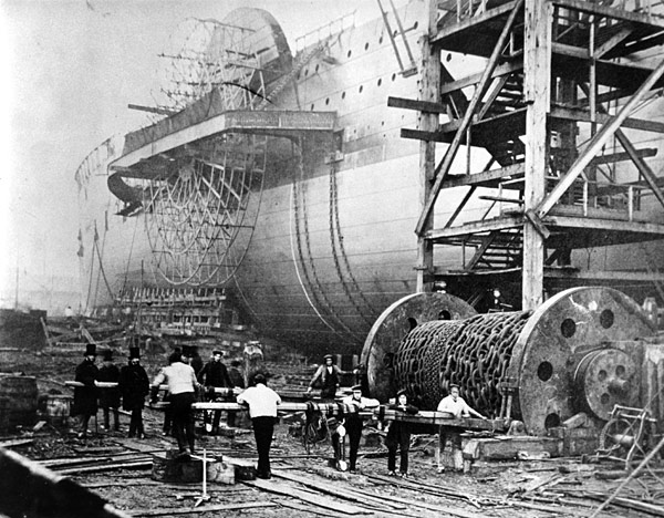
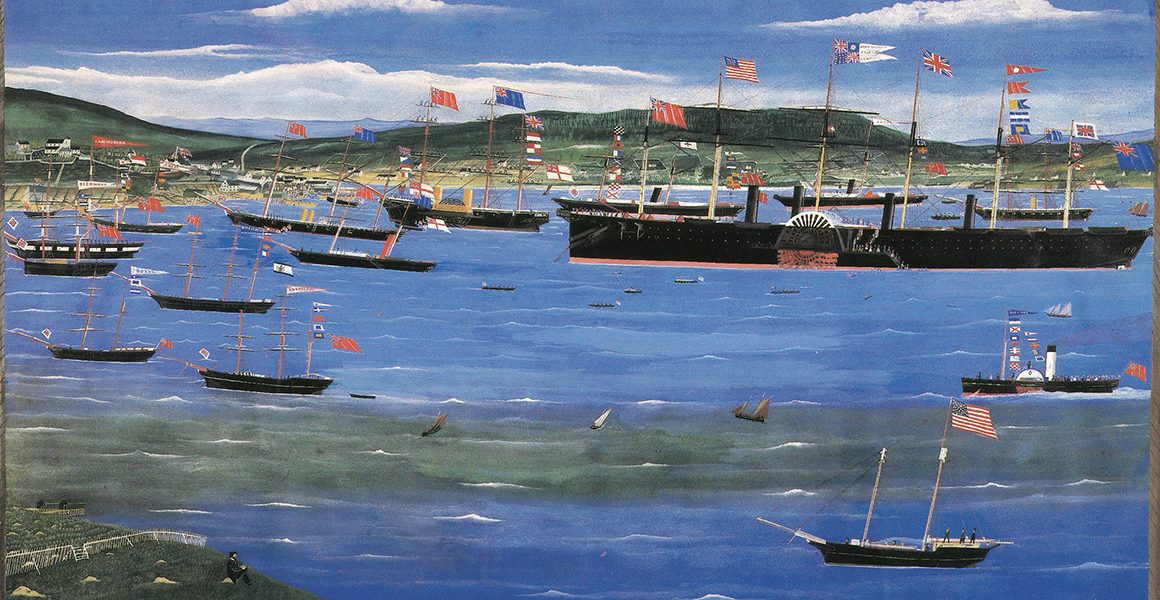


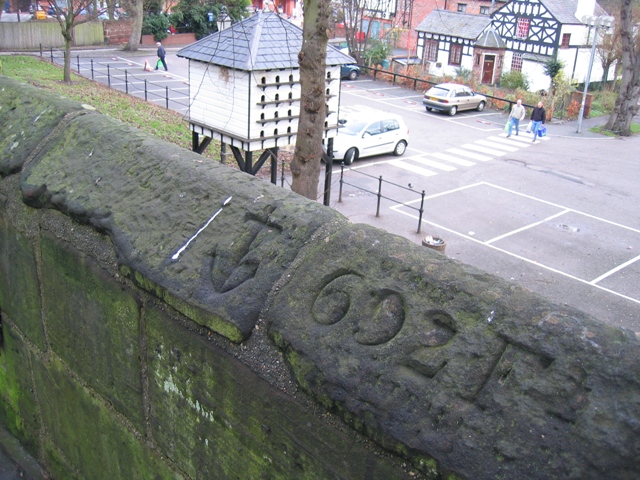
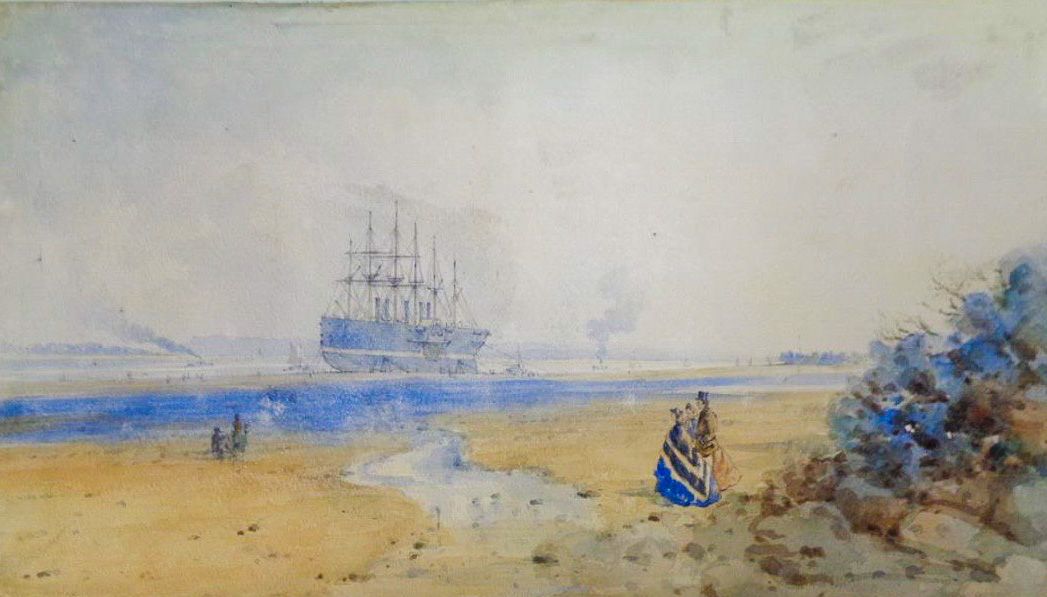
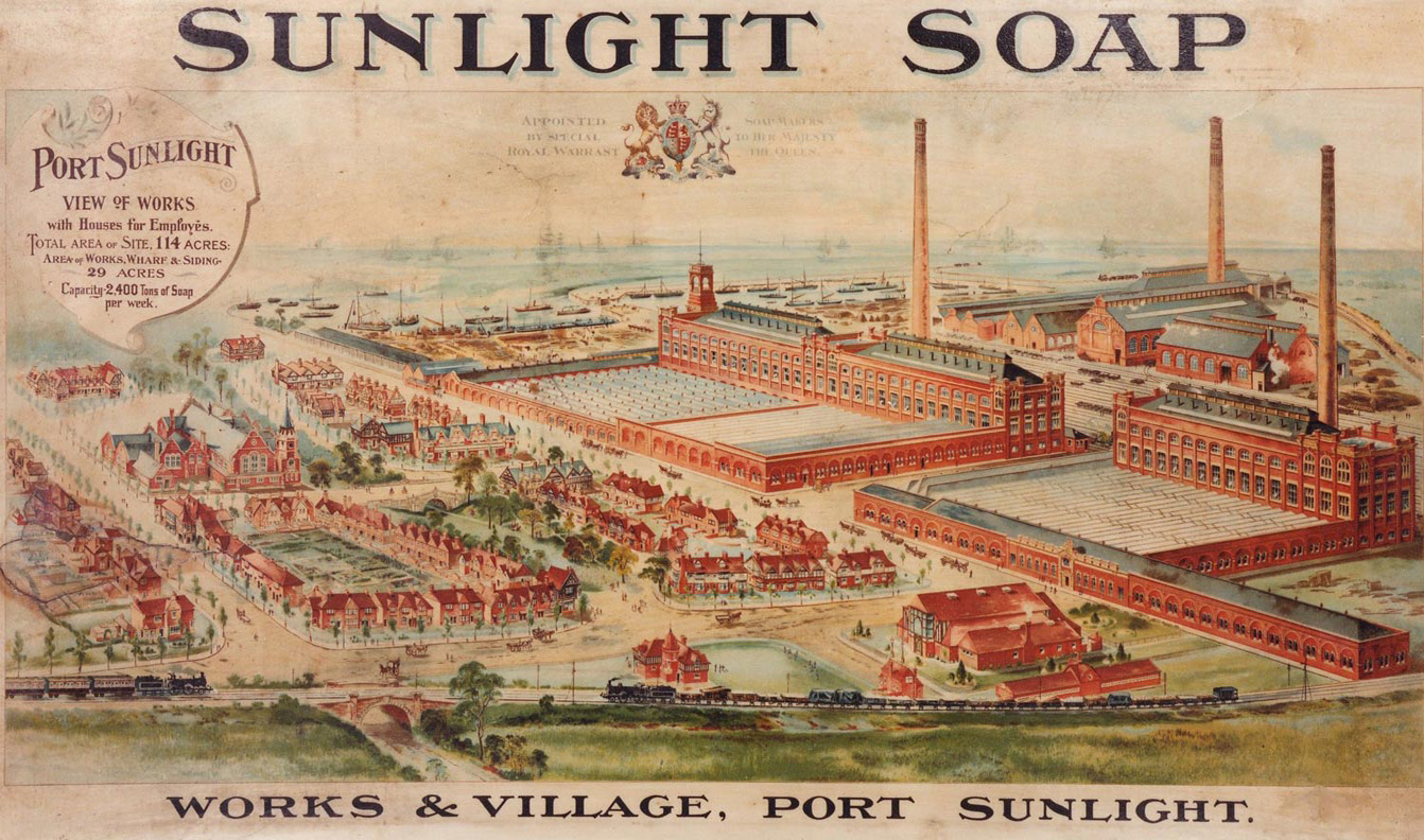
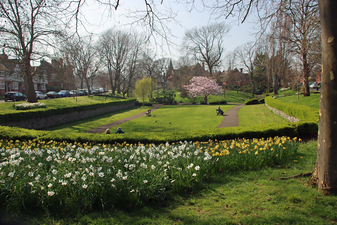

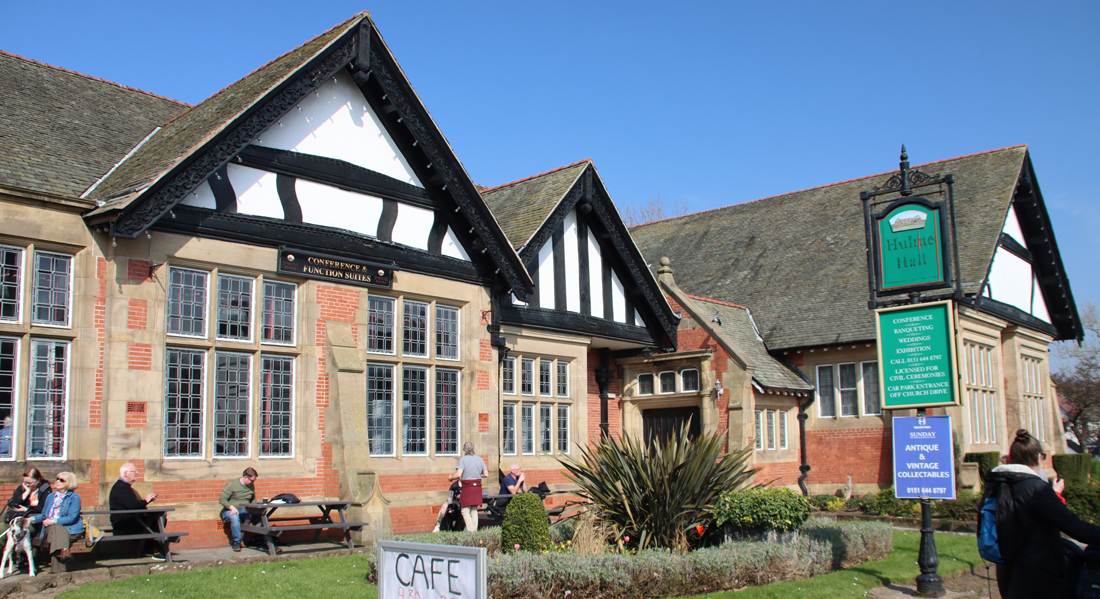
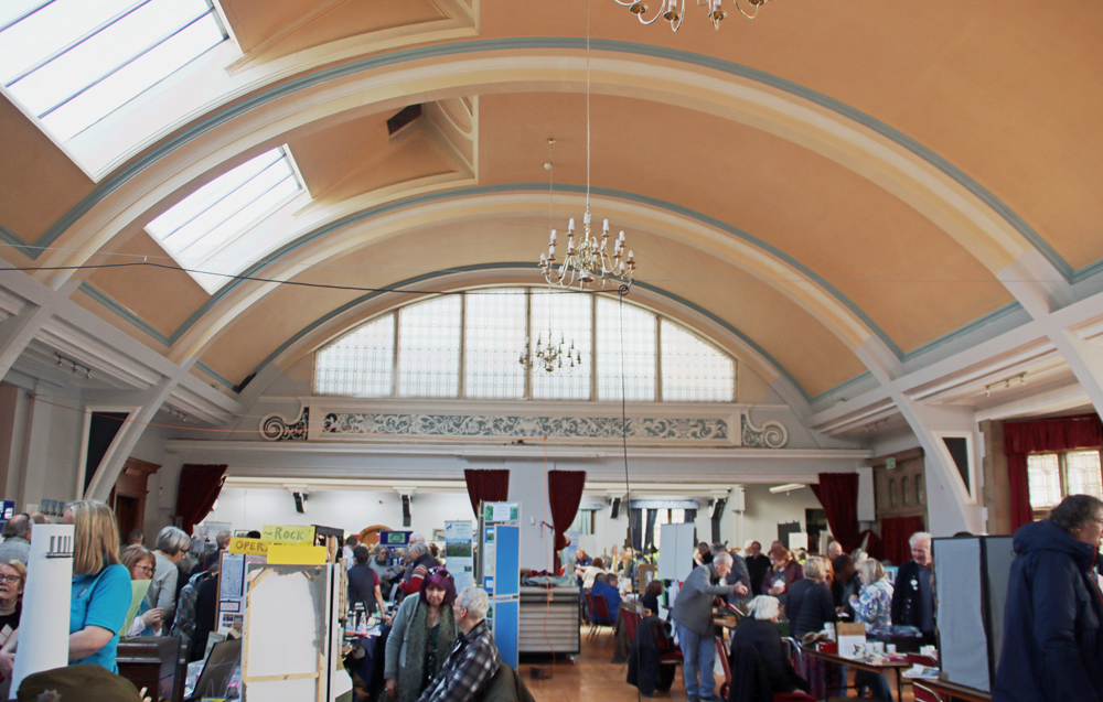
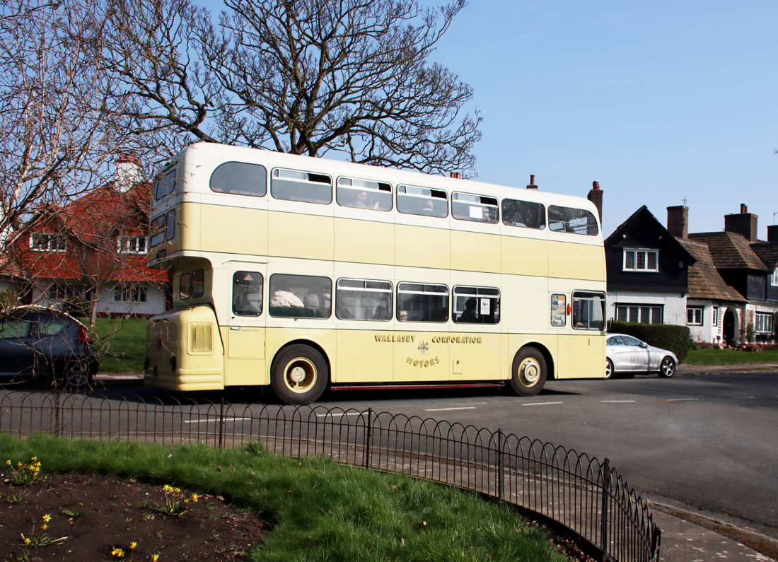
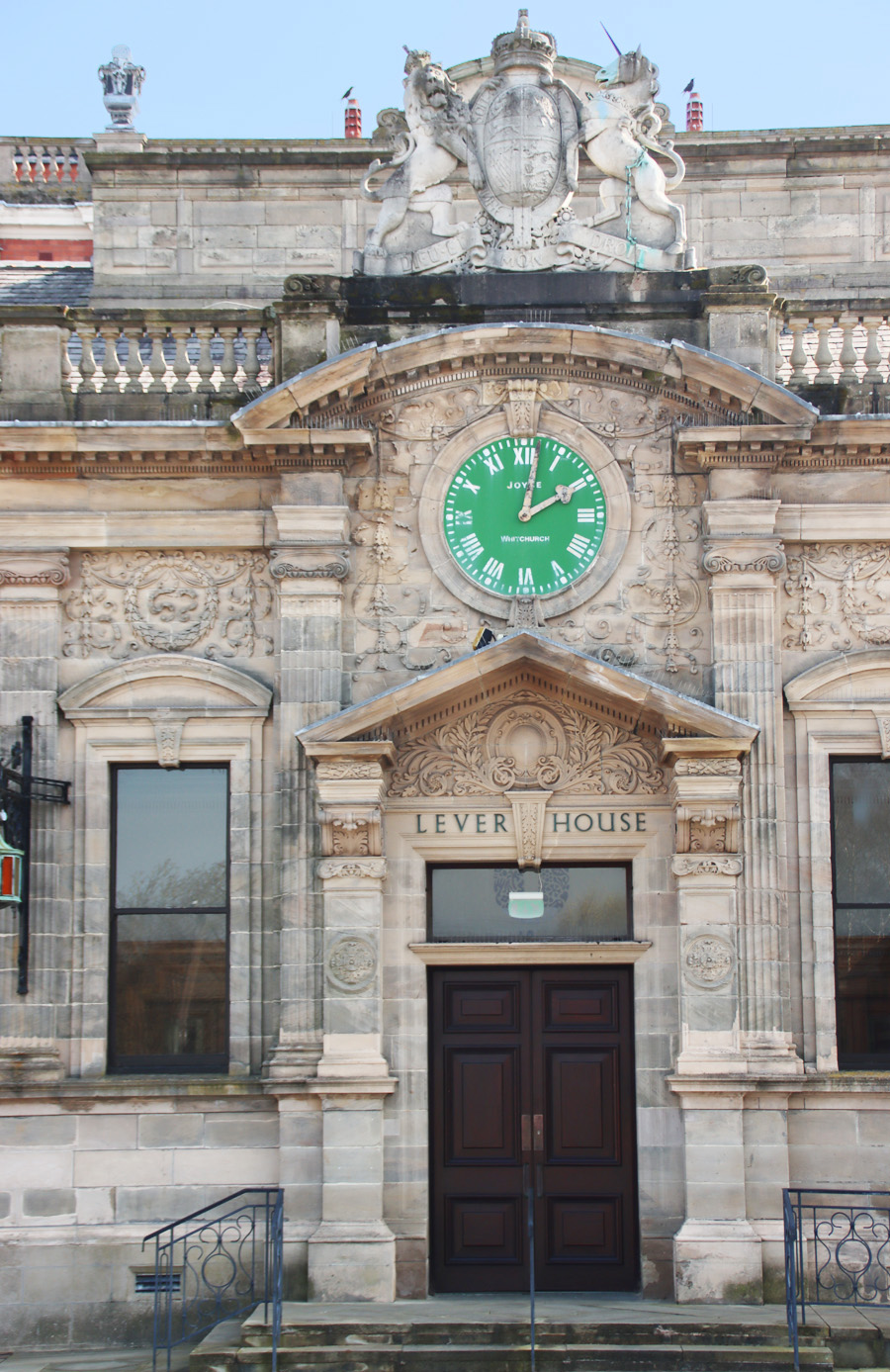
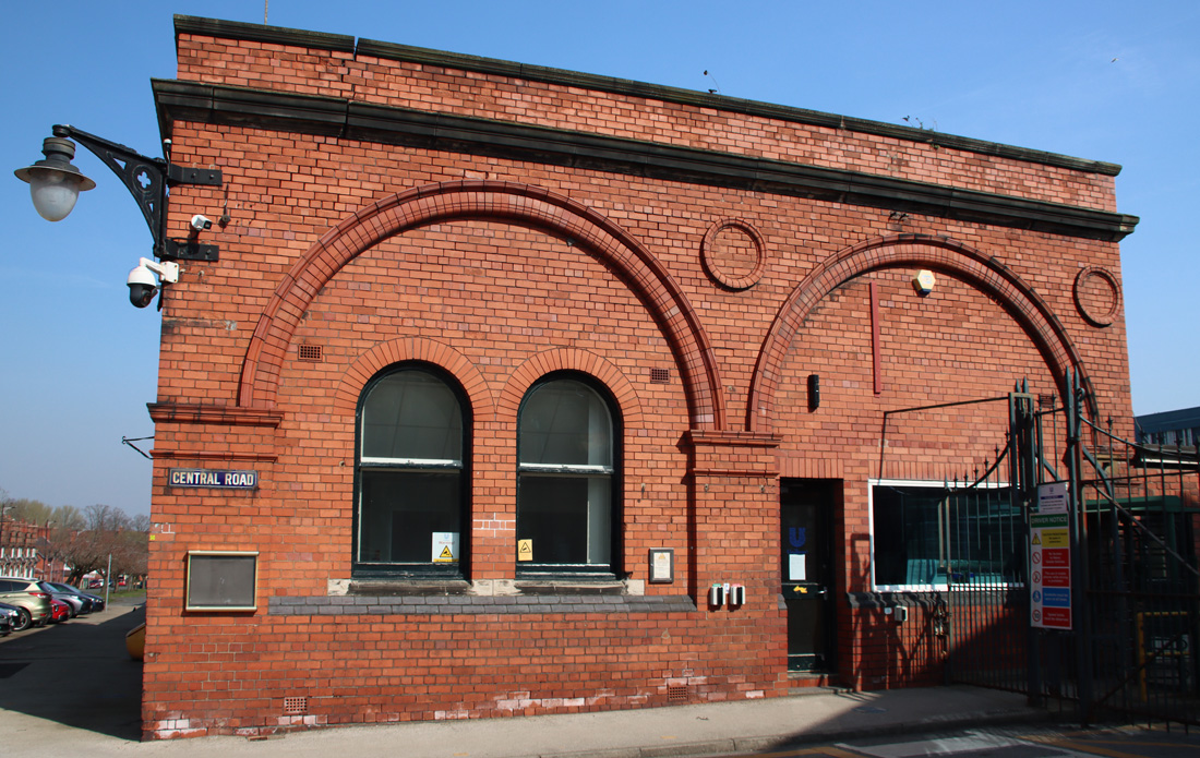
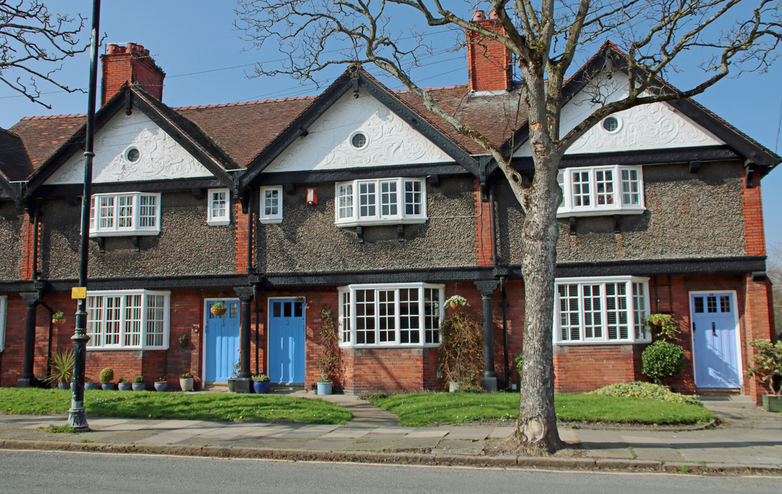
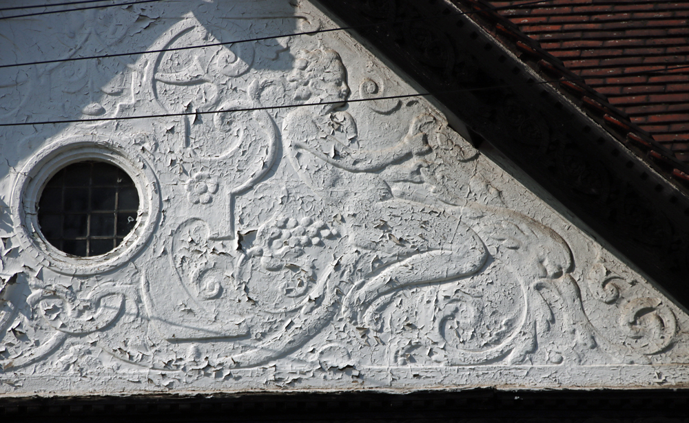
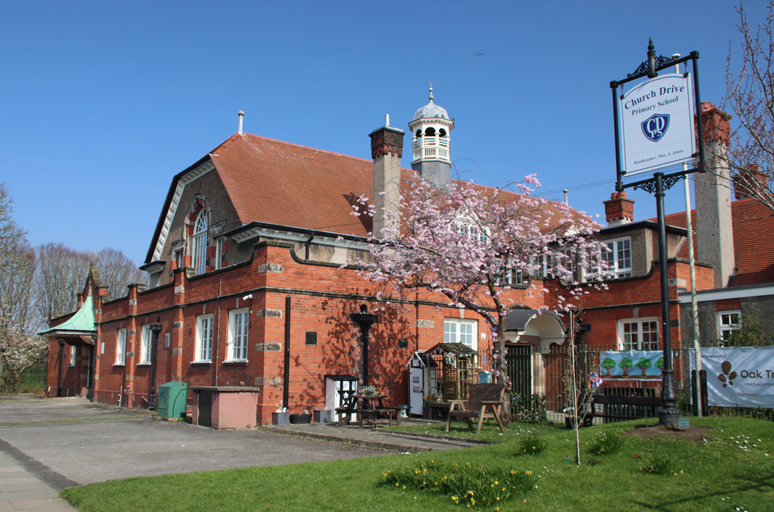
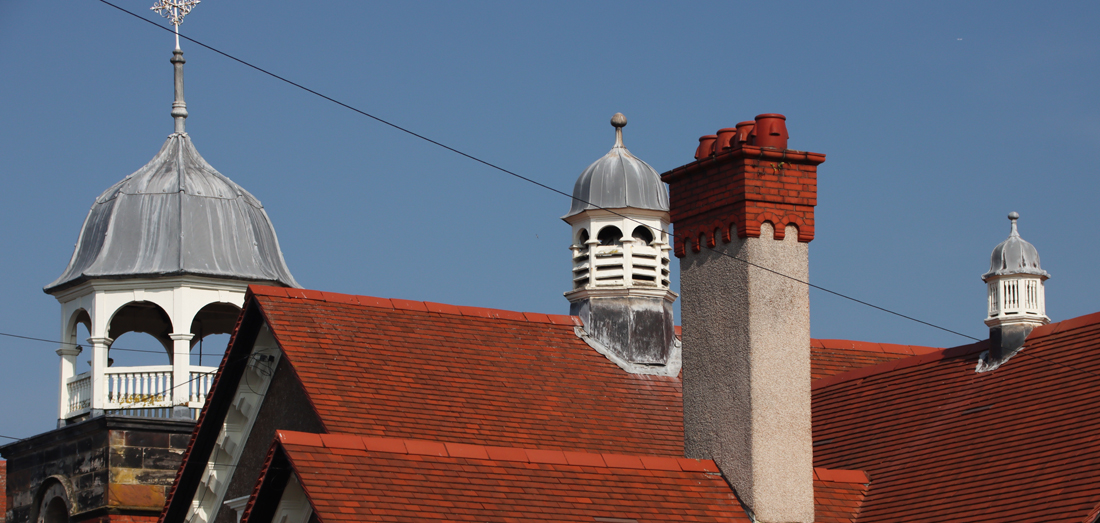
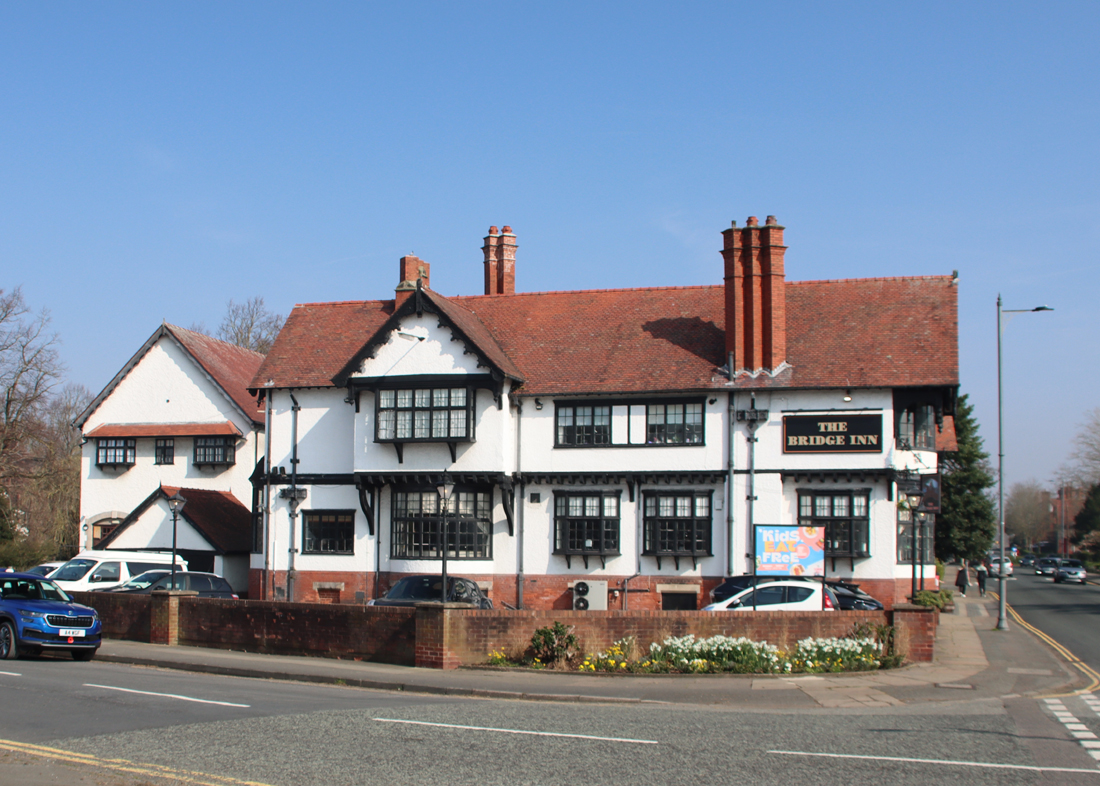
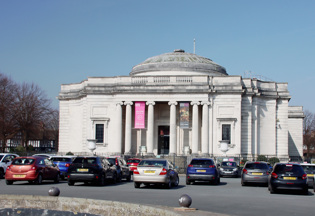


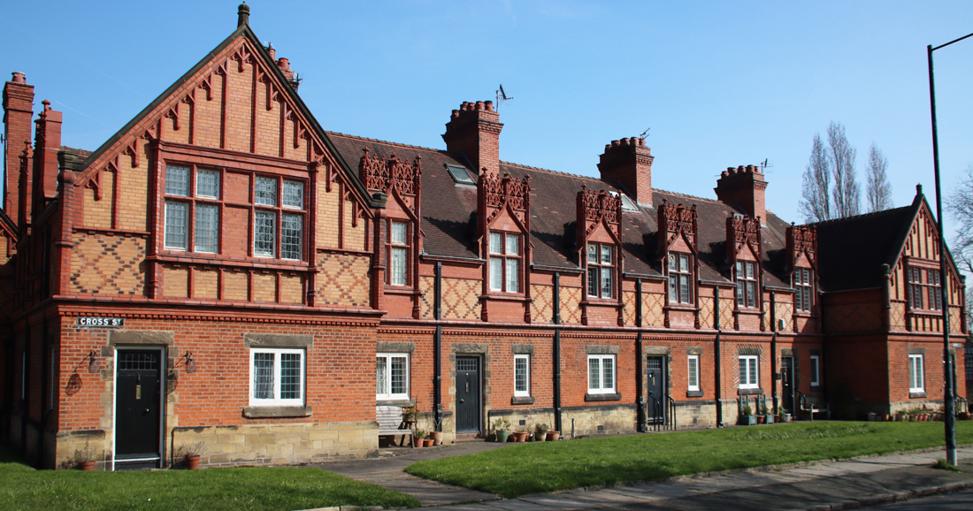
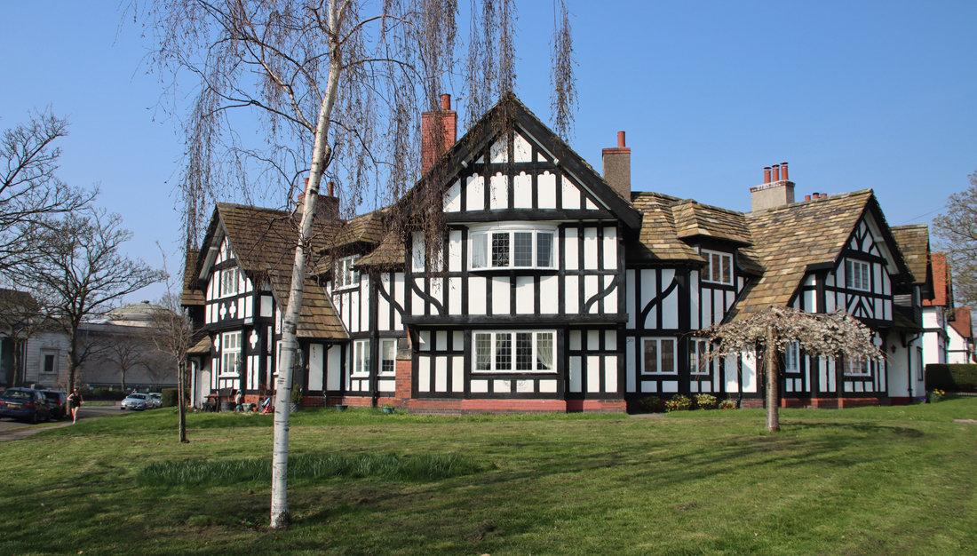
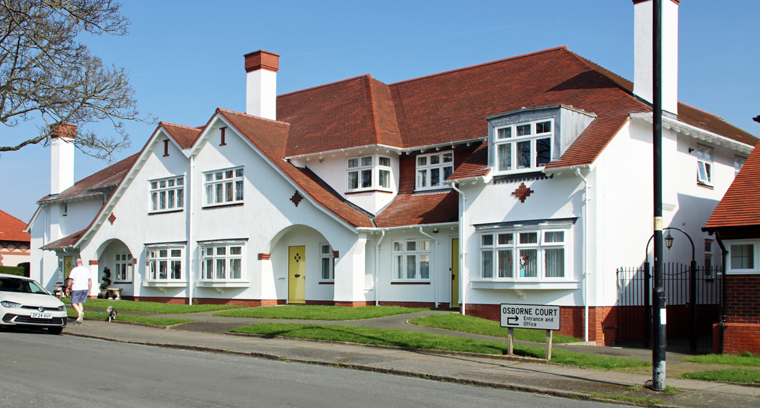
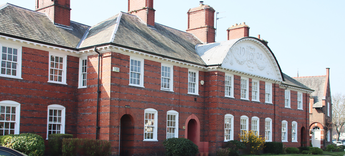
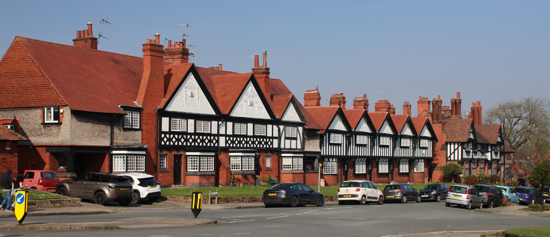
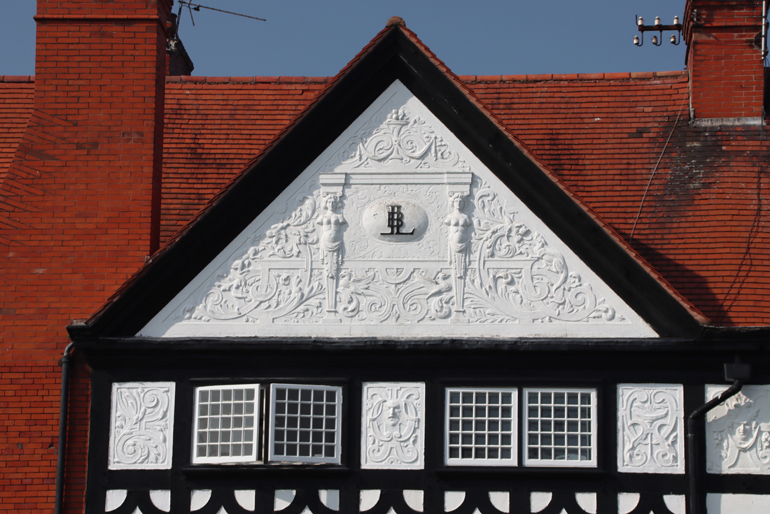
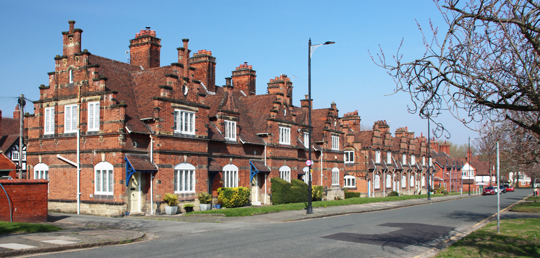
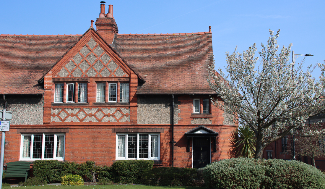
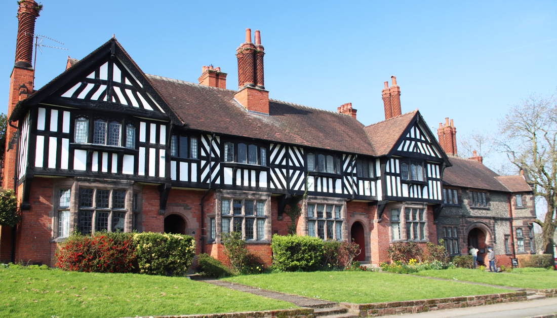
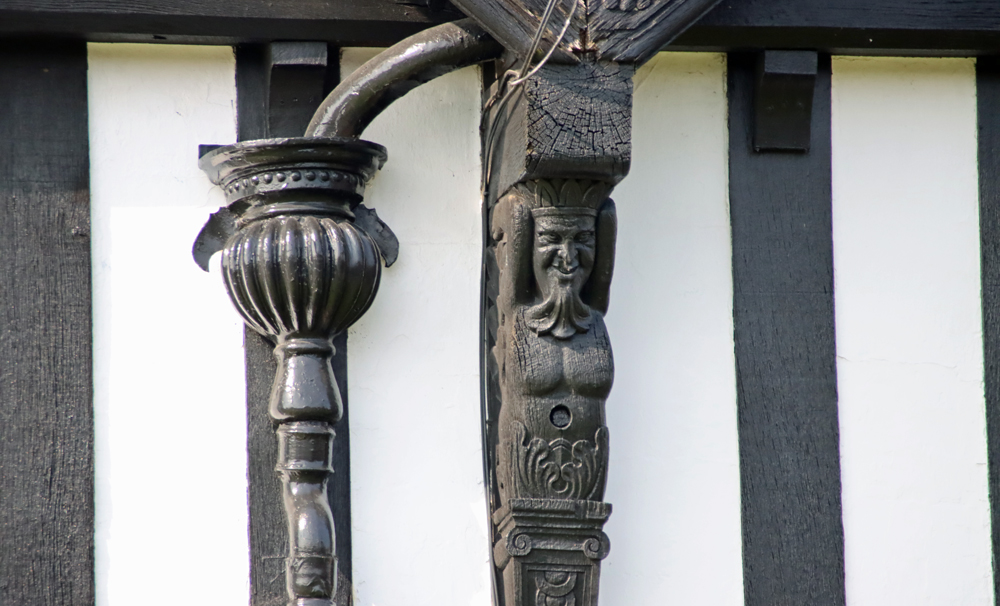
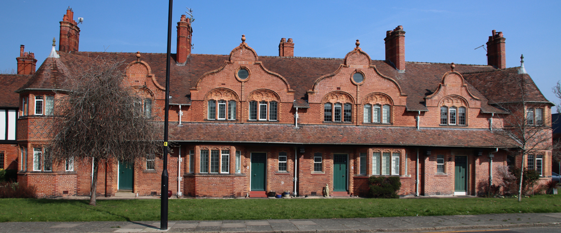
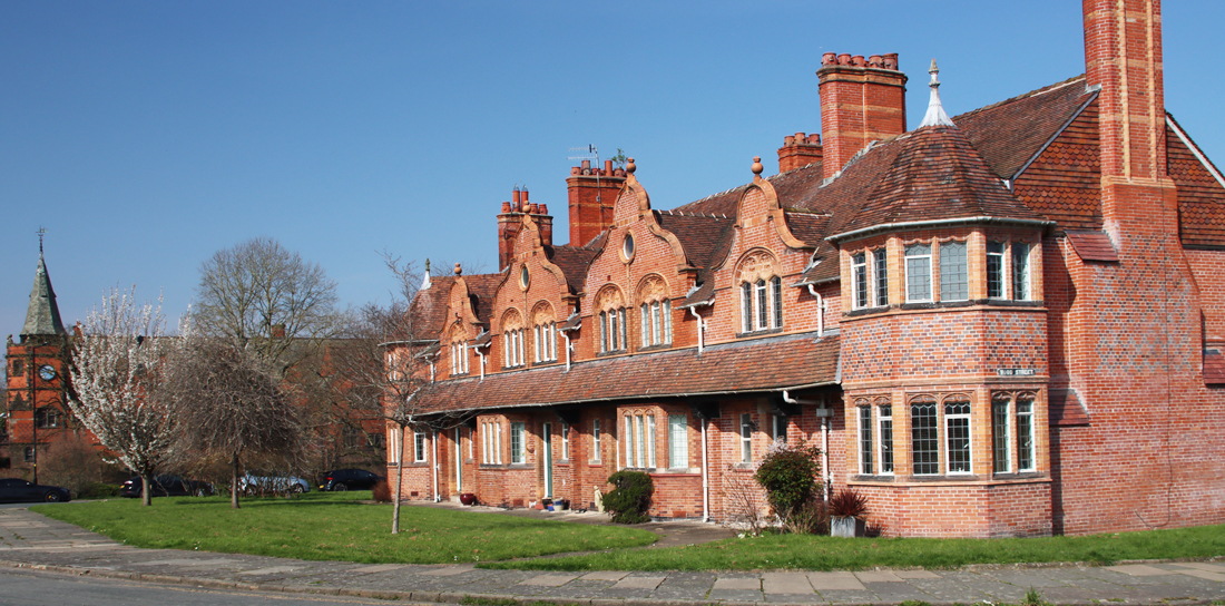
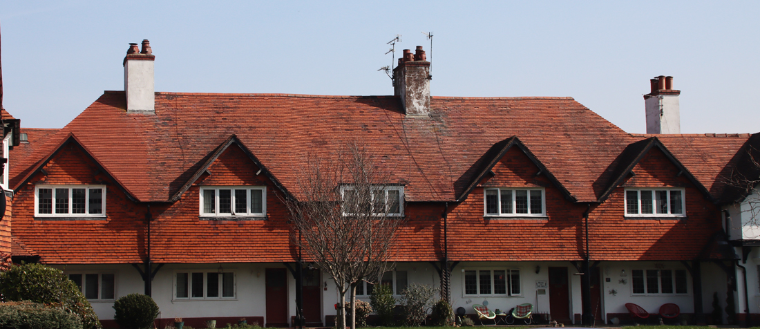
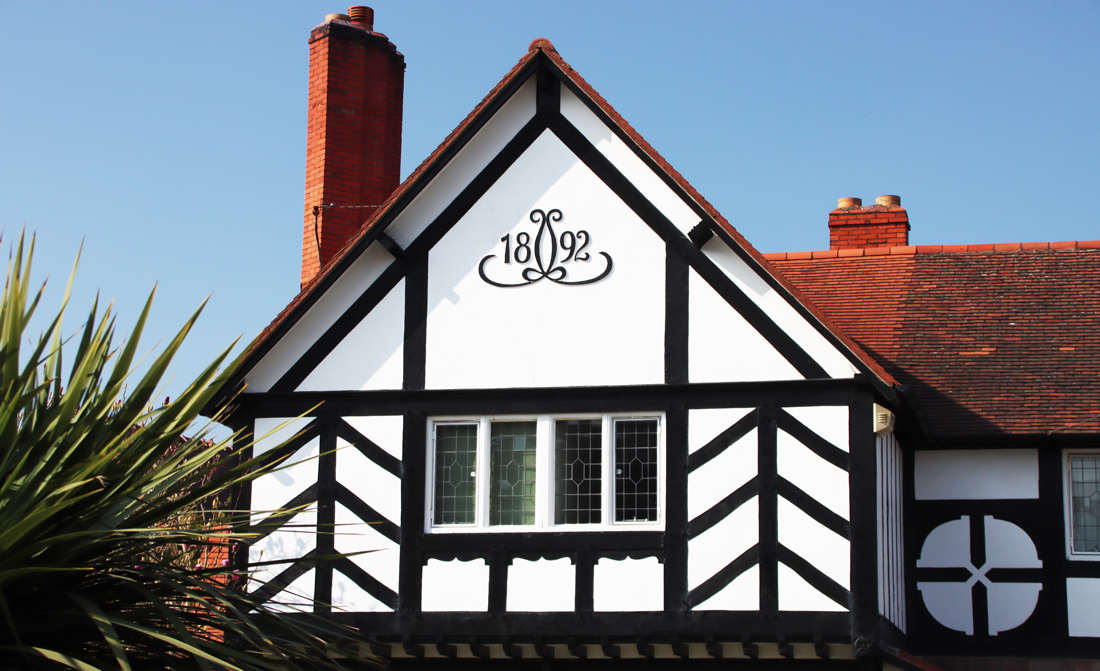
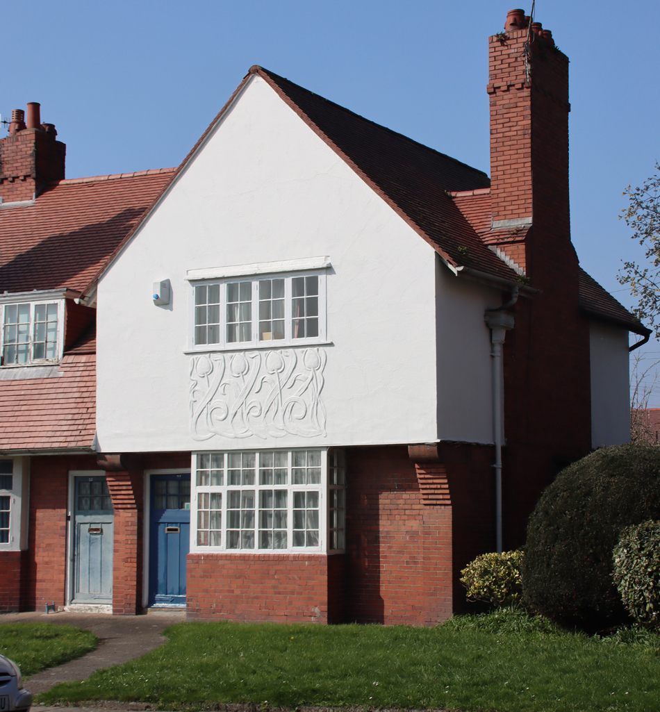
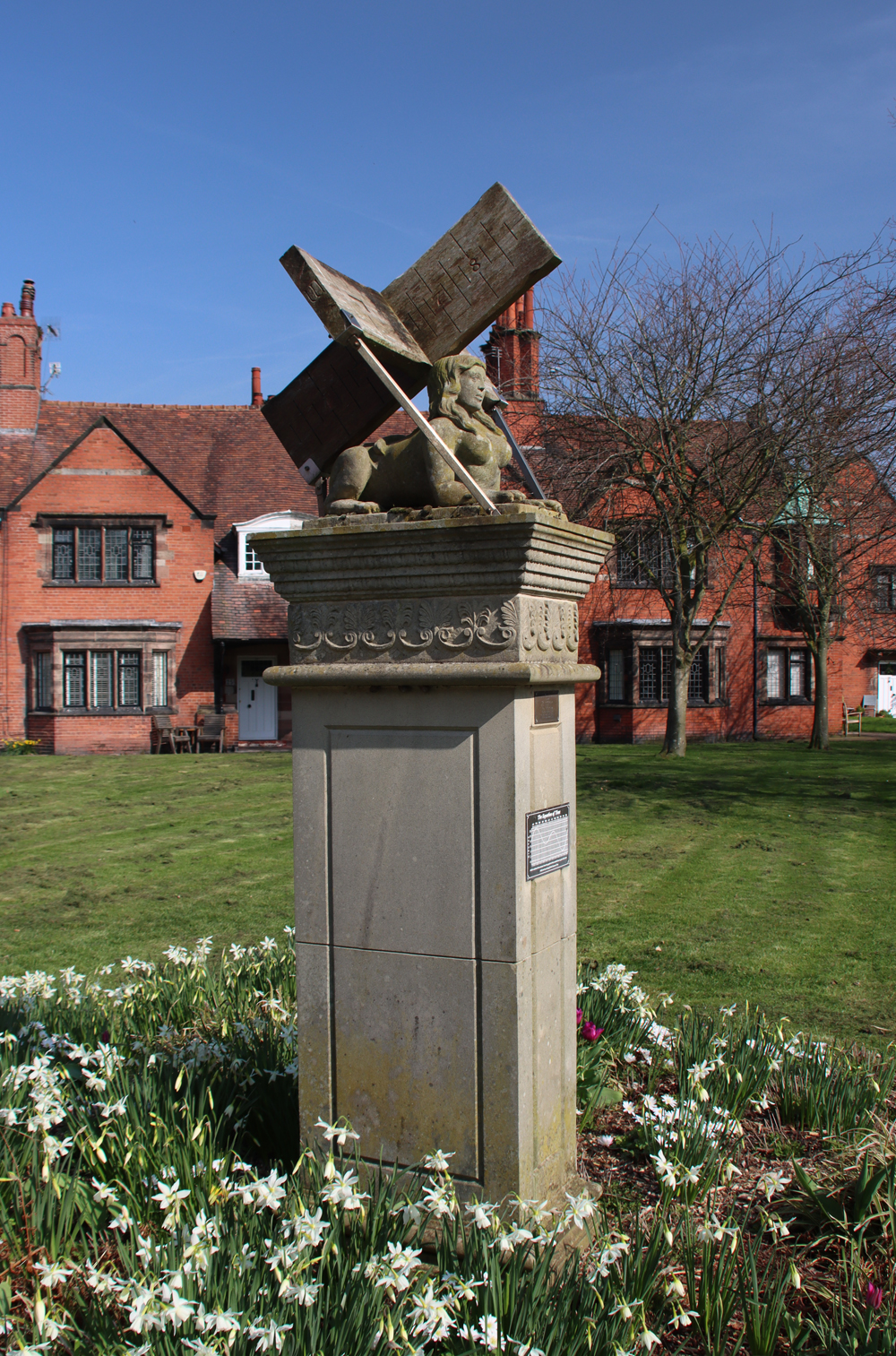
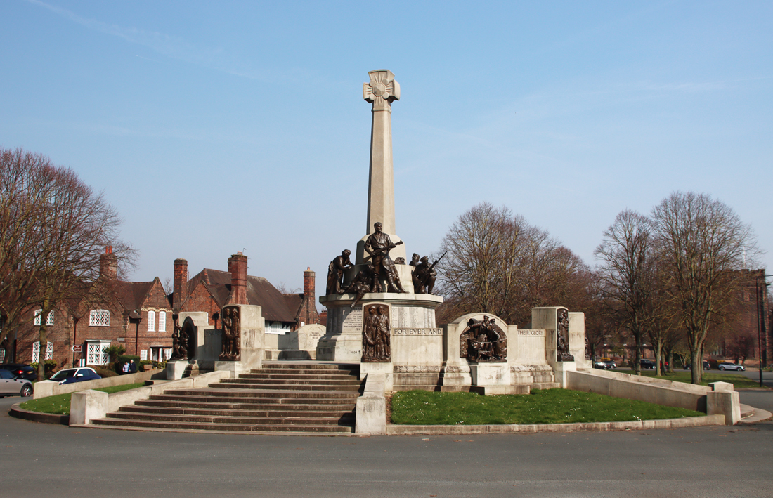
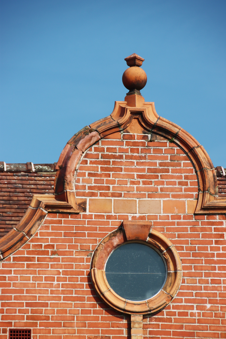
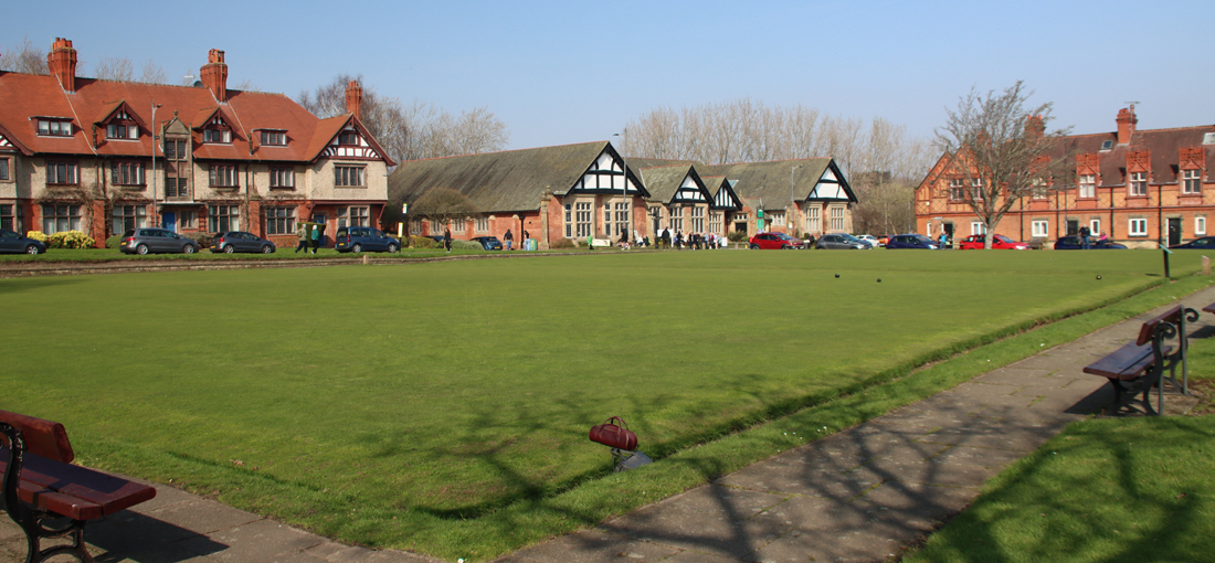
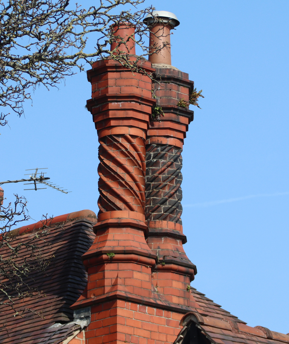
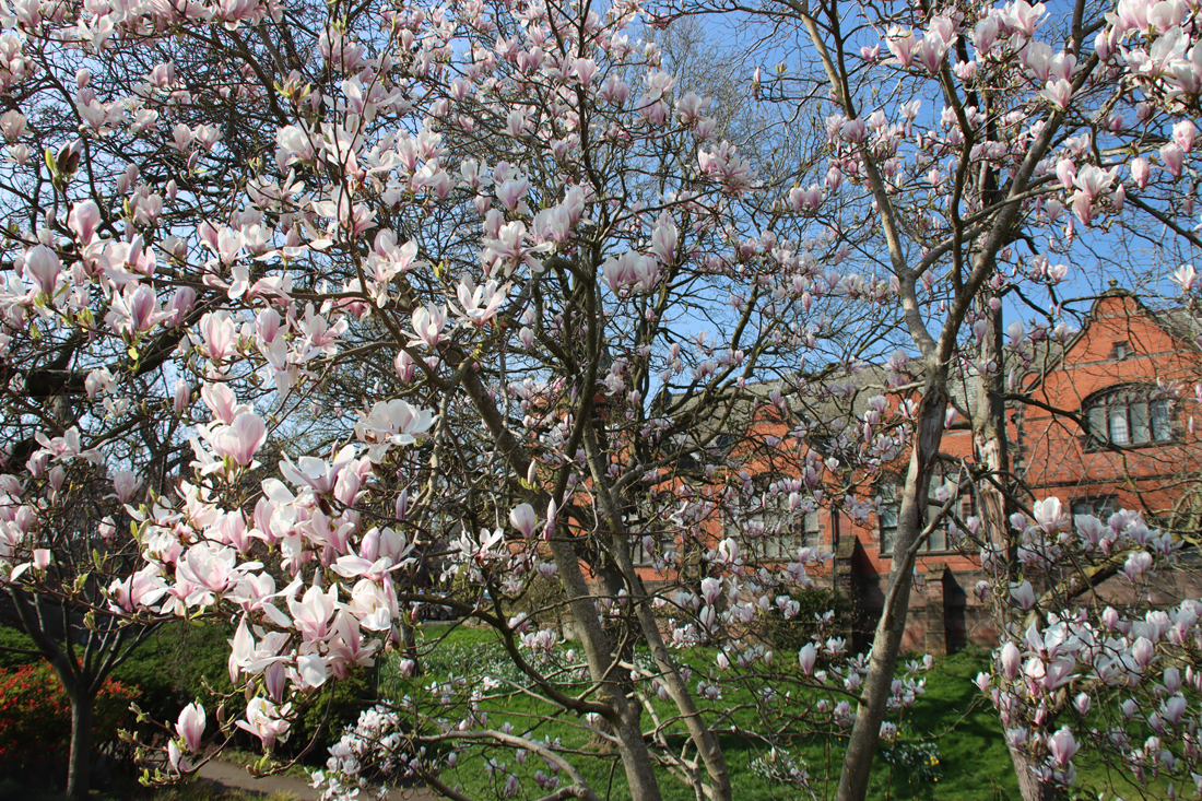
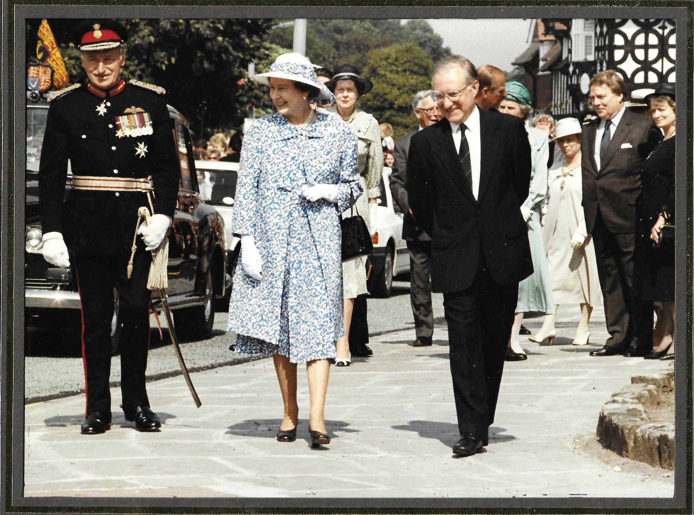
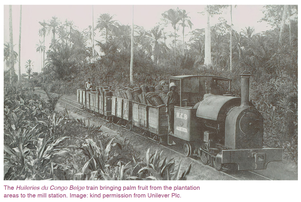
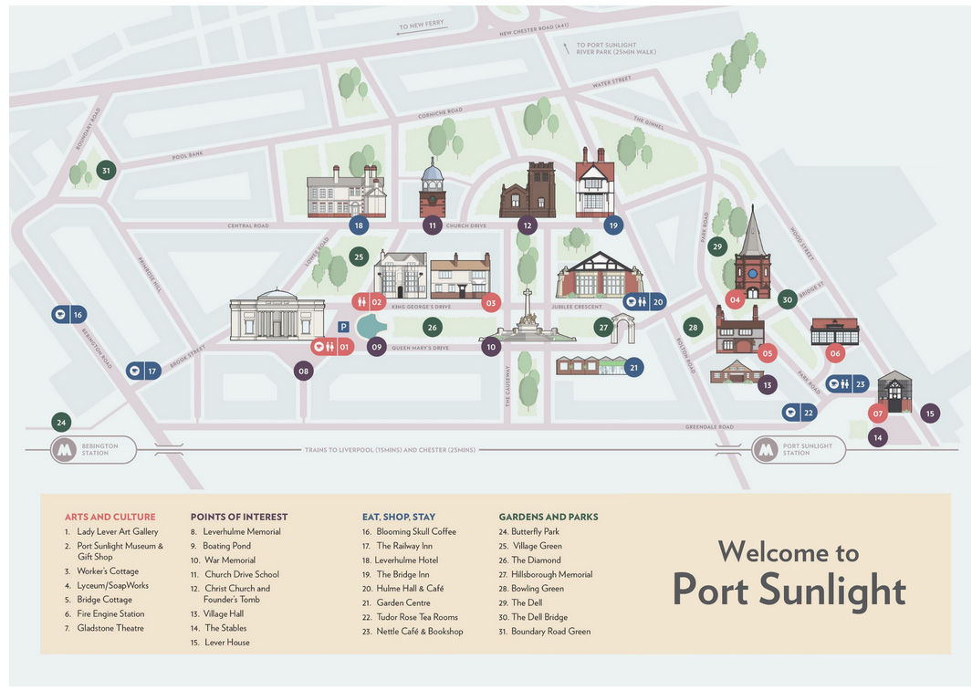
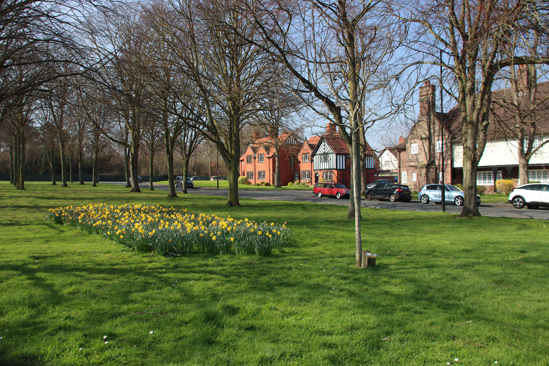
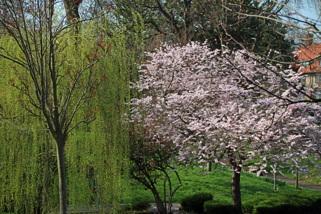
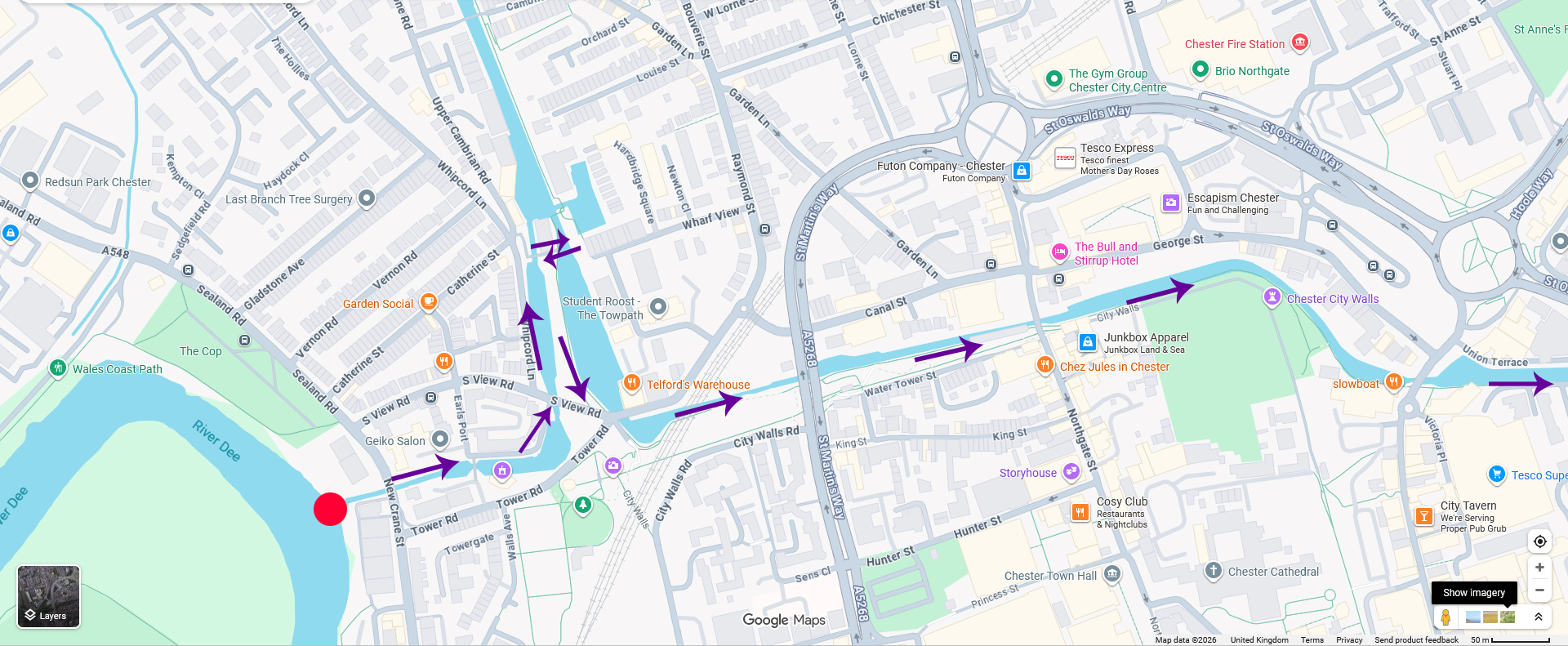
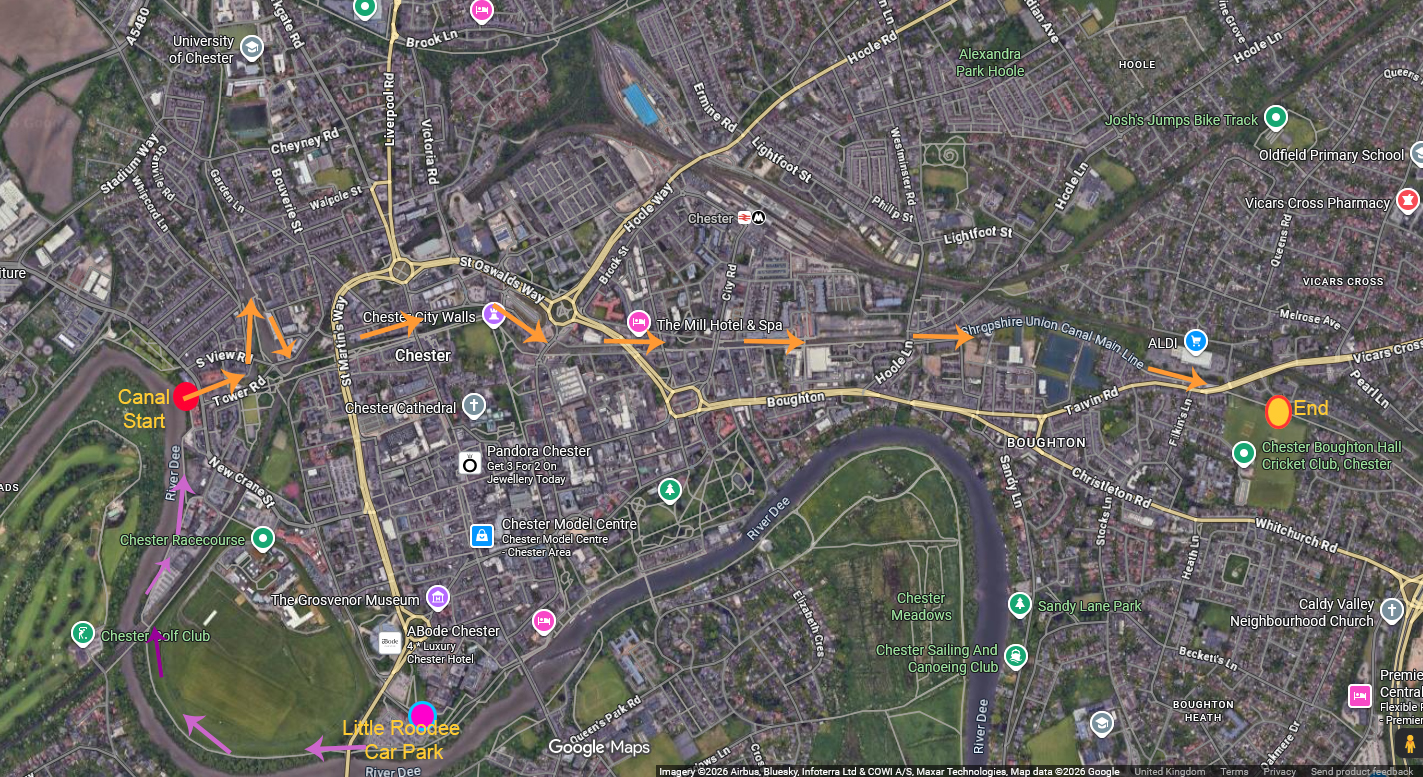
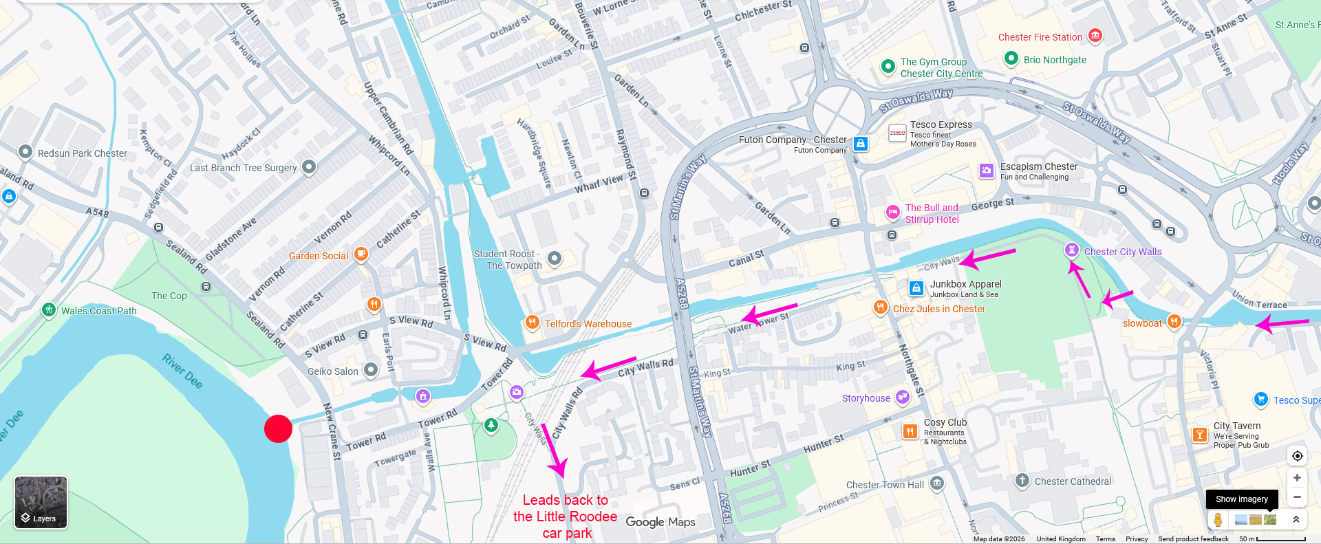
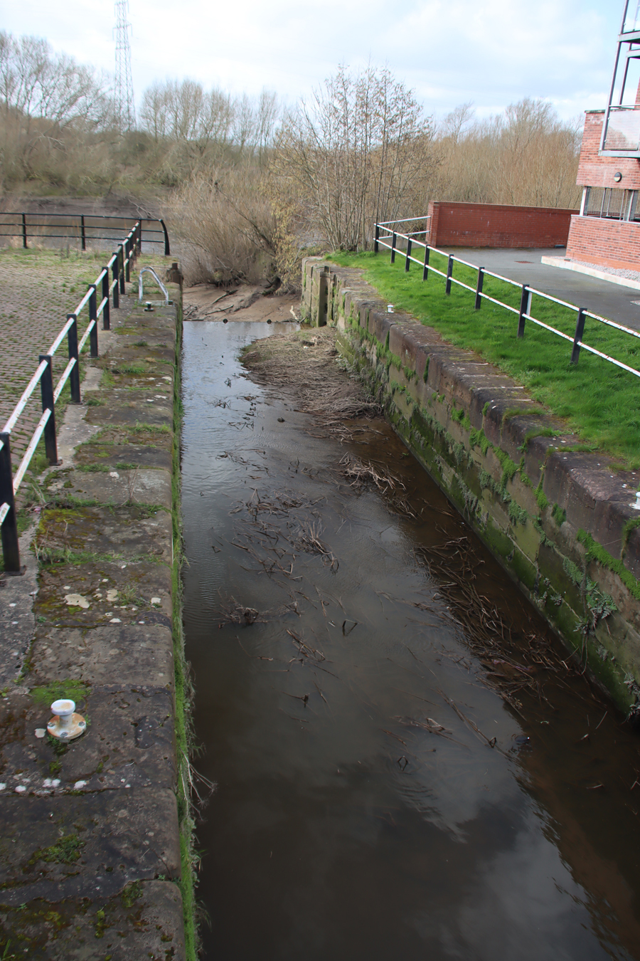
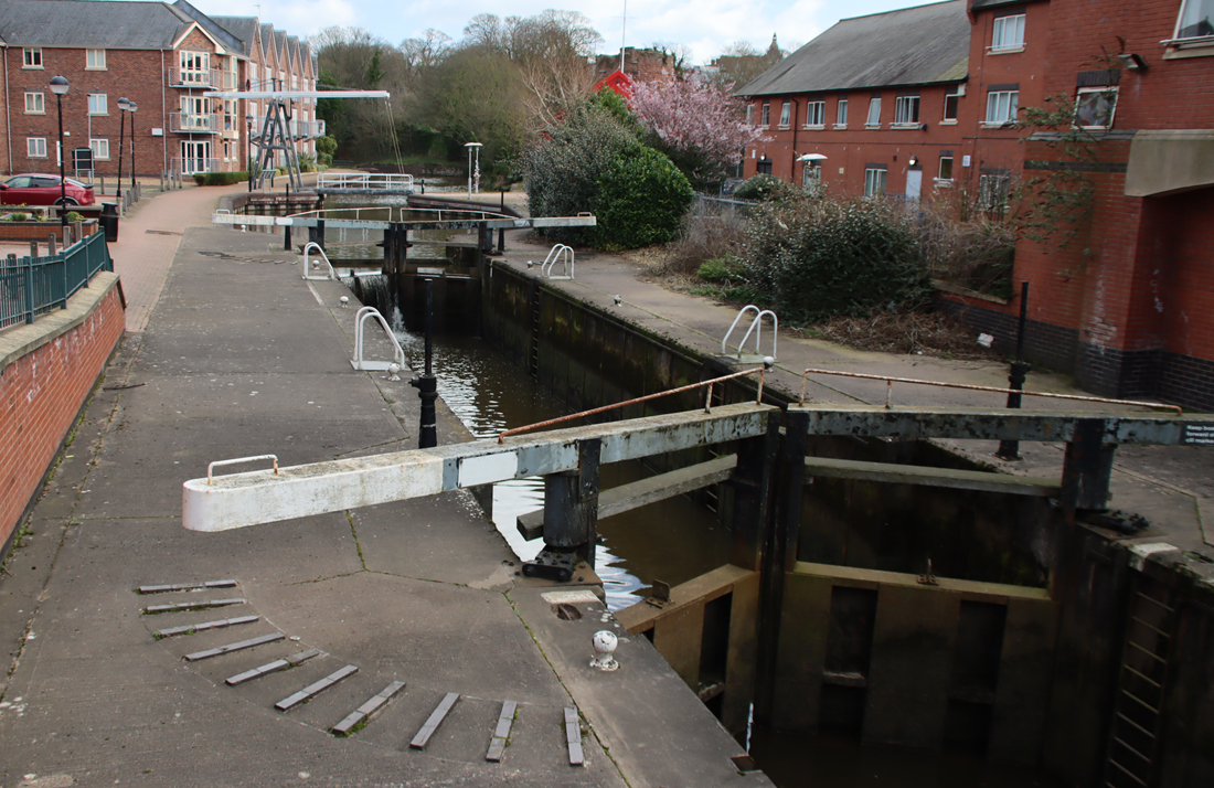
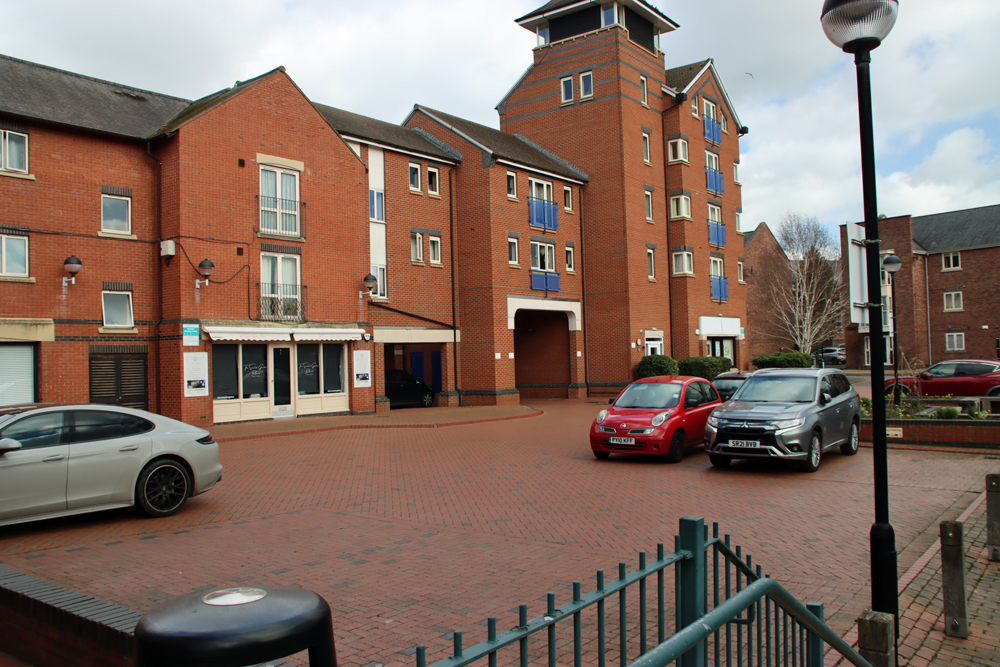
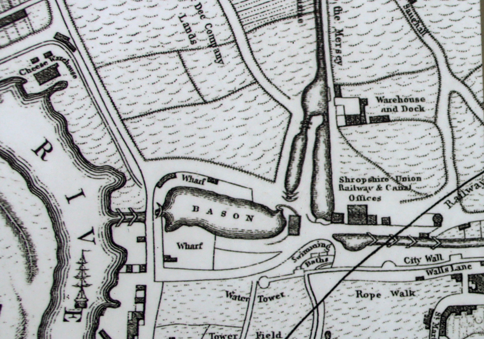
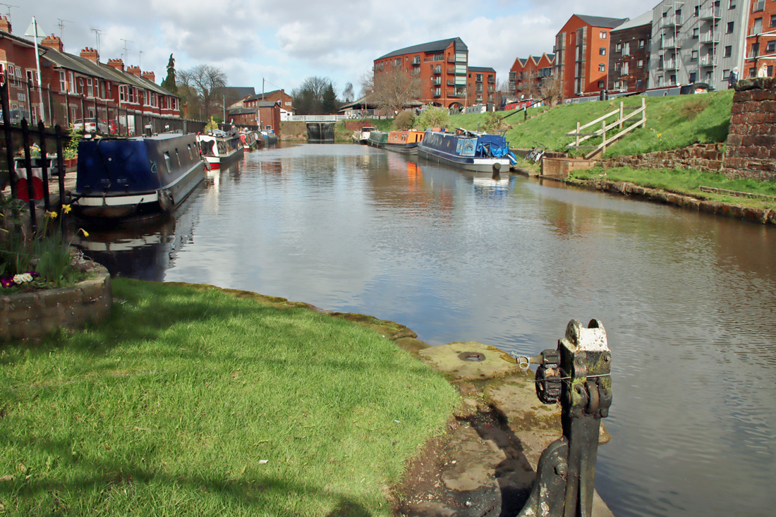
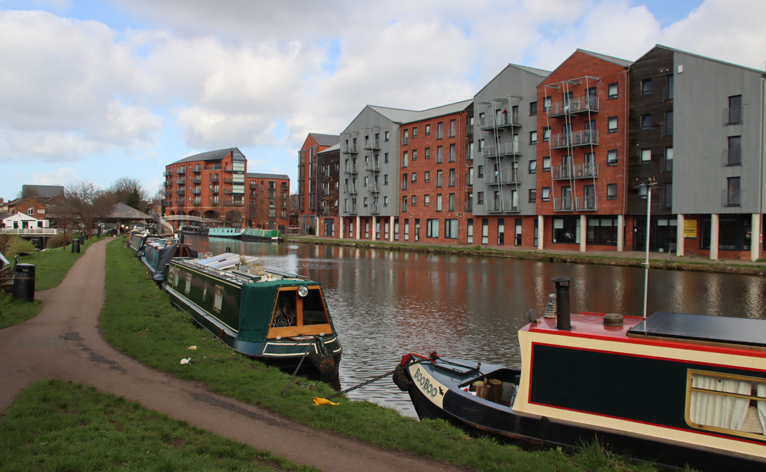
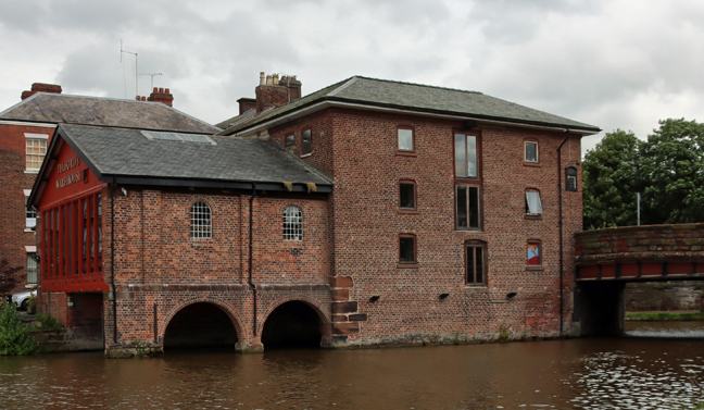
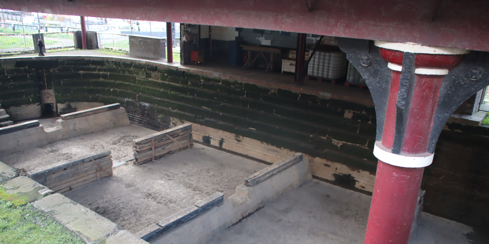
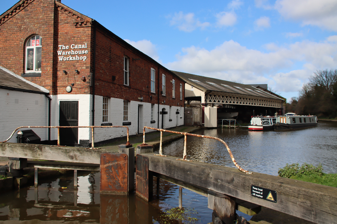
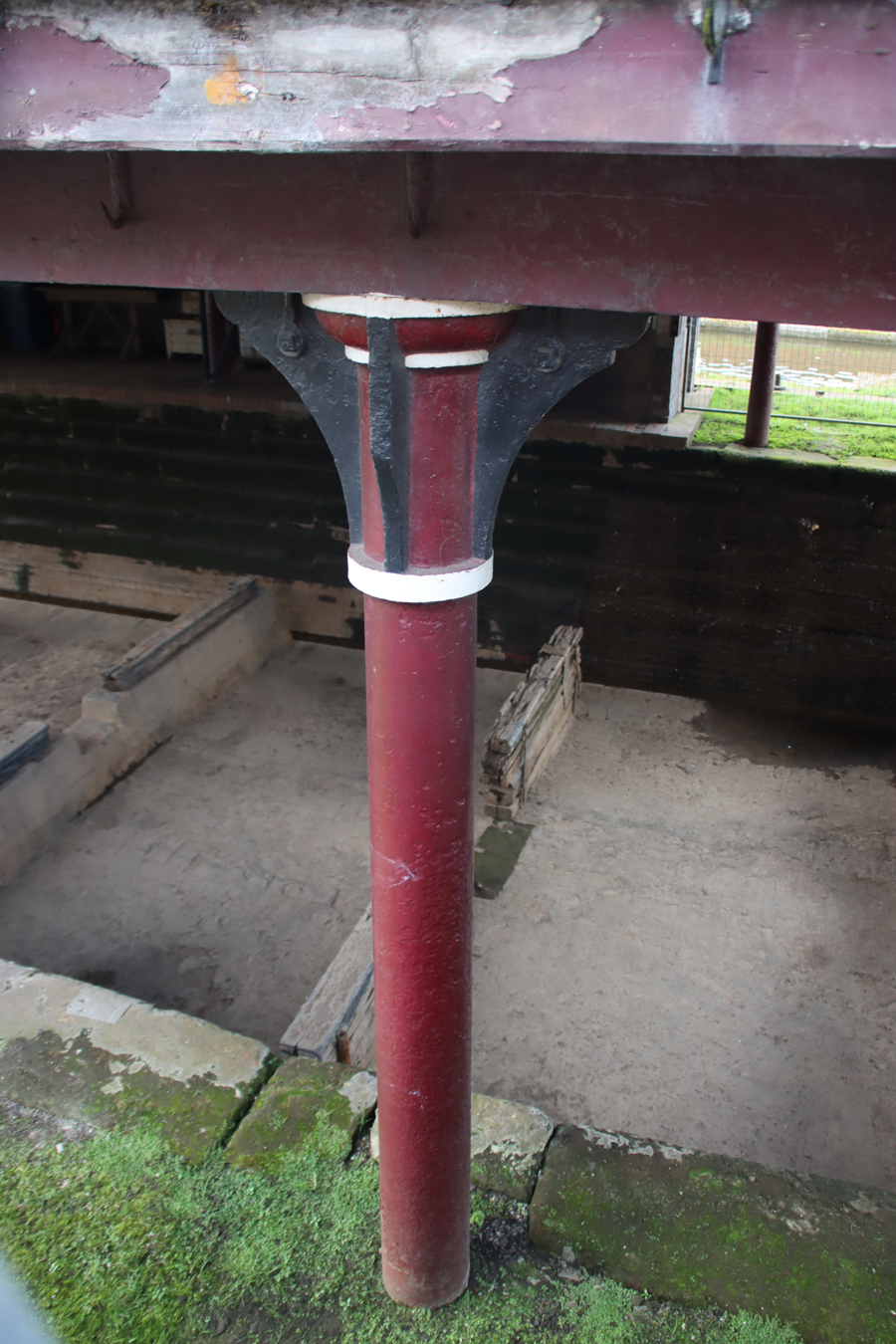
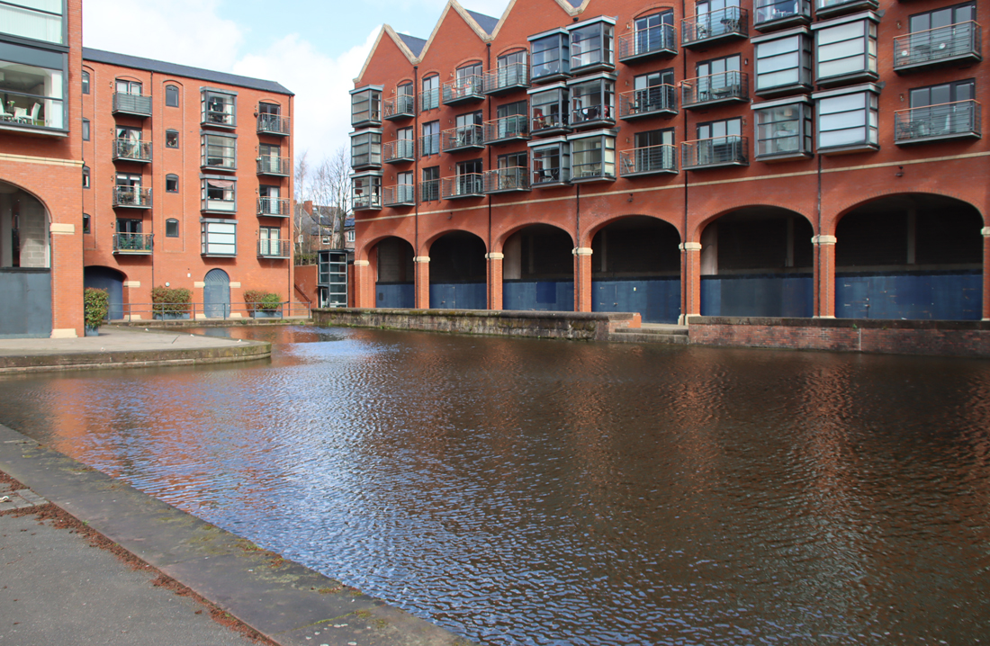
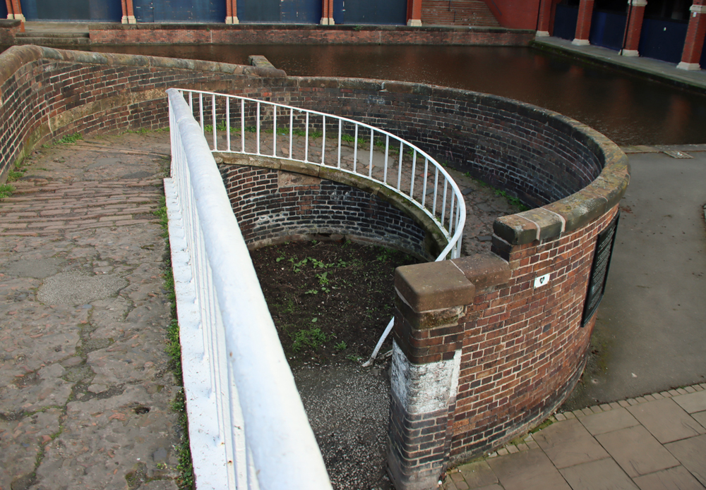
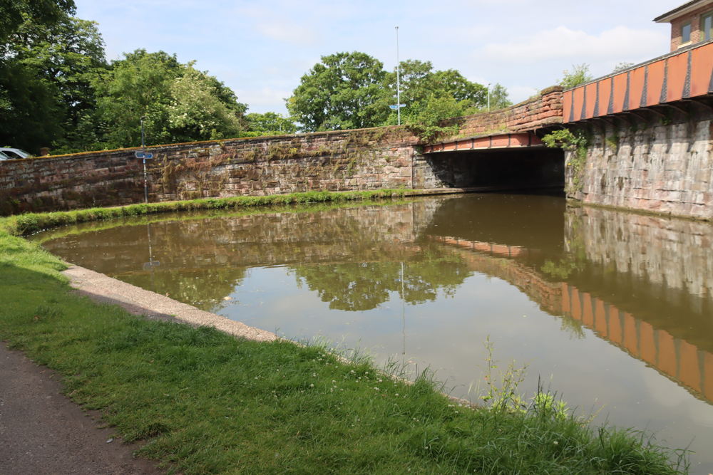
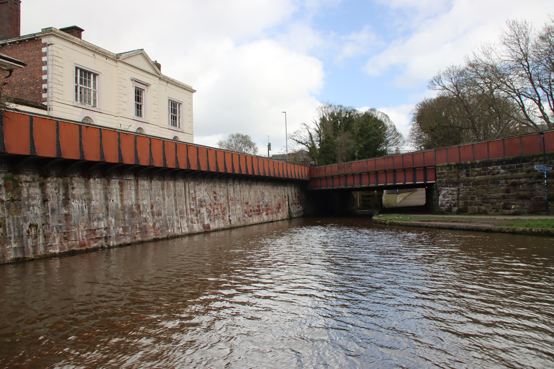
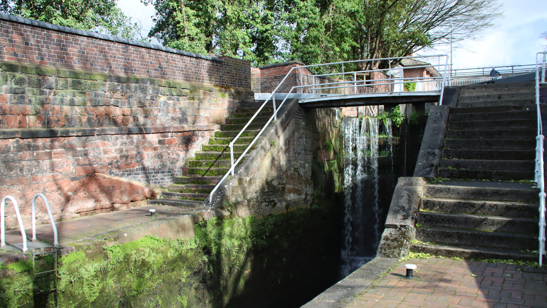
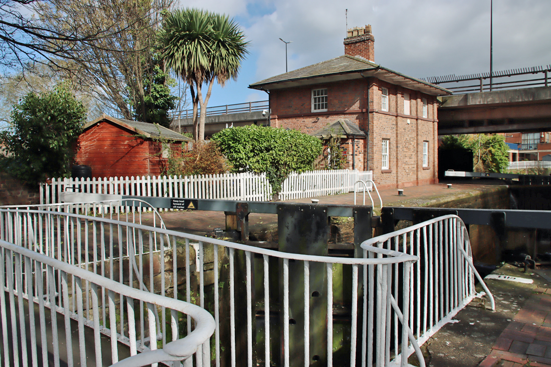
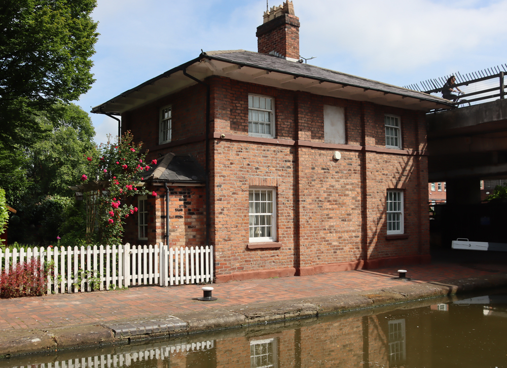
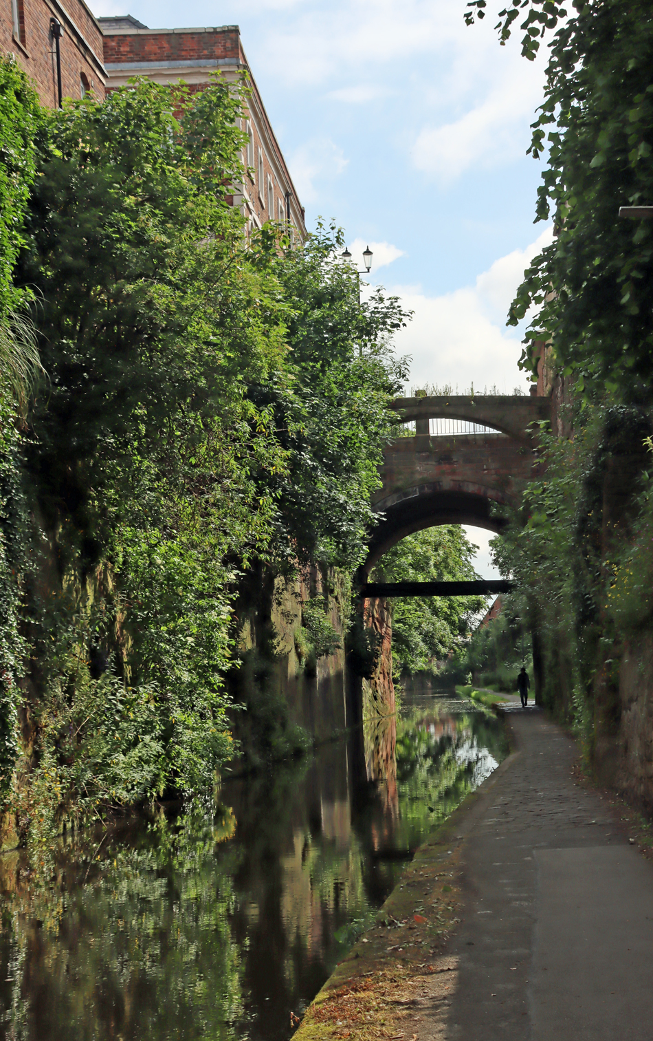
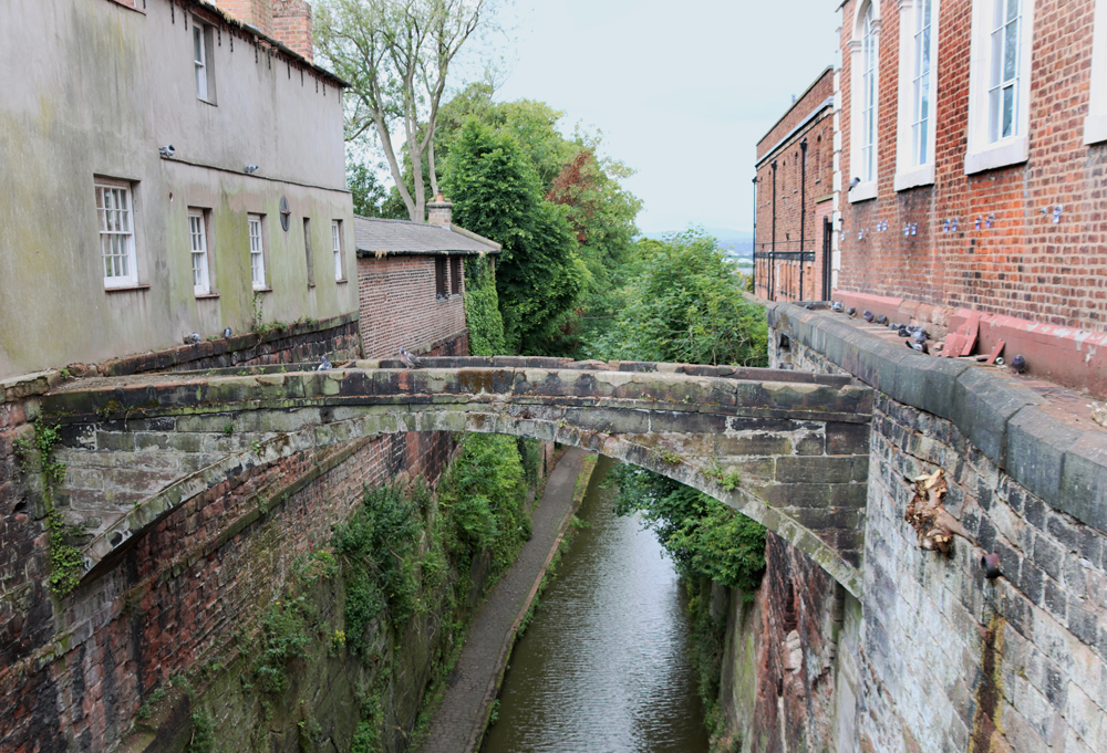
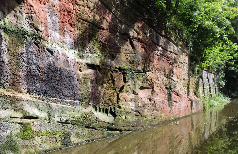
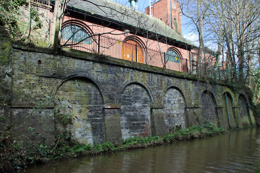
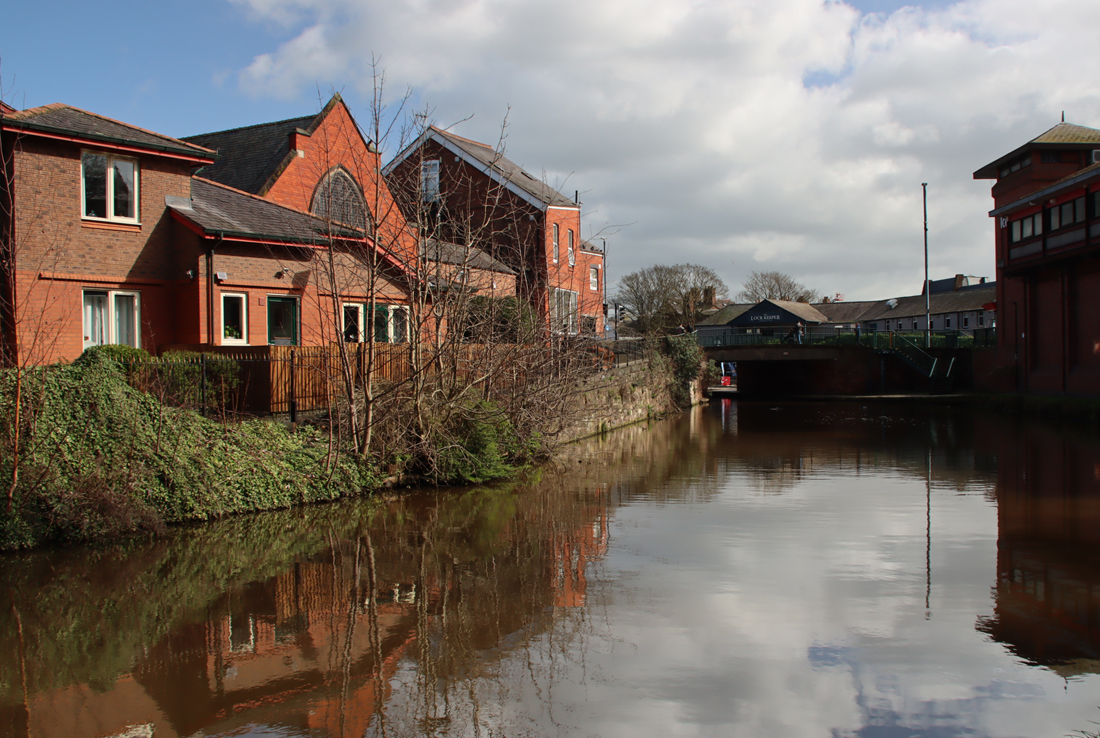
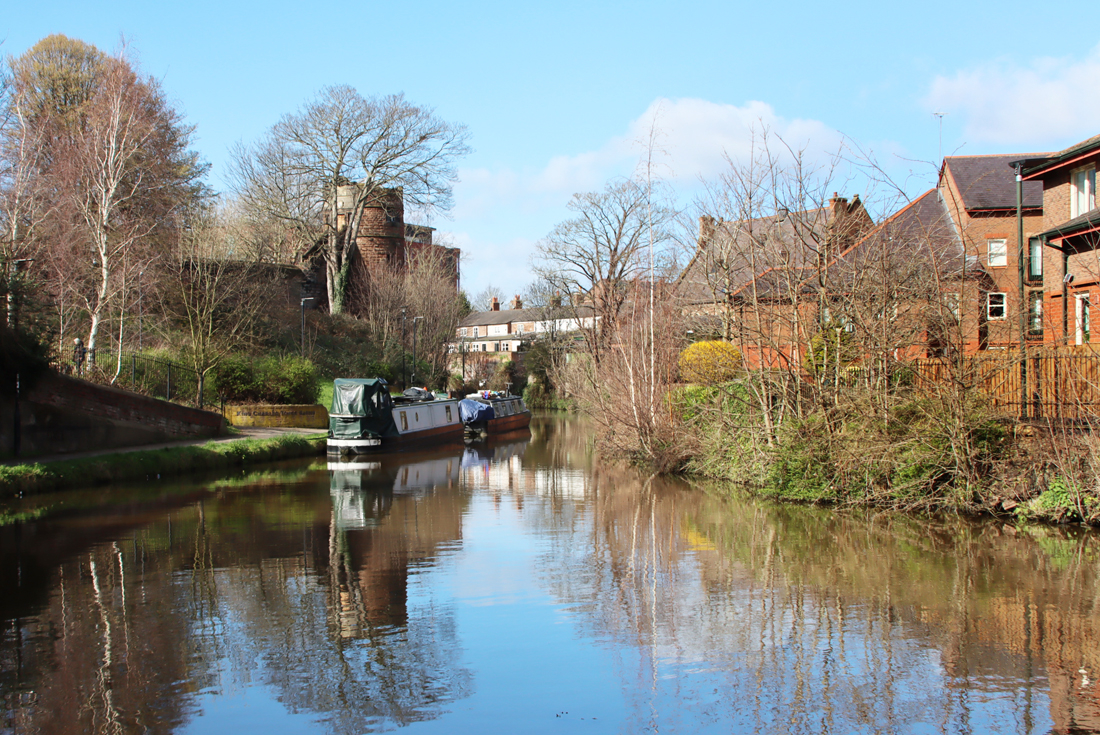
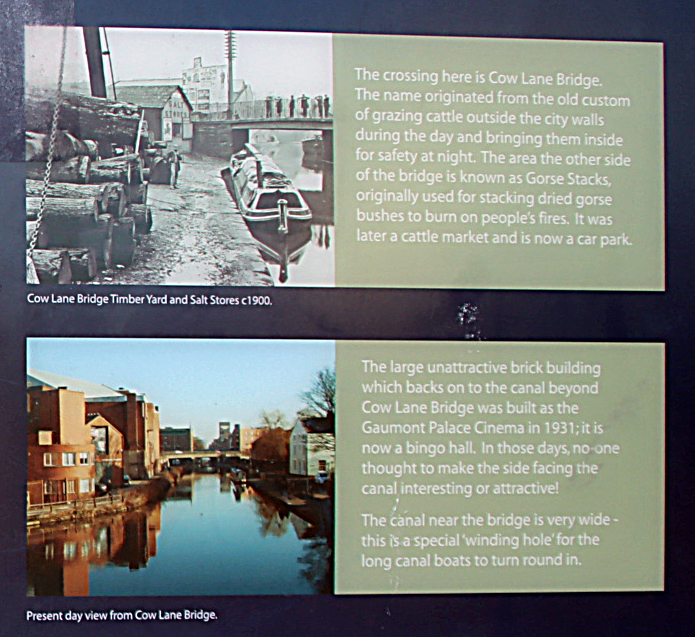
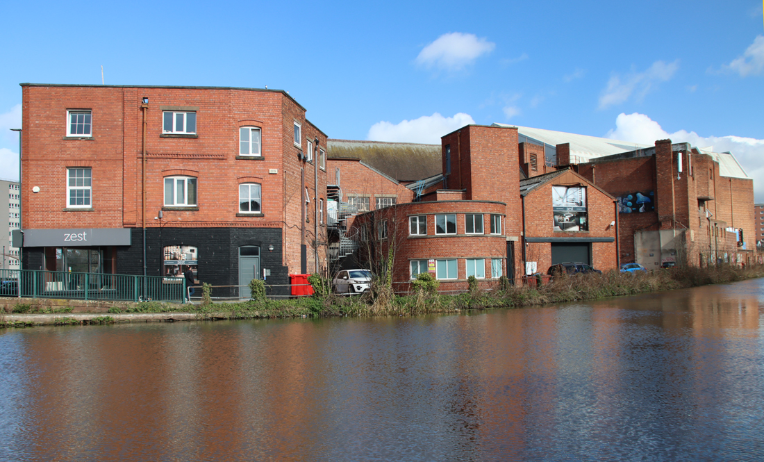
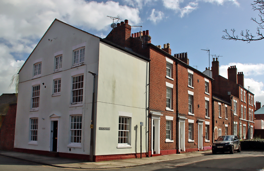
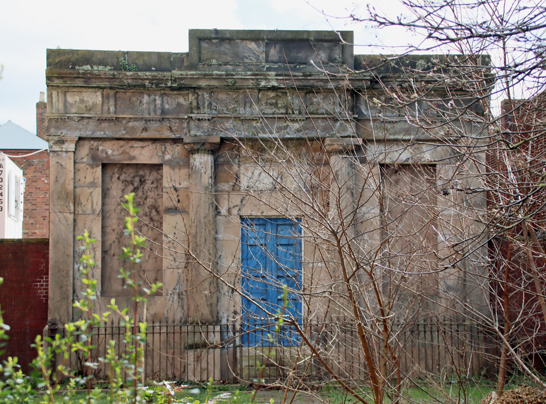
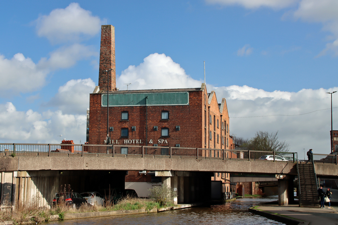
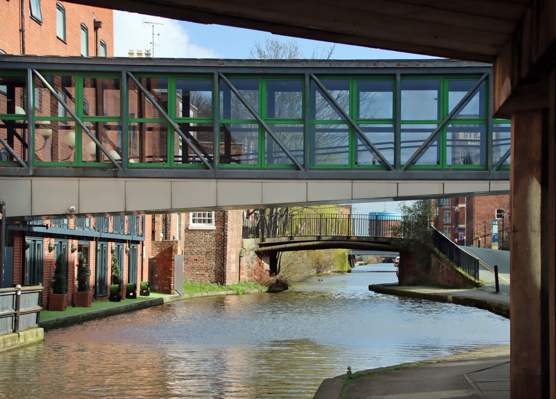
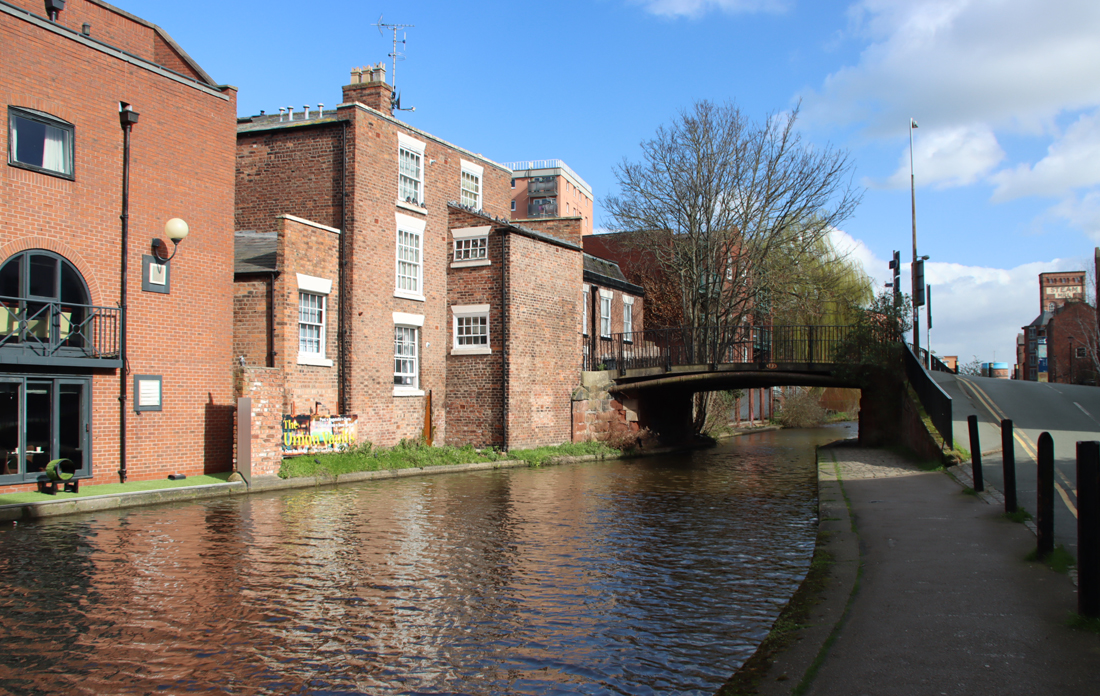
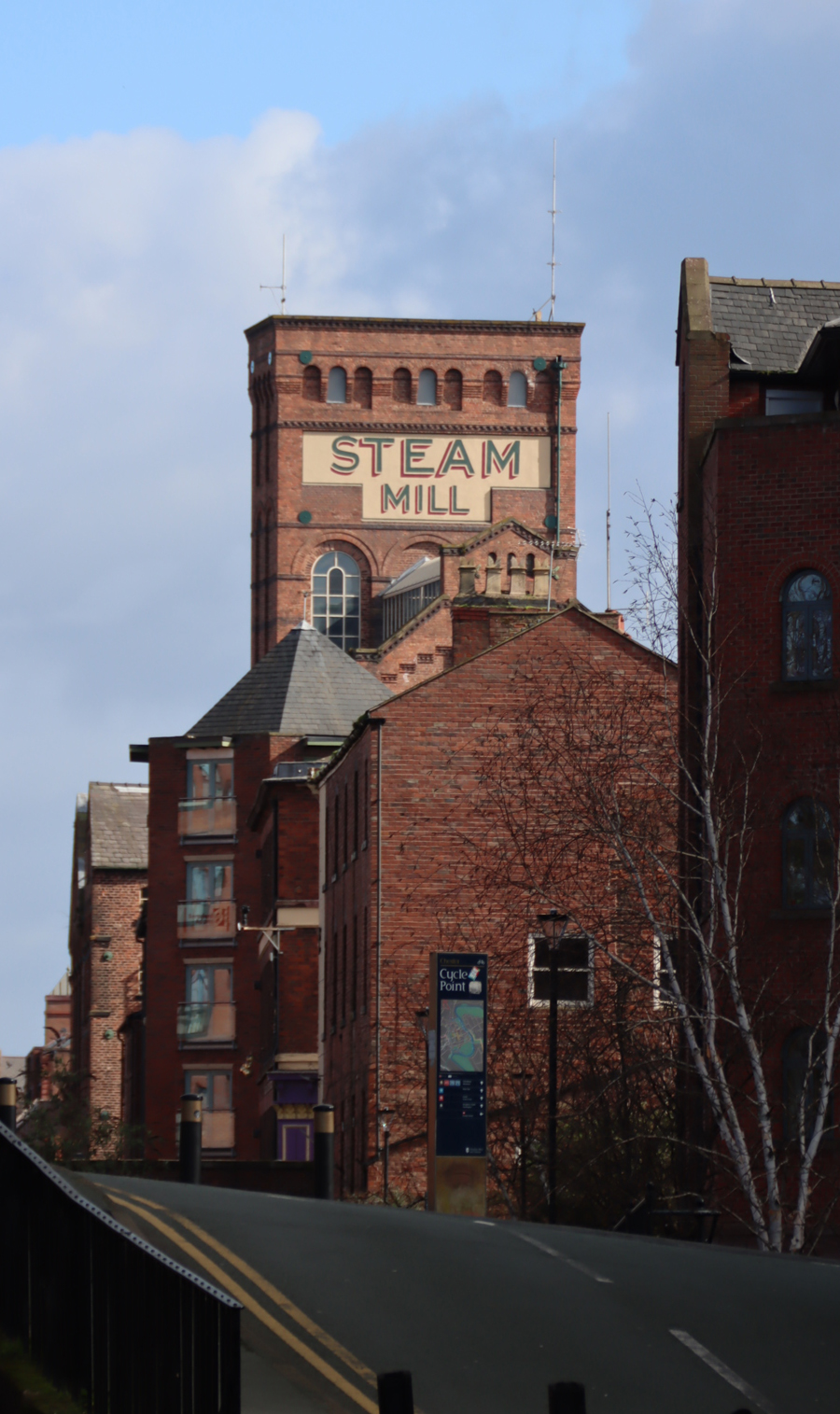
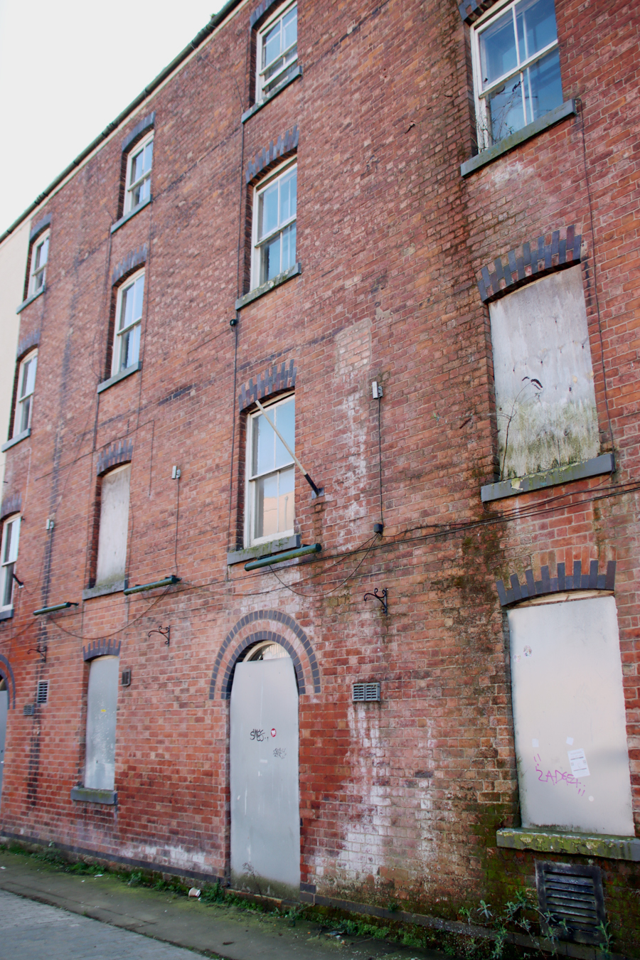
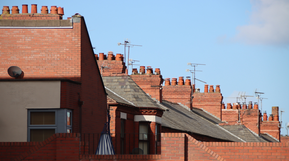
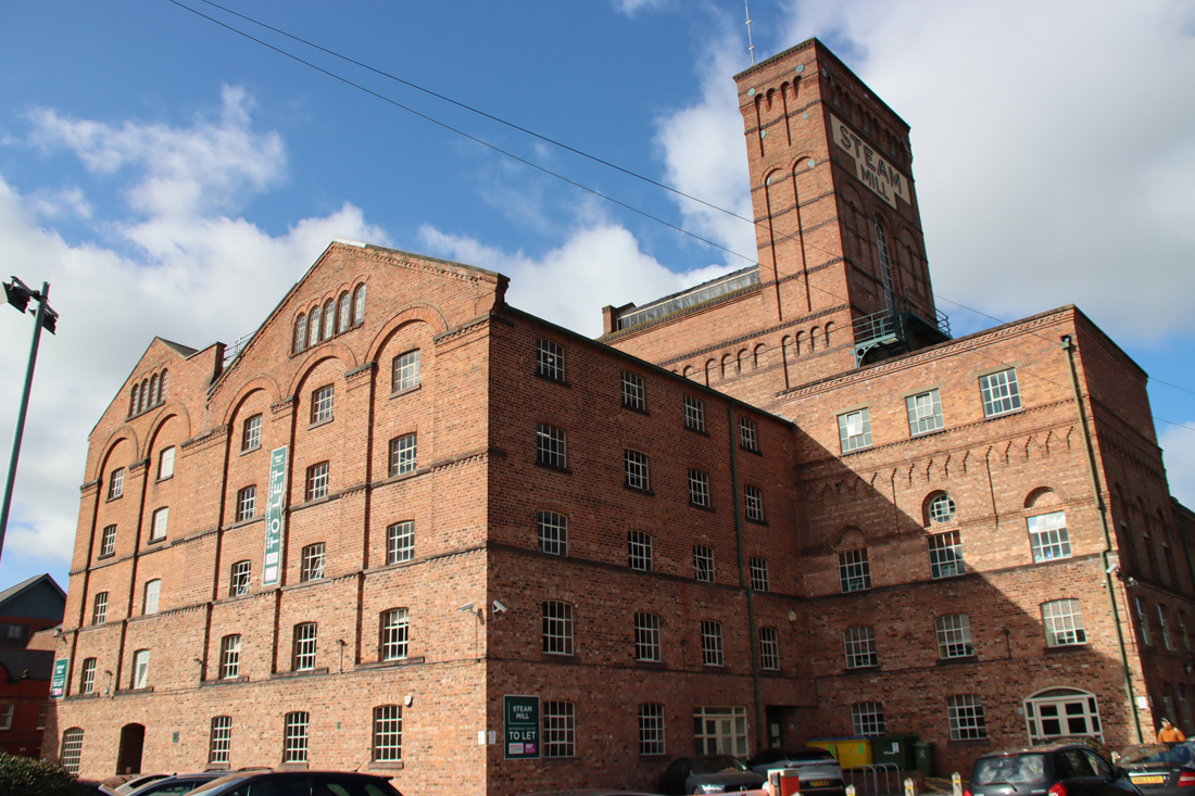
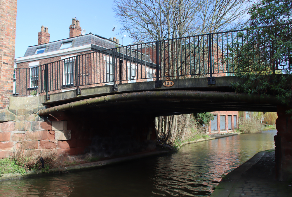
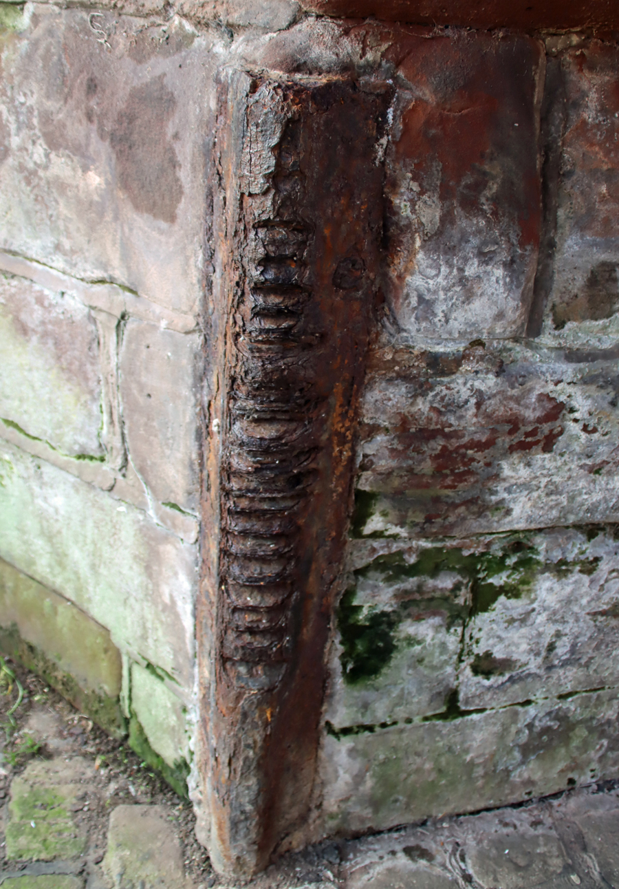
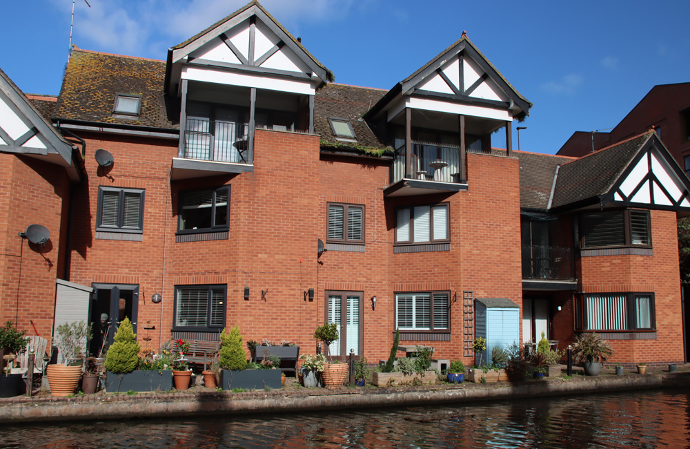
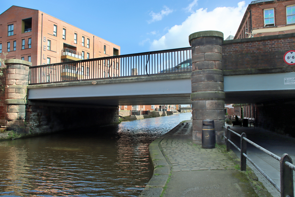
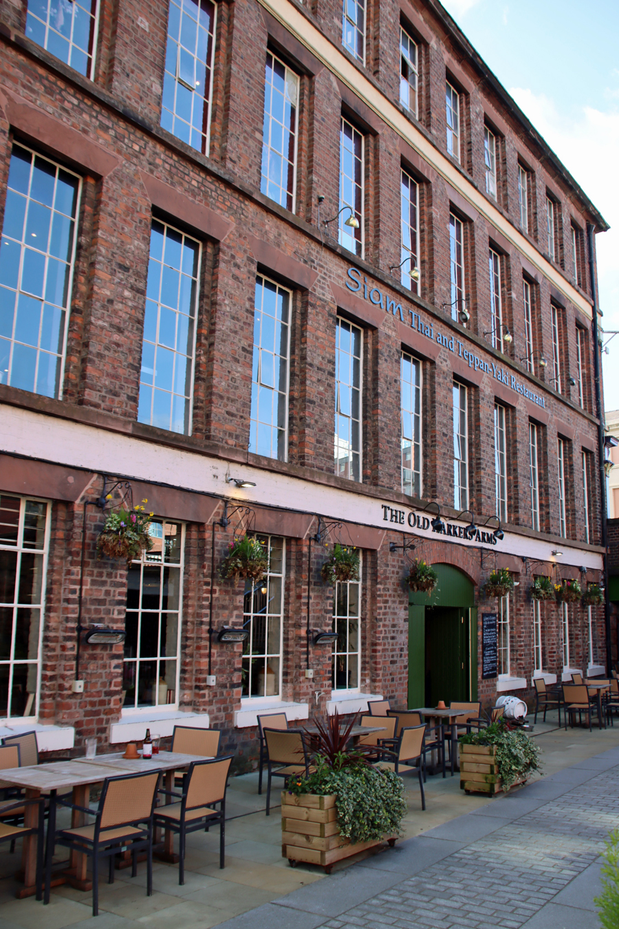
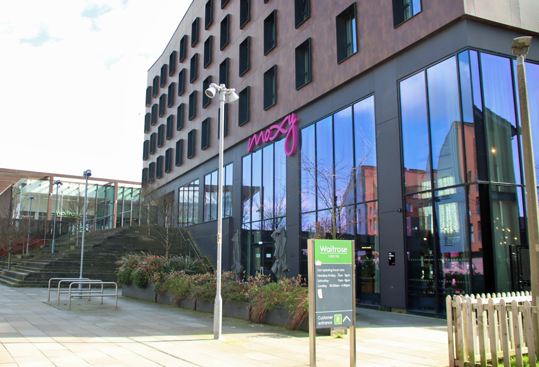
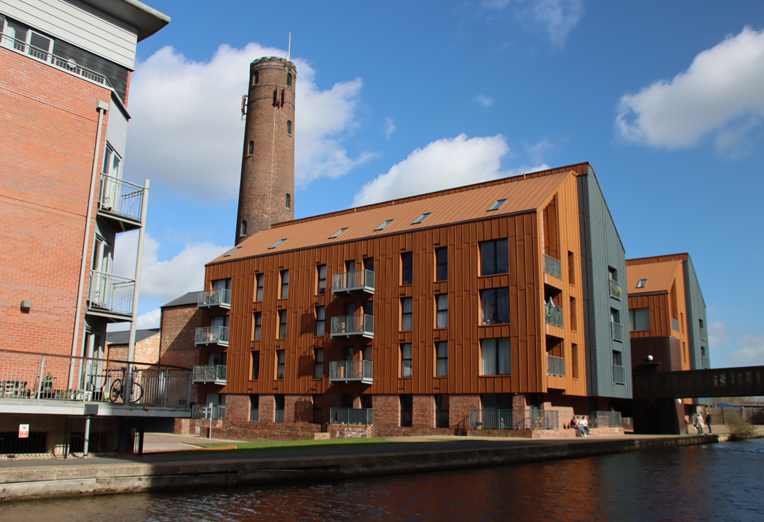
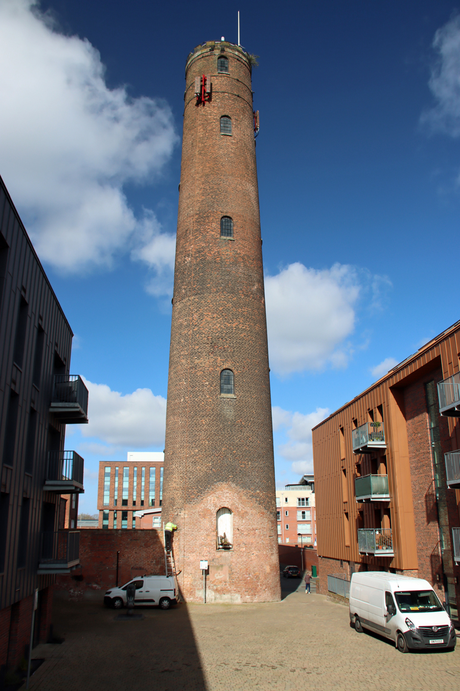
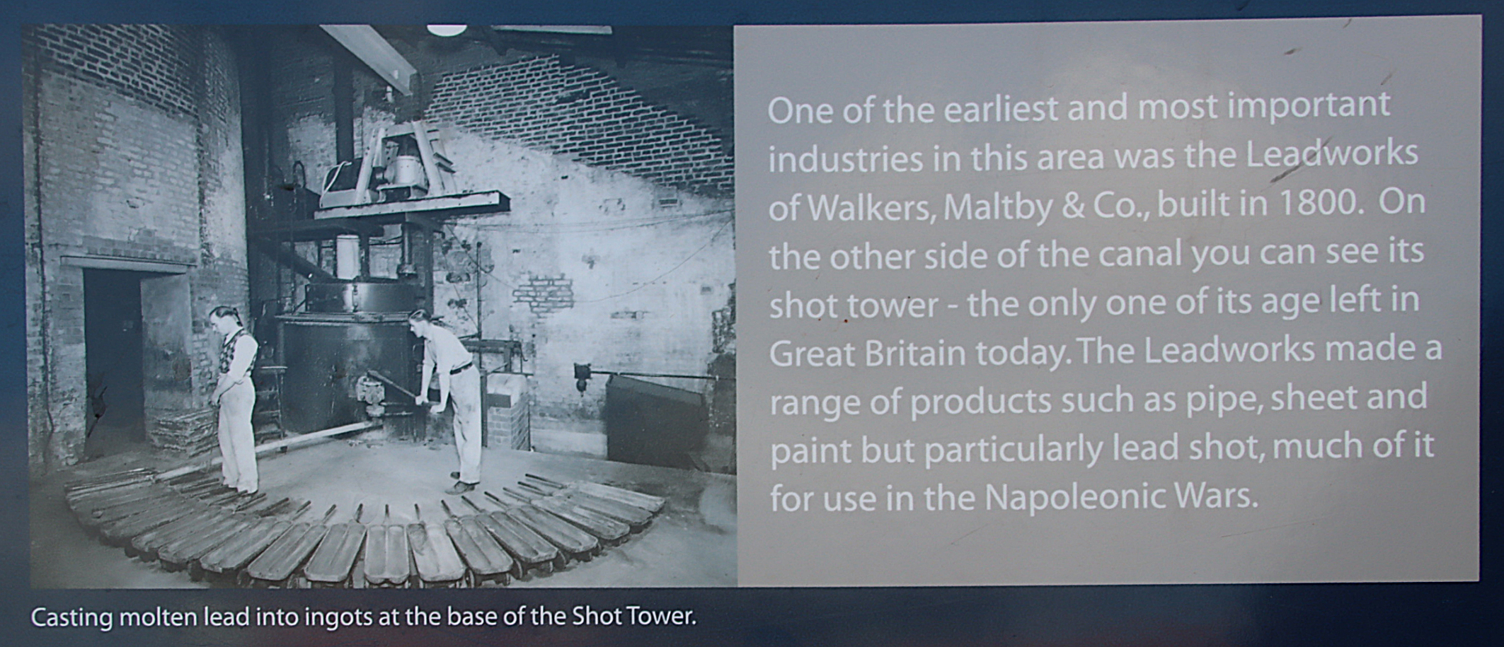
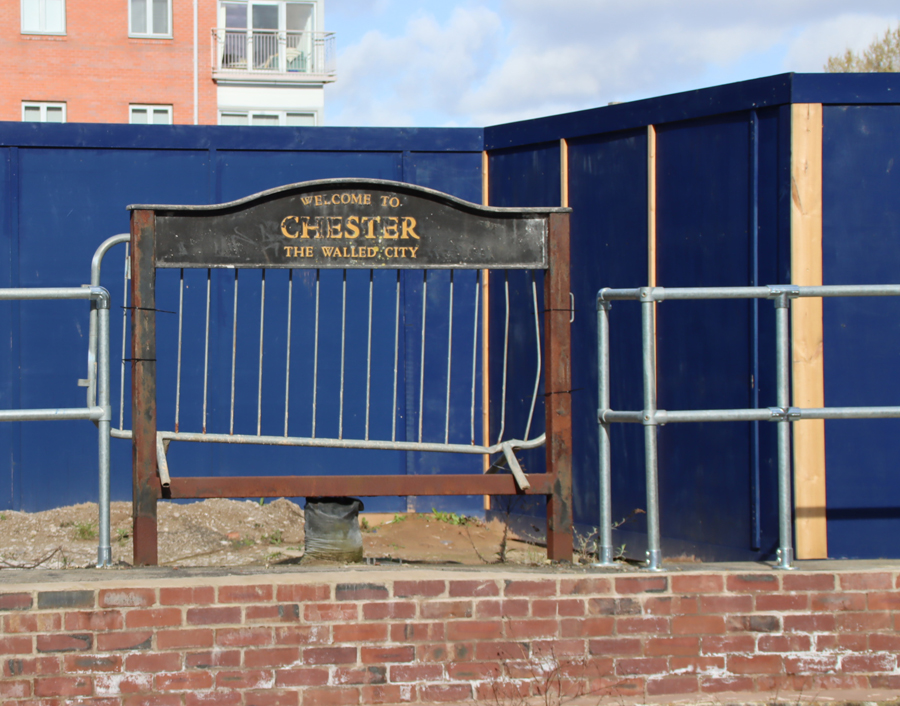
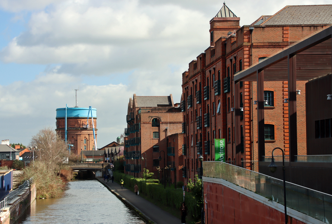
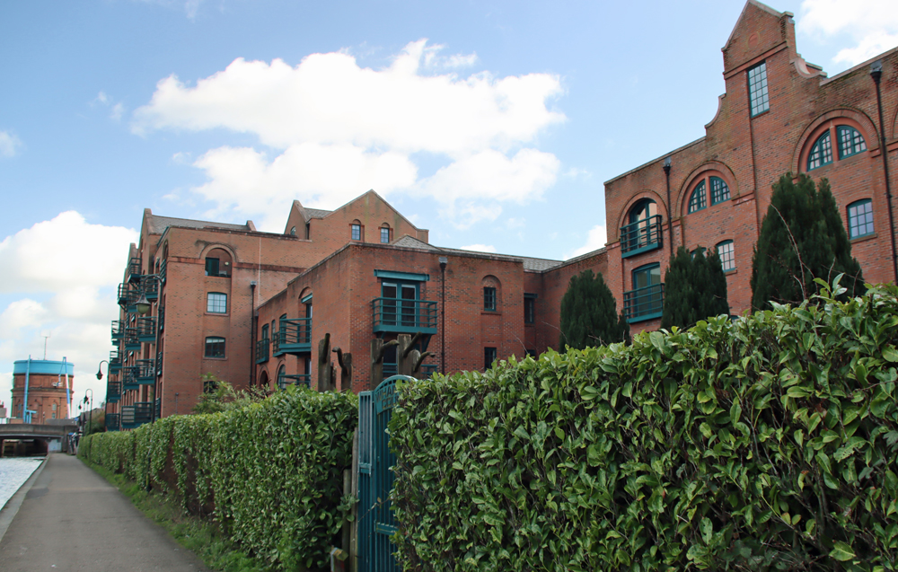
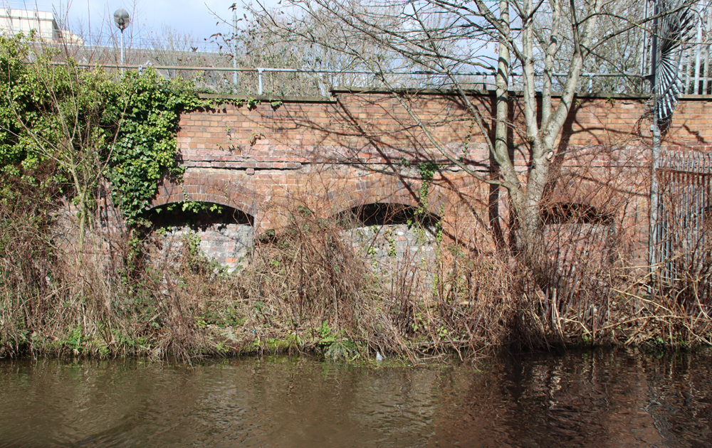
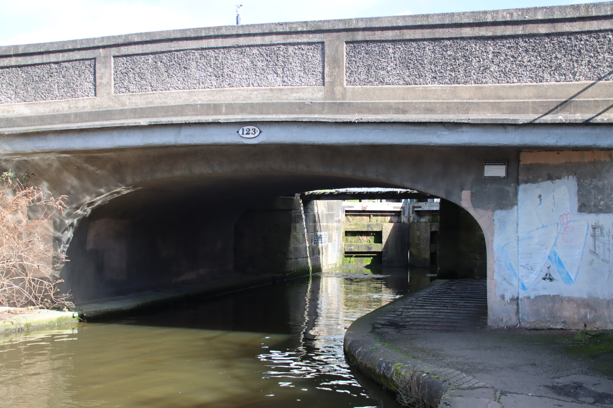
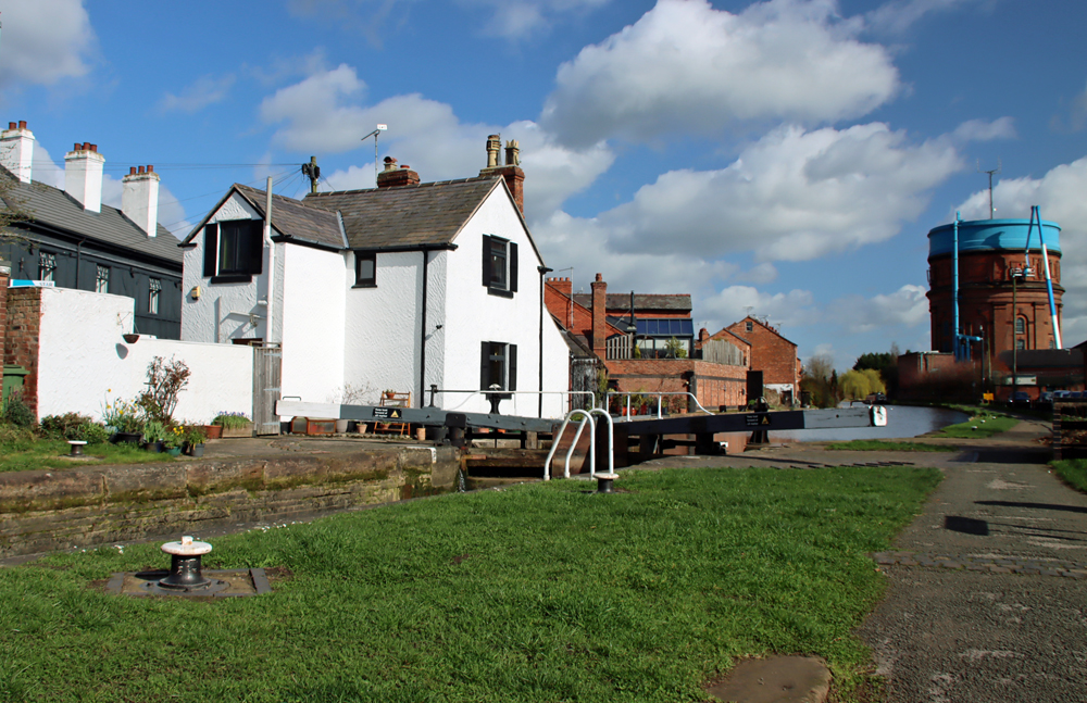
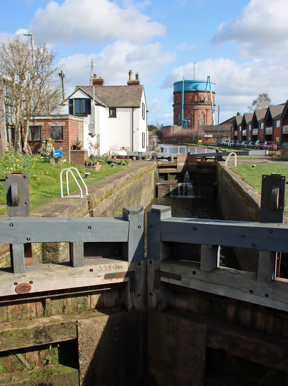
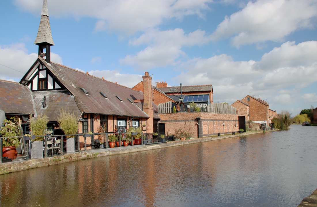
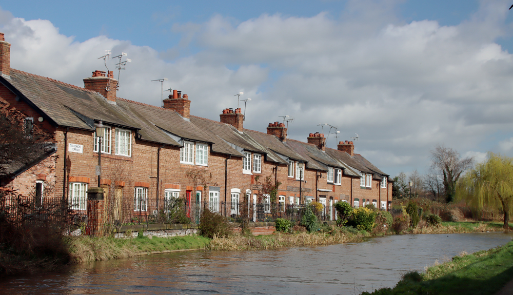
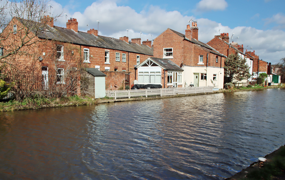
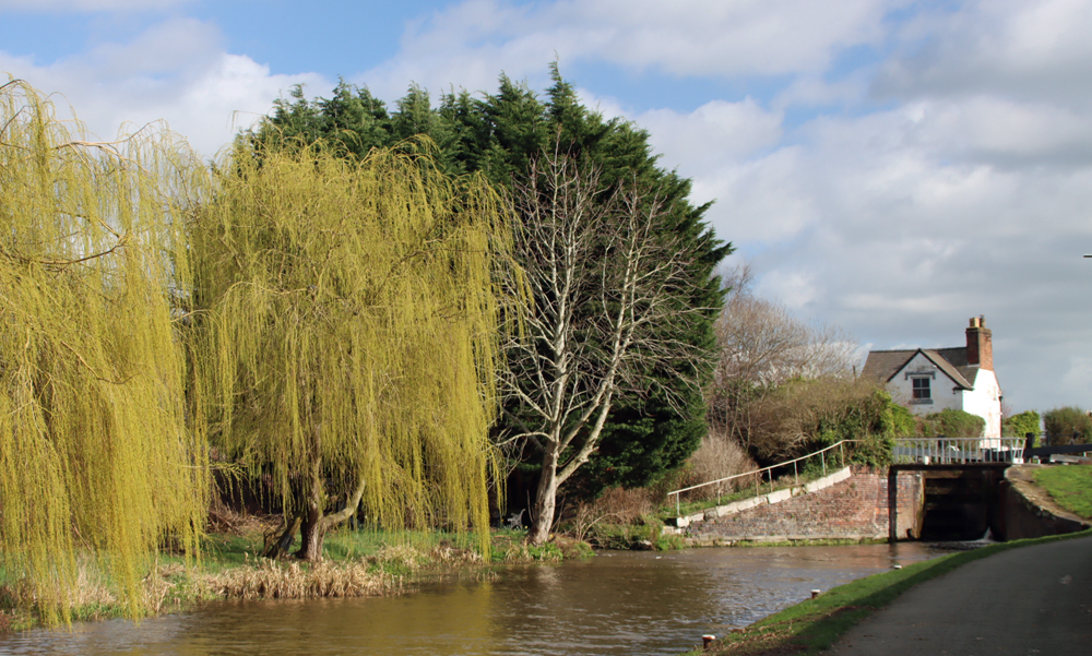
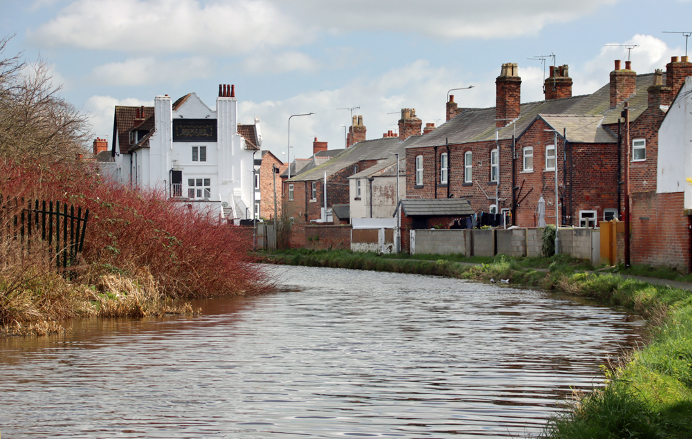
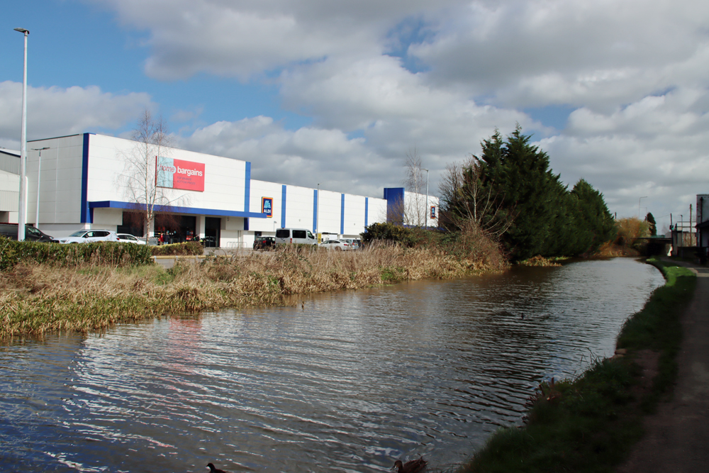
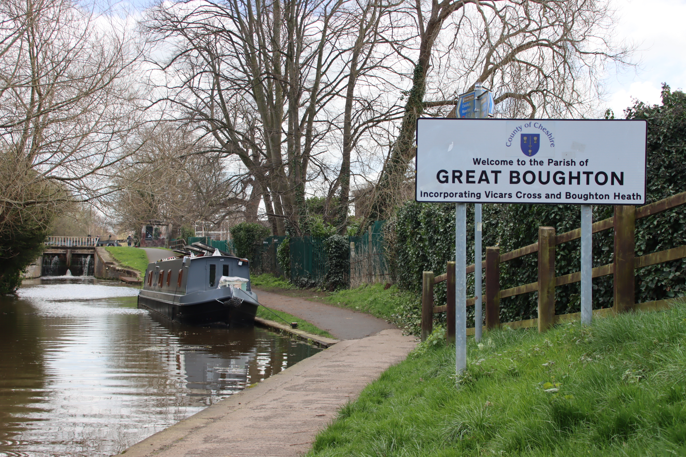
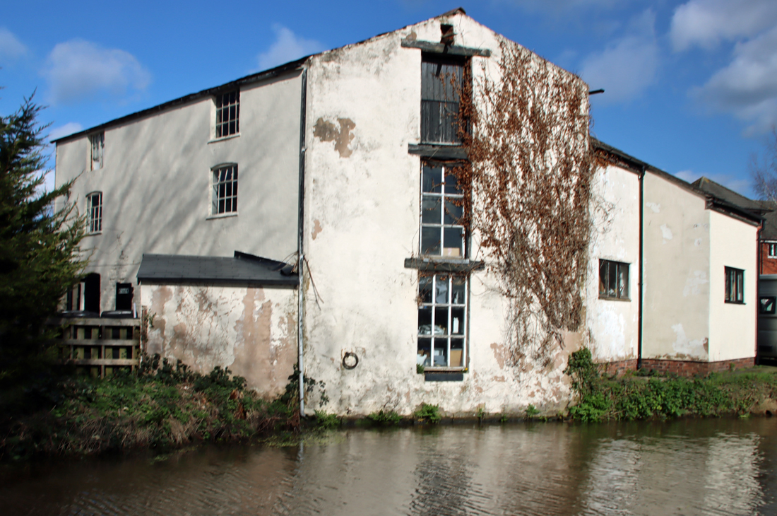
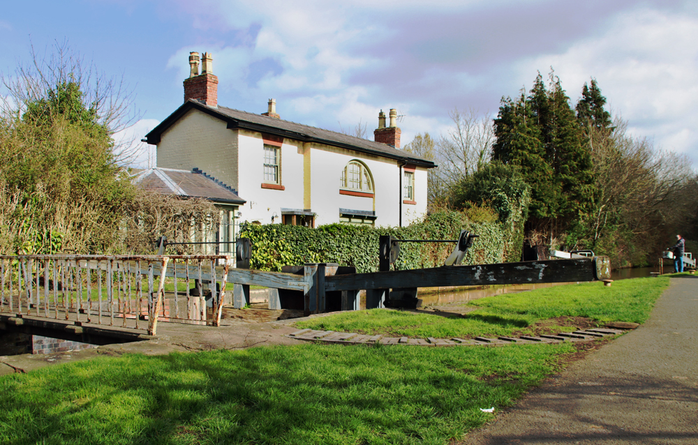
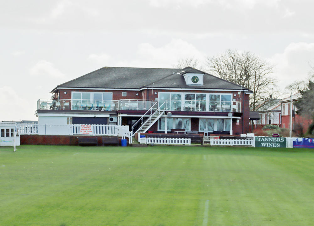
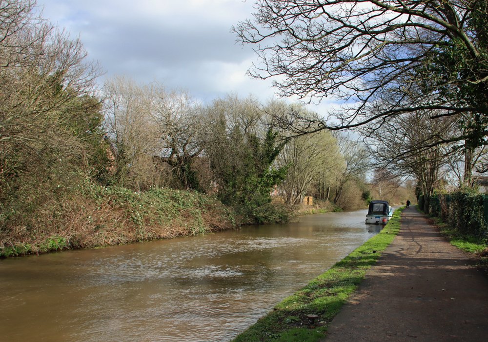
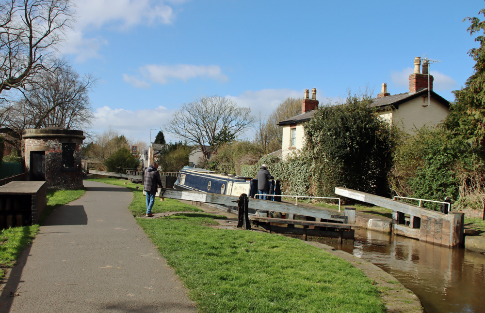
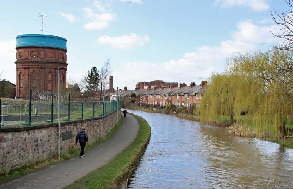
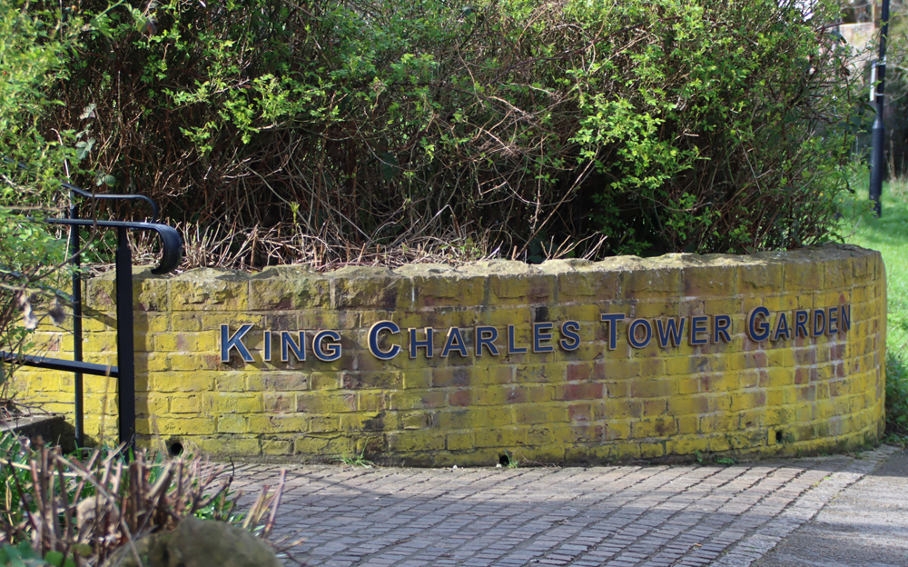
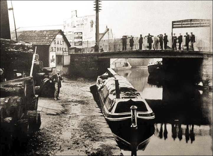
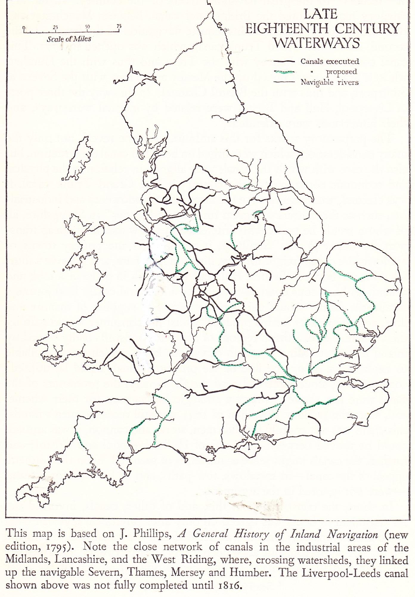
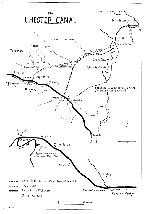
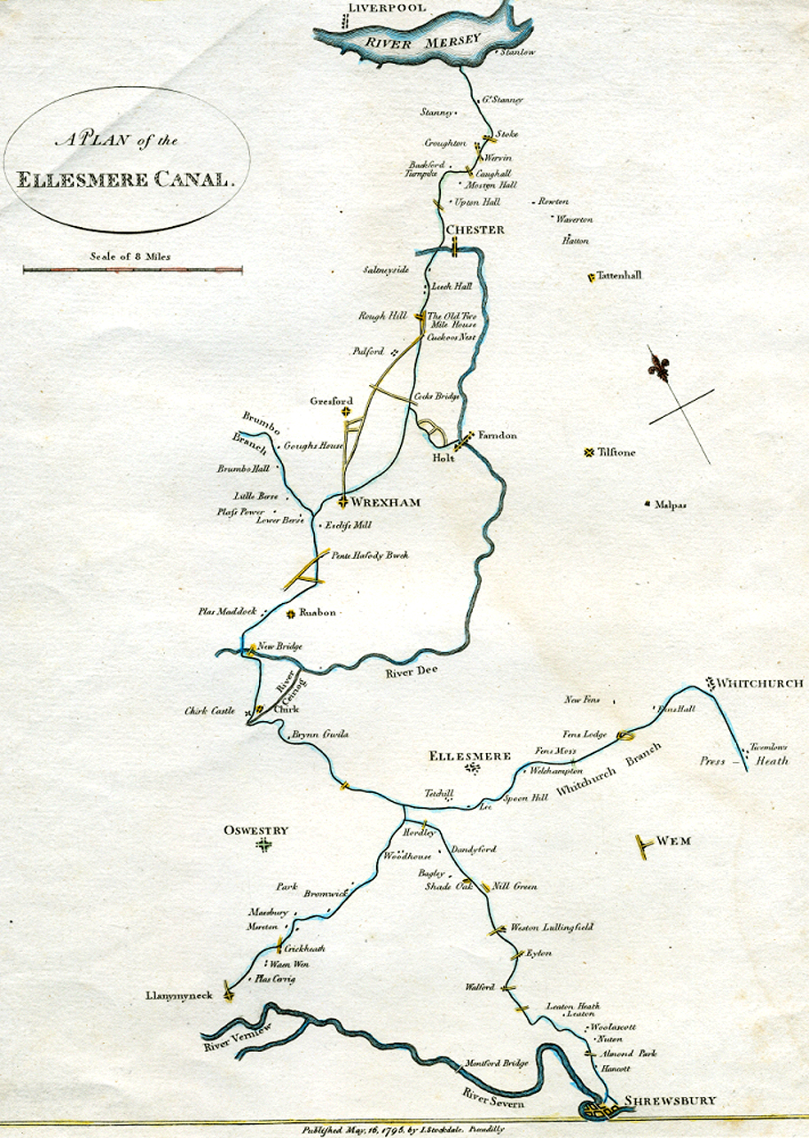
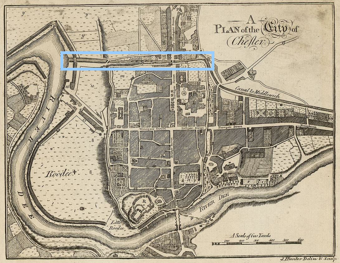
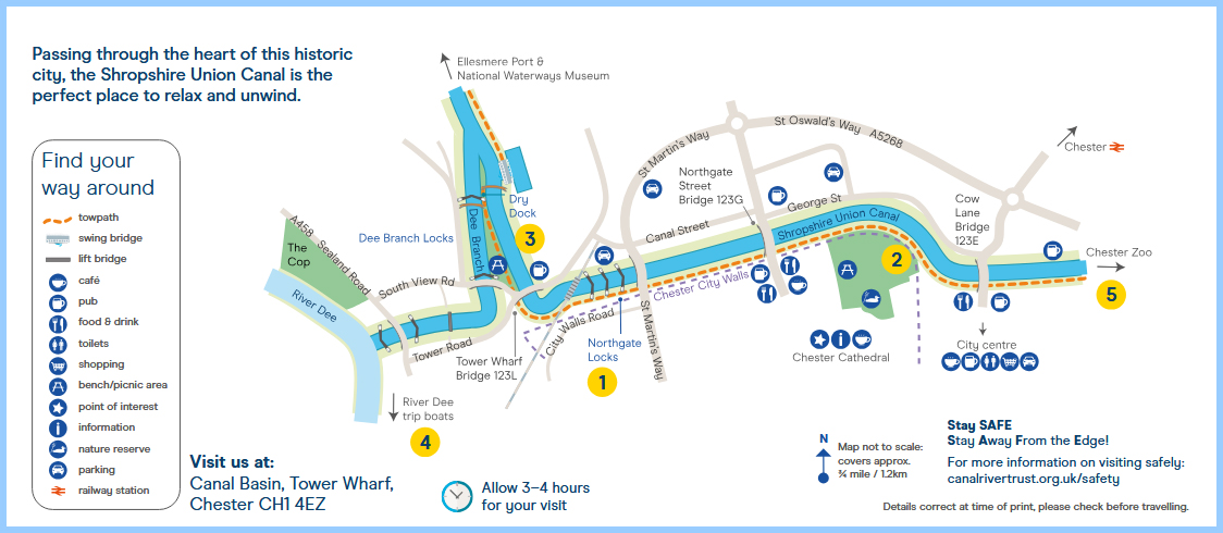
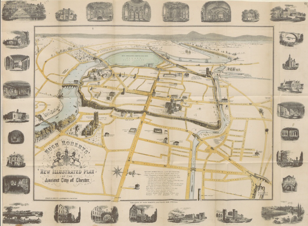
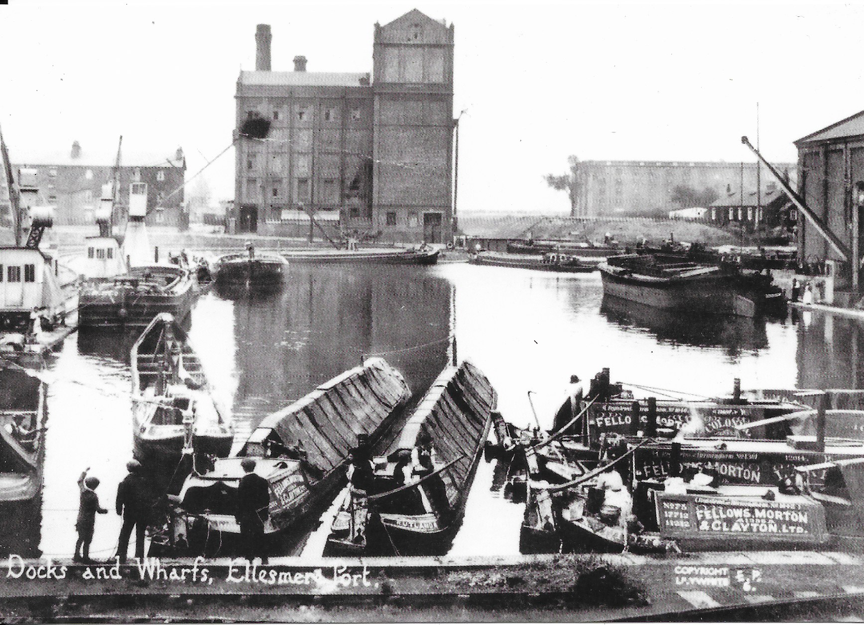
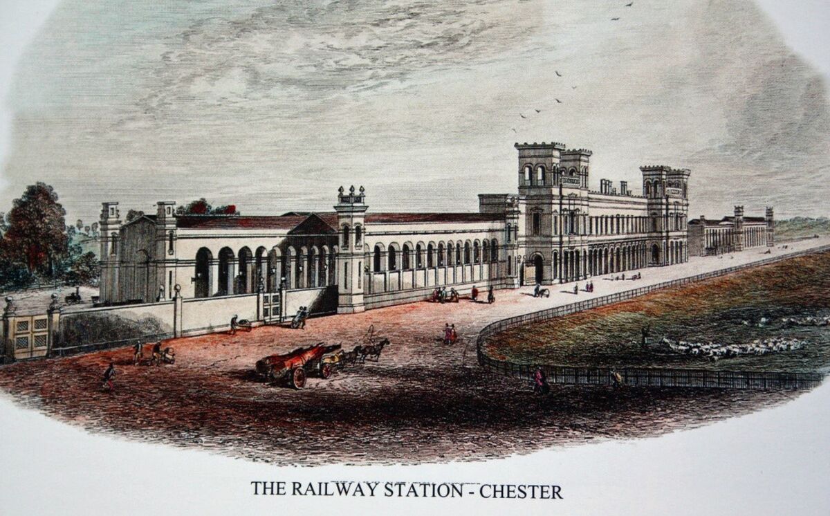
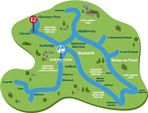
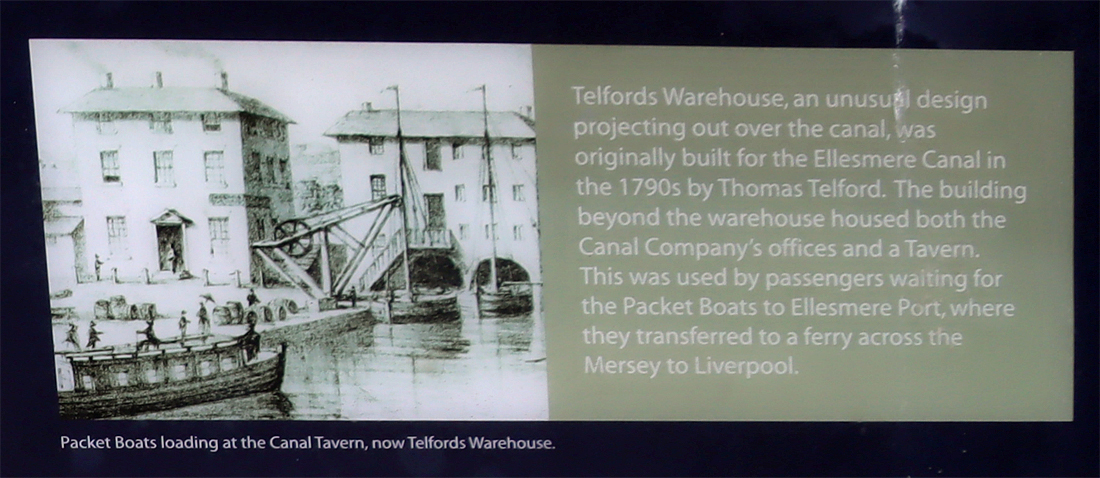
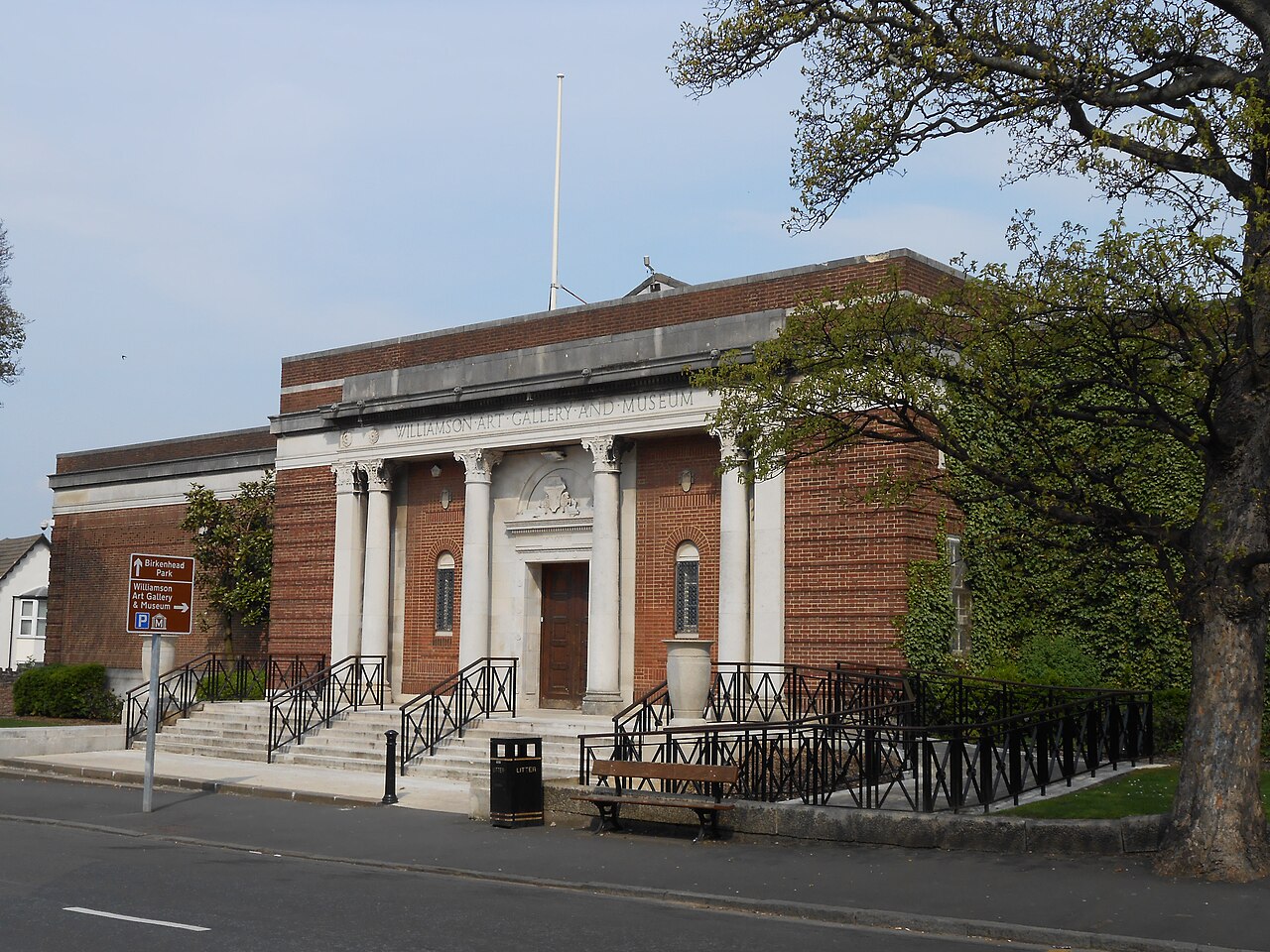
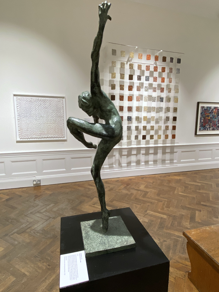

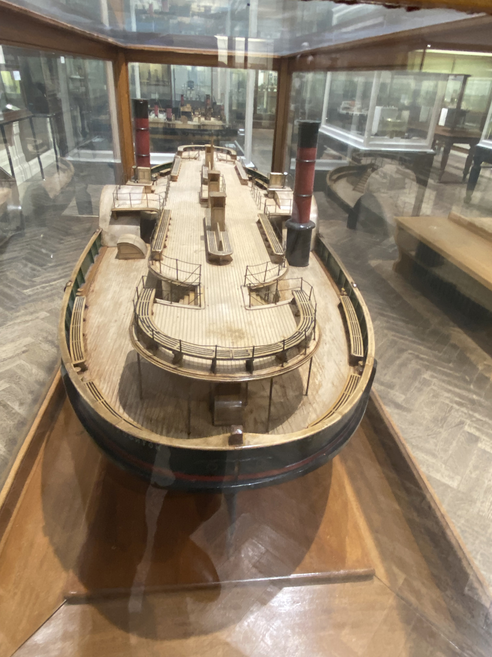
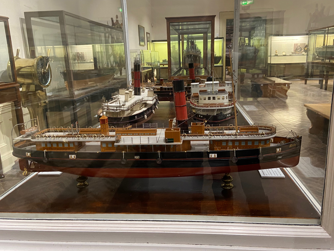
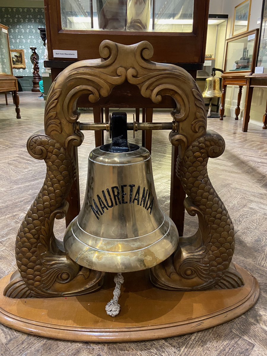
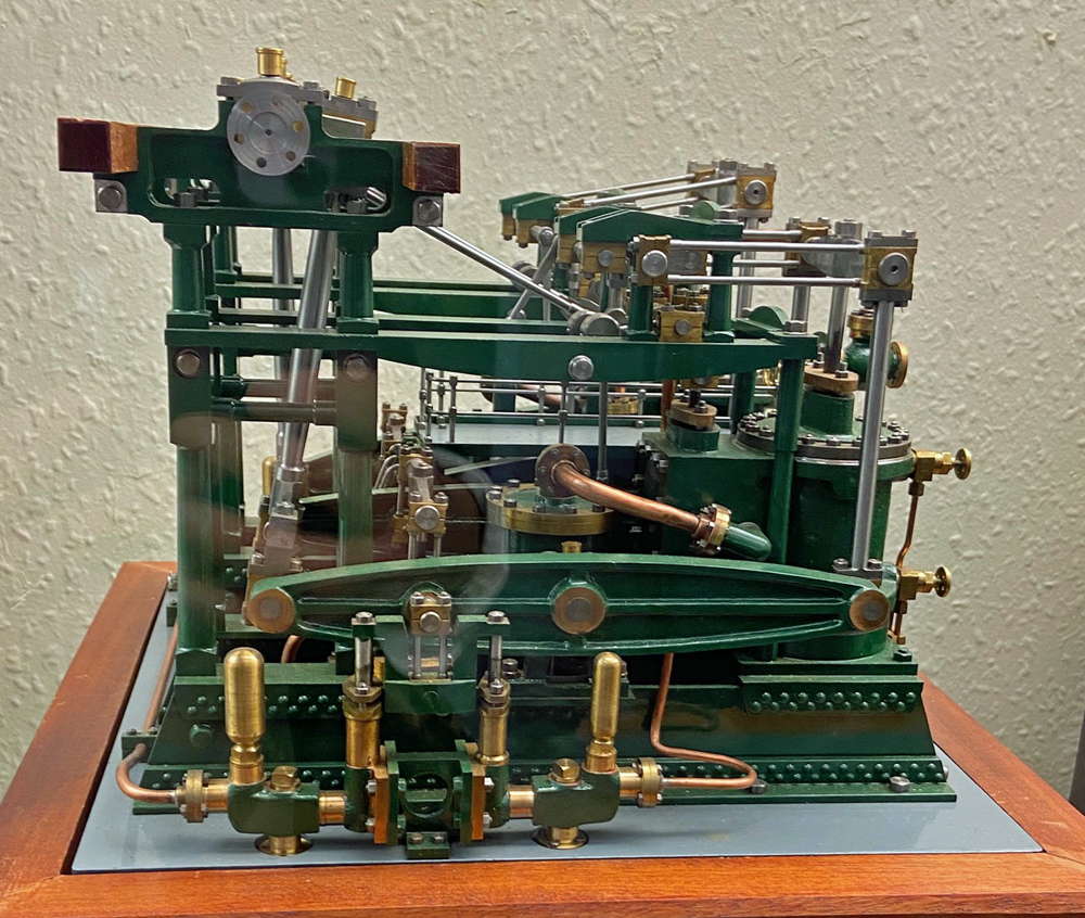
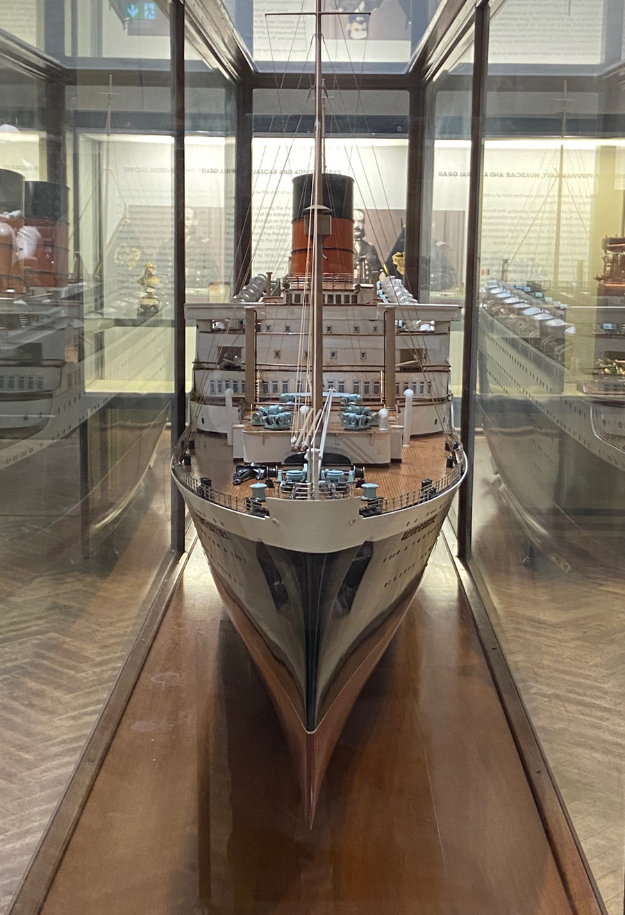

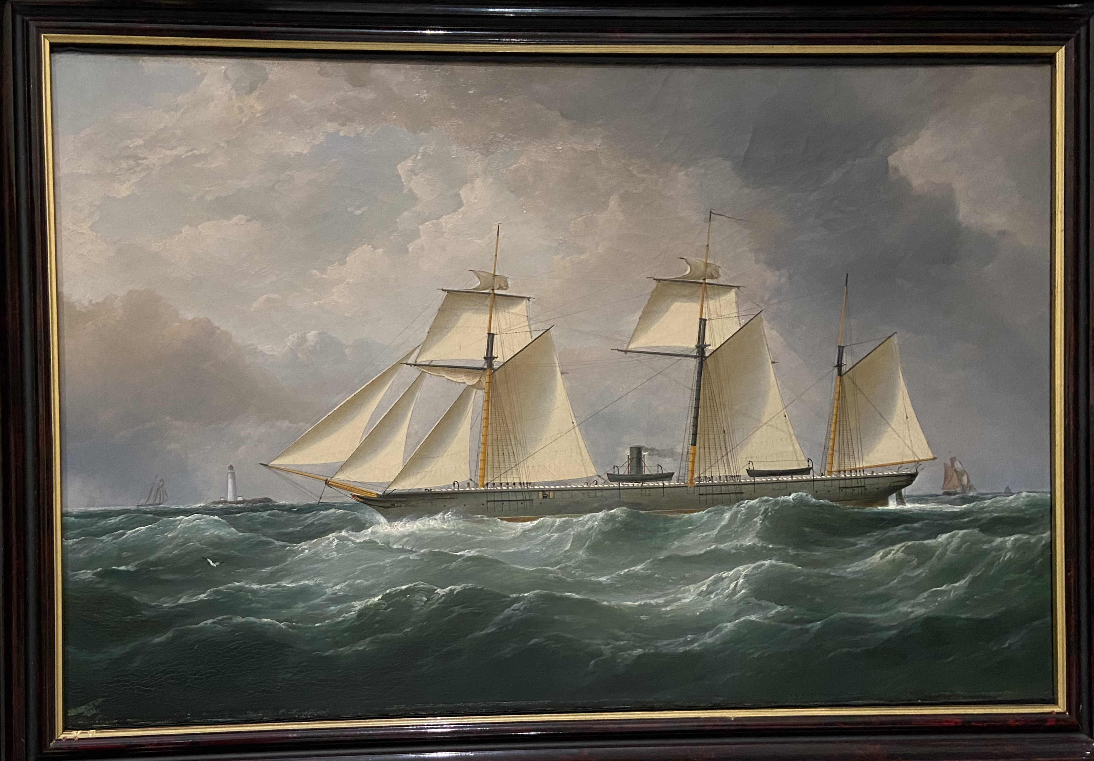
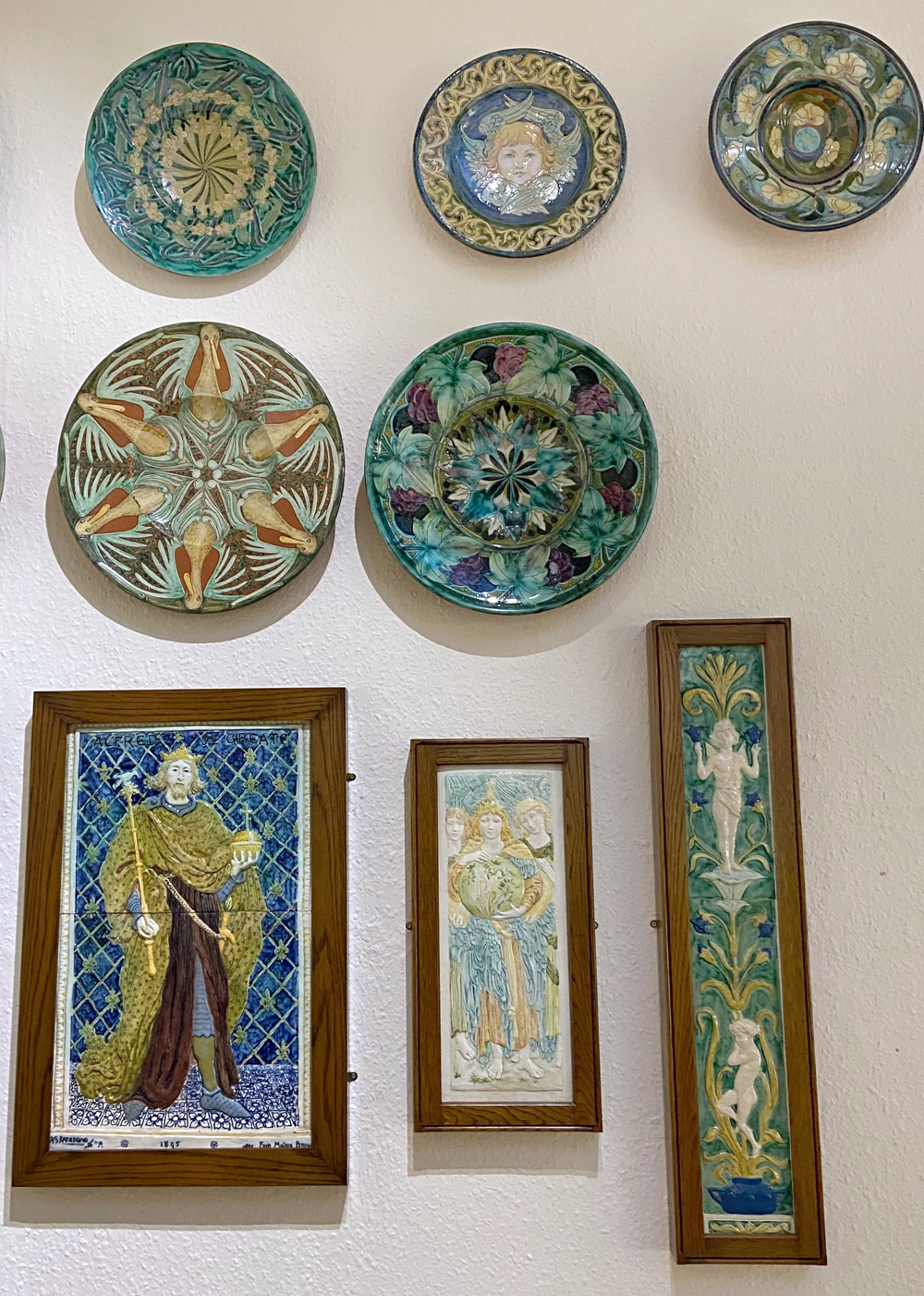
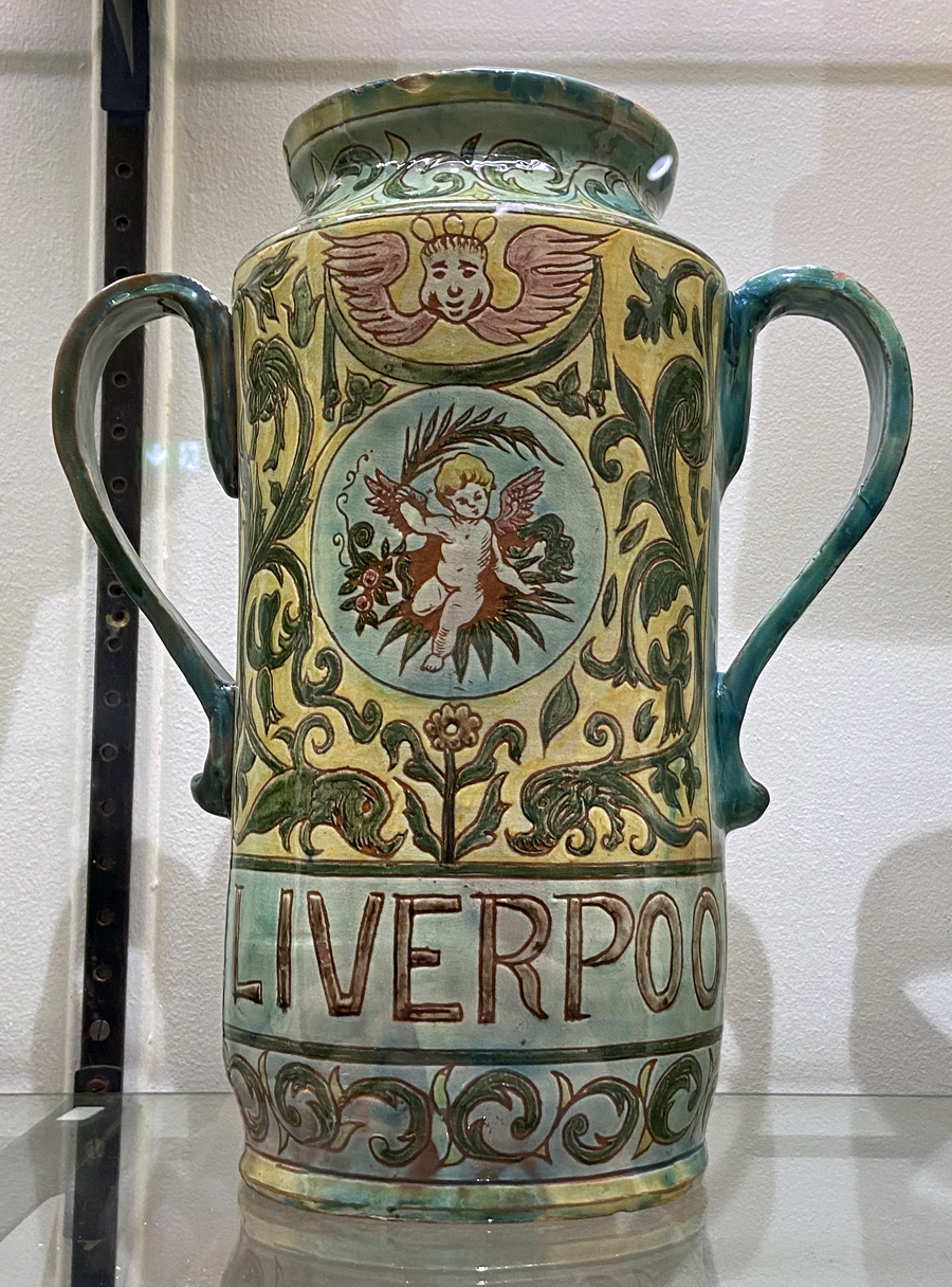
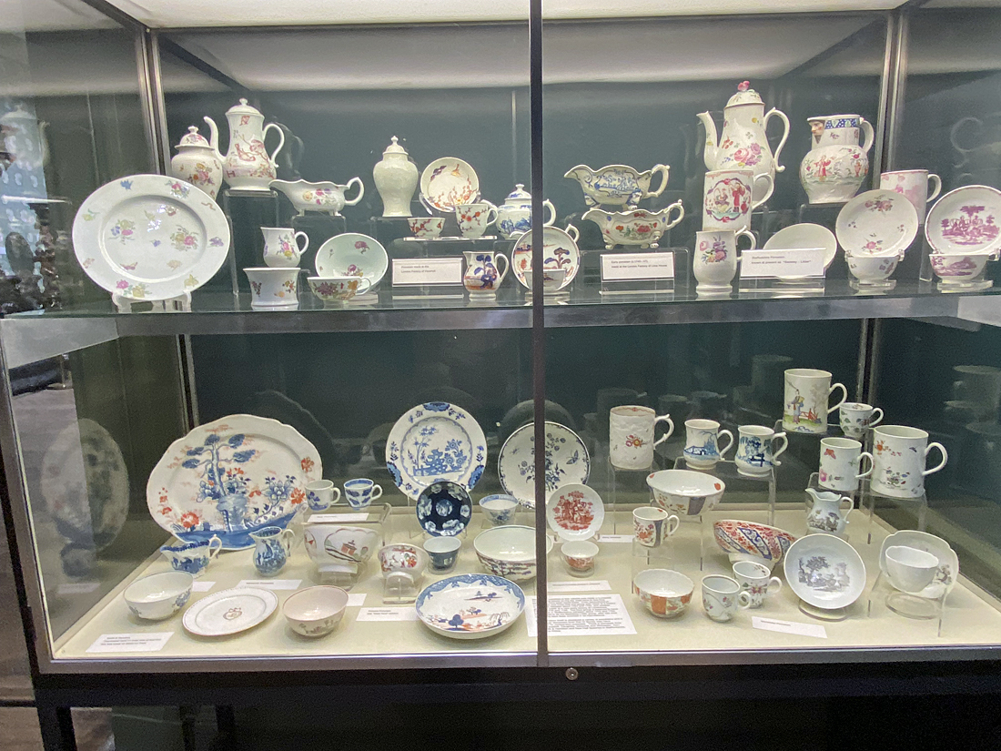
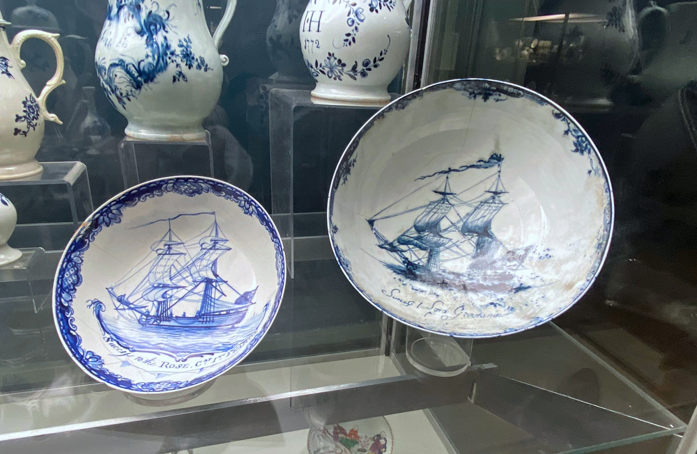


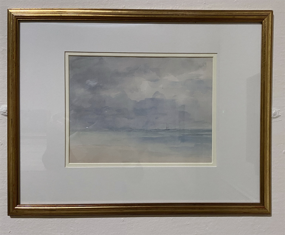


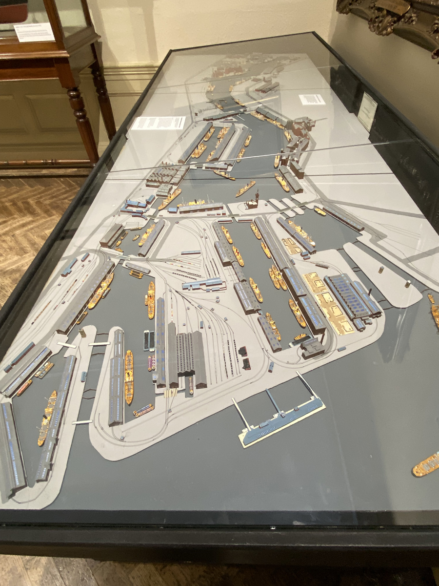
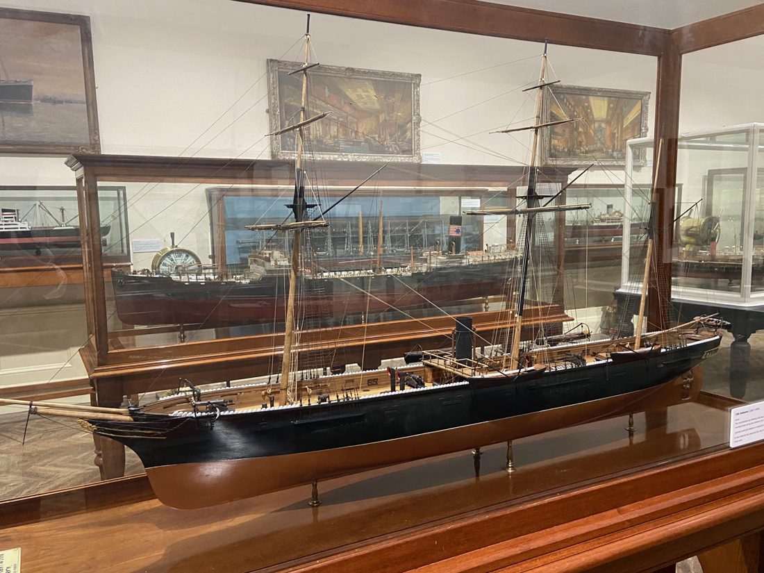


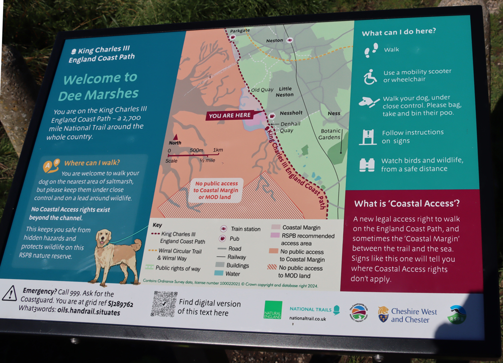


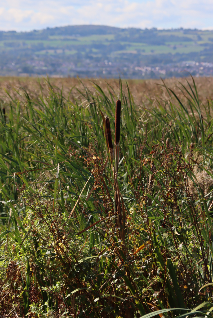


.png)