
Introduction
After writing a 4-part series on the 1829 Cheshire Lunatic Asylum (its original 19th century name), which introduced me for the first time to medical history, I became interested in how hospitals other than mental institutions developed in the United Kingdom. This post, offering a brief snapshot of how nursing staff built a sense of professional identity from the 19th century onwards, with particular reference to Chester, followed a visit to the Riverside Museum in Chester with its collection of nursing objects, including a cabinet full of hospital badges.
A brief background to hospital care in Chester
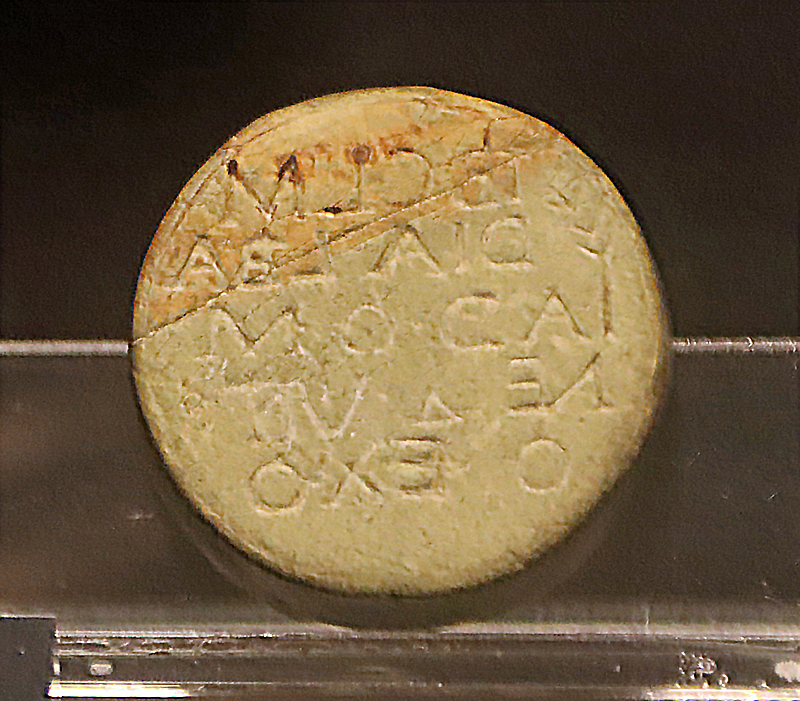
Eye Doctor Stamp from Wroxeter, now in the the Shrewsbury Museum and Art Gallery. SHYMS A/2008/00133
Medicine in one form or another has always been present. Doctors were in England in the Roman period. A nice example of a Roman emblem of medical authority is an eye doctor’s stamp from the Roman town of Wroxeter near Shrewsbury, now in Shrewsbury Museum and Art Gallery. Roman doctors and surgeons often treated their patients in the public baths, which were major community gathering places and health facilities but most legionary fortresses would also be equipped with a valetudinarium, a place for those needing help with valetudo (health), an early predecessor of the hospital. In a British legionary fortress this building was usually located opposite the city baths for convenience, but although the Chester (Deva) city baths are known to have been located on the east side of Bridge Street, sadly the valetudinarium has not been definitively located. Tim Strickland suggested, albeit tentatively, that it might be the building found in the 1982 excavations to the east of the barracks, on the west side of Northgate Street, a little way north of today’s Town Hall. This is given support by some fascinating evidence for the presence of medical expertise in that area in the form of two altars dedicated by doctors to suitable deities. Documented as RIB 461 and RIB 3151 they were both inscribed in Greek, implying that the doctors were themselves Greek, and were found on the west side of Northgate Street. Both are now in the Grosvenor Museum, Chester. David Mason offers the alternative suggestion that the traces of primary timber buildings opposite the baths could feasibly be the valetudinarium, but the remains were too meagre for any function to be determined.
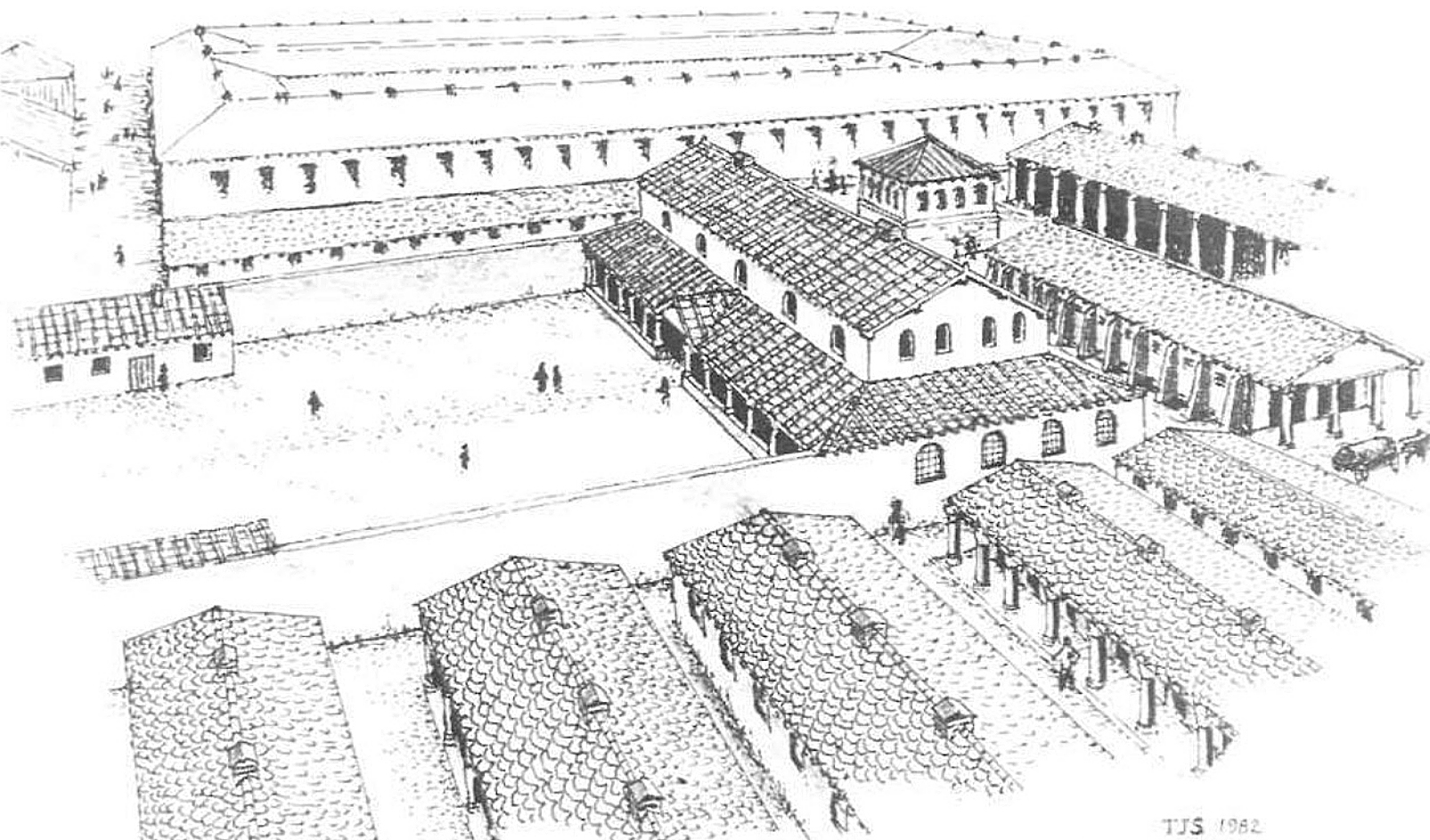
Tim Strickland’s reconstruction of the Princess Street Excavations, showing the possible hospital building in the background. Source: Strickland 1982
In the later medieval period, badges and medals were adopted in secular, military and ecclesiastical contexts to identify status, beliefs and achievements. Pilgrims to the St Werburgh shrine, in St Werburgh’s Benedictine Abbey, what is now Chester Cathedral, purchased pilgrim badges not only as souvenirs of their journey, but to identify themselves as actively committed to acts of Christian faith,or in gratitude for prayers being answered. Pilgrimages could be undertaken for a variety of reasons, but a major draw was the possibility of a saint interceding in response to prayers for curing illness or disability. Accumulated badges were attached to clothing and bags. These were of course emblems purchased by the pilgrim. They were not awarded by others to pilgrims in recognition of their devotion, but they communicated a powerful sense of affiliation and achievement.
St Werburgh’s Abbey pilgrim badge. British Museum 1836,0610.73
Chester’s very first infirmary was probably that of the medieval St Werburgh’s Benedictine Abbey, founded in 1092. As with most abbey complexes, the infirmary was a separate building that provided elderly and infirm monks with a more relaxed regime and better food than enjoyed by the rest of the monastic community, but was not necessarily concerned with the most of the market town’s community beyond the monastic walls. The location of the infirmary, which was usually a separate building and often set as one side of a second cloister (square of monastic buildings) is not known, although Alan Thacker suggests it might have been to the east of the surviving cloister.
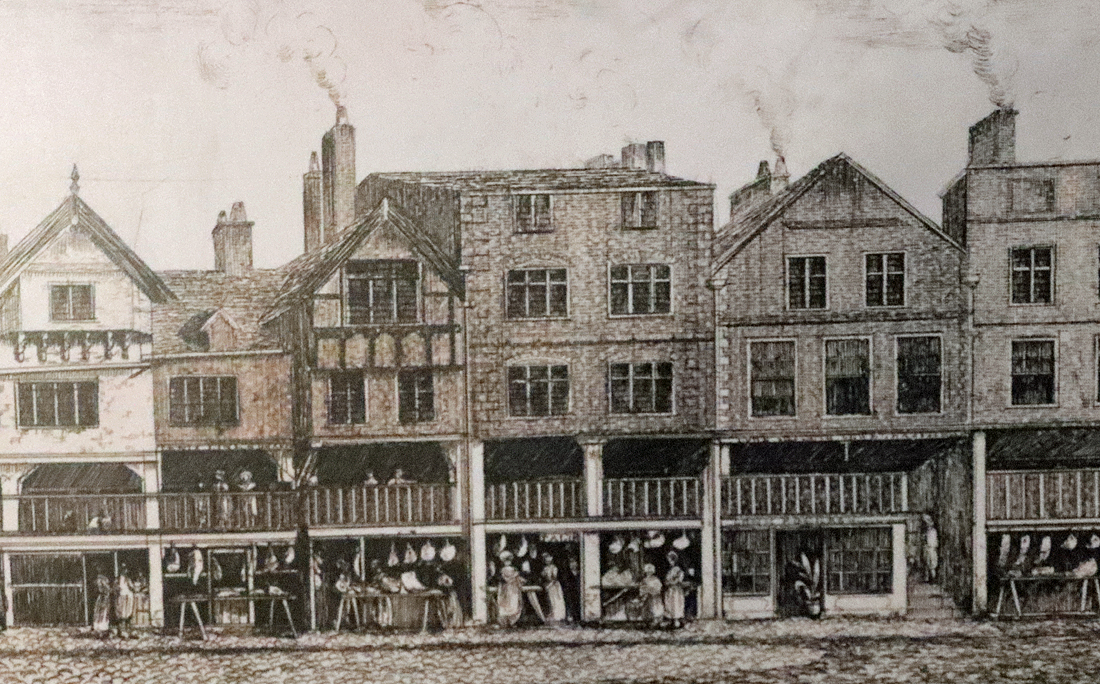
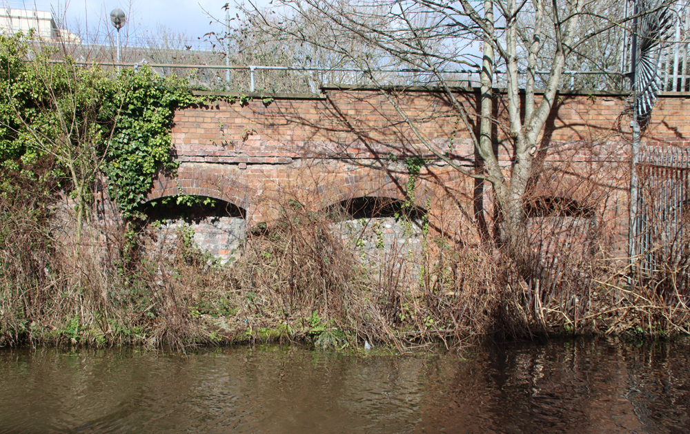
By contrast, the 12th century St Giles leper colony was dedicated to the care of anyone with the terrible Hansen’s Disease, better known as leprosy, caused by the bacteria Mycobacterium leprae. Like most leper colonies, it was outside the town, located about a mile away from Chester in Boughton. As was traditional with leper hospitals, it was located at a fork in the road, an optimal location for lepers to beg for alms heading into and out of Chester via the Eastgate. It later became more of an almshouse, until it was knocked down at the start of the Civil War in 1643. The remains of the hospital’s cemetery is still visible as a patch of raised grass just beyond the fork where Tarvin Road and Christleton Road split.

Artist’s impression of Birkenhead Priory as it may have looked in the 14th century by E.W. Cox c.1896.
Just outside the city walls, the charitable St John The Baptist Infirmary (known locally as Little St John’s to distinguish it from the Church of St John the Baptist) was established in around 1190 to take care of the elderly and infirm within the town, specializing in the care of the impoverished. Like most hospitals it was equipped with a church and a cemetery. Thirteen beds were reserved for the city’s impoverished, but could take in other patients when capacity permitted. There were always problems with the financial management of the hospital, which R. Stewart-Brown puts down to the policy of renting out the hospital’s properties in return for fixed sums, which could not be adjusted when costs rose. Matters reached a head in February 1315-15 when a public inquiry was held and it was decided to give responsibility to Birkenhead Priory, but this was apparently fairly short-lived. The hospital was demolished in 1644.
In 1510 a charitable bequest from former sheriff Roger Smith founded six almshouses in Commonhall Street, Smith’s former house, together with a chapel. Suffering financial difficulties, it was converted into the Fraternity and Hospital of St Ursula the Virgin. Although it was dissolved in the mid 1500s the almshouse buildings survived until 1871.
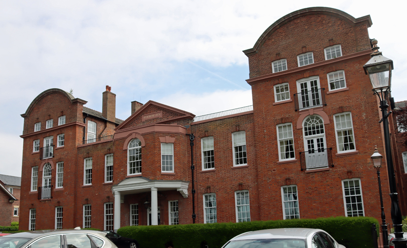
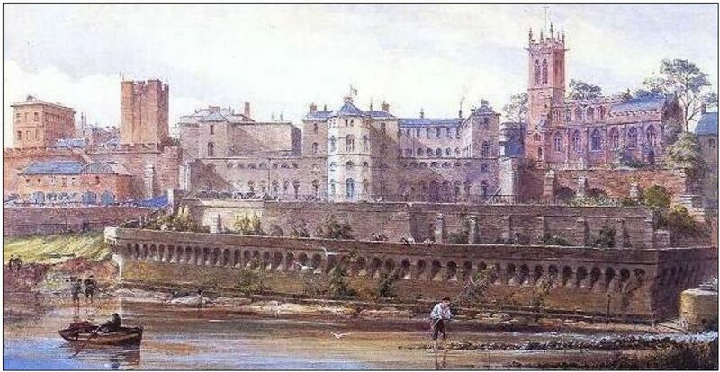
1761 Building Royal Infirmary
The Chester Infirmary opened in the mid-1700s after a bequest was left to found a county infirmary specifically to build a hospital for those unable to afford medical care. After an initial period at the Blue Coat School at Northgate, a site was purchased on City Walls Road, and the building was designed by William Yoxall, with its own chapel on the first floor.
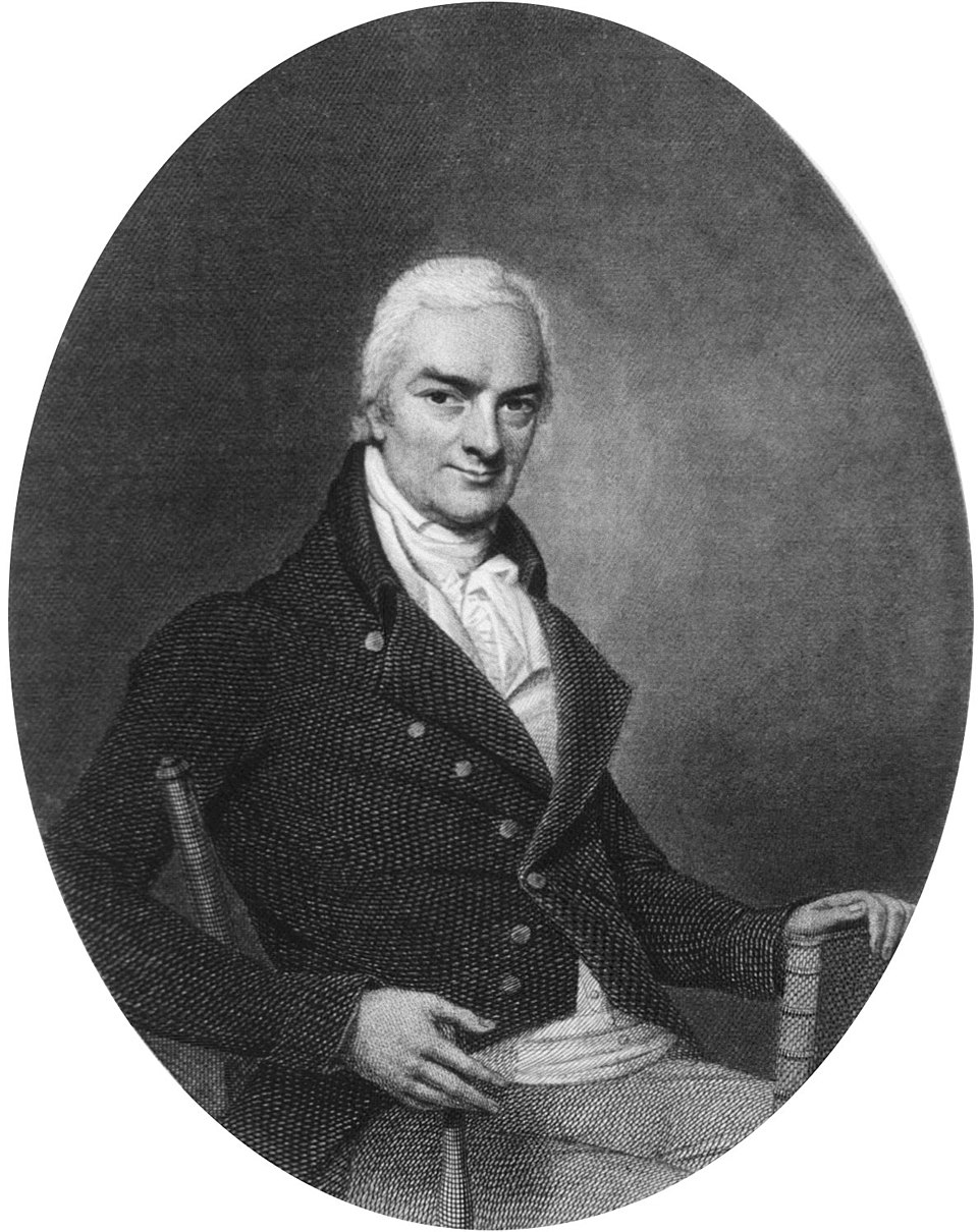
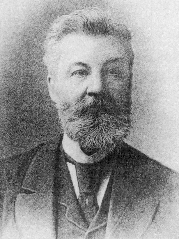
Dr John Haygarth. Source: Wikipedia
In 1766 Dr John Haygarth accepted a position at the Infirmary as a physician, working there until he retired in 1796. His investigative work lead him to become particularly interested in the spread of infections diseases in the poorer parts of the city, establishing a Smallpox Society in 1778. He promoted the control of disease in the community by establishing routines of cleanliness, ventilation and inoculation. The creation of isolation wards in 1783, in response mainly to typhus outbreaks, was an innovation at the Infirmary that was soon adopted by other hospitals. Over the coming years many changes were made to the Infirmary. The Chester Infirmary represented a considerable advance on medieval standards of care, both benefitting from and contributing to medical research and the understanding of infectious diseases.
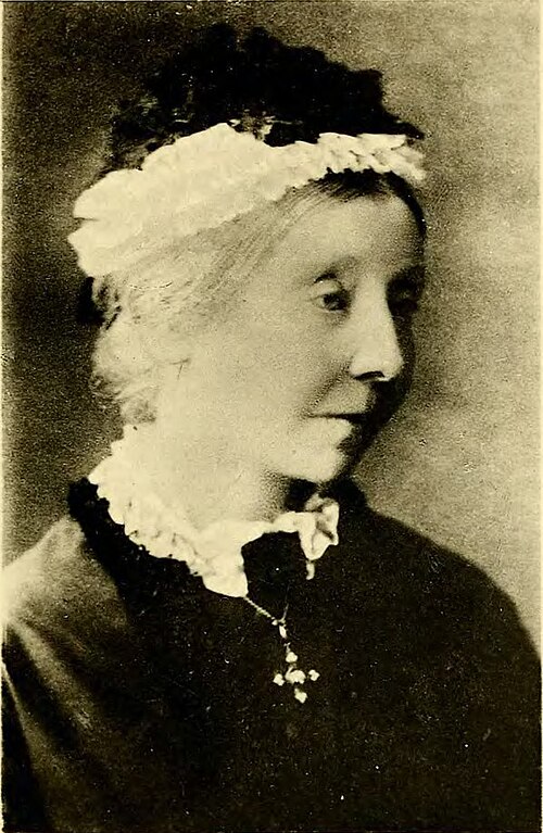
Frances Maria Wilbraham. Source: Wikipedia
At the Chester Infirmary, the sisters Frances and Emily Wilbraham and their friend and colleague Emily Ayckbowm demonstrated how women in the late 1800s might be highly active not merely in the care of patients, but in the management of hospitals and the handling of epidemics, building on the work of Florence Nightingale. Colonel Richard Wilbraham, brother of the sisters, had served in Crimea and was a friend of Nightingale’s.
The three major outbreaks of cholera in 1832, 1849 and 1865 stretched the hospital’s resources to the limit and they refused to take cholera patients, requiring isolation hospitals to be set up on vacant land, which were taken down once the worst was over. This was a period when Chester still lacked piped water and insanitary conditions, although being tackled by the authorities, were very common. At the onset of the 1865-66 outbreak of cholera, Frances was instrumental in setting up an isolation hospital in a semi-derelict farm building where the Grosvenor Park is now located, helping to, prepare it for patients, nursing the patients when they arrived, and managing workhouse inmates who were assigned to the infirmary. Frances published a book about her experiences in 1877, “Streets and Lanes of a City,” under the pen-name Amy Dutton. The windows in the chapel built on the first floor of the Royal Infirmary were installed in memory of the Frances and Emily.
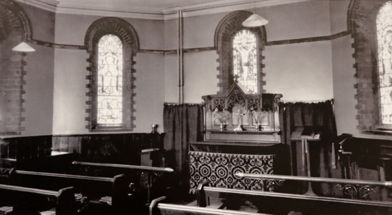
Infirmary Chapel Windows. Source: Photograph of first floor landing poster display in the Wheeler Building, University of Chester
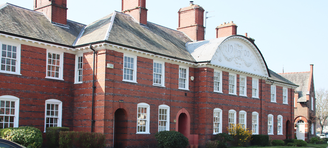
The building was expanded and modernized and in 1914 a major refurbishment was accompanied by a new wing with with six additional wards. After being opened by King George V and Queen Mary, it was renamed the Chester Royal Infirmary. In 1948 the hospital was absorbed into the National Health Service. In 1994 it eventually closed, its functions having been taken over by what is now the mammoth Countess of Chester Hospital. The original 1761 building was Grade 2 listed in 1972, and in 1998 was converted for residential use, but the rest was demolished. The building still stands and appears to be in very good condition.

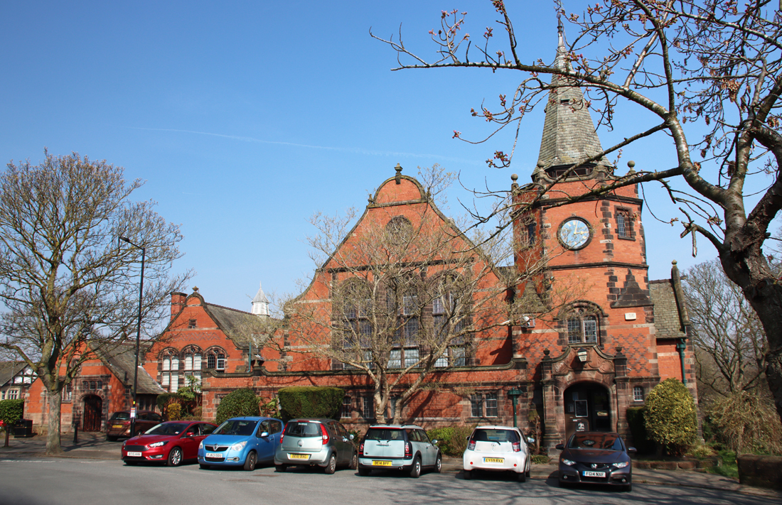
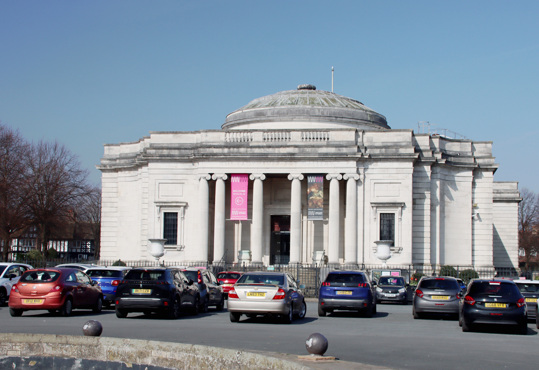
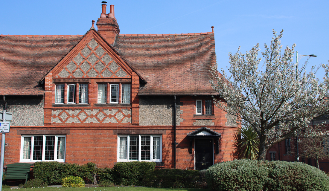
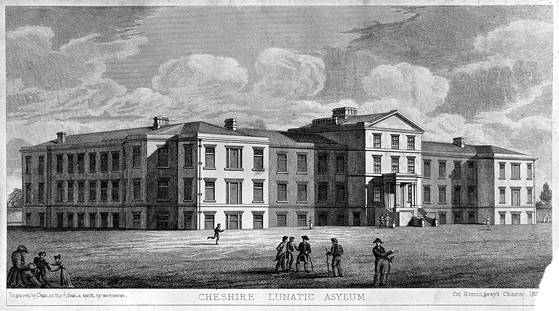
The 1829 Building, built as Cheshire’s first lunatic asylum and now part of the Countess of Chester Hospital
The Countess of Chester Hospital was, until 1968, a mental health hospital. It had been established as the county lunatic asylum in 1829, a progressive institution which, particularly under Thomas Nadauld Brushfield, attempted not merely to confine patients but to understand and treat mental illness. I have written a considerable amount about the lunatic asylum in the 19th century on this blog here. In 1968 it became a general hospital and in 1977 began to expand to become the central general hospital for the region.
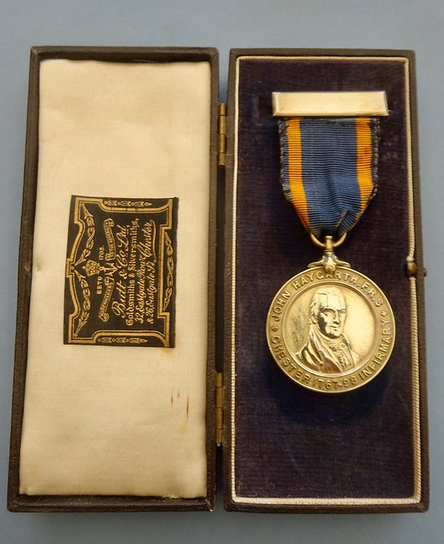
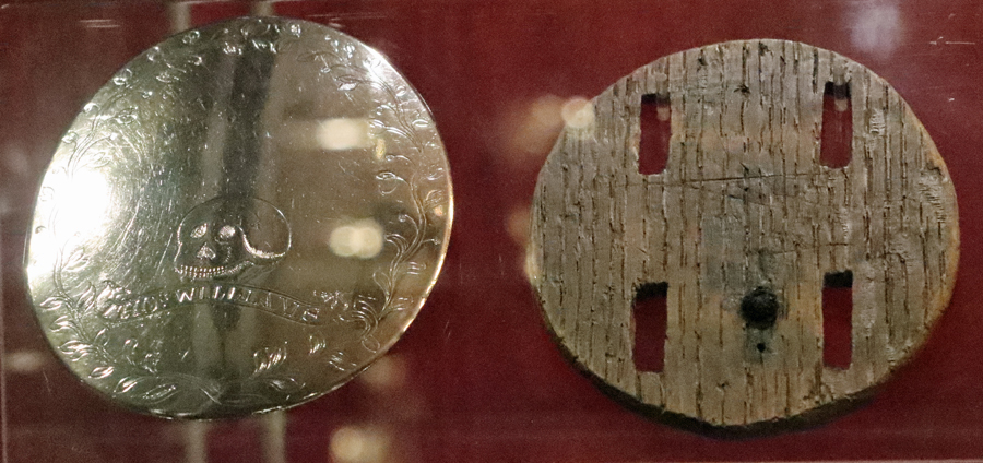
The Haygarth Medal, , Chester Infirmary. Source: Peter’s Nursing Collectibles (with permission)
The relationship between hospital, lunatic asylum and workhouse (most of which had their own medical wings for inmates) was complicated, but there was increasing recognition that medicine and patient care needed to be both professionalized and standardized. This is first visible in the increasing care invested in new hospital buildings. The architecture of both the Infirmary of 1761 and the Cheshire Lunatic Asylum of 1829 demonstrate the civic pride that lay behind these institutions. The buildings were not merely functional-looking cornflake-box buildings, but imaginative statements of philanthropic commitment, self-confidence and investment in society, as well as representing more than a little self-congratulation. Not all of the nation’s medical institutions were able to put well-meant ideals into practice, but on the whole the Chester medical establishments seem to have had the best of intentions and to have attracted good professional people to head up their medical enterprises.
In the late 19th century the Chester Infirmary began to award a silver medal each year to the best nurse at the Infirmary, recognizing that rewarding high standards was an important part of encouraging improvements in the profession as a whole. In honour of its pioneering physician Dr John Haygarth, it was named the Haygarth Medal, at left. The tradition of awarding badges and medals had a long pedigree in the military and the use of the same idea to recognize achievements and promotions was one of the most important tools used to demonstrate the professionalization of nursing.
xxx
The professionalization of nursing and associated symbols of achievement
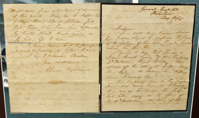
Original letter written by Florence Nightingale at Baklava to a soldier’s family, preserved at the Riverside Museum, Chester
The best know of the pioneering nurses is Florence Nightingale (1820-1910). She had introduced many important new initiatives, such as providing fresh air, clean conditions, warmth, quiet and a good diet. She recognized that nursing was regarded as little more than domestic service that attracted those without either skills or education, many of whom were very unsuitable. On her return to England, after the war ended in 1856, Nightingale established a school for nurses, funded with public contributions. It opened in 1860, provided year-long training, and was highly selective about the intake of trainees. Interestingly, Nightingale was not in favour of establishing national uniformity in the professional standardization of nursing. Instead, she believed that a letter of recommendation from her training school was sufficient recommendation.
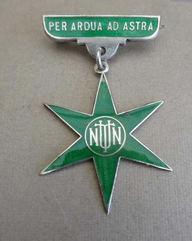
Badge of the National Union of Trained Nurses. Source: Peter’s Nursing Collectibles
It was another professional nurse, Ethel Gordon Fenwick (1857-1947), a matron of St Bartholomew’s hospital in London, who became one of the principal activists for the standardization of professional training and the introduction of qualifications. Because nursing was the almost exclusive activity of women, the work to professionalize nursing was most often undertaken by female activists in an era long before women had won the right to vote for the first time in 1918. Ethel Gordon Fenwick campaigned for the registration of nurses as a way of establishing universally accepted standards in nursing associated with acknowledged skills and integrity. In 1887 she established the British Nurses Association to campaign for registration, and issued both certificates and badges to nurses who were deemed to have met the Association’s high standards. This was eventually followed in c.1910 by the National Union of Trained Nurses, which again issued certificates and badges. Its badge, in the shape of a star, had the legend , with the legend translated as “per ardua ad astra,” a Latin phrase meaning “through adversity to the stars.”
College of Nursing Badge. Source: Peter’s Nursing Collectibles
Although a pioneer in her own right, Ethel Gordon Fenwick was not alone, and other institutional bodies were set up to push forward registration and standards, often in competition with one another. These different bodies were eventually superseded in 1919 when the Nurses Registration Act was passed and the College of Nursing was established, and the registration of nurses began on 30th September 1921, entitling nurses to refer to themselves as State Registered Nurses (SRNs). Ethel Gordon Fenwick signed the register in that year, becoming the first SRN. This new institution continued the tradition of issuing a badge, which had the initials CN surrounded by the motto “The College of Nursing founded MCMXVI,” accompanied by the emblematic flora of the four nations. It was updated a number of times, notably in 1946 when it was provided with the motto Tradimus Lampada, “We pass on the torch,” a reference to Florence Nightingale and her pioneering work to establish standards in patient care.
Nurses’ badges, which began to be awarded after the middle of the 19th century displayed affiliation to a value system, an ideology, a profession and an institution, whilst at the same time providing a sense of personal achievement and pride. They were also, much like military and ecclesiastical training awards, part of the process of ensuring that nurses adopted not only practical methodologies and procedures, but also particular patterns of behaviour and responsibilities. The messages incorporated into these badges were not only recognized by other health professionals but also provided reassurance to patients and their families. For women, always the minority in professional life up until the mid 20th century, it was an important indication of their increasingly important roles and skills in a medical environment.
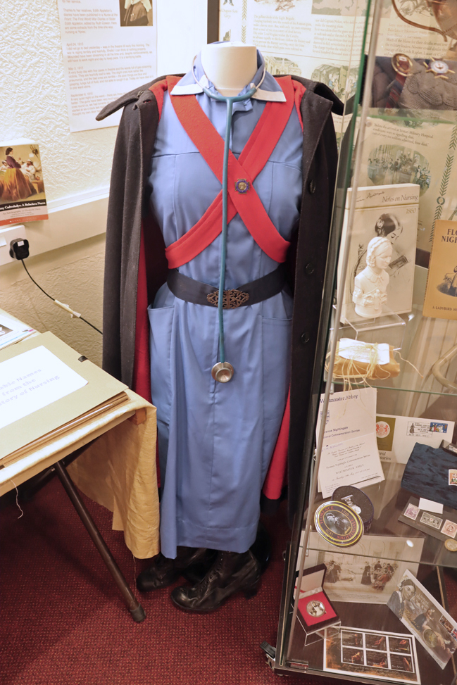
Nurse’s uniform on display at the Riverside Museum, Chester
Although by the later 19th century badges of honour and office were already popular, they acquired a new momentum as different segments of society began to recognize the importance of conforming to agreed professional standards at work. Nurses’ uniforms and badges were developed side by side with growing professional standards and the recognition that nurses, delivering hands-on care, required training, examination, and qualifications to ensure that the ever changing medical advances were incorporated into the daily routines of the hospital wards. The development of recognized formal standards and the uniforms and badges that indicated them, gave nursing a new sense of its own professional integrity, and value to society. Nursing badges were adopted by both the state, to recognize national awards, and by individual hospitals to recognize the achievements of their own nurses who had been trained according to that establishment’s own standards and specializations. This introduced some competition between hospitals, as some establishments became more prestigious than others, and issuing badges was a way of attracting nurses who wished to share in that prestige.
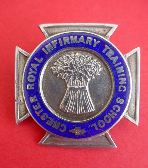
Chester Royal Infirmary Training School, combining the Maltese Cross with the wheat sheaf of Chester. Source: Peter’s Nursing Collectibles
State badges were eventually standardized. In 1919 the Nurses Registration Act introduced a single badge for all nurses who qualified, and continued to be a valuable part of a nurse’s uniform for over 70 years. Individual hospital badges continued to be far more eclectic and there are hundreds of styles and shapes of individual hospital badges. There was often a “pinning of the badge” ceremony to mark the transition of a nurse when she had finished her training or passed certain examinations, associating the badge with a sense of ceremony and occasion.
Themes represented on British badges were very varied. Some early examples were based on the Maltese Cross emblem of the Knights of St John. Others had Christian imagery to reflect the nurture, care and charitable character of nursing. Some had heraldic themes. Lamps, referencing Florence Nightingale, were popular. The Rod of Aesculapius is a recurring emblem.
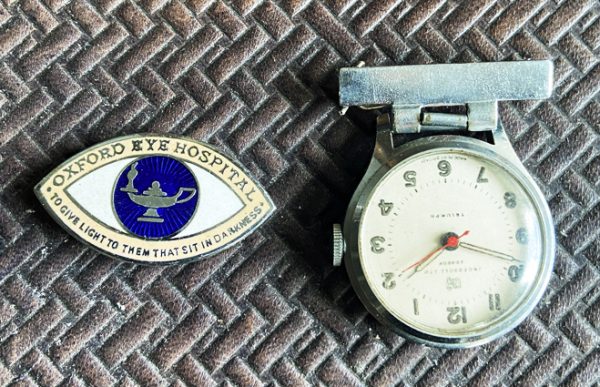
My mother’s Oxford Eye Hospital badge, in the shape of an eye with the emblem in the eye’s pupil, together with her fob watch
Specialist institutions might have imagery showing the nature of the specialization; images of mother-and-child were popular with midwifery, for example. Some simply displayed initials of the institution. Many included a motto around the edge or on the cross-bar. My mother became an ophthalmic nurse at the Oxford Eye Hospital after leaving school, and I still have her nurse’s badge, shown here, in the shape of a human eye with the image of a lamp symbolizing Florence Nightingale at its centre, in the pupil of the eye. The motto that sits along the base of the badge reads “To give light to them that sit in darkness.”
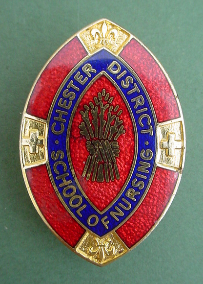
Chester District School of Nursing. Source: Peter’s Nursing Collectibles
In Chester hospitals, the wheat sheaves first associated with the 5th Earl of Chester from the 12th century were popular, such as that from the Chester School of District Nursing shown left and the Chester Royal Infirmary Training School above.
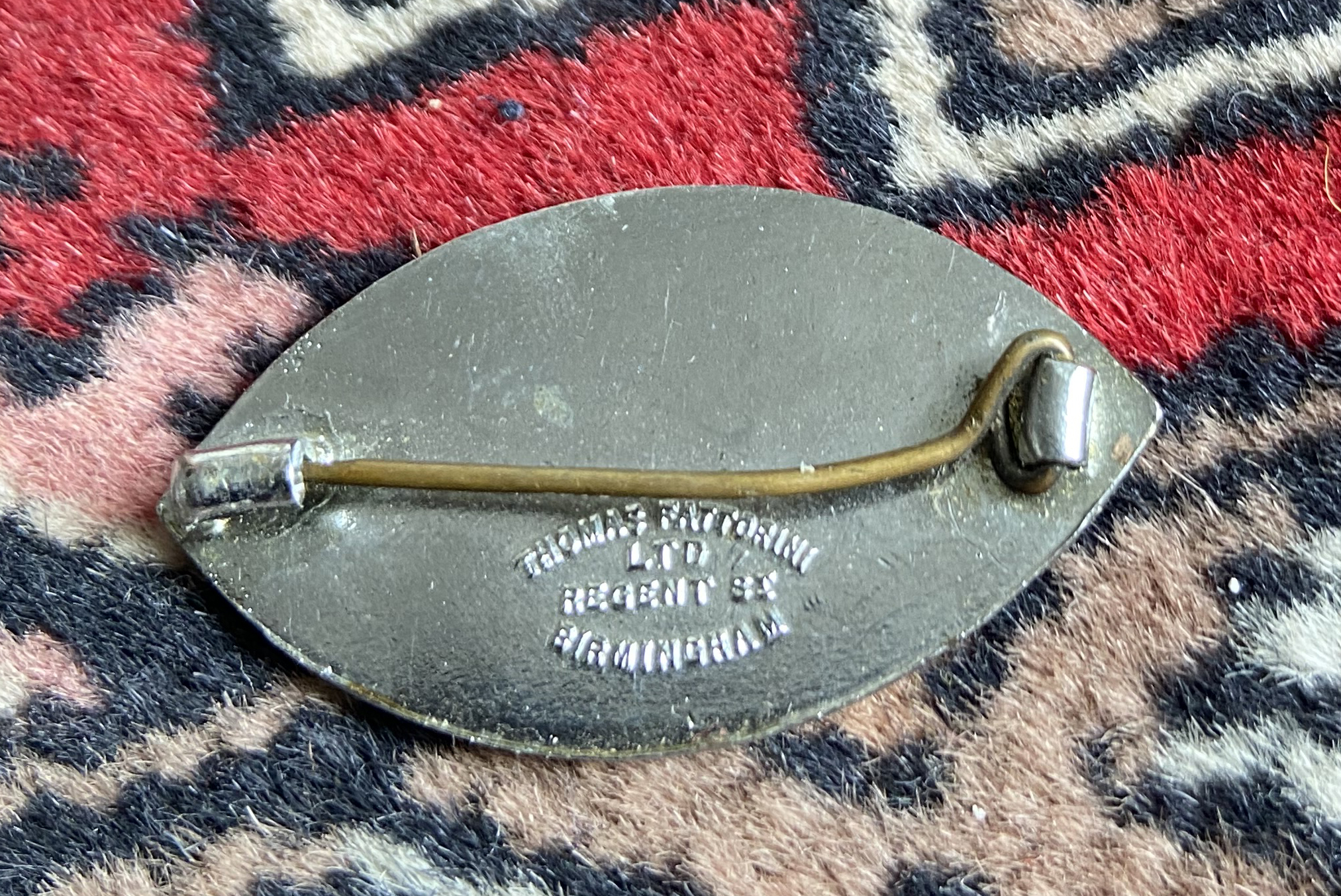
In the 20th century the principal manufacturer of nurses’ badges was Thomas Fattorini, in Birmingham. It is estimated that around 400 different UK nurses badge designs were produced in the 1970s and 80s alone. State badges ceased to be issued in 1983 when statutory bodies were reorganized under a central council. The tradition of issuing hospital badges also began to go into decline when the shift was made from hospital-based training to nursing colleges. Nurses’ badges are now, however, very popular with collectors so although they are now more matters of heritage than ongoing relevance, their survival seems secure.
xxx
The reverse side of a Thomas Fattorini Badge made for Oxford Eye Hospital
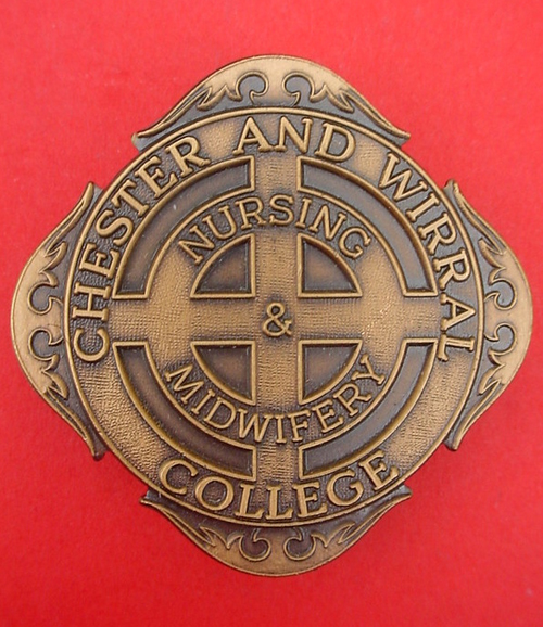
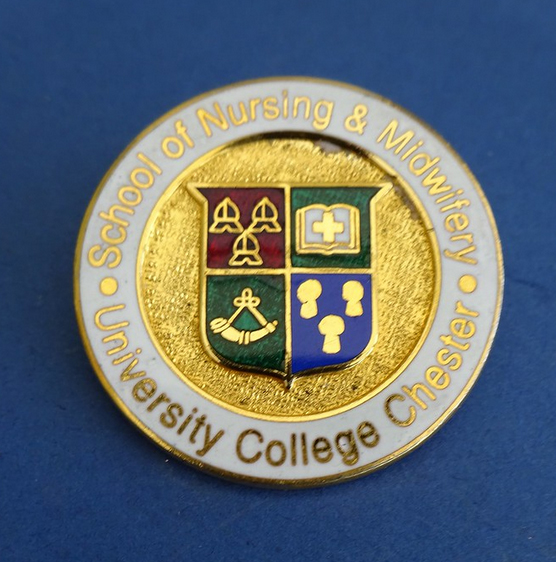
School of Nursing and Midwifery, Chester. Source: Peter’s Nursing Collectibles.
In conclusion, the professionalization of nursing and the recognition of nurses’ achievements was aided by the deployment of uniforms and badges that indicated the role of the women who wore them, and later men too. These uniforms and badges reflected social reform in which the growing recognition of the role of women outside the home and beyond the menial were increasingly recognized. The badges visibly demonstrated qualifications and abilities to their patients, their colleagues, their managing institutions and to society as a whole, creating a framework of recognition and respect. Perhaps just as importantly it provided the nurses who earned them with a sense of status and self-worth. The badge was not something that a nurse simply wore, but an emblem of honour and achievement indicating a personal commitment and attitude to a vocation involving both practical and book learning in which she not merely participated but in which she had been tested and at which she had excelled.
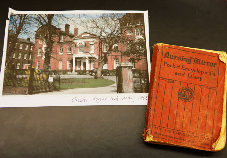
Photograph of the Chester Royal Infirmary in 1968, together with The Nursing Mirror Pocket Encyclopaedia and Diary. Riverside Museum, Chester.
I have referred to nurses throughout this short piece as female, as most nursers were, for most of nursing history. In mental health institutions male attendants were an absolute necessity for their physical strength rather than their medical skills, working alongside female nurses, but from the mid-19th century, and particularly during the two World Wars, men were serving as medics in first aid and nursing capacities in the military, as part of the Royal Army Medical Corps (RAMC), often at the front lines. Legal recognition for male nurses in Britain occurred in 1919 with the introduction of the Nurse Registration Act; the first male State Registered Nurses (SRNs) were registered in 1922. The first male SRN was George Dunn of Liverpool who had trained in the RAMC.
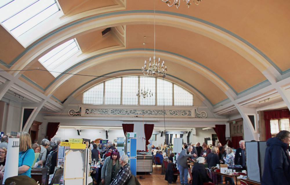
The Riverside Museum
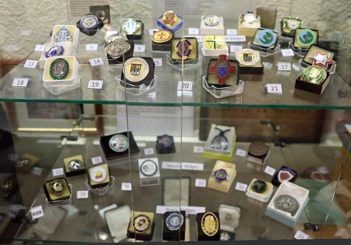
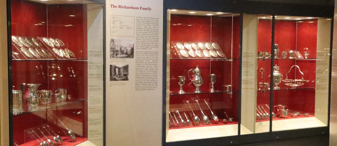
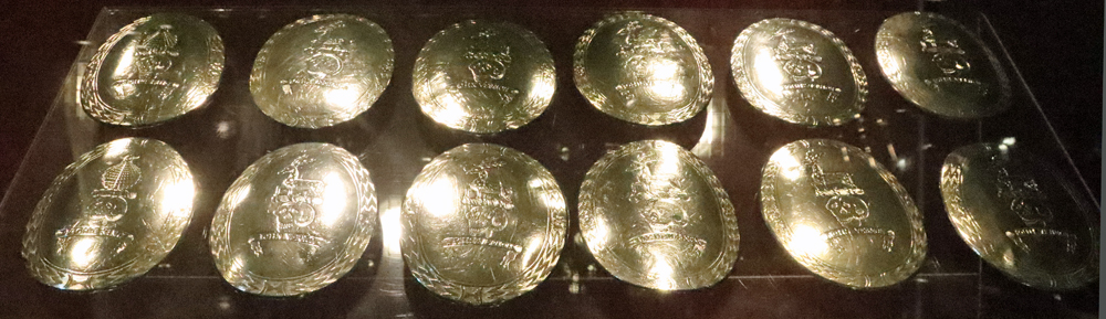
Nurses’ badges at the Riverside Museum, Wheeler Building, Chester
The Riverside Museum in Chester contains a rich assortment of items that relate to medicine, nursing, midwifery and related health services. In one display cabinet there are numerous nursing badges. They all come from Chester, the Wirral and elsewhere in the region, and they are all different shapes, sizes and colours with different motifs. Based on the model of military uniforms and medals, the nurses’ uniforms and state-awarded badges were intended to identify nurses as fully trained and qualified health professionals. Other badges additionally identified specific hospitals and specializations. The emblems, badges and uniforms formed a symbolic representation of skill, status and role within the healthcare community.
Riverside Museum
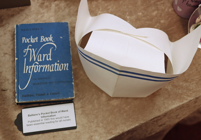
What is clear from the Riverside Museum is that as well as badges and uniforms, nurses had a plethora of written material to support them – pamphlets, handbooks, mini encyclopaedias and, later, textbooks. As well as used as training materials, they continued to be valuable for reference on the job, and new volumes helped to keep nurses up to date with the latest techniques and practices. These demonstrate not merely the standard that the nurses reached, but also the commitment to ongoing improvement.
If you have not heard of the Riverside Museum, it is probably because of its opening times. The museum is run by volunteers and its opening times are confined to once a month during term time, and on certain days during the Chester Heritage Festival and the Festival of Ideas. You can find their opening times for 2026 here.
School of Nursing and Midwifery. University College Chester. Source: Peter’s Nursing Collectibles.
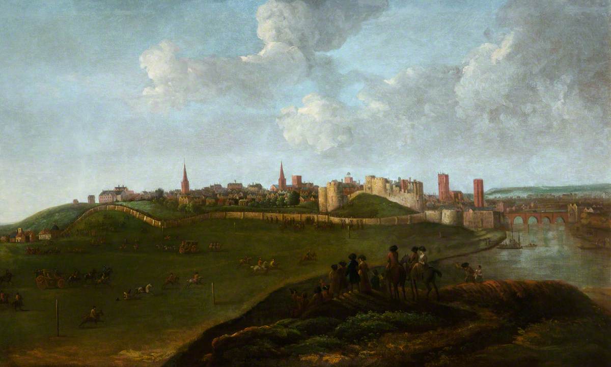
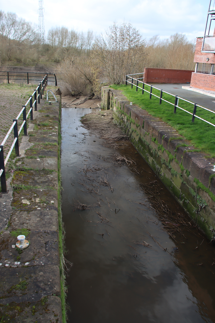
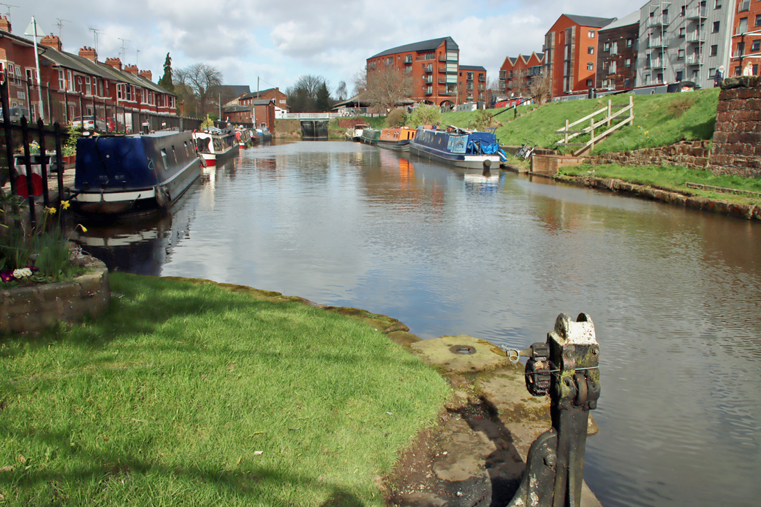
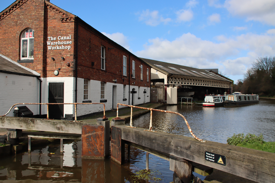
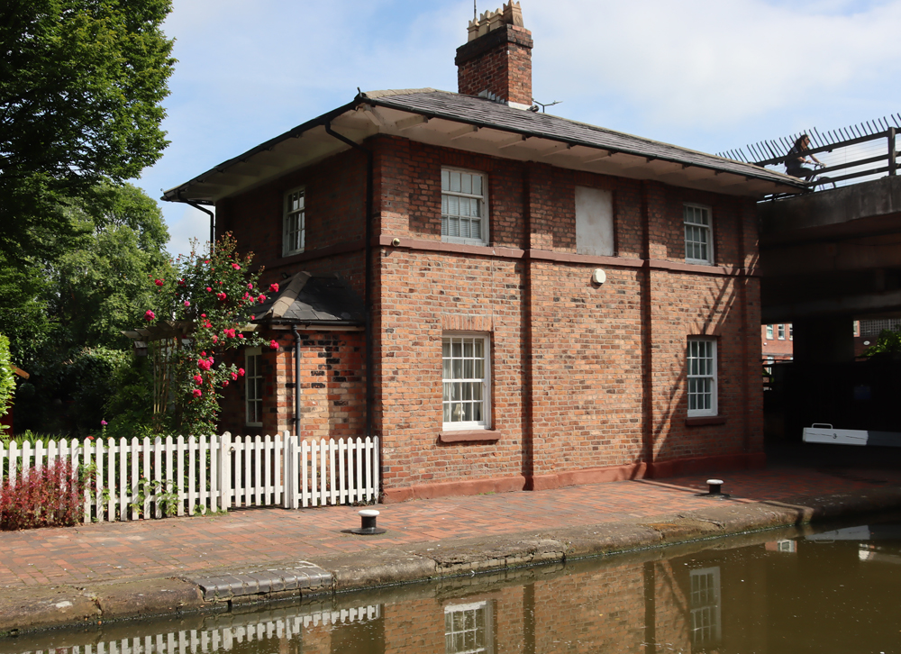
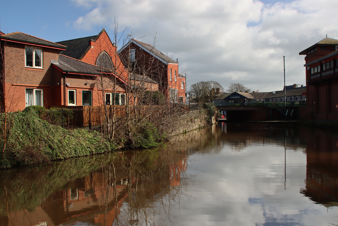
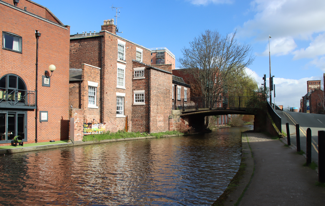
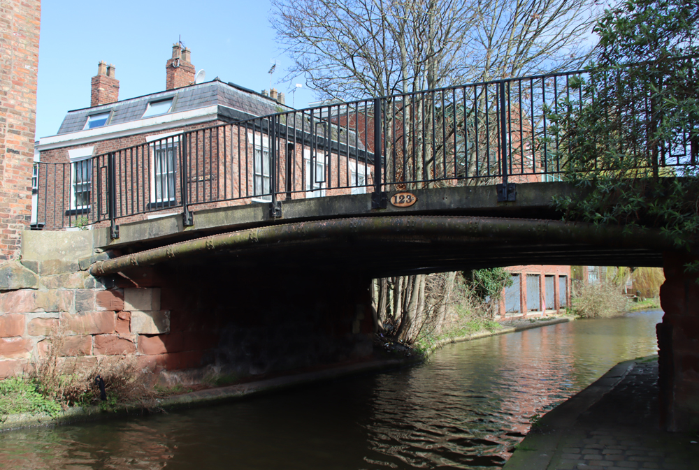
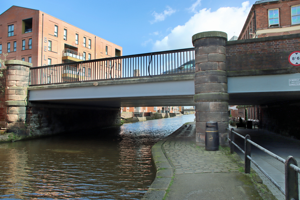
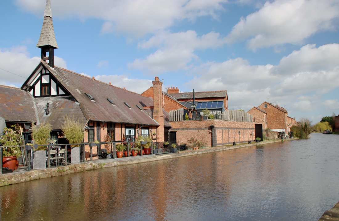
Do note that the opening times usually coincide with a free lecture series organized by the Faculty of Health, Medicine and Society Historical Society, also listed on the link above. These lectures are excellent, and it is well worth planning to combine a visit to the museum with attendance of a lecture. The Museum also accepts group bookings for six or more people by arrangement. The museum is located in the Wheeler Building, which was the former County Hall, the Cheshire County Council headquarters building. It sits on the northern bank of the Dee between the 14th century Old Chester Bridge and the 1832 Grosvenor bridge, overlooking the river. A map is available at the bottom of the Wheeler Building’s web page here.
Many and sincere thanks are owed to Peter Maleczek for giving me permission to use the images from his website Peter’s Nursing Collectables at https://petersnursingcollectables.com/home.php and his Flickr page at https://www.flickr.com/search/?user_id=36611823%40N07&sort=date-taken-desc&view_all=1&text=chester
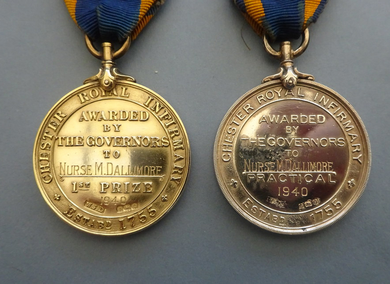
Chester Royal Infirmary prize medals, both engraved to Nurse M. Dallimore in 1940. Source: Peter’s Nursing Collectibles
Sources:
Books and Papers
Barrow, J.S., J.D. Herson, A.H. Lawes, P.J. Riden, M.V. J. Seaborne 2005. Local government and public services: Medical services. In A.T. Thacker and C.P. Lewis (eds.) A History of the County of Chester: Volume 5 Part 2, the City of Chester: Culture, Buildings, Institutions. British History Online
https://www.british-history.ac.uk/vch/ches/vol5/pt2/pp49-58
Bates, Christian 2010. Looking closely: Material and visual approaches to the nurse’s uniform. Nursing History Review vol.18, p.167-88
https://www.proquest.com/docview/207237406?sourcetype=Scholarly%20Journals
Callander-Green, Stephen 2001. Nurses’ Badges: Archaic Symbols or Icons of Nursing? International History of Nursing Journal, vol.6, iss.2, p.71
https://www.proquest.com/docview/218742979?pq-origsite=gscholar&fromopenview=true&sourcetype=Scholarly%20Journals
Carrington, P. 1994. Chester. Batsford / English Heritage
Catanzaro, Ana Maria 2002. Beyond the Misapprehension of Nursing Rituals. Nursing Forum, vol.37, No.2, April-June 2002, p.17-27
https://onlinelibrary.wiley.com/doi/abs/10.1111/j.1744-6198.2002.tb01194.x
Edelweiss, James 1992, 2009. Collecting Nursing History 6. Pictorial History – Collecting Nursing Badges. School of Nursing.
https://www.schoolsofnursing.co.uk/Articles/EdelweisJBA1.htm
Laughton, Jane 2008. Life in a Late Medieval City. Chester 1275-1520. Windgather Press
Mason, David 2001, 2007 (2nd edition). Roman Chester. City of the Eagles. Tempus
Richardson, Harriet (ed.) 1998. English Hospitals 1660-1948. Royal Commission on the Historical Monuments of England
Risse, Guenter B. 1999. Chapter 1. Collective Care of Soldiers and Slaves: Roman Valetudinaria. In (ed.) Guenter B. Risse. Mending Bodies, Saving Souls: A History of Hospitals. Oxford University Press
https://www.researchgate.net/publication/273441350_Collective_Care_of_Soldiers_and_Slaves_Roman_Valetudinaria
Strickland, Tim 1982. Chester. Current Archaeology 84, vol. 8, no.1, October 1982, p.6-12
Thacker, Alan 1995. The reuse of the monastic buildings at Chester, 1540-1640. Transactions of the Historic Society of Lancashire and Cheshire, vol. 145 (1995), p.21-43.
https://hslc.org.uk/wp-content/uploads/2017/05/145-3-Thacker.pdf
Wildman, Stuart 2020. Nursing history: the first male nurses: Who were the first male nurses? Royal College of Nursing Magazine, April 29th 2020
https://www.rcn.org.uk/magazines/History/2020/Nursing-History-Now-first-men-nurses-on-register
Wildman, Stuart 2023. What’s On a Badge? Using material culture to illustrate the professionalism of nursing. Bulletin of the UKAHN, vol.11 (1)
https://bulletin.ukahn.org/whats-on-a-badge-using-material-culture-to-illustrate-the-professionalization-of-nursing/
Websites
Based in Churton
The Cheshire Lunatic Asylum 1854-1870 – Part 2.1
https://wp.me/pcZwQK-6oU
The Cheshire Lunatic Asylum 1854-1870 – Part 2.2
https://wp.me/pcZwQK-7ts
Roman Inscriptions in Britain
RIB 461 and RIB 3151
https://romaninscriptionsofbritain.org/inscriptions/3151
School of Nursing
Sue Sullivan. Collecting Nursing History – Nursing Badge Design.
http://www.schoolsofnursing.co.uk/Articles/Badgedesignx.htm
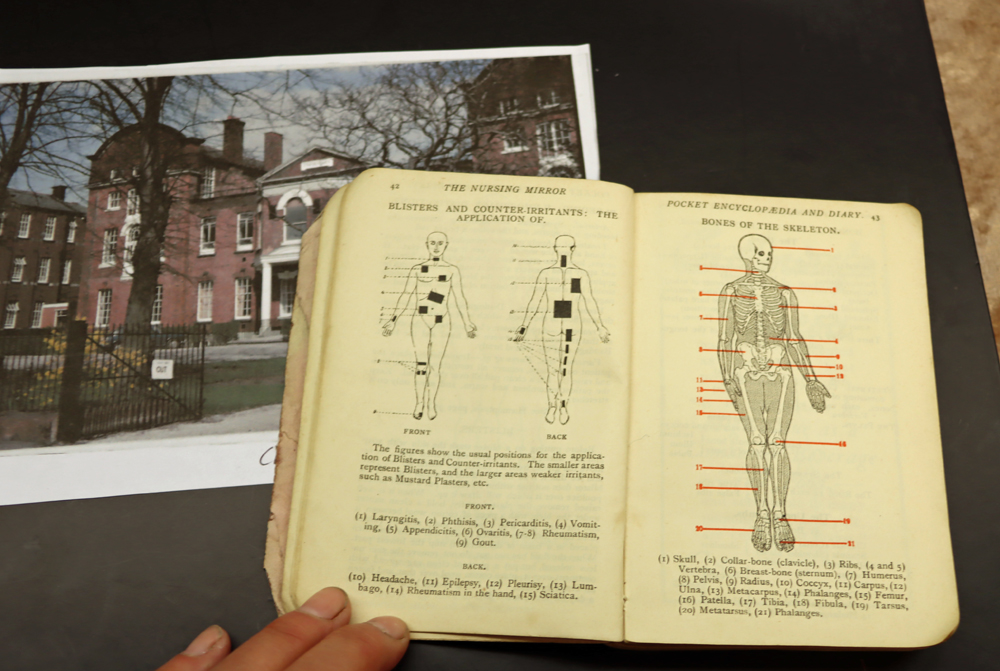
Pages from the Nursing Mirror Pocket Encyclopaedia and Diary. Riverside Museum, Chester


#/media/File:John_Douglas_(architect).jpg)
#/media/File:Grosvenor_Bridge_Chester.jpg)