Category Archives: Heritage

Chester Amphitheatre – the Grosvenor Museum exhibition and the University of Chester’s upcoming VR experience

After a successful expedition in to Chester, which included an excellent coffee break with 3-D artist Julian Baum (Take27), I went to see the Grosvenor Museum’s Chester Amphitheatre – An 8000 year story exhibition, running until 12th July, in which one of Julian’s reconstruction images is included.  Julian has also been working on the Our City, Our Story: Deva Victrix project under the auspices of the University of Chester, run by Dr Caroline Pudney (Senior Lecturer in Archaeology), which explores how Virtual Reality (VR) and the application of Artificial Intelligence (AI) can contribute to an interactive experience of the amphitheatre.  This project was showcased in Chester on Saturday 23rd May.  I mention Julian Baum’s work not merely to give him a shameless (although well-deserved) plug, but because the work he contributed to last year’s Gladiators of Britain, the current Chester Amphitheatre exhibition and the upcoming Our City, Our Story VR and AI project are examples of how the trend from static and video reconstruction towards more interactive experiences can complement traditional approaches to provide richer visitor experiences, discussed further below.

The "Chester Amphitheatre" exhibition

The “Chester Amphitheatre” exhibition

The Chester Amphitheatre exhibition is a stand-alone exhibition, complete in its own right, but for those who attended Gladiators of Britain (about which I posted, with a description of the amphitheatre on the blog here), the continuity of themes between the two exhibitions works very nicely, although as the name of the current exhibition indicates, this is not just about the Roman period.  This multi-period approach to the amphitheatre is the exhibition’s major strength, providing an excellent sense of how the same chunk of land has been used from the post-glacial period until the present day.  Apologies for the poor photographs.  I accidentally left my camera at home and they were taken with my elderly iPhone.  As anyone who follows the blog will know, I am rubbish with the thing!

The exhibition space, in Gallery 1 on the ground floor, is well thought out and very elegantly laid out, with a combination of interpretation boards on the walls, artefacts displayed in well-lit cabinets and clear labelling to identify individual objects.  It begins with details of the excavations, from which an understanding of the site was obtained, and then follows a chronological path, beginning with the Mesolithic (meaning Middle Stone Age, the period that starts in the post-glacial period).

The site was first explored in the early 1930s by Professor Robert Newstead, curator of the Grosvenor Museum at the time, and Dr J.P. Droop.  Although it had been assumed, on the basis of other legionary sites in England, that an amphitheatre had existed at Deva, its location was unknown, and it was not until a new road was laid out in 1929 that Roman remains were found and the amphitheatre was identified.  The road would have sliced across the top half of the amphitheatre, but following the discovery of Roman remains was thankfully re-routed to run around it instead of across it, allowing the site to be preserved and enabling further excavations to take place.  The most recent of those was the excavation project established by English Heritage and the former Chester City Council, lead by Tony Wilmott and Dan Garner between 2004 and 2006, published in 2018.  These excavations resulted in a re-evaluation of the Roman amphitheatre and its phases, and provided invaluable information about both its pre-Roman and post-Roman periods.

It is one of the interesting aspects of work into the later prehistory of West Cheshire, that wherever an archaeologist happens to poke a trowel, at both hillfort and lowland sites, earlier prehistoric material is likely to be found.  The type of material often found is epitomized by the finds at the amphitheatre.  The Mesolithic was characterized by very small stone tools called microliths, and a selection of these were found on the amphitheatre site, together with waste products from the manufacturing process, showing that the tools had been made on the spot.  Neolithic and/or Early Bronze Age tools, again made of stone, are also represented and these too are found all over the Cheshire area.

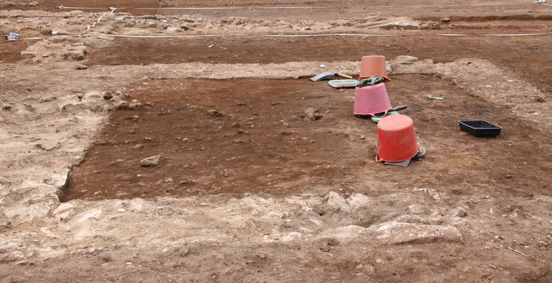
One of the most exciting discoveries of the excavation was the previously unsuspected presence an Iron Age settlement, made up of round houses and rectangular buildings, as well as portions of a cord-rig field system, very like medieval ridge-and-furrow.  Two photographs show details of one of the foundation features of one of the round-houses and a section of cord-rig as they were found during the excavation.  There is a particularly nice sherd of specialist pottery on display, known as VCP (Very Coarse Pottery), that was used for producing and transporting salt.  A highly corroded spear tip was also discovered, one of the few pieces of Iron Age metalwork to survive in the area due to the highly acidic soil.  Both are shown to the left.
xx

Photograph of the excavation showing a section of Iron Age field system

Photograph of the excavation showing a section of Iron Age field system

xx

Chester Amphitheatre exhibition

The Roman amphitheatre is inevitably the main focus of the exhibition, which is unsurprising given its scale and duration.  Now understood to consist of two main phases, having been expanded in its second phase, it was in use from c.AD 74/75.  It is estimated that the second phase of the amphitheatre could have accommodated up to between 7500-8000 spectators and it is to this phase that two of the larger objects in the exhibition belong: the tethering stone to which wild animals would have been tied, and a coping stone (rounded stone topping for a wall) that contains the inscription “SERANO LOCUS,” roughly meaning “Serano’s Place,” possibly an attempt to lay claim to a particular seat that sat behind the low wall.  The many other Roman artefacts on display include ornaments, gaming pieces, pottery (samian ware, grey ware, orange ware etc) and other items made of metals and glass.


SERANO

Capstone engraved SERANO LOCUS

Saxo-Norman artefacts

A display of Saxon-Norman objects demonstrates that there may be some degree of continued use of the amphitheatre’s space after the Roman abandonment of the site, albeit for a completely different purpose.

The excavations have also helped to clarify some of the medieval structures associated with the Romanesque St John the Baptist’s Church (at one point Chester’s cathedral) and how its churchyard encroached on the original amphitheatre during the Middle Ages.  The other side of the churchyard’s footprint, extending into the Grosvenor Park, is currently under excavation by West Cheshire Museums and the University of Chester.

Medieval jug

Medieval jug

xx
Post-medieval finds demonstrate how, as the amphitheatre was gradually lost due to stone robbing for other buildings, the accumulation of debris and ongoing building works as Chester continued to expand beyond the walls, the former amphitheatre site continued to be occupied, and broken objects continued to be abandoned, as they are today. A particularly nice find was a pit dug in Tudor times, containing a fascinating array of broken, discarded items.  Civil War finds included lead gun shot and the remains of gunpowder holders.  There is even a fabulous packet for a loaf of bread with a pre-decimalization price printed on it, with bright, happy colours, a splendidly cheery tiger and the strapline “The Swinging New Bread.”  Very 60s!  See below.

Detail of John McGahey’s 1852 painting of Chester from an air balloon (with my rough indicator of location of amphitheatre in red show how completely the amphitheatre area was covered over).

Detail of John McGahey’s 1852 painting of Chester from an air balloon (with my rough indicator of location of amphitheatre in red show how completely the amphitheatre area was covered over).


The Chester amphitheatre’s tethering stone

xx

Brilliant bread packet, pre-decimalization, which was implemented in 1971

Brilliant bread packet, pre-decimalization (which was implemented in 1971)

The amphitheatre through the ages, an excellent illustration covering an entire wall of the exhibition, demonstrating how different periods are captured in the vertical stratigraphy of the site. By India Hackett

The amphitheatre through the ages, an excellent illustration by India Hackett covering an entire wall of the exhibition, demonstrating how different periods are captured in the vertical stratigraphy of the site, including a Civil War canon, the tethering stone on the Roman level, flanked by gladiators, and the Iron Age roundhouse and fields being ploughed beneath.


The Chester Amphitheatre exhibition at the Grosvenor Museum runs until 12th July 2026
.  Access to the exhibition is free of charge.  For the Grosvenor Museum’s opening times, see their website for information here: https://grosvenormuseum.westcheshiremuseums.co.uk/

The University of Chester’s Virtual Reality approach to the same amphitheatre site during the Roman period (Our City, Our Story: Deva Victrix in VR), was showcased for the first time on  Saturday 23rd May, 11am – 4pm in Exchange Square (Northgate St).  Julian Baum and other key members of the project team, were all on hand to provide insights into how visitors of the very near future will be able to interact directly with virtual Romans in a reconstruction of their original setting.  Feedback is seen as part of the project design and when people filled in the feedback forms, was very welcome.

Image from the "Our City, Our Story: Deva Victrix in VR" project

Image from the “Our City, Our Story: Deva Victrix in VR” project.

Accuracy has been of great importance to the project.  The VR model of the amphitheatre itself, for example, is derived directly from the data unearthed in the excavations that are the subject of the museum’s exhibition and was developed by Julian in conjunction with Tony Wilmott, one of the site’s excavation directors.  The animated Roman residents of Deva Victrix, developed by VR company Imito, help to bring the amphitheatre to life, allowing visitors to participate and interact with Roman soldiers and other characters.

Although the museum exhibition and the VR project are separate entities, run by the museum and the university respectively, the two approaches, traditional and virtual, have the potential to work in tandem and to complement each other very well.  The current museum exhibition presents the physical and tactile raw data (artefacts and architectural components) and uses interpretation boards to create an empirical understanding of how data is translated into knowledge about the amphitheatre.  Nothing can replace artefacts as evocative components of the past, but the information derived from them can be handled in a number of different ways.  Although running as a separate project, the VR approach demonstrates the potential for a more interactive and immersive exposure to a vision of the past that allows a relationship with history to be formed, however briefly.  The combination of artefacts and displays of the information they impart, supported by immersive experiences, may provide a glimpse of the future of how history could be communicated and how people may begin to explore their past in a variety of different ways.

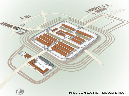
Julian Baum’s reconstruction of the fortress at Chester and the outer buildings in the mid 3rd Century.

The Riverside Museum, the development of hospitals in Chester and the professionalization of nursing

Introduction

After writing a 4-part series on the 1829 Cheshire Lunatic Asylum (its original 19th century name), which introduced me for the first time to medical history, I became interested in how hospitals other than mental institutions developed in the United Kingdom.  This post, offering a brief snapshot of how nursing staff built a sense of professional identity from the 19th century onwards, with particular reference to Chester, followed a visit to the Riverside Museum in Chester with its collection of nursing objects, including a cabinet full of hospital badges.

A brief background to hospital care in Chester

Eye Doctor Stamp from Wroxeter. SHYMS A/2008/00133

Eye Doctor Stamp from Wroxeter, now in the the Shrewsbury Museum and Art Gallery. SHYMS A/2008/00133

Medicine in one form or another has always been present. Doctors were in England in the Roman period.  A nice example of a Roman emblem of medical authority is an eye doctor’s stamp from the Roman town of Wroxeter near Shrewsbury, now in Shrewsbury Museum and Art Gallery.  Roman doctors and surgeons often treated their patients in the public baths, which were major community gathering places and health facilities but most legionary fortresses would also be equipped with a valetudinarium, a place for those needing help with valetudo (health), an early predecessor of the hospital.  In a British legionary fortress this building was usually located opposite the city baths for convenience, but although the Chester (Deva) city baths are known to have been located on the east side of Bridge Street, sadly the valetudinarium has not been definitively located.  Tim Strickland suggested, albeit tentatively, that it might be the building found in the 1982 excavations to the east of the barracks, on the west side of Northgate Street, a little way north of today’s Town Hall.  This is given support by some fascinating evidence for the presence of medical expertise in that area in the form of two altars dedicated by doctors to suitable deities.  Documented as RIB 461 and RIB 3151 they were both inscribed in Greek, implying that the doctors were themselves Greek, and were found on the west side of Northgate Street. Both are now in the Grosvenor Museum, Chester.  David Mason offers the alternative suggestion that the traces of primary timber buildings opposite the baths could feasibly be the  valetudinarium, but the remains were too meagre for any function to be determined.

Tim Strickland's reconstruction of the Princess Street Excavations, showing the possible hospital building in the background

Tim Strickland’s reconstruction of the Princess Street Excavations, showing the possible hospital building in the background. Source: Strickland 1982

In the later medieval period, badges and medals were adopted in secular, military and ecclesiastical contexts to identify status, beliefs and achievements.  Pilgrims to the St Werburgh shrine, in St Werburgh’s Benedictine Abbey, what is now Chester Cathedral, purchased pilgrim badges not only as souvenirs of their journey, but to identify themselves as actively committed to acts of Christian faith,or in gratitude for prayers being answered.  Pilgrimages could be undertaken for a variety of reasons, but a major draw was the possibility of a saint interceding in response to prayers for curing illness or disability.  Accumulated badges were attached to clothing and bags.  These were of course emblems purchased by the pilgrim.  They were not awarded by others to pilgrims in recognition of their devotion, but they communicated a powerful sense of affiliation and achievement.

St Werburgh’s Abbey pilgrim badge. British Museum 1836,0610.73

Chester’s very first infirmary was probably that of the medieval St Werburgh’s Benedictine Abbey, founded in 1092.  As with most abbey complexes, the infirmary was a separate building that provided elderly and infirm monks with a more relaxed regime and better food than enjoyed by the rest of the monastic community, but was not necessarily concerned with the most of the market town’s community beyond the monastic walls.  The location of the infirmary, which was usually a separate building and often set as one side of a second cloister (square of monastic buildings) is not known, although Alan Thacker suggests it might have been to the east of the surviving cloister.

By contrast, the 12th century St Giles leper colony was dedicated to the care of anyone with the terrible Hansen’s Disease, better known as leprosy, caused by the bacteria Mycobacterium leprae.  Like most leper colonies, it was outside the town, located about a mile away from Chester in Boughton.  As was traditional with leper hospitals, it was located at a fork in the road, an optimal location for lepers to beg for alms heading into and out of Chester via the Eastgate.  It later became more of an almshouse, until it was knocked down at the start of the Civil War in 1643.  The remains of the hospital’s cemetery is still visible as a patch of raised grass just beyond the fork where Tarvin Road and Christleton Road split.

Artist’s impression of Birkenhead Priory as it may have looked in the 14th century by E.W. Cox c.1896.

Just outside the city walls, the charitable St John The Baptist Infirmary (known locally as Little St John’s to distinguish it from the Church of St John the Baptist) was established in around 1190 to take care of the elderly and infirm within the town, specializing in the care of the impoverished.  Like most hospitals it was equipped with a church and a cemetery.  Thirteen beds were reserved for the city’s impoverished, but could take in other patients when capacity permitted.  There were always problems with the financial management of the hospital, which R. Stewart-Brown puts down to the policy of renting out the hospital’s properties in return for fixed sums, which could not be adjusted when costs rose.  Matters reached a head in February 1315-15 when a public inquiry was held and it was decided to give responsibility to Birkenhead Priory, but this was apparently fairly short-lived.  The hospital was demolished in 1644.

In 1510  a charitable bequest from former sheriff Roger Smith founded six almshouses in Commonhall Street, Smith’s former house, together with a chapel. Suffering financial difficulties, it was converted into the Fraternity and Hospital of St Ursula the Virgin.  Although it was dissolved in the mid 1500s the almshouse buildings survived until 1871.

1761 Building Royal Infirmary

1761 Building Royal Infirmary

The Chester Infirmary opened in the mid-1700s after a bequest was left to found a county infirmary specifically to build a hospital for those unable to afford medical care.  After an initial period at the Blue Coat School at Northgate, a site was purchased on City Walls Road, and the building was designed by William Yoxall, with its own chapel on the first floor.

Dr John Haygarth

Dr John Haygarth. Source: Wikipedia

In 1766 Dr John Haygarth accepted a position at the Infirmary as a physician, working there until he retired in 1796.  His investigative work lead him to become particularly interested in the spread of infections diseases in the poorer parts of the city, establishing a Smallpox Society in 1778.  He promoted the control of disease in the community by establishing routines of cleanliness, ventilation and inoculation.  The creation of isolation wards in 1783, in response mainly to typhus outbreaks, was an innovation at the Infirmary that was soon adopted by other hospitals.  Over the coming years many changes were made to the Infirmary.  The Chester Infirmary represented a considerable advance on medieval standards of care, both benefitting from and contributing to medical research and the understanding of infectious diseases.

Frances Maria Wilbraham

Frances Maria Wilbraham. Source: Wikipedia

At the Chester Infirmary, the sisters Frances and Emily Wilbraham and their friend and colleague Emily Ayckbowm demonstrated how women in the late 1800s might be highly active not merely in the care of patients, but in the management of hospitals and the handling of epidemics, building on the work of Florence Nightingale. Colonel Richard Wilbraham, brother of the sisters, had served in Crimea and was a friend of Nightingale’s.

The three major outbreaks of cholera in 1832, 1849 and 1865 stretched the hospital’s resources to the limit and they refused to take cholera patients, requiring isolation hospitals to be set up on vacant land, which were taken down once the worst was over.  This was a period when Chester still lacked piped water and insanitary conditions, although being tackled by the authorities, were very common.  At the onset of the 1865-66 outbreak of cholera, Frances was instrumental in setting up an isolation hospital in a semi-derelict farm building where the Grosvenor Park is now located, helping to, prepare it for patients, nursing the patients when they arrived, and managing workhouse inmates who were assigned to the infirmary.  Frances published a book about her experiences in 1877, “Streets and Lanes of a City,” under the pen-name Amy Dutton. The windows in the chapel built on the first floor of the Royal Infirmary were installed in memory of the Frances and Emily.

Infirmary Chapel Windows. Source: First floor display in the Wheeler Building, University of Chester

Infirmary Chapel Windows. Source: Photograph of first floor landing poster display in the Wheeler Building, University of Chester

The building was expanded and modernized and in 1914 a major refurbishment was accompanied by a new wing with with six additional wards.  After being opened by King George V and Queen Mary, it was renamed the Chester Royal Infirmary.  In 1948 the hospital was absorbed into the National Health Service.  In 1994 it eventually closed, its functions having been taken over by what is now the mammoth Countess of Chester Hospital.  The original 1761 building was Grade 2 listed in 1972, and in 1998 was converted for residential use, but the rest was demolished.  The building still stands and appears to be in very good condition.

The 1829 Building, built as Cheshire’s first lunatic asylum and now part of the Countess of Chester Hospital

The Countess of Chester Hospital was, until 1968, a mental health hospital.  It had been established as the county lunatic asylum in 1829, a progressive institution which, particularly under Thomas Nadauld Brushfield, attempted not merely to confine patients but to understand and treat mental illness.  I have written a considerable amount about the lunatic asylum in the 19th century on this blog here.  In 1968 it became a general hospital and in 1977 began to expand to become the central general hospital for the region.

The Haygarth Medal

The Haygarth Medal, , Chester Infirmary. Source: Peter’s Nursing Collectibles (with permission)

The relationship between hospital, lunatic asylum and workhouse (most of which had their own medical wings for inmates) was complicated, but there was increasing recognition that medicine and patient care needed to be both professionalized and standardized.  This is first visible in the increasing care invested in new hospital buildings. The architecture of both the Infirmary of 1761 and the Cheshire Lunatic Asylum of 1829 demonstrate the civic pride that lay behind these institutions.  The buildings were not merely functional-looking cornflake-box buildings, but imaginative statements of philanthropic commitment, self-confidence and investment in society, as well as representing more than a little self-congratulation.  Not all of the nation’s medical institutions were able to put well-meant ideals into practice, but on the whole the Chester medical establishments seem to have had the best of intentions and to have attracted good professional people to head up their medical enterprises.

In the late 19th century the Chester Infirmary began to award a silver medal each year to the best nurse at the Infirmary, recognizing that rewarding high standards was an important part of encouraging improvements in the profession as a whole.  In honour of its pioneering physician Dr John Haygarth, it was named the Haygarth Medal, at left.  The tradition of awarding badges and medals had a long pedigree in the military and the use of the same idea to recognize achievements and promotions was one of the most important tools used to demonstrate the professionalization of nursing.
xxx

The professionalization of nursing and associated symbols of achievement

Original letter written by Florence Nightingale at Baklava to a soldier's family, preserved at the Riverside Museum, Chester

Original letter written by Florence Nightingale at Baklava to a soldier’s family, preserved at the Riverside Museum, Chester

The best know of the pioneering nurses is Florence Nightingale (1820-1910).  She had introduced many important new initiatives, such as providing fresh air, clean conditions, warmth, quiet and a good diet.  She recognized that nursing was regarded as little more than domestic service that attracted those without either skills or education, many of whom were very unsuitable.  On her return to England, after the war ended in 1856, Nightingale established a school for nurses, funded with public contributions.  It opened in 1860, provided year-long training, and was highly selective about the intake of trainees.  Interestingly, Nightingale was not in favour of establishing national uniformity in the professional standardization of nursing.  Instead, she believed that a letter of recommendation from her training school was sufficient recommendation.

Badge of the National Union of Trained Nurses. Source: Peter’s Nursing Collectibles

It was another professional nurse, Ethel Gordon Fenwick (1857-1947), a matron of St Bartholomew’s hospital in London, who became one of the principal activists for the standardization of professional training and the introduction of qualifications.  Because nursing was the almost exclusive activity of women, the work to professionalize nursing was most often undertaken by female activists in an era long before women had won the right to vote for the first time in 1918. Ethel Gordon Fenwick campaigned for the registration of nurses as a way of establishing universally accepted standards in nursing associated with acknowledged skills and integrity.  In 1887 she established the British Nurses Association to campaign for registration, and issued both certificates and badges to nurses who were deemed to have met the Association’s high standards. This was eventually followed in c.1910 by the National Union of Trained Nurses, which again issued certificates and badges.  Its badge, in the shape of a star, had the legend , with the legend translated as “per ardua ad astra,” a Latin phrase meaning “through adversity to the stars.”

College of Nursing Badge. Source: Peter's Nursing Collectibles

College of Nursing Badge. Source: Peter’s Nursing Collectibles

Although a pioneer in her own right, Ethel Gordon Fenwick was not alone, and other institutional bodies were set up to push forward registration and standards, often in competition with one another.  These different bodies were eventually superseded in 1919 when the Nurses Registration Act was passed and the College of Nursing was established, and the registration of nurses began on 30th September 1921, entitling nurses to refer to themselves as State Registered Nurses (SRNs).  Ethel Gordon Fenwick signed the register in that year, becoming the first SRN. This new institution continued the tradition of issuing a badge, which had the initials CN surrounded by the motto “The College of Nursing founded MCMXVI,” accompanied by the emblematic flora of the four nations.  It was updated a number of times, notably in 1946 when it was provided with the motto Tradimus Lampada, “We pass on the torch,” a reference to Florence Nightingale and her pioneering work to establish standards in patient care.

Nurses’ badges, which began to be awarded after the middle of the 19th century displayed affiliation to a value system, an ideology, a profession and an institution, whilst at the same time providing a sense of personal achievement and pride.  They were also, much like military and ecclesiastical training awards, part of the process of ensuring that nurses adopted not only practical methodologies and procedures, but also particular patterns of behaviour and responsibilities.  The messages incorporated into these badges were not only recognized by other health professionals but also provided reassurance to patients and their families. For women, always the minority in professional life up until the mid 20th century, it was an important indication of their increasingly important roles and skills in a medical environment.

Nurse's uniform on display at the Riverside Museum, Chester

Nurse’s uniform on display at the Riverside Museum, Chester

Although by the later 19th century badges of honour and office were already popular, they  acquired a new momentum as different segments of society began to recognize the importance of conforming to agreed professional standards at work.  Nurses’ uniforms and badges were developed side by side with growing professional standards and the recognition that nurses, delivering hands-on care, required training, examination, and qualifications to ensure that the ever changing medical advances were incorporated into the daily routines of the hospital wards.  The development of recognized formal standards and the uniforms and badges that indicated them, gave nursing a new sense of its own professional integrity, and value to society.  Nursing badges were adopted by both the state, to recognize national awards, and by individual hospitals to recognize the achievements of their own nurses who had been trained according to that establishment’s own standards and specializations.  This introduced some competition between hospitals, as some establishments became more prestigious than others, and issuing badges was a way of attracting nurses who wished to share in that prestige.

Chester Royal Infirmary Training School. Source: Peter's Nursing Collectibles

Chester Royal Infirmary Training School, combining the Maltese Cross with the wheat sheaf of Chester. Source: Peter’s Nursing Collectibles

State badges were eventually standardized.  In 1919 the Nurses Registration Act introduced a single badge for all nurses who qualified, and continued to be a valuable part of a nurse’s uniform for over 70 years.  Individual hospital badges continued to be far more eclectic and there are hundreds of styles and shapes of individual hospital badges.  There was often a “pinning of the badge” ceremony to mark the transition of a nurse when she had finished her training or passed certain examinations, associating the badge with a sense of ceremony and occasion.

Themes represented on British badges were very varied.  Some early examples were based on the Maltese Cross emblem of the Knights of St John.  Others had Christian imagery to reflect the nurture, care and charitable character of nursing.  Some had heraldic themes.  Lamps, referencing Florence Nightingale, were popular.  The Rod of Aesculapius is a recurring emblem.

My mother's Oxford Eye Hospital badge

My mother’s Oxford Eye Hospital badge, in the shape of an eye with the emblem in the eye’s pupil, together with her fob watch

Specialist institutions might have imagery showing the nature of the specialization; images of mother-and-child were popular with midwifery, for example.   Some simply displayed initials of the institution.  Many included a motto around the edge or on the cross-bar.  My mother became an ophthalmic nurse at the Oxford Eye Hospital after leaving school, and I still have her nurse’s badge, shown here, in the shape of a human eye with the image of a lamp symbolizing Florence Nightingale at its centre, in the pupil of the eye. The motto that sits along the base of the badge reads “To give light to them that sit in darkness.”

Chester District School of Nursing. Source: Peter's Nursing Collectibles

Chester District School of Nursing. Source: Peter’s Nursing Collectibles

In Chester hospitals, the wheat sheaves first associated with the 5th Earl of Chester from the 12th century were popular, such as that from the Chester School of District Nursing shown left and the Chester Royal Infirmary Training School above.  

In the 20th century the principal manufacturer of nurses’ badges was Thomas Fattorini, in Birmingham.  It is estimated that around 400 different UK nurses badge designs were produced in the 1970s and 80s alone.  State badges ceased to be issued in 1983 when statutory bodies were reorganized under a central council. The tradition of issuing hospital badges also began to go into decline when the shift was made from hospital-based training to nursing colleges. Nurses’ badges are now, however, very popular with collectors so although they are now more matters of heritage than ongoing relevance, their survival seems secure.
xxx

The reverse side of a Fattorini Badge from Oxford Eye Hospital

The reverse side of a Thomas Fattorini Badge made for Oxford Eye Hospital


School of Nursing and Midwifery, Chester. Source: Peter's Nursing Collectibles.

School of Nursing and Midwifery, Chester. Source: Peter’s Nursing Collectibles.

In conclusion, the professionalization of nursing and the recognition of nurses’ achievements was aided by the deployment of uniforms and badges that indicated the role of the women who wore them, and later men too.  These uniforms and badges reflected social reform in which the growing recognition of the role of women outside the home and beyond the menial were increasingly recognized. The badges visibly demonstrated qualifications and abilities to their patients, their colleagues, their managing institutions and to society as a whole, creating a framework of recognition and respect.  Perhaps just as importantly it provided the nurses who earned them with a sense of status and self-worth.  The badge was not something that a nurse simply wore, but an emblem of honour and achievement indicating a personal commitment and attitude to a vocation involving both practical and book learning in which she not merely participated but in which she had been tested and at which she had excelled.

Photograph of the Chester Royal Infirmary in 1968, together with The Nursing Mirror Pocket Encyclopaedia and Diary. Riverside Museum, Chester.

Photograph of the Chester Royal Infirmary in 1968, together with The Nursing Mirror Pocket Encyclopaedia and Diary. Riverside Museum, Chester.

I have referred to nurses throughout this short piece as female, as most nursers were, for most of nursing history.  In mental health institutions male attendants were an absolute necessity for their physical strength rather than their medical skills, working alongside female nurses, but from the mid-19th century, and particularly during the two World Wars, men were serving as medics in first aid and nursing capacities in the military, as part of the Royal Army Medical Corps (RAMC), often at the front lines.  Legal recognition for male nurses in Britain occurred in 1919 with the introduction of the Nurse Registration Act; the first male State Registered Nurses (SRNs) were registered in 1922.  The first male SRN was George Dunn of Liverpool who had trained in the RAMC.

The Riverside Museum

Nurses' badges at the Riverside Museum, Wheeler Building, Chester

Nurses’ badges at the Riverside Museum, Wheeler Building, Chester

The Riverside Museum in Chester contains a rich assortment of items that relate to medicine, nursing, midwifery and related health services. In one display cabinet there are numerous nursing badges. They all come from Chester, the Wirral and elsewhere in the region, and they are all different shapes, sizes and colours with different motifs.  Based on the model of military uniforms and medals, the nurses’ uniforms and state-awarded badges were intended to identify nurses as fully trained and qualified health professionals.  Other badges additionally identified specific hospitals and specializations.  The emblems, badges and uniforms formed a symbolic representation of skill, status and role within the healthcare community.

Riverside Museum

What is clear from the Riverside Museum is that as well as badges and uniforms, nurses had a plethora of written material to support them – pamphlets, handbooks, mini encyclopaedias and, later, textbooks.  As well as used as training materials, they continued to be valuable for reference on the job, and new volumes helped to keep nurses up to date with the latest techniques and practices.  These demonstrate not merely the standard that the nurses reached, but also the commitment to ongoing improvement.

If you have not heard of the Riverside Museum, it is probably because of its opening times.  The museum is run by volunteers and its opening times are confined to once a month during term time, and on certain days during the Chester Heritage Festival and the Festival of Ideas.  You can find their opening times for 2026 here.

School of Nursing and Midwifery. University College Chester.

School of Nursing and Midwifery. University College Chester. Source: Peter’s Nursing Collectibles.

Do note that the opening times usually coincide with a free lecture series organized by the Faculty of Health, Medicine and Society Historical Society, also listed on the link above.  These lectures are excellent, and it is well worth planning to combine a visit to the museum with attendance of a lecture.  The Museum also accepts group bookings for six or more people by arrangement.  The museum is located in the Wheeler Building, which was the former County Hall, the Cheshire County Council headquarters building. It sits on the northern bank of the Dee between the 14th century Old Chester Bridge and the 1832 Grosvenor bridge, overlooking the river. A map is available at the bottom of the Wheeler Building’s web page here.

Many and sincere thanks are owed to Peter Maleczek for giving me permission to use the images from his website Peter’s Nursing Collectables at https://petersnursingcollectables.com/home.php  and his Flickr page at https://www.flickr.com/search/?user_id=36611823%40N07&sort=date-taken-desc&view_all=1&text=chester


Chester Royal Infirmary, both engraved to Nurse M. Dallimore.  Source: Peter's Nursing Collectibles

Chester Royal Infirmary prize medals, both engraved to Nurse M. Dallimore in 1940.  Source: Peter’s Nursing Collectibles

Sources:

Books and Papers

Barrow, J.S., J.D. Herson, A.H. Lawes, P.J. Riden, M.V. J. Seaborne 2005.  Local government and public services: Medical services.  In A.T. Thacker and C.P. Lewis (eds.) A History of the County of Chester: Volume 5 Part 2, the City of Chester: Culture, Buildings, Institutions. British History Online
https://www.british-history.ac.uk/vch/ches/vol5/pt2/pp49-58 

Bates, Christian 2010. Looking closely: Material and visual approaches to the nurse’s uniform.  Nursing History Review vol.18, p.167-88
https://www.proquest.com/docview/207237406?sourcetype=Scholarly%20Journals

Callander-Green, Stephen 2001.  Nurses’ Badges: Archaic Symbols or Icons of Nursing? International History of Nursing Journal, vol.6, iss.2, p.71
https://www.proquest.com/docview/218742979?pq-origsite=gscholar&fromopenview=true&sourcetype=Scholarly%20Journals

Carrington, P. 1994.  Chester. Batsford / English Heritage

Catanzaro, Ana Maria 2002. Beyond the Misapprehension of Nursing Rituals.  Nursing Forum, vol.37, No.2, April-June 2002, p.17-27
https://onlinelibrary.wiley.com/doi/abs/10.1111/j.1744-6198.2002.tb01194.x

Edelweiss, James 1992, 2009. Collecting Nursing History 6. Pictorial History –  Collecting Nursing Badges. School of Nursing.
https://www.schoolsofnursing.co.uk/Articles/EdelweisJBA1.htm

Laughton, Jane 2008. Life in a Late Medieval City. Chester 1275-1520. Windgather Press

Mason, David 2001, 2007 (2nd edition). Roman Chester. City of the Eagles. Tempus

Richardson, Harriet (ed.) 1998. English Hospitals 1660-1948. Royal Commission on the Historical Monuments of England

Risse, Guenter B. 1999. Chapter 1. Collective Care of Soldiers and Slaves: Roman Valetudinaria. In (ed.) Guenter B. Risse. Mending Bodies, Saving Souls: A History of Hospitals. Oxford University Press
https://www.researchgate.net/publication/273441350_Collective_Care_of_Soldiers_and_Slaves_Roman_Valetudinaria

Strickland, Tim 1982.  Chester. Current Archaeology 84, vol. 8, no.1, October 1982, p.6-12

Thacker, Alan 1995.  The reuse of the monastic buildings at Chester, 1540-1640. Transactions of the Historic Society of Lancashire and Cheshire, vol. 145 (1995), p.21-43.
https://hslc.org.uk/wp-content/uploads/2017/05/145-3-Thacker.pdf

Wildman, Stuart 2020.  Nursing history: the first male nurses: Who were the first male nurses? Royal College of Nursing Magazine, April 29th 2020
https://www.rcn.org.uk/magazines/History/2020/Nursing-History-Now-first-men-nurses-on-register

Wildman, Stuart 2023. What’s On a Badge? Using material culture to illustrate the professionalism of nursing. Bulletin of the UKAHN, vol.11 (1)
https://bulletin.ukahn.org/whats-on-a-badge-using-material-culture-to-illustrate-the-professionalization-of-nursing/

Websites

Based in Churton
The Cheshire Lunatic Asylum 1854-1870 – Part 2.1
https://wp.me/pcZwQK-6oU
The Cheshire Lunatic Asylum 1854-1870 – Part 2.2
https://wp.me/pcZwQK-7ts

Roman Inscriptions in Britain
RIB 461 and RIB 3151
https://romaninscriptionsofbritain.org/inscriptions/3151

School of Nursing
Sue Sullivan. Collecting Nursing History – Nursing Badge Design.
http://www.schoolsofnursing.co.uk/Articles/Badgedesignx.htm


The Nursing Mirror Pocket Encylopaedia and Diary

Pages from the Nursing Mirror Pocket Encyclopaedia and Diary. Riverside Museum, Chester

William Hesketh Lever’s Port Sunlight Village – industry, architectural diversity and social responsibility

Port Sunlight. Source: Unilever Archives

It is quite a story.  When William Hesketh Lever purchased land for a new factory and decided to build a village for the workers and their families in 1888, he wanted it to be a place where people would enjoy living, to be a thing of beauty, to offer educational and leisure facilities, and to celebrate the best of both vernacular and formal British architecture.  Port Sunlight is often referred to as a model village, but this implies something rather effete, a bit of a vanity project, whereas the village was intended to offer all the benefits of a real, thriving, supportive community, as well as an educational and cultural hub.  Port Sunlight was to be the very antithesis of the slum housing and overcrowding that had crushed so many workers in industrial areas and enterprises of the northwest.

View down part of the Dell

View down a section of the Dell, once an inlet of the Mersey

To ensure that there was real architectural diversity, over 30 architects were employed.  Central roads were based on boulevards.  All streets were wide and the houses, all with a minimum of two bedrooms, were fronted with lawns.   As it grew during the late 19th and early 20th centuries there were open green areas, a formal garden based around an old inlet of the Mersey now called the Dell, cricket lawns, a bowling green, tennis courts, a theatre, an open-air swimming pool (ingeniously heated with surplus heat from the soap factory), schools, a church, a cottage hospital, a private fire brigade, a village shop and various improving societies and clubs, including a girls’ institute.  There were even plenty of allotments.  To top it off, a library was built with a small display area to share a changing selection of Lever’s ever-expanding collection of antiques and antiquities, which were eventually moved into a custom-made art gallery within the village, which still attracts hundreds of visitors a year.  Lever believed in prosperity sharing.  Instead of profit sharing, in which additional cash is put into pay packets, he shared the prosperity of the company by using it to maintain the village and continue expansion and to add improvements to living conditions.  The benefits to villagers came with risk, as anyone not caring for their home, or who fell short of Lever’s high moral standards could be ousted from their homes.  His attitude to the village and his workers has been termed paternalistic.  Today the village is managed and cared for by the Port Sunlight Village Trust, an independent charitable trust set up by Unilever in 1999.

William Hesketh Lever. Source: Wikipedia

William Hesketh Lever (1851-1925) was born in Bolton, the son of a grocer.  Although he and his younger brother James went into business together, providing the company with the name Lever Brothers, it was William who had the innovative flair that made the company a household name.  His commercial successes earned him the title baronet in 1911, after which he was Lord Lever and baron in 1917, becoming Lord Leverhulme (combining his own surname with that of his late wife).  In 1922, following the death of his wife in 1913, he was further honoured with the hereditary rank of Viscount.  He named his village after his best-selling product, the subject of his genius for branding and marketing, Sunlight soap.  The soap factory and related buildings sat behind the long low frontage of office buildings, which eventually became the Lever Brothers headquarters, on the very edge of the village.  It was featured in the Illustrated London News in 1898, clearly the focus of considerable wonder. Today, with its beautiful homes, its art gallery, its community hall, its green spaces and formal flower beds, and even its more recent garden centre, it really merits the term oasis, sitting between a busy, industrial and commercial part of the Wirral built around the A41, and the Chester-Liverpool railway line.

Hulme Hall

Hulme Hall

I was incredibly lucky to live in Port Sunlight for six months in the early 1990s, but apart from an enjoyable foray into the Lady Lever Art Gallery last year, had not had a wander around the village since moving back up to the area a few years ago.  It was huge fun to visit the Wirral History Festival on 21st March 2026.  It was a bright and sunny day, and the turnout was enormous.  There was a vintage double decker bus doing tours of the village, and the gorgeous 1901 Hulme Hall that hosted the event (originally built as a ladies / girls’ dining hall and named after Lever’s wife and designed by William and Segar Owen) was filled with a vast swathe of stalls. Entry to the Festival was free of charge but it inevitably ended up costing me a small fortune in purchases of books and journals 🙂  After its stint as a dining hall, and a temporary display area for Lever’s art collection, Hulme Hall housed Dutch and Belgian refugees in the First World War, later becoming a military hospital, and went on to be used by the American army in the Second World War. According to the Unilever Archives booklet the Beatles played there in 1962 and for the last few decades it has been it has been used for various community events.

Interior of Hulme Hall

Interior of Hulme Hall with the Wirral History Festival in full flow

The History Festival's village tour bus

The History Festival’s village tour bus doing the rounds near the Lady Lever art gallery

The subsequent walk around the beautifully maintained village, looking fabulous against blue skies and busy with visitors, was delightful.  Today the village, within a 130 acre estate, is home to more than 900 Grade II listed buildings.  It is impossible to do full justice to them here so I have picked out a few buildings to talk about, and have added snapshots of several others to give a sense of the village and its splendid character.  Although the buildings looked great in the sunshine, many of the photographs simply didn’t work, even with the help of Photoshop either because I was shooting straight into the sun or because buildings were in deep shade, and there are some notable omissions.  Hopefully I will take those on another visit. See the tourist map at the end of this post for some of the more prominent buildings.

As the image at the top of the post shows so clearly, Port Sunlight was a story of two distinct parts:  the factory buildings that were focused on the production of soap, and the village that housed the workers and their families.  The long low brick frontage of the office buildings along Wood Street served as something of a liminal area between the splendid village and the industrial buildings, including the soap factory, accessed via Central Road beyond the gates.  The original main entrance to the offices of Lever House, with its 1895 ornamental stone façade by William and Segar Owen, and the Royal coat of arms above is still in situ, proudly welcoming visitors to Lever Brothers. Lever Brothers amalgamated with Dutch margarine producer Margarine Unie in 1929, becoming Unilever, today one of the world’s biggest multinationals.  Unilever Merseyside Ltd (UML) was based in the same Wood Street offices well into the 1990s.

Central Road, Port Sunlight

Part of Central Road, Port Sunlight, leading past the office buildings and through the gates into the factory zone

Houses on Wood Street, opposite the entrance to the factory area

Houses on Wood Street, nearly opposite the entrance to the factory area. By Douglas and Fordham, 1894

Decorative detail on the above building

Decorative detail on the above building


Community buildings were of fundamental importance to the development of the village.  Next to the large 1902-04 Gothic Revival church designed by William and Segar Owen is the splendid Church Drive School designed by Grayson and Ould. Dating to 1902-03, it was built to supplement the Park Road Schools in the building now known as the Lyceum, eventually replacing it.  The Lyceum, particularly enterprising and imaginative, was built 1894-96 and sits next to the Dell and its attractive bridge.  Designed by Douglas and Fordham it was enlarged in 1898 and had the capacity for 350 boys and girls and 150 infants.  It became a Lever Brothers training facility in 1917, eventually becoming the Unilever Archives between 1904 and 2006.  Today it serves as a community space, and also hosts an interactive exhibition about the production of soap.

The Lyceum

The Lyceum

Church Drive School

Church Drive School

The Bridge Inn

The Bridge Inn intrigued me because Lever’s family were Congregational and were dedicated teetotallers.  According to the guide to the village produced by Unilever, it was built in 1900, having been designed by Grayson and Ould who also designed the rather more adventurous Church Drive School.  It was named for the 1897 Victoria Bridge, since demolished:  “It was originally opened as a temperance hotel with dining and tea rooms and a few guest bedrooms but, in 1903, a deputation of villagers requested that a licence be applied for. Lever had to agree to a referendum and over 80% voted in favour of a licensed public house!”

The Classically-inspired Lady Lever Art Gallery was not part of Lord Lever’s original vision for the village but having filled his several homes to capacity, and finding the display areas of Port Sunlight’s library and other public buildings insufficient, he decided to build a gallery so that he could properly share his collections with the general public.  He was one of the first British industrialist to create a gallery for his personal collections, although it was a practice very much in vogue in America, where he had visited with his wife and son.

Turner, Joseph Mallord William; The Falls of the Clyde; Lady Lever Art Gallery. Source: Art UK

The art gallery was named in the memory of his wife Elizabeth née Hulme who had died in 1913 before Lever became Lord Leverhulme.  Work began on the museum in 1914, with George V in attendance, and was opened in 1922 by Queen Victoria’s youngest daughter Princess Beatrice.  The items on display, from all periods of history and many different countries, were selected by Lever personally and included works purchased specially to cater for broader tastes than his own, as well as art that he commissioned.  When he died in 1926, a substantial proportion of Lever’s private collections was sold at auction, but the items in the Lady Lever represent some of the the best of his years of collecting.  The museum was handed to the nation in 1986. I visited last year, and posted about that visit here.


There is a huge mixture of housing styles and types in the village, some of them based on actual historical buildings, the others designed specially for Port Sunlight.

Cross Street, by Grayson and Ould 1896

On the corner of Lower Road and Central Road, by Lomax Simpson 1906

Central Road

Church Drive, by Grayson and Ould 1900-02

Park Road

Park Road.  The first set at far left were by William Owen, 1892-4


Detail of the above picture

Wood Street by Grayson and Ould, 1895

Greendale Road by William and Segar Owen, 1894

Park Street, by Douglas and Fordham 1895

Lower Road, by C.H. Reilly, 1906

Bath Street, by Talbot 1895-97

3-9 Bridge Street by Douglas and Fordham

3-9 Bridge Street by Douglas and Fordham

Wood Street

Primrose Hill by Jonathan Simpson, 1899

Port Sunlight's alternative sun dial

Port Sunlight’s alternative sun dial

The war memorial is one of the unifying components of the village.  Built between 1919 and 1921, and designed by Sir William Goscombe John, a friend of Lever’s, its theme was defence of the home.  Inside the memorial is a copy of a book containing names of Port Sunlight residents and Lever Brothers employees worldwide who served in the forces during the First World War.

The War Memorial

The empty boating pond in front of the Lady Lever was not added until the 1930s.  In spite of several attempts to restore it to its former glory, the original construction of the pond, which used to include a fountain with a statue, was not sufficiently robust to survive the best part of a century, and solutions are now being sought to implement a long term repair to enable the pond to be re-filled and the statue and its fountain to be restored to their original positions.

The successful garden centre is on the site of the open air swimming pool near Port Sunlight railway station and the Gladstone Theatre, and is a rather good use of the space.  I daresay that Lord Leverhulme would have approved of something that combined commercial enterprise with a product that would bring pleasure in both the village and neighbouring areas.

The bowling green with Hulme hall in the background

One of the two bowling greens, with Hulme hall in the background, Cross Street on the right and the 1890 William Owen buildings on Bolton Road to the left

The Queen's visit to Port Sunlight in 1988 during a visit to celebrate the village's 100th birthday, with the then Managing Director of UML.

The Queen’s visit to Port Sunlight in 1988 during a visit to celebrate the village’s 100th birthday, with the then Managing Director of Unilever Merseyside Ltd (UML).

Sources:

Books

Hubbard, Edward and Michael Shippobottom 2019 (third edition). A Guide to Port Sunlight Village.  Liverpool University Press

MacQueen, A. 2004. The King of Sunlight. How William Lever Cleaned Up the World. Corgi.

Websites

Based in Churton
Lord Leverhulme’s multifarious collections at the Lady Lever Art Gallery in Port Sunlight, Wirral
https://wp.me/pcZwQK-70x

An Institutional History of Internal Communications in the UK
Domestos and Domestics: The Family Metaphor at Lever Brothers. By Joe Chick, August 2023
https://historyofinternalcomms.org/internal-communication-unilever-family/

National Museums Liverpool
Lady Lever Art Gallery
https://www.liverpoolmuseums.org.uk/lady-lever-art-gallery

Port Sunlight Village Trust
Home page
https://portsunlightvillage.com/
About Us
https://portsunlightvillage.com/about-us/
Renewing the Boating Pond
https://portsunlightvillage.com/renewing-the-boating-pond-project/
Racism, the Belgian Congo, and William Lever. Second edition, June 2022
https://portsunlightvillage.com/wp-content/uploads/2024/07/PSVT-Racism-the-Belgian-Congo-and-William-Lever-Booklet-July-2022.pdf

Lever Brothers in the Congo. Source: Port Sunlight Village Trust

Lever Brothers in the Congo. Source: Port Sunlight Village Trust

Unilever Archives
Port Sunlight Village booklet and guide (PDF)
https://archives-unilever.com/media/_file/website-documents/port%20sunlight%20village%20booklet.pdf

Wikipedia
Listed Buildings in Port Sunlight (list with photographs)
https://en.wikipedia.org/wiki/Listed_buildings_in_Port_Sunlight


Tourist map of some of the main non-residential buildings of Port Sunlight. Source and full-sized version: Port Sunlight Village Trust


Objects of privilege in the Ridgway Silver Gallery at the Grosvenor Museum, Chester

Sugar sifter spoon. George Walker I, Chester. 1794-95. 1988.53

Silver is one of those materials that can be sublime in its simplicity, relying on the brilliance of the fabric, the purity of shape to create beauty and elegance in functional items.  It can also be elaborately ornate, relying on layers of opulent, showy adornment for its impact and to make its ostentatiously unsubtle point.  The Grosvenor Museum in Chester displays both extremes and everything in between, in its Ridgway Silver Gallery.  The Ridgway Gallery is dedicated both to items of silver that were made in Chester and those that were purchased elsewhere, mainly in London, for use in Chester.

Chester had a long tradition of silver-working at least from the 13th century onwards.  The Chester Goldsmiths Co., registered just before the Dissolution in 1531, were the key authority for the city goldsmiths at that time, laying down standards and rules for production, assaying, and marking objects.  Assaying is a quality control method by which the content of silver in an item is determined, and confirms its purity, integrity, validity, which in turn offered guarantees of value for purchasers.  In the 17th century there was a decline in production by Chester goldsmiths as London grew to prominence.  This was aggravated by the Civil War which raged around Chester’s city walls.

In spite of some very rocky years, the 18th century marked an upturn in the fortune of Chester silver production, described by Peter Boughton as its heyday.  Two family dynasties, the Richardsons and Lowes, became synonymous with locally produced silver.  After 1884 Chester’s Goss Street Assay Office was one of only four in Britain that was still active.  This was only closed in 1962, by an Act of Parliament.

Silver has always been a prestige item, intended for conspicuous display.  Even the most modest items would have been unaffordable for most of Chester’s population, so the market for silver was a clear indication of the prosperity of the city’s elite.  Wealthy individuals and families, as well as the city corporations, institutions and establishments were all affluent consumers of Chester silver, purchasing it to demonstrate both their personal status and the prestige of local enterprises.

The Grosvenor Museum. Source: Geograph (1335188)

The Grosvenor Museum was founded in 1885-6 but it was not until the 1950s that it received the first pieces that formed its earliest display of silver.  In 1951 the Trustees of Chester Municipal Charities placed their collection of silver on long term loan.  The following year the museum began to acquire items of its own.  The earliest goldsmith represented in the Museum’s collection is William Mutton in the 16th century. The first exhibition of Chester silver was held to celebrate the Festival of Britain in 1951, which was held at the County Hall.  The present gallery was opened in 1992 by the Prince of Wales.  It was named after Canon Maurice Ridgway, the Vicar of Bowdon, who contributed a major work to the study of Chester silver with his 1968 Chester Goldsmiths from Early Times to 1726.  In 2000, the museum published Peter Boughton’s Catalogue of Silver in the Grosvenor Museum.

Interestingly, most of the more elegant and arguably the most aesthetically rewarding examples in the museum’s collection were earlier and were made in Chester, whilst the more ostentatious and elaborate pieces, including racing cups and church plate, were made in London and elsewhere, and purchased by local institutions.


Silver pap boat by George Walker I of Chester, dating to 1771-2. My photo. Catalogue number 39, p.72-74

A stunning piece that helps to demonstrate the skills that go into the less elaborate pieces is the small pap boat made in Chester by George Walker I, dating to 1771-2.  It is made of sterling silver and is 12.3cm long.  Pap, according to Peter Boughton, is a “mix of stale white breadcrumbs or flower, cooked to a sloppy mush in water, with the possible addition of a little wine, beer, beef-stock or milk” and was fed to infants as young as three months to aid with weaning them onto solids. It sounds truly appalling. It was also fed to invalids, poor things.  By holding the pap cup in the palm of the hand, it was easy to place the feeding end into the mouth and, by tipping it gently, much easier to control delivery of the content than using a handled jug.  Fifteen other Chester pap boats are known.  Due to the lack of fussy decoration, the shape of the jug can be admired without distraction, and the absence of anywhere to hide in the crafting of the object allows the goldsmith’s mastery of the art to be appreciated.


Peter Boughton’s Catalogue of Silver in the Grosvenor Museum. Chester. Phillimore., 2000. The cover image is a silver-covered cup made for the Chester races by Peter and William Bateman  of London 1813-4, (no.96 in the Catalogue)

Of the many elaborate and ornate pieces in the Ridgway Gallery is the silver-gilt cup, with a cover, made for the Chester races by Peter and William Bateman  of London 1813-4, (no.96 in the Catalogue).  It represents an item that was purchased for use in Chester rather than made by one of the local goldsmiths.  Horse racing on Chester’s Roodee has been taking place since the early 16th century, with the earliest known painting of racing on the Roodee dating to the earlier 18th century, by Peter Tillemans.  Even today competition winners are awarded elaborate trophies or cups, often highly ornate, usually in silver, sometimes gilded, recognizing a significant sporting achievement with a substantial and expensive display of splendour.  This was the object chosen for the cover of Peter Boughton’s Catalogue of Silver in the Grosvenor Museum, published in 2000.  Its Neoclassical design sits somewhere between the elegant simplicity of the unadorned items and the more ornamented items that are virtually encrusted with decorative emblems and motifs.  It was made for the second Earl Grosvenor, who paid £70.00 for it, and on the opposite side from “Chester Races 1814,” shown on the catalogue cover, shows his heraldic device.  As well as emulating a Classical shape, it also makes use of Classical motifs.  The Bateman family of London had a long history of providing racing cups for the Chester races, and this is stylistically very similar to other trophies that they produced for Chester.

Peter Tillemans: Chester and the Roodee c.1710–1734, showing a horse race in action. Grosvenor Museum, via ArtWork.org


1755-6 (catalogue no.27) by Richard Richardson II, Chester

Another twin-handled ornate cup is the  St Martin drinking cup 1755-6 (catalogue no.27) by Richard Richardson II, Chester.  It is a rather bizarre mixture of decorative concepts. It’s key theme is the cast figure of St Martin of Tours on horseback, mounted on the lid.  Boughton comments that the use of cast figures is rare, and was confined to particularly elaborate vessels.  Although St Martin (c.316/336 – 397) became the third Bishop of Tours, be was born in Hungary, and served in the Roman cavalry in Gaul (modern France).  He performed a number of miracles and acts of charity.  The scene on the lid shows one of his best known charitable acts, similar in tone to the Good Samaritan, where he uses his sword (the top half missing on this piece) to cut his cloak in half to give to a freezing beggar dressed only in rags. As he slept that night, St Martin dreamed that Christ appeared before him wearing that section of the cloak that he had donated to the beggar.  St Martin left the army to become a follower of Hilary, the Bishop of Poitiers in southern France, and went on to found at least one monastery.

The other side of the St Martins Cup. Source: Peter Boughton's Catalogue of Silver (catalogue no.27), p.59

The St Martin’s Cup, showing the other side from the one above.  Source: Catalogue of Silver in the Grosvenor Museum, Chester. By Peter Boughton, p. 59, catalogue number 27

The main body of the vessel is a good example of fine chasing (the working of the silver to produce relief decoration).  Boughton  says that the chasing is the equal of examples found in contemporary London:  “employing a wide range of textures from very find matting on an even ground to vigorous punching over an irregular embossed surface.”  The style of the cup is derived from rococo designs but the body decoration is heavily influenced by Chinese porcelain and ornament, with obviously oriental themes combined with contemporary emblems from the decorative arts in the bottom half of the cup around the entire body of the vessel.  On one side a lady sits flanked by two cherry blossom trees and a tall slender pyramid or obelisk, with flowers in her lap, shown above; on the other, a figure sits with fishing rod in one hand, a sprig of cherry blossom in the other, and an urn set back to the rear right.  Above these scenes in the upper register are two ornamental cartouches, designed to house crests, of which one is empty and the other has an obviously later lion’s head crest, probably dating to the 19th century, shown on the above photograph.  The only parts of the cup that have not received some form of decoration are the two handles, which are beautifully shaped but plain, apart from thumb rests and the sinuous, tapering “ducks-head” ends.  The lid shows a Chinese style pavilion on one side, and another tall slender pyramid or obelisk on the other.  There is no connection between St Martin and east Asia, so the themes are presumably purely decorative.  The overall impact is remarkable, demonstrating the artist’s skill and the purchaser’s ambitions to own a unique, highly noticeable item that would surely draw the attention and comment of visitors.  Its style and themes make it unique in Chester.  Interestingly, it is thought that although is has the mark of Richard Richardson II on the base, it may have been purchased in London and the marked when it arrived in Chester.


Coconut standing cup made by George Lowe I, dating to c.1807-17. My photo. Catalogue no.59, p.94-96

One of the most curious of the objects in the gallery is a remarkable glossy black goblet-style cup with a silver rim and a silver stem and base.  The 11cm tall black “standing cup” is perhaps one of the more surprising objects in the Ridgway Silver Gallery in Chester’s Grosvenor Museum.  The glossy section of the cup, looking like opaque black glass, is actually half a coconut.  It relies for its visual impact not on ornate decoration, but on the quality and texture of its materials, the high polish, and its satisfyingly rounded profile.  It was made by George Lowe I, whose mark appears on the base, and dates to c.1807-17.  Lowe originally had a business on Watergate Street and in 1803 moved to new premises in Bridge Street. The Lowes passed the trade from father to son over six generations.  According to Peter Boughton’s catalogue (pages 94-6), the coconut was fastened to the stem with a single brass screw and washer.  As well as being decorative, the silver rim protects the brittle top of the coconut.  There is a letter “B” engraved on the opposite side of the rim, but it is not known today what this originally signified.

The Lowe family shop was on Bridge Street Row East, the second from the right in this 1820 print by George Bateman. Photograph on one of the interpretation boards in the Ridgway Gallery

Using coconuts to make novelty drinking vessels was not uncommon.  Once the fibres were removed from the exterior, they could be scraped to a  smooth surface and then polished to provide the high gloss seen here.  As coconut is not porous, and can be worked until very thin, it was perfect as an imaginative alternative to glass, with an unusual texture and appearance, providing an instant talking point.  Although records indicate that Lowe made other coconut cups, this is the sole survivor, but one of his other examples sold for £1 5s 0d (which equates, in the National Archives Currency Converter, to around £58.00 today).  Examples made by other manufacturers in Chester were recorded, with Boughton’s catalogue listing twenty four examples.

Coconut cup by Cornelis de Bye in 1598 in the Walters Museum (number 571046).  Source: Wikipedia

The earliest known record of a coconut cup dates from 1259, but the earliest surviving examples date from the 15th century, when coconut was thought to have magical, supernatural properties, and due to its rareness was a prestige material that made it a good partner for silver.  As shipping and trade made coconuts more accessible and prices came down, many more continued to be  made.  In Europe coconuts were commonly covered with ornament and scenes, much like carved wood, showing great skill, but opting for a completely different type of aesthetic preference.  The extravagant example to the right is by Cornelis de Bye, dating to 1598.  The inscription in Dutch, “Drunkenness is the root of all evil,” is accompanied by Old Testament scenes.


A highly ornate but diminutive item is a baby’s rattle combined with a whistle, bells and, before it was lost, a stick of coral on which the baby could chew, protruding from the socket at the base.  It was placed around the baby’s neck on a ribbon, both a toy and a teething device.  It was made by John Twemlow of Chester, in 1828-29.  Confined mainly to the home, it is equally impressive as an example of conspicuous wealth as the above cups.


St John the Baptist Hospital badge from 1682

Finally, one of my favourite object groups in the gallery is one about which I can find out very little information:  the large oval hospital badges, engraved with specific motifs and legends and often featuring skulls as reminders of human mortality.   Apologies for the photographs, which are the best of several attempts at photographing several of the badges.  Unfortunately there is no information about the badges in Boughton’s catalogue of the museum’s silver, because they were only loaned to the museum and are therefore not included.  If you have any additional information do get in touch.  Although hospital badges are very familiar from modern nursing, where they have been traditionally awarded to nursing staff for both professional achievements and for association with particular hospitals, the 17 to 18th century ones on display in the Ridgway Gallery were awarded not to nursing staff or hospital governors but to almsmen, those who lived in almshouses and other housing provided by hospitals and religious institutions, often sponsored by named benefactors.  Almsmen and almswomen were awarded places in almshouses on the basis of certain stringent criteria, and were then responsible for certain duties within the almshouses.  The hospital and its buildings were intentionally demolished during the Siege of Chester (1644-1646) to prevent them walls being used as cover by the Parliamentarians, following which Oliver Cromwell put its reconstruction into the hands of the newly founded Chester Corporation.  In 1714 the hospital buildings were ordered to be taken down and rebuilt, creating today’s Bluecoat Building and associated structures.

St John the Baptist Hospital badge by Thomas Maddock, 1736-37

On the examples in the Ridgway Gallery, the large oval almsmen badge disks, held onto clothing by use of a wooden attachment at the rear, commemorate benefactors who provided alms via the Hospital of St John in Chester, which was located outside the Northgate.  At least five of those on display from the 17th century have the name Richard Bird inscribed on them in large letters, the name of the benefactor, together with the year 1682. The 17th century ones date to 1682, whilst the one with the wooden backing also shown here was made by goldsmith Thomas Maddock (who was mayor in 1744-5) and dates to 1736-37.  The badges were made during a period of great change for the hospital and its dependents.


Walking into the Ridgway Silver Gallery can be a bit overwhelming due to the sheer amount of lighting, polished silver, reflective surfaces and luxuriant red backgrounds, and it can be difficult to know where to start, but the interpretation panels and labelling are excellent, Peter Boughton’s catalogue is provided on a shelf for perusal, and there are some fascinating individual objects.  From the elaborate and ornate to the elegantly minimalist there is something for everyone.

Visiting details are available on the Grosvenor Museum and Art Gallery here.


Sources:

The detailed Grosvenor Museum interpretation panels in the Ridgway Silver Gallery offer an excellent source of information.

Books and papers

Boughton, Peter 2000. Catalogue of Silver in the Grosvenor Museum.  Phillimore.

Ridgway, Maurice 1968.  Chester Goldsmiths from Early Times to 1726John Sherratt & Son Ltd

Stewart-Brown, R. 1926. The Hospital of St John at Chester. The Historic Society of Lancashire and Shire, vol. 78, 1926, p.66-106
https://www.hslc.org.uk/wp-content/uploads/2017/06/78-6-Stewart-Brown.pdf

Websites

Great British Life
Inside the historic almshouses in Chester and Nantwich, 25th February 2025, by Joanne Goodwin
https://www.greatbritishlife.co.uk/magazines/cheshire/24884488.inside-historic-almshouses-chester-nantwich/ 


Thomas Robinson two-handled silver cup

Sterling silver cup by Thomas Robinson, 1690-92, Boughton catalogue number 5. The base is chased with alternate alternate spiral fluting and gadrooning, with two ornate handles, but the upper part of the body is plain and shows off the reflective surface of the vessel. Cups like this were used for caudle, a spiced mixture of alcohol (wine, ale or brandy) and gruel.  The balance between un-ornamented surface and the gently sweeping decorative features has particular elegance.

Half timbered magnificence – Little Moreton Hall near Congleton

The Close oblique view from the Newcastle-Congleton road of the absurd half-timbered structure, crowned by an  unbroken length of gallery window like some fantastic elongated Chinese lantern, and toppling, if not positively  bending over the tranquil water of a moat, the whole an ancient pack of cards about to meet from the first puff of the wind its own reflection, is something which once seen can never be forgotten.
James Lees-Milne, “People and Places,” 1992


The half-timbered moated Little Moreton Hall shows to particular advantage against a blue sky, and with spring daffodils and violets dotted around its gardens, and a neatly clipped knot garden, it was looking particularly fresh and sparkling on Wednesday last week.  It seems more than a little miraculous that it is still standing, as parts of it tilt away from other parts, and there are bends and kinks where no building should have them.  But at the same time it is so beautifully cared for that it looks pristine, as though it was designed to be like that.  As the guide book says, it looks as though it is defying gravity.  The impression is misleading and it has taken many different phases of restoration work to keep the building in once, secure piece.

The visit to the house is self-guided and is split between the ground floor, entered on one side of the courtyard, and the first floor,  via the staircase opposite.  The house is entered via the bridge across the moat, which leads through the first set of buildings into the courtyard.  The courtyard itself is a multi-textured vista of architectural features, carvings, mouldings, decorative shapes and tiny panes of window glass known as quarries, all forming different, mind-bending geometric patterns.  There is so much to take in that it is difficult to know where to start looking.

The Tudor reigns produced a wide variety of architectural styles, and the half-timbered manor house was a particular feature of this part of the world, with good examples still remaining at, for example, Speke Hall in Liverpool, Pitchford Hall in Shropshire and the smaller Churche’s Mansion in Nantwich.  Today the oak timbers are usually painted black, but this was not how they would have appeared in the Tudor period, when the oak would have been allowed to fade to a silvery colour.  It was a Victorian idea that the timbers should be preserved that led to them being painted black.

The house was built and owned by the Moreton family who passed it down through generations until it was handed over to the National Trust in 1938.  The Moretons were not landed aristocrats, and seem to have been both farmers and property speculators, buying land when it became available (most notably after the Black Death of 1348 and the suppression of the monasteries by Henry VIII in the mid 1500s), accumulating some 1360 acres (550 hectares) by the mid-6th century, most of which they rented out.

The prosperity of the Moretons was reflected in many additions to the house as a much-valued status symbol.  Joan Beck in Tudor Cheshire comments that contemporary writers “wrote almost exclusively about the gentry and the farmers, for, with due respect to the nobility, these were the folk who mattered and who were responsible for all the improvements.  There was a remarkable amount of new building and, where houses remain, the style of architecture and the size corroborate the story of wealth spent in this tangible way.  This was an age of materialism.”   This prosperity lasted until they declared in favour of the Royalists during the Civil War in 1642, after which the house was no longer expanded and began to deteriorate.  Sadly there are only a few surviving records of the Moretons and their activities, most of them legal.

The Great Hall

Four members of the Moreton family were responsible for the establishment and development of the Hall from the early 16th century until the mid 17th century.  William Moreton I (d.1526) had married into the prominent local Brereton family, and it was he who began to build the house.  It was made up of timber frames that were pegged together.  Thin sections of wood linking the panels, which were plastered and whitewashed, and brick fireplaces and internal staircases helped to give the whole structure stability.

William Moreton II (c.1510-63) was responsible for the north-west wing, the porch and, later, adding a first floor and the twin bay niches in the courtyard.

John Moreton (c.1541-98 followed, and it was he who created the delightful paintings in the ground floor parlour and the chapel (with the text in English rather than liturgical Latin, a significant sign of the religious times).
The painted parlour
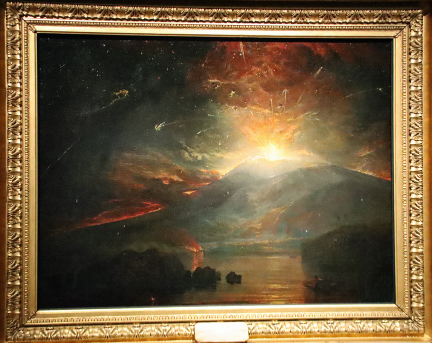
The painted parlour
The greyhound was part of the heraldry of the Moreton family

The greyhound was part of the heraldry of the Moreton family

William Moreton III’s (1574-1654) contributions were more prosaic, adding the brew and bake houses.  He seems to have lavished most of his income on members of his extended family.  He was arrested during the Civil War and although he was released, his estate was confiscated in 1643 to be used as occasional billeting for the Parliamentarian soldiers and horses.  With their finances in tatters and their home deteriorating, the house remained in the family, but they no longer lived there and chose instead to rent out it out.  In  the 18th and 19th centuries the house became an object of curiosity, visited like so many other distinctive and ruinous buildings by artists looking for romantic subjects.
The best way to understand each of the rooms in the house is to to buy a guide book. The current version is excellent, and provides much of the information in this post, but the previous edition by a different author is also very good as well.  However, there is one room that should be highlighted – the Long Gallery.

An inventory of 1601 suggests that it was build before that date.  A casual glance at it from the outside shows that it has a dog-leg part way along, implying that it has slumped.  The problems lie in the way in which it was built contrary to the convention of placing an upper room directly over the frame of the room below, ensuring that the existing structure provided the new level with as much support as possible.  The gallery, however, is much narrower than the room beneath, perhaps to give provide a greater impression of length.  The result is that it has no direct support and is additionally weighed down by the stone slabs that cover the roof.  Repairs began almost as soon as it was built.  In the 1890s iron tie-rods were added and in the late 1970s and 1990s steel was used to improve the structural stability.  It is a glorious feature, with panelling, decorative woodwork in the ceiling, cross beams and banks of windows with tiny quarries.  At each end is a painted plasterwork frieze showing excerpts from The Castle of Knowledge.

In the parlour off the Long Gallery is a striking and elaborate stone fireplace overmantel.  Appearances are deceptive here.  The fireplace is level, but the rest of the room is askew!  It shows Justice and Prudence, popular 17th century Protestant themes, flanking the central panel, which would have been brightly painted (much like Plas Mawr in Conwy today).  The coat of arms celebrates the marriage in 1329 of John de Morteon to Margaret, an heiress and daughter of John de Macclesfield.  The leaded quarries in here are particularly pretty, and there is one that contains a piece of 1642 graffiti.
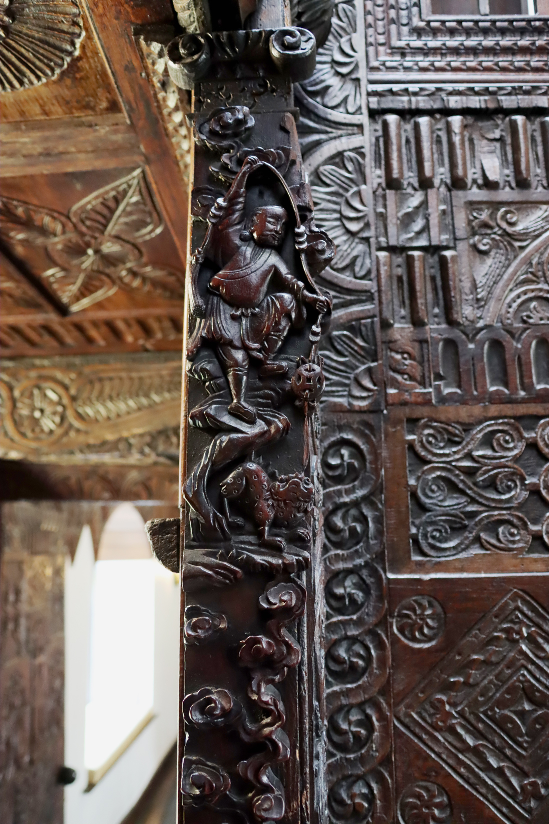
The fireplace in the Great Parlour, showing the coat of arms of Elizabeth I

The fireplace in the Great Parlour, showing the coat of arms of Elizabeth I

The home farm was established at the same time as the house, just across the moat in a neighbouring field, complete with the surviving cruick barn, as well as structures that are now lost, including stables and a dovecot.  At the rear of the house the knot garden, based on a 17th century design and planted in 1972, is flanked by a gorgeous yew tunnel.  To the side of the house, tables and chairs provide a lovely location for café users (excellent coffee and a fab bacon bap).   A walkway follows the line of the towpath from one side of the bridge to the other.  The plants in the garden have been chosen to reflect Tudor choices – many of them not only ornamental but useful too.  I had never heard of skirret (a white fleshy root vegetable like parsnips, a favourite of Henry VIII.  I had also never come across tussey musseys – posies of flowers and herbs carried as protection against disease.  Wild strawberries were not merely delicious but were used to treat cuts and bruises.

There is a viewing platform beyond the moat, which provides a slightly elevated view (the photograph at  the very top of the post).  A shop sells National Trust products and has shelves full of second hand books (with proceeds going to charity).  This is a National Trust property, with plenty of parking.  Visitor details are on their website.

With many thanks to Helen for the great company on a day that was both satisfyingly cultural and, over coffee and a bacon bap, profoundly lazy 🙂


Little Moreton Hall by George Theaker, c.1886

Little Moreton Hall by George Theaker, c.1886


Sources:

Beck, Joan 1969. Tudor Cheshire. Volume Seven of a History of Cheshire.  Cheshire Community Council.

Stubbs, Susie 2015. Little Moreton Hall. The National Trust

Rowell, Christopher, revised by Jeremy Lake 1984. Little Moreton Hall. The National Trust

Hillforts and amazing views – and why is there an Egyptian temple on the top of Moel Famau?

The Jubilee Tower

The Jubilee Tower

It was something of a surprise when I walked up to the top of Moel Famau during the week and found myself face to face with a building that was clearly based on an ancient Egyptian temple, the Grade II listed Jubilee Tower.  People talk about the views, the hillforts, the heather, the bilberries and the bird life, but no-one had mentioned that there was a rather unexpected slice of Egyptomania on the peak.  One would certainly, thankfully, not be permitted to build on a national beauty spot these days, but I suppose that it could be a lot worse, like the hideous, overpriced café on Snowdon.  The Jubilee Tower is not elegant, it is not authentic, and it is anything but pretty, but it did make me smile, and other walkers were clearly enjoying it too.  Heritage comes in various forms, some of them most unexpected.  The Egyptian Revival produced some splendid buildings and monuments, and although this one is not amongst the most accomplished, its location singles it out as a fairly remarkable example, a genuine curiosity.


Map of Moel Famau footpaths

Map of Moel Famau footpaths, as well as the locations of Moel y Gaer and Foel Fenlli hillforts. Source: Nearly Uphill

Moel Famau, on the Clwydian Range, is lovely.  It is the highest peak on the Clwydians and a very popular destination for hikers and dog walkers alike.  I don’t really remember my first visit, so it was very much like visiting for the first time.  There are a number of different approaches to the peak. I went along the Bwlch Pen Barras road, a pass through the Clwydian Range where there are two official starting points with car parks.  one of which takes you through the coed (wood), but it was far too gloriously sunny to be under cover, which means that that the best starting point was the large amount of lay-by parking (which I believe is free) or the Bwlch Pen Barras car park (payment required) .  The What3Words address for the Bwlch Pen Barras car park is ///hobble.passwords.device.  You are already very high up at this point, with terrific views over the Vale of Clwyd before you even start, and the footpath that I took (the purple track at far left of the above map) provides superb views over the Vale of Clwyd.

The walk, along a wide, well maintained path, starts very gently and for the first 20 minutes or so is very easy.  It becomes much steeper for a fairly short section leading up to the peak, but people of all levels of fitness seemed to be tackling it, some stopping frequently for a breather.  It’s worth that last push because the 360º views are breathtaking.


If you climb up the steps to the top of the Egyptian Revival “temple” there are metal plaques explaining the building.  It turns out that what we see today is just the stump of a much more ambitious project, the Jubilee Tower, which included an obelisk.  It was designed by architect Thomas Harrison, and was built to celebrate the Golden Jubilee of George III in 1810, paid for by public subscription, with Flintshire magistrate Lord Kenyon laying the foundation stone in October of that year.  Harrison’s buildings in Chester are far less frivolous, with most of his work in the Neoclassical style, including the Grosvenor Bridge and the Propylaeum (monumental gateway) into Chester Castle and the Neoclassical building that is now owned by the university but was previously occupied by the council as its Shire Hall.  The building materials were taken up by horse and cart. The design of the obelisk was modified during construction, with a shorter and stumpier version being completed in about 1817 after a break in work due to financial difficulties and a dispute between Harrison and the builder. Unfortunately the obelisk soon started to deteriorate, and eventually collapsed in a storm in 1862.  The rest of the structure continued to decay until 1970 when it underwent restoration, and in 2013 it again required significant restoration work.  Here’s the Coflein description of the Jubilee Tower:

The Jubilee Tower in the Edwardian period

The Jubilee Tower in the Edwardian period. Source:  BBC News

The monument now survives as a battered plinth, 12-15m diameter, of roughly coursed rubble stone. Located on a mound which may be artificial. Each face has a central blind doorway of dressed stone, in simple Egyptian style, under a roll-moulded lintel; roughly hewn cornice or hoodmould.  Above these blind openings are broad rectangular panels of dressed freestone with roll-moulded surrounds. The corners of the monument have stone and concrete steps, starting from low square projections, which lead to the centre of the monument. Inside are the circular rubble stone footings of a former higher section of tower, 6m in diameter.  Around the outside of the monument is a renewed retaining wall 0.5-1m high, open at the corners. A plaque reads ‘Cefn Gwlad award 1970’, with Prince of Wales emblems.

The Egyptian Revival followed Napoleon’s invasion of Egypt in 1798.  He took with him over 100 specialists, the “savants,” amongst whom were artists and draughtsmen who recorded the ancient Egyptian temples.

One of the first and very popular books to publish these images was Dominique Vivant-Denon’s “Journeys in Upper and Lower Egypt” published in 1802.  Even before Jean-François Champollion’s translation of hieroglyphs in 1822, and over a century before Howard Carter’s discovery of the tomb of Tutankhamen in 1922, Egypt had wriggled its way firmly into the British imagination.  Even so, I would love to have been at the meeting where plonking a pseudo-Egyptian monument on the top of a remote beauty spot in honour of the king’s jubilee was presented as a such a good idea that people invested in it.
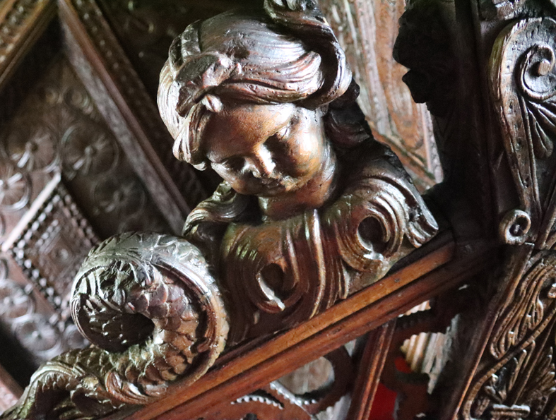
 

Moel y Gaer hillfort is the green beret on top of the pinkish-brown supr

Also on the top of the temple are plaques showing the names of the hills all around, with Cadair Idris and Snowdonia visible as silvery silhouettes through the slight haze, and the Moel Arthur hillfort next along on the Clwydian Range.
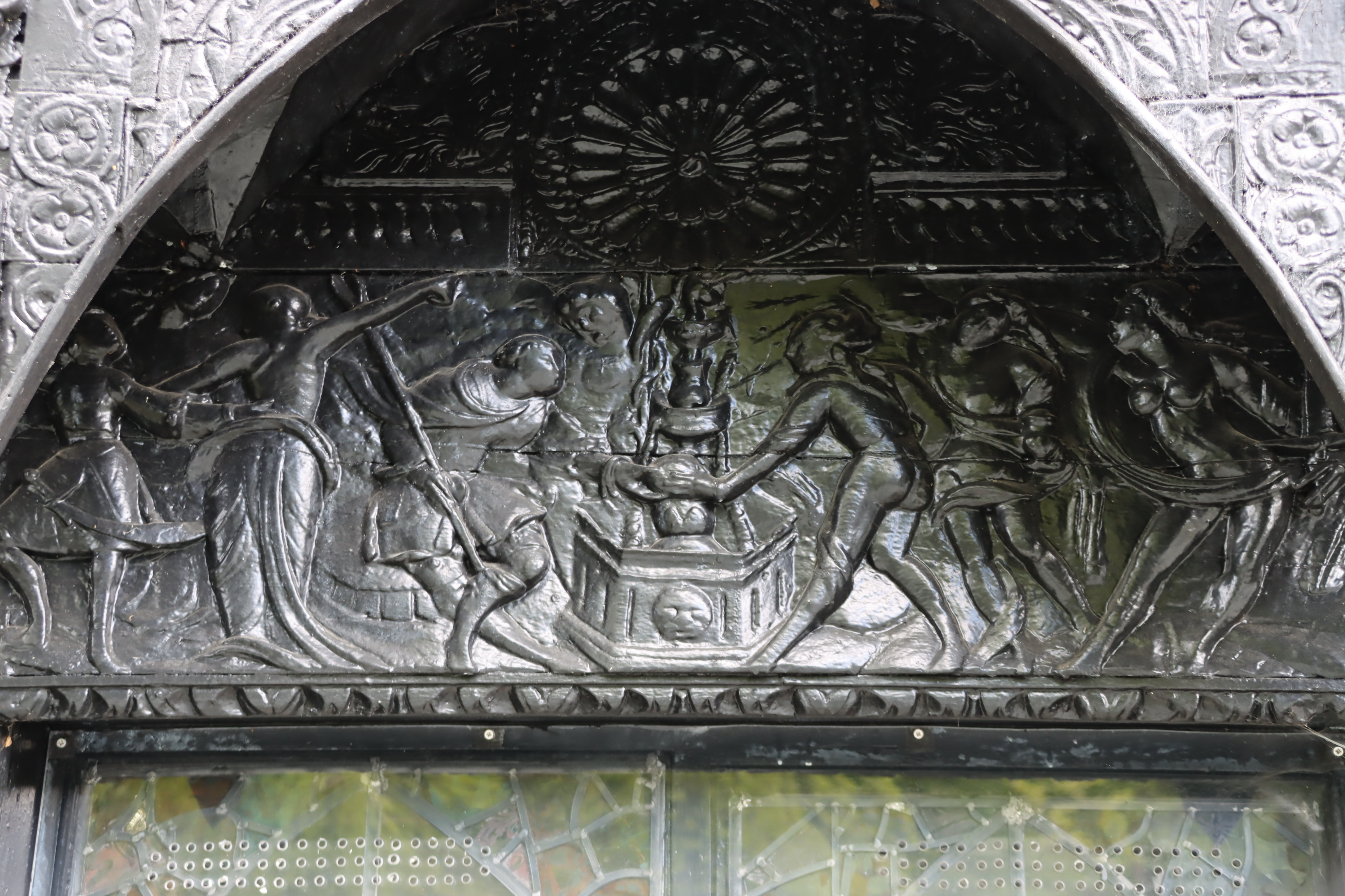
Looking northeast towards Prestatyn across Moel Arthur and Penycloddiau hillforts from the top of Jubilee Tower
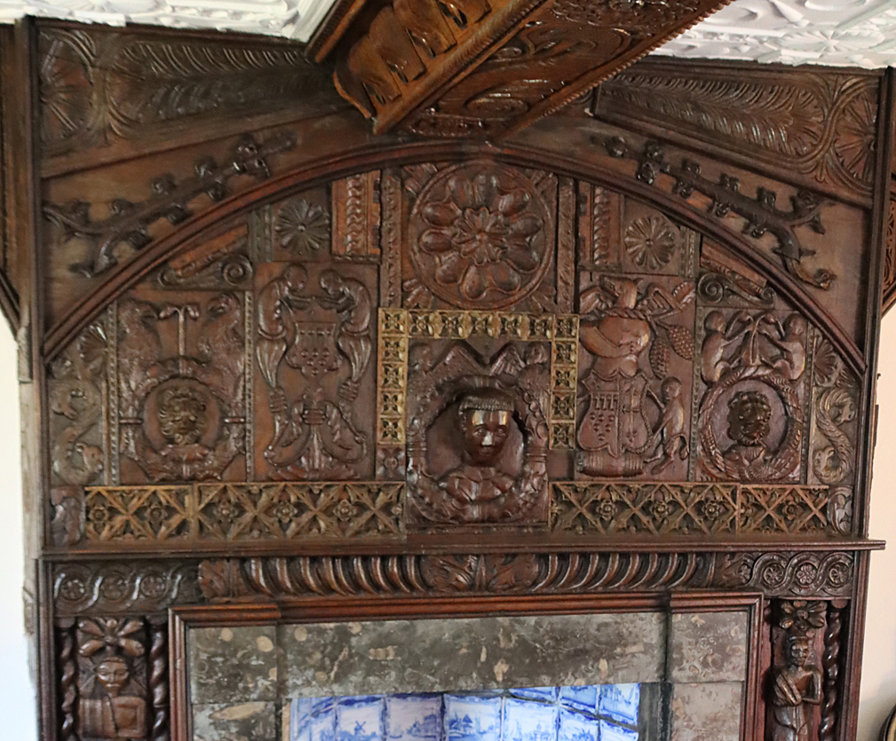
View from the main path to Moel y Gaer hillfort

If you are a fan of the Iron Age this is a terrific walk.  The path passes Moel y Gaer, which sits on a spur of the hillside, and is a piece of absolute perfection.  It is not on a public footpath, but it is clearly visible from the main route up Moel Famau.  Its banks and ditches form an elegant tiara, and its position overlooking the Vale of Clwyd is superb.  Once you have reached the peak of Moel Famau, the hill housing the Moel Arthur hillfort is clearly visible, with Penycloddiau beyond.  Foel Fenlli is a walk in its own right, but it is an important part of the walk back down from Moel Famau, because its vast banks and ditches are clearly outlined against a bright sky, yelling its late prehistoric credentials, a far more aggressive and prominent statement than Moel y Gaer.

Impressive fortifications of Foel Fenlli

The impressive fortifications of Foel Fenlli, as seen from the Moel y Gaer path

Apart from the acres of dark brown heather and the bright spring green of the valley below, there is not a lot of plant life to see at this time of year, although it is very striking without a floral contribution.  The heather, dark chestnut brown and lifeless at this time of year, has been cut into a peculiar pattern of rectangles to encourage new growth, apparently for the benefit of wildlife.  There is not much in the way of shrubs and the trees in the wood are conifer plantations. There are plenty of birds of prey if you have equipped yourself with binoculars.  I look forward to visiting again when the heather is in flower in late summer, which should be stunning.

It is about a 40 minute walk up, although I forgot to take a note of the times in either direction and have the impression that it took me only about half an hour back down, with extra time added for pausing to enjoy the views and for lazy mellowing and exploring the monument at the top.  I am something of a route-marcher, so that needs to be taken into account.  You can walk on beyond Moel Famau in various directions on public footpaths.  Most obviously the path continues, in a much narrower form, across the Clwydian Range, which looks like an absolutely splendid option.  If you have the energy, you can walk to the village of Bodfari, in another pass through the Clwydian Range, whilst the Offa’s Dyke Trail goes all the way to Prestatyn.  In the opposite direction, you can follow the route over Foel Fenlli all the way to Chirk, skirting the dramatic Eglyseg Mountain and passing Castell Dinas Bran and the Pontcysyllte aqueduct.

It was one of those spring days when everyone looked as though they had been released from a cage, shedding winter like a bad memory.  Super.  To read more about the environment and archaeology of the Clwydian Range and Llantysilio Mountains see the PDF produced by the Heather and Hillforts project. 


Aerial view of the Clwydian Range. Coflein image 662395. Source: Coflein


Walking the history of Chester’s canals, from the river Dee to Boughton #2 – The Walk

This post has been divided into two. Part 1, already posted here, looks at some of the history of the Chester city canals, in brief. Part 2 is a mainly photographic account following a walk along the canals from the point where the river Dee connects to the canal network to just beyond Tarvin Bridge.  Part of this was once the Chester Canal, which then became the Ellesmere and Chester Canal, as two different systems joined up with the rest of the canal network, and finally became the Shropshire Union Canal, the name by which it is known today.

Map of the first part of the canal route

Map of the first part of the canal route. The start point is marked by the red dot.  The rest of the route follows the canal as far as the Chester Boughton Hall Cricket Club

Map of the entire route from the Dee to Chester Boughton Hall Cricket Club

Map of the entire route, with the orange arrows showing the route from the Dee to Chester Boughton Hall Cricket Club. The pink arrows are the route I took from the Little Roodee car park to the start of the canal.  The darker purple arrow marks the arch beneath the railway viaduct that continues the river walk.

Detail of Tollemache Terrace

The walk begins at the point where the canal meets the river Dee, at the red dot (What3Words ///golf.finishing.upset).  It follows the tiny section of the old Chester Canal around the corner into the Dee Branch, which was created to allow access from the Wirral Line to the Dee.  The walk then crosses the roving-bridge with views up along the Wirral Line, across to the boatyard and down Tower Wharf Basin towards the main line of the canal to the east.  The walk then proceeds between Tower Wharf Basin and the Dee Branch, round the corner into the turning basin and along the rest of the canal, without any additional complications.  You can, of course, do as much or as little as you like. There is much more to see than included here – it’s a terrific walk.  I went as far as the Chester Boughton Hall Cricket Club, and the photographs go that far, but of course you can walk on as far as Wolverhampton if you have the time and stamina!

The return route is slightly different.  I parked in the long-term Little Roodee car park, which is under the city walls, so on the return route along the canal walked up onto the city walls (What3Words ///gone.dome.paths) and followed the walls back to the car park.

Map of the return route via the city walls

The slightly different return leg of the route, which leaves the main line of the canal and goes up on to the city walls looking down on the canal before heading, still on the city walls, towards the Little Roodee long term car park

There is plenty of parking in Chester, but I chose to park in the Little Roodee (What3Words ///helps.going.budget) because I was not sure how long I would take, and this is a long-term fixed-fee car park.  In the event, with plenty of stops to take photographs, it took around two and a half hours in total, two hours out (with lots of stops to take photos) and then an hour back to the Little Roodee via the City Walls, coming off the canal and walking above it from near to the King Charles Tower.  There are plenty of places to stop for drinks and a bite to eat.

The starting point

The starting point, where the canal tips water into the river Dee. The lock gates are long vanished, buy you can see where they once were.

The two main points to make at the beginning of the walk at the lock between the canal network into the Dee are that 1) this is obviously derelict and no longer usable, meaning that the canal network is now divorced from the river; and 2) this is one of the earliest parts of the Chester system, a legacy of the first Chester Canal, which went from Chester to Nantwich.  The connection with the river authorities had not been agreed before work began on the canal, and it took a number of years before the essential link between the Port of Chester and the Chester Canal were negotiated.

The walk continues over the road, from where this photograph was taken. Note that the canal passes under the road bridge.  Although this is now a fixed bridge, it was once a swing bridge to allow vessels of all heights to enter and leave the canal system.

Over the road (cross with care as it is on a blind corner) you continue along the canal, staying to its left.  This is the final set of locks as you come from the west and south, or the first as you begin to proceed up the canal system towards Nantwich, the source of the water.

Beginning to explore the Chester leg of the canal system

Beginning to explore the Chester leg of the canal system

On your left is a housing development with retail at its base.  This marks the site of the old Dee Basin which is where, after coming down a flight of five locks, narrowboats and wide barges would enter a holding area to await the tide.

The former Dee Basin

The former Dee Basin


The former Dee Basin

The former Dee Basin, shown on signage in the Tower Wharf Basin

When the Chester Canal was first built this was a tidal basin, but when the Chester Canal and the Ellesmere Canal merged, the water level was controlled by locks.  Continuing on, and staying left of the modern lift bridge, the bridge ahead of you leads you into the opening of the so-called Dee branch and on to Tower Wharf and the heart of the Chester canal system.   To proceed, do not go under the bridge (the footpath ends here) but go up the flight of steps to its left, turn right and cross the road and enter the Tower Wharf basin via the white gates.  On your right is the main line and Tower Wharf.  On your left, at a much lower level, is the Dee Branch, a requirement after the Wirral Line was added by the Ellesmere Canal (see an explanation of this in Part 1).  A lock was added to allow access to this lower section that flows out to the former Dee Basin and the river lock.

The Dee Branch

The Dee branch, with the main line up the bank at a higher level.

Tower Wharf basin

Tower Wharf basin


Telford's Warehouse

Telford’s Warehouse

There are some terrific features to look out for in the Tower Wharf Basin.  When the Wirral Line was built a new boatyard was added with a graving dock, both still in situ, and the boatyard not only survives but has been in continuous use since it was built.  Immediately on your right, at the far southern end of the basin, is a late 18th century building called Telford’s Warehouse (now a pub), designed by Thomas Telford with the open arches allowing vessels to load and unload under cover.  Running along the side of the Dee branch is an attractive row of Victorian brick-built terraced housing on Whipcord Lane, post-dating the canal.

Straight ahead is what is known as Taylor’s Boatyard after a former owner, complete with the graving dock.  The graving dock is a dry dock into which ships can be floated, and then the lock emptied so that hulls can be worked on.  Sadly it is surrounded, for safety reasons, by ugly metal fencing, but it is a lovely feature.  The boatyard lies beyond.

Looking down from the roving-bridge into the graving dock

Attractive iron column in the graving dock

In 1802 business in the Basin had not only picked up but was doing so well that its capacity was considerably over-stretched and a new basin was required, named North Basin, which was surrounded by more warehousing.  An absolutely delightful roving-bridge or snake/turnover bridge connects Tower Wharf with North Basin, an innovation that allowed horses pulling boats to cross the canal without being unhooked from the vessel.

North Basin

North Basin

The roving bridge

The roving bridge

If you have crossed the bridge, re-cross it to return to the central section of the basin, between the Tower Wharf Basin and the Dee Branch and retrace your steps.  Instead of going back up to the road where you entered, go under the bridge, following the towpath.  From here on, the route simply follows the towpath.  There are too many sights and sites to describe in detail, but here are some of the most interesting features contemporary with the working canal, with links to more information where I have found it.

As you leave the Tower Wharf Basin complex, you walk under the railway bridge and turn left into a section known as the Turning Basin, made particularly wide to enable horse-drawn vessels to negotiate the sharp turn into the basin.  There is a turning hook on the wall just under the Raymond Street Bridge that was also there to help vessels make the turn.  If you look up to the south (or your right, heading out along the canal) note that the canal follows the line of the city walls.

Looking back at the turning basin at the entrance to Tower Wharf Basin

The other end of the basin, leading to the locks

The other end of the basin, leading to the locks

Before the Ellesmere Canal Company introduced the Wirral Branch, there used to five locks that went all the way up to the Dee Basin, which has now largely been filled in and used for modern housing.  When the new branch was added, the bottom two locks were demolished and the canal diverted north.  The three remaining locks are still fully functional today and allow vessels to navigate a 33ft (10m) drop/rise.  At the top of the locks is a square house with a prominently overhanging roof eave, again one of Telford’s designs.  At this point today the canal runs under the St Martin’s Way ring road before carrying on along the foot of the northern stretch of the city walls.

After passing a row of modern house on your left you will notice two bridges overhead, the first tiny.  This is the somewhat battered-looking Grade II listed Bridge of Sighs, probably built in the 18th century. Although it is named after the magnificent one in Venice, the similarity lies in the fact that both were used for carrying prisoners, in this case from the prison to the chapel in the Bluecoast School to receive their last rites prior to execution.  The next bridge carries Upper Northgate Street over the canal, some sdfdsf ft / sdfsd m above.


The tiny Bridge of Sighs over the canal, followed by the Northgate Street bridge

Bridge of Sighs

Bridge of Sighs, Chester, shown from Upper Northgate Street

Triassic sandstone through which the canal was cut

Triassic sandstone through which the canal was cut, allegedly following the line of a Roman ditch

The canal passes the King Charles Tower as the canal and city walls part company, the canal briefly heading southeast and then due east.


The back of the Memorial Chapel next to Abakhan on Gorse Stacks

The back of the Penri Chapel next to Abakhan on Gorse Stacks. The Iceland on Frodsham Street is on the right

Looking back to the city walls and the King Charles tower above the canal. It is at this point on the reverse leg of the walk that there is a path up to the walls, which leads back to the Little Roodee car park.


Signage at Cow Lane Bridge


Queen's Place

Queen’s Place


This unexpected structure at the end of Queen’s Place is just a facade with no building behind it, the remnant of a lecture hall once attached to the 1777 Independent Chapel

The original Griffiths Corn Mill is now the Mill Hotel and Spa

The original Griffiths Corn Mill is now the Mill Hotel and Spa

Footbridge

Covered footbridge linking two parts of the hotel, with the Hoole water tower beyond


Steam Mill

The Grade II-listed Steam Mill building was built in 1786 as one of Britain’s first steam-powered flour mills. The listing details can be found on the Historic England website

This canalside building near the Union Canal Bridge is in a very sorry state.

This was a busy area, with industrial and commercial enterprises moving in to take advantage of the proximity of the canal.  There are a number of very fine buildings to spot here, and if you follow Stuart Shuttleworth’s walk (see video below) he takes you into some of the surrounding streets to explore some of the relevant buildings behind the canal.

Union Canal Bridge. Details are available on the Grace’s Guide industrial history website.

One of the protective iron uprights on the Union Bridge stonework, with rope markings from the barges pulled by horses

City Road Bridge (1863) by J. Mowle and Co.

Replica Spitfire, apparently once used as a raft

Replica Spitfire, apparently once used in a raft race

Old Harker's Arms

Looking back to the Old Harker’s Arms


Moxy Hotel with Waitrose beyond

The Chester leadworks shot tower. Information about the works and the tower on the Historic England website

Signage along the canal showing original photograph of the leadworks

Sign on the edge of the canal, and in front of a building site for “luxury retirement apartments”

Wharton Court

Wharton Court

Hoole Lane Bridge, 123A

Hoole Lane Bridge, 123A

Hoole Lane Lock

Hoole Lane Lock

Hoole Lane Lock

Hoole Lane Mission Hall. Information at Hoole History and Heritage Society

Tollemache Terrace

Tollemache Terrace

Chemistry Lock and sluice, Grade II listed. More information on the Historic England website

Towards the Bridge Inn (the white building)

Towards the Bridge Inn (the white building)

Tarvin Lock

Tarvin Bridge Lock

Chester and Boughton Hall Cricket Club

The view of the canal as it moves out of Chester towards Waverton and beyond


Starting the return leg of the walk at Tarvin Bridge Lock, next to the cricket club

Walking back into Chester, past the Boughton water tower.  See details on the Historic England website.

The point on the towpath at which I walked up to the flight of steps to go up to the city walls and turn right to return to the car park.


Sources

The full list of sources are in Part 1


Walking the history of Chester’s canals, from the river Dee to Boughton #1 – Short History

This post is divided into two. Part 1 (this part) looks in brief at some of the history of the Chester city canals, mainly to untangle the complicated story of what is happening at the Tower Wharf Basin, where the Chester and Ellesmere Canals came together.  Part 2 is a mainly photographic account of the walk along the canals from the river Dee to the Chester Boughton Hall Cricket Club, just beyond Tarvin Bridge.

The pink arrows are my route from the Little Roodee car park to the start of the canal. The orange arrows are the route taken from the start of the canal at the river Dee to Chester Boughton Hall Cricket Club. Details of the walk are in Part 2.

Cow Lane Bridge 1880s

Cow Lane Bridge in the 1880s. Source: chesterwallsinfo

This post begins with a short description of the history of the Shropshire Union Canal, describes why the intersections just beyond the Northgate staircase lock is so complicated, and goes on to describe the walk.

The Shropshire Union Canal runs today from the Mersey and the Manchester Ship Canal at Ellesmere Port, to Autherley Junction near Wolverhampton on the Staffordshire and Worcestershire Canal over a distance of 66.5 miles (107km).  Because it runs beyond the city walls, only making its presence felt to tourists where it crosses Northgate and along the base of the city walls, it does not feature on the city’s usual tourist routes.  Unlike Chester’s well known medieval, Georgian and Victorian architectural attractions, the canal is more directly a component part of the city’s industrial past, but is just as essential in the city’s story.

The history of the Shropshire Union Canal

During the 18th century civil engineer James Brindley (1716-1772) was responsible for building over 365 miles of canals.  Brindely realized that any inland waterway network would need to connect to all the great navigable rivers that connected to the sea, including the Thames, the Mersey, the Severn and the Trent, incorporating other important navigable rivers like the the Avon and the Dee.  The network was a sprawling affair, but it revolutionized transport, avoiding roads that would become mired and impassable in winter, as well as unnavigable sections of rivers, and the riverine problems of tides, drought and flood.  Water into and out of the canal system was regulated and therefore predictable, and allowed year-round transport.  The advantages became very clear very quickly, and manufacturing and trading businesses began to locate themselves at critical points on the canal network.  Eagerness to invest in infrastructure resulted in a canal boom in the mid to late 1700s.  Each new section of canal required an Act of Parliament, subject to Royal Assent, and Act after Act was passed as the network expanded.

The Chester Canal. Source: Shearing 1985, p.150

The  execution of the canal project for Chester was deeply flawed.  Jumping on the canal bandwagon, entrepreneurs and investors envisaged a money-making venture that would bring Shropshire and Cheshire into the mainstream trade network with Birmingham, the nation’s canal hub and centre of industry, via a junction at Middlewich with the 1777 Trent and Mersey Canal.  Unfortunately, the builders of the Chester Canal did not have agreements in place to connect their new Chester Canal either to the Trent and Mersey Canal, which denied them permission to build a junction, or with the River Dee Company, which also put barriers in their way leading to several years of negotiation before a satisfactory solution was reached.  The Chester Canal, opening in 1779, was not built to Middlewich, where it had been planned for the Chester to join the Trent and Mersey, and instead stopped at Nantwich, segregated from the rest of the national canal network.  With little traffic carrying low-value cargoes, as well as a packet boat service, the canal was a fairly substantial failure.  In 1787 the Beeston staircase locks collapsed and there were insufficient funds to pay for repairs.  The Chester Canal hovered on the verge of bankruptcy.

The complex arrangement of the Ellesmere Canal

The complex arrangement of the Ellesmere Canal and its branches is shown as thin blue winding lines. The thick blue line from Chester is the Dee. The yellow lines are roads. Click to see a bigger version. Source: Wikipedia

If it had not been for the 1791 Ellesmere Canal project, the Chester Canal would not have managed to limp on much longer.  The proposal for sections of canal to link the Mersey at Netherpool (now Ellesmere Port) to both the river Dee at Chester and the Severn at Shrewsbury was ambitious, but attracted sufficient support for a surveyor to be hired and possible routes to be explored.  The Ellesmere Canal proposal was presented to parliament and received its Royal Assent in April 1793.   Although shortages in funding prevented the realization of the full vision, shown right, Chester was at last brought into the national canal network. Part of this necessitated the addition of a new branch of canal from Chester to Ellesmere Port, which connected with the Chester Canal in what is now the Tower Wharf Basin.  The two companies merged in 1813, becoming the Ellesmere and Chester Canal Companh.  In 1833 the Middlewich branch was added, as the Chester Canal company had originally planned, and was connected to the rest of the network via the Trent and Mersey.

Hunter 1782 map with canal

Hunter 1782 map with the canal before the basins were added for the Wirral Line

These changes required major infrastructure changes in Chester itself that are still clearly visible today.  Starting from the former interface between the river and the canal, just off Sealand Road, the derelict remains of the river-canal lock are clearly visible as industrial archaeology.  The gates have long gone and this section of the lock and the branch that once lead into the Dee Basin, along Tower Road on the map below, on its way to the Dee Branch, is full of aquatic plant life.  As you walk along towards the Dee Branch, rounding the corner and passing under the bridge, you find yourself in the basin complex, the Ellesmere Canal Company’s solution to how best to incorporate the Wirral Line north to Ellesmere Port.  However before the Ellesmere Canal Company was involved, the Chester Canal simply ran straight ahead, running directly along the Dee Basin into a set of five staircase locks before heading east towards Boughton.

Canal and River Trust map of the basin and wharves, showing the complex arrangement of locks and basins required to incorporate the Wirral branch of the canal to Ellesmere Port.


Map from the 1858 Roberts Chester Guide

Map from the 1858 Roberts Chester Guide, showing the big Dee Basin at the far end where locks connected it to the Dee. Click image to enlarge

The set of basins and wharves that became necessary when the Chester Canal was incorporated into the Ellesmere Canal Company’s plans capture the fascinating history of how the area’s canal system was forced to evolve.  Three different sections of the canal are involved in this complex arrangement, shown above.  The earliest of these phases belongs to the original Chester Canal, which begins at the river Dee and once headed straight along into a series of five locks that climbed the hill to the dramatic sandstone cut and onwards to Hoole and Boughton before turning south to Christleton and beyond.  The second phase is the Ellesmere Canal Company’s civil engineering work to incorporate the new “Wirral Line,” which headed in a roughly northerly direction out of Chester.  This now chopped off the Chester Canal at the base of the locks, demolishing two of the five locks, to create the Tower Wharf Basin.  The new arrangement cut off the canal from the river, meaning that another section of canal, called the Dee Branch, had to be created parallel to the main basin and accessed via a lock, to allow vessels to travel between the main line, the Wirral line and the Dee.  It is not an elegant solution, but it worked.  The rest of the canal is very straight forward as you walk towards Hoole, Boughton and beyond.  The historical interest in those sections of the canal is more about the bridges and the flanking architecture that grew up around the canal.

The docks at Ellesmere Port during the 19th century

The docks and wharves at Ellesmere Port during the 19th century, from the Ellesmere Port canal museum archives

In 1846 the decision was made to bring together the various canal and railway interests together under one umbrella organization, the Shropshire Union Railways and Canals Company, providing the different sections of canal from Ellesmere Port to Wolverhampton with a single name:  the Shropshire Union Canal.  In 1894 the Manchester Ship Canal opened, and the Ellesmere Port access to the Mersey was now via the new shipping channel.

In spite of canalization of the Dee in the 1730s was intended to make the rapidly silting river navigable and to make Chester competitive once again with Liverpool, but in spite of these measures silting continued and the river became impractical for serious commercial shipping and shipbuilding, particularly in the face of Liverpool’s rapid expansion.  The last ships were built on the Dee in the early 20th century, ending a centuries old industry, and the connection between the Shropshire Union and the river went out of use.

Chester Railway Station

Chester Railway Station 1848. Source: Hoole History and Heritage Society

The railway came to Chester in 1840, picking up some of the slack, but Chester’s days as a centre for trade and industry were over and the main financial opportunity that the railway brought was tourism.  The canal, however, continued to be used as part of the canal network, connecting to maritime trade via the Mersey.  Eventually, as rail replaced the canals, many of them became derelict, only reviving as leisure resources in the later 20th century.

The canal attracted many businesses along its edges, and today the canal preserves a considerable amount of commercial and industrial heritage, adding a welcome extra dimension to Chester’s historic legacy.  The canal network today is used for pleasure, mainly in the form of cruising, walking and cycling.  It still covers a vast region of England and Wales and is managed by a mixture of state organizations and by both regional and local charities.

Schematic map showing how Chester relates to the canal network

Schematic map showing how Chester relates to the canal network today. Source: Swanley Bridge Marina

As canals have become attractive for residential development, new housing has also been erected, some developments more sympathetic than others, but all interesting.  The mixture is captured in the walk in Part 2. Apart from a few isolated examples, most of the warehousing that once flanked the basins and the canal has long gone, replaced by modern apartments, including student accommodation and retail outlets.

The Dee no longer connects to the canal network.  The lock between the river and the Dee Branch of the canal, lying just over Sealand Road, is completely derelict.  One of the locks further along is padlocked shut. The old swing bridge that had allowed vessels to interrupt road traffic to enter the canal network was replaced by the fixed road bridge in the 1960s.   Today the leg of the Dee branch of the canal running parallel to the Basin, once used for access to the river, is used for mooring privately owned narrowboats.

Signage at the canal basin showing information about Telford's Warehouse

Signage at the canal basin showing information about Telford’s Warehouse

I have kept this history brief, merely to introduce the walk.  Rather than reinventing the wheel, please see the Sources below, which contain much more information.  The three video links also provide an excellent overview, between them, of the canal, its history, and some of the buildings and businesses associated with it.  The first is by John Herson, one of whose guided canal walks I have done and thoroughly enjoyed, which focuses on Tower Wharf, the Canal Basin and the relationship of the canal with the Dee.  The second is by Stuart Shuttleworth and looks at the main line of the canal as it passes through Chester.  Together they form a brilliant introduction to the subject, showing the key places to visit.  At the end, underneath Sources, there is another video by “Pastfinder,” which is longer and explores what remains today in more depth, walking and talking at the same time, making it quite easy to retrace his footsteps.  There are some fascinating additional pieces of information in this.

John Herson:

Stuart Shuttleworth:


Sources:

A lot of information is contained in the two videos above and the one at the end of the post.

Other sources of information are as follows:

Books and papers

Carrington, Peter 1994. English Heritage Book of Chester.  Batsford / English Heritage

Martin, Richard 2018. Ships of the Chester Rivers.  Shipbuilding on the Dee from Chester to the Point of Ayr 1800-1942. Bridge Books

Mosse, J., David Lobband and Judith Pile 2023 (9th edition).  Collins Nicholson Waterways Guide 4. Four Counties and the Welsh Canals.  HarperCollins

Nicholson, R. 1989 (4th edition). Nicholson/Ordnance Survey Guide to the Waterways 2: Central. Robert Nicholson Publications and Ordnance Survey

Shearing, Edwin A. 1985. Chester Canal Projects: Part I. Journal of the Railway and Canal Historical Society. Vol XXVIII, no.3, November 1984. p.98-103

Shearing, Edwin A. 1985. Chester Canal Projects: Part II. Journal of the Railway and Canal Historical Society. Vol XXVIII, no.4, March 1985. p.146-154

Ward, Simon 2013 (2nd edition). Chester. A History. The History Press

Websites

Canal and River Trust
Welcome to Chester. Escape the city on this tranquil waterway (PDF)
https://canalrivertrust.org.uk/media/document/0z8YCnXdfYHg_am-LmUGSg/p22Wl115w_dWrQTRa-XYJd5Q5nl2UR6N17EY2G1JFyc/aHR0cHM6Ly9jcnRwcm9kY21zdWtzMDEuYmxvYi5jb3JlLndpbmRvd3MubmV0L2RvY3VtZW50Lw/0192bddd-4001-76ad-a95b-0ad3662ccdcc.pdf

Canal Routes
Chester Canal History
https://www.canalroutes.net/Chester-Canal.html
Chester Canal Route
https://www.canalroutes.net/Shropshire-Union-Canal.html#Chester-Canal-Route
Ellesmere Canal – Wirral Line
https://www.canalroutes.net/Shropshire-Union-Canal.html#Ellesmere-Canal-Wirral-Line
Shropshire Union Canal
https://www.canalroutes.net/Shropshire-Union-Canal.html

Cheshire West and Cheshire
Chester Canal Conservation Area Character Appraisal Ellesmere Port to Nantwich (PDF)
https://www.cheshirewestandchester.gov.uk/documents/planning-and-building-consultancy/total-environment/conservation-and-design/conservation-area-appraisals/canal-conservation-area-elesmere-port-to-nantwich-latest-version-261118.pdf
Chester Characterization Study
https://www.cheshirewestandchester.gov.uk/your-council/policies-and-performance/council-plans-policies-and-strategies/planning-policy/chester-characterisation-study

chesterwalls.info
Photographs of the Chester Canal Old and New, parts 1-5
https://chesterwalls.info/gallery/canalgallery.html

Chesterwiki
(with a lot of adverts interspersed)
Canalside
https://chester.shoutwiki.com/wiki/Canalside
Canal and Boatyard
https://chester.shoutwiki.com/wiki/Canal_and_Boatyard

Grace’s Guide to British Industrial History
James Brindley
https://www.gracesguide.co.uk/James_Brindley
William Jessop
https://www.gracesguide.co.uk/William_Jessop

Heritage Chester
Bite-Sized Wonder – The Lead Shot Tower
YouTube video

Historic England
Bridge of Sighs, Upper Northgate Street
https://historicengland.org.uk/listing/the-list/list-entry/1375967
Telfords Warehouse, Raymond Street

https://historicengland.org.uk/listing/the-list/list-entry/1375919?section=official-list-entry

Inland Waterways Association, Chester and Merseyside Branch
Chester Heritage Port Designation Document (PDF)
https://70cf2f03-3eb2-43c8-889f-b8f841fc3757.usrfiles.com/ugd/70cf2f_64e6633c34b9420f8c06a368857d1a42.pdf

UK Waterways Guide
Map of the Shropshire Union Canal
https://www.ukwaterwaysguide.co.uk/map/shropshire-union-canal/all-branches

“Pastfinder”:

A sunny spring canal walk south from Waverton to Golden Nook Bridge

Waverton to Golden Nook Bridge

Waverton to Golden Nook Bridge

In late October last year I took advantage of a beautiful sunny day to walk the towpath along the Shropshire Union canal from Waverton towards Chester, which I posted about here.  A couple of days ago the sky was clear and the sun was out, so I grabbed my rucksack and some damp-proof footwear (needed, as it was distinctly soggy underfoot) and headed out to do the section of the canal between Waverton and the wonderfully named Golden Nook Bridge, near the village of Hargrave, to its south. It took about an hour and a quarter each way at a brisk pace, stopping to take photos and chat to other walkers.  It was a rewarding walk, even at this time of year when there were only a few signs of spring beginning to make its mark.  Because of the season, the light meant that the walk provided two different experiences, there and back, with a silvery, ethereal light on the way out and a much more colourful walk on the return leg.  The birdsong was particularly lovely, and I have added a 36-second video at the end that was done purely to catch something of that sound.  I was lucky enough to see a kingfisher, a flash of bright orange as it settled on a branch followed by a flash of bright, electric blue as it took off.  It was too fast for me to photograph, but an absolute treat to see.

Waverton is just off the A41, so very easy to reach.The car park is quite small, with a capacity for about 20 cars, but at 11am there were only a few other cars parked up.  The What3Words address for the car park is ///fingertip.snored.deals.

To start the walk walk from the car park to the canal, just a few steps away, and turn right, heading south.  During the first couple of minutes the canal passes homes on the other side of the canal.  There is a section where it passes a golf course on the opposite side, but it is soon a very rural route with open fields flanking the canal.  Long Lane suddenly appears to the right as you walk south, the quiet stretch of road running parallel to the canal.  Shortly after this, official moorings begin on the other side of the canal, with a line of narrow boats and small cruising boats as far as the eye could see.  I stopped at Golden Nook Bridge and turned back, but the moorings presumably continue all the way to Tattenhall Marina.

St Peter's Church, Waverton

St Peter’s Church, Waverton

In total, there and back, the walk took about 2 1/2 – 3 hours, all on the flat.  Unlike the section towards Chester this part of the towpath is not metalled, and can be very uneven underfoot with tree roots and stones poking through.  It was also quite muddy after several weeks of rainfall.


View from Golden Nook Bridge and beyond to the sandstone ridge

View from Golden Nook Bridge and beyond to the sandstone ridge


Golden Nook Bridge, looking from the south and returning towards Waverton

Golden Nook Bridge, looking from the south and returning towards Waverton


36 seconds of birdsong from one of the canal bridges, taken on my smartphone.  There is a little interference from the breeze, but you can hear the birds giving forth wonderfully.


A Roman altar from Boughton, Chester, in the grounds of Eaton Hall

Roman objects at Eaton Hall

xx

The building that houses the Roman altar at Eaton Hall

The building that houses the Roman altar at Eaton Hall

Eaton Hall is part of the Duke of Westminster’s estate 4.2miles / 6.7km to the south of Chester.  It was very common for wealthy families to feature ancient Egyptian and Roman objects on their estates from the 18th century onwards.  Many of these were imported from overseas, but the cobbled-together display of a Roman altar in a small custom-built structure, flanked by two columns, are thought to have come from no further afield than Boughton, on the eastern outskirts of Chester, Roman Deva.

The gardens are only open to the public for three days a year for charity, and tickets tend to sell out very quickly, so this is not the easiest of the local Roman monumental works to visit, although others are on display in the Grosvenor Museum in Chester.

The Minerva shrine, Chester

The Minerva shrine, Edgar’s Field, Handbridge, Chester

The Roman army had arrived in Chester, Deva, in around AD 74 and, with a requirement for a base on the Anglo-Welsh border area, settled on Chester as a suitable and obvious location.  The river Dee had connections both south towards Wales and northeast via the Dee estuary to the sea, and was defensible.  An earlier Iron Age settlement found during excavations at the Roman amphitheatre indicate that the Roman incomers were not the first to appreciate this location.  The first fortress, built in around AD 76, was an earthen bank with a wooden palisade, gateways and interval towers, only being converted to stone from c.AD 100.  As it grew, the new army base included the usual architectural and administrative collection of a headquarter building, officers’ accommodation, barracks, baths and storage, as well as the elite and unique ‘elliptical building’.   Most of the stone for the new town was quarried locally from red sandstone bedrock, at least some of it derived from Edgar’s Field, on the south bank of the Dee at Handbridge, where a shrine to the goddess Minerva, protector of craftsmen, was carved directly into a red sandstone outcrop.  Beyond the walls were a parade ground, the amphitheatre to its south and, eventually, a civilian settlement (canabae legionis), which inevitably grew up to take advantage of the new population.

It is probable that the altars and tombstones were made by indigenous craftsmen who came to these settlements to take advantage of the disposable income available from both the residents of the Roman town and their fellow settlers.

Julian Baum’s reconstruction of the fortress at Chester and the outer buildings in the mid 3rd Century

Julian Baum’s wonderfully evocative reconstruction of the fortress at Chester and the outer buildings in the mid 3rd Century, with the road leading away from the amphitheatre towards the bottom right, heading out east towards Boughton (copyright Julian Baum, used with permission)

Altars, demonstrating piety towards a particular deity or spirit, could be purchased by Roman citizens for personal worship, or could be donated to public areas.  A specific request for help would be based on a deity’s particular skillset or virtues.  Gods and spirits of place all had different characteristics and were associated with specific roles and functions. Sometimes altars were offered in hope of good fortune or as thanks, a form of obligation in return for a certain request being granted.   Rituals accompanied by offerings took place at such altars to appeal to, appease, or thank a given deity.  Such altars expressed a relationship between whoever erected the altar (a person, family or community), and the deity whose influence had been requested.

Inscriptions carved in Latin onto Chester altars and gravestones have provided considerable information about their owners and the wide range of places from where those owners originated, as well as providing insights about the deities that their purchasers had considered most relevant and helpful to their personal hopes and ambitions, both in life and the afterlife.

All known Roman inscriptions are recorded on the Roman Inscriptions of Britain website (https://romaninscriptionsofbritain.org/about/about-rib-online) itself based on the earlier printed volumes.  The information about the altar in this short article comes from the Roman Inscriptions of Britain website.  The official designation of the Boughton altar on the Roman Inscriptions of Britain website is RIB 460, and is classified as a “private possession.”  The altar was found in 1821 in a field at the north end of what is now Cherry Road, near Boughton Cross, and about 1.8km east of The Cross, in Chester.

The altar is just under 120cm tall, 61cm wide and 50m deep.  It is undated.  There is an inscription on the front and back, but nothing on the sides. It stands on a pedestal, also original. The front is slightly damaged, but the front and back both read

Nymphis
et
Fontibus
leg(io) XX
V(aleria) V(ictrix)

Illustration of the inscription.

Illustration of the RIB 460 inscription. Source: Roman Inscriptions in Britain.

The Roman translation, as provided by the Roman Inscriptions of Britain page reads:  To the Nymphs and Fountains the Twentieth Legion Valeria Victrix.  In other words, the Twentieth Legion Valeria Victrix set this up to the nymphs and fountains.  It seems probable that the altar was built to commemorate guardians of the natural springs in the Boughton area, which probably supplied Deva with its water. The Romans had a particular affinity with natural springs, and often dedicated monuments to them.  The best known in Britain is the dedication to Sulis-Minerva at the Roman baths in Bath, Sulis being the indigenous deity with whom the Roman Minerva was associated.  The Eaton hall altar was not dedicated to a particular deity, simply venerating the more ephemeral but equally important and much-valued spirits of the place.

The springs in Boughton, 1.5km (1 mile) east of the city, which were fed by an aquifer sealed between two layers of boulder clay, were delivered to Chester by an aqueduct and pipes.  One route entered Chester along the line of Foregate Street and the other ran to its south, feeding the cisterns for the bath-house boilers near the southeast corner of the fortress.  David Mason estimates that in a 24 hour period, the military consumed some 2.370,000 litres (521,337 gallons) of water.


Roman altars at the Grosvenor Museum, Chester

Roman altars at the Grosvenor Museum, Chester

The Boughton altar is now housed in a structure referred to as “the loggia,” located in an open grassy area lying between the formal gardens, and is roofed and open-fronted. It was presumably designed to loosely emulate a very small Roman temple. Two original Roman columns flank the loggia and, within it and protected from the outside world by railings, is a Roman altar made of red sandstone.  The loggia protects the altar from the elements, and it appears to be in relatively good condition.

Although the Eaton Hall altar is not the easiest to visit, there are some excellent examples of both altars and gravestones in the Grosvenor Museum in Chester, which can be visited throughout the year.


Sources:

Books and Papers

Carrington, Peter 1994. The English Heritage Book of Chester.  Batsford / English Heritage

Mason, David, J.P.  2001, 2007 (2nd edition). Roman Chester. City of the Eagles. Tempus Publishing

Websites

Based in Churton
An impressive exhibit of decorated Roman tombstones in Chester’s Grosvenor Museum
https://basedinchurton.co.uk/2022/07/04/an-impressive-exhibit-of-decorated-roman-tombstones-in-chesters-grosvenor-museum/
Eaton Hall Gardens Charity Open Days 2022
https://basedinchurton.co.uk/2022/06/28/eaton-hall-gardens-charity-open-days-2022/

Grosvenor Museum
https://grosvenormuseum.westcheshiremuseums.co.uk/

Roman Inscriptions In Britain
RIB 460 (Eaton Hall)
https://romaninscriptionsofbritain.org/inscriptions/460