On 17th June 1860 the fabulous S.S Great Eastern left Liverpool and set sail on her maiden voyage for New York. She arrived there this day, 28th June. Her designer and architect was Isambard Kingdom Brunel whose pet name for the ship during construction was “Great Babe.”
There is a nice nod to Great Eastern on the Chester City Walls, where the length of the ship (692ft) was carved quite deeply into one of the coping stones at Kaleyard, near the pigeon coop, preceded by an engraved anchor. It is also the measurement between that point and the King Charles Tower, also known as the Phoenix Tower. You can see a photograph of it at the end of this post.
I have written previously about the Great Eastern and her relationship with the Mersey, and above is a splendid engraving from the 21st July 1860 Supplement of the Illustrated London News showing her June arrival in New York.
Great Eastern shortly before launch in 1858 by Robert Howlett. Source: Wikimedia
With a capacity for 4000 passengers, she left Liverpool on her maiden voyage with only 35 passengers and 8 company overseers, both of which were far exceeded by a crew of 418. She was equipped to run under sail or steam, via paddles or propeller, had four decks, and could carry 15,000 tons of coal. Sadly she was never given the opportunity to meet the long-distance goals of India, China and Australia intended for her by Brunel and her builders and investors and was never competitive on the busy cross-Atlantic passenger service to which she was initially confined.
The fortunes of Brunel’s astonishing S.S. Great Eastern swung between greatness and near-disaster like an enormous, record-breaking pendulum. She was all too often something of a gigantic white elephant, but she became an invaluable resource for laying cables across the Atlantic, and was always a great public attraction.
Painting by Charles James Lewis of the Atlantic Telegraph Expedition landing of the cable in Hearts Content Cable Station in Newfoundland, Canada, on July 27 1866, which he witnessed. Source: PK Porthcurno
After a traumatic roller-coaster of a career, the enormous ship was sold to be broken up in 1889, the work to take place on the Mersey.
Great Eastern, beached in advance of being broken up on the Mersey in late 1888, Wirral side. Source: Liverpool Echo
Throughout her history, Great Eastern was the subject of curiosity and fascination, and people lined up to buy souvenir pieces of the ship before the breaking work began on 1st January 1889. The photograph above shows her beached on the Mersey, ready to be broken up, and she continued to challenge even after the breaking work began. Not only was it a very sad episode for posterity but also, as it turned out, for the ship breaker. The company directors had estimated that it would take 200 men to break up the ship in a year, but she was so well built that it took nearly two years, requiring the costs of ongoing labour and additional machinery, including much more substantial wrecking balls, to finish the job. Substantial profits had been anticipated from her scrap value, but she was broken up at a considerable loss. Brunel had built her to last.
One of Robert Howlett’s famous photographs of Brunel with Great Eastern in 1857 prior to launch. Source: Wikimedia
Brunel had died in 1859 whilst the ship was still undergoing sea trials and had suffered an engineering accident during which five stokers died, and although the consensus is that the emotional stress of the ship’s construction and the difficulties of her launch undoubtedly contributed to his death, he was already suffering from a debilitating kidney disease.
It is perhaps thankful that he did not live to witness this drawn-out demise of his grandly imagined, fabulously realized and much-loved “Great Babe.”
Great Eastern was such a colossal, record-breaking chunk of maritime, industrial and national heritage that I find it more than slightly difficult to forgive the universe for allowing her to be broken up.
Infographic comparing ship sizes, in chronological order from left to right. Click to expand. Source: JF Ptak Science Books.
The length of Great Eastern carved into the City walls in the 19th century. Source: Geograph. By John Turner, CC BY-SA 2.0
The watercolour of Great Eastern, shows her beached on the Wirral side of the Mersey for repairs, although the painting is very sadly not on display. It was painted three years after the illustration at the top of the post, in 1863, by William Gawin Herdman (1805-1882).
Great Eastern watercolour showing the ship on the gridiron for repairs just off the Wirral on the Mersey in 1863. By W.G. Herdman (in the collection of the Williamson Art Gallery, not currently on display). Source: Williamson Art Gallery Collection at Birkenhead.
It is quite a story. When William Hesketh Lever purchased land for a new factory and decided to build a village for the workers and their families in 1888, he wanted it to be a place where people would enjoy living, to be a thing of beauty, to offer educational and leisure facilities, and to celebrate the best of both vernacular and formal British architecture. Port Sunlight is often referred to as a model village, but this implies something rather effete, a bit of a vanity project, whereas the village was intended to offer all the benefits of a real, thriving, supportive community, as well as an educational and cultural hub. Port Sunlight was to be the very antithesis of the slum housing and overcrowding that had crushed so many workers in industrial areas and enterprises of the northwest.
View down a section of the Dell, once an inlet of the Mersey
To ensure that there was real architectural diversity, over 30 architects were employed. Central roads were based on boulevards. All streets were wide and the houses, all with a minimum of two bedrooms, were fronted with lawns. As it grew during the late 19th and early 20th centuries there were open green areas, a formal garden based around an old inlet of the Mersey now called the Dell, cricket lawns, a bowling green, tennis courts, a theatre, an open-air swimming pool (ingeniously heated with surplus heat from the soap factory), schools, a church, a cottage hospital, a private fire brigade, a village shop and various improving societies and clubs, including a girls’ institute. There were even plenty of allotments. To top it off, a library was built with a small display area to share a changing selection of Lever’s ever-expanding collection of antiques and antiquities, which were eventually moved into a custom-made art gallery within the village, which still attracts hundreds of visitors a year. Lever believed in prosperity sharing. Instead of profit sharing, in which additional cash is put into pay packets, he shared the prosperity of the company by using it to maintain the village and continue expansion and to add improvements to living conditions. The benefits to villagers came with risk, as anyone not caring for their home, or who fell short of Lever’s high moral standards could be ousted from their homes. His attitude to the village and his workers has been termed paternalistic. Today the village is managed and cared for by the Port Sunlight Village Trust, an independent charitable trust set up by Unilever in 1999.
William Hesketh Lever. Source: Wikipedia
William Hesketh Lever (1851-1925) was born in Bolton, the son of a grocer. Although he and his younger brother James went into business together, providing the company with the name Lever Brothers, it was William who had the innovative flair that made the company a household name. His commercial successes earned him the title baronet in 1911, after which he was Lord Lever and baron in 1917, becoming Lord Leverhulme (combining his own surname with that of his late wife). In 1922, following the death of his wife in 1913, he was further honoured with the hereditary rank of Viscount. He named his village after his best-selling product, the subject of his genius for branding and marketing, Sunlight soap. The soap factory and related buildings sat behind the long low frontage of office buildings, which eventually became the Lever Brothers headquarters, on the very edge of the village. It was featured in the Illustrated London News in 1898, clearly the focus of considerable wonder. Today, with its beautiful homes, its art gallery, its community hall, its green spaces and formal flower beds, and even its more recent garden centre, it really merits the term oasis, sitting between a busy, industrial and commercial part of the Wirral built around the A41, and the Chester-Liverpool railway line.
Hulme Hall
I was incredibly lucky to live in Port Sunlight for six months in the early 1990s, but apart from an enjoyable foray into the Lady Lever Art Gallery last year, had not had a wander around the village since moving back up to the area a few years ago. It was huge fun to visit the Wirral History Festival on 21st March 2026. It was a bright and sunny day, and the turnout was enormous. There was a vintage double decker bus doing tours of the village, and the gorgeous 1901 Hulme Hall that hosted the event (originally built as a ladies / girls’ dining hall and named after Lever’s wife and designed by William and Segar Owen) was filled with a vast swathe of stalls. Entry to the Festival was free of charge but it inevitably ended up costing me a small fortune in purchases of books and journals 🙂 After its stint as a dining hall, and a temporary display area for Lever’s art collection, Hulme Hall housed Dutch and Belgian refugees in the First World War, later becoming a military hospital, and went on to be used by the American army in the Second World War. According to the Unilever Archives booklet the Beatles played there in 1962 and for the last few decades it has been it has been used for various community events.
Interior of Hulme Hall with the Wirral History Festival in full flow
The History Festival’s village tour bus doing the rounds near the Lady Lever art gallery
The subsequent walk around the beautifully maintained village, looking fabulous against blue skies and busy with visitors, was delightful. Today the village, within a 130 acre estate, is home to more than 900 Grade II listed buildings. It is impossible to do full justice to them here so I have picked out a few buildings to talk about, and have added snapshots of several others to give a sense of the village and its splendid character. Although the buildings looked great in the sunshine, many of the photographs simply didn’t work, even with the help of Photoshop either because I was shooting straight into the sun or because buildings were in deep shade, and there are some notable omissions. Hopefully I will take those on another visit. See the tourist map at the end of this post for some of the more prominent buildings.
As the image at the top of the post shows so clearly, Port Sunlight was a story of two distinct parts: the factory buildings that were focused on the production of soap, and the village that housed the workers and their families. The long low brick frontage of the office buildings along Wood Street served as something of a liminal area between the splendid village and the industrial buildings, including the soap factory, accessed via Central Road beyond the gates. The original main entrance to the offices of Lever House, with its 1895 ornamental stone façade by William and Segar Owen, and the Royal coat of arms above is still in situ, proudly welcoming visitors to Lever Brothers. Lever Brothers amalgamated with Dutch margarine producer Margarine Unie in 1929, becoming Unilever, today one of the world’s biggest multinationals. Unilever Merseyside Ltd (UML) was based in the same Wood Street offices well into the 1990s.
Part of Central Road, Port Sunlight, leading past the office buildings and through the gates into the factory zone
Houses on Wood Street, nearly opposite the entrance to the factory area. By Douglas and Fordham, 1894
Decorative detail on the above building
Community buildings were of fundamental importance to the development of the village. Next to the large 1902-04 Gothic Revival church designed by William and Segar Owen is the splendid Church Drive School designed by Grayson and Ould. Dating to 1902-03, it was built to supplement the Park Road Schools in the building now known as the Lyceum, eventually replacing it. The Lyceum, particularly enterprising and imaginative, was built 1894-96 and sits next to the Dell and its attractive bridge. Designed by Douglas and Fordham it was enlarged in 1898 and had the capacity for 350 boys and girls and 150 infants. It became a Lever Brothers training facility in 1917, eventually becoming the Unilever Archives between 1904 and 2006. Today it serves as a community space, and also hosts an interactive exhibition about the production of soap.
The Lyceum
Church Drive School
The Bridge Inn
The Bridge Inn intrigued me because Lever’s family were Congregational and were dedicated teetotallers. According to the guide to the village produced by Unilever, it was built in 1900, having been designed by Grayson and Ould who also designed the rather more adventurous Church Drive School. It was named for the 1897 Victoria Bridge, since demolished: “It was originally opened as a temperance hotel with dining and tea rooms and a few guest bedrooms but, in 1903, a deputation of villagers requested that a licence be applied for. Lever had to agree to a referendum and over 80% voted in favour of a licensed public house!”
The Classically-inspired Lady Lever Art Gallery was not part of Lord Lever’s original vision for the village but having filled his several homes to capacity, and finding the display areas of Port Sunlight’s library and other public buildings insufficient, he decided to build a gallery so that he could properly share his collections with the general public. He was one of the first British industrialist to create a gallery for his personal collections, although it was a practice very much in vogue in America, where he had visited with his wife and son.
Turner, Joseph Mallord William; The Falls of the Clyde; Lady Lever Art Gallery. Source: Art UK
The art gallery was named in the memory of his wife Elizabeth née Hulme who had died in 1913 before Lever became Lord Leverhulme. Work began on the museum in 1914, with George V in attendance, and was opened in 1922 by Queen Victoria’s youngest daughter Princess Beatrice. The items on display, from all periods of history and many different countries, were selected by Lever personally and included works purchased specially to cater for broader tastes than his own, as well as art that he commissioned. When he died in 1926, a substantial proportion of Lever’s private collections was sold at auction, but the items in the Lady Lever represent some of the the best of his years of collecting. The museum was handed to the nation in 1986. I visited last year, and posted about that visit here.
There is a huge mixture of housing styles and types in the village, some of them based on actual historical buildings, the others designed specially for Port Sunlight.
Cross Street, by Grayson and Ould 1896
On the corner of Lower Road and Central Road, by Lomax Simpson 1906
Central Road
Church Drive, by Grayson and Ould 1900-02
Park Road. The first set at far left were by William Owen, 1892-4
Detail of the above picture
Wood Street by Grayson and Ould, 1895
Greendale Road by William and Segar Owen, 1894
Park Street, by Douglas and Fordham 1895
Lower Road, by C.H. Reilly, 1906
Bath Street, by Talbot 1895-97
3-9 Bridge Street by Douglas and Fordham
3-9 Bridge Street by Douglas and Fordham
Wood Street
Primrose Hill by Jonathan Simpson, 1899
Port Sunlight’s alternative sun dial
The war memorial is one of the unifying components of the village. Built between 1919 and 1921, and designed by Sir William Goscombe John, a friend of Lever’s, its theme was defence of the home. Inside the memorial is a copy of a book containing names of Port Sunlight residents and Lever Brothers employees worldwide who served in the forces during the First World War.
The War Memorial
The empty boating pond in front of the Lady Lever was not added until the 1930s. In spite of several attempts to restore it to its former glory, the original construction of the pond, which used to include a fountain with a statue, was not sufficiently robust to survive the best part of a century, and solutions are now being sought to implement a long term repair to enable the pond to be re-filled and the statue and its fountain to be restored to their original positions.
The successful garden centre is on the site of the open air swimming pool near Port Sunlight railway station and the Gladstone Theatre, and is a rather good use of the space. I daresay that Lord Leverhulme would have approved of something that combined commercial enterprise with a product that would bring pleasure in both the village and neighbouring areas.
One of the two bowling greens, with Hulme hall in the background, Cross Street on the right and the 1890 William Owen buildings on Bolton Road to the left
The Queen’s visit to Port Sunlight in 1988 during a visit to celebrate the village’s 100th birthday, with the then Managing Director of Unilever Merseyside Ltd (UML).
Sources:
Books
Hubbard, Edward and Michael Shippobottom 2019 (third edition). A Guide to Port Sunlight Village. Liverpool University Press
MacQueen, A. 2004. The King of Sunlight. How William Lever Cleaned Up the World. Corgi.
Websites
Based in Churton Lord Leverhulme’s multifarious collections at the Lady Lever Art Gallery in Port Sunlight, Wirral https://wp.me/pcZwQK-70x
When the Williamson Art Gallery and Museum opened in 1928, Birkenhead was still reaping the rewards of the economic industrial expansion created by the ship building industry. The gallery was funded by philanthropists John Williamson and his son Patrick Williamson. John Williamson was a shop owner and merchant who became a director of Cunard when it formed as a public company, serving until 1902. He was also on the board of Standard Marine Insurance and served on the Merseyside Docks and Harbours Board. His son does not appear to have had a career but co-operated with his father on philanthropic activities. The museum’s design is a simple brick-built square, with a prominent facade that references Classical features. The steps dominate in the above photo, but there is a ramp at the side for easy access. The gallery is all on one floor, so this too provides ease of access.
Nicholas Eames, The Dancer (1983) with two textile works by Anna Sutton behind it
I visited with my friend Julian in December 2025. We drove guided by the SatNav, which was needed as the Williamson is surrounded by something of a residential rabbit warren (with some very attractive Victorian terracing if you keep an eye open). There is a free car park on Mather Road that had plenty of spaces. Full visiting details, both for drivers and those using public transport, are at https://williamsonartgallery.org/visit/. Apologies for the quality of the photos inside the gallery, taken on my smartphone. As always in galleries there is reflection from protective glass in many of the photos, but hopefully they will give a good idea of the exhibits.
The gallery is all on a single storey, arranged in a square of linked galleries around what is now the café (with artworks on the walls) and a sculpture garden. A pre-visit inspection of the site plan indicated that around half of it is used for permanent collections, whilst the rest is home to temporary exhibitions. The twin focal points are, in the main, 19th and early 20th century and modern, including furnishings, ceramics, paintings, textiles, sculptures and, on this occasion, a modern video installation. The inclusion of temporary exhibitions is probably very attractive to local people who have reason to visit on repeat occasions.
The first of the galleries that we visited was a temporary exhibition showing the results of the 31st exhibition of the annual Trinity Buoy Wharf Drawing Prize (2025). The exhibition “celebrates the role and value of drawing with creative practice and provides a forum to test, evaluate and share current drawing practice.” There is a wide variety of styles and subjects along a continuum from representational to abstract. The skill on display was impressive, and some of the pieces were visually stunning. The mainly monochrome entries drew attention to different combinations of line and texture, with the analytical, humorous and occasionally alarming all demonstrating the versatility of the medium.
For me, the highlight of the permanent collection was the Maritime room, which is filled with models of ships built locally, as well as the actual fittings from some of the ships depicted by the models. A model of the Birkenhead Docks is really evocative of the size and scale of the operation (shown at the end of the post). The models of Mersey ferries are truly splendid, including a deliciously curvaceous Art Deco-flavoured example. It was a genuine delight to see a model of the S.S. Mauretania, as well as objects that furnished her, because my grandad was quartermaster and helmsman on the ship. It turns out that my friend Julian’s grandfather was a marine engineer, so there was a particular sense of connection for both of us with these beautifully crafted insights into Birkenhead and Mersey shipping. The whole room is redolent of local maritime history. Given that the Liverpool Maritime Museum is disappointingly closed indefinitely whilst funding is being sought, this gallery in the Williamson offers the best available local insight into Mersey shipbuilding and shipping.
Models of some of the Mersey ferries
The ship’s bell from the Mauretania
Side lever paddle steam engine, representing an engine of about 1840
Birkenhead Corporation Ferries poster
The C.S.S. Alabama, built Camell Laird’s shipyard, in theoretical violation of official Government neutrality in the American Civil War, is represented at the Williamson by both an oil painting and a model (the latter shown at the very end of this post).
Oil painting of the CSS Alabama by Samuel Walters (1811-1882), painted after 1862
Piece of furniture, a sideboard, from Arrowe park. None of the Arrowe Park furniture can be ascribed to a particular carver or workshop. Diana is at centre, possibly an earlier French panel. The cupid-like boys flanking her represent food and drink.
Entirely in step with this growth of maritime industry and the rise of commerce, was Arrowe Hall. The name is now associated with as a hospital, it was originally built in 1935 for John Ralph Nicholson Shaw, who inherited Arrowe Park from his uncle John Shaw, Liverpool Mayor and slave trader. A small gallery is devoted to reconstructing one of the Arrowe Hall rooms, with some truly astonishing, beautifully crafted, enormous and aesthetically rather appalling pieces of furniture and ornamentation, a mish-mash of medieval, Tudor and Jacobean styles executed with enthusiastic Victorian panache. The information board says that most of the pieces of furniture date to the 1880s, but were carved with earlier dates: “This deceit, and staining the oak very dark, was meant to give the owner a heritage and respectability that they didn’t really have.” The detail in the fireplace overmantel below shows considerable skill imitating earlier Renaissance style friezes. At the time of writing, the house is now a home for adults with learning difficulties.
sdfsd
Pieces from the Della Robbia Pottery, Birkenhead
Similarly, the Della Robbia Pottery room is bound to split aesthetic opinion. Della Robbia Pottery, taking the name from Luca Della Robbia (1400-1481), and on whose style it is loosely based, was a remarkably successful Birkenhead enterprise for a short period of time between 1894 and 1906. It was established by Harold Rathbone (1858-1929), who worked with professional designers but also hired young people locally who he trained up. It is lavish, ornate, brightly coloured, glossy, often with multiple textures and sculptural components. Rathbone strained at the Slade School of Art and became a pupil of Ford Madox Brown, and the influence of the Pre-Raphaelites is clear in many of his pieces. Many of the themes of pieces produced by the pottery feature angels, cupids and mythological figures, as well as elaborate and complex patterns.
sdsfds
xxx
xx
Another small room focuses on ceramics that were either made and used in Merseyside or were imports, brought back to the Mersey docks from the far east to meet the demand of local consumers. Chinese ceramicists cottoned on very quickly to the types of decorative themes that were popular in the west, and produced specific types of design, including specific types of shape, for the European market. The mix is diverse, but there are one or two pieces that directly reference the maritime. The influence of Chinese ceramics is very clear, made either locally or imported, in some of the examples, but there are more localized themes as well. There were seven different sites in Liverpool that were making porcelain, all operating between the mid and late 1700s. Unfortunately, none of the factories used manufacturing marks so it is difficult to determine which factory produced which pieces.
xxx
Maria Prymachenko – Autumn is Riding on Horeseback
Paintings by Ukrainian children, produced since the start of the war, from the Sunflower Dreams Project were on display during our visit, alongside paintings by Maria Prymachenko. The exhibitions produced by Sunflower Dreams are displayed in Britain, North America and Europe. Although the Sunflower Dreams Project exhibition at the Williamson ended in December 2025, at the time of writing you can still find full details about the project, with samples of the paintings produced by this admirable initiative on https://sunflowerdreamsproject.org/. Maria Prymachenko (1909-1977) specialized in Ukrainian folklore and was awarded a gold medal at the World Exhibition in Paris in 1937 for her wonderful, brightly imagined paintings. She was largely forgotten after the Second World War, but there was a resurgence of interest in her work in the 1960s and she is now featured in a number of international museums.
Philip Wilson Steer. A Girl at her Toilet, 1892-3
The painting collection on display during our visit strongly featured the landscape and seascape artist Philip Wilson Steer (1860-1942), who was born in Birkenhead, although grew up elsewhere. He had spent time in Paris and was strongly influenced by the Impressionists and other contemporary artists. In his A Girl at Her Toilet of 1992-3, the theme of women engaging in personal behind-the-doors activities, so popular with Impressionist painters, is given a more dramatic overlay of contrasting colours, clearly inspired by Éduard Manet. the label says that the “intimate or even voyeuristic” tone of his painting was “ridiculed by English critics partly for the perceived indecency of his choices of subject matter.” By complete contrast, his Seascape off Walmer of 1930 was painted as he began to lose his eyesight, retaining only peripheral vision by 1935 when he moved almost completely over to watercolour. The entire composition is made up of thin washes of pale blue that create a delicate, almost abstract seascape with a single small boat in the distance, creating the only sense of depth.
Seascale off Walmer, 1930 by Philip Wilson Steer, 1860-1942
There were a set of paintings by Albert Richards (1919-1945), who has the sad distinction of being the youngest official War Artist to be killed in action in the Second World War, just two months before VE Day when the jeep in which he was travelling ran over a landmine. He was born in Liverpool but moved to Wallasey when young, training at the Wallasey School of Art.
Albert Richards – Della, c.1938. Painted when the artist was attending Wallasey School of Art. Gouache on paper.
Many of the other paintings on display by other artists from the period, both watercolours and oils, are obviously influenced by more accomplished Impressionist and Post-Impressionist works, but are interesting as examples of how local artists were influenced by the latest trends.
Temporary installation – Di Mainstone’s “Subterranean Elevator,” which shows continually throughout the day. On until the end of January.
Because at least half of the Williamson is dedicated to temporary collections, a lot of the paintings are in storage. None of the better known examples from the permanent collection were on display when we visited, including the glorious watercolour of Brunel’s S.S. Great Eastern beached on the Mersey for repair work by William Gawin Herdman in 1863 and the Joseph Mallord William Turner’s dramatic watercolour Vesuvius Angry, both of which I was really hoping to see. I checked with the information desk after our visit, but the consensus was that they were both in storage. The comprehensive and very nicely presented online catalogue shows what the Williamson holds, but it does not indicate what is or is not on display. xxx
Liverpool and Birkenhead, attributed to Charles Eyes 1767, showing Birkenhead Manor and Priory. This photo is taken from the Williamson’s online catalogue at https://williamsonartgallery.org/item/1580053/
The spacious and comfortable café, with more paintings on the walls was producing some very good-looking meals and bakes, and the coffee was excellent. One of the paintings was a very evocative one of pre-industrial Birkenhead showing the manor and the ruined priory, the sister paining of one in Liverpool’s Walker Art Gallery. I couldn’t get to it without trampling some diners underfoot, so the picture to the right is taken from the online catalogue. There is also a small shop area with books against one wall, and a few postcards. The sculpture garden, which can be reached from the café, looks interesting, but it was pouring with rain, so we abstained.
The Williamson represents Birkenhead and the Mersey, both past and present. The policy of the gallery is to mix its core collection of 19th and early 20th century art and decorative arts, with temporary exhibitions, often featuring contemporary works, and it is well worth keeping an eye on what their temporary exhibitions offer, either by checking the Williamson website or signing up to the email newsletter.
Frozen Fabric: Spectrum 1983 by Anna Sutton OBE (b.1935), British textile artist and designer. In this example she transforms a simple weave into a sculptural object, “merging textile traditions with minimalist abstraction.”
17th century Japanese temple bell, in the Arrowe Hall room. If it ever goes missing, you will know where to look!
The remains of the former church interior, with a tall arch that, now blocked with brick, once gave access to the tower
St Mary’s Parish Church in Birkenhead has a splendid claim to fame as one of the earliest churches to have cast iron tracery in its window openings, in place of the usual stone mullions and tracery. Although relentlessly Gothic Revival in style, it truly is a child of the Industrial Revolution.
St Mary’s sits over a part of the site occupied by the original medieval Birkenhead Priory. I have talked about the splendid remains of Birkenhead Priory, founded in the 12th century, and its ferry across the Mersey, the earliest one recorded, on an earlier post, Part 1, here. It is an absolute knock-out with a stunning vaulted chapter house, undercroft, remains of other parts of the monastic establishment and a small but very nice museum space.
A recent second visit to Birkenhead Priory, this time with the Chester Archaeological Society, was a good opportunity to re-familiarize myself with the much more recent stories of the 19th century St Mary’s Church, which is interesting in its own right. The tower, which is perfectly preserved with its clock mechanism visible from the stairwell, offers terrific views over the surrounding area whilst also serving as a memorial to those who died tragically during the sea trials of the submarine HMS Thetis.
St Mary’s Church
Plan of the Birkenhead Priory site, with the priory outlined in red, the now absent priory church outlined in orange and remains of the 1822 St Mary’s Church outlined in green. Source: Metropolitan Borough of Wirral leaflet (with my annotations in colour)
The site plan to the right shows the remains of the church framed in green. The medieval priory and its church are framed in red and orange respectively. The blue margin on the right is part of the Camell Laird’s shipyard, into which you can look from the tower of St Mary’s and watch the current shipbuilding activities. Church Street, right at the top of the image, post-dates the demolition of most of the church in 1970.
Although there are some stunning architectural survivals from the medieval priory, almost nothing remains of the priory church following the Dissolution. As you can see on the site plan to the right, the original priory church overlaps the site of St Mary’s. The Prior and his monks effectively handed over the keys to Henry VIII’s administrators and left peacefully. The need for a religious focus for the small community that remained, however, resulted in the consecration of the gorgeous monastic chapter house as a chapel (numbers 2, 3 on the plan, where the daily business of the priory had formerly taken place). It was only in the 19th century when Birkenhead began to grow into an industrial town, port and shipbuilding yards, with a rapidly expanding population, which was encouraged by the introduction of a steam ferry across the river Mersey, that the little chapel in the former chapter house became far too small for the needs of the Birkenhead community. As a result the decision was made to build a new church to meet the needs of this expanding population.
The architect chosen for the task of building a new parish church for Birkenhead was Thomas Rickman, an interesting character whose 1817 book Attempt to Discriminate the Styles of English Architecture helped to promote the development of the Gothic Revival, of which he was himself an enthusiastic proponent. Having secured some commissions in the Liverpool area from iron foundry owner John Cragg, Rickman had established an architectural practice in Liverpool in 1817. The foundation stone of the new Parish Church of St Mary’s was laid in July 1819, was consecrated on the 17th December 1821 and opened in 1822, with a vicarage established on the probable site of the priory kitchen. Built of red sandstone, which inevitably blackened with industrial pollution over the decades, the church had a rectangular plan apparently without aisles, with a tower at the west end. Although bricked up today for structural stability, the tall arch in the east wall of the tower would have opened into the nave of the church.
St Mary’s church in the early 20th century on a splendid postcard showing the church and the former churchyard. Source: St Mary’s Birkenhead blog
The church was large for the available population, but the landowner Francis Richard Price apparently decided to future-proof his new building, correctly judging that the early influx of people was going to continue to expand. By 1832 the church was too small for the congregation and was expanded with a north transept (wing), followed by a south transept in 1835. You can see some of the decorative touches from the roof in the remaining pieces of masonry at the feet of the west walls.
Victorian burials took place mainly in the churchyard but prestigious individuals were interred within the monastic garth. The former monastic garth, the square green that formed the focus around which the most important monastic buildings were arranged, became a cemetery for important residents in the 19th century. It is here, for example, that the Laird family crypt is to be found. In 2024, at his request, the cremated ashes of Birkenhead Labour MP Frank Field, who served for 40 years, were buried next to the entrance to the chapter house. He is almost certainly the last who will be given permission to be interred there.
The dock for which the churchyard was sacrificed in the 1950s
The churchyard with its cemetery no longer survives. It was originally established in the Middle Ages, for the monastic community, but after the 16th century probably only saw intermittent usage. It was only as Birkenhead began to expand that it came back into general use. After the opening of St Mary’s it once again became an important cemetery for the local area, remaining in use until 1901, after which only those with family plots or in exceptional circumstances were permitted. In 1948 the parishes of St Mary’s and St Paul’s in Birkenhead joined forces, and St Paul’s was demolished. In the 1950s, as the neighbouring shipyard expanded and was desperate for more space, a commercial deal was made between Camell Lairds and the town council, in the face of protests, to purchase the churchyard for a new dock. Whatever remained of the medieval church, all but part of one arch, was taken down. Around 1100 burials, including those that had been brought over, with headstones, from St Paul’s were transferred from the churchyard to the new Landican cemetery in 1957-8, leaving only those within the garth of the monastic complex, and a handful in the immediate vicinity of the church and the priory. A tall wall was built to divide the site from the docks below.
Another angle on St Mary’s showing the exterior walls and the base of the tower, as well as the clock
The Church tower has a number of notable features. The Victorian clock underwent restoration and was reinstalled in 1990, sponsored by local interests. From the top of the tower there are some stunning views, and you can peer into the fascinating Camell Laird’s shipyard and see the dry dock where the well-known and very controversial 1862 Alabama was built as a blockade runner for the Confederates in the American Civil War. However, the most notable aspect of the tower is its role as a memorial to the 99 men who died in 1939 on the submarine HMS Thetis.
The church was closed in 1974and the majority of the church was taken down in 1977. Most of the fallen masonry remained after the demolition was presumably removed for recycling as building material, but some of the pieces of stonework that were less obviously adaptable for other building projects are laid along the remains of the inner west walls of the former nave.
One of the splendid cast iron windows
xxx
HMS Thetis
HMS Thetis was salvaged, repaired and relaunched as HMS Thunderbolt, shown here. Source: Wikipedia
On 1st June 1939 a new submarine, the first of the new Titan class, left Cammell Laird’s shipyard in Birkenhead. This was her second set of sea trials, after her first went went very badly, and it was imperative that this time there should be no mistakes. There was great confidence when she put to sea, but only a few hours later sank 12 miles off the Great Orme in Liverpool Bay, with 103 men on board. This was twice the usual number of crew on board the HMS Thetis (N25), because as well as the standard Royal Navy crew of some 50 men that manned her, there were also engineers, members of the Admiralty and various others on board, including catering staff and other civilians, as she underwent sea trials. There were only four survivors, and it is partly due to their testimonies that the cause of the tragedy was pieced together.
The submarine sailed safely down the Mersey towards Liverpool Bay, heading towards the Great Orme and accompanied by a tug boat named the Grebe Cock. An essential part of her sea trials was to dive and make way underwater. When the attempt to dive was made, in 150ft (46m) of water, the submarine was found to be too lightweight to submerge. A submarine can make additional weight by taking on water. Her internal compensating tanks were full, and it was decided to check the status of the six torpedo tubes and allow the two lowest ones to flood if they were empty. The torpedo tubes could be checked by means of a stop-cock. If, when turned, water leaked out, then the torpedo tube was full. If it did not, it was empty and could opened and inspected. In the aftermath of the disaster, it was found that the stop-cock of the fifth torpedo tube had been accidentally covered with enamel paint during final preparation for trials, and had hardened, preventing any water seeping out of the stop-cock to indicate that the torpedo tube was, in fact, full of water. Because it was believed that the tube was empty, the rear door was opened. In fact, the torpedo door was open to the sea and immediately thousands of gallons flooded into the submarine, forcing her down at the bow as the water began to fill the first two sections. Thereafter the 270ft (82m) submarine could not be refloated and it was a matter of escape or rescue before air ran out.
The memorial stairways in St Mary’s tower
Thereafter it is a complicated story, certainly not one for someone uninformed to tell, and the best website account I have found to date is the unfortunately named Great Disasters website, which includes accounts by the four survivors and witnesses from the inquiry. Alternatively, and much-recommended is really excellent 15-minute summary provided by a video, with original photographs and diagrams, presenting the harrowing story very clearly: The Raven’s Eye YouTube channel.
The submarine was recovered on the 3rd of September 1939, towed to Traeth Bychan beach, where she was grounded and the remaining bodies either buried in a mass grave in Maeshyfryd Cemetery in Holyhead. After the submarine was salvaged, repaired and renamed HMS Thunderbolt she was returned to active service in 1940. She was a successful vessel until 1943 when she was sunk off the coast of Sicily by an Italian corvette, with the loss of all hands.
The catalogue of errors both on board and on shore is dismally reminiscent of the sinking of Titanic, when one is familiar with the details of both horror stories. Human error, in design, in execution, in procedures and in response to technological failure, always seems to be a major factor in shipping and air disasters. xxx
Final Comments
A visit to Birkenhead Priory is rewarding in its own right, but with the addition of the ruins of St Mary’s Church with its cast iron windows, and the tower, its memorial and its views. there is an awful lot to see, enjoy and learn.
There are some stunning views from the top of St Mary’s tower
xxx
Visiting Details
Details for visitors are in Part 1. Although Part 1 was posted in May last year, I have checked the details and nothing has changed in the meantime. There are also opening hours and a map on the Birkenhead Priory website. xx
An Online Archive for the Church of St. Mary’s & the Priory, Birkenhead Cheshire, including a listing of the monumental inscriptions from the old graveyard & Priory History of the Priory and St. Mary’s Church Birkenhead http://stmarysbirkenhead.blogspot.com/
The Eyes map of Liverpool showing Old Dock on a previous tidal inlet and enclosed within the streets of an expanding Liverpool in 1765, 50 years after it first opened. Later docks were laid out along the foreshore. Source: National Museums Liverpool
Earlier in summer 2024 I went on the Old Dock tour in Liverpool when it was offered one Sunday. Old Dock, of which only one corner remains to be visited, was perhaps Liverpool’s most important commercial and civil engineering initiative at a time when Chester’s port was going into decline and Liverpool had the opportunity to become the trading centre for the northwest.
Old Dock, Liverpool
Old Dock in Liverpool, the first of Liverpool’s impressive network of enclosed docks, opened in 1715, to the design of civil engineer Thomas Steers. It is Europe’s oldest enclosed cargo-handling dock. What remains of Old Dock is underground, beneath the “Liverpool ONE” shopping centre. Its lock gates can no longer be visited, but remain under The Strand (the modern dual carriageway that runs along the line of the old foreshore). Only the northeastern corner of the dock is accessible to visitors, and has been provided with a gantry and information panels, and its history is presented to pre-booked groups by an excellent guide. I’ve added details about booking and the tour itself at the end of the post under “Visiting.” The following looks at some of the history of Old Dock.
The 1699 Howland Great Wet Dock in London. British Library HMNTS 10349.ff.9.. Source: Wikipedia
Old Dock was modelled on the Howland Great Wet Dock, shown right, built in 1699, which was built to shelter ships, mainly of the East India Company, in the days when ships over-wintering on the Thames were regularly subjected to both storm damage and piracy. It was surrounded by a double planting of trees to help protect the ships within and had shipbuilding dry docks at its entrance. It was a convenient place to carry out repairs and to ready ships for the upcoming season, but was not used for handling cargo so was not a commercial trading dock. The Howland Great Wet Dock was built in a rural space on the south of the Thames in what is now the residential Surrey Quays area of southeast London, and was replaced in the 18th century by Greenland Dock, which itself became part of the Surrey Commercial Docks.
The commercial argument for Old Dock
Liverpool was established by a charter of King John in 1207 and was provided with a castle in 1235. At this time, however, Chester was the main northwestern port, and Liverpool did not become a commercial giant until the 18th and 19th centuries, and this required some pioneering Victorian thinking and civil engineering before it really took off as one of Britain’s leading ports. Old Dock is at the heart of this story.
Painting of Liverpool in 1680, from the Old Dock display area. Unknown artist. The original is held by the National Maritime Museum. See more (and a better image) on ArtUK
Before the docks, the Mersey was not the easiest of rivers to use in an age of sail partly due to strong winds but also because of the twice-daily tidal events that swept down the estuary. An additional problem was that due to the dumping of rubbish and ships’ ballast along the river edges, deep-sea shipping was unable to approach the river banks to offload and reload. It could also become very busy with river traffic of all shapes and sizes. The handling of cargo on the Mersey was achieved by mooring ships in the main channel and loading and offloading them with lighters – unpowered boats into which the cargo was loaded by hand, then rowed to shore, and offloaded by hand. This could only be carried out between tidal events, confining the activity to around 5 hours a day. To empty a single ship averaging 150 tons could take between two and three weeks.
The engineering success of the Howland dock enterprise inspired MP Thomas Johnson, who was both a successful merchant a slave trader, to approach one of the engineers probably responsible for the Howland dock, George Sorocold, to discuss the viability of a similar dock for Liverpool. Johnson, however, saw the greater potential of an enclosed inland dock, not for over-wintering ships but for creating a cargo-handling facility to radically improve speed and efficiency. Under The Dock Act of 1708 a Common Council of leading city figures was established to became trustees of the proposed dock, which they operated through council committees. The risk of doing it this way rather than as a private enterprise was that failure could have put the entire city finances in jeopardy. Thomas Steers from London was the civil engineer appointed in 1709 to make this a reality, only a decade after the opening of the Howland Great Wet Quay on which he had probably also worked. Initially costs had been estimated at £6000, but this was a serious underestimation and eventually the dock cost more than double this amount.
Building and opening the dock
The dock was lined with bricks in the upper sections with local red sandstone in the lower courses. I am accustomed to the later Surrey Commercial Docks in southeast London, where I used to live, which are lined with stone much like Liverpool’s Albert Dock, so the sight of a brick-lined dock seemed extraordinary to me. The bricks were made on site from local clays, with a dedicated kiln built for the task, and a special mortar was used to resist the incursion of water.
At the base of Old Dock, Liverpool
The result of all the investment, civil engineering and labour was Old Dock, which opened in 1715 at the mouth of a former tidal inlet or creek. Up to a hundred ships could be taken into the 3.5 acre dock via a 30ft wide entrance lock and could draw up against the quayside to offload without the use of lighters. Because of the tides, ships could only enter the dock at the top half of the tide, but a 1.5 acre tidal entrance basin was provided as a waiting area. By drawing ships up against the quayside, three weeks could be reduced to just one to two days. The proof of concept was soon confirmed.
The area around the dock was soon surrounded by residential, commercial, retail and service industry premises. Excerpt from a poster from the Old Dock exhibition area.
An entire new residential, commercial, retail and service industry quarter grew up around the dock, which became known as the Merchants’ Quarter. As well as homes, warehousing and other commercial facilities there were lodging houses for sailors, and less salubrious businesses that catered to their needs. This is a good illustration of the sort of process of urban sprawl that follows on from a specific industrial development.
Old Dock was such a notable success that new docks were soon opened, and the Liverpool foreshore began its transformation. During the 18th century South Dock, also built by Thomas Steers (later Salthouse Dock) opened 1753, George’s Dock opened 1771, King’s Dock opened and Queen’s Dock opened in 1796. It is a measure of the success of the dock concept, Old Dock having been established 53 years before Bristol’s first dock, that between 1772 and 1805 the total tonnage of shipping increased from 170,000 to 670,000, with foreign shipping increasing from 20,000 to 280,000. By the end of the 19th century 9% of all world trade passed through the Liverpool docks, and there were 120 acres of enclosed docks along 10km (7 miles) of Liverpool’s foreshore.
Closure of the dock
Old Dock, Liverpool
Old Dock itself closed in 1826 mainly because as ship sizes increased, in terms of width, length and depth, it became increasingly obsolete. It did not help either that the dock had become surrounded with other buildings and could not easily expand without considerable destruction. Instead, the development of docks beyond the existing foreshore seemed like a better option and this is what happened.
This new use of enclosed docks for cargo-handling was pioneered at Old Dock in Liverpool, creating the first revolution in cargo handling in the UK. To provide additional real estate for the rapidly growing city, most of the dock was infilled and built over, so this one remaining corner is a significant survivor from Liverpool’s early development as a major trading port.
Final Comments
Old Dock brickwork
Much of what is known about Liverpool’s earliest docks comes from the archaeological investigations that took place between 1976 and 2009. Old Dock was examined prior to the building of Liverpool One by Oxford Archaeology between 2001 and 2006. The remains of Old Dock are designated a site of Outstanding Universal Value.
It is difficult to over-emphasize how important London’s Howland Great Wet Dock and Liverpool’s Old Dock were to the development of maritime trade in Britain. With an enclosed dock designed by Thomas Steers, the Old Dock set Liverpool firmly on the path for trading success throughout the 18th century and the commercial and architectural triumphs of the Victorian period.
Visiting
Booking details, opening times, ticket prices and everything else you need to know are on the Old Dock Tour website.
At the time of writing the meeting point shown on one place on Google Maps is in a different location from the one that is shown on the Old Dock Tours website, and the latter is the correct one. I don’t know Liverpool at all and I was confused by the directions on the website, partly because I had no idea what a “Q-Park” might be when it escaped from its burrow, so I arrived early to make sure that I was in the right place, which was on the Thomas Steers Way entrance to the “Q-Park” (the Liverpool ONE car-park), on the left as you head up from the Mersey, near the base of the Sugar House Steps. Here’s the What3Words address for that location, which is traffic-free, but do check on the website or your ticket that this remains the same meeting place: https://what3words.com/found.farm.gent. Have your ticket handy to be checked, either printed out or on your device.
This is a guided tour. You receive an excellent lecture as you walk to the dock via a wall-sized map of old Liverpool, and then stand on the gantry looking down into the dock. Our guide was informative, humorous and engaging, parting with a staggering amount of information in an easily digestible way. It is always a mark of how well a guide does when there are questions afterwards, people wanting to explore specific aspects of the story, and there were lots of questions. I used to live overlooking Greenland Dock in London, and the remnants of the Surrey Commercial Docks were my home for twenty years. Opposite was Canary Wharf, where the former East India and West India quays are preserved and the Museum of London Docklands is located. It was a real dock heritage experience, so it was particularly nice to go to Liverpool and have someone bring this particular old dock to such vivid life.
If you are dealing with unwilling legs, there is a flight of steps with a banister to hold onto. I forgot to count, but I would guess perhaps ten steps, down from the car park entrance into the dock area. There is then a gantry (metal walkway) across the remaining part of the dock, with high sides to hang on to. There is nowhere to sit, so a portable perch of some sort might be useful whilst you are listening to the talks.
I had not realized that it was the schools’ half term break. Half-term was a poor day to visit Liverpool, and on the tour there were two completely uncontrolled young children running around and yelling their heads off. A less child-intensive day would be better if it can be arranged. There’s not a lot for young children to see on this walk anyway, although an older child seemed to be enjoying it very much. ———
—–
Sources
Most of the above details came from the guided tour. I did not want to detract from that so I have not gone into greater detail here, but I did use some additional sources to check facts that I had not noted down at the time, and have provided some suggestions for further reading.
Books and Papers
Farrer, William, and Brownbill, J. (eds.) 1911. Liverpool: The docks, in “A History of the County of Lancaster: Volume 4,” p. 41-43. British History Online. Originally published by Victoria County History, London, 1911. https://www.british-history.ac.uk/vch/lancs/vol4/pp41-43
Gregory, Richard A., Caroline Raynor, Mark H. Adams, Robert Philpott, Christine Howard-Davis, Nick Johnson, Vix Hughes, David A. Higgins 2014. Archaeology at the Waterfront vol 1: Liverpool Docks. Lancaster Imprints / Oxford Archaeology North
At Birkenhead Priory the other day I very much liked this small building on Knox Street, very close to both Birkenhead Priory and the Cammell Laird shipyard. It has been painted in the style of dazzle camouflage, used in the First World War, and to a lesser extent in the Second World War, primarily to confuse submarines. “The primary object of this scheme was not so much to cause the enemy to miss his shot when actually in firing position, but to mislead him, when the ship was first sighted, as to the correct position to take up. Dazzle was a method to produce an effect by paint in such a way that all accepted forms of a ship are broken up by masses of strongly contrasted colour, consequently making it a matter of difficulty for a submarine to decide on the exact course of the vessel to be attacked” (Norman Wilkinson, 1969, A Brush with Life, Seeley Service, p.79, quoted on Wikipedia).
The moment I saw it, it reminded me of a 1919 painting by Edward Wadsworth (1889 – 1949) that I have hanging in my spare bedroom, showing a ship in dry dock in Liverpool receiving its new paint job. Wadsworth painted in the style of the Vorticists, whose best known proponent was Wyndham Lewis, inspired by machinery and industry, and focused on clean lines, hard edges and planes of strong colour. The dazzle ship was a near perfect subject matter for this style of painting, and Wadsworth was in an ideal position to get up close and personal with his subject matter, as in the First World War he worked as an intelligence officer, and one of this responsibilities was implementing dazzle camouflage designs for the Royal Navy.
I would love to know who came up with painting the building on Knox Street in the same style. If you know anything about it, do let me know.
Below is a painting from the Merseyside Maritime Museum showing the Walmer Castle painted in her dazzle camouflage. “The Walmer Castle was launched in 1901 for the recently created Union Castle Mail Steamship Company. The ship sailed between Southampton and Cape Town and in 1917 was requisitioned by the British Government. It is seen here dazzle painted for use as a troop ship in the North Atlantic. Walmer Castle survived the war and was broken up in 1932″ (National Museums Liverpool).
Birkenhead Priory is one of the most enjoyably unexpected places I have visited in the region, even more surprising than a Roman bath-house embedded in a 1980s Prestatyn housing estate. The priory site incorporates both the remains of the 12th century monastic establishment and the ruins of St Mary’s 1822 parish church with its surviving tower and terrific views. On all sides the site is surrounded by both heavy and light industry. Cammell Lairds shipyard not only butts up against the south and east walls, but purchased part of the priory’s former churchyard and cemetery for its expansion and the building of Princess Dock. On the other sides are warehouses and commercial units. The result is that in spite of the clanging and banging from the vast ship under construction immediately next door (fascinating in its own right), the obvious and somewhat inescapable cliché is that the ruins of the priory and parish church are an oasis of peace in the midst of all the busy activity. The small but quiet stretches of grass, the trees and the wild flowers contained within the remains of the priory site are a treat, and the splendid views from the top of St Mary’s tower are a powerful reminder of how the world has changed since the foundation of the priory.
I have divided this post into two parts, because there is so much to say. A visit to Birkenhead Priory is really five visits in one. In chronological order, a visit to the site provides you with the following heritage:
1) The priory, established in the 12th century and built of red sandstone, is the oldest part of the site and the star turn with its vaulted undercroft and chapter house
2)St Mary’s parish church was built next to the ruins in 1821 to serve the growing community, its gothic revival windows wonderfully featuring cast iron window tracery
3) The priory’s scriptorium over the Chapter House, now with wood paneling over the sandstone walls, is the exhibition area for the Friends of the training ship HMS Conway,
4) The Cammell-Laird shipyard is hard up against the priory’s foundations and fabulously visible from St Mary’s Tower. When it wished to expand into the church’s churchyard, it purchased the land and re-located the burials
5) St Mary’s Tower, which is open to the public with amazing views from the top, is now a memorial to the 1939 HMS Thetis submarine disaster in the Mersey.
In this part, part 1 I am taking a look at the priory. In part 2 I have looked at the post-dissolution history of the site; the 1821 construction of St Mary’s parish church; the memorial to HMS Thetis and the display area for HMS Conway. I will tackle Cammell Laird’s separately, as I suspect that it will be very difficult to handle in a single post, and I need to do a lot more research before I make the attempt to summarize its history.
Birkenhead in the foreground with the manor and ruins of the monastery, and Liverpool in the background over the river, c.1767, showing just how isolated Birkenhead remained even in the 18th century. Attributed to Charles Eyes. Source: ArtUK
Foundation of the priory in the 12th Century
Artist’s impression of the priory done by E.W. Cox by 1896.
The priory was dedicated to St Mary and St James the Great. There are no documents surviving from the priory, and none of its priors became important in other areas of the church or in life beyond the priory, so most of the information comes from other sources of documentation as well as from the architecture itself. Its principal biographer, R. Stewart-Brown, writing in 1925, commented that it was “not possible to compile anything in any degree resembling a history of this small and obscure priory,” but the result of his work was an impressive overview of the priory, its financial stresses and its involvement in the Wirral as a whole and the Mersey ferry in particular. Much recommended if you can get hold of it. Although not certain, is thought that the priory was founded in the mid-12th century by one of William the Conqueror’s Norman followers who was rewarded for his service to the new king and the local earl Hugh Lupus with land on the Wirral. His name was Hamon (sometimes Hamo) de Massey from Dunham Massey, the second baron, who died in 1185, suggesting that the priory was founded before this date, probably in the middle of the 12th century.
Exterior of the west range, showing the two big windows that illuminated the guest quarters, the one on the left heavily modified.
The priory was established on an isolated headland, surrounded on three sides by water. Hamon almost certainly took as his model for the priory the abbey of St Werburgh in Chester (now Chester Cathedral) which was founded in 1093 by Hugh d’Avranches, also known as Hugh Lupus. Hugh Lupus had convinced St Anselm of Bec (later Archbishop of Canterbury and after his death canonized) to come and establish St Werburgh’s, and it was organized along classic Benedictine lines, about which more below. The founding of a monastic establishment was seen as a Christian act, a statement of piety and devotion, and was most importantly a precautionary investment in one’s afterlife, securing the prayers of the monks, considered amongst the closest to God, throughout the entire lifetime of the monastery
A priory was smaller and inferior in status to an abbey and was was often dependent (i.e. a subset) of an abbey, and answerable to it. It is possible that the much larger and infinitely more prestigious St Werburgh’s Abbey in Chester supplied the monks to establish Birkenhead Piory, but there is no sign in the cartularies (formal documents and charters) of St Werburgh’s that there was any ongoing formal connection between the two. The difference between a non-dependent priory and an abbey was usually that the priory did not have sufficient numbers to be classified as an abbey, or that it had not applied for the royal stamp of approval required for the more senior status of an abbey. The minimum requirement for the foundation of a Benedictine abbey was 12-13 monks. A 16th century historian suggested that there were 16 monks, but it is by no means clear where this figure came from. Twice during the 14th century it is recorded that there were only five monks at the priory, and it is very likely that the priory remained too small to become an abbey.
The typical monastic day in a Benedictine monastery. Not a great photo, but a very nice representation from a display in the museum area in the undercroft
The Benedictine Order was not the oldest of the monastic orders in Britain, but following the Norman Conquest it became the most widespread. It was named for St Benedict of Nursia who, in the 6th century, set out a Rule, or set of guidelines, for his own monastery. This spread widely and became the basis of many monastic establishments setting out to follow his example. The Benedictines had been well established in France at the time of the Conquest, and sponsorship by incoming Normans, granted land by William the Conqueror, ensured that they spread rapidly in England, and later Wales, Scotland and Ireland. Benedictine monasteries were all built to a standard architectural layout, with minor deviations, based on both religious and administrative requirements.
The monastic buildings
Plan of the Birkenhead Priory site. Source: Metropolitan Borough of Wirral leaflet (with my annotations in colour). North is left, south right.
If you take the guided tour, which I sincerely recommend, you begin your tour in the undercroft, now used as a museum / display space. Most helpfully it has a scale model of the priory with Stewart-Brown’s 1925 site plan, both of which help you to orientate yourself and get a sense of how the ruins were once a complex of buildings that defined and enabled a monastic community, combining religious, administrative, domestic and other functions. In the plan on the left, with the surviving remains of the priory outlined in red, the site of the priory church outlined in orange and remains of the 1822 St Mary’s Church outlined in green. The blue margin indicates the shipyard over the priory wall. The numbers on the plan are referred to in the description below. You can download a copy of the map (without the coloured additions) as a PDF here.
Like St Werburgh’s Abbey, the priory buildings were made of locally available red sandstone. Like all monasteries based on Benedictine lines, the monastic site plan began with a square. The bigger the monastery envisaged, the bigger the square. This was known as the garth (1 in the plan on the left), and was either a grassed area or a garden. Surrounding this was the cloister, a covered walkway that served as a link between the buildings that were erected around the garth, and where desks were usually arranged so that the monks could work. This was a secluded space, confined to the inmates of the monastery.
Model of the priory church and claustral buildings in the priory’s museum space in the undercroft showing a possible layout of the church. The chapter in this view is hidden behind the tower.
The most conspicuous of the buildings would have been the one that no longer stands: the church and its tower (4 on the plan above, outlined in orange), which made up one side of the cloister. Traditionally in Benedictine complexes this was built on the north side of the garth, making up an entire side of the cloister, in order protect the rest of the buildings and allow light into the garth and the other cloister buildings, but at Birkenhead Priory’s church was on the south, possibly to protect the claustral buildings from the winds whistling down and across the Mersey. The model and plan show that the 13th century church was built in the standard cross-shape. It featured a long nave at the west end (where the public were permitted to observe religious ceremonies), and a surprisingly long east end (where the ceremonies were performed) with two side-transepts, which were usually used as chapels for commemorating the dead and a tower over the crossing. A pair of aisles flanked the south and north transepts as show above. When it was first built in the 12th century, the church would have been much smaller and probably smaller than this footprint.
View of Birkenhead Priory by Samuel and Nathan Buck in 1726, showing the remains of the church’s northern arcade. Source: Panteek
Lonely remainder of the church’s northern arcade
The entrance to the chapter house with its Norman arches. You can clearly see the difference between the 12th century chapter house masonry and the 14th century scriptorium above with its gothic window and tracery. The tower in the background belongs to the 19th century church.
The chapter house (2) is the oldest of the Birkenhead Priory buildings, the only one remaining that dates to the 12th century. The building of the priory church, being the place where the main business of praising God took place, was usually started straight away, but the chapter house was often built in tandem as this was also of fundamental importance to a monastery. This is where the everyday business of the priory was attended to, from the day-to-day administration and disciplinary matters, to the daily readings of chapters of St Benedict’s Rules or other improving texts such as excerpts from one of the many histories of saints (hagiographies). The Birkenhead Priory’s original medieval chapter house is a gorgeous. The vaulted roof of the chapter house is superb (see the photo at the very top of this post), and although the windows have been altered over time, one of the deep Norman Romanesque window embrasures survives, and is a thing of real beauty (see below). The stained glass is all modern, but all are nicely done, the one over the altar by Sir Ninian Cowper combining religious themes relevant to the house (St Mary and St James flanking Jesus) with two prestigious characters from the priory’s own history (its founder Hamo de Massey and its two-time visitor Edward I). Gravestones from the medieval cemetery have been incorporated into the floor around the post-Dissolution altar. In the medieval priory, there would have been no altar in the chapter house, but following the Dissolution the chapter house was converted into a chapel and is still used for weddings, funerals and baptisms.
Over the top of the chapter house, a scriptorium was added in the 14th century. In theory this was where the copying of books took place, but it has been pointed out that this was a particularly large space for such an activity, and it may have been used for something else, or for a number of different activities. Today it is the display area for the training ship HMS Conway, and at some point in the 19th or early 20th century was provided with panelling and has some very fine modern stained glass by David Hillhouse. This modern usage will be discussed in part 2.
Opposite the chapter house the remains of the west range (7-11) survives, which was again a two-floor building separated into a number of different spaces It seems to have been divided into two, with the northern end and its big fireplace reserved for guests, and the southern end, with an entrance into the cloister, seems to have been split into two floors, with a fireplace on each, for the prior’s personal quarters, which would have included a private parlour that he could use for entertaining VIP guests. Although it’s not the most aesthetically stunning of the surviving claustral buildings today, the stonework displays a fascinating patchwork of different features and alterations that reflect many changes and refinements in use over time and are still something of a fascinating puzzle.
West Range
Remodelling in the 14th century created the undercroft and the refectory above it, as well as the kitchen. The undercroft (14), once used as a storage space, with the original floor intact. The investment in the lovely architecture may indicate that before it was used as a storage area, it had a more high profile role, perhaps as a dining area for guests. Above it was the refectory, unlike St Werburgh’s, Basingwerk Abbey or Valle Crucis Abbey, all of which had refectories at ground level. It was reached by a spiral stone staircase leads up to this space today.
The kitchen was apparently to the north of the west range, and connected to it, as shown on the above plan (12). This was convenient for the guest quarters, but not quite as convenient for the refectory over the undercroft, from which it was divided by a buttery (or store-room, 13), over which a guest room was also installed. The kitchen was apparently a stand-alone structure made mainly of timber, and this may have been because kitchen fires were so common, and building the kitchen slightly apart from the main monastery would have been a sensible precaution. Kitchen fires are thought to have been the cause of several devastating scenes of destruction in monastic establishments, spreading quickly via roof timbers and wooden furnishings.
Between the chapter house and the north range, which contained the undercroft and refectory, was an infirmary (19 on the plan) and the dormitory (18) side by side, each accessible from the cloister. The infirmary was for the benefit of the monks, and was where those who were sick or injured or suffering the impacts of old age were cared for.
Sources of income and financial difficulties
Carved head in the side of the fireplace in the guest quarters on the ground floor of the west range
Monasteries were amongst the most important land-owners in medieval Britain, on a par with the aristocracy. Their income came mainly from agricultural activities, both crops and livestock, as well as making and selling bread, beer, buttery and honey; but they might also own mills, mines, quarries and fisheries and the rights to anchorage, foreshore finds and the use of boats on rivers. For those with coastal and estuary locations with foreshore rights, there was, as Stewart-Brown lists, the benefits of flotsam (items accidentally lost from a boat or ship, jetsam (items deliberately tossed overboard), salvage from shipwrecks and keel toll. The luckier (or most strategically inclined) monasteries and churches also had pilgrim shrines, sometimes reliquaries imported from overseas. St John’s Church in Chester had a miraculous rood screen, St Werburgh’s Abbey in Chester had the shrine containing the bones of St Werburgh herself, and Basingwerk Abbey had the neighbouring holy well of St Winifred. These attracted donations and bequests and were good for the settlements in which they stood, because the pilgrims needed places to stay, food and drink, and would probably buy souvenirs. Birkenhead Priory had no such shrine, but it probably felt the impact of the pilgrim route as the ferry crossing over the Mersey, which it ran free of charge, was an important link between Lancashire, west Cheshire and northeast Wales.
The original foundation of the monastery would have included both the land on which the monastery sat, funding for building it, and an economic infrastructure of landholdings as well as the income of some local churches. The long list of land-holdings sounds impressive, but most of them appear to have been quite small and scattered, some of which will have been wooded and some wasteland, not all of it suitable for cultivation or pasture. These include lands in Birkhenhead (including the home farm in Claughton with its mill), Moreton (with a mill and dovecote), Tranmere, Higher Bebington, Bidston, Heswall, Upton, Backford, Saughall, Chester, Leftwich, Burnden at Great Lever in Middleton, Newsham in Walton, Melling in Halsall, and Oxton. Either at foundation or not long afterwards, the priory was granted the incomes of the churches of Bidston, Backford, Davenham and half of the church of Wallasey, and claimed rights of Bowdon church that were disputed.
Carving at the base of a window arch in the west range
The monastery did not flourish with these assets. In spite of the claim that there were 16 monks at the time of its foundation, the records made by official church visitors suggests there were only a small number of monks at any one time (only five in 1379, 1381, and 1469, and seven, including two novices, in 1518 and 1524), and there is plenty of evidence to indicate that the priory struggled financially. Monasteries had significant overheads including feeding the community, buying tools and supplies, repairing monastic and farm buildings, appointing stewards and other employees, providing charitable alms and providing hospitality free of charge. Where they earned incomes from churches and chapels, they were also responsible for the provision of the clergy and shared part of the cost of maintaining the buildings. Ambitious priors often invested in building projects, sometimes to improve the monastic offering, sometimes for prestige, and even with donations this was usually costly. There were also occasional challenges to bequests made to churches from following generations, which involved costly legal proceedings. Balancing the books was a frequent problem for monastic establishments, and the priors of Birkenhead Priory were no different.
There were quite limited means by which the priors of Birkenhead might increase their income. The most obvious way of generating ongoing income was to acquire more land through gifts and bequests. In this endevour the priory probably had a real disadvantage in being near to both St Werburgh’s Abbey in Chester and, across the river Dee, Basingwerk Abbey at Holywell. Both abbeys had significant land-holdings on the Wirral, and both had pilgrim shrines and were on pilgrim routes. Both were large and prestigious, and were far more likely to attract big gifts than a small and rather remote priory. If Birkenhead hoped to attract gifts of land, it probably had to depend on local landowners and merchants who felt a personal connection with the priory but would not necessarily have had the wherewithal to significantly change the income-earning potential of the priory, providing personal items rather than swathes of land. For these very local gifts and legacies, it is entirely possible that the priory was also in competition with contemporary parish churches on the Wirral. There are records in the early 16th century, not long before the monastery was closed during the Dissolution, that give an idea of the sort of bequests made by local people in return for requiem masses to be recited for their souls: one will provided a painting of the Crucifixion for the priory church. Another bequeathed the owner’s best horse, 10 shillings, and a ring of gold.
As the Middle Ages progressed, populations expanded and both new and old towns began to hold markets where everyday goods and more prestigious products could be traded, even once-isolated monasteries found themselves becoming integrated into the secular world and in competition with it. It certainly did not initially help the monks at first that during the early 13th century Liverpool began to grow. Under the Benedictine rules, monasteries had an obligation to provide hospitality to visitors when required, and the Birkenhead monks ran the ferry over the Mersey as a charitable service. When the priory was first established, offering occasional hospitality and running the ferry free of charge were not onerous. This changed rapidly after 1207 when Liverpool was granted burgh status by King John, as the following translation of the original Latin charter confirms (Translation from Picton 1884):
John, by the grace of God King of England, Lord of Ireland, Duke of Normandy, Aquitain, and Earl of Anjou, to all his faithful subjects who may have wished to have burgages in the town of Liverpool greeting. Know ye that we have granted to all our faithful people who may have taken burgages at Liverpul that they may have all liberties and free customs in the town of Liverpul which any free borough on the sea hath in our land. And therefore we command you that securely and in our peace you come there to receive and inhabit our burgages. And in testimony hereof we transmit to you these our letters patent. Witness Simon de Pateshill at Winchester on the 28th day of August in the ninth year of our reign.
A little later Liverpool was granted the right to hold markets and fairs, and the links between Liverpool and the busy port of Chester grew to be increasingly important. There was no infrastructure to cope with this increase in human traffic. They were already offering a ferry service free of charge but even more pressing on their resources was the cost of housing guests. There were no inns between Liverpool and Chester (showing a lack of commercial ambition on the part of both Liverpool and Chester medieval merchants!), so the monks found themselves obliged to offer accommodation and food, which the rules of the Benedictine order required them to offer free of charge. This hospitality became particularly difficult if there was a spell of bad weather, during which those waiting to cross from Birkenhead to Liverpool would have to wait at the priory until the weather improved and crossings could resume. They were also were troubled with all the through-traffic that travelled along a route that ran through the monk’s Birkenhead lands close to the priory buildings.
The spiral staircase from the undercroft into the former refectory
It must have exacerbated the monks’ financial situation when Edward I visited the monastery twice with his entourage during this period. Edward’s first visit was in September 1275 for three nights, seeking a diplomatic solution to his dispute with the self-styled Prince of Wales, Llywelyn the Last of Gwynedd. His second was in 1277 for six days with the apparently dual motives of pursuing his campaign against Llywelyn and receiving a delegation from Scotland to settle a boundary dispute. Although the king would pay the costs of his entourage and horses, the cost of entertaining the king and his most senior advisors fell to the monastery. Hosting a royal entourage was notoriously expensive, and any contributions made by a visiting monarch to a monastic establishment only rarely compensated for the outlay.
One of the measures to improve their income in the 1270s involved the expense of serious litigation when incumbent prior claimed that the church had been presented in its entirety to the priory. This was disputed by the Massey family, who triumphed in the courts. Fortunately for the priory, in 1278 the 5th Hamon de Massey came to an agreement with the monks to their benefit. Other litigation occurred over pasture rights in Bidston and Claughton.
In 1284 the priory received permission from Edward I, who had probably witnessed the priory’s problems at first hand in the 1270s, to divert the road that disrupted the priory “to the manifest scandal of their religion” and to provide the priory court with an enclosure, either a ditch, hedge or wall, to preserve its privacy. This would have incurred costs, but would have eased one of the problems caused by the ferry. Rather more significant for their finances, early in the 14th century the priory was granted a licence to build and charge for guest lodgings at the ferry at Woodside, and in 1311 they were granted the rights to sell food there. It was at this time that the church was expanded, which would have been a significant project.
Chapter house building with scriptorium room added over the top in the 14th century.
The first half of the 14th century had been hard for most of western Europe, with both famine due to anomalous weather conditions that caused crops to fail, followed only a few decades later by a plague that killed huge numbers of people. In Britain the famine lasted from 1315-17 and the Black Death arrived in 1348. The priory survived both the famine and the plague, as did the settlement of Liverpool, now a century old. At some point in the first half of the 14th century, the priory acquired land in Liverpool so that the monks could begin to trade their goods at market, building a granary or warehouse on Water Street (then known as Bank Street).
In 1316 the hospital of St John the Baptist in Chester was judged to be seriously mismanaged and was put into the hands of the priory, perhaps because of their experience running their own infirmary. This was a failure, merely adding to the priory’s problems, and was removed from their care in 1341.
Multiple layers in the west range, with a window added into the top of a former fireplace, blocking it, and a fireplace above it.
In 1333 Edward III requested monasteries to contribute to the expenses of the marriage of his sister Eleanor. Local monasteries who contributed included Birkenhead, which contributed £3 6s 8d and Chester’s St Werburgh’s Abbey which, bigger and more prosperous, gave £13 6s 8d. There were doubtless other payments of this sort, occasional and therefore unpredictable, and impossible to resist. The priory was also liable for taxation.
The ferry from Woodside had continued to be supplied free of charge, but the priory appealed to Edward III and was permitted for the first time to charge tolls in 1330, setting a precedent that remains today. A challenge to the monk to operate the ferry and claim the tolls, was challenged by the Black Prince in 1353, but the priory produced its charter and successfully resisted the removal of this privilege. The tolls charged were recorded at that time: 2d for a man and horse, laden or not; 1/4d for a man on foot or 1/2d on a Saturday market dasy if he had a pack
Other ways of generating income from lands to which they had rights were also explored, and from records of litigation against them, they were often accused of infringing forest law. Wirral had been defined as a forest by the Norman earls of Chester, which restricted how the land could be used. The monks were clearly assarting (cutting down wood to convert to fields and pasture), reclaiming waterlogged land, enclosing certain areas and cutting peat for fuel. The priory was able to argue special exemptions for some of the charges, and produced the charters to prove it, but at other times they were fined for the infractions. In 1357, for example, they were fined for keeping 20 pigs in the woods.
A number of monastic establishments seem to have responded to surviving the plague by redefining themselves via architectural transformations. Whatever the reasons for this trend, Birkenhead Priory was no exception and the 14th century could have been an expensive time for the monks. The frater range (including the elaborate vaulted undercroft and the refectory) was completely rebuilt and the west range was remodelled. The room today described as a scriptorium was also added over the chapter house at this time. Although Stewart-Brown suggests that much of this could have been accomplished with “pious industry . . . without much cost” with the assistance of donations of labour and money, that is probably somewhat optimistic, and there would have been an outlay. Certainly, at the end of the century the priory was considered to be so impoverished that it was exempted from its tax contribution.
There is some evidence that for at least some of the Middle Ages the priory rented out land rather than working it themselves, except for their home farm at Cloughton. This had the benefit of providing a dependable income if tenants were reliable, and obviated the need to appoint managers or deal with labour and handle the sale of produce, but if the cost of living went up, the fixed income that no longer purchased what it had previously afforded, and this could represent a serious problem.
Dissolution
The opening page of the Valor Ecclesiasticus, showing Henry VIII. Source: Wikipedia
When Henry VIII’s demand for a divorce was rejected by the pope, the king severed Britain from the Catholic Church, creating the Church of England. This provided him with the opportunity to acquire land and valuable assets by dissolving all monastic establishments, all of which had been subject to the papacy. The spoils were to be used to fund Henry’s wars with France and Scotland, and some former monasteries were given to Henry’s supporters as rewards. To assess the potential of the monastic assets, Henry VIII commissioned the Valor ecclesiastis, a review of every monastery in the country. All monastic establishments with an annual income of less than £200.00 were to be closed as soon as possible. The first monasteries were dissolved in 1536 and the process was more or less concluded by 1540, with a handful of the more prestigious abbeys, like St Werburgh’s in Chester, converted to cathedrals. Birkenhead Priory was only earning £91.00 annually so it was amongst the first to be closed. There was no resistance by the Birkenhead prior, who was provided with a pension of £12.00 annually. The brethren were either dismissed or disseminated to non-monastic establishments.
Visiting
The car park is on Church Street, at the rear of the priory, where the cafe is also located. There is some on-street parking on Priory Street at the front of the priory. Source: Birkenhead Priory website
This is a super place, and makes for a terrific visit. Do go. You won’t be disappointed!
Even with SatNav, the big thing to remember about finding your way to Birkenhead Priory, if you are arriving by car from the Chester direction, is to do whatever it takes NOT to end up at the Mersey tunnel toll-booths 🙂 They were very nice about it, let me out through a barrier, and gave me perfect directions to get to the priory once they had freed me from the tunnel concourse. Very nice people. If Edward III was looking down, I’m sure he would have rolled his eyes in despair, given that it was he who gave the monks the right to charge for their Mersey ferry crossings.
Do check the opening times on the website, as the priory is only open on certain days and for only a few hours on those days, mainly in the afternoons. There is dedicated parking on Church Street at SatNav What3Words reference ///super.punchy.report. From there, the priory is up a short flight of steps. You can also park on Priory Street, which is where the SatNav will take you if you simply type “Birkenhead Priory” into your SatNav (at What3Words ///indoor.vibes.hips), which offers step-free access but there is limited parking there, and it is a favourite place for van drivers to park and eat their lunches so may be better used as a drop-off point before going round the the car park.
Remnants of the decorative floor tiles, now in the priory’s undercroft, which is used as a museum space
At the time of writing, a visit is free of charge, and so are the guided tours. My guide was the excellent Frank. He covered not only the priory but St Mary’s, the HMS Conway room, and the HMS Thetis memorial and, when I headed up to the top of the tower of St Mary’s, directed me to out for the dry dock where the CSS Alabama (the US Confederate blockade runner) was built by John Laird, to be discussed in Part 2. Frank was very skilled at providing sufficient knowledge to get a real sense of the place, but not so much that it became information overload. I very much appreciated this, having always found it difficult myself to strike that particular balance. I was lucky enough to have him to myself, having turned up at opening time, but I noticed that the next tour had a respectable group attending.
There is a small gift shop where you can also buy a really useful guide book with plenty of plans, illustrations and colour photographs. Please note that they are not able to take cards, and payment is cash only.
There are toilets in St Mary’s tower, a picnic area behind the undercroft on sunny days, and the highly rated Start Yard café is almost next door on Church Street.
For those with unwilling legs, I would suggest that apart from the tower and its 101 steps, and a flight of around 10 steps up into the scriptoruim (the display area for HMS Conway) this is entirely do-able. There are occasional single steps and uneven surfaces, and it is a matter of taking good care. As mentioned above, if you park in the carpark at the rear on Church Street, there is a flight of steps into the priory, but even if there is no space in the limited street parking available at the front of the priory on Priory Street, it is a useful drop-off point for anyone needing step-free access. You can find the SatNav references for both above.
I have posted a two-minute video of the priory, recorded on my iPhone, on YouTube:
Sources
Books, papers, and guidebooks
Baggs. A.P., Ann .J Kettle. S. J. Lander, A.T. Thacker, David Wardle 1980. Houses of Benedictine monks: The priory of Birkenhead, In (eds.) Elrington, C. R. and B. E. Harris. A History of the County of Chester: Volume 3, (London, 1980) pp. 128-132. https://www.british-history.ac.uk/vch/ches/vol3/pp128-132
Burne, R.V.H. 1962. The Monks of St Werburgh. The History of St Werburgh’s Abbey. S.P.C.K.
Stewart-Brown, R. 1925. Birkenhead Priory and the Mersey Ferry, and a Chapter on the Monastic Buildings. The Gift of the Directors of the State Assurance Company Ltd.
White, Carolinne 2008. The Rule of St Benedict. Penguin.
On a recent visit to Birkenhead Priory, which I am still writing up, I arrived some time before the Priory opened, and went for a wander. There are some great things to see in the area, but this combined monument and street light really drew the eye. I decided not to risk life and limb by flinging myself across the very busy road to read the inscription at its base, so did a web search when I returned home. It is a monument to the building of the Queensway Tunnel under the Mersey. It is Grade II listed (1217871), was designed by Herbert Rowse and erected in 1934. It was shifted from its original position in 1970 due to changes in the road layout at the tunnel approach, but originally illuminated the first concourse / plaza.
The monument has the fluted elements of a Doric column clad in impressive black granite, hints at ancient Egyptian lotus-top capitals, has a light on top, and simply yells Art Deco creativity and optimism, with a touch of eccentricity. It is such a hybrid of different ideas, incorporating ancient art and contemporary technology, and happily combining the functions of both monument and lighthouse that it has no chance of being rationally categorized. Like Greek and Roman columns or ancient Egyptian obelisks, it looks as though it ought to be in company, not standing all on its own.
The monument did in fact have a twin, but instead of standing alongside its sibling was erected over the river in Liverpool, lighting the other entrance to the tunnel.Sadly this was taken down in the 1960s, a period when so many bad decisions were made regarding architectural heritage. There was some talk in the media this time last year about erecting a replica, but I don’t know if that plan went anywhere or has been abandoned.
The inscriptions on the bronze plaques on the base display the names of the engineer responsible for the civil engineering of the tunnel, Sir Basil Mott J.A. Brodie and the architect Herbert Rowse, as well as the names of the team who built the bridge and the construction teams and committee members who oversaw proceedings. The commemorative declaration reads:
Queensway, opened by His Majesty King George V, 18th July 1934 accompanied by Her Majesty Queen Mary. The work on this tunnel was commenced on 16th December by Her Royal Highness Princess Mary Viscountess Lascelles, who started the pneumatic boring drills at St George’s Dock Liverpool MCMXXXIV
I love the monument. It has a real sense of joie de vivre. It is a shame that it is no longer located closer to its original position as part of the tunnel’s original architectural vision. On the upside, at least it has been preserved and not demolished like its twin. Other aspects of the original Art Deco vision do survive insitu at the tunnel entrance, shown above right.
Although quite literally freezing cold, the sun was stunning yesterday so on the spur of the moment, having just run an errand to Rossett, I plotted a route to the National Waterways Museum at Ellesmere Port on the Wirral. It’s very easy to find, being just off the M53. I have been meaning to visit ever since I moved to this area. It is one of those places best done in dry weather, because there is as just as much, if not more, to see outside as indoors. Visitor information details are at the end.
Background History
The museum occupies the 19th century canal and port complex, re-using the lovely brick-built buildings for exhibits and displays and using sections of the docks and basins for a number of fascinating canal and waterway vessels. Ellesmere Port was the largest Inland Waterway dock complex in the United Kingdom. The name Ellesmere Port refers to the town of Ellesmere, where many of the decisions about the Shropshire Union canal network were made. There was no Ellesmere Port until the port was established in 1796 as a small base at the Mersey end of the Shropshire Union Canal.
The Shropshire Union Canal was one of a number of canals built at different times which, in 1846, were amalgamated into a single operational network. The earliest part of this network was the Nantwich to Canal section. The earliest part of the system was the Chester Canal which ran from Chester to Nantwich in 1772. It was not until 1793 that a section connecting Chester to the Mersey was built, with its terminus at Ellesmere Port. The section from Nantwich to Birmingham, the Birmingham and Liverpool Junction Canal, was the main north-south artery of this network, and was not completed until 1835, joining the national canal network for which Birmingham was the central hub.
By 1802 as well as a series of locks with a lock keeper’s house, there was also three basins, wet and dry docks, a small wharf, a clerk’s house and a canal lighthouse. Over subsequent decades additional wharves were added and warehouses, workshops and sheds were built. A scheme by Thomas Telford for a dock and entrance for seagoing vessels was completed in 1843, significantly improving the port’s suitability for transhipping. During the 1850s the most important cargo was iron, followed by ceramics from the Potteries, and substantial facilities were provided for both.
The opening of the Manchester Ship Canal in 1894, and the simultaneous improvement in facilities at Ellesmere Port significantly improved the prosperity of the port. Unfortunately this was something of a swansong for the canal port, and In 1921 the Shropshire Union Canal Company sold its fleet of barges and the commercial viability of the canal and the port for freight handling came to an end. The railways replaced the canals throughout Britain, with many of the former wharves and ports falling into disuse and dereliction. Ellesmere Port managed to survive until the 1950s and became a museum in the 1970s.
More details of the history of the port, (together with some of the business and industries it attracted, the development of the surrounding settlement and details of the drainage of Stanlow marshes by German prisoners of war in the First World War), are available in Vince Devine and Jo Clark’s excellent survey (see Sources at end).
The Museum
The derelict port buildings became a museum in the 1970s after a heroic effort by a group of volunteers, and is now a conservation area with nineteen Grade II listed buildings. It was originally known as the North West Museum of Inland Navigation and had various other names until it became The National Waterways Museum, with its emphasis on inland waterways, both rivers and canals, although coastal vessels are also included. As well as boats and exhibition and display spaces, the site is also home to the Waterways Archive, and education centre, conference facilities, a shop and café and other amenities, all located within the port buildings.
Map of the museum. Sorry it’s a bit crumpled, but there does not appear to be a clean version online. Click image to expand.
Entrance is via the ticket office that sits between the shop and the café. There is a 5 minute video to watch if required, and then access to the rest of the museum is on the other side of the shop, which sites on the side of the canal entrance to the port. There were obligingly two narrowboats moored further up the quayside, hemmed in with ice, and this is a very good place to orientate oneself with the help of the excellent map that comes with your entry ticket. It’s quite a complicated site, with several buildings containing exhibits, so the map is invaluable.
I started out by walking over the bridges towards the Exhibition Hall, former warehousing, taking in some of the historic boats moored up alongside the quays in the Upper Basin.
The big former warehouse, called the Island Warehouse, has displays on two floors. The ground floor is a vast collection of objects connected to the waterways, including bits of engine, windlasses, tillers, rudders, sack barrows, buckets and lamps and a zillion other objects, parts and bits. There’s very little information on display, although a QR code promised more details about some of the objects via your smartphone (I had left mine in the car by accident).
A really wonderful find on the ground floor was a long glass cabinet containing a prehistoric log boat found in Baddiley Mere in Cheshire, and made of a single, hollowed-out trunk of oak. This is a nationally important object and it was splendid to see it. I had no idea it was at Ellesmere Port. Sadly, the cabinet was hemmed in on all sides with other objects. It was also covered in dust and the glass sides reflected the surroundings, so it was difficult to get close or see it properly and impossible to photograph well. I do wish that it was on the first floor exhibition area, where it could be seen and appreciated properly. According to the Heritage Gateway website, it is on loan from the Grosvenor Museum.
The prehistoric log canoe, which could be rather more conspicuously and sympathetically displayed.
—————-
The first floor is a more formal exhibition area. There is a cut-away narrowboat called Friendship with its painted bow and stern and a tiny little cabin, the unimaginably small living quarters of the narrowboat’s operator and his family. A delightful pleasure boat, the 1954 Amaryllis, glows with glossy mahogany and polished brass. My favourite was an example of a long, slender boat called a “starvationer,” designed to run on the 46 miles (74km) of subterranean canal tunnels in the Duke of Bridgewater’s Worsley coal mines. Other cabinets have model boats and ships showing a range of different types and sizes. A couple of cabinets have examples of canal art associated with narrowboats. Items commonly found in the dock and canal port are included. There’s even a working model of the Anderton Boat Lift. Information boards provide plenty of detail.
A “starvationer”
Sack chute
Out on the other side of this building, back outside, there are more boats. Some of the boats that are usually out in the summer are under cover for winter, still visible but not as accessible. This is particularly true of the valuable wooden narrowboats like Gifford and the ice-breaker Marbury. Being under cover, they are also easier to work on. The ongoing care and repair of wooden boats is a major part of the out of season work at the museum, and there information boards explaining what is being done to each.
The ice-breaker “Marbury”
Walking to the left, a splendid ship hull rests in a giant covered cradle, the remains of the Mersey flat barge Mossdale. According to the signage she is the only surviving all-timber Mersey flat. She was initially named Ruby, in which guise she carried cargoes of up to 70 tons, towed by steam tug on canal, river and along the coast. In spite of her flat base she was very stable. She was sold in 1920, after which she carried pottery, grain, flour and sugar along the Bridgewater canal.
Mossdale
Beyond this is the splendid Pump House with its 69ft (21m) chimney built in 1873. This was closed to the public on the day I visited.
Heading back, the next place to visit is Porters Row, four terraced houses, each one fitted out with furniture, accessories, wallpaper, technology and kitchen equipment that would have been found in dock workers’ homes of the 1830s, 1900s, 1920s and 1950s. This is such fun, a really evocative way of getting a sense of how past objects were deployed in ordinary homes, although some were clearly more prosperous than others, one with a piano, and more remarkably one with a organ!
Beyond and downhill (reached via a ramp, or by locks if you are in a boat) is the Lower Basin containing more boats, with the rather well disguised Holiday Inn hotel beyond.
Crossing to the other side of the port, there is another set of buildings that includes the old stables (for the horses that pulled the unpowered narrowboats), the blacksmith’s forge (still operational), and the Power Hall, which is a display of ship engines, one of which can be operated via a push-button.
FCB18 – a barge made of concrete
On the other side of the Power Hall are two more boats, one of which, the barge FCB18, is fascinatingly made of concrete, which is a crazily counter-intuitive concept. But there it is, happily afloat. The information signage says that she was built in 1944 during the war, which was a time of steel shortage. Concrete was readily available and cheap, and although steel was still required, only 18 tons was required, as opposed to the 56 for a steel barge with a carrying capacity of 200 tons. Unfortunately, the resulting barge was heavy, difficult to steer, and brittle.
The other boat is Basuto, looking like something built of rusty Meccano, but again, still afloat in a sea of green weed.
Back up towards the exit is a sign pointing you to the slipway with its blue-painted wooden winch house, and from here you can see over to the channel that connects the Manchester Ship Canal to the River Weaver and Ellesmere Port. When you leave the museum, you can turn left along the road that passes between the museum and the car park, and walk along the channel’s edge towards the Holiday Inn, where there are some great swing bridges and more canal-side buildings, including a unique port lighthouse.
The above is just a sample – there’s lots to see. A great visit.
Visiting Information
A dry day is preferable for a visit, because there is a lot to see outside, and the buildings themselves are part of the attraction. Opening times are on the Canal and River Trust website here. At the time of writing (January 2024) the entrance fee was £11.75 for an adult, which seems quite steep but the ticket lasts for a year, and I will certainly be making use of mine for another visit. Other entrance fees are on the museum’s website on the above link. There is a nicely presented shop with books, toys and canal-themed ornaments, and a bright, comfortable café. Outside there are plenty of picnic benches, and a play area. The museum was amazingly quiet. Given the bright sunshine I thought that it would be fairly busy, but the cold was obviously a deterrent, the docks being frozen solid.
I was warned at the ticket office about icy surfaces, which takes on a particular resonance when you are walking along the edges of frozen expanses of water with almost no-one around. But they had done such a good job with the salt and grit that even in the cold shadows there was no ice on which to slip.
For those with unwilling legs, there are ramps nearly everywhere. In the Island Warehouse there is an elevator to the first floor, but this was out of order when I visited so it might be a good idea to phone first if you need it. There is a lot to see on the first floor, so it would be best to go when the elevator is working. The Pump House was closed, but this appears to be accessible only via a short flight of steps (5 or 6 steps). Otherwise, as far as I could see, the whole site seemed to be fully accessible for wheelchair users and those with unwilling legs.
The Meols Pilgrim Flask, now in the Grosvenor Museum, Chester (GM 43. M.56). Source of photograph: Pilgrims and Posies blog
Flipping through Peter Carrington’s book Chester when it arrived on my doorstep a year or so ago, I was surprised to see a black and white photograph of something both very familiar and exceedingly unexpected: an Egyptian pilgrim flask originally from the shrine of the Coptic Christian St Menas in Egypt. Only 98mm tall, it was manufactured during the 6th-7th century in northern Egypt. It was almost certainly purchased at the desert shrine of St Mena, 45km to the southwest of Alexandria.
It was found on the Wirral at Meols (pronounced mells) by a local man digging for lugworms in 1955, in a peat layer 61cm (2ft) below the sand 274m (300 yards) off Dove Point. For those unfamiliar with the local geography, there’s a map at the end of the post. The flask was donated to the Grosvenor Museum in Chester. Although the location site consists of nothing but sand dunes today, it was formerly inhabited. Griffiths and his colleagues, in their 2007 monograph on Meols, describe the 19th century investigations of this strip of land:
The eroding sand-dunes not only produced an enormous body of small finds, but also traces of buildings (the records of which are now unfortunately lost) and stumps of trees from the old ground surface. The numerous artefacts include, as well as many mundane objects, exotic pieces of high quality.
Today, the same team interpret early Meols (from the Norse meaning sand-hills) as a possible “beach market or port.”
Unsurprisingly, given the time that the pilgrim flask must have spent in the sand, the surface of the flask it is badly abraded and is slightly damaged. In the photograph on the left it looks as though it has a handle and spout, but in fact the “spout” was a twin handle, by which the vessel could be held in two hands, or threaded through a belt or chord for carrying. There is also some slight damage to the body of the vessel itself. It was not the most skilfully manufactured item, and was probably one of the less expensive examples on offer to the purchaser, but given its find-site is remarkably well preserved.
Although difficult to make out, the front of the vessel shows a scene consisting of the Roman-Egyptian St Menas flanked by two camels, about which more in a moment. There are photos of better preserved versions of the same scene below. I haven’t found a diagram or photograph of the reverse of the flask, but Griffiths et al describe it as follows: “The righthand part of the circular field has short radiating spokes from the frame. The design is very abraded and unclear, but appears to have a long curving design.”
Thompson’s figure 3, showing a sketch of the Meols flask at the time of its discovery. Source: Journal of the Chester Archaeological Society, volume 53, 1956
Material of the same period (6th-7th century AD) is found in the general area, confined to a short stretch at the top of the Wirral peninsula, producing over 100 artefacts, from both Roman and post-Roman objects, including Late Saxon and Anglo-Scandinavian material. Following its discovery in 1955 the find was reported very briefly by F.H. Thompson in the Miscellanea section of the Journal of the Chester Archaeological Society in 1956, accompanied by a sketch, and a description of the context in which it was found:
Although the coastal site of Meols, near Hoylake, is not now so prolific of antiquities as in the days when the Rev. A. Hume could devote a whole book to cataloguing the Romano-British, Saxon and mediaeval finds made there, single specimens are occasionally recovered.
The pilgrim flask is a well known form of vessel, and examples are found all over Egypt, and in Nubia. Fewer numbers have been found outside Egypt, most of them in the eastern Mediterranean. They are characterized by a lentoid (lens-shaped) body, narrow neck and twin handles, connecting the neck of the vessel to the main body. They seem to have been fitted with stoppers made from mud and other materials. The Meols example is 98mm high from lip to base. The body is 65mm wide, and the neck 35mmwide. The thickness of the pottery never exceeds 18mm. The neck and arms were added to the body after the manufacture of the vessel’s body, and there was not a great deal of skill demonstrated in its production. Much finer examples survive.
St Menas pilgrim flask from Preston on the Hill, Cheshire, now in Norton Priory Museum. Source: Griffiths et al 2007
The Meols pilgrim flask is not unique in England. Norton Priory Museum, near Warrington, has a collection of pilgrim tokens, one of which is a pilgrim flask from the shrine of St Menas, which was found in the Norton Priory area at Preston-on-the-Hill, shown left. It is missing its handles and neck. When the neck and handles are added on afterwards, the joints are a common point of failure. The Preston-on-the-Hill flask has a much clearer image of Menas and the camels and is framed with text, which is a blessing of St Menas. It was found during construction work for a new housing estate, and it is by no means clear how it got there. Other examples with a comparable date have been found elsewhere in England, including Durham, York, Derby, Baldock in Hertfordshire, Faversham and Canterbury. Although they are not unique, they are certainly not common. None, for example, have yet been found in Wales, Ireland or Scotland, although other contemporary Mediterranean objects have.
Who was St Menas?
St Menas was an early Christian saint dating to the Roman period who died in around the year 300AD. Christianity was introduced into Egypt, traditionally by St Mark, and became well established during the 2nd and early 3rd centuries in the multi-ethnic city of Alexandria on the Mediterranean coast. During the 541 Council of Chalcedon differences about theological understanding of the nature of Christ caused the Coptic Church of Egypt to split from Rome, and to establish its own clerical administration with its own pope, which it retains today. St Menas is part o the Coptic Christian tradition.
Pilgrim flask of St Menas at the British Museum, findspot unknown. BM1875,1012.16. Source: British Museum
There are a number of versions of the story of St Menas, and it is likely that the stories of St Menas and St Gordius were conflated into a single story. Probably the most popular version is that Menas was martyred in Phrygia, possibly during the reign of Diocletian in the 3rd Century for wishing to give up service in the Roman army to become a hermit in the service of God. Egypt had a tradition of eremitical worship in the desert, most famously represented by St Paul of Thebes (died c.345) and his follower St Antony (died c.356). The soldiers who killed Menas tried to burn his body but it remained unharmed. Pope Athanasius of Alexandria was visited by an angel who told him to take Menas into the desert for burial. Menas was carried on either one or two camels, and when the camel/s suddenly stopped and refused to go further, it was taken as a sign that he should be buried at the spot. A spring erupted into life where he was buried. The grave was forgotten until the 4th century. The story is that it was rediscovered by a shepherd when a wounded sheep submerged itself in the spring and was cured. As the shepherd continued to heal his sheep in the spring, the story began to spread. According to the legend Constantine the Great sent his daughter, afflicted with leprosy, to be cured. Her recovery endowed the site with even greater acclaim. Not long afterwards the saint’s grave was discovered, and a church was erected at the site in the Mareotis area, now known as Abu Mena, located around 45km southwest of Alexandria. The saint’s remains were transferred to the crypt. It soon became a place of pilgrimage with a settlement around it catering to the expanding number pilgrims from both inside Egypt and beyond as news of the shrine continued to spread. The site became renowned for its responsiveness to prayers, including the delivery of miraculous cures, becoming the largest pilgrimage destination in the eastern Mediterranean, and was considered to be a patron of desert caravans and merchants.
The Arab-Muslim Conquest of Egypt between 639-646AD caused considerable difficulty for the Coptic religion, and the site seems to have been destroyed at this time. It was partially restored in the 8th century but underwent various reversals and seems to have gone out of fashion after the 10th century. Excavations in the early 20th century, and then from the 1960s have uncovered the foundations of the church and the associated monastery.
Pyxis showing St Mena. British Museum 1879,1220.1. Source: British Museum
The saint was often shown on the pilgrim flasks flanked by camels wearing a short long-sleeved tunic, with a wide belt, military cloak, laced boots and raised arms in the “orans” posture, which is a gesture used by the clergy when praying with or on behalf of the congregation. The British Museum has a flask (shown above) that is much less eroded than the Meols example, and depicts the same scene of the saint flanked by two camels. It is more obviously similar to the Preston-on-the-Hill example, but lacks the inscription. Most have a different scene on the reverse side, sometimes another saint, but often a more geometric pattern consisting of motifs, as in the Meols example, .
Just for comparison, the ivory pyxis (cylindrical box) above left, dating to the 6th century, made in Egypt and found in Italy, shows a much clearer and far more elaborate version of the scene. On this side of the box St Menas is shown standing beneath an arch, representing a shrine, with his hands raised, flanked by two recumbent camels, and approached by worshippers. The reverse side shows his martyrdom.
What were the pilgrim flasks used for?
The ruins of the early religious complex at Abu Mena. It included, amongst other things, two churches, a basilica, courts, hostels, baths, a baptistry and colonnades. Photo source: Wikipedia
Above all the Egyptian pilgrim flask was a personal expression of pilgrimage for the purchaser, serving a) as means of carrying a part of the divine with him or her, b) as the memento of a personally important and perhaps very remarkable journey and c) as a mechanism for advertising that the pilgrimage was undertaken.
Pilgrimage is a personal voyage, for reasons known only to the person making the journey. Motivations can vary from an illness or disability afflicting the person making the pilgrimage, or afflicting someone else on whose behalf the pilgrimage is made, to a general need to demonstrate penitence, piety or fulfil another inner need. These little mementos contain more than hope – they contain something precious and beloved, a bridge between a person and his or her God, often via the intercession of a benevolent saint to whom it was perhaps easier to relate. Finds in Alexandria indicate that St Menas had a popular local following, and those further afield attest to his wider importance. A long distance pilgrimage was an investment not only of financial cost, time and energy, but also time away from family, home and the means of making an income, so it involved sacrifice, without which perhaps the pilgrimage was probably much less significant.
The similarity between the flasks, whether poorly- or well made indicates that they were mass-produced. They were not special to the producer, except as a means of making income, but they were immensely special to the pilgrim. Because the flasks were very small, between c.9 and 20cm tall, they were highly portable, and could be carried home even over very long distances without difficulty. Pilgrimage sites today still sell little objects for visitors to take home. Lourdes and Santiago de Compostella are two obvious examples, but at a visit to St Winifred’s well in Holywell, north Wales, I found that it too has a gift shop where you can purchase religiously-themed memorabilia.
Piers Baker-Bates of the Open University talks about the value of his own pilgrimage memento, helping to clarify the personal connection that people have with pilgrimage objects. This is part of the transcript from a short video, which at the time of writing you can find on the OU site here:
This is the pilgrimage medal I had after I went to Santiago [de Compostela] in 1995. It’s just the ordinary cheap, lead model they sell in the tourist shops there, nothing special at all, but it was simply, if you like, my memento mori of the expedition. It’s a scallop shell. The scallop shell has traditionally been the symbol of St James because it is a native of Galicia, which is the region of Spain where Santiago de Compostela is, and supposedly, according to legend, when his body was found it was surrounded by scallop shells, and this is therefore ever since been the symbol of the saint. So you will not just see the scallop as an individual symbol, but if you look at churches, if you look at hospices, if you look at other buildings connected with St James, they all have somewhere on them the scallop shell because it is the symbol of the saint.
If the chain wasn’t broken I’d still wear it round my neck all the time and it serves to remind me of something I did and I would like to do again eventually. If I was a medieval pilgrim, I’d have worn it in my hat, and you would have seen a wonderful selection of people who’d been to all the major shrines, who had a selection of these in their hats, so you’d have Jerusalem, Santiago de Compostela, Rome – they all had their own symbols. . .
Even though there are millions of these in the world, it still has meaning because it has meaning for me in particular, because it is particular to me, but also if someone else has one of their own, it will mean something to them. But at the same time, as a symbol, it means something to everyone, so when anyone looks at one of these they will recognise the symbol and understand what it means.
The vessel could contain the holy water of the well, the sand surrounding the shrine or liturgical oils. Some vessels were more elaborate than others. The Meols example, even though highly abraded, was probably never a very sophisticated piece of craftwork, meaning that the pilgrim who bought it probably had little spare money to spend. In Egypt, nearly all the complete examples were found in funerary contexts, indicating that they were sufficiently significant to the living that they wished to meet the afterlife with their pilgrim flasks at their sides.
Precursors of the the pilgrim flask
Clay vessel dating to the New Kingdom, painted with concentric rings, now in the Petrie Museum of Egyptian Archaeology (UC66492). Source: Petrie Museum of Egyptian Archaeology
The Coptic era pilgrim flasks were not an innovative form of pottery. The form emerged in the earlier New Kingdom (1550-1069BC). These were in their turn were based on vessels imported from the Levant in the 18th Dynasty (1550-1295BC). The form was soon taken up and copied by Egyptian potters who produced them for local demand. They were usually manufactured in clay, like the later pilgrim flasks, and sometimes other materials including glass, faience, stone and even metal. The early clay examples were frequently provided with a coloured slip and decoration that emulated the Near Eastern examples with concentric circles on each face. Kilroe suggests that the concentric circles were equivalent to branding, and that they were indicative of the contents of the flasks. They grew in popularity in the 19th Dynasty (1295-1186BC), and became part of the potter’s repertoire from that point forward. Their function was probably somewhat different from the later pilgrim flasks. One suggestion is that they were used for carrying valuable perfumed oils.
New Year flask from Egypt, now in the Walter’s Museum (48.419)
These were followed by so-called New Year’s flasks, which have the same basic shape, but with handles so small that they are merely decorative rather than functional. The New Year’s flasks are often ornate and are usually made of faience, an expensive material exclusive to the elite. New Year was one of the most important dates in the Egyptian calendar, marking the beginning of the Nile flood, which replenished the soil with fertile silts and saturated the land ready for germinating the seeds retained from the previous year’s harvest. Coinciding with the appearance in the night sky of the star Sirius, and closely associated with it, the new agricultural year was celebrated in an annual New Year festival called wep renpet meaning “opening of the year.” During the Saite 26th Dynasty (c.664-535BC) New Year flasks became a particularly popular celebratory item. They are found both in Egypt and abroad and are often decorated with papyrus and lily capitals. The lug handles on the shoulders are often in the form of the deity Thoth, represented as a baboon, responsible for knowledge, wisdom and the calculation of time. Nands of decoration around the body of the vessels and down the sides are also common. Many have hieroglyphs, often mentioning the wep renpet, together with favoured deities.
How did the Meols flask arrive in England?
Coins found in the northwest, including examples from the Wirral. Source: Philpott 2020, Journal of the Chester Archaeological Society, table V.1, p.53
F.H. Thompson discusses whether the Meols flask had been acquired at the St Menas shrine when it was brought to England or whether it was brought to the area at a much later date. There is no reason to doubt that it was manufactured in the 6th or 7th centuries, and there are arguments in favour of it having been brought to England at that time. As Thompson says, “finds of the late Saxon period from Meols are sufficiently common to suggest that this flask may well be contemporary.” The presence of three mid to late 6th century Byzantine coins in the Meols area are consistent with connections to the southeast Mediterranean at that time. This view is supported by William Anderson who believes that the flask may be associated with other evidence of long-distant contact, “namely amphorae and imported fine wares found at Tintagel in Cornwall, and other sites in Ireland, Wales, England and Scotland,” possibly representing direct trading contacts between the Mediterranean and and the west of Britain. Robert Philpott’s examination of early Byzantine coins from the northwest also supports a Mediterranean connection: “Although we lack diagnostic material to identify the elite with whom Mediterranean trade was conducted, the finds indicate an entry point at the port of Meols.” The Wirral coins, from Leasowe, Moreton,, Seacombe and Landican were issued over a period between 518 – 541 AD.
Susanne Bangert suggests two primary routes by which objects from Alexandria may have reached Britain. The first is an overland route across Europe, along the Rhine corridor or through Italy and via the Alps. Her other proposed route, by ship, would have passed through the Straits of Gibraltar and north up the Atlantic coast, putting into ports along the west cost of Britain, including Cornwall, Wales and perhaps Meols.
It is a possibility that the pilgrim flask was connected with early Christian pilgrimage at Hilbre Island, just off the Wirral as part of a global pilgrimage circuit to Christian monasteries and shrines. As unlikely as this sounds, it is not beyond the bounds of probability, as some of the Egyptian pilgrim flasks in England are found in the rough vicinity of former monastic sites (Canterbury, Derby, Durham, Norton, Runcorn and York). Christianity arrived in England during the Roman occupation in the 4th century, after which it existed alongside pagan religions of the Anglo-Saxons until the arrival of Irish Christianity on the one hand, and the arrival of St Augustine’s mission to England from Rome in 597. Monasteries were established in both traditions, but many were destroyed by Viking raids during the 9th century. Only those of the Roman tradition were restored in the 10th century. Pilgrimage was a popular activity in Britain from the early Christian period until the end of the medieval period, and it is possible that the Meols flask was deposited or lost during a pilgrim’s visit to the tidal Hilbre Island. Although a monastic cell was established in the late 11th century by St Werburgh’s Benedictine Abbey in Chester, there was apparently a much earlier shrine to the obscure St Hildeberga, which the St Werburgh charters appear to confirm.
An example from Baldock, Herts., in the Letchworth Museum, no.7421. Source: Fitzpatrick-Matthews 2010
Another possibility is that although originally purchased at the Menas shrine, the Meols (and other English flask finds) were brought not directly from the site, but during near-contemporary or slightly later periods from Alexandria, locations in the Levant and elsewhere in the eastern Mediterranean, where many more Menas flasks have been found. A generation or two on from the original pilgrims who purchased them, they may have entered local markets as devotional curios, sold by their families to contemporary travellers to raise cash. Then too, at a much later date, it could have been acquired as an antiquity by a collector, or as a travel memento by someone on military service in the Near East, or making the Grand Tour. Philpott, in his analysis of coins from northwest England argues against this: “If the coins were modern losses by tourists or soldiers who served in eastern Europe, the Middle East or north Africa, as has often been asserted, the material recovered by metal detectorists should range more widely through the Byzantine era to embrace, for example, the common anonymous bronze issues of the late tenth to eleventh centuries, as well as other coins of Turkish, north African or Near Eastern origin.”
On balance, the available evidence seems to point a to a connection between the port of Meols and the eastern Mediterranean until the 7th century, and it seems likely that the Meols flask was introduced, along with other objects like the coins described by Philpott, at that time.
Final comments
There are four distinct phases that we know of in the life of the Meols pilgrim flask. The first is its production. Raw material sources were acquired, and the flask was manufactured. The raw material was clay, very easy to source in the Nile Delta, and the manufacturing process was mundane. Hundreds of pilgrim flasks have survived, and this is one of the less elaborate examples, produced quickly and without flourishes. The fact that the Menas pilgrim flask left the site of Abu Menas strongly suggests that it was purchased by a pilgrim, who bought one of the less expensive examples, and was probably not particularly well off.
Next, we find the pilgrim flask in Meols, so we know that it travelled. There are a number of possible explanations for how it left the eastern Mediterranean and arrived in Meols, all of them viable. Found in sand dunes, which cover the site of a small port, with a market, the object could have been hidden in a building that decayed, or may have been lost by its owner in or around the settlement.
The discovery of the flask in 1955, another stepping stone in its history, resulted in it being donated to its next port of call, the Grosvenor Museum, in 1956. The museum deemed it of sufficient curiosity value to have replicas made, which were sold in the museum’s shop.
Subsequently, a number of academic papers were written about it. Peter Carrington published a photograph of it in his book on Chester in 1994 (as mentioned at the beginning of this article, bringing us full circle), and it was described in some detail in a monograph about Meols in 2007. This little object has had quite an interesting life.
Although this is the story of an object, its real value lies in its part of a much bigger story – that of early Christian pilgrimage. When considered in the light of other pilgrim sites, and other objects that have travelled from the eastern Mediterranean to other parts of the world, it becomes much more than an object, and part of a fascinating narrative about people, movements and the way in which Christianity was understood and expressed in the 6th and early 7th centuries. The St Menas pilgrim flasks also offer the chance to explore the relationship between Christianity and Egypt’s pagan past, via the survival of some of PHaraonic Egypt’s ideas and traditions in object form. Finally, the presence of the pilgrim flask at Meols raises questions about the development of trade and transport on the Wirral and in Chester in the post-Roman period.
If anyone has anything to add to the story of the Meols pilgrim flask, do get in touch.
——-
The Wirral, showing Meols and Chester. Source: Google Maps
Anderson, W. 2007. Menas flasks in the West: pilgrimage and trade at the end of antiquity. Ancient West and East 6, p.221-43
Bagnall, R.S. 2001. Archaeological Work on Hellenistic and Roman Egypt, 1995–2000. American Journal of Archaeology. Archaeological Institute of America, 105 (2), p.227–243
Bourriau, J. 2004. The beginning of amphora production in Egypt, in J. Bourriau and J. Phillips (eds.), Invention and Innovation. The Social Context of Technological Change 2. Egypt, the Aegean and the Near East, 1650-1150 BC, Oxford, 78-95
Brooks Hedstrom, D.L. 2019. Archaeology of Early Christianity in Egypt. In Pettegrew, D.K., Caraher, W.R. and Davis, T.D (eds). The Oxford Handbook of Early Christian Archaeology, Oxford Handbooks, Oxford Academic.
Carrington, P. 1994. Chester. Batsford / English Heritage (flask mentioned on page 54, and shown on page 56, figure 33)
Craggs, J.D. 1982. Hilbre: The Cheshire Island: Its History and Natural History. Liverpool University Press
Farmer, David. 2011 (5th edition, revised). The Oxford Dictionary of Saints. Oxford University Press.
Grossmann, P. 1998. The Pilgrimage Center of Abû Mînâ. in D. Frankfurter (ed.), Pilgrimage & Holy Space in Late Antique Egypt. Leiden-Boston-Köln, Brill. p.282
Harris, A. 2003 Byzantium, Britain and the West: the archaeology of cultural identity AD 400-650. Tempus.
O’Ferrall, R.S.M. 1951. A Pilgrim’s Flask found in Derby. Journal of Derbyshire Archaeology and Natural History Society 71, p.78-9.
Philpott, R.A. 2020. Early Byzantine Copper Coins from Lowland North-West England. New Finds from Wirral, Cheshire and West Lancashire. Journal of the Chester Archaeological Society, volume 90, 2020, p.51-70
Richards, J.D., Naylor, J. and Holas-Clark, C. Anglo-Saxon Landscape and Economy: using portable antiquities to study Anglo-Saxon and Viking Age England. 4.4.5. Meols, Cheshire. Internet Archaeology https://intarch.ac.uk/journal/issue25/2/4.4.35.html
Stevenson, A. 2015. The Petrie Museum of Egyptian Archaeology: Characters and Collections. Petrie Museum of Egyptian Archaeology, p.35
Thompson F.H. 1956. Pilgrim’s flask from Meols. Journal of the Chester Archaeological Society 43, p.48-9
Wyn Griffiths, D. 1991. Anglo-Saxon England and the Irish Sea Region AD 800 – 1100. An Archaeological Study of the Lower Dee and Mersey as a Border Area. A Thesis presented for the degree of Doctor of Philosophy. Department of Archaeology, the University of Durham http://etheses.dur.ac.uk/1488/1/1488.pdf


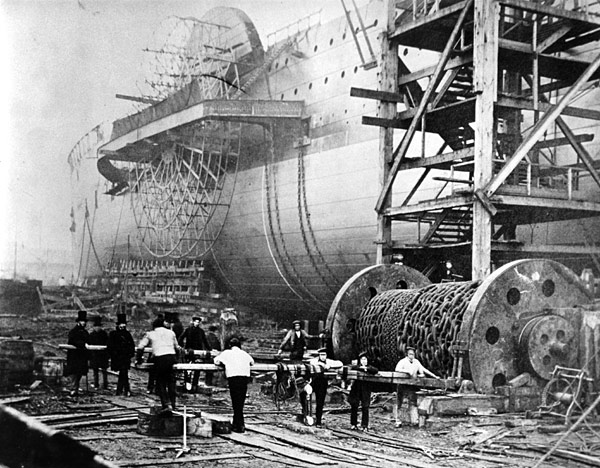
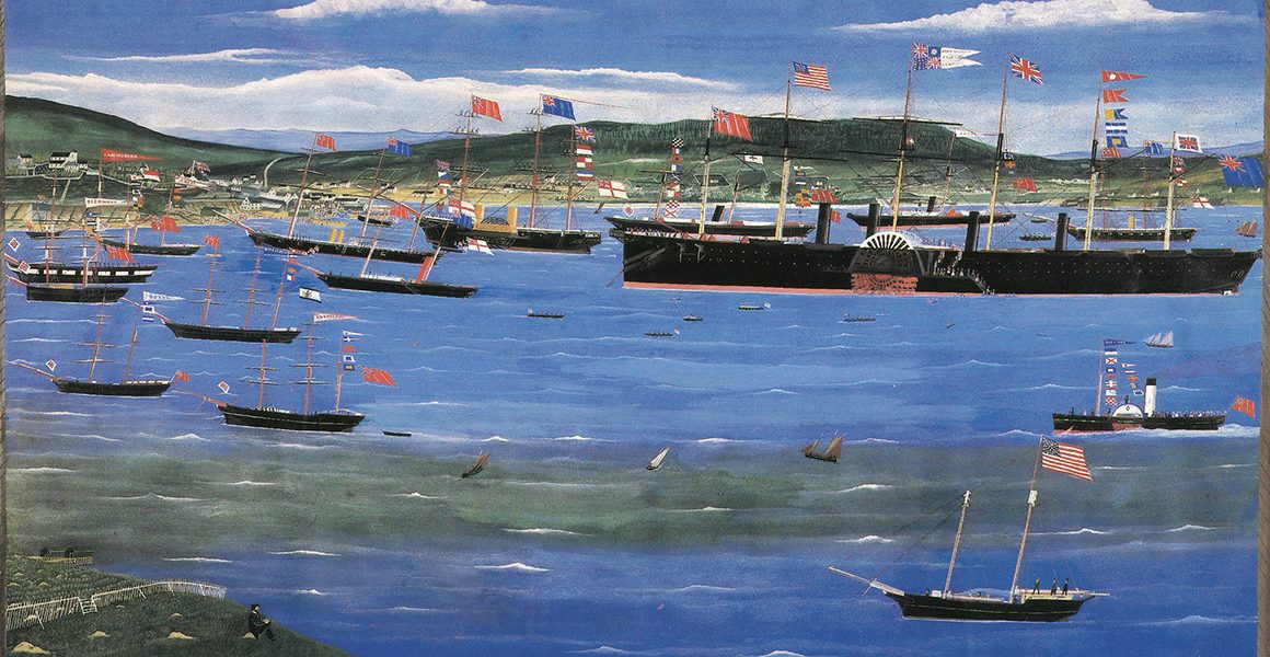


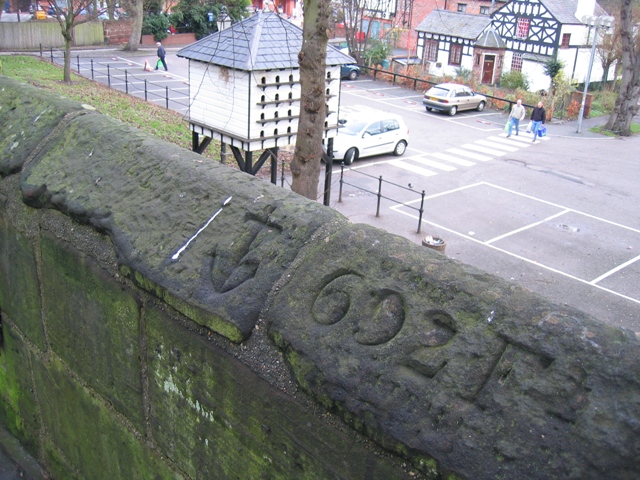
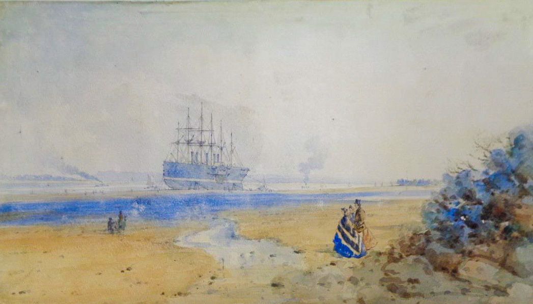
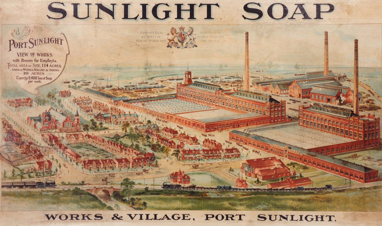
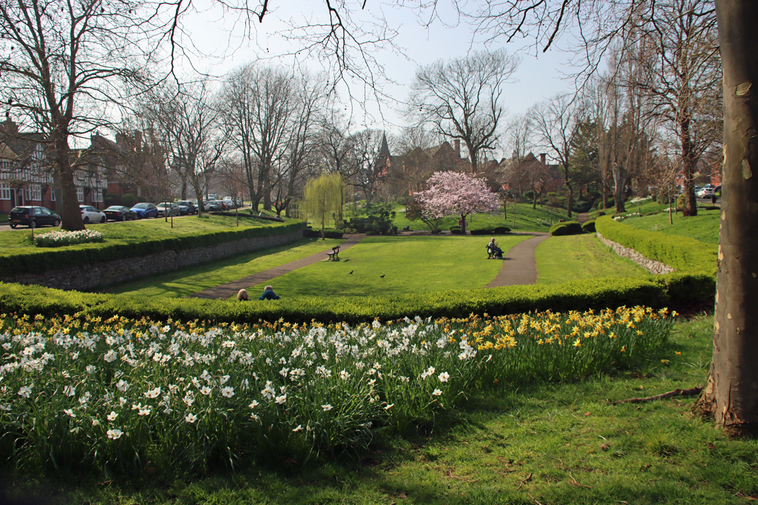

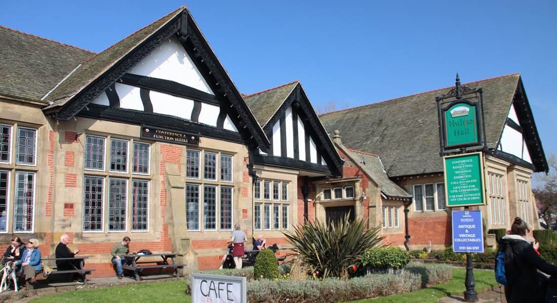
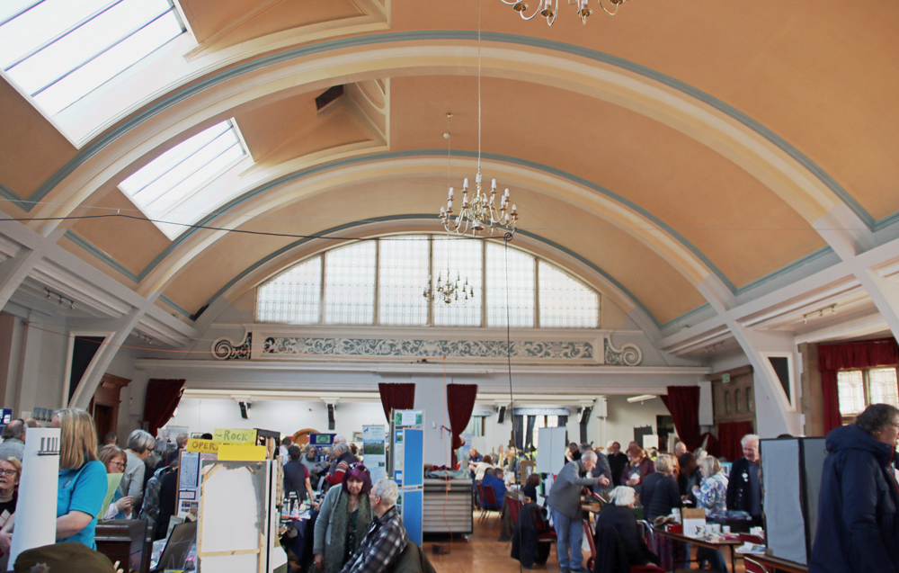
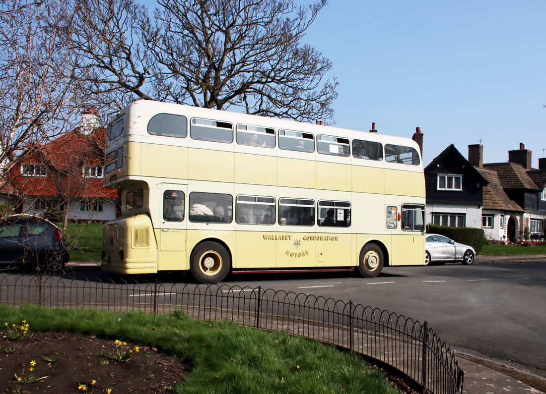
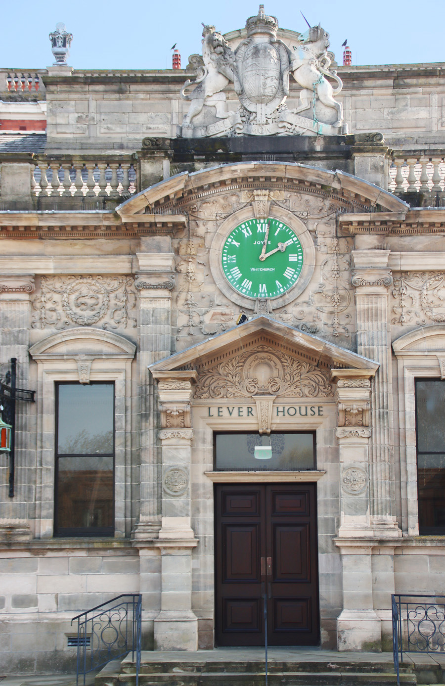
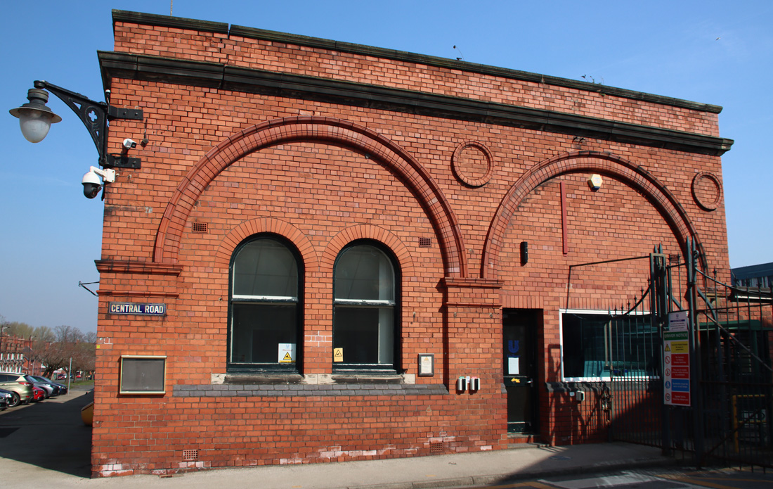
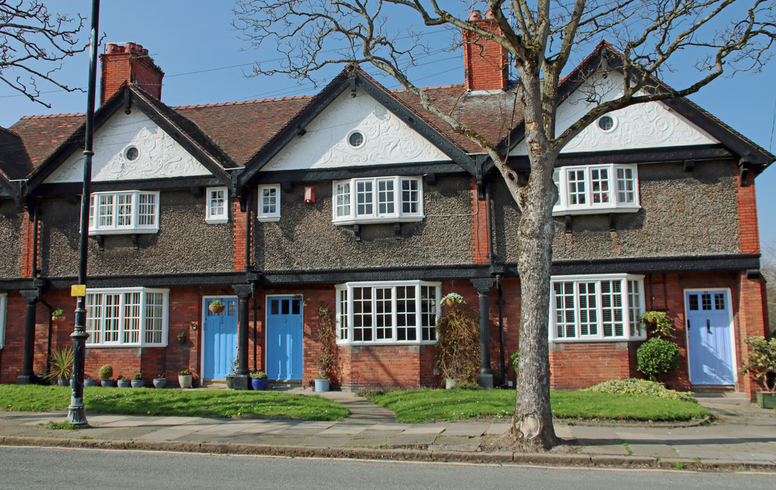
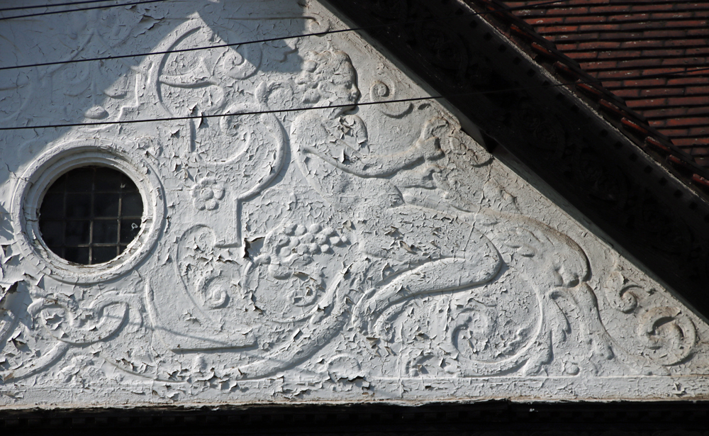
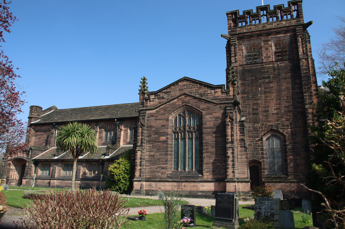
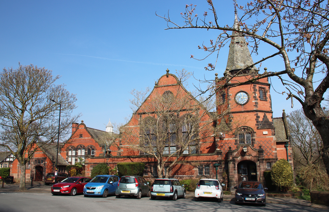
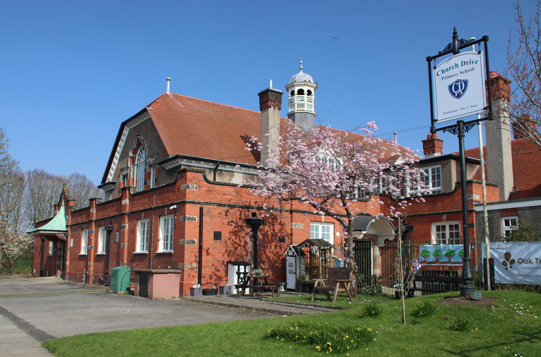
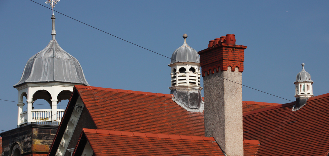
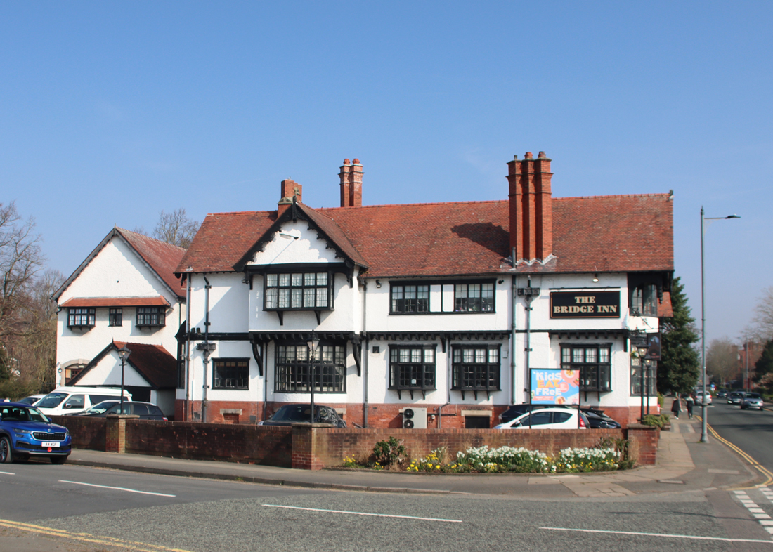
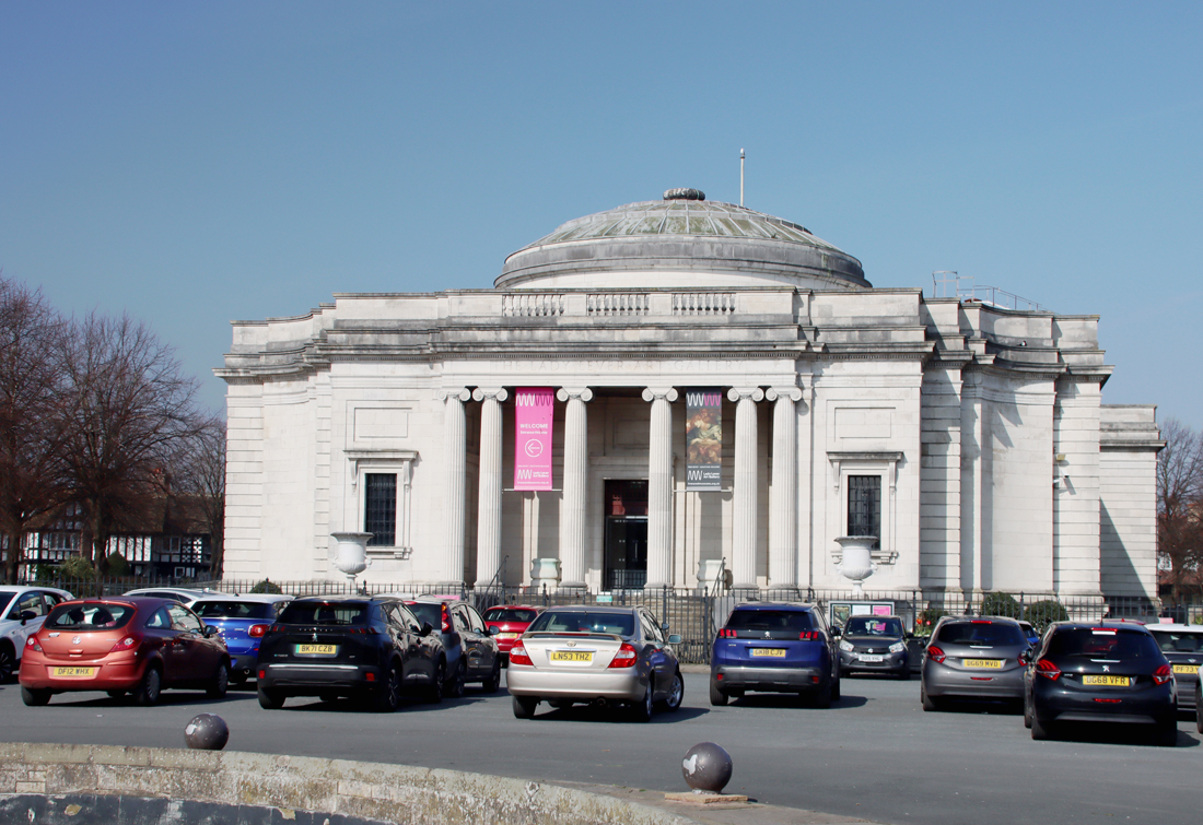


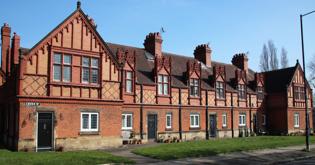
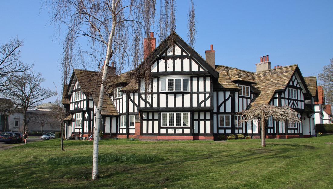
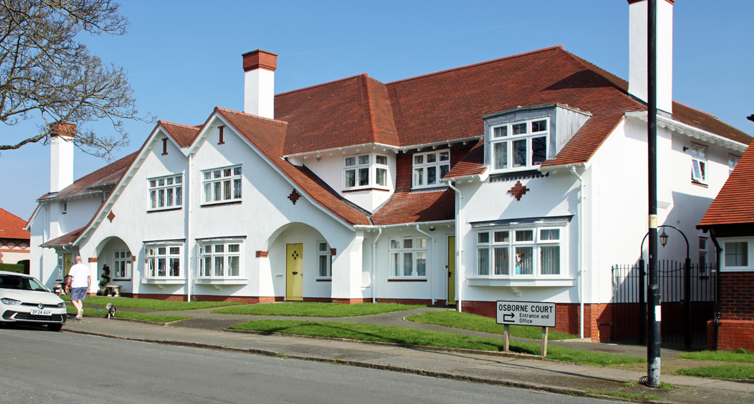
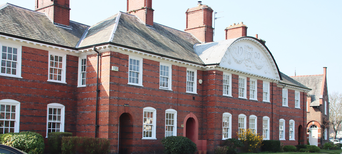
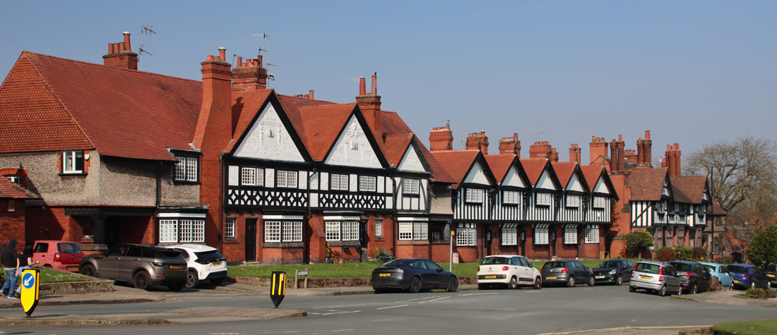
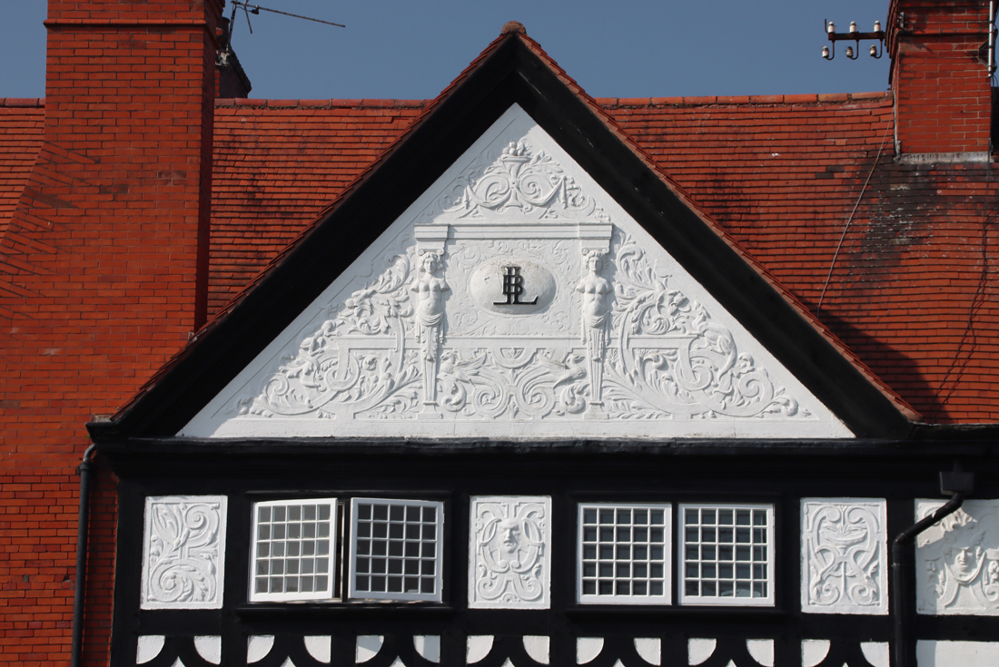
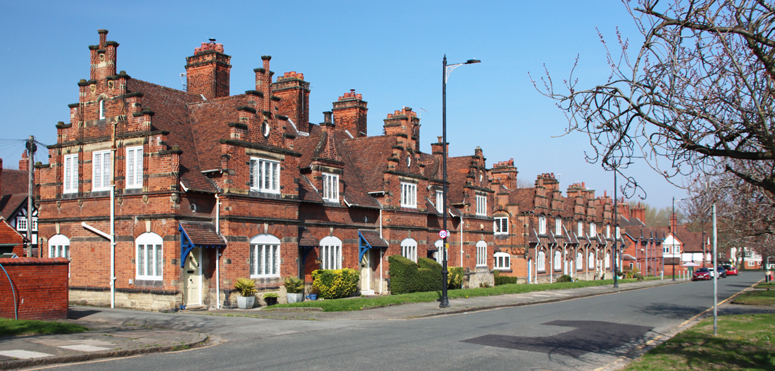
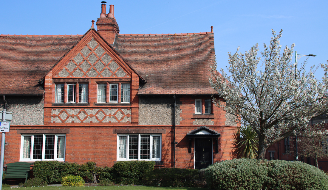
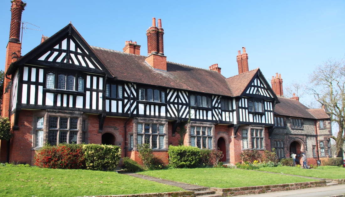
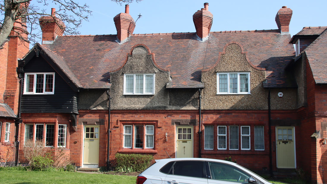
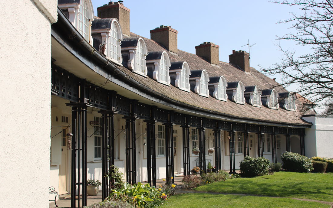
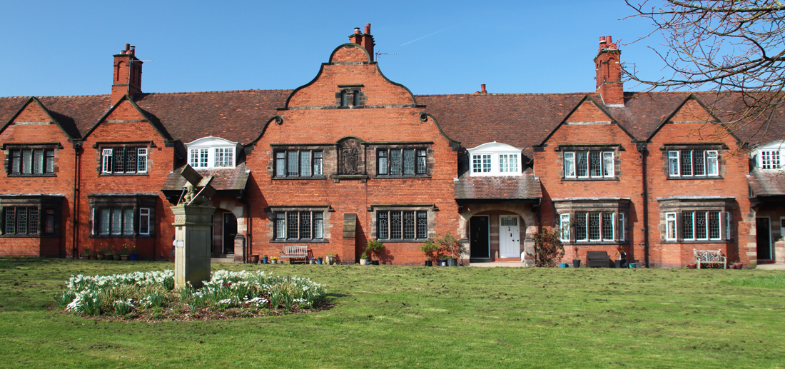
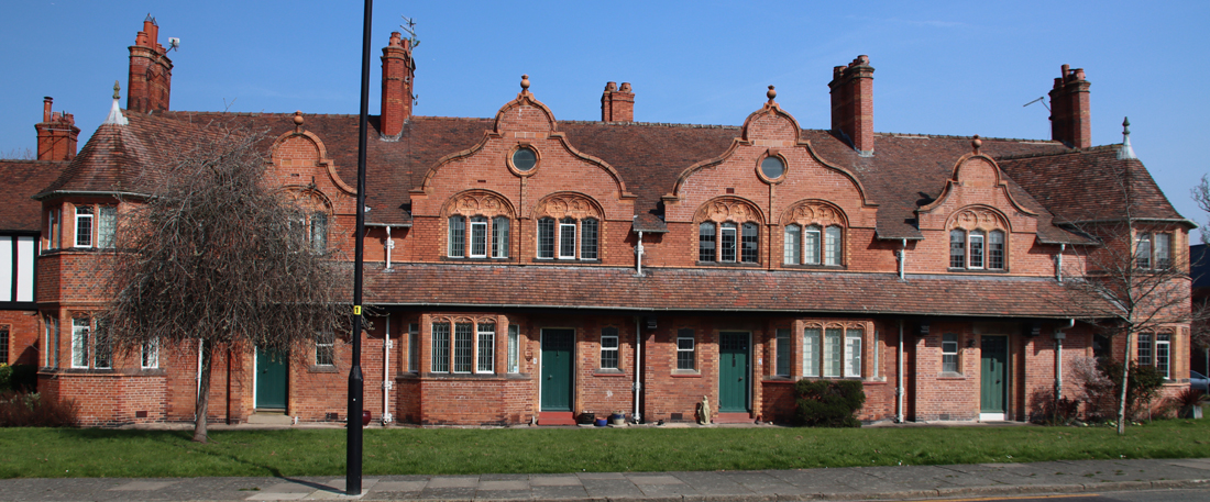
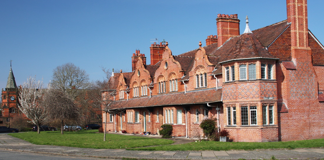
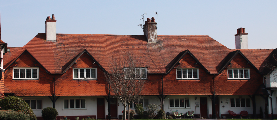
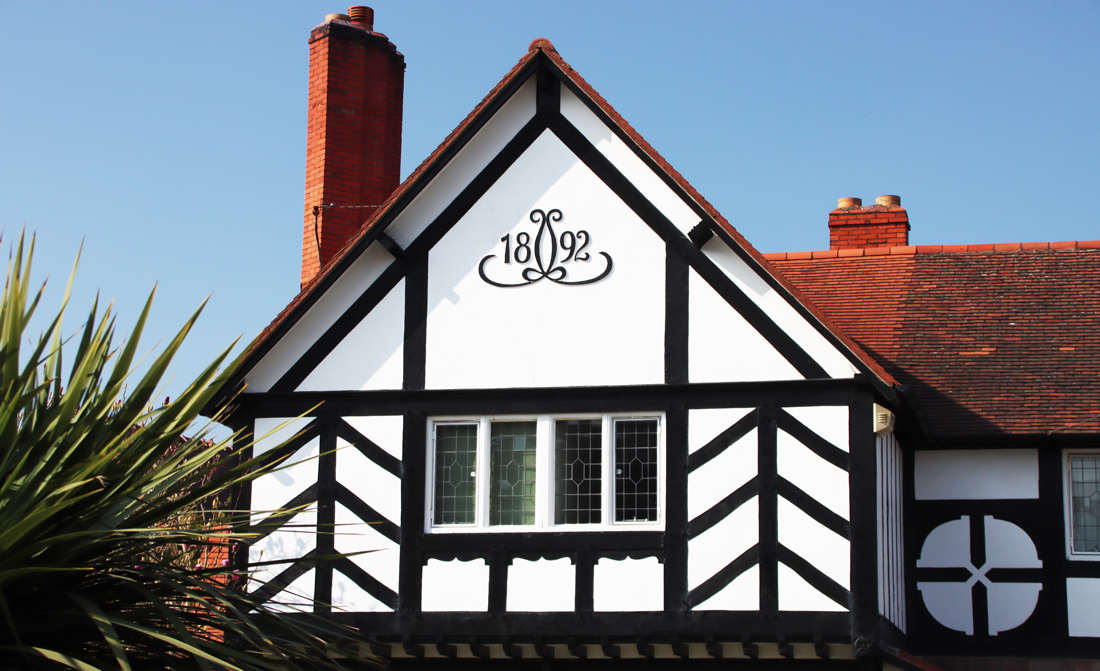
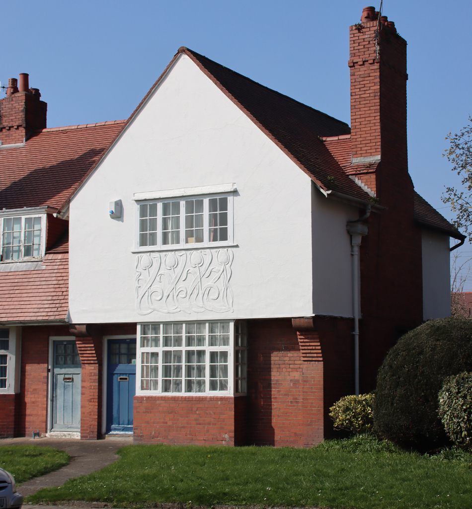
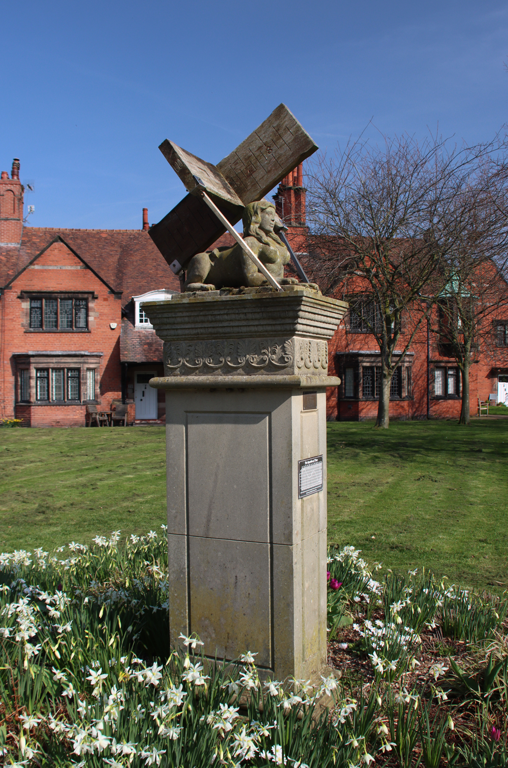
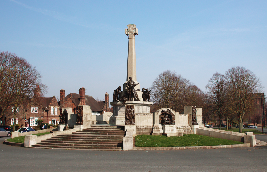
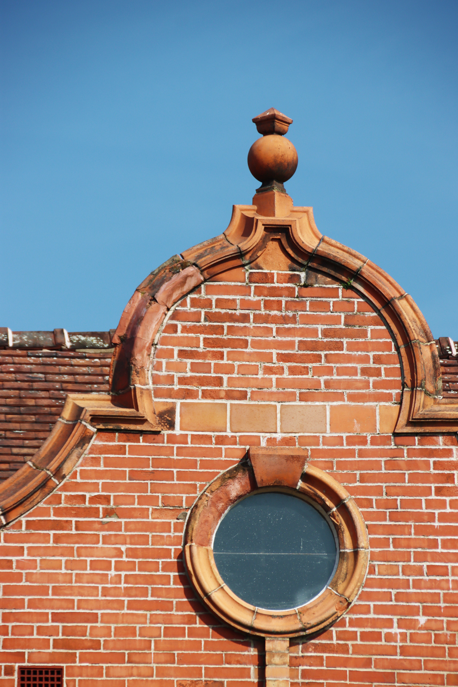
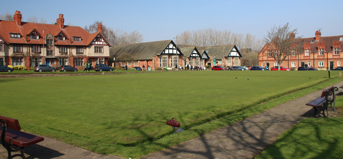
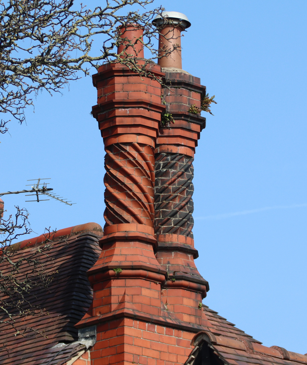
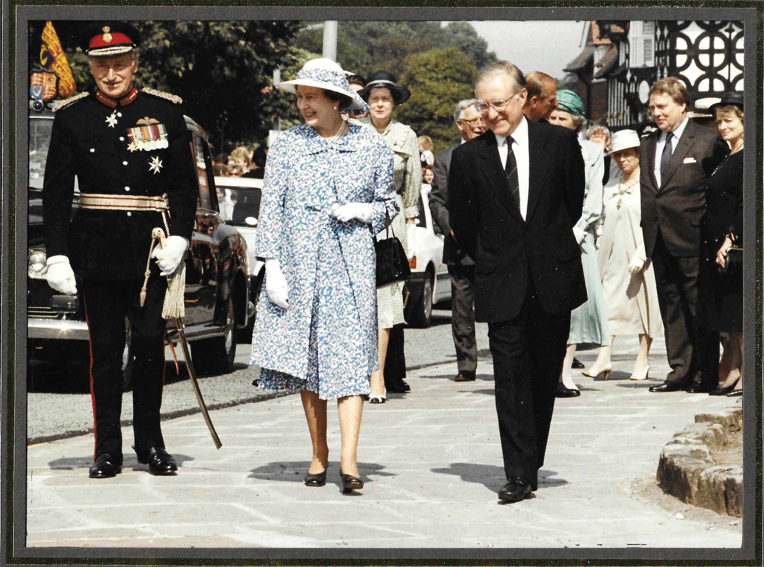
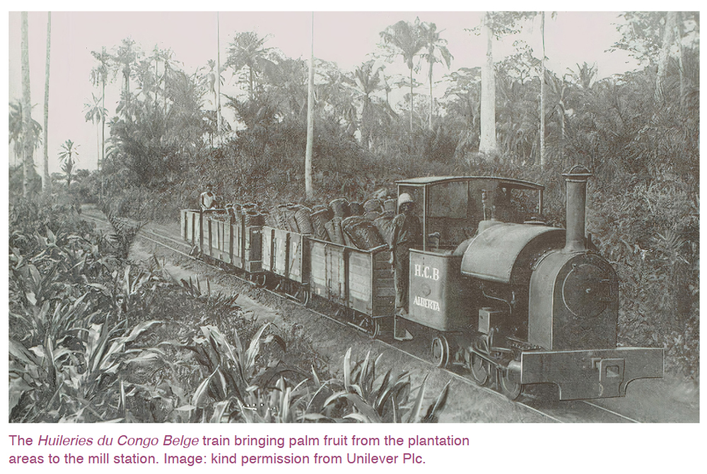
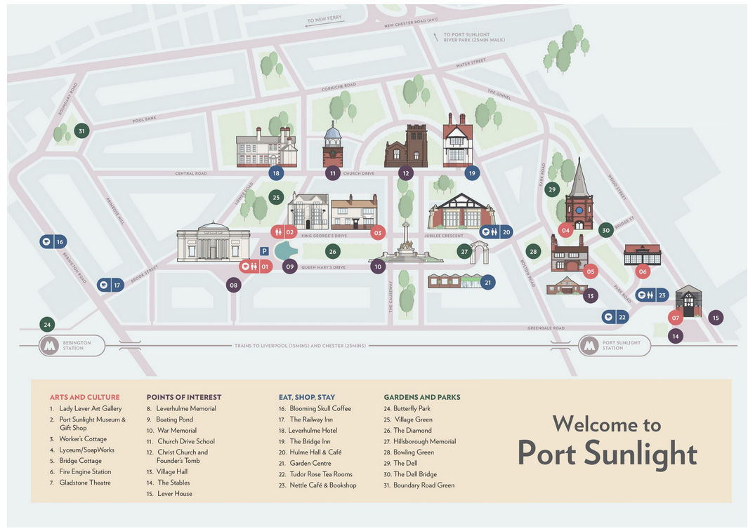
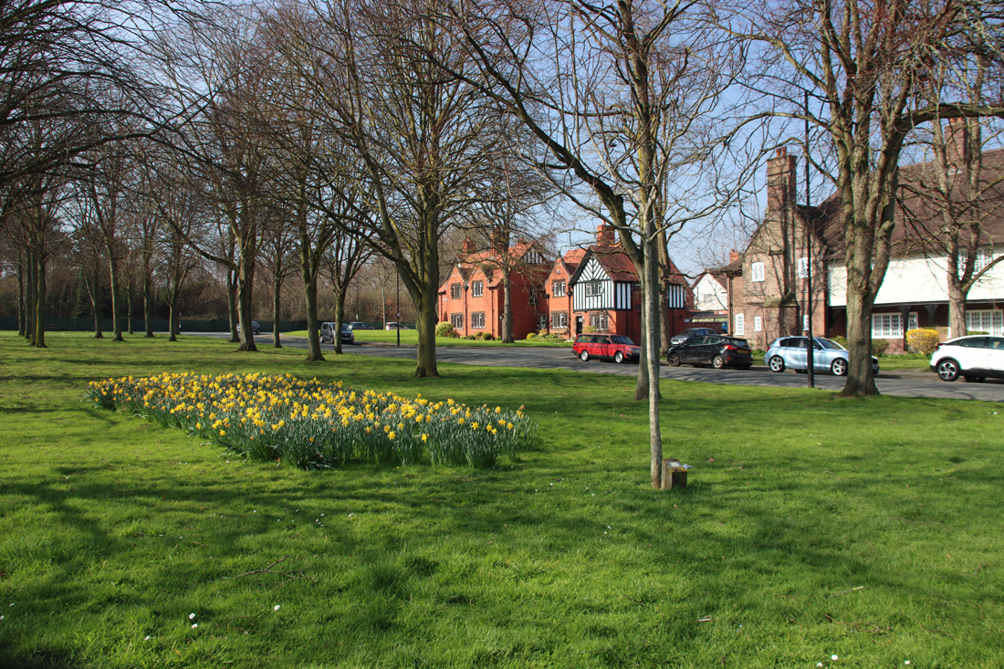
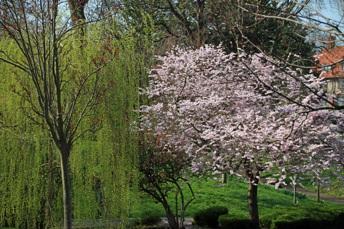
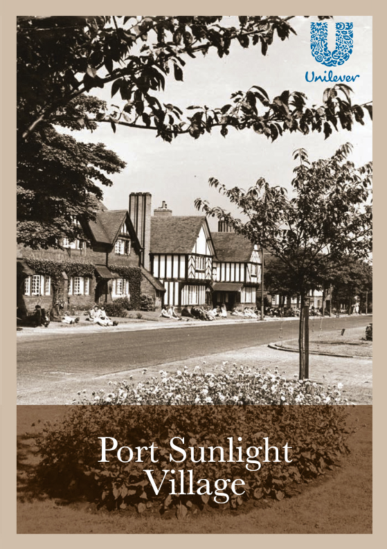
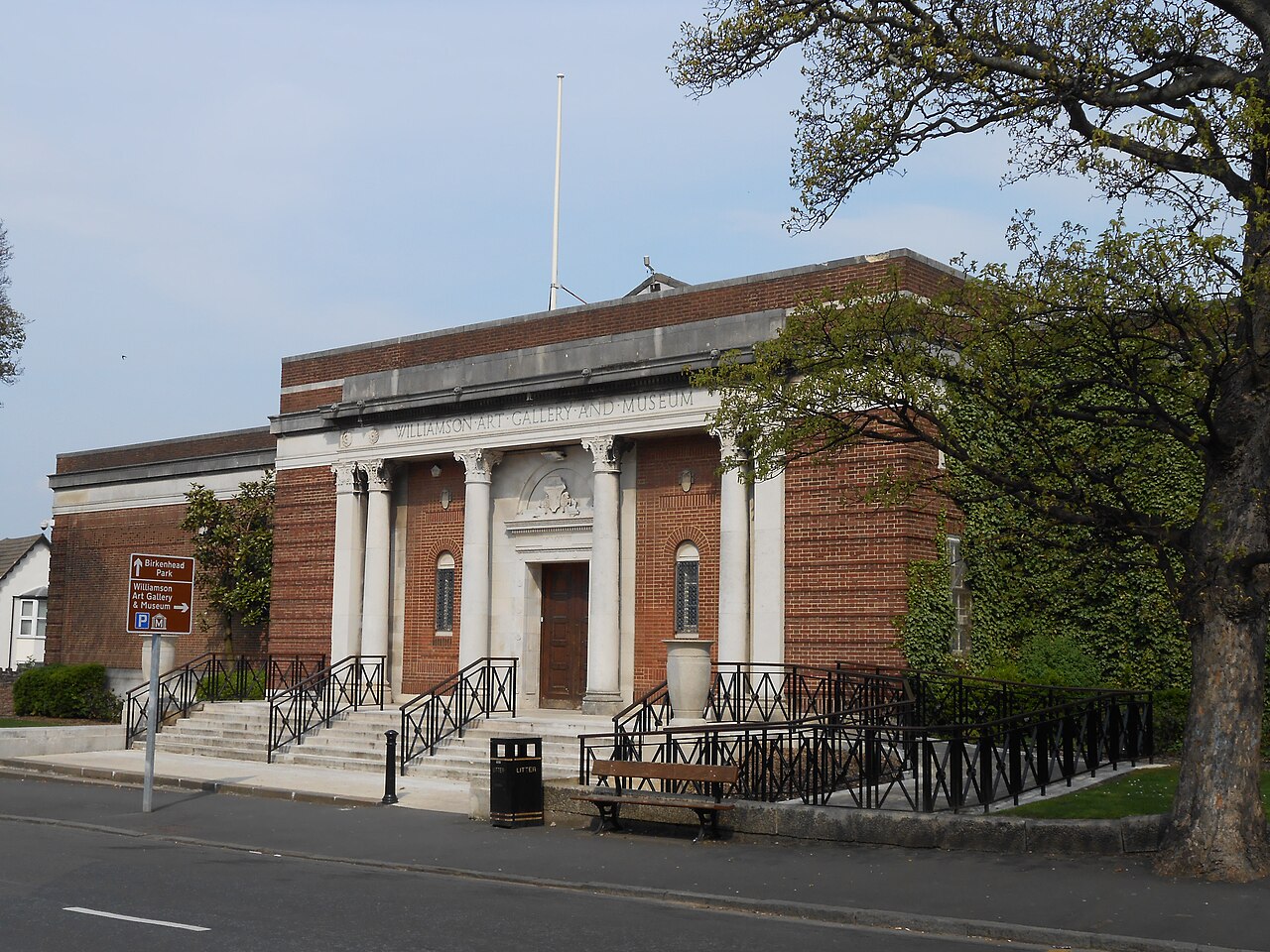
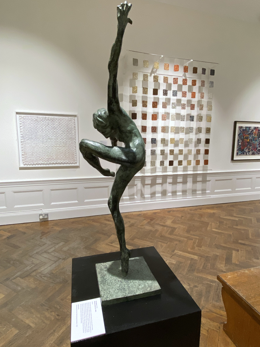

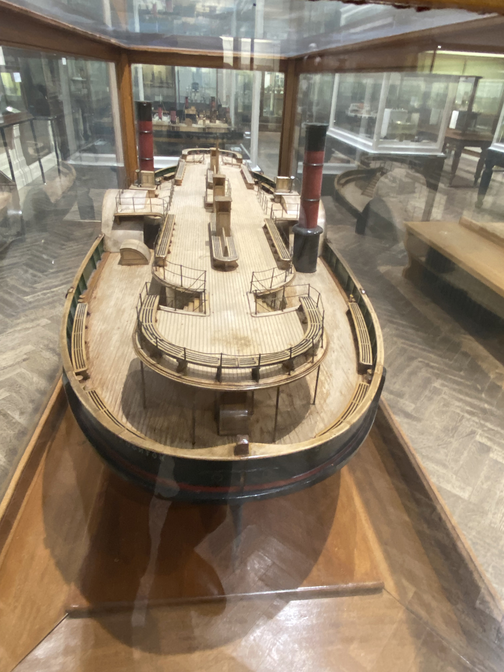
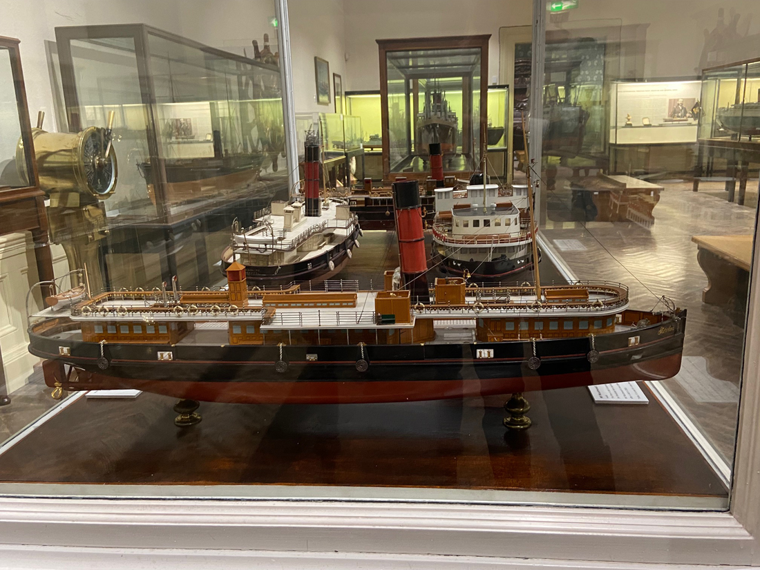
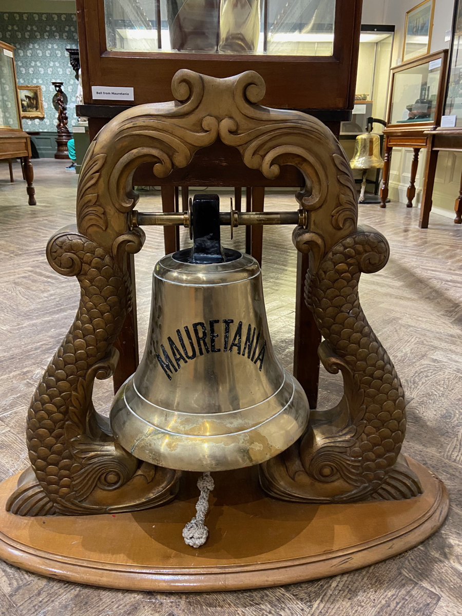
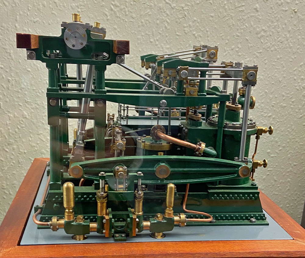
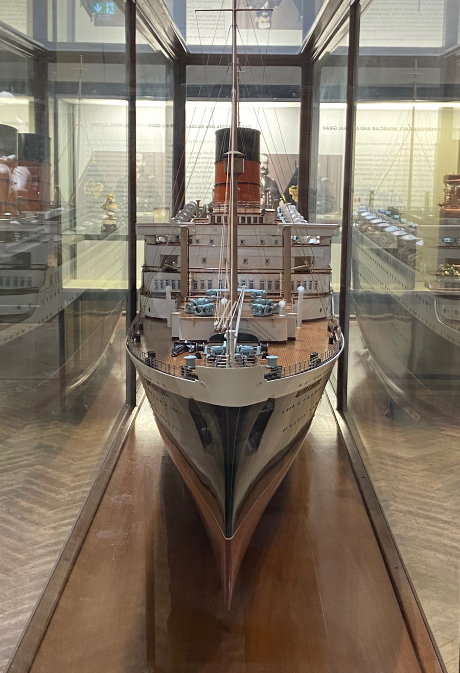

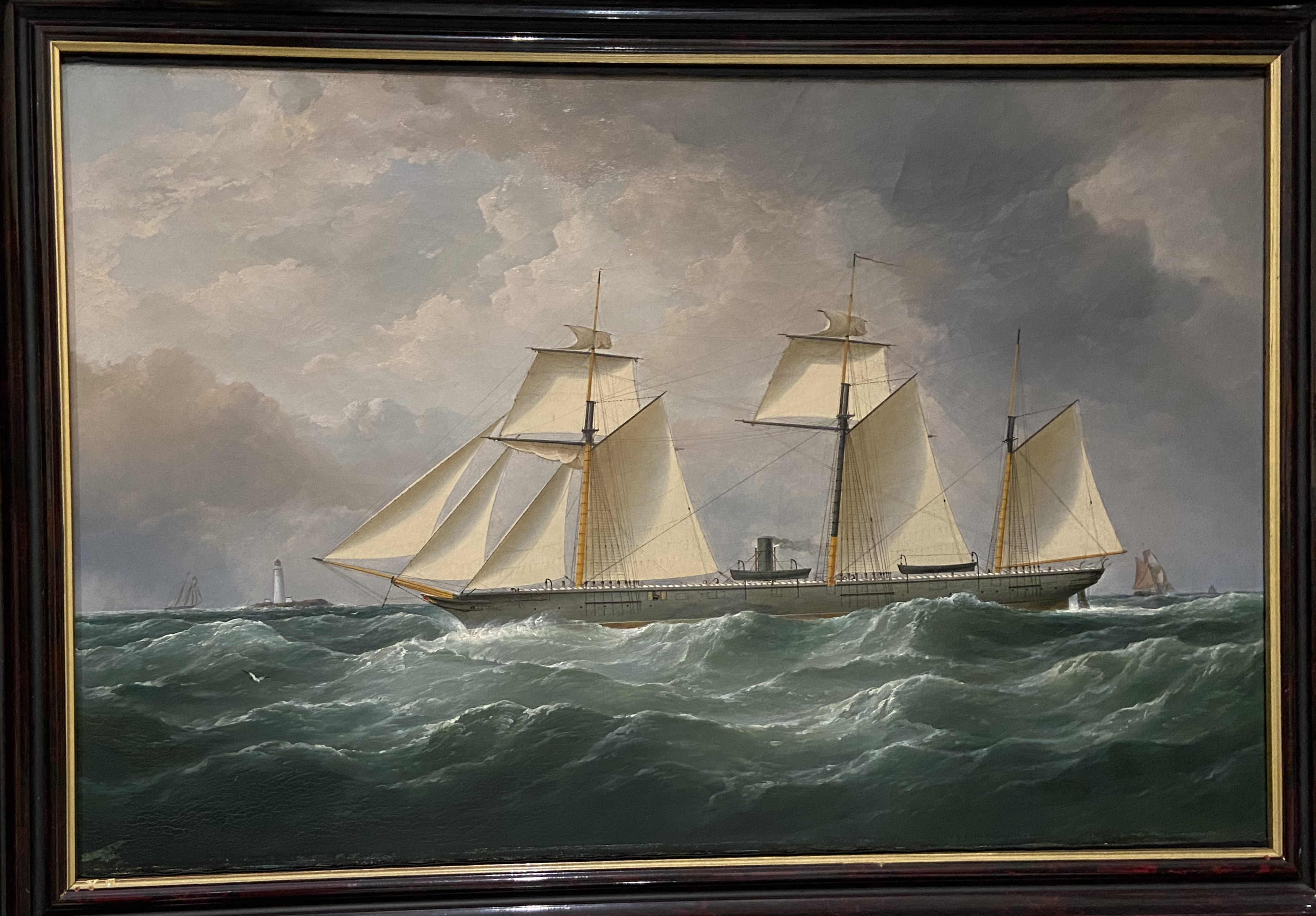
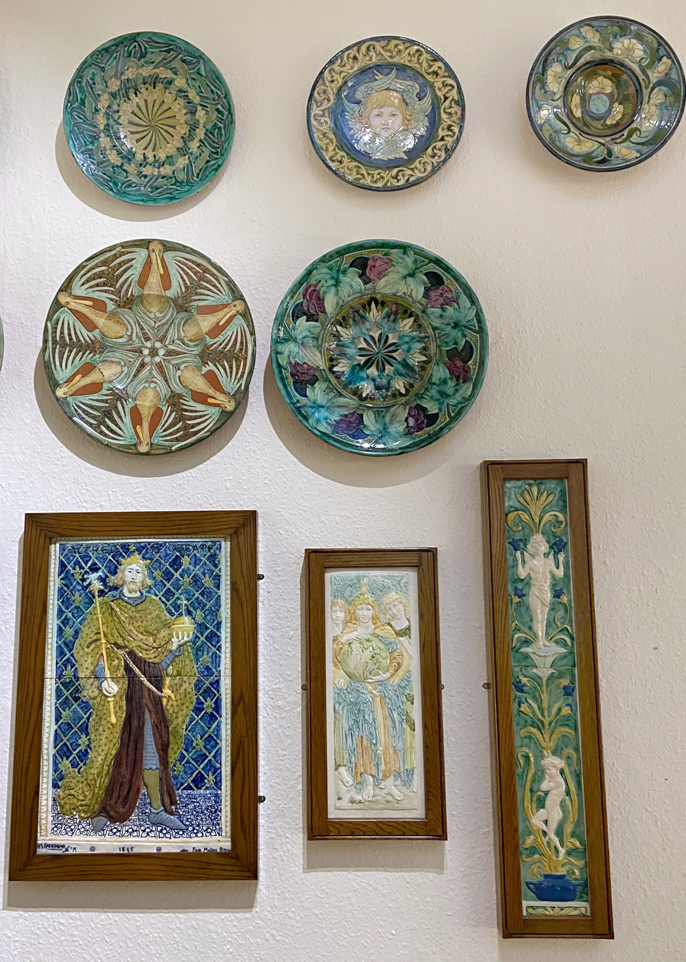
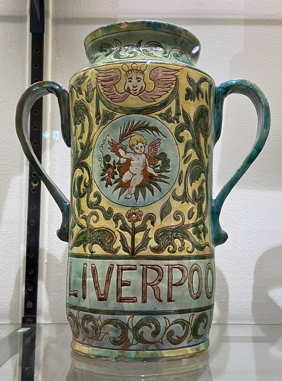
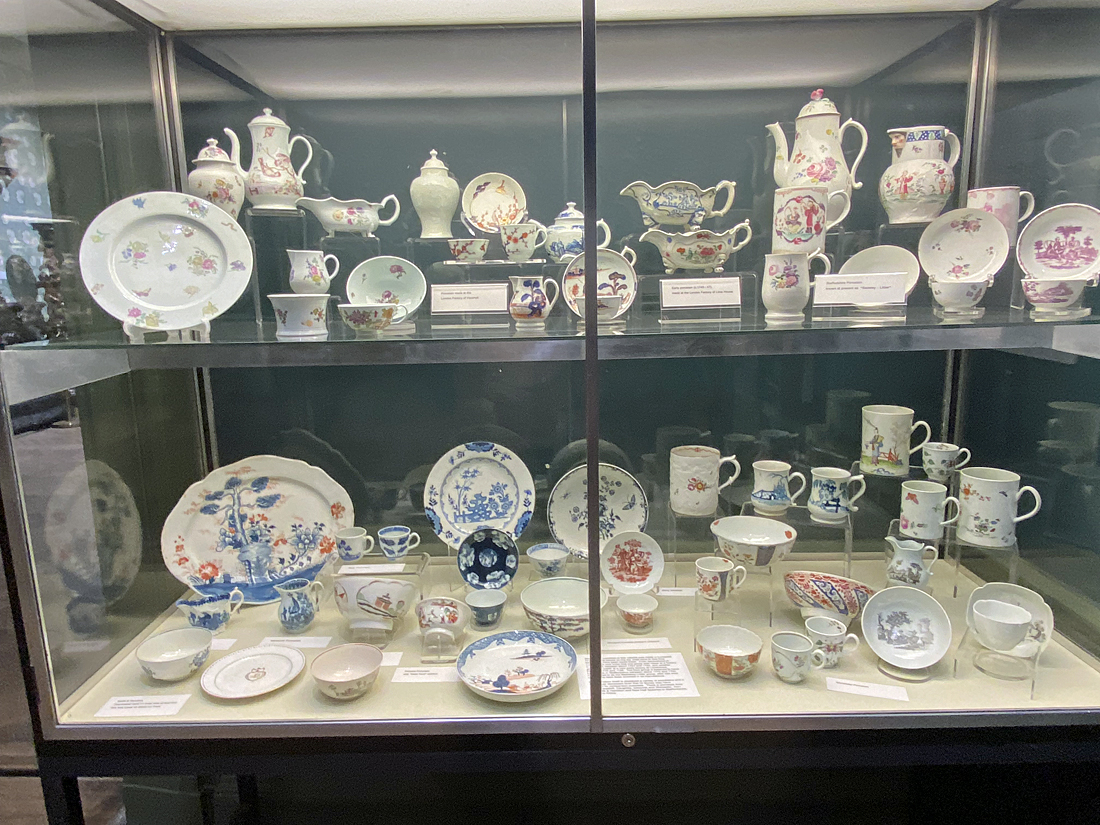
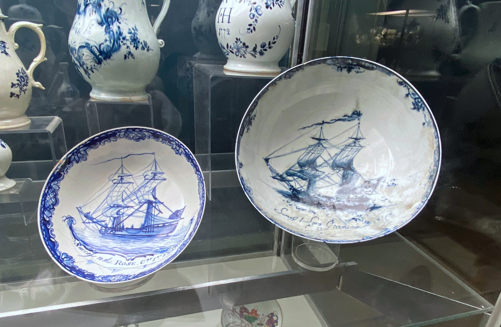


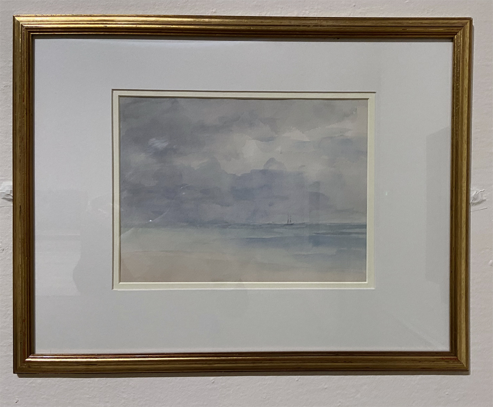

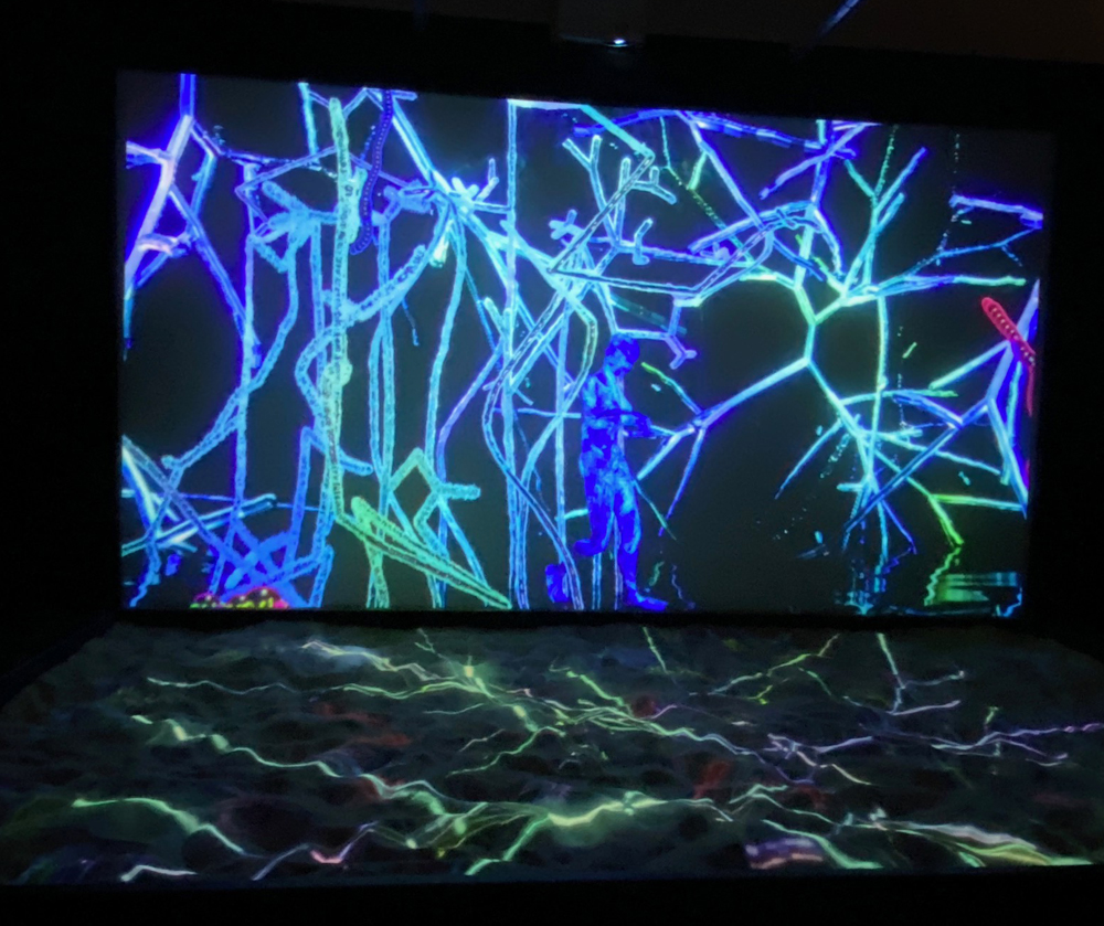


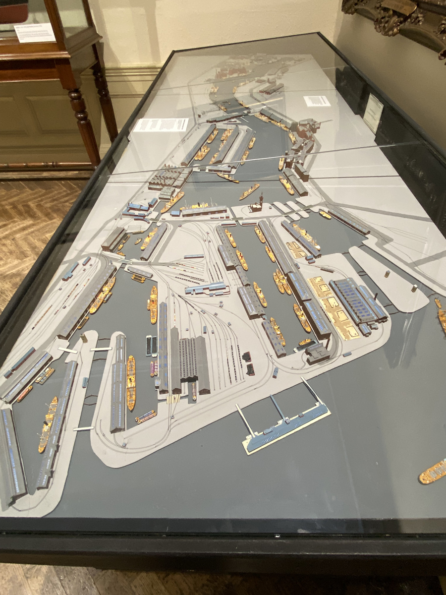
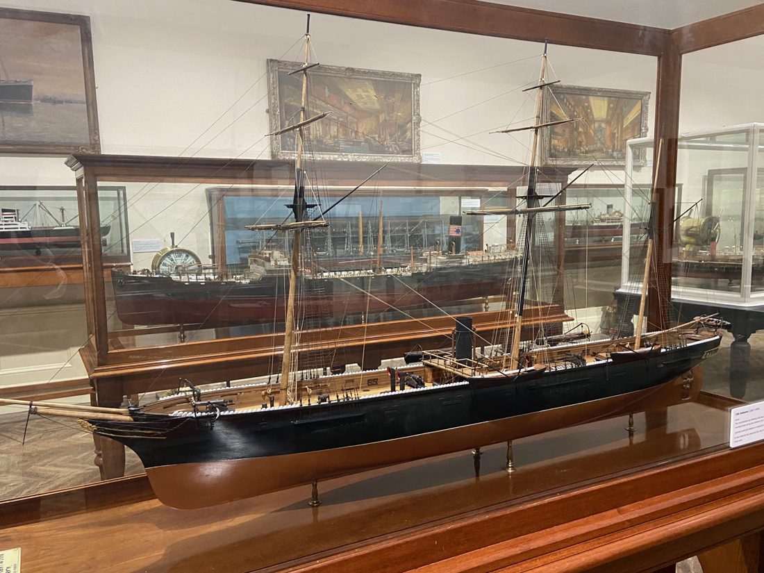


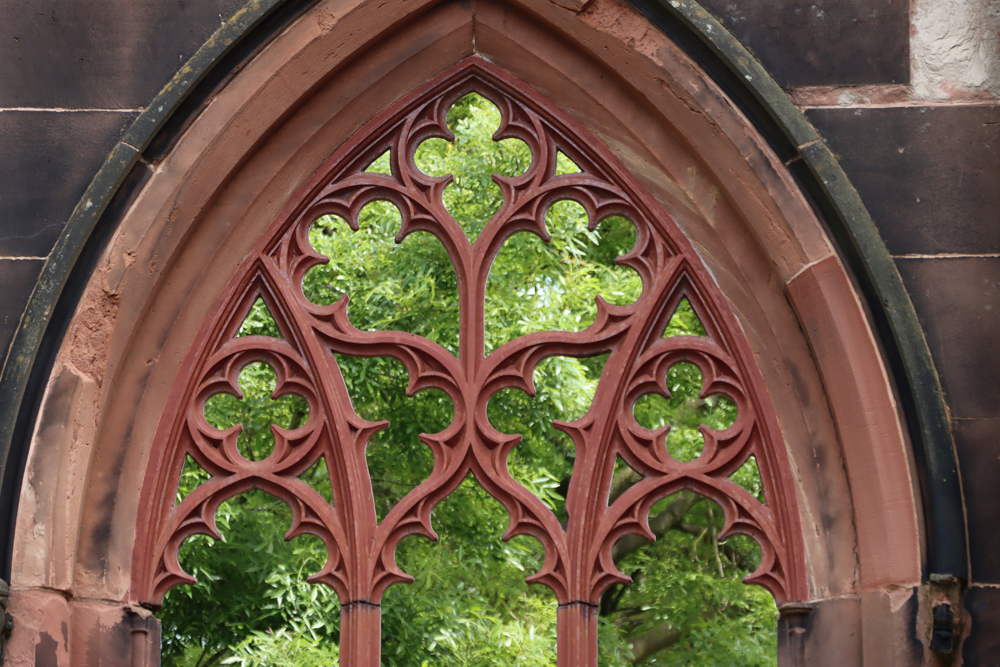


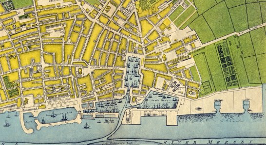


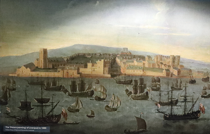


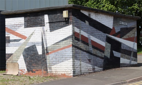


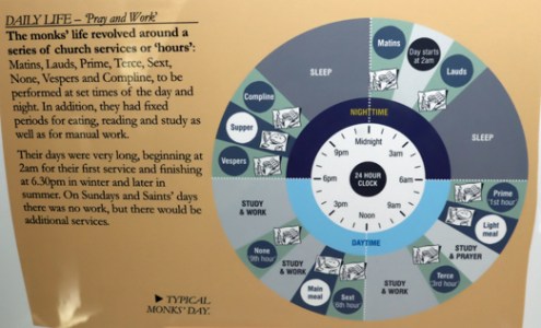


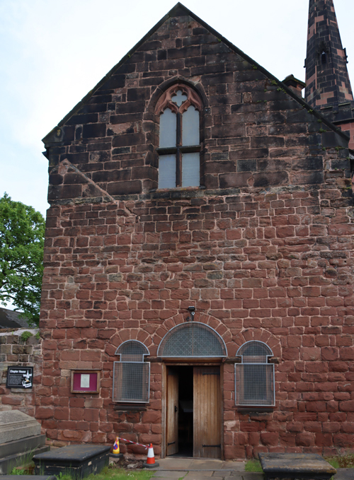


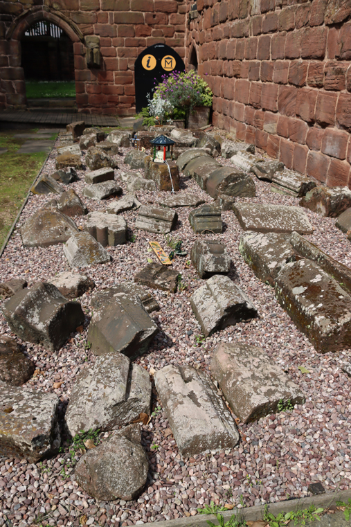


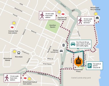


.png)
.jpg)