Although this is a great area to live, one of the things I still miss about living in London is a wide range of top-class take-away food restaurants on the doorstep. The whole process of ordering it online, dropping in and having a chat whilst waiting to collect it, carrying it tenderly home whilst inhaling the stunning aromas, and then pouring a big glass of wine to kick back and munch and slurp accompanied by a good movie was wonderful. My takeaways were always something to seriously, seriously enjoy.
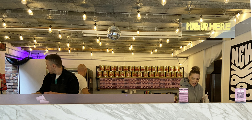
Enter Pull Up Pizza in Farndon (Harbledown House Garage, Churton Road, Farndon), a splendid fortnightly pop-up, every other Friday, that has brought a large dash of cosmopolitan sparkle to the village, and produces pizzas to order on the premises that quite simply make your heart sing. Mucho mucho happiness. The upmarket take-away has arrived, and in style. The magicians are husband and wife team Will and Charlie, with Jonny and Chris, who form the power-team that produce this excellence, working like crazy, making time for quick chats with big smiles.
I first noticed it on Friday two weeks ago when I passed the garage entrance on my way home, a little way up from the post office/pharmacy in Farndon as you head north on Churton Road towards Chester. To my surprise the garage entrance was wide open, filled with light, and there was a busy pizza-making operation in full swing. I immediately abandoned my plans for making a fiddly cheese soufflé, ditched the car, and entered a nirvana of bright music, a chatty, friendly atmosphere and the most gorgeous aromas emanating in my direction. Fifteen minutes later I walked out with an exciting pink and black pizza box, the proud possessor of a Penduja Power. Oh the bliss! I could barely wait to get home to lift the lid as the aromas began to do serious injury to my will-power. The Penduja, with a crispy crust, thin base, chunky slices of jalapeño and thickly spread nduja, has a serious kick to it, with smokiness from the pepperoni, whilst both the creamy fior di latte mozzarella and pure mozzarella ensure that there is just the right balance of flavour, with subtle undertones and divine ultra-spicy overtones, all accompanied by gorgeous hits of fresh basil. It really was love at first glorious bite ❤️.
Pull Up Pizza’s “Penduja Power” with a guilty slice missing
I was so busy enjoying my small chunk of heaven that I forgot to photograph the thing. This meant (oh dear, oh dear) that I had to go back this Friday to buy another one. And you know what? I had already been so completely overpowered by the alluring scents by the time I arrived home that I had devoured a slice before I remembered that I was supposed to be taking a photograph of it – again! This could have gone on forever, so here’s the photograph of the pizza decanted onto a very large pre-heated plate with (ahem) one slice missing. Please note that before I had wrestled it with inelegant haste from its box it was actually a thing of real beauty and perfection.
Although they can take walk-in orders when they are not snowed under with online orders, the whole operation is based on the premise that pre-orders will enable them to respond with maximum efficiency to make their pizzas to order, ready for collection at a certain time. They emphasize that checking ordering before cut-off times is essential, so signing up to their newsletter (a maximum of three emails a month) or checking their website or Instagram page is essential. For example today’s cut-off for all evening orders was 3pm, and order collections began at 4pm and ended at 9pm. For full details of how it works see the Pull Up Pizza website, but basically you can either order via Instagram or if you don’t have an account, you can just click the Order Pizza Now button on the aforementioned website, which is what I did. Customers select a fifteen minute timeslot from a drop-down menu and pay in advance, and it all seems to work like an absolute dream. There are a number of different payment options, including debit card, credit card and Apple Pay, and of course you receive an order confirmation.
This is a real pop-up. When they close down, everything is on wheels so simply pushes back out of the way to re-create the garage space. It was really good to see people coming and going, chatting to the proprietors and generally enjoying the spectacle and the anticipation of great pizza and garlic bread (oh the scent of that garlic bread!). If you arrive early there is a bench inside where you can sit and wait. There is parking on the road immediately outside as well as on the main Farndon high street, and of course there is free parking at the Memorial Hall on Church Lane.
I am a serious pizza nut, so it is a matter of some celebration that these guys have established Pull Up Pizza so close by. My major challenge is to wean myself off the Penduja Power and try one of their other pizzas, all of which are listed on their website. I foresee a Crimson Blaze on the horizon. The fact that they are only open once a fortnight holds out some hope for my waistline actually continuing to be a waistline. Wishing them all the best for a really great future – it’s such an enterprising idea, and so well executed. xxx
Not for the first time I am writing about somewhere that I really ought to have talked about a long time ago because it is so near to me, in this case the Grade II* listed St Chad’s Church just down the road in Farndon. It is a lovely church, with a rather unexpected history, surrounded by a churchyard and enclosed by an irregularly shaped curving wall. Apart from the tower, there is very little of the medieval church remaining, having been almost completely rebuilt in 1658 following the damage inflicted during the Civil War, but it followed a broadly gothic template and is charming in its own right with a number of nice features, some influenced by the gothic, and others departing in interesting directions. It is particularly well known for the Civil War window installed by William Barnston.
St Chad’s Farndon
The congregation traditionally included those who were on the English side of the river, with burials from Churton-by-Farndon and Churton-by-Aldford, Crewe-by-Farndon, Barton, Leche, and Caldecott, and other nearby villages and farms. After 1866 residents of Churton-by-Aldford were often buried in at the Church of St John in Aldford.
During the summer I posted an account of St Chad’s Church in Holt, opposite Farndon on the other side of the river Dee, with its medieval links to Holt Castle and the Lordship of Bromfield and Yale. It is larger and more elaborate than St Chad’s in Farndon, and the two churches each has its own distinctive character with a lot to offer the visitor. Both churches were involved in the Civil War, due to the importance of the crossing here, and both bear musket ball damage as a result, but Farndon’s St Chad’s came off much worse than St Chad’s in Holt. xxxxxx
According to Bede (writing in the 8th century) St Chad was one of four brothers who entered the church in the 7th century, and started his training at Lindisfarne Monastery under St Aiden. He was ordained in Ireland and became a leading light in the Anglo-Saxon church, rising through the ecclesiastical ranks on the kingdoms of Northumbria and Mercia and under King Wulfhere, one of the earliest Christian kings. He was appointed Bishop of Northumbria, including York, and became the first Bishop of Lichfield in the new diocese of Lichfield, at the heart of Mercia. Mercia was one of seven British kingdoms of 7th century Britain and occupied most of central England. Chad died in AD c.672 and was buried in Lichfield Monastery, now Lichfield Cathedral. Regarded as a pioneer who helped to spread Christian teaching in and beyond Mercia, he became a popular icon during the Middle Ages in the Midlands and its borders. xxx
The Medieval Church
It is remarkable to think that the Civil War obliterated so much of the medieval church in 1643 that most of it had to be rebuilt in the 17th century. The Domesday book records a village priest, as well as two other priests locally, strongly suggesting the presence here of an earlier church, probably wood-built.
Today’s church has a nave and tower that are thought to have followed the original medieval footprint dating to the14th century building. All that obviously remains of the 14th century is the tower, of which three storeys date to around 1343. Everything else appended to this basic structure on north, east and south sides are later in date. Although you enter the church through an 18th century yellow sandstone porch, the thick wooden door itself is actually medieval, a quite astonishing survival.
Lines of the old roof of St Chad’s in Farndon marked on this photograph in white.
Inside, looking towards the tower from the nave, you can see the converging lines at which the old church roof met the tower, considerably lower down than the current roof, and terminating further down than the current arch. This suggests that the medieval church was both shorter and darker. Within the tower there are three chambers with one each for bell-ringers, another for the clock-works and the belfry itself, containing the bells, originally three, at the top.
In the north aisle in the interior of the church is a 14th century funerary effigy showing a knight in armour holding a shield carved with a Latin inscription reading “Here lies Patrick of Barton. Pray for Him.” Sir Patrick holds a sword in his other hand, and has some form of animal at his feet, now too badly worn to be identified with any certainty. This effigy is one of three that was found, but the other two were ground down to make white sand. Although Sir Patrick survived this particular indignity, he was used as a step into the belfry in in the 1900s, which accounts for the wear and tear to his face and the animal. Latham says that one of the other effigies was inscribed with the word “Madocusdaur” and a third was inscribed with a wolf.
John speed was the Farndon tailor’s son and was baptised in St Chad’s in 1552. There’s a good biography of him on the New World Cartographic website explaining how Speed followed his father into tailoring at a time when fashion was of growing importance, doing very well in the business, whilst at the same time pursuing his interests in history, geography, cartography, antiquities and genealogies. It was not until he moved to London that he gained a patron and was able to abandon tailoring and launch a new career. His map of the County of the Palatine of Chester was completed in 1610-11, and was used by both sides during the Civil War. He died in 1629 and is buried in London. xxx
The Civil War
Musket ball and cannon ball marks in the walls of the medieval tower.
The tower in Farndon’s church shows musket-ball and cannon shot damage to the exterior, to the right of the main porch, but the fact that the rest of the church had to be rebuilt in 1658 makes it clear that it experienced a much worse time of it than its counterpart in Holt. In 1643 the commander of the Cheshire and Lancashire Parliamentarian troops used Farndon and its church as a headquarters and barracks, assembling a force of around 2000 to force their way across the bridge, through Royalist defences. The subsequent fighting entered the churchyards at both Holt and Farndon. During the fighting in Farndon churchyard the roof was somehow set alight. In spite of the damage to the roof, the Parliamentarians reoccupied the church until they were ousted in winter 1645. xxx
The 17th Century Rebuild
Apart from the tower at the west end, the current red sandstone church with its slate-tiled roof is largely the result of the post-Civil War rebuild in 1658, presumably re-using some of the original medieval stonework. The main body of the church consists of a nave with clerestories (a run of windows above the nave below roof level to allow in light) and two aisles, terminating in the chancel at the east end. The 5-bay arcade separating the nave from the aisles consists of round piers (columns) with simple capitals and pointed arches. Over 40 different mason marks are dotted throughout the church, each one identifying a separate mason, giving a hint of the scale of the workforce required to rebuild St Chad’s. There used to be a musician’s gallery at the tower end, but this was removed in the 19th century.
Mason’s mark on the arch between the nave and the tower
The nave of the 1658 nave, arcade and overhead clerestory. The entrance to the Barnston chapel is shown at lower far right.
The new church was taller than the old one, with the clerestory and the large Gothic-style lancet windows letting in much more light. The tower was provided with a new top section at this time.
Adding to the footprint of the old church, the Barnston family, major landowners in the area, built a small chapel off the chancel end of the south aisle, for their private use and to bury and commemorate family members. According to the church’s history booklet, there are records mentioning Barnstons in Churton during the reign of Henry VI in the 15th century. In the 17th century William Barnston was a major contributor to the rebuild of the church, and requested that he be buried under a gravestone in the south aisle of the church that has already been placed ready. His 1663 will left a substantial bequest to the church for its upkeep. He died in 1664.
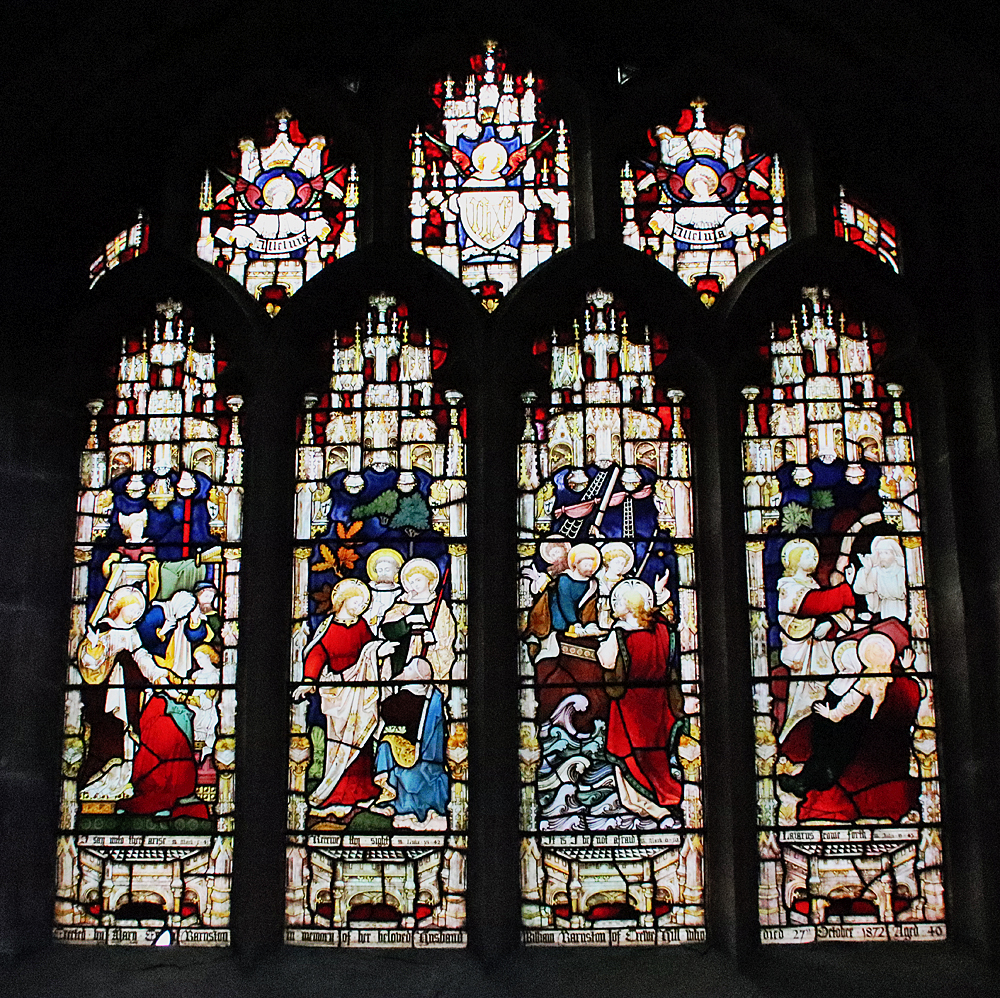
The Civil War window, St Chad’s, Farndon
An adviser to Charles I at the Siege of Chester, William Barnston was responsible for the famous Civil War window in the chapel. What surprises most people who see it for the first time is how small it is, but it is full of details that show Royalist participants, including Barnston himself, and a variety of items of contemporary clothing and equipment used in the Siege of Chester. Pevsner and Hubbard say that the technique is “decidedly Dutch” and Latham adds that “Its artist took his design for the armour from a military work by Thomas Cookson (1591-1636) and for the bottom border from prints by Abraham Bosse (1632).” My photo, left, is very poor due to the lack of light, but have a look at the Visit Stained Glass website for a much better image and a close-up of the depiction of William Barnston.
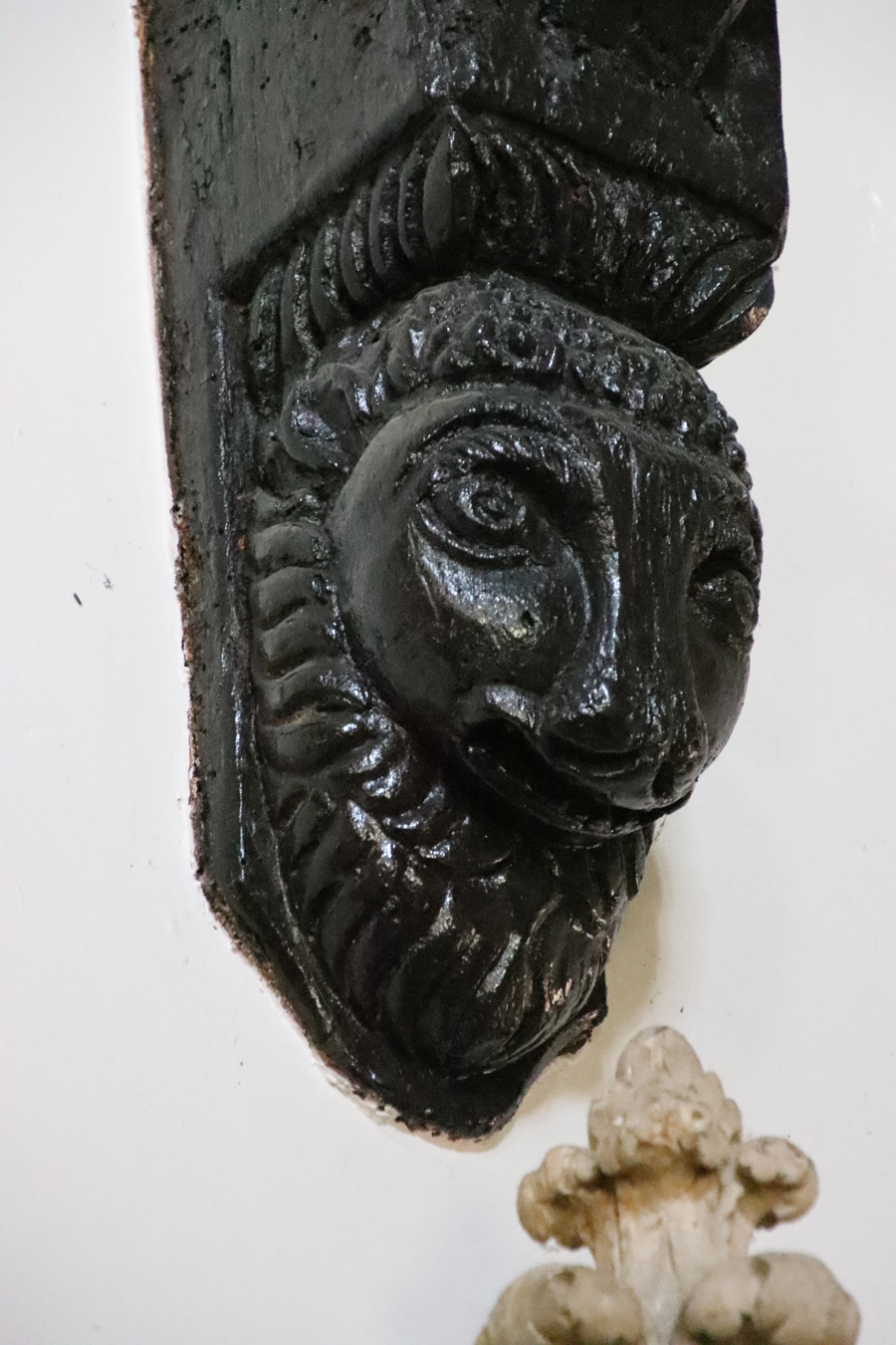
There are many features of interest to look out for in the 17th century church. In the south aisle there is a rather fine sculpted wooden beam support. The church’s booklet questions whether it is a human or an animal but it looks very like the lions with curly manes that are familiar from Tudor and Jacobean carvings. It is surprising that it is on its own. The damaged medieval font was repaired by Samuel Woolley of Churton but the current octagonal font is thought to date to 1662, replacing the repaired one. XXXxxx
18th, 19th and early 20th century alterations
Georgian style porch, St Chad’s
According to Frank Latham, by 1735 “St. Chad was surrounded by green fields and the houses were few and far between,” and the Massie family seems to have been important to the congregation at this time, with six pews allocated to Richard Massie Esq., and his family. He adds that the east wall was demolished in the 18th century and shifted 10ft (c.3m) further to the east, providing a much larger chancel. Towards the end of the century repairs to the roof were made between 1793 and 1798. Today the red sandstone church is entered via a Georgian-style porch built in yellow sandstone, although I have seen no mention of a precise date for this, and inside there is a large 18th century oak chest that housed the church plate and the parish records.
Memorial to Francis Fletcher 1782
The eastern end of the church was remodelled to include today’s chancel in 1853, not by the Barnstons this time but by the Marquess of Westminster. The carved reredos behind the altar shows the Last Supper and was installed in 1910, with the carvings on the pulpit were added in 1911, showing St Chad accompanied by the usual pulpit team of Saints Matthew, Mark, Luke and John, represented by their emblems. In 1927 the original three bells were joined by another five. The church booklet says that they were rung to mark nationally important occasions, including the defeat of Napoleon in Egypt in 1799, and his defeat at Trafalgar in 1805.
Of the various memorials, one that may be of interest to those familiar with the Barnston obelisk just outside Farndon, is the marble memorial to the Major Roger Barnston (died 1847) in the Barnston chapel. The obelisk in the field on Churton Road, now a natural burial ground, is also a memorial to Major Barnston (died 1847) discussed on the blog here,
The north aisle, like nearly all churches in this area, used to have a clear run to the end of the nave, but the presence of an organ since the 19th century regrettably meant that a gallery just in front of the tower’s arch, where musicians located, became redundant and was removed. The present organ dates to 1949.
St Werburgh and St Chad stained glass in the chancel
The windows are often round-topped, set within rectangular frames that give the exterior an unusual appearance. Exceptions are the large east window behind the altar, installed in 1858 and showing the Sermon on the Mount, installed in memory of church benefactors William and Anne Plumpton, and the south window in the Barnston chapel, both gothic-style.
Most of the stained glass is interesting for the contrasting styles. Following the Trena Cox: Relections 100 exhibition in Chester last year I have become quite interested in 19th century stained glass. On the north side of the chancel, to the left as you face the altar, is a window showing St Chad and St Werburgh (to whom Chester Cathedral was dedicated when it was a Benedictine monastery), by Trena Cox. A look at Aleta Doran’s website devoted to Trena Cox confirmed that this was one of hers, from the 1950s (1953 to be exact). Those windows immediately opposite are similar in style but were clearly crafted by a different artist and show St David (patron saint of Wales) and St Cecilia. Most of the other stained glass was added in the 19th century, with many of the larger window openings being decorated with romantic takes on the gothic, whilst smaller ones are more minimalist. It was a little sad not to be able to learn something about the makers of the glass either at the church or after a hunt through my books and around the Internet.
Window dedicated to the memory of Harry Barnston installed by his sisters after he died in 1929, in somewhat Pre-Raphaelite style
Stained glass in the Barnston chapel, emulating gothic tracery and themes
At the rear (south side) of the building you can see a substantial addition at the west end (near the tower) and I assume that this was a 20th or 21st century add-on, presumably acting as a vestry and storage. xxx
The Churchyard
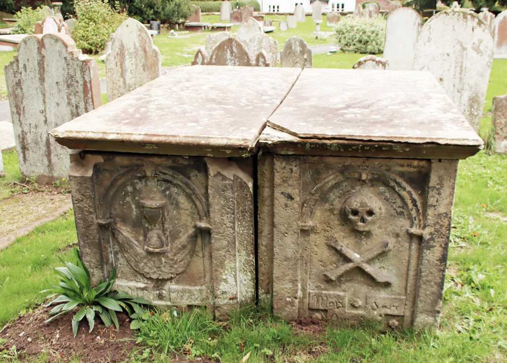
The churchyard includes a mixture of different types of grave, including chest, table and ledger tombs and vertical headstones, some accompanied by kerbs, mainly of good quality yellow sandstone. A particularly fine example is a Grade II listed double-chest grave made of yellow sandstone and dating to the early 18th century :
West ends of tombs have recessed round-headed panels; that to north contains an hourglass, that to south a skull and crossbones above an inscription Mors S… Omnium [i.e. Mors Sola Omnia,” meaning Death Conquers All]. North side of north tomb has a square central panel containing an encircled quatrefoil in a lozenge with a vertical panel right and a decayed panel left. The east end of each tomb has a fielded panel; south side of south tomb has 3 fielded panels in bolection moulded borders (Historic England – list entry number 1228746)
It was sobering to notice just how many of the chest grave inscriptions commemorate infants and children. I always spend an hour or so reading grave inscriptions and don’t remember seeing so many very young children commemorated, often from the same family in the same generation. As you would expect, the earlier graves are nearest to the church, although unusually many of these are on the north side, which is normally the last to be filled.
Red sandstone gravestone covered in yew berries
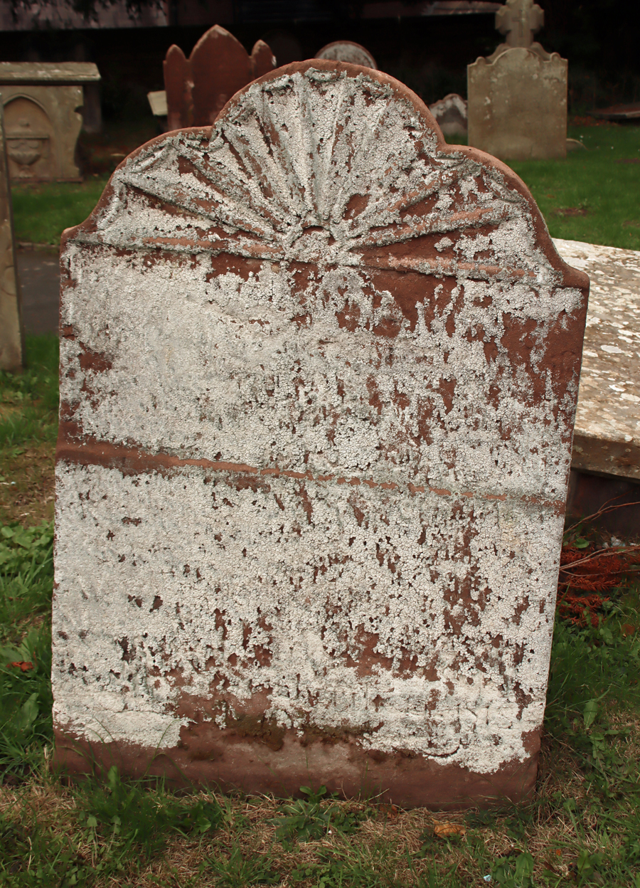
Moving away from the immediate area surrounding church building, to its south, the traditional upright gravestones of the later 19th century begin to dominate, with many examples of 19th century funerary symbolism on the headstones. Although many of the headstones are lancet-shaped and much of a muchness in terms of size, there was clearly a lot of choice available in terms of the symbolic motifs that decorated the tops of the graves.
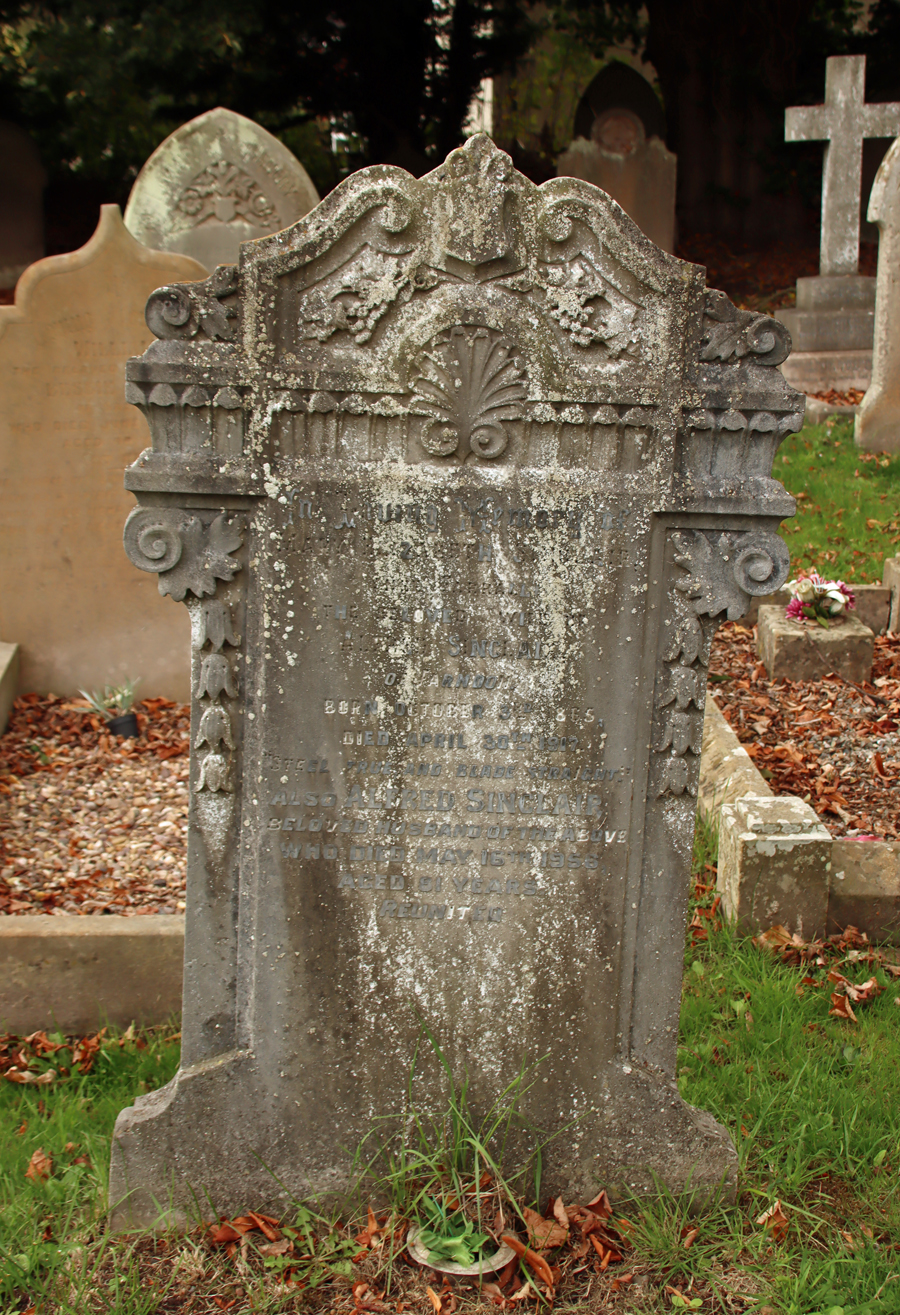
Art deco style headstone
Through a small gate beyond the headstones, the churchyard has been extended for modern use. The 1922 War Memorial in the form of a stone cross commemorates eighteen men killed in the First World War and four in the Second World War. xxx
Final Comments
This medieval church, almost completely rebuilt in the 17th century, has a character of its own, reflecting various periods of restoration and intended improvement, with a strong gothic influence throughout. There are many more features than those described above, including benefaction boards, a list of incumbents, and memorials, and the church booklet produced by Cheshire County Council in 1989 is a good guide.
The church website contains no information about visiting, and the Facebook page hasn’t been updated since 2019, but at the moment the church has an open door policy. On my two recent visits (October 2025) I was able to walk in. There is a contact page on the site, so if you are coming from any distance it might be worth double-checking.
It is splendid to have two really impressive churches, one either side of the river connected by a splendid 14th century bridge, with very different personalities and features, and both very well cared for and open to visit.
Sources:
Books and papers
Cheshire County Council 1989. The Parish church of St Chad, Farndon. (10-page booklet available for purchase at the church)
Latham, Frank 1981. Farndon. Local History Group
Pevsner, Nikolaus and Edward Hubbard 1971. The Buildings of England: Cheshire. Penguin Books
Thanks to Paul Roberts for his continued updates via the Focus newsletter (LibDems). Sincere apologies that this is a very battered copy, but hopefully it is still legible. Paul’s March 2024 newsletter draws attention to the proposal for a new housing site on Sibbersfield Lane, which would accommodate 287 houses. This would seriously increase the traffic and pollution along Sibbersfield Lane and Chester Road, and cause further risk on the junction with the A534. Paul raises other concerns too. You have until 16th March to comment.
Paul draws attention to various concerns with the proposal and provides the link for commenting on the plan. In case my dreadful copy makes this difficult to read, here’s the link: https://app.maptionnaire.com/q/9pn72k8ibb8a
In terms of usability, this online interface is really rather horrible. You first have to find the development on the interactive map, then zoom in on it and then click on it. Only then can you add a comment.
Thanks to the March 2024 Focus LibDem newsletter from Paul Roberts for the information that the operating hours of the no.5 bus service between Chester and Wrexham via Churton, Farndon and Holt have been extended. This is very welcome news.
After all the rain last night, which was truly torrential, I was somewhat surprised to wake up to bright sunshine and a topaz sky this morning. A treat for mid November. Planning to walk through the fields behind Churton towards Farndon, before turning right down Townfield Lane to the Dee, I decided that it was a moment for seriously waterproof footwear. Not walking boots but welly boots. It was a good instinct. The fields were sodden and marshy, the tracks muddy and mired due to tractors, and the picturesque but unadopted Townfield Lane was a series of lane-wide pools. The short section of footpath leading north from the lane along the river bank to the field next to the river was only just clear of the flood waters, which were moving fast and forming fascinating eddies.
I always like the Churton-to-Farndon fields following harvest, because of the linear stubble that draws the eye into the distance and focuses attention on individual trees that, at this time of year, are full of bright warm colours. The deep chestnut brown of the fields provides a beautiful foil for the silvery stubble, the blue skies and the autumnal leaves. The mirror-like reflections in the standing water were a pleasure in their own right. Today really was a water walk.
The biggest surprise was spotting a cormorant (or is it a shag?) at the very top of a tall tree by the side of the river (see photo at end of post). Cormorants and shags are right at home on the coastal estuaries of mid-Wales, and are frequent visitors to the Thames and its former docks in London, both places where I used to live, but I never did learn to tell the difference between them, and I have never seen one this far inland. It seemed right at home. …….. ………
…….. —–
View from the Dee at the end of Townfield Lane across the fields to the Barnston Memorial.
It would have been good to turn this into a circular walk by continuing north along the side of the Dee and taking the footpath from the Dee straight through the plantation onto the track extending directly from Hob Lane in Churton, but the footpath back to Hob Lane through the plantation of trees is usually bad news in even averagely showery weather, with seriously thick, sometimes impassable mud, so I simply retraced my steps on this occasion. The circular walk is very much a summer activity after a period of very dry weather.
If you don’t like squelching through wet mud and soggy grass, or paddling through big areas of standing water, this is not a good walk following heavy rainfall, even on a beautiful day. On the other hand, it cast a very familiar local walk in an entirely new light. After heavy rainfall I would advise that this is not a walk for those with unwilling legs, although my father (he of a notably unwilling leg) had no problems with it in dry periods in the spring and summer. Today it was far too slippery and sludgy.
The White Horse public house in Churton, some 20 minutes south of Chester and a few minutes north of Farndon and Holt, had been closed since the pandemic, but was the source of some heavy-duty activity over the several months, thanks to the efforts of its new owner Gary Usher and his crowd-funding business model.
Mike Royden, whose massive and seriously impressive website about Farndon and its environs, Royden History, is one of the best of the region’s history resources, has added a history of the White Horse to his site, with terrific images and explanatory text, tracing not just the history of the building but its various incumbents too. Buildings are far easier to trace than the people associated with them, and this really is a great piece of work using primary sources. Marvellous detective work and a very good read. Whether you are interested in Churton’s history or just the White Horse itself, Mike’s history of the White Horse can be found at the following page:
It was a real eye-opener to see the 1895 photo of the pub’s thatched predecessor, as well as the completely bizarre photograph of the Red Lion, a former Churton pub, in one of its previous incarnations. Thank you Mike!
I took the pics below in February 2022, when the future of the White Horse was very much up in the air. It is great to see it all looking so trim and tidy.
White Horse images from February 2022
The latest chapter in the pub’s history began when it opened on 3rd March 2023. For more details about the White Horse and its menu, the website is at thewhitehorsechurton.co.uk.
The walk through the fields from Churton to Farndon and back again is always enjoyable, taking about an hour for the full circuit, or less if you don’t pause for photos. It always varies enormously by season, but was quite spectacularly distinctive yesterday, glazed in frost under a bright blue sunny sky. Where the tractors had been out, during wet weather the deep tracks along some of the footpaths had filled with rainwater and frozen solid, but the ridges between were ice-free. Literally freezing in the shade, it was actually quite warm in the sun. A splendid walk, all colour and light.
The route taken from Churton to Farndon along official footpaths (in bright pink). The return route takes the pink footpath that starts in Brewery Lane. The red blobs are the approximate locations of two possible prehistoric sites, now ploughed out. Source of map: The Public Map Viewer.
Barnston Monument Meadow Natural Burial Ground in Farndon, June 2021
This time last year I was singing the praises of the glorious floral colour extravaganza of the newly established Monument Meadow Natural Burial Ground on the outskirts of Farndon, where I was taking additional photographs for a post about the Barnston Memorial. The blues and reds (cornflowers and poppies) were brilliant against the white mayflowers and chamomiles and all the sunny yellows. It was the best fantasy wildflower garden that I could imagine (more photos of how it looked last year here). But that’s essentially the trouble with wildflower gardens. The fantasy is easily replaced by a rather different reality. You can seed them as much as you like, and in the first year you might have the perfect, cottage garden look, but wild means wild, and a field full of seeds will do its own thing, whether those seeds were scattered by human hand, blow in by the wind or deposited by birds on high. Last year, I was standing amongst the poppies and the cornflowers. dubiously wondering how many years this idyllic vision would last.
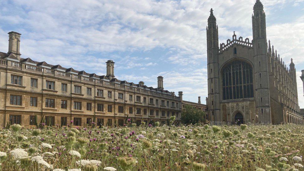
Year 2 at Cambridge Kings College Chapel. Source: BBC News
My doubts were largely due to a television report a couple of years ago, about research based on a study at Cambridge University, which took place on what had been a formal lawn behind King’s College Chapel. When it first flowered it looked like the Barnston Memorial field above, full of poppies, mayflowers and cornflowers. What happened in its second year of flowering is that most of the colourful species were replaced by cow parsley and other great leggy white-flowered umbellifera weeds of British verges, as well as thistles, as you can see in the photograph of the Cambridge wildflower field just before being harvested (using shire horses).
The Barnston Memorial field in year 2, July 2022
I have been driving past the Barnston Memorial field for the last few weeks keeping a look out for the poppies and cornflowers, but could see nothing but white. When I pulled over on Tuesday 5th July to take a closer look at this, its second year, it became clear that it had gone the way of the Cambridge experiment. Large swathes of cow parsley and a few thistles and white chamomiles are accompanied by a patches of yellow vetch, one or two fugitive cornflowers well below the level of the cow parsley, a lot of yellow ragwort (poisonous to horses and cattle) and some pinkish, blousy mallow. Mallow, or lavatera, is a chronic escape artist from domestic gardens, which seeds itself wherever it can; I suspect that the lavatera in the field is just such a domestic escapee. There are multiple species of grass and a few cereal crops that have escaped from the neighbouring field. There is not a poppy in sight. That is not to say that the field is unattractive, but it is a very different proposition from last year, and the loss of the blue cornflowers and red poppies makes it a much less idyllic prospect.
The wildflower field was not planted as an ecological experiment, and it is not being monitored by any specialists, but it will be interesting to see what happens next year. sfssdf
Barnston Memorial field – 2021 on the left and 2022 on the right
I’m still collecting mileposts that are found along the Chester to Worthenbury turnpike (about which I have posted in two parts, starting here). The mileposts post-date the original Chester to Worthenbury ones, of which none survive, but they are still a lovely bit of heritage When I originally wrote the piece, it was in the middle of summer and although I set off confidently with a map that marked the location of the surviving 1898 mileposts, I could only find two of them. Since then I have been finding them and adding them to a post about the 1898 mileposts.
This is one that I wasn’t looking for, because it is not on the official Chester to Worthenbury turnpike. I spotted it out of the corner of my eye on a rare occasion when I was driving through Farndon along Barton Road, and this was only because the bridge was closed and I found myself driving through Farndon to get onto the bypass. The exact location is, using What3Words: ///warned.tower.mascots, which you can see on a map at https://what3words.com/warned.tower.mascots.
I remembered it a few days ago and went back to photograph it. Many thanks to whoever does such a splendid job of sculpting the hedge behind it so that the whilst the hedge still looks great, the milepost is perfectly protected and easy to spot, and looks absolutely super. If only they were all so well cared for.
The milepost just outside Holly Bush Cottage, the nearest one to Farndon, close to the Barnston Monument. It sits at a slight tilt today. This is the best one for seeing the manufacturer’s logo, which reads W.H. Smith and Co, Makers, Whitchurch. Milestone Society National ID: CH_CHTP08a. What3Words ///dressing.sublime.lunge
Between Aldford and Farndon there are three very fine 1898 milestones dotted along the road, following the line of the Farndon branch of the old Chester to Worthenbury turnpike (toll road), all on the west side of the road. The photos here show those mileposts that remain between Farndon and Aldford along the B5130. Other photos show milestones between Aldford and Huntington, plus one in Farndon, but I have no idea if there are some missing along that particular route. At the moment they are in no particular order but I will eventually, when I have found a few more, organize them from north to south.
The photos of the milestones along the Farndon to Aldford stretch are mine, but the two to the north of Aldford, as the B5130 approaches Huntington, are by other people, found online, because I have not yet managed to track them down in the real world. Please see the captions for image credits. All photos can be clicked on to see the bigger image, in which the text on the mileposts can be read clearly (except, of course, where vegetation blocks the view). For the ones I’ve seen myself, I have taken What Three Words readings to fix the location. What Three Words is a smartphone app that assigns three words to uniquely describe areas a little smaller than the size of a parking space. It’s simpler than other location systems, and fixes locations very precisely, world-wide. It is particularly useful for finding people in emergencies, but I thought it would be useful for enabling people to relocate the mileposts when they become overgrown.
Churton milepost, next to Greenfields, the last house in Churton at its north on the way to Aldford. Milestone Society Milestone Society National ID CH_CHTP07. What3Words ///blatnatly.backers.comic. My photos, CC BY-NC-ND 4.0
All English turnpike Acts, each created by a separate Act of Parliament, had expired by the end of the 19th Century. The Local Government Act of 1888 put responsibility for roads into the hands of local councils, making nearly all of the remaining turnpikes redundant. Sections 92 to 98 of the 1888 Act, however, provided for some exclusions and section 97 enabled Chester County Council to initially avoid taking responsibility for the Chester to Worthenbury turnpike. Eventually, the Council was forced to take over all the local roads and in 1898 it erected a number of particularly handsome mileposts in Cheshire, including those along the route of the former Chester to Worthenbury turnpike, by then defunct, as well as the Farndon branch of the turnpike. I have posted about the Chester to Worthenbury turnpike – part 1 about the background to turnpikes and part 2 about the Chester to Worthenbury turnpike in particular.
The milepost outside Glebe Farm, between Churton and Aldford. The red dot is apparently something to do with a cycle race. Milestone Society National ID CH_CHTP06. What3Words ///decently.hatter.slide. My photos, CC BY-NC-ND 4.0
None of the mileposts that must have been erected during the 1854 turnpiking of the road have survived. Milestones or mileposts were erected from the first half of the 17th Century onwards, starting in southeast England, mainly for the benefit of mail coaches and other passenger vehicles. Turnpikes were merely encouraged to install mile posts from the 1740s but they became a legal requirement from 1766 when it was found that as well as being useful for coachmen and passengers, it enabled accurate measuring of distances for the pricing of different routes. It also helped to improve improved the reliability of timetables, something to which the turnpikes themselves, had enabled, particularly relevant in bad weather. Assuming that mileposts were erected when the 1854 turnpike was established, they were presumably removed when the 1898 milestones were installed.
I was unable to find the Crook of Dee milestone, but in the Milestone Society’s survey (over 18 years ago) it is listed it as near Cheaveley Hall Farm, opposite Cheaveley Hall Cottages. It is marked on the Ordnance Survey Map and on the above Public Map Viewer with the letters MP. Milestone Society National ID CH_CHTP04. Image sources: Geograph and the Cheshire West and Chester Public Map Viewer
The 1898 mileposts are all the same, painted white with black lettering, and consisting of hollow metal posts with two sides meting in the middle, topped with a triangular cap that is tipped towards the road. The triangular cap says, in all cases, “Chester County Council 1898.” The two sides, each facing into the oncoming traffic, give the number of miles to key destinations in each direction. On the southernmost face, the manufacturer’s mark “W.H. Smith and Co., Makers, Whitchurch” is shown below the mileages. There are no backs on the mileposts. The ones shown here are in good condition. Being on the side of a very busy road, they are vulnerable to exhaust fumes and road dirt sprayed during rainy periods. I don’t know who maintains them, but in other parts of Cheshire many have needed to undergo restoration, some having been in very poor condition. A lot of this work has been lead by the Milestone Society in co-operation with the relevant council.
The Crook of Dee milestone at Cheavely Cottages. What3Words address: ///liner.apprehend.stitch
The survival of these mileposts is remarkable and a pleasure to see. I have now found all of the ones on the former Chester to Worthenbury turnpike. I only found the Crook of Dee milepost in November 2021, after hunting for it for ages. It was completely concealed by undergrowth in the summer and it was only after leaf fall, and with the hedge cut back, that I eventually found it, covered in ivy but still there. The photograph of the Crook of Dee shown above left, decoratively peeping through a fine show of dandelions and dead nettles is from the Geograph website, taken during the Milestone Society’s national survey over 18 years ago, and is a particularly nice photograph so I have left it here. My own photograph is at right. I cleared the ivy as best I could on a very dangerous stretch of road with no footpath and only a tiny verge, but it is in fair condition, albeit very rusty. The What3Words address for it is shown on the image to the right. It is located opposite the Cheaveley Hall Cottages,
There is also one at Huntington, for which I kept an eye open for months, and found on the same day as the Cheaveley Hall one. It is shown left, along with its What3Words location. It is in excellent condition on a grass verge, just north of a pedestrian crossing.
The Ordnance Survey map, shows another run of mileposts between Churton and Worthenbury. The first heading south from Churton towards Worthenbury should be somewhere along Sibbersfield Way (which I have repeatedly looked out for in the car when nothing has been behind me, but I still haven’t found)
The rest on the leg of the road south of the bypass that runs towards Worthenbury via Crewe by Farndon and Shocklach through blissful rural fields and past several estates and farms. I made an attempt to locate them during the summer, few months later I found the one to the north of Crewe by Farndon, which had been revealed by hedge-cutting. It is in the grass verge on the west side of the road, just before Caldecott Farm.
Not so shiny and new as some of them, but still hanging on in there! It is located just short of a farm on the left heading south (the east), and is on the west side of the road about two or so metres to the right of a telegraph pole. I will go back and get an exact What Three Words location for it next time I’m in that area, but for the time being it is roughly at ///rainfall.duplicity.proofs.
During the summer I was able to find the nice one in Shocklach, thankfully not hiding in a hedge and at that time pleasingly accompanied by some lovely roses.
The milepost at Shocklach, on the route to Worthenbury. Milestone Society National ID CH_CHTP12. My photo, CC BY-NC-ND 4.0
I suspect that the rest are still hiding in overgrown verges. As with the Crook of Dee milepost, as the vegetation dies down this winter I will continue to look for them. When I have the full set I’ll put them into north-south order.
The Sibbersfield Lane milepost, which is on the stretch of road from Churton towards Crewe-by-Farndon, about halfway down before reaching the bypass, is slowly diving into a ditch. It’s a terrible photograph but I was not going to risk getting out of the car to take it, as it is a very nasty and fast stretch of road. I forgot to take its What3Words location, but will go back and re-take the photograph and note the location on a quiet day, preferably when the road is closed! Taken in March 2022:
In May 2022 I was diverted due to the Holt-Farndon bridge closure down Barton Road, the road that runs through Farndon from the bridge, and noticed a milestone on the south side of the road. I was in a hurry so didn’t stop, but went back in early July, half expecting it to be completely subsumed into the hedge that stood behind it, but not a chance. Someone is looking after it beautifully (with thanks). It’s What3Words location is ///warned.tower.mascots, which you can see on a map at https://what3words.com/warned.tower.mascots.
Sources:
Books and papers
Benford, M. 2002. Milestones. Shire Publications
Crosby, A.G. 2012. New Roads for Old. Cheshire Turnpikes in the Landscape 1700-1850. In (eds.) Varey, S.M. and White, G.J. Landscape History Discoveries in the North West. University of Chester Press, p.190-223.
Local Government Act 1888 (51 and 52 Vict. c.41). Section 97, Saving as to liability for main roads.
Wright, G. N. 1992. Turnpike Roads. Shire Publications Ltd.

 Although this is a great area to live, one of the things I still miss about living in London is a wide range of top-class take-away food restaurants on the doorstep. The whole process of ordering it online, dropping in and having a chat whilst waiting to collect it, carrying it tenderly home whilst inhaling the stunning aromas, and then pouring a big glass of wine to kick back and munch and slurp accompanied by a good movie was wonderful. My takeaways were always something to seriously, seriously enjoy.
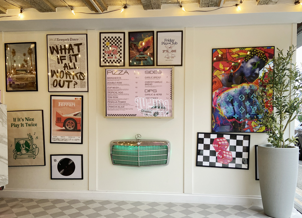 I first noticed it on Friday two weeks ago when I passed the garage entrance on my way home, a little way up from the post office/pharmacy in Farndon as you head north on Churton Road towards Chester. To my surprise the garage entrance was wide open, filled with light, and there was a busy pizza-making operation in full swing. I immediately abandoned my plans for making a fiddly cheese soufflé, ditched the car, and entered a nirvana of bright music, a chatty, friendly atmosphere and the most gorgeous aromas emanating in my direction. Fifteen minutes later I walked out with an exciting pink and black pizza box, the proud possessor of a Penduja Power. Oh the bliss! I could barely wait to get home to lift the lid as the aromas began to do serious injury to my will-power. The Penduja, with a crispy crust, thin base, chunky slices of jalapeño and thickly spread nduja, has a serious kick to it, with smokiness from the pepperoni, whilst both the creamy fior di latte mozzarella and pure mozzarella ensure that there is just the right balance of flavour, with subtle undertones and divine ultra-spicy overtones, all accompanied by gorgeous hits of fresh basil. It really was love at first glorious bite ❤️.
 This is a real pop-up. When they close down, everything is on wheels so simply pushes back out of the way to re-create the garage space. It was really good to see people coming and going, chatting to the proprietors and generally enjoying the spectacle and the anticipation of great pizza and garlic bread (oh the scent of that garlic bread!). If you arrive early there is a bench inside where you can sit and wait. There is parking on the road immediately outside as well as on the main Farndon high street, and of course there is free parking at the Memorial Hall on Church Lane.


