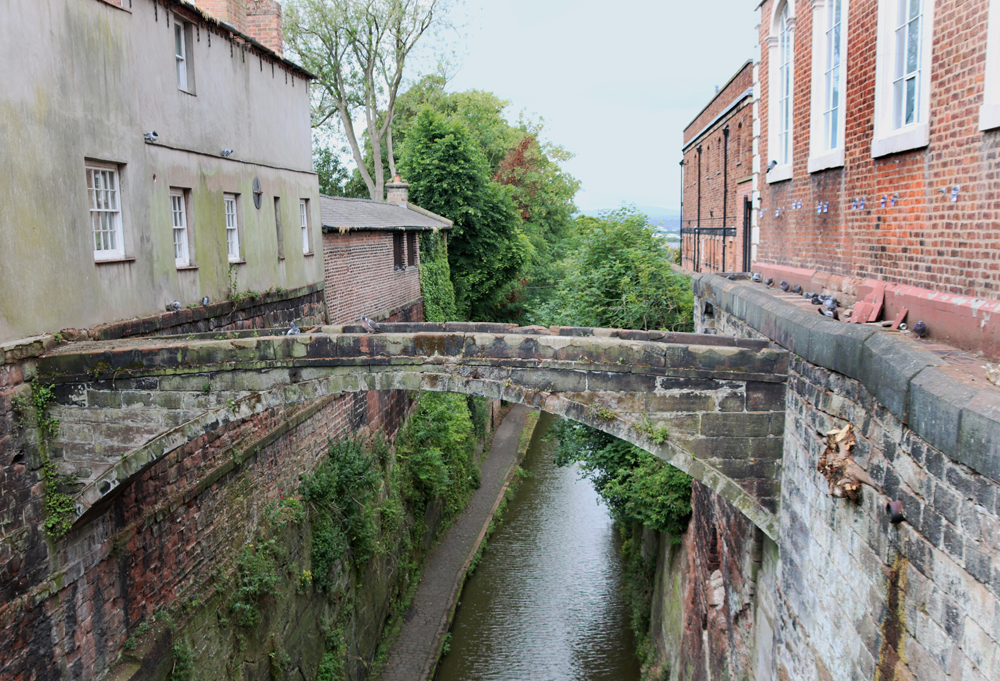
Category Archives: Chester

Beneath Chester’s Roman Amphitheatre – the Iron Age buildings and fields

Introduction

Chester Amphitheatre Aerial

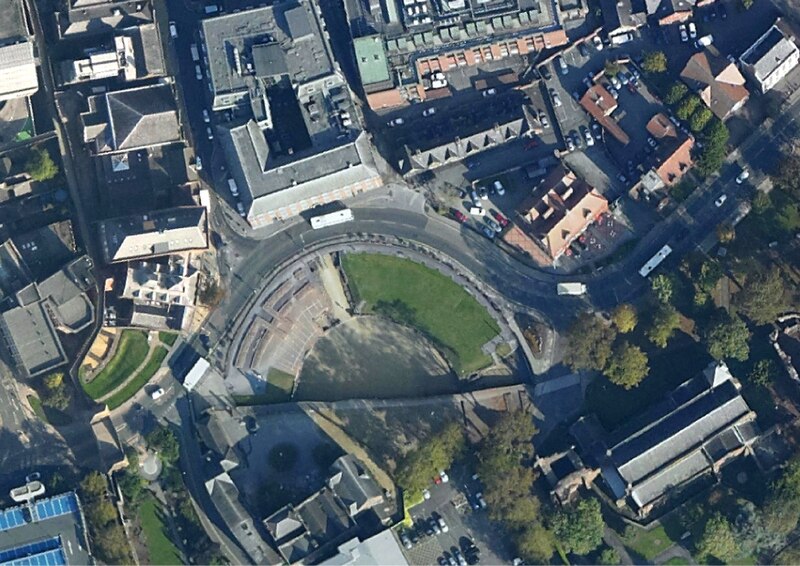
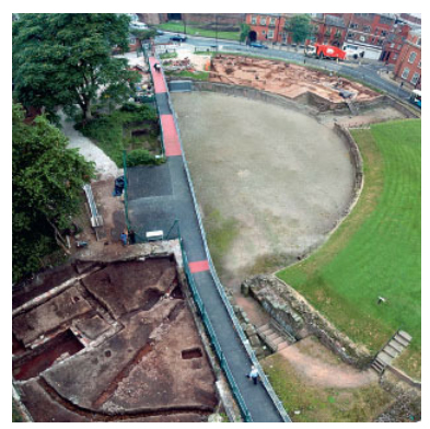
Aerial photograph of the half of the Chester amphitheatre that is visible. The rest lies beneath derelict buildings and car-parking. Image source: Environment Agency via Wikipedia

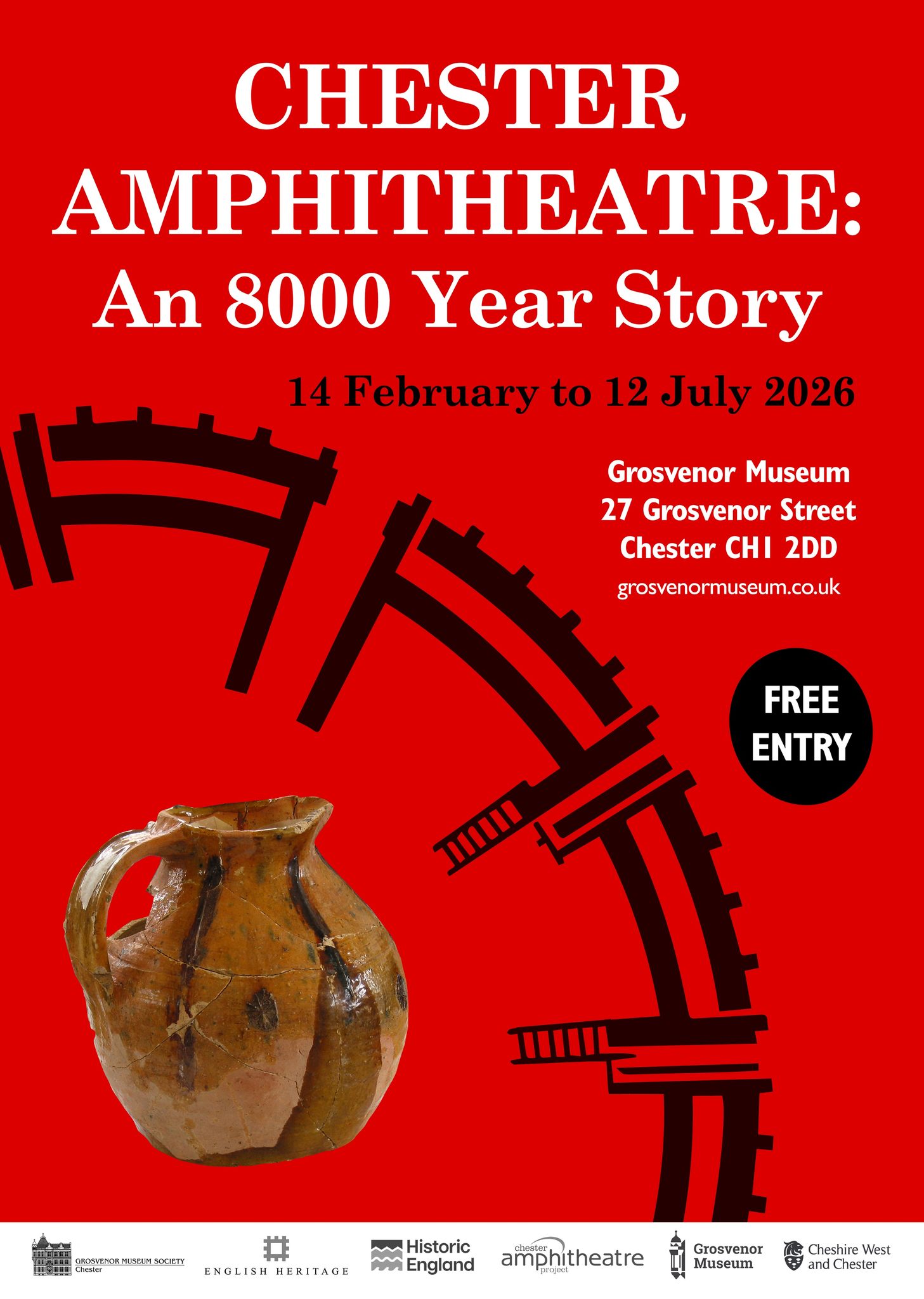
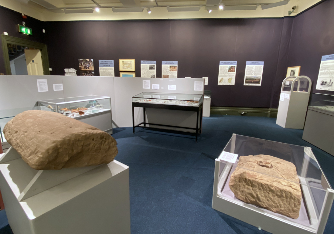
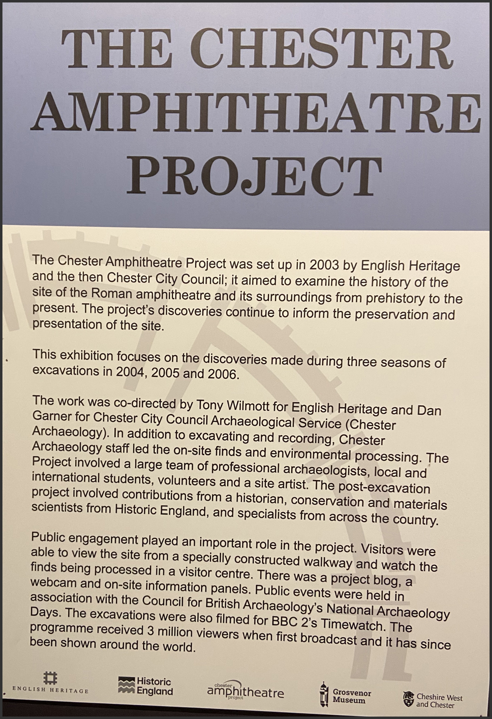
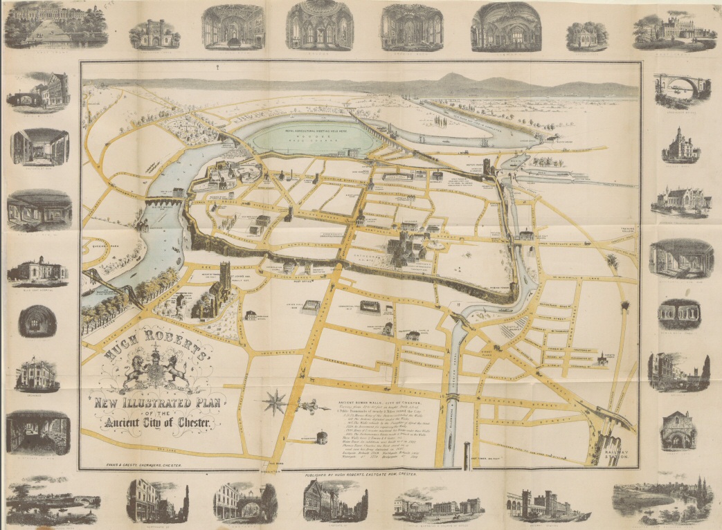
Partly as a result of the Gladiators of Britain exhibition last year and the Chester Amphitheatre – An 8000 year Story exhibition this year (closes 12 July 2026), both at Chester’s Grosvenor Museum, there has been a lot of recent interest about the development of the Chester amphitheatre.  The Gladiators project focused attention on the Roman period but the current exhibition looks at 8000 years of how the chunk of land on which the amphitheatre sits was used from early prehistory onwards.  Of these various periods of use, one of the most interesting is the discovery of a section of an Iron Age settlement and field management, representing a number of phases of the Middle and Late Iron Age.  These phases were found, together with earlier prehistoric material, during the last of  three seasons of excavation that took place between 2004 and 2006, included in volume 1 of the amphitheatre publication produced by Tony Wilmott and Dan Garner in 2018 (see Sources at end).
xxx

The challenges of locating the Iron Age in West Cheshire

Maiden Castle, Bickerton Hill, Cheshire

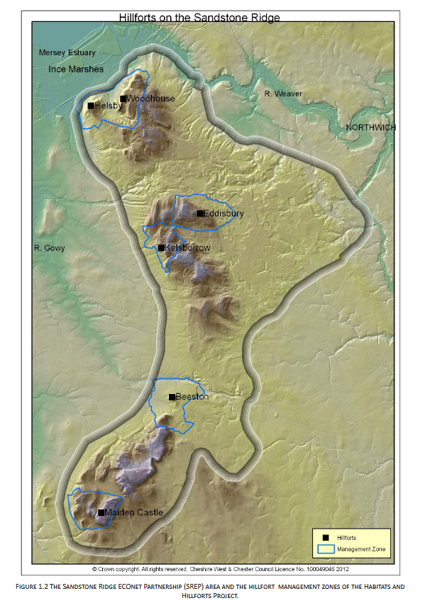
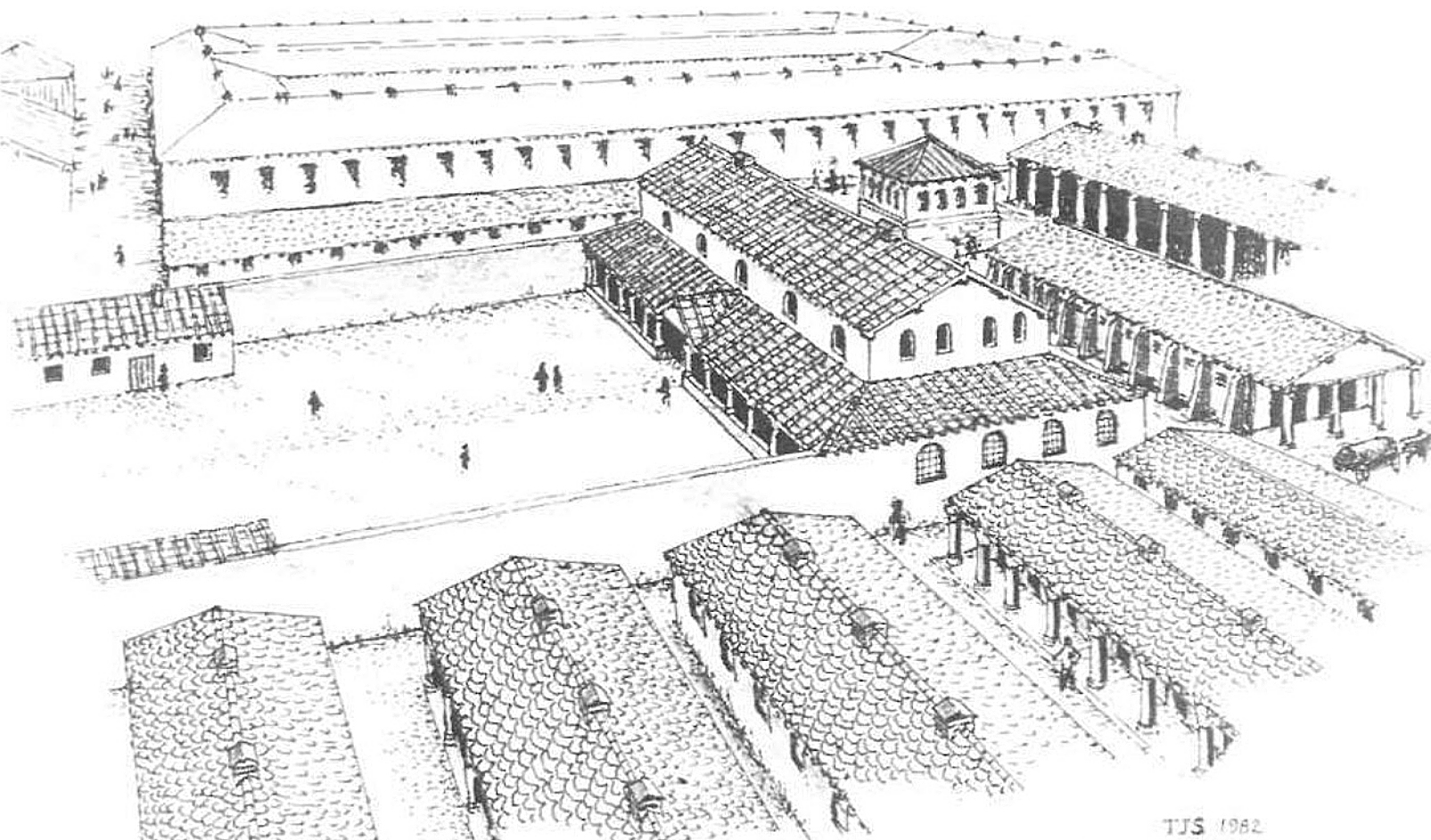
Artist’s impression of Maiden Castle on the mid-Cheshire Sandstone Ridge. Produced by the Habitats and Hillforts Project 2008-2012. Image source: Sandstone Ridge Trust

The Iron Age in West Cheshire was first recognized at hill-top sites known as hillforts in Britain, characterized by banks and ditches surrounding an internal space, but it has been amply demonstrated in other parts of the country that lowland settlements, some enclosed with a bank and ditch, formed the settlement focus of farming livelihoods. It has always been difficult to identify such lowland sites in the West Cheshire area, for reasons discussed below, although the presence of six hillforts on the mid-Cheshire Sandstone Ridge strongly implied that there must be corresponding lowland sites on the land to east and west.

Hillforts on the mid-Cheshire Sandstone Ridge. Image source: Garner 2012, p.4.

In 1982, in response to this absence of known lowland sites in the fields around the hillforts on the Sandstone Ridge, James Schoenwetter used proxy botanical data from nearby waterlogged contexts to search for evidence for agricultural activity contemporary with the hillforts.  He found evidence that strongly suggested that lowland agricultural settlements must have been present in the vicinity of Peckforton Mere, near the Sandstone Ridge.  However it was was not until 2001 that the nearest settlement to the mid-Cheshire sandstone ridge was found at Bruen Stapleford near Tarvin, during the laying of a Transco gas pipeline.  Since then a small number of sites have been surveyed and/or excavated across West Cheshire and the Wirral, with other possible sites awaiting survey and excavation. The Iron Age levels at the Chester Amphitheatre, were revealed in 2006.

Quite apart from the urban and suburban sprawl of Chester and the Wirral on what was once rural land, finding the lowland sites in West Cheshire has been complicated by the composition of the soil in the Cheshire Basin, the nature of the archaeology itself, and the reduction of funding for research archaeology over the last few decades.

Aerial photography has been of great value for identifying sites in some parts of the country, but the moisture-retaining boulder clays deposited across the Cheshire lowlands by the last glaciation mean that the outlines of structures and enclosures, which show up in other areas as crop-marks, cannot always be seen in this region.  It is only during periods of drought that crop marks are likely to put in an appearance.

Amphitheatre VCP rim

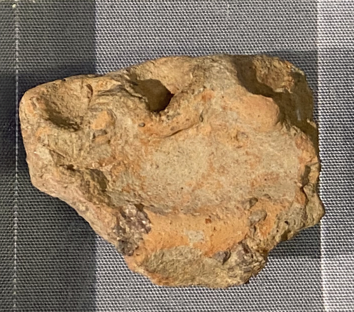
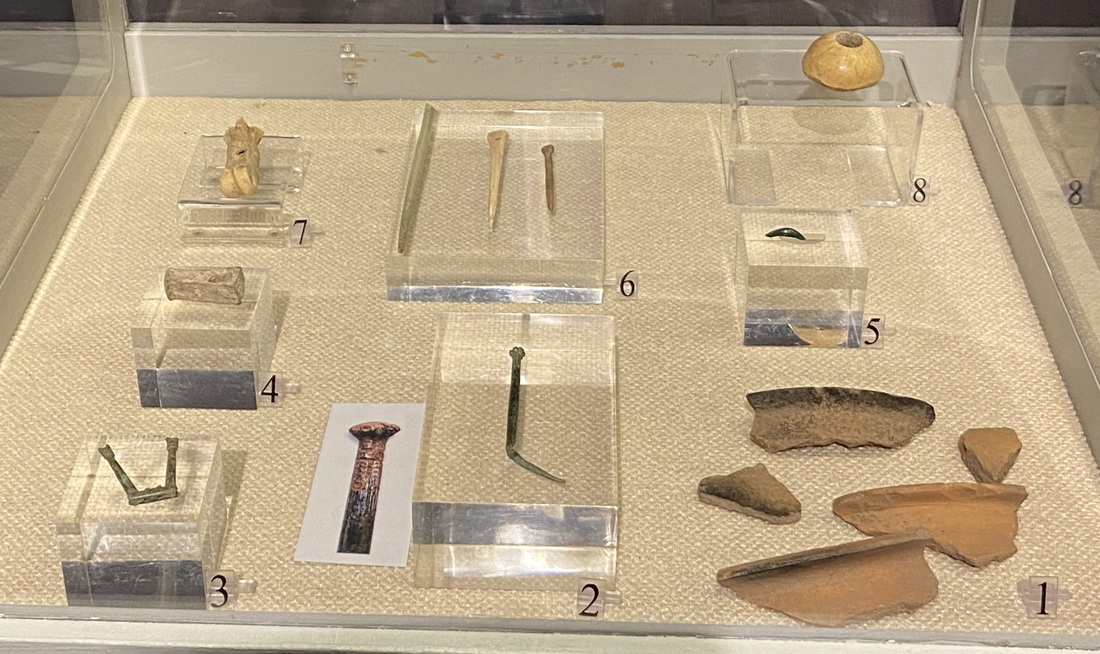
VCP rim-sherd found in one of the roundhouse (Building 1) gullies at the amphitheatre, on display at the Grosvenor Museum

Field-walking (the survey of ploughed fields on foot, collecting all artefacts found) also faces serious challenges. The boulder clays of the Cheshire Plain boulder are acidic, meaning that organic materials (plants, bone and antler, foodstuff, textiles, leather etc) and metals have often disintegrated in the past and are only very rarely found today.  Field-walking tends to rely on pottery and stone artefacts, and although both often survive in local conditions, by the time of the Iron Age smaller stone tools were no longer in use, with only larger stone items like querns and pounders (grain and pigment grinding objects) and anvils (for metalwork) remaining in use.  It is also a problem that the Iron Age in the West Cheshire region is largely aceramic.  Pottery often present at other Iron Age sites in Britain, is usually absent in this immediate area, with only a particular type known as Very Coarse Pottery (VCP), used for producing and transporting salt from the East Cheshire brine springs, consistently found in the region.

Composite map of Iron Age sites

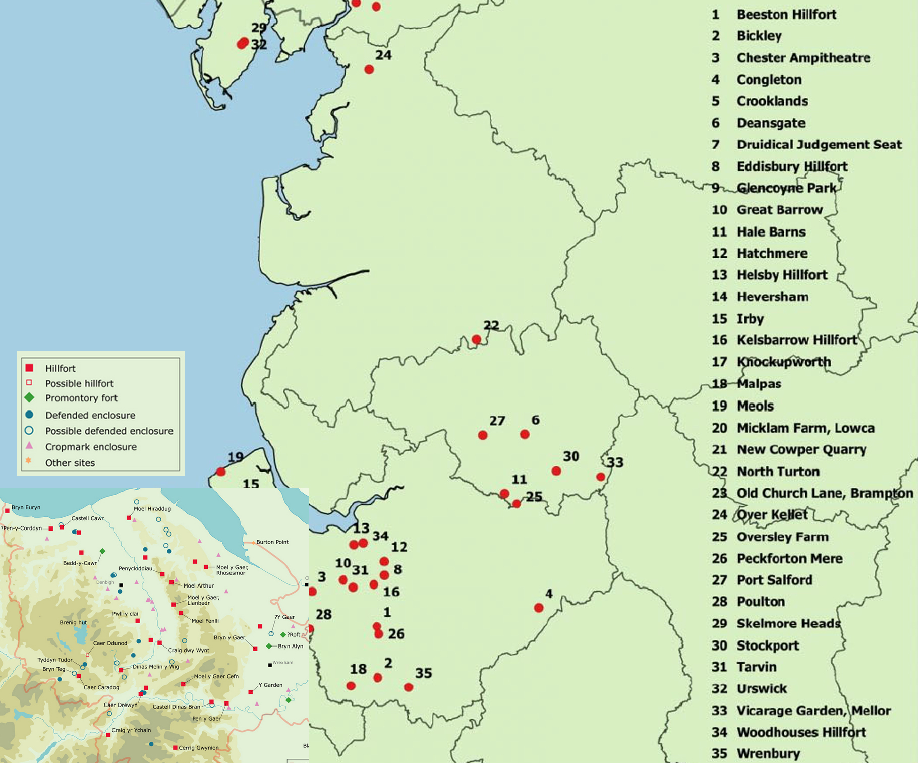
Composite image of two maps showing the distribution of Iron Age sites in northwest England and northeast Wales.  Sourced from Ritchie 2018 and Nevell 2025 (click to enlarge)

Because of these challenges, individual objects found in the area are most often found by metal detectorists who report their findings to the Portable Antiquities Scheme.  The last time I checked there were 43 findspots dating to the Iron Age in West Cheshire, although not all can be dated with precision.

Most of the Iron Age lowland sites discovered have been the result of developer-led watching briefs and funding for excavation and publication.  This simply means that instead of excavation being guided by archaeological research projects and survey activities, sites are usually found when, for example, new buildings are erected, cables or pipelines are laid down and new quarries are opened.  Archaeologists are assigned to maintain watching briefs on such projects, funded by the developer in question, in case archaeological features are identified.  Watching briefs have been responsible, for example, for the Late Prehistoric discoveries at Bruen Stapleford near Tarvin (where a gas pipeline was due to be laid), Chester Business Park at Huntington (in advance of a new housing estate), and Puddington Lane sites 129 and 154 at Burton on the Wirral (where sections of an offshore power cable were being laid).  A 2026 article in British Archaeology (the publication of the Council for British Archaeology) by Sarah Wolferstan states that nearly 98% of UK archaeology is now developer-funded.

Large scale evironmental and heritage conservation projects are few and far between, but in this region included the Heather and Hillforts project that first oversaw the exploration, survey and excavation of both the uplands in northeast Wales in the early 2000s, and in a later phase the mid-Cheshire Ridge between 2008 and 2011, with the archaeological work overseen by Dan Garner, resulting in two main publications made available in 2012 and 2016.

Amphitheatre excavation 2004

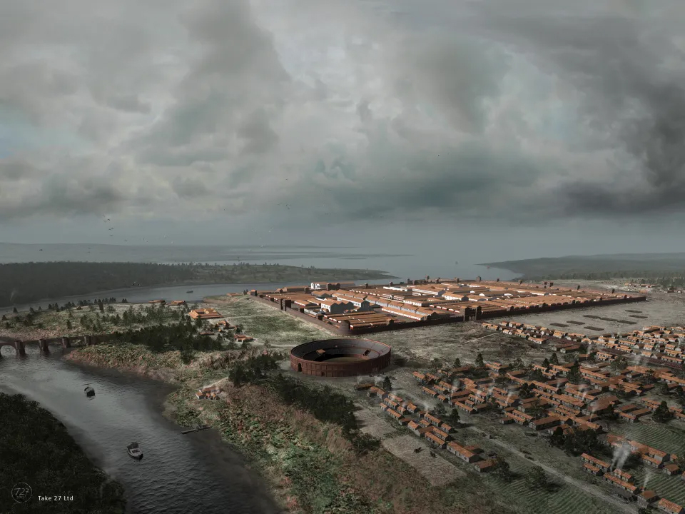
Chester Amphitheatre under excavation in 2004. Source: Wilmott and Garner 2018, fig 26, p.24 (Kindle edition)

The Chester Amphitheatre Project was a special project.  Unlike the above examples, the Chester Amphitheatre was the focus of a very welcome three-year project that was initiated for research purposes.  In 2000 it was deemed that the deteriorating state of the amphitheatre needed to be addressed, and English Heritage issued a call for tenders to produce a conservation plan together with costings.  Discussions between English Heritage, Chester City Council and a number of specialists resulted in the Chester Amphitheatre Project in 2003.  Excavations took place between 2004 and 2006, led by Tony Wilmott and Dan Garner and funded by English Heritage and Chester City Council.
xxx

Settlement features in the West Cheshire Iron Age

The structures that make up Late Prehistoric settlement sites in Britain, enclosed and unenclosed, are usually round-houses and four-posted (or “four-poster”) buildings.  In West Cheshire none have produced evidence of enclosures (banks and/or ditches) surrounding the settlements, but none of the sites has been fully excavated meaning that whether or not any of them were enclosed is currently unresolved.  The remains of field systems, sealed beneath early Roman levels, are of great interest, providing clues to the agricultural activity that formed the basis of Late Prehistoric livelihoods.

Reconstructed Poulton roundhouse 2020

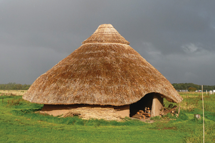
Reconstructed Iron Age roundhouse on private land at the site of an excavation on the west side of the river Dee at Poulton, south of Chester. Source: Cootes et al 2020 (see Sources at end of post)

Roundhouses in the area are defined by circular gullies  or ditches, sometimes single and sometimes double (concentric).  The largest roundhouse in this area reach was Bruen Stapleford’s Structure 3, with a diameter of c.19m but smaller examples are more usual, with the smallest clustering around 7.5-8m, with the amphitheatre roundhouse measuring c.8.4m diameter.  Gullies can either be complete, leaving a gap for one or more entrances, or interrupted.  Outer gullies are often interpreted as drains or eavesdrips to collect rainwater run-off from the roof.  The inner gully is often a foundation trench for posts or stakes, which will have performed the job of anchors for the walls, which may have been made of wattle-and-daub (long slender branches woven together and then coated with clay or equivalent), planks, or an alternative construction material that has so far not been observed, such as turf.  Alternatively, the outer gully may hold the walling material, whilst the inner gully may hold weight-bearing posts to support the roof timbers.  The interior may have additional features, such as hearths or shallow pits.  The activities that took place in roundhouses are still not well understood in spite of including “house” in their names.  Whilst some may well have provided accommodation for group/family members (depending on how family and social units were defined and organized), others are likely to have have been used for a number of other activities related to farming, craft and/or community activities.

Moel y Gaer Rhosesmor

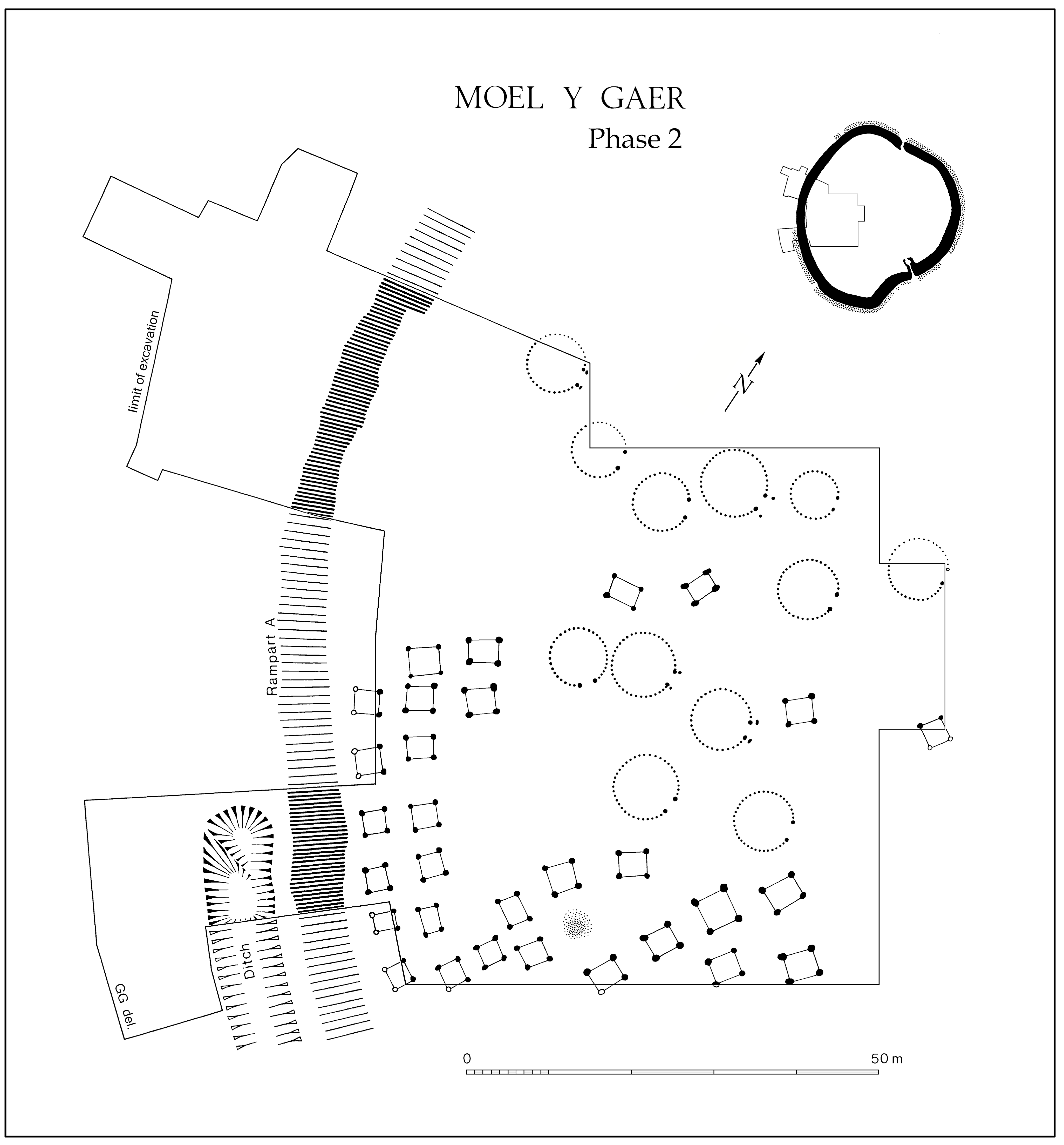
Moel y Gaer Rhosesmor hillfort, phase 2, showing both roundhouses and four-posters. Image source:  Graeme Guilbert 2018, Internet Archaeology Journal

Four-posted buildings are even more elusive in the West Cheshire and Wirral areas, but happily two phases of one four-poster was found at the amphitheatre, and another was as at the Chester Business Park excavation in Huntington, another lowland site.  They are also represented at the upland Beeston Castle hillfort.  A particularly good example outside the immediate area is Moel y Gaer Rhosesmor hillfort (phase 2) in Flintshire.  these structures are often described as “possible granaries,” but this is only one possible interpretation of their role within a given site or region.  They are usually quite small, and either square or rectangular around 3.5 x 3.5m or 3.0 x 3.5m on average, and although they may well have stored cereal grain, particularly where there is sufficient evidence to suggest this purpose, they could also have stored other goods such as animal hides, wool and textiles, salt, and preserved foods, and some may not have been used for storage at all.  For example, Janice Kinory suggests that one possible interpretation of for four postholes is that some of them could have been hanging frames, rather than buildings, used for maturing slaughtered and/or cuts of butchered livestock.  Adrian Chadwick raises the possibility that some of them could have been excarnation (exposed funeral) platforms.  As with roundhouses, they may have had multiple roles and it is only by excavation of the organic and inorganic remains associated with them that the uses of these buildings will continue to be clarified and refined.
fdf

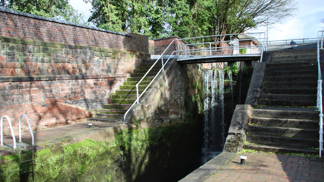
The Iron Age beneath the Chester Amphitheatre

Because Late Bronze Age and Iron Age lowland sites are elusive, it is always exciting when a new one is discovered.  The Chester amphitheatre is one of Chester’s best known landmarks, and the 2004-2006 excavations (Wilmott and Garner 2018) were expected to provide information primarily about the Roman and post-Roman uses of the site, so the 2006 discovery of Iron Age activity underlying the Roman amphitheatre, a short distance from the river Dee, provided a very welcome insight into the Chester area and environs prior to the arrival of the Roman legions.  Most significantly, the Iron Age finds included not only structural evidence and a small number of artefacts, but also two distinct phases of field system, providing information about the development of field-management methodologies in the region.  The source of the amphitheatre’s Iron Age data used in this post is in Part 2, Before The Amphitheatre, in the 2018 publication by Tony Wilmott and Dan Garner (see “Sources” at the end of the post).  Some of the images shown on this post have also been taken from the Kindle version of the same publication.  See image captions for details of all image sources.

Mesolithic stone tools and cores

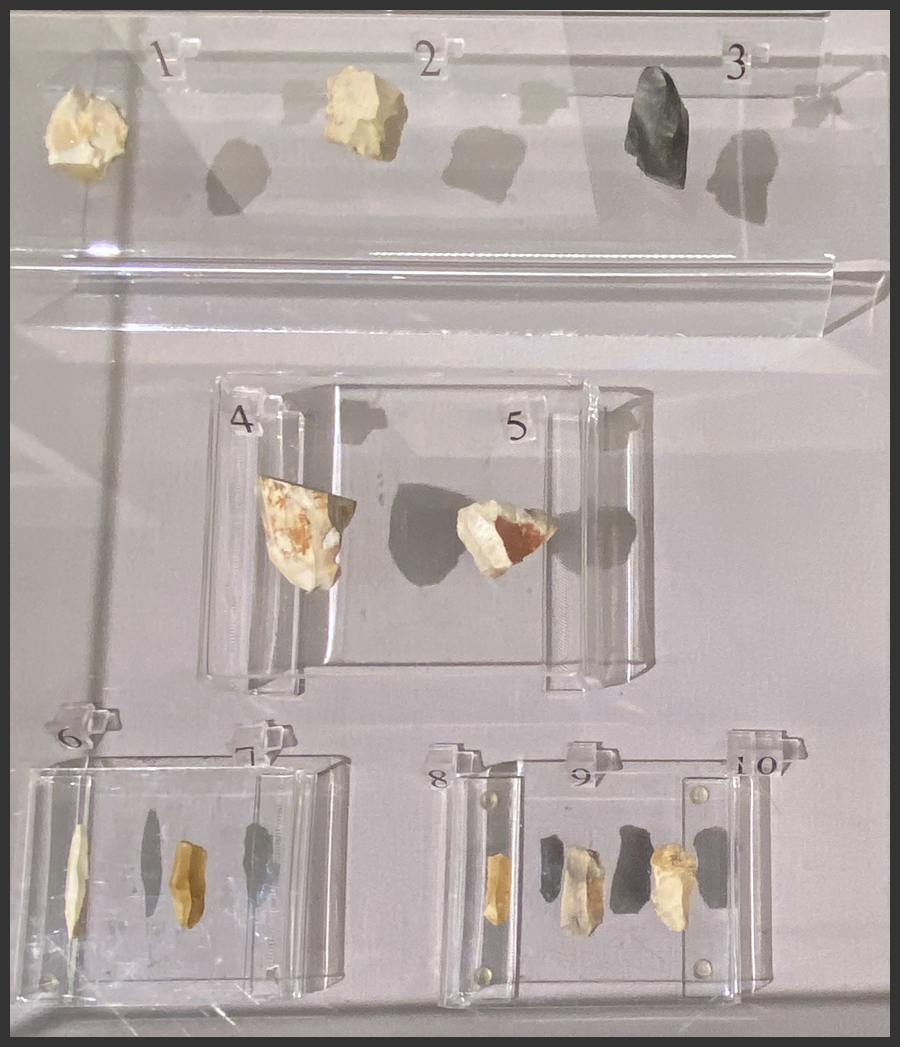
Mesolithic stone tools and cores from the amphitheatre site, Phase 1a on display at the Grosvenor Museum’s “Chester Amphitheatre – An 8000 Year Story” exhibition, found during the Wilmott and Garner 2018 excavation

The amphitheatre site had been surveyed and excavated several times previously, beginning in the early 1930s, discussed in detail by Wilmott and Garner 2018, but this was the first of the amphitheatre excavations to produce evidence of Iron Age occupation underlying the Roman levels.

The amphitheatre site has been divided into a number of periods, phases and sub-phases, of which Period 1 represents all the prehistoric phases, of which phase 1a consists of ephemeral data from the Mesolithic to the Early Bronze Age (not included here, but extensively described and illustrated in Wilmott and Garner 2018, providing an important contribution to the understanding of earlier prehistoric presence in the area); phases 1b and 1c, which date to the Middle Iron Age and include structural elements and evidence of ard cultivation respectively; and phase 2, which produced evidence of Late Iron Age cord-rig cultivation.  Later periods, not listed here, describe the history of the Roman amphitheatre.

The phases of Period 1 (Prehistory):

Amphitheatre Period 1 (Prehistory) phases

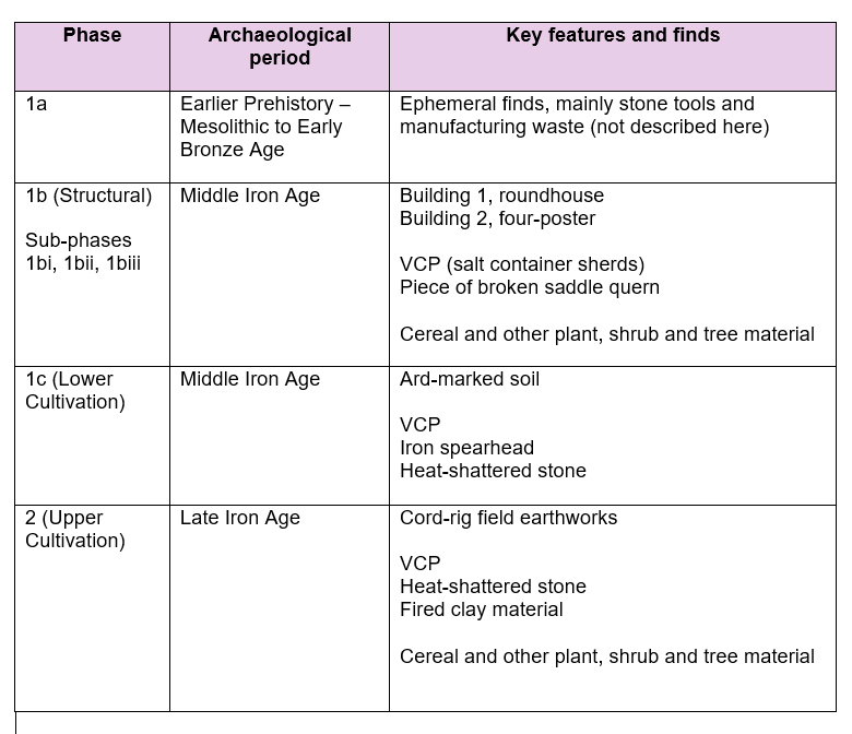
Amphitheatre Period 1 (Prehistory) phases, with radiocarbon dates indication that periods 1b – 2 covered the period c.400BC to the pre-amphitheatre Roman period.

Phase 1b (Middle Iron Age, 400-200 Cal.BC) 

Amphitheatre roundhouse during excavation

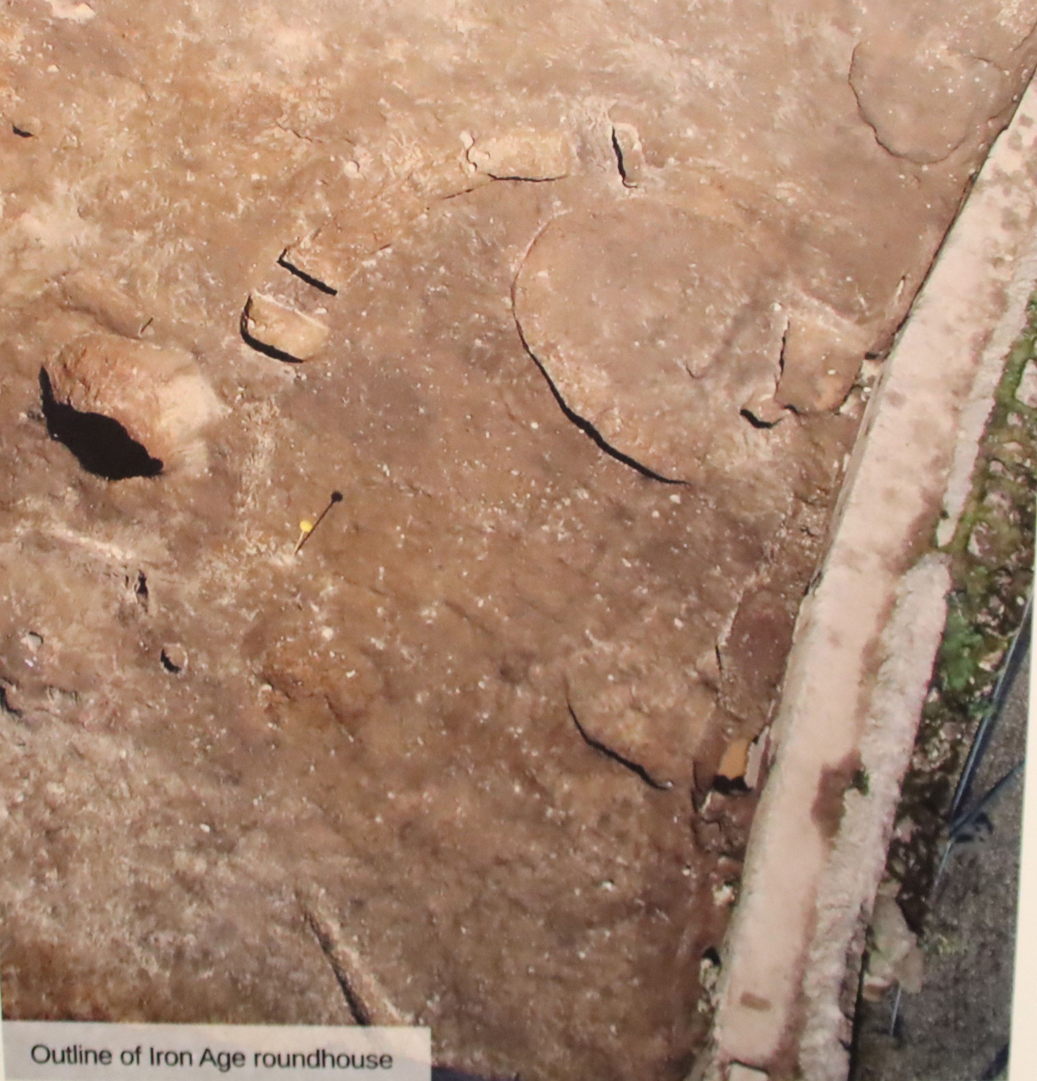
Part of the roundhouse under excavation. Source: Grosvenor Museum’s “Chester Amphitheatre – 8000 Years of Stories” exhibition, from the Wilmott and Garner 2018 excavation

Phase 1b includes the only Iron Age settlement features found during the excavation, consisting of a single roundhouse (Building 1) and a four-posted building that was built in three phases (Building 2).

Building 1, was defined by two concentric gullies that made up part of a curvilinear structure that would have been about 8.4m in diameter if it had been complete.  The inner gully was probably a construction trench for the walls of the house.  A rim-sherd of VCP was found in one of the gullies.  A shallow pit was found towards the centre of the building measuring c.1m x 0.75m and 0.07m, its function unspecified.  Plant remains were collected and sampled, containing very few cereal remains, representing hulled barley and a glume base of spelt wheat.  Buttercup, sheep’s sorrel, and vetches and other wild species. may have been used as floor covering, animal fodder or bedding.

Chester Middle Iron Age structure (Building 1) in the Chester Amphitheatre

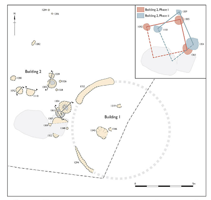
The Chester Amphitheatre Iron Age, part of Buildings 1 and Building 2.  Image source: Wilmott and Garner 2018, fig.33 p.44 (Kindle version)

Building 2 comprised three postholes representing two sides of what the excavators interpreted as a four-posted building, erected in two phases as shown on the illustration above.  It is only the second example of a lowland site with four-poster identified in the West Cheshire area (the other is at the Chester Business Park site).  In Phase i of Building 2 the structure measured 3.5×3.5m.  The postholes suggest that at least two of the posts were around 0.4m diameter and most of them had stone packing material to support the posts.  Plant remains were found in all three of the main postholes, including remains of spelt wheat, a small amount of emmer wheat, and low amounts of barley.  There were also abundant weed seeds, plenty of small grass seeds, a sloe stone and charcoal containing oak and lesser amounts of alder and hazel.  Charcoal in Building 2 postholes, which is also found spread elsewhere on the site, suggests Building 2 appears to have been destroyed by fire in phase i, either deliberately (which has been proposed at, for example, the Iron Age roundhouse at Prestatyn) or accidentally.  In Phase ii the four-posted building had shifted position, suggesting that phase ii was a replacement building, its footprint overlapping with the older structure.  It also had three postholes, but is thought to have been rectangular, measuring c.3.5 x 4m.  Postholes from phase ii (again with processing waste dominating over actual grains) contained spelt wheat, emmer wheat, grasses and charcoal dominated again by oak with smaller quantities of alder and hazel. In this phase the post packing material was so disturbed that it is suggested that the building was deliberately dismantled by the removal of the posts, something seen at other sites in Britain possibly including Prestatyn, where it was thought that the roundhouse was probably deliberately dismantled (before being set on fire).

Phase iii of Building 2 is far less easy to understand.  It consists of a sub-circular cut that truncated posthole 3.  It appeared to be lined with red clay, and although showed no signs of burning, a later fill was charcoal-rich, suggesting a hearth.  The plant remains were dominated by the by-products of spelt wheat processing. Features that could not be connected to the structure included a pair of stake-holes and a single posthole, with another stake-hole nearby.

All the Building 1 and Building 2 levels were sealed under Period 1’s, Phase 1c, the ard-marked soil.
xxx

Period 1, phase 1c (Middle Iron Age)

Amphitheatre cultivation and ard marks Phase 1c

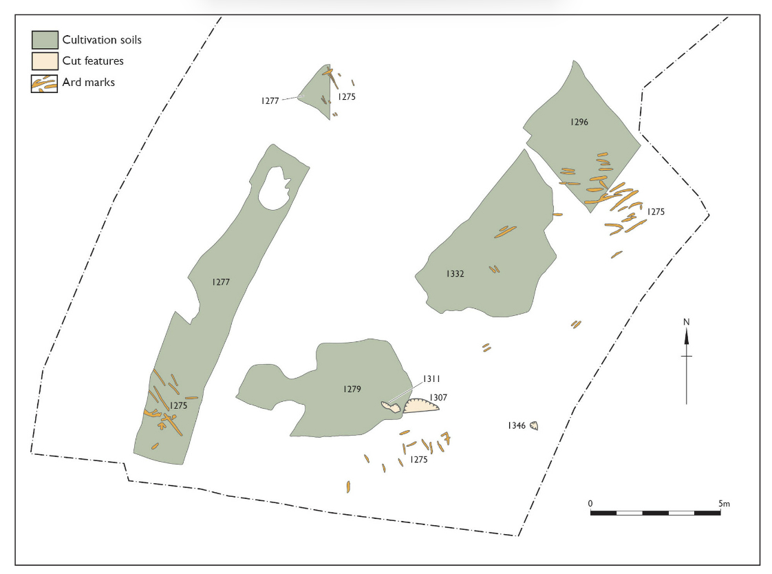
Amphitheatre cultivation and ard marks Phase 1c. Image source: Wilmott and Garner 2018, fig.34 p.46 (Kindle version)

Phase 1c, the lower level of cultivation at the site, represents patches of Middle Iron Age cultivation, with marks in the ground thought to have been made by an ard.  An ard is a predecessor of the plough, also known as a scratch-plough, a simple tool, usually pulled by livestock, that carves a shallow line into the soil rather than turning and lifting it like the later and more sophisticated plough. The marks are associated with a number of different patches of cultivated land within the amphitheatre that post-date the Phase 1b round-house and 4-poster, and are not associated with known structures.

Period 1, phase 2 (Late Iron Age)

Cultivation soils and cord-rig earthworks of Period 1, Phase 2, with cut features of Phase 3

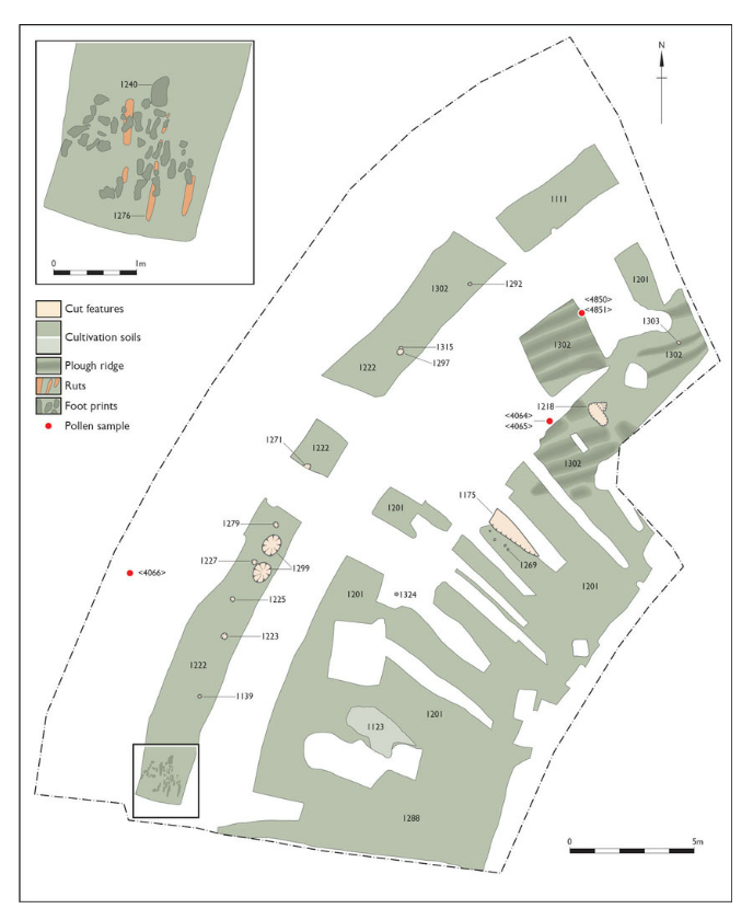
Cultivation soils and cord-rig earthworks of Period 1, Phase 2, with  features of the Roman Phase 3. Image source: Wilmott and Garner 2018, fig.36, p.48 (Kindle version)

Phase 2 consists of an upper level of cultivation soils showing a distinctive cord-rig arrangement of parallel low banks and shallow furrows, providing raised rows for planting, and ditches for drainage, over an area at the north of the site some 15 x 6m in area.   An east-west alignment of 11 ridges was recorded, c.0.64m apart. These undulating earthworks “are a dramatic archaeological discovery, and represent the evidence for arable cultivation immediately prior to the construction of the first amphitheatre, in the last phases of the pre-Roman period” (Wilmott and Garner 2018, p.47).

The Chester Amphitheatre cord-rig is the first to have been recorded south of Northumberland.  To the southwest another type of earthwork consists of a pair of circular depressions, the function of which remains unknown.  Burnt vegetation, including possible turves, may be indicative of land clearance and digging the burnt material back into the soil to be cultivated.
sdfds

The Iron Age livelihood at the Amphitheatre

The occupants of the settlement located themselves very close to the river Dee, with access to both water and an excellent route for communication and travel.  One roundhouse, two phases of a four-poster and two phases of field management data do not necessarily represent a full settlement and farming system.  Because the excavation was limited to the amphitheatre itself, It is possible that beyond these boundaries, either destroyed by later roads and buildings or lying beneath them, a more extensive community settlement could have existed.

Photograph of the excavation showing a section of Iron Age field system

Photograph of the excavation showing a section of Iron Age cord-rig field system ( photograph from the “Chester Amphitheatre – an 8000 year story” exhibition, from the Wilmott and Garner 2018 excavation)

Field systems, many of them enclosed, were an increasingly familiar aspect of Late Prehistoric landscape management throughout Britain.  The presence of a clear chronological sequence of field management approaches is particularly helpful, suggesting improved efficiencies and the desire or the need to apply new techniques to improve output, marked by the replacement of Middle Iron Age ard-marks by Late Iron Age cord-rig earthworks.  Burnt plant rhizomes and possibly turves in phase 2 may have been turned into the ground to help fertilize the field, and heat-cracked stone that found on cultivation levels, mentioned below, may also have been part of general refuse spread on fields as fertilizer. 

Spelt crop

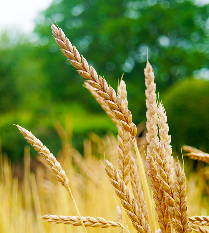
Spelt crop. Image source: Waldkorn

The plant remains at the site include cereal grains and chaff (the inedible parts of the plant), and together with the field-working marks indicate that this was agricultural land.  The best represented of the cereal remains was spelt wheat, which became increasingly popular over emmer wheat during the course of the Iron Age, perhaps due to its greater tolerance of poor, marginal soils, cold and damp conditions, its ability to do well without large amounts of fertilizer and its resistance to pests and diseases.  Other types represented are emmer wheat and hulled 6-row barley in smaller amounts, as well as indeterminate remains. As well as grains, the chaff produced during processing could be used for, amongst other things, animal fodder and fuel.  There is also evidence of quantities of brassiceae, (the mustard and cabbage family).  Weeds suggest a broadly grassland environment, some of which may have been used for roofing, flooring and animal fodder as well as other uses.  Wood found at the site, invaluable for buildings, fencing, fuel, tools, weapons, handles, containers and a variety of other objects and furnishings, mainly includes oak, alder/hazel and willow.

Red sandstone saddle quern piece

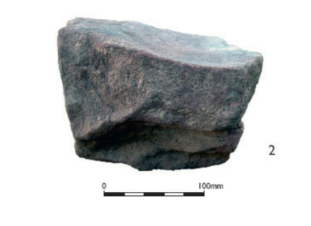
Red sandstone saddle quern piece. Image source: Wilmott and Garner 2018, fig.42, p.63 (Kindle version)

A broken red sandstone fragment of Middle Iron Age saddle quern is a nice find (shown above), also relating to agricultural activities. It was found in a post-hole in phase 1b, with its grinding surface worn to a characteristic shallow dish-shape.  Similar fragments have been found at other sites in the region, with a whole example found at Beeston Castle hillfort.  Querns were traditionally used for grinding cereal grain and seeds, but could also be employed for working pigments into powder.  As suggested below for the VCP, it is possible that fragments of tools and equipment were inserted into structural features as tokens of some sort.  A quern fragment from the Chester Business Park site was found, for example, in what has been interpreted as a former Iron Age well.

Farming Year Cunliffe 2005 p419

The farming year: a reconstruction based on evidence from settlements at Iron Age Danebury (Hampshire) and region. Source: Cunliffe 2005, p.419, fig.16.5. Click to enlarge.

Even though domesticated animal remains have not been found at the amphitheatre from prehistoric phases (although they are plentiful in the Roman phases), they would have been necessary to provide fertilizer for the crops, and evidence at other sites in the region have usually been seen as indicative of a mixed cultivation and livestock herding strategy.  At Poulton near Rossett (30km south of Chester) for example, where preservation has been much better than any other Late Prehistoric sites in the area, the trifecta of cattle, sheep/goat and pig is indicated by the animal bones, which could have been employed not only for meat and fertilizer and, in the case for cattle and sheep/goat for dairy products, but also for hides for tanning and sheep’s wool for textiles.  Sheep and goat are very difficult to distinguish archaeologically, but both would have been viable.  A dog burial at Poulton suggests that at least that particular animal had value in everyday life.

Cheshire Stony VCP

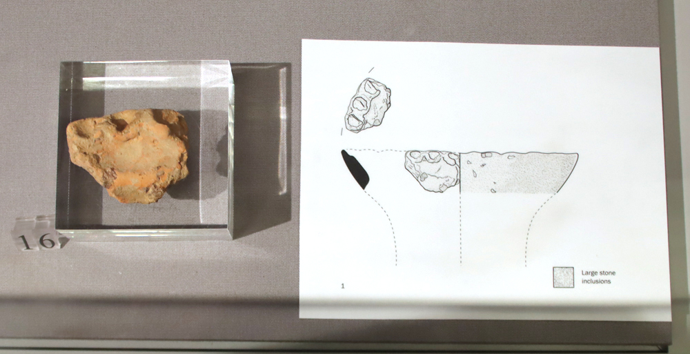
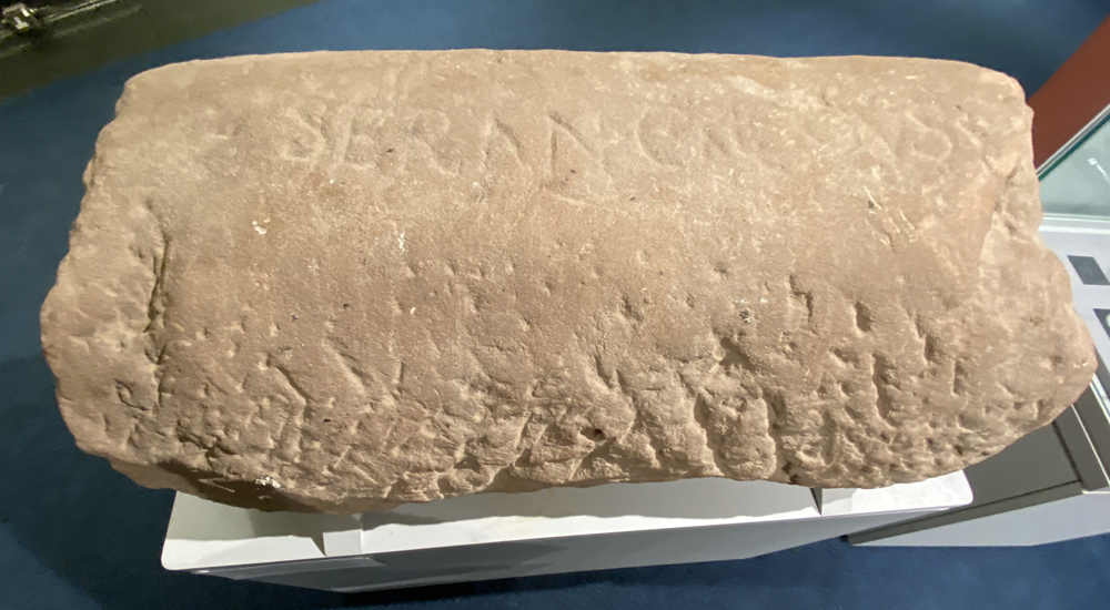
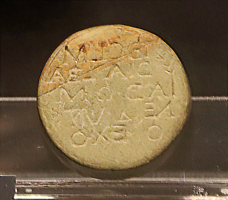
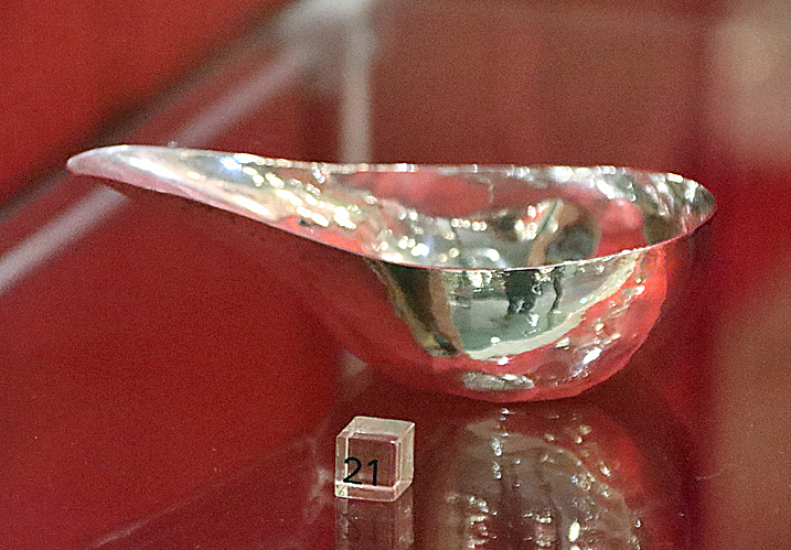
Chester Amphitheatre VCP sherd. A particularly nice piece with a decorated rim. No complete VCP vessel has been found in Britain, but sufficient sherds have been found to show that it has a relatively narrow base and a flaring rim.  Displayed at the “Chester Amphitheatre – An 8000 Year Story” exhibition

Pottery was generally not found in West Cheshire and Wirral sites from the Iron Age, although it is found in Late Bronze Age levels, and has been found north of the Mersey.  The exception to this is Cheshire Stony VCP, Very Coarse Pottery, which is found in varying quantities in the area.  A particularly nice single piece of VCP rim sherd, with “pie-crust” decoration and 71 body sherds, were found at the amphitheatre, with the rim sherd shown above found in the gully of Building 1.  VCP was used in the region for transporting salt, and may be indicative that the people at the amphitheatre settlement were importing salt from the salt brine springs in the Middlewich area.  In her 2012 study of VCP Janice Kinory, building on the work of Elaine Morris, suggests that sometimes both single and more numerous sherds deposited in post-holes or gullies could have had a symbolic function, indicating the importance of salt itself, the value of social connections with salt producers, or the importance of the pottery itself to families and/or communities.  The piece of VCP with “pie crust” decoration along the rim is similar to an example found at Poulton in Structure 2.

Corroded spearhead.

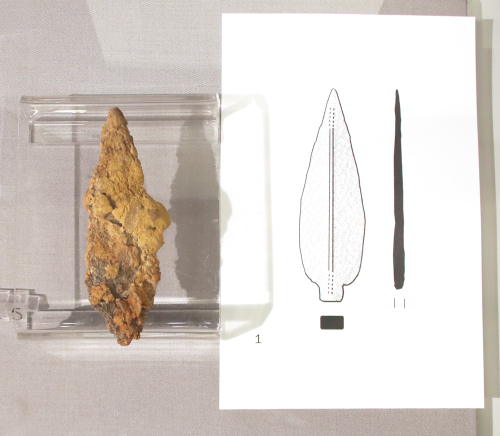
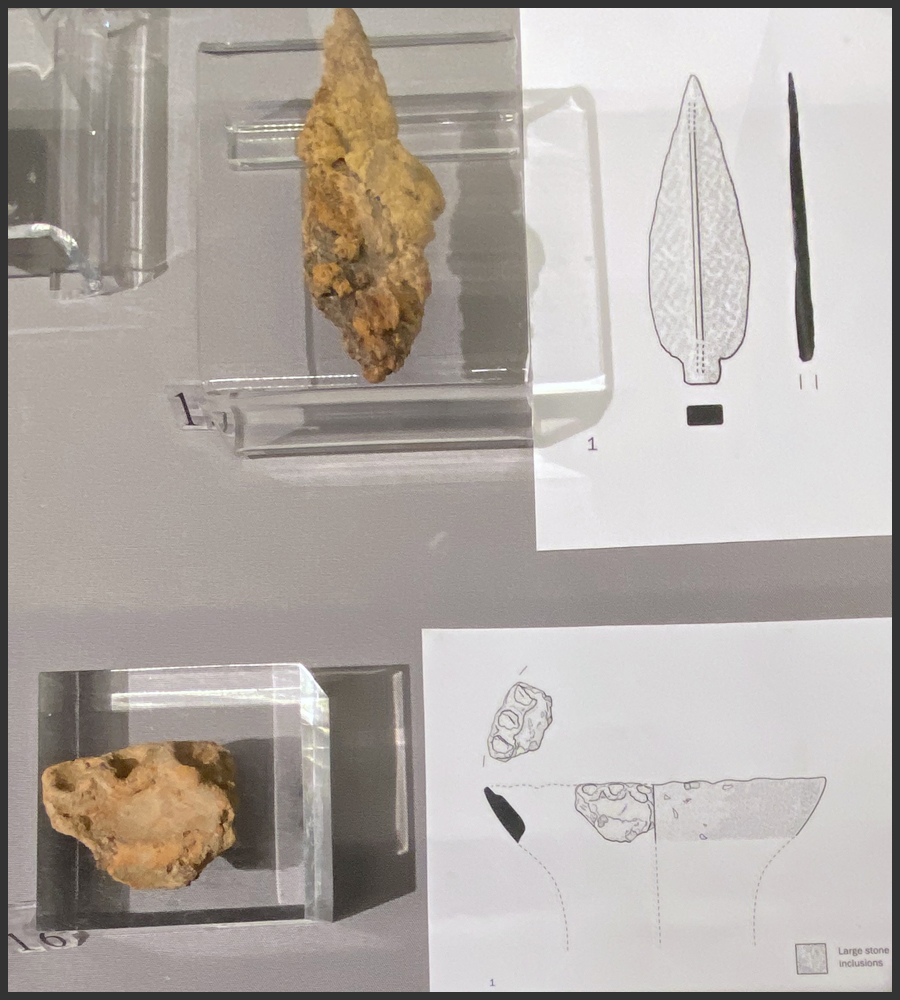
Corroded spearhead. On display at the “Chester Amphitheatre. An 8000 Year Story” exhibition at the Grosvenor Museum

The single, highly corroded iron spearhead is sadly the only metalwork to be found in Period 1, and there is no evidence to suggest that any metalworking took place.  It was originally leaf-shaped, an elegant design that was common in the early Roman period as well, but this spear-head was found securely stratified in phase 1c in the lower of the two cultivation levels.

Fired clay, which is often found at Iron Age sites, was found in small quantities, of two locally available clay types, but its purpose at the amphitheatre is unknown.

Heat-shattered stone is a feature common on the local sites, and the amphitheatre produced 56kg of it from prehistoric levels, mainly local sandstone.  Some dates from a Phase 1a (early prehistory) pit, but the main concentrations were in the cultivation areas during phases 1c and 2.  At other sites in the area it is generally found within settlement structure features, but that may well be a reflection of the fact that only at Saighton Camp at Huntington has an excavation of a contemporary field system taken place in the West Cheshire area.  The function of heat-shattered (or cracked / affected) stone has been much debated, with a number of plausible suggestions, including use for heating up or boiling water for various activities including tenderizing meat and cooking.  Their presence on cultivated levels may suggest that, as with fields in other regions, they could have been spread on fields along with other refuse as fertilizer.
xxx

Final Comments

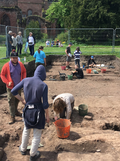
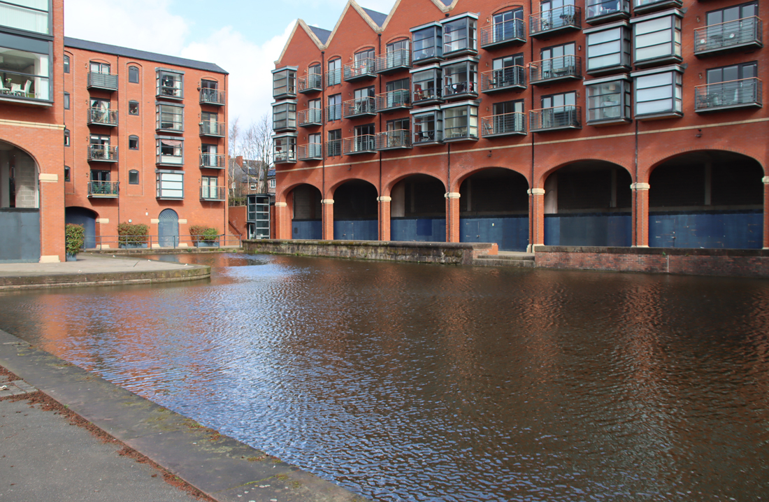
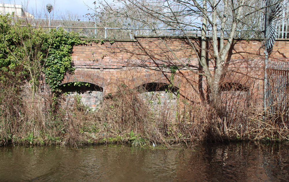
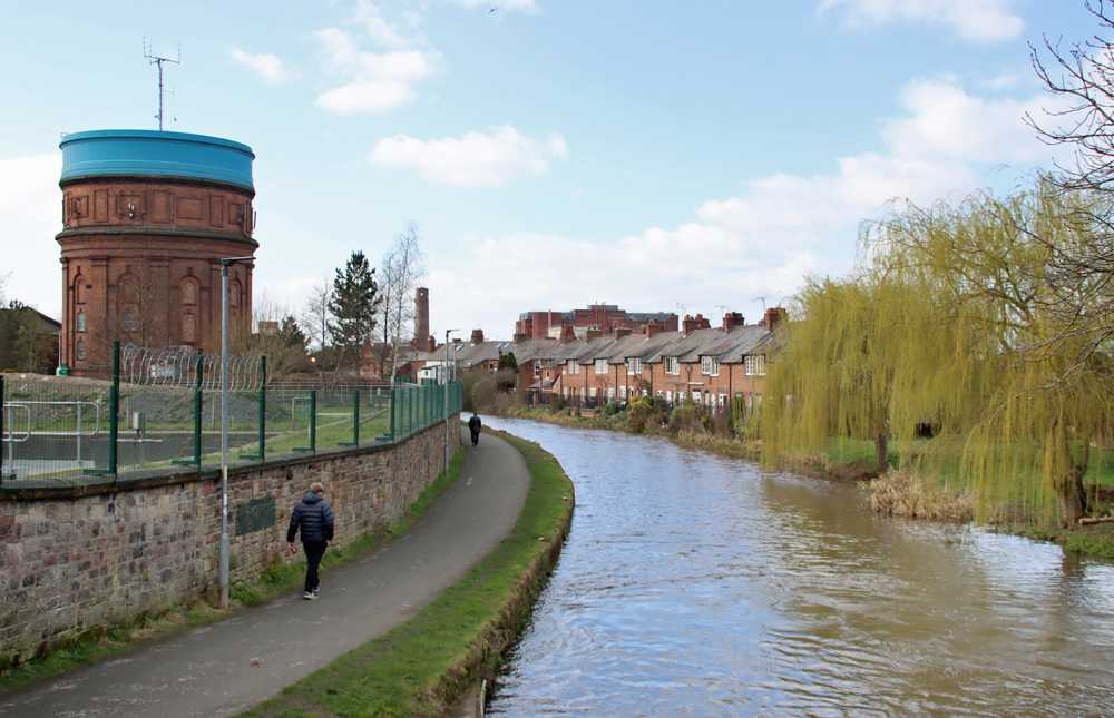
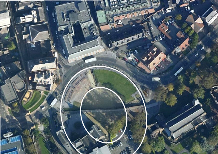
Excavations exploring the amphitheatre environs in the Grosvenor Park are ongoing. Image Source: CAER blog 2019

As with most excavated sites dating to Late Prehistory in the West Cheshire and Wirral areas, the amphitheatre has added more invaluable data to the slowly accumulating knowledge regarding the period in this region.

Although most archaeological and historical evidence in Chester is from Roman and medieval periods, the presence of Iron Age predecessors in the city suggesting that this may have been a farming locale before the arrival of the Romans, is an exciting find.  The site was used both during the Middle and Late Iron Age periods, a period of up to 400 years, during which field management techniques improved.

There is always the possibility that as parts of Chester’s built environment are replaced with new planning developments, such as the upcoming Northgate 2 housing project, other Iron Age remains will be found beneath Roman levels.  The ongoing excavations in Grosvenor Park, to the east of the amphitheatre may eventually reach the lower levels contemporary with the amphitheatre finds.  With more excavated sites within the region there is also the hope that it will be possible to assemble sufficient data to characterize the Late Bronze Age and Iron Age periods in West Cheshire and the Wirral, and to differentiate more fully between this and other regions in the Northwest and further afield.


Sources

Books and papers

Blockley, Kevin 1989. Prestatyn 1984-5. An Iron Age Farmstead and Romano-British Industrial Settlement in North Wales.  BAR British Series 210.

Brück, Joanna 2008. Chapter 11. The Architecture of Routine Life. In Joshua Pollard (ed.) Prehistoric Britain. Blackwell Publishing, p.248-267

Chadwick, Adrian M. 2009. The Iron Age and Romano-British Periods in West Yorkshire. Research Agenda. West Yorkshire Archaeology Advisory Service.
https://www.wyjs.org.uk/media/1271/iron-age-and-roman.pdf

Collens, Jill 1999. Flying on the Edge: Aerial Photography and Settlement Patterns in Cheshire and Merseyside.  In Mike Nevell 1999 (ed.) Living on the Edge of Empire. Archaeology North West, Volume 3 (Issue 13 for 1998).
https://www.academia.edu/14506084/Living_on_the_Edge_of_Empire_Models_Methodology_and_Marginality_Late_Prehistoric_and_Romano_British_Rural_Settlement_in_North_West_England
Or
https://www.castleshawarchaeology.co.uk/documents/anw13-living-on-the-edge-1999-ebook.pdf

Cootes, Kevin; Rea Carlin, Janet Axworthy, Matt Thomas, Roxanne Guildford, and David Jordan 2020. Tales of the unexpected: Uncovering an Illuminating Iron Age Settlement at Poulton. Current Archaeology 366, September 2020, p.18-25
https://www.researchgate.net/publication/351840056_Uncovering_an_illuminating_Iron_Age_settlement_at_Poulton

Cootes, Kevin; Janet Axworthy, David Jordan, Matt Thomas and Rea Carlin, 2021a. Poulton Cheshire: The excavation of a lowland Iron Age settlement.  Journal of the Chester Archaeological Society, vol.91, 2021, p.103-178
https://researchonline.ljmu.ac.uk/id/eprint/25824/1/JCAS_ns_091_Cootes_IA_Poulton_Offprint.pdf
or
https://files.core.ac.uk/download/pdf/648373506.pdf

Cunliffe, Barry 2005 (4th edition). Iron Age Communities in Britain. Routledge

Fowler, P.J. 1981, 1983 (2nd edition). The Farming of Prehistoric Britain. Cambridge University Press

Garner, D. (and contributors) 2012. Hillforts of the Cheshire Sandstone Ridge. Habitats and Hillforts Landscape Partnership Scheme. Cheshire West and Chester Council.
https://www.sandstoneridge.org.uk/lib/file-234636.pdf

Garner D. (and contributors) 2016. Hillforts of the Cheshire Ridge. Investigations undertaken by The Habitats and Hillforts Landscape Partnership Scheme 2009–2012. Archaeopress
Abridged version available online, minus appendices (there is no index in either print or online versions):
https://www.researchgate.net/profile/Peter_Marshall14/publication/313797404_Hillforts_of_the_Cheshire_Ridge_Investigations_undertaken_by_The_Habitats_and_Hillforts_Landscape_Partnership_Scheme_2009-2012/links/58a6860aa6fdcc0e078652a7/Hillforts-of-the-Cheshire-Ridge-Investigations-undertaken-by-The-Habitats-and-Hillforts-Landscape-Partnership-Scheme-2009-2012.pdf?__cf_chl_tk=hzbN0_un1j_np6Me4Z0bWxtROgI9juclGR.5XFzS5iY-1764184426-1.0.1.1-RsTsNKNPcI.Zt7JSR8rdabCJKMfRvmSXkjpGJZHx31c

Garner, Dan 2024. Chester Business Park 2003: A summary of the excavation of a late prehistoric and Roman rural site. Journal of Chester Archaeological Society 94, p.63

Guilbert, Graeme 2018. Historical Excavation and Survey of Hillforts in Wales: some critical issues. Internet Archaeology Journal 48
https://intarch.ac.uk/journal/issue48/3/index.html
https://intarch.ac.uk/journal/issue48/3/box1.html

Johnston, Robert 2008. Chapter 12. Later Prehistoric Landscapes and Inhabitation. In Joshua Pollard (ed.) Prehistoric Britain. Blackwell Publishing, p.268-287

Kinory, Janice 2012. Salt Production, Distribution and Use in the British Iron Age.  BAR British Series 559.

Morris, Elaine L. 1983. Salt and ceramic exchange in Western Britain during the first Millennium B.C. University of Southampton, Doctoral Thesis
https://eprints.soton.ac.uk/437245/1/Morris.pdf

Mytum, Harold and James Meek 2020. Experimental archaeology and roundhouse excavated signatures: the investigation of two reconstructed Iron Age buildings at Castell Henllys, Wales. Archaeological and Anthropological Sciences.
https://www.researchgate.net/publication/339595363_Experimental_archaeology_and_roundhouse_excavated_signatures_the_investigation_of_two_reconstructed_Iron_Age_buildings_at_Castell_Henllys_Wales

Nevell, Mike 1994. Late prehistory pottery types from the Mersey Basin. In Peter Carrington (ed.) From Flints to Flower Pots.  Current Research in the Dee-Mersey Region.  Chester City Council, p.33-42.

Nevell, Mike 2025. Northwest Regional Research Framework: Later Prehistory
https://researchframeworks.org/nwrf/resource-assessments/later-prehistory/ 

Ritchie, Matt 2018.  A Brief Introduction to Iron Age Settlement in Wales. Internet Archaeology 48. https://intarch.ac.uk/journal/issue48/2/1.html

Schoenwetter, James 1982. Environmental Archaeology of the Peckforton Hills. Cheshire Archaeological Bulletin, no.8, 1982, p.10-12

Schoenwetter, James 1983. Environmental Archaeology of the Peckforton Hills.
https://core.tdar.org/document/6256/environmental-archaeology-of-the-peckfo
rton-hills

Wilmott, Tony and Dan Garner 2018. The Roman Amphitheatre of Chester. Volume 1, The Prehistoric and Roman Archaeology. Oxbow  [available on Kindle, although not all of the tables of data are fully legible – page numbers cited in the text refer to the Kindle version]

Wolferstan, Sarah 2026. Oral and performance storytelling for archaeological engagement and research.  British Archaeology, July – August 2026, p.51

Wood, P. N. and D.G. Griffiths 2022. Excavations at Chester. Roman land division and probable villa in the hinterland of Deva. Excavation at Saighton Army Camp, Huntington. Archaeopress Roman Archaeology 93
https://www.academia.edu/121134097/Excavations_at_Chester_Roman_land_division_and_a_probable_villa_in_the_hinterland_of_Deva_Excavation_at_Saighton_Army_Camp_Huntington_Chester
afdsfsd

Websites 

Based In Churton
Chester Amphitheatre – An 8000 year story: Exhibition at the Grosvenor Museum
https://basedinchurton.co.uk/2026/05/21/chester-amphitheatre-the-grosvenor-museum-exhibition-and-the-university-of-chesters-upcoming-vr-experience/
The small and rather puzzling Burton Point promontory fort on the Wirral
https://basedinchurton.co.uk/2026/04/11/the-small-and-rather-puzzling-burton-point-promontory-hillfort-on-the-wirral/
Exploring Maiden Castle Iron Age Hillfort, Bickerton Hill (mid-Cheshire Sandstone Ridge)
https://basedinchurton.co.uk/2025/12/01/exploring-maiden-castle-iron-age-hillfort-bickerton-hill-mid-cheshire-sandstone-ridge/
The three official first days of spring: astronomical, meteorological and phenological
https://basedinchurton.co.uk/2026/03/20/the-three-first-days-of-spring-astronomical-meteorological-and-phenological/

Denbighshire Countryside Services
Heather and Hillforts of the Clwydian Range and Llantysillio Mountains
https://www.denbighshirecountryside.org.uk/files/13491026-2854.Heather%26Hillforts_PT_72.pdf

Heather and Hillforts Landscape Project
[N.B. – most of the document links are broken]
https://heatherandhillforts.co.uk/index.php/en/about/about-the-project

Historic England Introductions to Heritage Assets October 2018
Field Systems
https://historicengland.org.uk/images-books/publications/iha-field-systems/heag204-field-systems/
Hillforts
https://historicengland.org.uk/images-books/publications/iha-hillforts/heag206-hillforts/


Chester Amphitheatre – the Grosvenor Museum exhibition and the University of Chester’s upcoming VR experience

After a successful expedition in to Chester, which included an excellent coffee break with 3-D artist Julian Baum (Take27), I went to see the Grosvenor Museum’s Chester Amphitheatre – An 8000 year story exhibition, running until 12th July, in which one of Julian’s reconstruction images is included.  Julian has also been working on the Our City, Our Story: Deva Victrix project under the auspices of the University of Chester, run by Dr Caroline Pudney (Senior Lecturer in Archaeology), which explores how Virtual Reality (VR) and the application of Artificial Intelligence (AI) can contribute to an interactive experience of the amphitheatre.  This project was showcased in Chester on Saturday 23rd May.  I mention Julian Baum’s work not merely to give him a shameless (although well-deserved) plug, but because the work he contributed to last year’s Gladiators of Britain, the current Chester Amphitheatre exhibition and the upcoming Our City, Our Story VR and AI project are examples of how the trend from static and video reconstruction towards more interactive experiences can complement traditional approaches to provide richer visitor experiences, discussed further below.

The "Chester Amphitheatre" exhibition

The “Chester Amphitheatre” exhibition

The Chester Amphitheatre exhibition is a stand-alone exhibition, complete in its own right, but for those who attended Gladiators of Britain (about which I posted, with a description of the amphitheatre on the blog here), the continuity of themes between the two exhibitions works very nicely, although as the name of the current exhibition indicates, this is not just about the Roman period.  This multi-period approach to the amphitheatre is the exhibition’s major strength, providing an excellent sense of how the same chunk of land has been used from the post-glacial period until the present day.  Apologies for the poor photographs.  I accidentally left my camera at home and they were taken with my elderly iPhone.  As anyone who follows the blog will know, I am rubbish with the thing!

The exhibition space, in Gallery 1 on the ground floor, is well thought out and very elegantly laid out, with a combination of interpretation boards on the walls, artefacts displayed in well-lit cabinets and clear labelling to identify individual objects.  It begins with details of the excavations, from which an understanding of the site was obtained, and then follows a chronological path, beginning with the Mesolithic (meaning Middle Stone Age, the period that starts in the post-glacial period).

The site was first explored in the early 1930s by Professor Robert Newstead, curator of the Grosvenor Museum at the time, and Dr J.P. Droop.  Although it had been assumed, on the basis of other legionary sites in England, that an amphitheatre had existed at Deva, its location was unknown, and it was not until a new road was laid out in 1929 that Roman remains were found and the amphitheatre was identified.  The road would have sliced across the top half of the amphitheatre, but following the discovery of Roman remains was thankfully re-routed to run around it instead of across it, allowing the site to be preserved and enabling further excavations to take place.  The most recent of those was the excavation project established by English Heritage and the former Chester City Council, lead by Tony Wilmott and Dan Garner between 2004 and 2006, published in 2018.  These excavations resulted in a re-evaluation of the Roman amphitheatre and its phases, and provided invaluable information about both its pre-Roman and post-Roman periods.

It is one of the interesting aspects of work into the later prehistory of West Cheshire, that wherever an archaeologist happens to poke a trowel, at both hillfort and lowland sites, earlier prehistoric material is likely to be found.  The type of material often found is epitomized by the finds at the amphitheatre.  The Mesolithic was characterized by very small stone tools called microliths, and a selection of these were found on the amphitheatre site, together with waste products from the manufacturing process, showing that the tools had been made on the spot.  Neolithic and/or Early Bronze Age tools, again made of stone, are also represented and these too are found all over the Cheshire area.

One of the most exciting discoveries of the excavation was the previously unsuspected presence an Iron Age settlement, made up of round houses and rectangular buildings, as well as portions of a cord-rig field system, very like medieval ridge-and-furrow.  Two photographs show details of one of the foundation features of one of the round-houses and a section of cord-rig as they were found during the excavation.  There is a particularly nice sherd of specialist pottery on display, known as VCP (Very Coarse Pottery), that was used for producing and transporting salt.  A highly corroded spear tip was also discovered, one of the few pieces of Iron Age metalwork to survive in the area due to the highly acidic soil.  Both are shown to the left.
xx

Photograph of the excavation showing a section of Iron Age field system

Photograph of the excavation showing a section of Iron Age field system

xx

Chester Amphitheatre exhibition

The Roman amphitheatre is inevitably the main focus of the exhibition, which is unsurprising given its scale and duration.  Now understood to consist of two main phases, having been expanded in its second phase, it was in use from c.AD 74/75.  It is estimated that the second phase of the amphitheatre could have accommodated up to between 7500-8000 spectators and it is to this phase that two of the larger objects in the exhibition belong: the tethering stone to which wild animals would have been tied, and a coping stone (rounded stone topping for a wall) that contains the inscription “SERANO LOCUS,” roughly meaning “Serano’s Place,” possibly an attempt to lay claim to a particular seat that sat behind the low wall.  The many other Roman artefacts on display include ornaments, gaming pieces, pottery (samian ware, grey ware, orange ware etc) and other items made of metals and glass.


SERANO

Capstone engraved SERANO LOCUS

Saxo-Norman artefacts

A display of Saxon-Norman objects demonstrates that there may be some degree of continued use of the amphitheatre’s space after the Roman abandonment of the site, albeit for a completely different purpose.

The excavations have also helped to clarify some of the medieval structures associated with the Romanesque St John the Baptist’s Church (at one point Chester’s cathedral) and how its churchyard encroached on the original amphitheatre during the Middle Ages.  The other side of the churchyard’s footprint, extending into the Grosvenor Park, is currently under excavation by West Cheshire Museums and the University of Chester.

Medieval jug

Medieval jug

xx
Post-medieval finds demonstrate how, as the amphitheatre was gradually lost due to stone robbing for other buildings, the accumulation of debris and ongoing building works as Chester continued to expand beyond the walls, the former amphitheatre site continued to be occupied, and broken objects continued to be abandoned, as they are today. A particularly nice find was a pit dug in Tudor times, containing a fascinating array of broken, discarded items.  Civil War finds included lead gun shot and the remains of gunpowder holders.  There is even a fabulous packet for a loaf of bread with a pre-decimalization price printed on it, with bright, happy colours, a splendidly cheery tiger and the strapline “The Swinging New Bread.”  Very 60s!  See below.

Detail of John McGahey’s 1852 painting of Chester from an air balloon (with my rough indicator of location of amphitheatre in red show how completely the amphitheatre area was covered over).

Detail of John McGahey’s 1852 painting of Chester from an air balloon (with my rough indicator of location of amphitheatre in red show how completely the amphitheatre area was covered over).


The Chester amphitheatre’s tethering stone

xx

Brilliant bread packet, pre-decimalization, which was implemented in 1971

Brilliant bread packet, pre-decimalization (which was implemented in 1971)

The amphitheatre through the ages, an excellent illustration covering an entire wall of the exhibition, demonstrating how different periods are captured in the vertical stratigraphy of the site. By India Hackett

The amphitheatre through the ages, an excellent illustration by India Hackett covering an entire wall of the exhibition, demonstrating how different periods are captured in the vertical stratigraphy of the site, including a Civil War canon, the tethering stone on the Roman level, flanked by gladiators, and the Iron Age roundhouse and fields being ploughed beneath.


The Chester Amphitheatre exhibition at the Grosvenor Museum runs until 12th July 2026
.  Access to the exhibition is free of charge.  For the Grosvenor Museum’s opening times, see their website for information here: https://grosvenormuseum.westcheshiremuseums.co.uk/

The University of Chester’s Virtual Reality approach to the same amphitheatre site during the Roman period (Our City, Our Story: Deva Victrix in VR), was showcased for the first time on  Saturday 23rd May, 11am – 4pm in Exchange Square (Northgate St).  Julian Baum and other key members of the project team, were all on hand to provide insights into how visitors of the very near future will be able to interact directly with virtual Romans in a reconstruction of their original setting.  Feedback is seen as part of the project design and when people filled in the feedback forms, was very welcome.

Image from the "Our City, Our Story: Deva Victrix in VR" project

Image from the “Our City, Our Story: Deva Victrix in VR” project.

Accuracy has been of great importance to the project.  The VR model of the amphitheatre itself, for example, is derived directly from the data unearthed in the excavations that are the subject of the museum’s exhibition and was developed by Julian in conjunction with Tony Wilmott, one of the site’s excavation directors.  The animated Roman residents of Deva Victrix, developed by VR company Imito, help to bring the amphitheatre to life, allowing visitors to participate and interact with Roman soldiers and other characters.

Although the museum exhibition and the VR project are separate entities, run by the museum and the university respectively, the two approaches, traditional and virtual, have the potential to work in tandem and to complement each other very well.  The current museum exhibition presents the physical and tactile raw data (artefacts and architectural components) and uses interpretation boards to create an empirical understanding of how data is translated into knowledge about the amphitheatre.  Nothing can replace artefacts as evocative components of the past, but the information derived from them can be handled in a number of different ways.  Although running as a separate project, the VR approach demonstrates the potential for a more interactive and immersive exposure to a vision of the past that allows a relationship with history to be formed, however briefly.  The combination of artefacts and displays of the information they impart, supported by immersive experiences, may provide a glimpse of the future of how history could be communicated and how people may begin to explore their past in a variety of different ways.

Julian Baum’s reconstruction of the fortress at Chester and the outer buildings in the mid 3rd Century.

The Riverside Museum, the development of hospitals in Chester and the professionalization of nursing

Introduction

After writing a 4-part series on the 1829 Cheshire Lunatic Asylum (its original 19th century name), which introduced me for the first time to medical history, I became interested in how hospitals other than mental institutions developed in the United Kingdom.  This post, offering a brief snapshot of how nursing staff built a sense of professional identity from the 19th century onwards, with particular reference to Chester, followed a visit to the Riverside Museum in Chester with its collection of nursing objects, including a cabinet full of hospital badges.

A brief background to hospital care in Chester

Eye Doctor Stamp from Wroxeter. SHYMS A/2008/00133

Eye Doctor Stamp from Wroxeter, now in the the Shrewsbury Museum and Art Gallery. SHYMS A/2008/00133

Medicine in one form or another has always been present. Doctors were in England in the Roman period.  A nice example of a Roman emblem of medical authority is an eye doctor’s stamp from the Roman town of Wroxeter near Shrewsbury, now in Shrewsbury Museum and Art Gallery.  Roman doctors and surgeons often treated their patients in the public baths, which were major community gathering places and health facilities but most legionary fortresses would also be equipped with a valetudinarium, a place for those needing help with valetudo (health), an early predecessor of the hospital.  In a British legionary fortress this building was usually located opposite the city baths for convenience, but although the Chester (Deva) city baths are known to have been located on the east side of Bridge Street, sadly the valetudinarium has not been definitively located.  Tim Strickland suggested, albeit tentatively, that it might be the building found in the 1982 excavations to the east of the barracks, on the west side of Northgate Street, a little way north of today’s Town Hall.  This is given support by some fascinating evidence for the presence of medical expertise in that area in the form of two altars dedicated by doctors to suitable deities.  Documented as RIB 461 and RIB 3151 they were both inscribed in Greek, implying that the doctors were themselves Greek, and were found on the west side of Northgate Street. Both are now in the Grosvenor Museum, Chester.  David Mason offers the alternative suggestion that the traces of primary timber buildings opposite the baths could feasibly be the  valetudinarium, but the remains were too meagre for any function to be determined.

Tim Strickland's reconstruction of the Princess Street Excavations, showing the possible hospital building in the background

Tim Strickland’s reconstruction of the Princess Street Excavations, showing the possible hospital building in the background. Source: Strickland 1982

In the later medieval period, badges and medals were adopted in secular, military and ecclesiastical contexts to identify status, beliefs and achievements.  Pilgrims to the St Werburgh shrine, in St Werburgh’s Benedictine Abbey, what is now Chester Cathedral, purchased pilgrim badges not only as souvenirs of their journey, but to identify themselves as actively committed to acts of Christian faith,or in gratitude for prayers being answered.  Pilgrimages could be undertaken for a variety of reasons, but a major draw was the possibility of a saint interceding in response to prayers for curing illness or disability.  Accumulated badges were attached to clothing and bags.  These were of course emblems purchased by the pilgrim.  They were not awarded by others to pilgrims in recognition of their devotion, but they communicated a powerful sense of affiliation and achievement.

St Werburgh’s Abbey pilgrim badge. British Museum 1836,0610.73

Chester’s very first infirmary was probably that of the medieval St Werburgh’s Benedictine Abbey, founded in 1092.  As with most abbey complexes, the infirmary was a separate building that provided elderly and infirm monks with a more relaxed regime and better food than enjoyed by the rest of the monastic community, but was not necessarily concerned with the most of the market town’s community beyond the monastic walls.  The location of the infirmary, which was usually a separate building and often set as one side of a second cloister (square of monastic buildings) is not known, although Alan Thacker suggests it might have been to the east of the surviving cloister.

By contrast, the 12th century St Giles leper colony was dedicated to the care of anyone with the terrible Hansen’s Disease, better known as leprosy, caused by the bacteria Mycobacterium leprae.  Like most leper colonies, it was outside the town, located about a mile away from Chester in Boughton.  As was traditional with leper hospitals, it was located at a fork in the road, an optimal location for lepers to beg for alms heading into and out of Chester via the Eastgate.  It later became more of an almshouse, until it was knocked down at the start of the Civil War in 1643.  The remains of the hospital’s cemetery is still visible as a patch of raised grass just beyond the fork where Tarvin Road and Christleton Road split.

Artist’s impression of Birkenhead Priory as it may have looked in the 14th century by E.W. Cox c.1896.

Just outside the city walls, the charitable St John The Baptist Infirmary (known locally as Little St John’s to distinguish it from the Church of St John the Baptist) was established in around 1190 to take care of the elderly and infirm within the town, specializing in the care of the impoverished.  Like most hospitals it was equipped with a church and a cemetery.  Thirteen beds were reserved for the city’s impoverished, but could take in other patients when capacity permitted.  There were always problems with the financial management of the hospital, which R. Stewart-Brown puts down to the policy of renting out the hospital’s properties in return for fixed sums, which could not be adjusted when costs rose.  Matters reached a head in February 1315-15 when a public inquiry was held and it was decided to give responsibility to Birkenhead Priory, but this was apparently fairly short-lived.  The hospital was demolished in 1644.

In 1510  a charitable bequest from former sheriff Roger Smith founded six almshouses in Commonhall Street, Smith’s former house, together with a chapel. Suffering financial difficulties, it was converted into the Fraternity and Hospital of St Ursula the Virgin.  Although it was dissolved in the mid 1500s the almshouse buildings survived until 1871.

1761 Building Royal Infirmary

1761 Building Royal Infirmary

The Chester Infirmary opened in the mid-1700s after a bequest was left to found a county infirmary specifically to build a hospital for those unable to afford medical care.  After an initial period at the Blue Coat School at Northgate, a site was purchased on City Walls Road, and the building was designed by William Yoxall, with its own chapel on the first floor.

Dr John Haygarth

Dr John Haygarth. Source: Wikipedia

In 1766 Dr John Haygarth accepted a position at the Infirmary as a physician, working there until he retired in 1796.  His investigative work lead him to become particularly interested in the spread of infections diseases in the poorer parts of the city, establishing a Smallpox Society in 1778.  He promoted the control of disease in the community by establishing routines of cleanliness, ventilation and inoculation.  The creation of isolation wards in 1783, in response mainly to typhus outbreaks, was an innovation at the Infirmary that was soon adopted by other hospitals.  Over the coming years many changes were made to the Infirmary.  The Chester Infirmary represented a considerable advance on medieval standards of care, both benefitting from and contributing to medical research and the understanding of infectious diseases.

Frances Maria Wilbraham

Frances Maria Wilbraham. Source: Wikipedia

At the Chester Infirmary, the sisters Frances and Emily Wilbraham and their friend and colleague Emily Ayckbowm demonstrated how women in the late 1800s might be highly active not merely in the care of patients, but in the management of hospitals and the handling of epidemics, building on the work of Florence Nightingale. Colonel Richard Wilbraham, brother of the sisters, had served in Crimea and was a friend of Nightingale’s.

The three major outbreaks of cholera in 1832, 1849 and 1865 stretched the hospital’s resources to the limit and they refused to take cholera patients, requiring isolation hospitals to be set up on vacant land, which were taken down once the worst was over.  This was a period when Chester still lacked piped water and insanitary conditions, although being tackled by the authorities, were very common.  At the onset of the 1865-66 outbreak of cholera, Frances was instrumental in setting up an isolation hospital in a semi-derelict farm building where the Grosvenor Park is now located, helping to, prepare it for patients, nursing the patients when they arrived, and managing workhouse inmates who were assigned to the infirmary.  Frances published a book about her experiences in 1877, “Streets and Lanes of a City,” under the pen-name Amy Dutton. The windows in the chapel built on the first floor of the Royal Infirmary were installed in memory of the Frances and Emily.

Infirmary Chapel Windows. Source: First floor display in the Wheeler Building, University of Chester

Infirmary Chapel Windows. Source: Photograph of first floor landing poster display in the Wheeler Building, University of Chester

The building was expanded and modernized and in 1914 a major refurbishment was accompanied by a new wing with with six additional wards.  After being opened by King George V and Queen Mary, it was renamed the Chester Royal Infirmary.  In 1948 the hospital was absorbed into the National Health Service.  In 1994 it eventually closed, its functions having been taken over by what is now the mammoth Countess of Chester Hospital.  The original 1761 building was Grade 2 listed in 1972, and in 1998 was converted for residential use, but the rest was demolished.  The building still stands and appears to be in very good condition.

The 1829 Building, built as Cheshire’s first lunatic asylum and now part of the Countess of Chester Hospital

The Countess of Chester Hospital was, until 1968, a mental health hospital.  It had been established as the county lunatic asylum in 1829, a progressive institution which, particularly under Thomas Nadauld Brushfield, attempted not merely to confine patients but to understand and treat mental illness.  I have written a considerable amount about the lunatic asylum in the 19th century on this blog here.  In 1968 it became a general hospital and in 1977 began to expand to become the central general hospital for the region.

The Haygarth Medal

The Haygarth Medal, , Chester Infirmary. Source: Peter’s Nursing Collectibles (with permission)

The relationship between hospital, lunatic asylum and workhouse (most of which had their own medical wings for inmates) was complicated, but there was increasing recognition that medicine and patient care needed to be both professionalized and standardized.  This is first visible in the increasing care invested in new hospital buildings. The architecture of both the Infirmary of 1761 and the Cheshire Lunatic Asylum of 1829 demonstrate the civic pride that lay behind these institutions.  The buildings were not merely functional-looking cornflake-box buildings, but imaginative statements of philanthropic commitment, self-confidence and investment in society, as well as representing more than a little self-congratulation.  Not all of the nation’s medical institutions were able to put well-meant ideals into practice, but on the whole the Chester medical establishments seem to have had the best of intentions and to have attracted good professional people to head up their medical enterprises.

In the late 19th century the Chester Infirmary began to award a silver medal each year to the best nurse at the Infirmary, recognizing that rewarding high standards was an important part of encouraging improvements in the profession as a whole.  In honour of its pioneering physician Dr John Haygarth, it was named the Haygarth Medal, at left.  The tradition of awarding badges and medals had a long pedigree in the military and the use of the same idea to recognize achievements and promotions was one of the most important tools used to demonstrate the professionalization of nursing.
xxx

The professionalization of nursing and associated symbols of achievement

Original letter written by Florence Nightingale at Baklava to a soldier's family, preserved at the Riverside Museum, Chester

Original letter written by Florence Nightingale at Baklava to a soldier’s family, preserved at the Riverside Museum, Chester

The best know of the pioneering nurses is Florence Nightingale (1820-1910).  She had introduced many important new initiatives, such as providing fresh air, clean conditions, warmth, quiet and a good diet.  She recognized that nursing was regarded as little more than domestic service that attracted those without either skills or education, many of whom were very unsuitable.  On her return to England, after the war ended in 1856, Nightingale established a school for nurses, funded with public contributions.  It opened in 1860, provided year-long training, and was highly selective about the intake of trainees.  Interestingly, Nightingale was not in favour of establishing national uniformity in the professional standardization of nursing.  Instead, she believed that a letter of recommendation from her training school was sufficient recommendation.

Badge of the National Union of Trained Nurses. Source: Peter’s Nursing Collectibles

It was another professional nurse, Ethel Gordon Fenwick (1857-1947), a matron of St Bartholomew’s hospital in London, who became one of the principal activists for the standardization of professional training and the introduction of qualifications.  Because nursing was the almost exclusive activity of women, the work to professionalize nursing was most often undertaken by female activists in an era long before women had won the right to vote for the first time in 1918. Ethel Gordon Fenwick campaigned for the registration of nurses as a way of establishing universally accepted standards in nursing associated with acknowledged skills and integrity.  In 1887 she established the British Nurses Association to campaign for registration, and issued both certificates and badges to nurses who were deemed to have met the Association’s high standards. This was eventually followed in c.1910 by the National Union of Trained Nurses, which again issued certificates and badges.  Its badge, in the shape of a star, had the legend , with the legend translated as “per ardua ad astra,” a Latin phrase meaning “through adversity to the stars.”

College of Nursing Badge. Source: Peter's Nursing Collectibles

College of Nursing Badge. Source: Peter’s Nursing Collectibles

Although a pioneer in her own right, Ethel Gordon Fenwick was not alone, and other institutional bodies were set up to push forward registration and standards, often in competition with one another.  These different bodies were eventually superseded in 1919 when the Nurses Registration Act was passed and the College of Nursing was established, and the registration of nurses began on 30th September 1921, entitling nurses to refer to themselves as State Registered Nurses (SRNs).  Ethel Gordon Fenwick signed the register in that year, becoming the first SRN. This new institution continued the tradition of issuing a badge, which had the initials CN surrounded by the motto “The College of Nursing founded MCMXVI,” accompanied by the emblematic flora of the four nations.  It was updated a number of times, notably in 1946 when it was provided with the motto Tradimus Lampada, “We pass on the torch,” a reference to Florence Nightingale and her pioneering work to establish standards in patient care.

Nurses’ badges, which began to be awarded after the middle of the 19th century displayed affiliation to a value system, an ideology, a profession and an institution, whilst at the same time providing a sense of personal achievement and pride.  They were also, much like military and ecclesiastical training awards, part of the process of ensuring that nurses adopted not only practical methodologies and procedures, but also particular patterns of behaviour and responsibilities.  The messages incorporated into these badges were not only recognized by other health professionals but also provided reassurance to patients and their families. For women, always the minority in professional life up until the mid 20th century, it was an important indication of their increasingly important roles and skills in a medical environment.

Nurse's uniform on display at the Riverside Museum, Chester

Nurse’s uniform on display at the Riverside Museum, Chester

Although by the later 19th century badges of honour and office were already popular, they  acquired a new momentum as different segments of society began to recognize the importance of conforming to agreed professional standards at work.  Nurses’ uniforms and badges were developed side by side with growing professional standards and the recognition that nurses, delivering hands-on care, required training, examination, and qualifications to ensure that the ever changing medical advances were incorporated into the daily routines of the hospital wards.  The development of recognized formal standards and the uniforms and badges that indicated them, gave nursing a new sense of its own professional integrity, and value to society.  Nursing badges were adopted by both the state, to recognize national awards, and by individual hospitals to recognize the achievements of their own nurses who had been trained according to that establishment’s own standards and specializations.  This introduced some competition between hospitals, as some establishments became more prestigious than others, and issuing badges was a way of attracting nurses who wished to share in that prestige.

Chester Royal Infirmary Training School. Source: Peter's Nursing Collectibles

Chester Royal Infirmary Training School, combining the Maltese Cross with the wheat sheaf of Chester. Source: Peter’s Nursing Collectibles

State badges were eventually standardized.  In 1919 the Nurses Registration Act introduced a single badge for all nurses who qualified, and continued to be a valuable part of a nurse’s uniform for over 70 years.  Individual hospital badges continued to be far more eclectic and there are hundreds of styles and shapes of individual hospital badges.  There was often a “pinning of the badge” ceremony to mark the transition of a nurse when she had finished her training or passed certain examinations, associating the badge with a sense of ceremony and occasion.

Themes represented on British badges were very varied.  Some early examples were based on the Maltese Cross emblem of the Knights of St John.  Others had Christian imagery to reflect the nurture, care and charitable character of nursing.  Some had heraldic themes.  Lamps, referencing Florence Nightingale, were popular.  The Rod of Aesculapius is a recurring emblem.

My mother's Oxford Eye Hospital badge

My mother’s Oxford Eye Hospital badge, in the shape of an eye with the emblem in the eye’s pupil, together with her fob watch

Specialist institutions might have imagery showing the nature of the specialization; images of mother-and-child were popular with midwifery, for example.   Some simply displayed initials of the institution.  Many included a motto around the edge or on the cross-bar.  My mother became an ophthalmic nurse at the Oxford Eye Hospital after leaving school, and I still have her nurse’s badge, shown here, in the shape of a human eye with the image of a lamp symbolizing Florence Nightingale at its centre, in the pupil of the eye. The motto that sits along the base of the badge reads “To give light to them that sit in darkness.”

Chester District School of Nursing. Source: Peter's Nursing Collectibles

Chester District School of Nursing. Source: Peter’s Nursing Collectibles

In Chester hospitals, the wheat sheaves first associated with the 5th Earl of Chester from the 12th century were popular, such as that from the Chester School of District Nursing shown left and the Chester Royal Infirmary Training School above.  

In the 20th century the principal manufacturer of nurses’ badges was Thomas Fattorini, in Birmingham.  It is estimated that around 400 different UK nurses badge designs were produced in the 1970s and 80s alone.  State badges ceased to be issued in 1983 when statutory bodies were reorganized under a central council. The tradition of issuing hospital badges also began to go into decline when the shift was made from hospital-based training to nursing colleges. Nurses’ badges are now, however, very popular with collectors so although they are now more matters of heritage than ongoing relevance, their survival seems secure.
xxx

The reverse side of a Fattorini Badge from Oxford Eye Hospital

The reverse side of a Thomas Fattorini Badge made for Oxford Eye Hospital


School of Nursing and Midwifery, Chester. Source: Peter's Nursing Collectibles.

School of Nursing and Midwifery, Chester. Source: Peter’s Nursing Collectibles.

In conclusion, the professionalization of nursing and the recognition of nurses’ achievements was aided by the deployment of uniforms and badges that indicated the role of the women who wore them, and later men too.  These uniforms and badges reflected social reform in which the growing recognition of the role of women outside the home and beyond the menial were increasingly recognized. The badges visibly demonstrated qualifications and abilities to their patients, their colleagues, their managing institutions and to society as a whole, creating a framework of recognition and respect.  Perhaps just as importantly it provided the nurses who earned them with a sense of status and self-worth.  The badge was not something that a nurse simply wore, but an emblem of honour and achievement indicating a personal commitment and attitude to a vocation involving both practical and book learning in which she not merely participated but in which she had been tested and at which she had excelled.

Photograph of the Chester Royal Infirmary in 1968, together with The Nursing Mirror Pocket Encyclopaedia and Diary. Riverside Museum, Chester.

Photograph of the Chester Royal Infirmary in 1968, together with The Nursing Mirror Pocket Encyclopaedia and Diary. Riverside Museum, Chester.

I have referred to nurses throughout this short piece as female, as most nursers were, for most of nursing history.  In mental health institutions male attendants were an absolute necessity for their physical strength rather than their medical skills, working alongside female nurses, but from the mid-19th century, and particularly during the two World Wars, men were serving as medics in first aid and nursing capacities in the military, as part of the Royal Army Medical Corps (RAMC), often at the front lines.  Legal recognition for male nurses in Britain occurred in 1919 with the introduction of the Nurse Registration Act; the first male State Registered Nurses (SRNs) were registered in 1922.  The first male SRN was George Dunn of Liverpool who had trained in the RAMC.

The Riverside Museum

Nurses' badges at the Riverside Museum, Wheeler Building, Chester

Nurses’ badges at the Riverside Museum, Wheeler Building, Chester

The Riverside Museum in Chester contains a rich assortment of items that relate to medicine, nursing, midwifery and related health services. In one display cabinet there are numerous nursing badges. They all come from Chester, the Wirral and elsewhere in the region, and they are all different shapes, sizes and colours with different motifs.  Based on the model of military uniforms and medals, the nurses’ uniforms and state-awarded badges were intended to identify nurses as fully trained and qualified health professionals.  Other badges additionally identified specific hospitals and specializations.  The emblems, badges and uniforms formed a symbolic representation of skill, status and role within the healthcare community.

Riverside Museum

What is clear from the Riverside Museum is that as well as badges and uniforms, nurses had a plethora of written material to support them – pamphlets, handbooks, mini encyclopaedias and, later, textbooks.  As well as used as training materials, they continued to be valuable for reference on the job, and new volumes helped to keep nurses up to date with the latest techniques and practices.  These demonstrate not merely the standard that the nurses reached, but also the commitment to ongoing improvement.

If you have not heard of the Riverside Museum, it is probably because of its opening times.  The museum is run by volunteers and its opening times are confined to once a month during term time, and on certain days during the Chester Heritage Festival and the Festival of Ideas.  You can find their opening times for 2026 here.

School of Nursing and Midwifery. University College Chester.

School of Nursing and Midwifery. University College Chester. Source: Peter’s Nursing Collectibles.

Do note that the opening times usually coincide with a free lecture series organized by the Faculty of Health, Medicine and Society Historical Society, also listed on the link above.  These lectures are excellent, and it is well worth planning to combine a visit to the museum with attendance of a lecture.  The Museum also accepts group bookings for six or more people by arrangement.  The museum is located in the Wheeler Building, which was the former County Hall, the Cheshire County Council headquarters building. It sits on the northern bank of the Dee between the 14th century Old Chester Bridge and the 1832 Grosvenor bridge, overlooking the river. A map is available at the bottom of the Wheeler Building’s web page here.

Many and sincere thanks are owed to Peter Maleczek for giving me permission to use the images from his website Peter’s Nursing Collectables at https://petersnursingcollectables.com/home.php  and his Flickr page at https://www.flickr.com/search/?user_id=36611823%40N07&sort=date-taken-desc&view_all=1&text=chester


Chester Royal Infirmary, both engraved to Nurse M. Dallimore.  Source: Peter's Nursing Collectibles

Chester Royal Infirmary prize medals, both engraved to Nurse M. Dallimore in 1940.  Source: Peter’s Nursing Collectibles

Sources:

Books and Papers

Barrow, J.S., J.D. Herson, A.H. Lawes, P.J. Riden, M.V. J. Seaborne 2005.  Local government and public services: Medical services.  In A.T. Thacker and C.P. Lewis (eds.) A History of the County of Chester: Volume 5 Part 2, the City of Chester: Culture, Buildings, Institutions. British History Online
https://www.british-history.ac.uk/vch/ches/vol5/pt2/pp49-58 

Bates, Christian 2010. Looking closely: Material and visual approaches to the nurse’s uniform.  Nursing History Review vol.18, p.167-88
https://www.proquest.com/docview/207237406?sourcetype=Scholarly%20Journals

Callander-Green, Stephen 2001.  Nurses’ Badges: Archaic Symbols or Icons of Nursing? International History of Nursing Journal, vol.6, iss.2, p.71
https://www.proquest.com/docview/218742979?pq-origsite=gscholar&fromopenview=true&sourcetype=Scholarly%20Journals

Carrington, P. 1994.  Chester. Batsford / English Heritage

Catanzaro, Ana Maria 2002. Beyond the Misapprehension of Nursing Rituals.  Nursing Forum, vol.37, No.2, April-June 2002, p.17-27
https://onlinelibrary.wiley.com/doi/abs/10.1111/j.1744-6198.2002.tb01194.x

Edelweiss, James 1992, 2009. Collecting Nursing History 6. Pictorial History –  Collecting Nursing Badges. School of Nursing.
https://www.schoolsofnursing.co.uk/Articles/EdelweisJBA1.htm

Laughton, Jane 2008. Life in a Late Medieval City. Chester 1275-1520. Windgather Press

Mason, David 2001, 2007 (2nd edition). Roman Chester. City of the Eagles. Tempus

Richardson, Harriet (ed.) 1998. English Hospitals 1660-1948. Royal Commission on the Historical Monuments of England

Risse, Guenter B. 1999. Chapter 1. Collective Care of Soldiers and Slaves: Roman Valetudinaria. In (ed.) Guenter B. Risse. Mending Bodies, Saving Souls: A History of Hospitals. Oxford University Press
https://www.researchgate.net/publication/273441350_Collective_Care_of_Soldiers_and_Slaves_Roman_Valetudinaria

Strickland, Tim 1982.  Chester. Current Archaeology 84, vol. 8, no.1, October 1982, p.6-12

Thacker, Alan 1995.  The reuse of the monastic buildings at Chester, 1540-1640. Transactions of the Historic Society of Lancashire and Cheshire, vol. 145 (1995), p.21-43.
https://hslc.org.uk/wp-content/uploads/2017/05/145-3-Thacker.pdf

Wildman, Stuart 2020.  Nursing history: the first male nurses: Who were the first male nurses? Royal College of Nursing Magazine, April 29th 2020
https://www.rcn.org.uk/magazines/History/2020/Nursing-History-Now-first-men-nurses-on-register

Wildman, Stuart 2023. What’s On a Badge? Using material culture to illustrate the professionalism of nursing. Bulletin of the UKAHN, vol.11 (1)
https://bulletin.ukahn.org/whats-on-a-badge-using-material-culture-to-illustrate-the-professionalization-of-nursing/

Websites

Based in Churton
The Cheshire Lunatic Asylum 1854-1870 – Part 2.1
https://wp.me/pcZwQK-6oU
The Cheshire Lunatic Asylum 1854-1870 – Part 2.2
https://wp.me/pcZwQK-7ts

Roman Inscriptions in Britain
RIB 461 and RIB 3151
https://romaninscriptionsofbritain.org/inscriptions/3151

School of Nursing
Sue Sullivan. Collecting Nursing History – Nursing Badge Design.
http://www.schoolsofnursing.co.uk/Articles/Badgedesignx.htm


The Nursing Mirror Pocket Encylopaedia and Diary

Pages from the Nursing Mirror Pocket Encyclopaedia and Diary. Riverside Museum, Chester

Objects of privilege in the Ridgway Silver Gallery at the Grosvenor Museum, Chester

Sugar sifter spoon. George Walker I, Chester. 1794-95. 1988.53

Silver is one of those materials that can be sublime in its simplicity, relying on the brilliance of the fabric, the purity of shape to create beauty and elegance in functional items.  It can also be elaborately ornate, relying on layers of opulent, showy adornment for its impact and to make its ostentatiously unsubtle point.  The Grosvenor Museum in Chester displays both extremes and everything in between, in its Ridgway Silver Gallery.  The Ridgway Gallery is dedicated both to items of silver that were made in Chester and those that were purchased elsewhere, mainly in London, for use in Chester.

Chester had a long tradition of silver-working at least from the 13th century onwards.  The Chester Goldsmiths Co., registered just before the Dissolution in 1531, were the key authority for the city goldsmiths at that time, laying down standards and rules for production, assaying, and marking objects.  Assaying is a quality control method by which the content of silver in an item is determined, and confirms its purity, integrity, validity, which in turn offered guarantees of value for purchasers.  In the 17th century there was a decline in production by Chester goldsmiths as London grew to prominence.  This was aggravated by the Civil War which raged around Chester’s city walls.

In spite of some very rocky years, the 18th century marked an upturn in the fortune of Chester silver production, described by Peter Boughton as its heyday.  Two family dynasties, the Richardsons and Lowes, became synonymous with locally produced silver.  After 1884 Chester’s Goss Street Assay Office was one of only four in Britain that was still active.  This was only closed in 1962, by an Act of Parliament.

Silver has always been a prestige item, intended for conspicuous display.  Even the most modest items would have been unaffordable for most of Chester’s population, so the market for silver was a clear indication of the prosperity of the city’s elite.  Wealthy individuals and families, as well as the city corporations, institutions and establishments were all affluent consumers of Chester silver, purchasing it to demonstrate both their personal status and the prestige of local enterprises.

The Grosvenor Museum. Source: Geograph (1335188)

The Grosvenor Museum was founded in 1885-6 but it was not until the 1950s that it received the first pieces that formed its earliest display of silver.  In 1951 the Trustees of Chester Municipal Charities placed their collection of silver on long term loan.  The following year the museum began to acquire items of its own.  The earliest goldsmith represented in the Museum’s collection is William Mutton in the 16th century. The first exhibition of Chester silver was held to celebrate the Festival of Britain in 1951, which was held at the County Hall.  The present gallery was opened in 1992 by the Prince of Wales.  It was named after Canon Maurice Ridgway, the Vicar of Bowdon, who contributed a major work to the study of Chester silver with his 1968 Chester Goldsmiths from Early Times to 1726.  In 2000, the museum published Peter Boughton’s Catalogue of Silver in the Grosvenor Museum.

Interestingly, most of the more elegant and arguably the most aesthetically rewarding examples in the museum’s collection were earlier and were made in Chester, whilst the more ostentatious and elaborate pieces, including racing cups and church plate, were made in London and elsewhere, and purchased by local institutions.


Silver pap boat by George Walker I of Chester, dating to 1771-2. My photo. Catalogue number 39, p.72-74

A stunning piece that helps to demonstrate the skills that go into the less elaborate pieces is the small pap boat made in Chester by George Walker I, dating to 1771-2.  It is made of sterling silver and is 12.3cm long.  Pap, according to Peter Boughton, is a “mix of stale white breadcrumbs or flower, cooked to a sloppy mush in water, with the possible addition of a little wine, beer, beef-stock or milk” and was fed to infants as young as three months to aid with weaning them onto solids. It sounds truly appalling. It was also fed to invalids, poor things.  By holding the pap cup in the palm of the hand, it was easy to place the feeding end into the mouth and, by tipping it gently, much easier to control delivery of the content than using a handled jug.  Fifteen other Chester pap boats are known.  Due to the lack of fussy decoration, the shape of the jug can be admired without distraction, and the absence of anywhere to hide in the crafting of the object allows the goldsmith’s mastery of the art to be appreciated.


Peter Boughton’s Catalogue of Silver in the Grosvenor Museum. Chester. Phillimore., 2000. The cover image is a silver-covered cup made for the Chester races by Peter and William Bateman  of London 1813-4, (no.96 in the Catalogue)

Of the many elaborate and ornate pieces in the Ridgway Gallery is the silver-gilt cup, with a cover, made for the Chester races by Peter and William Bateman  of London 1813-4, (no.96 in the Catalogue).  It represents an item that was purchased for use in Chester rather than made by one of the local goldsmiths.  Horse racing on Chester’s Roodee has been taking place since the early 16th century, with the earliest known painting of racing on the Roodee dating to the earlier 18th century, by Peter Tillemans.  Even today competition winners are awarded elaborate trophies or cups, often highly ornate, usually in silver, sometimes gilded, recognizing a significant sporting achievement with a substantial and expensive display of splendour.  This was the object chosen for the cover of Peter Boughton’s Catalogue of Silver in the Grosvenor Museum, published in 2000.  Its Neoclassical design sits somewhere between the elegant simplicity of the unadorned items and the more ornamented items that are virtually encrusted with decorative emblems and motifs.  It was made for the second Earl Grosvenor, who paid £70.00 for it, and on the opposite side from “Chester Races 1814,” shown on the catalogue cover, shows his heraldic device.  As well as emulating a Classical shape, it also makes use of Classical motifs.  The Bateman family of London had a long history of providing racing cups for the Chester races, and this is stylistically very similar to other trophies that they produced for Chester.

Peter Tillemans: Chester and the Roodee c.1710–1734, showing a horse race in action. Grosvenor Museum, via ArtWork.org


1755-6 (catalogue no.27) by Richard Richardson II, Chester

Another twin-handled ornate cup is the  St Martin drinking cup 1755-6 (catalogue no.27) by Richard Richardson II, Chester.  It is a rather bizarre mixture of decorative concepts. It’s key theme is the cast figure of St Martin of Tours on horseback, mounted on the lid.  Boughton comments that the use of cast figures is rare, and was confined to particularly elaborate vessels.  Although St Martin (c.316/336 – 397) became the third Bishop of Tours, be was born in Hungary, and served in the Roman cavalry in Gaul (modern France).  He performed a number of miracles and acts of charity.  The scene on the lid shows one of his best known charitable acts, similar in tone to the Good Samaritan, where he uses his sword (the top half missing on this piece) to cut his cloak in half to give to a freezing beggar dressed only in rags. As he slept that night, St Martin dreamed that Christ appeared before him wearing that section of the cloak that he had donated to the beggar.  St Martin left the army to become a follower of Hilary, the Bishop of Poitiers in southern France, and went on to found at least one monastery.

The other side of the St Martins Cup. Source: Peter Boughton's Catalogue of Silver (catalogue no.27), p.59

The St Martin’s Cup, showing the other side from the one above.  Source: Catalogue of Silver in the Grosvenor Museum, Chester. By Peter Boughton, p. 59, catalogue number 27

The main body of the vessel is a good example of fine chasing (the working of the silver to produce relief decoration).  Boughton  says that the chasing is the equal of examples found in contemporary London:  “employing a wide range of textures from very find matting on an even ground to vigorous punching over an irregular embossed surface.”  The style of the cup is derived from rococo designs but the body decoration is heavily influenced by Chinese porcelain and ornament, with obviously oriental themes combined with contemporary emblems from the decorative arts in the bottom half of the cup around the entire body of the vessel.  On one side a lady sits flanked by two cherry blossom trees and a tall slender pyramid or obelisk, with flowers in her lap, shown above; on the other, a figure sits with fishing rod in one hand, a sprig of cherry blossom in the other, and an urn set back to the rear right.  Above these scenes in the upper register are two ornamental cartouches, designed to house crests, of which one is empty and the other has an obviously later lion’s head crest, probably dating to the 19th century, shown on the above photograph.  The only parts of the cup that have not received some form of decoration are the two handles, which are beautifully shaped but plain, apart from thumb rests and the sinuous, tapering “ducks-head” ends.  The lid shows a Chinese style pavilion on one side, and another tall slender pyramid or obelisk on the other.  There is no connection between St Martin and east Asia, so the themes are presumably purely decorative.  The overall impact is remarkable, demonstrating the artist’s skill and the purchaser’s ambitions to own a unique, highly noticeable item that would surely draw the attention and comment of visitors.  Its style and themes make it unique in Chester.  Interestingly, it is thought that although is has the mark of Richard Richardson II on the base, it may have been purchased in London and the marked when it arrived in Chester.


Coconut standing cup made by George Lowe I, dating to c.1807-17. My photo. Catalogue no.59, p.94-96

One of the most curious of the objects in the gallery is a remarkable glossy black goblet-style cup with a silver rim and a silver stem and base.  The 11cm tall black “standing cup” is perhaps one of the more surprising objects in the Ridgway Silver Gallery in Chester’s Grosvenor Museum.  The glossy section of the cup, looking like opaque black glass, is actually half a coconut.  It relies for its visual impact not on ornate decoration, but on the quality and texture of its materials, the high polish, and its satisfyingly rounded profile.  It was made by George Lowe I, whose mark appears on the base, and dates to c.1807-17.  Lowe originally had a business on Watergate Street and in 1803 moved to new premises in Bridge Street. The Lowes passed the trade from father to son over six generations.  According to Peter Boughton’s catalogue (pages 94-6), the coconut was fastened to the stem with a single brass screw and washer.  As well as being decorative, the silver rim protects the brittle top of the coconut.  There is a letter “B” engraved on the opposite side of the rim, but it is not known today what this originally signified.

The Lowe family shop was on Bridge Street Row East, the second from the right in this 1820 print by George Bateman. Photograph on one of the interpretation boards in the Ridgway Gallery

Using coconuts to make novelty drinking vessels was not uncommon.  Once the fibres were removed from the exterior, they could be scraped to a  smooth surface and then polished to provide the high gloss seen here.  As coconut is not porous, and can be worked until very thin, it was perfect as an imaginative alternative to glass, with an unusual texture and appearance, providing an instant talking point.  Although records indicate that Lowe made other coconut cups, this is the sole survivor, but one of his other examples sold for £1 5s 0d (which equates, in the National Archives Currency Converter, to around £58.00 today).  Examples made by other manufacturers in Chester were recorded, with Boughton’s catalogue listing twenty four examples.

Coconut cup by Cornelis de Bye in 1598 in the Walters Museum (number 571046).  Source: Wikipedia

The earliest known record of a coconut cup dates from 1259, but the earliest surviving examples date from the 15th century, when coconut was thought to have magical, supernatural properties, and due to its rareness was a prestige material that made it a good partner for silver.  As shipping and trade made coconuts more accessible and prices came down, many more continued to be  made.  In Europe coconuts were commonly covered with ornament and scenes, much like carved wood, showing great skill, but opting for a completely different type of aesthetic preference.  The extravagant example to the right is by Cornelis de Bye, dating to 1598.  The inscription in Dutch, “Drunkenness is the root of all evil,” is accompanied by Old Testament scenes.


A highly ornate but diminutive item is a baby’s rattle combined with a whistle, bells and, before it was lost, a stick of coral on which the baby could chew, protruding from the socket at the base.  It was placed around the baby’s neck on a ribbon, both a toy and a teething device.  It was made by John Twemlow of Chester, in 1828-29.  Confined mainly to the home, it is equally impressive as an example of conspicuous wealth as the above cups.


St John the Baptist Hospital badge from 1682

Finally, one of my favourite object groups in the gallery is one about which I can find out very little information:  the large oval hospital badges, engraved with specific motifs and legends and often featuring skulls as reminders of human mortality.   Apologies for the photographs, which are the best of several attempts at photographing several of the badges.  Unfortunately there is no information about the badges in Boughton’s catalogue of the museum’s silver, because they were only loaned to the museum and are therefore not included.  If you have any additional information do get in touch.  Although hospital badges are very familiar from modern nursing, where they have been traditionally awarded to nursing staff for both professional achievements and for association with particular hospitals, the 17 to 18th century ones on display in the Ridgway Gallery were awarded not to nursing staff or hospital governors but to almsmen, those who lived in almshouses and other housing provided by hospitals and religious institutions, often sponsored by named benefactors.  Almsmen and almswomen were awarded places in almshouses on the basis of certain stringent criteria, and were then responsible for certain duties within the almshouses.  The hospital and its buildings were intentionally demolished during the Siege of Chester (1644-1646) to prevent them walls being used as cover by the Parliamentarians, following which Oliver Cromwell put its reconstruction into the hands of the newly founded Chester Corporation.  In 1714 the hospital buildings were ordered to be taken down and rebuilt, creating today’s Bluecoat Building and associated structures.

St John the Baptist Hospital badge by Thomas Maddock, 1736-37

On the examples in the Ridgway Gallery, the large oval almsmen badge disks, held onto clothing by use of a wooden attachment at the rear, commemorate benefactors who provided alms via the Hospital of St John in Chester, which was located outside the Northgate.  At least five of those on display from the 17th century have the name Richard Bird inscribed on them in large letters, the name of the benefactor, together with the year 1682. The 17th century ones date to 1682, whilst the one with the wooden backing also shown here was made by goldsmith Thomas Maddock (who was mayor in 1744-5) and dates to 1736-37.  The badges were made during a period of great change for the hospital and its dependents.


Walking into the Ridgway Silver Gallery can be a bit overwhelming due to the sheer amount of lighting, polished silver, reflective surfaces and luxuriant red backgrounds, and it can be difficult to know where to start, but the interpretation panels and labelling are excellent, Peter Boughton’s catalogue is provided on a shelf for perusal, and there are some fascinating individual objects.  From the elaborate and ornate to the elegantly minimalist there is something for everyone.

Visiting details are available on the Grosvenor Museum and Art Gallery here.


Sources:

The detailed Grosvenor Museum interpretation panels in the Ridgway Silver Gallery offer an excellent source of information.

Books and papers

Boughton, Peter 2000. Catalogue of Silver in the Grosvenor Museum.  Phillimore.

Ridgway, Maurice 1968.  Chester Goldsmiths from Early Times to 1726John Sherratt & Son Ltd

Stewart-Brown, R. 1926. The Hospital of St John at Chester. The Historic Society of Lancashire and Shire, vol. 78, 1926, p.66-106
https://www.hslc.org.uk/wp-content/uploads/2017/06/78-6-Stewart-Brown.pdf

Websites

Great British Life
Inside the historic almshouses in Chester and Nantwich, 25th February 2025, by Joanne Goodwin
https://www.greatbritishlife.co.uk/magazines/cheshire/24884488.inside-historic-almshouses-chester-nantwich/ 


Thomas Robinson two-handled silver cup

Sterling silver cup by Thomas Robinson, 1690-92, Boughton catalogue number 5. The base is chased with alternate alternate spiral fluting and gadrooning, with two ornate handles, but the upper part of the body is plain and shows off the reflective surface of the vessel. Cups like this were used for caudle, a spiced mixture of alcohol (wine, ale or brandy) and gruel.  The balance between un-ornamented surface and the gently sweeping decorative features has particular elegance.

Walking the history of Chester’s canals, from the river Dee to Boughton #2 – The Walk

This post has been divided into two. Part 1, already posted here, looks at some of the history of the Chester city canals, in brief. Part 2 is a mainly photographic account following a walk along the canals from the point where the river Dee connects to the canal network to just beyond Tarvin Bridge.  Part of this was once the Chester Canal, which then became the Ellesmere and Chester Canal, as two different systems joined up with the rest of the canal network, and finally became the Shropshire Union Canal, the name by which it is known today.

Map of the first part of the canal route

Map of the first part of the canal route. The start point is marked by the red dot.  The rest of the route follows the canal as far as the Chester Boughton Hall Cricket Club

Map of the entire route from the Dee to Chester Boughton Hall Cricket Club

Map of the entire route, with the orange arrows showing the route from the Dee to Chester Boughton Hall Cricket Club. The pink arrows are the route I took from the Little Roodee car park to the start of the canal.  The darker purple arrow marks the arch beneath the railway viaduct that continues the river walk.

Detail of Tollemache Terrace

The walk begins at the point where the canal meets the river Dee, at the red dot (What3Words ///golf.finishing.upset).  It follows the tiny section of the old Chester Canal around the corner into the Dee Branch, which was created to allow access from the Wirral Line to the Dee.  The walk then crosses the roving-bridge with views up along the Wirral Line, across to the boatyard and down Tower Wharf Basin towards the main line of the canal to the east.  The walk then proceeds between Tower Wharf Basin and the Dee Branch, round the corner into the turning basin and along the rest of the canal, without any additional complications.  You can, of course, do as much or as little as you like. There is much more to see than included here – it’s a terrific walk.  I went as far as the Chester Boughton Hall Cricket Club, and the photographs go that far, but of course you can walk on as far as Wolverhampton if you have the time and stamina!

The return route is slightly different.  I parked in the long-term Little Roodee car park, which is under the city walls, so on the return route along the canal walked up onto the city walls (What3Words ///gone.dome.paths) and followed the walls back to the car park.

Map of the return route via the city walls

The slightly different return leg of the route, which leaves the main line of the canal and goes up on to the city walls looking down on the canal before heading, still on the city walls, towards the Little Roodee long term car park

There is plenty of parking in Chester, but I chose to park in the Little Roodee (What3Words ///helps.going.budget) because I was not sure how long I would take, and this is a long-term fixed-fee car park.  In the event, with plenty of stops to take photographs, it took around two and a half hours in total, two hours out (with lots of stops to take photos) and then an hour back to the Little Roodee via the City Walls, coming off the canal and walking above it from near to the King Charles Tower.  There are plenty of places to stop for drinks and a bite to eat.

The starting point

The starting point, where the canal tips water into the river Dee. The lock gates are long vanished, buy you can see where they once were.

The two main points to make at the beginning of the walk at the lock between the canal network into the Dee are that 1) this is obviously derelict and no longer usable, meaning that the canal network is now divorced from the river; and 2) this is one of the earliest parts of the Chester system, a legacy of the first Chester Canal, which went from Chester to Nantwich.  The connection with the river authorities had not been agreed before work began on the canal, and it took a number of years before the essential link between the Port of Chester and the Chester Canal were negotiated.

The walk continues over the road, from where this photograph was taken. Note that the canal passes under the road bridge.  Although this is now a fixed bridge, it was once a swing bridge to allow vessels of all heights to enter and leave the canal system.

Over the road (cross with care as it is on a blind corner) you continue along the canal, staying to its left.  This is the final set of locks as you come from the west and south, or the first as you begin to proceed up the canal system towards Nantwich, the source of the water.

Beginning to explore the Chester leg of the canal system

Beginning to explore the Chester leg of the canal system

On your left is a housing development with retail at its base.  This marks the site of the old Dee Basin which is where, after coming down a flight of five locks, narrowboats and wide barges would enter a holding area to await the tide.

The former Dee Basin

The former Dee Basin


The former Dee Basin

The former Dee Basin, shown on signage in the Tower Wharf Basin

When the Chester Canal was first built this was a tidal basin, but when the Chester Canal and the Ellesmere Canal merged, the water level was controlled by locks.  Continuing on, and staying left of the modern lift bridge, the bridge ahead of you leads you into the opening of the so-called Dee branch and on to Tower Wharf and the heart of the Chester canal system.   To proceed, do not go under the bridge (the footpath ends here) but go up the flight of steps to its left, turn right and cross the road and enter the Tower Wharf basin via the white gates.  On your right is the main line and Tower Wharf.  On your left, at a much lower level, is the Dee Branch, a requirement after the Wirral Line was added by the Ellesmere Canal (see an explanation of this in Part 1).  A lock was added to allow access to this lower section that flows out to the former Dee Basin and the river lock.

The Dee Branch

The Dee branch, with the main line up the bank at a higher level.

Tower Wharf basin

Tower Wharf basin


Telford's Warehouse

Telford’s Warehouse

There are some terrific features to look out for in the Tower Wharf Basin.  When the Wirral Line was built a new boatyard was added with a graving dock, both still in situ, and the boatyard not only survives but has been in continuous use since it was built.  Immediately on your right, at the far southern end of the basin, is a late 18th century building called Telford’s Warehouse (now a pub), designed by Thomas Telford with the open arches allowing vessels to load and unload under cover.  Running along the side of the Dee branch is an attractive row of Victorian brick-built terraced housing on Whipcord Lane, post-dating the canal.

Straight ahead is what is known as Taylor’s Boatyard after a former owner, complete with the graving dock.  The graving dock is a dry dock into which ships can be floated, and then the lock emptied so that hulls can be worked on.  Sadly it is surrounded, for safety reasons, by ugly metal fencing, but it is a lovely feature.  The boatyard lies beyond.

Looking down from the roving-bridge into the graving dock

Attractive iron column in the graving dock

In 1802 business in the Basin had not only picked up but was doing so well that its capacity was considerably over-stretched and a new basin was required, named North Basin, which was surrounded by more warehousing.  An absolutely delightful roving-bridge or snake/turnover bridge connects Tower Wharf with North Basin, an innovation that allowed horses pulling boats to cross the canal without being unhooked from the vessel.

North Basin

North Basin

The roving bridge

The roving bridge

If you have crossed the bridge, re-cross it to return to the central section of the basin, between the Tower Wharf Basin and the Dee Branch and retrace your steps.  Instead of going back up to the road where you entered, go under the bridge, following the towpath.  From here on, the route simply follows the towpath.  There are too many sights and sites to describe in detail, but here are some of the most interesting features contemporary with the working canal, with links to more information where I have found it.

As you leave the Tower Wharf Basin complex, you walk under the railway bridge and turn left into a section known as the Turning Basin, made particularly wide to enable horse-drawn vessels to negotiate the sharp turn into the basin.  There is a turning hook on the wall just under the Raymond Street Bridge that was also there to help vessels make the turn.  If you look up to the south (or your right, heading out along the canal) note that the canal follows the line of the city walls.

Looking back at the turning basin at the entrance to Tower Wharf Basin

The other end of the basin, leading to the locks

The other end of the basin, leading to the locks

Before the Ellesmere Canal Company introduced the Wirral Branch, there used to five locks that went all the way up to the Dee Basin, which has now largely been filled in and used for modern housing.  When the new branch was added, the bottom two locks were demolished and the canal diverted north.  The three remaining locks are still fully functional today and allow vessels to navigate a 33ft (10m) drop/rise.  At the top of the locks is a square house with a prominently overhanging roof eave, again one of Telford’s designs.  At this point today the canal runs under the St Martin’s Way ring road before carrying on along the foot of the northern stretch of the city walls.

After passing a row of modern house on your left you will notice two bridges overhead, the first tiny.  This is the somewhat battered-looking Grade II listed Bridge of Sighs, probably built in the 18th century. Although it is named after the magnificent one in Venice, the similarity lies in the fact that both were used for carrying prisoners, in this case from the prison to the chapel in the Bluecoast School to receive their last rites prior to execution.  The next bridge carries Upper Northgate Street over the canal, some sdfdsf ft / sdfsd m above.


The tiny Bridge of Sighs over the canal, followed by the Northgate Street bridge

Bridge of Sighs

Bridge of Sighs, Chester, shown from Upper Northgate Street

Triassic sandstone through which the canal was cut

Triassic sandstone through which the canal was cut, allegedly following the line of a Roman ditch

The canal passes the King Charles Tower as the canal and city walls part company, the canal briefly heading southeast and then due east.


The back of the Memorial Chapel next to Abakhan on Gorse Stacks

The back of the Penri Chapel next to Abakhan on Gorse Stacks. The Iceland on Frodsham Street is on the right

Looking back to the city walls and the King Charles tower above the canal. It is at this point on the reverse leg of the walk that there is a path up to the walls, which leads back to the Little Roodee car park.


Signage at Cow Lane Bridge


Queen's Place

Queen’s Place


This unexpected structure at the end of Queen’s Place is just a facade with no building behind it, the remnant of a lecture hall once attached to the 1777 Independent Chapel

The original Griffiths Corn Mill is now the Mill Hotel and Spa

The original Griffiths Corn Mill is now the Mill Hotel and Spa

Footbridge

Covered footbridge linking two parts of the hotel, with the Hoole water tower beyond


Steam Mill

The Grade II-listed Steam Mill building was built in 1786 as one of Britain’s first steam-powered flour mills. The listing details can be found on the Historic England website

This canalside building near the Union Canal Bridge is in a very sorry state.

This was a busy area, with industrial and commercial enterprises moving in to take advantage of the proximity of the canal.  There are a number of very fine buildings to spot here, and if you follow Stuart Shuttleworth’s walk (see video below) he takes you into some of the surrounding streets to explore some of the relevant buildings behind the canal.

Union Canal Bridge. Details are available on the Grace’s Guide industrial history website.

One of the protective iron uprights on the Union Bridge stonework, with rope markings from the barges pulled by horses

City Road Bridge (1863) by J. Mowle and Co.

Replica Spitfire, apparently once used as a raft

Replica Spitfire, apparently once used in a raft race

Old Harker's Arms

Looking back to the Old Harker’s Arms


Moxy Hotel with Waitrose beyond

The Chester leadworks shot tower. Information about the works and the tower on the Historic England website

Signage along the canal showing original photograph of the leadworks

Sign on the edge of the canal, and in front of a building site for “luxury retirement apartments”

Wharton Court

Wharton Court

Hoole Lane Bridge, 123A

Hoole Lane Bridge, 123A

Hoole Lane Lock

Hoole Lane Lock

Hoole Lane Lock

Hoole Lane Mission Hall. Information at Hoole History and Heritage Society

Tollemache Terrace

Tollemache Terrace

Chemistry Lock and sluice, Grade II listed. More information on the Historic England website

Towards the Bridge Inn (the white building)

Towards the Bridge Inn (the white building)

Tarvin Lock

Tarvin Bridge Lock

Chester and Boughton Hall Cricket Club

The view of the canal as it moves out of Chester towards Waverton and beyond


Starting the return leg of the walk at Tarvin Bridge Lock, next to the cricket club

Walking back into Chester, past the Boughton water tower.  See details on the Historic England website.

The point on the towpath at which I walked up to the flight of steps to go up to the city walls and turn right to return to the car park.


Sources

The full list of sources are in Part 1


Walking the history of Chester’s canals, from the river Dee to Boughton #1 – Short History

This post is divided into two. Part 1 (this part) looks in brief at some of the history of the Chester city canals, mainly to untangle the complicated story of what is happening at the Tower Wharf Basin, where the Chester and Ellesmere Canals came together.  Part 2 is a mainly photographic account of the walk along the canals from the river Dee to the Chester Boughton Hall Cricket Club, just beyond Tarvin Bridge.

The pink arrows are my route from the Little Roodee car park to the start of the canal. The orange arrows are the route taken from the start of the canal at the river Dee to Chester Boughton Hall Cricket Club. Details of the walk are in Part 2.

Cow Lane Bridge 1880s

Cow Lane Bridge in the 1880s. Source: chesterwallsinfo

This post begins with a short description of the history of the Shropshire Union Canal, describes why the intersections just beyond the Northgate staircase lock is so complicated, and goes on to describe the walk.

The Shropshire Union Canal runs today from the Mersey and the Manchester Ship Canal at Ellesmere Port, to Autherley Junction near Wolverhampton on the Staffordshire and Worcestershire Canal over a distance of 66.5 miles (107km).  Because it runs beyond the city walls, only making its presence felt to tourists where it crosses Northgate and along the base of the city walls, it does not feature on the city’s usual tourist routes.  Unlike Chester’s well known medieval, Georgian and Victorian architectural attractions, the canal is more directly a component part of the city’s industrial past, but is just as essential in the city’s story.

The history of the Shropshire Union Canal

During the 18th century civil engineer James Brindley (1716-1772) was responsible for building over 365 miles of canals.  Brindely realized that any inland waterway network would need to connect to all the great navigable rivers that connected to the sea, including the Thames, the Mersey, the Severn and the Trent, incorporating other important navigable rivers like the the Avon and the Dee.  The network was a sprawling affair, but it revolutionized transport, avoiding roads that would become mired and impassable in winter, as well as unnavigable sections of rivers, and the riverine problems of tides, drought and flood.  Water into and out of the canal system was regulated and therefore predictable, and allowed year-round transport.  The advantages became very clear very quickly, and manufacturing and trading businesses began to locate themselves at critical points on the canal network.  Eagerness to invest in infrastructure resulted in a canal boom in the mid to late 1700s.  Each new section of canal required an Act of Parliament, subject to Royal Assent, and Act after Act was passed as the network expanded.

The Chester Canal. Source: Shearing 1985, p.150

The  execution of the canal project for Chester was deeply flawed.  Jumping on the canal bandwagon, entrepreneurs and investors envisaged a money-making venture that would bring Shropshire and Cheshire into the mainstream trade network with Birmingham, the nation’s canal hub and centre of industry, via a junction at Middlewich with the 1777 Trent and Mersey Canal.  Unfortunately, the builders of the Chester Canal did not have agreements in place to connect their new Chester Canal either to the Trent and Mersey Canal, which denied them permission to build a junction, or with the River Dee Company, which also put barriers in their way leading to several years of negotiation before a satisfactory solution was reached.  The Chester Canal, opening in 1779, was not built to Middlewich, where it had been planned for the Chester to join the Trent and Mersey, and instead stopped at Nantwich, segregated from the rest of the national canal network.  With little traffic carrying low-value cargoes, as well as a packet boat service, the canal was a fairly substantial failure.  In 1787 the Beeston staircase locks collapsed and there were insufficient funds to pay for repairs.  The Chester Canal hovered on the verge of bankruptcy.

The complex arrangement of the Ellesmere Canal

The complex arrangement of the Ellesmere Canal and its branches is shown as thin blue winding lines. The thick blue line from Chester is the Dee. The yellow lines are roads. Click to see a bigger version. Source: Wikipedia

If it had not been for the 1791 Ellesmere Canal project, the Chester Canal would not have managed to limp on much longer.  The proposal for sections of canal to link the Mersey at Netherpool (now Ellesmere Port) to both the river Dee at Chester and the Severn at Shrewsbury was ambitious, but attracted sufficient support for a surveyor to be hired and possible routes to be explored.  The Ellesmere Canal proposal was presented to parliament and received its Royal Assent in April 1793.   Although shortages in funding prevented the realization of the full vision, shown right, Chester was at last brought into the national canal network. Part of this necessitated the addition of a new branch of canal from Chester to Ellesmere Port, which connected with the Chester Canal in what is now the Tower Wharf Basin.  The two companies merged in 1813, becoming the Ellesmere and Chester Canal Companh.  In 1833 the Middlewich branch was added, as the Chester Canal company had originally planned, and was connected to the rest of the network via the Trent and Mersey.

Hunter 1782 map with canal

Hunter 1782 map with the canal before the basins were added for the Wirral Line

These changes required major infrastructure changes in Chester itself that are still clearly visible today.  Starting from the former interface between the river and the canal, just off Sealand Road, the derelict remains of the river-canal lock are clearly visible as industrial archaeology.  The gates have long gone and this section of the lock and the branch that once lead into the Dee Basin, along Tower Road on the map below, on its way to the Dee Branch, is full of aquatic plant life.  As you walk along towards the Dee Branch, rounding the corner and passing under the bridge, you find yourself in the basin complex, the Ellesmere Canal Company’s solution to how best to incorporate the Wirral Line north to Ellesmere Port.  However before the Ellesmere Canal Company was involved, the Chester Canal simply ran straight ahead, running directly along the Dee Basin into a set of five staircase locks before heading east towards Boughton.

Canal and River Trust map of the basin and wharves, showing the complex arrangement of locks and basins required to incorporate the Wirral branch of the canal to Ellesmere Port.


Map from the 1858 Roberts Chester Guide

Map from the 1858 Roberts Chester Guide, showing the big Dee Basin at the far end where locks connected it to the Dee. Click image to enlarge

The set of basins and wharves that became necessary when the Chester Canal was incorporated into the Ellesmere Canal Company’s plans capture the fascinating history of how the area’s canal system was forced to evolve.  Three different sections of the canal are involved in this complex arrangement, shown above.  The earliest of these phases belongs to the original Chester Canal, which begins at the river Dee and once headed straight along into a series of five locks that climbed the hill to the dramatic sandstone cut and onwards to Hoole and Boughton before turning south to Christleton and beyond.  The second phase is the Ellesmere Canal Company’s civil engineering work to incorporate the new “Wirral Line,” which headed in a roughly northerly direction out of Chester.  This now chopped off the Chester Canal at the base of the locks, demolishing two of the five locks, to create the Tower Wharf Basin.  The new arrangement cut off the canal from the river, meaning that another section of canal, called the Dee Branch, had to be created parallel to the main basin and accessed via a lock, to allow vessels to travel between the main line, the Wirral line and the Dee.  It is not an elegant solution, but it worked.  The rest of the canal is very straight forward as you walk towards Hoole, Boughton and beyond.  The historical interest in those sections of the canal is more about the bridges and the flanking architecture that grew up around the canal.

The docks at Ellesmere Port during the 19th century

The docks and wharves at Ellesmere Port during the 19th century, from the Ellesmere Port canal museum archives

In 1846 the decision was made to bring together the various canal and railway interests together under one umbrella organization, the Shropshire Union Railways and Canals Company, providing the different sections of canal from Ellesmere Port to Wolverhampton with a single name:  the Shropshire Union Canal.  In 1894 the Manchester Ship Canal opened, and the Ellesmere Port access to the Mersey was now via the new shipping channel.

In spite of canalization of the Dee in the 1730s was intended to make the rapidly silting river navigable and to make Chester competitive once again with Liverpool, but in spite of these measures silting continued and the river became impractical for serious commercial shipping and shipbuilding, particularly in the face of Liverpool’s rapid expansion.  The last ships were built on the Dee in the early 20th century, ending a centuries old industry, and the connection between the Shropshire Union and the river went out of use.

Chester Railway Station

Chester Railway Station 1848. Source: Hoole History and Heritage Society

The railway came to Chester in 1840, picking up some of the slack, but Chester’s days as a centre for trade and industry were over and the main financial opportunity that the railway brought was tourism.  The canal, however, continued to be used as part of the canal network, connecting to maritime trade via the Mersey.  Eventually, as rail replaced the canals, many of them became derelict, only reviving as leisure resources in the later 20th century.

The canal attracted many businesses along its edges, and today the canal preserves a considerable amount of commercial and industrial heritage, adding a welcome extra dimension to Chester’s historic legacy.  The canal network today is used for pleasure, mainly in the form of cruising, walking and cycling.  It still covers a vast region of England and Wales and is managed by a mixture of state organizations and by both regional and local charities.

Schematic map showing how Chester relates to the canal network

Schematic map showing how Chester relates to the canal network today. Source: Swanley Bridge Marina

As canals have become attractive for residential development, new housing has also been erected, some developments more sympathetic than others, but all interesting.  The mixture is captured in the walk in Part 2. Apart from a few isolated examples, most of the warehousing that once flanked the basins and the canal has long gone, replaced by modern apartments, including student accommodation and retail outlets.

The Dee no longer connects to the canal network.  The lock between the river and the Dee Branch of the canal, lying just over Sealand Road, is completely derelict.  One of the locks further along is padlocked shut. The old swing bridge that had allowed vessels to interrupt road traffic to enter the canal network was replaced by the fixed road bridge in the 1960s.   Today the leg of the Dee branch of the canal running parallel to the Basin, once used for access to the river, is used for mooring privately owned narrowboats.

Signage at the canal basin showing information about Telford's Warehouse

Signage at the canal basin showing information about Telford’s Warehouse

I have kept this history brief, merely to introduce the walk.  Rather than reinventing the wheel, please see the Sources below, which contain much more information.  The three video links also provide an excellent overview, between them, of the canal, its history, and some of the buildings and businesses associated with it.  The first is by John Herson, one of whose guided canal walks I have done and thoroughly enjoyed, which focuses on Tower Wharf, the Canal Basin and the relationship of the canal with the Dee.  The second is by Stuart Shuttleworth and looks at the main line of the canal as it passes through Chester.  Together they form a brilliant introduction to the subject, showing the key places to visit.  At the end, underneath Sources, there is another video by “Pastfinder,” which is longer and explores what remains today in more depth, walking and talking at the same time, making it quite easy to retrace his footsteps.  There are some fascinating additional pieces of information in this.

John Herson:

Stuart Shuttleworth:


Sources:

A lot of information is contained in the two videos above and the one at the end of the post.

Other sources of information are as follows:

Books and papers

Carrington, Peter 1994. English Heritage Book of Chester.  Batsford / English Heritage

Martin, Richard 2018. Ships of the Chester Rivers.  Shipbuilding on the Dee from Chester to the Point of Ayr 1800-1942. Bridge Books

Mosse, J., David Lobband and Judith Pile 2023 (9th edition).  Collins Nicholson Waterways Guide 4. Four Counties and the Welsh Canals.  HarperCollins

Nicholson, R. 1989 (4th edition). Nicholson/Ordnance Survey Guide to the Waterways 2: Central. Robert Nicholson Publications and Ordnance Survey

Shearing, Edwin A. 1985. Chester Canal Projects: Part I. Journal of the Railway and Canal Historical Society. Vol XXVIII, no.3, November 1984. p.98-103

Shearing, Edwin A. 1985. Chester Canal Projects: Part II. Journal of the Railway and Canal Historical Society. Vol XXVIII, no.4, March 1985. p.146-154

Ward, Simon 2013 (2nd edition). Chester. A History. The History Press

Websites

Canal and River Trust
Welcome to Chester. Escape the city on this tranquil waterway (PDF)
https://canalrivertrust.org.uk/media/document/0z8YCnXdfYHg_am-LmUGSg/p22Wl115w_dWrQTRa-XYJd5Q5nl2UR6N17EY2G1JFyc/aHR0cHM6Ly9jcnRwcm9kY21zdWtzMDEuYmxvYi5jb3JlLndpbmRvd3MubmV0L2RvY3VtZW50Lw/0192bddd-4001-76ad-a95b-0ad3662ccdcc.pdf

Canal Routes
Chester Canal History
https://www.canalroutes.net/Chester-Canal.html
Chester Canal Route
https://www.canalroutes.net/Shropshire-Union-Canal.html#Chester-Canal-Route
Ellesmere Canal – Wirral Line
https://www.canalroutes.net/Shropshire-Union-Canal.html#Ellesmere-Canal-Wirral-Line
Shropshire Union Canal
https://www.canalroutes.net/Shropshire-Union-Canal.html

Cheshire West and Cheshire
Chester Canal Conservation Area Character Appraisal Ellesmere Port to Nantwich (PDF)
https://www.cheshirewestandchester.gov.uk/documents/planning-and-building-consultancy/total-environment/conservation-and-design/conservation-area-appraisals/canal-conservation-area-elesmere-port-to-nantwich-latest-version-261118.pdf
Chester Characterization Study
https://www.cheshirewestandchester.gov.uk/your-council/policies-and-performance/council-plans-policies-and-strategies/planning-policy/chester-characterisation-study

chesterwalls.info
Photographs of the Chester Canal Old and New, parts 1-5
https://chesterwalls.info/gallery/canalgallery.html

Chesterwiki
(with a lot of adverts interspersed)
Canalside
https://chester.shoutwiki.com/wiki/Canalside
Canal and Boatyard
https://chester.shoutwiki.com/wiki/Canal_and_Boatyard

Grace’s Guide to British Industrial History
James Brindley
https://www.gracesguide.co.uk/James_Brindley
William Jessop
https://www.gracesguide.co.uk/William_Jessop

Heritage Chester
Bite-Sized Wonder – The Lead Shot Tower
YouTube video

Historic England
Bridge of Sighs, Upper Northgate Street
https://historicengland.org.uk/listing/the-list/list-entry/1375967
Telfords Warehouse, Raymond Street

https://historicengland.org.uk/listing/the-list/list-entry/1375919?section=official-list-entry

Inland Waterways Association, Chester and Merseyside Branch
Chester Heritage Port Designation Document (PDF)
https://70cf2f03-3eb2-43c8-889f-b8f841fc3757.usrfiles.com/ugd/70cf2f_64e6633c34b9420f8c06a368857d1a42.pdf

UK Waterways Guide
Map of the Shropshire Union Canal
https://www.ukwaterwaysguide.co.uk/map/shropshire-union-canal/all-branches

“Pastfinder”:

A Roman altar from Boughton, Chester, in the grounds of Eaton Hall

Roman objects at Eaton Hall

xx

The building that houses the Roman altar at Eaton Hall

The building that houses the Roman altar at Eaton Hall

Eaton Hall is part of the Duke of Westminster’s estate 4.2miles / 6.7km to the south of Chester.  It was very common for wealthy families to feature ancient Egyptian and Roman objects on their estates from the 18th century onwards.  Many of these were imported from overseas, but the cobbled-together display of a Roman altar in a small custom-built structure, flanked by two columns, are thought to have come from no further afield than Boughton, on the eastern outskirts of Chester, Roman Deva.

The gardens are only open to the public for three days a year for charity, and tickets tend to sell out very quickly, so this is not the easiest of the local Roman monumental works to visit, although others are on display in the Grosvenor Museum in Chester.

The Minerva shrine, Chester

The Minerva shrine, Edgar’s Field, Handbridge, Chester

The Roman army had arrived in Chester, Deva, in around AD 74 and, with a requirement for a base on the Anglo-Welsh border area, settled on Chester as a suitable and obvious location.  The river Dee had connections both south towards Wales and northeast via the Dee estuary to the sea, and was defensible.  An earlier Iron Age settlement found during excavations at the Roman amphitheatre indicate that the Roman incomers were not the first to appreciate this location.  The first fortress, built in around AD 76, was an earthen bank with a wooden palisade, gateways and interval towers, only being converted to stone from c.AD 100.  As it grew, the new army base included the usual architectural and administrative collection of a headquarter building, officers’ accommodation, barracks, baths and storage, as well as the elite and unique ‘elliptical building’.   Most of the stone for the new town was quarried locally from red sandstone bedrock, at least some of it derived from Edgar’s Field, on the south bank of the Dee at Handbridge, where a shrine to the goddess Minerva, protector of craftsmen, was carved directly into a red sandstone outcrop.  Beyond the walls were a parade ground, the amphitheatre to its south and, eventually, a civilian settlement (canabae legionis), which inevitably grew up to take advantage of the new population.

It is probable that the altars and tombstones were made by indigenous craftsmen who came to these settlements to take advantage of the disposable income available from both the residents of the Roman town and their fellow settlers.

Julian Baum’s reconstruction of the fortress at Chester and the outer buildings in the mid 3rd Century

Julian Baum’s wonderfully evocative reconstruction of the fortress at Chester and the outer buildings in the mid 3rd Century, with the road leading away from the amphitheatre towards the bottom right, heading out east towards Boughton (copyright Julian Baum, used with permission)

Altars, demonstrating piety towards a particular deity or spirit, could be purchased by Roman citizens for personal worship, or could be donated to public areas.  A specific request for help would be based on a deity’s particular skillset or virtues.  Gods and spirits of place all had different characteristics and were associated with specific roles and functions. Sometimes altars were offered in hope of good fortune or as thanks, a form of obligation in return for a certain request being granted.   Rituals accompanied by offerings took place at such altars to appeal to, appease, or thank a given deity.  Such altars expressed a relationship between whoever erected the altar (a person, family or community), and the deity whose influence had been requested.

Inscriptions carved in Latin onto Chester altars and gravestones have provided considerable information about their owners and the wide range of places from where those owners originated, as well as providing insights about the deities that their purchasers had considered most relevant and helpful to their personal hopes and ambitions, both in life and the afterlife.

All known Roman inscriptions are recorded on the Roman Inscriptions of Britain website (https://romaninscriptionsofbritain.org/about/about-rib-online) itself based on the earlier printed volumes.  The information about the altar in this short article comes from the Roman Inscriptions of Britain website.  The official designation of the Boughton altar on the Roman Inscriptions of Britain website is RIB 460, and is classified as a “private possession.”  The altar was found in 1821 in a field at the north end of what is now Cherry Road, near Boughton Cross, and about 1.8km east of The Cross, in Chester.

The altar is just under 120cm tall, 61cm wide and 50m deep.  It is undated.  There is an inscription on the front and back, but nothing on the sides. It stands on a pedestal, also original. The front is slightly damaged, but the front and back both read

Nymphis
et
Fontibus
leg(io) XX
V(aleria) V(ictrix)

Illustration of the inscription.

Illustration of the RIB 460 inscription. Source: Roman Inscriptions in Britain.

The Roman translation, as provided by the Roman Inscriptions of Britain page reads:  To the Nymphs and Fountains the Twentieth Legion Valeria Victrix.  In other words, the Twentieth Legion Valeria Victrix set this up to the nymphs and fountains.  It seems probable that the altar was built to commemorate guardians of the natural springs in the Boughton area, which probably supplied Deva with its water. The Romans had a particular affinity with natural springs, and often dedicated monuments to them.  The best known in Britain is the dedication to Sulis-Minerva at the Roman baths in Bath, Sulis being the indigenous deity with whom the Roman Minerva was associated.  The Eaton hall altar was not dedicated to a particular deity, simply venerating the more ephemeral but equally important and much-valued spirits of the place.

The springs in Boughton, 1.5km (1 mile) east of the city, which were fed by an aquifer sealed between two layers of boulder clay, were delivered to Chester by an aqueduct and pipes.  One route entered Chester along the line of Foregate Street and the other ran to its south, feeding the cisterns for the bath-house boilers near the southeast corner of the fortress.  David Mason estimates that in a 24 hour period, the military consumed some 2.370,000 litres (521,337 gallons) of water.


Roman altars at the Grosvenor Museum, Chester

Roman altars at the Grosvenor Museum, Chester

The Boughton altar is now housed in a structure referred to as “the loggia,” located in an open grassy area lying between the formal gardens, and is roofed and open-fronted. It was presumably designed to loosely emulate a very small Roman temple. Two original Roman columns flank the loggia and, within it and protected from the outside world by railings, is a Roman altar made of red sandstone.  The loggia protects the altar from the elements, and it appears to be in relatively good condition.

Although the Eaton Hall altar is not the easiest to visit, there are some excellent examples of both altars and gravestones in the Grosvenor Museum in Chester, which can be visited throughout the year.


Sources:

Books and Papers

Carrington, Peter 1994. The English Heritage Book of Chester.  Batsford / English Heritage

Mason, David, J.P.  2001, 2007 (2nd edition). Roman Chester. City of the Eagles. Tempus Publishing

Websites

Based in Churton
An impressive exhibit of decorated Roman tombstones in Chester’s Grosvenor Museum
https://basedinchurton.co.uk/2022/07/04/an-impressive-exhibit-of-decorated-roman-tombstones-in-chesters-grosvenor-museum/
Eaton Hall Gardens Charity Open Days 2022
https://basedinchurton.co.uk/2022/06/28/eaton-hall-gardens-charity-open-days-2022/

Grosvenor Museum
https://grosvenormuseum.westcheshiremuseums.co.uk/

Roman Inscriptions In Britain
RIB 460 (Eaton Hall)
https://romaninscriptionsofbritain.org/inscriptions/460


Modern and Roman Repairs of a Samian Bowl in the Grosvenor Museum, Chester

A recent Bluesky post by Nina Willburger (drnwillburger.bsky.social) about a 1st century AD Samian ware vessel found in Ladenburg, Germany, repaired in antiquity with lead rivets, reminded me of one of my favourite objects in the Grosvenor Museum in Chester.

Repaired Roman vessel from Chester in the Newgate Room in the Grosvenor Museum, Chester

Repaired Roman vessel from Chester in the Newgate Room in the Grosvenor Museum, Chester

It is always a good moment in a museum, especially a small local one, when one looks into a display cabinet and finds something completely unexpected.  In the Grosvenor Museum in Chester, there is a high quality Samian bowl that was reconstructed in modern times with deliberately lighter pieces of matt clay added to make it perfectly clear what is old and what is new.  What is more interesting is that this elegantly decorated bowl was originally repaired in the Roman period with lead rivets, and this really seizes the attention.  It has no label, so there are no details about its date, provenance, history or subject matter, but it appears to show two hunting dogs facing towards each other with a stylized floral motif between them, with other stylized floral and animal forms circling the bowl beneath them.  This is a common type of subject matter for Samian ware.  Samian (terra sigillata) was the prestige table-ware of the Roman world.  It was manufactured between the 1st and 3rd centuries, mainly in Gaul (today parts of France, Belgium and western Germany), and has a distinctive reddish-orange and glossy surface, with a very fine fabric texture.  Although Samian could be undecorated, the most prestigious examples featured raised decoration, sometimes showing animal and floral motifs drawn from nature with more elaborate items representing gladiatorial events and simplified narratives drawn from Classical mythology.

Samian sherds from Silchester

Samian sherds from Silchester, a few of dozens rejected by Victorian excavators and thrown onto their spoil heap

Often all that is left of pottery at Roman sites are broken sherds that had been disposed of when a pot was broken.  It is a fact of archaeological work that during excavations archaeologists are always in the position of finding the component parts of objects, the broken pieces that once made up a whole item.  Today the majority of these are collected and weighed as a source of data about site usage, but in earlier periods of archaeological exploration, smaller and unremarkable sherds were often discarded.  More remarkable sherds have always been privileged for collection and recording, as demonstrated by the pages from the excavation report of the Holt tileworks shown below.  Where it is clear that sherds belonged to a single vessel attempts might be made to reconstruct the entire vessel, enabling the original appearance of an item to be understood by attempting to restore it to something resembling its original condition.  Because of its inherent beauty and complexity, Samian pottery is often the recipient of modern reconstructions. Professor Robert Newstead (1859-1947), curator of the the Grosvenor Museum, was responsible for many of the museum’s reconstructions, using a lighter shade of clay to make it clear that modern repairs had been made.

Samian pottery found at the Chester tileworks at Holt. Source: Grimes 1930

Samian pottery found at the Chester tileworks at Holt. Source: Grimes 1930

Fascinatingly, in several parts of the world high value vessels were often repaired during antiquity, enabling broken items to continue in use, although perhaps for a new purpose.  In recent years archaeologists and conservationists have shown considerable interest in preserving ancient repairs, recognising them as part of the life-history of an object, and an indication of how such objects were perceived and valued in the past.

Prehistoric repair of a Badarian pot. BM EA62175. Source: British Museum CC BY-NC-SA 4.0

Prehistoric repair of a Badarian pot. BM EA62175. Source: British Museum CC BY-NC-SA 4.0

In some parts of the world ancient repairs may date back to prehistoric periods.  In around 4400-4000 BC, for example, repairs of bowls of Egyptian prehistoric Badarian ware, a very finely made ceramic belonging to nomadic sheep herders, were often achieved by drilling broken pieces to provide holes that could then bound together with cord, sinew or strips of leather.  The Badarian pottery was some of the finest quality ware ever produced in Egypt, requiring considerable artistic flair and manufacturing skill, and was therefore certainly worth repairing.

A ceramic vessel may be broken in many ways at any point during its lifecycle from kiln, via transportation to purchase and usage and finally to breakage.  As Angelika Kuettner (Chipstone Foundation) explains:

The Samian bowl in the Grosvenor Museum, clearly showing the lead rivets

The Samian bowl in the Grosvenor Museum, clearly showing the lead rivets

Whether broken by shipment, cataclysmic weather event, a clumsy servant, a rowdy guest, unsupervised children or animals, or impassioned religious or political zealots, the owner of the ill-fated ceramic object then had to decide whether to repair the dish or dispose of it as waste, as something devalued to the point where it was completely worthless.

The reasons for repairing an item may depend on a number of variables, including such practical considerations as income and geography.  Perhaps the owner of the bowl could not afford to purchase a replacement, or there was nowhere nearby to purchase anything similar at the particular time of its breakage.  Perhaps the theme had particular significance and nothing equivalent was available locally.   As well as practical reasons for a repair, there may have been sentimental reasons attached to a vessel, either because it was connected with a special person or event, perhaps because it was a gift or a family heirloom.  It is even possible that the item was discarded by its owner when broken and retrieved by a servant in the household who took the opportunity to repair and own a luxury item.  There is no way of knowing what motives were involved in this or any other ancient repair, each one having its own story.  In this and other cases it is curious that the repair was so conspicuous, with no attempt at disguise, leading to the  appearance of a luxury item being severely compromised.

Lead ingot from a river jetty site at the edge of Chester racecourse dating to 74AD. Source: David Mason’s “Roman Chester. The City of the Eagles,” p.45

Lead ingot from a river jetty site at the edge of Chester racecourse dating to 74AD. Source: David Mason’s “Roman Chester. The City of the Eagles,” p.45

The repaired pieces of Samian in the Grosvenor Museum  were joined together using lead staples or rivets. As with the Badarian example shown above, the Samian repair technique required holes to be drilled into the object concerned before the rivet or staple could be applied.  There is a video at the end that shows how this may have been achieved.   Lead was used as a standard building material in Chester, for pipes and as waterproof lining for cisterns and reservoirs, and was mined from places like Halkyn mountain and Meliden near Flint, both in northeast Wales.  David Mason estimates that 39 tons or 50 wagon-loads for water pipes, and 34 tons or 43 wagon-loads for reservoir linings were used during the building of Chester.  Lead was readily available and would not have been difficult to source for the repair.  Research has demonstrated that decorated platters, dishes and bowls are by the the most frequently repaired pieces of Samian in Britain, at both military and civil centres.  Unsurprisingly, the number of repairs are highest in remote and upland areas

Bronze  cauldron at the Grosvenor Museum

Bronze  cauldron at the Grosvenor Museum

Another example of Roman repair work in the Grosvenor Museum is is a particularly nice  bronze cauldron in the Newstead Gallery, shown right.  According to the accompanying label, it was found in Chester’s Roman barracks by Professor Newstead, squashed almost flat, and was found to be made of a single sheet of bronze.  Fascinatingly, it had been repaired 14 times during the period of its use, indicating how much it was valued.  It was conserved and remounted by York Archaeological Trust in 2009, and looks stunning.  As well as this story of ancient repairs this demonstrates a very imaginative and evocative approach to using the remaining parts discovered in an excavation to provide a very evocative reconstruction of the original form.

Repairs of favoured objects have continued to be made throughout history, still to be found sometimes centuries later in people’s homes.  Stapling was common in the 19th century for the repair of valued ceramic items like the ornamental dish shown below.  Cleverly, the rivets are clearly visible on the underside but do not actually pierce the main surface when turned over.

Repaired 19th century dish

Repaired 19th century dish

A more extreme example is this piece of Kutani, obviously very much-loved by its owner judging from the number of rivets used to repair it.

The repair of a Kutani cup. Photograph by Helen Anderson, with thanks

The left hand image shows the multiple staples used in the repair of a Kutani cup, preserving the vessel so that the main design, right, can still be displayed. Photograph by Helen Anderson, with thanks


Kintsugi repaired vessel. Photograph by Haragayato. Source: Wikimedia Commons BY-SA 4.0

Interestingly, in spite of  easy access to endless retail products at relatively low cost today, we often choose to  repair items that we hold dear or which would cost too much to replace, rather than purchasing new versions.  Ceramics are stapled or glued together, like the 19th century dish above, and the now international fashion for a technique called kintsugi (“golden joinery”) pioneered in Japan has given new life to broken objects by combining gold with an adhesive agent to provide a vessel with an entirely new life-force whilst retaining something of its original essence.  This has become a skilled craft in its own right, and some kintsugi items now have a unique and precious value of their own. Having had a go at this with a lovely but broken dish that I found in my parents’ loft, I can attest to how much skill is required to produce something both beautiful and functional, skills that I apparently don’t have in any abundance 🙂

The Samian bowl in the Grosvenor Museum, showing both ancient repairs and modern repairs to allow reconstruction and provide a good sense of the original object

The Samian bowl in the Grosvenor Museum, showing both ancient repairs and modern repairs to allow reconstruction and provide a good sense of the original object

The repaired Samian bowl in the Grosvenor Museum, reveals both ancient repairs and modern reconstruction work.  Both are part of its life history.  There are just as many stories to be found in repaired items as in perfect ones, perhaps more.  Although we are often accustomed to seeing only the brightest, best and most complete objects in museum collections, sometimes it is those that were broken and then repaired or otherwise curated by their owners that give us a personal sense of a connection with the past.  Archaeology always includes unknowns, and there is never going to be an answer as to why this particular bowl was repaired, but it evokes a sense of the personal in a way that more perfect, undamaged objects in museum collections may not.

Discarded dinner set found in a ditch at Vindolanda

Discarded dinner set found in a ditch at Vindolanda on Hadrian’s  Wall. Source: Vindolanda Charitable Trust

Vessels that had been repaired, whether lashed, stapled and/or glued would probably never be able to carry liquids without at least some leakage, but they could happily carry dried goods, continue to have decorative and sentimental and even prestige value and to be considered by their owners to retain a useful life.

Just as interesting as all the Samian items that have been repaired, is a single remarkable case of disposal from Vindolanda, which engagingly provides evidence of one of the biggest temper-tantrums recorded in British archaeology.  The Vindolanda Charitable Trust website explains:

In our Museum at Vindolanda we have an almost complete dinner set of Samian Ware which was imported from the famous La Graufesenque potteries (near the modern French town of Millau at the southern end of the Gorges du Tarn). Using the potters stamps we have dated this collection to the late AD80s. The pottery had been broken in transit and was thrown, unused, into the ditch of the fort. . . . Imagine how disappointing it would be to finally get your delivery only for it to be broken!

It puts breakages received from Amazon into perspective.
xxx

Professor Newstead and some of his restored Samian items, in the Newstead Gallery of the Grosvenor Museum.

Professor Newstead and some of his restored Samian items, in the Newstead Gallery of the Grosvenor Museum.

At the end of the post see a nice video by Guy de la Bédoyère who, amongst other things, discusses the variable quality of Samian found in Britain and elsewhere; and another one that shows how, in the Roman period, mending holes may have been made in Samian using a manual drill that uses a simple but effective technology deriving from the use of spindle whorls.


Sources:

Books and papers

Albert, Kasi 2012. Ceramic rivet repair: History, technology, and conservation approaches. Studies in Conservation, 57(sup1), S1–S8.

Hsieh, Julia 2016. The Practice of Repairing Vessels in Ancient Egypt. Methods of Repair and Anthropological Implications.  Near Eastern Archaeology, Vol. 79, No. 4 (December 2016), pp. 280-283

Dooijes, Renske and Olivier Nieuwenhuyse 2007.  Ancient Repairs: Techniques and Social Meaning.  In (eds):  M. Benz and U. Kästner (red.), Konservieren oder restaurieren, die Restaurierung griechischer Vasen von der Antike bis heute (3rd suppl. to the CVA Germany), Beck Publishers, 15-20
https://www.academia.edu/13881341/Ancient_repairs_techniques_and_social_meaning

Garachon, Isabelle 2010. Old Repairs of China and Glass. Rijksmuseum Bulletin, 15th March 2010., Vol. 58 No.
https://www.academia.edu/10120934/Old_repairs_of_China_and_glass

Gosden, Chris and Yvonne Marshall 1999. The Cultural Biography of Objects. World Archaeology 31(2), October 1999, p.169-178

Grimes, W.F. 1930.  Holt, Denbighshire:  Twentieth Legion at Castle Lyons Y Cymmrodor.  Society of Cymmrodorion.

Kopytoff, Igor 1986.  The cultural biography of things: commoditization as process.  In (ed.) Arjun Appadurai. The Social Life of Things. Commodities in cultural perspective. Cambridge University Press

Mason, David J.P.  2001, 2007. Roman Chester. The City of the Eagles. Tempus Publishing

Ramakers, Hanneke  2013. Historic Repairs. Conservation Journal Autumn 2013 Issue 61
http://www.vam.ac.uk/content/journals/conservation-journal/spring-2013-issue-61/historic-repairs/

Willis, Steven 2004 Samian Pottery, a Resource for the Study of Roman Britain and Beyond: the results of the English Heritage funded Samian Project. An e-monograph. Internet Archaeology 17.
https://intarch.ac.uk/journal/issue17/willis_toc.html
Chapter 11, 1-7 – Samian Repaired
https://intarch.ac.uk/journal/issue17/1/11.1_2.html

Websites

BlueSky – Dr Nina Willburger
Fascinating glimpse into everyday Roman life
https://bsky.app/profile/drnwillburger.bsky.social/post/3m73bxsbs4k2n

Chipstone Foundation
Simply Riveting: Broken and Mended Ceramics by Angelika R. Kuettner, 2016
https://chipstone.org/images.php/742/Ceramics-in-America-2016/Simply-Riveting:-Broken-and-Mended-Ceramics

Field Museum
Restoring Pottery
https://www.fieldmuseum.org/science/research/area/conserving-our-collections/treatment/restoring-pottery

Alice T. Miner Museum
Conserving the Collection: Ceramic Repair Techniques by Ellen E. Adams, Thursday, August 26, 2021
http://minermuseum.blogspot.com/2021/08/conserving-collection-ceramic-repair.html

Vindolanda Charitable Trust
A Closer Look at Samian Pottery
https://www.vindolanda.com/blog/a-closer-look-at-samian-pottery


Organist Jonathan Scott playing and talking about Chester Cathedral’s 19th century organ

Chester Cathedral organ pipes seen over the top of the choir

Chester Cathedral’s 19th century organ pipes seen over the top of the medieval choir

This is a really remarkable recording of Jonathan Scott playing the organ at Chester Cathedral, filmed by his brother Tom, who clearly understands what goes in to achieving the sounds that the organ, with Jonathan at its helm, is capable of producing.

The organ, which dates to the 19th century, has a rich, vibrant voice.  I often feel that the addition of organs to medieval churches and cathedrals destroys something (sometimes a considerable amount) of the internal harmony, with very little in the way of gain, but this video argues that at least in this particular case, there might be great compensation for architectural alterations.

This is an hour-long concert held in Chester Cathedral, beginning with the Overture to Mozart’s Magic Flute, in which the cathedral’s is being played by the remarkable Jonathan Scott, who talks about how the organ delivers its sound via keys, pedals and stops.  There is some great footage of Jonathan Scott’s finger work on all four tiered keyboards, and for me it was a particular revelation to see the amazing foot work required. I had no idea. There are also some great internal views of the cathedral on the video.  It is a truly illuminating insight into organ music.

YouTube channel Scott Brothers Duo: https://www.youtube.com/@scottbrothersduo


Cheshire Proverbs 8: “As Bare as the Bishop of Chester” (15th Century)

“As Bare as the Bishop of Chester”

J.C. Bridge, no.33, p.9


This comes from a poem that Bridge believes dates to the time of Edward IV (28 April 1442 – 9 April 1483), and he suggests that it may belong to the period between the 1460s and 70s.  There are two versions of it surviving in contemporary manuscripts (which I have massaged into modern English).

Hearken to my tale that I shall show
For of such marvels I have heard four
If any of them be  a lie that I tell after
I would I were as bare as the Bishop of Chester

The second version reads as follows:

Hearken to my message that I shall to you show
For of such marvels you have heard but few
If any of them be untrue that I shall tell you after,
Then become I as poor as the Bishop of Chester

As Bridge points out, this refers to the first Chester Bishopric at St John the Baptist’s, not the one founded by Henry VIII in 1541 that converted the dissolved Benedictine Abbey of St Werburgh to become Chester’s new cathedral.


A bit of background

Lead seal of Peter, Bishop of Chester

Lead seal mould of Peter, Bishop of Chester 1075-1085 (Chester Archaeology). Source: The Medieval Period Resource Assessment 2007

In the 11th century Archbishop of Canterbury Lanfranc decreed that bishops should locate themselves in the largest and most impressive provincial centre within their area of responsibility (called a see).  Accordingly, in 1075 the Bishop Peter of Lichfield moved his power base to Chester and began to build a new cathedral commensurate with the importance of his status in his newly adopted town in a monumental Romanesque style, dedicated to St John the Baptist.  Quite why he decided to build outside the walls could be explained in a number of ways, but may have had something to do with Hugh d’Avranches, the first Earl of Chester, who may already have had plans for an ecclesiastical institution within the city walls on an existing church site (St Werburgh’s Abbey, founded in 1093);  or it may have been something to do with a shortage of space for such a large project.  Whatever the reason, by establishing it where he did, on the site of a church that is thought to have been established in the 7th century, he provided his own foundation with a sense of longstanding religious heritage that reinforced its validity as a primary Christian house.

On the death of Bishop Peter in 1095, the role passed to Robert de Limsey.  Bishop Robert abandoned the Chester cathedral in 1102, shifting the see to Coventry, probably to take advantage of the considerable wealth of the Priory of St Mary, which became a new cathedral.  Work foundered on Chester’s St John’s Cathedral which, in spite of no incumbent bishop, retained its role, with subsequent bishops of Coventry and Lichfield terming themselves, when convenient, Bishop of Chester at least into the 16th century.

Work resumed on St John’s a century after the death of Bishop Peter, and was completed sometime in the late 1200s, becoming a successful collegiate church.  It is to this period that the upper storeys belong.  Today’s tower replaces the one that partially collapsed in 1881 after a lightning strike.  The cathedral was included in the local pilgrimage route, along with the Abbey of St Werburgh, when it acquired what was claimed to be a relic of the true cross during the Crusades.
xxx

Back to the proverb

The glorious Romanesque interior of St John's, Chester

The glorious Romanesque interior of St John’s, Chester

There are four possible interpretations of the poem.  The first is that posed by Bridge himself, which is that it was a “sarcastic” reference to the sheer wealth of the Bishops of Coventry and Lichfield.  Douglas Jones highlights how the livings earned by those appointed to different roles at St John’s were doing very nicely, and were far more wealthy than all local churches other than the Rectory of St Mary’s.  Between 1300 and 1430 six out of ninety-one canons of St John’s were presented by the King and three by the Prince of Wales, with twelve by the Pope. Twenty-seven were arranged by the Bishop, and when he was free to make his own choices, he “seems often to have regarded the prebendal status of the collegiate church as providing a source of additional pocket money for his relatives, his friends and his clerks” (Jones, p.17).  Some of those appointed to St John’s rose to positions of great regional and national influence.

In a second possible scenario, the word “bare” could equate to “threadbare,” referring to the fact that the title of “Bishop of Chester” was no more than nominal, nothing more than the smoke and mirrors promoted by the bishopric of Coventry and Litchfield which, having abandoned Chester in favour of more profitable regions, had retained its rights over title to it, and had left St John’s as nothing more than a sinecure.

In a third possible interpretation, it is distinctly possible that it was a matter of considerable amusement within Chester that there was an ongoing quarrel between St John’s and St Werburgh’s, both wealthy institutions that stood above and over the general populace.  In general, monastic institutions were obliged to pay an annual sum to the Bishopric, by whom they were overseen, and to whom they had to account for themselves.  It was the ambition of many monasteries to escape both the financial obligation and the ongoing interference, and Chester had petitioned the pope for just such a relief.  It was granted an exemption in 1363, but nothing at St Werburgh’s ever ran smoothly, and the ongoing fight to retain independence was always at odds with the interests of the Bishops, still nominally of St John’s, to resume its position of influence.  This ongoing failure to entirely subdue St Werburgh’s and bring it back into the financial fold may also have been a source of amusement and comment amongst Chester’s populace about both St John’s and St Werburgh’s.

St John's Chester 1881 after tower collapse

The cathedral in 1881 after the collapse of the top of the 16th century tower. Now in the Grosvenor Museum, Chester. Artist unknown.

The final possible interpretation (unless someone else has other ideas) could also refer to a loss of financial income for St John’s in the 15th century.  Jones says that Owen Glyndŵr’s rebellion had had a considerable impact on ecclesiastical finances after 1430.  It is again pure speculation, but it is possible that St John’s, like other ecclesiastical institutions in Chester, was suffering an unaccustomed shortage of funds, and that this was a source of some amusement in the local community.

In any one of these scenarios, the Bishop of Chester could be said to be “bare,” either in tones of irony due to his extreme wealth, or actually reflecting a documented change in the financial fortunes of Chester’s St John’s that was responded to in Chester with a distinct sense of schadenfreude.
xxx

Final Comments

I particularly like two aspects of this proverb.  The first is that it recalls a part of Chester’s history that is often forgotten, which is that St John’s was not only established as a cathedral but continued to perform the role into the 16th century.  Secondly, I love that this proverb is fundamentally embedded in what must have been a topic of real controversy in Chester:  a bishopric that provided its various incumbents and administrators with a high wage, but whose leaders were absent, claiming rights over Chester and drawing status from it without being any part of the city.  When St John’s and its employees went through less profitable times, there was probably very little sympathy in the city.  In fact, there was almost certainly a distinct sense of justice having been served.  Whether the proverb refers to greater or less profitable times, there is a distinct sense that the relationship between the St John’s and the City was often far from harmonious and that the bishops themselves were bare of any form of substance.  However it may be interpreted, this proverb captures the fact that Chester’s ecclesiastical past was not merely a barely remarked upon fact of life, but something that was noticed and discussed, not always in favourable terms.


For more about J.C. Bridge and this Cheshire Proverbs series,
see Cheshire Proverbs 1.

For the other proverbs in the series, click on the Cheshire Proverbs label
in the right hand margin, or see the end of the Archaeology, Heritage and Art page, where they are listed.


The east end of St John's, walled off from the main church after the Dissolution

The east end of St John’s, walled off from the main church after the Dissolution


Sources:

Books and papers

Boughton, Peter 1997.  Picturesque Chester. The City in Art. Chester City Council and Phillimore

Bridge, J.C. 1917.  Cheshire Proverbs and Other Sayings and Rhymes Connected with the City an County Palatine of Chester.  Phillipson and Golder (Chester)

Carrington, Peter 1994.  Book of Chester.  B.T. Batsford / English Heritage

Jones, Douglas 1957.  The Church in Chester 1300-1540. Chetham Society

Pevsner, Nikolaus and Edward Hubbard 1971. The Buildings of England: Cheshire. Penguin Books

Websites

St John the Baptist
A History of St John’s
https://stjohnschester.uk/history-of-st-johns-chester/