Category Archives: Scenery

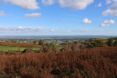
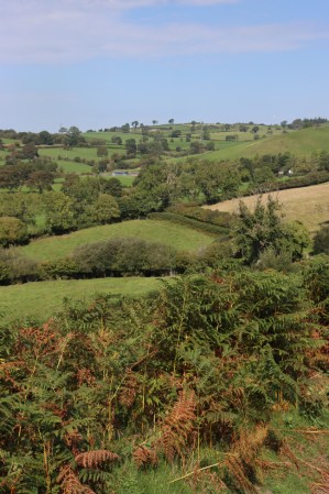
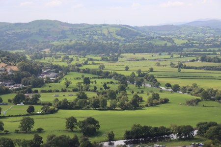
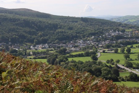
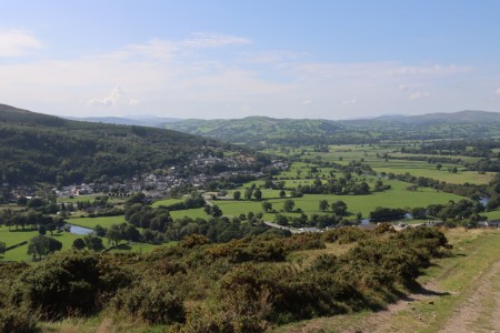
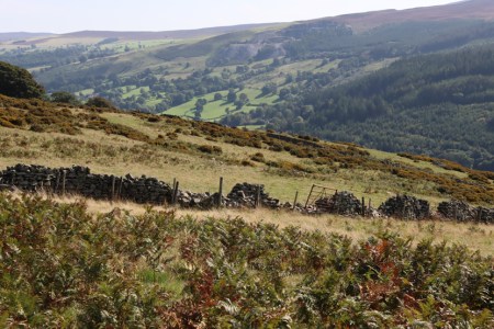
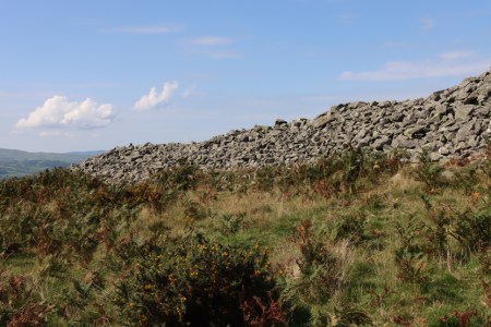
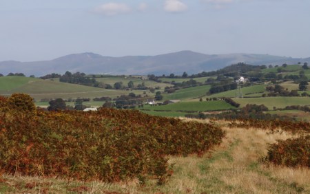
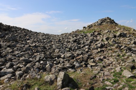
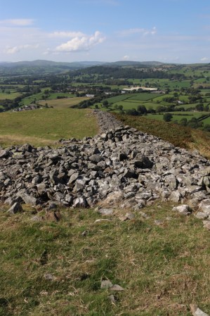
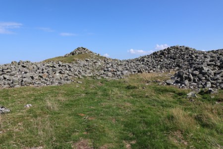
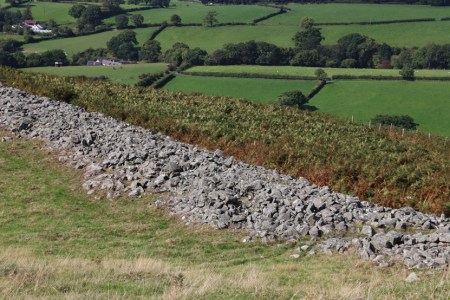
Terrific scenery and views from Waun y Llyn Country Park, near Caergwrle

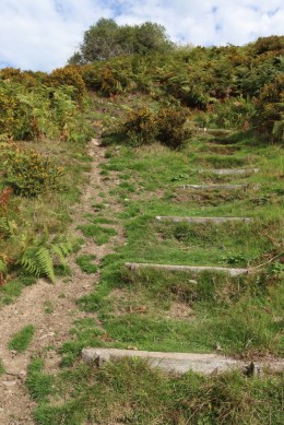
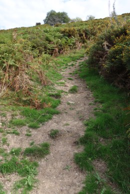
I had been visiting Caergwrle Castle on a bright, sunny, perfect autumnal day, and was actually heading elsewhere for a much longer walk when I noticed on my O/S map that there was a country park a short drive away, and went there on a whim.  I’ll write up Caergwrle Castle later but here is some visiting information accompanied by some photos of the country park walk for those of you who are, like me, addicted to lovely views.  It is certainly worth making the most of these occasional very beautiful days while we have them.  Waun y Llyn Country Park sits on a hilltop with views over the local hillsides and and over the Dee floodplain into Merseyside.

Waun y Llyn is about half an hour’s drive from Churton, probably (I’m guessing) a bit less from Wrexham and a bit more from Chester.  It is reached from all directions by single-track roads.  Do note that if you or your driver is not keen on reversing, this is not the place to go.  Access is via single track roads with passing places, and it is a popular destination with hikers and dog-walkers and is frequented by farm vehicles, so you will need to be prepared to reverse around very bendy bits as well as straight bits.

Location of Waun y Llyn, above Caergwrle (near Llay).

There is a warning on one of the information boards in the car park that there is livestock within the country park, and that you should keep dogs under control.  I had assumed that it would be sheep, but the very fresh cow-pats made it clear that there was cattle up there.  I didn’t see any, and much to their irritation neither did the two farmers who were looking for them!  As one of them said, when he asked me if I had seen them, there are 70 acres for them to hide in.

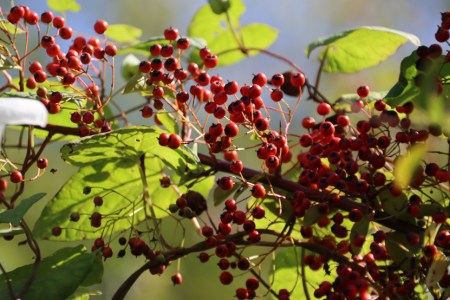
I believe that Waun y Llyn means moorland by the lake (but do feel free to correct me). It is indeed a type of moorland, with copper-coloured bracken at this time of year, and bright yellow gorse in flower.  There are only few trees, but there are young silver birch,some young oaks and small holly bushes, some of which are currently festooned with bright red berries.

There is also, as the name implies, small lake surrounded by boggy margins, with permanent water-loving plant species underfoot if you follow the watery marshland tracks.  You can skirt the marsh and head towards the higher green ground, which provides a good viewpoint, but be aware that the whole area around the lake, linking one footpath to another is fairly damp.
———
——–

If you go when there has been rainfall, do wear water-resistant footwear.  In spite of the glorious sunshine today, it rained all day yesterday, and although there are grassy footpaths, most of the the footpaths furthest from the car park were very muddy underfoot with large pools of water, and there are also places where small streams cross paths that require either jumping over or skirting around.  Water loves an easy route, and some of the smaller footpaths had become tiny streams in their own right.  All absolutely fine with suitably water-resistant footwear.

I would advise those of you with unwilling legs to avoid it at this time of year.  There are no steep slopes or steps, but there are seasonally related challenges.  I’ll give it another go in the summer and report back, but at this time of year the mud is very slippery, there is a lot of wet bedrock showing through on some of the narrower footpaths.  One lady who had a bad leg was managing fine with two sticks along the grassy footpath, but had to turn back when the going became too muddy and rocky underfoot.

There is no archaeological site recorded at the country park, which seems almost counter-intuitive given the views.  Both silica sandstone and millstone grit were quarried from the hill in the late 19th century, the latter for housing in the Alyn valley below, and the walk to the hilltop was a favourite destination of visitors to a spa in Caergwrle, contemporary with the quarry.

This  walk took me about 45 minutes, so it was a short one but a good one.  You can make it shorter or longer by following the different footpaths on the noticeboard by the car park, and you can turn it into a serious hike by including other local footpaths as well.  There’s no hyperlink to the Country Park’s official website, because there does not appear to be one.  Let me know if you find one.  If you give Waun y Llyn Country Park a go, do enjoy!

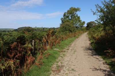
The metalled approach from the car park to the entrance to the country park. The metalled surface goes onwards for a short way to the viewing point.

Entrance to the car park

Sunshine, archaeology and great views at Caer Drewyn Iron Age hillfort at Corwen

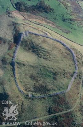
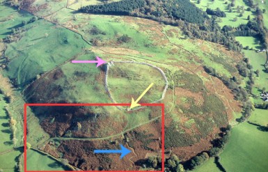
Caer Drewyn aerial photograph. The entrance at the top is at the northeast. Source: Cadw

Caer Drewyn is an Iron Age hillfort located a mile north of Corwen, with remarkable stone-built defences all around its perimeter, and terrific views in all directions.  Happily, it is accessible to the public, with a relatively easy footpath that works its way gently around the hill to the northeast entrance.

This post begins with a brief description of Caer Drewyn the Iron Age archaeological site (it is worth reading either this or another description before you visit, as there is no information signage at the site), and finishes with the the walk and views, from the car park via the farm track to the top, and back partly via the track, but also using a different, steep footpath that shortens the route.

If you use the What3Words app, you can find the hillfort at ///kitchen.quaking.segments.  Leaflets promoting local walks indicated that it was acceptable to park at the Corwen Leisure Centre, just to the north of Corwen (via Green Lane from the A5, postcode LL21 9RW).

Caer Drewyn

Willoughby Gardner’s 1922 sketch of the position of Caer Derwyn on the slope rather than around the peak of the spur.

Caer Drewyn is located on a spur projecting south and west into the Vale of Ederinion in the upper valley of the river Dee, some 800-985ft above sea level and, at its south, 500ft (152m) above the Dee floodplain.  The aerial photo shown at the top of the post gives some idea of the way in which the site dips fairly steeply from east to west over two loosely defined natural terraces. 

Caer Drewyn is defended by vast stone defences, spreading to beyond 15ft wide in places.  They do not merely defend a particular weak point; they enclose the entire perimeter – and there is an awful lot of perimeter to defend (3 hectares / nearly 7.5 acres, measuring c.629ft / c.192m north-south by 705ft / 215m east-west).  This sort of stone defence is not unique.  There are a number of examples in Ceredigion and in south Merioneth (e.g. Craig yr Aderyn, and Castell y Gaer) both on or near the mid-west Wales coast, with which the area may have had contact via the route that follows a geological fault-line. Other similar examples are further afield in northwest Wales including the famous Tre’r Ceiri on the coast of the north Llyn Peninsula, which has a complete stone perimeter and includes very clearly visible hut circles within.

Although parts of the stone walls were cleared of bracken and other vegetation in the late 19th and early 20th centuries, ahd graving sheep help to keep it down, Caer Derwyn hillfort has not been excavated, so all knowledge is based on observation of the extant features.  According to the Coflein website, the hillfort was probably developed over at least three phases.  

The earliest phase is thought to have consisted of a smaller curvilinear earthwork at the northeast of the hillfort that stands today, and survives in part as an earthwork outside and to the east of Caer Drewyn.  This can be seen on the aerial photograph at the very top of this post.

The next phase is the vast rubble-walled site that dominates the hill today.  This later hillfort was defined by the stone rampart, which Willoughby Gardner describes  in his 1922 paper as  consisting “of a core of rubble stones, faced on either side with a wall of dry masonry.”  These surviving patches of stone facing may suggest that the rampart may have been equipped with an inner wall-walk.

Instead of sitting around the peak of the spur, the hillfort actually sits on the slope, meaning that the interior can be seen from below.  Like many hillforts, it is ideally located for visibility over the landscape, in this case with views over the surrounding area, including the valleys of the rivers Dee and Alwen, which meet just to the east, the Berwyns to the south and the north and east across to the rest of the Clwydian range.  These views are wonderful on a clear, bright day.  Toby Driver points out that in spite of the defences, the above-mentioned fact that the interior of the hillfort can be viewed from below somewhat undermines its strategic value.

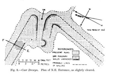
Willoughby Gardner’s 1922 plan of the northeast entrance of the hillfort

The hillfort could be approached from the west and the northeast, where the two entrances were in-turned, a typical feature of many hillforts that helps to control access to the interior.  Willoughby Gardner says that there was a spring a short way down from the west entrance.  The entrance in the northeast corner where the cairn is located, which is the highest point of the site and shown clearly bottom right of the aerial photo below, may have featured a guard chamber, another characteristic feature, suggested by the complex jumble of stone that implies at least one additional feature at the entrance.  Willoughby Gardner estimates a 12ft diameter. So-called guard chambers are recesses in the entrance passages hillforts, mainly in north Wales and the Welsh Marches, but the name does not mean that the function of these recesses is actually understood, and they may have been used for some sort of religious or alternative function.

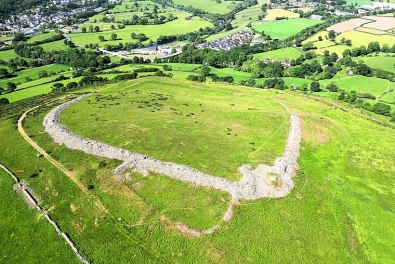
You can see circular dips dotted here and there in the walls.  These may or may not be relatively modern features.  They were there in 1887 when the Reverend Hugh Pritchard was investigating.  One interpretation is that they could have been grouse butts (small enclosures used as grouse-shooting positions), but this is unsubstantiated.  You can see some of them most clearly in the aerial image below.

Caer Drewyn showing northeast entrance, annex, and circular depressions in walls. Source: Peoples Collection Wales

The interior surface has been examined by Willoughby Gardner in 1922 and by the Engineering Archaeological Services (EAS) in 2006.  Willoughby Gardner comments that there are circular structures within the hillfort.  He casts doubt on them being original because in his experience wattle-and-daub or wood was the favoured material for hut circle construction.  The EAS, acting on behalf of the Heather and Hillforts Landscape Partnership Scheme (Denbighshire County Council) carried out a topographical survey which identified eight possible hut platforms within the walls.  Apparently aerial photographs taken in low winter light confirm hut-like shapes in the central and eastern parts of the enclosure.  I had a poke around for anything resembling them on the ground, but could find nothing amongst the bracken.  Winter, when the vegetation has died down a bit, would be a better time for that sort of optimistic activity.  

To the south and southwest there are views over Corwen, the Berwyns and into the far distance.  There is excellent line of sight from Caer Drewyn to other hilltops, some of which housed other hillforts that may or may not have been contemporary.  I walked all the publicly accessible hillforts in the southern Merioneth area in mid west Wales a couple of years ago my write-ups here), and each of them had a clear line of sight to one or more neighbouring hillforts, which would make sense both for mutual support and maintaining lines of communication amongst friendly neighbours, and for keeping an eye on any hostile neighbours.

Caer Drewyn. Photograph by Llywelyn2000, CC BY-SA 4.0. Source: Mapcarta

A third phase apparently added a small  trapezoidal annex to the north-east of the fort, which employs the earliest earthwork of the hillfort.  In the aerial photograph above and to the right you can see one very clearly on the left, but there are others visible on some photographs, much fainter, which may also be hut circles.  There is nothing to indicate a date, but Coflein suggests that it may have been added after the hillfort had gone out of use in the Romano-British period, presumably because of the  possible hut circles, but it could equally have been much later.

Without excavation it is impossible to know how the interior of either earlier or later hillfort forms, or the annex were used, or to know for sure the period over which they were used. 

The term “hillfort,” combined with defensive structures such as banks, ditches, stone walls, defended entrances give the impression that these were built primarily for exclusively military purposes, but it is by no means certain that this was there only purpose or even, in some cases, their primary purpose.  Secondary uses could include storage of agricultural output, protection for livestock, and a visible territorial marker in the landscape. There is no room here to enter into a discussion on the subject, but if you are interested have a look at Toby Driver’s 2018 online paper on the subject (free to access): New Perspectives on the Architecture and Function of Welsh Hillforts and Defended Settlements.  Whatever their primary and secondary purposes, the sheer amount of work that goes into an enterprise like this, or a banked-and-ditch hillfort is considerable, and there was certainly a very desirable outcome in mind when a hillfort was embarked upon.

The site continues to be used for grazing sheep, and it is recorded that it was used as a hafod (seasonal grazing) in around 1600.  It is reputed to have been used as temporary bases for Owain Gwynedd in the 12th century during his conflict with Henry II, and by Owain Glyndwr during his rebellion in 1400.  There is apparently no actual data to support either theory.
———-

Visiting details: parking, the walk and the views

I was advised that it was acceptable to park at the Corwen Leisure Centre, just to the north of Corwen (via Green Lane from the A5, postcode LL21 9RW).  When I arrived, there were only three other cars there, and no signage to indicate that parking was restricted.  By the time I returned to the car a couple of hours later mine was the only car in the car park, so I didn’t feel that I was intruding.

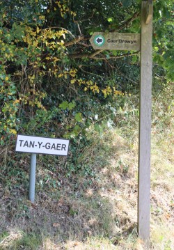
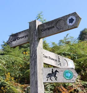
Walking up to the road from the car park, turn left (east).  There is no pavement, just a narrow grass verge, but you are going a very short distance, just a few metres, before a wide farm track is clearly signposted to Caer Drewyn on your left.

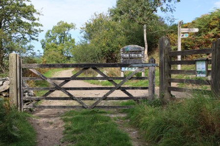
Follow the attractive track for a few minutes, past a couple of farm buildings on your right.  You will reach a gate.


On the other side of the gate is another signpost that gives a few options.

—–

The red box shows part of the farm track taking the easy route up the side of the hill towards the highest part of the hillfort and the northeast entrance (pink arrow). The blue arrow shows the steep footpath that cuts off a corner of the easier route. The yellow arrow shows the lowest point of the hillfort, which is also an access/exit point. Click image to enlarge. Copyright CPAT. Source of image: Britnell and Sylvester 2018

For Caer Drewyn you can either turn left and follow the farm track, or go straight ahead on a very small footpath straight uphill, which intersects with the farm track at a much higher level. Looking at the aerial photo to the left, it should be possible, although I didn’t realize at the time, to cross over the farm track (or, if you are on the farm track turn left at the point where it intersects with the footpath) to go up to the very lowest point of the hillfort defences and the western entrance.  I wouldn’t, myself, because I really enjoyed the views from the farm track.  It would make a shorter and easier walk for anyone who follows the track to the northeast entrance but doesn’t want to do a full circuit of the hillfort, to follow one set of walls down to the bottom of the hillfort and exit back to the farm track or footpath via the lower entrance.

The farm track is the easy option, so I decided to follow this and, on my return journey, take the footpath down.  I would strongly advise that you take the farm track either on your ascent or descent, because the views are so terrific, and you will miss some of them if you confine yourself to the footpath.

The farm track heads west for a short distance on the level, and then you will reach another signpost that points you right, uphill through a gate that has a walk-around on its right.  Take the uphill option that takes you relatively gently across the side of the hill towards the northeast entrance.  This is uphill all the way and although not particularly steep on the seethingly hot day on which I walked it, it was noticeable.


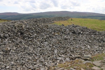
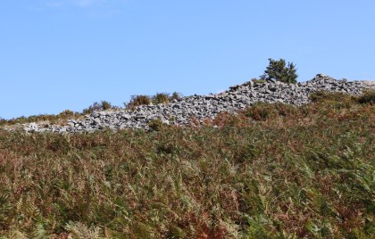
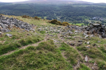
As you climb towards the top of the hill, you will suddenly see some stone rubble on the left, like a massive fallen drystone wall.  This is the hillfort perimeter.  Continue to follow the farm track, running parallel to the walls.  You will eventually reach a gate, which is the end of the line.  Ahead of you is a superb view to the east, and on your left, just a few metres behind you, is a mass of stonework including a roughly conical pile of stone which is a useful point to orient yourself.  This is the northeast corner and marks the following in-turned entrance and possible guard house.  From the cairn you can see for miles and miles around.  The landscape is truly stunning.  You can also see the stone defences heading out in both directions, plunging away to your right down the slope and following the ridge left before then, too, plunging downhill.

It is easy to walk the entire perimeter because all you have to do is follow the stone boundaries, but do take into account when you are heading downhill towards the far eastern extent, that you will have to walk all the way back up again if you want to do the full perimeter back to the cairn!  Alternatively, head out of the well-worn exit at the bottom end of the hillfort to rejoin the farm track.

View over the enclosure towards the west

Looking back up the hill along the northern rampart

The interior showing the topographical tilt to the west

Although there are tracks inside the hillfort, many of them created by sheep, there are no formal pathways and if you leave the trackways, it is very uneven underfoot, with the danger of turning an ankle.  I was wearing tried and tested breathable but very solid hiking trainers that are fabulous on hot days, but it would have been better to have worn summer-weight hiking boots with good ankle support.

Well worn access to and exit from the hillfort at the bottom

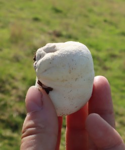
Puff ball

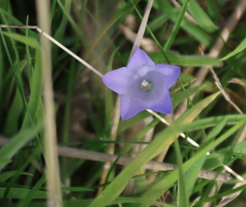
There is not a lot in the way of wildlife, but there is plenty of bright yellow gorse in flower at the moment.  I found a perfect white puff-ball (mushroom) which I later cooked in garlic butter, and some other unidentifiable mushrooms.  There were some very occasional and very pretty wild flowers, including some wonderful harebells dotted around, but there was little else to see at this time of year.  Bird song was all around, but the singers were well hidden.  Judging from the endless rabbit droppings, this is bunny nirvana.  If you are interested in lichen, there seemed to my inexperienced eye to be many different types on the stone defences and the interior rocks and boulders and later that day I read on the Clwydian Range and Dee Valley AONB website that over 60 species of lichen were identified in a 1993-1994 study.


On the way down I kept a close eye out for a signpost for the footpath down, which chops off the corner that the farm track takes (the blue arrow on the above annotated photo).  There is no full-sized signpost, just a little way-marker on the left/south that you need to look out for.  There is a big boulder opposite, which is a useful landmark.  The first part of the footpath, from the top, consists of some quite deep steps reinforced with wood.  It then becomes a fairly steep narrow track – much steeper than it looks in my photographs below.  I suspect that the whole thing becomes a muddy stream during wetter weather, as there are plenty of signs that water courses have made their way down.  The footpath drops you at the gate back down to the road and the car park.

It only took me about half an hour to get up to the hillfort, with lots of stops to enjoy the spectacular scenery, take photos and top up with water.  Once up there, you can spend as long as you like, of course, and it is a great place for a picnic.  I had it to myself, even on a sunny Saturday.

Hopefully the photos will speak for themselves, but I recommend this as a far from strenuous walk, mixing fascinating late prehistoric heritage with terrific views.  If you time your visit to coincide with stunning Rhug Chapel’s opening times (the chapel’s website is here), that would make a great second visit, just a ten minute drive away.

UPDATE:

After I posted about this walk, I found an official leaflet that includes a longer walk incorporating the hillfort, which looks really great.  The relevant page is shown below, but you can download the entire leaflet, with some other really excellent-looking walks too at https://www.denbighshirecountryside.org.uk/files/158946141-Discovering%20Corwen%20A5%20ENG%20WEB.pdf


——–


For other Iron Age sites on this blog see:

Beneath Chester’s Roman Amphitheatre – the Iron Age buildings and fields
https://basedinchurton.co.uk/2026/06/02/beneath-chesters-roman-amphitheatre-the-iron-age-buildings-and-fields/
Burton Point: The small and rather puzzling Iron Age promontory fort on the Wirral
https://basedinchurton.co.uk/2026/04/11/the-small-and-rather-puzzling-burton-point-promontory-hillfort-on-the-wirral/
Exploring Maiden Castle Iron Age Hillfort, Bickerton Hill (mid-Cheshire Sandstone Ridge)
https://basedinchurton.co.uk/2025/12/01/exploring-maiden-castle-iron-age-hillfort-bickerton-hill-mid-cheshire-sandstone-ridge/

Sources

Books and papers

Bowden, M. 2006.  ‘Guard Chambers’: An Unquestioned Assumption in British Iron Age Studies. Proceedings of the Prehistoric Society, 72, p.423-436 [NOT free to view]
https://www.cambridge.org/core/journals/proceedings-of-the-prehistoric-society/article/abs/guard-chambers-an-unquestioned-assumption-in-british-iron-age-studies/E6D627EE54566C400B07C0F42CB5F18C

Britnell W.J. and Silvester, R.J. 2018. Hillforts and Defended Enclosures of the Welsh Borderland. Intarch Issue 48 (2018). Iron Age Settlement in Wales. https://intarch.ac.uk/journal/issue48/7/index.html

Driver, Toby 2018. New Perspectives on the Architecture and Function of Welsh Hillforts and Defended Settlements. Intarch Issue 48 (2018). Iron Age Settlement in Wales. https://intarch.ac.uk/journal/issue48/9/toc.html

Gardner, Willoughby. (1922). The Ancient Hill Fort known as Caer Drewyn, Merionethshire. Archaeologia Cambrensis – The Journal of the Cambrian Archaeological Association. Vol. 77. Seventh Series. 2. Vol 77, p.108-125

Savory, H.N. 1958.  Caer Drewyn. Archaeologia Cambrensis – The Journal of the Cambrian Archaeological Association. Vol 107, p.135-6

Websites

Clwydian Range and Dee Valley Area of Outstanding Natural Beauty
Hillfort: Caer Drewyn
https://www.clwydianrangeanddeevalleyaonb.org.uk/projects/hillfort-caer-drewyn/

Coflein
Caer Drewyn; Caer Drewen – Details
https://coflein.gov.uk/en/site/95431
Caer Drewyn; Caer Drewen – Images
https://coflein.gov.uk/en/site/95431/images
Tre’r Ceiri
https://coflein.gov.uk/en/site/95292

People’s Collection Wales
Caer Drewyn
https://www.peoplescollection.wales/items/5482

Aberdovey Londoner
Iron Age hillforts in South Merioneth
https://aberdoveylondoner.com/category/iron-age-hillforts-in-south-merioneth/

—–

The puff ball as a delicious minimalist starter. Divine.

A winter walk through the fields from Churton to Farndon

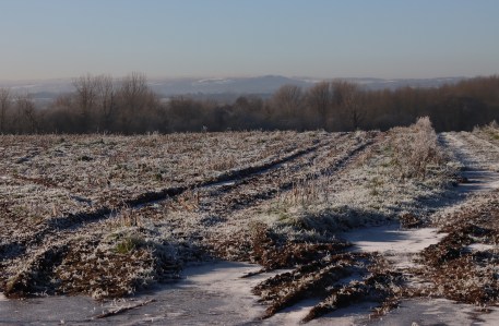
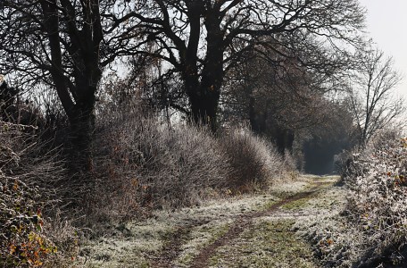
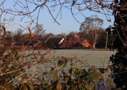
The walk through the fields from Churton to Farndon and back again is always enjoyable, taking about an hour for the full circuit, or less if you don’t pause for photos.  It always varies enormously by season, but was quite spectacularly distinctive yesterday, glazed in frost under a bright blue sunny sky. Where the tractors had been out, during wet weather the deep tracks along some of the footpaths had filled with rainwater and frozen solid, but the ridges between were ice-free.  Literally freezing in the shade, it was actually quite warm in the sun.  A splendid walk, all colour and light.


The route taken from Churton to Farndon along official footpaths (in bright pink). The return route takes the pink footpath that starts in Brewery Lane.  The red blobs are the approximate locations of two possible prehistoric sites, now ploughed out. Source of map: The Public Map Viewer.


Day trip: Flint Castle – Edward I’s first permanent Welsh foothold

Northwest “garrison” tower at far left, with the big detached southeast “Great” tower in the middle and the northeast “Eagle” tower at far right.  Out of sight, opposite the Great Tower, is the southwest “Prison” tower

A visit to Flint Castle is not really a day trip if your starting point is the Chester-Wrexham area because it’s only about half an hour away, but because we started out quite late, and decided to combine it with a visit to Basingwerk Abbey in Holywell (a 10 minute drive from Flint), and had a long, lazy coffee in the sun, it did turn into something of a day trip.  If you are into fascinating ruins, I recommend both Flint Castle and Basingwerk, particularly as they are such a short distance from one another and overlap chronologically.  Basingwerk Abbey was founded in 1132 and closed in 1535, so its inhabitants would have seen the first construction of Flint Castle.  I’ll be talking about Basingwerk on another occasion.

As Edward began his castle building extravaganza, Llywelyn at last paid homage to the king of England, sitting to the left of the king’s throne, with Alexander of Scotland at the king’s right.

I have already posted the background story to Edward I’s castle building programme in northeast Wales, describing how different generations of Llywelyn the Great’s descendants clashed with England and the Marcher lords in a fight for territory and prestige in Wales.  I have not repeated any of that here, so if you would like the background information, do have a look at my earlier post.

Flint Castle is right on edge of the river Dee estuary, with beautiful  views across to the Wirral, and even though it is on the edge of a busy town with somewhat chaotic traffic, the castle itself is set back from a quiet housing area and stands apart even from that.  Although the river has silted up in front of the castle today, when it was built, the river flowed up to the castle itself.  It has a sense of isolation and peace about it and is a lovely place to visit, and can be combined with sections of the Wales Coast Path.  See my notes about visiting the castle at the end of the post, together with maps.

The Who, When and Why of Flint Castle

Artist reconstruction of the southeast and northeast towers of Flint Castle by A. Hook. Source: Ancient and Medieval Architecture

When Henry III died in 1272, Edward was on his way home from an underwhelming crusade, having narrowly survived an assassination attempt, and he took his time to return to England.  He was not crowned until 1274.

Henry III and Edward had been troubled throughout Henry’s reign with rebellions in Wales, masterminded by Llywelyn ap Gruffud, known as Llywelyn the Last.  Several treaties had failed to achieve long term peace, and although the Treaty of Montgomery of 1267 looked as though it might hold, Llywelyn ap Gruffud was labelled an outlaw in 1276, and war was declared in 1277.  A peace was brokered, but although Edward had every reason to believe that the treaty might secure peace between England and Wales, he began to build a series of castles in northeast Wales, beginning at Flint in 1277 and rolling out along the coastlines throughout the next two decades.

Why here? The location of Flint Castle

Strategic importance of the castle
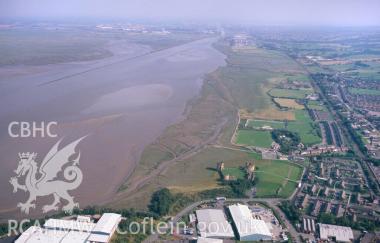
View down the Dee estuary towards Chester showing Flint Castle in the foreground. The build-up of marshland is a recent phenomenon. In the 13th century, the castle was right on the edge of the river, accessible by boat.  Source: Coflein

The unoccupied site for Flint Castle was chosen for its excellent views for miles around, and the slab of bedrock on the edge of the estuary, on which the castle would be built.  Although the castle was sited on a floodplain rather than on a more traditional hill, its location on the Dee floodplain still provided clear lines of sight in all directions.  It would be impossible to sneak up on Flint Castle unless it was foggy.  With tall towers on all four corners, any approach by land or water would be easy to spot, and the town that Edward had planned from the beginning sat on the landward side of the castle, preventing any large-scale onslaught from going unnoticed.

Map of the Welsh Cantrefi showing the location of Flint Castle. Source: Wikipedia.

Although Flint was in English hands in the heart of Llywelyn’s former territory, it was only a day’s march from Chester, one of the great earldoms along the Welsh border.  The castle could be supplied with food and other essentials from Chester by boat, and the estuary provided a potential, although not terribly reliable route of escape, should it be needed.  In addition, a small garrison was maintained at Ness on the Wirral, opposite the site of Flint Castle. When the tide was out, it is said that the river between Flint and Ness could be forded which, if true, would have been a significant logistical advantage.  Most importantly, Flint Castle was a stepping stone into Wales, allowing Edward to build his series of castles one day’s march from one another.  This simple linear network, which could be supported by the sea, began to enclose Gwynedd, particularly as Edward and his magnates began to repair or rebuild Welsh castles that they had defeated.

Castles under siege were always at risk from running out of supplies, but the potential of being restocked from the sea was one form of additional security, and the castle had two wells, one in the centre of the inner ward, and one in the detached southeast tower.

Economic potential of the area

Flint Castle northwest corner

Although Flint Castle was a military installation, Edward intended for it to have a town accompanying it, to take advantage of the area’s natural resources.  A new town would need to attract inhabitants, and as well as incentives, the land itself would need to be able to support the town.

Although there was no settlement at Flint, which was named by either Edward or one of his entourage, it would be wrong to think of the land along the estuary as deserted when the castle was first thought up in 1277.  As far back as the Domseday survey of 1086 the nearby hamlet Atis Cross had a church, a corn mill and a a hide of land, something in the range of 120 acres, belonging to Hugh Lupus of Chester, and there was a lead smelting works here.  Nearby Coleshill (Cwynsyllt) was also mentioned in the Domesday book, and Hen Blâs motte and bailey castle at Bagillt, just over a mile away, which lies within the township of Coleshill Fawr, may have served as the llys (court) for the commote of Coleshill.  Archaeological excavations in the mid 1950s concluded that the castle was replaced by a fortified manor house in the early 13th century, which was in turn abandoned in the late 14th century.  In 1132 the abbey of Basingwerk was built here, and in the 13th century it had water mills and a nearby windmill.  This was potentially a prime area for water mills, as water dropped at speed from the hills towards the Dee, ideal for turning water wheels for processing grain or sheep’s wool.  The area was also suitable for agrarian development, sharing with Anglesey a lowland, fertile location that could be cleared for fields and farmed.

The designer and the design 

1919 plan of the castle grounds that were passed into state care, showing all four towers, the inner keep, the well and the remains of the connecting walls.  Only part of the outer keep is preserved.  The same area  remains under Cadw guardianship today. Source: Coflein

Although much of the castle was deliberately torn down following the civil war in the 16th century to prevent re-use, many of the key features are still visible on the ground.  Castle architecture has some basic requirements that are shared by all castles, but Flint itself showed a number of innovations that make it stand out today. Most of Edward I’s castles in Wales were designed primarily by Master James of St George, but Flint Castle was the brainchild of Richard L’Engenour (d.1315), a wealthy resident of Chester, an architect, master mason and military engineer, the owner of three farms in the Chester area, who in 1304 became Mayor of Chester.  It is probable that Edward’s input is reflected in features of the castle that resemble the castle of Aigues-Mort from which Edward left on crusade in 1270.

The wide open site placed few constraints on its designers and builders.  The castle has a number of notable features, including a double moat and the massive offset donjon, that were innovations in British castle building.  Although Flint began with the castle, a town was always part of Edward’s plan for Flint, so the layout of castle and town were conceived of together.

The castle comprised an inner ward (or bailey) and an outer ward, separated by a moat and drawbridge.  The outer ward protected the main gate into the castle and acted as an interface between the inner ward and the outside world.  It was shaped rather like a funnel, allowing access via a single gatehouse into what was effectively a holding area, narrowing into a path that connected it to a gate into the inner ward, which was overseen by the battlements and by the southwest and southeast towers.  It would have had buildings to house and feed troops stationed there, together with stables for horses and a gaol for holding prisoners.

The rectangular inner ward was made up of round towers built into the walls on three corners, and a detached round tower on the south-eastern corner.  Sturdy curtain walling connected all four towers, with the detached tower joined to the inner keep by a footbridge.  Some foundations remain within the inner ward, plus the all-important well.  On the day that I visited in mid June, the water of the well in the inner ward was clearly visible at about 5ft (152cm) below the ground surface.  Buildings within the inner keep would have included a bakehouse, brewhouse, kitchen, chapel and a hall.  Both wells, the one in the inner ward and the one in the donjon, were fed by the freshwater Swinchiard Brook.  Uniquely, the castle had two moats.  An inner moat protected the main castle and an outer moat protecting access from the town.

The southwest tower and a stretch of the curtain wall.

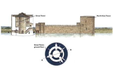
Each of the towers was different.  Although all had spiral staircases leading to battlements for defence, each had its own function.  The southwest tower is, according to Vicky Perfect, recorded in the payroll as the Prison Tower, so may have served as a gaol before a more formal building was added to the outer ward.  It originally had three storeys.  The basement, where prisoners were presumably held, had no steps, which would certainly have frustrated attempts at escape.  The northwest tower, also known as the Garrison Tower, had four points of access, which was useful for deploying troops to the battlements in a hurry, and its basement was probably the store for weaponry.  The northeast, Eagle Tower, was three storeys high, with a basement that was accessed via a trapdoor.  Guests and servants were housed here, and there was a fireplace on the second floor with a chimney up on to the battlements.  A spiral staircase ran up one side.  The potentially standalone southeast Great Tower (also known as the castle keep or donjon), is of particular interest.  Its isolation from the rest of the castle was an additional form of security against any successful incursion, accessible only via a drawbridge, now replaced by a permanent bridge. Sitting within its own portion of moat, it is unique in Britain.  It is a truly massive piece of architecture, about 20ms in diameter, was accessible only on the drawbridge, and contained a central space some 6m diameter.  It was several storeys high.
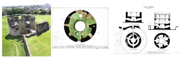
Southeast Great Tower, donjon or keep.  In the centre and on the right, images sourced from Coflein

The donjon or southeast Great Tower

On an everyday basis the Great Tower was the home of the Constable, but also housed the king’s chamber, which was completed in 1286.  The walls of the keep were 7 meters thick at ground floor level, but were still 5 meters thick at upper levels.  To add to its independence from the rest of the castle, and to provide the king with some privacy when he was in residence, it was provided by its own well.  Holes in the floors above it allowed water to be drawn rather than carried, and a wooden wheel was fitted to raise and lower the pail.  It was also provided with garderobes (toilets) and its own chapel.  Its basement, shown right, had a barrel-vaulted ceiling, limewashed to provide reflective light, but also illuminated by torches.  At times of siege, livestock could be moved into the tower to provide supplies on the hoof.

A watergate was built into the north wall, with steps down to the river frontage.   This was for loading and unloading boats directly into the castle.  A smaller watergate was also built into the donjon, again reflecting its design as a standalone unit.

Building the castle 

The first stage in the construction of the castle was to clear an overland route to Chester.  Although the castle could be supplied by boat, there was no road to Flint from Chester. The tidal character of the river meant that the castle could only be reached at high tides, so an overland route was vital.  More immediately Edward was unwilling to run the risk of penetrating the alien countryside where he could be attacked by those with superior local knowledge.  The road allowed him to travel with realistic protection to his new castle, and to enable his army advance unhindered along the Welsh coastline. A road was carved out of the densely vegetated coastal landscape.  It took 10 days to clear the route to Flint, and from there the castle was linked with routes to Rhuddlan, Degannwy and eventually to Conwy.

The next step was to dig a deep ditch around the chosen site at Flint to protect builders and visitors alike, which took three weeks.  The castle was to be built on bedrock, which gave it a solid base on the otherwise soft floodplain.

View from Flint Castle across the estuary and the River Dee to the Wirral

Wood for scaffolding, lifting equipment and for the defences that would surround the planned town was sourced mainly from the Forest of Toxteth (now part of Liverpool).  The fill of the walls of the castle was built mainly of yellow sandstone, much of which Vicky Prefect says was sourced from Ness on the Wirral, opposite, across the estuary, and other locations on the edge of the Wirral.  Ness could be reached over the sands when the tide was out by fording the river, but stone could also be brought in by boat.  Edward kept a small garrison at Ness.  Other sandstone was available locally, along with other natural resources including lead ore, lime for mortar and white limewash for walls (both lead and lime available from Halkyn Mountain).  Although yellow sandstone dominated, red sandstones were employed for some parts of the outer and inner walls, some of which came from Burton Point, a bit upriver from Ness, with the inner space between them filled with mixed rubble, including stones from the beach and broken building materials.

Many of the original payrolls for the construction of the castle have survived, meaning that details of names, home towns, job roles, and salaries of the workers who built the castle have survived.  Just as the king could demand that his noble subjects should provide men for his armies, he could assemble workforces of specialist craftsmen from across England, whether they wanted to go or not.  The building site and the craftsmen were protected by armed forces. This formula worked so well at Flint that the same model, and many of the same craftsmen, were used at the subsequent castles.  Here’s Vicky Perfect’s description of the first weeks of work in the summer of 1277:

The workforces were placed under the control of various knights, and split into groups under their twenty men (foremen). . . . In week one of the the build a total of 1858 men were involved in the first stage of the building of the castle.  Most were dykers who were required to help prevent the water from filling in the newly dug foundations.  The first order of 10,000 sandstone blocks was placed at the quarry of Ness prior to 25th July 1277.  Large numbers of carpenters and wood cutters were employed, some working in the forest s at Toxteth cutting the timber and building the 250 rafts needed to transport the stone across the water.  Many others were working on site, constructing the stockade required to keep the men safe and making the lifting machinery to move the sandstone blocks into place.  There were also numerous masons, working the stones delivered from Ness Quarry.  Smiths were employed to make and mend the metal tools required for the project.

By week two, the workforce had increased dramatically to 2,911, indicating the urgency of making the site safe.  More specialist workers were brought to the site, such as Carbonarii (miners) to mine the coal to fuel the smith’s fires.  The number of dykers working on the site doubled, including a group from Holland.

The well in the Great Tower.

The rest of that chapter is worth reading in its entirety, providing some fascinating facts and figures including lists of some of the workers, their trade, the number of them employed and how much they were paid.  For example, in the first two weeks, the castle employed dykers, smiths, carpenters, masons, woodcutters, miners, cinder carriers, masons and constables, paid from 2d to 8d a day, the latter reserved for the specialist Dutch dykers.  Other specialists were brought in as work progressed.  John le Blund, for example, was brought from London and paid 19 shillings for dressing stones for the well in the Great Tower.

The castle was not completed until the mid 1280s, by which time it had been painted with  white limewash, and the towers, which had been provided with temporary roofs of thatch, were now provided with lead roofing.  In 1302, following storm damage, lime was brought to repair the castle walls.  In 1304, wood from Ewloe produced 60 boards, 12,000 pieces of wood for tiling, 1000 lathes and four louvres for repairs so kitchen and stabling.

The town

John Speed early 17th century map of Flint. Source: Coflein. Click to enlarge.

An accompanying town, (or “implanted bastide”) was part of Edward’s original plan for the castle.  The idea of establishing defended new towns around castles in hostile territory came from Gascony, where Edward had already founded a number of new defended towns.  Pioneer settlers were granted considerable commercial privileges as incentives, and were expected to help defend the town should it come under attack.  These new towns reinforced the network of castles with economic as well as military foundations, and the enclaves of English commerce also introduced English urban traditions within rural Wales.  Flint and Rhuddlan were two of the earliest examples. 

Writing in 1924, Patrick Abercrombie commented that “There is no town in this country that is of greater interest to the student of Town Planning than Flint. Laid out by Edward I, in 1277 as an appendage to his mighty castle, it has preserved its mediaeval plan almost intact. Like most artificially planted communities, there was no fundamental human need in this place for a town, which accordingly grown in the past little beyond its original size.”  It is a fascinating idea that new towns, built from scratch, arrived with the Normans.  According to Francis Pryor, a total of 172 of these towns are known in England and 84 in Wales, and Edward was the “last great instigator” of the new towns.  As well as the layout of the towns, functional considerations were also important, and Edward believed that to support markets, good road links were vital.  Communications became one of his mantras, vital for a peripatetic king and court, but also for the movement of troops and the commercial viability of new settlements. 

Excavations in 2015 explored what are thought to be part of the town’s defences. Source: BBC News

An indication that the beginnings of the town, which  were already established by early in 1278, was a proclamation of a weekly market each Thursday and an annual fair.  Edward decreed that the burgesses of Flint should hold a market on Thursday of each week, and an annual week-long fair at the time of the Pentecost (50 days after Easter Sunday).  The castle constable was to serve as mayor, one of Edward’s own brothers was installed as chaplain at the castle, and agents were appointed to rent out plots of land to any pioneering English inhabitants who were prepared to chance their luck even though the defences were incomplete.  To encourage take-up, in 1282 these agents offered plots in the town free of rental for ten years, followed by a reduced rate in subsequent years, and residents came under English, rather than Welsh jurisdiction.  Burgesses (property-owning merchants) were exempt from the payment of tolls. In 1284 the town received its first royal charter, which conferred full English-style free borough privileges.  The settlers had their own guild and courts.  Conveyances of property suggest that many of the settlers were from Cheshire, who took advantage of the provision of land in the royal demesne and forests.  Others probably came from Shropshire.  A town mill was constructed, and permission was granted for another, which incurred an annual rate of ten pounds. Even with these benefits, it was obviously an uphill struggle to attract residents at first, in spite of the fact that by 1300 much available land in England was in use and the expansion of population during the 13th century meant that it was becoming increasingly difficult to find land.   By 1292, however, the town had taken off and there were 74 burgesses registered for tax in Flint.

The main source of information for the town’s layout is John Speed’s sketch of 1610, shown above.  The Norman new towns were built as grids.  The maps show that Flint still preserved its Medieval layout, and that it was one of the most symmetrical known, with a very precise underlying geometry.  Four parallel roads ran perpendicular to the river, whilst Edward’s coastal road passed through the middle of the town parallel to the river.  Whether the dog-leg was original or developed between the 1280s and Speed’s map of 1610 is unknown.  One of the four parallel roads, along the route of modern Church Street, connects the entrance to the town with the entrance to the outer ward, passing in front of the Church of St Mary’s and the town square.
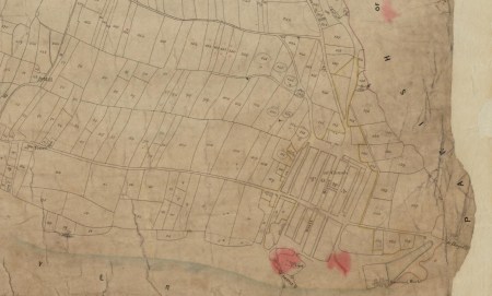
Tithe map of Flint area, showing the original Medieval field systems. Flint castle is handily under the left-hand red blotch, and the grid layout of the town is easily seen, as are the neatly arranged fields.  Source: People’s Collection Wales

The economy of most of north Wales was based on livestock herding. Nearby Basingwerk Abbey depended for some of its locally derived income on its 53 heads of cattle and its 2000-strong herd sheep.  However, some lowland areas could be developed for mixed farming.  Anglesey was “the bread basket of Wales,” and the river lowlands at Flint were potentially ideal for agrarian land use.  In order for agriculture to underpin the activities of the settlers at Flint, clearance of neighbouring land took place to create new fields, the outlines of which survive, remarkably, on the 1839  tithe map, shown above.  This shows Flint town’s four parallel roads immediately in front of the castle, but extended on either side beyond the bissecting coast road.   The surrounding land is similarly divided up on a grid pattern of long, thin fields.  Although residential, commercial and industrial growth have obliterated much of this, some of it still survives to the south of Flint town.

Access from the outer ward into the inner ward

Writing about the design of Flint Castle’s town, Caroline Shillaber concludes that “Viewed in historical perspective, Edward I appears as the forerunner of British planners who regard the creation of new towns as a function of national government, who locate and plan the towns to serve an overall administrative policy, who lay out the towns  in accordance with the needs of the people, and who devise economic conditions conducive to their growth and development.”  Some areas were riskier than others, however, as the settlers in Flint discovered in 1294 when renewed hostilities between England and Wales resulted in the town being burned to the ground.  Even though residents received compensation and the town was rebuilt, it must have been a daunting thought to stay in a town where its supposed protectors were willing to burn it down if the need presented itself.

A tax assessment of the town had been made in 1293, naming residents like Adam the carter, Benedict the miner, Godfrey the carpenter and Nicholas the smith.  The assessment recorded 76 households.  Only five of those named were Welsh, like Madog ap Iorwerth and Einion Cragh, indicating that even in an English enfranchisement Welsh people held property.  Things changed after the town was burned down after 1294, perhaps due to bad feeling about the devastation of the town thanks to Welsh hostilities.  This is reflected in a petition of 1297, written when the town was still being rebuilt.  The English burgesses of Flint complained that in an English town, Welsh individuals had “bought land in the town and bake and brew, contrary to their charter and custom,” although there was actually nothing in the 1284 town charter to restrict the nationality of residents. 

Matthew Stevens gives an account of an Englishman named Richard Slepe who had been in Flint town from its inception, and had remained after the town had been burned down.  His daughter Agnes had married a Welsh man, Adda ap Einion.  When Richard died in 1327, Agnes and her husband inherited Richard’s properties, but because Adda was Welsh, they were confiscated by local officials.  They appealed the decision but were turned down.  Enfranchised Welsh towns, occupied by the English, made no concessions to a mixed-nationality marriage, a situation that continued until the 1536 Act of Union giving Welsh nationals equal rights to English.  

The castle under attack during the reign of Edward I

In March 1282 Llywelyn’s brother Daffyd launched a ferocious assault on Hawarden Castle, and this was followed by further attacks on Flint and Rhuddland castles, in which Llywelyn appears to have participated.  Attempts by Archbishop Pecham to negotiate a peace failed, and Edward through everything he had at the brothers, as described on my previous post.  Llywelyn was killed in battle in December 1282, and Dafydd was captured and put to death the following year.  The Flint area, including Basingwerk Abbey, was trampled underfoot, but Basingwerk was given significant compensation and Flint Castle was repaired and construction work completed by 1284.

As mentioned above, in September 1294, those who had been lured to settle in Flint met the dangers of living in the shadow of a strategic military facility head-on when the constable of the castle, William de la Leye, ordered that the town be set on fire to prevent forces led by Madog ap Llywelyn from using it as a protective screen.  Madog ap Llywelyn, one of Llywelyn the Last’s more remote cousins, considered himself to be a successor of Llywelyn and made a bid for power, supported by other Welsh landowners.  Some of them joined Madog on an opportunistic basis, with territorial claims in mind, but all of those who retaliated at this time acted in response to a massive tax demand, and a culling of Welsh men to supply troops for his activities in Gascony. Attacks were co-ordinated and took place at castles both built and appropriated by Edward, at Aberystwyth, Builth, Castell-y-Bere, Denbigh, Criccieth, Harlech, Caernarfon, Morlais, Flint and Rhuddlan.  It was a serious rebellion, and it demanded a serious response.  Edward immediately diverted the troops waiting to ship out to Gascony, sending them instead to Wales, where they advanced from three bases. Madog’s revolt was put down after some delay in March 1295, with Madog surrendering in July.  Edward compensated seventy five burgesses with £521.00, and the buildings were all re-built, but life next to a strategic outpost of an invading nation cannot have been particularly reassuring.  

View along the Dee towards the west from the inner ward

Edward I died in July 1307 at the age of 68 and was succeeded by his son Edward II (April 1284 – September 1327), who had been declared Prince of Wales in 1301.  Edward’s reign was colossally unpopular and he was forced to abdicate in January 1327 in favour of his 14-year-old son, Edward III. Following the quashing of the rebellion of Madog, North  Wales remained more or less at peace until the rebellion of Owain Glyndŵr under the reign of Henry IV in 1400.  Flint Castle continued to be strategically important, and retained a garrison.  The town, protected by the castle, was a financial and administrative centre during the 14th and 15th centuries, meaning that even in times of peace the castle retained its importance and was accordingly well maintained.  Future archaeological excavations may provide information about the original town, both before and after the fire.

Back in the wars after Edward I

Richard II 

Richard II at his coronation. Source: Wikipedia

In terms of great events after Edward, Flint Castle’s next claim to fame was as the venue for the abdication of Richard II (1367-1400) in favour of Henry Bolingbroke, who became Henry IV.  Richard II was the grandson of Edward III, and on the death of his own father, Edward the Black Prince, became heir to the throne, succeeding in 1377 at the age of 10.  He was deposed in 1399.  Flint Castle itself had had nothing to do with Richard II’s career up until that point.  Richard’s regency was managed by a number of councils.  One of his most important advisors was his uncle John of Gaunt. 

The regency councils saw England through the continuing eruptions of the Hundred Years War and the Peasants’ Revolt of 1381, and Richard himself was forced to deal with a number of substantial disruptions, including the threat of invasion from France.  As he came into his own power, Richard’s mistrust for the aristocracy lead him to select both his friends and personal guard with care, causing discontent amongst the powerful aristocracy.  When a group of them took control of the government in 1387, refereed to as the Lords Appellant, Richard was able to reinstate himself, but punished the conspirators with exile or execution.  One of the exiled was his cousin Henry Bolingbroke, son of his advisor John of Gaunt. 

The coronation of Henry IV, from a 15th-century manuscript of Jean Froissart’s Chronicles. Source: Wikipedia

On the death of John of Gaunt, Richard denied Henry Bolingbroke his inheritance, and this was enough to push Henry to open rebellion, landing in Yorkshire in June 1399. Richard II seems to have been very unpopular, and it does not appear to have taken Henry a substantial amount of effort to depose his cousin.  While Richard was in Ireland, Henry moved south.  Richard landed in Wales in July 1399 and entered negotiations with the Earl of Northumberland before surrendering to Henry on 19th August at Flint Castle.  Shakespeare puts these words into Richard’s mouth (Act 3, scene 3):

Cousin, I am too young to be your father,
Though you are old enough to be my heir.
What you will have, I’ll give, and willing too;
For do we must what force will have us do.

Henry Bolingbroke, in Shakespeare’s version, shows all due reverence and offers the king dignity and reverence, but the reality is that Richard was forced to resign in exchange for his life and was forced follow behind Henry to London, where he was incarcerated in the Tower of London.


Owain Glydwr 

Northwest tower

In 1400, a wealthy and London-educated Welsh nobleman was the source of the final great rebellion.  Owain Glyndŵr was the descendent of Llywelyn the Great and the princes of Powys, Owain Glyndŵr (c.1359–c.1415), and had served as a soldier under Richard II revolted against King Henry IV of England, using guerrilla tactics and his knowledge of the terrain to inflict damage on English forces. As with Madog in 1294, his primary grievances were unfair taxation, land disputes, and systematic neglect by the English government.  Owain’s first move was to attack key English castles, including Flint, placing it under siege in 1403.  The burgesses retreated into the castle whilst the town was plundered, inflicting damage that again took substantial time to repair.  Owain inflicted a number of defeats on the English forces with the aid of foreign assistance, and for a few years controlled most of Wales.  He called a parliament in Machynlleth in mid Wales, which was also attended by foreign dignitaries, where he named himself Prince of Wales, presented his plans for an independent Wales, which included building two national universities and the reintroduction of the traditional Welsh legal system.  In the long term, however, even with foreign military aid Owain was unable to compete with England’s superior forces and the king began to regain control of Wales.  Owain Glyndŵr continued to be a thorn in England’s side until 1412, when he disappeared after escaping a siege at Harlech.  He became something of a folk hero and a powerful symbol of Welsh nationalism and heritage.


The English Civil War (1642-1651)

Colonel Roger Mostyn (c.1623-90)

When Charles I acceded to the throne in March 1625, he came into conflict with Parliament from very early in his reign.  Like Henry III, he believed that the king ruled by divine right, and this in turn meant that he was answerable only to God, and not to any earthly authority.  His marriage to a Catholic did not help his popularity.  Constant bickering over religion and funds for Charles’s various projects, none of which Parliament was willing to fund to the king’s satisfaction led to the deterioration of the relationship, and in 1642 the country was torn in two, when civil war broke out.

By this time Flint Castle had been abandoned and was in very poor condition.  It was still, however, located in an excellent strategic position and local landowner Roger Mostyn made the decision to repair the castle and install a garrison as a contribution the Royalist cause.  A useful store for supplies for Chester, the castle changed hands several times during the conflict.  Back under Roger Mostyn, Flint found itself under Parliamentarian siege on 1st June 1646 and held out for nearly three months until all supplies had been exhausted and the garrison under Roger Mostyn surrendered rather than starve.  Although the Parliamentarians allowed them to leave unharmed, they were taking no chances regarding the castle, which was immediately slighted (rendered unusable).

The king was defeated at Rowton Heath, south of Chester, on September 24th 1645.  John Taylor in A Short Relation of a Long Journey, which he wrote in the summer of 1652, painted a thoroughly gloomy picture:.

Surely war hath made it miserable; the sometimes famous castle… is now almost buried in its own ruins, and the town so spoiled that it may truly be said of it, that they never had any  market (in the memory of man). They have no sadler, taylor, weaver, brewer, baker, botcher, or button maker; they have not so much as a signe of an alehouse . . . and this (me thinks) is a pitiful description of a shire town.

Future archaeological excavations may provide information about the original town, both before and after the 1294 fire.

An object of artistic interest

J.M.W.Turner’s painting of Flint Castle. Source: williamturner.org

Although it’s life was over as a military installation, Flint Castle joined other nearby ruined castles and abbeys, like Beeston Castle in West Cheshire and Valle Crucis Abbey near Llangollen, as popular tourist destinations, which were also popular with artists.  The best known of these was J.W.W. Turner (1775-1851), who painted both of the previously mentioned sites, and created a typically atmospheric view of Flint Castle too.  It is fairly typical of Turner’s paintings of this period, produced in the 1830s.  It shows the main subject of Turner’s interest in the background, with contemporary activities in the foreground.  Rather than place his ruins centre stage, Turner usually placed them where they eye was drawn to them, but in much less detail than the activities taking place in his foregrounds.  The man on the right looks towards the castle.  The sun rises at the castle’s side.  A line of blue-grey along the horizon draws the eye from left to right, tying the composition together.  The castle’s silhouette contrasts spectacularly with the yellows, reds, oranges and golds of the rest of the composition.  Everything in the painting draws the eye away from the more detailed and busy foreground to the static silhouette of the the castle’s profile.  Both beautiful and clever.  This was not Turner’s only study of Flint Castle, but it is my favourite.

View of Flint Castle by Richard Reeve 1812. Source:

I also very much like Richard Reeve’s earlier, far more prosaic and much less virtuoso portrait of Flint Castle.  Painted in 1801, instead of Turner’s juxtaposition of past and present, it blends the two, showing everyday life in in harmony with the ruins.  In Reeve’s view, the castle, the the beached boats drawn up on the shore alongside, the cottages in the foreground and the horse and cart driving away all occupy the same time zone without difficulty.  The men pulling in the nets are so accustomed to the castle’s looming presence that it is a mere backdrop to their activities.

Although no-one of Turner’s luminary talent has been drawn to the castle since the 19th Century, probably because of its urban and industrial surroundings, plenty of artists and photographers continue to find inspiration from Flint Castle.

Flint Castle today

Today the castle is a tourist attraction managed by Cadw.  It is beautifully maintained and money has been lavished on creating staircases that give safe access to and within the towers.  The views from both the inner ward and the towers are superb.

There is not much in the way of explanatory signage.  If you want to be informed, it is best to do the reading in advance.  There is a Cadw guidebook that takes in Ewloe castle as well, but it is out of print and difficult to get hold of.  Former mayor of Flint Vicky Perfect has dedicated a small but excellent book to Flint Castle, which is very well researched and written, and includes photographs, illustrations and maps (details of both books are in Sources at the end).

Visiting
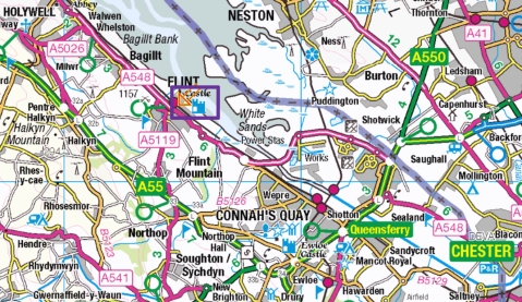
Map showing the location of Flint Castle relative to Chester and Holywell (Basingwerk Abbey, marked as “Abbey” at the top left of this map, on the coast at Holywell, can be combined with Flint Castle for a visit). Source: streetmap.co.uk

You have to watch carefully for the road signs directing you to the castle (little Celtic cross symbols) because they are easy to miss.  Alternatively, as we did, check it on the map first to get an idea of the location and then just rely on GPS (I use the free Google Maps app on my iPhone, which works a treat).  There is a good car park overlooking the castle and estuary, with picnic benches on the grass below.
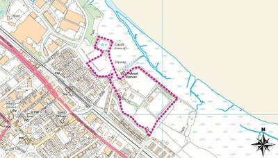
Short walk taking in Flint Castle, and suitable for those with mobility issues, although accessing towers within the castle requires the ability to tackle staircases.  Even without entering the towers, the sense of the castle from within the inner keep is excellent, and the views from the inner keep across the estuary towards the Wirral are lovely.  Source: Flintshire County Council

Flint Castle itself is a bit of a mixed blessing for those with unreliable legs.  One of the best things about Flint Castle is that it is possible to walk up staircases (both original stone ones and bright, modern metal ones), some of which are quite steep.  Although access is on the flat into the outer and inner wards, and the views from the inner ward are lovely, it is difficult to really experience all the components of the castle unless you tackle some stairs.  On the other hand, the walk shown here (from the Flintshire County Council website) shows a walk that includes that castle but could easily be done for those with unwilling legs.

Access to the castle is free, but check the Flint Castle pages on the Cadw website to check if it is closed for certain seasons or specific dates.  The car park is also free of charge.  There was a mobile café van whilst we were there, but there are no other café type facilities on the site.  There is a nice café at Basingwerk Abbey in Holywell if you are combining the two on a single visit to the area.

A section of the Wales Coast, marked with green diamonds, heading west from Flint Castle (marked at left with a white cross on a blue background). Source: Wales Coast Path interactive map

If you like walking, the castle is handily located on the Wales Coast Path, and although the Welsh side of the Dee is characterized by light industry, the views from the Wales Coast Path are across the estuary towards the Wirral.  We’ve not yet done any of the Wales Coast Path in that part of Wales, but the views from the castle argues that it has lots of potential, and I am hoping for sea and marsh birds too.  I cannot state whether or not it is suitable for those with unwilling legs, but it does seem plausible, because it is all on the flat.
asdfasdfa

1726 print of Flint Castle.  Source: Coflein

Sources

Books and papers

As usual, the main sources used are shown in bold.

Note:  Vicky Perfect’s book on the castle (listed below) is great guide to Flint Castle in one convenient publication, with excellent illustrations.  In particular, Chapter 3 “The Building of Flint Castle” makes excellent use of primary sources to provide a fascinating insight into the resources required, the techniques used and the men involved in the construction work (including details of some of their roles and daily pay).

Abercrombie, P. 1924.  Flint.  The Town Planning Review, Vol. 10, No. 4 (Feb., 1924), p.241-244
https://www.jstor.org/stable/40101411

Butlin, R.A. 1978. The Late Middle Ages, c.1350-1500.  In Dodgshon, R.A. and Butlin, R.A. (ed.) An Historical Geography of England and Wales.  Academic Press, p.119-150

Davies, J. 2007 (3rd edition). A History of Wales. Penguin

Dyer, C. 2002.  Making a living in the Middle Ages.  The People of Britain 850-1520.  Yale University Press

Jack, R.I. 1988. H. Wales and the Marches. In Chapter 4, Farming Techniques in Hallam, H.E. (ed.) The Agrarian History of England and Wales, Volume II, 1042-1350. Cambridge University Press, p.412-496

Jenkins, G.H. 2007. A Concise History of Wales. Cambridge University Press

Hume, P. 2020. The Welsh Marcher Lordships. I: Central and North. Logaston Press

Morris, M. 2008. A Great and Terrible King. Edward I and the Forging of Britain. Penguin

Perfect, V. 2012. Flint Castle. The story of Edward I’s first Welsh castle. Alyn Books

Pryor, F.  2010. The Making of the British Landscape.  How we have transformed the land, from prehistory to today.  Allen Lane

Renn, D.F. and Avent, R. 2001 (2nd edition). Flint Castle – Ewloe Castle. Cadw

Rowley, T. 1986. The High Middle Ages, 1200-1500. Routledge and Kegan Paul

Saul, N. 1997. The Oxford Illustrated History of Medieval England. Oxford University Press

Shillaber, C. 1947. Edward I, Builder of Towns. Speculum, Vol. 22, No. 3 (Jul., 1947), p.297-309
https://www.jstor.org/stable/2856866

Stephenson, W. 2019. Medieval Wales c.1050-1332. Centuries of Ambiguity. University of Wales Press

Vening, T. 2012. The Kings and Queens of Wales. Amberley

Walker, D. 1990. Medieval Wales. Cambridge Medieval Textbooks


Websites

Ancient and Medieval Architecture
Flint – Castle (particularly useful for images) (Janusz Michalew)
https://medievalheritage.eu/en/main-page/heritage/wales/flint-castle/

BBC News
Historic Flint Castle defences found under block of flats. June 7th, 2015
https://www.bbc.com/news/uk-wales-north-east-wales-33032562
Flint Castle: History behind castle chosen for sculpture. By Matthew Frank Stevens (Senior Lecturer in History, Swansea University). 1st November 2019
https://www.bbc.co.uk/news/uk-wales-50260758

Cadw
Flint Castle
https://cadw.gov.wales/visit/places-to-visit/flint-castle
Flint.  Understanding Urban Character.
https://www.flintshire.gov.uk/en/PDFFiles/SHARP/Flint-Understanding-Urban-Character-(Cadw-2009).pdf

Clwyd Powys Archaeological Trust
Historic Settlement Survey – Flintshire
https://cpat.org.uk/ycom/flints/flint.pdf

Coflein
Site Record: Flint Castle (with some excellent image and plans)
https://coflein.gov.uk/en/site/94448/

Curious Clwyd
https://www.mythslegendsodditiesnorth-east-wales.co.uk/

Halkyn Mountain
https://www.halkynmountain.co.uk/

Wales Coast Path
Home page
https://www.walescoastpath.gov.uk/?lang=en
Interactive Coast Path Map
https://www.walescoastpath.gov.uk/plan-your-visit/interactive-coast-path-map/?lang=en#


Eaton Hall Gardens Charity Open Days 2022

My father and I booked for the open day on Sunday 26th June.  All tickets have to be booked in advance, both for the gardens and for the train a narrow gauge railway.  We skipped the train option so I don’t know what that experience was like (lots of children, I would imagine) but the gardens were superb, and in some ways unexpected.  Brief comments on practicalities for those considering July or August visits, in terms of parking, suitability for those with mobility issues etc, are at the end of this post.

The Eaton Hall Gardens are open to the public three times this year, the last Sunday in June, July and August, all in aid of three different charities.  If you are intending to go, but have not yet booked a ticket, I suggest you book immediately via EventBrite, as it sells out every year. I missed the chance last year.  The benefiting charities for the 2022 events are Cheshire Young Carers, Cheshire Wildlife Trust and Kidsbank.

We entered via the Belvedere gate just north of the Grosvenor Garden Centre on the old Chester to Wrexham road (the B5445).  It is an ostentatiously long approach to the property.  Just in front of a gigantic obelisk is a checkpoint where you show your tickets.

Young RAF Air Cadets were on hand everywhere to direct traffic and answer questions, and did an absolutely splendid job of keeping the traffic moving.  Once we had followed their directions and parked in a field (but see my notes on disabled access at the end), and walked up towards the estate buildings, you pass through a gate where your tickets are checked again.  Here you are handed a leaflet about the charity being supported, and another highlighting garden features that you might want to visit by head gardener Jan Lomas, with an excellent map on the back showing the locations those features, with  recommended routes between them, which is absolutely necessary if you are not going to miss anything.  You can download my battered copy of the map here if you want to plan your visit in advance.

We were lucky with the weather, because although it was overcast, with only short burst of occasional sunshine, it remained dry, and it was warm.  You can click on any of the photos to see a bigger version.

The description of the gardens on the EventBrite website gives some idea of the treats in store:

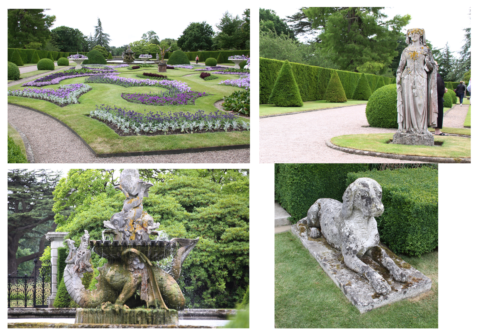
Eaton Hall Gardens extend to 88 acres and have been developed over many years by prominent designers, most recently by Lady Arabella Lennox-Boyd. The gardens have a wide variety of planting, including four formal colour-themed rose gardens and grand colour-themed herbaceous borders. There is a newly completed hot border design and a stunning bedding scheme in the Dragon Garden which is not to be missed. Visitors can also enjoy the walled Kitchen Garden, as well as the wildflower garden and the lake walk, where you can take in fabulous views of the Hall and grounds. Finally, the Tea House is filled with roses and herbs and sits perfectly at the end of a short walk past the lake area.

We found all the gardens except the wildflower garden (up a flight of stairs out of the Dragon Garden), and we didn’t do the lake walk simply because it was getting rather late, but looks like a brilliant venue for the picnics that were being carried by more organized visitors.

The first place that we visited was the camellia walk, a long, slender glass corridor lined with camellia bushes.  Although none of the camellias were in flower (they are a spring flowering species), the conservatory building itself was a thing of real beauty, and the sense that it goes on and on without visible end is wonderful.

Nearby are the sheds and the platform for the narrow gauge railway (with open-sided carriages pulled by a steam engine, which used to connect to a Chester-Shropshire railway line siding some 3 miles away).  We walked along a track round the walled kitchen garden towards the courtyard entrance, which is an intriguing little walk, as there is a lovely tree-lined walk towards the kitchen garden, and a couple of quirky buildings, but no signs that it is in use for anything.

The first port of call for most people is the former stable block surrounding a courtyard.  The stable courtyard is open to the public, and there is a horse-drawn carriage display in the light-filled atrium that gives access to it.

The open courtyard itself is laid out with tables and chairs, and is one of the places where refreshments are served in aid of charity (for cash only), and was very congested, but the surrounding buildings were not at all busy.

The former stables themselves, built by Alfred Waterhouse in around 1869, are open.  The saddle horses and harness horses were stabled separately, and there was a harness room and a carriage house too.  There is some information about the horses stabled there and a reconstruction of the stud manager’s office, as well as the family history and exhibition rooms.  You can also, from the stable courtyard, access the bizarre shell grotto and the 1870 Eaton Chapel from the courtyard (stained-glass windows by Frederic James Shields).  Live organ concerts were being played in the chapel, majoring on Johann Sebastian Bach, a lovely, intimate sound in that small space.   

After visiting the courtyard, which is the first place that everyone seems to filter into first, the nearest of the gardens to visit is the walled kitchen garden.

Along one of the walls is a broad border filled with brightly coloured flowers, many of which grow on a massive, upwardly skyrocketing scale.  Within the walls, the beds are divided into squares and rectangles by multiple pathways, many of which are provided with colourful arches.  Some of the beds are defined some defined by short hedges of interlaced apples.  Some of the flowers are exotic and gaudy, others are more humble and subtle, and there is a lively mix of floral displays and vegetables, with lots to see.  The overall impact is one of careful husbandry with a real eye for colour, scale and shape.

asfsdfs
dafdsfs

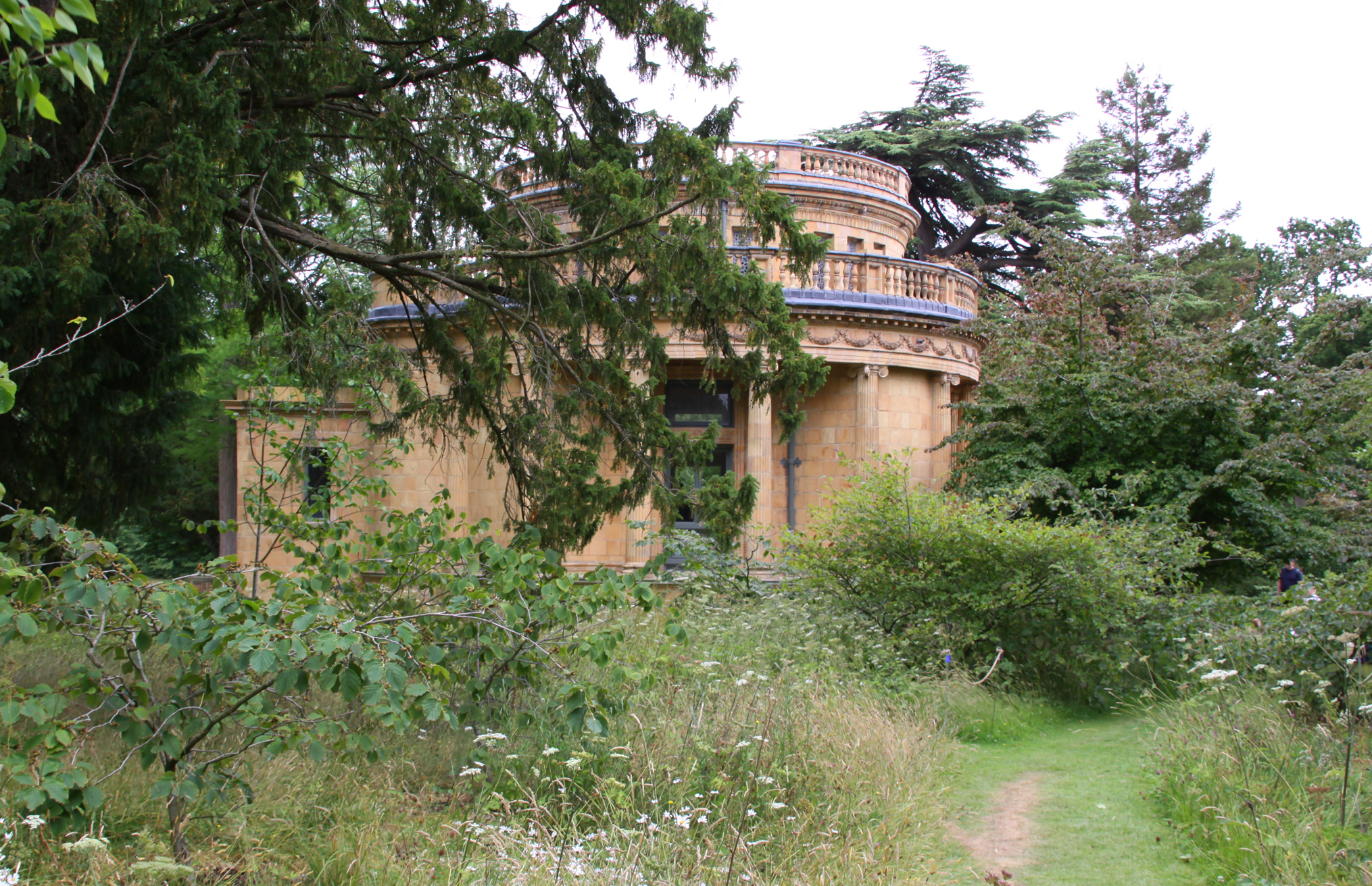
From there we walked down to the Parrot House, a little round building looking rather like a Graeco-Roman temple, but designed to keep tropical birds.  It was built in the 1880s by Alfred Waterhouse and was fitted with heating to create suitable conditions for such birds, but apparently never housed anything more tropical than some budgies.  There were hay bales outside for visitors to sit and watch the band.

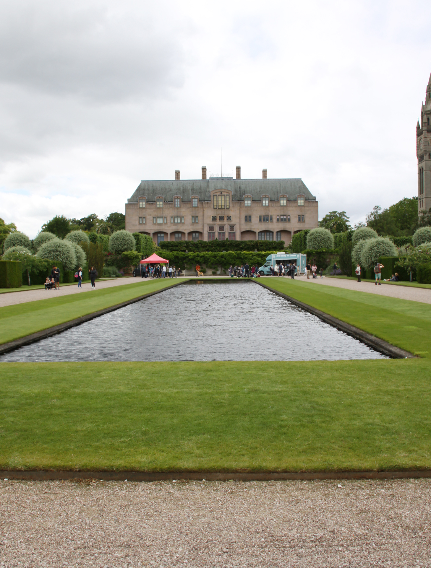
From here it was a short walk to the rose gardens, which sit in front of the Eaton Hall house, offering the first real glimpse of the house and the great clock tower of the neighbouring chapel.  The Country Seat website offers the following very useful potted history of Eaton Hall (not open to the public, but an unavoidable presence).

A Victorian Gothic iteration of Eaton Hall in the late 19th Century. Source: Lost Heritage

The first notable Eaton Hall was designed by William Samwell and built in 1664 but was replaced by a vast Gothic creation by William Porden in 1803, which was then enlarged by William Burn in 1845. This was then replaced by the Victorian Gothic of Alfred Waterhouse in 1870, before the whole edifice was swept away in 1961 as the trustees of the then young Duke couldn’t imagine anyone living in such splendour again. Faced with being a Duke with no seat in his 11,500-acre estate in Cheshire, in 1971 the 5th Duke commissioned a starkly white modernist country house from John Dennys, (who also happened to be the Dukes’ brother-in-law) which was as striking as it was controversial. This was then given a vaguely ‘chateau’ style makeover in 1989 for the 6th Duke, to designs by the Percy Thomas Partnership. So of the five major houses which have been graced with the name Eaton Hall, the current one, though impressive, still doesn’t quite have the gravitas of the others. Perhaps, in time, a future Duke may decide to replace it again.

The current house is an ugly great block of a thing looking not unlike Faengslet prison. I daresay it has more going on in its favour on the inside.  Next to it, rather more endearing in a uniquely Victorian way, is the Eaton Hall chapel clock tower and the chapel itself, behind which is the the stable courtyard.  Although the history of the house is of interest, the visit is all about the gardens, which are excellent.

The gardens are dotted throughout a park that sits above a lake and extends to the east.  Instead of being clustered around the house, as in most houses and estates of this type, the different gardens are dotted around, approached both via metalled surfaces and grass paths mowed through stretches that have been allowed to run wild.

The rose gardens are probably the highlight of the gardens at this time of year, with climbing roses climbing up trellis obelisks and running along heavy rope links.  The twin gardens flank a long rectangular ornamental pond that runs towards the house.  The pond is often shown with fountains, but they were not operating when we visited.

The rose gardens, supplemented by other species to complement the colours of different sections, form part of a remarkable of a set of terraces.  The top terrace, not accessible to the public, is on the level of the house.  The rose gardens are next down, and below this is the lioness and kudu pond, which in turn overlooks the slope down to the lake, which is fed by the River Dee.

The rose gardens and the pond are flanked by wooden arches connected with thick ropes, and both the arches and the connecting ropes support white and palest pink roses.

On each side of the pond are two square rose gardens, separated by yew hedges, cleverly offset so that one garden cannot be seen from the next, giving the impression of being the entrance to a maze.  Each of these rose gardens has a central focal point, a circular path, and four beds, each with a massive obelisk in its corner.  Each of the gardens is colour-themed.  One, for example, is blue and yellow, whilst another is pure white.  The roses are certainly the dominant flower, but they are supported by penstemons, clematis, geraniums and various other species that help to create a mass of different textures and shapes.

asfsfdfsd
The Dragon Garden is named for the dragon sculpture in the centre of the garden.  A formal geometric garden, planted with small species  of blues, purples, lilacs and mauves, this is a delightful sight, highly structured and precise.  There is a statue of a figure on each corner of the garden, possibly former family members.

After a pause to enjoy the view at the end of the terrace, and to look down over the lioness and kudu sculpture (a truly bizarre thing) we went towards the Dutch Tea House and the accompanying Tea Garden.  Outside this garden, and elsewhere on the estate, several of the vast oaks are wrapped in fine mesh.  I had seen this on a previous visit to the Aldford Iron Bridge on the other side of the estate, and had wondered what it was all about.  A helpful sign explained that it was an experimental measure taken against acute decline disease, thought to be caused by a parasitic boring beetle.  The mesh restricts the movement of the beetles and prevents them spreading.  At the same time, the roots of the tree, under soil compacted over the decades, prevents water and nutrients reaching the tree, so a programme of mulching has been undertaken to help retain water and help the transfer of nutrients and water via the roots into the trees.

The Tea House is a little ornamental building, approached via a path that leads through the pet cemetery, and look out for a delectable little wooden Wendy house on the other side of a low hedge.   If you have a pushchair or wheelchair / buggy, there is a side entrance to the garden that avoids the steps down from the Tea House.  Giant fennel plants give a wonderful bitter-sweet scent on approach to the garden.  The garden has a statue of Mercury at its centre (standing on a personification of the wind).  The garden is beautiful in a less formal way than the rose gardens, with a more unaffected feel, with lovely block-paved paths and beds filled with flowers and highly aromatic herbs that deliver a gloriously chaotic range of different aromatic scents that follow you around.  On a hot day I imagine that it would be even better as the aromas heat through.  

From here there was a choice of walking down to the lake, or taking one of the grass paths to another little temple-like building, referred to as a loggia.  We opted for the walk to the loggia, rectangular this time, which was flanked by two genuine Roman columns and housed a genuine Roman altar, the latter found to the east of Chester between the Tarvin and Huntington roundabouts, about 320 metres east of Boughton Cross, and 1.8 km due east of The Cross, Chester.  Given how much Roman architecture has been lost from Chester, it was probably a kindness to remove and preserve them, although the public only rarely have access.

The altar is today known officially as RIB 460.  On two sides it reads “Nymphis et Fontibus
leg(io) XX V(aleria) V(ictrix),” translated as “To the Nymphs and Fountains the Twentieth Legion Valeria Victrix (set this up).”  It was rediscovered first in 1821.

There is a grass avenue from here back to the Parrot House via the terrace with the lioness and kudu pond.  The band’s little white marquee is stationed in front of the Parrot House so you don’t really get a sense of the connection between the two buildings, but it is a nice arrangement.  As you walk onto the pond terrace, you pass through a grass path flanked with two borders filled with lavender.  We paused to run fingers through it and release the splendid scent.  The wall that runs below the upper terrace where the rose gardens were located is covered in white hydrangea petiolaris, a form of hydrangea that climbs. The pond itself has a vast greened sculpture in the middle showing a lioness about to leap on and kill a kudu (a deer-like animal).  As you walk up behind it, the change of perspective gives a strange sense that the lioness is in motion. It is absolutely not my cup of coco, and I would have it moved somewhere a lot less conspicuous, but it is certainly attention-grabbing.

From the Parrot House it was a short walk along the bottom edge of the walled garden to the field where we were parked.  We found the Air Cadets who were stationed around all the entrances and exits very helpful in sorting out somewhere where I could easily pick up my father.

Later, whilst my father was masterminding a fabulous culinary extravaganza in his kitchen, I read the leaflet about the Cheshire Young Carers charity that the day’s takings were to support.  It was something of an eye-opener to learn how many children care for their parents or their siblings, unsupported by any official mechanisms.  I was so pleased that our tickets had gone towards helping this excellent organization, which not only helps with practical support but organizes away days for children, activities that allow them to escape their responsibilities for a short time.
sdfsfas

Visiting Practicalities

The parking arrangements were very well managed with plenty of Air Cadets and other personnel at the ready to give directions and advice.  The car park was a field.  The field surface was dry buy very uneven.  A brief conversation with one of the parking officials enabled me to drop my father off on the hardstanding that led up to the gardens, and park nearby, where some spaces had been kept free, but if you have a disability badge, there are is special parking right by the entrance to the gardens.

There is a disability stand where disability scooters and other aids can be collected, and the gardens as a whole are generally easy for those with mobility issues, as well as for wheelchair and pushchair users. The gardens are connected with the lake by metalled paths leading between gardens, and within some of the gardens and in the park between them, there are level grass surfaces and light slopes throughout, which (at least on a dry day) are suitable for wheelchairs and pushchairs.  There are not many benches or seats around, and none between the gardens.

It was only moderately busy.  The car parks seemed to be stuffed full of cars, but the park and gardens seemed to swallow visitors very easily.  Only in the places where people tend to convene, like refreshment areas and places where there was live music, was there a sense that it might become crowded.  The gardens themselves gave no sense at all of there being too many people for the space.

Full details of the event, plus booking information, are on the Eventbrite website at:
https://www.eventbrite.co.uk/e/eaton-hall-gardens-charity-open-day-tickets-308591705097

sdfd
Sources:

EventBrite
Eaton Hall Gardens Charity Open Days 2022
https://www.eventbrite.co.uk/e/eaton-hall-gardens-charity-open-day-tickets-308591705097

Historic England
Eaton Hall Park and Garden
https://historicengland.org.uk/listing/the-list/list-entry/1000127?section=official-list-entry

Lost Heritage
Eaton Hall
http://www.lostheritage.org.uk/houses/lh_cheshire_eatonhall_info_gallery.html

Roman Inscriptions of Britain
RIB 460
https://romaninscriptionsofbritain.org/inscriptions/460

The Country Seat
Country houses of the 2014 Rich List – Top 10
https://thecountryseat.org.uk/tag/eaton-hall/

A walk from Telford’s Horseshoe Falls to the outskirts of Llangollen

Photograph taken from the top of the path leading from the car park, looking down at the Horseshoe Falls

The Horseshoe Falls are just outside Llangollen, a remarkable and lovely feature developed by Thomas Telford as part of his solution for supplying the Llangollen canal with water.  As the name suggests, it is a semi-circle of falling water, actually a man-made weir, which combines human symmetry with the natural beauty of water.  It looked spectacular in the sun, more art than engineering.

I usually make my comments about accessibility for people with uncooperative legs at the end, but in case the above photo makes you think I have lost my mind to categorize it as suitable , this is because there are other ways to approach the falls than from the top of the hill, approaches that are completely on the flat along the canal towpath.  Bear with me; clarity will emerge 🙂

Map of the Horse Falls area. Source: Pontcysyllte Aqueduct website

I had not set out to do this walk yesterday (Friday), and was actually on my way back from Valle Crucis (open once again to the public, but closed Tuesday and Wednesday each week), and was not ready to go home, so decided to drive down the road to the car park for the Falls, which is clearly signposted, and do a short walk to find out what it was like with a view to returning for a longer walk on another day.  The car park is pay-and-display but it is only a pound for the entire day, payable by cash or by swiping your debit card.  There are also public toilets.  I imagine that it gets quite busy at the weekends.

It is a short walk from there up a very slight slope along a metalled path to the top of the hill, from which the valley unfolds below.  There is an information sign here too.

I covered the basics of the building of the canal on earlier my post about the fabulous Pontcysyllte aqueduct, which you can find here, so won’t repeat that on this post, but the Horseshoe Falls deserve an explanation in its own right.  To secure water from the Dee, which ultimately comes from Lake Tegid at Bala, Telford gained permission from the owner of the lake to take off water  from the Dee for the new canal. The water had to be diverted from the Dee into the Llangollen canal by means of a feeder channel, some 1.8 miles long.  The distinctively shaped weir helps create a pool of water that can be pumped into the feeder channel. 

This link between the river and the canal required the installation of a pumping station by the side of the pool below the weir.  It was replaced by a new  Meter House or “valve house” in 1947, which still stands.  A massive pipe, 20ft long and 3ft in diameter runs 8ft below the ground to supply the Dee water to the Llangollen canal feeder.  This flow is released and slowed by means of guillotine valves which are controlled from the valve house.  By using the water of the Dee as it fell from Snowndonia via Lake Tegid, over 11 million gallons of Dee water a day, is fed into the Llangollen canal, eventually emptying into Hurleston reservoir, just north of Nantwich, where the Llangollen Canal meets the Shropshire Union Canal and contributing to the greater canal network. It was completed in 1808.

asfafas
It is a short and not particularly steep walk down to the falls from the car park, and the hillside is, at the moment a sheer delight, with the slopes covered in giant buttercups, purple thistles and daisies, with a few blue speedwells dotted in amongst them.  Once down at the falls, you are at the source of the Llangollen canal, a remarkable thought.   The valve house for the canal is at your left, and the footpath runs both left (east) and right (west).

I cannot yet comment on the footpath heading west, but if you head left, towards Llangollen, you find yourself immediately on a wide, level path, the towpath, which runs deliciously between the canal on your left and the Dee on the right.  The canal is very narrow at this stage, just a feeder, and not navigable.  The Dee too changes character, from a wide, deep run of uninterrupted river to fast, impressive rapids channelling itself through large slabs of natural rock.  Although the towpath runs above the level of the Dee, there are paths down to the river, and people were sunbathing on the huge slabs and paddling in the water.

The sound of the river coursing over the rocks is glorious, and a fabulous contrast to the peaceful, mirror-surfaced channel of canal that runs along the base of a solid wall of local rock, infiltrated by all sorts of rock-loving plant species and overhung by trees.  The canal widens as it goes, but remains un-navigable because, even where the canal is sufficiently wide and deep, there is no winding point (an indent where narrow-boats can turn around.  Long, sinuous weeds signal the direction of flow in the apparently motionless water, and fish, swimming against the current, hold a stationary position.  With the sun on it, when not mirroring the vegetation and sky above, it appears gold and velvet brown.  There are bridges all the way along, some modern and metal, but there are also traditional stone canal bridges, clearly numbered, with ramps for horses.  There is also an impressively substantial bridge spanning both the canal and the river.

One bridge is a delightful exception, and very unexpected.  The Chain Bridge Hotel contains within its Dee frontage, access to a small but perfect suspension bridge that provides access from the tow path to the railway station on the other side of the river, and some height above.   There is a small car park at the hotel, which can be used by the public.  I didn’t stop for a for a drink or a bite to eat, but the views from the terrace, over the bridge and the Dee rapids, are excellent.  This would probably be a good place to start and end your walk (particularly if the food is any good) if your legs like things simple, because the whole walk is on the flat.

I didn’t go much further because it was already getting rather late and I had other things to do.  I suppose I must have walked for about half an hour, with breaks to take photos, and then turned and walked back. Another way of tackling the walk would be to start in Llangollen and walk out towards the Horseshoe Falls.  This would be a much longer walk, and one for another day,  and again on the flat all the way along the towpath.  I am looking forward to it.

I went some way past the Motor Museum, which was to the right and below the level of the towpath.  The walk was particularly good on a day like yesterday, with hot sun and a light breeze.  At this time of year, with leaves on the trees, the towpath is in dappled shade, perfectly warm but not too hot.

Here are the rest of the photos:
dafsdfds

Day trip: Bodnant Gardens in Conwy are looking fabulous

Bodnant Gardens are currently stunning.  Bodnant is always stunning, and it gets better every year.  This time of year is one of its particularly shining moments, with the laburnum walk and the last of the azaleas, the rhododendrons in full bloom, the wisteria flowing like water, fabulous guelder rose (actually a viburnum), a few glossy camellias still in flower, some charming early roses, and enormous pieris shrubs the size of trees blooming with flowers that look like lily of the valley.  These are complemented at ground level with some brightly coloured arrays of perennial flowers, glossy and eye-catching, even in the deep shade, where careful choices have produced fabulous results.  The formal ponds were dignified and peaceful, whilst the bubbling brook at the bottom of the valley was utterly stunning, with birdsong and water over stones combining to create an audio-visual sense of peace and harmony that was really rather magical.  Even the views are wonderful from the formal terraces, looking out over the river Conwy across to the hills that lie between Bodnant and the Menai Strait.  I have  run out of superlatives, but Bodnant merits it.

Visiting notes, including notes for those with unwilling legs, are at the end.


Visiting notes

Although we had set out for Valle Crucis Abbey, just outside Llangollen, it was closed.  I did not bang my head helplessly against the nearest wall, in spite of all the emails I have sent down the black hole of Cadw‘s multiple “contact” email addresses to find out when it would be open again.  Instead we took out the road atlas and considered our options and Bodnant looked like a distinctly uplifting improvement on the day to date, particularly as we were planning to go next week anyway.  The weather was a bit dodgy, but what the heck; we decided that the A5 was just down the road, and with a swift right turn onto the A470 at Betws y Coed we could be at Bodnant Gardens in no time – which is to say about 45 minutes from Llangollen.  It was only noon, which gave us plenty of time to get there and spend the rest of the day wandering, especially if we returned to Dad’s in Rossett via the A55 dual carriageway and had a pub meal afterwards to avoid the need to cook (which we did).  The weather improved all the time and by 4pm it was sunny, blue-skied, hot and perfectly gorgeous.  In spite of a false start to the day, it became a marvellous day.

As you would expect with a National Trust property, there is loads of parking.  As Bodnant is on a hill, the car park is quite steep and if you have anyone with leg issues, there is a drop off point (and a pick up point opposite) with some benches considerately provided.  It was impressive that a new pedestrian underpass has been built.  It was always a bit of a take-your-life-in-your-hands moment to cross the road from the car park to the ticket office, but the new walkway, flanked with some lovely plants (including the biggest euphorbias I have ever seen), is a major contribution to the experience.

One of the truly admirable things about Bodnant is that so much thought has gone into making it friendly not only for those with unwilling legs, but for wheels, which includes wheelchairs, push chairs and wheeled support frames, all of which were being used when we were there.  The map above was downloaded from the National Trust website, but on the map that they hand you in the ticket office, there are two routes marked, one in red (step-free) and one in blue (suggested route with wheels).   Wheel-friendly paths are not only marked on the map, but are signposted.  Other tracks and pathways are also shown, allowing people without leg issues additional freedom to explore. Those trails not picked out in blue or red are, when appropriate, marked with triple chevrons to show where there is a steep gradient.  The whole thing is really well thought out.

Exiting through the gift shop, the eternal formula for visits these days, is given a slightly different twist to it, as not only is there a garden centre with some very healthy plants that were being snapped up by visitors, but a series of small Welsh craft shops.  Within the garden centre there is a rather tatty coffee shop (although it did a good latte).  There is also an official National Trust gift shop as you reach the exit.  When you return to the car park via the new underpass, a much more upmarket café is available, which was well attended.

For official visiting information, including opening times and prices, see the Bodnant pages on the National Trust website at: https://www.nationaltrust.org.uk/bodnant-garden

When I read that Storm Arwen had taken down some trees that were over 100 years old, I felt a sense of real loss on their behalf.  Sincere credit is due to the design strategists at Bodnant, because you really wouldn’t guess that 50 trees (fifty!) had come down, including some enormous redwoods.  The impact of the existing trees is just as good as it ever was, and if there are one or two gaps, they are being speedily filled with replacements.  Only one tree remains prone, its roots encased in earth, its footprint so enormous that it looks like something geological or vastly palaeontological, and completely anachronistic.  It was planted in 1897, and now lies like a bitter accusation against Storm Arwen, itself a symptom of climate change.  I didn’t have the heart to take a picture of it, but you can read more about it, with a picture of some of the damage on the Bodnant Gardens website.


A year in the life of a single tree in Churton

The tree in early April 2021, still rather bare of leaves.

Just for fun, since April 2021 I have been photographing the deciduous tree that I can see from the window in my home office.  It stands in the middle of a rather untidy fence, completely dwarfing it, but finds itself in arboreal isolation, between two fields that belong to the Churton Hall / Barnston Estate dairy farm.  On the far, eastern side of the hedge, the field was eventually ploughed.

On the western side, cows grazed all summer during the day, vanishing at speed from time to time, presumably for milking and feeding.  Most of the time the cows ignored the tree, but on hot sunny days often gravitated towards it, even though it is not very large, and never offers much shade.

The same tree a few weeks later in mid-June 2021

The cows have surprised me.  Not dull, static, plodding things but always on the move, pushing one another out of the way for that special patch of grass, often cantering around together, and frequently departing back to their barn at a serious gallop, presumably for food.  The fresh air certainly seemed to agree with them.  The cattle vanished at some point during the late summer or autumn and the field remained empty of livestock, but reappeared in early April, making me smile when I saw them first exploring their fresh environment, rushing around and bumping into each other in something resembling excitement.


The tree, the backdrop to all this bovine activity, was ever-changing.  The time between bare branches in April and richly new light green leaves in June, a complete metamorphosis, was a mere six weeks.  Extraordinary.

This post is simply a set of photos of bits of a year in the tree’s life.  One or two of the photographs look as though the colours have been messed with in Photoshop to make them more interesting, but there would have been no fun in that.

I am too far away to know for sure what specie it may be.  I suspect from the shape that it is an oak, but I need to see the leaves, and the longest lens on my camera cannot get me close enough.
fdfasdf


An amazing sunset on 16th March 2022, when even my house, which is painted white, was peach-coloured. No Photoshop employed.

Snow on the 31st March 2022

Early April 2022, with the cows returned to the field

Mid April 2022, with leaves arriving on branches and a doom-laden sky in the background

Valle Crucis Abbey #4 – Patrons, abbots and priors

Cadw sign at the site showing a cutaway of how the interior of the Valle Crucis abbey church may have appeared

Part 1 of this series about Valle Crucis Abbey near Llangollen introduced the background to 12th Century monasticism in Britain, via St Pachomius and St Benedict, and talked about the Cistercians, the spread of the Cistercian order in Wales and why Valle Crucis was located where it was.  Part 2 looked at how the buildings at Valle Crucis were used and how the monastic community functioned.  Part 3 looked the architectural development of the abbey, an architectural jigsaw of a story from foundation in 1201 to dissolution in 1536.

Part 4 and upcoming part 5 look at how the patrons, abbots, priors and monks of the Cistercian Order contributed to life at Valle Crucis.  In Part 4, the top levels of the abbatial hierarchy are introduced, and in Part 5 the main body of the monastic community is described, all helping to build a view of what sort of people were to be found at the abbey, and what life was like within the cloister.

It is the way of the literate world that more is known about those at the top of the hierarchy than those of the main body of the community, because it is the patrons and abbots whose names were on formal documentation, and who were accountable to the mother abbey at Strata Marcella, to the General Chapter at Cîteaux, to the pope, and ultimately to God. More mundanely, the abbots were also subject to the vagaries of political activity and war, and as leaders of the abbey were named as its representatives.  Even so, there are considerable gaps in the list of abbots at Valle Crucis, many of whom are simply unrecorded and others are known only by their names, and even then not always with certainty, and sometimes only partially.
dsfsdfsdfs

Normans, Cistercians and Welsh princes

The remains of Strata Florida in midwest Wales. Photograph by Jeremy Bolwell. Source: Wikimedia

Although Wales had its own monastic tradition both before and after the Norman invasion in 1066, by 1150 Norman lords had established houses attached to a number of monastic orders in Wales, connected with French orders.   The Normans also set about normalizing the priesthood, bringing it under the archdiocese of Canterbury, and a number of new dioceses were established, each under a new, Norman-sponsored bishop.  Welsh Cistercian monasteries were spawned by  the Anglo-Norman abbeys in Tintern and Whitland in the south.  Whilst Tintern remained embedded in the Norman-Marcher tradition, Whitland’s fortunes became bound up with the Welsh princes in the 12th century when the Lord Rhys ap Gruffudd restored the fortunes of Deheubarth by claiming it from the Anglo-Norman Robert fitz Stephen.  Lord Rhys assumed patronage of both Whitland (founded with monks from Clairvaux) and Strata Florida in mid-west Wales (founded with monks from Whitland), the latter initially founded by fitz Stephen.  The new Welsh monasteries spawned by Whitland spreading from south to north, were all founded with this sense of being true to the Cistercian order, the spirts of St Benedict, the Virgin Mary and Christ, but were, at the same time, Pura Wallia, pure Welsh.

The regulations and charters of the Cistercians formalized the original intentions of St. Robert of Molesme Benedictine Abbey, who founded the Cistercian order in 1098.  Robert was was conscious that the  labora component of the Benedictine motto “ora et labora” (prayer and work) had been largely abandoned.  In the Cluniac order in particular there was too much comfort, a lot of elaborate and time-consuming ora and very little labora.  Cistercian abbeys were intended to be self-sufficient, combining work, prayer and solitude, distant from the distractions of urban areas.  This was Robert’s vision for the New Abbey at Cîteaux.  Robert was recalled somewhat forcibly to Molesme to resume his role, but was succeeded as abbot at the New Monastery by Alberic (1099-1109), who built on Robert’s initial work and successfully obtained papal privilege for the new abbey and its community in 1100.  Alberic was in turn succeeded by Stephen Harding in 1109, an English monk and theologian who consolidated his predecessors’ work over the next 25 years.

The New Monastery at Citeaux as it is today. Source: European Charter of the Cistercian Abbeys and Sites

Abbot Stephen Harding is usually credited with much of the underlying structure that ensured the success of the Cistercian order.  He appears to have understood that new abbeys, each one its own world isolated from its predecessors and peers, meant that standards would be difficult to maintain.  One of his priorities was to standardize life throughout the Cistercian network of abbeys, to ensure conformity to both the Benedictine Rule and Cistercian values, and it is generally thought that he produced the official constitution for the Order, the Carta Caritatis (Charter of Care), ratified by the Pope in 1119.  Amongst other regulations were a number that dealt with governance and accountability.  The governance was to ensure that all abbeys had the resources to conform to the Cistercian vision.  The accountability was the means by which abbeys were monitored, disciplined and assisted.  

Aerial view of Valle Crucis. Source: Coflein

Records of life at Valle Crucis are sketchy.  To complicate matters, as the centuries passed and the Cistercian order relaxed some of the more severe of its dictums, daily life changed accordingly.  This means that there is no single Valle Crucis way of life because as ideological decay set in, so did the way in which lives were lived.  This phenomenon of gradual departure from early Cistercian values is by no means unique to Valle Crucis, and was remarkably consistent across the Cistercian abbeys and across the centuries.  Some of this is visible at Valle Crucis, and the records that do survive give some insights into a few of the peaks and troughs at Valle Crucis.  Between what is known about Valle Crucis and what is known about Cistercian abbeys in general, we can make a fair stab at getting to know some of the people and their roles.
asfdasdf

Patronage of the abbey

The founder and first patron of Valle Crucis

Cistercians might seek relatively remote locations, but they never made any decisions about founding new abbeys without the input of the Cistercian order, local senior clergy and influential secular local dignitaries.  The most important of these secular authorities was the patron who put up the money for the building of the core monastic buildings, including the church, and provided the abbey with lands to secure its income.  Welsh monasteries were not merely religious but had a political and territorial role.

Valle Crucis Abbey in its valley setting today. Source: Archwilio

Prince Madog ap Gruffudd Maelor of Powys Madog (north Powys, northeast Wales) was the last of the major landholders in Wales to invest in a Cistercian establishment, and was convinced by four of the nearest abbots that he should found a monastery in his territory, extending the reach of the Cistercians in Wales.  Investing in Valle Crucis was not a light-hearted undertaking.  As well as land on which to establish the monastic precinct (the monastery buildings, the abbey church, the gatehouse, storage facilities and possibly farm buildings), the abbey had to be allocated lands to ensure that it could at least achieve self-sufficiency and, ideally, to make a profit to fund future activities.  Although monks took a vow of poverty, some abbeys and priories became very wealthy in their own right.  In the case of Valle Crucis, endowment  first meant relocating the village that already occupied the land chosen for the abbey, and providing it with land and other properties, such as mills and fishing rights.  The lands subsequently allocated to the abbey, both highland and lowland, suitable for livestock grazing and agricultural development respectively, had previously fed into Madog’s own coffers.

Depiction of purgatory in the 15th Century Les Très Riches Heures du duc de Berry. Source: Wikimedia

In return, what did Madog acquire to compensate himself for the ill-will of villagers and farmers, the loss of a useful revenue stream?  The position, prestige and identify of the Welsh princes in the 12th Century was dependent not merely upon political power, but also on spiritual security, which could be secured by investment in monastic establishments and the prayers that would be dedicated to them by the monks.  Richard Southern’s epic narrative about the Middle Ages emphasises the importance of monasteries to patrons (p.225):

The battle for the safety of the land was closely associated with the battle for the safety of the souls of their benefactors.  It was this double objective that induced great men to alienate large portions of their property for monastic uses.  They and their followers and families . . . believed that their temporal and eternal welfare equally depended on the warfare of the monks.

At the same time, his personal prestige would grow along with the monastery.  He had achieved a new status, a validation of his authority and a connection into the wider European world of erudition, culture and divine integrity represented by the spread of the Cistercians and their influence.  With a Cistercian abbey in his heartland, no-one could accuse any ruler of presiding over an uncivilized land.  The spread of the Cistercians in Wales was often connected with reinforcing power, prestige and identity, whilst still maintaining a Welsh personality all wrapped up in a nicely Christian package.  A neat trick.
By investing in a monastic establishment, Madog also stayed on the good side of the Church.  More importantly, what he obtained for himself and his family was the most important direct commodity that the abbey had to offer – its prayers.  As the horrors of purgatory loomed ever closer, patrons hoped that the strength and integrity of monastic prayer would offer powerful intercession.  The prayers of monks who were so close to the divine might work wonders on behalf of the deceased and his family.  Although the Cistercians initially banned burial of secular people within monastic premises, no matter how important, this rule was not observed at many Cistercian monasteries, and certainly at Valle Crucis part of the arrangement seems to have included the burial of Madog and members of his family within the monastic precinct, yet another step nearer to God.
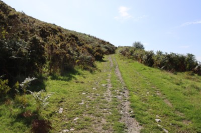
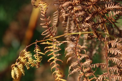
Patrons descended from Madog ap Gruffudd Maelor

When Madog ap Gruffudd Maelor, prince of Powys Fadog (north Powys) died in 1236, his son Gruffudd Maelor ap Madog (c.1220-1269/70), appears to have taken over most of the responsibilities of Madog’s role, although the domains were split between all five of Madog’s sons.  It was Gruffudd who in the year of his father’s death re-confirmed the founding charter, meaning that Valle Crucis retained the properties and assets that had been bestowed upon it by Madog.  He had two sons, Gruffydd Ial ap Madog and Madog ap Gruffydd Maelor.  The family had complicated allegiances, swapping sides between the Welsh and the English, but retained their lands until Edward I took Powys Fadog in 1277.  Gruffudd’s sons were both buried at Valle Crucis, and had presumably taken over the patronage as their father had done before them.

Patronage under English rule

Map showing Bromfield and Iâl (Yale). Source: Rogers 1992, p.444

Valle Crucis, located in a part of Powys known as Bromfield and Iâl, found itself in the middle of several political tugs of war and it is difficult to know what sort of patronage followed between the death of Gruffyd and the suppression of Valle Crucis in 1536.  The answer lies somewhere in the history of Bromfield and Iâl, which had become something of a diplomatic bargaining chip. It seems worth recounting some of that history in order to highlight how political complexities could impact both Valle Crucis and other monastic establishments in Wales.  

Following Edward I’s conquest of Wales Edward I’s reparations to Valle Crucis were generous, but these were intended for replacement of stock, repairs to property, and general compensation for the injury to the dignity of the monastery, but Edward did not replace the Powys princes as patron.  Madog ap Gruffyd, the great-grandson of founder Madog ap Gruffudd Maelor, was buried in the abbey in 1306, as was his cousin Gweirca, implying that they continued to support the abbey even after Edward I.  However, on the death of Madog ap Gruffyd everything changed.

Much of the following has been based on information from the 1992 doctoral thesis The Welsh Marcher Lordship of Bromfield and Yale 1282-1485 by Michael Rogers (any errors are, of course, my own).  Rogers quotes a charter of Edward I from 7th October 1282 at Rhuddlan:

Notification that the king, for the greater tranquillity and common benefit of him and his heirs and of all his realm of England, has granted by this charter to John de Warenne, earl of Surrey, the castle of Dinas Bran, which was in the king’s hands at the commencement of the present war in Wales, and all the lands of Bromfield, which Gruffudd and Llywelyn, sons of Madog Fychan, held at the beginning of the said war . . . saving to the king the castle and land of Hope . . . ; and the king also grants to the earl the land of Yale, which belonged to Gruffudd Fychan, son of Gruffudd de Bromfield, the king’s enemy; doing therefor the service of four knights’ fees for all service custom and demand . . .

Seal of John de Warenne, 6th Earl of Surrey. Source: Wikipedia

Two years later in 1284, John de Warenne granted Bromfield and Iâl to his son William, who died young in 1286.  The crown once again took possession whilst John tried to claim his rights to the lands, but in the following year Bromfield and Iâl were restored to John, in spite of possible claims of William’s baby son, also John, born in 1286.  When John de Warenne died on 27th September 1304, his grandson and heir, William’s son John was still a minor and became a ward of the king, with Bromfield and Iâl remaining in crown hands until 1306.

The history of Bromfield and Iâl was tied closely to the history of the village of Holt, which was also given to John Warren on Madog’s death, and which also passed to William.  John began the castle, which William subsequently continued to build.  Holt and its castle passed by marriage into the hands of the Earl of Arundel, who fell foul of Richard II and was executed.  After reverting to the crown and again being granted to the Earls of Arundel, Holt and its castle were granted by Richard III to Sir William Stanley, together with Chirk Castle the lordship of Bromfield and Iâl (now known as Yale) in 1484. It is this family that appear to have taken on the patronage of Valle Crucis.  Unfortunately Stanley was himself executed for treason in 1495.  Holt Castle next passed to William Brereton, who was apparently also a patron of Valle Crucis, before being executed in 1536 under Henry VIII for most foolishly tinkering with Ann Boleyn.  Bromfield and Iâl was then transferred to the crown under Henry VII and subsequently Henry VIII.

Sir William Stanley. Source: Wikipedia

In 1536 the Act of Union withdrew the special status of the Marcher lordships, and Bromfield and Iâl were incorporated into the new county of Denbighshire, together with Chirkland, Denbigh and Dyffryn Clwyd. 1536 was a momentous year for Bromfield and Iâl, and marked the dissolution of Valle Crucis.

After the death of Madog, with Bromfield and Iâl passing to John de Warenne, Valle Crucis had now of passed from the Welsh line to the English.  In spite of its location in the territory of Bromfield and Iâl, it is by no means clear whether Valle Crucis received any real material support from de Warenne or subsequent owners of the land.  On the other hand, it seems as though the descendants of the former Welsh ruler of Powys Madog still took an active interest in the abbey, and that local landowning patrons may have been involved with the abbey’s writing of Welsh history and its connection with Welsh poets, whom local gentry also supported.  The Trefor family, from whom two of the 15th century abbots as well as bishops of St Asaph were derived, is one example.

It was not until the arrival of Sir William Stanley in the picture that clear support for the abbey is once again demonstrated.  Whilst it is possible that the Stanley family may have continued to support the abbey on a private basis after Sir William’s death, it is more likely that reversion to the ownership of the crown changed the abbey’s circumstances yet again.  Eventually Bromfield and Iâl passed to Henry Fitzroy, duke of Richmond and Somerset, who became the patron of Valle Crucis and who was involved in untangling the problems that ensued, not long before the dissolution, under Abbot Robert Salusbury.

I suspect that there is a lot more to be said on the above, and hope to dig out some more details as I continue to look into Valle Crucis.

Abbots of Valle Crucis

One of the ways in which Cistercian standards were maintained was in the strict hierarchy of the abbey.  The senior position was abbot, who was supported by a prior and, at larger establishments a sub-prior.  Beneath them were the choir monks who made up the primary community of the monastery.  Although monks were in theory equal in status, many of them had particular responsibilities, and the requirement for self-sufficiency meant that these roles were very clearly delineated and were of importance to the smooth running of the abbey.  The monks assigned certain roles were called obedientiaries.  The monks will be discussed in part 5.
The role of the abbot

The remains of Strata Marcella, the abbey from which Valle Crucis was founded. Source: Coflein

The most important person in the abbey was the abbot (from the Greek abbas, father).  He would normally be assisted by a prior, the second in command.  The abbot was responsible for maintaining order according to the Cistercian regulations.  He was accountable to both the mother abbey, Strata Marcella in mid Wales, as well as the founding abbey, Cîteaux, for the abbey’s performance and adherence to Cistercian standards, as well as for internal morale and discipline.  An abbot could have been a prior or an experienced monk before being elevated to the most senior position within a new abbey.  He could be promoted internally from within his own abbey or another Cistercian abbey on the retirement, death or elevation of a predecessor. Alternatively, when a new abbey was established the mother house provided the abbot and monks, and the new abbot was responsible for managing not only the monks but also for overseeing the building of the monastery and its church, a process that could take 40 years or more.

Most importantly, the abbot was responsible for ensuring that salvation was ensured for all of of the monks under his authority.  Salvation could only be achieved by undivided focus on God, achieved by adhering to the Order’s rules, including obedience, commitment and remarkable self-discipline.  Individual breaches of internal order would be profoundly disruptive to the community as a whole and, depending on the nature of the transgression, could place the individual’s soul in jeopardy.  Even the most dedicated and devout might find frustrations and difficulties associated with such a life.  Maintaining strict discipline, albeit with compassion, empathy and care, was of fundamental importance for a community that lived together, usually for life, and the abbot was responsible for the wellbeing of both individual monks and the community as a whole, the father of his community.

Salvation.  God seated in glory with angels to either side, proclaims salvation; the archangel Michael fights the 7-headed dragon as devils are hurled by other angels from the sky.  From the Cistercian Abbey of Citeaux. Source: Wikipedia

The abbot was also responsible for the welfare of the monastery’s finances and its economic  self-sufficiency.  Each abbey received land and associated assets to ensure that it was self sufficient, but these resources did not manage themselves and, with assistance from key obedientiaries, the abbot was responsible for ensuring that the abbey achieved ongoing financial security.  Obedientiaries, monks with specific roles within the community, were each allocated a budget to finance their particular area of responsibility, and the abbot would have been responsible for overseeing how to allocate funds, and how these individual budgets, once allocated, were employed.  The running of a monastic establishment was equivalent to running a business, and the abbot was its managing director.

Each year, abbots were obliged to proceed to the heart of the Cistercian order, the New Monastery at Cîteaux, to attend a meeting called the General Chapter, which discussed matters of policy, changes to the rules and statutes, and disciplinary matters and ensured that standards were maintained. Sometimes abbots at lesser abbeys such as Cymer near Dolgellau, or abbeys going through economically rough patches, were forced to borrow the funds required for this long trip, which might place a heavy burden on the economic resources of the monastery.    

Abbots of Valle Crucis

The abbey took its tone from the abbot, and there were both successes and failures recorded at Valle Crucis.  Nothing much could be done about the war waged by Edward I on the abbey’s properties, and although reparations were made by Edward twice in the late 13th Century, the financial constraints and perhaps even some privation within the community may have been felt.  It would have been the job of the abbot at that time of these and other difficulties to mitigate the impacts of the worries and any challenges that the abbey experienced.

There are no likenesses of any of the abbots of Valle Crucis, with the possible exception of a stone effigy that may have been Abbot Hywel, shown below and discussed further in part 5.  The Cistercians did not believe in adorning their monasteries with art works, and even though later Cistercian abbots might have indulged themselves with portraits, during the dissolution of the monasteries, Henry VIII commanded that all the assets of the monasteries be sold or destroyed.  Only a few Cistercian portraits therefore survive, and none of them were from Valle Crucis.

Sculpted face at the far end of the slype. Source: Wikimedia

Valle Crucis, founded in 1201 with monks and an abbot, Abbot Philip, from Strata Marcella, received an annual visitation from the abbot of Strata Marcella, or his proxy, throughout its life to ensure that it was conforming to the rules and values of the Cistercians.  Nothing is known of Abbot Philip, except that his appointment as abbot of an important new house marks him out as a highly responsible and suitably motivated individual, in all ways suitable for the daunting task of bringing up a monastery and its economic infrastructure from scratch.  Certainly the architectural development of the abbey argues that Abbot Philip was very capable in at least that respect, but a statute issued early in his tenure refers to him rarely celebrating Mass or receiving the Holy Eucharist.  He was apparently not alone, as the Abbots of Aberconwy and Carleon were also found guilty of the same lax behaviour.   

There is mention of an an Abbot Tenhaer in 1227 and again in 1234.  Nothing about him is known, but three dates tie in roughly with his tenure.  In the mid 1225 and 1227 Valle Crucis was recorded as being in dispute with neighbouring monasteries Strata Marcella and Cwmhir respectively, probably in connection with grazing rights.  In 1234 the General Chapter recorded that the incumbent abbot had allowed women to enter the monastic precinct.  The name of the abbot is not given, so the guilty party could have been either Tenhaer or his immediate successor whose name is not recorded.

Between approximately 1274 and 1284 an Abbot Madog or Madoc is known, his name recorded in two notable documents.  The first was a letter to the Pope in 1275, in which seven of the Welsh Cistercian abbots defended the reputation of Llywelyn against charges made by Anian, Bishop of St Asaph. The other six abbeys were Aberconwy, Whitland, Strata Florida, Cwmhir, Strata Marcella and Cymer.  Valle Crucis is recorded in the same year as having only 5 monks.  The second document is a document dating to December 1282, which notes a loan from Prince Llywelyn ap Gruffud of £40.00 to “expedite and sustain Abbot Madog” on abbey business.  That was a substantial sum – the National Archives Currency Convertor estimates that today this would equate to £27,762.78 (or 47 horses, 88 cows or 173 stones of sheep wool).  It may well have had something to do with Edward’s two major assaults on Wales in 1277 and 1282–83 respectively.  Edward’s generous compensations to Valle Crucis and other northern abbeys indicate the level of damage inflicted on the monastic establishments, allocated to Valle Crucis in 1283 and 1284 (£26 13s  4d and 160 respectively – the latter the highest sum paid to a Welsh Cistercian monastery).

Fragment of a gravestone, possibly from Valle Crucis and perhaps showing Abbot Hywel. Photograph by Professor Howard Williams. Source: ArchaeoDeath blog

An Abbot Hywel is mentioned in February 1294 and July 1295. The dates tie in with a record showing that Edward I placed the estates of Roger of Mold in the care of the abbey in 1294 (whilst Roger was on Crown work in Gascony), and then visited in person in in 1295, making oblations (religious gifts) of “two cloths.”  It is possible that he is the same Hywel Abbas shown in the fragment of a gravestone effigy showing a tonsured monk, first recorded in 1895 and now in Wynnstay Hall near Ruabon, which was on loan for a period to Llangollen Museum. A photograph of the effigy is shown left.  Professor Howard Williams and colleagues have researched the fragment, the style of which is consistent with the late 13th century, and believe that it probably came from Valle Crucis.  Whilst it may have been one of the choir monks, the investment in the carving of the slab argues that it was someone of more importance.  

Abbot Hywel was succeeded by a number of abbots about whom, again, almost nothing is known, but in 1330 Abbot Adam was appointed and is apparently mentioned on several occasions until perhaps January 1344.  It is thought that the inscription that remains clearly visible on the rebuilt gable on the west façade of the abbey church belongs to this abbot, claiming credit for the restoration work.  His inscription was not consonant with Cistercian ideas of modesty and humility, but this type of autograph was by no means unknown in the Cistercian Order.

St Asaph Cathedral, which dates back to the 13th Century. Source: Wikipedia

Again there are some names or partial names recorded, but this was the period of the Black Death that arrived in 1349, when keeping up to date records was probably the last thing on most people’s minds, and it is not until Abbot Robert Lancaster that more details are again available.  Abbot Robert was installed as abbot of Valle Crucis in about 1409, the year in which the papacy was reunited under pope Alexander V after the Great Schism of 1378.  Shortly afterwards he was elevated to the bishopric of St Asaph.  He held the positions of Abbot and Bishop simultaneously, until September 1419.  His is an interesting case, although not unique.  In that same year, 1419, a petition to the pope records that he had undertaken repairs to the monastery following a fire possibly inflicted during the Owain Glyndŵr rebellion.  Another extension to his twin role was granted In June 1424 for another fifteen years.  The conflicting demands of St Asaph and Valle Crucis may have tested his leadership skills because there is papal correspondence to the monastery, reminding the monks of their vows of obedience to the abbot, implying that there had been at least one serious breach of discipline or a challenge to his authority.  Abbot Robert may have retained the abbacy of Valle Crucis up to the time of his death in March 1433.  It is somewhat ironic that 6 generations on from Madog ap Gruffudd Maelor, the founder of Valle Crucis, the damage inflicted on the abbey during the Welsh rebellion between 1400 and 1410, was lead by Madog’s own descendent Owain Glyndŵr.  This time, there was no compensation, and it is not known how Valle Crucis, under Abbot Robert, was able to fund its own recovery.

The English Richard or John Mason held the position of abbot, for a period period lasting between February 1438 and July 1448, which may have been a period of neglect, although the evidence for this has not been clearly stated.  Abbot Mason was English, which may have caused difficulties within a Welsh context.  Although 18 years after the end of Owain Glyndŵr’s rebellion, nearly a generation on, there must have been residual resentment and a sense of loss amongst the Welsh gentry of Powys Fadog, if not amongst those monks of the Valle Crucis community who retained a sense of Welsh identity.

Sculpted head at the far end of the slype. Photograph by Llywelyn2000 Source: Wikimedia

There is a gap of some seven years in the records, but the three abbots that followed, Sîon ap Rhisiart (John ap Richard, 1455-1461), Dafydd ab Leuan ab Iorwerth (1480-1503) and Sîon Llwyd (John Lloyd) seem to have engineered a turnaround in the fortunes of the abbey, which now came under the patronage of the Stanley family who have been discussed above.  Under these abbots, Valle Crucis became a centre for literature and poetry.  At the same time, it seems to have become a rather more gregarious establishment than in previous centuries, entertaining high profile guests in fairly lavish style, praised in verse by Welsh poets Guto’r Glyn, Gutun  Owain and Tudur Aled.

Abbot Sîon ap Rhisiart (John ap Richard) was abbot between c.1455 and 1461.  David Williams refers to him as an “abbot-restorer,” who was from an important local family, the Trefors.  He is best known for the enthusiasm with which his hospitality was received by the poet Gutun Owain who described Valle Crucis as “a palace of diadem.”

Abbot Dafydd ab Leuan ab Iorwerth seems to have become abbot in February 1484.  He may have come from the Aberconwy monastery, and was again a member of the important local Trefor family.  He too was being praised by the Welsh poet Gutun Owain for his hospitality, commenting, with hindsight somewhat ambivalently “how good is the lord who loves to store his wealth and spend it on Egwestl’s noble church.”  Owain also praised Dafydd’s architectural achievements, including a fretted ceiling in the abbot’s house.  The village of Egwestl was the one that Valle Crucis had supplanted, and the abbey was still known locally by the village name.  Abbot Dafydd became deputy reformator of the Cistercian Order in England and Wales in 1485, a position of considerable importance.  Between 1500 and 1503 he was raised to the position of Bishop of St Asaph in Wales which, like Abbot Robert Lancaster earlier in the same century, he held concurrently (in commendam) with the the abbacy of Valle Crucis.  He died in about 1503.

Abbot Sîon Llwyd (John Lloyd) became abbot in about 1503 and stayed in the position until about 1527.  He became one the overseers of the compilation of the Welsh pedigree of Henry VII, a royal appointment, and in 1518 he was described as “king’s chaplain and doctor of both laws.”  Like his two predecessors, he was praised in verse for his hospitality by a well known poet, this time Tudur Aled.  Although he was buried at Valle Crucis, his tombstone was moved after the suppression and placed outside the church of Llanarmon yn Iâl.

Henry Fitzroy, duke of Richmond and Somerset, and patron of Valle Crucis during the abbacy of Robert Salusbury and during the dissolution of the abbey. Source: Wikipedia

Unfortunately but interestingly, this relatively brief period of glory was followed by disgrace.  The richness of the abbey in its late years, and its comfortable lifestyle, seems to have attracted quite the wrong sort of abbot, of which more in the next post.  The member of a local family was appointed to the post of abbot, although it is far from clear how he was able to obtain the position.  The family was prominent and well respected, but Abbot Robert Salusbury, who held the position from 1528-35 has been implicated in a number of crimes and felonies and appears to have had no training as a monk.  As Evans puts it (Valle Crucis Abbey, Cadw 2008):  “He was a totally unsuitable candidate, who appears to have been imposed upon the abbey;  he was probably under age, never served a proper novitiate as a monk, and does not seem to have been properly professed or elected.” Five monks left, leaving just two behind, forcing Robert Salusbury to acquire seven more from other monasteries, who he paid to serve.  In February 1534, with matters clearly out of control at the abbey, Henry Fitzroy, duke of Richmond and Somerset, Lord of Bromfield and Iâl, and patron of Valle Crucis, sent a visitation (inspection) to Valle Crucis, headed by Abbot Lliesion of Neath (reformator of the Cisternian order in Wales), and accompanied by the abbots of Aberconwy, Cwmhir and Cymer.  Things were soon set in motion for change.  In June 1534, the abbey was put under the care of the Abbot of Neath. in 1534, assisted by the prior Robert Bromley.  Salusbury was sent to Oxford for re-education, with a generous allowance, but the order’s good intentions were wasted.  Salusbury was eventually imprisoned in the Tower of London for leading a band of highwaymen in Oxford.

Abbot John Herne/Heron/Durham had the unenviable task of succeeding Robert Salusbury.  He had been a monk of the Abbey of St Mary Graces, Smithfield, London. It must have been something of a culture shock transferring from one of the Cistercian order’s few urban locations to the rural splendours of Valle Crucis, especially as he found the finances in such a poor state that he was forced to borrow £200 to meet the expenses of his own installation.  He was abbot of Valle Crucis from June 1535 until August 1536.  He was abbot when the Valor Ecclesiasticus, Henry VIII’s valuation of all the abbeys in the  realm, was carried out.  All monastic establishments valued at less than £200.00 were listed for immediate suppression and and the abbey was closed accordingly in 1536.  Henry Fitzroy, patron of Valle Crucis, died in the same year, at the age of 17.  After the suppression of the abbey, it is recorded in March 1537 that Abbot John was granted a pension.
fsdfasdf

Priors and sub-priors

The opening page of the Valor Ecclesiasticus, showing Henry VIII. Source: Wikipedia

The prior was secondary only to the abbot, was usually promoted from within the abbey’s own ranks and could rise to abbot of the same or another establishment, particularly a new, daughter establishment.  

The only prior to receive  attention in records associated with Valle Crucis is Prior Robert Bromley, who had been at Valle Crucis since about 1504 was passed over in favour of Robert Salusbury in 1528, a clearly very bad decision.  Williams says that he was given several privileges, perhaps as compensation for being passed up for the abbacy in 1528:  “He was now absolved from ecclesiastic censure due (if any) for not wearing the habit; he was permitted (because of infirmity) to wear linen next to his skin, long leggings of a decent colour (the monks were normally hare legged beneath their habit, and a ‘head warmer’ under his hood; he was allowed to talk quietly in the dorter [dormitory] . . . . and to eat and drink in his own (prior’s) chamber” (The Welsh Cistercians, p.68).  Such concessions were usually allowed only to the abbot.  When Salusbury was ousted by the Abbot of Neath in 1534, it was put in Bromley’s care temporarily, but he had no desire to become abbot of such a neglected establishment.  He too was a victim of the Valor Ecclesiasticus, and was respectably pensioned off.
fsdfasdf

Final comments on part 4

Valle Crucis from the south

As I was trying to untangle the stories of Powys Fadog and Bromfield and Iâl with a view to determining how they impacted patronage of the monastery, and to see what sort of political world surrounded and incorporated the abbey, it became increasingly clear why there were peaks and troughs in its career.  Whilst there were  periods of investment in architecture and scholarly output, it was also clear, and perfectly understandable, that the abbey had been through periods of downturn and neglect.  

The Black Death of 1349 raised questions in secular minds about the value of the clergy and of monastic prayer, whilst the Hundred Years War between 1337 and 1453 and the Great Schism of 1378-1409 inevitably challenged more than the idea of a unified Cistercian identity, placing Britain and France (the homeland of the Cistercians), in opposing camps.  For the entire period of the Great Schism, the annual General Chapter at Cîteaux was cancelled, with a papal bull from Urban VI releasing the Cistercians outside France from their obedience to the abbot of Cîteaux.  The General Chapter resumed in 1411, but the tone of Europe, the perception of the Church and the character of the Cistercian order had changed. It was during the late 14th and 15th centuries that the abbots of Valle Crucis became more worldly, less committed to the original ideals of either St Benedict or the earliest Cistercians.

The penultimate abbot, Robert Salusbury, was clearly a very poor decision, but demonstrates how both the abbey’s current patron, Henry Fitzroy, and the Cistercian order mobilized together to resolve the undoubtedly embarrassing problem.  They might not have bothered had they known how soon their world was to come tumbling down.

Next

Part 5 is coming shortly, and will talk about the monastic community below the level of abbot and prior, and how the monks and their colleagues lived their lives.  All parts are available, as they are written by clicking on the following link: https://basedinchurton.co.uk/category/valley-crucis-abbey/
fsdfasdf

Sources for part 4:

Tying in various bits of data would have been a lot more difficult without the excellent Monastic Wales website, a brilliant resource for all monastic establishments in Wales, which lists a number of abbot names mentioned in documents, highlighting gaps in the sequence and allowing a clear impression of what is and is not known about both the abbey and its abbots.  I used this as my starting point for reading about the personnel at Valle Crucis.  As usual, The Welsh Cistercians by David Williams (2001) and the booklet Valle Crucis Abbey by D.H. Evans (2008) have been invaluable.  

All sources for the series are listed in part 1.