Category Archives: Scenery

The Burton Marsh cycle and walking route 568 along the Dee estuary, Wirral

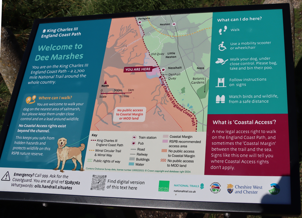
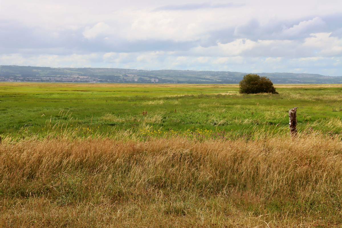
In 2013 a track across the wetlands from Connah’s Quay via Burton Point to Neston was opened.  As part of the Sustrans cycle network it is known as Route 568 or The Burton Marsh Greenway, and an information board at the point where the route meets Station Road (see map at end) says that this section is now also part of the “King Charles III England Coast Path.”  This section of the route, Burton Marsh, is partly made up of metalled lane, and partly boardwalk, and is a terrific walk.  I had never heard of it until I was standing in what remains of the hillfort on Burton Point headland, part of the RSPB reserve, and saw it passing almost at our feet and beyond into the distance.  It is an extraordinary sight, a mainly straight track across the landscape, and such a brilliant idea.

I parked on the section of Station Road that runs parallel to the estuary, which is part of the cycle route to Chester, and is separated from the rest of the Burton Marsh stretch of track by a gate to keep the sheep in.  There’s a map showing where the parking is located towards the end of this post.  This walks is all particularly beautiful on a sunny day with a blue sky stretching to the horizon. A shifting sky, which one moment produced sun and the next light shade, brought out the textures and colours for miles around.  Because the estuary is so flat and vast it can be very breezy or windy, which was no bad thing on a particularly sticky July day!


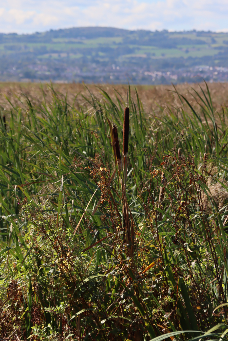
I headed through the gate in the Chester direction.  Starting out from this point you are on a metalled lane and have fields rising on your left, currently planted with palest yellow barley, whilst on your right are marshland habitats stretching all the way to the river Dee running along the Welsh side of the estuary, with every shade of green you can imagine, dotted with bright clumps of flowering plants and layer upon layer of different textures.

The barley fields are soon replaced by a fairly short red sandstone cliff edge, which has been heavily quarried over the centuries.  Where this red sandstone becomes much more uneven and comes out towards the lane, there is a sign on your right that explains that here are the remains of an Iron Age hillfort at the top of this small headland.  This is fenced off, as it is RSPB land.

Burton Point

The lane pulls away from the headland heading out into the wetlands, and soon you find yourself on a long section of boardwalk, which rattles splendidly when cyclists come along, with the marsh habitats either side of you.


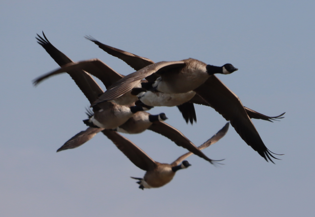
On a clear day the views seem endless as far as the way to the Clwydian Range of Wales.  The track gives a sense of how big that landscape actually is, and why it is such a special environment for wildlife, with aquatic plant life as far as the eye can see, and bird life launching itself in and out at surprising and random moments.  As well as plenty of Canada and greylag geese, both on the ground and in the air, there were dozens of skylarks, terns flying overhead and birds of prey too high to identify.  Unsurprisingly there were plenty of seagulls too.  Beneath the surface, there must be an awful lot more going on.

The intention was to walk for an hour and a half, see where that took me, and then turn back to retrieve the car, but the sudden onset of fairly heavy rain both greyed out the landscape and blocked the view so I only walked for around half an hour before turning around.  Even during that short walk, the views were superb and the environment absorbing, and one of the nice things about this is that however far you want to go, and from wherever you start, it lends itself to any length of walk.  I was chatting to a man on a bike who had stopped to watch a group of greylag geese, who had cycled from the middle of Chester and was going to visit his father in Neston before turning around and coming back, and by contrast there were a couple who were just out walking a short way with their dog and a child in a pushchair.  All very civilized and a great way of introducing a wide range of people to an entirely new environment in a very easy way.


xxx

Visiting from near Burton Point

You can access the track free of charge from anywhere along its route.  Because it is all on the flat, it is suitable not only for walkers and cyclists but those with pushchairs, buggies, and wheelchairs.  There was even a man on one of those push-it-with-one-leg adult scooters.  There are gates at interfaces with roads because of the sheep.  Also because of the sheep there are frequent signs asking owners to keep dogs on short leads.   Having been followed for about half a mile by one particular sheep, which stopped and looked fixedly at me every time I turned around to see if it was still following me, I can confirm that sheep are a very likely to be encountered.

I have only done this from just north of Burton Point so far, a short drive from the A540 via the village of Burton, and you can park on the straight section of Station Road that runs along the estuary, and where there is plenty of room to park along the road (what3words: ///recur.films.dream if you have the Google-compatible app on your smartphone).  Station Road, as it leads back inland, also has some parking along its edges near to the estuary.  I have highlighted the main parking-friendly area on Station Road in the pink box below.

Convenient road-side parking near Burton Point marked in pink. Source: Streetmap.co.uk

If you fancy starting in Chester, you can set off from the Little Roodee car park, go around the Roodee itself, and then follow the track to Connah’s Quay and go from there.  Fortunately you don’t have to depend on my finger-in-the-air directions, because Sustrans has its own website with full details for Route 568, which you can find here.  It shows the sections where the route meets roads, and where it intersects with other routes in the network.


Castell Dinas Brân, Castle of Crows above Llangollen – Medieval ruins and stunning views

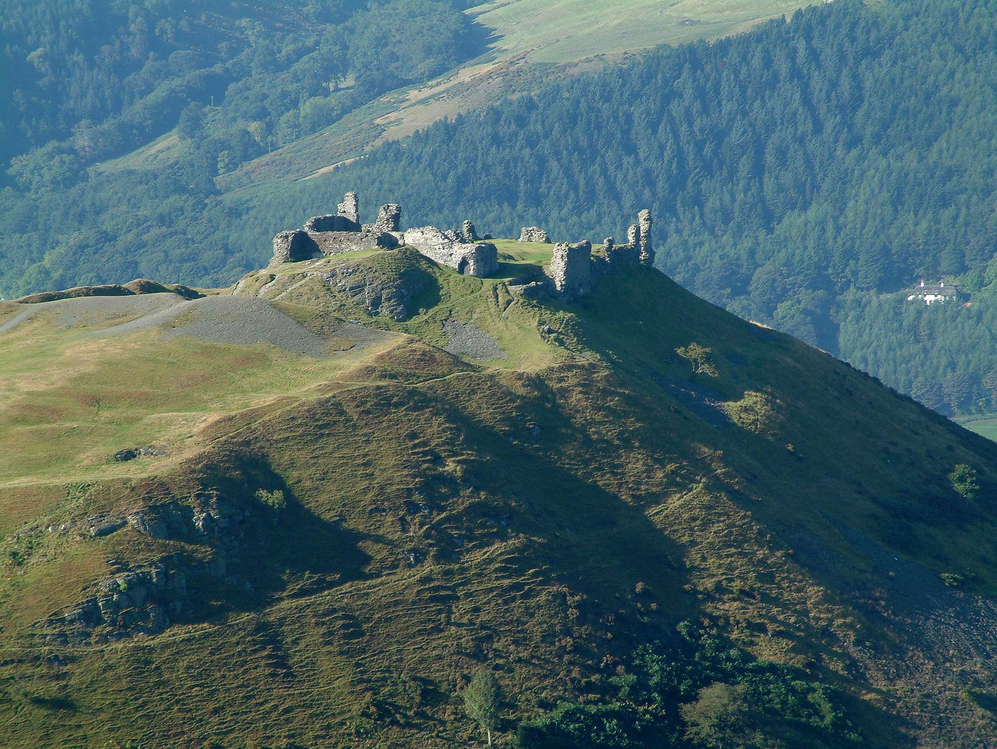
I have been visiting Dinas Brân on and off for decades, but have never got around to writing it up.  It was one of my favourite walks with the family dog in the 1980s when my parents lived hereabouts.  Much later, a regular return trip between Aberdovey and Rossett gave me the opportunity to see the castle from various different angles in all sorts of weather, the conical hill on which it sits soaring from the Dee valley providing a commanding, impressive position that dominates the landscape.  I recently drove into Llangollen to go up to the castle on a hot day, prepared for a moderately steep walk from the canal bridge, correctly anticipating a slightly breathless arrival at the ruins.

This is a splendid walk.  It is only about 2km (1.3 miles) from the Eisteddfod Pavilion, where I parked, although uphill all the way from the Wern Road canal bridge, so it feels longer, and the views towards the castle and back over the valley are splendid.  The views from the castle itself are of course stupendous, both aesthetically and geologically.  The geology and geomorphology are mentioned in brief below.  More about parking, the different routes and conditions underfoot are towards the end of the post in Visiting.


Dinas Bran ruins

Castell Dinas Brân, a Scheduled Monument, is the story of two fortifications, one dating to the Iron Age, at around 600BC, the other a medieval castle dating to the 13th Century.  It is far from unusual to find Medieval castles built within the circumference of an Iron Age hillfort, because both were making use of the same strategic features:  a good view of the surrounding countryside, a defensible position, often above cultivable land, and access to water.  This post is about the Medieval castle.

xxx

History of Castle of the Crows

The medieval castle

Window of what was possibly the Great Hall of Dinas Bran

Window of what was possibly the Great Hall of Dinas Bran

It is not certain which of the Powys Fadog rulers built Dinas Brân.  The most common suggestion is that the castle was built by Prince Gruffudd ap Madoc (c.1220-c.1270), beginning in the 1260s, but there is an argument discussed by Paul R Davies that it may have been built by his father Prince Madoc ap Gruffudd Maelor.

Valle Crucis Cistecian Abbey, founded 1201

From c.1190 Prince Madoc was ruler of Powys Fadog, the northern section of Powys, which had been split into two on the death of Madoc ap Maredudd in 1160.  He founded the nearby Cistercian abbey in 1201, and although his territory was comparatively small, he clearly had ambitions to establish his name and ensure his legacy, A castle would have been consistent with that intention, and as Davis points out, materials and workers could have been shared between the two sites.  Prince Madoc died in 1236 leaving four sons, of whom Prince Gruffudd was the only one to survive.  Whether Madoc started work on the castle or not, it is clear that Prince Gruffudd continued it, completing it well before the war of 1277.

Together with Powys Wenwynwyn to the south, Powys Fadog was sandwiched between the much larger territory of Llywelyn ap Gruffudd’s Meirionydd in the west of Wales and England to the east.  Llywelyn (c.1223 – 11th December 1282, also known as Llywelyn the last, grandson of Llywelyn the Great) and his brother Dafydd (1238 – 3rd October 1283) had been in a long-term power struggle with Henry III that erupted once again under Henry’s son Edward I.  Whilst the northeast territories provided a buffer zone between the two warring factions, their rulers were inevitably dragged into the question of where to bestow their loyalties.  There was never any certainty that the members of a single family would throw in their lot with the same side, and some, like Llywelyn’s brother Dafydd, switched sides at least once.

Wales following the 1267 Treaty of Montgomery showing Powys Fadog sandwiched between Gwynedd and England. Source: Turvey 2002, p.xxvii map 8

Prince Gruffudd was married to an English wife, presumably for diplomatic reasons, providing a nod of friendship to the English.  With Lady Emma Audely he had four sons, the eldest named Madoc, and one daughter.  Presumably seen as fair game by Llywelyn, Powys Fadog was attacked.  When Henry III was appealed to for help but did not come to Powys Fadog’s aid Gruffudd seems to have thrown in his lot with Llywelyn, arranging for peace between Meirionydd (Gwynedd) and the return of his territories by agreeing to the marriage of his eldest son Madoc to Llywelyn’s sister Margaret.  Dinas Brân was apparently built in support of the interests of Llywelyn the self-styled Prince of Wales, borrowing certain elements of architectural styling from Llywelyn’s castles, including the D-shaped tower at its southern side.

Gruffudd apparently died in around 1270, because it was in this year that his sons signed a grant to provide Lady Emma with lands of Maelor Saesneg to secure her future.  At this time ownership of the castle would have been split four ways between his sons, because primogeniture was the English but not the Welsh system of inheritance.  Instead of one son or daughter inheriting an estate, on the death of a father all property was divided between the remaining sons, with provision usually made for wives and daughters.  Each of Prince Gruffudd’s sons had his own decision to make in November 1276 when war broke out again between England and Wales.  However they started the war, Gruffydd’s eldest sons eventually submitted to Edward, but in May 1277 an English force sent to take possession of the castle found it in engulfed in flames and it was evident that the garrison left behind had remained loyal to Llywelyn.  The decision to burn and abandon the castle rather than defend or surrender it did not, however, completely destroy the castle.

After the Treaty of Aberconwy in 1277 Llywelyn paid homage to Edward, sitting to the left of the king’s throne, with Alexander of Scotland at the king’s right. The peace did not last.

After the Treaty of Aberconwy in 1277, Llywelyn’s power was confined to northwest Wales.  The English inspection of Dinas Brân to assess the damage caused by the fire found that although considerable superficial damage had been inflicted, the well-built castle was structurally sound and still of strategic value.  Henry de Lacy, Earl of Lincoln, wrote to Edward I recommending that the castle be repaired and garrisoned with English troops.

Following Edward’s triumph, Powys Fadog was abolished as a territory.  Edward gave ownership of the castle and all its lands to John de Warenne, the early of Surrey.  The castle, however, was no longer relevant as a symbolic stronghold of the former territory and now stood at the borderland of the new friendly lordships of Chirk, held by Roger Mortimer, and Bromfield and Yale by John de Warenne.  Instead of devoting any attention to Dinas Brân, de Warenne became busy building his new castle at the eastern end of Bromfield and Yale on the Dee crossing at Holt near Chester.

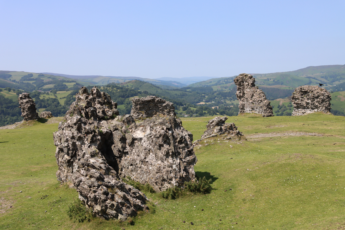
Ruins of Dinas Bran

Ruins of Dinas Bran

There is no record of the role performed by Dinas Brân, if any, during the final great conflict between Llywelyn and Edward of 1282, when the English were triumphant.  Llywelyn died on the battlefield that year, and Dafydd was captured and put to death in 1283.  As Holt Castle grew, Dinas Brân was abandoned.

A completely unsubstantiated legend concerns the fate of the two underage sons of Prince Madoc, Gruffudd’s eldest son.  Walter Tregellas in 1864 tells the story, in which Edward I conferred guardianship of the two boys on Roger Mortimer and John de Warenne:  “it is stated that the two children were soon afterwards drowned under Holt Bridge . . . This is said to have happened in 1281.”  He goes on to recount an even better version of the conspiracy, however: “it is uncertain whether the king himself did not cause the children to be put to death.”  There is no evidence whatsoever about what became of the two younger children of the prince of Powys Fadog.

Dinas Bran and the wonderful scenery beyond

Dinas Bran and the wonderful scenery beyond

The only hint that they castle buildings may have been re-used is a poem by Hywel ab Einion Llygliw Myfanwy Fychan in the 14th century, in which he claimed to have been rejected by the beautiful girl who lived there.  There is no evidence to support this later domestic occupation, but neither is there anything to deny it.  John Leland, visiting in 1536, found it in ruins.


The Victorians

Dinas Brân Castle by Alphonse Dousseau, c.1850. Source: The National Library of Wales, via WikiData.

When ruins became desirable romantic destinations, Dinas Brân was an obvious lure for painters (many of whom chose to paint safely from below) and more adventurous tourists.  The Holyhead road was the major route through north Wales, with Telford’s great route, now the A5, opening in 1826, and the railway was opened in 1864.  A local entrepreneur, demonstrating great faith in the spirit of adventure demonstrated by the new tourists, decided to make the most of the popular site and the first visitor provision was supplied in 1820, with a cottage added in the 1880s as a tea room together with an octagonal camera obscura, which was still in situ by the start of the Second World War.

Walking up the hill not far from the summit I found a piece of slender white clay pipe, about an inch long, on a piece of well-worn hillside.  This almost certainly belonged to the period of Victorian interest in the castle.

Victorian cottage built for serving teas to visitors on Dinas Brân. Source: People’s Collection Wales


The castle as it stands today

Fieldwork

Plan of Dinas Brân, both prehistoric and medieval, following the geophysical survey of 2017

There has been very little fieldwork at Dinas Brân, and even the antiquarian investigators who explored other sites seem to have felt that this was one challenge too many.  The only exception appears to be alocal treasure hunter who is mentioned in a journal entry by Lady Eleanor Butler of Plas Newydd, whose home was in full view of the castle, and who commented that their landlord had informed them that a smith from Dimbraneth “has been dreaming of more than a year past of treasure at Dinas Brân. Hew has within this week begun to dig.”  There is no report of any discoveries.

In 2017 a geophysical survey was carried out and this was quite comprehensive, addressing both the medieval castle and the prehistoric hillfort.  Although nothing conclusive was discovered, magnetic readings did suggest that a fire had scoured the ramparts, perhaps tying in with contemporary reports that the sons of Prince Gruffudd had set fire to the entire structure rather than surrender it to the English.

In 2020 a survey was carried out by the Clwyd Powys Archaeological Trust (CPAT) to assess the condition of the site, both the castle and the prehistoric hillfort, making recommendations to make it safer and more approachable for visitors and to manage archaeological impact.  Earthworks were noted beyond the hillfort but were not included in the survey.

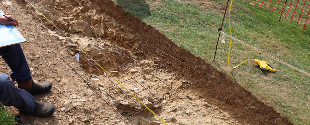
CPAT excavation at Dinas Brân in 2021. Source: Heneb

It was not until August 2021 that the first archaeological investigation was carried out at the site, organized by CPAT.  It was a small exploratory dig, with four trial trenches both within and outside the castle walls.  The main aim of the project was less investigation of the history and more about assessment of the condition of the building’s foundations.  Although the excavations did no more than reveal the medieval floor surface, one sherd of medieval pottery was recovered and a “ledge/kerb was discovered projecting from the gatehouse wall, with a portcullis slot in it near the east end, and a fine masonry carved pillar base at the western end.”  In 2021 the Heneb report said that the excavation report was “awaiting a second phase of work in 2022,” but I have been able to find nothing about a 2022 excavation and no further reports.

Modern conservation work was carried out by Recclesia, who surveyed the site and inserted stabilizing rods into the south wall of the castle to ensure that it stays upright now and in the future.

The surviving architecture

Detail of an old interpretation board

The plan drawn by Tregellas in 1864. with annotations

The castle was very fine in its day, with imposing fortified walls and stone and timber buildings.  There are hints that there were decorative features.  I have annotated the plan drawn in 1864 by Walter Tregellas to make this easier to follow.  If you have walked up from Llangollen, and climbed the east-facing slope of the hill, you will have entered opposite the original entrance.  I had had a long wander around before tackling how the ruins relate to the original layout but when I got stuck into the site plan, I started at the entrance.

The ditch surrounding the castle

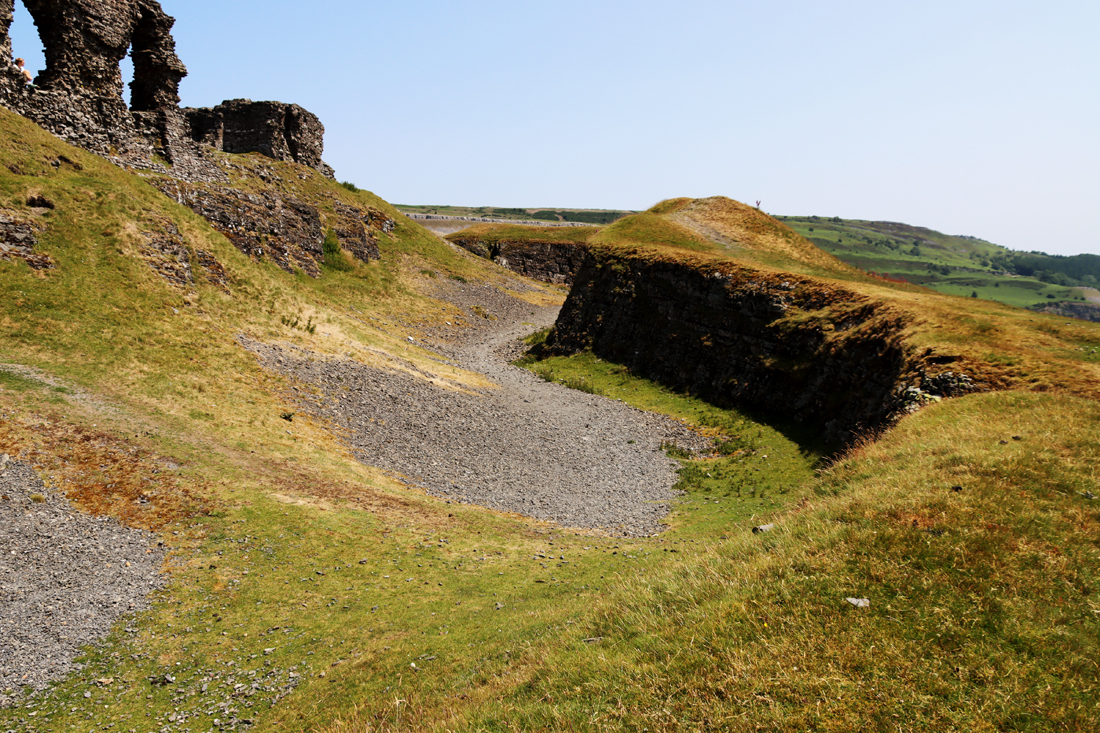
The site consists of a rectangular court orientated east-west, c.82m  by 35m, surrounded by a ditch dug out of the bedrock, which provided the material from which the castle was built.  As well as building materials available within the immediate vicinity, it was found that there was sandstone facing in certain parts of the castle, which would have provided it with both refinement and prestige.  It is not clear where this came from, but it is likely that it was sourced from the same location as the Valle Crucis ashlar.  The ditch surrounding the castle was an impressively deep and wide feature, running around three sides, the northern side of the castle being positioned directly over a steep drop.  At the southwestern corner of the ditch was once a well, the location of which is now very difficult to see.

An artist’s impression of how the gatehouse (right) and the keep (left) as they may have looked when it was first built. Source: Clwydian Range and Dee Valley

The original entrance was marked by a gatehouse that, being one of the points of weakness of the castle, was built so that it could be well defended, with twin English-style towers forming a gatehouse, each with hollow basements and, remarkably, appears to have been furnished with highly ornate rib-mouldings.  This is unprecedented in Welsh castle design and may have been copied from an English example.  One of the two gate towers still has the underfloor barrel-vaulted arch that was accessible from the courtyard; although it is now open to the outside, this would have been closed in the 13th century and is probably the enlargement of an arrow slit.  The vaulted room is closed to the public except on special open days.  The gatehouse was supplied with latrines on its northern side, that emptied down the walls into the ditch.

The vaulted undercroft in the gatehouse


The stairwell that lead up to the first floor of the keep

Heading clockwise from here, you encounter the square keep.  This was once an impressive building that helped offer protection for the gatehouse as well as the most vulnerable eastern approach.  It will also have provided a home for the main family members and a final retreat at a time of siege.  It was equipped with latrine which, like the gatehouse, emptied into the ditch.  Additional security was provided for the keep.  It could only be entered via a first floor door reached by stairs from a walled passage, and was separated from the rest of the castle interior by its own ditch, which would have been crossed by a liftable bridge.

Continue around to the right to follow what was once the long south curtain wall.  The section of wall with two giant openings in it was either the site of the castle’s Hall, where dining and socializing would have taken place, or its chapel. The two openings, providing plenty of light for interior, would have been about 1.8m (6ft) wide at their maximum width.  They would have had shutters to protect the castle from the elements, but no window glass.

At the far end of the Hall a doorway opened into a D-shaped tower that extended beyond the line of the curtain wall.  The D-shaped section has gone, but this tower was a major feature of the castle, rising to two if not three floors.  A good surviving example can be seen at the well known Ewloe Castle (about which I have posted here).  Again, this was a defensive measure providing archers good views over the ditch and the flanking walls. The ruins of the inners walls give a sense of the size of this half of the room. It is likely that part of this was used for the castle kitchens, which gives weight to the argument that the adjoining apartment was the dining hall rather than the chapel.

Further along this stretch and you will find yourself looking out between two sections of wall, a gap that represents the remains of the postern gateway.  As well as providing a useful secondary pedestrian entrance on the opposite side of the castle from the main gatehouse, this could also be used as a “sally port” that would allow foot soldiers to mount a surprise attack from an unexpected position.

A rectangular building at the west end may have been either the hall or the chapel or served another purpose.  This area is likely to be highly disturbed, archaeologically, due to the Victorian building works in this area. The rest of the interior would have been filled with timber-built buildings, including accommodation for servants, storage, stables and workshops.


The landscape  

xxx

British Geological Survey geological timeline.

Standing on the peak of the hill, you are 305m (c.1000ft) above seal level.  Geologically, Llangollen is divided into two main formations.  At the top of Dinas Brân you are standing on one and looking at the other.

Beneath your feet the rock formations are dark grey Silurian shales and silstones, which were laid down as deep sea sediments and then subjected to metamorphic processes.  These are the same rocks that you see in the Dee river bed from the Llangollen bridge, with the rapids flowing over them.  The stone quarried from the ditches of this Silurian hillside were used to build the castle, and are uncleaved, around 30-40cm thick.

Above this layer in Llangollen is the heavily layered Carboniferous limestone escarpment that so dramatically forms a backdrop to Llangollen and Dinas Brân, laid down when the sea was warm and shallow.  The Devonian, which theoretically should have sat between these two geological periods, is missing, presumably because it was not under water in this area at that time, and did not form the rich, deep layers usually laid down in marine contexts.

The solid geology of Clwyd showing rock types. Jenkins 1991, p.14

Geomorphologically, the Vale of Llangollen is a typical U-shaped valley carved by the advancing ice and associated debris of the Welsh Ice Sheet as it advanced east.  The river Dee wends its way through this flat base, and former river beds are visible in the landscape, the former routes of the river blocked by the ice sheet, forcing water to find a new passage.

The  plant life that has settled into place on this isolated outpost is typical species that are capable of surviving on highly exposed rock with very little topsoil.  Drought-resistant annuals like foxgloves and swathes of rock-hugging perennial succulents like sedum anglicum are dominant at this time of year.


xxx


Visiting

Map of the footpaths to Dinas Brân Castle (Kightly 2003, Denbighshire County Council)

The castle is on the open hilltop and is free of charge to access.  There are no facilities at all.  You will need to take water and any snacks with you, although there are plenty of facilities down in Llangollen itself.

There are two main approaches to the castle for walkers arriving by car from the east.  One is a longer walk from the valley bottom, and the other is a much shorter but slightly steeper walk from the other side, approached along the narrow road now marked on the map as the Offa’s Dyke Path (even though Offa’s Dyke does not actually follow this exact path).  A map taken from the bilingual booklet Castell Dinas Brân Llangollen (in their Enjoy Medieval Denbighsire series) shows two alternative routes, with variations. 

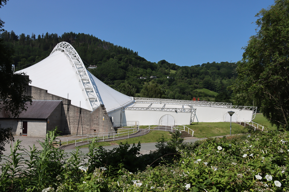
The easiest place to park if you are heading up from the valley is the International Eisteddfod Pavilion (marked as the Royal International Pavilion on the map), which offers a really lovely walk along the canal to arrive at the canal bridge where you cross to begin the walk.  The second approach is much shorter and takes you from the Offa’s Dyke Path, a single-track road that follows the line of the hill, and has spectacular views; there is no official parking here, although there is space to pull over and park for about 4-5 cars (being careful to leave passing spaces) and this gets full very quickly on fine days.  

Both routes require sensible footwear, whatever the weather.  I was wearing some excellent lightweight hiking trainers with heavy tread, perfect for a hot day, but in damper seasons I would go for hiking boots.  Although the path starts off metalled in Llangollen itself, mainly because it is one access point to the local school, it becomes much more uneven underfoot as the path goes on, with patches of coarse bedrock and scatterings of loose scree.

The Eisteddfod Pavilion is on the A539 on the way out of Llangollen towards Valle Crucis and the Horseshoe Pass.  The car park is big, with a pay and display system.  From here, go up out of the car park towards the canal bridge, and go down on to the towpath to the left of the bridge, turning to the right under the bridge to head east in the direction of Llangollen.  This is a lovely stretch of canal, passing the marina on your left.

When you reach the next canal bridge, with a cafe on the right, walk up on to the bridge.  Directly in front of you, heading straight up a short flight of stairs, is the public footpath.

From here on it is easy to find your way.  Just keep going straight up.  You first pass the school on the left, and a field on the right, with a gate at the top of this first stretch.  Go through the gate, cross the lane, and keep going up the other side.

You will pass various attractive buildings along the way, the largest of which is the Grade II listed Dinbren Hall, built with conviction but without a great deal of imagination in a very lovely location in 1793.

Soon you will reach another gate.  This has signage on the other side of it warning to inform you that you have now arrived at the foot of the hill, and to keep dogs on a lead (there are sheep all the way along this walk).

It is less even underfoot from here, with a very short uneven patch, but you will find that just over the other side the path opens out onto the hillside, with a clear view of the path ahead.

A very short uneven section of path, but it evens out just on the other side


Beyond this, along the steepest part of the route, the ziz-zag path marked on the map is beautifully maintained at the time of writing, with occasional stretches provided with a hand rail and long shallow steps where required.

This brings you out at the the west end of the castle, where the Victorian camera obscura and teashop used to be located.  If you are approaching from the other side, via the Offa’s Dyke Path, you will find a similar zig-zag arrangement to provide a less strenuous way up the hill than heading straight up the side.

Eastern approach to the castle

You can easily turn this into a circular walk from the Eisteddfod pavilion. For the quickest of the two easiest routes, come down from the castle onto the lane under the limestone escarpment and head downhill along the Wern Road, which takes you back to the canal bridge.  For a longer but really attractive route, continue along Offa’s Dyke Path, past Wern Road, which eventually heads downhill and comes out at the Sun Trevor on the A542; cross the road, cross the canal bridge, turn right and walk back along the towpath into Llangollen.  Although this is a much longer way back, it is all metalled lane and nicely maintained towpath, so is very easy underfoot.

Sources

Ordnance Survey Explorer no.256: Wrexham/Wrecsam and Llangollen.  Particularly useful if you want to make this into a circular walk, or to visit other local sites like the Horseshoe Falls and Valle Crucis Cistercian abbey.

If you are particularly interested in medieval architecture in the Denbighshire area, do download their bi-lingual PDF booklet Enjoy Medieval Denbighshire.

Map showing sites featured in the “Enjoy Medieval Denbighshire” PDF

Books and papers

Berry, D. 2016 (4th edition). Walks around Llangollen and the Dee Valley.  Kittiwake Books

Davies, John 2007 (3rd edition). A History of Wales. Penguin.

Davis, Paul R. 2021. Towers of Defiance. The Castles and Fortifications of the Princes of Wales. Y Lolfa

Kightly, Charles 2003.  Castell Dinas Brân Llangollen.  Denbighshire County Council (bilingual booklet with excellent illustrations, artist reconstructions, photographs and information)

Jenkins, David A. 1991.  The Environment: Past and Present. In (eds.) John Manley, Stephen Grenter and Fiona Gale. The Archaeology of Clwyd. Clwyd Archaeology Service, p.13-25

Jones, N. W., 2020. Castell Dinas Brân, Llangollen, Denbighshire: Condition Survey. Unpublished report. CPAT Report No. 1739
https://coflein.gov.uk/media/366/634/cpatp_144_001.pdf

Roserveare, M. J., 2017. Castell Dinas Bran, Llangollen, Denbighshire: geophysical survey
report. TigerGeo Project DBL161.

Tregellas, Walter 1864. Castell Dinas Bran Near Llangollen, Denbighshire. The Archaeological Journal, 21, p.114–120
https://archaeologydataservice.ac.uk/archiveDS/archiveDownload?t=arch-1132-1/dissemination/pdf/021/021_114_120.pdf

Turvey, Roger 2002. The Welsh Princes. The Native Rules of Wales 1063-1283. Pearson Education

Venning, Timothy 2012. The Kings and Queens of Wales. Amberley


Websites

Coflein
Castell Dinas Bran
https://coflein.gov.uk/en/site/307064/

Clwydian Range and Dee Valley
Dinas Brân
www.clwydianrangeanddeevalleyaonb.org.uk/projects/dinas-bran/

CPAT
Historic Landscape Characterization: The Making of the Vale of Llangollen and Eglwyseg Historic Environment
https://heneb.org.uk/archive/cpat/projects/longer/histland/llangoll/vlenvi.htm

Heneb
Castell Dinas Brân, Llangollen
https://heneb.org.uk/cy/project/castell-dinas-bran-llangollen/
Dinas Brân, Llangollen Community, Denbighshire (HLCA 1150)
https://heneb.org.uk/hcla/vale-of-llangollen-and-eglwyseg/dinas-bran-llangollen-community-denbighshirehlca-1150/

Recclesia
Castell Dinas Bran
https://recclesia.com/our-work/castell-dinas-bran

Scottish Geology Trust GeoGuide
Dinas Brân
https://geoguide.scottishgeologytrust.org/p/gcr/gcr19/gcr19_dinasbran


You can explore the castle from afar via this Sketchfab 3D model by Mark Walters.


A video showing the two main stages of occupation of the Dinas Bran hill, on the Clwydian Range and Dee Valley website, beginning with the hillfort and moving on to the medieval castle.

xxx

An autumnal stroll from Churton to Aldford, pausing for lunch at The Grosvenor

Autumn sun and brightly coloured leaves are always a joy at this time of year, right up until the point that they drop in huge numbers and need clearing off the garden lawn 🙂

Because it was so warm, my destination was The Grosvenor pub, a self-indulgent extension to my terrific short break in the Ironbridge area of Shropshire last week.  It is always such a treat to be able to sit outdoors at this time of year.

The map of this walk is at the end of the post, and is a very simple one.  It takes around 40 – 45 minutes to walk through the fields to Aldford from Churton, so it is a short walk, and always a good fall-back when I don’t want to be bothered with the car.  The harvested fields, mainly used for growing corn, can be very soggy at this time of year with nothing but wet earth under foot, but it is always an easy and attractive option on a sunny day when the leaves are changing colour.  It was fine on the field edges, although distinctly squelchy underfoot crossing diagonally from footpath FP7 to FP6.  Half of the route is the metalled B-road Lower Lane, which gave the hiking boots a bit of a break from the sludge.

Irritatingly, I did not have my camera with me, so these were taken on my iPhone and many don’t bear close scrutiny.
===

=====================

======

===

===

After a very enjoyable lunch in the sun at the Grosvenor Arms, I had a wander around the village and returned back to Churton using the same route.  Normally I go back via the well-signposted FP8 footpath, but having investigated on my way to Aldford, deemed it far too muddy and waterlogged to make the attempt in anything other than wellies.  In the dry, this is a nice return route and takes in a chunk of the Roman road that once ran east of Churton (about which I posted here).

===

===

===

===

===

===

===

===

Cheshire West and Chester Public Map Viewer, annotated


A walk from Waverton towards Chester along the Shropshire Union Canal

I have driven over the canal bridge on Eggbridge Lane in Waverton so many times thinking that I really must take advantage of the little car park just before the bridge to go and take a stroll down the towpath.  Having woken up early on a sunny morning I decided to investigate. Waverton is just off the A41, so very easy to reach. The car park is quite small, but it was not full even on a bright and warm morning.  The What3Words address for the car park is ///fingertip.snored.deals

Victoria Mill, Waverton

Immediately opposite the car park, as you walk to the towpath, is a very attractive canal building, the Grade 2 listed, a mid-19th century Victoria Mill, a former steam-powered canal-side corn mill, with bays for loading and unloading narrowboats, and now converted for modern use. The Historic England description is here.  This is part of the heritage of the Shropshire Union Canal, which if you keep walking north eventually ends up at Ellesmere Port.  To the south, it eventually connects up with the rest of the main canal network at Hurleston Junction.  The Shropshire Union has quite a complicated history, as does Chester’s canal heritage as a whole, and was not completed until 1835.

As with most canal walks, there’s always a choice to turn right or left, and as I had no idea what to expect from either direction I decided to head north, leaving the walk south for another occasion. Out of the car park I turned left under the unprepossessing bridge no.119 and headed up the towpath.  This section is metalled, so it avoided the mud and sludge that I had been half expecting.

If you take this route you find yourself walking along a short row of houses with canal gardens along a metalled pathway.  Canal-side gardens are always fascinating.  I used to live on a narrow boat many years ago, and it is always a lot of fun to see how different minds have dealt with a garden that opens directly on to a canal.  These are always hugely individualistic and personal.  There is always much to see in the way of garden furniture, garden ornaments (someone will always have gnomes, and there is usually at least one example of traditional canal painting), sheds in various states of repair, a wide range of summer houses, varieties of approaches to terracing, often some very interesting specimen trees and shrubs, and different attitudes to garden seclusion, along a spectrum from solid barriers of hedging or fencing to a complete lack of interest in any form of privacy.  A real cultural treat.

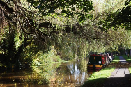
After just a minute or so the towpath enters a more rural section, and in the late season sun it was a real pleasure to take in all the autumnal colours on trees and shrubs that flank the canal.  I’ve posted some of the photos below. It’s a well-used section of towpath, with joggers, cyclists and plenty of dog walkers, but everyone is very civilized about moving over to make passing easy.  There was not much in the way of canal traffic, with just two narrowboats on the move, but I expect that it is much busier in summer.

Keep an eye out on your left as you leave the housing on your right and reach the more rural section.  Partly concealed by the grass next to the towpath, there is a short inscribed red sandstone Parish Boundary Marker. This section of the canal passes through the parish of Rowton, famous for the Civil War Battle of Rowton Heath (see the Wikipedia entry on the subject and a more detailed analysis by Historic England).  King Charles I is said to have watched his army lose that battle from the Phoenix Tower that still stands on Chester’s city walls. The stone marks the boundary between the parishes of Christleton (CP on the stone) and Rowton (RT).  The date commemorates the date of the battle in 1645 and, below the level of the grass, 1995, the 250th anniversary of the battle.
===

After this more countrified section there are more houses, all interesting, with some lovely weeping willows and other water-loving species, and a very attractive hump-backed bridge, that I have since discovered carries Rowton Bridge Road into Christleton.  I walked up as far as The Cheshire Cat, which sensibly has a gate onto the towpath, and carried on just a short way beyond it, but at that point the canal converges closely with the A41 (Whitchurch Road) and it becomes quite a noisy experience with the unremitting traffic, especially during the week.

Checking the map later (for example see the plotaroute.com website), I note that by coming off the towpath at Rowton Bridge it is possible to walk into the attractive village of Christleton, with its marvellous pond, and I would have done this had I realized.  Another time.  had to be somewhere else in the afternoon, so it was a short walk, probably an hour and a bit there and back at strolling pace, with pauses to let bicycles pass, and to take photographs.

For those with unwilling legs (see the blog’s Introduction for details about what this refers to), the towpath heading north from Waverton is metalled, but quite uneven.  No problem for most people, I would have thought but do keep an eye on it.  There are places where the edges of the surface are particularly uneven, but this just means that if you are with someone else you need to go in single file for short sections.  Otherwise, it’s on the flat and very enjoyable.

On the way back I followed the towpath beyond the car park for a few minutes to see how far the housing that backs onto the canal extended.  This part of the towpath is not metalled, was muddy and is single-track.  These houses and gardens are another interesting mixture – each of the sections of housing and gardens has its own personality, presumably reflecting both when it was built and the pricing.  These look as though the garden-canal margins were all designed with narrowboats or other canal vessels in mind. There was indeed one narrowboat moored up at a garden.  The housing stops after a couple of minutes and the towpath reverts to a far more rural appearance.  I’ll investigate further on another day.

A visit to the 12th century Birkenhead Priory #1 – The Medieval buildings

Introduction

The chapter house

Birkenhead Priory is one of the most enjoyably unexpected places I have visited in the region, even more surprising than a Roman bath-house embedded in a 1980s Prestatyn housing estate.  The priory site incorporates both the remains of the 12th century monastic establishment and the ruins of St Mary’s 1822 parish church with its surviving tower and terrific views.  On all sides the site is surrounded by both heavy and light industry.  Cammell Lairds shipyard not only butts up against the south and east walls, but purchased part of the priory’s former churchyard and cemetery for its expansion and the building of Princess Dock.  On the other sides are warehouses and commercial units.  The result is that in spite of the clanging and banging from the vast ship under construction immediately next door (fascinating in its own right), the obvious and somewhat inescapable cliché is that the ruins of the priory and parish church are an oasis of peace in the midst of all the busy activity.  The small but quiet stretches of grass, the trees and the wild flowers contained within the remains of the priory site are a treat, and the splendid views from the top of St Mary’s tower are a powerful reminder of how the world has changed since the foundation of the priory.

I have divided this post into two parts, because there is so much to say.  A visit to Birkenhead Priory is really five visits in one.  In chronological order, a visit to the site provides you with the following heritage:

  • 1) The priory, established in the 12th century and built of red sandstone, is the oldest part of the site and the star turn with its vaulted undercroft and chapter house
  • 2) St Mary’s parish church was built next to the ruins in 1821 to serve the growing community, its gothic revival windows wonderfully featuring cast iron window tracery
  • 3) The priory’s scriptorium over the Chapter House, now with wood paneling over the sandstone walls, is the exhibition area for the Friends of the training ship HMS Conway,
  • 4) The Cammell-Laird shipyard is hard up against the priory’s foundations and fabulously visible from St Mary’s Tower. When it wished to expand into the church’s churchyard, it purchased the land and re-located the burials
  • 5) St Mary’s Tower, which is open to the public with amazing views from the top, is now a memorial to the 1939 HMS Thetis submarine disaster in the Mersey.

In this part, part 1 I am taking a look at the priory.  In part 2 I have looked at the post-dissolution history of the site; the 1821 construction of St Mary’s parish church; the memorial to HMS Thetis and the display area for HMS Conway.  I will tackle Cammell Laird’s separately, as I suspect that it will be very difficult to handle in a single post, and I need to do a lot more research before I make the attempt to summarize its history.

Birkenhead in the foreground with the manor and ruins of the monastery, and Liverpool in the background over the river, c.1767, showing just how isolated Birkenhead remained even in the 18th century. Attributed to Charles Eyes. Source: ArtUK

Foundation of the priory in the 12th Century

Artist’s impression of the priory done by E.W. Cox by 1896.

The priory was dedicated to St Mary and St James the Great.  There are no documents surviving from the priory, and none of its priors became important in other areas of the church or in life beyond the priory, so most of the information comes from other sources of documentation as well as from the architecture itself. Its principal biographer, R. Stewart-Brown, writing in 1925, commented that it was “not possible to compile anything in any degree resembling a history of this small and obscure priory,” but the result of his work was an impressive overview of the priory, its financial stresses and its involvement in the Wirral as a whole and the Mersey ferry in particular.  Much recommended if you can get hold of it.  Although not certain, is thought that the priory was founded in the mid-12th century by one of William the Conqueror’s Norman followers who was rewarded for his service to the new king and the local earl Hugh Lupus with land on the Wirral.  His name was Hamon (sometimes Hamo) de Massey from Dunham Massey, the second baron, who died in 1185, suggesting that the priory was founded before this date, probably in the middle of the 12th century.

Exterior of the west range, showing the two big windows that illuminated the guest quarters, the one on the left heavily modified.

The priory was established on an isolated headland, surrounded on three sides by water.  Hamon almost certainly took as his model for the priory the abbey of St Werburgh in Chester (now Chester Cathedral) which was founded in 1093 by Hugh d’Avranches, also known as Hugh Lupus.  Hugh Lupus had convinced St Anselm of Bec (later Archbishop of Canterbury and after his death canonized) to come and establish St Werburgh’s, and it was organized along classic Benedictine lines, about which more below.  The founding of a monastic establishment was seen as a Christian act, a statement of piety and devotion, and was most importantly a precautionary investment in one’s afterlife, securing the prayers of the monks, considered amongst the closest to God, throughout the entire lifetime of the monastery

A priory was smaller and inferior in status to an abbey and was was often dependent (i.e. a subset) of an abbey, and answerable to it.  It is possible that the much larger and infinitely more prestigious St Werburgh’s Abbey in Chester supplied the monks to establish Birkenhead Piory, but there is no sign in the cartularies (formal documents and charters) of St Werburgh’s that there was any ongoing formal connection between the two.  The difference between a non-dependent priory and an abbey was usually that the priory did not have sufficient numbers to be classified as an abbey, or that it had not applied for the royal stamp of approval required for the more senior status of an abbey. The minimum requirement for the foundation of a Benedictine abbey was 12-13 monks.  A 16th century historian suggested that there were 16 monks, but it is by no means clear where this figure came from.  Twice during the 14th century it is recorded that there were only five monks at the priory, and it is very likely that the priory remained too small to become an abbey.

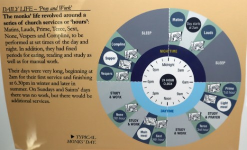
The typical monastic day in a Benedictine monastery. Not a great photo, but a very nice representation from a display in the museum area in the undercroft

The Benedictine Order was not the oldest of the monastic orders in Britain, but following the Norman Conquest it became the most widespread.  It was named for St Benedict of Nursia who, in the 6th century, set out a Rule, or set of guidelines, for his own monastery.  This spread widely and became the basis of many monastic establishments setting out to follow his example.  The Benedictines had been well established in France at the time of the Conquest, and sponsorship by incoming Normans, granted land by William the Conqueror, ensured that they spread rapidly in England, and later Wales, Scotland and Ireland.  Benedictine monasteries were all built to a standard architectural layout, with minor deviations, based on both religious and administrative requirements.

The monastic buildings

Plan of the Birkenhead Priory site.  Source: Metropolitan Borough of Wirral leaflet (with my annotations in colour). North is left, south right.

If you take the guided tour, which I sincerely recommend, you begin your tour in the undercroft, now used as a museum / display space.  Most helpfully it has a scale model of the priory with Stewart-Brown’s 1925 site plan, both of which help you to orientate yourself and get a sense of how the ruins were once a complex of buildings that defined and enabled a monastic community, combining religious, administrative, domestic and other functions.  In the plan on the left, with the surviving remains of the priory outlined in red, the site of the priory church outlined in orange and remains of the 1822 St Mary’s Church outlined in green. The blue margin indicates the shipyard over the priory wall.  The numbers on the plan are referred to in the description below.  You can download a copy of the map (without the coloured additions) as a PDF here.

Like St Werburgh’s Abbey, the priory buildings were made of locally available red sandstone.  Like all monasteries based on Benedictine lines, the monastic site plan began with a square.  The bigger the monastery envisaged, the bigger the square.  This was known as the garth (1 in the plan on the left), and was either a grassed area or a garden.  Surrounding this was the cloister, a covered walkway that served as a link between the buildings that were erected around the garth, and where desks were usually arranged so that the monks could work.  This was a secluded space, confined to the inmates of the monastery.

Model of the priory church and claustral buildings in the priory’s museum space in the undercroft showing a possible layout of the church.  The chapter in this view is hidden behind the tower.

The most conspicuous of the buildings would have been the one that no longer stands:  the church and its tower (4 on the plan above, outlined in orange), which made up one side of the cloister.  Traditionally in Benedictine complexes this was built on the north side of the garth, making up an entire side of the cloister, in order protect the rest of the buildings and allow light into the garth and the other cloister buildings, but at Birkenhead Priory’s church was on the south, possibly to protect the claustral buildings from the winds whistling down and across the Mersey. The model and plan show that the 13th century church was built in the standard cross-shape.  It featured a long nave at the west end (where the public were permitted to observe religious ceremonies), and a surprisingly long east end (where the ceremonies were performed) with two side-transepts, which were usually used as chapels for commemorating the dead and a tower over the crossing. A pair of aisles flanked the south and north transepts as show above.  When it was first built in the 12th century, the church would have been much smaller and probably smaller than this footprint.

View of Birkenhead Priory by Samuel and Nathan Buck in 1726, showing the remains of the church’s northern arcade.  Source: Panteek

Lonely remainder of the church’s northern arcade

The entrance to the chapter house with its Norman arches. You can clearly see the difference between the 12th century chapter house masonry and the 14th century scriptorium above with its gothic window and tracery. The tower in the background belongs to the 19th century church.

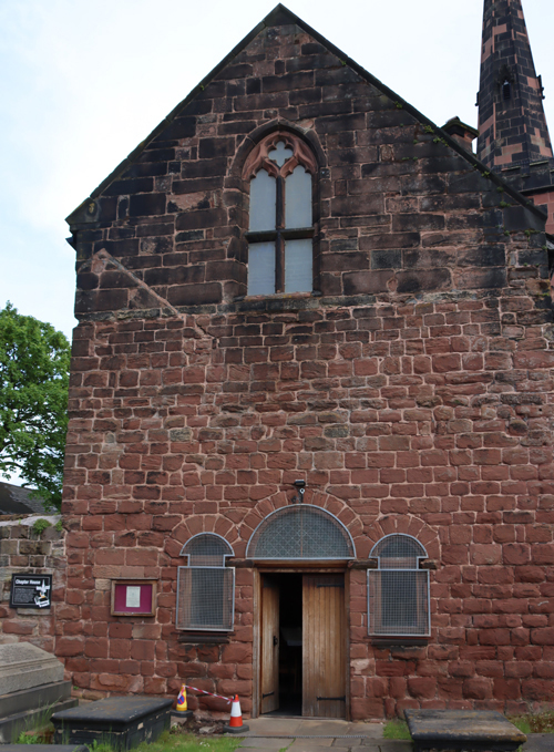
The chapter house (2) is the oldest of the Birkenhead Priory buildings, the only one remaining that dates to the 12th century.  The building of the priory church, being the place where the main business of praising God took place, was usually started straight away, but the chapter house was often built in tandem as this was also of fundamental importance to a monastery.  This is where the everyday business of the priory was attended to, from the day-to-day administration and disciplinary matters, to the daily readings of chapters of St Benedict’s Rules or other improving texts such as excerpts from one of the many histories of saints (hagiographies).  The Birkenhead Priory’s original medieval chapter house is a gorgeous. The vaulted roof of the chapter house is superb (see the photo at the very top of this post), and although the windows have been altered over time, one of the deep Norman Romanesque window embrasures survives, and is a thing of real beauty (see below).  The stained glass is all modern, but all are nicely done, the one over the altar by Sir Ninian Cowper combining religious themes relevant to the house (St Mary and St James flanking Jesus) with two prestigious characters from the priory’s own history (its founder Hamo de Massey and its two-time visitor Edward I).  Gravestones from the medieval cemetery have been incorporated into the floor around the post-Dissolution altar.  In the medieval priory, there would have been no altar in the chapter house, but following the Dissolution the chapter house was converted into a chapel and is still used for weddings, funerals and baptisms. 

Over the top of the chapter house, a scriptorium was added in the 14th century. In theory this was where the copying of books took place, but it has been pointed out that this was a particularly large space for such an activity, and it may have been used for something else, or for a number of different activities.  Today it is the display area for the training ship HMS Conway, and at some point in the 19th or early 20th century was provided with panelling and has some very fine modern stained glass by David Hillhouse.  This modern usage will be discussed in part 2.

Opposite the chapter house the remains of the west range (7-11) survives, which was again a two-floor building separated into a number of different spaces  It seems to have been divided into two, with the northern end and its big fireplace reserved for guests, and the southern end, with an entrance into the cloister, seems to have been split into two floors, with a fireplace on each, for the prior’s personal quarters, which would have included a private parlour that he could use for entertaining VIP guests.  Although it’s not the most aesthetically stunning of the surviving claustral buildings today, the stonework displays a fascinating patchwork of different features and alterations that reflect many changes and refinements in use over time and are still something of a fascinating puzzle.

West Range

Remodelling in the 14th century created the undercroft and the refectory above it, as well as the kitchen.  The undercroft (14), once used as a storage space, with the original floor intact. The investment in the lovely architecture may indicate that before it was used as a storage area, it had a more high profile role, perhaps as a dining area for guests.  Above it was the refectory, unlike St Werburgh’s, Basingwerk Abbey or Valle Crucis Abbey, all of which had refectories at ground level.  It was reached by a spiral stone staircase leads up to this space today.

The kitchen was apparently to the north of the west range, and connected to it, as shown on the above plan (12).  This was convenient for the guest quarters, but not quite as convenient for the refectory over the undercroft, from which it was divided by a buttery (or store-room, 13), over which a guest room was also installed.   The kitchen was apparently a stand-alone structure made mainly of timber, and this may have been because kitchen fires were so common, and building the kitchen slightly apart from the main monastery would have been a sensible precaution.  Kitchen fires are thought to have been the cause of several devastating scenes of destruction in monastic establishments, spreading quickly via roof timbers and wooden furnishings.

Between the chapter house and the north range, which contained the undercroft and refectory, was an infirmary (19 on the plan) and the dormitory (18) side by side, each accessible from the cloister.  The infirmary was for the benefit of the monks, and was where those who were sick or injured or suffering the impacts of old age were cared for.

Sources of income and financial difficulties

Carved head in the side of the fireplace in the guest quarters on the ground floor of the west range

Monasteries were amongst the most important land-owners in medieval Britain, on a par with the aristocracy.  Their income came mainly from agricultural activities, both crops and livestock, as well as making and selling bread, beer, buttery and honey; but they might also own mills, mines, quarries and fisheries and the rights to anchorage, foreshore finds and the use of boats on rivers. For those with coastal and estuary locations with foreshore rights, there was, as Stewart-Brown lists, the benefits of flotsam (items accidentally lost from a boat or ship, jetsam (items deliberately tossed overboard), salvage from shipwrecks and keel toll.  The luckier (or most strategically inclined) monasteries and churches also had pilgrim shrines, sometimes reliquaries imported from overseas. St John’s Church in Chester had a miraculous rood screen, St Werburgh’s Abbey in Chester had the shrine containing the bones of St Werburgh herself, and Basingwerk Abbey had the neighbouring holy well of St Winifred.  These attracted donations and bequests and were good for the settlements in which they stood, because the pilgrims needed places to stay, food and drink, and would probably buy souvenirs.  Birkenhead Priory had no such shrine, but it probably felt the impact of the pilgrim route as the ferry crossing over the Mersey, which it ran free of charge, was an important link between Lancashire, west Cheshire and northeast Wales.

Some of the monastic landholdings on the Wirral. Source: Gill Chitty, on Merseyside Archaeology Society website

The original foundation of the monastery would have included both the land on which the monastery sat, funding for building it, and an economic infrastructure of landholdings as well as the income of some local churches. The long list of land-holdings sounds impressive, but most of them appear to have been quite small and scattered, some of which will have been wooded and some wasteland, not all of it suitable for cultivation or pasture. These include lands in Birkhenhead (including the home farm in Claughton with its mill), Moreton (with a mill and dovecote), Tranmere, Higher Bebington, Bidston, Heswall, Upton, Backford, Saughall, Chester, Leftwich, Burnden at Great Lever in Middleton, Newsham in Walton, Melling in Halsall, and Oxton.  Either at foundation or not long afterwards, the priory was granted the incomes of the churches of Bidston, Backford, Davenham and half of the church of Wallasey, and claimed rights of Bowdon church that were disputed.

Carving at the base of a window arch in the west range

The monastery did not flourish with these assets.  In spite of the claim that there were 16 monks at the time of its foundation, the records made by official church visitors suggests there were only a small number of monks at any one time (only five in 1379, 1381, and 1469, and seven, including two novices, in 1518 and 1524), and there is plenty of evidence to indicate that the priory struggled financially.  Monasteries had significant overheads including feeding the community, buying tools and supplies, repairing monastic and farm buildings, appointing stewards and other employees, providing charitable alms and providing hospitality free of charge.  Where they earned incomes from churches and chapels, they were also responsible for the provision of the clergy and shared part of the cost of maintaining the buildings.  Ambitious priors often invested in building projects, sometimes to improve the monastic offering, sometimes for prestige, and even with donations this was usually costly.  There were also occasional challenges to bequests made to churches from following generations, which involved costly legal proceedings.  Balancing the books was a frequent problem for monastic establishments, and the priors of Birkenhead Priory were no different.

There were quite limited means by which the priors of Birkenhead might increase their income.  The most obvious way of generating ongoing income was to acquire more land through gifts and bequests.  In this endevour the priory probably had a real disadvantage in being near to both St Werburgh’s Abbey in Chester and, across the river Dee, Basingwerk Abbey at Holywell.  Both abbeys had significant land-holdings on the Wirral, and both had pilgrim shrines and were on pilgrim routes.  Both were large and prestigious, and were far more likely to attract big gifts than a small and rather remote priory.  If Birkenhead hoped to attract gifts of land, it probably had to depend on local landowners and merchants who felt a personal connection with the priory but would not necessarily have had the wherewithal to significantly change the income-earning potential of the priory, providing personal items rather than swathes of land. For these very local gifts and legacies, it is entirely possible that the priory was also in competition with contemporary parish churches on the Wirral.  There are records in the early 16th century, not long before the monastery was closed during the Dissolution, that give an idea of the sort of bequests made by local people in return for requiem masses to be recited for their souls:  one will provided a painting of the Crucifixion for the priory church.  Another bequeathed the owner’s best horse, 10 shillings, and a ring of gold.

As the Middle Ages progressed, populations expanded and both new and old towns began to hold markets where everyday goods and more prestigious products could be traded, even once-isolated monasteries found themselves becoming integrated into the secular world and in competition with it.  It certainly did not initially help the monks at first that during the early 13th century Liverpool began to grow.  Under the Benedictine rules, monasteries had an obligation to provide hospitality to visitors when required, and the Birkenhead monks ran the ferry over the Mersey as a charitable service.  When the priory was first established, offering occasional hospitality and running the ferry free of charge were not onerous.  This changed rapidly after 1207 when Liverpool was granted burgh status by King John, as the following translation of the original Latin charter confirms (Translation from Picton 1884):

The 1207 charter of Liverpool by King John. Source: Royal Charters of Liverpool leaflet

John, by the grace of God King of England, Lord of Ireland, Duke of Normandy, Aquitain, and Earl of Anjou, to all his faithful subjects who may have wished to have burgages in the town of Liverpool greeting. Know ye that we have granted to all our faithful people who may have taken burgages at Liverpul that they may have all liberties and free customs in the town of Liverpul which any free borough on the sea hath in our land. And therefore we command you that securely and in our peace you come there to receive and inhabit our burgages. And in testimony hereof we transmit to you these our letters patent. Witness Simon de Pateshill at Winchester on the 28th day of August in the ninth year of our reign.

A little later Liverpool was granted the right to hold markets and fairs, and the links between Liverpool and the busy port of Chester grew to be increasingly important. There was no infrastructure to cope with this increase in human traffic. They were already offering a ferry service free of charge but even more pressing on their resources was the cost of housing guests.  There were no inns between Liverpool and Chester (showing a lack of commercial ambition on the part of both Liverpool and Chester medieval merchants!), so the monks found themselves obliged to offer accommodation and food, which the rules of the Benedictine order required them to offer free of charge.  This hospitality became particularly difficult if there was a spell of bad weather, during which those waiting to cross from Birkenhead to Liverpool would have to wait at the priory until the weather improved and crossings could resume.  They were also were troubled with all the through-traffic that travelled along a route that ran through the monk’s Birkenhead lands close to the priory buildings.

The spiral staircase from the undercroft into the former refectory

It must have exacerbated the monks’ financial situation when Edward I visited the monastery twice with his entourage during this period.  Edward’s first visit was in September 1275 for three nights, seeking a diplomatic solution to his dispute with the self-styled Prince of Wales, Llywelyn the Last of Gwynedd. His second was in 1277 for six days with the apparently dual motives of pursuing his campaign against Llywelyn and receiving a delegation from Scotland to settle a boundary dispute.  Although the king would pay the costs of his entourage and horses, the cost of entertaining the king and his most senior advisors fell to the monastery.  Hosting a royal entourage was notoriously expensive, and any contributions made by a visiting monarch to a monastic establishment only rarely compensated for the outlay.

One of the measures to improve their income in the 1270s involved the expense of serious litigation when incumbent prior claimed that the church had been presented in its entirety to the priory.  This was disputed by the Massey family, who triumphed in the courts.  Fortunately for the priory, in 1278 the 5th Hamon de Massey came to an agreement with the monks to their benefit.  Other litigation occurred over pasture rights in Bidston and Claughton.

In 1284 the priory received permission from Edward I, who had probably witnessed the priory’s problems at first hand in the 1270s, to divert the road that disrupted the priory “to the manifest scandal of their religion” and to provide the priory court with an enclosure, either a ditch, hedge or wall, to preserve its privacy.  This would have incurred costs, but would have eased one of the problems caused by the ferry.  Rather more significant for their finances, early in the 14th century the priory was granted a licence to build and charge for guest lodgings at the ferry at Woodside, and in 1311 they were granted the rights to sell food there.  It was at this time that the church was expanded, which would have been a significant project.

Chapter house building with scriptorium room added over the top in the 14th century.

The first half of the 14th century had been hard for most of western Europe, with both famine due to anomalous weather conditions that caused crops to fail, followed only a few decades later by  a plague that killed huge numbers of people.  In Britain the famine lasted from 1315-17 and the Black Death arrived in 1348. The priory survived both the famine and the plague, as did the settlement of Liverpool, now a century old.  At some point in the first half of the 14th century, the priory acquired land in Liverpool so that the monks could begin to trade their goods at market, building a granary or warehouse on Water Street (then known as Bank Street).

In 1316 the hospital of St John the Baptist in Chester was judged to be seriously mismanaged and was put into the hands of the priory, perhaps because of their experience running their own infirmary.  This was a failure, merely adding to the priory’s problems, and was removed from their care in 1341.

Multiple layers in the west range, with a  window added into the top of a former fireplace, blocking it, and a fireplace above it.

In 1333 Edward III requested monasteries to contribute to the expenses of the marriage of his sister Eleanor.  Local monasteries who contributed included Birkenhead, which contributed £3 6s 8d and Chester’s St Werburgh’s Abbey which, bigger and more prosperous, gave £13 6s 8d.  There were doubtless other payments of this sort, occasional and therefore unpredictable, and impossible to resist.  The priory was also liable for taxation.

The ferry from Woodside had continued to be supplied free of charge, but the priory appealed to Edward III and was permitted for the first time to charge tolls in 1330, setting a precedent that remains today.  A challenge to the monk to operate the ferry and claim the tolls, was challenged by the Black Prince in 1353, but the priory produced its charter and successfully resisted the removal of this privilege.  The tolls charged were recorded at that time:  2d for a man and horse, laden or not; 1/4d for a man on foot or 1/2d on a Saturday market dasy if he had a pack

Other ways of generating income from lands to which they had rights were also explored, and from records of litigation against them, they were often accused of infringing forest law.  Wirral had been defined as a forest by the Norman earls of Chester, which restricted how the land could be used.  The monks were clearly assarting (cutting down wood to convert to fields and pasture), reclaiming waterlogged land, enclosing certain areas and cutting peat for fuel. The priory was able to argue special exemptions for some of the charges, and produced the charters to prove it, but at other times they were fined for the infractions.  In 1357, for example, they were fined for keeping 20 pigs in the woods.

A number of monastic establishments seem to have responded to surviving the plague by redefining themselves via architectural transformations.  Whatever the reasons for this trend, Birkenhead Priory was no exception and the 14th century could have been an expensive time for the monks.  The frater range (including the elaborate vaulted undercroft and the refectory) was completely rebuilt and the west range was remodelled.  The room today described as a scriptorium was also added over the chapter house at this time.  Although Stewart-Brown suggests that much of this could have been accomplished with “pious industry . . . without much cost” with the assistance of donations of labour and money, that is probably somewhat optimistic, and there would have been an outlay.  Certainly, at the end of the century the priory was considered to be so impoverished that it was exempted from its tax contribution.

There is some evidence that for at least some of the Middle Ages the priory rented out land rather than working it themselves, except for their home farm at Cloughton. This had the benefit of providing a dependable income if tenants were reliable, and obviated the need to appoint managers or deal with labour and handle the sale of produce, but if the cost of living went up, the fixed income that no longer purchased what it had previously afforded, and this could represent a serious problem.

Dissolution

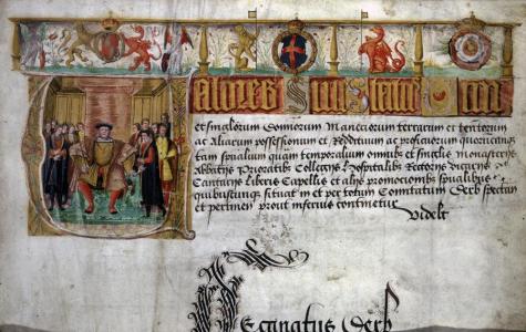
The opening page of the Valor Ecclesiasticus, showing Henry VIII. Source: Wikipedia

When Henry VIII’s demand for a divorce was rejected by the pope, the king severed Britain from the Catholic Church, creating the Church of England.  This provided him with the opportunity to acquire land and valuable assets by dissolving all monastic establishments, all of which had been subject to the papacy.  The spoils were to be used to fund Henry’s wars with France and Scotland, and some former monasteries were given to Henry’s supporters as rewards. To assess the potential of the monastic assets, Henry VIII commissioned the Valor ecclesiastis, a review of every monastery in the country.  All monastic establishments with an annual income of less than £200.00 were to be closed as soon as possible. The first monasteries were dissolved in 1536 and the process was more or less concluded by 1540, with a handful of the more prestigious abbeys, like St Werburgh’s in Chester, converted to cathedrals.  Birkenhead Priory was only earning £91.00 annually so it was amongst the first to be closed.  There was no resistance by the Birkenhead prior, who was provided with a pension of £12.00 annually.  The brethren were either dismissed or disseminated to non-monastic establishments.

Visiting

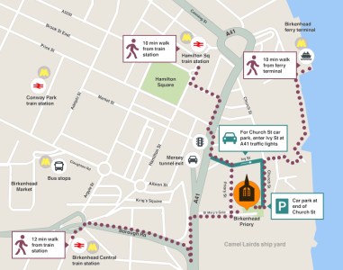
The car park is on Church Street, at the rear of the priory, where the cafe is also located.  There is some on-street parking on Priory Street at the front of the priory. Source: Birkenhead Priory website

This is a super place, and makes for a terrific visit.  Do go.  You won’t be disappointed!

Even with SatNav, the big thing to remember about finding your way to Birkenhead Priory, if you are arriving by car from the Chester direction, is to do whatever it takes NOT to end up at the Mersey tunnel toll-booths 🙂  They were very nice about it, let me out through a barrier, and gave me perfect directions to get to the priory once they had freed me from the tunnel concourse.  Very nice people.  If Edward III was looking down, I’m sure he would have rolled his eyes in despair, given that it was he who gave the monks the right to charge for their Mersey ferry crossings.

Do check the opening times on the website, as the priory is only open on certain days and for only a few hours on those days, mainly in the afternoons. There is dedicated parking on Church Street at SatNav What3Words reference ///super.punchy.report.  From there, the priory is up a short flight of steps.  You can also park on Priory Street, which is where the SatNav will take you if you simply type “Birkenhead Priory” into your SatNav (at What3Words ///indoor.vibes.hips), which offers step-free access but there is limited parking there, and it is a favourite place for van drivers to park and eat their lunches so may be better used as a drop-off point before going round the the car park.

Remnants of the decorative floor tiles, now in the priory’s undercroft, which is used as a museum space

At the time of writing, a visit is free of charge, and so are the guided tours.  My guide was the excellent Frank.  He covered not only the priory but St Mary’s, the HMS Conway room, and the HMS Thetis memorial and, when I headed up to the top of the tower of St Mary’s, directed me to out for the dry dock where the CSS Alabama (the US Confederate blockade runner) was built by John Laird, to be discussed in Part 2.  Frank was very skilled at providing sufficient knowledge to get a real sense of the place, but not so much that it became information overload.  I very much appreciated this, having always found it difficult myself to strike that particular balance.  I was lucky enough to have him to myself, having turned up at opening time, but I noticed that the next tour had a respectable group attending.

There is a small gift shop where you can also buy a really useful guide book with plenty of plans, illustrations and colour photographs.  Please note that they are not able to take cards, and payment is cash only.

There are toilets in St Mary’s tower, a picnic area behind the undercroft on sunny days, and the highly rated Start Yard café is almost next door on Church Street.

For those with unwilling legs, I would suggest that apart from the tower and its 101 steps, and a flight of around 10 steps up into the scriptoruim (the display area for HMS Conway) this is entirely do-able.  There are occasional single steps and uneven surfaces, and it is a matter of taking good care.  As mentioned above, if you park in the carpark at the rear on Church Street, there is a flight of steps into the priory, but even if there is no space in the limited street parking available at the front of the priory on Priory Street, it is a useful drop-off point for anyone needing step-free access.  You can find the SatNav references for both above.

I have posted a two-minute video of the priory, recorded on my iPhone, on YouTube:

Sources

Books, papers, and guidebooks

Baggs. A.P., Ann .J Kettle. S. J. Lander, A.T. Thacker, David Wardle 1980. Houses of Benedictine monks: The priory of Birkenhead, In (eds.) Elrington, C. R. and B. E. Harris. A History of the County of Chester: Volume 3, (London, 1980) pp. 128-132.
https://www.british-history.ac.uk/vch/ches/vol3/pp128-132

Burne, R.V.H. 1962. The Monks of St Werburgh. The History of St Werburgh’s Abbey. S.P.C.K.

Chitty, Gill 1978. Wirral Rural Fringes Survey. Journal of Merseyside Archaeological Society, vol.2 1978
https://www.merseysidearchsoc.com/uploads/2/7/2/9/2729758/jmas_2_paper_1.pdf

de Figueiredo, Peter 2018. Birkenhead Priory. A Guidebook. ISBN 978 1 9996424 0 2

Hughes, Tony. St Mary’s Parish Church, BIrkenhead, 1819-1977. n.d.
https://thebirkenheadpriory.org/wp-content/uploads/St-Marys-booklet.pdf

Picton, Sir James A. 1884.  Notes on the Charters of the Borough (now City) of Liverpool. The Historic Society of Lancashire and Cheshire, vol 36 (1884)
https://www.hslc.org.uk/wp-content/uploads/2017/07/36-5-Picton.pdf

Stewart-Brown, R. 1925.  Birkenhead Priory and the Mersey Ferry, and a Chapter on the Monastic Buildings. The Gift of the Directors of the State Assurance Company Ltd.

White, Carolinne 2008. The Rule of St Benedict. Penguin.


Websites

The Birkenhead Priory
https://thebirkenheadpriory.org/
Buildings of Birkenhead Priory
https://thebirkenheadpriory.org/about/
The medieval grave slabs of Birkenhead Priory
http://thebirkenheadpriory.org/wp-content/uploads/Graveslabs-of-Priory-Chapel.pdf

Mike Royden’s Local History Pages
The Monastic and Religious Orders in the Hundred of Wirral from the Saxons to the Dissolution of the Monasteries – A study of the Monastic history and heritage of Wirral by Norman Blake, April 2003
http://www.roydenhistory.co.uk/mrlhp/articles/students/monasticwirral/monasticwirral.htm
The Influence of Monastic Houses and Orders on the Landscape and locality of Wirral (with particular reference to Birkenhead Priory) by Robert Storrie, April 2003
http://www.roydenhistory.co.uk/mrlhp/articles/students/bheadpriory/bheadpriory.htm
The Medieval Landscape of Liverpool: Monastic Lands (with particular reference to the granges of Garston Hall and Stanlawe Grange) by Mike Royden, 1992
http://www.roydenhistory.co.uk/mrlhp/articles/mikeroyden/liverpool/monastic/mondoc.htm

ArchaeoDeath
Commemorating the Reburied Dead: Landican Cemetery
https://howardwilliamsblog.wordpress.com/2024/05/16/commemorating-the-reburied-dead/

Old Wirral
https://oldwirral.net/archaeology.html

Wirral Council
Making Our Heritage Matter. Wirral’s Heritage Strategy 2011-2014, 2013 Revision. Technical Services Department.
http://democracy.wirral.gov.uk/documents/s50009194/Wirral Heritage Strategy Appendix.pdf

Wirral History
Medieval Wirral (maps)
http://www.wirralhistory.uk/medieval.html

An online archive for for St Mary’s Church and the Priory, Birkenhead
History of the Priory and St. Mary’s Church Birkenhead
http://stmarysbirkenhead.blogspot.com/p/history-of-priory-and-st-marys-church.html


Leaflets

Birkenhead Priory Guide. Metropolitan Borough of Wirral.
Birkenhead Priory A4 leaflet Wirral

Liverpool’s Royal Charters
https://liverpool.gov.uk/media/ghdaoid3/liverpool-charter.pdf

St Mary’s Parish Church 1819-1977
https://thebirkenheadpriory.org/wp-content/uploads/St-Marys-booklet.pdf


Gop Cave and Gop Cairn near Prestatyn – # 1: Woolly rhinos and hungry hyaenas

Introduction

Gop Hill in northeast Wales, a few miles southeast of Prestatyn, and just above the village of Trelawnyd (formerly Newmarket from 1710 to 1954) is home to Gop Cave and Gop Cairn, just a few minutes apart from one another.  Gop Cairn has the distinction of being the largest man-made prehistoric mound in Wales, and when approached from a distance, its size really is impressive.  Although the cairn was investigated in the 19th century, with a vertical shaft sunk from the top to the level of the floor, and a “drift” tunnelled outward from the base of the shaft, no burial chamber or human remains were found.

The south-facing limestone cave was also investigated, producing Pleistocene zoological remains, Mesolithic stone tools and Neolithic human burials and contemporary artefacts and the bones of both domesticated and wild animals. In 1868 Boyd Dawkins excavated pre-glacial animal species such as woolly rhino and steppe bison in the cave deposits, which provided significant data about local ecological conditions. Excavations by T. Allen Glenn in the early 1920s discovered Mesolithic remains on the platform outside the cave.  Although this was a small assemblage, it is an important contributor of knowledge about the poorly understood North Wales Mesolithic.  The Boyd Dawkins excavations also produced an unusual and very important Neolithic burial chamber.  It was found in one of the upper layers, with walls made of layers of stone containing at least 14 burials.  Pottery and stone tools found with them were sufficiently distinctive to provide a chronological range, placing the burials within the Neolithic period.  Excavations conducted by John H. Morris and T.A. Glenn between 1908 and 1914 found another six burials in a previously undiscovered passageway, including two children as well as a Neolithic axe-head from the nearby Graig Lywyd axe factory and are considered to lie within the same date range as those found by Boyd Dawkins, taking the total count of individuals found up to 20.  It did not take a great leap of imagination to speculate that the Neolithic date for the cave could suggest a similar date for the cairn, although this remains unverified.

Over three posts, the Gop Hill sites are described and the work carried out summarized.  This post, Part 1, looks at the 19th century excavation of Gop Cave by Sir William Boyd Dawkins, a really rather remarkable early investigator of prehistoric habitats and fauna as well as archaeological remains. Visiting details are provided towards the end of Part 1, after which there is a list of references.  Part 2 looks in detail at the Neolithic burial within the cave, and part 3 looks at the cairn.

Sir William Boyd Dawkins, excavating 1886-1887

When I was working in caves with archaeological deposits in the mid- to late-1980s, 100 years after William Boyd Dawkins was excavating at Gop Cave, he was a very well-known name, and a respected one.  It is easy to be frustrated with the quality of the work carried out in those early investigations, some of which were far from systematic, and caves have some particular quirks of their own to contend with, but a few of these early investigators were impressive and Sir William Boyd Dawkins was one of them.

Born near Welshpool in 1837 Sir Wiliam Boyd Dawkins (1837-1929), developed a keen interest as a child in collecting fossils.  His initial field of interest was primarily geology, natural history and palaeontology, all of which have in common with archaeology a focus on stratified sequences and the relative positioning of fossils, bones and objects within those sequences.  Just as early archaeologists were interested in building up sequences of artefacts so that they could understand how human technology developed, early palaeontologists were interested in the developmental sequence of prehistoric animal and plant species. In 1860 he graduated in Natural Sciences and Classics from Oxford and in 1861 he was appointed to the Geological Survey of Great Britain. Fortunately, because Sir William found many archaeological remains during his investigations, he treated these more recent discoveries with equal interest and respect.  His earliest archaeological excavations were at Wookey Hole in Somerset where he discovered some of the first evidence of Palaeolithic (Old Stone Age) occupation.  These discoveries helped him to develop methodologies for excavating cave sites and to build up a good understanding of the type of environmental and human data that he was likely to encounter within particular geological and geomorphological contexts.  He wrote a number of important articles about extinct sub-species of rhinoceros that had once inhabited Britain. He became the first President of the Lancashire and Cheshire Antiquarian Society and President of the Cambrian Archaeological Association.  He excavated at a number of cave sites in north Wales, and his 1874 book “Cave Hunting: researches on the evidence of caves respecting the early inhabitants of Europe” became a classic.

The four phases of Gop Cave deposits

Figure 5 from Boyd Dawkins 1901, p.327 (the cavity marked as B was the Neolithic burial chamber)

When Boyd Dawkins first encountered Gop Cave, it was full to the brim with glacial, post-glacial and more recent debris and rock fall:

While the cairn was being explored my attention was attracted to a fox-earth at the base of a low scarp of limestone 141 feet to the  south-west of the cairn. It occupied a position which I have almost invariably found to indicate the presence of a cavern  used by foxes, badgers, and rabbits as a place for shelter. I therefore resolved to explore this, with the assistance of Mr. P. G. Pochin. The fox-earth led us into a cave completely blocked up at the entrance by earth and stones and large masses of limestone, which had fallen from the ledge of rock above. This accumulation of debris occupied a space 19 feet in width, and extended along the whole front of the cavern

Nothing loth, he set about clearing it in a top-down methodical way that would allow him to assess the chronological composition of the deposits.  It was a remarkable achievement, given the incredibly limited head space and the absence of more than a thin envelope of natural light.

Figure 4 showing the excavations of the cave in horizontal plan, with the sections through the deposits both outside and within the cave. Feature B is the Neolithic burial chamber. Source: Boyd Dawkins 1901, p.325

Boyd Dawkins identified four distinct phases within the cave.   These are shown in the table below and discussed beneath.  The terms Pleistocene and Holocene used in the table below refer to consecutive periods in the geological timescale.  The Pleistocene begins at around c.2.8 million years ago, covering the most recent period of repeated periods of major glaciation to 11,700 years ago, when the last glacier retreated and the planet entered its present inter-glacial phase, the Holocene. The Holocene levels at Gop Cave, which include the 14 burials (thought by Boyd Dawkins to be Bronze Age but now reassigned to the earlier Neolithic), will be discussed in Part 2.  Below is a discussion of the Pleistocene levels.

Geological Table Source: USGS

Figure 6 from Boyd Dawkins 1901, p.329

Boyd Dawkins noted that the layers were not as they would have been originally deposited: “They appear to have been washed out of the original hyaena floors by the action of water, and to have been redeposited at a time later than the occupation of the cave by hyaenas.”  The presence of stone of non-local origin also argues for different phases of water and glacial activity entering the cave, scouring the deposits and replacing them.

Boy Dawkins identified the Pleistocene fauna from the surviving bones and antlers found in the cave as follows.

  • Cave hyaena – Hycena spelaea
  • Bison – Bison priscus
  • Red deer – Cervus elaphus
  • Reindeer – Cervus tarandus
  • Roe deer – Cervus capreolus
  • Horse – Equus caballus
  • Woolly rhinoceros – Rhinoceros tichorhinus

Woolly Rhino. Source: Science

Woolly rhino (now designated Coelodonta antiquitatis), cave hyaena (now referred to as Crocuta crocuta , and sometimes Crocuta crocuta spelaea) and Bison priscus (steppe bison) are now extinct.  The steppe bison was the species painted in famous Upper Palaeolithic caves like Lascaux in France and Altamira in France.  Although Boyd Dawkins identified horse as Equus caballus, if the identification of horse was correct, it would probably have been the wild ancestor of caballus, Equus ferus. Reindeer are no longer found wild in Britain.  Of the species on his list, red deer and roe deer and horse are the only wild species that remain in Britain.  Boyd Dawkins observed that some of the remains, and particularly the antlers of “the reindeer, bore the teeth marks of hyaenas, and had evidently belonged to animals which had fallen victims to those bone-eating carnivores.”

20th Century Excavations
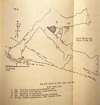
Glenn’s fold-out plan of the 1912 excavations. Source: Davies 1949

Further excavations took place during the earlier part of the 20th Century, contributing more information.

Between 1908 and 1914 John H. Morris and T. Allen Glenn investigated the northwest passage of the cave system, sometimes.  This was missed by Boyd Dawkins because it was hidden behind a blockage of clay and stalagmite.  This passage produced an additional six skeletons, two of which were children.  Glenn describes an excavation “carried out with extreme care and by modern methods” but says that due to burrowing animals there was no recognizable stratification byond determining Pleistocene and Neolithic levels.  The floor was covered to a depth of between 18 inches and 2ft “with cave earth and pieces of limestone over a hard floor of clay mixed with stalactite fragments and limestone rubble” over bedrock.   There is some indication that limestone slabs had been used to build low walls around some of these skeletons.  Finds within the cave, at the new entrance and near the cave between 1911 and 1917 were collected by Morris.  Neolithic human remains and artefacts were found, and will be discussed in Part 2.  Animal remains found were horse, sheep/goat, ox, pig, wolf, fox, bear, lynx, badger, fowl, hare, rabbit, frog, watervole, mole, stoat and fieldmouse.  The mixture of Pleistocene and Holocene species suggests that these were highly disturbed layers, probably due to the activity of burrowing animals mentioned by Allen.

The excavations linked the passage in which they were working to the second entrance, the very small opening for which is a little further along the ridge to the west, and shown on the plan at the top of this post. This is sometimes referred to as the North-West Cave, although it is part of the same cave system as the main Gop Cave.
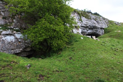
Both cave entrances in the limestone ridge.

T. Allen Glenn returned to the site between 1920 and 1921, funded by the National Museum of Wales.  He excavated the platform in front of the cave, which was largely untouched by Boyd Dawkins and found more human and animal remains, as well as Mesolithic stone tools, described below.  Glenn wrote up both his own and Morris’s excavations in one 1935 report.

In 1956 William H. Stead excavated at the site and amongst other animal remains found a lion tibia.  The reports are in the Proceedings of the Prehistoric Society, nos 23 (1957), 28 (1958) and 29 (1960).  Although I have listed them in the bibliography, I don’t have access online via the University of Chester, and the library does not have these volumes on the shelves, so I have been unable to read up on the findings.  If I get hold of them (please give me a yell if you have access to them!), I’ll update this section.

Dating the animal remains in the Pleistocene cave

Gop Cairn with the cave entrance visible on the limestone ridge just below.

There were only certain periods when Britain was actually habitable.  One reason is that harsh climatic conditions during glacial periods forced most life to leave all but the most southern areas.  For example, between c.160,00 and 80, 000 years ago the environment was too hostile for human occupation and for most animals.  Another reason is that, after 130,000 years ago the permanent chalk land-bridge between Britain and Europe was destroyed, and after this time Britain and Europe were only connected during glacial periods when the water level dropped sufficiently for land-bridges to be revealed, which enabled animal and human migratory movement.  Modern research into the climatic and environmental past has helped to clarify when land bridges between Europe and Britain enabled animals and humans to wander freely. With the final retreat of the ice sheets at around 10,000 BC the land bridges were permanently submerged. De Groote et al explain this very clearly:

Generalised reconstruction of the land surface and the extent of ice sheets of the British Isles. Source: De Groote et al 2017, fig.1 p.3

From the early Pleistocene, Britain was connected to main-land Europe by a land-bridge that enabled humans and fauna to migrate in and out (Fig. 1A). Until about 130,000 years ago, this narrow chalk isthmus, separating the north (North Sea) and southwest (English Channel) marine embayments, kept Britain connected to varying extents even when sea-levels were high during the warm interglacial periods; the eventual complete breaching of this chalk barrier was crucial in forming the island and the Dover Strait. During glacial periods, much of the earth’s water would have been trapped in the ice caps and when, during the later Pleistocene, the bed of the North Sea was exposed, a large land area known as Doggerland, created by geological uplift and sedimentation from rivers, also provided a route into the British Isles and fauna, including hominins, would have entered this way. The flooding of the shallow shelf areas of the English Channel and the North Sea are the consequence of the current high interglacial sea levels.

Even without modern scientific dating methods, reliable time-ranges can be assigned to animal bone assemblages on the basis of which species were found together in a certain place during a certain period. Boyd Dawkins had already assembled a considerable amount of data on the subject, some of which was published in his earlier work Early Man in Britain published in 1880.
AHOB time chart showing periods of human absence and occupation. Click to enlarge or see original on the AHOB website

Improvements in palaeo-zoology have helped to clarify which species were present during which periods.  Some animals that are now either completely extinct or permanently migrated out of Britain provide a latest possible date for their presence.  Studies of prehistoric assemblages of fauna have also helped to fix date ranges for the presence of certain species, assigning them to marine isotope stages (also known as oxygen isotope stages).  Marine isotope stages measure oxygen isotopes in sea water that is absorbed into the skeletons of tiny single-celled organisms called foraminifera, which are preserved in sediments on the sea floor.  The oxygen isotopes contain information about the volume of ice present globally, and therefore provide a record of alternating glacial and interglacial periods. The faunal assemblage corresponds well to MIS 3, which falls into the Middle Palaeolithic archaeological period.  Woolly rhino, for example, had left Britain by around 30,000 years ago.  The entire assemblage probably puts Gop Cave in Marine isotope stage 3 (MIS 3).  MIS 3 lasts from between 60,000 and 25,000 years ago. The conditions were ideal for woolly rhinoceros, horse, bison, hyaena, and reindeer, which inhabited temperate but cold semi-arid steppe-like conditions with often hot summers and very cold winters.  Steppes are characterized by wide open treeless grasslands, with small shrubs, ideal for grazing species, and for carnivores preying on the grass-loving herbivores.

Pontnewydd Cave entrance. Source: National Museum of Wales

Even though the idea of woolly rhino, bison and hyaena roaming the hills of north Wales, all of them now extinct, may seem distinctly exotic, these time ranges are not particularly early for Britain.  Not far away, near St Asaph, the cave site of Pontnewydd produced stone tools and human remains in association with animal species for which sound scientific dates were obtained during modern excavations.  The human remains found in association with stone tools belonged to the branch of hominin known as Neanderthal (Homo neanderthalensis, named for the type site in the Neander Valley in Germany) and the dates cluster around 225,000 years ago.  If correct, the Gop Cave date ranges are relatively recent by comparison.

Although MIS 3 corresponds to periods of human occupation in Britain during the Middle Palaeolithic there was no human habitation identified within the Pleistocene levels of the cave.  Boyd Dawkins was experienced at identifying human artefacts and would almost certainly have recognized them had any been there to be found. a number of brief occupations of the country, Britain would have been occupied intermittently during this time, depending on the environmental conditions, and probably only by small groups.  The most probably candidate for any humans dodging lions and woolly rhinos and competing with hyaenas for dining on deer, may have been Homo Neanderthalensis (Neanderthals).  The oldest Neanderthal find in Britain was from Swanscombe in Kent, where a skull dates to c.400,000 years ago, a warm interglacial period.  Neanderthals left and re-entered Britain numerous times, their movements determined by glacial and interglacial conditions, until around 40,000 years ago when the Neanderthals became extinct.

The Mesolithic

Microliths from Gop Cave, excavated by Glenn in 1920-21. Source: Wainwright 1961

The Mesolithic, corresponding to the geological Holocene, represents settlement during the earliest post-glacial period.    Although the site was small, the Gop artefacts are very typical of Mesolithic finds in the area.   The stone tools found included 6 microliths (tiny stone tools usually 3cm or less long), a scraper, two other tools of undetermined types, possibly waste flakes, and twenty three microlith and blade cores.  A core is the original piece of stone after it has been worked.  When microliths, flakes and blades have been struck from it it is discarded, but still bears the marks of the tools that were removed from it.  Of the microliths, Geoffrey Wainwright describes two were obliquely blunted, two lanceolate, and four scalene triangles.  There was also one broad point retouched on both sides and a section of a bone pin.

Distribution of Mesolithic sites in Wales. Source: Heneb Dyfed

The earliest known Mesolithic site in Wales dates to c.8600 BC (some 10,500 years ago) at The Nab Head in southwest Wales (no.5 on the map to the right).  In 2021 a 9000 year old site was found on Castle Hill, off Hylas Lane in Rhuddlan, where over 13,000 stone tools and five decorated stone pebbles were found. Another well known site is at Trwyn Du on Anglesey where a Mesolithic occupation dates to between 8,000- 9,000 years ago, and was preserved beneath Bronze Age burial mound excavated when it was threatened by coastal erosion in 1974 (no.9 on the map).

With the withdrawal of the ice sheets, vegetation re-established itself, and whilst the land-bridge remained in tact, animals once again drifted across the land, with humans in their wake.  Once the ice had fully retreated, the land-bridge was submerged and Britain and Ireland became separated both from the continent and from each other.  The island was soon occupied by many small groups exploiting inland and coastal resources, hunting, collecting plant resources, fishing and collecting shellfish.
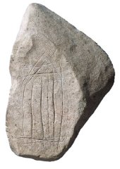
Decorated stone pebble from the Mesolithic deposits at Rhuddlan. Source: Dyfed Archaeology

Warmer and wetter than today, with a deciduous woodland landscape, the environment favoured different wild animal populations from the pre-glacial period, which required different hunting techniques.  Particularly characteristic of the Mesolithic toolkit was the microlith, a catch-all term for a large number of varieties of tiny stone artefact that could have been hafted into wood, bone or antler to make arrows, spears, harpoons and scythes.  Many Mesolithic communities were located on or near the the seashore. The seashore was a movable feast at this time as a) the ice continued to melt, raising sea levels, and b) land, which had been compressed under the pressure of the ice, began to rise.  The exploitation of marine resources included both fish and shellfish.  It was these settlers who, stranded on an island when the land-bridge was lost, were sufficiently stable and persistent to contribute to modern DNA.

Although permanent amelioration of the climate provided the ability to develop new patterns of living eventually lead to the expansion of populations and the modification of landscape, sites are difficult to locate, some were submerged during rising sea levels, and many are often highly disturbed, meaning that the period is still poorly understood.  Each new site therefore contributes important data to the overall picture, and Gop Cave contributes information about where such sites were to be found in north Wales and what sort of activities were pursued.

The location of the finds today

Neolithic stone implements found in and near Gop Cave. Source: Davies 1949, p.283

Davies, writing in 1949, says that most of the animal and human bones from the Dawkins excavations were stored at the pigeon house belonging to Gop Farm, but that some of these were sold in around 1912 to an archaeologist in Wrexham.  Davies himself saw “great quantities of bone” in the pigeon house in 1913 but in the same year, although T. Allen Glenn, who had excavated at the cave, had received permission from the estate manager to remove the archaeological remains, the tenant threw all of it “down an open mine-shaft nearby.”  He goes on: “In a letter dated, ‘The Manchester museum, The University, Nov.19, 1937,’ the keeper, Mr. R.U. Sayce, M.A., supplied the information that there were in the museum several of the remains from the cave; they included animal bones, human skulls, and limb bones; also some sherds of Neolithic ‘B’ pottery. The long flint implement and the Kimmeridge clay links have not been traced.”  The pottery, the flint implement and the Kimmeridge objects relate to the cairn and will be discussed in part 2.  Davies also says that the finds from the objects retained by Morris at his home in Rhyl (where Davies was able to inspect them) were bequeathed to the National Museum of Wales.  Those from the subsequent Glenn excavations in 1920-21 were also deposited in the National Museum of Wales, who had funded Glenn’s work.

According to Cris Ebbs, on the Cambrian Caving Council website, other zoological and archaeological remains that were not disposed of are now in the collections of Aura Museums Service, Grosvenor Museum in Chester.

Conclusions
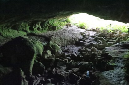
Although there were no human remains in the Pleistocene levels of Gop Cave, the faunal remains provide a fascinating insight of their own into the environmental conditions of north Wales, suggesting that a steppe environment prevailed, possibly at some stage between 60,000 and 30,000 years ago.  Understanding of the palaeozoology, palaeoecoloy and archaeology of the Pleistocene are all dependent on the work of palaeanthropologists, geologists, geomorphologists and climatologists, and many other specialists, all contributing very specialized research about how and when animals and humans would have been able to migrate to and from what is today an island.

The Mesolithic remains are the earliest evidence of human settlement in the immediate vicinity of the cave.  Although they represent a small group of people probably passing through, with no signs of seasonal returns to the site, this helps to contribute to the fragmentary picture of what was happening in Wales in the post-glacial period.  Both tools and tool cores were found, suggesting that tools were manufactured during the short stay at the site.


Visiting Details

When packing your rucksack or stuffing your pockets, do be sure to take a torch with a good, strong beam, and wear some solid footwear that will cope both with slippery mud and some very irregular stones and sharp rocks underfoot in the cave itself.  Caves are nearly always dripping with water, so unless it has been a very dry period, you may want to have a waterproof ready to drag on.  You cannot stand upright in the entrance of the cave, so you enter bent over, but it does open out so that you can explore some of the cave upright.  It is a good idea to get a sense of the internal plan before you go, because the dark is very disorientating and it is quite difficult to make out what is where.

The village of Trelawnyd showing the locations of the car park (red rectangle), and the small lane that leads to the footpath (red arrow). Click to expand.  Courtesy Apple Maps.

Gop Cave is a short walk from the village of Trelawnyd on the A5151 (itself a short drive from junction 31 on the A55).  It is a two-for-one scenario, as immediately above Gop Cave and only a minute or two away, and visible for miles around, is Gop Cairn.  I forgot to to take a What3Words reading for the cave, but the cairn is at ///searcher.sprint.wins,  Both are on public footpaths and are free of charge to access.  There is a car park on the little High Street in Trelawnyd, just off the A5151, or there is a limited amount of on-street parking a bit closer to the start of the small lane that leads to the footpath on the hillside, just up the slope from the car park.  The footpath is clearly marked, as shown in the photograph below.

The first part of the footpath is a small lane that takes you past a couple of houses, until it reaches a narrow path that makes its way along the side of a tall garden fence to your right.  This turns abruptly right and slightly uphill, leading to a low stone-built stile which takes you on to the hillside.  I was with Helen Anderson (well-known on Twitter as @Helenus_) and we were busy nattering and wild-flower spotting (complete with wild orchids) so weren’t paying too much attention to the pathway markers, but they are there if you keep an eye open.

We followed the well-worn track, which leads at this time of year, late April / early May, through bright yellow gorse until it opens onto higher ground, which is completely open, with stunning views over the surrounding valley to Iron Age hillforts on the Clwydian range and to the sea to the west.  You need to turn left beneath a shallow pale grey limestone ridge to reach the main cave entrance.  A very tiny secondary entrance is a little further along.  Retrace your steps to go up to the cairn, through a gate in a drystone wall.  For anyone wanting to stop for a breather, there’s a bench near the gate, somewhat bizarrely looking like an escapee from a Victorian arcade or promenade.
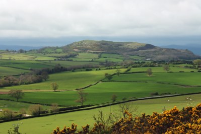
Moel Hiraddug

Although the walk is slightly steep for a short section, it is a mellow walk, and far from strenuous and there are some great views across the valley.  It took perhaps 10 minutes from the road to the cave, 15 minutes maximum, and another five minutes or so from the cave to the cairn.  The cave itself requires you to duck down and be very careful both to watch your footing on a very uneven and rocky surface, and to mind your head.  Best to leave your rucksack outside after liberating your torch.

If you are interested in the Iron Age heritage of the Clwydian Range, Moel Hiraddug is beautifully clear to the southwest, and other hillforts of the Clwydian Range, fading into the distance when we were there, are easily visible on a clear day,

The wildflowers were an added bonus, with a classical karst mix of tiny hardy species clinging to the almost non-existent topsoil above the limestone bedrock, including some really pretty succulents and lichens.  The Early Purple Orchids (Orchis mascula) were a particular bonus, and apparently fairly common in early spring  in the general area.  As well as the miniature slipper-orchid shaped flowers clustering at the top of the stems, their long pointed green leaves often have dark aubergine-coloured spots along them.  Read more about them on the Woodland Trust website.

Having visited, there’s the option of a very good lunch at The Crown Inn in Trelawnyd, which was filling up rapidly during our visit.  After lunch we went on to see the gorgeous Dyserth waterfall only a few miles away, which is very close to the road (a 50p honesty fee was required for access), and then went on to visit the small but fascinating Prestatyn Roman bath-house, which was again nearby.   I have posted about the bath-house here.

If you want to incorporate Gop Hill into a much longer walk (4-7 hours over 5miles / 10.5 kilometers) the Clwyd and Powys Archaeologial Trust has published what looks like an excellent one: https://www.cpat.org.uk/walks/gopcairn.pdf
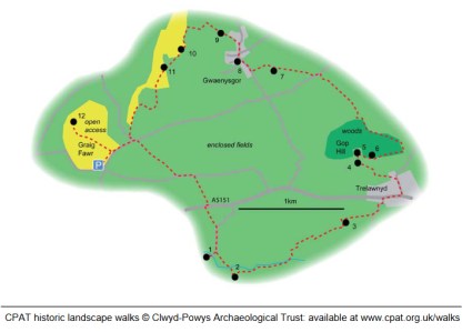
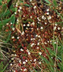
Sources for parts 1 – 3

Books and Papers

N.B. The reports by Stead and Bridgewood in the Proceedings of the Prehistoric Society are highlighted in green because although they are the record of the 1950s excavations, I have been unable to get access to them so I have not actually used them in this post. I have included them for the sake of completeness.  If you do have access to them and don’t mind scanning them, I’d be really grateful so that I can add them to the post!
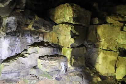
Barton, Nicholas 1997.  Stone Age Britain. English Heritage / B.T, Batsford.

Brace, Selina, et al 2019. Ancient genomes indicate population replacement in Early Neolithic Britain – Supplementary Material. Nature Ecology and Evolution
https://reich.hms.harvard.edu/sites/reich.hms.harvard.edu/files/inline-files/2019_Brace_NatureEcologyEvolution_Supplement.pdf

Brady, James E. and Wendy Ashmore 1999.  Mountains, Caves and Water: Ideational Landscapes of the Ancient Maya. In (eds.) Wendy Ashmore and A. Bernard Knapp. Archaeologies of Landscape. Contemporary Perspectives. Blackwell Publishers.,. p.124-145

Britnell, William J. 1991. The Neolithic. In (eds.) John Manley, Stephen Grenter and Fiona Gale. The Archaeology of Clwyd, 9.55-64

Brown, Ian. 2004. Discovering a Welsh Landscape.  Archaeology in the Clwydian Range. Windgather Press

Burrow, Steve. 2011.  Shadowland. Wales 3000-1500BC. Oxbow / National Museum of Wales

Crumley, Carole, L. 1999. Sacred Landscapes: Constructed and Conceptualized.  In (eds.) Wendy Ashmore and A. Bernard Knapp. Archaeologies of Landscape. Contemporary Perspectives. Blackwell Publishers., p.269-276

Davies, Ellis. 1925. Hut circles and ossiferous cave on Gop Farm, Gwaunysgor, Flintshire. Archaeologia Cambrensis, 7th series, vol.5, p.436-438

Davies, Ellis 1949. The Prehistoric and Roman Remains of Flintshire with a Short Appendix to “The Prehistoric and Roman Remains of Denbighshire” (1929). Cardiff

William Boyd Dawkins: Cave Hunting

Dawkins, Sir William Boyd 1874. Cave hunting, researches on the evidence of caves respecting the early inhabitants of Europe. Macmillan
https://www.gutenberg.org/files/52424/52424-h/52424-h.htm
or https://archive.org/details/CaveHunting/dawkins-w-cave-1874-RTL002406-LowRes/

Dawkins, Sir William Boyd 1886. Early Man in Britain. Macmillan

Dawkins, Sir William Boyd 1901. On the Cairn and Sepulchral Cave at Gop, near Prestatyn. Archaeological Journal, Vol.58, vol.1

De Groote, I., Lewis, M. & Stringer, C. 2017. Prehistory of the British Isles: A tale of coming and going. Bulletins et mémoires de la Société d’anthropologie de Paris
https://link.springer.com/article/10.1007/s13219-017-0187-8

Dinnis, R. & Cris Ebbs. 2013. Cave deposits of North Wales: some comments on their archaeological importance and an inventory of sites of potential interest. Cave and Karst Science 40(1): 28-34.
https://www.academia.edu/5157200/Dinnis_R_and_Ebbs_C_2013_Cave_deposits_of_North_Wales_some_comments_on_their_archaeological_importance_and_an_inventory_of_sites_of_potential_interest_Cave_and_Karst_Science_40_1_28_34

Glenn, T. Allen, 1925. Distribution of the Graig Lwyd Axe and its Associated Cultures.  Archaeologia Cambrensis vol 90, p.190-218

Jenkinson, Rogan D.S. 2023. A North-Western Habitat: the Paleoethology and Colonisation of a European Peninsula. Internet Archaeology 61
https://intarch.ac.uk/journal/issue61/1/full-text.html

Last, Jonathan (compiler) 2003. The Archaeology of English Caves and Rock-Shelters: A Strategy Document. Centre for Archaeology Report 32/2003
https://historicengland.org.uk/research/results/reports/5231/TheArchaeologyofEnglishCavesandRock-Shelters_AStrategyDocument

Lynch, Frances 2000. The Earlier Neolithic. In (eds) Frances Lynch and Stephen Aldhous-Green.  Prehistoric Wales,  Sutton Publishing, p.42-78

Marsolier-Kergoat M-C, Palacio P, Berthonaud V, Maksud F, Stafford T, Bégouën R, et al. 2015. Hunting the Extinct Steppe Bison (Bison priscus) Mitochondrial Genome in the Trois-Frères Paleolithic Painted Cave. PLoS ONE 10(6)
https://journals.plos.org/plosone/article?id=10.1371%2Fjournal.pone.0128267

Parker-Person, Mike 1999, 2000. The Archaeology of Death and Burial. Texas A&M University Press

Ray, Keith and Julian Thomas. 2018.  Neolithic Britain. The Transformation of Social Worlds. Oxford University Press

Schulting, Rick J. 2007. Non-monumental burial in Britain: a (largely) cavernous view. In L. Larsson,
F. Lüth and T. Terberger (eds), Non-megalithic Practices in the Baltic: New methods and
research into the development of Stone Age society, 581–603. Bericht der Römisch-
Germanischen Kommission 88, Schwerin

Schulting, Rick J 2020. Claddedigaethau mewn ogofâu: Mesolithic to Romano-British human remains (mainly) from the caves of Wales. Proceedings of the University of Bristol Spelaeological Society, 28 (2), p.185-219

Shanks, Michael and Christopher Tilley 1982.  Ideology, symbolic power and ritual communication: a reinterpretation of Neolithic mortuary practices.  In (ed.) Ian Hodder, Symbolic and Structural Archaeology. Cambridge University Press, p.129-50

Sheriden, Alison 2012. The jet belt slider, Movers Lane.  In E. Stafford, D. Goodburn and M. Bates, Landscape and Prehistory of the East London Wetlands. Investigations Along the A13 DBFO Roadscheme, Tower Hamlets, Newham and Barking and Dagenham, 2000–2003, 192–202. Oxford: Oxford Archaeology (Monograph 17)

Sheriden, J.A. and Davis, M. 1998.  The Welsh Jest Set in Prehistory: A case of keeping up with the Joneses?  In (eds.) Gibson, Alex and Derek Simpson.  Prehistoric Ritual and Religion. Sutton Publishing, p.148-162.

Stead, W.H., and Bridgewood, R., 1957. Gop Cave, Newmarket and Nant-y-fuach,
Dyserth, Flintshire, Proceedings of the Prehistoric Society, 23, p.228

Stead, W.H., and Bridgewood, R., 1958. Gop Cave, Newmarket and Nant-y-fuach,
Dyserth, Flintshire, Proceedings of the Prehistoric Society, 24, p.219

Stead, W.H., and Bridgewood, R., 1959. Gop Cave, Newmarket and Nant-y-fuach,
Dyserth, Flintshire, Proceedings of the Prehistoric Society, 25, p.280

Tilley, Christopher 2004.  The Materiality of Stone: Explorations in Landscape Phenomenology: 1.  Berg

Wainwright, Geoffrey J. 1961
The Mesolithic Period in South and Western Britain. Unpublished PhD, UCL April 1961
Volume 1
https://discovery.ucl.ac.uk/id/eprint/1317731/1/282048_Vol_1.pdf
Volume 2
https://discovery.ucl.ac.uk/id/eprint/1317731/2/282048_Vol_2.pdf

Westbury, Michael V. et al.  2020. Hyena paleogenomes reveal a complex evolutionary history of cross-continental gene flow between spotted and cave hyena. Science. Vol.6, No.11.
https://www.science.org/doi/10.1126/sciadv.aay0456

White, Mark J. and Paul B. Pettitt 2011.  The British Late Middle Palaeolithic: An Interpretative Synthesis of Neanderthal Occupation at the Northwest Edge of the Pleistocene World.  Journal of World Prehistory 24, p.25-97

Wymer, John. (ed.) 1977.  Gazetteer  of Mesolithic Sites in England and Wales. CBA Research Report no.20. GeoAbstracts and The Council for British Archaeology.


Websites

Ancient Human Occupation of Britain
https://ahobproject.org/

Archaeology Data Service
A database of Mesolithic Sites based on Wymer JJ and CJ Bonsall, 1977
https://archaeologydataservice.ac.uk/archives/view/mesgaz_ma_2008/

Cambrian Caving Council
Gop Cave by Cris Ebbs. Based on “An Introduction to the Caves of Northeast Wales (2000, ISBN 0 9522242 1 6)) by Cris Ebbs, which is no longer available.
https://www.cambriancavingcouncil.org.uk/registry/CoNW/CoNW_04.htm#Gop

Dafyd Archaeology (Heneb)
Mesolithic
https://www.dyfedarchaeology.org.uk/wp/mesolithic-main-page/

Derbyshire County Council
William Boyd Dawkins – Chronology
https://www.derbyshire.gov.uk/site-elements/documents/pdf/leisure/buxton-museum/permanent-collections/dawkins-jackson/sir-william-boyd-dawkins/william-boyd-dawkins-chronology.pdf

Dictionary of Welsh Biography
Sir William Boyd Dawkins
https://biography.wales/article/s-DAWK-BOY-1837

Dyfed Archaeology
Mesolithic Wales
https://www.dyfedarchaeology.org.uk/lostlandscapes/trwyndu.html

A Maritime Archaeological Research Agenda for England
The Mesolithic. By Martin Bell and Graeme Warren with Hannah Cobb, Simon Fitch, Antony J Long, Garry Momber, Rick J Schulting, Penny Spikins, and Fraser Sturt
https://researchframeworks.org/maritime/the-mesolithic/

Natural History Museum
First Britons
https://www.nhm.ac.uk/discover/first-britons.html

Nation Cymru
Unearthed 9,000 year-old encampment ‘on a par with the oldest mesolithic site’ in Wales. By Jez Hemming, 17th February 2021
https://nation.cymru/news/unearthed-9000-year-old-encampment-on-a-par-with-the-oldest-mesolithic-site-in-wales/

A Research Framework for the Archaeology of Wales
Key Sites: Northeast Wales – Palaeolithic and Mesolithic 22/12/2003
https://www.archaeoleg.org.uk/pdf/paleolithic/KEY%20SITES%20NE%20WALES%20PALAEOLITHIC%20AND%20MESOLITHIC.pdf
A Research Framework for the Archaeology of Wales: Palaeolithic and Mesolithic, version 04 – October 2022. By Dr Elizabeth A. Walker, (Co-ordinator), Amgueddfa Cymru – National Museum Wales
https://www.archaeoleg.org.uk/pdf/review2024/VERSION%2004%20Palaeolithic%20and%20Mesolithic.pdf

Science
The Rise of the Woolly Rhino. New fossil discoveries may explain origin of several Ice Age creatures. 1st September 2011, by Sid Perkins.
https://www.science.org/content/article/rise-woolly-rhino

Smithsonian Magazine
An Evolutionary Timeline of Homo Sapiens
https://www.smithsonianmag.com/science-nature/essential-timeline-understanding-evolution-homo-sapiens-180976807/

South Yorkshire Historic Environment Research Framework
Palaeolithic. By Paul Pettitt
https://researchframeworks.org/syrf/palaeolithic/
Mesolithic. By Penny Spikins with a contribution by Ellen Simmons
https://researchframeworks.org/syrf/mesolithic/

UCL Blogs – Research in Museums
Migration Event: When did the first humans arrive in Britain? By Josie Mills, 24th February 2019
https://blogs.ucl.ac.uk/researchers-in-museums/2019/02/24/migration-event-when-did-the-first-humans-arrive-in-britain/

University of Manchester, Science and Engineering
Sir William Boyd Dawkins – An Extraordinary Study. By Joe Shervin, 28th January 2019
https://www.mub.eps.manchester.ac.uk/science-engineering/2019/01/28/sir-william-boyd-dawkins-an-extraordinary-study/
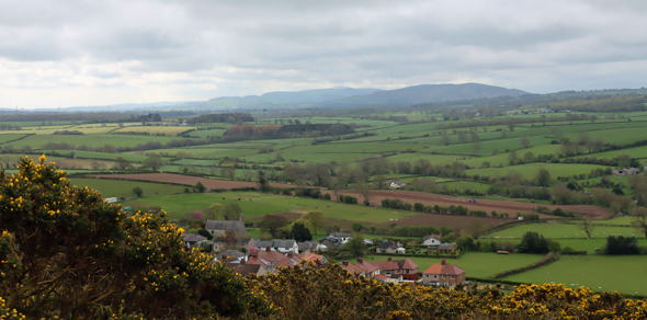
 

View across the valley


Day trip: Edward I’s 1282 Denbigh Castle and Town Walls

Introduction

Aerial view of Denbigh Castle. Source: Coflein

The substantial remains of Denbigh Castle and its walls represent an important slice of Anglo-Welsh history, and are truly beautiful to visit on a sunny day when the castle walls and the surrounding landscape are bathed in bright, lovely light. It is thought, partly because of the original name Dinbych meaning ‘little fort’, that a previous castle, along much more modest lines, had been on the site at least from the 12th century.  The new castle at Denbigh was built by Edward I (1239-1307, reigning from 1272).  It was started in 1282, and given to Henry de Lacy to complete and defend in the same year.  It survived the 1294 rebellion by Madog ap Llywelyn, the rebellion of Owain Glyndwr in 1400 and held out under siege for six months during the Civil War in 1646, before being slighted at the end of that war in 1659.  The ruins attracted a number of painters, examples of whose work are shown towards the end of the post.  On a visit to the town, and making it a good day out, there are also impressive heritage sites to see in Denbigh, some of which I have included in the Visitor details at the end of the post.

Llywelyn the Last paying homage to Edward, sitting on Edward’s left.

It is probably impossible to fully understand Edward I’s castles in Wales without getting to grips with the longstanding conflict between the English Crown and the Welsh princes in the 13th century.  I did my best to summarize the background in a post on this blog in which, as well as discussing the conflicts, I have tried very hard to distinguish the different generations of Welsh princes from one another coherently, which is something of a challenge due to their repetitive naming conventions.  Apart from a short introduction in the next paragraph, all my comments on Edward’s military strategy, and the reasons for it, are on that post, and are not covered here.

Map of Wales showing Edward I’s new castles in Wales. Source: By Eggishorn on Wikipedia

Denbigh Castle was Edward I’s sixth castle in Wales as he headed relentlessly west to subdue Wales.  His castles at Flint, Hawarden, Rhuddlan and Builth (unfinished) in the northeast, and Aberystwyth in mid-west Wales were already underway, all started in 1277. Henry III and Edward had been troubled throughout Henry’s reign by rebellions in Wales, masterminded by Llywelyn ap Gruffud, known as Llywelyn the Last (not to be confused with Llywelyn the Great, his grandfather).  Several treaties had failed to achieve long term peace, and although the Treaty of Montgomery of 1267 looked as though it might hold, Llywelyn ap Gruffud was labelled an outlaw in 1276, and war was declared in 1277. A peace was brokered, marked by the Treaty of Aberconwy of November 1277, but although Edward had every reason to believe that the new treaty might secure peace between England and Wales, he was taking no chances and began to build a series of castles in northeast Wales, beginning at Flint in 1277, with Rhuddlan Castle started later in the same year.  These costly and invasive measures were vindicated in 1282 when war broke out again, instigated by Dafydd ap Gruffyd, Llywelyn’s brother, whom Llywelyn joined in the new uprising.  Both were killed during the war, and peace lasted until 1294 when a distant cousin of Llywelyn’s, Madog ap Gruffud, again took up arms against Edward, marking the last of the 13th century attempts to regain both lost territory and lost dignity.

Why here? The location of Denbigh Castle

Strategic importance of the castle

Denbigh in the Vale of Clwyd with the River Conwy to the west and the Clwydian range and the Dee estuary to the east.  Source:  Google Maps

Denbigh Castle was built on a Carboniferous limestone outcrop overlooking the flat plain of the Vale of Clwyd and the lowlands of the Clwydian Range of hills, rising to 468ft (142m) above sea level.  There may have been an earlier castle on the same spot.  From the point of view of visibility of the surrounding landscape it is an excellent site for a castle.  The Dee estuary lies over the hills to the northeast, and the River Conwy to the west.  The Conwy marked a natural border between east and west Wales, a border that was a frequent bone of contention between the Welsh princes of Gwynedd and the English crown, as the Welsh attempted to push west in the face of the determination of the English crown to hold them safely contained in the west.   

The Four Cantrefi. Source: Wikipedia

Denbigh lies in what was Rhufoniog, one of the so-called Four Cantrefi, four areas of north Wales that Henry III wrested from Wales and were allocated under the Treaty of Woodstock in 1247.  Following grievances with the English governorship of the Four Cantrefi, Llywelyn the Last took up the cause against Edward I. Following Llywelyn’s surrender, Rhufoniog had been granted under the 1267 Treaty of Montgomery to Llywelyn’s treacherous brother Dafydd ap Gruffudd, together with Dyffryn Clwyd, but Dafydd rebelled against Edward.  Llywelyn threw in his lot with his brother, and was killed in battle in 1282.  Dafydd was captured and then tortured and killed in 1283, after which the cantrefi reverted to the English crown, a source of bitter resentment for the Welsh. 

Edward granted land in Wales to favoured supporters, and allocated Denbigh to Henry de Lacy, Earl of Lincoln, together with the cantrefi of Rhos and Dinmael, the latter having been wrested from the rulers of northern Powys.  These three regions were combined to become Denbigh, a massive English footprint in northeast Wales.  Henry de Lacy certainly set out to make the most of his new possession, evocatively expressed by R.R. Davies:

The seal of Henry de Lacy, Earl of Lincoln

Henry Lacy, earl of Lincoln: in his new, vast lordship of Denbigh not only did he create a brand new manor (with a brand new name) for himself from forfeited and other lands, grant out sizable estates for his followers and servants (including his chamberlain and his cook), establish two studs for his horses, and carve out parks for his pleasure and stock them with deer from Cheshire; but he also declared majestically that the new land measurement to be used in Denbigh was to be a perch of twenty-one feet as gauged by the length of his own foot.

Edward’s chain of castles, the so-called ring of iron, consisted of both both fortifications and a communication network.  It was put to the test not only during the Middle Ages but in subsequent the early 1400s and the 17th century, highlighting the strategic importance of each castle. 

Economic potential of the area

View from the castle’s main gate house

Edward’s castles were not standalone constructions.  Communication networks were vital for a peripatetic king and court, but also for the movement of troops and the commercial viability of new settlements.  Each castle connected to Edward’s growing network of roads and was accompanied by a new town. Areas in which castles and their towns were located had to be economically viable to attract English settlers to potentially volatile locations.  Additional benefits were low rentals, exemption from tolls, and, in the case of Denbigh and some other towns, Edward granted the town a monopoly.  The towns were monetized, using coinage for purchases, rather than the traditional Welsh system of exchange.  Edward established mints at Rhuddlan and elsewhere to enable the urbanization of Wales.

View over fields beyond the castle walls today

Denbigh was one of the few castles built by Edward that was not a port, and did not have river access to a port.  However the land was suitable for agricultural activities and livestock rearing.  Cattle prefer good quality grazing, but sheep, which are less fussy about their food source, could be converted not merely into meat and dairy, but sheared for the thriving 14th century trade in wool and inexpensive cloth centred in nearby Ruthin.  Stevens says that the in the Denbighshire lordship of Dyffryn Clwyd, “the lord’s demesne [productive land attached to the manor] flock numbered 2,000 – 3,000 and the aggregated tenant flocks nearly as many, with several private flocks numbering between 100 and 240.”  In Dyffryn Clwyd it is known that weaving on a piecemeal basis in farmsteads supplemented other income.

The design

Burgess Gate, from the castle side

It is thought that the castle was designed and its build overseen by James of St George, who was responsible for Edward’s most spectacular castles in Wales.  It was built mainly of local limestone, with some components built in local yellow and Triassic red sandstone.  For the Green Chambers, the two-storey building with chambers over a wine cellar and meat store, a different type of sandstone was sourced from a site 16 miles (25km) north of the castle.

Today, as in Edward’s day, the castle was approached primarily via the Burgess Gate, which sits along the town walls, north of the castle.  This is a thoroughly substantial piece of architecture with the power to intimidate and impress as well as to defend.  Its original portcullis has long gone but when you stand beneath the arch you can see the carefully cared square holes in the masonry above you, which shows where the portcullis was raised.  The mechanism that operated it was on the first floor.

St Hilary’s Tower with the remnants of the church still attached to its eastern side.

Passing through the gate and heading uphill brings you to the castle, with St Hilary’s tower on your left.  St Hilary’s was a chapel with a tower at its west end dating to the early 14th century, only two decades after the castle was founded, and was altered a number of times, but the church itself was taken down in 1923.  The chapel had fallen out of use when a new church was built in the town beyond the walls in 1874.  The tower with its contemporary west doorway and its 15th century battlements are all that remains to commemorate the church.

The castle is still fairly awe-inspiring, but must have been magnificent when towering over the valley, particularly when compared to the smaller and less solidly built Welsh castles.  L.A.S Butler describes three main phases of construction work.  Initially what are now the outer defences on the south and west were built to provide a defensible enclosure within which the main building activity could be carried out.  Once the outer defences were completed, the castle was built on rather more massive lines.  The curtain walls are taller and thicker, and were interrupted by hexagonal and octagonal towers, the postern gate almost opposite the main gate and a hidden passage called the sally port allowing pedestrian movements during times of siege.

A CGI impression of the three towers that make up the gate house, showing some of the internal passageways and the locations of the three portcullis gates. Source: Castle Studies Group Journal 2015

The entrance to the castle proper is an extraordinary construction consisting of three octagonal towers, on a triangular plan, with internal passages and staircases. It was protected by a portcullis over a ditch, and contains a statue in a niche above, which may be a later addition depicting Edward II (1307-1327).  Following the attack of 1294 additional protective walls were added, with semi-circular towers at weak points.  The areas between these outer walls and the later inner walls are referred to as mantlets and offered additional protection to the completed castle. Construction work continued after the attack, both to undertake repairs and to complete most of the original design.

Today the castle walls surround a large green area along the edge of which are the foundations and partial ruins of a number of structures essential to the castle, including two wells, a great hall, apartments, a kitchen with two splendid 16ft (5m) wide fireplaces, a combined treasury and muniments tower, and a pigeon house.  The open area of green grass, the ward or bailey, was once the place where troops could muster and train, and might be used for storage.  Interestingly, Neaverson comments that the well sunk into the Carboniferous limestone would have been unreliable, with the many joints in the rock allowing water to escape, and notes that there were medieval records describing this problem.

For information about the building process involved in Edward’s early castles in Wales, see my post on Flint Castle, which quotes former mayoress Vicky Perfect’s excellent research on the subject.


The town and the walls

The town

Photograph of a wall poster from the Denbigh Castle shop, showing what the castle may have looked like in the 14th century.  Also shown in the Cadw guide book.

Like his first Welsh castle and town in Flint in 1277, the new castle-town at Denbigh,  was Edward I’s replication of a French “bastide” of the sort he had already built in Gascony, in which both the castle and the town were planned as a single entity, each supporting the other.  These new English castle-town arrangements were deeply unpopular in Wales because the land appropriated from the Welsh for the town and associated land-use was reserved for the English, part of Edward’s plan to undermine the Welsh occupation and domination of key strategic places.  Pioneer settlers were expected to help defend the town should it come under attack, but were granted commercial privileges as incentives in these troubled areas, and might attract those who were unable to generate similar opportunities in more peaceful places.  

Artefacts on display in the visitor shop at Denbigh Castle.

One of the primary activities of the new settlers was agriculture. The Welsh inhabitants were ousted and English settlers were given the most productive land.  Other settlers would have been traders and middlemen, sourcing luxury goods and other desirable produce and goods from elsewhere for sale both to the castle and townspeople.  Service industries will also have grown up, like grain mills, blacksmith forges and tanners, as well as food outlets such as butchers, bakeries and breweries and would all have been vital to a successful town.  A church and courthouse would have been essential, and would have required their own officials.

John Speed’s map of 1610. Source: Cadw

Once the land within the town walls had filled to capacity with homes and businesses, other buildings grew around the exterior of the walls, forming a very large settlement site.  Butler says that the original layout of the town in c.1282 incorporated 63 burgesses (a free citizen of the borough) each with its own burgage plot (property and attached land held by ownership or tenure).  By 1305 only 52 houses were within the walls and up to 183 were outside, the latter taking advantage of the flatter land and the easier access to water.  By 1476 there were 276 burgages beyond the walls.  A tile kiln dating to the 14th or 15th-century was found during the 1930s during building work.  15th century records refer to town routes including High Street, Beacon’s Hill, Pepper Lane and Sowter Lane, and during both late 15th and 16th centuries craftsmen included a draper, glovers, shoe-makers, mercers and weavers.  Leland, writing in the 1530s, comments that the walled town was largely abandoned in favour of lower land beyond the walls where water could be accessed and “maany welles” had been established.
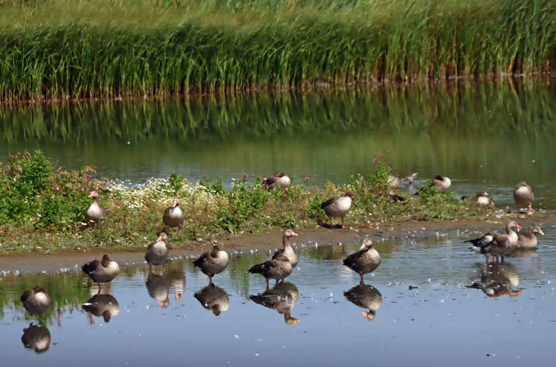
The battered remains of the Carmelite Friary on the edge of the medieval town. Source: Coflein

All that remains of the medieval town within the walls is the tower of St Hilary’s Chapel, started in the early 1300s.   Beyond the castle walls, the CPAT survey dates the cruck-framed Friesland Hall House (later the Old Castle Arms and now Bryn Awelon) to the 14th century.  The same survey states that The Plough in Bridge Street was originally an L-shaped timber-framed building with a medieval rock cut cellar below.  An outlier in the medieval town was the Carmelite friary dating to c.1289.  In the current town all the other ordinary wood-built buildings will have been replaced many times over, although some of the stone cellars may date to the late-15th century during the War of the Roses, when townspeople may have decamped from within the town walls after Jasper Tudor burned the town in 1468 (about which more below).

Robert Dudley’s courthouse, now the library

In 1536 the Act of Union promoted Denbigh to one of four administrative capitals in Wales. Surviving buildings from the reign of Elizabeth I in the 16th century are the courthouse of 1571 and the incomplete church of 1578, both built by Robert Dudley, earl of Leicester, who was granted the lordship of Denbigh in 1563.   The courthouse was built in the lower town, whilst the new church took advantage of the empty spaces within the town walls.  Dudley appears to have done very little to restore the castle.  A 1610 map of Denbigh by John Speed shows only a handful of building, including the two churches, within the town walls, and a sprawling town beyond, with the 1289 Carmelite friary (the only one in Wales, and marked on the map as “The Abbey”) on the outskirts.

The walls

Walking the town walls of Denbigh

The walls were built to contain the new town and were started at the same time as the castle.  Unlike Flint’s long-gone rectangular town walls, Denbigh’s loop around in an irregular sub-circular shape, enclosing enclosing c.9.5 acres (3.8 ha), again supplied with defensive towers, offering good views over the surrounding area.  Access into the town was via two main gates in the walls, the Burgess Gate mentioned above to the north and the Exchequer Gate to the west.  You can walk a section of the walls, but you need to pick up a key to the gate from either the library or the castle shop.

The castle under attack during the reign of Edward I

Tombstone of Madog ap Llywelyn in Gresford All Saints’s Church

In September 1294 a distant cousin of Llywelyn the Last and Dafydd ap Gruffudd, named Madog ap Llywelyn, made one last- ditch attempt to repel the English before Owain Glyndŵr’s attempt over a century later.  His reasons were not simply territorial but had much to do with the English tax burden of 1/15th imposed on the region.  Madog successfully captured a number of castles, including Denbigh, forcing their defenders to retreat, but only three months later Madog was forced out of the castle, and by April 1295 the castles had been restored to the hands of their English lords.  The plan might have worked had Edward, who had mustered an army on the coast for action in Gascony, and should have been absent when the revolt took place; unfortunately for the rebels, bad weather delayed departure and Edward temporarily abandoned his campaign in Gascony and headed for Wales.  Madog was taken to London where he was held in captivity, probably until his death in around 1312.  For those in the Wrexham-Chester area, Madog was buried in Gresford All Saints’ Church (described on this blog here), where his tomb, showing an effigy of him in armour with his shield, can still be visited.  Gresford Church is very well worth a visit in its own right.

Tombstone of Madog ap Llywelyn in Gresford All Saints’s Church


Back in the wars after Edward I

Owain Glyndŵr’s Rebellion (1400 – c.1410)

Banner of Owain Glyndwr. Source: Wikipedia

By 1400 the castle had passed through a number of hands under the reigns of Edward II (reigned 1307 to 1327), Edward III (reigned 1327 to 1377) and Richard II (reigned 1377 to 1399).  In 1399 Henry Bolingbroke became Henry IV and ruled until 1413, and one of the earliest challenges of his reign was the rebellion of Owain Glyndŵr in 1400.  Glyndŵr was the last Welsh national to claim the title Prince of Wales, which had actually been conferred on Edward I by his father Henry III.  By this time the lordship of Denbigh had passed into the hands of the Mortimer family, but Roger Mortimer died in battle when his son Edmund Mortimer was a minor.  Henry IV therefore appointed Henry Percy to take charge of Denbigh, together with other administrative responsibilities in the area.  In 1400 Glyndŵr attacked the town of Denbigh, although apparently did not attempt to take the castle.  Percy, popularly known as Hotspur, planned a rebellion of his own and was interested in forming an alliance with Glyndŵr.  Fortunately for the king, Hotspur died in battle in 1403.  The preservation of the castle was possibly due to a strategic marriage between Sir Edmund Mortimer (young Edmund’s uncle) and Glyndŵr’s daughter Catrin in November 1402.  As Denbigh was part of young Edmund’s inheritance, the agreement to preserve of Denbigh’s castle from destruction might have been part of the marriage negotiation.

The War of the Roses (1455 – 1485)

Still in the hands of the Mortimer family, who supported the Yorkist cause, Denbigh Castle became the target of Jasper Tudor, who had been granted the role of constable (high official) of Denbigh, but was unable to fulfil the role until he gained access to the castle.  He made his attempt first in 1460, when he successfully took the castle for a number of months before being ousted, and again in 1468 when he failed to take the castle, but breached the town walls and set fire to the town.  The castle was again repaired after the end of the war, and as mentioned above, it appears that the area within the town walls was abandoned rather than rebuilt.

The English Civil War (1642 – 1651)

Charles I. Source: Royal Museums Greenwich

The slow decay of the castle under the earl of Leicester continued unchecked until the castle suddenly resumed strategic importance during the English Civil War, beginning in 1642, when it had to be made fit to garrison 500 royalist soldiers.  This task was allocated to Colonel William Salesbury of Rhug near Corwen (whose colourfully decorated Rhug chapel is now one of the real gems of north Wales).  Butler says that although off the beaten track in terms of the main centres of fighting, Wales was nevertheless under threat.  Its relative proximity to Chester proved useful in 1645 when Charles I’s royalist siege of Chester was unsuccessful, and the king headed to Denbigh, staying for three nights, as a royalist force assembled at the castle prior to making another attempt on Chester.  Charles and the additional royalist force were attacked by Sir William Brereton and Sir Thomas Mytton, and were defeated in the land around the Carmelite friary on the outskirts of the Denbigh town.  Within the castle, Colonel Salesbury remained under siege with 500 men from April to October 1646, only surrendering when he received a written command to do so from Charles I.  Following a brief royalist reoccupation in 1659 the castle was slighted (demolished) by the parliamentarians to prevent it being of any further value to the royalists.  It instantly became a source of very useful building material, and no attempt was made to restore it under Charles II when the crown was restored to the throne in 1660.

Denbigh Castle in Art

Denbigh Castle by Edward Dayes 1715. Source: Art Fund

All of the artworks here were painted in the 18th century, a period when an interest in the Classical ruins of the Mediterranean had also turned British artistic eyes towards ruins on the doorstep. Each  of the paintings has its own very distinctive personality, but all are part of a tradition that responded to the ruins of grand buildings, particularly castles and abbeys, as symbols of a lost grandeur, fallen kingdoms and abandoned dreams.  The Romantic fascination with aesthetically-pleasing icons of loss and decay also highlighted the inevitability of entropy as something sympathetic and pitiable.  Although unimpeded by the facts and figures behind these vast structures, there is a sense that the artists of the 18th century were finding their own way of grappling with the past.  The result was often poignant, usually striking, evoking magnificence and beauty blended with regret, redefining castles in their 18th century setting as something not merely benign but infused with a certain special value conferred upon them by their very antiquity.


Click to expand.  Denbigh by John Boydell 1750 showing the castle, the Burgess gate, some of the city walls, St Hilary’s Chapel and the Earl of Leicester’s incomplete Protestant church. Source: Peoples Collection Wales

A View of Denbigh Castle by Francis Towne, 1777. Source: francistowne.ac.uk

The Gatehouse of Denbigh Castle: Colour Study 1799-1800 by J.M.W. Turner 1775-1851. Source: The Tate Research Publications

Final Comments

Denbigh Castle ticks all the boxes as a part of the story of Anglo-Welsh conflicts in the 13th century, as an excellent example of James of St George’s architectural imagination, and as an imposing and impressive component of Edward I’s chain of castles in north Wales.  There are sufficient structural remains still visible within the castle walls to understand some of the key features regarded as necessary to the running of a castle in times of both peace and war.  Denbigh Castle also demonstrates how medieval castles could be adapted for use during the English Civil War.  As a ruin it inspired a number of 18th century artists who appreciated it more for its sense of the romantic than its military past.  As a visitor destination it offers lovely views over the surrounding landscape, and provides the opportunity to explore a small multi-period market town which has a great deal to offer in terms of its architecture and its personality. There is even an annual plum festival in autumn, which this year was held on 7th October, and which we only just missed.  At the castle, don’t miss the stairs in one of the gate towers up to the upper walkway, which gives you a birds-eye view over the interior of the castle and down into the town, across the valley and into the hills.  

Visiting

First you need to check the opening times on the Cadw website. Particularly in autumn and winter, the site is only open on certain days.  There is an entry fee unless you are a member of Cadw or an affiliated organization (again, check the Cadw website for up to date information).  If you want to walk the town walls you will need to collect the key, available with a refundable deposit from either the library in the town or in the castle ticket office and shop. The library is currently shut on Thursdays at time of writing (October 2023).

If you want to park at the castle, it has a dedicated car park that you can find by following the occasional signage, and the access to which is at What3Words address ///craftsman.obstinate.explain.  Instead of going straight to the castle we followed a leaflet, available to download from the Northeast Wales website, which took us around all of the key sites of Denbigh town (some of which are mentioned at the start of this post), so we parked behind the High Street and walked up to the castle after visiting other sites.  There are lots of other parking options that are well signposted.  A great and detailed source of information about the town is the official Cadw analysis of the town’s heritage, Denbigh: Understanding Urban Character, available for download as a PDF.  At the castle there is information signage, but if you want detailed information it is best to do the reading in advance.  There is a comprehensive Cadw guide book by L.A.S Butler dedicated to the castle, which is stuffed full of information with some really excellent maps and illustrations and is available from the castle shop, or from the usual online retailers.

There is plenty to see in the town itself.  As well as the castle and walls, medieval sites include the Burgess Gate (once the main gateway through the town walls), St Hilary’s Chapel tower (the remnant of the early 14th century church), and the ruins of the Carmelite friary dating to c.1289.  The CPAT survey dates the cruck-framed Friesland Hall House, otherwise known as Bryn Awelon with a 14th-century doorway in its southern side to the medieval period, as well as The Plough in Bridge Street, which was originally an L-shaped timber-framed building with a medieval rock cut cellar below.  Elizabethan buildings from the 16th century include the Earl of Leicester’s courthouse (now the library) and his ambitious but incomplete 10-bay church, and there are other survivors of the 16th and 17th centuries in the town.  The attractive town has plenty of substantial and Georgian homes and Victorian civic and residential projects that bring to life the wealth and confidence of the former market town.  Be sure not to miss the fabulous statue of Dr Evan Pierce on his 72ft (22m) Tuscan column.  

For those with unwilling legs:  Please note that there are pros and cons with the castle and the walls.  For the castle, I would suggest that you will miss getting up close and personal with some of the castle’s key features because many of them require going up or down slippery stone steps.  On the other hand, if you confine yourself to the grass you can still see down into most of the features and up to others, and you will still get an excellent sense of the castle’s perimeter and personality, and the views over the surrounding landscape are simply spectacular in good weather.  The upper rampart walk, reached via an original stone staircase, could be a potential difficulty, although there is a solid metal banister to grip.  The town walls are also risky when there has been even a little rain due to the unavoidable shiny stone-work underfoot and the very real potential of slipping.  I would say it is well worth the visit even if you cannot do it all.

Sources

Books and papers

Butler, L.A.S. 1990, 2007 (2nd edition). Denbigh Castle. Cadw

Davies, J. 2007 (3rd edition). A History of Wales. Penguin

Davies R. R. 2000. The First English Empire: Power and Identities in the British Isles 1093-1343. Oxford University Press (https://academic.oup.com/book/7027 requires institute access)

Morris, M. 2008. A Great and Terrible King. Edward I and the Forging of Britain. Penguin

Neaverson, E. 1947.  Mediaeval Castles in North Wales. A Study of Sites, Water Supply and Building Stones.  the University Press of Liverpool, Hodder and Stoughton Ltd.

Stephenson, W. 2019. Medieval Wales c.1050-1332. Centuries of Ambiguity. University of Wales Press

Stevens, M.F. 2019. The Economy of Medieval Wales 1067-1536. University of Wales Press

Walker, D. 1990. Medieval Wales. Cambridge Medieval Textbooks

Websites

Cadw
Denbigh Castle
https://cadw.gov.wales/visit/places-to-visit/denbigh-castle
Denbigh Town Walls
https://cadw.gov.wales/visit/places-to-visit/denbigh-town-walls
Denbigh: Understanding Urban Character (PDF)
https://cadw.gov.wales/sites/default/files/2019-05/Denbigh-%20Understanding%20Urban%20Character_0.pdf

Castle Studies Group
CSG Annual Conference Proceedings, Wrexham 2015, Individual Site Summaries. CSG29 2015 Wrexham Conference.  Castles of North East Wales – Denbigh.  Journal no.29 2015-2016.
http://www.castlestudiesgroup.org.uk/page153.html
http://www.castlestudiesgroup.org.uk/CSGJournal2015-16X8-pp1-120Final-Denbigh-58-89-low-res.pdf

Clwyd Powys Archaeological Trust
Denbighshire Historic Settlements (index)
https://cpat.org.uk/ycom/denbigh/denbigh.htm
Denbigh

https://cpat.org.uk/ycom/denbigh/denbigh.pdf

Ancient and Medieval Architecture
Denbigh – Castle

https://medievalheritage.eu/en/main-page/heritage/wales/denbigh-castle/

Enjoy Medieval Denbighshire (PDF) leaflet
https://www.northeastwales.wales/wp-content/uploads/2022/03/medieval-denbighshire.pdf


Terrific scenery and views from Waun y Llyn Country Park, near Caergwrle

I had been visiting Caergwrle Castle on a bright, sunny, perfect autumnal day, and was actually heading elsewhere for a much longer walk when I noticed on my O/S map that there was a country park a short drive away, and went there on a whim.  I’ll write up Caergwrle Castle later but here is some visiting information accompanied by some photos of the country park walk for those of you who are, like me, addicted to lovely views.  It is certainly worth making the most of these occasional very beautiful days while we have them.  Waun y Llyn Country Park sits on a hilltop with views over the local hillsides and and over the Dee floodplain into Merseyside.

Waun y Llyn is about half an hour’s drive from Churton, probably (I’m guessing) a bit less from Wrexham and a bit more from Chester.  It is reached from all directions by single-track roads.  Do note that if you or your driver is not keen on reversing, this is not the place to go.  Access is via single track roads with passing places, and it is a popular destination with hikers and dog-walkers and is frequented by farm vehicles, so you will need to be prepared to reverse around very bendy bits as well as straight bits.

Location of Waun y Llyn, above Caergwrle (near Llay).

There is a warning on one of the information boards in the car park that there is livestock within the country park, and that you should keep dogs under control.  I had assumed that it would be sheep, but the very fresh cow-pats made it clear that there was cattle up there.  I didn’t see any, and much to their irritation neither did the two farmers who were looking for them!  As one of them said, when he asked me if I had seen them, there are 70 acres for them to hide in.

I believe that Waun y Llyn means moorland by the lake (but do feel free to correct me). It is indeed a type of moorland, with copper-coloured bracken at this time of year, and bright yellow gorse in flower.  There are only few trees, but there are young silver birch,some young oaks and small holly bushes, some of which are currently festooned with bright red berries.

There is also, as the name implies, small lake surrounded by boggy margins, with permanent water-loving plant species underfoot if you follow the watery marshland tracks.  You can skirt the marsh and head towards the higher green ground, which provides a good viewpoint, but be aware that the whole area around the lake, linking one footpath to another is fairly damp.
———
——–

If you go when there has been rainfall, do wear water-resistant footwear.  In spite of the glorious sunshine today, it rained all day yesterday, and although there are grassy footpaths, most of the the footpaths furthest from the car park were very muddy underfoot with large pools of water, and there are also places where small streams cross paths that require either jumping over or skirting around.  Water loves an easy route, and some of the smaller footpaths had become tiny streams in their own right.  All absolutely fine with suitably water-resistant footwear.

I would advise those of you with unwilling legs to avoid it at this time of year.  There are no steep slopes or steps, but there are seasonally related challenges.  I’ll give it another go in the summer and report back, but at this time of year the mud is very slippery, there is a lot of wet bedrock showing through on some of the narrower footpaths.  One lady who had a bad leg was managing fine with two sticks along the grassy footpath, but had to turn back when the going became too muddy and rocky underfoot.

There is no archaeological site recorded at the country park, which seems almost counter-intuitive given the views.  Both silica sandstone and millstone grit were quarried from the hill in the late 19th century, the latter for housing in the Alyn valley below, and the walk to the hilltop was a favourite destination of visitors to a spa in Caergwrle, contemporary with the quarry.

This  walk took me about 45 minutes, so it was a short one but a good one.  You can make it shorter or longer by following the different footpaths on the noticeboard by the car park, and you can turn it into a serious hike by including other local footpaths as well.  There’s no hyperlink to the Country Park’s official website, because there does not appear to be one.  Let me know if you find one.  If you give Waun y Llyn Country Park a go, do enjoy!

The metalled approach from the car park to the entrance to the country park. The metalled surface goes onwards for a short way to the viewing point.

Entrance to the car park

Sunshine, archaeology and great views at Caer Drewyn Iron Age hillfort at Corwen

Caer Drewyn aerial photograph. The entrance at the top is at the northeast. Source: Cadw

Caer Drewyn is an Iron Age hillfort located a mile north of Corwen, with remarkable stone-built defences all around its perimeter, and terrific views in all directions.  Happily, it is accessible to the public, with a relatively easy footpath that works its way gently around the hill to the northeast entrance.

This post begins with a brief description of Caer Drewyn the Iron Age archaeological site (it is worth reading either this or another description before you visit, as there is no information signage at the site), and finishes with the the walk and views, from the car park via the farm track to the top, and back partly via the track, but also using a different, steep footpath that shortens the route.

If you use the What3Words app, you can find the hillfort at ///kitchen.quaking.segments.  Leaflets promoting local walks indicated that it was acceptable to park at the Corwen Leisure Centre, just to the north of Corwen (via Green Lane from the A5, postcode LL21 9RW).

Caer Drewyn

Willoughby Gardner’s 1922 sketch of the position of Caer Derwyn on the slope rather than around the peak of the spur.

Caer Drewyn is located on a spur projecting south and west into the Vale of Ederinion in the upper valley of the river Dee, some 800-985ft above sea level and, at its south, 500ft (152m) above the Dee floodplain.  The aerial photo shown at the top of the post gives some idea of the way in which the site dips fairly steeply from east to west over two loosely defined natural terraces. 

Caer Drewyn is defended by vast stone defences, spreading to beyond 15ft wide in places.  They do not merely defend a particular weak point; they enclose the entire perimeter – and there is an awful lot of perimeter to defend (3 hectares / nearly 7.5 acres, measuring c.629ft / c.192m north-south by 705ft / 215m east-west).  This sort of stone defence is not unique.  There are a number of examples in Ceredigion and in south Merioneth (e.g. Craig yr Aderyn, and Castell y Gaer) both on or near the mid-west Wales coast, with which the area may have had contact via the route that follows a geological fault-line. Other similar examples are further afield in northwest Wales including the famous Tre’r Ceiri on the coast of the north Llyn Peninsula, which has a complete stone perimeter and includes very clearly visible hut circles within.

Although parts of the stone walls were cleared of bracken and other vegetation in the late 19th and early 20th centuries, ahd graving sheep help to keep it down, Caer Derwyn hillfort has not been excavated, so all knowledge is based on observation of the extant features.  According to the Coflein website, the hillfort was probably developed over at least three phases.  

The earliest phase is thought to have consisted of a smaller curvilinear earthwork at the northeast of the hillfort that stands today, and survives in part as an earthwork outside and to the east of Caer Drewyn.  This can be seen on the aerial photograph at the very top of this post.

The next phase is the vast rubble-walled site that dominates the hill today.  This later hillfort was defined by the stone rampart, which Willoughby Gardner describes  in his 1922 paper as  consisting “of a core of rubble stones, faced on either side with a wall of dry masonry.”  These surviving patches of stone facing may suggest that the rampart may have been equipped with an inner wall-walk.

Instead of sitting around the peak of the spur, the hillfort actually sits on the slope, meaning that the interior can be seen from below.  Like many hillforts, it is ideally located for visibility over the landscape, in this case with views over the surrounding area, including the valleys of the rivers Dee and Alwen, which meet just to the east, the Berwyns to the south and the north and east across to the rest of the Clwydian range.  These views are wonderful on a clear, bright day.  Toby Driver points out that in spite of the defences, the above-mentioned fact that the interior of the hillfort can be viewed from below somewhat undermines its strategic value.

Willoughby Gardner’s 1922 plan of the northeast entrance of the hillfort

The hillfort could be approached from the west and the northeast, where the two entrances were in-turned, a typical feature of many hillforts that helps to control access to the interior.  Willoughby Gardner says that there was a spring a short way down from the west entrance.  The entrance in the northeast corner where the cairn is located, which is the highest point of the site and shown clearly bottom right of the aerial photo below, may have featured a guard chamber, another characteristic feature, suggested by the complex jumble of stone that implies at least one additional feature at the entrance.  Willoughby Gardner estimates a 12ft diameter. So-called guard chambers are recesses in the entrance passages hillforts, mainly in north Wales and the Welsh Marches, but the name does not mean that the function of these recesses is actually understood, and they may have been used for some sort of religious or alternative function.

You can see circular dips dotted here and there in the walls.  These may or may not be relatively modern features.  They were there in 1887 when the Reverend Hugh Pritchard was investigating.  One interpretation is that they could have been grouse butts (small enclosures used as grouse-shooting positions), but this is unsubstantiated.  You can see some of them most clearly in the aerial image below.

Caer Drewyn showing northeast entrance, annex, and circular depressions in walls. Source: Peoples Collection Wales

The interior surface has been examined by Willoughby Gardner in 1922 and by the Engineering Archaeological Services (EAS) in 2006.  Willoughby Gardner comments that there are circular structures within the hillfort.  He casts doubt on them being original because in his experience wattle-and-daub or wood was the favoured material for hut circle construction.  The EAS, acting on behalf of the Heather and Hillforts Landscape Partnership Scheme (Denbighshire County Council) carried out a topographical survey which identified eight possible hut platforms within the walls.  Apparently aerial photographs taken in low winter light confirm hut-like shapes in the central and eastern parts of the enclosure.  I had a poke around for anything resembling them on the ground, but could find nothing amongst the bracken.  Winter, when the vegetation has died down a bit, would be a better time for that sort of optimistic activity.  

To the south and southwest there are views over Corwen, the Berwyns and into the far distance.  There is excellent line of sight from Caer Drewyn to other hilltops, some of which housed other hillforts that may or may not have been contemporary.  I walked all the publicly accessible hillforts in the southern Merioneth area in mid west Wales a couple of years ago my write-ups here), and each of them had a clear line of sight to one or more neighbouring hillforts, which would make sense both for mutual support and maintaining lines of communication amongst friendly neighbours, and for keeping an eye on any hostile neighbours.

Caer Drewyn. Photograph by Llywelyn2000, CC BY-SA 4.0. Source: Mapcarta

A third phase apparently added a small  trapezoidal annex to the north-east of the fort, which employs the earliest earthwork of the hillfort.  In the aerial photograph above and to the right you can see one very clearly on the left, but there are others visible on some photographs, much fainter, which may also be hut circles.  There is nothing to indicate a date, but Coflein suggests that it may have been added after the hillfort had gone out of use in the Romano-British period, presumably because of the  possible hut circles, but it could equally have been much later.

Without excavation it is impossible to know how the interior of either earlier or later hillfort forms, or the annex were used, or to know for sure the period over which they were used. 

The term “hillfort,” combined with defensive structures such as banks, ditches, stone walls, defended entrances give the impression that these were built primarily for exclusively military purposes, but it is by no means certain that this was there only purpose or even, in some cases, their primary purpose.  Secondary uses could include storage of agricultural output, protection for livestock, and a visible territorial marker in the landscape. There is no room here to enter into a discussion on the subject, but if you are interested have a look at Toby Driver’s 2018 online paper on the subject (free to access): New Perspectives on the Architecture and Function of Welsh Hillforts and Defended Settlements.  Whatever their primary and secondary purposes, the sheer amount of work that goes into an enterprise like this, or a banked-and-ditch hillfort is considerable, and there was certainly a very desirable outcome in mind when a hillfort was embarked upon.

The site continues to be used for grazing sheep, and it is recorded that it was used as a hafod (seasonal grazing) in around 1600.  It is reputed to have been used as temporary bases for Owain Gwynedd in the 12th century during his conflict with Henry II, and by Owain Glyndwr during his rebellion in 1400.  There is apparently no actual data to support either theory.
———-

Visiting details: parking, the walk and the views

I was advised that it was acceptable to park at the Corwen Leisure Centre, just to the north of Corwen (via Green Lane from the A5, postcode LL21 9RW).  When I arrived, there were only three other cars there, and no signage to indicate that parking was restricted.  By the time I returned to the car a couple of hours later mine was the only car in the car park, so I didn’t feel that I was intruding.

Walking up to the road from the car park, turn left (east).  There is no pavement, just a narrow grass verge, but you are going a very short distance, just a few metres, before a wide farm track is clearly signposted to Caer Drewyn on your left.

Follow the attractive track for a few minutes, past a couple of farm buildings on your right.  You will reach a gate.


On the other side of the gate is another signpost that gives a few options.

—–

The red box shows part of the farm track taking the easy route up the side of the hill towards the highest part of the hillfort and the northeast entrance (pink arrow). The blue arrow shows the steep footpath that cuts off a corner of the easier route. The yellow arrow shows the lowest point of the hillfort, which is also an access/exit point. Click image to enlarge. Copyright CPAT. Source of image: Britnell and Sylvester 2018

For Caer Drewyn you can either turn left and follow the farm track, or go straight ahead on a very small footpath straight uphill, which intersects with the farm track at a much higher level. Looking at the aerial photo to the left, it should be possible, although I didn’t realize at the time, to cross over the farm track (or, if you are on the farm track turn left at the point where it intersects with the footpath) to go up to the very lowest point of the hillfort defences and the western entrance.  I wouldn’t, myself, because I really enjoyed the views from the farm track.  It would make a shorter and easier walk for anyone who follows the track to the northeast entrance but doesn’t want to do a full circuit of the hillfort, to follow one set of walls down to the bottom of the hillfort and exit back to the farm track or footpath via the lower entrance.

The farm track is the easy option, so I decided to follow this and, on my return journey, take the footpath down.  I would strongly advise that you take the farm track either on your ascent or descent, because the views are so terrific, and you will miss some of them if you confine yourself to the footpath.

The farm track heads west for a short distance on the level, and then you will reach another signpost that points you right, uphill through a gate that has a walk-around on its right.  Take the uphill option that takes you relatively gently across the side of the hill towards the northeast entrance.  This is uphill all the way and although not particularly steep on the seethingly hot day on which I walked it, it was noticeable.


As you climb towards the top of the hill, you will suddenly see some stone rubble on the left, like a massive fallen drystone wall.  This is the hillfort perimeter.  Continue to follow the farm track, running parallel to the walls.  You will eventually reach a gate, which is the end of the line.  Ahead of you is a superb view to the east, and on your left, just a few metres behind you, is a mass of stonework including a roughly conical pile of stone which is a useful point to orient yourself.  This is the northeast corner and marks the following in-turned entrance and possible guard house.  From the cairn you can see for miles and miles around.  The landscape is truly stunning.  You can also see the stone defences heading out in both directions, plunging away to your right down the slope and following the ridge left before then, too, plunging downhill.

It is easy to walk the entire perimeter because all you have to do is follow the stone boundaries, but do take into account when you are heading downhill towards the far eastern extent, that you will have to walk all the way back up again if you want to do the full perimeter back to the cairn!  Alternatively, head out of the well-worn exit at the bottom end of the hillfort to rejoin the farm track.

View over the enclosure towards the west

Looking back up the hill along the northern rampart

The interior showing the topographical tilt to the west

Although there are tracks inside the hillfort, many of them created by sheep, there are no formal pathways and if you leave the trackways, it is very uneven underfoot, with the danger of turning an ankle.  I was wearing tried and tested breathable but very solid hiking trainers that are fabulous on hot days, but it would have been better to have worn summer-weight hiking boots with good ankle support.

Well worn access to and exit from the hillfort at the bottom

Puff ball

There is not a lot in the way of wildlife, but there is plenty of bright yellow gorse in flower at the moment.  I found a perfect white puff-ball (mushroom) which I later cooked in garlic butter, and some other unidentifiable mushrooms.  There were some very occasional and very pretty wild flowers, including some wonderful harebells dotted around, but there was little else to see at this time of year.  Bird song was all around, but the singers were well hidden.  Judging from the endless rabbit droppings, this is bunny nirvana.  If you are interested in lichen, there seemed to my inexperienced eye to be many different types on the stone defences and the interior rocks and boulders and later that day I read on the Clwydian Range and Dee Valley AONB website that over 60 species of lichen were identified in a 1993-1994 study.


On the way down I kept a close eye out for a signpost for the footpath down, which chops off the corner that the farm track takes (the blue arrow on the above annotated photo).  There is no full-sized signpost, just a little way-marker on the left/south that you need to look out for.  There is a big boulder opposite, which is a useful landmark.  The first part of the footpath, from the top, consists of some quite deep steps reinforced with wood.  It then becomes a fairly steep narrow track – much steeper than it looks in my photographs below.  I suspect that the whole thing becomes a muddy stream during wetter weather, as there are plenty of signs that water courses have made their way down.  The footpath drops you at the gate back down to the road and the car park.

It only took me about half an hour to get up to the hillfort, with lots of stops to enjoy the spectacular scenery, take photos and top up with water.  Once up there, you can spend as long as you like, of course, and it is a great place for a picnic.  I had it to myself, even on a sunny Saturday.

Hopefully the photos will speak for themselves, but I recommend this as a far from strenuous walk, mixing fascinating late prehistoric heritage with terrific views.  If you time your visit to coincide with stunning Rhug Chapel’s opening times (the chapel’s website is here), that would make a great second visit, just a ten minute drive away.

UPDATE:

After I posted about this walk, I found an official leaflet that includes a longer walk incorporating the hillfort, which looks really great.  The relevant page is shown below, but you can download the entire leaflet, with some other really excellent-looking walks too at https://www.denbighshirecountryside.org.uk/files/158946141-Discovering%20Corwen%20A5%20ENG%20WEB.pdf


——–


For other Iron Age sites on this blog see:

Beneath Chester’s Roman Amphitheatre – the Iron Age buildings and fields
https://basedinchurton.co.uk/2026/06/02/beneath-chesters-roman-amphitheatre-the-iron-age-buildings-and-fields/
Burton Point: The small and rather puzzling Iron Age promontory fort on the Wirral
https://basedinchurton.co.uk/2026/04/11/the-small-and-rather-puzzling-burton-point-promontory-hillfort-on-the-wirral/
Exploring Maiden Castle Iron Age Hillfort, Bickerton Hill (mid-Cheshire Sandstone Ridge)
https://basedinchurton.co.uk/2025/12/01/exploring-maiden-castle-iron-age-hillfort-bickerton-hill-mid-cheshire-sandstone-ridge/

Sources

Books and papers

Bowden, M. 2006.  ‘Guard Chambers’: An Unquestioned Assumption in British Iron Age Studies. Proceedings of the Prehistoric Society, 72, p.423-436 [NOT free to view]
https://www.cambridge.org/core/journals/proceedings-of-the-prehistoric-society/article/abs/guard-chambers-an-unquestioned-assumption-in-british-iron-age-studies/E6D627EE54566C400B07C0F42CB5F18C

Britnell W.J. and Silvester, R.J. 2018. Hillforts and Defended Enclosures of the Welsh Borderland. Intarch Issue 48 (2018). Iron Age Settlement in Wales. https://intarch.ac.uk/journal/issue48/7/index.html

Driver, Toby 2018. New Perspectives on the Architecture and Function of Welsh Hillforts and Defended Settlements. Intarch Issue 48 (2018). Iron Age Settlement in Wales. https://intarch.ac.uk/journal/issue48/9/toc.html

Gardner, Willoughby. (1922). The Ancient Hill Fort known as Caer Drewyn, Merionethshire. Archaeologia Cambrensis – The Journal of the Cambrian Archaeological Association. Vol. 77. Seventh Series. 2. Vol 77, p.108-125

Savory, H.N. 1958.  Caer Drewyn. Archaeologia Cambrensis – The Journal of the Cambrian Archaeological Association. Vol 107, p.135-6

Websites

Clwydian Range and Dee Valley Area of Outstanding Natural Beauty
Hillfort: Caer Drewyn
https://www.clwydianrangeanddeevalleyaonb.org.uk/projects/hillfort-caer-drewyn/

Coflein
Caer Drewyn; Caer Drewen – Details
https://coflein.gov.uk/en/site/95431
Caer Drewyn; Caer Drewen – Images
https://coflein.gov.uk/en/site/95431/images
Tre’r Ceiri
https://coflein.gov.uk/en/site/95292

People’s Collection Wales
Caer Drewyn
https://www.peoplescollection.wales/items/5482

Aberdovey Londoner
Iron Age hillforts in South Merioneth
https://aberdoveylondoner.com/category/iron-age-hillforts-in-south-merioneth/

—–

The puff ball as a delicious minimalist starter. Divine.

A winter walk through the fields from Churton to Farndon

The walk through the fields from Churton to Farndon and back again is always enjoyable, taking about an hour for the full circuit, or less if you don’t pause for photos.  It always varies enormously by season, but was quite spectacularly distinctive yesterday, glazed in frost under a bright blue sunny sky. Where the tractors had been out, during wet weather the deep tracks along some of the footpaths had filled with rainwater and frozen solid, but the ridges between were ice-free.  Literally freezing in the shade, it was actually quite warm in the sun.  A splendid walk, all colour and light.


The route taken from Churton to Farndon along official footpaths (in bright pink). The return route takes the pink footpath that starts in Brewery Lane.  The red blobs are the approximate locations of two possible prehistoric sites, now ploughed out. Source of map: The Public Map Viewer.