Category Archives: Chester

The 1854 turnpike from Chester to Worthenbury via Churton, with a branch to Farndon – Part 2: The Turnpike

View west from the turnpike.

This is part 2 of the story about the Chester to Worthenbury turnpike, a rural toll road that ran peacefully through Huntington, Aldford, Churton (with a branch to Farndon), Crewe-by-Farndon, and Shocklach before terminating at lovely Worthenbury.   Part 1, posted the day before yesterday, looked at the background to turnpikes (toll roads) in the 17th to 19th Centuries, and their roles in everyday life as a setting for the Chester to Worthenbury turnpike.  Part 2 looks at the turnpike itself.  As I said in Part 1, the reason for splitting the post into two is that it turned out to be a fairly mammoth topic.  If you prefer to read it as a PDF or print it, you download the PDF by clicking here.

Most former turnpikes are still busy.  For example, when you wait patiently at Milton Green to turn on to the A41 that runs from Chester to Whitchurch, the thundering HGVs that happily ignore the “please drive carefully through our village” signs make it is difficult to imagine it populated with quietly plodding horses and carts.  It is a different story once you have driven from Crewe-By-Farndon via Shocklach to Worthenbury, because an entirely different leap of the imagination is required.  This time, it’s a case of wondering why such a quiet and rural stretch of road could ever have been sufficiently busy to require turnpiking.  Churton, Shocklach and Worthenbury are all well-defined villages, but other places marked on the map, such as Crewe-by-Farndon, Castletown and Caldecott Green are little more than a single big house and/or farm with a couple of associated buildings.

Scenery flanking the road that was turnpiked in 1854.


The route of the Chester to Worthenbury turnpike

In many areas, the presence of a Roman road dictated the line of Medieval and later roads, but the Roman road that once ran from Chester through Aldford fell out of use.  As you head south from Aldford, a small lane to the left, Lower Lane, indicates where the path of the Roman road splits from the B5130 and thereafter becomes a series of farm tracks and footpaths, its route sitting in between today’s A41 (Chester to Whitchurch) and A483 (Chester to Wrexham).  This Roman road, known today as Watling Street West (or more prosaically 6A), passed through Ecclestone, Heronbridge and Aldford then veered to the east of Churton, bypassing both Churton and Farndon  (I have written about the Roman road in an earlier post, here).  

The bending course of the road that was turnpiked in 1854. My photograph CC BY-NC-ND 4.0

Later, however, the establishment of Farndon as an important crossing to Holt and the rest of north and mid Wales meant that the path of the Roman road southeast of Aldford, was abandoned during the Middle Ages, and the line of the road shifted instead west towards the Dee, passing through what is now Churton before reaching Farndon.  This route was established at least during the reign of Edward I, (reigned 1272-1307), who followed it on one of his peripatetic Royal Itineraries, heading south from Chester through Ecclestone and Malpas.  Rachel Swallow says that a toll gate was documented at Shocklach at around 1291, all traces now vanished. 

The Chester to Worthenbury turnpike followed a path from Chester through Huntington, Aldford and Churton before heading down what is now Sibbersfield Lane and across the modern bypass before vanishing down the quiet, wending country B-road to Worthenbury.  As with every turnpike, an Act of Parliament was required before Trustees could be appointed, and this was the Chester, Farndon and Worthenbury Turnpike Road Act 1854, “An Act for making a Turnpike Road from Chester, by Farndon, to Worthenbury, with a Branch therefrom to the Village of Farndon,” which passed into law on 3rd July of that year.  The exact wording of the first part of the Act is shown below the bibliography, Sources, right at the end of this post.  It was the last road in Cheshire to be turnpiked.  Here is the description of the route from the 1854 Act:

A Turnpike Road to commence in Boughton in the Parishes of Saint Oswald and Saint John the Baptist, or One of them, within the Parliamentary Borough of Chester, by a Junction with the Road leading from the City of Chester to Whitchurch opposite and near to a Public House called the “Jolly Gardener,” and to terminate in the Township and Parish of Worthenbury in the County of Flint by Two Junctions with the Whitchurch and Marchwiel Turnpike Road, one thereof at or near to a certain Farm House called “Broughton Lodge,” and the other thereof at or near the Finger Post at the Junction of the present Highway from Shocklach with the Whitchurch and Marchwiel Turnpike Road : A- Branch Turnpike Road to commence from and out of the said intended Turnpike Road in the Township of Churton, by Farndon and Parish of Farndon, at or near the Point where the existing Highways leading from Churton to Farndon and from Churton by Crewe and Shocklach to Worthenbury respectively diverge, and to terminate in the Village, Township, and Parish of Farndon by a Junction with the Turnpike Road leading from Wrexham to Barnhill near to the Raven Inn, all in the County of Chester.

A court case that followed the demise of the turnpike is useful for describing the state of the road before it was turnpiked

“Before and until the passing of the Chester, Farndon and Worthenbury Turnpike Road act of 1854, it consisted of an ordinary fenced road, varying in width from about 20-30ft, of which nine feet wide only was paved with stones along the centre;  the sides not being metalled were of grass or earth.  The stone of which the pavement was formed was got in the township from the lands alleged in the indictment . . . . The road, which was an ordinary carriage highway was at that time repaired by John Brock Wood, the owner of the said lands.”

The stones of the old pavement were used in the construction and macadam was brought from Penmaenmawr to lay along its surface.  The width was not expanded beyond the original fences that flanked it.

The Chester to Worthenbury turnpike trust

The sheer number of trustees appointed in the 1854 Act staggered me, as I had been imagining something in the region of ten or twenty responsible dignitaries.  There were 66 (give or take – I may have lost one or two in the process of counting).  After including “All Her Majesty’s Justices of the Peace for the Time being acting for the County of Chester, for the County of the City of Chester, and for the County of Flint respectively” the Act goes on to name individual trustees, and here they all are:

Sir Richard Puleston of Emral Hall. Source: Puleston Ancestry.

The Honourable Hugh Lupus Grosvenor commonly called Earl Grosvenor, the Honourable Richard de Aquila Grosvenor commonly called Lord Richard de Aquila Grosvenor, the Honourable Henry Cholmondeley commonly called Lord Henry Cholmondeley, Sir Robert Henry Cunlife Baronet, Robert Ellis Cunliffe, Sir Watkin Williams Wynn Baronet, Sir Philip de Malpas Grey Egerton Baronet, Philip Le Bel- ward Egerton, Samuel Aldersey, Thomas Aldersey, the Rector of Aldford for the Time being, Roger Barnston, Harry Barnston, Thomas Boyden Clerk, Richard Barker, Francis Henry Barker, Thomas Chorlton Glutton, Charles Colley, Hugh Colley, Henry Crane, Tanat Wynne Denton, Thomas Dixon, Thomas Dixon the younger, James Dixon, the Minister of Farndon for the Time being, William Wynne Ffoulkes, Edward Francis French, Alexander Price French, Philip Stapleton Humberston, Thomas Cowper Hincks, Thomas Cowper Hincks the younger, Thomas Hignett, John Hignett, Robert Broadhurst Hill, the Minister of Holt for the Time being, Robert Howard, Francis James Hughes, Townsend Ince, Thomas Jones, John Hurleston Leche, Sir William Lloyd, Richard Massie, John Finchett Maddock, Thomas Finchett Maddock, Townshend Mainwaring, Henry Water Meredith, Robert Buckley Orton, Sir Richard Puleston Baronet, Francis Richard Puleston, Theophilus Puleston, Charles Potts, Henry Potts, Charles William Potts, William Parker, John Parker, Richard Powdrell, William Rowe, Samuel Rowe, John Rogers, Thomas Vernon Royle; Joseph Sparkes, John Townshend, Charles Townshend, John Williams, Edward Tilston, John Brock Wood, William Henry Wood, the Rector of Worthenbuiy

Pratt’s 1912 study offered the following comment on the sheer number of trustees that could be in charge of a turnpike:

One result of the excessive localisation of the turnpike system was that trusts of absurdly large proportions were created to look after absurdly small stretches of road. “The fundamental principle,” says a writer in the “Edinburgh Review” for October, 1819, “is always to vest the whole management in the hands of the country gentlemen; and, as they act gratuitously, it has been the policy of the law to appoint in each act a prodigious number of commissioners—frequently from one hundred to two hundred, for the care of ten or fifteen miles of road; and thus a business of art and science is committed to a promiscuous mob of peers, squires, farmers and shopkeepers, who are chosen, not for their fitness to discharge the duties of commissioners, but from the sole qualification of residence within a short distance from the road to be made or repaired. . . .

The whole time of the meetings of turnpike trusts was “occupied in tumultuous and unprofitable discussions, and in resolving on things at one meeting which run a good chance of being reversed at the next; that the well informed and civilized commissioners become very soon disgusted with the disorderly uproar, or the want of sense, temper or honesty of some of their companions; and that the management finally falls into the hands of a few busy, bustling, interested persons of low condition, who attend the meetings with no idea of performing a public duty, but for the purpose of turning their powers, by some device or other, to the profit of themselves or of their friends or relations.

Scenery flanking the road that was turnpiked in 1854. My photograph CC BY-NC-ND 4.0

Local landowners could invest their own funds to improve a road, but generally loans were taken out to meet the initial set-up costs, with the interest theoretically being paid back from the income derived from tolls, or at least that left over after paying salaried staff and carrying out frequent repairs.  Even where the accounts tallied, which they often did not, huge debts were accrued.  The Select Committee on Turnpike Trusts in 1839 reported that eighty four trusts had paid no interest in years, and that the total estimated debt of English and Welsh turnpike trusts together exceeded £9,000,000, a staggering sum in those days. It seems remarkable, under these conditions, that a new turnpike Act was passed in favour of the Chester to Worthenbury turnpike so late in the turnpike era.

The reasoning behind the creation of the turnpike

One of the many farms that lines the turnpike’s route. My photograph CC BY-NC-ND 4.0

The Chester to Worthenbury road wended its bendy way at its own leisure through agricultural land, connecting a number of villages, including Churton, Crewe-by-Farndon and Shocklach.  A drive down that section of the road south of Sibbersfield Lane confirms it as a winding, rural road with a few farm buildings along its routes, the few villages very small and quiet.  A branch ran from Churton into Farndon.   Worthenbury, a rural village that has changed very little since the 19th Century, was not an obvious destination for traders, merchants, carriers or passenger vehicles, traditionally the main users of turnpikes.   The destructive impact of the transportation of heavy loads of cheese was given as a primary reason for the creation of a turnpike between Chester and Whitchurch.  The production of Cheshire cheese was certainly of great importance to the county, as Defoe explains in 1725:

This county, however remote from London, is one of those which contributes most to its support, as well as to several other parts of England, and that is by its excellent cheese, which they make here in such quantities, and so exceeding good, that as I am told from very good authority, the city of London only take off 14000 ton every year; besides 8000 ton which they say goes every year down the Rivers Severn and Trent, the former to Bristol, and the latter to York; including all the towns on both these large rivers: And besides the quantity ship’d both here, and at Leverpool [Liverpool], to go to Ireland, and Scotland. So that the quantity of cheese made in this country, must be prodigious great. Indeed, the whole county is employ’d in it, and part of its neighbourhood too.

However, this situation was over a century before the Chester to Worthenbury turnpike was mooted and there’s no indication either in contemporary newspapers or in the Act itself whether the carriage of Cheshire cheese or any other particular problem was a reason why the Chester to Worthenbury turnpike was deemed worth the cost and effort.  The Act merely says that the turnpike “would be of great public value,” which is somewhat unhelpful.  Crosby suggests “the rather remote possibility of abstracting traffic from the Chester-Wrexham and Chester-Wrexham roads,” but the encyclopaedic New Historical Atlas of Cheshire (2002) is silent on the subject, as is Latham’s Farndon

Scan of map showing turnpike roads in Cheshire, from the New Atlas of Cheshire (Phillips and Phillips 2002, p.77).  The Chester to Worthenbury turnpike is shown in green at the far left, crossing the Broxton to Wrexham Turnpike (in yellow).

Perhaps the object of the exercise was to improve the quality of the road network in this part of West Cheshire. This area was rather isolated.  The canal network bypassed the Dee, south of Chester, with the 1772 Chester Canal (now part of the Shropshire Union) heading southeast from Chester via Beeston to Nantwich to Birmingham, linking into other parts of the canal and turnpike networks as it went, and the Dee itself was only navigable by very light traffic. By the end of the 18th Century there were already serviceable turnpikes between Chester and Whitchurch and Chester and Wrexham, which accounted for most of the market-bound and commercial traffic.   

The turnpike  linked up with Whitchurch after passing through Worthenbury, but it was a very rambling route, and the Chester to Whitchurch turnpike would have been a much better option unless you were starting from somewhere like Churton, Farndon or Holt.  The New Atlas shows an intersection with the Wrexham to Broxton turnpike (now the A534), which was opened in the period 1760-1789, linking the Chester to Wrexham and Chester to Whitchurch roads.  There was a turnpike between Bangor On Dee and Malpas, which opened in 1767.  Although the road between Worthenbury and Bangor on Dee (the B5069) does not appear to have been turnpiked, it was a short stretch and would have been easy enough to maintain in good condition if there was sufficient motivation.

Emral Hall, Worthenbury.  The lower photo shows the ballroom, now preserved (thank goodness) in the Town Hall at Portmeirion.  Source: Wrexham Online.

A number of large estates and prosperous farms were located along the route of the turnpike.  The largest of these were Crewe Hill in Crewe-by-Farndon, Boughton Hall near Threapwood and the magnificent Emral Hall just to the south of Worthenbury.  Crewe Hill was the principal home of the Barnston family, and the base of their wide-ranging and profitable estate that included land in and around Farndon and extending north to the middle of Churton.  The lovely half-timbered Broughton Hall was sadly demolished in 1961, but at the time was the home of the Howards.  Emral Hall also tragically demolished in the 1930s, was the home and estate of the Pulestons throughout the 18th and 19th Centuries.  Others along the route, from north to south, are Aldford Hall, Churton Hall, Sibbersfield Hall, Crewe Hall, Shocklach Hall,  Kingslee and Caldecott Hall.  Trustees included community members from all areas through which the turnpike passed, so members of the family present on the trustees list does not prove that they were driving forces behind the turnpike, but it is still interesting to see (where these family names can be traced) which estates provided family members as trustees.  

  • Broughton Hall, demolished 1961. Source: Threapwood History Group.

    • Aldford Hall:  The Earl of Westminster and Lord Richard de Aquila Grosvenor
    • Churton Hall:  Roger Barnston and Harry Barnston
    • Sibbersfield Hall:  William Rowe and Samuel Rowe
    • Crewe Hill:  Roger Barnston and Harry Barnston
    • Caldecott Hall:  Philip Stapleton Humberston
    • Broughton Hall:  Robert Howard
    • Emral Hall: Sir Richard Puleston (baronet), Francis Richard Puleston, and Theophilus Puleston


Sibbersfield Hall, just outside Churton. Ordnance Survey 1888-1913.  Source: National Library of Scotland

Other trustees on the above list with a vested interest in being able to get around were the Rectors of Aldford and Worthenbury and the Ministers of Farndon and Holt.  Trustees Samuel Aldersey and Thomas Aldersey of Aldersey Hall, would also have benefitted from the tunrpike road, to which the road on which Aldersey Hall was located was linked.  And so it goes on.

There are apparently some omissions and question marks too.  Although a large building is shown on the site of Churton Lodge, no details are available on the Tithe map.  Shocklach Hall was only built in the 1850s, so was perhaps itself under construction at the time, or built partly because the turnpike was there.  In the 1840s tithe maps the land on which it as located was owned by Emral Hall.  Crewe Hall (as opposed to Crewe Hill) was owned and occupied by the Bennion family when the 1838 tithe map was published, but they do not appear as trustees.  

Crewe Hill from the garden. Source: Landed Families of Britain and Ireland website

Some of the very few buildings along the turnpike route at Crewe-by-Farndon and Shocklach.  From left: Crewe Hall, one of the buildings in the village of Shocklach, the Bull in Shocklach and Kingslee.  My photograph CC BY-NC-ND 4.0

Toll cottages along the route

The tollgate was usually accompanied by a toll cottage.  The Grade-2 listed, two-storey brick-built Cross Cottage in Churton is built across the junction between Chester Road and Pump Lane and, by virtue of the fact that it was built to serve the turnpike, must have been built at around 1854.  It is strategically located just to the north of where the road splits into two, one road going into Farndon and the other proceeding via Stannage Lane, to Crewe-by-Farndon and on to Worthenbury.  Both roads were part of the turnpike, with the Farndon section a branch of the main turnpike to Worthenbury.  The attractive recessed arch, which is at both front and rear, was once centred in the middle of the building, and was provided with a slender band of sandstone between the upper and lower floors.  An extension of uncertain date, possibly the 1930s, breaks down this symmetry, although it was done sympathetically using almost identical bricks to the originals but does not repeat the sandstone band.

The rear view of Cross Cottage. Source: mylisting365.

The roof is currently hipped (converging in from four sides onto a central ridge), but before the addition of the extension, the roof was probably pyramidal, converging from four sides onto a single point.  The original roof was probably also made of slate, as today.  There are two chimneys today, but there will only have been the one in the 19th Century, with a central flue.  Although it was Grade II listed in 1984, there are no details on the Historic England website about the interior, and whether any of the 19th Century interior survives in tact.

The listing details are as follows:

  • NGR 4180856444
  • List number 1228714
  • First listed 28th December 1984

Toll collectors could improve their wellbeing by keeping livestock and growing fruit and vegetables in the confines of their properties, and some toll cottages were provided with a small amount of land that could be used for either the keeping of livestock or the development of small horticultural plots.   Cross Cottage was provided with a large garden that could have been used for either.

The bridge at Worthenbury. My photograph CC BY-NC-ND 4.0

I went looking for any other toll cottages that might have been built along the road.  On some turnpikes additional toll gates were added as a way of trusts earning more revenue, but there was nothing that looked remotely like a toll cottage.  There should have been one at Worthenbury, the end of the turnpike.  In cases where a river crossing was present, toll gates were often set up against a bridge, making it more difficult to evade, but although there is a beautiful old bridge in Worthenbury, the western side of it is open fields, and the eastern side is now the site of a modern home, part of a housing estate.  The bridge replaces one that was damaged by floods in 1872, and was built in 1872-3.  This was the period when the Chester-Worthenbury turnpike was amalgamated with the Chester-Whitchurch.  Still, tolls would have required ongoing collection, and if there was a toll gate here, there’s no sign of it now.

The toll collectors

There is a toll-house at Churton so it of course follows that there must have been at least one toll collector, possibly accompanied by his family.  Regrettably, I have not yet worked out who he/they might have been, because the commercial directories available online don’t mention a Churton toll collector during this period (the1857 Post Office Directory of Cheshire and the 1864 Morris & Co.’s Directory of Cheshire).  Whilst the Delta variant of Covid is still at large, it’s probably not a good idea to start hitting the record offices, but perhaps someone who has checked into the available resources can illuminate me.  Speculating, this absence from the directories may be because although early turnpikes were manned by manor employees and then by specially hired toll collectors, the appointment of later collectors was given into the hands of specialist contractors, who would bid for the lease at auction.  It may be that under such conditions, the toll collectors were deemed to be transient members of the community.

Toll collectors had an ambivalent position in local society.  Because toll charges were lengthy and complex, incorporating a large number of variables, a toll collector needed to be both literate and numerate, and hopefully (but not always) trustworthy. As people of responsibility, often living in custom-built homes with their families, toll collectors might be people of high status within a community.  Although in many ways, toll collectors were about as popular as tax collectors are today, they provided a vital role.  A toll house could bring prestige to an otherwise fairly nondescript community, even attracting the building of inns where passengers could purchase refreshments and where carriage horses could be rested or changed, meaning that gentry and clergy could be regular visitors, raising the status of an entire village.  

The 1898 mile post at Shocklach. My photograph CC BY-NC-ND 4.0

The toll charges for Chester-Worthenbury are probably described in the 1854 Act, but this too is not available without tramping the real-world archive trail, and I will update this post when I have the chance to check this out, as a copy is apparently available locally.  Each turnpike Act set out the maximum toll chargeable for each animal and category and size of vehicle, and all the multiple variables of each.

As I said in Part 1, the mile posts that dot the western verges of the former turnpike post-date the end of the Cheshire turnpikes.  Disturnpiked in the 1870s, there must have been mile posts because they were a legal requirement, but when Chester County Council was created on 1st January 1889 and was given the job of maintaining highways, it presumably replaced the original milestones with its own iron ones, all dating to 1898.  I have found some of these, marked on the Ordnance Survey map, but not others.  The one shown in Part 1 is in Churton and the one shown above is in Shocklach.

The final days of the Chester to Worthenbury turnpike

The lovely Georgian St Deiniol’s Church in Worthenbury. My photograph CC BY-NC-ND 4.0

The Chester-Worthenbury turnpike was never much of a success and was amalgamated with the Whitchurch Trust in 1871.  The joint body expired in 1877.  Presumably, and not very surprisingly, the Worthenbury turnpike failed to justify its costs, and the Whitchurch turnpike was probably put out of business by the London and North Western Railway.  The railway’s important route to London via Crewe had opened by 1840, and the branch that ran from Chester to Whitchurch opened between 1870 and 1879.

An indictment concerning repairs to the road following the lapse of the Act

Rural landscape to the east of the once-turnpiked stretch of road that passes through Churton. My photograph CC BY-NC-ND 4.0

The most interesting part of the turnpike’s history, or at least the most interesting bit to survive, refers to what happened when the Act for the Chester to Worthenbury section had been disturnpiked, and a question arose over responsibility for its ongoing care arose.  In 1890 an indictment was raised in Crown Court for failure to repair a highway.  The issue was by no means straightforward.  The law stated that responsibility for repair of a road that had formerly come under a turnpike trust would revert to common law liability on the lapse of the trust, but only if “the highway remains similar in character to what it was up to the time of the passing of the Turnpike Act.”  For those roads that were significantly altered, “as to destroy what was the old highway, the common law liability is put to an end by operation of the law.”  In addition, there were ambiguities about the responsibilities for occupiers versus mere owners, where roads were concerned.

The indictment covered several stretches of road that had become “miry, deep, broken and in great decay,” due to “such want of due reparation and amendment.”   This included the stretch from Huntington to Farndon.  The same allegation was made against stretch from Chester to Saighton.  The text from the court case is damning.

“The liege subjects of the Queen could not and still could not go, return, pass, repass, ride or labour on foot with their horses, coaches, carts and other carriages in, through, and along the said public highway aforesaid as they ought and were wont and accustomed to do, without great danger and common nuisance of all the liege subjects of our said Lady the Queen, her crown and dignity, and that the defendant, by reason of his tenure of certain lands and tenements situate in the said township of Huntington, ought to repair and mend the same.”

It goes on:

“As to the road mentioned in the first count [Saighton was the second] it was proved that before and until the passing of the Chester, Farndon and Worthenbury Turnpike Road Act of 1854, it consisted of an ordinary fenced road.”

The individual who had taken responsibility for repairing the road before it was converted to a turnpike was John Brock Wood, who is recorded in the list of trustees for the turnpike.  The record of the indictment states that there was no evidence that he had contributed to its maintenance during the continuance of the Act, but on its expiry in 1876 he resumed repair work, continuing to do so until his death in 1888.  The person who inherited John Brock Wood’s responsibilities “the devisee in trust of the said lands” continued to repair the road in the belief that he was legally liable.  He provided proof that he had expended £155, £224 and £206 in 1887, 1888 and 1889 respectively.

View from the former turnpike over the fields to Worthenbury

The prosecution (Tatham and Proctor for Carrington and Baker, Chester) claimed that as John Brock Wood had accepted responsibility before the establishment of the Trust, it was now the devisee in trust’s responsibility following the expiry of the Act.  However, the law stated that if significant alternation had taken place during the conversion of a road to a turnpike, the original owner was no longer responsible for maintenance.  In fact, Chester County Council had been approached with a view to taking on responsibility for the road, but they had refused to do so under Section 97 of the Local Government Act 1888.   The estimated costs were in excess of £400 and may have been as much as 1000.

The defense (the company Cunliffe and Dawn for Churton, Chester) claimed that the alternations to the road when it was converted to  a turnpike were so extensive as to destroy any liability that either he, or for that matter John Brock Wood, should have had.  In response, the prosecution argued that by repairing the road, the defendant had acknowledged the liability and could be indicted for non-repair.

The judge overseeing the proceedings, Lord Coleridge C.J. ruled in favour of the defendant.  In his view, citing Rolle’s Abridgement from the reign of Charles I, the occupier and not the owner is the person responsible for repairs, and the defendant was the owner but not the occupier.   In addition, he found that the road had been significantly altered, and therefore liability for the repairs should not fall on the original owner or occupier.  The indictment was quashed.  The judge was concerned that under these circumstances, the “graver question” was if any person was actually liable to repair the road.  He does not, however, come to any conclusion about how to resolve the problem.

In the end, Chester County Council must have adopted the road, but this may have been at a much later date.  Section 97, “Saving as to liability for main roads,” which they used to avoid the responsibility, falls within Sections 92-98 “Savings.”  It reads “Nothing in this Act with respect to main roads shall alter the liability of any person or body of persons, corporate or unincoprorate, not being a highway authority, to maintain and repair any road or part of a road.”

As always, please let me know if you have any questions
or have some more information to contribute


Sources for parts 1 and 2:

Books and papers:

An Act for making a Turnpike Road from Chester, by Farndon, to Worthenbury, with a Branch therefrom to the Village of Farndon, 1854

Benford, M. 2002. Milestones.  Shire Publications

Crane, N. 2016.  The Making of the British Landscape.  From Ice Age to the Present.  Weidenfeld and Nicholson

Crosby, A.G. 2012.  New Roads for Old. Cheshire Turnpikes in the Landscape 1700-1850.  In (eds.) Varey, S.M. and White, G.J. Landscape History Discoveries in the North West.  University of Chester Press, p.190-223.

Cunningham Glen, R. 1895. Indictment presented before Lord Coleridge, C.J.  Reg. vs. Barker.  Reports of Cases in Criminal Law argued and determined in the courts of England and Ireland, vol.XVII, 1890-1895. Reported by R. Cunnigham Glen Esq., Barrister at Law. Horace Cox

Defoe, D. 1724–1726 (Rogers, P. ed.). A Tour Through the Whole Island of Great Britain Penguin (particularly, Volume II, 1725, and its appendix).

Harvie, C. and Matthew, H.C.G.  1984, 2000.  Nineteenth Century Britain. Oxford University Press

Hindle, P. 1998 (3rd edition).  Medieval Roads and Tracks.  Shire Publications Ltd

Keys, D. 2016. Discovery of huge Bronze Age wheel sheds light on transport in prehistoric Britain.  The Independent, Friday 19th February 2016
https://www.independent.co.uk/news/science/archaeology/prehistoric-britain-discovery-bronze-age-wheel-archaeology-a6882671.html

Langford, P. 1984, 2000. Eighteenth Century Britain.  Oxford University Press

Latham, F.A. 1981.  Farndon. The History of a Cheshire Village.  Local History Group.

Local Government Act 1888 (51 and 52 Vict. c.41). Section 97, Saving as to liability for main roads.

OS Landranger map 117 2016.  Chester and Wrexham.  Ordnance Survey

Phillips, A.D.M. and Phillips, C.B. 2002.  A New Historical Atlas of Cheshire. Cheshire County Council and Cheshire Community Council Publications Trust.

Pratt, E.A. 1912.  A History of Inland Transport and Communication in England. Kegan Paul, Trench, Trübner and Co Ltd.
Project Gutenburg: https://www.gutenberg.org/files/52087/52087-h/52087-h.htm

Pryor, F. 2010.  The Making of the British Landscape.  How We Have Transformed the Land from Prehistory to Today.  Allen Lane

Swallow, R. 2013-14. Two For One:  the Archaeological Survey of Shocklach, Castle, Cheshire. Cheshire History Journal, No.53, 2013-4
https://www.academia.edu/4577267/Two_for_One_The_Archaeological_Survey_of_Shocklach_Castle_Cheshire_in_Cheshire_History_Journal_No_53_2013_4_Cheshire_Local_History_Association_2013_

Wright, G. N. 1992. Turnpike Roads. Shire Publications Ltd.

Websites

A Collection of Directories for Cheshire
Cheshire County Council
http://cheshiredirectories.manuscripteye.com/index.htm

British Listed Buildings
Cross Cottage, Churton
https://britishlistedbuildings.co.uk/101228714-cross-cottage-churton

Broughton Hall, Threapwood
Threapwood History Group
http://www.threapwoodhistory.org/broughtonhall.html

Cheshire Tithe Maps Online
Cheshire Archives and Local Studies
https://maps.cheshireeast.gov.uk/tithemaps/

Emral Hall, Worthenbury
Wrexham Online
https://www.wrexham-history.com/emral-hall-worthenbury/ 

Historic England
Cross Cottage, Churton
https://historicengland.org.uk/listing/the-list/list-entry/1228714

Dig Diary 19: Discovering Britain’s Oldest, Complete Wheel
February 29, 2016
Must Farm Dig Diaries
http://www.mustfarm.com/progress/site-diary-19-discovering-britains-oldest-complete-wheel/

National Archives
Chester and Whitchurch Turnpikes Trust
https://discovery.nationalarchives.gov.uk/details/r/11e8a8d6-43c5-4704-a93b-58fe6d0444a6

National Library of Scotland Mapfinder
OS 6-inch map, 1888-1913
https://maps.nls.uk/geo/explore/#zoom=15&lat=53.09734&lon=-2.86868&layers=6&b=1

Peterborough Archaeology
Must Farm Bronze Age Settlement
https://peterborougharchaeology.org/peterborough-archaeological-sites/must-farm/

Turnpike Roads in England and Wales
Turnpikes.org.uk
http://www.turnpikes.org.uk/Tollhouse%20design.htm

The 1854 Act (excerpt)

Most of the Act is in big undifferentiated chunks, so the paragraphs in the following excerpt are mine, simply to aid with digestion.  The URL of the source of this excerpt is at the end, but if you want to see the entire Act, paid subscription is required.

[3rd July 1854]
Chester, Farndon and Worthenbury Turnpike Road Act 1854
(17 & 18 Vict.) c. lxxxvi
An Act for making a Turnpike Road from Chester, by Farndon, to Worthenbury, with a Branch therefrom to the Village of Farndon.

ANNO DECIMO SEPTIMO & DECIMO OCTAVO VICTORIA REGINA. ********.*****************.********************* Cap. lxxxvi. An Act for making a Turnpike Road from Chester, by Farndon, to Worthenbury, with a Branch therefrom to the Village of Farndon. [3d July 1854.]

WHEREAS the Formation and Maintenance of a Turnpike Road from Chester, by Farndon in the County of Chester, to Worthenbury in the County of Flint, with a Branch therefrom to the Village of Farndon in the said County of Chester, would be of great public Advantage: And whereas certain of the Highways in the Line of the said intended Road and Branch, or Portions thereof, might advantageously be made available for the Purposes of such Road and Branch ; but the same cannot be effected without the Aid and Authority of Parliament : May it therefore please Your Majesty that it may be enacted ; and be it enacted by the Queen’s most Excellent Majesty, by and with the Advice and Consent of the Lords Spiritual and Temporal, and Commons, in this present Parliament assembled, and by the Authority of the same.

That in citing this Act for any Purpose whatsoever it shall be Short Title. sufficient to use the Expression ” The Chester, Farndon, and Worthenbury Turnpike Road Act, 1854.” H. That in this Act the following Words and Expressions shall Interpreta have the several Meanings hereby assigned to them, unless there be tion of [Local.] 15 D something Terms. 1302 Appointment of Trustees. Power to appoint additional Trustees. 17 & 18 VICTORUE, Cap.lxxxvi. 171e Chester, Farndon, and Worthenbury Turnpike Road Act,1854. Something in the Subject or Context repugnant to such Construction ; (that is to say,) The Expression ” the Trustees,” or ” the said Trustees,” shall respectively mean the Trustees for the Time being acting in the Execution of this Act : The Word Lands ” shall include Messuages, Tenements, and Hereditaments of any Tenure : The Expression ” Toll Gate ” or ” Toll Gates” shall respectively include Turnpikes, Bars, and Chains. III.

That all Her Majesty’s Justices of the Peace for the Time being acting for the County of Chester, for the County of the City of Chester, and for the County of Flint respectively, together with the Honourable Hugh Lupus Grosvenor commonly called Earl Grosvenor, the Honourable Richard de Aquila Grosvenor commonly called Lord Richard de Aquila Grosvenor, the Honourable Henry Cholmondeley commonly called Lord Henry Cholmondeley, Sir Robert Henry Cunlife Baronet, Robert Ellis Cunliffe, Sir Watkin Williams Wynn Baronet, Sir Philip de Malpas Grey Egerton Baronet, Philip Le Bel- ward Egerton, Samuel Aldersey, Thomas Aldersey, the Rector of Aldford for the Time being, Roger Barnston, Harry Barnston, Thomas Boyden Clerk, Richard Barker, Francis Henry Barker, Thomas Chorlton Glutton, Charles Colley, Hugh Colley, Henry Crane, Tanat Wynne Denton, Thomas Dixon, Thomas Dixon the younger, James Dixon, the Minister of Farndon for the Time being, William Wynne Ffoulkes, Edward Francis French, Alexander Price French, Philip Stapleton Humberston, Thomas Cowper Hincks, Thomas Cowper Hincks the younger, Thomas Hignett, John Hignett, Robert Broadhurst Hill, the Minister of Holt for the Time being, Robert Howard, Francis James Hughes, Townsend Ince, Thomas Jones, John Hurleston Leche, Sir William Lloyd, Richard Massie, John Finchett Maddock, Thomas Finchett Maddock, Townshend Mainwaring, Henry Water Meredith, Robert Buckley Orton, Sir Richard Puleston Baronet, Francis Richard Puleston, Tlieophilus Puleston, Charles Potts, Henry Potts, Charles William Potts, William Parker, John Parker, Richard Powdrell, William Rowe, Samuel Rowe, John Rogers, Thomas Vernon Royle; Joseph Sparkes, John Townshend, Charles Townshend, John Williams, Edward Tilston, John Brock Wood, William Henry Wood, the Rector of Worthenbuiy for the Time being, and their Successors, being duly qualified to act as Trustees of Turnpike Roads in England, shall be Trustees for putting this Act into execution.

That it shall be lawful for the said Trustees, at any Meeting under this Act, to elect any Number of Persons, duly qualified to act as Trustees of Turnpike Roads in England, not exceeding Three in the whole, to be Trustees for, the Purposes of this Act, in addition to the 17 & 18 VICTORIAE, Cap.lxxxvi. 1303 The Chester, Farndon, and Worthenbury Turnpike Road Act, 1854. the Trustees hereby nominated, and such Trustees so elected shall have the same Powers and Authorities for executing this Act as if they had been hereby appointed. V. That the said Trustees shall meet together on the Twenty-first Meetings of Day after the passing of this Act, or as soon after as conveniently Trustees. may be, at the Exchange in the City of Chester aforesaid, or at some other convenient Place in Chester, and shall then and from Time to Time afterwards adjourn to and meet at such Times, and at such Places on or near to the said Roads, as they shall think proper. VI.

That the said Trustees may appoint Committees out of their Power to take the Care and Management of any particular Part point Committees. of the Roads, or to execute any of the other Purposes of this Act, according to such Instructions and Regulations as shall be laid down by the said Trustees at any General or Special Meeting ; and the said Committees and their Officers may proceed and act according to such Appointment, but subject always to the Authority and Control of the said Trustees. VII. That this Act shall be put into execution for the Purpose of Roads to making and maintaining, according to the Provisions of this Act, the which Act is applicable. Turnpike Road and Branch herein-after mentioned ; (that is to say,) A Turnpike Road to commence in Boughton in the Parishes of Saint Oswald and Saint John the Baptist, or One of them, within the Parliamentary Borough of Chester, by a Junction with the Road leading from the City of Chester to Whitchurch opposite and near to a Public House called the “Jolly Gardener,” and to terminate in the Township and Parish of Worthenbury in the County of Flint by Two Junctions with the Whitchurch and Marchwiel Turnpike Road, one thereof at or near to a certain Farm House called “Broughton Lodge,” and the other thereof at or near the Finger Post at the Junction of the present Highway from Shocklach with the Whitchurch and Marchwiel Turnpike Road : A- Branch Turnpike Road to commence from and out of the said intended Turnpike Road in the Township of Churton, by Farndon and Parish of Farndon, at or near the Point where the existing Highways leading from Churton to Farndon and from Churton by Crewe and Shocklach to Worthenbury respectively diverge, and to terminate in the Village, Township, and Parish of Farndon by a Junction with the Turnpike Road leading from Wrexham to Barnhill near to the Raven Inn, all in the County of Chester. VIII. And whereas Plans and Sections describing the Lines and Power to Levels of the said intended Roads, and the Lands through which the make Roads &c. according to deposited Plan, &c. Power to deviate from Plan to a certain Extent. 17 & 18 VICTORIAE, Cap.lxxxvi.

The Chester, Farndon, and Worthenbury Turnpike Road Act, 1854. Same are to be carried, together with Books of Reference containing the Names of the Owners or reputed Owners, Lessees or reputed Lessees, and Occupiers of such Lands, have been deposited with the Clerk of the Peace for the County of Chester, with the Clerk of the Peace for the County of the City of Chester, and with the Clerk of the Peace for the County of Flint respectively : Be it therefore enacted, That it shall be lawful for the Trustees to make and maintain the intended Turnpike Roads.

https://vlex.co.uk/vid/chester-farndon-and-worthenbury-808261441

The 1854 turnpike from Chester to Worthenbury via Churton, with a branch to Farndon – Part 1, Background

Every now and again one of my posts turns into something that needs to be split into  two or more parts.  This is one of them.  I found the subject so gripping that the post acquired a momentum all of its own and has grown into something of a monster, more diplodocus than tyrannosaurus, but still a bit of a beast.  I have therefore divided it into two.

Former toll cottage, Cross Cottage, on the corner of Pump Lane and Chester Road (my photograph, CC BY-NC-ND 4.0)

This first part looks  at turnpikes (toll roads) in general, as a background to the Chester to Worthenbury turnpike.  If you wish to save or print this as a PDF, please click here.

The second part looks at the turnpike itself, which ran from Chester through Huntington, Aldford, Churton, Crewe By Farndon and south through the villages along that road to Worthenbury, with a branch that ran from Churton to Farndon.

Anyone pausing to look at Cross Cottage on the corner of Chester Road and Pump Lane in Churton might wonder why it was located with its façade facing diagonally across the corner of these two roads.  This diagonal aspect is typical of many toll-houses, some of which were hexagonal in other parts of the country, in order to provide the toll collector with the best view of the approaching traffic.  The rest of the building does not immediately suggest its role as a toll-house to anyone more familiar with the single-storey Welsh ones, which are generally tiny, charming and fairly easy to spot.  Cross Cottage is brick-built, has two storeys, and is a substantial albeit rather bijou structure (more about it below).  It was built on the turnpike (or toll road) that was established by an 1854 Act of Parliament to run between Chester and Worthenbury, via Aldford, Churton and Shocklach, with a branch to Farndon.

Turnpikes and tolls from the 17th to 19th Centuries

Although the wheel had been known from around 1000 BC during the later Bronze Age, for much of British prehistory and early history the easiest means of transporting goods was by water, either coastal or riverine.  Travel over land was much more challenging until at least the 16th Century, even though the Romans, with their superior planning and engineering, may appear to give lie to that statement.  Prior to Roman roads and once again following the withdrawal of Rome in the 5th Century, the condition of tracks and roads was fairly grim.

From Tudor and Stuart times the responsibility for roads had fallen on the parish or township.  The Highways Act of 1555 set this down in law.  Members of the parish were obliged to contribute labour and equipment for repairs, in batches of consecutive days.  For parishes in rural areas with no major byways this was not necessarily a problem, but parishes that hosted major routes were victim to very unfair financial burdens and the condition of roads from one parish to another became very inconsistent. During the 16th  and 17th Centuries matters deteriorated as oxen- and horse-drawn waggons and carts replaced packhorses, and carriages capable of travelling longer distances became more common.  In the first half of the 16th century the long wheelbase waggon had been introduced, which allowed much heavier cargoes to be carried.  The Highways Act of 1662 included measures to try to reduce the damage to major highways by prohibiting the use of more than 7 horse teams to pull vehicles, and by banning the use of wagons with wheel widths that were in excess of 4 inches.

The London to Birmingham Stage Coach by John Cordrey, 1801. Source: Birmingham in the 18th Century

Carriages and coaches were a particular phenomenon of the late 18th and early 19th Centuries, when improvements in design, particularly improving ride by use of spring-loaded, shock-absorbing suspension and much better reliability via improved wheel design meant that both public and private transportation was much more common, faster, and could be pulled by more horses, all of which inflicted damage on roads.  Post, mail coaches and stage coaches began to offer a network of passenger travel across Britain.  Pratt gives the following statistics:

Over 3000 coaches were then on the road, and half of these began or ended their journeys in London. Some 150,000 horses were employed in running them, and there were about 30,000 coachmen, guards, horse-keepers and hostlers, while many hundreds of taverns, in town or country, prospered on the patronage the coaches brought them. From one London tavern alone there went every day over eighty coaches to destinations in the north. From another there went fifty-three coaches and fifty-one waggons, chiefly to the west of England. Altogether coaches or waggons were going from over one hundred taverns in the City or in the Borough.

The development of the turnpike network from 1741 to 1770. Source: Langford 2000, p.34-5

The state of roads in England and Wales became so poor that some were almost impassable in the winter.  Connections between villages and market towns were threatened, some becoming virtually cut off in bad weather.  Collection of rents became difficult and long distance trade was always in jeopardy in some regions.  This situation was aggravated during the 18th Century as the population expanded, and the demand for goods and produce increased.  As the Industrial Revolution gained momentum and coal, building materials, textiles and more food began to be needed all over the country as well as for export markets, cargoes were moved both locally to town markets, and then on to river and canal wharves and coastal ports and for transport over long distances and people travelled far more widely on business.

To take control of important routes, and place the cost of maintenance on the users rather than the parish through which they passed, turnpike trusts were set up to manage the rebuilding of existing bits of the road network and to construct new linking sections of road.  An initial experiment was set up in Lincolnshire in 1663, and in 1706 an Act of Parliament established a turnpike along a stretch of the A5, that became a model for future turnpikes.  The first of these turnpikes, or toll roads, were rolled out during the 18th and early 19th centuries, peaking in the early 1800s.  The Acts of Parliament that were required to establish a turnpike endured for a fixed period, initially of 21 years.  When this period expired, the Act could be renewed or permitted to lapse (“disturnpiked”).  In 1741 new legislation gave trustees the right to install weigh-bridges, and any load over 3 tons carried a surcharge.
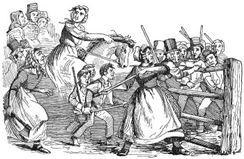
The Rebecca Riots. Illustrated London News 1843

Tolls were payable by users of the turnpikes to foot the bill for them in the long term, with toll rates based on usage of the road.  This meant that the cost of maintaining the road fell on those who used it, much like modern road tax, rather than on the often landless and impoverished members of the parish.  A single person on horseback would pay much less than someone taking animals or a cart of goods for sale at market.  Again, it’s a bit like modern road tax where a four-wheel-drive or a van is charged at a higher rate than a small runabout.  Some people were exempt from tolls, including those attending church on a Sunday, clergymen, voters attending elections, mail coaches and funerals.  Local gentry were not exempt, and nor was farm traffic.  Although often very unpopular, penalties for damaging turnpikes began as whippings and up to three months imprisonment but were escalated, as protests increased, to include the possibility of deportation.  This did not prevent a number of protests and even riots being organized, mostly by farmers.  The best known of these are the Welsh Rebecca Riots of 1839-1843, when farmers dressed up as women to avoid identification, but there had been many earlier examples too. Most everyday personal protests took the form of attempting to cheat the toll or evade it entirely, rather than inflicting any physical damage.  Toll cheating was a favourite pastime.

Others, however, were much more enthusiastic.  Daniel Defoe, writing in 1725, was a fan.  Travelling around Britain and writing his “A Tour Through the Whole Island of Great Britain” he described one section along Watling Street in ecstatic terms:  “The bottom is not only repaired, but the narrow places are widened, hills levelled, bottoms raised and the ascents and descents made easy.”

Each new turnpike trust was authorized by an individual Act of Parliament, which initially lasted for 21 years, after which they could be renewed until the decision was made after the first half of the 19th Century to allow all turnpikes Acts to expire.   The turnpike trusts were composed of local landowners and dignitaries, including clergy and the new class of professional men that included ambitious local merchants and manufacturers.  Although the trustees were not paid, it was absolutely in their interests to improve the economic infrastructure of their particular areas.

The trustees in turn appointed salaried officers, such as solicitors and bankers, to do the actual work of building and maintaining the road and managing the collection of tolls.  Turnpikes helped to establish reliable timetables and improved the dependability of the mail.  Ribbon developments grew up along them, particularly as they headed out of a town, or passed through a major intersection, and new coaching inns were established to meet the needs of passengers, horses and carriage crew.   In 1745 it had taken a fortnight to reach Edinburgh from London, but by 1796 this had been reduced to two and a half days, and by 1830 just 36 hours.  By the end of 1750 there were 166 turnpike trusts covering 3400 miles / 5500km.  By the 1870s turnpikes covered 19,000 road miles (30,000km).

Most turnpikes simply repaired existing roads and others reinvented existing roads in terms of their construction, sometimes rerouting them.  Only occasionally were entirely new roads were built.  The Chester to Worthenbury stretch was somewhere between the first two of these, improving the road surface and drainage whilst maintaining the original width and route of the old road.

The main activities required for the establishment of a turnpike were hard-surfacing and draining as well as signposting.  The surfacing was required to prevent animals and cart and carriage wheels from carving up the roads, and drainage, as the Romans had discovered, was required to maintain the surface and prevent it reverting to deeply indented mud.  Edwin Pratt’s 1912 study of inland transport (an invaluable source of information for this post), was most unflattering about the quality of the turnpikes before Thomas Telford and particularly John Loudon MacAdam began to standardize a better, reliable way of surfacing roads:

Although a vast amount of road-making or road-repairing was going on, at the very considerable expense of the road users, and to the advantage of a small army of attorneys, officials and labourers, it was not road-making of a scientific kind, but merely amateur work, done at excessive cost, either with unintelligent zeal or in slovenly style, and yielding results which mostly failed to give the country the type of road it required for the ever-increasing traffic to which expanding trade, greater travel, and heavier and more numerous waggons and coaches were leading. Before the adoption of scientific road-making, the usual way of forming a new road was, first to lay along it a collection of large stones, and then to heap up thereon small stones and road dirt in such a way that the road assumed the shape of the upper half of an orange, the convexity often being so pronounced that vehicles kept along the summit of the eminence because it was dangerous for them, especially in rainy weather, to go along the slope on either side.

John McAdam. Engraving by Charles Turner. Courtesy of the Trustees of the British Museum

This was probably not true of all turnpikes, but was clearly valid in a daunting number of cases.  In the early 19th Century McAdam’s first insight was that road surfaces needed to be impermeable so that water did not pass through to the soil beneath and begin to run away, collapse and otherwise undermine the road above.  His second insight was that stones laid as road surfaces should be  broken and angular, not rounded, so that when subjected to the weight of traffic they would consolidate, compact and bear weight.  He ran successful experiments to test his ideas.  This was the first strategic and standardized approach to road building in Britain since the Romans left.

Signage, much like the M6 Toll today, advertized the presence of a turnpike, and promoted its use, but also showed routes to villages along roads with which it intersected.  A gate was set up and a toll cottage or at the very least a hut was usually built.

Milestones

1898 milepost, just to the north of Churton (my photo, CC BY-NC-ND 4.0)

Milestones or mileposts were set from the first half of the 17th Century onwards, starting in southeast England, mainly for the benefit of mail coaches and other passenger vehicles.  Turnpikes were encouraged to install them from the 1740s and in 1766 became obligatory when it was found that as well as being useful for coachmen and passengers, it enabled accurate measuring of distances for the pricing of different routes.  It also helped to improve improved the reliability of timetables, something to which the turnpikes themselves, had enabled, particularly relevant in bad weather.

There are some very fine milestones dotted along the road along the line of the old Chester to Worthenbury turnpike, but all are dated to 1898, two decades after the expiration date of the 1854 Act.  They were erected by Chester County Council after it had accepted responsibility for the road.  A forthcoming post will talk about the milestones.  Sadly, if there were original milestones belonging to the 1854-1876 Chestser to Worthenbury turnpike, which in theory there should have been, none remain.  They may have been removed when the 1898 ones were put in place.  Looking around online for earlier mileposts in Cheshire, they were all made of stone, some of sandstone, engraved with the mileage details, and some are badly eroded.  Perhaps some fallen and lost ones will eventually turn up.

I am keeping a record of all the surviving 1898 mileposts, as I find them, and the condition that they are in on another post, here.

The end of the turnpikes

Arguments that turnpikes were an impediment to free trade were also beginning to be heard, and national infrastructure was gradually coming under more active government control.  The Local Government Act of 1888 put responsibility of roads into the hands of local councils, at which point many of the turnpikes became redundant, although sections 92-98 of the 1888 Act provided for some exclusions.

Railways of England and Wales 1825-1914. Source: Harvie and Matthew 2000

According to Crosby, by the mid 19th Century the network of turnpikes in Cheshire covered around 590 miles.  As the the railways began to cover more parts of the country, far more efficient at transporting both people and cargoes, including livestock, turnpikes were no longer as important.  In the 1840s, as railways took off, income from tolls fell dramatically.  From this time forward, and particularly from the 1860s, as turnpikes came up for renewal most were allowed to lapse, and the government decided to referred to as “disturnpiked.” In 1895 the last of the turnpikes closed down.

Some villages that had been bypassed by a major turnpike, suddenly became economically prosperous when railways were run through them.  For example, Aberdovey, a small but important port for the coastal trade in mid-West Wales (known to many of today’s West Cheshire residents for its golf course), was bypassed when an east-west turnpike was built following the Merioneth Turnpike Act of 1775, but when the railway arrived in the middle of the 19th Century it became an increasingly important port for the transportation of Irish livestock, and became a popular destination for tourists.  Rail fares began to undercut stagecoaches and were faster, and the stagecoaches rapidly went out of business as the reach of the railway network grew.  Most of the last turnpike survivors had become feeders to the railways.

However, one of the major reasons for turnpikes being disturnpiked was that they were always something of a headache.  Construction methods were not standardized until very late (and then only if the trust chose to go down that particular path), and care was highly variable.  Pratt puts this down in part to the way in which labour was sourced:

Managed or directed by trustees and surveyors . . .  the actual work on the turnpike roads was mainly carried out by statute labour, pauper labour or labour paid for out of the tolls, out of the receipts from the composition for statute duty, or, as a last resource, at the direct cost of the ratepayers, who were thus made responsible for the turnpike as well as for the parish roads.  Statute labour was a positive burlesque of English local government. Archdeacon Plymley says in his “General View of the Agriculture of Shropshire” (1803): “There is no trick, evasion or idleness that shall be deemed too mean to avoid working on the road: sometimes the worst horses are sent; at others a broken cart, or a boy, or an old man past labour, to fill: they are sometimes sent an hour or two too late in the morning, or they leave off much sooner than the proper time, unless the surveyor watch the whole day.

The milestone outside Glebe Farm, part way between Churton and Aldford

The piecemeal organization of the turnpikes meant that they served local interests but only sometimes contributed to long-distance travel and communication.  Even on a region by region basis, there were big gaps in good quality road infrastructure because a county as a whole was not of much interest to local trusts.  This significant failing in centralized strategy for inland communications was something that the government knew it needed to address, particularly as manufacturing became increasingly industrialized, demand grew and merchants wanted better access to a much wider geographical choice of markets.  In a period of expanding opportunities and spending power, turnpikes had helped to improve conditions for the economy and for passengers, but they had simply never been able to meet the needs imposed on them by the late 19th Century.

For two centuries turnpikes had been essential to the support of local links and longer distant trade and travel.  The toll houses established were usually added at each end of a turnpike and  sometimes in between, and some of those remain dotted around this and neighbouring counties.  Some of the mileposts and signposts also continue to be dotted around the modern rural landscape.  When Cheshire County Council was formed on 1st January 1889, it inherited an excellent network of roads linking all its key towns and villages, most of which had been turnpikes and soon began to position its own mileposts on major highways, many of them former turnpikes.

As always, please let me know if you have any questions
or if you have additional information to contribute

Part 2 can be found here

Sources for Parts 1 and 2:

Books and papers:

An Act for making a Turnpike Road from Chester, by Farndon, to Worthenbury, with a Branch therefrom to the Village of Farndon, 1854

Benford, M. 2002. Milestones.  Shire Publications

Crane, N. 2016.  The Making of the British Landscape.  From Ice Age to the Present.  Weidenfeld and Nicholson

Crosby, A.G. 2012.  New Roads for Old. Cheshire Turnpikes in the Landscape 1700-1850.  In (eds.) Varey, S.M. and White, G.J. Landscape History Discoveries in the North West.  University of Chester Press, p.190-223.

Cunningham Glen, R. 1895. Indictment presented before Lord Coleridge, C.J.  Reg. vs. Barker.  Reports of Cases in Criminal Law argued and determined in the courts of England and Ireland, vol.XVII, 1890-1895. Reported by R. Cunnigham Glen Esq., Barrister at Law. Horace Cox

Defoe, D. 1724–1726 (Rogers, P. ed.). A Tour Through the Whole Island of Great Britain Penguin (particularly, Volume II, 1725, and its appendix).

Harvie, C. and Matthew, H.C.G.  1984, 2000.  Nineteenth Century Britain. Oxford University Press

Hindle, P. 1998 (3rd edition).  Medieval Roads and Tracks.  Shire Publications Ltd

Keys, D. 2016. Discovery of huge Bronze Age wheel sheds light on transport in prehistoric Britain.  The Independent, Friday 19th February 2016
https://www.independent.co.uk/news/science/archaeology/prehistoric-britain-discovery-bronze-age-wheel-archaeology-a6882671.html

Langford, P. 1984, 2000. Eighteenth Century Britain.  Oxford University Press

Latham, F.A. 1981.  Farndon. The History of a Cheshire Village.  Local History Group.

Local Government Act 1888 (51 and 52 Vict. c.41). Section 97, Saving as to liability for main roads.

OS Landranger map 117 2016.  Chester and Wrexham.  Ordnance Survey

Phillips, A.D.M. and Phillips, C.B. 2002.  A New Historical Atlas of Cheshire. Cheshire County Council and Cheshire Community Council Publications Trust.

Pratt, E.A. 1912.  A History of Inland Transport and Communication in England. Kegan Paul, Trench, Trübner and Co Ltd.
Project Gutenburg: https://www.gutenberg.org/files/52087/52087-h/52087-h.htm

Pryor, F. 2010.  The Making of the British Landscape.  How We Have Transformed the Land from Prehistory to Today.  Allen Lane

Wright, G. N. 1992. Turnpike Roads. Shire Publications Ltd.

Websites

A Collection of Directories for Cheshire
Cheshire County Council
http://cheshiredirectories.manuscripteye.com/index.htm

British Listed Buildings
Cross Cottage, Churton
https://britishlistedbuildings.co.uk/101228714-cross-cottage-churton

Broughton Hall, Threapwood
Threapwood History Group
http://www.threapwoodhistory.org/broughtonhall.html

Cheshire Tithe Maps Online
Cheshire Archives and Local Studies
https://maps.cheshireeast.gov.uk/tithemaps/

Emral Hall, Worthenbury
Wrexham Online
https://www.wrexham-history.com/emral-hall-worthenbury/ 

Historic England
Cross Cottage, Churton
https://historicengland.org.uk/listing/the-list/list-entry/1228714

Dig Diary 19: Discovering Britain’s Oldest, Complete Wheel
February 29, 2016
Must Farm Dig Diaries
http://www.mustfarm.com/progress/site-diary-19-discovering-britains-oldest-complete-wheel/

National Archives
Chester and Whitchurch Turnpikes Trust
https://discovery.nationalarchives.gov.uk/details/r/11e8a8d6-43c5-4704-a93b-58fe6d0444a6

National Library of Scotland Mapfinder
OS 6-inch map, 1888-1913
https://maps.nls.uk/geo/explore/#zoom=15&lat=53.09734&lon=-2.86868&layers=6&b=1

Peterborough Archaeology
Must Farm Bronze Age Settlement
https://peterborougharchaeology.org/peterborough-archaeological-sites/must-farm/

Turnpike Roads in England and Wales
Turnpikes.org.uk
http://www.turnpikes.org.uk/Tollhouse%20design.htm


A touch of Rome just east of Churton #2 – The Walk

Yesterday I went to find the section of the Roman road that runs from Chester, through Aldford, and down to the east of Churton.   The Roman road that starts in Chester and passes to the east of Churton is Margary’s road number 6a, also known as Watling Street West. On the Cheshire West and Chester’s Public Map Viewer, the section of it that passes through Aldford and passes Churton is public footpath “Aldford FP8.”  I described the background to Roman Chester and the British road system yesterday, in part 1.  The walk I took to find the traces of the road on the ground is the subject of this post, part 2.

The Roman road that starts in Chester and passes to the east of Churton is Margary’s road number 6a, also known as Watling Street West. On the Cheshire West and Chester’s Public Map Viewer, the section of it that passes through Aldford and passes Churton is public footpath “Aldford FP8.”

Plan from David Mason’s comprehensive book “Roman Chester. City of the Eagles,” 2007, p.50. My annotations in colour, picking out structures mentioned in the text that flank Watling Street West on the start of its route to Aldford, Churton, Whitchurch and beyond. Click image to enlarge.

By AD 200, after repairs and reconstruction, with new buildings added, Deva had fulfilled all of its architect’s original hopes, and plans of the fortress at this time allow reconstruction of the first part of the original route from fortress. On today’s city plan the route of Watling Street West begins at the Chester Cross, at the head of Bridge Street. The Bridge Street stretch of the road within the fortress walls was called the Via Praetoria. The fortress headquarters (principia) and neighbouring legionary commander’s residence (praetorium) would have been located here, behind the Chester Cross, facing down Bridge Street. The building housing the Victoria pub (with a toast to our friend Jack), and the neighbouring St Peter’s Church both sit over parts of the the principia and praetorium.

Proceeding down the Via Praetoria, flanked first by the scamun tribunorum (senior officer’s quarters) on each side and then by the thermae (bath-house) on one side, and what may have been the valetudinarium (hospital) on the other side, a traveller would have crossed the Via Sagularis that ran along the inner edge of the rampart. At that point he or she would have been stopped at a large stone gateway mid-way along the southern wall of the fort, the Porta Praetoria, which would have been one of four substantial defensive checkpoints for those going in and out. Sadly, the gateway was destroyed when the Medieval defences were extended. From here, the route passed down the path of Lower Bridge Street, crossing a bridge over the Dee into what is now Handbridge and was then a canabae legionis (civilian suburb) that sprawled beyond the fortress walls.

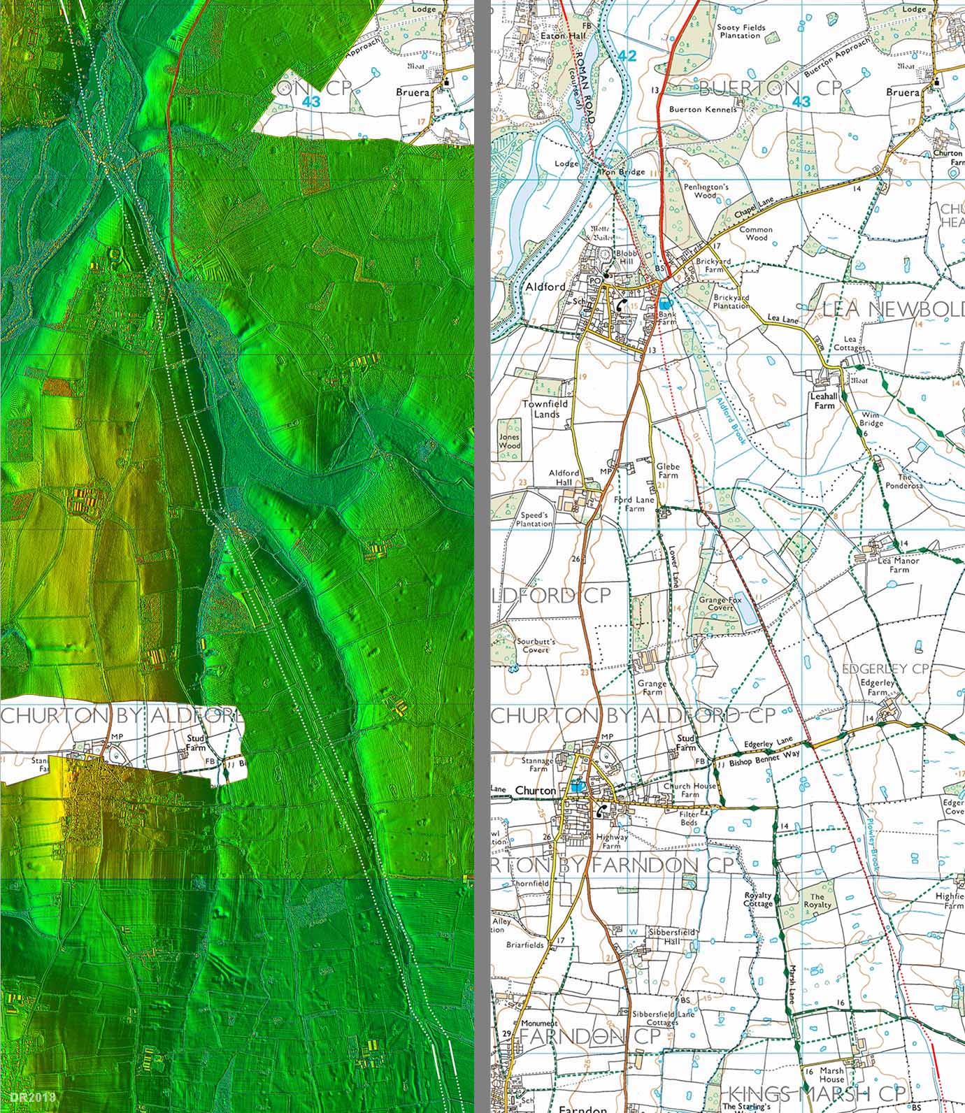
A section of the route of 6a from Aldford to Churton – LiDAR and Ordnance Survey. Click to see the bigger image. Source:
Roads of Roman Britain online gazetteer.

Once the bridge was crossed and the canabae legionis traversed, a left-hand turn down Eaton Road follows the path of 6a/Watling Street West to Eccleston. Much of the line of the road from here is shown both on the LiDAR (remote sensing) image and the corresponding Ordnance Survey map (from the Roads of Roman Britain website). Some 2km (1.2 miles) to the south of Chester, the road passed through Heronbridge (once a large Roman civil settlement on the west bank of the Dee), before crossing the Dee again, at Aldford. A Roman presence at such crossings, such as a fortlet, roadside inn (mansio) or way-station (mutatio) was not unusual, but to date there is no evidence for any such installation at Aldford.

From Aldford the road passed to the east of Churton and the Roman works at Holt, which were on the west side of the Dee. There was no bridge but the river could be forded at low tide. There is currently no evidence that a Roman site was established at or near Farndon on the eastern bank of the river. The road continued on its way from east of Churton through Tilston and Malpas before reaching Whitchurch (Mediolanum). From Whitchurch, another stretch of Roman road ran to Wroxeter (Virconium Cornoviorum) and from there travellers could proceed either southeast to London (Londinium) or Colchester (Camulodunum), and from these bases to the rest of Europe, or south to Caerwent (Venta Siluris).

A second and short stretch of road into this long section to the north of Churton at Aldford, and is also shown on the above map. In Ivan Margary’s scheme, this stretch of is 6aa. The route had been proposed during the 19th Century, but was not confirmed until recently. Although much of the route is under modern development, sections of the proposed section of road were identified by LiDAR, confirming that the road headed south through Huntington to Alford. LiDAR also revealed what is thought to be a previously unknown Roman camp fort along the path of that road. LiDAR, a remote sensing method, has become invaluable for revealing sub-surface features without excavation.

The map on the right is from the online Cheshire West and Chester Public Map Viewer

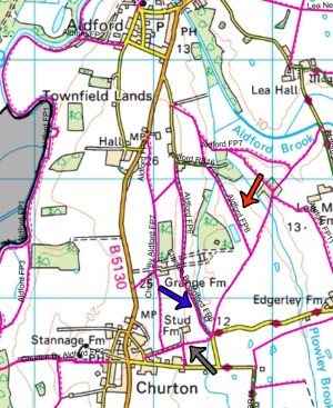
The red arrow shows the line of FP8, the footpath that runs along a stretch of the original Roman road, Watling Street West (also Margary’s 6a). Although I did a circular walk, along the footpaths marked by the arrows, the photographs below show only the Roman section of my walk, between Aldford and the section of the roadway that runs east of Churton. I will post photographs of the full circular walk that incorporated the Roman section in the next couple of days. There is nothing particularly Roman about it, apart from the broad width of the track and the fairly straight route that it takes, but it makes a very fine walk in its own right, with plenty of scenery and some wide, colourful vistas. I was intending to follow FP8 as far as FP10 (the diagonal path that runs back to where three paths meet on the yellow B-road, Edgerely Road). In fact, just past the dauntingly named but aromatically inoffensive slurry bed (marked on the map above as a blue rectangle) and on the other side of a metalled lane, the grassy path was flooded with very gungy, muddy ankle-deep water and I really didn’t fancy getting a boot fool of distinctly fetid sludge. Instead, I retraced my steps and turned west to cut along the metalled track that leads from FP8 to Grange Farm (of which it is a part) and retraced my original path along FP6 to Edgerley Road (along the route that I took a couple of days ago). So there remains a small run of the Churton section of Watling Street West accessible on public footpaths that I have yet to complete.

Roman Road Watling Street West (Margary 6a) where it crosses Edgerley Lane.  The section south of the road is not a public footpath.  Source: Roman Roads in Britain Gazeteer

As the above maps show, Watling Street West bypassed Farndon completely, running to its east.  There is speculation, currently unsupported by archaeological evidence, that there may have been some sort of Roman installation at the present crossing between Farndon and Holt, because this may have been the best place to ford the river.  The tile and pottery works to the north of Holt on the east bank of the Dee made use of the river for most of their transportation needs, but a connection to Watling Street West would have been desirable, via a small branch road.  Even if there was a small Roman presence at Farndon, like a fortlet, it did not attract a large community and there was no reason to divert the main line of Watling Street West.  It is only when Farndon became an expanding community, some time after the construction of a permanent bridge, that a route from Aldford to Farndon was established.  Today, the B5130 passes along the 6aa (Huntington to Aldford) route rather than the 6a (Bridge Street to Aldford) route and then heads through the middle of Churton before arriving at Farndon.  Churton grew up as a small ribbon development along this new route, its earliest buildings apparently dating to the 17th century.  This route eventually replaced the section of Watling Street West that ran from Aldford to the east of Churton.  We are lucky that Watling Street West still survives as a farm track and public footpath.

Aldford viewed from Lower Lane

Footpath FP7 across a field from Lower Lane, just short of the B5130 road that runs through Churton and  Aldford.  A short flight of wooden steps leads to a stile.

Footpath across the field from Lower Lane  The footpath goes through the hedge and heads south, to the right

There are good views over the fields as you head to the south.

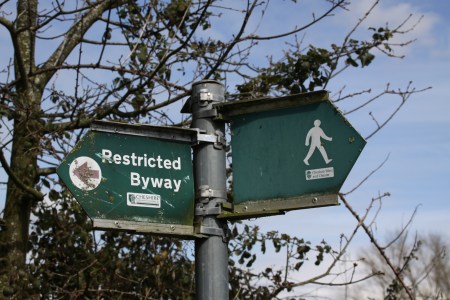
Follow the footpath to the east end of the restricted byway (RB16 on the map above), turn left and proceed along footpath FP8 along the Roman road

After crossing a small metalled lane leading to Grange Farm, the track runs out and a grassy and soggy section of the footpath leads further south.

The sogginess became very wet indeed and I turned back at this point, and will resume on another day.

Looking back the way I had come, the Roman road heads back towards Aldford and I turned left towards Grange Farm and a dry route back to Churton.

A note on walking conditions. Some of the walk follows a small lane but the rest runs through fields and young woodland or coppices. It is all very easy underfoot. However, at this time of year, and following any recent rainfall, sturdy damp-proof hiking footwear is strongly recommended as there is a bit of slightly uneven ground and some very muddy sections. Hereabouts, the land is not always well drained, and standing water tends to gather and linger soggily on the surface.

Sources:

Books and journals:

Davies, H. 2008. Roman Roads of Britain. Shire Archaeology

Frere, S.S., Hassall, M.W.C. and Tomlin, R.S.O. 1988. Roman Britain in 1987. Britannia, Vol. 19 (1988), p.415-508

Jones, G.D.B. and Webster P.V. 1968. Mediolanum: Excavations at Whitchurch 1965–6. Archaeological Journal, 125:1, p.193-254

Lathan, F.A. 1981.  Farndon. The History of a Cheshire Village.  Local History Group

Margary, I. 1973 3rd edition). Roman Roads in Britain.  John Baker 1973.

Mason, D.J.P. 2001, 2007. Roman Chester. City of the Eagles. Tempus

Mason, D.J.P. 2007. Chester AD 400-1066. From Roman Fortress to English Town. Tempus.

Peel, J.H.B. 1976. Along the Roman Roads of Britain. Macmillan

Shaw, M. and Clark, J. 2003a. Cheshire Historic Towns Survey. Aldford Archaeological Assessment. Environmental Planning, Cheshire County Council

Shaw, M. and Clark, J. 2003b. Cheshire Historic Towns Survey. Farndon Archaeological Assessment. Environmental Planning, Cheshire County Council

Ward, S. 2013. Chester. A History. The History Press

Website resources:

Cheshire West and Chester – Public Map Viewer
https://maps.cheshirewestandchester.gov.uk/cwac/webmapping

Roman Roads Research Association http://www.romanroads.org/

The Roads of Roman Britain
http://roadsofromanbritain.org/index.html
http://www.romanroads.org/gazetteer/cheshire/cheshire.html

A Web-enhanced version of Roman Roads in Britain by Thomas Codrington,
published by the Society for Promoting Christian Knowledge, London, 1903
https://tinyurl.com/75ujdd43

A touch of Rome just east of Churton #1 – Background

Yesterday I went to find the section of the Roman road that runs from Chester, through Aldford, and down to the east of Churton.  I have divided this post into two parts.  The first part, below, looks at the background to Roman roads in Britain.  Part 2 describes the walk itself.

The Cuppin Street excavation one lunchtime, 1986 or 87. My photo.

As mentioned in the introduction to this blog, I trained as an archaeologist and spent my summers in the 1980s digging up various parts of England and Wales. Although technically a prehistorian, my early excavation experience also included the Roman temple site at Caerwent (Venta Silurum in southeast Wales), the basilica at Silchester (Calleva Atrebatum in Hampshire) and three consecutive seasons with the Grosvenor Museum team on the multi-period Cuppin Street site in Chester (Deva). Whenever modern building work takes place in Chester, the city’s archaeologists are given time to undertake excavations. Before we started digging it up, under the capable direction of Dr Simon Ward, the site was an informal, roughly surfaced car park that was destined to become the Magistrates Courts, originally just outside the Roman town’s walls.

A collapsed road was one of many important features that made up a truly fascinating site. The metalled road had a central dip along its depth, which we set out to investigate. Black tar from a defunct Victorian gasworks oozed into a very deep trench, where a friend and I were excavating what lay beneath the road. A wood-lined drain beneath the road had slowly collapsed over time, becoming blocked with general waste, the middle of the well-made road had gently subsided into the void, creating a bizarre concave profile. Drains in Deva were often located under roads, and could be up to 5ft deep. The Cuppin Street example was one of several major and minor roads and lanes that punctured Deva from all directions. I’ve had something of an interest in Roman roads ever since.

Deva (later Deva Victrix) was at the far northwestern edge of the roman Road network Where England and Wales met at the point where the Dee emptied into its estuary. It was a strategically important Roman base with a large command area over much of the northwest and north Wales. The legionary fortress was established by at least AD79 in the territory of the Cornovii who were based at Wroxeter (Virconium Cornoviorum), although Rome’s presence in the Chester area predates the permanent fortress by two decades. There is no indication of violence, and it is possible that the Cornovii had already come to terms with the Roman invaders, perhaps as early as AD43 when Claudius entered into treaty relationships with a number of kings. Whatever Roman presence had been here previously, the fortress was established in AD79, having been started in around AD74-75, and was built by the Second “Adtiutrix” Legion. In AD86 the second legion was sent to the Danube and was replaced by the Twentieth “Valeria Victrix” Legion, which remained until the withdrawal of the Roman army from Britain in AD 410.

One of Julian Baum’s stunning impressions of Deva, showing the
beginning of Watling Street West (Margary 6a) and the Dee
crossing. Source: Julian Baum, Take27 Ltd.

When completed, the Deva fortress covered over 60 acres (24 hectares) on the standard playing-card plan (see site plan below), and eventually housed up to 6750 soldiers, servants and slaves, and was the headquarters of the local legion. It was a sizeable entity, 20% larger than both Caerleon (Isca) and York (Eboracum), which were both permanent legionary fortresses that were built at much the same time as Deva. It has been suggested that this size may have been needed to accommodate some unusually grand buildings under orders from an important official resident at the fortress, perhaps the provincial governor who, appointed by the emperor himself, would have required a more impressive portfolio of amenities than the usual fortress would have provided. A civilian entourage followed the military, including merchants, service providers and families of the soldiers (legionnaires were not permitted to marry until AD212, but this did not prevent them having partners and children). They were not permitted to live within the fortress so settlements (canabae legionis) grew up as suburbs immediately in the vicinity of the fortress. Also near to the fortress were the site’s cemeteries. Other small civil settlements growing up further afield at Heronbridge, a farming community, and the smaller Saltney. A tile and pottery works was established further down the Dee at Holt.

Roman roads of the Chester area. 6a and 6aa leave Chester and head south, meeting at Alford. 6a continues south, passing to the east of the Dee and the villages of Churton and Farndon. Map source: The excellent “Roads of Roman Britain” online gazetteer.

The fortress was in a good strategic position, convenient both for subjugating fractious groups in north Wales and for maintaining control over the northwest, where subjugation of the troublesome Brigantian tribe had become a priority. It was built on a rise in the land within a bend in the river Dee, meaning that it had natural defences on two sides, which contributed substantially to the security of the walled fort. The racecourse, on the Roodee, sits on the location of what was once a natural harbour, enabling a busy port to flourish on the Dee just beneath the fort. This was a natural extension of the road network, enabling the fort to be provisioned, with both soldiers and supplies being brought in from Europe, and for local commerce to develop along the coast. The Romans brought a wide selection of foods to Britain that we now think of as everyday, but were then luxury items, including apples, pears, cherries, grapes, asparagus, cabbages, carrots, onions, turnips, cucumbers, fennel and dill. High value perishables like these were much better transported by sea than road, which was both slower and could seriously jolt fragile produce. Other luxury items usually trusted to sea rather than road were high quality but delicate or costly objects like samian pottery, glass and vessels of wine. To link north and south, the river required the provision of a bridge, and this was erected where Lower Bridge Street crosses the Dee into Handbridge. In its place is now the Old Dee Bridge, dating to the 14th Century. The road went on to Whitchurch and Wroxeter, from where a number of destinations were possible. Today it is known as Watling Street West. Other roads out of Deva headed north, east and west, as shown on the map below.

The vast and complex road network was the glue that bound the impressive imperial infrastructure of forts, fortresses, fortlets, towns, inns, way-stations, camps and industrial centres. It is a remarkable cat’s-cradle of long straight stretches, most metalled or paved, others very rough, with some following much older trackways. Today many modern roads follow these original Roman routes, like Watling Street, along which the A5 now travels. Roman roads were planned out by teams of engineers and surveyors.  There are no documents detailing how the task was achieved, but the first step was probably to establish the line of the road, which was planned as a more or less straight line, as the crow flies, from a to b (in this case Chester to Whitchurch).   Just as today, the army had trained surveyors and engineers.  A map would probably have been prepared, and the required line would have been staked out

The profile of Stane Street in Surrey offers a good idea of how many roads were built in Roman Britain. Source: Epsom and Ewell History Explorer website.

Although the local geology, geomorphology and soil structure determined the exact construction of roads, they followed a basic conceptual idea of how a road should be built.  Roads were flanked by drainage ditches, which carried rainfall runoff and provided quarry material for a raised section along the road.  In profile, the roads were were usually built up above the level of the surrounding landscape and were cambered, with a curved top and sloping edges to aid drainage.  Many modern accounts describe four or more levels of construction, but Hugh Davies says that this belief, widespread but incorrect, was probably a misreading of the work of a famous Roman architect called Vitruvius who certainly describes for successive layers, but was actually referring to paved areas around prominent buildings rather than roads.  In the case of roads,  a standard arrangement was usually much simpler, consisting of two levels, although road construction methods differ from one place to another.   The standard arrangement consisted of an agger (a built-up section of road between the two drainage ditches), a layer of rough metalling consisting of stones, cobbles, pebbles  and smaller infill, and then a top layer of smaller stones and/or gravel.  Some were then topped with paving stones, which helped to preserve them.  The agger could be up to 1.2m (4ft) but was often raised only just above the level of the surrounding landscape.  Like forts and temples, roads were not strictly standardized.  Today some remarkable examples survive, but the greater majority have been destroyed or eroded.  Re-use for modern roads and expansion of urban settlement have destroyed sections of roads, while weather damage and compaction over the centuries have flattened many of the surviving roads and broken up their surfaces.

Sasha Trubetskoy’s schematic map of Roman Britain, based on
Harry Beck’s London Underground map of 1933. Click image to see a bigger version. Source:  Sasha Maps

Modern knowledge of this vast network, extending from the south coast into mid Scotland, has been built up by extensive detective work from the 18th Century onwards. Initial research into the British Roman road network was based on the “Antonine Itinerary,” written in c.AD 200, one of handful of surviving Latin documents that provide records names and other data that can help to located both and the routes of roads. The document is made up of a series of lists, and each list, or iter, provides details about the start and end point of each route, its total mileage (mille passus or m.p, meaning 1000 paces) and notes places distributed along the routes. The lists only cover about 25% of British roads, and are by no means complete, but they have been an invaluable research tool. Today, with dedicated work on foot, together with the use of remote sensing technologies from the air, each year new discoveries help to fill the obvious gaps and to reveal unsuspected stretches. One of the most important organizations contributing to this task of identifying sections of the road network is the terrific Roman Roads Research Association, which builds on work pioneered by Roman road expert Ivan D. Margary. Margary devised a numbering system to both identify and categorize Roman roads, publishing his comprehensive “Roman Roads in Britain” in 1955, which continues to be an invaluable reference. The Roman Roads Research website includes an invaluable online gazetteer, the Cheshire section of which has been assembled by David Ratledge and Neil Buckley, with many thanks for such a great resource. The outcome of all of this research is nicely captured on a cleverly conceived schematic map designed by cartographer Sasha Trubetskoy, using the London Underground of map of 1933 designed by Harry Beck as a template.

The Roman road that starts in Chester and passes to the east of Churton is Margary’s road number 6a, also known as Watling Street West. On the Cheshire West and Chester’s Public Map Viewer, the section of it that passes through Aldford and passes Churton is public footpath “Aldford FP8.”  This is the subject of part 2.


Sources:

Books and journals:

Davies, H. 2008. Roman Roads of Britain. Shire Archaeology

Frere, S.S., Hassall, M.W.C. and Tomlin, R.S.O. 1988. Roman Britain in 1987. Britannia, Vol. 19 (1988), p.415-508

Jones, G.D.B. and Webster P.V. 1968. Mediolanum: Excavations at Whitchurch 1965–6. Archaeological Journal, 125:1, p.193-254

Lathan, F.A. 1981.  Farndon. The History of a Cheshire Village.  Local History Group

Margary, I. 1973 3rd edition). Roman Roads in Britain.  John Baker 1973.

Mason, D.J.P. 2001, 2007. Roman Chester. City of the Eagles. Tempus

Mason, D.J.P. 2007. Chester AD 400-1066. From Roman Fortress to English Town. Tempus.

Peel, J.H.B. 1976. Along the Roman Roads of Britain. Macmillan

Shaw, M. and Clark, J. 2003a. Cheshire Historic Towns Survey. Aldford Archaeological Assessment. Environmental Planning, Cheshire County Council

Shaw, M. and Clark, J. 2003b. Cheshire Historic Towns Survey. Farndon Archaeological Assessment. Environmental Planning, Cheshire County Council

Ward, S. 2013. Chester. A History. The History Press

Website resources:

Cheshire West and Chester – Public Map Viewer
https://maps.cheshirewestandchester.gov.uk/cwac/webmapping

Roman Roads Research Association http://www.romanroads.org/

The Roads of Roman Britain
http://roadsofromanbritain.org/index.html
http://www.romanroads.org/gazetteer/cheshire/cheshire.html

A Web-enhanced version of Roman Roads in Britain by Thomas Codrington,
published by the Society for Promoting Christian Knowledge, London, 1903
https://tinyurl.com/75ujdd43