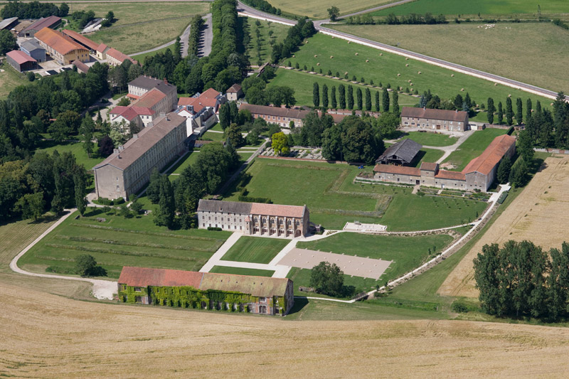
It was such a gloriously sunny day yesterday that even though I had marked today for giving the house a much-need top-to-toe clean, I abandoned the whole project, jumped in the car, and stopped off to pick up my Dad before driving down to Chirk Castle to enjoy the pristine garden and the walks in the small woodland. It is a great time of year for it. The castle, the only one of Edward I’s Marcher fortresses still inhabited today, always a little intimidating in its block-like immobility, is far less bellicose in the bright sun.
The topiary is great at any time of year, and the colours of new foliage and bright heather give a real lift to everything, whilst the daffodils and snowdrops, popping up everywhere but particularly good in the woodland, are a joy. The snowdrops are all in full swing, but although a lot of daffodils are out and looking terrific, there are still more to break out of their buds. We stopped off on a perfectly placed bench for a blissful half hour in the sun to look out beyond the ha-ha over the rolling hillside towards the view below. It’s only a short outing, but a very agreeable one. I’ll let the pictures speak for themselves.
Plan of Chirk Castle grounds. Most of the snowdrops are in the Pleasure Ground Wood, but the daffodils are everywhere. Source: Chirk Castle, National Trust (website and free leaflet available in the ticket office)
Details of visiting are on the Chirk Castle website (National Trust). Regarding my usual comment on access, a wheelchair user might be able to see some of the gardens, but the woodland is probably not advisable. As for unwilling legs, yes if you keep in mind that the ground is uneven. There is a shuttle from the car park to the castle entrance, as the walk up can be challenging for unwilling legs.
Inside the rib-vaulted slype (or passage) passing through the east range of the cloister, to the rear of the abbey. Source: Coflein
In part 1 of this series, the establishment of the Cistercian order of monks, a branch of break-away houses based on the rule of St Benedict is explained, and its spread into Wales during the 12th century is discussed. Within this context, the foundation of Valle Crucis Abbey by Prince Madog of Powys Fadog is introduced, establishing the abbey as a member of a unique family of Cistercian houses that had its own particular Welsh character.
Part 2 looked at what each of the monastic buildings was for and how each room was used by the community of monks that lived at the abbey, potentially for the duration of their lives. It is discussed how the layout of each abbey was unique, but was guided by the basic Cistercian model of mixing domestic and religious buildings around a square, the cloister, and how this is demonstrated at Valle Crucis.
This post, part 3, takes a look at the history of the abbey buildings, pointing out how how certain architectural features indicate developments between the time of the foundation of the abbey in 1201 to its dissolution in 1537. Over this time, the occupants of the abbey responded to disasters, including fire and war; fluctuating economic conditions; changes of abbey leadership, and evolving outlooks, including eroding values, within the Cistercian order. The architecture of the claustral buildings reflects many of these changes, whether imposed upon or chosen by the community, capturing them uncompromisingly in stone.
The row of arches that define the eastern range of buildings surrounding the cloister.
The entire abbey is a narrative of time passing, and the east range of the cloister is a good example. In the photograph of the east range to the left, this small but well preserved section of the abbey reveals an immense profusion of architectural change, during the lifespan of the monastery and beyond its closure by Henry VIII. The combination of the row of arches above the window frames, lines of holes and protrusions and the slate-tiled roof above it all, capture how change over time is revealed in the abbey’s architecture. A simple list of just some of the architectural changes visible in the east range helps to illustrate the point.
The rounded entrance at the left is early 13th century, one of the earliest parts of the abbey, leading into the early 13th century sacristy.
Next to it, the ornate entrance to the book room in the middle is mid 14th century.
At the far right is a very elaborate passage from the cloister to the eastern part of the monastery precinct, and although this incorporates an earlier 13th century arch from elsewhere in the monastery, its construction dates to the late 15th or early 16th century, only a matter of decades before closure
The first floor was originally the monks’ dormitory when the abbey was first builtin the 13th century
Excavations found that the east range had been much longer in the 13th century, but for reasons unknown was later reduced in size, and when this happened the latrine (marked on the above photograph by rough masonry) must have been added
The row of holes are beam holes that supported the roof of an arcade (a covered walkway)
The two rows of stone protrusions, corbels, that stick out of the east range above arch level date to different periods. The upper set supported the base of an ornamental parapet belonging to the early 15th century, whereas the lower set supported the roof of the arcade of the 14th century
The blocked doorway on the first floor is 16th century, but this in turn replaces a 15th century doorway that followed the demolition of the roof that covered the walkway, when the abbot converted the dormitory into his personal apartments; a wooden staircase would have led down into the cloister
The slate roof visible today was put on after the monastery had been abandoned, and when the east range had been converted into a farm house, as is the square window to the left of the top floor’s blocked 16th century doorway.
See the excellent booklet by D.H. Evans (B.A., F.S.A) for more in the same vein as the above (Valle Crucis Abbey by D.H. Evans, Cadw 2008). Evans walks visitors through Valle Crucis building by building, room by room, picking out features from different periods in each. In this post, I have used Evans as my main source for architectural change, looking at what happened at different periods in chronological order, so that the development of the abbey as a whole can be understood as a historical narrative.
The arrival of the Cistercians at Llanegwestl in 1201
The meagre surviving remains of Strata Marcella. Source: Coflein
The first abbey to be established in Wales was Tintern in 1131, in Monmouthshire, South Wales, only the second abbey to be established in the British Isles. It was followed in 1151 by Whitland Abbey in Monmouthshire (also in south Wales, on the borders of Pembrokeshire and Carmarthenshire), founded with monks from Clairvaux Abbey, of the Cistercian order in France. Both were founded by Cambro-Normans, a bare century after the Conquest, but whereas Tintern remained firmly under Norman control, Whitland was adopted by the Lord Rhys, the Welsh prince of Deheubarth, who also adopted Whitland’s offspring, the abbey Strata Florida. The Lord Rhys established a new tradition of monasticism in Wales, referred to as Pura Wallia. As well as Strata Florida, Whitland provided the monks for Strata Marcella in 1170 and Cwmhir in 1176, which in turn provided abbots and monks for their own off-springs, resulting in three branches of Cistercian abbeys in Wales, spreading from south to north, an eastern branch a central branch and a western branch. In the eastern branch, Whitland founded Strata Marcella in 1170, and Strata Marcella in turn founded Valle Crucis, at the top of the western branch, in 1201.
Map of the cantrefi of Wales showing Powys Fadog. Source: Wikipedia
By the end of the 12th century, northern Powys (Powys Fadog) was the only territory or cantref in Wales to be without a Cistercian monastery, a matter of some discontent amongst the other monasteries in the Whitland network, including Whitland itself, Cwmhir, Strata Florida and Strata Marcella. Their abbots joined forces to persuade Prince Madog ap Gruffudd Maelor, ruler of northern Powys (Powys Fadog) to make the endowments required for the foundation of a new Cistercian monastery in northeast Wales. As described in part 1, when Prince Madog founded Valle Crucis in the commute of Iâl, it was in partnership with the Strata Marcella Abbey in mid Wales. Strata Marcella (founded 1170) provided the abbot and monks, and Prince Madog provided upland and lowland estates, mills, fishing rights and the agricultural infrastructure to enable Valle Crucis to establish and maintain itself.
Nant Eglwseg, running to the east of Valle Crucis
The site chosen by Madog and the Cistercians for the new abbey was remote from urban life, but was not an untamed wilderness. There was, in fact, a settlement already there called Llanegwestl, and the abbey was often referred to thereafter by the former settlement’s name rather than by its official Latin name. The site was ideal for village life. On the edge of a fast-flowing and generous stream it was sheltered by tall hillsides and benefited from both upland and lowland ranges, ideal for grazing sheep and cattle respectively, and was even sufficiently fertile on the floodplains for some agricultural or horticultural activity. It was near enough to the village of Llangollen for local trade to be practical, and was within reach of outlying farms (granges) that belonged to it.
The east face of Valle Crucis. View from the other side of the monastic fish pond. Source: Coflein
For the Cistercians, the proximity of water was integral not only to drinking, cooking and washing, but to their liturgies. At all Cistercian monasteries, a complex and often impressive network of subterranean drains and sluices was established, by which water was moved around each abbey to where it was needed. Water was also diverted form fish ponds. Inevitably, in order for the monks to move in, the villagers were forced to move out, and this was the first step taken to establish the new abbey. This was by no means an unusual, if unpopular event when a Cistercian abbey moved in, and Madog provided the dispossessed residents of Llanegwestl with land to the east, at Northcroft and Stansty (Bromfield) near Wrexham.
In 1201, the abbot and monks supplied by Strata Marcella arrived at their newly vacated destination, and started work. Although the following account is by no means not exhaustive, I have picked out some of the key points about the abbey’s architectural past to give an idea of how the abbey began, what happened to it in the course of its history, and how both accident and design led to physical changes in the function and appearance of the abbey’s surviving buildings. safasdfa
The early 13th Century
Butler’s 1970 excavation was published in Archaeologia Cambrensis in 1976.
Archaeological excavations by Lawrence Butler in 1970 shows that once the villagers had been resettled, the site was cleared so that an initial set of essential buildings could be built rapidly in wood, probably including a small church, chapter house (where the monks met each morning), and sleeping and eating quarters, the core infrastructure that St Benedict had determined was the bare minimum for a monastic community. Whilst living in the temporary buildings, the Valley Crucis monks set about overseeing the construction of their stone church, starting at the east end. The church, as the focus of abbey life, was always the first building to be started, although others could subsequently start to be developed simultaneously.
The early Cistercian order required choir monks to engage in manual labour as part of their daily duties, but it is unlikely that they engaged in any significant work on building activities due to the demands of their seven daily prayer sessions. Instead, specialist joiners, masons and labourers, perhaps with the assistance of any of the conversi (lay bretheren) not actively engaged in farming and related activities, will have carried out the bulk of the work. It is thought that many of these craftsmen were itinerant, making a living out of building and repairing ecclesiastical buildings.
Each Cistercian abbey’s floorplan was an echo of the Cistercian order’s “Bernadine” plan, promoted by St Bernard of Clairvaux abbey, which itself echoed the layout of earlier Benedictine monastic establishments. All Cistercian abbeys were guided by the principal of opus Dei, God’s work, and were organized to meet the needs of regular devotion in church, scholarly activity, economic self-sufficiency, personal poverty, communal support, all embedded in routines and activities that brought these ideas together and ensured their sustainability. As Cistercian monks took a Vow of Stability, which bound them to a given monastery for life, unable to leave it without good reason and then only with the permission of the abbot, a strict regime of route and reinforcement of core values was essential, all embodied in the claustral arrangement.
Valle Crucis ground plan. Source: Valley Crucis Abbey by D.H. Evans (Cadw 2008)
The west front of Valley Crucis abbey church
As the church continued to go up and attention could be turned to the rest of the monastic complex around the cloister, one of the first tasks will have been to have laid out the claustral plan and to put in drains that would run under rooms and subsequently be covered with floors. Butler’s excavation of the site, published in 1976, found several sections of stone-lined drains that passed under floors and under the garth, but he was unable to trace sufficient stretches to map them as a network. Therefore, how they functioned as a network is still not fully understood, although they almost certainly led, at a minimum, to the kitchen, the lavatorium (water basin) in the garth, and to clear the latrine drains.
fdsfsadfasdfa
As you leave the car park, look up, and you are confronted by the impressive west face, shown in the photograph above left. It is evident, when you pause to take it in, that there are considerable differences in the masonry, which mark work carried out at different periods. There is very little of the early 13th century remaining. The most noticeable features date to over 100 years after the abbey was founded, including the lancet windows and the arch that frames them, the doorway, the rose window and the finely dressed yellow sandstone ashlar (covering stone) in which the rose window sits, and will be discussed below. The earliest parts of the west face are, unsurprisingly, at the base, where a dressed plinth in preserved, and rather severe dressed buttresses (supporting squared pillars built against the walls) rise from the ground to support the tall west face.
Vaulting shaft shown in red, string course between the two periods of masonry shown with the blue arrow, and one of the church windows, of which only the bases remain along the north wall, is shown in green. click to expand the image.
Moving inside the church, more of this earliest phase is visible in the north aisle (the wall at far left). In the early 13th Century the walls were built roughly faced rubble held in place by a lot of mortar, combining bigger and smaller pieces that would have been plastered over when finished. There is a clear change in the style of this construction, visible in the photograph to the right. The lighter, lower part of the wall, consisting of poorly sorted masonry below is the earlier wall, and the darker, more regimented masonry above the stringcourse (row of projecting stones at the top of the lighter looking stonework) followed a fire that swept through the abbey at around 1240. Also in the photograph, in the centre at ground level, is one of several “vaulting shafts,” the bases of small pillars built against the wall. These too were part of the early 13th century vision. Had fire not have swept through the part-built abbey, they would have supported stone-vaulted roofs over both aisles. Instead, the early 13th century aisle roofs were built in wood.
There are five pairs of piers, or columns. The first four of these help to mark out the original footprint of the nave, where the conversi, any guests and corrodians (paying residents) attended church services. They were separated from the east end of the church, and the abbey’s choir monks, by a stone screen, called a pulpitum. The eastern end, where the choir monks carried out liturgies and services, with the presbytery, high alter, and two chapels in each of the two transepts, was started first. The nave lay on the other side of the pulpitum. The remains of the pulpitum today are where they were moved at a later date, and this later position is marked by the base of a spiral staircase. However, the base of the spiral staircase has features that date to the early 13th century, so it looks as though that both this and the original pulpitum were simply moved one bay along, extending the nave and reducing the eastern end. Originally it will have crossed the nave at the previous set of piers. It is thought that the staircase probably led up to an organ loft.
The fabulous sacristy was also built at this time, shown in the photographs below. The sacristy had doorways into the church and into the cloister. Its role was to house the vestments and altar furnishings, and any other paraphernalia required during the liturgies and services. It is an extraordinary part of the building, with a marvellous tunnel-vaulted stone roof, which is shown below, is a unique part of the abbey. Seen from the cloister, the entrance to the sacristy also dates from the early 13th Century and retains the round-topped arch of the Romanesque style (see photograph below), which sits rather strangely against the pointed arches of most of the abbey’s early and later Gothic styles, but echoes the sacristy’s interior tunnel vaulting. Today church sacristies and vestries are often rather dismal spaces, little more than untidy cupboards, but at Valle Crucis the magnificently built room was also an interface between church and cloister, and was given an appropriately dignified character.
On the left: The entrance to the sacristy with its rounded arch, dating to the early 13th century. Above it is a hotch-potch of later changes of direction. Note the pieces of facing stone above the arch and beneath the square window, coloured red by the later fire (my photo); On the right: the interior of the sacristy (source: Coflein)
All of the north transept is early 13th century. Although alterations were made at a later date, none of these survive. The north transept incorporates two chapels, each with some nice features original to its construction, including two small cupboards (aumbries) where communion vessels would have been stored, and a stone basin (piscina) for cleaning them following use. The south transept and its chapels also belong to the early 13th century, but all of its upper levels belong to the period after the fire. The entrance between the dormitory and the night stairs in the south transept dates to the 13th Century. This doorway led directly from the first floor dormitory to the east end of the church via a flight of wooden stairs (10ft / 3m) above the ground level of the church) for access to the church for the night-time liturgy.
South transept. The door to the day stairs is at far right, the stairs now long gone. To its left is the entrance to the sacristy. The big arch at the far left is the entrance to one of the two chapels.
Out in the cloister, the base of the water basin (lavatorium) is still in situ, and was almost certainly there since the establishment of the abbey. Excavations found that the east range of the cloister found that it extended for another 12m (40ft).
The east end of the abbey church, seen from the other side of the fish pond. The early 13th century pilasters with quoins are framed in red
Walking through the slype, the passageway at the end of the east range (itself of a later date), and heading outside to look back at the eastern end of the abbey, there are more original 13th century features. The lower level of walls and pointed lancet windows date to this time, although the central lancet window would have been taller, reflecting the arrangement of the west end windows. The church buttresses that lie flat against the walls (pilasters) are later in date. However, the buttresses that are visible to the left of the church, against the south transept. Instead of being completely covered in stone dressing, like the church buttresses, they are built of rubble and provided with dressed stone, quoins, on the corners.
The 12th and early 13th century Cistercians valued simplicity and rejected ostentation, associating it with adulation of the material, wealth, self-indulgence and a tendency to succumb to luxury. However, even in the early 13th century one or two pieces of decorative stonework were erected and have survived. One of the very few pieces of early ornamentation is the ceremonial arch that leads from the church in the north corridor of the cloister into the cloister, and has very beautiful sculpted columns topped with stiff-leaf capitals, which can be seen on the photograph below.
South transept arch with stiff-leaf capitals. Source: Coflein
The cemetery was also established in the early 13th Century. The abbey’s abbots and its most conspicuous contributors to the abbey’s property, possibly its founder Prince Madog, whose gravestone was found at the site would have been buried within the church. Ordinary monks would have been laid to rest in the cemetery that grew to the north and east of the abbey within the abbey precinct. A 13th century tombstone was used, post-dissolution to make a fireplace in the dormitory, which by then had been converted into a farmhouse, but is evidence for high profile 13th Century burials both within the abbey and in the abbey precinct.
Evans says that by around 1225 the eastern half of the church was well advanced, work had started on building the stone roof over the presbytery, transepts and crossing. By about 1240 the western church had been laid out and the lower parts of the walls and piers were underway.
The monastic precinct must have been growing at the same time. The full extent of the abbey’s immediate precinct is unknown, but must have been home to a number of ancillary buildings, as discussed in part 2. The core buildings that exist today did not live in a vacuum, although its full extent is unknown, The main entrance into the abbey precinct, was probably overseen by a gatehouse on the outer edges of the abbey precinct, perhaps were the buildings at the top of the lane leading to the abbey are now located. Once within the abbey precinct, visitors could attend the church to participate in services in the nave (the long, west end of the abbey church). Just as it is today, in 1201 the main entrance to the abbey church was in the west, nowadays approached from the car park.
The mid-13th Century fire and its consequences
The fire in the first half of the 13t Century swept through the abbey church, changing some of the yellow sandstone pink. The design of the church had to be changed to a rather more modest design with a wooden roof, rather than the vaulted stone roof originally envisaged
When Madog, the founder of Valle Crucis, died in 1236, his son Gruffudd II Maelor (d.1269) confirmed his father’s gifts to the monastery in a new charter, rather like renewing a contract, ensuring that the abbey retained its lands and continued to be viable.
Around 40 years after its establishment in 1201, the abbey was coming along nicely, with the stone walls rising impressively from the ground. The community must have had a very real sense of progress and achievement. The eastern end of the abbey church was approaching completion. The short presbytery at the east end of the church, where the most sacred liturgies took place, was complete. So too were the transepts, the two eastern piers and the two eastern chapels. The west end of the church was probably laid out and work was underway on the walls and piers of the nave. Buttress bases were established, ready to support the tall walls on all sides of the church. The entire building must have been a cat’s cradle of wooden scaffolding. The refectories and other south and west range buildings were probably built, but made of wood.
Although it is not recorded in any surviving documentation, it is clear that there was a major fire at Valle Crucis. It was fierce and spread fast through the wooden scaffolding, turning yellow sandstone features pink. Given that the source of the fire seems to have been the kitchen area, it is probable that the fire was connected with the preparation of food for the refectories. The refectories were probably the first to burn down.
Entrance to the nave at the west end of the church. The shape of the arch is early Gothic, but the decoration imitates Norman predecessors
Repairs were immediately implemented, but the overall design was subjected to a rethink. Instead of vaulted stone ceilings, the church aisles were provided with wooden roofs. The same walls continued to go up, but instead of mixed sizes of stone, only smaller, flatter and thinner pieces were selected, laid flat. Romanesque curves were largely eliminated, and early Gothic features dominated. It was all about height and drawing attention to it with tall, pointed lancet windows and doorways with pointed arches.
Some of these features, far more ornamental than the early 13th century vision, are clearly seen on the west front. The arched ceremonial doorway that was added to the earlier west face dates to after the fire and is also early Gothic in style. It was inserted into the west front, probably replacing an earlier and simpler version. The wall had only just reached the level of the windows by the time of the fire. When work resumed, tall lancet windows were provided with elaborate “lights” (ornamental dividers) that divided each into two.
Wall support for bell tower after the fire at the right, at the end of the south aisle and in front of an arch that opens into the cloister. Source: Wikimedia Commons, J. Armagh
The structural integrity of the bell tower that rose above the crossing point beneath the two transepts and the main axis of the church was apparently undermined by the fire. A new wall was built along the south aisle where it approached the south transept, and a filled relieving arch was added to the south wall of the tower, at the end of the south aisle.
Looking at the exterior of the east end of the church, which can be reached by passing through the passage at the end of the east range, the buttresses that lie flat, but sit flat between and either side of the church windows form a remarkable arch at the top. The upper windows, thin lancets, echo the lower windows but are incorporated into the buttresses. These feature all date to the mid 13th century , when the rebuilding took place.
The east and south ranges also had to be rebuilt and the opportunity was taken to build it of stone. Postholes within the lowest surviving course of the refectory walls show the position of the timber supports for the roof of the building. The refectory pulpit may have predated the fire, but by only a short time. The kitchen was also rebuilt at this time. The western range appears to have had relatively insubstantial stone courses, which has led to suggestions that first storey half-timbered and therefore more lightweight and requiring less support.
The later 13th Century and Edward I
Edward I, from Westminster Cathedral. Source: Wikipedia
One of the challenges that the Welsh monastic houses confronted in the latter half of the 13th Century, was the military ambition of Edward I (1239-1307) in Wales. Edward’s grandfather King John (1166-1216) had lost the bulk of the French territories that kings of England had sought to retain since the arrival of William the Conqueror. Edward I had both the leisure and the inclination to bring the rest of the island under his control. In 1276-77 and again in 1282-83 Edward concentrated his energies on Wales, allowing nothing to stand in his path, including religious houses, a few of which he made use of and some of which experienced severe damage to buildings, land and agricultural resources. Some monasteries were occupied, and many suffered financial loss due to damage of the main abbey or its related granges (farms) and by devastation of its herds and crops. At least one Cistercian abbey’s entire community, Aberconwy, was forcibly moved to new premises and its old premises were occupied by Edward’s troops. In spite of its proximity to the well-sited Castell Dinas Brân (Castle of the Crow), the ruins of which continue to overlook the Vale of Llangollen and Valle Crucis itself, Valle Crucis was subjected to the indignities of war. Interestingly, there is little evidence that the abbey core buildings. The evidence underlying the suggestion that property owned by Valle Crucis had suffered some form of financial harm comes from payments made to the abbey by Edward I following the conquest of Wales, by way of compensation. It is possible, therefore, that whilst Valle Crucis properties were damaged, the core of the abbey itself was protected.
Cadw signage showing the layout and possible appearance of Castell Dinas Brân
The stone castle was built in the late 1260s by Prince Gruffudd ap Madog (c.1220-1270), but may have been preceded by a wooden structure, and it is uncertain whether Valle Crucis was built under the eye of the castle, or whether the castle came later. Dinas Brân was passed on the death of Madog to his four sons in 1236. Although it is not known which of the brothers made the decision to resort to a desperate measure, when confronted by English attack, under the Early of Lincoln, the castle was burnt by the the Welsh soldiers who held the castle in 1277, perhaps to prevent the English taking it. In fact, the English found that it could be repaired and, greatly admiring it, retained it and held it until 1282, after which it was abandoned.
Edward, a veteran of the eighth crusade, was a solid supporter of religious establishments, founding the Cistercian abbey of Vale Royal in Cheshire in 1270. Valle Crucis received £26 13s 4d in 1238 and £160 in 1284. In the absence of signs of damage to the abbey itself at that time, it seems likely that either abbey granges had been damaged, or that abbey resources, including crops and livestock, were pillaged by Edward’s armies.
Page from Peniarth Ms. 20, folio 260v. (c.1330), the earliest copy of Brut y Tywysogion. Source: Wikipedia
At some time during the later 13th Century, Valle Crucis began to be an important source of scholarly texts. Cistercians were often formidable scholars and had a mission to perpetrate both religious and historical literature. Valle Crucis is thought to have been one of the important centres of literary output, possible the primary centre, for the copying and distribution of a series of historical and religious, of which more on a future post. One of these documents is known as Peniarth MS 20 (its National Library of Wales reference number), is the one that is thought by some to have been copied at Valle Crucis. It consists of a number of different texts, including a version of the Brut y Tywysogian (Chronicle of the Princes), Y Bibl ynghymraec’, (a version of The Bible in Welsh), Kyvoesi Myrddin a Gwenddydd (the prophecy of Merlin and his sister Gwenddydd) and a summary of bardic grammar, as taught to fledgling poets.
The 14th Century
View of Valle Crucis from 1905, with gravestones in the foreground at the east end of the church, with the west front at the end. Source: Wikipedia ( Illustrations and photographs of places and events in Welsh history from a childrens book called ‘Flame Bearers of Welsh History’)
In the late 13th and early 14th centuries, Valle Crucis was apparently still supported by Madog ap Gruffudd’s descendants. A 1290 tombstone from the site names “Gweirca daughter of Owain,” who may have been Madog’s great granddaughter, and in 1306 Madog’s great grandson, another Prince Madog ap Gruffudd, was buried at the abbey. In 1956 his grave stone, with his grave beneath were found in front of the church’s high altar, a very high honour. The beautifully carved slab includes a heraldic shield showing a lion rampant, a sword, a spear and a riot of fruit and foliage. The inscription surrounding the shield names the prince. These grave stones were shifted from their original locations and placed in the former eastern range dormitory.
It is in the east range that the 14th century changes are most obvious. Although individual monks took a vow of poverty, the reality is that many monastic establishments could become very wealthy if they were well endowed and well managed. Individual abbots could become very highly regarded, and abbeys noted for particular achievements might host important guests. Throughout the late 14th and 15th Centuries, the role of Valle Crucis and its abbots in particular, began to change, becoming both more worldly and more prestigious, and some of the signs of these changes are visible in the architectural embellishments at this time.
Inscription on the west face of Valle Crucis, above the rose window
The west front of the abbey was rebuilt under the abbacy of Abbot Adam, c.1330-44. Just above the rose window, is an inscription in Latin, with Lombardic lettering that reads ADAM ABBAS CECIT HOC OPUS IN PACE QUIESCAT AMEN (Abbot Adam carried out this work; may her rest in peace. Amen). The repair work restored the arch that contained all three lancet windows on the exterior, but failed to do so on the interior. The rose window was added , a popular architectural convention at this time, with eight lights, providing an ornamental focal point for the west face, inside and out. At the same time the surrounding gable was elegantly faced with sandstone blocks.
In the east range there were a number of changes. First, the entire east range was reduced from its early 13th century length by some 40ft (12m). Although the east range had a chapter house from day one, in the mid-14th century it was rebuilt and replaced with something far more ambitious than the early 13th century monastery would probably never have attempted or approved of. The entrance was replaced with something much more impressive, and the door to the book cupboard, with its ornate tracery, is now one of the most remarkable features of the ruined abbey, perhaps accompanying the rising importance of Valle Crucis as a literary centre. The ornate detail of the east range with its impressive chapter house would certainly have drawn the attention of important guests, including other monastic scholars, who came to contribute to or learn from the work of the Valle Crucis monks. It should be noted that the windows at the rear of the chapterhouse were reconstructed in the Victorian period and the flagstone floor was probably laid in the 18th century.
Artist’s reconstruction of the east range as it might have looked in the mid 14th Century, complete with the book room entrance, the arcade and a dormitory separated into individual cells by wooden dividers. The lean-to latrine is at the end. By Chris Jones-Jenkins. Source: Evans 2008
This trend to incorporate ornate gothic elements that had become so popular in ecclesiastical buildings was found throughout the Cistercian tradition at this time.
The lovely rib-vaulted passageway at the far end of the east range, the slype, was either completely new or, more probably, was an extension or rebuild of an earlier version. There is a photograph of it at the top of this post. A 13th Century arch was incorporated into the end of the passage, perhaps moved from the chapter house to make room for the new chapter house door. The elaborate character of the passageway is unusual, and it has been suggested that although a passage located in this position would originally have lead to the cemetery, this more ostentations version may have led to the abbot’s personal house, marking his increasingly public role at the abbey.
Stairs built into the relocated pulpitum, perhaps leading to an organ loft. Source: RCHAMW
In the late 14th or early 15th century, within the abbey church the pulpitum and east end choir were moved an entire bay east towards the end of the church, so that it now sat between the two piers immediately in front of the transepts. At the same time, a stone screen was added as an extension to the pulpitum across the north aisle. This happens at other monastic churches at this time, and may be because the space at the west end was no longer needed for lay congregations, or perhaps because there were fewer choir monks. At around the same time, the cloister arcade was probably built or rebuilt. Excavations were unable to shed any light on the subject.
During the mid-14th Century the Black Death tore through Britain, wiping out much of the population, including the conversi (lay brotherhood), which had already been on the wane during the late 13th Century. Managers and servants had to be employed to do their work. The western range, discussed in part 2, was no longer required for the conversi, and must have been adapted for other uses. Unfortunately, so little of it left that even excavations have been unable to cast much light on the subject.
Further damage was thought to have been inflicted on the abbey during Owain Glyndŵr’s uprising between c.1400 and 1410. Excavations found evidence of another fire early in the century, which destroyed much of the western and southern ranges, the latter containing kitchen and refectory, which may or may not have been an outcome of the Owain Glyndŵr rebellion. However the fire started, both ranges were apparently rebuilt under Abbot Robert of Lancaster, who arrived in 1409 and was simultaneously bishop of St Asaph. The kitchen was supplied with a new fireplace with a large external chimney.
The abbey seems to have struggled in the following years. Unlike Edward I, Glyndŵr appears to have made no provisions to the Welsh abbeys to compensate them for damage caused, probably because although he made some short term progress, he was ultimately unsuccessful, vanishing in around 1412. It also seems as though the incumbent abbots in the years after these events, between 1419 to 1438, were unable to turn the abbey’s fortunes around. It was not until later in the century, between 1455-1527, that new abbots and new patronage combined to inaugurate a new era for Valle Crucis, again as a centre for Welsh literature and poetry, this time with an emphasis on the work of the Welsh bards rather than more scholarly historical or religious texts. Further elaboration to the design of the abbey, giving it yet another ornamental flourish, was the addition of a parapet to the church, as well as to the east range. Corbels, the protruding stone supports that remain visible today, are all that is left of this.
Valle Crucis dormitory on the first floor of the east range. Source: Coflein
It is always difficult to stifle ambition, and the abbots of Valle Crucis became increasingly differentiated from the choir monks. Three abbots in particular, attracted attention to themselves as patrons of Welsh literature and poetry between 1455 and 1527, building a scholarly reputation for Vale Crucis. These activities may be been enabled or at least assisted by the patronage of the Stanley family who were granted Bromfield and îal (today known as Yale) in 1484. Once the princes had ceased to support the abbeys, after the conquest of Wales by Edward I at the end of the 13th Century, the monasteries were forced either to make the most of their existing assets or to find new ways of generating income. This will be discussed in a future post. However, finding a new patron so late in its history was an important and very lucky break for Valle Crucis.
In the early 16th Century the dormitory had been converted into a great hall for the abbot, and at least part of the arcade had been removed to allow a staircase to be added to the former dormitory. By Chris Jones-Jenkins. Source: Evans 2008
In the 12th and 13th Centuries the Cistercian custom had been for the abbot as well as all of the brothers to share a dormitory on the first floor of the east range, but the abbot became more isolated, often moving into a private dwelling on the precinct, near to the core abbey buildings. In the 15th century at Valle Crucis the dormitory in the first floor of the east range was replaced with a new suite of rooms for the abbot, and possibly accommodation for particularly important guests. Cistercian monasteries were committed to providing for guests, but it is probably that most guests were quartered somewhere else within the precinct. Only the most prestigious of guests would have been accommodated in the east range. This required the removal of at least one side of the arcade to allow a staircase to be built from the upper storey of the east range down into the cloister.
The monks who had inhabited the dormitory must have been accommodated elsewhere in the abbey, perhaps in the west range, which had been abandoned during the mid-14th century. Although they had been housed in an open-plan dormitory in the early 13th century, this custom changed over time throughout the Cistercian order, and monks were given some privacy by separating their beds by divisions, into separate cells. As other rules were relaxed and the dormitory was co-opted by the abbot, more comfortable quarters might have become available.
By the 16th Century it was not only the living arrangements that had changed. The style of architecture now included decorative elements, and stained glass is thought to have been added to some windows. Most of the stricter Cistercian rules were relaxed. As Greene puts it “Valle Crucis had become unrecognisable as a Cistercian abbey in comparison with its early thirteenth century beginnings” (p,108).
Unfortunately, its comfortable lifestyle seems to have attracted quite the wrong sort of abbot between 1528 and 1535, of which more in the next post. The abbey had to be put under the care of the prior of Neath, but before he had time to make any significant input, Valle Crucis fell victim to Henry VIII’s dissolution of the monasteries. In January 1537, it was wound up. Although parts of the building were re-used for secular activities, and the church survived as a ruin, it would never again serve as a monastic establishment. The details of the dissolution and the former abbey’s subsequent history will be looked at in a later post.
Final comments
One of the striking things about Valle Crucis is the process of change visible in the architecture. People with archaeological training tend to be a bit change-fixated but at Valle Crucis the architectural developments mirror changing ideas about how strictly Cistercian rules should be obeyed, how the abbot was perceived, and what sort of role the abbey should perform in cultural terms. At the same time, traces and subsequent impacts of the mid 14th century fire can be tracked throughout the abbey. Changes to the east range, for example, reflect the switch from the early Cistercian focus on austerity and simplicity to a far less demanding approach to monastic life, which included ornamental display and the expansion of the abbot’s quarters. Modifications of the west face of the abbey church, which included the addition of an ornamental doorway and a rose window, followed damage inflicted on the building, but the opportunity was taken to add ornamental flourishes to a previously plain façade.
By the time of Henry VIII and the reformation of the Church, which resulted in the suppression of Valle Crucis in the first round of monastic closures, the abbey had developed in fits and starts from a strictly governed house of the Cistercian order to a community living under a less regulated, more nonchalant interpretation of Cistercian rules, barely differentiated from other monasteries that were nominally but not actually practising in the original Benedictine tradition. The monks no longer worked the land themselves, and a much more elaborate selection of foodstuffs than the Cistercian order originally permitted was consumed, including meat. Meat had been banned by St Benedict because he thought that it would inflame passions, but passions were perhaps no longer quite as worrying as they had been in the 11th Century. The plagues of the 14th Century wiped out what remained of the lay brethren, and their work was now carried out by paid servants. Income was derived not from hard work but from tithes and rent. The abbot was provided with finely specified quarters incorporating a room for entertaining, and . Although the monastic community at Valle Crucis experienced deep troughs, including fire, war, conquest and rebellion, as well as its own troubled leadership, it was also a centre of literary output and became a lodging for some of the great Welsh bards. Ambition and display had replaced austerity, self-discipline and communal privation, but the abbey had also left its mark on history with its literary output and its lovely buildings.
Next
Part 4 looks at how life was lived within the abbey, what individual responsibilities were, how the monks were organized and what sort of problems they experienced over a period of 376 years of political, social and ecclesiastical change. All parts are available, as they are written by clicking on the following link: https://basedinchurton.co.uk/category/valley-crucis-abbey/ dasdasd
Bibliographic sources for parts the Vale Crucis series:
After a morning of shifting logs, the sad remnants of an enormous fallen tree, from one end of the garden to the other and stacking them in the shed, I was fairly stiff and very bored. It was a lovely day, so even though there is an immense pile still sitting there, I put the wheelbarrow back in the garage and decided to go and walk along the river, taking in Holt Castle.
A number of people have asked me if I’ve visited the castle yet, and my answer that the last time I saw it was probably 30 years ago always seems a tad lame, given how close it is. I will talk about the castle on another post, but it was interesting today to see how much it has changed. When I was last there, it was inaccessible and covered in ivy. I remember the doorway hanging in the side of the wall, and remembered that it was built on a sandstone base, and that local sandstone was quarried from around the castle to provide building material and form a moat, but I had forgotten anything else that I knew about it. Today, I was so pleased to see how well it has been served since I last saw it. There is now a staircase leading to the top of the castle, from which the views of the Dee and the fields beyond are excellent, and there is plenty of signage to explain all the features remaining, and to show what existed in the Middle Ages. I must try to find the photographs I took 30 years ago for comparison.
I was walking straight into the sun, which was beautiful but blinding, so after visiting the castle I retraced my steps and headed instead towards the bridge, crossed the road just before it, and went through the gate into the grass field that flanks the Dee to its west, heading north in the direction of Chester. It was only a short walk. I did not pass out of the field onto the track, which was covered with deep pools of muddy water, but the sun on the grass made it glow, the reflections in the river were lovely, and the cobwebs forming silver nets on the ground were glorious, and all in all it was a really rewarding stroll.
Visiting and accessibility notes
There is no carpark for the castle, but during the week there is plenty of on-road parking. The footpath leading down to the Dee is well maintained, but as it opens into the open grass it is muddy and a little slippery after rainfall. That is true for the worn footpaths around the castle too, so suitable footwear is required. The path leading up to the top of the castle is gravel set into a plastic matrix, and felt very safe underfoot. The metal staircase up tot he top of the castle is also well-textured underfoot, with a good handrail. It’s only a short flight. Do note that the noise from the bypass is considerable, so if you were thinking of carrying on along the Dee to the south after seeing the castle, do bear that in mind.
The walk along the Dee has no car park on the Holt side, but cross the bridge and there is a small car park on the Farndon side, to the south of the river (to the right as you cross from Holt into Farndon). You can then return across the bridge on the narrow footpath to do the walk on the west of the river heading north. As you open the gate, you may again find that the converging feet and paws have muddied the approach from the field, making it slippery. The rest of the walk through the field is slip-free, and on the flat.
A few weeks ago, Chester Archaeological Society forwarded a request from Cheshire West and Chester (CWAC) for participants to attend a Local List Workshop. I volunteered, but at that time I had only the fuzziest idea of what a local list actually is. This post aims to clarify the subject of local lists and provides an account what happened during the fascinating Chester workshop.
A lot of county and city councils have programmes dedicated to local listing, and are running their own workshops and other forms of interaction with the public in order to launch their own local lists. So what is a local list when it emerges from its burrow?
What Local Listing is not
The Grade 1 nationally-listed Chester Cathedral. Shame about the big purple sign, which completely destroys the first impression. One of the lessons of Chester is that inappropriate signage and shop frontages can intrude very negatively on an otherwise beautiful city.
First, it’s useful to understand what local listing is not. Local listing is not the same as the more familiar sense of the term listing, which is where a building or monument is “graded.” Most of us are aware that when a building is officially listed and allocated a grade (Grade 1, grade 2 etc), it is given a special status and there are limits on what can be done to it and how it can be used. Here’s part of the English Heritage explanation: “Listing marks and celebrates a building’s special architectural and historic interest, and also brings it under the consideration of the planning system, so that it can be protected for future generations. The older a building is, and the fewer the surviving examples of its kind, the more likely it is to be listed.” There are currently 511 listed buildings (Grade 1, Grade 2* and Grade 2) in Chester City Ward alone. Chester Cathedral, for example, is Grade 1 listed. This is a national designation, and usually referred to as National Listing.
Local Listing
Local listing is different. For a start, it is not a national designation and is not determined by a centralized national unit. It is organized on a local basis by the council. Here are some of the details on the Cheshire Local List Project website:
“In addition to the National designations, (including Listed Buildings, Scheduled Monuments, Registered Parks and Gardens and Registered Battlefields) local heritage can also be identified through the production of Local Heritage Lists of non-designated heritage assets. These enable the significance of any building or site on the list to be better taken into account in planning applications affecting the building or site or its setting.”
As I discovered when contesting a planning application in London a couple of years ago, one of the sticking points in objecting to any planning application is the concept of a “material consideration.” A material consideration is something that a planning department takes into consideration when accepting or rejecting a planning application. More to the point, anything that is not a material consideration is ignored when objections are made. Local listing ensures that even those aspects of the built environment that are not nationally listed and have no grading are included as a matter of material consideration, which may make all the difference to communities attempting to care for their assets.
National, graded listing is designed to protect buildings and other sites, and ensures that when changes are proposed, a process of consultation takes place, but there are many other buildings, sites and objects that are not nationally listed, but nevertheless have an important role in communities, either because they contribute to community identity, or represent significant markers of local history. As locally listed entities, these become subject to material consideration in the planning process.
The Cheshire Local List Project (CLLP) website goes on:
The Cheshire Local List gives importance to local heritage within the planning system, but also allows the expression of community identity, both through the list itself and through engagement in the research and designation process. It is a key component of conservation area management and Neighbourhood Plan development, and allows numerous stakeholders to better understand and appreciate the heritage of the county and its communities.
It would have been helpful if the word “listing” had been confined to national graded listing (such as when we refer to something as Grade 1-listed) to avoid any confusion, but hey-ho, we’re stuck with it, and whatever it is called it is a really good idea, assuming that it is well implemented and becomes an integrated part of local planning procedures. Local listing is a government initiative that sits at a level beneath graded listing, and is a much less formal designation, but could be just as important for communities if they work with councils to identify important local sites that cannot be nationally listed. It puts the onus on councils to engage with the idea, but my hour on Google suggests that many have taken up the gauntlet.
The idea of the workshop
One of the Project’s aims is to be community-lead. Here’s the official wording: “We see the Cheshire Local List as a community-driven dataset. Rather than impose detailed criteria, which may be restrictive and exclusive, we have developed non-asset-specific criteria which we hope will enable local communities to define local heritage significance on their own terms.”
The term “community-driven” is often an indication that an organization intends to do nothing at all unless poked firmly in the ribs by some community-based pressure group, but here we had excellent James Dixon, Built Environment Officer (Conservation and Design) at CWAC, reaching out to Chester Archaeology Society, amongst other groups, for people to come and participate in a series of workshops. The objective, ongoing, is to understand sensory experiences of small groups of people walking the same route through Chester to see how this might help to build an idea of what the concept of local listing might contribute to a city that already has 511 nationally designated listed buildings. Rather than looking at the merit of individual buildings, this approach sought to develop an idea of how people respond to and interact with the city as a whole.
The approach is evidence-based. Evidence-based approaches have become popular in all sorts of research that involves human interaction, including archaeology, social science and economic development as well as urban planning. They have largely emerged from the basic idea of phenomenology – the way in which different living spaces are experienced and interpreted by individuals and communities – but are now a tool for developing strategies or policies. It takes the idea that how people live their lives and how they perceive their built, natural and cultural environment should influence what decisions should be made about those environments. First, of course, is the requirement to understand people’s responses, both conscious and subconscious to the context under discussion, in this case the city of Chester. In our workshop group at least, it produced some interesting results.
Another concept that has been incorporated into the Cheshire approach is “group value.” This divorces heritage in its own right from other things we appreciate, such as assets, objects and spaces and how we experience all of these in a sensory way. Valuable buildings are easy to put a finger on, describe and evaluate, but the open spaces in front of them, the odds and ends of modern sculpture, ancient architectural lumps and bumps, and the occasional well-positioned tree or cobbled footpath are more difficult to evaluate. And yet, they too are part of the heritage landscape, the built environment, the cultural context or whatever else we are calling it this year. My above whinge about the purple sign in front of Chester Cathedral is just as important to people’s perception of how we move through our cultural space as the building we want to engage with, because signage is an attention grabber, and it manages expectations.
Archaeologists and historians are always flipping between what a site, building or object might have meant in the past and what it means in the present and how that distinction influences how we interpret the past. That’s the archaeologist in me talking, but it works for any entity that we look back on from the perspective of time. Cities and towns are accumulations, so we are reacting not to a single slice of time, but to an amalgamation that spans the oldest to the newest building and and is generally experienced by the user (shopper, visitor, worker) as something that instead of having many multi-layered and multi-temporal identities, has one single identity in their own minds, in this case the identity of being Chester.
Because we humans are all so different from one another, a Chester identity is no single thing, because different people will respond to it in different ways depending on, for example, nationality, familiarity, personal interests, and the way in which they are intending to interact with it. So Chester actually has multiple identities, each person perceiving the city as single cohesive entity but each doing so from a different perspective, meaning that there are multiple identities of Chester, all of them compressing the complexities built up by time into a hurried present-day reality through which we pass, often in a tearing hurry.
In order to move beyond this sense of Chester being any single thing, James has come up with a method of directing participants in the workshop to look at Chester in an alternative way, something that had nothing to do with arranging its buildings chronologically or by function, but by asking us to think about how we reacted to different sensory aspects of it.
Participating in the workshop
Post-Covid there are a lot of empty shops, looking abandoned and derelict, dragging down the image of their neighbouring shops. The entire of the St Werburgh Row is devoid of life, and tragic. This initiative, however, where empty shop windows are provided with imaginative Chester-themed boards is excellent, raising a smile. The one here is the former Patisserie Valerie on Bridge Street.
On the 18th of November, the 90 minute workshop started at the bottom of Bridge Street, where we received our instructions from James, an excellent, reassuring communicator who turns out to have a natural gift for herding cats. From the bottom of Bridge Street to The Cross, and then from The Cross to the top of Northgate Street, the workshop set out to build an evidence base of sensory experiences including, for example, colour, sound, smell and texture, and more elusive concepts like fun and solitude.
James handed each of us a 6x4inch card, at the top of which was written a single word. There were eight of us in the group, which was a good number for exploring some of the concepts, and enabled us to exchange notes on three occasions, once after we had walked Bridge Street, once after Northgate Street, and once in the town square, outside the town hall. The topics were, in no order, were texture, colours, sound, stillness, views, words, and mine was fun.
There were Covid-aware latex gloves for those of us who wanted to explore texture by touch. We could partner up with someone else, we could proceed en masse, or we could go off individually. Apart from that we were given no direction so that the thoughts that came to us were not influenced in any way by James, or by the council’s objectives.
The idea was to write down words that occurred to us in relation to the given topic on the card. I have to say my heart sank because I had no idea how I was supposed to interpret “fun,” but it was hugely enjoyable once I got into the swing of it. The photos on this post are snaps that I took as I was walking around and thinking about my target word. It came in very handy for consolidating my thinking as I went along. If I had had a different word on my card, the photos would have been entirely different, which is an interesting thought in its own right. For example, if I had had “stillness” or “texture,” both my words and photos would of course have been quite different.
The record cards
The keywords are clever, because they avoid simple reductionist descriptions based on liking or disliking, positives and negatives and instead focus on more nuanced responses and descriptions.
When he set us off on our own, James said that there was no right or wrong thing to write down, that the whole point was to let us react and write accordingly. We had a card for Bridge Street and either the reverse side or a new card for Northgate Street. One of mine is shown here, annotated to make it legible. As well as capturing our thoughts so that we didn’t have to remember them, they helped us to marshal our thoughts when we gathered to discuss our findings. We handed the record cards in at the end, so that James could collate them with those of other workshops. The cards were an important part of the workshop. Several of us had to apologize for our handwriting 🙂
Discussing the keywords
James was great at getting us together, on four separate occasions. Two of the discussions were about what we had written on our record cards. Here’s just a bit of that, but I am sure that James received radically different comments when running different workshop groups, so this is just a sample of a sample.
In all the discussions it was clear is that we were all looking in different directions, and that’s partly because of the keywords, which directed attention to different parts of the built environment, and partly because of how we interpreted those keywords and what took our interest.
The Cross
Our first stop to exchange notes was at The Cross, where Bridge Street meets with the other three primary roads preserved from the legionary fortress, Eastgate Street, Watergate Street and Northgate Street. We had at that stage walked only up Bridge Street. James asked us what struck as what we found surprising about Bridge Street, within the parameters of the keywords on our cards. I didn’t know anyone’s names, so these comments are all anonymous, and are shorter, simplified versions of what was discussed:
The Rows. There is a lot more stillness here than down on the streets, at least at the moment. It makes for a nicer experience, but I am sure that the shops would prefer greater footfall.
Views: As one looks up towards the Cross, the impression is of a great complexity pattern of walls and facades of buildings that forms an incredibly intricate pattern that frames the view from the floor up. Some bits stick out, some don’t, and all the buildings have their own character, but they lead unambiguously to The Cross, along a road that is surprisingly wide given its Medieval past. The rows give the whole thing a very distinctive feel, and means that the shops on those level are set back from the road. Everything converges on St Peter’s church, which is a big red sandstone building that draws the eye. The path from one end to the other, seen as a view, is almost too much for the eye to make sense of.
Touches of colour in the old buildings above shop level stand out and are welcome.
Colours: The biggest surprise was the contrast between the more or less uniform character of the builds above the shop frontages versus the brightly multi-coloured shop frontages themselves. There were only a few details in colour on the older half-timbered buildings, which made the colour stand out. Chester at street level is a torrent of colour, but when one captures a little of it in the buildings that soar above the shops, it is a lovely piece of deliciousness.
Sound: In this area, the biggest surprise was what could not be heard. There was such a cacophony of clinks, roadworks and street music, that the things that one could see going on around one, were lost in the other noise. A pair of hard heels could be heard, but trainers and other soft-soled shoes were lost in the overall sound. Even individual voices were difficult to make out.
Words: At shop level the impact of words, in the form of text, was impossible to avoid, and overwhelming. Branding and signage dominate, in a variety of lights and colours, and it is difficult to differentiate one from another. Silent, in terms of audibility, they still manage to form a cacophony.
Different ideologies expressed in different building materials, different approaches, different design ideas, different colours and textures.
Texture: Texture occurs at every level. It changes underfoot, but is most obvious in the walls, which are red sandstone, yellow sandstone, brick, wood, concrete and many other materials, which each has its own personality. Decorative plasterwork is very distinctive and very fine, but not always noticed. Each texture has its own character – granular, soft, smooth, slippery etc. Each adds to the diversity of the buildings.
Stillness: This one was rather sad in many ways at this point. The main stillness was embedded in failed, closed-down shops. There had been several before Covid, but there have been some tragic losses since. These were all devoid of movement and interaction, dead areas that people walked past without looking. More amusingly, anywhere not selling coffee had a certain stillness, by contrast to those places that were, which were busy, noisy and drew attention to themselves.
Fun: There is not a lot of fun at foot level because it is all shops with unlovely frontages, but look up and there is a lot to make one smile in the decorative architectural elements that embellish the buildings, particularly the 19th century facades, a bit like excessively ornate wedding cake decoration, and improbable towers and incredibly ornate ironwork. Often OTT, and very confident, these flourishes are always very finely crafted. They are both fine and truly great fun.
The Story House
The Story House is a thing of real ugliness, but even so I would defend it energetically if anyone were to threaten it because it is a monument to its era. Not all heritage is pretty. The same could be said for the telephone box in the foreground. The bollards, however, at the edge of the road, were agreed by all to be cultural as well as physical barriers.
Our next stop was at the Story House. Northgate Street had started out very like Bridge Street, with lots of engaging architecture similar to Bridge Street, again sitting on top of ordinary shop frontages, but as one proceeds, it opens out and there’s a lot of more architecture to see, some from more recent times, not all terribly positive. The four most dominant buildings as one filters through the narrow entry to the market square are Chester Cathedral, the Town Hall, the Motor Works, and the Story House. There is also a very conspicuous frontage to The Forum Shopping Centre, which incorporates the market. At the moment, the Christmas market dominates the public space, closely clustered and overwhelmingly full of cooking smells. We walked past the market and gathered in front of the Story House to discuss the walk up Northgate Street.
Inevitably and fascinatingly, we all talked about how interesting it was to compare the walk from the bottom of Bridge Street to The Cross with the walk from The Cross to the Story House.
Views: This was a story of constriction within fairly narrow confines to a sense of release in the big space in front of the Market Square and the Town Hall, but it was also a story of disappointment. The sense of being lead somewhere by views of trees beyond the narrow start of Northgate Street lead to nothing more than an untidy space that was undefined and offered nothing like the oasis that was suggested by the trees. At this time of year, particularly, the trees lend very little because they are deciduous and have dropped all of their leaves untidily onto the ground. The Christmas market did not improve matters. The cathedral, to one side, was a pleasant presence but did not dominate. The main dominating factor, in terms of being lead forward, was actually the Story House, not Chester’s most aesthetically pleasing building. Beyond the Story House, the symmetry collapses and there is nothing to tempt one forward.
Colours: This is so dependent, just as it was on Bridge Street, on where you happen to look. Ground level is bright and full of aggressive colours, but although on Bridge Street these were very jarring, they are more restrained on Northgate Street. Looking up things are far simpler with black and white facades, and reddish-brown brickwork that provide a warmer feel. The Christmas decorations were felt, by everyone who expressed an opinion, to be just right, not overstated or understated, but entirely suitable for the job in hand.
Sound: In contrast with Bridge Street, Northgate Street was a far richer audio experience. There was tapping, humming, rattling, the sound of wheeled suitcases on cobbles, a bicycle, and more human traffic, as well as the inevitable street music. The sound of heeled shoes versus trainers was again particularly noticeable. Reaching the marketplace, the noise of people talking increased enormously, and there was more traffic.
Words: The plethora of promotional messages at street level was again dominant. It was all very urban and vibrant, but there was also text in the historic buildings above the shops, where there were other messages to be seen that were resonant of the past.
Textures: There were so many textures to be seen including the old versus the new, tiles versus glass, wood versus brickwork and the incorporation of carvings and sculptures into building facades. As well as buildings, there were plants and trees to take into account, including moss on cobbles next to the cathedral.
Stillness: The cathedral, a former abbey, is an oasis of stillness in the city, and offers a gateway into an inner peace, including its gardens. The interface between the city and the peace beyond is provided by the Abbey Gate, and was probably the only entirely still place in the part of Chester that we walked on that day.
Fun: Again there were a lot of excellent architectural details that were functionally unnecessary but expressed real exuberance. Examples are the little sculptures in niches above the row of shops that includes Lakeland and Zara, little towers at the top of buildings and ornamental plasterwork on all sorts of buildings. The overall impression of certain attention-grabbing buildings, like the town hall and the motor works lift the spirits, and both these draw attention to the positive impact of colour in building materials.
We did not, of course, explore internal spaces, but the idea of exploring interfaces between external spaces and internal spaces is an interesting one. Little corridors leading from one space to another gave an almost secret feel to some of the city.
The good, the bad, and the highly nuanced
The other two discussions took place first in the public space in front of the Town Hall and the entrance to the market (The Forum Shopping Centre) and then at the point of Bridge Street where it becomes traffic-free and were less on what was on our cards than on our overall impressions.
Market / Town Hall Square
When we paused in front of the Town Hall, in what is usually an open area, we were asked what our impressions were of that public space. The Christmas market was setting up, obscuring a sense of what it is like of most days of the week, but some interesting comments emerged.
Two of the dominant buildings, the Town Hall and the old Motor Works were exuberant, and were terrific examples of how whole buildings can express the enthusiasm and enjoyment (as well as ambition and pride) of those who created them. They, together with the Story House and the Cathedral, surround the public open space. The chap who was looking at “views” drew attention to how we had been funnelled from the lower end of Northgate Street, between buildings similar to those in Bridge Street into a space that, from a distance, with trees visible, had led to a sense of anticipation, but had very little to offer. There were random odds and ends dotted around, leading to the sense that there was no cohesion in the space. A very grubby Roman column here, a modern sculpture there, and an anti-terrorism barrier across the road. I think that we all had the sense that nothing seemed properly integrated, and that a public space that might have had real potential was actually very drab, in spite of being surrounded by some great buildings, each of a very different but superb character. We also looked at a bike rack that was very intrusive but could be placed somewhere less conspicuous and still be useful. This was no piazza or plaza, and there was really nothing to celebrate.
The entrance to the indoor market. A reminder of Chester’s Roman heritage, or just ugly?
I found myself almost back to back with a Roman soldier who was explaining something to a small group of visitors. I love the soldiers, who certainly come under the heading of “fun,” because wherever they go they raise a smile, but these soldiers, whether giving guided tours to adults or leading long strings of children wearing cardboard armour and carrying cardboard Legio XX shields, are a terrific innovation. Some of us were also facing a Roman column that usually looks a little forlorn and isolated, and for which I have affection, but on that day looked more than a little farcical hemmed in on all sides by the Christmas market. In Chester, a great effort has been made to incorporate the city’s Roman past, and there are constant, excellent reminders that help to reinforce the fact that as well as the built environment, the buried environment also plays an important role. But that column could do with a rethink and a clean.
Little flourishes are worth looking out for.
Although the keywords on the record cards avoid simplistic likes and dislikes, positives and negatives, we found that in discussions value judgements were inevitable, because for every example of “fun” there is probably a “dull” in the next street, and for every ten tactile and aesthetically enjoyable examples of “texture” there is probably an edifice of brutal concrete nearby (the Pepper Street multi-storey car park springs to mind for both examples). One of the interesting things from the discussions was that there are so many positives that the negatives stand out as noticeable intrusions on the positives. One of the workshop members pointed out that anti-terrorist bollards, for example, are not only very ugly with their modern appearance and big lights, but give a misleading sense that there are better bits and less desirable bits of the city, separating areas in which one is safe and where there are good thing to visit from those which may be not quite as safe, and not quite as worth visiting. Once this was pointed out, everyone agreed, and we all understood that the city should not be seen in terms of what lies within and what lies beyond those bollards, but that the perception is difficult to avoid.
Upstairs or downstairs – where does the fun lie?
Response to the keywords is a hugely personal thing. I am guessing that many workshops would be required to capture even a small sample of what an entire community might think and feel about their living environment. I interpreted “fun” as anything that would make me smile spontaneously. I automatically looked away from the street level shopfronts to the upper levels where time, imagination and skill have wrought wonders. Some shop road level frontages are better than others, but for me all are brash, most of them frightfully ugly, and I hate shopping anyway, so nothing fun is to be found there. But I have friends for whom shopping is hugely enjoyable, and the bright lights and colourful window dressings are all part of the enjoyment, and some of them would be puzzled by me describing architectural exuberance and decorative flourishes as “fun.” So my interpretation of fun, confined to the upper levels where history looks down at me and I look back at it, would not be someone else’s.
Pausing again on Bridge Street
We paused again on Bridge Street, just on the uphill side of the anti-terrorist bollards, to discuss our views. We were on borrowed time, as we had eaten up most of our 90 minutes, but we were all eager to point out the negatives of our immediate environment, because we all wanted to see improvement to encourage businesses to invest in that part of town. Everyone agreed that the anti-terrorist bollards seemed, again, to cut one part of the street from another, and that the area north of Bridge Street was rather more prestigious than that to the south of them. We also looked at some truly awful shop frontages, text-heavy, with lurid colours, tacky. We asked about planning permission for frontages, as we were standing in front of a particular shocker at the time, and it turns out that they are indeed subject to planning permission, but that some retail outlets do not follow the procedures. There is a lot of work to check up on those who ignore the rules, and it takes even longer to enforce the violated regulations.
The future
James said that he will feed back to Chester Archaeological Society about the results of the workshops once they have all been completed, and I really look forward to that. Particularly, it will be interesting to know the answer to James’s own question – what can the local list do that designated graded listing does not already do in somewhere like Chester, which has listed buildings everywhere you turn?
The good news, even before the workshops have been completed and their findings collated, is that the Local List facility is already up and running and you can nominate an “asset” for local listing if you feel that it has particular community value and should be taken into account when planning and other issues are raised that might place it under threat. You can find out full details on the Chester Local List Project website at the following address: https://local-heritage-list.org.uk/cheshire/guidance:
The Proposal Process
When you make a proposal or proposals for the Cheshire Local List, you will first have the option of creating and revising a draft that will not be reviewed until you submit it. When you submit your proposal, a Conservation Officer will check it to see if more information is needed. If so, it will come back to you for revision, and if not it will be moved forward for approval.
Approvals for nominations to the Cheshire Local List will be done by a panel of Conservation, Planning and Built Environment officers from Halton, Cheshire West and Chester and Cheshire East.
The final list will be put forward for formal adoption by each of the three boroughs in due course as part of the development of new Supplementary Planning Documents for local heritage.
Valle Crucis, founded in 1201, is a superb example of a ruined Cistercian abbey, located less than an hour’s drive from the Chester-Wrexham area, in a lovely valley on the edge of a quiet stream that flows into the Dee. It has been extensively surveyed, the few documents relating to the site and its antecedents have been studied and the site has been excavated both in the 19th Century and in the 1970s. Importantly, most of the main features of the core buildings are identifiable, and can be discussed in terms of how the monastery was planned and used. All of these resources form a good basis for understanding how Valle Crucis was established and used, and what happened to it after it was “suppressed” or decommissioned following Henry VIII’s dissolution of most of Britain’s monasteries.
This is the first of a series of posts looking at the monastery. These posts are quite long. Valle Crucis, is used in this series of posts to introduce not only this particular abbey, but also the ideas that lead to monasticism, different monastic orders and the distinctive architecture that defines most of the monastic orders in Britain.
An “order” is a shared monastic tradition, a set of spiritual ideals often spelled out in considerable detail in rules that covered everything from how many times a day a monk should pray, communally or individually, to where and when they could speak, eat and sleep, and what work they should engage in. All orders involve a degree of renunciation and isolation by communities of monks. Monastic architecture reflects both the need to gather a community in one establishment, adhering to a single set of rules, and the need to divorce that establishment from the rest of the world. Unlike monks, friars could leave the monastic community (friary) to preach and tend to the poor, and were often located in urban contexts, but other orders chose to confine themselves to an abbey to focus their attentions on worship and scholarly activities that celebrated God. Some chose to locate themselves far from other human habitation. All were what is now termed Catholic, and all owed allegiance to the Pope, as well as to the heads of their own order, and to the founders who endowed their properties with land and resources. The religious orders of the 12th and 13th Centuries in Britain were differentiated from one another based not on their religious beliefs, but on their ideas about how best to worship and celebrate God. They dedicated themselves to spirituality and worship in different ways, based on traditions established in the history of monasticism.
Monasticism grew out of an early tradition in 3rd-4th Century A.D. Egypt where the devout might abandon their communities to live as hermits in the desert hills and mountains, divorced from anyone else. They had as their models St John the Baptist and Jesus, both of whom had engaged in devout isolation in the desert. Hermits began to organize themselves into communities that focused on offering guidance and communal prayer whilst still offering isolation from the distractions of secular life. In the 4th Century, former soldier Pachomius, having followed the eremitic path in the Egyptian desert to live the life of a hermit, heard a voice telling him to establish a community for hermits like himself, a coenobitic (“common living”) way of combining isolation from the outside world with communal support and guidance. This acknowledged that whilst individuals might seek out a life divorced from the material, they could well need help to achieve the sort of enlightenment that they were seeking. These communities were therefore sources of knowledge, wisdom and education as well as worship. He established his monastery in Tabennisi in Egypt, and simultaneously began to develop the first set of formal rules for guiding life in a monastery, which grew over time. The rules combined prayer, solitude and work in a communal and very isolated environment, a difficult balance to strike. This was successful and soon spread. Monasteries began to appear throughout the Mediterranean from where they spread into Europe.
A 12th Century interpretation of St Benedict delivering his monastic rule in the 6th Century AD. Source: Wikipedia, via Monastery of St. Gilles, Nimes France (1129)
In 6th Century Italy, St Benedict developed another set of rules for monastic living that required not only individual prayer and communal worship, but outlined a strict regime of living that included eating merely for fuel rather than enjoyment, a largely vegetarian and very narrow diet, and the requirement for manual work, including contributing to building projects and labouring in the fields. The concept of an abbey emerged, a religious establishment consisting of both a monastery and a church in a single complex, housing a community of monks who do not leave the premises. St Benedict’s form of monasticism was popular and spread throughout Europe.
As Benedictine monasticism spread and developed its own personality over the centuries, the strictness of St Benedict’s rules was often abandoned to enable a much more comfortable lifestyle, with an emphasis on liturgy rather than work, a varied and rich diet that included meat, and an emphasis on glorifying God through rich works of art and generous patronage. Some abbots became involved in religious and state politics beyond the abbey walls, and became influential in their own right, far from the unworldly vision of monks that St Benedict had promoted. In the 12th Century this more opulent version of Benedictine monasticism was epitomized by the Cluniac order of monks (named after their abbey at Cluny in France). The Cluniac order was the apogee of this desire to express devotion through liturgy and art, the elaborate and rich monasteries home to opulent treasures, art works, tapestries and fabulous stained glass that were intended to both reflect and celebrate the glory of God, and the monks entertained lavishly, rubbing shoulders with the rich and powerful. This trend sat ill with those who sought a simpler, modest, withdrawn and hard-working way of serving God, true to St Benedict.
Johann Petr Molitor, Cistercian monks, murals in the Capitular Hall, Cistercian Abbey Osek, North Bohemia, before 1756. Source: Wikipedia, from the Cistercian Abbey of Osek, North Bohemia
During the early Middle Ages, the Cistercians, named after their first abbey, the 1098 New Monastery at Cîteaux (Cistercium in Latin) in France, set about returning to the values of St Benedict, which led to the reformation of some branches of Benedictine-based monasticism. New Cistercian abbeys were established as a network of child abbeys, each secondary to its own mother, and all owing allegiance to the founding house at its core, Cîteaux. Each new abbey could spawn one or more other abbeys. The third abbot of the new Cistercian order, Stephen Harding, wrestling with the problem of how to ensure that the Cistercian principles would not submit to similar decay, retained the Cluniac’s governing principle of the first abbey being the mother for all subsequent houses of the order, to ensure consistency and standardization throughout the order. This contrasted with Benedictine abbeys that adhered to the same 6th Century monastic rules proposed by St Benedict, but were wholly independent of one another.
Harding’s own guidelines, building on those of St Benedict, also included obligations that had to be acted upon on a regular basis by the entire family of abbeys. One of these was that all the same liturgies should be used in all abbeys. A unique requirement was that all abbots should attend, annually, the General Chapter at Citeaux, a meeting of all the abbots that discussed changes, challenges and difficulties, and enforced discipline. Another innovation was that when an existing abbey founded a new house, the mother abbey was obliged to arrange annual visits to its daughter houses to ensure that the standards, values and rules of the Cistercian order were being maintained. In this way, for the 11th,12th and much of the 13th centuries, the Cistercians maintained control and uniformity over a vast family of monastic houses, including Valle Crucis. The monks wore undyed habits, unlike the other Benedictine orders whose habits were dark brown or black. Accordingly, they became commonly known as the White Monks.
The Cistercians combined worship with hard work in remote places that encouraged contemplation, eliminated distractions and enabled focus on a communal but pared down livelihood that was far more in keeping with St Benedict’s more spartan ideals. After Cîteaux, the most important Cistercian monastery, responsible for evangelizing on behalf of the Cistercians, was Clairvaux (founded 1115), which was the home base of abbot St Bernard. St Bernard was a restless and vocal monastic propogandist of the 12th Century who, in contradiction to the rules of the order, travelled far and wide to bring the Cistercian message to the western world, and whose sayings are still widely quoted: “Arouse yourself, gird your loins, put aside idleness, grasp the nettle and do some hard work.” He was an advocate of crusades, connected with monarchs, politicians and other religious hierarchy, promoted the cult of the Virgin Mary, and became an unexpected and influential celebrity and icon, the poster-child of the Cistercian message. Gascoigne calls him “the most influential monk of the Middle Ages.”
St Bernard in his white robes holding a delightfully improbable demon at his feet. Marcello Baschenis, c.1885. Source: Wikipedia
Very quickly, new Cistercian abbeys proliferated in Europe and across Britain, always in isolated locations, each connected as a daughter to its mother abbey, to which it owed homage and loyalty. Clairvaux was the mother abbey for Whitland in south Wales, which was established by monks from Clairvaux itself. Whitland in turn established other abbeys including Strata Marcella near Welshpool, and this abbey in turn established Valle Crucis. It took 86 years from the foundation of Clairvaux until the foundation of Valle Crucis, but it was only four monastic steps from St Bernard, and that sense of proximity must have resonated at Valle Crucis, as with all the abbeys in Wales.
Every Cistercian abbot had to return from his abbey to Citeaux every year for what was known as the General Chapter, a great conference of abbots. This was the case even for abbeys that were located overseas, and the British abbeys were subject to this costly and time-consuming annual trek. Also on an annual basis, the abbot or his prior if he had one (the abbot’s second in command) would visit a given abbey’s daughter abbeys to ensure that everything was running according to the original Benedictine plan. This led to a degree of standardization and adherence to the order’s rules that was not necessarily seen in the other orders.
The remains at Valle Crucis offer a great opportunity for discussing the main points of Cistercian architecture, life and economic strategy. It is a site that reinforces many of the observations that have been made about Cistercian monastic traditions throughout Britain, but which is also interesting in its own right. The Welsh abbeys provide a particular opportunity for considering how their circumstances may have differed from their English counterparts, due to a series of factors including the patronage of Welsh abbeys by the Welsh princes, the wars fought on monastic land by Edward I and Owain Glyndŵr, and the character of the landscape in which the abbeys were built. Other orders will be discussed in the future.
Introducing Valle Crucis
The East Range
In 1201 bValle Crucis was built in a scenic valley beneath the Horseshoe Pass near Llangollen, on the banks of Nant Eglwyseg, a fast-moving stream that ran into the Dee and now feeds the Llangollen canal.
Both choir (or quire) monks and lay brothers were housed at Valle Crucis. The choir monks and lay brothers lived different lives. Their refectories, dormitories and latrines were all quite separate, and their roles within the abbey were clearly delineated. Although the lay brothers would worship in the church, they were confined to the nave and a screen separated them from the choir brothers. The lay brothers ate more advantageously, as they needed a better diet to support them in their daily work. Cistercian orders worshiped seven times a day and once at night, and engaged in scholarly pursuits, but were also expected to engage in manual labour, contributing to the work carried out by lay monks. Lay monks (conversi) were illiterate and worked the land, but were resident at the monastery. They had their own separate quarters for sleeping and eating, and were confined to a section of the church that was divided from the parts of the church used by the quire monks. Their church worship was much less frequent than that undertaken by quire monks, as most of their day was taken up by agriculture, crafts and building works.
The name of Valle Crucis is Latin, meaning Valley of the Cross, a reference to the 9th Century inscribed Pillar of Eliseg that was erected to commemorate the ancestors of Concenn of Powys, a Welsh chieftain who died on pilgrimage to Rome in 858. Eliseg was Concenn’s great-grandfather. The inscription is now illegible but was recorded in 1696 and lists great deeds of ancestors, presumably with a view to establishing an incontrovertible connection to the lands on which the cross was constructed.
Survey, excavation, restoration and modern research
Carved head found in the refectory during excavations, and now rather a long way from home in the National Museum in Cardiff. Source: Evans 2008, p.47
Documentary resources are few and far between for Valle Crucis, so other ways of exploring the history of the site have been employed. The documentary archives of other monasteries and of related properties have helped to provide some additional information, but the documentary picture remains very threadbare.
Because of the architectural and functional standardization of monastic establishments, it has been possible to extrapolate the roles of much of the site’s key buildings by comparison to other Cistercian abbeys, but this only takes one so far.
Observing the above-ground architecture has taken matters a lot further, telling a story of a major fire forty years after the foundation of the abbey, and the changes in architectural direction that had to be taken as a result. As the decades and centuries passed, changes in Cistercian values and ideas are captured in the architectural features and new decorative motifs. This rich source of information has been supplemented by data that has come from the ground.
One of the illustrations from Butler’s 1970 excavations, published in 1976
One of the fads of the 19th Century was antiquarianism, the investigation of ancient sites of all ages. Excavations became popular activities, although often hair-raising in the level of destruction achieved in the process of the pursuit of dazzling objects. Valle Crucis did not escape this attention, and a series of archaeological excavations were carried out in both the middle of the 19th century, and in its latter half. An anonymous letter to Archaeologia Cambrensis dating to 1863 by a visitor to Valle Crucis condemned the mid 19th Century excavations by W.W.E. Wynne, but the subsequent excavations by Harold Hughes appear to have been carried out with rather more integrity.
In 1970 the site was excavated by Lawrence Butler. He reported on the findings, including the chronological sequences from the site, and full details of the pottery in 1976. The pottery was limited in type and form but covered the full range of the site from construction to dissolution. The faunal remains were analyzed by the ever excellent Graeme Barker as part of that project’s post-excavation work, to provide information about diet and economic activities, and his report was published in the same year. The results of this particular project are of great interest as Butler found evidence of the earliest clearance of the site and was able to clarify details of fire, flood and alterations to the architecture in line both with these events and in response to the relaxation of Cistercian rules.
Because work has been concentrated on the core abbey buildings, it is less clear how the larger monastic precinct was organized. This is the area surrounding and beyond the abbey’s heart, that were essential to the abbey’s economic survival, in which agricultural and activities took place, and in which vital supplies were stored for consumption or trade.
Illustration from the 1895 excavation report by Harold Hughes.
Restoration work began with clearance of the site for excavation, but more ambitious work followed. Sir Gilbert Scott, the renowned Victorian architect, was employed to repair the west front of the church in 1872, and Sir Theodore Martin restored part of the east end in 1896. The difference in the stonework at the and the site has been made safe for visitors.
After passing into the hands of the Ministry of Works in 1950, Valle Crucis was eventually transferred into the care of Cadw in 2008, which retains responsibility for the site. Between them the site was made safe for visitors and Cadw has expended some effort on information signage to help visitors understand some of the site’s history.
How Valle Crucis and other Welsh abbeys were founded
12th Century links between Cistercian monasteries. Source: Evans, D.H. Valle Crucis Abbey (Cadw). Although Citeaux, the node for all Cistercian abbeys, established early new bases in France, it was Clairvaux under the lead of St Bernard that was responsible for the earliest new abbeys in Wales. Of these Whitland was the most important for the northward spread of monasticism. The green lines emanating from Savigny reflect the Savignac order, which merged with the Cistercians after only 20 years, in 1147. So although Basingwerk in the north and Neath in the south were founded as Savignac orders, after 1147 they were brought under the rule of the Cistercians at Citeaux.
Valley Crucis was at the northeastern end of a branch of a monastic chain that spread from south Wales to the north over a period of some 60 years during the 12th Century, building on a much older European monastic tradition. The Cistercian order of monks spread through Wales during the 12th Century AD from the of Wales where it was established by monks from the French monastery Clairvaux, forming an eastern and a western chain of monasteries.
The first new Cistercian abbeys were established in Wales in the wake of the Norman conquest, the earliest at Tintern in 1131, and had a distinctly Anglo-Norman flavour. However, a second strand of Cistercian monasticism spread in Wales. It began at Whitland (Abaty Hendy-gwyn ar Daf), founded in 1140 by monks from St Bernard’s abbey at Clairvaux, second only to the Cistercians’ founding abbey at Citeaux. Whitland spawned a series of abbeys that were funded by the native Welsh princes and were populated mainly by Welsh monks, a pura Wallia (Welsh Wales) version of Cistercian monasticism that nurtured Welsh literature and learning. This spread into the poorer and more remote areas of Wales.
Valle Crucis was founded in 1201, the daughter house of Strata Marcella Abbey (Abaty Ystrad Marchell) near Welshpool, founded by Owain Cyfeiliog, prince of southern Powys, itself a daughter house of Whitland. Establishing an abbey was an expensive undertaking, both in terms of its construction and providing it with the resources to ensure ongoing economic security. Accordingly, every new abbey required an endowment by a donor, someone with enough land and wealth to give some of it away in return for divine good will and the prayers offered by the monks for the souls of the donor and his family. The donor usually required a guarantee that they would be buried within the abbey church, and that their family would be buried either within the church itself or within the monastery precinct. Monks were considered to have a hotline to God. Having dedicated their lives to Him, and living sin-free lives, they built up a surplus of virtue and influence that could be employed on behalf of the living in order to provide for them in the afterlife, an intercession to minimize the impact of sins committed in life. Valle Crucis Abbey was founded by Prince Madog ap Gruffydd.
Original sacristy entrance, 13th Century.
Prince Madog ap Gruffydd controlled the territory of Powys Fadog from the Tanat valley in the south to the edge of Chester from 1191 until his death in 1236, and was an ally of his cousin Llywelyn ap Iorwerth (Llywelyn the Great), prince of Gwynedd, d.1240. In accordance both with tradition, and to fulfil the terms of his original financing and support of the abbey, he was buried in the abbey church at Valle Crucis, although the exact site of the grave has been lost. The map above left shows the territorial divisions in Wales in 1267, with Powys Fadog bordering Chester, Gwynedd, southern Powys (Powys Wenwynwyn) and England.
Valle Crucis was supplied with at least twelve monks (considered by St Benedict to be the minimum number for founding a monastery, following the twelve apostles), possibly thirteen, who were installed in temporary accommodation with a wooden church. Work would have begun immediately on the stone church, the sacristy and the accommodation, and the 1970 excavation found unmistakeable signs of this work.
Choice of location
The map to the left (Ordnance Survey SJ24/34) shows the relative locations of Valle Crucis Abbey, the Pillar of Eliseg and Castell Dinas Brân, all a short drive from Llangollen, which was probably a large village that would have benefitted from the proximity of the monastery and its associated farms (known as granges).
Ordnance Survey map SJ24/34, showing the relative locations of Valle Crucis Abbey, the Pillar of Eliseg and Castell Dinas Brân (the latter not built until 1270, 69 years after the foundation of Valle Crucis)
The Cistercian ideal of a contemplative existence away from distractions meant that new abbeys were sited where monks could practise their devotions in relative seclusion, although not in complete isolation. They were often near to well-established routes, and they always located themselves near to water that would be used for drinking, cooking, cleaning, ritual purification, as well as fishing and sometimes for powering water mills. Abbeys were supposed to be economically self-sufficient, so abbeys still needed to be near enough to manors and villages to enable them to trade their produce, mainly agricultural, in exchange for the basics required for sustaining the abbey, both the choir monks (the dedicated monks within the monastery) and the conversi or lay brotherhood.
Although little is known about Llangollen in the late 12th Century, there was some type of settlement recorded there based around a church, and in 1284, Edward I granted the manor of Llangollen to Roger Mortimer, together with the rights for a weekly market and two annual fairs. Llangollen was far enough away for monks to feel that they were isolated from civilization, but near enough to a village to enable contacts to be established if required for sourcing produce, raw materials and other goods. The site of the abbey was clearly idyllic. The following is an evocative excerpt from a paper by John Williams, who reported on the abbey in 1846 in the journal Archaeologia Cambrensis:
Luxuriantly watered by a clear stream and sheltered by high hills, the sides of which are gracefully ornamented by trees, the place altogether appears as if especially intended to be the home of peace and happiness – a paradise for restored man, where he might securely worship his Creator and cultivate the graces of heaven implanted in his soul.
The sad remains of Strata Marcella Abbey, which supplied the founding monks of Valle Crucis. Source: Coflein website – RCAHMW, taken by C.R. Musson, 2/1/1995.
The founding monks of Valle Crucis from Strata Marcella near Welshpool certainly thought so. They moved the residents of the existing hamlet of Llanegwest to a new location in order to establish themselves in this particular paradise in the form of a fine abbey. Llanegwest was probably a fairly tiny settlement, and it was relocated to Maelor Gymraeg (on the far northeastern border). This was by no means unusual, and there are enough records of hamlets and villages being moved to make way for a monastic establishment for this to be seen as a fairly standard (if somewhat ruthless) act in the establishment of a new Cistercian abbey.
The fish pond at Valle Crucis
The Cistercians were renowned for their use of water, which in some abbeys included sophisticated networks of sunken drains that fed into and out of monastic buildings. The siting of Valle Crucis next to the Eglwyseg was essential for sourcing water that was used for cooking, cleaning, washing, for use in rituals and for creating a fish pond and a drainage system to flush both the choir monks’ and lay brothers’ latrines.
The pond is an expanded version of the original one, and is the only one surviving in Wales. As early Cistercians could not eat meat under St Benedict’s rules, except on certain nominated days, fish was often an important component of the diet. As the rules relaxed, meat found its way into the diet on more than just special days, but in the early abbeys fish was often responsible for providing much-needed protein.
The latrines, located on the first floor at the end of the dormitories, were flushed by drains below, which diverted fast-moving stream water to clear waste back into the stream, presumably downriver of the monastery. Cleanliness was an important component of monastic life, with monks washing their hands before each meal, and latrines associated with the devil.
Finally, the Pillar of Eliseg may or may not have influenced the location of the abbey, even though it provided the abbey with its name. It is, however, entirely possible that the presence of the ancient cross as a clear and ancient statement of Christian affiliation would have been particularly attractive to the new abbot and his monks. Perhaps more significantly, it was probably particularly resonant for the founder-patron of the abbey, Prince Madog ap Gruffydd, embedded as the monument was with memories of the past inhabitants of the region who sought to defend it against all-comers. With the Marcher Lords at the borders and the English beyond, Madog probably felt a close affinity with Concenn and his predecessors. The cross still stands to the north of the abbey, but is considerably shorter, with bits missing, including the top, base and arms of the cross. In the view to the right by David Parkes, dated 1809, the remains of Valle Crucis are visible at the lower left of the image.
I had initially assumed that the siting of Valle Crucis took into account the proximity of Dinas Brân, a Medieval castle that was also located in the Vale of Llangollen and can be seen from the abbey. The castle was not, however, built until 1270.
View from the interior of Valle Crucis. I find it hard to get my head around the idea that this and other very narrow views were all that the monks would have seen. They could not explore the environment in which their abbey was located, because they were confined to the monastic precinct. They could merely see it, never truly experience it.
The remains of Valle Crucis
Valley Crucis provides a very useful template for understanding other monasteries in the Benedictine tradition, all incorporating a church and the main monastic buildings arranged around a square cloister, consisting of a walkway connecting the buildings around a garden or “garth.”
Cadw site plan, with photographs of mine added to show the relative location of some of the key features (click to expand).
Above is a site plan of Valle Crucis, which adopted the typical layout of a Benedictine abbey that the Cistercians had adopted, basing themselves on the Benedictine rule. The earliest known abbey in Britain that adopted this basic layout was Glastonbury Abbey. Part 2 will show this image again, and look at these and other features in detail, discussing how they reflect historical developments from the foundation of the abbey at the beginning of the 13th Century, via fire, flood, fluctuating fortunes and changing ideas to its dissolution in the mid 16th century.
As I mentioned at the start of this post, Valle Crucis is not merely of interest as a component of the Vale of Llangollen landscape, but is a useful representative of both Welsh and English Cistercian traditions. It both exemplifies many of the historical details that have been assembled about Cistercian monasticism in Britain, and provides an impressive volume of data that both reinforces existing knowledge and adds to it. Some of this will be explored further in the next three posts.
This post, Part 1, has introduced the Cistercian order and explained why Valle Crucis was located where it is. The next post, part 2 looks at the organization of the abbey in terms of its purpose and how it was built to meet the needs of the monastic community, looking at each room in turn. All parts are available, as they are written, by clicking on the following link: https://basedinchurton.co.uk/category/valley-crucis-abbey/
Sources for the Valle Crucis series
Resources that were of particular use are picked out in bold.
Davies, J. 2007 (3rd edition). A History of Wales. Penguin
Evans D.H. 2008, Valle Crucis Abbey, Cadw
Edwards, N. 2008. The Pillar of Eliseg. In: Evans D.H., Valle Crucis Abbey, Cadw
Gascoigne, B. 2004 (revised edition). A Brief History of Christianity. Constable and Robinson
Greene, J.P. 1992. Medieval Monasteries. Leicester University Press
Gresham, C.A. 1968. Medieval stone carving in North Wales: Sepulchral slabs and effigies of the thirteenth and fourteenth centuries. University of Wales Press
Jones, O.W. 2020. The Most Excellent Princes: Geoffrey of Monmouth and Medieval Welsh Historical Writing. In Henley, G. and Smith, J.B. (eds.) A Companion to Geoffrey of Monmouth. Brill
Kelley, J. 2006. The Great Mortality. An intimate history of the Black Death. Harper Perennial
Kerr, J. 2006. Life in the Medieval Cloister. Continuum
Long, J.F. 1992. 1147 Rejected: A study of Cistercian and Savignac Possessions in England and Wales 1127-1176. Master of Arts Dissertation, University of Manitoba, December 1992
Miller, D. 2017. Sing a New Song. The Spirit of Cistercian Liturgical Reform and the 1147 Hymnal. M.A. Thesis, Central European University, Budapest. https://www.etd.ceu.edu/2017/miller_dane.pdf
Morris, R.M. 1987. Bare Ruined Choirs. The Fate of a Welsh Abbey. Stanley Thornes Ltd.
Platt, C. 1984. The Abbeys and Priories of Medieval England. Chancellor Press
Pratt, D. 2011. Valle Crucis abbey: lands and charters. Denbighshire Historical Society Transactions
Price, G.V. 1952, Valle Crucis Abbey. Hugh Evans and Sons / The Brython Press
Rees, W. 1920. The Black Death in England and Wales, as Exhibited in Manorial Documents. Transactions of the Royal History Society. vol.3, Dec.1920, p.115-135
Robinson, D. 2006. The Cistercians in Wales. Architecture and Archaeology 1130-1540. Society of Antiquaries London
Silvester, R.J., and Hankinson, R., 2015. The Monastic Granges of East Wales. The Scheduling Enhancement Programme: Welshpool. Clwyd-Powys Archaeological Trust (CPAT)
Southern, R.W. 1970. Western Society and the Church in the Middle Ages. Penguin
Stephenson, D. 2016. Medieval Powys. Kingdom, Principality and Lordship 1132-1293. Boydell and Brewer
Ströber, K. 2008. Social Networks of Late Medieval Monasteries. In Burton, J. and Ströber, K. Monastery and Society in the British Isles in the Late Medieval Period. Boydell and Brewer
Venning, T. 2015 (second edition). The Kings and Queens of Wales. Amberley
Waddell, C., 1993. Towards a new provisional edition of the Statutes of the Cistercian General Chapter, c. 1119-1198. In (eds.) F. R. Swietek and J. Sommerfeldt. Studiosorum Speculum: Studies in Honour of Louis J. Lekai. Kalamazoo, p.384-419.
Williams, D. 1984. The Welsh Cistercians. Cyhoeddiadau Sistersiaidd
Williams, D. 1990. Atlas of Cistercian Lands in Wales. University of Wales Press
Williams, G. 1976 (second edition). The Welsh Church from Conquest to Reformation. University of Wales Press
Williams, H., Smith, G, Crane D. and Watson, A. 2018.The Smiling Abbot: Rediscovering a Unique Medieval Effigial Slab.Archaeological Journal,175, 2, p.255-291 DOI: 10.1080/00665983.2017.1366705
It is without question a marvel of modern engineering and a remarkable sight, but what strikes most people when they first see the 1000ft (c.305m) Pontcysyllte canal aqueduct is that the handrail along the pedestrian walkway 127ft (38.5m) over the river Dee is only a few steps away from the other side of the narrow canal trough, which has no handrail at all to separate a boat user from a straight drop into the valley bottom. Until you lean over the towpath’s handrail and look straight down, 127ft is a rather abstract number. The photograph on the right shows me crossing it on a 40ft narrowboat in the 1990s on a two week canal holiday. What you cannot see are the white knuckles with which I am gripping the tiller for dear life, in spite of having absolutely no fear of heights, because there was absolutely nothing between me and that drop. The aqueduct, Grade I listed, and a UNESCO World Heritage Site since 2009, is the longest and highest in Britain. It’s a long way down.
The Pontcysyllte Aqueduct passing over the Dee valley at Trevor. Source: Dronepics Wales
Seen from below or from a distance, the Pontcysyllte aqueduct is a fabulous sight, not pretty but truly awe-inspiring, and it shows exactly what Pontcysyllte is: an iron trough built on 18 vast tapering brick piers, with 19 arches. It was all about function, nothing to do with aesthetics, and has no ornamentation to soften it, but the sheer ambition of it grips the imagination and makes one look beyond the factual details of the thing. It really is superb. There is a path leading down along the side of the approach to the aqueduct into the valley below, a long but well maintained track to the valley bottom, where you can walk along the Dee and get a long at the aqueduct from a distance. That’s one for another day.
It was a beautiful day, absolutely flawless, with cerulean blue skies, a golden sun warming one’s face, and a brightness of autumnal colours that takes some beating. After attending the Remembrance Day commemoration at the Churton war memorial, with a memorable and moving address, and a two-minute silence filled with birdsong, I collected the car first, the parent next, and we proceeded towards Trevor, on the A539 to Llangollen. There’s a brown signpost pointing to the aqueduct’s pay-and-display car park at the Trevor Basin, which is the home of a number of canal boat companies today, but when it was built was used for the transhipment of coal, building stone, iron products, timber and bricks, much of which was brought to the canal wharf by horse-drawn waggons.
Map of the key canal features in the Vale of Llangollen. I have added a red arrow to show the best car park for Pontcysyllte. Click to enlarge. Source: Pontcysyllte Aqueduct & Canal World Heritage Site
Thomas Telford and his chosen team
Portrait of Thomas Telford, who chose to be painted with the Pontcysyllte aqueduct in the background. Engraved by W. Raddon from a painting by S. Lane.
The aqueduct (built (1794-1805) was part of the Ellesmere Canal project. It is one of the many British civil engineering projects that has the names of Thomas Telford (1757-1834), ironmaster William “Merlin” Hazeldine (1763-1840) and master stonemason John Simpson (1755-1815) attached to it, three men who had brought their particular skills to many different joint projects and in doing so had developed an invaluable relationship of trust and mutual respect.
Thomas Telford started his career as a stone mason, working in London on buildings such as Somerset House, and had ambitions to develop his career as an architect. When he became the County Surveyor for Shropshire, he worked on a great variety of building projects including, by his own estimation, 40 road bridges between 1790 and 1796, two of which employed iron in their construction. Hazledine had initially trained as a millwright, but his family owned a small foundry and Hazeldine went on to grow his iron casting business with the large Coleham Foundry at Shrewsbury. Hazledine and Telford, both Freemasons, had met at Salopian Lodge in Shrewsbury in 1789 and become friends and professional collaborators. On one of his earliest projects in Shrewsbury Telford hired a childhood friend Matthew Davidson to oversee works, and Davidson employed master stonemason John Simpson who worked on many of Telford’s projects. Telford described Simpson as “a treasure of talents and integrity.”
Although Telford is by far the best known of the three, he, Hazledine and Simpson worked together frequently on many different projects to produce some of the great civil engineering constructions of their era, mainly bridges. All three were involved with the Pontcysyllte aqueduct, where Matthew Davidson also joined them, but the story of the canal starts before any of them were recruited to work for the Ellesmere Canal project.
Background to the aqueduct
The Trevor Basin today.
The big name in canal construction was James Brindley (1716-1772), who was responsible for building over 365 miles of canals by the time he died. Brindely realized that any inland waterway network would need to connect to all the great navigable rivers that connected to the sea, including the Thames, the Mersey, the Severn and the Trent, incorporating other important navigable rivers like the the Avon and the Dee. Most of his canals were contour canals, wherever possible built on the level and avoiding slopes so that locks and lifts could be avoided. The network was therefore a sprawling affair, but it revolutionized transport, avoiding roads that would become mired and impassable in winter, as well as unnavigable sections of rivers, and the riverine problems of drought and flood. Water into and out of the canal system was regulated and therefore predictable, and allowed year-round transport. The advantages became very clear very quickly, and manufacturing and trading businesses began to locate themselves at critical points on the canal network. Eagerness to invest in infrastructure resulted in a canal boom in the late 1780s and 1790s. Each new section of canal required an Act of Parliament, subject to Royal Assent, and Act after Act was passed as the network expanded.
The complex arrangement of the Ellesmere Canal and its branches is shown as a think blue winding line. The thick blue line is the Dee. The yellow lines are roads. Click to see a bigger version. Source: Wikipedia
In 1791 a proposal for a canal to link the Mersey at Netherpool (later renamed Ellesmere Canal) to the river Dee at Chester and the Severn at Shrewsbury was discussed by three Shropshire entrepreneurs, carrying mainly coal, iron and lime, supported by other goods as well. It was decided that a branch would be needed to Wrexham and Ruabon and onwards, via Chirk, bypassing Oswestry at its west, to Shrewsbury in the south with a branch to Whitchurch in the east and another to Llanymynech. Originally it was planned to run a branch from Ruabon to reach the Irenant slate quarries near Llantysilio, via Llangollen, but this was at first dropped and later revived for different reasons (discussed below). That branch would in turn connect to the Montgomery Canal from Frankton Junction via Welshpool to Newtown in mid Wales (for carrying limestone, coal, timber, stone and slates).
This seriously ambitious plan found sufficient support for a surveyor to be hired and possible routes to be explored. William Jessop, an experienced canal engineer, was hired to head up the project and oversee all of its different components. After disagreements over the final route were resolved (albeit not to everyone’s satisfaction), the Ellesmere Canal proposal went through parliament and received its Royal Assent in April 1793. There were still a lot of technical and logistical details to resolve, including how the canal was to cross the Dee and Ceiriog valleys.
It was clear that Jessop needed help, and although the internal promotion of William Turner was Jessop’s first choice, Telford was brought in without his input. It is not certain how Telford, increasingly bored with life as a county surveyor, managed to insert himself into this ambitious engineering project, but the canal was already generating considerable excitement in the area and it looks as though he heard of the position and sought the support of one of Britain’s most prominent industrialists, John Wilkinson, to help him secure it. Jessop made it clear in his letters what he thought of having Telford, who he had never met, brought in against his wishes as his right hand man, and refused to attend the meeting that appointed Telford to the Ellesmere Canal Company. In spite of this rocky start, Jessop and Telford seem to have hammered out a decent working relationship, with Jessop teaching Telford what he needed to know about canal construction, and Telford injecting some ideas into the project. Like Jessop, Telford managed to broker a deal to enable him to carry out other projects when his personal presence was not necessary, and this enabled him to work on other civil engineering works whilst the Ellesmere Canal was being built.
Building the aqueduct
Work began at Netherpool on the Mersey, renamed Ellesmere Port, in 1793. The 9-mile canal ran down the Wirral to meet the Dee at Chester, and went so well that it opened for traffic in 1795 and was an immediate success. While this section was underway, discussions were underway about how the canal might cross the Dee. The original idea presented to the directors by Jessop and Turner, and apparently not opposed by Telford, was a relatively low level stone channel crossing three stone arches, with step locks either side to manage the ascent to and descent from the level of the canal to the aqueduct. This would have been an expensive option, requiring not only the locks but the management of the water that would feed the locks. Even after this had been agreed in principle, concerns resulted in a new plan for an iron channel on stone columns. It is likely that it was proposed by Telford and supported by Jessop partly because it would have reduced the cost as iron was lighter, easier to work and move, and cost less. A sketch by Telford from March 1794 survives showing an early version of this aqueduct design.
Telford’s Grade 1 listed Longdon-on-Tern aqueduct in Shropshire, 1796. Source: Chris Allen, Wikimedia
In early 1795 Telford had the opportunity to try out a smaller, less ambitious version of the design at Longdon-on-Tern on the new Shrewsbury Canal, on which Telford was also working, as replacement for the incumbent engineer who had died mid-project. Later in the same year he had built a fully navigable iron aqueduct on a canal that had none of the problems of leakage or shattering that had worried other engineers. Whether or not this was taken into account by the directors of the Ellesmere Canal Company, they decided in the same year to go for the iron trough on immense stone piers that was eventually built.
Telford’s friend and frequent collaborator, master mason John Simpson soon joined him on the project. Telford also brought in Matthew Davidson, his childhood friend of Telford, a stone mason, civil engineer and excellent organizer, to oversee the bridge works. Telford and Davidson had worked successfully together on Telford’s Montford Bridge project of 1790 – 1792. Shortly afterwards, William Hazledine arrived to establish an ironworks and take charge of the construction work for the iron ribs and the trough. By assembling three men that he had worked with before and trusted absolutely, Telford was not only ensuring that the project was in good hands, but that he had a team who could operate in his absence. The foundation stone for the aqueduct was laid on 25th July 1795.
Jessop and Telford made wooden models to test the design for the trough, finding that 1000s of iron parts would be needed. The cast iron for the aqueduct was made of cast iron that was produced in William Hazledine’s new iron foundry nearby at Plas Kynaston, Cefn Mawr. Hazledine established the Plas Kynaston foundry to service the construction of the Pontcysyllte aqueduct, thereafter taking advantage of the canal network to carry his cast iron in segments to be transhipped by river or sea to where it was needed. When he built the Eaton Hall Iron Bridge at Aldford on the river Dee (described on an earlier post) it was from Plas Kynaston that the iron was shipped by canal.
After 1801 Jessop was much less involved and Telford also had interests elsewhere, and Telford was also involved in other projects, leaving Davidson, Hazledine and Simpson to run with the project. The piers rose steadily, each built in turn from south to north by, at the peak of the project, over 500 men. Jessop had been desperately worried from the beginning by the dangers to workmen’s lives of such tall piers, and safety precautions were taken very seriously, with the loss of only one life. The iron parts were manufactured as needed at Plas Kynaston, and were numbered according to the order in which they would be needed so that only pieces needed at any one time would be delivered to the site. First, ribs of iron were fitted to the piers, and then the trough was bolted on top, after which a wooden towpath was fitted to the side. The entire project was finished in 1805, and opened on a sunny afternoon on November 26th 1805 at a grandiose ceremony followed by a lavish feast. The entire cost for the aqueduct project was £47,018, which in today’s money translates as around £617,855 (National Archives Currency Convertor).
Metalwork over and under the arch at the left-hand Rhos y Coed bridge.
Although not as visible in the finished design, iron was also used in the Chirk aqueduct on the Llangollen canal where ten semi-circular masonry arches were crossed by a water channel with an iron bed plate and brick sides sealed using hydraulic mortar. As well as in the aqueducts, iron was used in various ancillary structures too. for example, Bridge 29, Rhos y Coed, at the Trevor Basin has visible iron metalwork supplementing the stone arch, and iron was used to cap the weir at the Horseshoe Falls.
The role of the aqueduct
Map from Nicholson’s Guide to the Central canal system, showing the stump end (framed in orange) of the planned Ruabon to Chester section of the canal, which was never built and now houses the attractive Trevor boatyard where the visitor centre is located. Source: Nicholson 1989
The Pontcysyllte aqueduct was almost immediately in danger of becoming something of a white elephant, because its original role as a direct route to Wrexham and Chester was never fulfilled. The section that led past Trevor Basin over the aqueduct was supposed to run straight on to the west of Ruabon, via Wrexham and on to Chester where it would link with the Wirral stretch leading to the Mersey and to the Dee and the Shropshire Union Canal. All that is left of the Trevor-Ruabon-Wrexham-Chester branch is a stump end occupied by the Trevor Basin, where the car park is located. This is clearly visible on Nicholson’s map left, where the main line of the canal comes to a sudden, abrupt end.
The abandonment of this important part of the original plan was due to both engineering problems and financial issues. There were only two obvious engineering options – an enormous tunnel or a series of locks climbing towards Wrexham and another descending into the Cheshire plain where the canal could run along the flat plain to Chester. The tunnel would have been appallingly costly, and it was difficult to know how the locks, by no means a low-cost option themselves, could have been supplied with the sufficient water. Although other technologies were considered, they were rejected for reasons of practicality and cost. This left the problem of where the water was to come from to feed the rest of the Ellesmere Canal and its branches.
Horseshoe Falls
At the far end of the Llangollen canal is Telford’s great arc of a weir, today known as the “Horseshoe Falls,” marking the point at which the Dee begins to feed the Llangollen canal. An original survey had considered using the water of the Dee as it fell from Snowndonia via Lake Tegid at Bala and through the Vale of Llangollen as a water source for the canal. The idea had been to link the canal to a slate works, feeding the canal at the same time. This proposal was now revisited. The owner of Lake Tegid gave his permission and the plan was actioned. At the Horseshoe Falls the canal is fed with water from the Dee via a sluice and meter, and today carries over 11 million gallons of Dee water a day, emptying it into Hurleston reservoir, just north of Nantwich, where the Llangollen Canal meets the Shropshire Union Canal. I will be posting more about the Horseshoe Falls weir on another day. There is no turning point for vessels over 10ft long beyond Llangollen, so the final stretch is only used by minimal traffic today.
This means that the vast aqueduct, such a remarkable feat of civil engineering, would only ever lead to the relatively unimportant narrow section of canal and feeder to a complete dead end at Llantisilio after passing high through Llangollen. This navigable channel is approached from the aqueduct by negotiating a sharp left-hand corner just beyond the exit of the trough. Although this seems like a sad role for an aqueduct that should have carried many times the traffic that it eventually did, without the aqueduct there would have been no water to feed the rest of the system.
Even without the Ruabon – Chester link, those wishing to carry all their goods by canal were still able to connect to the main canal system, although to reach Chester they had to take a very long way round, and Wrexham was excluded completely. The Llangollen canal still linked to the Shrophsire Union at its eastern end, from which the rest of the vast canal network could be reached.
Chester could still be reached by travelling the full length of the Llangollen canal to Hurleston Junction, just north of Nantwich, on the Shropshire Union Canal. From here Chester was nearly 16 miles away.
Just to the north of Hurleston Junction was the Middlewich Branch, which headed east and linked to the Trent and Mersey Canal, from where Manchester, Stoke on Trent, the eastern Midlands and Yorkshire could all be reached.
In the opposite direction, from Hurleston Junction the Shropshire Union ran directly to Birmingham, which was a vast junction for canals in all directions, including London on the Thames and Gloucester on the Severn.
The Cefn Mawr railway viaduct, which opened in 1848.
Along the line that the original canal would have taken, a cast iron tramway was built to connect local collieries and ironworks with the canal, the iron supplied by Hazledine. This made the Trevor Basin a particularly important hub of activity, taken delivery of bricks, tiles, coal, iron limestone, slate and sandstone for transhipping along the canal. It was also a boatyard, with working narrowboats being built and repaired by Hills Boatyard in the dry dock next to the Visitor Centre (now occupied by a floating take-away café). Later, there was an interchange with the steam railway.
Visiting Pontcysyllte
A small pay-and-display car park is available for visitors at the Trevor Basin, now the home of some canal trip and holiday companies. There is also a pub with outdoor seating, and a take-away small café on a little boat next to the visitor centre. There is a lot of disabled parking provided for in the small car park, which is reached from the A539 in Trevor, clearly signposted with brown heritage signposting. The aqueduct is a very short walk from the car park, and the towpath heads for miles in both directions.
If, before or after crossing the aqueduct, you are interested in finding out more about the general context of the aqueduct and its location in relation to other parts of the canal, at the Trevor Basin there is a visitor centre, a small but nicely put together display space. As well as a map of the area that takes up a wall and shows all the main features of the landscape and the canal system itself, there is a display of some of the tools that were used in the construction of the aqueduct, which are startlingly basic, and photographs and artists’ impressions of some of the supporting works, including the foundry at Plas Kynaston. There are ring folders full of additional information, including facts and figures, that you can look through.
Walking the aqueduct itself is not for everyone. The towpath is rock solid, with a tall handrail on the valley side, but only wide enough for two people, so there is a lot of stopping still to allow others to pass and there is nothing to stop you falling into the canal. The canal is only just over 6ft (1.8m) wide, and beyond that is an unrestricted (no handrail, no nothing) drop 127ft to the valley floor. A couple who I passed told me that they were determined to walk the full length and back, but were conquering their fears to do so, and they were gripping firmly to the handrail.
An alternative to walking is to cross by boat. There are a number of short cruises that leave the Trevor Basin and run for about 20 minutes before turning and coming back (depending on which one you take and the time of year).
For those with uncooperative legs, everything is on the flat, so it is a very good walk for those who find uphill sections of walks difficult. After rainfall, towpaths always become a bit muddy, and can be slippery, but even though we’ve had some rainfall recently, it was fine. The towpath between Trevor and Llangollen is beautiful, and a good choice if you can face the aqueduct.
I noticed that one of the passenger boats said that it was suitable for disabled passengers, but I would recommend getting in touch with them first to find out about timings, prices and suitability for different types of disability.
Sources
Books and papers
Glover, J. 2017. Man Of Iron. Thomas Telford and the Building of Britain. Bloomsbury
Lynn, P. A. 2019. World Heritage Canal. Thomas Telford and the Pontcysyllte Aqueduct. Whittles Publishing.
Nicholson, R. 1989 (4th edition). Nicholson/Ordnance Survey Guide to the Waterways 2: Central. Robert Nicholson Publications and Ordnance Survey
Rolt, L.T.C. 1958, 2007. Thomas Telford. The History Press.
The gateway to the inner ward seen from the outer ward
In Part 1, I introduced Ranulf III, the powerful descendant of King Henry I, who started building Beeston Castle in 1220, and during his lifetime was close to four kings of the Middle Ages: Henry II, Richard I (“the Lionheart”), John (“lackland”) and Henry III.
Here, part 2 looks at the castle itself, the walk up to the castle, 18th and 19th Century artistic interpretations of the castle, and practical visit details, including notes on accessibility for those with less than cooperative legs. The two parts are designed to be read together, as many of the photographs of the castle are in Part 1.
With so much of its stonework intact, Beeston is entirely comprehensible as a functioning castle and, together with the stunning views, is worth a visit in its own right, but arming oneself with knowledge about the its builder makes for an even more rewarding experience.
Twelve years before he died after a rich and varied life, the magnate, military leader and crusader Ranulf, Earl of Chester, set about building three new castles to add to his existing tally, of which Beeston was the most impressive.
Beeston has been the subject of investigations since the 19th Century, encompassing both documentary research and fieldwork, and is one of the most comprehensively studied sites in the mid-Cheshire area. This research encompasses the impressive prehistoric remains at the site, the castle’s 13th Century origins, repairs in the 14th Century and, after a period of partial abandonment, a major renovation during the Civil War (17th Century). After the final military abandonment of the castle in the 17th Century, it entered a new phase in the 18th Century as a growing tourist attraction, which expanded during the 19th Century when rail arrived.
These are all aspects of its past that are well worth exploring, and all are handled by Beeston’s small but informative visitor centre and the really excellent illustrated guidebook. Supplementing these resources with other material, I have written up more details about the castle’s builder, Ranulf III, and described a few of the highlights of the castle’s history below. I am saving an account of the multi-period record of prehistory for another post. If you have even a little curiosity about prehistory, I hope that it will be worth waiting for 🙂
Today’s approach to the monumental gateway into the outer ward. The tall tower was a later addition to Ranulf’s original gatehouse
Before launching into the history of the castle, you might want to have a look at the castle’s site plan shown above left, which can be downloaded from the English Heritage website, showing the site’s elevations and colour-coded chronological phases. It is also reproduced in the Beeston Castle guide book.
This page is divided up as follows:
Beeston Castle in the 13th Century
Beeston after Ranulf III
Beeston during the Civil War in the 17th Century
Beeston in the 18th and 19th Centuries
Visiting Beeston (with accessibility notes for those with unwilling legs)
If you would prefer to download parts 1 and 2 as single a PDF, please click here.
Ranulf’s 13th Century Castle
Probably springing from multiple motivations whirling around Ranulf’s busy head, the resulting castle at Beeston is awe-inspiring. Strategically, Beeston is in an exceptional position, with views that would have provided sight of an approaching army miles (and hours) away, control of the valley below. These views make for an excellent visit.
A reconstruction of the early 14th Century castle, showing both inner and outer wards. Source: English Heritage’s excellent Beeston Castle guidebook. Click to see a bigger picture.
The English Heritage guidebook has an invaluable blow-by-blow description of all the features of the castle, which should not be missed by anyone who really wants to understand it. Soden adds additional details about what features Beeston shared with the two other castles that he was building at the same time. Here, I’ve picked out the bits that I found most interesting.
The immediate impression one has of the castle on approach is that it consists of two main colours: white-grey and red. The red sandstone seems to have been used in the original construction but also seems to have been the main building material used during subsequent restoration works. The original works were dominated by the grey-white stone. I haven’t yet pinned down exactly what sort of sandstone this is, but unlike the usual local red sandstone it is very hard and dense, and very difficult to damage.
There are two main elements of the castle, the big outer ward (or bailey) and the smaller inner ward, each defined by a stone wall interrupted with D-shaped defensive towers (known as mural towers) arranged at intervals along tall curtain walls. Each of these defensive curtain walls was provided with a single access point, almost identical heavily defended double-towered gateways. To ensure that no-one unwanted gained access, every tower along the walls was furnished on the ground floor with arrow-slits, tall thin “windows” in the walls and the topmost level would have been manned by archers. The outer ward followed the line of the defences of the Iron Age hillfort incorporating its accompanying defensive ditch.
Although archaeologists were let loose in the outer ward, they found no evidence of buildings contemporary with the castle, and there is little indication in the documentary sources either. It is possible that work was clearly concentrating on the inner ward, with just the defensive elements of the outer ward being completed, but it is also a possibility that the area of archaeological investigation did not coincide with any buildings that had been erected.
The inner ward’s gatehouse from the inside
The inner ward, the heart of the castle complex, was separated from the outer ward by a deep ditch cut into the rock. The ditch had a double function, being both the quarry for stone for the castle, and a line of defence in its own right. This ditch was crossed by a wooden bridge, probably with a drawbridge and portcullis, the mechanisms for which would have been housed in one of the gatehouses as suggested in the above reconstruction. There was no keep (a big central tower, a third level of defence that usually contained accommodation and prison cells) and it appears that a keep had never been part of Ranulf’s plan.
One of the gatehouse towers in the inner ward
The ground floor of the inner ward’s gatehouse was provided with chambers, each of which had a slit through which arrows could be fire. The first floor of the inner ward’s gatehouse would have housed the guardian of the castle, known as the constable, and the top floor would have housed the gate and bridge mechanisms, the former lowered and the latter raised at times of threat, as well as archers who would have protected access through the gate. Even though the main accommodation for the constable was probably in the main gatehouse, the only fireplace found was in the southwest tower, perhaps a daytime office for the constable. Other rooms could have been heated by braziers when needed.
As with the gatehouses, the D-shaped towers of were provided with slits through which arrows could be fired, and also had upper floors that acted as platforms from which other soldiers could defend the castle. Any stairways between these floors must have been made of wood because no staircases survive. It is thought that the upper floor of the towers, including the gatehouses, were surrounded by wooden rather than stone defences in Ranulf’s day, because a much later record talks about the replacement of wood with the crenellated stone wall that is shown in the above reconstruction.
Well within the inner ward
Both upper and lower wards were provided with water wells, which would have helped the castle to hold out during a siege. The well in the inner ward has a circular wall and has been provided with a lid to prevent children falling into it. A legend that King Richard II left his treasure at the castle lead to several investigations of the well. The investigations in the 1930s found that it went down to 110yds / 100m with the medieval masonry down to 61m. The well in the outer ward, under a big tree, looks a bit like a quarry and it is suggested that this bizarre appearance was the result of attempts during the Civil War to enlarge it. It has now been filled in, but its depth was recorded in 1623 as 240ft / 73m.
Remains of the well in the outer ward
Views from the inner ward across the Cheshire plain showing its strategic position
Detail of the inner ward at the southeastern end
Beeston Castle was unfinished at the time of Ranulf’s death. The north curtain wall of the inner ward was not completed until the 1280s, by which time it was in the Crown’s ownership. The centre of the upper ward feature big outcrops of bedrock, suggesting that it had never been levelled for the construction of an imposing entrance or the addition of inner buildings. Additionally, some key castle features were missing, like a kitchen and a great hall. This was confirmed by archaeological work that found no sign of inner structures.
Ranulf employed many of the same features at his other new castles. Although the plans were all distinct, they shared twin-towered gates, deep ditches, D-shaped towers, individual chambers within the towers (mural rooms) and “fish tailed” arrow loops. Ranulf had a model of the perfect castle and he was working towards achieving three different versions using the same toolkit of modern defensive options.
After Ranulf
The top courses of stonework is clearly different from the lower, showing the 15th Century rennovation of the towers.
When Ranulf died in 1232, 12 years after he began the castle, his estates were inherited by his nephew John le Scot. However, le Scot died five years later in 1237 and Henry III confiscated all of his land, redistributing some of it and retaining the better part for his son Edward, perhaps justifying Ranulf’s belief that the Crown was a greater threat to his territories than the Welsh. The Chester estates, together with Beeston and Chester castles, were initially put into the custodianship of John de Lacy, earl of Lincoln (c.1192-1240).
Under the Crown, Beeston languished in second position to Chester Castle, but in the 1240s hostilities against the Welsh led to it being repaired, building on Ranulf’s work, presumably to prevent the Welsh attempting to take it and reinforce it themselves. In c.1253 Henry III granted the earldom of Chester, together with Beeston, to his son Edward I and Edward’s subsequent heirs as Princes of Wales.
Early 14th Century records of investment in the castle indicate that crenellations were added to the towers, which were themselves raised to a higher level and were roofed with lead, and the gateway of the inner ward required repair. The gateway was provided with a new wooden bridge, anchored on a massive stone plinth that is still visible between the 1970s bridge today. The timber was carried 8 miles from Delamere forest on ox cart to Beeston.
The southwest end of the inner ward
The castle appears to have been allowed to fall into ruin during the 15th Century. It was sold in 1602 to Sir Hugh Beeston, a local landowner, although his reasons for his wanting a ruined castle are unknown.
The Civil War
Silver bowl and spoon dating the the Civil War period found at Beeston and now on display in the Beeston Visitor Centre
Forty years later the Civil War broke out. Royalist forces took up position at Chester in 1642, using it as a base to provision themselves from the Dee, which was still a working port with river access via the Dee to the Irish Sea and Liverpool Bay. Shortly afterwards, Parliamentarians established themselves at Nantwich. Beeston sat right in the middle, and the parliamentarians under Puritan Sir William Brereton installed a garrison there in February 1643, under the control of Captain Thomas Steele. Essential repair work took place to secure the ruined castle. Brereton’s efforts were in vain. Royalist men entered the castle in mid December and Steele surrendered. He was later shot for his failure to defend the castle. John Byron, leading the Royalist forces, installed his own garrison at Beeston and went on to defeat the parliamentarians at Middlewich. Brereton, however, was not finished and in November 1644 besieged Chester and set about cutting off the royalists entrenched in Beeston with a blockade to prevent them re-provisioning. The Royalists managed to breach the blockade twice, but the blockade was reinforced.
The king was defeated at Rowton Heath, south of Chester, on September 24th 1645 and Beeston Castle was given up to the parliamentarians on 15th November. Royalist soldiers, half-starved, were allowed to depart. Beeston was now systematically dismantled (an action known as “slighting”) so that defending it would be impossible without major rebuilding. For the next two centuries it attracted only local attention.
Beeston in the 18th and 19th Centuries
Beeston Castle’s inner ward gatehouse, a romanticized view painted by George Barret in the mid 1770s. Source: Wikipedia
Now a ruin, in the 18th Century the castle, visible for miles around acquired a romantic air and become something of a visitor attraction, and a number of artists represented it, three of which are shown here, offering very contrasting views of the castle.
To the right is a highly romanticized version by relatively minor painter George Barret in the mid 1770s, highly coloured and dramatic.
The famous J.M.W Turner (1775-1851) painted a scene in 1809, based on sketches he made in 1801, showing a woodland scene with Beeston as a faint silhouette in the distance. Turner had initially wanted to train as an architect rather than a painter, but was pushed in the direction of painting by Sir Joshua Reynolds when Turner joined the Royal Academy at the age of 14. His love of buildings remained with him throughout his life, and painted a great many architectural themes. He particularly liked English castles. Typical of his work, Beeston is a mere suggestion, a ghost of a place on the edge of the real world. By employing the traditional narrative approach of painting that he would have learned at the Royal Academy, which draws the eye from left to right, the castle’s apparently subordinate position still results in its domination of the rural woodland scene. Past and present are juxtaposed, but while the present takes up most of the canvas, it is the past that dominates the landscape.
Joseph Mallory William Turner’s view of Beeston Castle (far right) in 1809, based on sketches he made in 1801. Source: Sandstone Ridge Trust
Another painting worth seeing is by David Cox (1783-1859) a leader of the Birmingham School and renowned watercolour and landscape painter, showing yet another view, this time in 1849. As with Turner’s painting the castle is shown against the sky with no discernible details, apart from the towers, but unlike Turner, it is placed centre stage, surrounded by Cox’s typical use of bright, vibrant colours with extremes of light and dark.
David Cox’s view of Beeston in 1849. Source: WikiArt
The Beeston Festival of 1851, from the Illustrated London News, showing tents and stalls in the inner ward, and people queuing at the 1846 entrance built in the style of the castle. Source: English Heritage guidebook, p.35
In 1840 the castle was sold to landowner John Tollemache as part of the Peckforton Estate, purchased with wealth derived from sugar plantations in Antigua, first purchased by his father. It was Tollemache who built Peckforton Castle on the neighbouring hill and carried out restoration work on Beeston Castle, re-using original stonework. When we were at Beeston I was puzzled by the fir trees in the outer word, and it turns out that these were exotic imports designed to reflect the new gardens and grounds at Peckforton Castle. Deer were imported and contained within the outer ward, along with goats. Somewhat more bizarrely, so were kangaroos. What the three species made of each other is not recorded. The railway between Chester and Crewe opened in 1846 and a station at Beeston greatly facilitated tourism and in 1844 a two-day annual festival was held in the outer ward. In 1846 the current entrance to the ticket office, an imitation Medieval gateway, was built to handle the thousands of visitors and provide limited accommodation.
The castle passed into the hands of the Ministry of Works in 1959 and then, in 1984, was taken over by English Heritage, who have done a really splendid job of maintaining the site and introducing visitors to all aspects of its past.
Visiting Beeston Castle
Pieces of decorated ceramic on display in the Visitor Centre
There is a car park at the foot of the castle, opposite the entrance (pay-and-display or free for members), a café and a really nice picnic area.
English Heritage has done an excellent job of ensuring that the castle is as accessible and enjoyable as possible. The site is beautifully maintained and feels cared for. The staff are friendly and helpful, and the Visitor Centre, on the other side of the nice little shop, is excellent. It mixes a few cabinets of objects with big information boards with lots of helpful illustrations, and feels modern, spacious and welcoming. If you don’t anticipate wanting to buy the guide book (which I bought, thoroughly enjoyed and have used as the basis of this post together with Iain Soden’s biography of Ranulf) I do recommend reading up on the castle on the English Heritage website, and printing off the site plan PDF shown at the top of the post (links below).
View from the inner gateway across the modern bridge across the plain
Accessibility for those with mobility challenges This is an uphill walk, entirely suitable for anyone only averagely fit, taking perhaps 15-30 minutes depending on level of fitness, but you will anyway want to make many pauses to take in the views. Although the walk consists of fairly easy slopes, this is not suitable for anyone who really can’t walk uphill, and there is understandably no access for wheelchair users. Having said that, a lot of older people were doing the walk with the aid of walking sticks, pausing at benches along the way, and were doing it slowly but with enthusiasm. Don’t forget that at the time of writing, English Heritage allows registered disabled people to bring a helper along free of charge, an “essential companion” in English Heritage terms.
There are a number of benches along the route, but all were well-used, so bringing along some form of portable stool might be an option for those with leg issues. My Dad has a brilliant rucksack-cum-coldbag that has a hinged metal frame and folds out into a stool. Suffering rucksack-stool envy, I’ve just ordered one for myself.
The walk up to the top of the castle can be described as a two-part enterprise. There’s a slope up to the outer ramparts that can either be approached via a path with steps or a path without steps. Once the outer ramparts are reached, there’s a short flight of stairs and then the approach to the upper ramparts that define the main castle are quite level for a while, followed by a fairly gentle slope up to the bridge across the ditch (what on a lowland site would be a moat). The bridge itself is arched and quite steep for about 5-6 ft, but some good, solid railings were helpful for those with walking sticks.
There’s a café at the site, but we chose to finish our visit with a very happy beer at the nearby Pheasant, a famous pub with more great views. The menu looks excellent.
The Pheasant, from the garden
Beeston Castle viewed from Churton, seen over the top of a field of corn.
Sources
Books and papers
Alexander, J. 1982. RANULF III OF CHESTER: An Outlaw of Legend? Neuphilologische Mitteilungen, 83(2), p.152-157. http://www.jstor.org/stable/43343443 (available free with registration)
Gillingham, J. and Griffiths, R.A. 1984. Medieval Britain. A Very short Introduction. Oxford University Press
Liddiard, R. and Swallow, R.E. 2007. Beeston Castle. English Heritage Guidebooks
Rubin, M. 2014. The Middle Ages. A Very Short Introduction. Oxford University Press
Soden, I. 2021 (second edition). The First English Hero: The Life of Ranulf de Blondeville. Amberley
Ward, S. 2013 (second edition). Chester. A History. The History Press
The approach to the inner ward (or bailey) seen from the bridge, with the vast ditch below, part quarry and part defensive device, and a slice of the superb panoramic view in the background.
The English Heritage Guidebook to Beeston Castle opens with the following statement: “Standing on a rocky crag high above the Cheshire plain, Beeston is one of the most dramatically sited medieval castles in England.” Organizations keen to puff off the virtues of their sites are often guilty of hyperbole, but in this case, the guide book speaks nothing but the truth. On a bright mid-August day, with the sky a silvery pale blue, it was absolutely spectacular, both on the approach to the solidly impressive fortifications from below, and standing in the inner ward above the plain, gazing east to the Welsh foothills and northwest to the Pennines, with the floor of the world reaching out in all directions, lovely and fabulously impressive. All this and history too.
This post has been split into two parts, with Part 1 looking at Ranulf III himself, and Part II tackling the castle itself, looking at how it was built, used and perceived, covering 600 years from the 13th to 19th Centuries.
If you would prefer to download parts 1 and 2 as single a PDF, please click here.
Ranulf III
Although Beeston Castle was altered several times since its original construction, it was the brainchild of Ranulf III (Ranulf de Blondeville), the 6th Earl of Chester and first Earl of Lincoln (1170-1232). Ranulf’s castle building phase came fairly late in his very busy and dangerous life as the most powerful magnate in England. The first work on Beeston Castle took place c.1220, only 12 years before his death, so this needs to be understood in the context of the rest of his life.
Hugh de Kevelioc’s coat of arms, featuring five wheatsheaves. Source: Wikipedia
Ranulf was a descendent of the powerful Norman Marcher Lords installed by William the Conqueror to provide a buffer against the perceived chaos across the border in Wales. Wales was at that time a set of territories controlled of powerful families headed by chieftains who were often in armed dispute with one another as well as with England The Marcher lords, acting as guardians of the border, were incentivized with land, title and, perhaps most importantly, a great deal of autonomy. Originally intending to shift the border further into Wales, the Marcher lords found the mountainous territory of the Welsh chieftains a serious impediment to progress and instead consolidated their positions in the lowlands. However, the give and take of land and lives continued throughout Ranulf’s life, in spite of both reprisals and peace treaties. It was not until after his death, during the reign of Edward I, that attacks by the Welsh chieftains were eventually squashed. The loss of Crown lands in France by previous kings meant that Edward had had plenty of time to devote to the problem.
Ranulf’s official seal, reading “Seal of Ranulf Count of Chester and Lincoln.” The wheatsheaf emblems were later adopted by the Grosvenor family and can be seen on the outside of Churton-by-Aldford’s former school. Source: Wikipedia’s Ranulf III page
Ranulf, being of Norman stock, probably thought of himself primarily as Norman rather than English. His mother was Bertrada de Montford, a cousin of Henry II from Evreux in eastern Normandy. His father was the 5th Earl of Chester, Hugh de Kevelioc. Hugh de Kevelioc was born in 1147, the son of Ranulf II, 4th Earl of Chester and Maud, the daughter of Robert the 1st Earl of Gloucester, who was an illegitimate son of King Henry I. When his father died in 1181, Ranulf became a royal ward of Henry II and was sent to Henry’s court in Normandy, accompanied by his mother and four sisters. When he came of age, knighted as Earl of Chester, he had inherited Chester Castle and the important trading port of Chester, together with valuable territories in Normandy until these were lost in 1204-5 by King John. Sadly, there are no images of him.
Chester had been established as a palatine by William the Conqueror, granted special powers, removing it from of the direct control of the Crown, but Ranulf’s other estates could be redistributed at the whim of the king, to reward or punish, or merely reorganize. Although Ranulf’s holdings expanded and contracted throughout his adult life he remained one of the most powerful men in England.
Henry II
Henry II and his children. From left to right – left to right: William, Henry, Richard, Matilda, Geoffrey, Eleanor, Joan and John. Source: Wikipedia
Ranulf, brought up in the court of Henry II, was loyal to the kings Henry II, Henry’s sons Richard I and (eventually) John, followed by John’s son Henry III. These rulers were collectively known as the Angevin kings. The period leading up to Henry II’s death was one of conflict, with his sons, Richard, Geoffrey and John turning on him due to the uncertainties of succession.
At Henry II’s request Ranulf married Constance of Brittany in 1189 at the age of 19, giving him the right to call himself Duke of Brittany. Constance was widow of Geoffrey of Brittany, and mother of Arthur of Brittany who was next in line to the Duchy of Brittany. Henry wanted to diffuse a situation in which Brittany was supporting his son Richard against him. 1189 was also the year in which Ranulf was knighted Earl of Chester by Henry. Ranulf was now in control of his estates in England and Normandy. Unfortunately, Ranulf and Constance soon developed a mutual loathing that lead to their separation within five years. 1189 was also the year in which Henry died and Richard I “the Lionheart” came to the throne, without further hostilities being required to assure the succession.
Richard I
Richard I painted c.1250–55 by Matthew Paris in his Historia Anglorum. Source: Dorling Kindersley findout
Under Richard the Lionheart, the newly knighted Ranulf, connected to Richard via their relationship to Henry I, was given a role of key importance role in the coronation procession, carrying the jewel-encrusted crown. Richard departed on crusade just a year later, having appointed a number of officers to oversee his interests in England during his absence. He also named his heir in case he perished during the crusade. Instead of his younger brother John, he named Ranulf’s stepson, heir to Brittany, Constance’s son Arthur. Unsurprisingly, Prince John’s nose was now firmly out of joint and he attempted to take the crown, supported by the king of France, Philip Augustus. He was opposed by a number of powerful barons, including Ranulf. Learning, weeks after the fact, of trouble at home, Richard decided to return, but he was humiliatingly delayed when he was recognized on the return leg of the journey, captured and held hostage in Germany. Following an eye-watering payment Richard was freed, and his return settled the matter of John’s ambitions. Richard underwent a second coronation just to push home the point. Ranulf remained loyal to the king and followed Richard into war in Normandy and Brittany, where his estranged wife Constance was now stirring up rebellion. In a rather botched attempt to split Arthur from Ranulf’s estranged wife Constance, both were ambushed in a trap set up by Richard with Ranulf’s help. Constance was taken prisoner by Ranulf, who was now able to refer to himself one again as Duke of Brittany, but Arthur fled to the comparative safety of the King of France, Philip Augustus.
Whilst Ranulf was fixed in Normandy, Llewelyn the Great attacked and took Mold (then known as Montalt). Mold was retaken but Ranulf’s trusted supporter, Ralph de Montalt, died in the conflict. Ranulf was powerless to do anything about this, but it was just one more indication that something needed to be done about Wales.
Richard died in 1199 in a minor dispute (allegedly over rights to a Roman treasure), and with Arthur now allied with France, John succeeded to the throne.
John
King John painted c.1250–55 by Matthew Paris in his Historia Anglorum. Source: TLS
Ranulf, having opposed John’s attempted coup, needed to prove his loyalty in the face of John’s notorious paranoia. Ranulf was now about 29 years old. He spent a lot of time early in the reign shifting between his territories in Normandy and England, while John reconciled himself with Arthur by naming him Duke of Brittany (ending Ranulf’s tenure) and Earl of Richmond. The reconciliation was short-lived. Arthur attacked Angers, taking a key Angevin castle, a terrible shock to John, who took instant revenge by taking the castle at neighbouring Le Mans, where Arthur’s mother Constance was staying. He razed both castle and village to the ground.
Arthur fled back to Philip Augustus. Ranulf, joining John, swore loyalty to him at a big gathering in eastern Normandy in 1199, but John remained suspicious of him and it took time to win his trust. This was not helped when, in 1200, Ranulf married Clemence de Fougeres, whose family had connections to both Brittany (via her father) and Normandy (via her mother). John had a personal interest in Clemence himself, and was also concerned that Ranulf’s loyalties might be divided. Ranulf doggedly pursuing his policy of demonstrating loyalty to John, stayed at court and accompanied the king on his travels throughout his territories.
Arthur paying homage to Philip Augustus of France. Chroniques de St Denis, British Library. Source: Wikipedia
Constance, mother of Arthur, died in 1201 from leprosy. Arthur, attacking another Brittany castle, was captured and imprisoned. In 1202 he disappeared, probably having been murdered. In response, Brittany rose up in revolt backed by Philip Augustus, king of France, who began to move against Normandy. After an initial serious hiccough, when John charged Ranulf with treason, Ranulf was reinstated and his briefly confiscated estates returned to him. He set about proving his loyalty during the campaigns in Brittany and French-occupied Normandy.
Staggered by the speed at which Philip Augustus was moving, and anticipating defeat, John left for England in December 1203, leaving his followers to defend his territories as best they might. Ranulf followed shortly afterwards, similarly leaving his castles to defend themselves. Although the war in France had continued in both John’s and Ranulf’s absences, Normandy was lost by 1205. Ranulf, at court in England with John since late 2003, managed to weather the storms of John’s suspicions and continued to travel with the court, accompanied John in military expeditions to Poitou and Gascony and supported John in the face of the First Baron’s War. Ranulf had, however, lost his five great castles in Normandy, together with the small private army that supported them.
After another hiccough, when Ranulf’s loyalty was once again questioned in early 1205 by John, Ranulf again successfully challenged the accusations levelled at him. Given John’s suspicions, it seems bizarre that only a year later John was so impressed by Ranulf’s loyalty that he rewarded him with so many titles and “honours” (estates) that he became the most powerful and wealthy man in England. By 1208 Ranulf was not only Earl of Chester but also Earl of Lincoln, Earl of Richmond and had rights over Lancaster and Leicester. The land and income associated with these honours were vast.
Following John’s death in 1216, the 46 year old Ranulf paid homage to the new king, the 9 year-old Henry III, and went to war in his name against Louis of France. The king’s first Justiciar (effectively an acting regent) was Earl Marshall, a friend of Ranulf’s, and the transition seemed to go smoothly for Ranulf. Fulfilling a promise to King John, Ranulf took an important part in the siege of Damietta in Egypt in 1218 during the 5th Crusade, returning after two years of battle. He left Egypt in July 1220, arriving in England a month later.
Ranulf returned, having lost many friends to the crusade, to find that his friend Earl Marshall had been replaced as Justiciar by Hugh de Burgh, a long-standing enemy. With two years of accumulated business to take care of, including repairs to some of his properties, he was kept busy with his own estates, but Henry also awarded him with new estates. Disruptions over the rights to a number of castles involved Ranulf in military activity on behalf of the Crown in Northamptonshire, and then again on both his own and the Crown’s account at the Welsh borders, the latter at least partly resolved in the case of the Chester border with the marriage of Ranulf’s nephew John le Scot to Llewellyn’s daughter Helen in October 1223.
Section of the outer ward’s curtain wall with remains of one of the D-shaped towers
Ranulf soon embarked on a major programme of castle-building, rebuilding castles at Bolinbroke Castle in Lincoln, Chartley in Staffordshire and establishing a new castle Beeston in Cheshire. Of the three, Beeston was by far the largest. Ranulf’s reasons for wanting these castles, particularly Beeston Castle, which competed in scale and ambition with those of the kings themselves, have been much debated. It has often been assumed that Beeston Castle, which was started in around 1220, was erected as a deterrent to the Welsh princes, but this was apparently not the case. Not only is Beeston too far east of the Welsh border for this to be practical, but before building his castle, Ranulf had made his peace with Llewellyn the Great, whose territories met Ranulf’s along the Welsh border. He felt sufficiently safe after the signing of this treaty to leave on the 5th Crusade in 1218 without any risk to his territory from Wales. Although there had been a brief disruption after Ranulf’s return, this was at least partially resolved by the marriage of his nephew John le Scot to Llewellyn’s daughter, sealing peace if not actual friendship between Llewellyn and Ranulf. Nor does Wales explain his other two castle-building enterprises.
The approach to the gateway to the inner ward with remains of the curtain walls and D-shaped towers
Perhaps surprisingly, the English crown represented a far greater risk to Ranulf’s security than Wales. Henry III did not assume control of his government and territories until 1227, seven years after Ranulf started the building works at Beeston. During this period control remained with Henry III’s Justiciar, Hubert de Burgh, Ranulf’s enemy. Disapproving of the way in which so much Crown territory had been given away as favours under previous reigns, Hubert de Burgh had started to claw back land and assets wherever he saw weakness. It was now that Ranulf started to make improvements to his existing properties and to build his three new castles: Beeston Castle in Cheshire, Bolinbroke Castle in Lincoln and Chartley in Staffordshire. The new castles were probably intended to be Ranulf’s insurance against a royal land-grab happening to him, mainly acting as a statement of political authority and independence.
The great ditch around the inner ward, used for quarrying building fabric for the castle, as well as defence.
By raising taxes, Ranulf could easily afford these great projects. Iain Soden describes Ranulf’s properties at this time:
Ranulf continued to hold the largest number of lands of any magnate in England; with them came the bulk of the armed forces. Besides his ancestral earldom of Chester, the Honour of Chester stretched right across the Midlands, out into Gloucestershire and across Staffordshire and Warwickshire into Northamptonshire. Outlying lands attached to the honour lay as far south as Devon and as far north as Derbyshire. His earldom of Lincoln was intact, stretching from Yorkshire to Leicestershire, white the honour of Leicester linked his norther n lands with those in Northamptonshire. To these, of course, could be added the family lands. His brother-in-law Ferrers held the earldom of Derby and now the honour of Lancaster while his nephew was Earl of Huntingdon.
As his castles were being built, Ranulf continued to be in attendance at court and again returned to battle in France in 1230, this time against Louis IX, remaining until 1231, with a successful outcome. He returned to England later that year.
Ranulf died on 26th October 1232 at the royal castle in Wallingford, 12 years after he began work on Beeston Castle. Consistent with the traditions of the time, when he died his body was eviscerated (internal organs removed) so that it could buried in three locations. His entrails were buried at Holy Trinity Priory at Wallingford. His heart was buried at Dieulacrès Abbey, the Cisterian monastery that he had relocated, in 1214, from Poulton, south of Chester and just north of Rossett, to Leek in the Midlands. His embalmed body was then returned to Chester and buried in the chapter house of the Benedictine Abbey, St Werburgh’s, next to his father and grandfather. He had no children.
Ranulf was a really fascinating historical figure, a powerful magnate, and a key figure in the lives of the Angevine kings. Although he was swept up in the royal imperative to hang on to existing territories, retrieve lost ones, and acquire new ones, as well as meet the crusading demands of the Pope, he stands out as someone who was immensely powerful in his own right, loyal to the Angevine kings but perfectly confident to engage in strategic planning on his own behalf. In spite of the skilled work of his biographers, who have delved into difficult contemporary documents, Ranulf as a personality remains elusive, lost in the accounts of military and courtly engagements, actions and deeds. He respected, cared for and supported his friends, detested his first wife, apparently rubbed along well with his second one, and engaged in bitter conflict with one of Henry III’s key advisors. He had a passion for hunting, a quick temper, was an excellent project manager, a compelling leader of men and was unafraid of exposing himself to the genuine horrors of war, often engaging in fearsome hand-to-hand combat. There is the suspicion that his final phase of castle building had as much to do with vanity as a fear of having his estates confiscated, but that remains pure speculation. There is no surviving image of him to give an impression of what he looked like.
For anyone wanting to read more about Ranulf III, whose extraordinary and complicated life cannot be more than touched upon in a post of this length, Iain Soden’s “The First English Hero” is a good read, details of which are in Sources, at the end of this post.
Part 2 looks at the castle itself, both how it was used and how it was perceived, from the 13th to 19th Centuries.
Sources
Books and papers
Alexander, J. 1982. RANULF III OF CHESTER: An Outlaw of Legend? Neuphilologische Mitteilungen, 83(2), p.152-157. http://www.jstor.org/stable/43343443 (available free with registration)
Gillingham, J. and Griffiths, R.A. 1984. Medieval Britain. A Very short Introduction. Oxford University Press
Liddiard, R. and Swallow, R.E. 2007. Beeston Castle. English Heritage Guidebooks
Rubin, M. 2014. The Middle Ages. A Very Short Introduction. Oxford University Press
Soden, I. 2021 (second edition). The First English Hero: The Life of Ranulf de Blondeville. Amberley
Ward, S. 2013 (second edition). Chester. A History. The History Press
From Churton, head down Pump Lane, turn left into New Lane and then right along the footpath that passes the stud farm. Keep going past the the metal kissing gate on the left, staying on the metalled road until the left-hand corner. Then climb the stile into the field and head straight on. There are a number of stiles on this part of the walk. Shortly you cross a small stream, cross over a field diagonally and then pop out on Edgerley Road, where there are two footpath choices on your left. Choose the one on the left, following the path of the stream. This is footpath FP6 and you can follow it in a straight line all the way to Aldford.
FP6 is a particularly interesting as well as scenic route at this time of year, taking in views over the rapeseed fields, Grange Farm where tall, slender trees (possibly poplar?) flank a wide track north and were shining bright and light in the sun. The little cluster of lovely buildings at Brooklands on Lower Lane is particularly nice, and immensely peaceful. Most of my walks are circular, but this time I enjoyed it so much that when I reached Aldford I turned around and came back again.
I walked it later in the year, early August, and found it very overgrown with nettles and huge umbellifers. The fields had been planted with corn, which was likewise very tall, so views over the fields very limited.
For notes on accessibility (for those with legs that don’t necessarily want to climb over stiles and gates) and for what it’s like underfoot, see my notes at the end of this post.
From the Cheshire West and Chester’s Public Map Viewer, with my arrows added in blue.
Accessibility. There are a number of stiles to cross as you head west to east along the first stretch of the route, but if you go along Pump Lane and follow the road left into Edgerely Road, you will find yourself at the gate that takes you due north past the farm and to Aldford. It’s a climb-free walk from there onwards.
A note on walking conditions. Although there has been standing water on other walks, this one was very dry except for a bit of hoof-trampled mud around the stile from the field into Edgerley Road, and this was easy to walk around. It is all on the flat, and although the first part to Edgerley Road is partly field, most of it is track and metalled road. It is very easy-going underfoot.
I was dropping off My Village News through letterboxes, having volunteered in response to an appeal for help. I thought that it would be a good way of familiarizing myself with the village, and I enjoyed it. After dropping off the last of my first batch, I found myself standing in front of a tempting downhill track, which clearly ran to the Dee. It ran gently downhill, and was a rewarding stroll, with tall hedges filled with bright spring greens and some dots of floral colour, mainly bluebells and celandines with some glorious sweeps of hawthorn. Gaps in the hedges and farm gates revealed long views over the surrounding countryside, rolling fields with the Welsh foothills in the distance. It looked fabulous in the sun against a deep blue sky. I hadn’t actually intended to go any further than Stannage Lane, so was walking around the village in tennis shoes, not a great choice for the serious sogginess that I encountered when I reached the wood at the end of the track. I really wanted to reach the river, but the thick brown sludge was a persuasive argument against it, so I turned around and came back. Another day.

 It was such a gloriously sunny day yesterday that even though I had marked today for giving the house a much-need top-to-toe clean, I abandoned the whole project, jumped in the car, and stopped off to pick up my Dad before driving down to Chirk Castle to enjoy the pristine garden and the walks in the small woodland. It is a great time of year for it. The castle, the only one of Edward I’s Marcher fortresses still inhabited today, always a little intimidating in its block-like immobility, is far less bellicose in the bright sun.
 The topiary is great at any time of year, and the colours of new foliage and bright heather give a real lift to everything, whilst the daffodils and snowdrops, popping up everywhere but particularly good in the woodland, are a joy. The snowdrops are all in full swing, but although a lot of daffodils are out and looking terrific, there are still more to break out of their buds. We stopped off on a perfectly placed bench for a blissful half hour in the sun to look out beyond the ha-ha over the rolling hillside towards the view below. It’s only a short outing, but a very agreeable one. I’ll let the pictures speak for themselves.
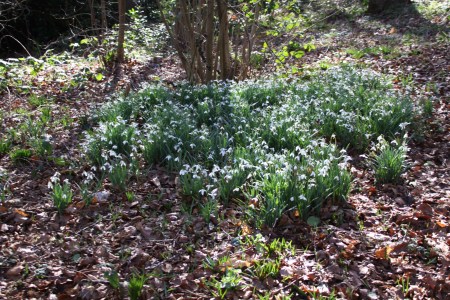


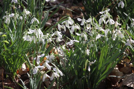
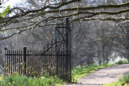


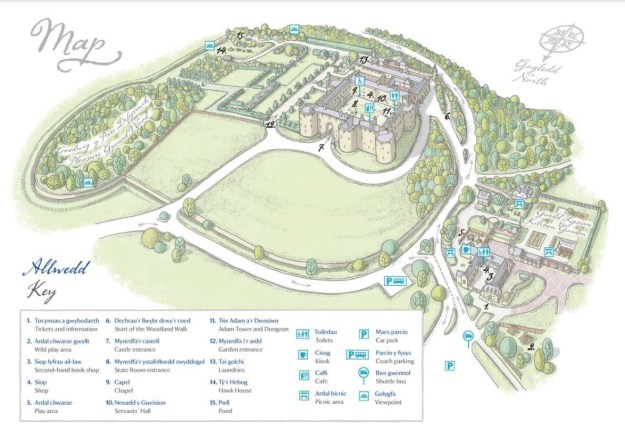


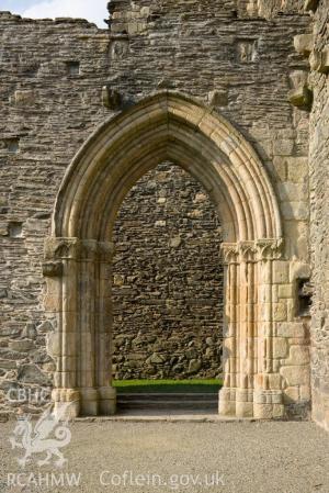


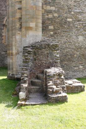

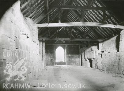


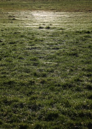


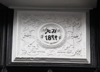
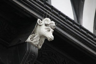
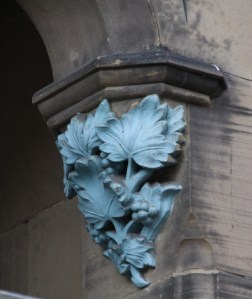

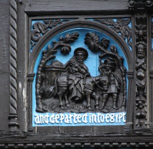


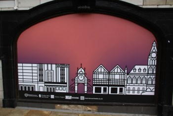


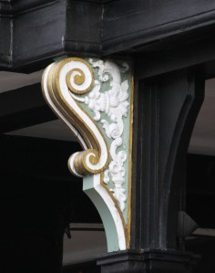
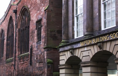

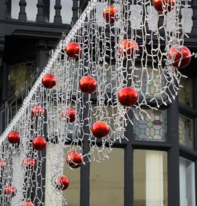

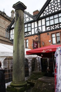
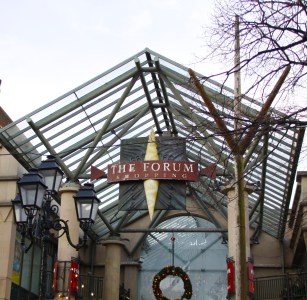

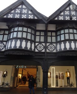


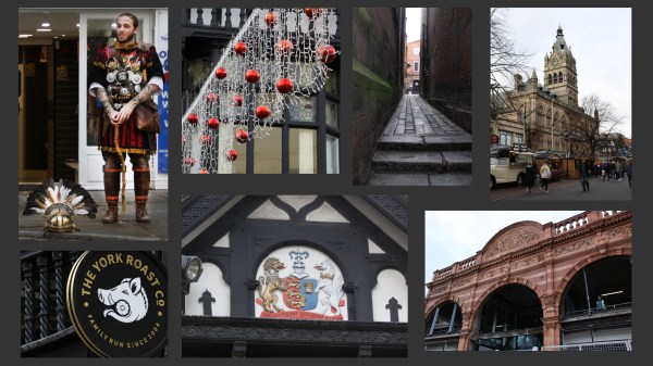



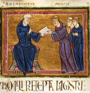


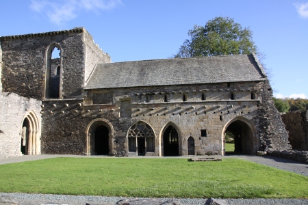
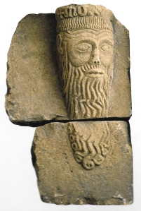
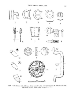
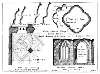
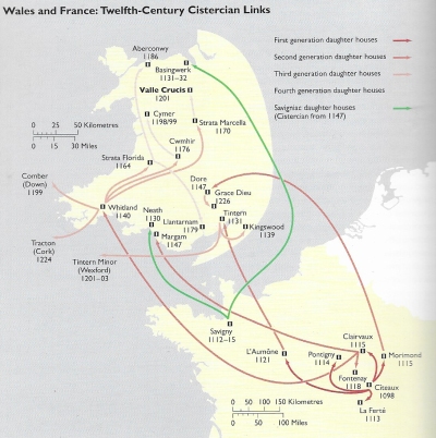

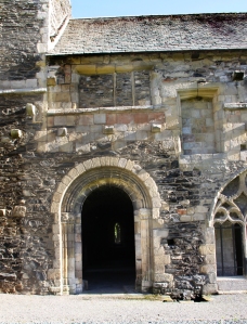


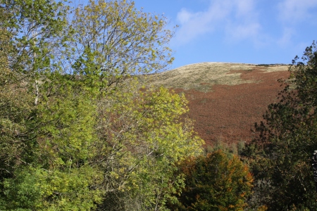


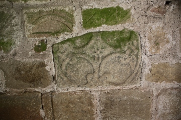

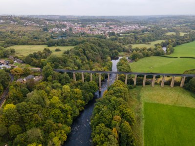

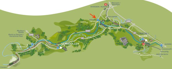
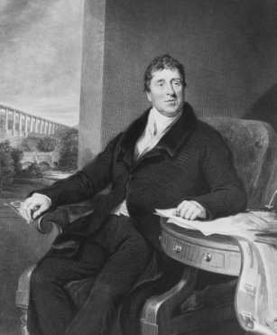


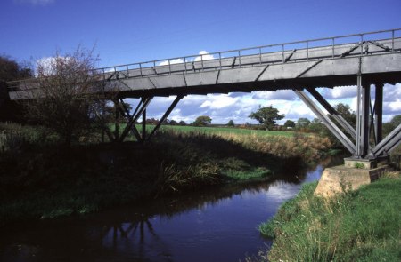


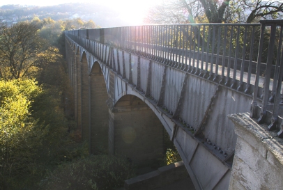
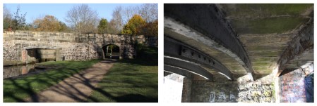


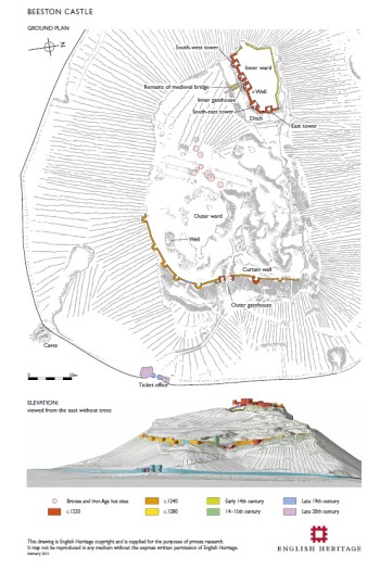
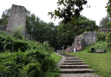

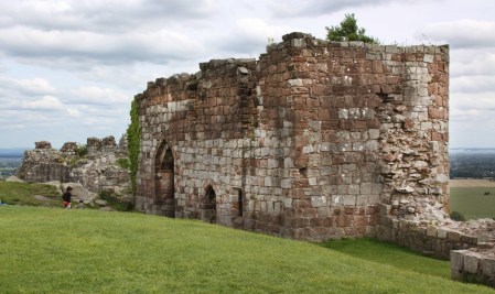
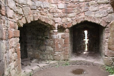


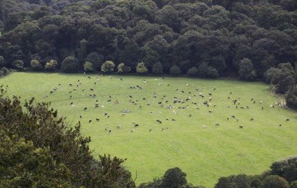

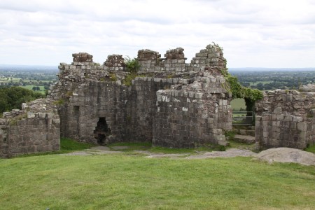
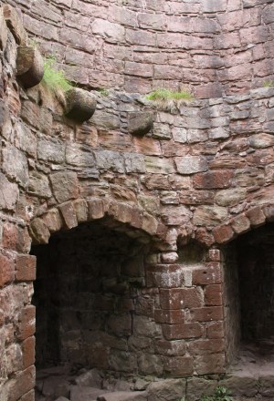


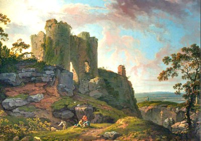


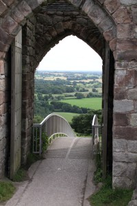

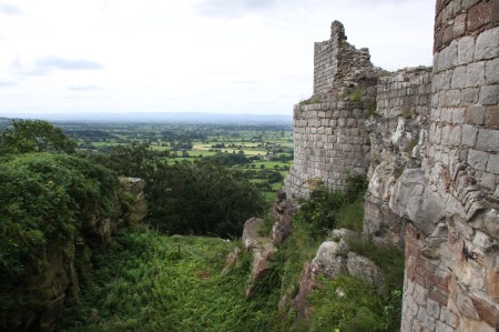


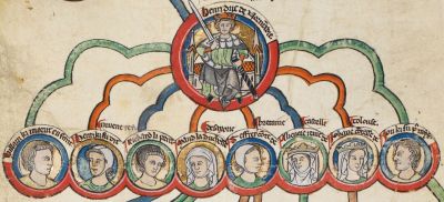


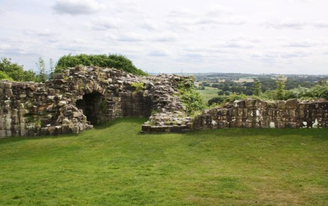
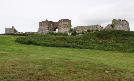






.jpg)