Category Archives: Mediaeval History

Medieval ambition and Civil War musket ball holes at the Church of St Chad’s in Holt (Grade 1 listed)

Introduction

Either side of the River Dee, and linked by the lovely late medieval red sandstone bridge, are the villages of Holt on the Welsh side and Farndon on the English side, each with its own substantial red sandstone church, both of which are dedicated to St Chad and both of which have well-populated churchyards.  Each has its own very particular character and personality, and as well as being the centres of Christian devotion and burial, seamlessly blending life and death, both have Civil War stories and scars and both continue to function as places of worship today.  This post is about the Grade-1 listed St Chad’s in Holt.
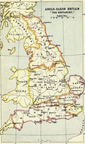
Map showing the location of Mercia and the line of the Anglo-Welsh border. Source: Wikipedia

The church is located at the top of the slope that runs down to the river crossing, precisely where Bridge Street meets Church Street, opposite the small rectangular green.  An attractive wrought iron gateway is set between a house on one side and the Peal O’ Bells pub on the other, and opens onto a path flanked by red sandstone garden walls leading to the church and churchyard.  The church is light-filled with a peaceful atmosphere and some notable features, some of them very unusual. The overall effect of St Chad’s is welcoming and combines a sense of heritage with contemporary relevance.  For details about visiting, see Visiting Details at the end.

According to Bede (in the 8th century) St Chad, who died in AD 672, was a leading light in the Anglo-Saxon church, rising through the ecclesiastical ranks in the kingdoms of Northumbria and Mercia and under King Wulfhere, one of the earliest Christian kings, became the first Bishop of Lichfield in the new diocese of Lichfield, at the heart of Mercia.  Mercia was one of seven British kingdoms of 7th century Britain and occupied most of central England, with much of the border with Wales, always a movable feast, somewhat further to the west.  Regarded as a pioneer who helped to spread Christianity in and beyond Mercia, he became popular during the Middle Ages in the Midlands and its borders.

The following details are just the edited highlights. For a more technical architectural description see the Wrexham Churches Survey (see Sources at the end).  The church very much rewards a visit.
xxx

Exterior

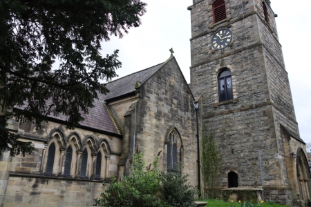
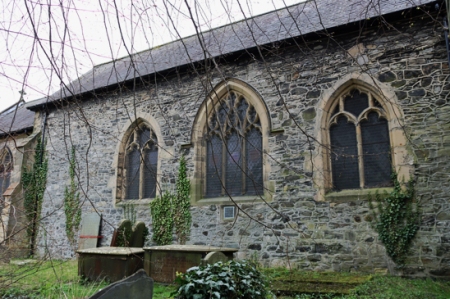
South side of St Chad’s Church, Holt

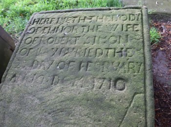
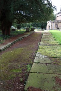
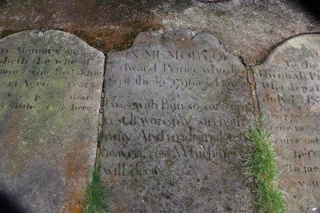
The church is approached through a pair of wrought iron gates that were made in 1816 and replaced the former lychgate.  As you approach the church and walk around to find the carvings around the south door, you will notice a change underfoot because in the immediate vicinity of the church the path is composed of horizontal ledger grave stones and vertical headstones laid flat (distinguished by chisel marks at the bases, which would have been underground), all forming huge paving slabs, some from the 18th century.

Path made up of grave markers

The exterior of the church is built of local red sandstone, the older parts badly eroded on the exterior, probably as a result of traffic pollution.  Sandstone, being soft, lends itself to graffiti and there is quite a lot of it dotted around the building, dating from the 18th century.  The roof of the rectangular nave and chancel is made of copper, which accounts for its green colour.  Copper was more expensive than the more usual lead, and is both fire resistant and more enduring, as well as a gesture of status.

A curious feature of the church and its roof-level features is the presence of crocketed pinnacles, each with twin gargoyles on the north sides and the absence of them on the south side.  I only noticed because I love gargoyles and go looking for them.  This is due to the removal of the pinnacles on the south side during 1732, one of the periods of redesign and alteration.
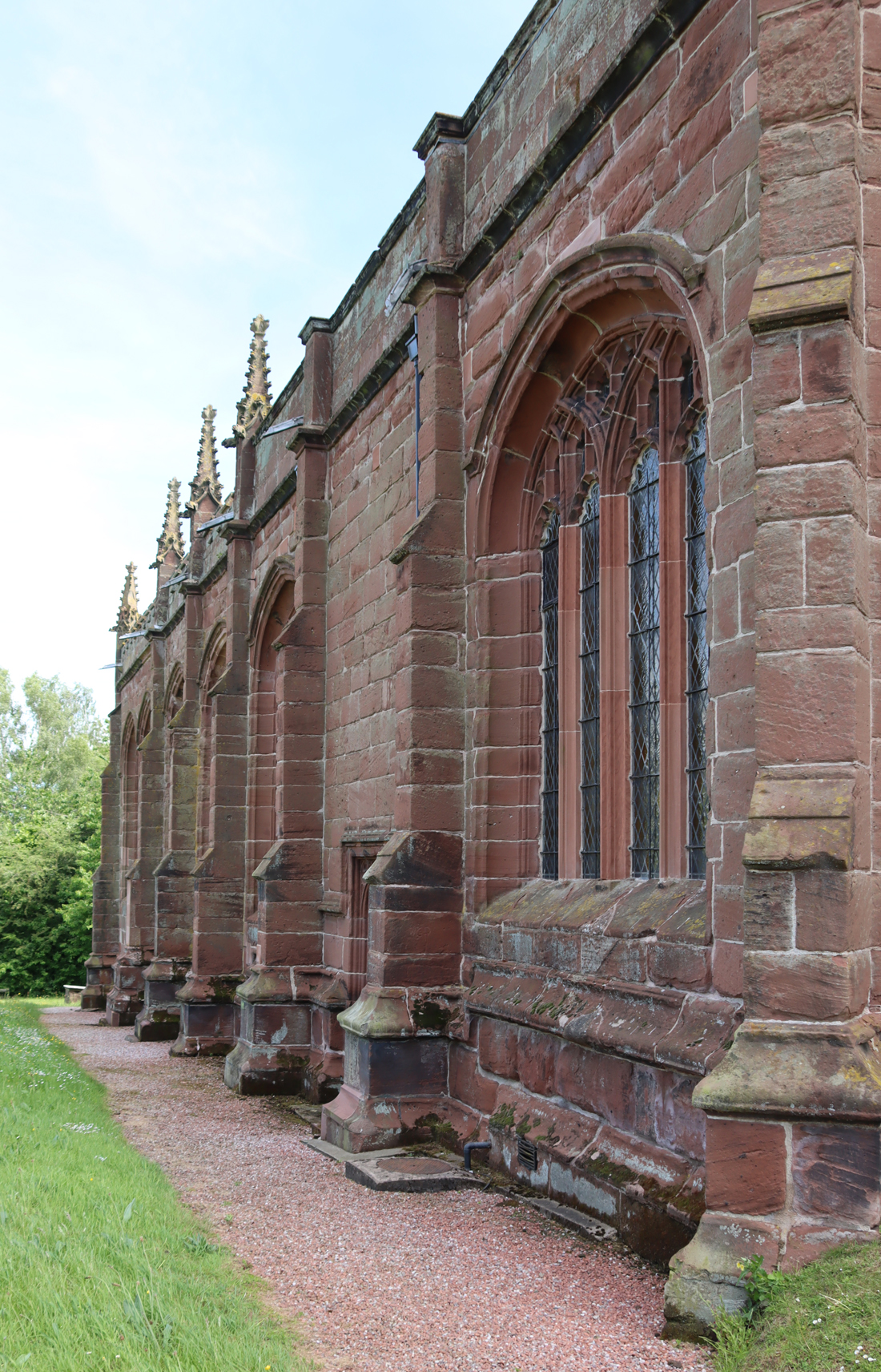
North side of the church, showing four pinnacles, each of which is adorned with small gargoyles. Photograph taken from the west, just next to the tower.

The tower features four gargoyles on the corners at the very top of the tower, and a string-course just below that level marked by floral ornamental motifs and small grotesques, very similar to the sculpted string-course that you can see here at Gresford All Saints’.  The 18th century bells are referred to below.  The top of the tower has gargoyles at its corners and the roof of the tower appears to be leaded.

The string course of grotesques, flowers and other motifs near the top of the tower.


A circuit of the exterior reveals that there are three doorways.  The studded west door, through which visitors enter today, is impressively large, but has no notable features.

The earliest entrance is the south door, with some lovely, albeit very eroded ornamental carvings. This would have been the main access from the castle, which is why it was so ornate.  As well as decorative motifs, there is a central panel showing the Annunciation set over the top of the arch and carvings in the spandrels (the three-sided sections between the arch and the square frame).  The spandrel on the right as you face the door shows the arms of Henry VII, together with a figure wearing a mitre; the other side is very worn. Above the door and its surround is a carved band of small quatrefoil motifs, each arranged in patterns of four. xxx

The door that opens into the north aisle of the church (round to the left of the tower as you face it) has nice carved details in the spandrels between the arch and the square frame.  Most fascinatingly, it has a line of three holes in it plugged with wooden stoppers.  These holes are called loopholes and were used for firing muskets from inside, much like arrow-slits in medieval castles.

The north entrance with the “loop holes.”

At the east end, under the central window, is an unusual little memorial built into the wall to Jasper Peck Esq and his wife Amy, died 1712 and 1740 respectively, the latter the daughter of Sir Kenrick Eyton.

At the east end of the church, built into the external wall beneath the central window, is an 18th century memorial

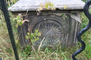
A memorial in the churchyard of St Chad’s, Holt

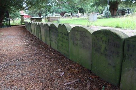
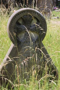
The churchyard contains plenty of grave stones and memorials.  The earliest, now moved for its protection inside the church (about which more below) dates to either the late 17th or early 18th century.  Although there are many from the 18th century, the majority of graves and their memorials date to the 19th century, with a range of fairly typical shapes and symbols.  Most of the memorials accompanying the graves are headstones, but earlier chest-style memorials and ledgers (inscribed horizontal slabs) are also represented, together with more obviously monumental types.  The cemetery was later extended east, possibly in an effort to avoid the north side of the church, which only has one gravestone, and even that is at the far east end.  The north side of a churchyard, in the shadow of the church, was often reserved either for burials that had to be buried in unconsecrated ground, such as suicides or babies who had died before baptism, but might also contain pauper and unmarked graves.  The monument known as the Roman Pillar, shown further down the page, may or may not have originally been a Roman column from the nearby tileworks, but in the churchyard performed the role of a sundial, now without a dial, with an octagonal top with the engraving TP WR CW 1766.

xxx

Interior

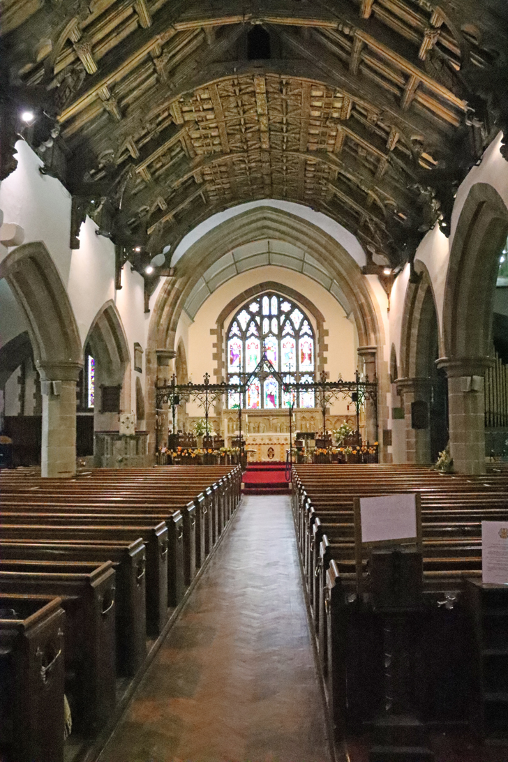
The plan of St Chad’s is simple, with the tower at the west end, and the chancel (where the high altar is located) at the east end as usual.  The nave, where the congregation sits, is flanked by two aisles.  The chancel is flanked by two chapels for private prayer.

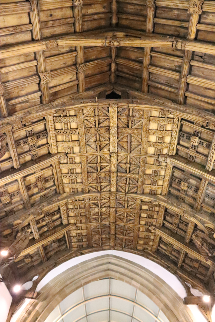
The roof looks as though it belongs to the Perpendicular period, but is belongs to the restoration of 1871-3

Heading through the impressive main door, set into the base of the tower, and through the glass-panelled doors into the nave, you are immediately presented with an uninterrupted view down the full length of the tall nave towards the east end.  The multiple large windows, only one of which has stained glass (dating to the early 1900s), provide the interior with a lot of natural light, even in the absence of clerestories. The arcades are made of a fine yellow sandstone, much better than red sandstone for creating a light space, and much more refined in appearance. The warm, light reddish wood of the relatively modern pews helps to add to avoid any sense of dourness.  The walls lack the usual distracting and overblown clutter of highly ornamental wall memorials.  Looking up, the wooden ceiling looks as though it belongs to the Perpendicular period, but is belongs to the restoration of 1871-3.

Inevitably there is a bank of 1910 organ pipes blocking the south aisle, shutting out light and preventing direct access from the north aisle to the north chapel, but this is entirely typical, echoing the same scheme in both Gresford and Malpas churches, amongst many others.  Similarly, the south aisle is truncated at the western end of the aisle by a small room presumably used as a vestry.

The 13th and 14th Centuries

Holt Castle by Peter Mazell in 1779. Source: Castle Studies Trust

There is no evidence of a church prior to the 13th century.  The village of Holt was built in the early 1280s, probably as a bastide by John de Warenne, the 7th Earl of Surrey under a charter from Edward I.  A bastide was a newly laid out pioneer town built around a castle on the edge of potentially hostile territory.  Edward I imported the idea imported from Gascony where he had founded a number of new defended towns, and used it as a model for Flint Castle and its bastide town, as well as subsequent castles in his circle of defences in north Wales.  Defensive walls may have been planned for the town but were never built.  The foundations of the first church were probably included in the plan for the border colony, along with a former marketplace (where the village square is located today).

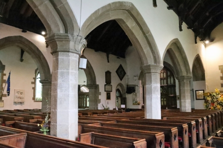
The earliest remaining components of the present church belong to the 13th -14th century.  The nave arcades (arches that divide the nave from the aisles) feature five bays of lancet-shaped pointed arches that date to this period and indicate either that the original church of c.1280 was aisled, or that aisles were a later 14th century addition.  The aisles were widened in the 15th century, removing the older aisle outer walls, but the original ones almost certainly featured lancet-shaped windows of the earlier gothic “Decorated” style.

The earliest of the aisle arches are pointed (or lancet) shaped, unlike the later Perpendicular arches that flank the chancel.

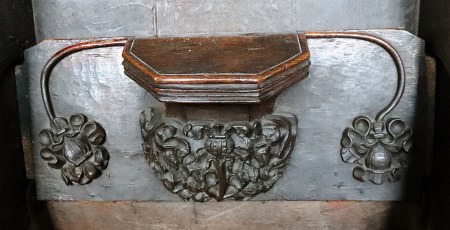
An attractive 14th century “credence table,” looking like a small shrine, was built into the south wall of the Lady Chapel at the east end of the south aisle, moved into this position in Sir William Stanley’s alterations in the late 15th century.  This was used for accessories used to celebrate Holy Mass.  The underside, completely hidden when looking down onto the small platform, has a marvellous grotesque face flanked by two faces, one human and one animal, looking very like a misericord.  If there were misericords in the late medieval choir, like the lovely ones at Gresford, these are long gone.   A mirror leans against the wall but can be laid flat for those who want to see the underside without kneeling down.

Unexpected underside of the credence table, looking very like a misericord

Late 15th Century

In 1483 Richard III granted the Lordship of Bromfield and Yale to Sir William Stanley, which incorporated both Holt Castle and the church.  Stanley made significant changes to the church, removing and replacing the outer walls of the original aisles to widen them, providing them with the Perpendicular style windows, and extended the arcade at the east end.  For reasons unknown, the north aisle is wider than the south aisle. The south aisle chapel is a Lady Chapel. The little leaflet that the church provides suggests, with reservations, that that the chancel, which is slightly out of alignment with the nave, may have been a so-called “weeping chancel,” deliberately and symbolically echoing the images of the crucifixion where Christ’s head is tiltee down to his right.
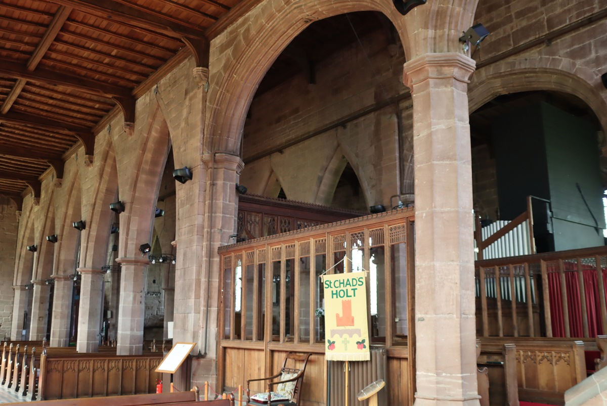
At the chancel, the two bays of arcades flanking the chancel (the choir and high altar), have much wider four-centred (flattened) arches, providing a very fine contrast to the earlier lancet-shaped arches.  The new arcades were fitted with carved stone heads at the tops of the east and west walls, all but three undetermined male heads.  The other three consist of one male head that is crowned and is probably a king, another depicting a dog and another a grotesque face. 

There were apparently problems with the civil engineering of the new east arcade. The last of the free-standing arcade pillars in the south aisle is at a distinct angle, and there is a pillar at the east end, against the wall, which does not reach the roof, as described on the Clwyd Powys Archaeological Trust / Heneb website: “To explain anomalies at the east end of the south aisle it has been suggested that because the east window of the aisle was too large for the wall to support, an external buttress had to be placed nearer to this window than was planned. An internal pillar was then constructed where the exterior buttress should have been sited.”  

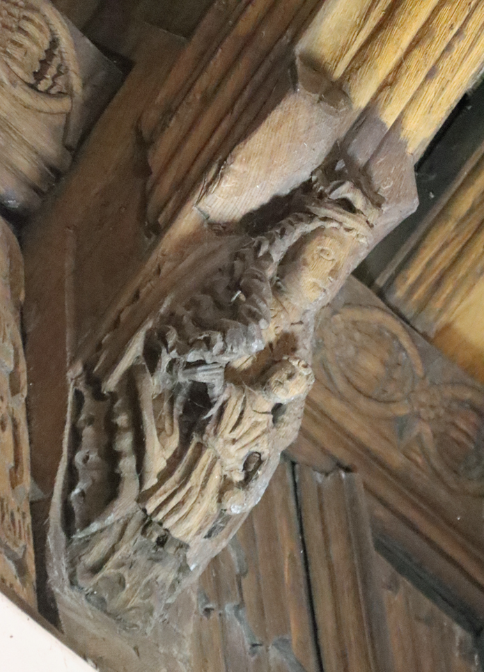
Mitred figure at St Chad’s, Holt

The tower at the west end, through which you enter the church, has a spiral stair case to the bell tower (closed to the public).  As you go into the nave from the tower, look right.  There is a carving of a figure wearing a mitre, which is a fragment of a medieval bench-end of the sort that you can see in the choirs at Chester Cathedral and Gresford All Saints’, and suggests that there was once some very interesting Gothic wood carving here.  The mitre is consistent with it representing St Chad, but other candidates are also entirely plausible.  During 19th century restoration work the head was removed from the church and for reasons unknown found itself at Holt Hall, where its dignity was severely undermined, having been employed as a newel post. Holt Hall was one of the many of the fine buildings that failed to survive the early 20th century, and when it was taken down in the 1940s the head was returned to St Chad’s.

Also at the west end to the right as you enter the church, in the south aisle, is the wonderful font, elaborately and deeply carved and dated by Edward Hubbard to c.1493 on the basis of the heraldry that appears in amongst the other carved panels.  It is a truly remarkable object, featuring the above-mentioned heraldic emblems, religious symbols and even a number of grotesques.  The heraldic symbols include a stag’s head, which is one of the emblems of Sir William Stanley and the others are the arms of previous lords of Bromfield, the Warenne and Fitzalan families as well as the heraldic shield of King Richard II (reigned 1452-85).   Others are religious symbols showing emblems of Saints Matthew, Mark, Luke and John, the Lamb of God, the “pelican in her piety,” highly stylized roses representing the Virgin Mary and the ubiquitous gothic acanthus leaves.

The late 15th century font with a reconstruction from one of the interpretation boards showing how the shields may have been coloured

Sir William’s modifications represent a major investment and suggest enormous personal ambition, a desire to put his stamp on the biggest community asset in late medieval Holt.  It did not save him from political manoeuvring.  Although one of the richest men in England, Sir William Stanley was executed for suspected treason by Henry VII in 1495 and the Lordship of Bromfield and Yale reverted to the crown. 

The 17th Century
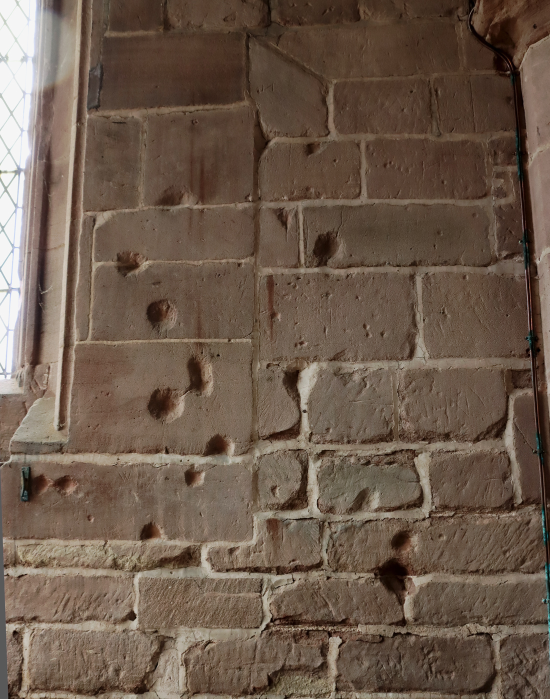
Musket ball holes in the west wall, south aisle of st Chad’s Church, Holt

The Civil War took place between 22nd August 1642 and 3rd September 1651, and had a massive impact on the Chester area, with opposing forces occupying Holt and Farndon at the strategic river crossing.  Frank Latham sets the scene as it was in 1643: “Because of its prominence on a hilltop overlooking the river the parish church of Farndon was garrisoned by Roundhead troops from 1643 to 1645 which enabled watch to be kept on the Welsh village of Holt and particularly on the castle there which was occupied by the enemy.” With Farndon in the hands of the Parliamentarians and Holt in the hands of the Royalists, armed conflict was almost inevitable, and the Battle of Farndon Bridge in November 1643 appears to have been the beginning of a number of skirmishes.  The castle was taken by the Parliamentarians, but in 1644 was retaken by the Royalists.  In 1647 it was besieged for 9 months. 

Fascinatingly, impact marks of musket balls scar the wall and pillars inside the west end of St Chad’s, which are an evocative reminder of the area’s troubled history at that time, when Royalist soldiers defended the church against the Parliamentarians, with hand-to-hand fighting taking place within the church itself.  You can find these mainly on the west wall of the south aisle (turn right as you walk in from the tower and they are on your right), with a few on the other side as well.  Don’t forget that the north aisle has a doorway with three “loop holes” through which weapons could be fired, only one of these can be seen from the interior, but there are also some marvellous lock fittings. 

Finally, a very small and beautifully decorated late brass plaque in the north aisle chapel should not be missed. Its beautifully reflective surface made it impossible to photograph nicely.  It is dedicated to Thomas Crue, who died in 1666.  The plaque was provided by his brother Silvanus Crue.  All of the imagery, with a skeleton flanked by skulls at its base, columns supporting sundials and hour glasses all reference time, death and the transition of the soul.  On the columns the words FUGIT HORA also reference the passing of time: “time flies.”  At the top, in the centre, a lion rampant stands over a grotesque head.  As well as some lovely engraved mortuary-themed decoration, it contains an acrostic; when read vertically, the first letter of each new line makes up one or more words.  In this case the vertical reading over two verses is THOMAS CRUE, and the full text is as follows (having performed some serious gymnastics to read it against the light):

The life of man incessantly from the womb
Hastneth both day and night unto the tomb
Of mortal life when once the thread is spunne
Man has a life immortal then begunne
A wise man dying lives; and living dies
Such was the main that here intombed lies

Carefull he liv’d gods secret laws to keep
Religiously until to Death or Sleepe
Unto a happy life his soule did bring
Ending this life to live with Christ our King

At the base it reads STIPENDIUM PECCATI MORS EST is a Latin phrase that translates as “The reward of sin is death,” and with dry humour typical of the 18th century, HODIE MIHI CRAS TIBI  translated as “Me today, you tomorrow”.  All of this may sound a little gloomy and morbid, but this was the era of John Donne and equally articulate metaphysical poets who engaged with satire, dark humour and word play, balancing the reality of time and its inevitable consequences with a strong sense of irony and flamboyant wit.

The 18th Century
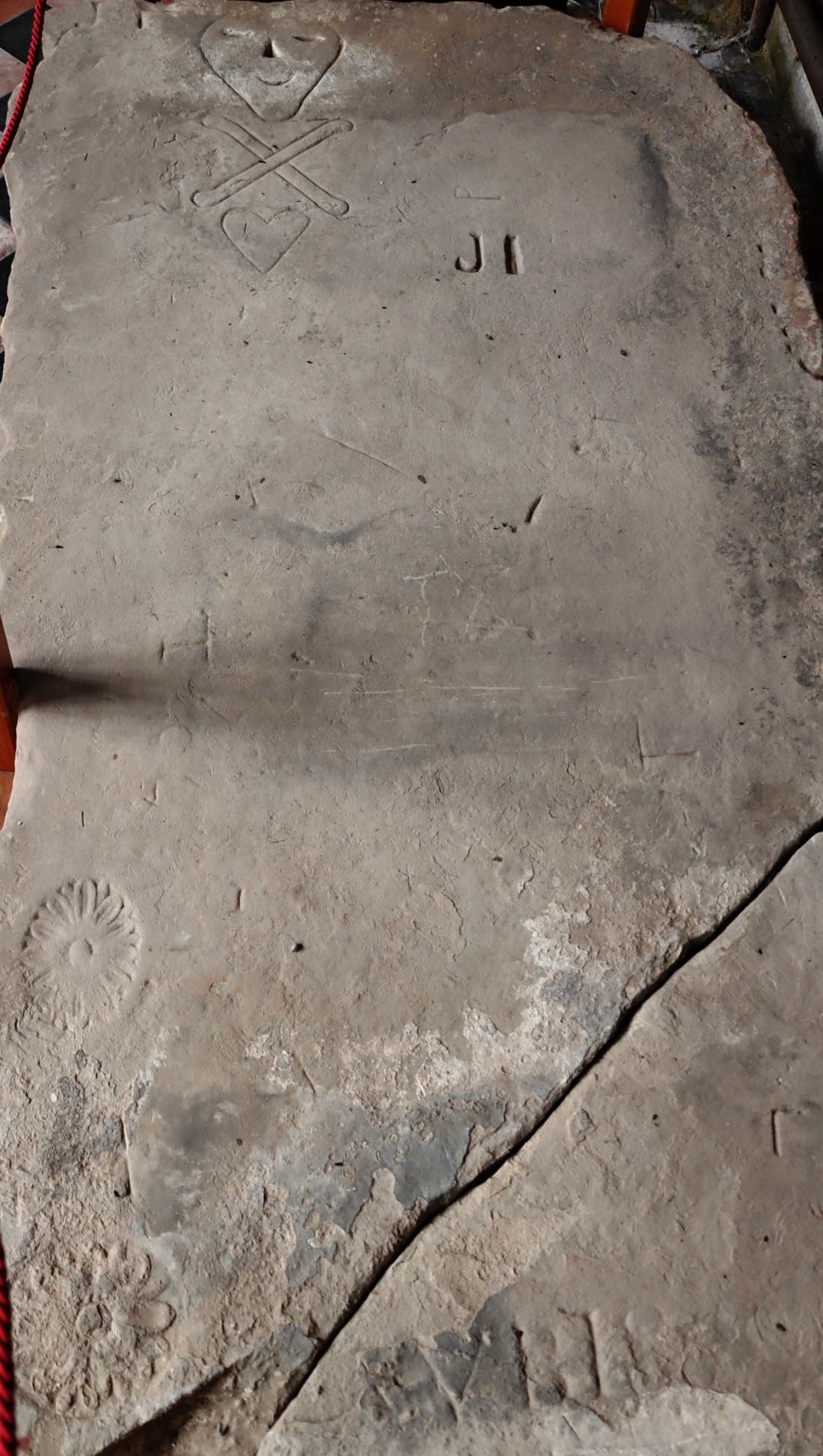
In the south aisle, heading towards the chancel and on your left, there is a super grave slab that was moved in from the churchyard to protect it. It is a marvellous piece, with a skull and crossed bones, the skull having a somewhat surprisingly beatific smile on its face.  There are also some flowers at its base.  The flowers at bottom left were apparently typical of the 18th century, but the skull and crossed bones were better known from plague graves of the 17th century, and are known as memento mori stones, indicating the inevitability of death.

It is in this period that six bells were added to the tower, made by Rudhalls of Gloucester in 1714.  Presumably, if there had been any misericords these would have been removed either during the 17th century purge of medieval religious motifs, or at this time, although at least parts of the choir stalls were reported to be preserved in 1853, but were stripped out in the 1870s.  In 1720 the church was presented with a clock, which stayed in position until 1901.  This was followed by significant renovation of the church in 1732, during which, very sadly, the the rood loft and screens were removed.  This renovation also accounts for the parapet that replaced the pinnacles, gargoyles and battlements on the south side, although some were left in position on the north side.

A lovely engraved brass plaque near the entrance, on the west wall on the north side is worth looking out for, dedicated to John Lloyd and dating to 1784.

19th – 20th Century

The 19th century restoration between 1871 and 1873 was responsible for adding some of the ornamental features, such as the new seating in the nave and oak screens to separate the chancel from the side chapels, but also removed some of the memorial tablets from the walls.  Restoration work included including the renewal of the camber-beam oak panelled roof of the nave and the sanctuary at the far end of the chancel, re-laying of the floors and repairs to the window tracery.  Interestingly, many memorial tablets were removed during the renovation of the interior, which almost certainly improved it no end, but whatever remained of the rood screen and choir stalls were also stripped out.  It is possible that choir stalls and some stained glass were removed at this time, as they were mentioned by a visitor in the early 1850s. 

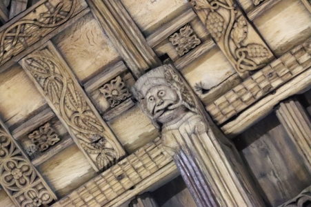
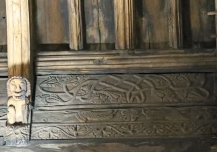
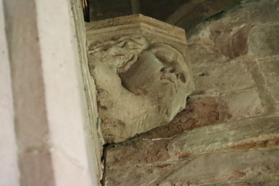
The interior ceiling corbels that support the camber beams were provided with sculptural elements, all human heads.  You will need binoculars or a long camera lens to see them, high up and in shadow, but a couple of examples are shown here.  There is no mention of them in any of the texts, so it is unclear if this dates to the major reworking during the 15th century, or to the 19th century restoration and reconstruction of the ceiling.

Nineteenth century restoration activities can often result in some hair-raising alterations, but St Chad’s seems to have got off quite lightly, retaining some fine original features.  The attempts to restore some of the original ambience were fairly sympathetic, and the new features were not unattractive.  As nineteenth century restorations go, it was not unsuccessful.

In 1896 the bells were provided with a new iron frame and the following year a weathervane was added.
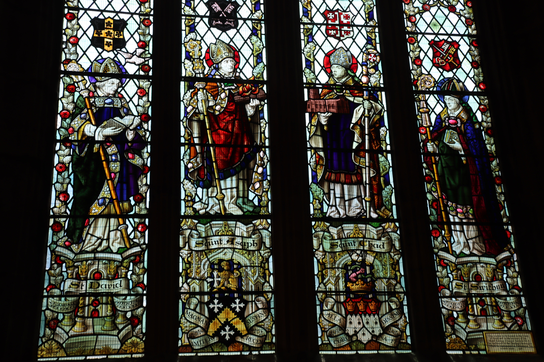
The single stained glass window in St Chad’s, Holt. Early 20th century.

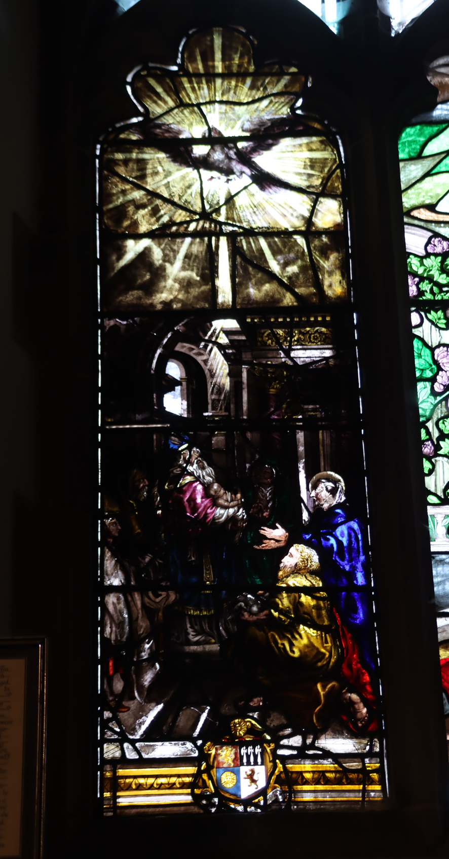
Since then, the main additions to the church have been the new clock in 1902 and a stained glass window later in the early 20th century. The new clock and chimes were fitted to commemorate the coronation of King Edward VIII and Queen Alexandra in 1902.  The stained glass window consists of four panels depicting saints.  The two central panels show St Chad holding an image of the church in his hand, and St Asaph (the church is in the diocese of St Asaph). The outer panels show St David, the patron saint of Wales and St Swithin, reflecting an older connection with Winchester Cathedral in 1547.  It is very nicely done for a 20th century window, emulating the gothic and works well with the rest of the church’s features.

In the 1960s the lighting and heating were improved and the roof coverings were restored.

Detail of Victorian pulpit, St Chad’s Holt

Uncertain dates

It is not known for sure when the tower was built.  One authority puts it in the 17th century, but it is more likely that is is much earlier, probably late 15th century.

Probably late medieval, but not officially dated, are consecration crosses, one of which is next to the radiator to the right of the credence table, and there are other similar consecration crosses marking places that have been consecrated by a member of the clergy elsewhere in the church.

There is a magnificent chest not far from the west end, which had four locks, each representing a keyholder who had to be present when the chest was opened.  This has not been dated, but realistically looks as though it could date to any time between the late 15th to the 17th century.
xxx

Chest in St Chad’s, Holt


Today

There has also been some modernization to improve lighting and heating, which were probably much-needed.  The pipework for the heating system is fantastic – a remarkable feature in its own right, just as the heating system in Chester Cathedral makes its own contribution to domestic-industrial history.

A replacement sandstone block interrupting some engraved text on an external wall of the church

Obviously the church requires ongoing maintenance.  Sandstone is very vulnerable to pollution, and some of the blocks have had to be repaired using modern sandstone, but thanks to the church being set back from the road this is minor work.  It also looks as though some of the four gargoyles on the tower have experienced some damage, but that too is inevitable.  Overall, St Chad’s seems to be in really excellent condition and is clearly well cared for and appreciated.

The church organizers seem to be doing a very good job of balancing the contrasting demands on St Chad’s.  As well as the provision of plenty of information for visitors about the history and heritage of the church as a tourist attraction, the church is managed as a community asset for services, weddings, funerals and community activities.  Reflecting a concern with modern global issues, there are four “millennium banners,” made by members of the congregation to welcome in the year 2000, which capture local scenes but represent the universal ideas of love, hope, peace and faith.


Visiting St Chad’s, Holt

The “Roman pillar”

There is currently no dedicated website, so there is no generally available online information about opening times.  I was able to walk in during the day one bank holiday Monday on a whim, and found it open. On the other hand, I was there some months later at around 1230 on a Wednesday and it was closed, but I found that it had opened later in the afternoon.  There is a Facebook page but it has no details about opening times and contact details.  Please note that the email address on the National Churches Trust page bounces (i.e. it is defunct).  This is a living church, with Sunday services, weddings and funerals, so even if you do find out what the opening times may be, there will be times when it is not possible to gain access.

There is plenty of parking along the road, but there is also a public car park just a few minutes walk away on the other side of the rectangular grass area, Church Green, on the other side of the road from the church.  There is a car park next to the Dee on the Farndon side, but this is very small and fills up quickly at the weekend and during the school holidays, and floods when the river is up.

One of the bilingual interpretation panels in the church, describing the early development of the town

Information boards and circular panels on short pedestals explain the heritage of the church and are nicely done and for the most part do not intrude on the look and feel of the church.  A small black and white leaflet was available on the table to the right in the tower as you walk in, consisting of two sides of A4, folded, that lists the key features to see in the church.

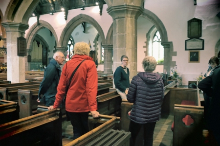
For those worried about steps and accessibility, the church can be visited without having to negotiate any obstacles, as there is a ramp from the tower into the nave.  There are plenty of pews for giving irritable legs a rest.  Outside, there is a  wide path that runs along the south side of the church and a narrower one along the north side and these both felt safe underfoot. There are also tracks through the churchyard, but if you are looking for a particular grave, note that the grassy spaces between graves are very uneven and you need to take seriously good care where you place your feet.  I suspect that it gets very muddy during rainy periods, so appropriate footwear is recommended.

This would make an excellent start or finish to a walk along the River Dee, which has footpaths on both sides of the river.  The late medieval bridge is itself a joy.  On the Holt side a visit could easily take in Holt Castle as well and on the Farndon side there is, of course, the other St Chad’s.  There’s a pub next door to the Holt church that advertises food and a garden, which I haven’t yet tried, but might be handy for the end of a walk.  There are other pubs and coffee shops on both sides of the river, all serving food.


————-

Sources:

Visitor information in St Chad’s, Holt

Interpretation boards and panels

Free leaflet:  20 Minutes of Discovery Around St Chad’s Church Holt


Books and papers:

Farmer, David 2011 (5th edition).  Oxford Dictionary of Saints. Oxford University Press

Hubbard, Edward 1986.  The Buildings of Wales.  Clwyd (Denbighshire and Flintshire). Penguin Books and University of Wales Press

Latham, Frank. 1981.  Farndon: the History of a Cheshire Village. Farndon Local History Society


Websites:

Archaeodeath 
Skulls in Stone and Brass: Inside Holt Church
https://howardwilliamsblog.wordpress.com/2015/08/25/skulls-in-stone-and-brass-inside-holt-church/
Masters of Holt
https://howardwilliamsblog.wordpress.com/2015/10/09/masters-of-holt/

Based In Churton
Big and bold: All Saints’ Church in the small village of Gresford
https://wp.me/pcZwQK-43a
Gresford All Saints’ Church – exterior gargoyles and grotesques
https://wp.me/pcZwQK-498
Gresford All Saints’ Church – a beginner’s guide to funerary monuments
https://wp.me/pcZwQK-49Z
Miracles, myths, demons and the occasional grin: Misericords in the Chester-Wrexham area #2:  The churches of Gresford All Saints’, Malpas St Oswald’s and Bebington St Andrew’s
https://wp.me/pcZwQK-4Ey

British Listed Buildings
The Parish Church of St Chad, Holt
https://britishlistedbuildings.co.uk/300001596-parish-church-of-st-chad-holt

Cadw
The Parish Church of St Chad, reference 1596
https://cadwpublic-api.azurewebsites.net/reports/listedbuilding/FullReport?lang=en&id=1596

Coflein
St Chad’s, Holt
https://coflein.gov.uk/en/site/165283/?term=holt&pg=2
(images at https://coflein.gov.uk/en/site/165283/images?term=holt)
Holt Bridge; Farndon Bridge, Holt, Wrexham

https://coflein.gov.uk/en/site/24043/

Early Tourists in Wales
North side of the churchyard
https://sublimewales.wordpress.com/material-culture/buildings/churchyards/special-graves/north-side-of-the-churchyard/

CPAT / HENEB – Wrexham Churches Survey
Church of St Chad, Holt
https://heneb.org.uk/archive/cpat/Archive/churches/wrexham/16796.htm
or https://cpat.org.uk/Archive/churches/wrexham/16796.htm 

National Churches Trust
St Chad’s, Holt
https://www.nationalchurchestrust.org/church/st-chad-holt

Peoples Collection Wales
St Chad’s Church, Holt
https://www.peoplescollection.wales/items/435519#?xywh=0%2C-55%2C799%2C642

St Chad’s, Holt – Facebook page
https://www.facebook.com/pages/St-Chads-Church-Holt/102667013120267

xxx

One of the many heads at the tops of the aisle walls


Day trip: Architectural expression in the Cluniac Wenlock Priory in Much Wenlock, Shropshire

Introduction

North transept

Because there is no sense of a physical division between the remains of Cluniac Wenlock Priory and the very picturesque village of Much Wenlock, the one blending into the other, the village and the priory make up a terrific visit between them.  The little museum was closed when I was there, but this too is apparently well worth a visit.

The post-Conquest priory was established in the 11th century, at around 1082 by Roger de Montgomery.  The term “priory” often denotes a smaller subset of a more impressive substantial abbey, but this is misleading here.  Wenlock Priory is considerably substantial and its remains continue to impress.  The term “priory” in this case refers to its status as a foundation belonging to the Cluniac order’s founding monastery at  in France, discussed further below.

The ground plans of monastic establishments in Britain all conform to a basic formula, first established by the Benedictine order, and because most are ruined it is sometimes easy to miss the considerable variations that were built into the architecture by the different monastic orders that followed the Benedictines.  This is clearly seen at Wenlock, where specific architectural features reflect a very different ideology from many of its competitors.  These differentiating features are highlighted below.

Artist’s reconstruction of Wenlock Priory in the mid 15th century. My annotations, based on the above English Heritage site plan.  There’s a nifty feature on the English Heritage site that allows you to overlay an aeriel photograph over this image by dragging it, to show how present and past related.  Source: English Heritage

The original arrangement of the most important monastic buildings followed the Benedictine interpretation of their founder, the 6th century St Benedict of Nursia, in Italy.  The formula required that the first building to be built was a church. This formed one side of a square cloister of essential buildings, all connected by a walkway that surrounded a green square, the garth.  Other buildings would be erected later in a monastic establishment’s history, often around secondary and tertiary cloisters.

This basic layout is demonstrated at Wenlock Priory. The church was normally on the north side of the cloister, to protect the rest of the buildings from the worst of the weather and to provide light to the garth, and this is also true at Wenlock.

The rest of the cloister, main shown on the left in the reconstruction, consists of three ranges connected by a walkway.  The east range essential administrative buildings: the chapter house and the book room a door leading up to the dormitory. The dormitory extended from the east range out to the south to become one side of a secondary cloister.  The south range usually incorporated the refectory, as it does here, where the monks ate all their meals, as well as the kitchen and the warming room.  The use of the west range varied from one order to another, and at Wenlock its use is uncertain.

Blind arcading in the Chapter House

Subsequent buildings, such as an infirmary, the prior’s lodging and land set aside for a cemetery, are often lost in ruined cemeteries, but thanks to the conversion of the prior’s lodging and infirmary into a private residence, these have been preserved (although are not open to visitors).  This enables the larger layout of Wenlock to be understood, where this information has been lost in many other ruined sites.  Other elements, such as boundary markers, and a gate-house are no longer visible, but the sites of tow important fishponds have been located.
==

The Cluniacs

A model representing the vast headquarters of the Cluniac order at Cluny in France as it was at its height. Source: Wikipedia, by Hannes72 CC BY-SA 3.0

The Cluniac Order was founded in 909 in the southern Burgundy area of France by the Duke of Aquitaine with the Abbey of Cluny.  The new order was created partly as a response to the belief that the earlier Benedictine order had become lax in its monastic practices and also the belief that its senior personnel were frequently corrupt.  However, although they took St Benedict’s Rules as their guideline, the Cluniac order did not follow the letter of St Benedict’s vision.

St Benedict had divided the workload of his monastic community into “ora et labora” (prayer and work).  Different monastic orders each put different emphasis on these components. Work for the Cistercians, for example, meant both physical labour and time spent both learning and copying religious texts and religious law.  For the Cluniacs, manual labour was not considered relevant, and study was rarely as significant as in other orders.  Instead, their emphasis was on glorifying God and Christ via an emphasis on liturgy and displays of material wealth.  Their elaborate architecture, stained glass, paintwork, artworks, rich vestments, priceless relics and other valuable objects, attracted wealthy patrons who related to this rich environment. 

Early in its history the Cluniac order had secured independence from the local bishopric, which usually oversaw monastic establishments, and became answerable only to the papacy.  This direct attachment to the ultimate divine authority on earth and the emphasis on liturgy and prayer were particularly attractive to endowments.  The order’s rules laid down that those who granted endowments to the order were not permitted to dictate Cluniac management of their own houses.  The Cluniacs became politically influential in France. 

La Charité-sur-Loire, Burgundy, the mother house of Wenlock Priory. Photograph by Rolf Kranz. Source: Wikipedia CC BY-SA 4_0

All this ostentatious display of piety impressed patrons, but one shudders to think what St Benedict would have made of it all.  The Cistercians, Savignacs and Carthusians all responded to the increasing materiality and conspicuous displays of wealth of both Cluniac and Benedictine orders with a different ideological and procedural way of life, already discussed on the blog in connection with Valle Crucis Abbey (Llangollen) and Basingwerk Abbey (Holywell).  It was the Cluniac model that particularly repelled the break-away orders who sought isolation, humility and hard work as more appropriate ways of honouring their Christian beliefs.  On the other hand, the Cluniac system of making all subsequent houses accountable to the mother house introduced an element of governance, together with the insistance of rule enforcement, that was not required by the Benedictines, and which helped to give the Cluniacs real cohesion, a system imitated and enforced in particular by the Cistercians.

Throughout England, following the Norman invasion and mainly between 1075 and 1175, the order began to spread throughout England, amounting to 36 new foundations, many of them very ambitious.  The first was established in Lewes in Sussex in 1077 by William de Warenne.  Bermondsey, now a part of southeast London followed soon afterwards.  Wenlock was one of the next to be established in 1180, by Roger de Montgomery.  The Cluniac order continued to be very successful, particularly in France. 

The bronze effigy of Edward III in Westminster Cathedral

Because the priory it was subject to its mother abbey of Cluny in France, Wenlock was one of many French monasteries in Englan termed an “alien priory.”  This became particularly relevant during the Hundred Years War under Edward III, which broke out in 1337.  Alien priories were suspected of representing French interests in England.  King Edward III (reigned 1327 – 1377) saw these alien priories not only as a political threat, but also as a source of income. Some were suppressed, with Edward confiscating their properties and lands, and others were ordered to pay an often crippling annual fee for survival.  Wenlock was able to pull together the funds to pay, amounting to more than half of the priory’s total annual income, and in the late 13th century, took the decision to cut its links with its mother house, La Charité, to swear loyalty as English nationals to the Crown, and to pay a massive one-off fee to secure this new “denizen status.”  Tensions remained, as La Charité was by no means ready to accept the situation, and the connection was not fully terminated until the end of the 15th century.

The Anglo-Saxon Monastery dedicated to St Milberga

Excavations have established that the Cluniac Wenlock Priory was established on the site of a much earlier monastery that had been established in around AD 675, closing in around the 10th century.  Both monks and nuns worshiped at the monastery, with each having their set of buildings including their own churches.  The monastery was dedicated to St Milburga, the patron saint of the original 7th century abbey, who continued to be venerated in the 12th century priory, just as at Chester the Anglo-Saxon St Werburgh was venerated in the Anglo-Norman Abbey of St Werburgh, now Chester Cathedral.  As with most Anglo-Saxon saints, not a great deal is known about St Milburga.  She was the eldest daughter of the King of Mercia, Merewalh, and was sent to be educated near Paris.  She arrived at Wenlock in 687 to succeed the presiding abbess of the nunnery, where she remained for three decades.  She became renowned for the miracles that she performed whilst at Wenlock.  She was supposed to have resurrected a dead child, to have banished geese that devastated the region’s cultivated fields, but she is best known for having floated her veil on a sunbeam.


Entering the site today – orienting yourself

Entering the nave from the west, with the piers running from west to east, the outline of the porch on your left, and the north and south transepts either side

Today you enter the priory from the west end, where the grand entrance would have stood.  This entrance was reserved for ceremonial occasions.  The public would normally have entered via a stone porch on the north side of the nave, whereas the monks would have entered via one of two entrances opening into the south side.   Entering from the west end gives you an excellent view of the church.  In front of you are the bases of piers (multi-shafted columns), flanked by twin side aisles.

Next, you see two tall opposing stone constructions to left and right, the north and south transepts.  Looking beyond the transepts, the church continues with a vast east end, with what would have been the choir, the presbytery and high altar and probably the shrine of st Mildeburge.  Beyond this, in the 14th century, a small Lady Chapel was added. Although some publications refer to a “traditional cruciform shape,” referring to the cross-shape created by the east end, the west end and protruding transepts, most monastic churches have an east end much shorter than the nave, giving it more of the shape of the crucifix; the church at Wenlock is therefore not entirely traditional.

Chapter House

The nave of the church makes up the north wall of the main cloister, which lies to its south, so if you look to your right, you will see an archway leading through to the cloister.  Buildings further along the line of the church, also to the right, are buildings that were built after the main cloister was established, including the infirmary and the prior’s lodging.

I started with a walk from one end of the church to the other, taking in both transepts, came back to the main cloister and then later went and had a look at the remains of the secondary cloister.  I’ve used that visiting order in the description below.


The Church

A multi-phase construction

The location, next to Farley Brook, which runs into the Severn four miles to the south, was important for supplying water to the fish ponds and for the monastery’s own water supply and drainage system.   The Anglo-Saxon church seems to have formed the foundations for Roger de Montgomery’s 1180 monastic church, after which a number of phases of construction can be identified.

The plan of Wenlock Priory. Source: McNeill 2020, English Heritage

The West End – the Nave, the Porch and the Upper Chamber

Entering from the west, you are following the approximate approach of the monks through their grand entrance, used only on special days of the religious calendar and for processions.  The long 8-bay nave with its octagonal plinths, probably built during the mid-13th century, was used by visitors to the priory and provided a suitably impression processional space.  Along the north wall, midway between the entrance and the crypt, was a porch that gave public access to the nave (the bottom courses of which mark its position), whilst the monks would usually enter from the cloister.  The nave was divided from the crossing and the east end presbytery, which were confined to the monks, by a stone screen that no longer remains.

One of the pier bases in the nave of the priory church at the west end of the church, with the garth on the other sideof the ruined wall, the cloister visible to the left

A very unusual architectural feature is found at the south side of the nave next to the west entrance.  A chamber sits over part of the south aisle, which is particularly low to accommodate the chamber above.  It is not recorded what this chamber was for, and although there are several ideas about its possible use, there is nothing to help choose between them.  The chamber is not open to the public.

The Upper Chamber, seen from the Cloister

Medieval tiles gathered together from around the site in the south aisle of the west transept.

Medieval tiles


The 3-storey Transepts and the Crypt

Flanking the crossing were two transepts, which give the priory its cruciform appearance.  These were used for chapels on the ground floor, where masses were held for the deceased.  There were three chapels in each transept.

The south transept

South Transept

The best preserved of the two transepts is the south transept, which was built in the 1230s and retains some attractive features of the 13th century church.  The archers are supported on massive columns, each consisting of eight vertical shafts, themselves supported on plinths.  The side walls seem massive and the reason is that above the level of the chapel arches they contained an internal passage, the triforium, and supported windows above, the clerestory, which allowed light into the south transept.  The end wall at the south has two decorative blind arches.

The west wall has one of the special features of the priory:  a set of narrow, pointed blind arches with two tiny blind arches between them, to hold candles.  A channel carved into the stone of the central arch indicates that this once held a water pipe, and was probably used as part of the monks’ ritual cleansing prior to liturgies.

Unique feature in the west wall of the south transept

The north transept

Opposite the south transept, the north transept is less well preserved, but reflects the south transept.  One of the chapels was excavated and revealed a skeleton accompanied by a ceramic chalice, thought to have been a medieval monk.

The crypt and possible sacristy

In the west wall there is a blocked entrance that once opened into a two-storey building, the remains of which can still be seen.  The upper level shares a wall with the south transept and retains three arched recesses, possibly the sacristy. The lower level of was a vaulted crypt whose function remains unknown.

The possible sacristy, backing on to the north transept

The crypt below the possible sacristy

The East End, the Treasury and the Lady Chapel

By 1320 the church was 105m long.  Divided from the west end of the church by a stone screen, the holy east end consists of 7 bays and was confined to the monks, and was where the high altar was located and where liturgies, masses for the souls of the dead and the Eucharist were performed.  Behind the high altar it is thought that the shrine of St Milburga was probably retained.  All that remains of the east end are the lowest tiers of wall and the plinths for the piers, but these manage to contribute to the sense of the sheer scale of the church as you look from one end to the other.

The Treasury

Just to the south of the presbytery was a seven-sided building now referred to as The Treasury, which is thought to have been built in the 15th century and was probably used to store valuable ritual items associated with special days in the religious calendar and the associated processions.

The Lady Chapel was a particular feature of 13th century churches when dedication to the Virgin Mary became an important feature of Christianity, and was frequently a somewhat untidy bolt-on to an existing arrangement.  This is the case at Wenlock, where a small protrusion was added to the east end.

The Main Cloister

The Garth with the walkway and lavabo

Lavabo in the foreground, looking towards the south transept and the Upper Chamber

The garth, the central green around which the main cloister walkway (which does not survive) and the cloister buildings were arranged would have been the centre of the most important part of the priory in the medieval period.  It could have served as a herb garden or as a peaceful area for contemplation. One of the oddities about the layout of the cloister at Wenlock, which is easier to see on the plan that it is on the ground, is that it is not a perfect square or rectangle.  The refectory cuts across the south end of the garth at a distinct angle, which is out of keeping with the line of the church or with the other two ranges that make up the cloister buildings.


Artist’s reconstruction of the lavabo. Source: information board at Wenlock Priory

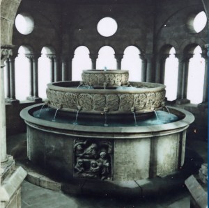
Today the main feature of the garth that survives in ruined form, but was once a magnificent feature unparalleled in England, is the late 12th century lavabo.  Its remains were found during the 19th century, and although only a few elements were preserved intact, they give a good idea of how the lavabo would have appeared.  It consisted of a fountain arrangement of two upper bowls and a lower basin all of which sat within an arched octagonal structure.  It was decorated with carved panels whoing religious themes, two of which are now in the Much Wenlock Museum.  This is where the monks washed before eating.

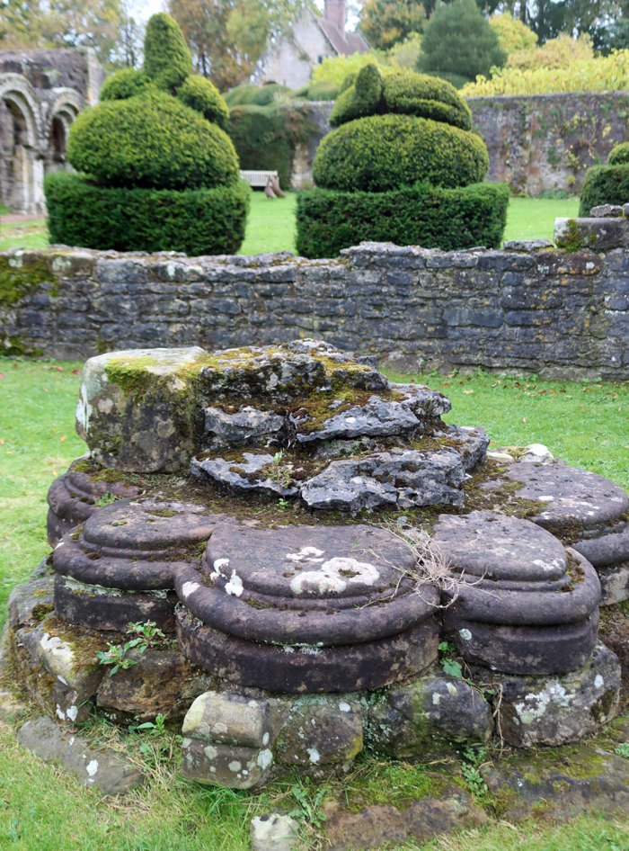
The garth’s modern topiary bushes were established in the 19th century.  Opinion is divided about whether this is a positive addition or not, but it has become a component part of the site’s history.

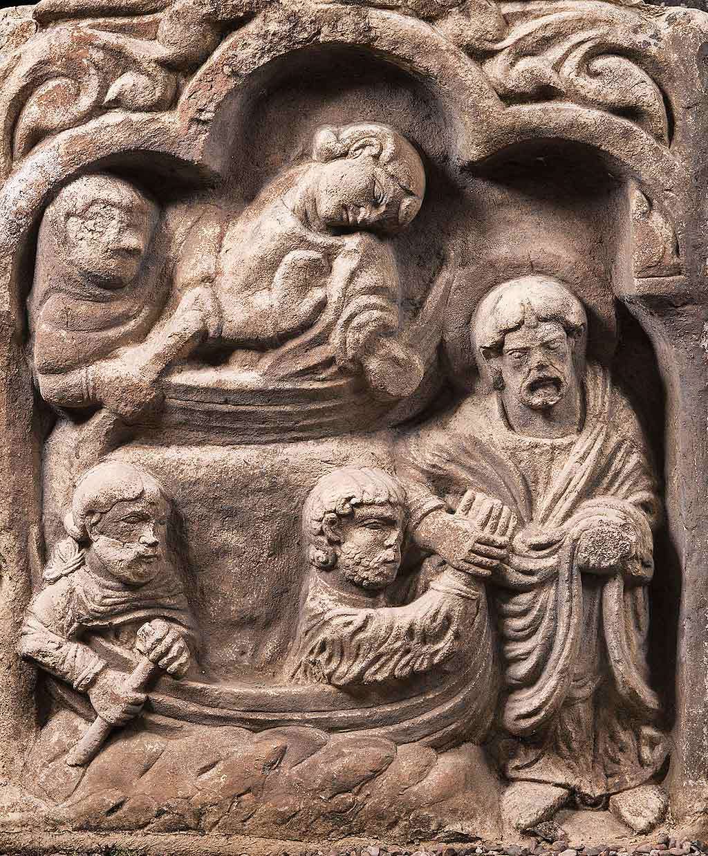
Lavabo carving of Christ with St Peter and St Andrew on the Sea of Galilee. Source: English Heritage

The covered walkway, with open arches that offered light and views of the garth, provided a link between all the cloister buildings that formed the heart of the monastic establishment, where most of the monks spent most of their lives. The walkway no longer survives.  On three sides of the cloister, these are referred to as ranges.  Part of the church nave made up the fourth side.

The East Range

The magnificent Chapter House

The Chapter House, dating from the 12th century, is the jewel in the crown of the abbey.  Considerable investment was usually made in any order’s chapter house, where the community met daily to discuss the business of the monastery, but Cluniac chapter houses are characterized by their particularly elaborate architectural detail, which would have been picked out in full colour.  The blind arcading, a decorative feature emulating window arches, is particularly characteristic of Cluniac sites, although it appears in the architecture of other orders too.  Philip Wilkinson suggests that it was probably “one of the most magnificent rooms in Norman England” (p.35).

Entrance to the chapter house from the cloister

The Chapter House

Blind arcading in the Chapter House

Decorative features in the Chapter House

Romanesque lintel over blocked door in the Chapter House, probably moved here from a different part of the abbey

Decorative touches in the Chapter House

Imaginative reconstruction of how the Chapter House, with its painted arcading, might have looked. Source: English Heritage. See video at the end of the post.

The library with medieval floor tiles

The library on the left, with the Chapter House to its right

Although many monasteries had a book cupboard, the book room at Wenlcock is particularly generous.  The library dates to the 13th century, as does the central arch, but the other arches were added later.  Thanks to pigeons, it has been necessary to put up netting to protect this space, but this also protects the tiles from other general wear and tear.

13th century tiles from around the site have been gathered together here, and laid down at random in order both to preserve them under a roof, and to display them to advantage.  There are also two tombstones, also moved here from elsewhere, but their owners have not been identified.

Medieval tiles and tombstone, seen through netting that protects the tiles from pigeons

The South Range – the refectory

The south range was entirely taken up by the refectory, although only one wall survives.  Sometimes refectories were built perpendicular to the cloister to allow inclusion of other buildings, but others were like this one, running along the side of the cloister with room at each end for a kitchen and a warming house (the latter a small heated room where the monks could spend a little time to warm through during harsh winters).  An oddity is that the line of the refectory runs at an angle (see site plan above), meaning that the garth is not the conventional square or rectangle.

The West Range

The west range, which has now been lost, was used differently from one monastery to another, and could have been used for storage, for visitors, including pilgrims, and could also have been used as the prior’s quarters before a large dedicated building was completed in the 15th century to house the prior and infirmerer.


The Secondary Cloister and beyond

All of the extant buildings that make up the remaining secondary cloister are off-limits to the public, having been sold off after the Dissolution closed it in 1540 but the exterior of the infirmary and prior’s lodging ranges are visible from the east end of the church.  These are considerably modified from their 13th century origins, but are in the original positions of those buildings.  Both are now part of a private residence.

Once the main cloister had been built in stone, further wooden buildings could be replaced by new stone versions.  At Wenlock a secondary cloister was made up by another four ranges.  On the north side was the Infirmary  and the Infirmarer’s lodging.  On the east side was a chapel and the prior’s lodging, the latrines were on the south side and on the west was the continuation of the dormitory that also overlapped with the main cloister as part of the latter’s east range.

At the end of the monks’ dormitory was also a non-standard building that is now known as the Chamber Block and Hall.  The role of this is speculative but it is thought that it may have been reserved for high status visitors like the king, who is known to have visited the priory six times during his reign.

Further to the south and southwest there would also have been subsidiary service buildings including the brewery, bakery, stores and the buildings of the home farm.

Final Comments

It is fairly unusual to have so much of the original site plan preserved in the remaining architecture, even where this only survives as a few courses of stonework.  Wenlock Priory gives a much better idea of the complexity of well-endowed monastic establishments that many others around the country.  In addition, the extravagance of the Cluniac Order is clearly visible in both the size and the architectural detail of Wenlock Priory.

At the same time, much of the understanding of Wenlock Priory and its Early Medieval predecessor comes from excavations, which were carried out in 1901, the early 1960s and during the 1980s, and these findings survive mainly in the form of excavation reports.

This mixture of what can be observed on the ground and what derives from excavations is typical of medieval monastic sites.


Visiting

Entrance to the cloister

The Wenlock Priory is an attractive site beautifully maintained by English Heritage.  The former Prior’s Lodging and the Infirmary are privately owned and cannot be visited but are but visible from the English Heritage site.  There is a large car park. Details of ticket prices and parking fees are on the English Heritage website.  The most recent version of the English Heritage guidebook (by John McNeill, 2020) has some excellent site plans, an artist’s reconstruction and photographs, available from the nice little gift shop, but also available through online retailers if you want to read up the full details in advance of a visit.  The site is mainly all the level, and should be fully suitable for those with unwilliing legs. with a wary eye out for underfoot masonry.

Its postcode is TF13 6HS.  Don’t forget to check the opening days and times of the Much Wenlock Museum, which is a separate entity, and located within the village itself.

The site is near to other attractions, making it a great visit for a day out.  I visited Haughmond Abbey (built by Augustinian monks) and Wroxeter Roman City (posted about here) on the same day, and Ironbridge Gorge is a short drive away (although Ironbridge and its museums, posted about here, really take up a whole day in their own right).  For those with time on their hands, a nice-looking walk in reasonable weather, recommended by English Heritage, takes you from Much Wenlock to the Ironbridge.


Sources

Books and papers

Wenlock Priory 1798 by R. Paddey. Source: Government Art Collection

Angold, M.J., George C. Baugh, Marjorie M. Chibnall, D.C. Cox, D.T.W.Price, Margaret Tomlinson, B.S. Trinder 1973, ‘Houses of Cluniac monks: Abbey, later Priory, of Wenlock‘, in A History of the County of Shropshire: Volume 2, ed. A T Gaydon, R B Pugh (London, 1973), British History Online
https://www.british-history.ac.uk/vch/salop/vol2/pp38-47

Burton, Janet 1994. Monastic and Religious Orders in Britain. Cambridge University Press

McNeill, John 2020. Wenlock Priory. English Heritage

Pinnell, Julie 1999. Wenlock Priory. English Heritage

Platt, Colin 1995 (2nd edition). The Abbeys and Priories of Medieval England.  Chancellor Press

White, Carolinne 2008. The Rule of St Benedict. Penguin.

Wilkinson, Philip 2006.  England’s Abbeys. Monastic Buildings and Culture. English Heritage

==
Websites

English Heritage
Wenlock Priory
https://www.english-heritage.org.uk/visit/places/wenlock-priory/
Walk: Wenlock Priory to the Iron Bridge Shropshire (4.5 miles/7.5km (2-3 hours walking, plus time to visit the properties)
https://www.english-heritage.org.uk/siteassets/home/members-area/exclusive-content/your-exclusive-content/walking-page-dec-20/wenlock-priory-to–the-iron-bridge-shropshire-v2.pdf
St Milburga
https://www.english-heritage.org.uk/visit/places/wenlock-priory/history/st-milburga/

Historic England
Wenlock Priory
https://historicengland.org.uk/listing/the-list/list-entry/1004779?section=official-list-entry


Day Trip: Misericords and other choir carvings at St Bartholomew’s, Tong, Shropshire

Introduction

This time last year I wrote a short 3-part series about misericords in the Chester-Wrexham area, at St Werburgh’s Abbey (now Chester Cathedral), St Andrew’s Church in Bebbington and All Saints in Gresford.  These are all terrific examples of misericords, in really excellent architectural contexts.  On my way back from a short break in Shropshire in October I passed Tong, which I have been meaning to visit for years, so dropped in. Tong is on the A41, just where the road meets the M54, and the church, St Bartholomew’s is literally a couple of seconds off the A41.  It is about an hour’s drive from the Chester area.  It’s a very small, pretty village, and the collegiate church seems disproportionately large, but there was an inhabited castle here, and it was well used in both medieval and Tudor times. The unusual name Tong appears in Domesday as “Tuange.”  Although there is no consensus on the subject, it may derive from a word meaning “fork in the river,” referring to a meeting place of two streams near the former castle.

Lady Isobel and Sir Fulke Pembrugge. Lady Isobel founded the church in 1409 on the death of her husband.

St Bartholomew’s is thought to have been the third church on the site.  It was built by Royal License from 1409, the year of the death of crusader Sir Fulke de Pembrugge, by Lady Isabel Pembrugge, his second wife. It was finished by about 1430.  Lady Isabel established it as a collegiate church, meaning that as well as the church there was a separate building that housed a small community of secular (non-monastic) priests.  There were five at Tong, plus one or two clerks, who were employed to say masses for the soul of Sir Fulke de Pembrugge, in order to reduce his time in Purgatory, as well as prayers for other deceased souls.  The priests also ran a school for village children and a hospital for the elderly and sick, slight ruins of which still survive.  Both Sir Fulke and Lady Isabel are buried in the church in an elaborate tomb, shown above.

The style of the church is Perpendicular Gothic, with the Golden Chapel added 100 years later as an extension in 1510.  It is possible that the arcading in the south side of the nave dated to an earlier, perhaps 13th century church, because the style is different, and could have been incorporated into the new church.  Quite unusually, there are no projecting transepts, so the footprint of the church is not cruciform.  An original porch projects from the nave, whilst on the opposite side a large vestry projects from the chancel.  The rest of the church and its history will be discussed on a future post.

Misericords are “mercy seats,” first employed in monastic establishments, and carved onto the underside of hinged seats in choir stalls.  When the seat is down, it can be sat on as normal, but when leaning up against the back of the choir stall it has a little protrusion on which a monk or nun could prop themselves during some of the long daily offices that were typical of monastic and collegiate life.  Many of these feature elaborate carved decoration.  The earliest ones in Britain were carved in monasteries in the 13th century, and later on they found their way into collegiate establishments, cathedrals and, later still, parish churches.  Whether in monastery, cathedral or church, they could include a variety of subjects, religious, classical, pagan, chivalric and naturalistic.  You can read much more about them on my introductory post on the subject here and my round-up post here, looking at who might have been responsible for the themes chosen, who may have paid for the misericords, why they were contained within the most sacred part of the church and how they might be understood.
==

The misericords at St Bartholomew’s, Tong

The stone elements of the St Bartholomew’s choir, including the piscina (shallow basin used for cleaning communion and other vessels) in the sanctuary or chancel and sedilia (stone seat), also in the sanctuary all date to between 1410 and 1430.  The oak choir stalls would have been inserted only after the stonework had been completed, probably towards the end of the 1420s.

There are two sets of L-shaped eight choir stalls, facing each other with the entrance to the choir separating them.  Originally each would have had a misericord and today there is only apparently one missing, with no subsequent replacements, with only some slight restoration work carried out.  There are also with three-light traceried back panels, carved frieze, and desks, as well as carved bench ends, desk ends and carved poppy-heads, all dating to the early 15th century.  The published guide to St Bartholomew’s adds that one of the bench-ends seems to be a much simpler and less skilled example, and was probably a later replacement for one that was damaged.

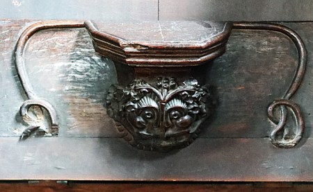
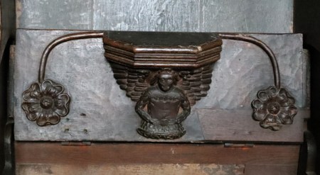
Most of the misericords are botanical, but there are other themes, some of them natural and some of them apparently pagan, such as the face above.  Pagan faces, or grotesques, are not unusual, but although they are often difficult to interpret. Two show winged angels, one apparently in armour holding a shield, the other holding a book or coat of arms, and another apparently depicts a castle.  These may be references to the family who built the church.  Sir Fulke de Pembrugge, for example, was a crusader, and the family lived in the nearby castle.


It is sod’s law that the last of the misericords shown above is the one most discussed in books and is the one that I took three attempts to photograph and still came out dismally.  This is the only one that represents a specific scene: the New Testament story of the Annunciation.  In the middle is a lily growing in a vessel with two blooms and, at its centre, Christ on the cross. This arrangement is flanked on one side by the Angel Gabriel and on the other by the Virgin Mary, each of whom hold pieces of a scroll that records the Angel’s greeting and Mary’s reply.  The supporters may either represent doves of peace or the Holy Spirit.


Details of poppy heads (on the tops of bench ends and desk ends). Click to enlarge

There are numerous churches in the Midlands that could have provided the general idea for misericords at St Bartholomew’s.  For a list of misericords elsewhere in the Midlands see Misericords of Midlands Churches page on the misericords.co.uk website.  It is probable that many other misericords were lost when Henry VIII dissolved the monasteries.

===

Visiting

Check the St Bartholomew’s Church website for up-to-date opening hours and events that may close it to the public, but at the time of writing it is open daily, and in the summer months runs heritage tours that do not need to be booked in advance.  The church’s post code is TF11 8PW but Tong is almost impossible to miss, just seconds away from the A41 immediately before the M54 roundabout.

When there are no events, it is easy to park on the quiet road outside the church.

There is absolutely tons to see at the church, which is a feast for the eyes.  The 1515 Golden Chapel alone is a remarkable thing with its fan vaulting, but the many other early Tudor monuments are also spectacular.  See the church’s Heritage links on the above site to explore what it has to offer the visitor.  There is also a guide book that you can purchase at the church for £2.00 (cash into an honesty box), at the time of writing, which is great value with excellent photographs and good explanatory text, although it skims over the choir carvings.

If you want to make a day trip of it, nearby is the marvelous RAF Museum at Cosford, around 10 minutes away, and the the small but attractive White Ladies Augustinian Priory, also around 10 minutes away. 


Sources

See the end of Part 3 of my original series on misericords for sources on the general subject of medieval misericords.

The St Bartholemew’s misericords are referenced in the following works:

Books and papers

Anderson, M.D. 1954. Misericords. Medieval Life in English Woodcarving. Penguin Books

Anon, 2002. St Bartholomew’s Church, Tong, Shropshire. ISBN 1 872665 59 4.
(Almost no information about the misericords but some background information about the medieval church, to which the misericords date)

Grössinger, Christa. 2007.  The World Upside-Down. English Misericords.  Harvey Miller Publishers

Websites

St Bartholomew’s Church, Tong
https://tong-church.org.uk/
History (very top-level)
https://tong-church.org.uk/history/
Tong’s timeline
https://tong-church.org.uk/tong-parish/timeline/

Historic England
Church of St Bartholomew
https://historicengland.org.uk/listing/the-list/list-entry/1053606?section=official-list-entry

The Medieval Bestiary
Excerpts from Francis Bond, Wood Carvings in English Churches: Misericords (pages 208-214). This text is believed to be in the public domain.  CHAPTER XVII: ON THE USE OF MISERICORDS – NOMENCLATURE
https://bestiary.ca/prisources/pstexts4837.htm

misericords.co.uk
Home page
https://misericords.co.uk/


Ewloe Castle in Wepre Park, near Connah’s Quay

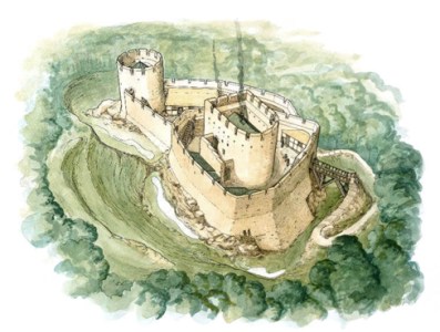
Artist’s reconstruction of Ewloe Castle. Source: Renn and Avent 2001

The ruins of the 13th century Ewloe Castle, one of Llywelyn ap Gruffudd’s more puzzling constructions, is located in the public Wepre Park, near Connah’s Quay and not far from Chester.

Visiting details are at the end of the post, including information about car parking, the visitor centre, an excellent downloadable guide to the routes through the park and its key features, as well as where to find out more information about the castle.
==


==

Wepre Park

Wepre Park map in the Explore Wepre Park PDF by Denbigh County Council online.  The Main Trail leads from the car park all the way to the foot of Eweloe Castle.  The Boardwalk is also reached from the car park, and is shown at bottom left.

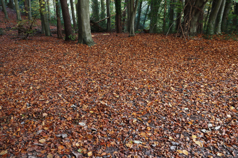
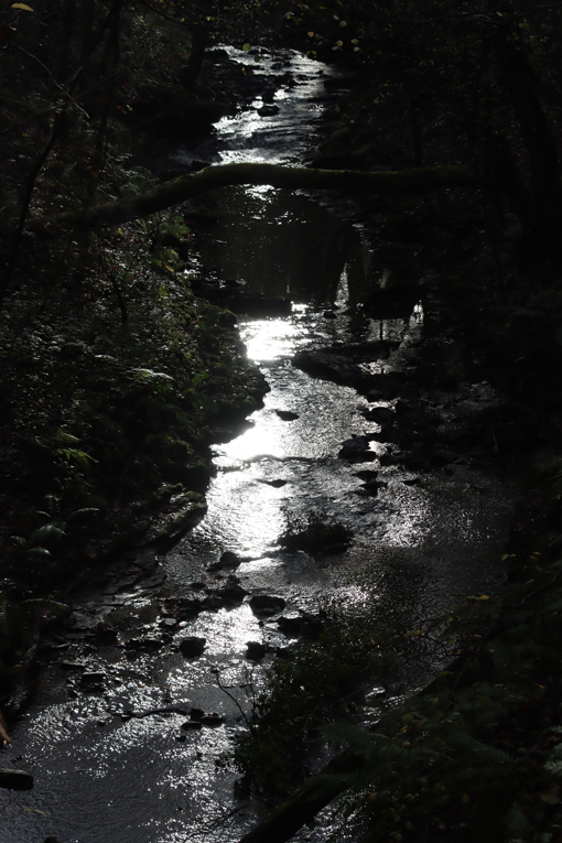
Wepre Park is a woodland valley, largely deciduous, that flanks the Wepre Brook, and is very popular with dog walkers, joggers, and families. According to the park’s literature, it is a remnant of the great hunting forest of Ewloe.  More recently it was the site of Wepre Hall.  On a sunny day in the autumn, with the light filtering through the trees, this should be a wonderful display of illuminated colour.  The autumnal display was very fine, with the light filtering through the multi-coloured leaves and the woodland floors carpeted with bright yellows and oranges.  The woodland contains a wide mixture of different trees, shrubs and vegetation and is home to varied wildlife, including aquatic species, insects, birds, bats, badgers and a lot of very busy squirrels.  There is also a small wildlife meadow, although there is not much to see at this time of year.
==

The valley was owned in the 11th century by St Werburgh’s Abbey in Chester.  In the mid 12th century it was the site of a major confrontation between Henry II and the forces of Owain ap Gruffydd, ruler of Gwynedd in west Wales, during Owain’s campaign to extend his territories to the east. In 1157 Henry II took an army into northeast Wales to subdue Owain, but was ambushed by Owain in the Ewloe valley.  Although Henry escaped, and defeated Owain at Rhuddlan, Owain later regained much of the lost territory.

Wepre Hall, first built in 1788. Source: RCHAMW

A house is recorded at the site from at least the late Middle Ages.  During the Civil War a house at Wepre belonged to Royalist supporters who, in 1645, supposedly hid in the cellars a Royalist sympathiser who was a participant in the the Battle of Rowton Moor.  It was rebuilt as a 2-storey Georgian house in 1788 by Edward Jones, the owner of a local lead mine, with outbuildings and later extensions.  It was demolished in 1960.  There is nothing remaining of Wepre Hall except for the cellars.  The visitor centre sits on part of the Wepre Hall site, and the gardens here and nearby are designed to echo the formal gardens of the Hall.

There are a number of routes through the park.  From the car park, the Main Trail is a wide metalled track that leads from the car park past the visitor centre nearly as far as the castle (after which there are wooden steps leading up to the castle).  It follows the line of the brook, which drifts in and out of sight and is constantly audible.  The most notable feature on the Main Trail, apart from the lovely woodland, are the outcrops of Hollin Rock, a 320 million year old red sandstone, popular as a building material.  Towards the end of the trail is a small and attractive bridge, Pont Aber, that was once located further upstream but was moved here in 1800 to improve access to Wepre Hall.  There is a delightful small waterfall on the other side, which used to be the location of the Castle Hill Brewery that used the water from a natural spring.
==

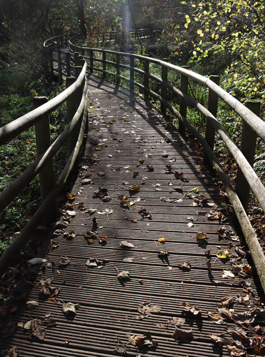
The second significant route is a boardwalk, which leads from the car park along the brook and connects to the Main Trail about half way way along.  The main feature of the Boardwalk route is the waterfall, actually built as a weir to power a small hydroelectric plant, but it is a very attractive feature.  The plant used to provide electricity to the Hall before mains electricity arrived in the area in 1925.  There is a variety of aquatic vegetation flanking the boardwalk, and information boards indicate the different wildlife, including birds, that can be spotted on a walk.  The boardwalk follows the brook closely until it slopes up slightly to meet the Main Trail, and the “bubbling brook” phrase never seemed more apt.  This is a very audio-visual walk.
==

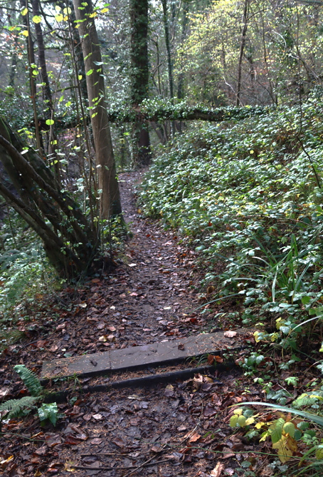
Some of the other footpaths are just well-worn tracks, very muddy at this time of year, but follow lovely winding routes through the woodland.  I tried the track from the bridge to the Devil’s Basin, supposed to be a short set of very pretty falls, but after five minutes or so the deeply churned mud made it completely impassable in ordinary hiking boots. It would have required wellies.

Near the visitor centre there is a small lake called the Rosie Pool that was created in the late 19th century for fishing and is now managed by the local angling club.  Immediately behind the visitor centre is a small but very attractive formal garden with a small pond, a nod to the former hall.  Even at this time of year, fuchsia, hydrangea and sedum still have some flowers.  There is a small pet cemetery located at its edge.  For more about the park download the Explore Wepre Park guide (in Sources at the end of this post).

Ewloe Castle

Ewloe Castle from the air. RCHAMW 6463845. Source: RCHAMW

There is some discussion about who built the castle. It was certainly either built or rebuilt in c.1257 by Llywelyn ap Gruffudd (also known as Llywelyn the Last), but he may have been restoring a castle originally built by Llywelyn ap Iorwerth (Llywelyn the Great).  The D-shaped keep has been seen as characteristic of Llywelyn the Great, and differences in the stonework of the upper and lower wards have been used to argue for a two-phase construction.  If this was indeed the case, it is argued that the upper ward would have been contemporary with the keep built by Llywelyn the Great and the lower ward built by his grandson Llywelyn the Last.  On the other hand, there is an early 14th century document that states that the entire was built by Llywelyn the Last.  The question remains unresolved, but it is not doubted that whoever built the castle, Llywelyn the Last certainly carried out extensive building work here.

Plan of the castle. Source: Lloyd 1928

Although it is built to a fairly standard Welsh plan, it is something of an oddity in strategic terms, not being built high on a hill but on the edge of a small valley.  Although the sides slope steeply away from the castle on three sides, it was actually overlooked from the south, so required quite extensive outer defences on that side, consisting of a ditch, the digging out of which would have provided a bank.
==

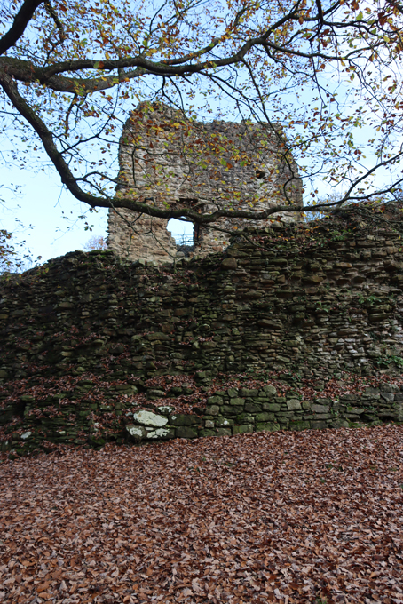
The keep sits within a small upper ward.  A larger lower ward was added, possibly at a later date, with a tower at its furthest extent from the upper ward and both were provided with curtain walls, some of which remain.  The D-shaped (or apsidal) keep has a small footprint with its semi-circular end overlooking the defences, whilst the tower in the lower keep overlooks both the southern aspect and the valley below.  The lower ward would have been provided with timber buildings for domestic functions and storage.

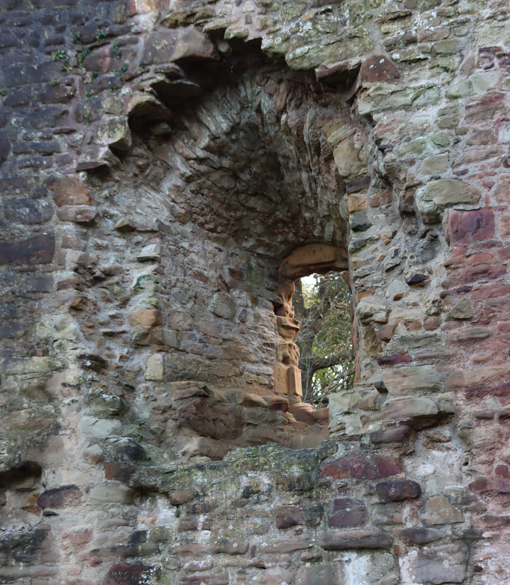
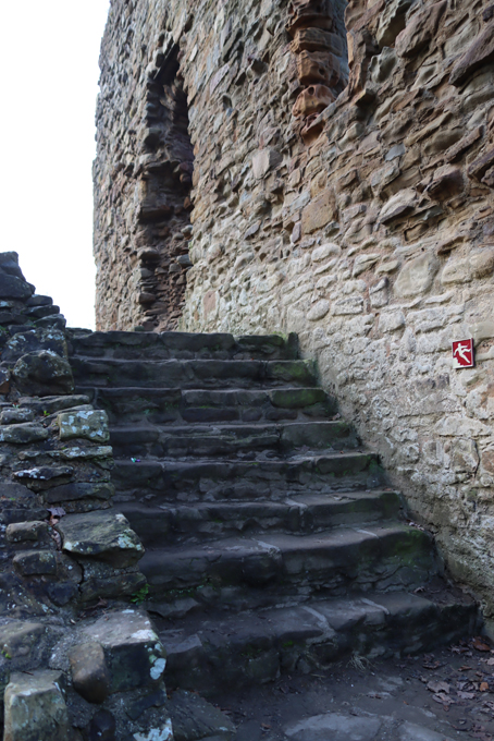
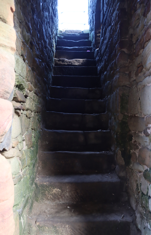
On the former ground floor of the keep, to which the steps at the back of the upper ward lead, the former hearth is still visible, and there are windows set in the thick walls.  Looking at the keep today, the lowest layer was a basement with no lighting.  The keep had an outer stone staircase at its south, and this is still in use for accessing the inner staircase that leads up inside the walls of the keep to a viewing platform at the top of what remains of the keep’s walls.
Two entrances, one into the upper ward and one into the lower ward would have been approached by bridges over the defences.  The lower ward’s tower was probably accessed from the curtain walls of the lower ward.

In 1257, when the castle was either built or rebuilt, Llywelyn ap Gruffudd was on the offensive, attempting to retake Perfeddwlad, otherwise known as the “Four Cantrefs,” which incorporated the cantrefs of Rhos, Rhufoniog, Dyffryn Clwyd and Tegeingl, a constant bone of contention between the Welsh princes and the English crown.

The problem of the poor strategic location could be explained by suggesting a different intention for the castle as more of a political statement than a fully functional military outpost.  Its location on the edges of disputed territory, not far from older English castles and the site of Owain Gwynedd’s defeat of Henry II may simply have been a statement of a Welsh return to land that they claimed as their own, and a useful staging point for any future negotiations, given its proximity to the Anglo-Welsh border.  This is supported by its probable use first in November 1259 and again in December 1260 when English ambassadors were sent to meet with Llywelyn at a place identified as Wepre, which must have been the castle.  There is no record of the castle’s involvement in 1276 and 1277, when war between England and Wales reignited, which may give added weight to this castle being a political gesture rather than a strictly military base, but could also reflect the necessity of Welsh retreat to safer ground.

Ewloe Castle by Moses Griffith (1747-1819) NMW A13529. Source: National Museum of Wales

Edward I does not appear to have felt that Ewloe Castle was worthy of his interest.  Although he restored other castles for his own use, this was probably too small, too badly sited and too difficult to defend.  Instead, in 1277 Edward began to build at Flint (posted about on the blog here), Rhuddlan (posted about here) and Denbigh (posted about here).  Owain Glyndwr’s rebellion in 1400 found no use for it either.
==

Visiting

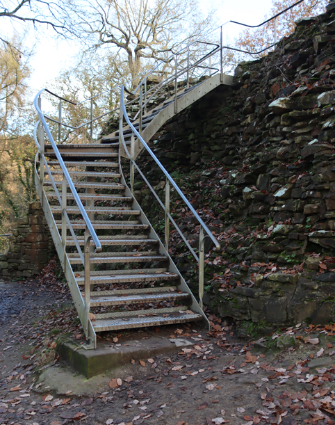
Access to the castle, managed by Cadw, is free of charge and open all year round, as is the entire park, but you will need to be confident with stairs, as they are the only way in and out of the castle.  There are new metal stair cases with handrails, and original stone ones, including a small flight in a stairwell in the keep leading up to a viewing platform at the top.  None of the stone staircases have handrails.

Parking is straight forward for both castle and park.  If you only want to see the castle there is a lay-by on the side of the B5125 that looks as though it will take about 8 cars, maybe a couple more.  I didn’t try the route from there to the castle so have no idea what the footpath is like underfoot, but the What3Words address for the lay-by parking is ///follow.beauty.mistaking.  The official car park is a large one near the visitor centre on Wepre Drive. Ewloe Castle is about a mile away from this car park along a very easy and attractive trail. The What3Words address is for the main car park is  ///contrived.writing.mailers

A circular walk taking in the boardwalk and returning to the car park via the Main Trail would be suitable for unwilling legs, as would a walk along the boardwalk to the bridge and then back along the main route.  The castle is not suitable for those who cannot manage steps and stairs, as this is the only way of getting into the castle, from whatever direction you approach.

The visitor centre is closed at this time of year (November) but its cafe was open on my visit.  The public toilets are also open nearby.  There’s a substantial play area on the edge of the car park.  There are a small number of good information boards throughout the park, including one at the castle, but the Cadw official guide to Flint Castle also has a section on Ewloe Castle.  Other sources are listed below, including castle information and an excellent guide to the park, together with a footpath map.


Sources:

Wepre Park

Flintshire County Council
Parks and Countryside
https://www.flintshire.gov.uk/en/LeisureAndTourism/Countryside-and-Coast/Parks-and-countryside.aspx
Discover Wepre Park Booklet
https://www.flintshire.gov.uk/en/PDFFiles/Countryside–Coast/Discover-Wepre-EnglishWEB.pdf

A different map that may be slightly easier to follow is on the following link:
Potty Adventures
Wepre Park
https://pottyadventures.wordpress.com/2016/07/16/wepre-park-our-local-8th-wonder-of-world/

=
Ewloe Castle

Books and papers

Davis, Paul R. 2021.  Towers of Defiance.  The Castles and Fortifications of the Princes of Wales. Y Lolfa

Lloyd, J.E. 1928.  Ewloe.  Y Cymmrodor, vol.39 (unnumbered)

Renn, D.F. and Avent, R. 2001 (2nd edition). Flint Castle – Ewloe Castle. Cadw

Websites

BBC News
13th century castle to be sold (18th November 2009)
http://news.bbc.co.uk/1/hi/wales/north_east/8364611.stm

Cadw
Castell Ewloe
https://cadw.gov.wales/visit/places-to-visit/castell-ewloe

Coflein
Ewloe Castle
https://coflein.gov.uk/en/site/94447/
Wepre Hall
https://coflein.gov.uk/en/site/36307/

Wales Online
Ewloe Castle has sold to farmer at auction (9th December 2009)
https://www.dailypost.co.uk/news/local-news/ewloe-castle-sold-farmer-auction-2770922
==

Rhuddlan Castle and the Statute of Wales

Rhuddlan Castle from the air. Source: People’s Collection Wales.

The magnificent Rhuddlan Castle, and its predecessor Twthill motte-and-bailey castle (the latter now just a mound), are located just over 3 miles south of the point on the North Wales coast where the river Clwyd, which Edward I diverted to pass the foot of Rhuddlan, empties into the sea at Rhyl. Like all of Edward I’s newly built English castles in Wales, this has some features in common with its brethren, but is at the same time a unique entity, each with a highly distinctive, unmistakable appearance in its own right, building on previous creativity to create even more innovative defensive measures.

I visited Rhuddlan last week for the first time, taking spur-of-the-moment advantage of a cold but gloriously sunny morning to make the most of Rhuddlan’s striking looks and lovely location.  The castle is an impressive sight, particularly as it is bounded on its northeastern side by fairly dense village housing and one gets the sense of emerging abruptly from the bustling present into a peaceful and finely fossilized landscape of the past.

This is the third post in an occasional series about the history of Edward I’s earliest castles in northeast Wales.  The background history to Edward’s sudden launch into castle building in Wales from 1277 is the first part, and can be found here. It looks at the disputes between Edward I’s father Henry III, king of England, and his subsequent and far more personally felt disputes with Llywelyn ap Gruffud, Llywelyn the Last of Wales.  The second post in the series looked at Flint Castle, the first of Edward’s castles in Wales started in July 1277, with its accompanying new town.  Rhuddlan Castle was started in September 1277, and is covered below.  Denbigh built in 1282 is posted about here.

St Mary’s Rhuddlan

I combined Rhuddlan Castle with a look at the last surviving chunk of Edwardian defensive ditch that originally surrounded the town, and a wander around the exterior of the nearby St Mary’s Church (its opening times to visitors are limited to the summer months), which was built sometime after the granting of the town charter in 1278, both of which are mentioned below. I then skirted the castle and followed the track and footpath down to Twthill. The story of life at Rhuddlan before Edward I, both pre- and post-Norman, will be covered on another post, and will include the background to and history of Twthill.

St Asaph’s Cathedral

After Rhuddlan I drove the few miles south to visit St Asaph Cathedral, which has connections to both Rhuddlan Friary, originally located near the castle, and Valle Crucis Abbey, near Llangollen.  Valle Crucis is the subject of an ongoing series of posts on this blog.  Rhuddlan Friary has been discussed on the blog here, and St Asaph Cathedral will be discussed on a separate post at a later date.

To make it an official day-trip, the day not being warm enough for an ice cream, I stopped for a very self-indulgent glass in The Hare in Farndon on the way home, which was the cherry on top of a very good day!

Visitor information for Rhuddlan Castle is at the end of the post.

Rhuddlan during the reign of Henry III

Henry III (reigned 1216-1272), father of Edward I, had ongoing problems with self-styled Prince of Wales Llywelyn ap Gruffudd, also known as Llywelyn the Last, a grandson of Llywelyn ap Iorwerth (Llywelyn the Great).  Llywelyn was based in Gwynedd, his home territory, but had managed to establish some degree of unity within his own family (particularly his brothers Dafydd and Owain) and throughout Wales, historically a fragmented and constantly shifting set of territories.  The powerful Marcher lordships along the Welsh border formed an aggressive barrier between Wales and the rest of England, and trouble had rumbled continuously along the border during the reigns of previous kings, causing the official border between the two countries to move regularly.  The crown held territories within modern Wales, and these came under attack by Llywelyn the Last. This is all covered in the post that describes the background to the disputes between Edward and Llywellyn, complete with a family tree of the relevant participants.

A Dominican priory, described on the blog here, was founded by Llywelyn ap Gruffudd in 1258 during the reign of Henry III, and is discussed.  The building does not survive, but some of its materials were visibly incorporated into the farm that now sits on the original site of the priory.  It is quite likely that during the 13th century played host to Llywelyn ap Grufudd, and later to both Henry III and Edward I during their visits.  As with most monastic institutions, the Dominicans were obliged to show hospitality to guests, irrespective of their political allegiance, and it would have been in their interests to stay in the good graces of both Welsh and English leaders.  Edward had probably taken advantage of hospitality at Basingwerk Abbey during the construction of Flint Castle.

Edward I’s Rhuddlan Castle

Expanding the the “Ring of Iron”

Map of Edward I’s campaigns in Wales. Source: History Matters at the University of Wales

Edward was granted the royal lands in Wales by Henry III on the occasion of his marriage to Eleanor of Castille, and took an active interest in the Welsh situation until his departure on crusade, during which his father died.  Edward inherited the dispute with Llywelyn, but was already very familiar with the the Welsh prince and his ambitions, and was also familiar with the Welsh landscape.  The expenses incurred during his crusade had left him with serious debts, and the terms of the agreement that Llywelyn had reached with Henry III involved a substantial annual payment by the Welsh prince to the Crown treasury, but there were problems.  Llywelyn was already three years in arrears, and was now refusing to pay homage to the new king.  Several treaties under Henry III had failed to achieve long term peace, and although the Treaty of Montgomery of 1267 had looked as though it might hold, Llywelyn ap Gruffud’s behaviour was intolerable to Edward who labelled Llywelyn an outlaw in 1276, and war was declared in 1277. A peace was brokered, but although Edward had every reason to believe that the treaty might secure peace between England and Wales, he began to build a series of castles in northeast Wales, eventually extending into northwest Wales, beginning at Flint in the July of 1277 and rolling out along the coastlines throughout the next two decades.  This was followed almost immediately by the foundation of Rhuddlan in the same year.

Artist’s impression of the Twthill motte-and-bailey castle by Terry Ball.  All that survives today is the motte. Source: Wikipedia

When Edward started building his castle at Rhuddlan in September 1277, Flint Castle and town were still under construction.  Flint had been virgin territory, and consisted of both a stone castle and a new defended town, an “implanted bastide.”  Although the site of Edward’s castle itself had not been occupied, Rhuddlan had been long-established, from the pre-Conquest period into the 13th century.  The existing wooden Twthill motte-and-bailey castle, a short distance from Rhuddlan probably served as a useful base from which to manage building works and campaigns as the new stone castle was built and the new town laid out and provided with perimeter defences.

Llywelyn, realizing that his cause was lost, surrendered  later in 1277 at Rhuddlan, several years before Edward’s castle was finished, and for a while it looked as though the resulting Treaty of Aberconwy would provide the basis for long-term peace.  Llywelyn had been granted the entire region of what is now known as Gwynedd, permitted to retain the title Prince of Wales, and his difficult brother Dafyddd was allocated territories in mid-north Wales whilst Owain was given control of the Llŷn peninsula.   Edward, however, was not taking any chances, and he continued with his castle building programme, unambiguously reinforcing his message that Wales was under English control, with Rhuddlan performing the role as the administrative headquarters for the region.  Should any attempts at rebellion be attempted in the future, Edward and his supporters would be ready.

Why Rhuddlan?

What were the strategic advantages that made Edward I choose Rhuddlan as the location for his third castle, his new administrative headquarters for north Wales?

First, the castle is right on the edge of the River Clywd, a fairly narrow but very attractive ribbon of blue threading its way between the fields, all the more impressive when you know that the river actually ran along a slightly different course until Edward canalized it and had it dredged to provide a deep-water channel for connecting the castle to the coast and the Dee Estuary. The River Clywd become un-navigable not far south of Rhuddlan.  The link to the estuary connected Rhuddlan both to Flint Castle and Chester to its east and then, later, to Edward’s castles at Conwy and Caernarvon in the west.

Photograph of Rhuddlan Castle in the context of the River Clwyd floodplain and the coast to the north. Rhuddlan Castle is at bottom left, near the rear foot of the RCAHMW dragon logo.  Source: Coflein, archive number 6356180 / AP_2007_2032

The castle itself sits above a very wide, low floodplain, on an area of raised land.  Standing on the battlements, reached by modern spiral staircases, the views over the surrounding landscape are remarkable, providing an excellent impression of how well the castle was positioned for sighting oncoming threats.  Economically, the wide floodplain was ideal for the development of a new town, with potential for raising livestock and agriculture.

Until Conwy was built, Rhuddlan was conveniently located as a regional HQ just on the edge of Llywelyn’s territory, and it was his most important base in Wales.  By the time Conwy Castle was up and running, Rhuddlan had become secondary in importance, but was still garrisoned and was very important in Edward’s chain of defences.

The Designers and the Design

The outer curtain wall, which only survives in very small sections, followed the perimeter of the revetted dry moat, and enabled archers in the battlements of the castle to fire over the heads of those protecting the outer defences.

Rhuddlan has a very distinctive look and feel to it, containing some innovative features that were carried through to other castles in the northeast.  The first architect to work on Rhuddlan, who was probably responsible for its layout and some of its initial design elements, was king’s engineer Master Bertram, who had been employed by Henry III is Gascony, and who brought with him Gascon design principles.  He was replaced after six months by Master James of St George, whose work Edward had seen in France at the castle of St Georges d’Esperanche, and who went on to build Edward’s great castles at Conwy, Caernarvon, Harlech and Beaumaris.

The most obvious novel feature of the design, when compared to Flint, was the use of both an inner and a very short outer curtain wall, shown in the photograph above, a concentric arrangement of defences that formed the template for Edward’s later castles, including nearby Denbigh, built in 1282.  The lower outer curtain wall, which at Rhuddlan was installed along the inner perimeter of a revetted dry moat, itself impressively lined with stone, enabled archers on the battlements of the main castle to aim beyond those defending the outer curtain wall without endangering them, whilst providing two lines of defence for the castle and its defenders.

Nice to see part of the original gateway in this 19th century watercolour by David Cox. Source: Victoria and Albert Museum

Originally a formal gateway granted access across the moat and the short outer curtain wall into the riverside entrance between the first pair of distinctive twinned towers.  Diagonally across the inner ward a second pair of twinned towers gave access via a secondary entrance. On the other two corners of the main castle were another two towers, each single.  All the towers, including the river tower, were 4 storeys high, including a subterranean basement in each.

Building the castle

The first task was to build defensive ditches, which which would offer protection for the construction camp as the castle was built, and would later become the dry moat.  At Flint Castle 1800 ditchers, known as fossatores, were employed for thus task, as well as the digging of the ditch and banks for the town defences, and it is probable that a similar number was employed at Rhuddlan, sourced from all over England, some of whom were forced labour.  It is possible that a proportion of the fossatores who had been employed at Flint were now deployed at Rhuddlan.

As the castle began to take shape, skilled craftsmen were also imported, including carpenters and masons. Carpenters would have been vital for the build, as they were responsible for the scaffolding as well as various buildings in both inner and outer wards, and other architectural features.  Masons used a mixture of stone types for the construction, all available locally, including yellow and red sandstones, the latter more vulnerable to erosion over the centuries than the yellow, and the grey limestone.   Extensive robbing from the lower levels of the castle after it was slighted (damaged to prevent re-use) after the English Civil War in the 17th Century gives the impression of a serious attack of delamination, but as peculiar as it looks helpfully reveals the underlying construction, showing that the the more enduring limestone covered more vulnerable sandstones.

View of Rhuddlan from the west showing what it may have looked like by the beginning of the 14th century. Illustration by Terry Ball. Source: Taylor / Cadw 2004, p.3

In 1278 sufficient progress had been made for the king and queen to stay at the castle, and in 1280 the towers were roofed in lead and in 1281 the king’s hall was roofed with shingles.  A well was sunk into the centre of the inner ward, 50ft deep.

Whilst work on the castle proceeded, one of the most impressive of the civil engineering feats at Rhuddlan was completed simultaneously.  The river Clwyd was diverted from its natural course, and canalized for two miles (3.5km), the work of 968 workers who were imported to Rhuddlan for the task in 1277, providing the castle with deep channel access to the coast, suitable for sea-going vessels, avoiding the need for trans-shipping.  This met Edward’s requirement for a fluid and seamless communications network.

There was space by the riverside tower, known today as Gillot’s Tower, for a single vessel to put in to dock at high tide, and a river gate alongside the tower, improving efficiencies for loading and unloading.  As Rhuddlan always had a garrison, and was on a number of occasions the base from which forces departed towards Snowdonia, it was often provisioned from Ireland with livestock and grain.  A military cemetery was established at the castle, a clear indication that Edward was expecting casualties in his dealings with Wales.

Work was suspended during renewed hostilities in 1282, when Llywelyn’s brother Dafydd instigated another rebellion against Edward I.  Dafydd attacked Hawarden Castle on 21st March, Palm Sunday.  His action encouraged other Welsh landholders to retaliate in kind, but it was not until June that Llywelyn took the decision to join his brother’s rebellion.  Although the Welsh rebellion seemed to gain ground for a while, the English assembled a substantial force at Rhuddlan, consisting of around 9000 men, which advanced into Wales taking several Welsh castles as they proceeded.  The castle was re-provisioned by ship from Ireland with livestock and cereals.  This time there was no peace treaty, and Llywelyn was killed on the battle field in the same year, whilst Dafydd was eventually caught in June 1283 and held at Rhuddlan Castle before being put on trial in Shrewsbury for treason, after which he was tortured and executed.  The cost was massive, some £120,000 (£83,288,423.43 in today’s money, according to the National Archives Currency Converter) with £50,000 having been raised by a tax on English residents.  There was also a huge cost in terms of English life;  the military cemetery established at Rhuddlan had run out of space by October 1282.

Work had resumed on Rhuddlan following the conflict and although there are no records of damage to the castle at that time, records of repairs do survive and these suggest that Rhuddlan had come under attack.  A record survives for the payment of 64 shillings to “Adam the tailor” for red silk to make pennons and royal standards for Rhuddlan.  As if the massive castle itself was not a sufficient statement of English power in the region, it was to be adorned with the rich and brightly coloured symbols of English monarchy.

The 50ft / 15m well in the inner ward

Today it is difficult to conceive of a royal court that was constantly on the move, but in the Medieval period, royal authority was reinforced by the movement of the monarch to properties around his kingdom, both his own and those of favoured aristocrats.  After the execution of Dafydd, Edward took his court on a tour of various provincial areas, whilst work continued at Rhuddlan.  He was back at Rhuddlan for Christmas.  Between 1283 and 1286 further investment was made on the royal apartments and chapel, both of which would have been in the wooden buildings in the inner ward, together with the kitchens.  Beam holes in the walls of the castle’s interior show where the roof beams were installed.  A well was sunk in the centre of the inner ward.  The outer ward would also have been filled with buildings, of a more utilitarian variety, including at least one granary, a forge, stables and storage facilities.

Arnold Taylor quotes a figure of £9613 2s 8 3/4d for the building of Rhuddlan between 1277 and 1282.  According to the National Archives Currency Converter, this would be some £6,672,184.58 in today’s money (or 11,209 horses or 21,362 cows or 961,313 days of a skilled tradesman’s labour).

Edward’s new borough and town

Plan of Rhuddlan. Source: Arnold Taylor/Cadw 2004, p.9

As at Flint a new borough was created and provided with defences and English settlers were incentivized to live and work there.  The new town, known as an “implanted bastide” after prototypes in Gascony, was built to the northwest of the the old town and was granted its charter in 1278.  This new-town bastide concept and its management are discussed in more detail on the post about Flint Castle.  Today’s town follows the original layout of the new town, its streets originally dividing the town into five sections leading down to a bridge across the river, with the High Street, Church Street, Castle Street, Parliament Street and Gwindy street being the key survivors.

The town was defended on three sides by a ditch with flanking banks, possibly topped with a timber palisade, a section of which survives off Gwindy Street, shown in the illustration and photograph below.  In the 1960s the complete length of the ditch survived north of the town, but by 1970 only the Gwindy Street section remained. Excavation of part of the defences, known as Plot 0, was undertaken when the land was due to be sold for development, but due to the heavily eroded state of the banks was unable to confirm if there were timber defensive features.  The fourth side of the defences was made up by a cliff running down to the river.

Source: Quinnell and Blockley 1994

====

What remains of the double banks and ditch that surrounded the new town of Rhuddlan

Although it might have seemed like an unattractive proposition to be an immigrant English population living in a defended town in ostensibly hostile territory, there was a huge demand for land in England at that time, and the new towns in Wales represented great opportunity as well as risk, particularly as charters offered far more favourable conditions for the English than their Welsh neighbours.  Marc Morris refers to them as “those enclaves of English privilege, where the Welsh were obliged to trade but could not live and where the legal discrimination between the two peoples was a fact of every day existence.”  The risk for these settlers was very real, and it was the towns rather than the castles that were targeted by Dafydd in 1282, in Aberystwyth, Denbigh and Rhuddlan.
===

The Statute of Rhuddlan of March 1284

Peniarth MS 41 a 15th century copy of the Statute of Rhuddlan. Source: National Library of Wales, via Wikipedia

In 1284 Edward I formalized how Wales to was to be governed and ruled after the deaths of Llywelyn in 1282 and Dafydd in 1283 during Dafydd’s ill-conceived rebellion of 1282.  The document that captured his requirements was the Statute of Rhuddlan or Statue of Wales, which was issued by Edward I from Rhuddlan whilst he was in residence. Although Edward had been sufficiently diplomatic to recognize different interests and hierarchical claims within Wales after 1277 for the sake of peace, in 1282 his aim was to bring the entire of Wales into a single administrative system controlled by England.

The Statue of Rhuddlan, part territorial administration and part legal treatise, handled Wales as a single homogenous unit, an extension of England and her criminal legal system.  Wales was divided into new English-style shires:  Flint, Merioneth, Caernarvon, Anglesey, Cardigan and Carmarthen, a structure that endured until 1536 when the Act of Union was passed.  An English administrative hierarchy was put into place with officials and administrators answering to a new justiciar based in northwest Wales. Legally, the Statue was an interesting mixture of English law with some concessions to Welsh traditions.  Criminal law was English, but the Statute allowed for Welsh traditions of civil law to be maintained for matters like contracts, inheritance, land deals and debt handling.

Edward’s castle building continued unabated even as the statute was being written up in Rhuddlan, announced and enforced.  It is thought that it was at Rhuddlan that Edward declared that the title and role of prince of Wales would pass to his own son and to the future sons of English kings.  Edward’s first child, who became Edward II, was born at Caernarfon in April 1284, in the month following the statute, and was officially granted the title of Prince of Wales in 1301.   The title has been handed down from reigning monarch to eldest son ever since that date, most recently on the death of Queen Elizabeth II when, the former Prince of Wales, Charles, having acceded to the throne on 10th September 2022, the title passed to his eldest son, Prince William.

Rhuddlan Castle after Edward I

Rebellion of October 1294

Resentment in Wales continued to fester, and in October 1294 Madog ap Llywelyn, a relation of Llyweln the Great, and Morgan ap Maredudd, both important land owners in northwest Wales laid siege to Edward’s castles at Criccieth, Conwy and Harlech.  This followed particularly harsh taxes imposed by Edward, that discriminated against the Welsh, and also Edward’s demand for men to fight in Gascony.  Rhuddlan served as a jumping-off point for Edward’s response to this uprising in March 1295, but Conwy was by now at the heart of the action, and Edward’s new headquarters whilst Caernarfon Castle was still being built (and which was damaged during the attack).  By June 1295 the uprising had been put down and order was restored.

Owain Glyn Dŵr, 1400-c.1410

In 1400, during the reign of Henry IV, Owain Glyn Dŵr, having been declared Prince of Wales by a group of his followers met at Glyndyfrdwy, lead a new rebellion in response to harsh conditions imposed by the English crown, and Rhuddlan was one of the castles and towns that came under attack. Rhuddlan Castle held out against the assault, but the town itself was brutalized, and there are indications such as the failure to properly repair town defences that the borough never recovered.

The English Civil War, c.1642-51

In the Civil War of 1642-48, the castle was held by the king’s forces but although it initially held out, it was surrendered to the parliamentarian commander-in-chief Major-General Thomas Mytton, and a decision was made in the House of Commons to slight the castle (render it unusable), which was actioned in May 1648. This was the fate of several medieval castles that were employed during the Civil War.

Rhuddlan Castle in 18th and 19th century art

John Boydell (1720-1804). “A North West View of Rhuddlan Castle in Flintshire,” in 1749. Source: People’s Collection Wales

In my posts about Flint and Denbigh I had a look at some of the art works that were produced in the 18th and 19th centuries when medieval buildings with their air of romance and mystery found an enthusiastic audience amongst painters of all skill levels.  There are so many art works of Rhuddlan that it is almost impossible to pick and choose, so I have selected views that show different aspects of the castle, and have added a link at the end of Sources to some more examples.

John Boydell was a publisher, talented engraver and promoter of art, as well as doing a stint as Lord Mayor of London. His 1749 image above not only captures the castle but the attached village and the distinctive bridge and that captures something of village life, with men fishing, a barge pulled up at the river edge, and people approaching on horseback and foot.  The strongly featured bridge is typical of his work – in 1747 he published The Bridge Book, featuring six landscapes all of which showcased distinctive bridges.  He did a rather nice one of Denbigh Castle too.

From the 1781 edition of “A tour In Wales” by Thomas Pennant (1726-1798) Source: Wikipedia via the National Library of Wales

Thomas Pennant was born in Flintshire and is best known for his remarkable A Tour In Wales, which eventuallyran to eight illustrated volumes, capturing three journeys that he made in Wales between 1773 and 1776. The National Library of Wales says that one of his greates gifts was “his ability to foster friendships. His appreciation of people was very well-known and because of this he always received sensible and full answers to all his enquiries for information.”  He was a great collector, but his interest was always in the subject matter and the details captured, rather than particular artistic merit.  The painting of Rhuddlan below was in the 1781 edition, capturing something of the sense of the isolation of the castle in a wide landscape, a contrasting and more delicate approach to Boydell’s bright and lively image.

Rhuddlan Castle as captured by artist George Pickering (1794-1857) and engraved by George Hawkins the Younger (1819-1852). See the National Library of Wales catalogue for a bigger image in which details can be clearly seen.

A completely different approach was taken by lithographer George Pickering the Younger, who got up close and personal with the castle, sacrificing the general form of the castle in favour of picking out particular features.  He artist looks out over the river and the floodplain beyond, the sun low in the sky, with village buildings shown in the background, including St Mary’s Church.  The ivy clinging to the towers is also shown on Peter Ghent’s painting below.  Cattle are shown grazing on the foreshore, a small sailing vessel is pulled up on the other side of the bridge, and there are other visitors inspecting the site.

Rhuddlan Castle c.1885 by Peter Ghent (1857–1911). Williamson Art Gallery and Museum.  Source: ArtUK

The oil on canvas painting of Rhuddlan Castle by Peter Ghent, now at the Williamson Art Gallery and Museum in Birkenhead, is a rather more impressionistic view of the castle, showing the ivy and the surrounding trees, and cattle cooling themselves in the river.   The riverside tower is not shown, although part of the river wall is shown.  The russet and green palette is characteristic of Ghent’s work.  Ghent was born in Birkenhead and attended Birkenhead School of Art.  He moved to Conwy, which he used as a base for exploring Welsh landscapes in both oil and watercolour.
===

Rhuddlan Castle Today

The castle was given into state care in 1944 and conservation work began in 1947.  It was transferred from the Department of the Environment to the newly created Cadw, the Welsh Government’s historic environment service, in 1984.  It is beautifully cared for, without a single blade of grass out of place.  The ivy that once ran riot over its walls has been completely eliminated which given how invasive ivy is was a considerable task.  The castle continues to undergo conservation work as needed to prevent deterioration and to ensure that it remains safe.

The castle was deliberately slighted (i.e. partly demolished) at the end of the English Civil War in the 16th century so that it could not be reused in any future offensives, which accounts for its ruined state. This does not impede an understanding of the castle and its features, many of which remain.  Some of the damage is more recent.  The lower courses of stone have been extensively robbed since the 16th century for local construction projects, revealing the inner filling of the walls, and leaving it looking very denuded and rather peculiar at its ground floor level, but allowing the inner construction of the thick walls to be seen.

Although there are no floors left in the towers and inner walls, there are fireplaces and beam slots (the beams supporting the floors at each level) that show where each of the storeys was located.  Some of the fireplaces, like the one on the left, retain black burn marks, a really evocative link to the past.  Many of the fireplaces were quite huge and, given the diameter of the towers, must have provided substantial heat for the castle guardians and administrators who were based there even in the coldest Welsh winters, even if the space was a little cramped.

A number of modern excavations have been carried out at Rhuddlan, between 1973 and 1988 helping to clarify some details about the medieval history of Rhuddlan as well as information about earlier phases, particularly during the Norman and prehistoric periods (Neolithic, Bronze Age and Iron Age, including some particularly fine lithics and decorated pebbles dating to the Mesolithic).  These are summarized by Quinnell and Blockley in their 1994 publication, which can be downloaded from the Archaeology Data Service website.

Excavated Areas in Rhuddlan between 1969 to 1973. Click to expand.  Source: Quinnell and Blockley 1994, p4

Excavated object from Rhuddlan. Source: Quinnell and Blockley 1994, p.184


St Mary’s Church, Rhuddlan

St Mary’s, only a five minute walk from the castle, was closed when I visited, so I am going to cover it on another post next summer when it re-opens to visitors, but it is certainly worth mentioning here, as it looks as though it is a splendid piece of later medieval heritage.  An earlier Norman church was built to the east of the castle, but St Mary’s was first built in 1284 and was enlarged in the 15th century.  It has undergone changes over the years, and perennial multi-tasker Sir George Gilbert Scott had a go at it during his restoration of St Asaph’s Cathedral in the 1900s, but by all accounts the restoration appears to have been quite sympathetic. The gilbertscott.org website reports that “Scott treated the old building gently, lowering the floor in the nave and raising it in the chancel, providing some new windows, seating, a vestry and rebuilding the south porch.  He also provided a vestry screen, pulpit, an eagle lectern, altar rail and chancel seats.”  However, Quinnell and Blockley say that the church contains much of the original 13th century architecture in the nave and chancel.  They add that fragments from two different crosses, found during the demolition of a wall near the Vicarage in 1936, are now kept in the church.  Both have inter-laced decoration and have been dated stylistically to the late 10th or early 11th centuries.

If you are there when it is open, it should be well worth visiting at the same time as a trip to the castle (unfortunately the St Mary’s website does not currently show the times when it is open to visitors, but there is an email address).  Even though it was closed, I very much enjoyed a walk around the building and a poke around the churchyard.  Gravestones and their symbolism are eternally fascinating and there are some very good examples of churchyard monuments.

Final Comments

Rhuddlan is visually stunning, and retains plenty of its newly innovated  features to capture interest, demonstrating significant improvements in medieval castle design.  The canalized river showcases both Edward’s obsession with good communication links and the civil engineering skills that were available to him.  As a visitor attraction it is beautifully maintained by Cadw, which is particularly noticeable when comparing it with earlier images of the castle covered in ivy.  Rhuddlan attracted a serious amount of artistic interest, providing views of how it looked in the 18th and 19th centuries and, at the same time, demonstrating the fascination that artists had for medieval ruins. This is a site that really rewards a visit, particularly on a bright sunny day, when the red and yellow sandstones absolutely glow against a blue sky.


Visiting Rhuddlan Castle

Map of the Rhuddlan town trail from the North East Wales website

Rhuddlan is operated by Cadw, and is subject to an entry fee.  Details of opening times and entry charges are on the Cadw website.  There is a free car park, which also has a map of the main features of the town and the route down to Twthill, just five minutes away from the castle.  Beyond Twthill, the footpath passes the Abbey Farm and caravan park, the site of the former Rhuddlan Friary, which is on private land and cannot be visited.

As usual with Cadw venues, there is not much information about the history of Rhuddlan on the Cadw website, but there are plenty of online resources and there is an excellent short (9-page) Cadw guide book available from the ticket office, or from online book retailers, with a 3-D reconstruction and a site plan, as well as a history of the site and a numbered tour of the key features, each with a descriptive paragraph explaining what you’re looking at – well worth the £2.50 that it cost me in the Rhuddlan Castle gift shop.  You are also given a site plan as part of the ticket price, with 7 features picked out and described briefly (bi-lingual English and Welsh).

My battered copy of the Cadw leaflet that is provided with your ticket, showing some of the key features of the castle.  The reverse side shows the same details in Welsh.

===

The approach to the castle is on the flat, as is the interior and the walk around the castle, so this is suitable for those with unwilling legs.  As with Flint Castle, the towers are fitted with modern spiral staircases, which will probably not be suitable for unwilling legs, but there is plenty to see without scaling the heights, including excellent views over the floodplain.

The ticket office also has toilets and a small gift shop.  There are no coffee facilities but there is a freezer with ice-creams and a fridge with cold drinks, and there are some tables and chairs outside for a sit down.

It’s a seriously attractive site, and well worth a visit.

Sources

Books and papers

Davis, Paul R. 2021. Towers of Defiance.  The Castles of Fortifications of the Princes of Wales. Y Lolfa

Davies, John 2007 (3rd edition). A History of Wales. Penguin

Dean, Josh and Catherine Jones 2020. Archaeological Watching Brief report for Plas Llewelyn, Rhuddlan. Project code: A0209.1, report no. 0203. Aeon Archaeology
https://coflein.gov.uk/en/site/92914

Morris, M. 2008. A Great and Terrible King. Edward I and the Forging of Britain. Penguin

Quinnell, Henrietta and Marion R. Blockley with Peter Berridge 1994.  Excavations at Rhuddlan, Clwyd 1969-73. Mesolithic to Medieval. CBA Research Report No 95 (1994)
https://archaeologydataservice.ac.uk/archiveDS/archiveDownload?t=arch-281-1/dissemination/pdf/cba_rr_095.pdf

Rowley, T. 1986.  The High Middle Ages, 1200-1550.  Routledge and Kegan Paul

Shillaber, C. 1947. Edward I, Builder of Towns. Speculum, Vol. 22, No. 3 (Jul., 1947), p.297-309
https://www.jstor.org/stable/2856866

Spencer, Dan 2018. The Castle At War in Medieval England and Wales. Amberley Publishing

Stevens, Matthew Frank 2019. The Economy of Medieval Wales 1067 – 1536. University of Wales Press

Taylor, Arnold. 2004.  Rhuddlan Castle.  Abridged from a text by Arnold Taylor. Cadw

Websites

Abbey Farm Caravan and Camping Park
History
https://abbeyfarmrhuddlan.co.uk/portfolio-item/history/#top

Balfour Beatty
Balvac repaired this 13th century castle in North Wales
https://www.balfourbeatty.com/what-we-do/projects/rhuddlan-castle/

Cadw
Rhuddlan Castle
https://cadw.gov.wales/visit/places-to-visit/rhuddlan-castle
Rhuddlan, Norman Borough
https://coflein.gov.uk/en/site/303586

Coflein
Rhuddlan Castle
https://coflein.gov.uk/en/site/92914

Ecclesiastical and Heritage World
Rhuddlan Castle: Conservation of Castle River Dock
https://www.ecclesiasticalandheritageworld.co.uk/news/1038-rhuddlan-castle-conservation-of-castle-river-dock

Goldin Fine Art
John Boydell: The Enlightenment Man
https://www.goldinfineart.com/blogs/blog/john-boydell?srsltid=AfmBOop6p7_0_WrJ2Sx_WA4FEs0lZW09ZdoRzqo61Hc6WFokRC3aLG9h

National Library of Wales
A Tour In Wales. Thomas Pennant (eight digitized volumes)
https://www.library.wales/discover-learn/digital-exhibitions/pictures/a-tour-in-wales

Sulis Fine Art
Peter Ghent RCA (1857-1911)
https://www.sulisfineart.com/peter-ghent-rca-1857-1911-late-19th-century-watercolour-cottage-by-a-stream-qo859.html

Rhuddlan Castle in Art

Meisterdrucke
Rhuddlan Castle and Marshes, 1898, unknown artist
https://www.meisterdrucke.ie/fine-art-prints/Unbekannt/785633/Rhuddlan-Castle-and-Marshes.html

ArtUK
Rhuddlan Castle by John Lawson 1868 – 1909. Glasgow Museums Resource Centre
https://artuk.org/discover/artworks/rhuddlan-castle-84929

Darnely Fine Art
Rhuddlan Castle by Norman Wilkinson 1878-1971.
https://darnleyfineart.com/artwork/rhuddlan-castle/

Government Art Collection
Rhuddlan Castle by David Gentleman 1930 –
artcollection.dcms.gov.uk/artwork/17005/

Rhuddlan Castle in Art
Various examples – a good mix
https://jenikirbyhistory.getarchive.net/topics/rhuddlan+castle+in+art

A visit to Basingwerk Abbey, Holywell

Introduction

The Chuch is at left, the Chapter House opposite and the ground floor monks’ day parlour whcih once had their dormitory overhead. The line of the cloister, a covered walkway with arcades, and the central garth are marked out by the stone foundations

I have been to Basingwerk Abbey a couple of times, but never got around to writing it up.  It’s a super site, and although it is now a ruin, it retains enough of its original structures to ensure that its layout is easily understood.  St Winifred’s Well, with its lovely late gothic shrine, is only a mile and a bit away, and an important part of Basingwerk’s property for most of its life, will be covered on another post.

Basingwerk Abbey is only a  few miles away from Flint Castle.  The abbey preceded the castle by over a century but when Edward I founded Flint Castle and its accompanying town in 1277, the histories of abbey and castle became entwined. A visit to the abbey is easily combined with a look-in at the attractive riverside remains of Flint Castle.  I have written about the history of Flint Castle on an earlier post.

Digital Aerial Photograph of Basingwerk Abbey. AP_2009_2896 – s, Archive Number
6355272. Source: Coflein

Savignacs and Cistercian Basingwerk Abbey

Remains of the church

The first Basingwerk abbey, dedicated to St Mary, was founded as a Savignac monastery Ranulf II (Ranulf de Gernons) (1099–1153), fourth earl of Chester and later merged with the Cistercian order. It is not known why the Savignac order was chosen by Ranulf, but the monks who were sent to Basingwerk were provided directly by the founding monastery of Savigny in southwest Normandy itself. It became Cistercian in 1147.  Most of the monks who served there subsequently, up until the 15th century, were English, aliens in territory that was a bone of contention between England and Wales.

A monastic order is formed of a shared set of spiritual ideals, often spelled out in considerable detail in rules that covered everything from how many times a day a monk should pray, communally or individually, to where and when they could speak, eat and sleep, and what work they should engage in. All orders involved, at least in theory, a degree of renunciation and isolation by communities of monks, but these ideals were eroded as the influence of monastic houses grew.  The trajectory of monastic history in Europe changed in the late 11th century and early 12th century with the establishment of the so-called reforming orders, who wanted a purer, less self-indulgent and more hard-working approach to cloistered living than other contemporary monastic institutions offered.  The reforming orders believed that the Rule of St Benedict, as it had been originally conceived and set down in the 6th Century Italy, was the key to recovering a holier and more disciplined approach to a communal life of worship. The Carthusian order was established in 1084, the Cistercian order in 1098, the Savignac order between 1109 and 1112.

12th Century links between Cistercian monasteries.Although Citeaux, the node for all Cistercian abbeys, established early new bases in France, it was Clairvaux under the lead of St Bernard that was responsible for the earliest new abbeys in Wales. Of these Whitland was the most important for the northward spread of monasticism. The green lines emanating from Savigny reflect the Savignac order, which merged with the Cistercians after only 20 years, in 1147. So although Basingwerk in the north and Neath in the south were founded as Savignac orders, after 1147 they were brought under the rule of the Cistercians at Citeaux.  Source: Evans, D.H. Evans 2008, Valle Crucis Abbey (Cadw).

In Wales one of the most successful of these orders was the Cistercian order, which left remains in north, mid and south Wales.  Valle Crucis in Llangollen is the nearest of the Cistercian abbeys to the Chester-Wrexham areas, established in 1201, and is discussed in a series of earlier posts, which begins here with Part 1.  The Savignac order is much less well represented throughout Britain, and the reason for this is that in 1147 it was amalgamated with the Cistercian order.  Basingwerk Abbey, established as a Savignac monastery, became Cistercian in that year.

Because of their similarities the Savignacs and Cistercians were a good match, but there were differences too, largely in terms of the constitutional framework and systems of accountability.  To ensure that these were understood after the fusion, Savignac monasteries were put under the supervision of an appropriately located and senior Cistercian order.  Basingwerk was put under authority of Buildwas Abbey in Shropshire, which had also originally been Savignac.  This was perfectly in keeping with the Cistercian hierarchical approach to monastic management with every new monastery answerable and accountable to a mother house.  The mother house for the entire order was Cîteaux, and Clairvaux was the mother abbey for Whitland in south Wales, which was established by monks from Clairvaux itself. Whitland in turn established other abbeys including Strata Marcella near Welshpool, and this abbey in turn established Valle Crucis.   This system created a network of houses that all linked back to the ultimate mother house at Cîteaux (Cistercium in Latin) in France, the founding monastery of the Cistercian order.  Every Cistercian abbot had to return from his abbey to Cîteaux every year for what was known as the General Chapter, a great conference of the Cistercian abbots. 

A more detailed history of monasticism, and the Cistercians in particular, is included in Part 1 of the series on Valle Crucis.

Cadw guardianship monument drawing of Basingwerk Abbey. Survey-plan. Cadw Ref. No. 216/9a4. Scale 1:192. Source: Coflein

The foundation and economic basis of Basingwerk Abbey at Holywell

Exterior of the refectory

The first Basingwerk Abbey was probably in wood, and was located at a different but nearby site possibly somewhere in the vicinity of Hên Blas in Coleshill, near a now-lost castle.  There is a reference to a fortification in the Annales Cambriae describing how, when Henry II advanced into Wales from Chester,  Owain Gwynedd prepared for the upcoming battle by digging a large ditch associated with a hastily built camp at a site called Dinas Basing.  It is thought that this was the castle known to have been in the area of Hên Blas, which lies on a ridge between two streams and overlooks the Dee estuary.  Excavations in the 1950s demonstrated the existence of a 12th century motte-and-bailey castle , which was flattened by Llewelyn the Great in the early 13th century, and was replaced with a defended courtyard with timber-framed buildings.

The central garth on a very moody day looking at the remains of the church. The tall upstanding ruin is the main remnant of the church at its east end. Photo taken from within the refectory

Basingwerk Abbey was later rebuilt in stone at the current site of the ruins, possibly in the 1150s, probably when Henry II granted a charter to the house and endowed it with the wealthy manor of Glossop in Derbyshire to assist with its financial future, 10 years after it became Cistercian.  The general location seems to have been strategic rather than purely spiritual.  The area of Tegeingl is located in the Four Cantrefs between the earldom of Chester and Welsh Gwynedd, always the subject of territorial dispute between England and Wales and a source of regional discontent until Edward I completed his invasion in the late 13th century.  The establishment of a large French monastery was probably part of this process of establishing a presence, and a holy one at that.  Although the monastery was later mainly populated by English monks, the Welsh too saw the benefit of patronizing a prestigious religious establishment and both Llywelyn ab Iorwerth (d. 1240) and his son, Dafydd ap Llywelyn (d. 1246) were benefactors. 

Detail of Map 12, page 91 in Williams 1990 showing Cistercian Lands in Wales, with those of Basingwerk marked in red. Click to enlarge.

When an abbey was founded, its endowment included a number of properties that included farmland or pasture that were intended to support it by the provision of produce to make it self sustaining and later by selling produce.  Some of these could be quite substantial manors, but others were smaller farms, which the Cistercians referred to as granges.  These could resemble mini monastic establishments and often had their own chapels. Later still, properties with their land could be rented out to tenants, but as late as the early 16th century, Abbot Nicholas Pennant was busy creating a new open enclosure in the mountains adjacent to the monastery apparently for agricultural development.

Gelli Chapel, from Thomas Pennant’s 18th Century Tour in Wales. Source: National Library of Wales, via Wikipedia

Based on the work of D.H. Williams in his 1990 Atlas, Silvester and Hankinson 2015 list all the known Basingwerk granges, shown on the above map produced by Williams. These were supplemented in 2001 by Williams in 2001.  Apart from two properties in Derbyshire these are all concentrated in northeast Wales and the Wirral and include, in alphabetical order:  Baggechurch /Beggesburch Grange, Bagillt; Calcot; Gelli Grange, either at Gelli or Gelli Fawr; lands in Whitford and the adjacent parish of Cwm; the Lordship of Greenfield, alias Fulbrook, including lands of Merton Abbot and party of Holywell town; and Over Grange, Holywell (all in Flintshire).  Lands with uncertain boundaries have also been identified elsewhere in the area, including Mostyn, Wake, Flint and Gwersylt as well as transhumant pasture close to property belonging to Valle Crucis Abbey at Moelfre-fawr in Denbighshire, at Boch-y-rhaiadr and Gwernhefin. They also owned Lake Tegid at Bala.

Beyond Wales, there were also three granges on the Wirral: Caldy Grange (West Kirby), Thornton Grange and Lache Grange (known as “La Lith”), as well as the granges in Charlesworth at Glossop, their mos profitable property, and leased land in Chapel le Frith. 

Over Grange, Holywell. Source: Williams 1990, plate 39, page 120. No indication of when the photograph was taken.

Of this list, only two buildings seem to have survived into relatively recent times, the remnants of two granges.  A chapel at Gelli Fawr in Whitford (Flints), apparently once belonging to Basingwerk Abbey was recorded in  a late 18th-century drawing which suggests that the chapel was part of a larger building complex. More can be found about the building and its possible function it in Silvester and Hankinson 2015.  Another grange, Over Grange, was listed by Cadw in 1991, according to Silverster and Hankinson, and was located located to the southwest of the modern farm house, and has been much-altered.  The photograph below shows it with small cross over the gable.

The Coflein website says that it is believed that Basingwerk Abbey originally constructed a windmill on this site, but the present structure probably dates to the late18 or early 19th century.  Now restored. Source: Coflein 804658 – NMR Site Files. Archive Number 6259181

To support its farming activities, the monastery built watermills, windmills and fulling mills.  Abbot Thomas Pennant (abbot from 1481 to 1522) appears to have been particularly active in the building of mills.  Records indicate that there were at least four windmills, at least three watermills, and at least two fulling mills, as well as a tithe barn in Coleshill.

The site of the Holywell windmill is thought to be preserved by the surviving windmill that can be seen today, shown right.  Two of the windmills were on the Wirral. Rowan Patel’s research has found that the Basingwerk windmill that stood at West Kirby area had been established at around 1152, and was probably upgraded and even replaced several times.  It stood on a high spot near the coast, an ideally windy location, and eventually featured on sea charts as a major landmark for coastal navigation.   It was mentioned in Henry VIII’s Valor Ecclesiasticus, the valuation of all monastic properties. Patel has found that after the Dissolution the mill became the property of the Crown and was rented to Thomas Coventree for an annual sum of 40s.  Rowan Patel’s research suggests that the second Basingwerk windmill was at Newbold, east of West Kirby, mentioned in the Taxatio of Pope Nicholas IV in 1291, where a Newbold windmill was referred to and valued at 40s a year.  Before the Dissolution it appears to have been rented out to Thomas Coyntre in 1525 on a 100 year lease at 40s a year.  By the time of the Dissolution, Thomas’s son Richard Coventry was apparently paying rent to the Crown, and in 1659 William Coventry, presumably a descendant of Richard’s, was still paying rent.  In 1664 it is next recorded having been sold to one Thomas Bennett in who donated it to the support of the poor.  Patel notes that in 1546 two men stole oats, barley and pease worth 10d, indicating the cereals proposed at the mill in the mid-16th century if not before.

Watermills continued to have a value well into the 20th century, and medieval mills will have been replaced over time, removing the visible remains of them, particularly along the valley that ran down the hill behind St Winifred’s Well and past Basingwerk before emptying into the Dee.

Economic Values excerpted from Williams 1990, map 21, p.105, showing the dominance of the agricultural contribution to the abbey’s income

Basingwerk had a large amount of livestock.  The hills and newly cleared meadows around Basingwerk were ideal for sheep in the uplands and cattle in river valleys and pastures.  The Welsh princes are also recorded as expecting two horses annually from Basingwerk which may indicate that the monks, like those of Cymer Abbey, were breeding horses.

As well as agriculture, which made up most of its income, Basingwerk was also involved in industrial activities, owning or leased industrial properties, Williams lists silver mining as a component of Basingwerk’s economic activities, and this is supported by Gerald of Wales whose trip through Wales in 1188 records leaving Conwy and heading east through Tegeingl through “a country rich in minerals of silver, where money is sought in the bowels of the earth” before spending the night at Basingwerk.  The abbey was also involved in the salt trade, with salt extraction enterprises in Northwich and possibly Middlewich.   Williams notes a coal mine leased from the Crown in Coleshill.  Lead was also mined at Basingwerk, probably making use of the same resources that had been exploited by the Romans in the area.

Economic resources excerpted from Williams 1990, map 22, p.105

Timber was taken from woodlands in Penllyn in Merionydd for housing, hedges, fuel and other requirements, as well as for sale.  Tenants were permitted to take a reasonable amount of firewood.  Assarting, the removal of woodland for conversion to agricultural land and other uses was a common activity in the middle ages.

Fishing probably made up a significant part of the diet, as it did at most Cistercian monasteries.  Basingwerk held the fishing rights for Lake Tegid at Bala, which it owned, and had a weir at West Kirby.  Prince Dafydd granted them one fifth of the catch at Rhuddlan in the 13th century.  They may also have purchased fish caught in the nearby coastal waters.

Basingwerk had a number of urban properties too, in Holywell, Flint, Chester, and Shrewsbury, which served as bases in town for the abbot and his representatives, which were probably loaned to friends of the monastery, but could also be leased out for additional income if required.  The Shrewsbury house was probably a legacy of the abbey’s connection with Buildwas Abbey after the amalgamation of the Cistercian and Savignac orders.

The fan vaulting in St Winifred’s Well at Holywell

A major feather in the financial cap of Basingwerk was St Winifred’s shrine with its beautiful natural spring.  The Holywell shrine of St Winifred was also another source of travelers requiring somewhere to stay and something to eat.  St Winifred’s shrine was granted in 1093 to St Werburgh’s Abbey in Chester, but was passed to Basingwerk in 1240, together with the living of Holywell church.  An abbey with a pilgrim shrine had a whole world of opportunities for income generation, and St Winifred’s was not only famous in its own right for its powers of healing and provision of miraculous cures, but was on the pilgrim trail to Bardsey Island at the end of the Llŷn peninsula and Ireland, via Anglesey.  In 1427 it was given a considerable boost when Pope Martin V granted indulgences for those visiting the shrine and giving alms to the chapel.  Indulgences rewarded certain behaviours, like pilgrimages, with a remission of sins, meaning less time in purgatory.  Royal visitors included King Henry V in around 1416 and Edward IV in 1461, helping to raise the profile of the shrine, which continues to welcome pilgrims today.  It became even more attractive from the late 15th – early 15th century when the shrine was provided with a spectacular gothic building that surrounded the spring.  I will cover Holywell in a separate post.

A traditional method of income acquisition for monasteries was appropriating a church and its income, sometimes to cover a particular expense, such as a major building project, and sometimes just to supplement income.  The Cistercians officially frowned on this practice, but the ban on appropriating church incomes did not survive very long.  Even so, Basingwerk had appropriated surprisingly few, just parish churches at Holywell, Glossop and a third at an unknown location, possibly to be identified with Abergele.

The fairs and markets granted to Basingwerk during Edward I’s reign in the 1290s are discussed below, and this must have been a considerable aid to their income.

Behind the monks’ day room and the dormitory above it was a block of buildings the function of which remains unclear. Suggestions include an extension of the abbot’s personal quarters, with rooms for special visitors, or a dedicated guest wing.

In spite of these various forms of income, Basingwerk sometimes found itself in financial stress. The monastery had been unable to provide a required payment to Edward III in 1346, and by way of explanation complained of the burdens of hospitality that came partly with being a Cistercian abbey, which put a great deal of emphasis on providing free hospitality, and partly from being near a major road, which had become increasingly busy after Edward I had moved forward into Wales, establishing market towns whose merchants moved between Wales and Chester for trade.  Even later in its history, in the late 15th/early 1gth century, it was reported that guests were so numerous that they had to take their meals in two sittings. Smith paints an evocative picture of other travelers in Wales who “cautiously flitted from one English settlement to the next, seeking safe overnight bases where food and shelter could be found “in a land in which rumors of insurrection abounded.” Basingwerk was by no means the only abbey to complain of this burden, which was a particular problem for Cistercian abbeys, but was shared by any monastic community that sat at a busy location.  Birkenhead Priory, which ran the ferry that allowed crossings between the Wirral and Lancashire for access to Chester and beyond (and later Liverpool), found itself in real difficulties due to the requirement to supply hospitality for ferry users who might be stuck at the monastery for several nights in bad weather.

A rather more specific problem was the expectation by the Welsh princes to use the abbey’s Boch-y-rhaiadr range for its annual hunting expeditions, during which the abbey was expected to provide bread, butter, cheese and fish for a hunting party of 300, expanding to 500, with money due in lieu when hunting did not take place.  This was abolished by Edward I after his conquest of Wales.

The Cistercian monasteries in Wales were not exempt from all taxes, or subsidies, and some of the abbots and their community were employed as tax collectors.  Other occasional charges were made on the abbey, such as a demand for financial contributions towards the marriage of Edward III’s sister.  Basingwerk provided £5 in 1333.

The abbey, being so active in economic production in the Holywell-Flint areas, was responsible for the management of its lands and the personnel who managed and worked the land, but was also required to function in a judicial role, its courts administering justice and meting out punishments.  Lekai says that the monastery had “a pillory, tumbrel and other instruments of punishment, although the penalty most often inflicted was a fine.”

The church is on the left and the two arches of the chapter house at right,.  All the buildings were arranged around the central green area, the garth. The stone foundations for the covered and arcaded walkway survive.

Most of the Cistercian abbeys in Wales, at one time or another, had a diplomatic role acting as intermediaries between the Welsh princes and the Crown, acting for either side, a role that was in their political interests to accept.  For example In 1241 Henry III used the Lache grange for a conference between himself and Prince Dafydd’s clerk.  In 1246 Henry III chose the abbot of Basingwerk to escort Prince Dafydd’s wife Isabella from Dyserth Castle to Godstow nunnery near Oxford.  A decade later, Prince Llywelyn ap Gruffyd used an abbot of Basingwerk to carry a letter to Henry III.

In 1291 the Taxatio Ecclesiastica of Pope Nicholas IV valued Basingwerk at £68 8s 0d, gross value (compared with Valle Crucis at £91 8s 0d, and Margam  at £255 27s 4½d).  In 1346 it claimed that its lands were sterile, and it went through some bad years, but in spite of the rebellion of Owain Glyn Dŵr in the early 1400s and a very troublesome period when a monk took the abbacy without being legally elected in the first half of the 15th century, with a similar problem in the later 15th century, the appointment of Thomas Pennant in the early 16th century seems to have turned things around.  In 1535, Henry VIII’s Valor Ecclesiasticus valued the monastery at £157 15s 2d.  Margam by this time was valued at £188 14s 0d, and Valle Crucis £214 3s 5d.
——

The layout of the monastery

Plan of Basingwerk Abbey. Source: Robinson, D. M., 2006. Basingwerk Abbey (Cadw).

The remains of the monastery conform to a standardized layout favoured by all the orders that followed the rule of St Benedict, clearly shown on the Cadw plan to the right, which helpfully colour-codes the dates for each part of the building. Few parts of the 12th century abbey are left.  Most date to the early 13th century, but the monk’s refectory was built in the mid-13th century.  Much of the abbey was rebuilt in the 13th century, which was not unusual when, for example, a new abbot might want to make a mark, but in this case it is possible that much of not most of it was done due to damage inflicted during the wars between the English and the Welsh, when Edward paid compensation to the abbey to enable it to carry out repairs, about which more below.

The cloister arcade was apparently remodelled in the late 14th century.  In the late 15th century Abbot Thomas Pennant carried out building work not only at the abbey but also at the shrine of St Winifred just up the road in Holywell.  There are various aspects of the site where both date and function remain unclear.  The western range, opposite the chapter house, would have been part of the original layout, used to house the lay brethren, discussed below, but may have gone out of use if a new use for them could be found when the lay brethren were no long featured in the community.  Although the above plan shows that the possible guest accommodation is undated, timbers from fire damage Basingwerk were saved for future analysis and tree-ring dating shows that the felling-date of the crown-post truss was c. 1385.  This is one of the earliest Welsh tree-ring dated.  The dating was commissioned by Cadw.

The church is at left, the chapter house to its right, the day room and the windows of the first floor dormitory next, and set to the far right is the refectory

Although every monastery differed in some aspects, the basic template of buildings surrounding a central square area, a garth (green area) with surrounding walkway (the cloisters) with the monastic church making up one side, was a universal arrangement.  The church was usually on the north side, as it was here, and often included two chapels in the transepts that flanked the crossing area where the choir was located.  Some churches featured towers either above the crossing or at one end.  The other buildings usually included a chapter house (the important monastic meeting room), day room with a dormitory on its first floor, a refectory, and sometimes an undercroft for storage. with an external door leading into the cloister on one side and the monastic precinct beyond. A sacristy was usually attached to the church, sandwiched between the church and the chapter house, which is how matters were arranged at both Basingwerk and Valle Crucis.  The cloisters were usually supplied with desks (called carrels) along the exterior wall of the church  where the monks could study and write.

The precinct, in which this arrangement of buildings sat, could include other structures like farm buildings, and visitor accommodation and often included a gatehouse, the whole surrounded by some form of boundary.  A key feature of Cistercian monasteries was good drainage, which supplied the kitchens and fish ponds, where present, and took away toilet waste, and various parts of the Basingwerk drainage system can be traced at the site.

Part of the abbey’s drainage system

Part of the abbey’s drainage system

The church, with its entrance at far left and the south transept at right

Many of these features can be found at Basingwerk.  The church is largely in ruins, but the layout is still visible in the very masonry walls that sit on the grass, including the columns that supported the roof and divided the church into a central nave with three aisles and seven bays, two side transepts each with a small transept and an eastern presbytery where the high altar would be located.  At around 50 metres in length the church would have been one of the smallest Cistercian churches in Wales. Only Cymer near Dolgellau is shorter, at just over 30m in length.  At the entrance to the presbytery a stone set into the floor may have supported a lectern.

What remains of the south transept, with the presbytery beyond

Basingwerk Abbey refectory wall

Opposite the former church, and one of the best preserved parts of the abbey, is south range with the refectory, which was built perpendicular to the cloister rather than lying along it on a north-south axis.  The refectory in Chester Cathedral, the former St Werburgh Abbey, was built along the length of the cloister, limiting its size, but the the refectory at Basingwerk as limited only by the size of the precinct.  This was probably a change introduced in the 13th century remodelling of much of the abbey, replacing a 12th century refectory that lay along the side of the cloister on an east-west axis.  It is a substantial building with many features preserved in its walls.  This includes the former entrance and stairway to the pulpit, now blocked off, from which religious texts would have been read during meals.  S series of tall windows would have let in a lot of light, and there was a hatch between the refectory and the kitchen for the convenient handing over of food, as well as a cupboard, which was apparently shelved, opposite.

The monks’ day parlour at ground floor level, with the dormitory on the first floor, the windows suggesting the original height of this building

The east range of buildings, again along the edge of the cloister, extends between the east range and the church.  As you face this range, running from right to left are the monks’ day parlour, over which was the dormitory, the length of which over-ran the cloister and ran parallel for a short distance with the refectory;  a long thin parlour is next, and then most importantly is the chapter house, where the monks met daily to discuss the business of the order.  To its left is the sacristy, which adjoined the south transept of the church.

The Chapter House

The sacristy to the left of the chapter house, with doorway leading into the church to the left.

Looking towards where the western range would have been located. The building beyond is now the café.

Opposite this range was the western range, of which there is almost nothing left.  In a Cistercian monastery this was usually used, at least in the early decades, for the lay brethren.  These were members of the monastic community who worked the land, and were not required either to be as educated as the monks, or to dedicate a similar amount of time to worship.  They worked the land and were maintained by the monastery.  As properties were leased out, the lay brethren were increasingly redundant and the western range was usually put to different uses.  It is not known how it would have been used at Basingwerk.


Edward I and Basingwerk Abbey

Plan of Flint Castle. Source: Coflein

When Edward I settled on his location for his new castle at Flint, Basingwerk Abbey was just a few miles west of the new site.  The monks of Basingwerk Abbey, which was established over 100 years earlier in 1132, must have wondered about the impact of the castle on their own security and their livelihood.  During the first few months of the castle construction process in the summer of 1277 Edward stayed near Basingwerk.  Edward saw himself as a religious man.  He had been on crusade, and had made a vow to establish a monastic house of his own, under the Cistercian order, and had selected a site for it in Cheshire.  Vale Royal Abbey was already underway in 1277 near Northwich, Edward having laid the first stone in early August.  It seems unlikely that Edward was not often a guest of the Basingwerk Cistercian Abbey during the building of Flint, which apart from being obliged under Cistercian rules to provide hospitality, was unlikely to reject a royal visitor.  Although Basingwerk had been founded by an English patron, Ranulf II it was probably more in tune with Welsh interests by the arrival of Edward.  Indeed, earlier in 1277 seven Cistercian abbots had written a letter to Pope Gregory X supporting Prince Llewellyn ap Gruffud against charges placed by the Bishop of St Asaph, although the abbot of Basingwerk was not amongst them.

Drainage at Basingwerk, from the refectory

Whatever their personal leanings, it would have been very much in the interests of the order for good relations to be maintained.  They may have offered advice about his plans for Vale Royal, and it is clear that some of the abbots in the Welsh-based monasteries, including Basingwerk, played an invaluable role as intermediaries between the Welsh and the English.  Fortunately for the monks at Basingwerk, Edward I chose the Cistercian abbey at Aberconwy for his headquarters, forcing that monastic community to eventually shift further south along the Conwy valley to a new home.

The monks of Basingwerk would have been less than astute, however, if they had not regarded the new castle with misgivings, and if they had concerns about being caught in the middle of a fight between Edward and Llywelyn, their worries would later be justified.  In the 1270s and 1280s the abbey suffered damage during the wars of Edward I, in spite of letters of protection issued to it in 1276,1278, and 1282 and in 1284 Edward granted £100 compensation to the monks after the army stole corn and cattle and the loss of workers who were abducted, presumably for labour.  An additional 132 4d was paid in damages to churches in Holywell.  Basingwerk was not the only abbey in the area to suffer and receive compensation.  Valle Crucis near Llangollen received a sum of £160.00, and nearby Aberconwy was occupied by Edward I’s forces and its monastic community was forced to move to a new home to the south, at Maenan.  Relations between the abbey and castle obviously continued to remain good, because when the castle was completed in 1280 a monk of Basingwerk was engaged as the chaplain to the royal garrison.

One of John Speed’s maps showing Flint Castle and town. The castle and town of Flint as mapped by John Speed in 1610, showing the original road layout and market place. Source: National Library of Wales

At Flint, Edward had established a Norman-style new town as part of his vision for colonizing various parts of Wales.  This was an English settlement, and any new burgesses prepared to live there was given numerous incentives.  In 1278 Edward granted it permission to hold weekly markets and an annual fair.  In 1292 he granted Basingwerk the same permissions for Holywell, having granted them permission to hold an annual fair at their Glossop manor in 1290.  The monks could charge market stall holders rent for the duration of the market, a nice source of income, as well as selling their own products.  Basingwerk, with its water mills, windmills and fulling mills and land under both grazing and grain, was certainly in a position to sell a number of products, including grain, livestock and livestock products including meat, skins and wool. Welsh wool was recognized as being of very high quality, sometimes superior to even that of the better known wool produced by the Yorkshire monastic producers.  The Taxatio ecclesiastica of Pope Nicholas IV in 1291 recorded that Basingwerk had 2000 sheep producing 10 sacks of wool, 53 cows (at a ratio of 37.1:1), and no goats. Even if it found itself in competition with Flint, Basingwerk’s fairs probably represented the opportunity to raise the abbey’s income.  Its industrial products, as well as some of its wool, may have been sold for export.

The 14th – 16th century

Burton and Stöber describe how by the mid 14th century there were reports that the abbey was in debt, and in the fifteenth century some of its abbots were a distinct liability:

in 1430 the house was seized by Henry Wirral, who made himself abbot, and the following year he was engaged in a legal dispute for the office with Richard Lee. Despite the court ruling in favour of Lee, Henry continued in power at Basingwerk until 1454 when he was arrested for various misdemeanours and deposed. Matters did not improve, for in the following decade Richard Kirby, monk of Aberconwy, disputed the abbacy with Edmund Thornbar. Although the General Chapter ordered that Edmund be recognized as abbot, Richard was still in office in 1476.

Manuscript by Gutan Owain, National Library of Wales, MS3026C. Source: The National Library of Wales

Fortunately the abbey’s fortunes improved under Welsh Abbot Thomas Pennant, who ruled the house for about forty years from around 1481 to 1523, although this was very much a last hurrah before Henry VIII dissolved the monasteries beginning in 1535. By the early 16th century Welsh bard Tudur Aled (died 1526) makes it clear that there was lead roofing and stained glass at the abbey.   Tudur Aled praised Abbot Thomas , commending his his learning but also his generosity, generally an indication that they were being sponsored by a given abbot, as at Valle Crucis.  Gutun Owain seems to have benefited from Basingwerk Abbey’s patronage.  Owain is notable for having addressed over fifteen poems to Cistercian abbots, and is known to have stayed as a guest at Valle Crucis and Strata Florida as well as Basingwerk.  Although the late fifteenth century manuscript known as the Black Book of Basingwerk (Llyfr Du Basing, now NLW MS 7006D, which was the mainly the work of Gutun Owain copied into a single volume) was probably held by Basingwerk at the time of the dissolution in around 1536, it is thought in fact to have been the work of copyist monks at Valle Crucis.

Thomas Pennant was not a man of undiluted virtue.  In an order where celibacy was required and monks were not permitted to marry, Pennant not only fathered a family, but his son Nicholas, became the last abbot of Basingwerk, which in theory was an act of simony banned by the order.  When the abbey closed, probably in 1536, with just three monks, Nicholas was the abbot.

St Mary on the Hill, Chester. Source: GENUKI

After the Dissolution every valuable object and piece of structural material was stripped for Henry VIII’s treasury.  James says that part of the timber ceiling is at Cilcain, and that stained glass can be found at Llanasa.  Burton and Stöber add that the choir stalls from the abbey were transferred to the church of St Mary on the Hill in Chester.  Lead from the roof was removed, and may have been used for the repair of Holt Castle on the Dee and Dublin Castle. Williams adds that it may have been employed also in other crown buildings in Dublin, and that it is possible that the wooden sedilia in the parish church of St Mary, Nercwys, was from Basingwerk.  There is a tradition that the Jesse window was reinstalled in the parish church of St Dyfriog (Llanrhaeadr-yng-Nghinmeirch) but this remains unconfirmed.

I have been unable to get access to St Mary on the Hill, a comprehensive history of which is on the Chesterwiki. It was decomissioned in 1972 and now describes itself as a Creative Space and venue for a range of activities.  However, the Chesterwiki site says that the fittings, presumably including the Basinwerk choir stalls, were removed after the church was decomissioned, although it does not say where these fittings went.

From the 18th century the site attracted artists who recorded features that are now lost.  In the early 20th century a large section of the south transept collapsed.  In 1923 the site was put in State guardianship and in 1984 it was put into the car of Cadw.

Basingwerk Abbey miniature by Moses Griffiths, c.1778. Source: National Library of Wales, via Wikipedia

Final comments

The building that may be a guesthouse, has had burned timbers dendro-dated, which give the roof a date of c.1385. Source: RCAHMW Exhibitions: Dendrochronology Partnerships

Information about Basingwerk Abbey is fragmented and partial, but researchers have pieced together a history of the abbey that tells a story about abbey’s past, beginning as a Savignac establishment before being absorbed into the Cistercian network of monasteries.  The disputes between the Welsh princes and Henry III and Edward I caused grief for the north Wales monasteries, but they survived to rebuild and move forward.  Like other abbeys in Wales, the abbots of the abbey had a diplomatic role, often acting as intermediaries between Wales and England.  As members of the wider community with an important economic role, the abbey was often involved in local judicial matters. Financial difficulties in the 14th and 15th centuries are recorded and but again the monastery survived these difficulties.  In the early 16th century the abbey became a haven for Welsh bards, supporting their work. Throughout its history, its location on the main route through north Wales meant that it was obliged to provide more hospitality than more secluded monastic houses, whilst the shrine of St Winifred, whilst contributing to the prestige and financial value of the abbey, also required some management to prevent it becoming a drain on the abbey’s obligation to provide shelter and food.  After the Dissolution in 1536, the abbey was decommissioned, its valuables removed and its properties either sold off our leased out.  Today it is managed by Cadw and offers an excellent visitor experience.


Visitor Information

Find the captions and see the full-sized map at https://greenfieldvalley.com/greenfield-valley-zones/. There is an interactive version of the map at https://greenfieldvalley.com/explore/interactive-map/.

The site is free to visit.  There is no visitor information centre but a small modern shop sells guide books, postcards and souvenirs relating to Basingwerk, St Winifred’s Shrine and the Greenfield Valley Park. The abbey’s postcode is CH8 7GH and the car park is on Bagillt road, just to the west of the enormous railway bridge, opposite a small trade/industrial estate.
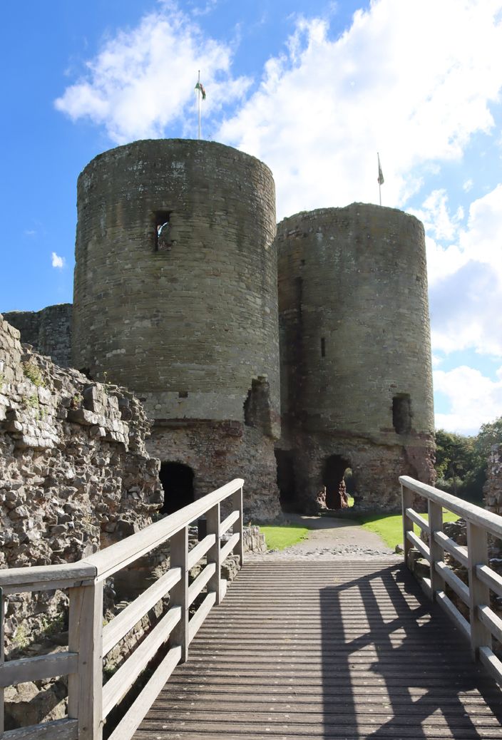
There is a big car park at the foot of the abbey, shown to the right left on the A548, just west of the enormous railway bridge, which has a fairly gentle metalled incline up to the abbey, with a bench and information map half way up.

There is also a café just outside the main gates, which in October 2022 was doing a good coffee and a splendid lunch.

Basingwerk Abbey is a component part of Greenfield Valley Park, and is popular with dog walkers and children, so if you want a quiet visit it is probably best to go on a weekday outside the holidays. The rest of Greenfield Valley Park is an excellent visit in its own right, with a remarkable amount of industrial archaeology within its borders, and plenty of interpretation boards.  I have posted about the industrial archaeology of the Green Valley Park here.

If you want to stay in the medieval period, St Winifred’s Well is about 1.5 miles through the park (shown as No.9 at the very top of the map right), or if you prefer to drive it has its own car park.  Flint Castle is only 4 or so miles down the A548 towards Chester, and makes for a great visit.  I wrote about the history of Flint Castle on an earlier post, Together, the three sites make a very fine medieval day.

Sources

Books and papers:

Burton, J. and Stöber, K. 2015.  Abbeys and Priories of Medieval Wales.  University of Wales Press.  https://www.jstor.org/stable/j.ctt9qhdvn.13

Davies, Paul R. 2021. Towers of Defiance. YLolfa

Elfyn Hughes, R., J. Dale, I. Ellis Williams and D. I. Rees. Studies in Sheep Population and Environment in the Mountains of North-West Wales I. The Status of the Sheep in the Mountains of North Wales Since Mediaeval Times. Journal of Applied Ecology , Apr., 1973, Vol. 10, No. 1 (Apr., 1973), p.113-132
https://www.jstor.org/stable/2404720

Evans D.H. 2008, Valle Crucis Abbey, Cadw

Knight, L. Stanley 1920. The Welsh monasteries and their claims for doing the education of later Medieval Wales. Archaeologia Cambrensis, 6th series, volume 2, 1920, p.257-276
https://journals.library.wales/view/4718179/4728984/314#?xywh=-63%2C345%2C2942%2C1730

Rhys, Ernest (ed.) 1908.  The Itinerary and Description of Wales with an introduction by W. Llewelyn Williams. Everyman’s Library. J.M. Dent and Co, London. and E.P. Dutton and Co (NY)
https://archive.org/details/itinerarythroug00girauoft

Huws, D. 2000.  Medieval welsh Manuscripts. University of Wales Press

James, M.R. 1925.  Abbeys. The Great Western Railway
https://archive.org/details/abbeys-great-western-railway

Jones, Owain, 2013. Historical writing in medieval Wales. PhD Thesis, University of Bangor.
https://research.bangor.ac.uk/portal/files/20577287/null&ved=2ahUKEwjxssbb0tvtAhWmxIsKHQgvBW0QFjAOegQICBAI&usg=AOvVaw2GbJiGy6Sl3SPiTX4K8RqZ

Lekai, Louis L. 1977. The Cistercians. Ideals and Reality. The Kent State University Press

Patel, Rowan 2016. The Windmills and Watermills of Wirral. A Historical Survey. Countyvise Ltd.

Robinson, D. M., 2006. Basingwerk Abbey. Cadw

Silvester, R.J., and Hankinson, R., 2015. The Monastic Granges of East Wales. The Scheduling Enhancement Programme: Welshpool. Clwyd-Powys Archaeological Trust (CPAT)
coflein.gov.uk/media/241/979/652240.pdf

Smith, Joshua Byron 2016. “Til þat he neӡed ful neghe into þe Norþe Walez”: Gawain’s Postcolonial Turn. The Chaucer Review, Vol.51, No.3 (2016), p.295-309
https://www.jstor.org/stable/10.5325/chaucerrev.51.3.0295

Williams, David H., 2001. The Welsh Cistercians, Gracewing

Williams, David H., 1990. Atlas of Cistercian Lands. University of Wales Press

Websites:

Coflein
Basingwerk Abbey
https://coflein.gov.uk/en/site/35649?term=basingwerk%20abbey%20holywell

Monastic Wales
Basingwerk Abbey
https://www.monasticwales.org/browsedb.php?func=showsite&siteID=24
Gutun Owain
https://www.monasticwales.org/person/72
The Black Book of Basingwerk
https://www.monasticwales.org/archive/24
Valle Crucis (Abbey)
https://www.monasticwales.org/browsedb.php?func=showsite&siteID=35

RCAHMW Exhibitions: Dendrochronology Partnerships
Bilingual exhibition panel entitled Partneriaethau Dendrocronoleg; Dendrochronolgy Partnerships, produced by RCAHMW 2013
https://coflein.gov.uk/media/200/524/rcex_026_01.pdf

RCAHMW List of Historic Placenames (searchable database)
https://historicplacenames.rcahmw.gov.uk/

University of Notre Dame
A Knight in St. Patrick’s Purgatory, by Haley Stewart. March 15, 2019
https://churchlifejournal.nd.edu/articles/a-knight-in-st-patricks-purgatory/

An Essay on Cistercian Liturgy by Dr Julie Kerr
Cistercians in Yorkshire, University of Sheffield
www.dhi.ac.uk/cistercians/cistercian_life/spirituality/Liturgy/Cistercian_liturgy.pdf 


The chapter house propped up during excavations when M.R. James visited in 1925.

Basingwerk Abbey from the South. 1929 postcard. Source: People’s Collection Wales

Gresford All Saints’ Church – a beginner’s guide to funerary monuments

Full statue angels only arrive on the churchyard scene in the Victorian period.

This informal look at the monuments in Gresford’s All Saints’ church graveyard follows on from three previous posts about All Saints’, the first a general history of the interior, the second a quick look at the splendid gargoyles and grotesques on the exterior of the building.  The third post looked at misericords (fascinatingly carved so-called mercy seats in choir stalls) in a three-part series about misericords in Gresford, Malpas, Bebington and Chester Cathedral.

I began writing this over a year ago, mainly for my own benefit when I was getting to grips with how churchyards develop, what sort of chronological markers can be found and the variety of monument types and themes that could be expected.  I have just re-found the post in my drafts folder and thought that others might find it useful.  This is no more than a very basic introductory starting point for investigating this and other churchyards in the area.

The churchyard surrounds the Gresford parish church of All Saints’ on all sides.  The main part of the cemetery is to the south of the church.  In parish churchyards the area to the north side of the church was usually the last to be occupied by the dead.  This is partly because the brighter areas were favoured, but partly because the darker area was often reserved for church and community events until the 19th century when a requirement for more burial grounds resulted in the extension into all areas of a churchyard.

There is a variety of different tomb styles with the All Saints’ churchyard, mainly belonging to the late-18th, 19th centuries and 20th centuries.  This includes chest tombs, table graves, ledger gravestones, vertical gravestones and sculptural monuments.  Although most of the grave markers are relatively uniform in shape, size and motifs, reflecting standardization in the approach to gravestones, some are very personal and inevitably there are a few that stand out either because they are conspicuously larger than their neighbours, or because they are slightly unusual in some way.

Grave Types

Terminology can differ slightly from publication to publication.  Graves are, on this post at least, subterranean pits into which the deceased is placed.  Grave stones, markers and monuments may sit over the grave to mark their positions and, if required, provide details of the deceased. Head stones are specifically the vertical slabs that sit at the head end of the grave, and may be accompanied by a short foot stone to mark the other end of the grave.  Kerbs are low stone frames for the space occupied by the grave.  Tombs are constructions, sometimes resembling buildings, that contain above-ground storage of the dead, but the term is often applied to false tombs, which are containers that sit on the ground but lie over a subterranean burial like the chest tombs and table tombs that are found at Gresford.  Memorials commemorate the dead, but may not be associated with the grave where people are interred (like war memorials).  There are no mausolea at Gresford or, indeed, at most parish churchyards, but these are standalone buildings, often highly ornate, that contain one or more tombs within.

The following photographs, all from All Saints’, show individual grave marker types that have been mentioned below.  There are other types that do not appear in the All Saints’ churchyard, which are not included here.  Click the image to enlarge so that the descriptions are legible:

The main types of grave marker present in Gresford All Saints’s churchyard, although there are other types too. Click image to enlarge.

Headstones

The dead are buried on their backs facing upwards, with heads to the west, feet to the east.  Table tombs have inscriptions on the ledger (flat top) and the supports may be plain or more elaborate. Headstones face east, with the inscription on the eastern face.  Because many inevitably face away from footpaths, in some cemeteries a name may be etched into the back of the headstone, to identify the deceased, whilst the full details are shown on the east-facing side.  Chest tombs may have decorative components on the side panels, and text may be on both the ledger (flat top) or the side panels, or both.

Date Range

The earliest graves at Gresford are located within the church itself in the north and south aisles, and have been mentioned on the first post about All Saints’, both dating to the 13th century.  They consist of effigies, the inscribed or carved sculpted images of the deceased and represent two of the highest status and wealthiest individuals of local 13th century society.

Marked graves in British parish churchyards were a relatively late phenomenon, the first ones appearing in the 17th century.  These are quite few and far between, and I have not yet seen mention of any in local or neighbouring churchyards.  Grave monuments in the Gresford churchyard date mainly from the late 18th, 19th and early 20th centuries..

18th Century

Ledger of 1710

The earliest graves that I have found are early 18th century, one of the earliest dating to 1710, although there may be earlier examples that I have not noticed, including some completely concealed by ivy.  A number of examples from this period are ledgers, flat tablets that in this churchyard are usually carved from fine-grained yellow stone, often greyed with age, set horizontally into the ground, with large, simple text, and almost no decorative features. Later ledger stones were sometimes provided with small decorative embellishments.

Some of the ledger gravestones flank walkways and paths, forming kerbs and revetments, such as the ones shown on the right that flank the main churchyard path.  It is easy to forget that they are grave markers in their own right.  This is apparently a particular feature of churchyards in Cheshire and Lancashire.

Other ledgers are laid between chest and table tombs, with which they are usually contemporary.  Chest tombs are simply more elaborate versions of ledgers, with the horizontal slab raised off the ground, the space beneath enclosed with stone panels.  Table tombs are also raised ledgers, but on four legs or on three cross-members.  This raising of the ledgers may have been to create something more monumental, to provide more space for inscriptions where a grave is intended for more than one generation of family members, or to prevent the slab being encased in grass, moss, ivy and weeds.

Organized in a row alongside one of the paths, near the east end of the church, are the smallest (c.16in/ 41cm tall) upright grave markers.  These are either footstones that have been separated from their corresponding headstones (only ever inscribed with initials and date if inscribed at all), or were purchased as gravestones by those with few means at their disposal.  None have many inscribed details, and the one shown left, dating to 1778, is particularly minimalist, providing only the initials of the deceased, the year of death and the age at time of death. Others in the row are slightly more informative than this example but there is insufficient space for them to provide detailed information.

Red sandstone chest tomb (with decorative pilasters at each corner), sadly commemorating child deaths, just one month apart, of Robert Jones, aged 12, in July 1791 and Sarah Jones, aged 13, in August 1791, aged 13.

There are a number of chest tombs consisting of four stone panels with a ledger stone set on top.  Chest tombs of all periods are merely monuments like gravestones, in the sense that they do not contain the burial themselves, but sit over the top of subterranean graves.  There is something undeniably spooky about a breach in a chest tomb, but as Trevor Yorke says “Don’t be alarmed when you see a chest tomb with a cracked or missing side, a skeletal arm will not reach out to grab you!  The body was always interred below the ground with the hollow interior empty.”  Most are made of yellow sandstone, but there is one isolated chest tomb in red sandstone.

19th Century

Chest tombs are also a feature of the 19th century, and many of these are more elaborate than earlier forms and have side panels decorated by geometric shapes and small motifs.

Chest tomb dating to 1835, one of a kind within this cemetery

A yellow sandstone chest tomb with another sad inscription, commemorating the death of a 12 year old in 1846 and a 2 year old in 1849.  These are by no means the only records of child and infant mortality in the churchyard.  This grave later went on to house the children’s parents.

An elaborate chest tomb raised on feet and provided with a lid rather than a simple ledger, with decorated panels. The first-mentioned deceased was Bridget Hugo from Truro in Cornwall, who died aged 44 in 1820. It was used again in 1837 for the interment of Elizabeth Hugo, aged 88. Mother or sister?

A table tomb of 1879

Pedestal graves, essentially smaller square versions of chest tombs, also appear at this time.  Like chest graves, pedestal graves could have inscriptions on more than one side.  Some had inscriptions on all four sides, but others might have inscriptions on only one or two, depending on how many people were eventually interred and commemorated.  The pedestal gravestone below is engraved on all four sides with the details of family members related to Timothy Parsonage of Wrexham, who were buried successively in 1811, 1817, 1831, 1839, 1872 and 1875.

Platform of stone paves, surrounded by railings, presumably the remnants of an elaborate monument.

Both chest and pedestal graves could be surrounded by iron railings in the 19th century, and there are several examples at All Saints’.

There are a couple of graves consisting of nothing more than sprawling platforms of paves with a higher raised section in the middle.  It is very probable that the centre of the platform formerly supported some form of monument, now lost, possibly on a fairly narrow stand, such as a cross, that resulted in a fall when the platforms destabilized.  Alternatively, there is a pedestal tomb on a similar platform, which could be an alternative arrangement, although it is more difficult to explain how such a monument could be lost, unless it was destroyed in a fall.

Headstone with kerb defining the area of the grave

The main 19th century cemetery is on the south side of the church and consists of tall headstones of the upright variety with an inscription on the main panel, a few decorative flourishes at the top, and sometimes an epitaph or other line of text at the base.  On several of them the top of the headstone had been carved into a decorative sculptural component in its own right.  These also contain introductory phrases and are often accompanied by religious symbols and motifs.

The area occupied by the body in front of the headstone could be demarcated with a stone kerb or a set of railings.  Although it is difficult to tell because of the long grass, these seem to be confined to a relatively small number of graves, presumably because of the additional cost that would have been incurred.  I noticed at Farndon’s St Chad’s churchyard that the plentiful kerbs accompanying headstones usually belonged to the early 20th century.

Most of the headstones in this section of the churchyard were made of local sandstone, mainly superior fine-grained yellow sandstone, but a few, particularly towards the end of the 19th century, were also made of imported stone, such as rose granite, often highly polished to achieve a glossy surface, such as the 1891 coped stone shown below (interestingly one of the few to be inscribed in Welsh).  Some were partially polished, with parts left unworked to provide contrasts in colour and texture, such as the 1908 example on the right.  Similarly, some of the later grave stones combined different types of stone to draw attention to particular motifs or to highlight inscriptions.  Colour inserts are unusual, but the headstone above includes a blue and white religious symbol, containing the letters IHS. These are usually interpreted as a Christogram, representing the first three letters of the name Jesus Christ’s in Greek, iota eta sigma.   The H is the capitalization of “eta.”

Rose granite coped gravestone

Dotted amongst these more conventional 19th century headstones, and particularly popular in the Victorian periods, is the monumental grave stone, consisting of a large sculptural element supported on an inscribed plinth.  Frequent types are crosses, angels and obelisks.  One example, below far right, has a column on a plinth topped with the crucified Jesus on one side and Mary with the baby Jesus on the other, both protected by a roof.  The relatively tiny cross at its base was dedicated to an infant.

The later 20th Century

At some point between the late 19th and early 20th century, highly polished imported black stone became desirable for gravestones.  There are a couple of full-sized early versions of this stone in the Gresford churchyard, most of which have both polished and unpolished sections to create texture and contrast.

As the 20th century proceeded, the same stone type was used to make tiny grave markers usually laid flat, with white or gold lettering.  Because those commemorated by these stones are often within living memory of children or grandchildren, some of them may be visited and flowers often accompany them, real or artificial, a brightly coloured foil for the standardized lines of shiny black polished stone, quite unlike the earlier, upright headstones.  Although very different from their monumental antecedents they give a sense of continuity from the 18th century.

Grave locations

The irregularly shaped churchyard

The wish for burial within a church or as close as possible to the church, demonstrated by the two 13th century examples in the north and south aisles of the church itself, was driven by the belief that proximity to holiness would confer some form of additional divine spirituality on the dead.  The chancel, the east end section where the choir and high altar were located, was particularly desirable as a burial place.  Throughout history, burial within church premises was reserved only for a limited number of people including senior clergy, those drawn from the upper echelons of society, and those who had provided financial support to the church.  Others might be buried in private mausolea in their own premises, but most would be consigned to a churchyard or, later, a dedicated cemetery.  The north side of a parish church was often the last to be used for burials, in some cases because the cemetery might have been used in early years for village community events, but also because it, or parts of it, were sometimes reserved for unconsecrated burials such as babies who died before baptism and suicides; but in some cases it appears to be simply because the darker north side was seen as less attractive and further away from the divine.

Designs and motifs in the churchyard

Elaborate monument to William Trevor Parkins, Chancellor of St Asaph, who died in 1908 and is also commemorated with a stained glass window in the church. His wife and son are also commemorated on the the monument.

Although gravestones were primarily used for recording details of the deceased, motifs, emblems and symbols were introduced in the late 17th century, and became popular in the 18th century, establishing memento mori and other themes as part of the language of the grave marker.  Most of these helped to express ideas with which the deceased might wish to be connected, a visual reference to the connection between the living, the dead and the afterlife.  The range of visual features in the Gresford churchyard is fairly limited, but they echo churchyard motifs in other local churchyards, suggesting that there was a limited range of ideas with which local people were familiar or felt comfortable, such as as crosses, floral motifs and the letters IHS that stand for the first three letters of the name of Jesus in Latin.  Others are rather more specific, and convey a particular association, such as a cross showing the Star of David and a military grave showing the Canadian maple.  If anyone can enlighten me about the multiple serpents wending their way through half-globes on the Celtic-influenced cross on the image to the right, the 1908 monument to William Trevor Parkins, I would be very grateful!  There is a similar one in the Overleigh Old Cemetery in Chester.

Instead of looking at the limited range of symbols and motifs on gravestones at Gresford, a future post will look at some of these.

Challenges for grave architecture

Heavy central erosion to the headstone on the left; de-lamination of the sandstone of the headstone on the right, leaving a small part of the original surface containing the inscription in one corner

In all churchyards, some grave markers fare better than others, thanks to unavoidable natural processes.  Most of the graves at All Saints’ are in good condition, and the churchyard as a whole is well maintained and cared for.  Natural processes, however, can defy all attempts to conserve grave markers and there is no blame attached to this.  The greater percentage of grave markers at All Saints’ are made of friable yellow sandstone, which is susceptible to damage by extremes of the weather, to the impact of concentrated dripping from trees and to the fumes from motor pollution.  Some of this is mild erosion, some of it has rendered text illegible whilst leaving the basic form unharmed, but other cases are very severe, such as examples shown here, some of which have large patches resembling melted ice-cream, whilst others are suffering serious de-lamination.

Like most rural churchyards, some of the churchyard is well manicured, and other parts of it have been left to develop a more natural feel.  The dominant vegetation surrounding the 19th century headstones away from the trees is very tall grass, (very wet up to mid-thigh in some areas after rainfall – beware!).  The tall grass appears to do little harm to the headstones, although it does inhibit visits to those gravestones, and the build up of foliage at the bases eventually creates topsoil that covers up inscriptions at the bases, particularly in the case of pedestals at the bottom of crosses, obelisks and similar statues, where text may be confined to the base of the monument.

Carved ivy tendrils wrap around a rustic cross as real ivy on the ground just begins to encroach on the pedestal.

Under trees and in shaded areas invasive ivy does real damage, fastening itself to the stone, hiding inscriptions and, when removed, removes the friable surfaces of the stone. Ivy is very difficult to eradicate from an area once it establishes a network of roots, from which it sends out runners that in turn root themselves.  It is resistant to just about every form of weed killer, even if that were desirable in a graveyard that strives to encourage a natural environment.  One or two of the gravestones are carved with images of ivy spreading across their surfaces, which seems like an ironic acknowledgement of the inevitable blending of nature with death.  The only way of dealing with it is to keep cutting it back when it it begins to climb the grave stones – a thankless and endless task!

What appears to be one or more chest tombs, completely overrun and concealed by ivy.

A grave dedicated to Arthur Henry Leslie Soames M.C. and Légion d’Honneur, which had been partially hidden by ivy and other weeds, was uncovered in May 2018 by local historian Jimmy Jones, with the permission of the church.  His account, and the before-and-after photographs used to be on the now defunct Wrexham-History website, and described how the central grave monument and a horizontal slab to one side were visible, but once the full monument was uncovered, a second slab on the opposite side was revealed, indicating that this was a family plot.  This contributes to the biography of Arthur Soames, who died testing an experimental bomb for the army in 1915.

Moss is similarly invasive and destructive where conditions favour its growth and spread, and there are examples at All Saints’ where inscriptions on ledgers have been colonized and concealed.

Ledgers encroached on by moss as well as grass and lichen

Lichen is another natural invader of stone grave monuments, and is very difficult, if not impossible to tackle.  Different types of lichen prefer different environmental conditions, so can be very widespread in a cemetery, even in the most cared-for sections.  Where lichen spreads across inscriptions, it can obscure them completely, and it can eat away the friable surfaces grain by grain over the period of many decades, meaning that inscription, motifs and decorative features may be damaged, obscured or lost.  It can also add to the more abrupt problem of certain types of sandstone de-laminating, which can eliminate big sections of text very suddenly.


Fairly minor lichen damage to a gravestone, dating to 1807.  It has not completely obscured the inscription just yet, although the centre epitaph is illegible. but will probably become worse as time passes

An example of damage inflicted on an inscription by a combination of weathering and lichen, making much of the the text, including the date, illegible.

Lead lettering from 1882, some of which have parted company from the headstone leaving empty peg marks

A small number of the 19th century tombs were provided with lead lettering, hammered into peg holes in the stone.  Some of the lettering has been lost from these grave stones, leaving behind some whole letters, some partial letters and some of the peg holes.  Again, this is natural wear and tear over the centuries and in some ways it seems surprising that any of these lead inserts have actually managed to survive at all.

Some of the stonework of chest and table tombs has been damaged, with panels falling away and ledgers tipping to the side, but this is the usual wear and tear as trees grow and roots find new paths, and storms impose injuries.

Final Comments: The living, the dead and eternity

Although there is some uniformity in the appearance of the churchyard, with certain forms, motifs and shapes being repeated, when you stand in the middle of it all, with the wet grass up to your knees, the great sweep of gravestones and monuments spreading to the limits of the churchyard provides a great sense of individual character and personal commitment.  Each monument contains a fragmentary sense of how precious life could be.  The inscriptions, whilst often fairly formulaic, also represent choices and decisions about what what best represented the interests of the deceased, the living and how this connected to belief in an afterlife.  Churchyards are often places of sadness, but for a great many they also represented ideas of hope.

The grave marker links the living, the dead and Christian belief in a relationship that, particularly when the text survives, may still be engaged with.  Whoever made the decisions about the design of the grave marker, what stands out is how these inanimate objects, the material commemoration of the dead, reflect a wide range of understated emotional ideas a including love, commitment, devotion, fear, anxiety, grief and hope. Collectively they convey both the sadness that the living confront in death and the comfort they find in commemorating their lost loved ones.  People find solace where they can.

If you want to find out more about the owner of a particular grave, the findagrave.com website is a terrific resource.

A ledger and inscription dating to 1796, describing the pain that the deceased suffered.

Sources:

Frisby, Helen 2019. Traditions of Death and Burial. Shire Library

Hayman, Richard 2019.  Churches and Churchyards of England and Wales.  Shire Library.

Heritage, Celia 2022. Cemeteries and Graveyards. A Guide for Family and Local Hstorians in England and Wales. Pen and Sword

Post, W. Ellwood 1962, 1974. A Concise Dictionary: Saints, Signs and Symbols. SPCK

Yorke, Trevor 2017 (2nd edition). Gravestones, Tombs and Memorials.  Countryside Books

Websites:

Cemetery Symbolism
https://cemeterysymbolism.wordpress.com/

Interesting example of a chest tomb that has suffered de-lamination but where the carving of the inscription was so deep that even where it has de-laminated, some of it can still be read.  The ivy is beginning to gain a foothold.

A visit to the 12th century Birkenhead Priory #1 – The Medieval buildings

Introduction

The chapter house

Birkenhead Priory is one of the most enjoyably unexpected places I have visited in the region, even more surprising than a Roman bath-house embedded in a 1980s Prestatyn housing estate.  The priory site incorporates both the remains of the 12th century monastic establishment and the ruins of St Mary’s 1822 parish church with its surviving tower and terrific views.  On all sides the site is surrounded by both heavy and light industry.  Cammell Lairds shipyard not only butts up against the south and east walls, but purchased part of the priory’s former churchyard and cemetery for its expansion and the building of Princess Dock.  On the other sides are warehouses and commercial units.  The result is that in spite of the clanging and banging from the vast ship under construction immediately next door (fascinating in its own right), the obvious and somewhat inescapable cliché is that the ruins of the priory and parish church are an oasis of peace in the midst of all the busy activity.  The small but quiet stretches of grass, the trees and the wild flowers contained within the remains of the priory site are a treat, and the splendid views from the top of St Mary’s tower are a powerful reminder of how the world has changed since the foundation of the priory.

I have divided this post into two parts, because there is so much to say.  A visit to Birkenhead Priory is really five visits in one.  In chronological order, a visit to the site provides you with the following heritage:

  • 1) The priory, established in the 12th century and built of red sandstone, is the oldest part of the site and the star turn with its vaulted undercroft and chapter house
  • 2) St Mary’s parish church was built next to the ruins in 1821 to serve the growing community, its gothic revival windows wonderfully featuring cast iron window tracery
  • 3) The priory’s scriptorium over the Chapter House, now with wood paneling over the sandstone walls, is the exhibition area for the Friends of the training ship HMS Conway,
  • 4) The Cammell-Laird shipyard is hard up against the priory’s foundations and fabulously visible from St Mary’s Tower. When it wished to expand into the church’s churchyard, it purchased the land and re-located the burials
  • 5) St Mary’s Tower, which is open to the public with amazing views from the top, is now a memorial to the 1939 HMS Thetis submarine disaster in the Mersey.

In this part, part 1 I am taking a look at the priory.  In part 2 I have looked at the post-dissolution history of the site; the 1821 construction of St Mary’s parish church; the memorial to HMS Thetis and the display area for HMS Conway.  I will tackle Cammell Laird’s separately, as I suspect that it will be very difficult to handle in a single post, and I need to do a lot more research before I make the attempt to summarize its history.

Birkenhead in the foreground with the manor and ruins of the monastery, and Liverpool in the background over the river, c.1767, showing just how isolated Birkenhead remained even in the 18th century. Attributed to Charles Eyes. Source: ArtUK

Foundation of the priory in the 12th Century

Artist’s impression of the priory done by E.W. Cox by 1896.

The priory was dedicated to St Mary and St James the Great.  There are no documents surviving from the priory, and none of its priors became important in other areas of the church or in life beyond the priory, so most of the information comes from other sources of documentation as well as from the architecture itself. Its principal biographer, R. Stewart-Brown, writing in 1925, commented that it was “not possible to compile anything in any degree resembling a history of this small and obscure priory,” but the result of his work was an impressive overview of the priory, its financial stresses and its involvement in the Wirral as a whole and the Mersey ferry in particular.  Much recommended if you can get hold of it.  Although not certain, is thought that the priory was founded in the mid-12th century by one of William the Conqueror’s Norman followers who was rewarded for his service to the new king and the local earl Hugh Lupus with land on the Wirral.  His name was Hamon (sometimes Hamo) de Massey from Dunham Massey, the second baron, who died in 1185, suggesting that the priory was founded before this date, probably in the middle of the 12th century.

Exterior of the west range, showing the two big windows that illuminated the guest quarters, the one on the left heavily modified.

The priory was established on an isolated headland, surrounded on three sides by water.  Hamon almost certainly took as his model for the priory the abbey of St Werburgh in Chester (now Chester Cathedral) which was founded in 1093 by Hugh d’Avranches, also known as Hugh Lupus.  Hugh Lupus had convinced St Anselm of Bec (later Archbishop of Canterbury and after his death canonized) to come and establish St Werburgh’s, and it was organized along classic Benedictine lines, about which more below.  The founding of a monastic establishment was seen as a Christian act, a statement of piety and devotion, and was most importantly a precautionary investment in one’s afterlife, securing the prayers of the monks, considered amongst the closest to God, throughout the entire lifetime of the monastery

A priory was smaller and inferior in status to an abbey and was was often dependent (i.e. a subset) of an abbey, and answerable to it.  It is possible that the much larger and infinitely more prestigious St Werburgh’s Abbey in Chester supplied the monks to establish Birkenhead Piory, but there is no sign in the cartularies (formal documents and charters) of St Werburgh’s that there was any ongoing formal connection between the two.  The difference between a non-dependent priory and an abbey was usually that the priory did not have sufficient numbers to be classified as an abbey, or that it had not applied for the royal stamp of approval required for the more senior status of an abbey. The minimum requirement for the foundation of a Benedictine abbey was 12-13 monks.  A 16th century historian suggested that there were 16 monks, but it is by no means clear where this figure came from.  Twice during the 14th century it is recorded that there were only five monks at the priory, and it is very likely that the priory remained too small to become an abbey.

The typical monastic day in a Benedictine monastery. Not a great photo, but a very nice representation from a display in the museum area in the undercroft

The Benedictine Order was not the oldest of the monastic orders in Britain, but following the Norman Conquest it became the most widespread.  It was named for St Benedict of Nursia who, in the 6th century, set out a Rule, or set of guidelines, for his own monastery.  This spread widely and became the basis of many monastic establishments setting out to follow his example.  The Benedictines had been well established in France at the time of the Conquest, and sponsorship by incoming Normans, granted land by William the Conqueror, ensured that they spread rapidly in England, and later Wales, Scotland and Ireland.  Benedictine monasteries were all built to a standard architectural layout, with minor deviations, based on both religious and administrative requirements.

The monastic buildings

Plan of the Birkenhead Priory site.  Source: Metropolitan Borough of Wirral leaflet (with my annotations in colour). North is left, south right.

If you take the guided tour, which I sincerely recommend, you begin your tour in the undercroft, now used as a museum / display space.  Most helpfully it has a scale model of the priory with Stewart-Brown’s 1925 site plan, both of which help you to orientate yourself and get a sense of how the ruins were once a complex of buildings that defined and enabled a monastic community, combining religious, administrative, domestic and other functions.  In the plan on the left, with the surviving remains of the priory outlined in red, the site of the priory church outlined in orange and remains of the 1822 St Mary’s Church outlined in green. The blue margin indicates the shipyard over the priory wall.  The numbers on the plan are referred to in the description below.  You can download a copy of the map (without the coloured additions) as a PDF here.

Like St Werburgh’s Abbey, the priory buildings were made of locally available red sandstone.  Like all monasteries based on Benedictine lines, the monastic site plan began with a square.  The bigger the monastery envisaged, the bigger the square.  This was known as the garth (1 in the plan on the left), and was either a grassed area or a garden.  Surrounding this was the cloister, a covered walkway that served as a link between the buildings that were erected around the garth, and where desks were usually arranged so that the monks could work.  This was a secluded space, confined to the inmates of the monastery.

Model of the priory church and claustral buildings in the priory’s museum space in the undercroft showing a possible layout of the church.  The chapter in this view is hidden behind the tower.

The most conspicuous of the buildings would have been the one that no longer stands:  the church and its tower (4 on the plan above, outlined in orange), which made up one side of the cloister.  Traditionally in Benedictine complexes this was built on the north side of the garth, making up an entire side of the cloister, in order protect the rest of the buildings and allow light into the garth and the other cloister buildings, but at Birkenhead Priory’s church was on the south, possibly to protect the claustral buildings from the winds whistling down and across the Mersey. The model and plan show that the 13th century church was built in the standard cross-shape.  It featured a long nave at the west end (where the public were permitted to observe religious ceremonies), and a surprisingly long east end (where the ceremonies were performed) with two side-transepts, which were usually used as chapels for commemorating the dead and a tower over the crossing. A pair of aisles flanked the south and north transepts as show above.  When it was first built in the 12th century, the church would have been much smaller and probably smaller than this footprint.

View of Birkenhead Priory by Samuel and Nathan Buck in 1726, showing the remains of the church’s northern arcade.  Source: Panteek

Lonely remainder of the church’s northern arcade

The entrance to the chapter house with its Norman arches. You can clearly see the difference between the 12th century chapter house masonry and the 14th century scriptorium above with its gothic window and tracery. The tower in the background belongs to the 19th century church.

The chapter house (2) is the oldest of the Birkenhead Priory buildings, the only one remaining that dates to the 12th century.  The building of the priory church, being the place where the main business of praising God took place, was usually started straight away, but the chapter house was often built in tandem as this was also of fundamental importance to a monastery.  This is where the everyday business of the priory was attended to, from the day-to-day administration and disciplinary matters, to the daily readings of chapters of St Benedict’s Rules or other improving texts such as excerpts from one of the many histories of saints (hagiographies).  The Birkenhead Priory’s original medieval chapter house is a gorgeous. The vaulted roof of the chapter house is superb (see the photo at the very top of this post), and although the windows have been altered over time, one of the deep Norman Romanesque window embrasures survives, and is a thing of real beauty (see below).  The stained glass is all modern, but all are nicely done, the one over the altar by Sir Ninian Cowper combining religious themes relevant to the house (St Mary and St James flanking Jesus) with two prestigious characters from the priory’s own history (its founder Hamo de Massey and its two-time visitor Edward I).  Gravestones from the medieval cemetery have been incorporated into the floor around the post-Dissolution altar.  In the medieval priory, there would have been no altar in the chapter house, but following the Dissolution the chapter house was converted into a chapel and is still used for weddings, funerals and baptisms. 

Over the top of the chapter house, a scriptorium was added in the 14th century. In theory this was where the copying of books took place, but it has been pointed out that this was a particularly large space for such an activity, and it may have been used for something else, or for a number of different activities.  Today it is the display area for the training ship HMS Conway, and at some point in the 19th or early 20th century was provided with panelling and has some very fine modern stained glass by David Hillhouse.  This modern usage will be discussed in part 2.

Opposite the chapter house the remains of the west range (7-11) survives, which was again a two-floor building separated into a number of different spaces  It seems to have been divided into two, with the northern end and its big fireplace reserved for guests, and the southern end, with an entrance into the cloister, seems to have been split into two floors, with a fireplace on each, for the prior’s personal quarters, which would have included a private parlour that he could use for entertaining VIP guests.  Although it’s not the most aesthetically stunning of the surviving claustral buildings today, the stonework displays a fascinating patchwork of different features and alterations that reflect many changes and refinements in use over time and are still something of a fascinating puzzle.

West Range

Remodelling in the 14th century created the undercroft and the refectory above it, as well as the kitchen.  The undercroft (14), once used as a storage space, with the original floor intact. The investment in the lovely architecture may indicate that before it was used as a storage area, it had a more high profile role, perhaps as a dining area for guests.  Above it was the refectory, unlike St Werburgh’s, Basingwerk Abbey or Valle Crucis Abbey, all of which had refectories at ground level.  It was reached by a spiral stone staircase leads up to this space today.

The kitchen was apparently to the north of the west range, and connected to it, as shown on the above plan (12).  This was convenient for the guest quarters, but not quite as convenient for the refectory over the undercroft, from which it was divided by a buttery (or store-room, 13), over which a guest room was also installed.   The kitchen was apparently a stand-alone structure made mainly of timber, and this may have been because kitchen fires were so common, and building the kitchen slightly apart from the main monastery would have been a sensible precaution.  Kitchen fires are thought to have been the cause of several devastating scenes of destruction in monastic establishments, spreading quickly via roof timbers and wooden furnishings.

Between the chapter house and the north range, which contained the undercroft and refectory, was an infirmary (19 on the plan) and the dormitory (18) side by side, each accessible from the cloister.  The infirmary was for the benefit of the monks, and was where those who were sick or injured or suffering the impacts of old age were cared for.

Sources of income and financial difficulties

Carved head in the side of the fireplace in the guest quarters on the ground floor of the west range

Monasteries were amongst the most important land-owners in medieval Britain, on a par with the aristocracy.  Their income came mainly from agricultural activities, both crops and livestock, as well as making and selling bread, beer, buttery and honey; but they might also own mills, mines, quarries and fisheries and the rights to anchorage, foreshore finds and the use of boats on rivers. For those with coastal and estuary locations with foreshore rights, there was, as Stewart-Brown lists, the benefits of flotsam (items accidentally lost from a boat or ship, jetsam (items deliberately tossed overboard), salvage from shipwrecks and keel toll.  The luckier (or most strategically inclined) monasteries and churches also had pilgrim shrines, sometimes reliquaries imported from overseas. St John’s Church in Chester had a miraculous rood screen, St Werburgh’s Abbey in Chester had the shrine containing the bones of St Werburgh herself, and Basingwerk Abbey had the neighbouring holy well of St Winifred.  These attracted donations and bequests and were good for the settlements in which they stood, because the pilgrims needed places to stay, food and drink, and would probably buy souvenirs.  Birkenhead Priory had no such shrine, but it probably felt the impact of the pilgrim route as the ferry crossing over the Mersey, which it ran free of charge, was an important link between Lancashire, west Cheshire and northeast Wales.

Some of the monastic landholdings on the Wirral. Source: Gill Chitty, on Merseyside Archaeology Society website

The original foundation of the monastery would have included both the land on which the monastery sat, funding for building it, and an economic infrastructure of landholdings as well as the income of some local churches. The long list of land-holdings sounds impressive, but most of them appear to have been quite small and scattered, some of which will have been wooded and some wasteland, not all of it suitable for cultivation or pasture. These include lands in Birkhenhead (including the home farm in Claughton with its mill), Moreton (with a mill and dovecote), Tranmere, Higher Bebington, Bidston, Heswall, Upton, Backford, Saughall, Chester, Leftwich, Burnden at Great Lever in Middleton, Newsham in Walton, Melling in Halsall, and Oxton.  Either at foundation or not long afterwards, the priory was granted the incomes of the churches of Bidston, Backford, Davenham and half of the church of Wallasey, and claimed rights of Bowdon church that were disputed.

Carving at the base of a window arch in the west range

The monastery did not flourish with these assets.  In spite of the claim that there were 16 monks at the time of its foundation, the records made by official church visitors suggests there were only a small number of monks at any one time (only five in 1379, 1381, and 1469, and seven, including two novices, in 1518 and 1524), and there is plenty of evidence to indicate that the priory struggled financially.  Monasteries had significant overheads including feeding the community, buying tools and supplies, repairing monastic and farm buildings, appointing stewards and other employees, providing charitable alms and providing hospitality free of charge.  Where they earned incomes from churches and chapels, they were also responsible for the provision of the clergy and shared part of the cost of maintaining the buildings.  Ambitious priors often invested in building projects, sometimes to improve the monastic offering, sometimes for prestige, and even with donations this was usually costly.  There were also occasional challenges to bequests made to churches from following generations, which involved costly legal proceedings.  Balancing the books was a frequent problem for monastic establishments, and the priors of Birkenhead Priory were no different.

There were quite limited means by which the priors of Birkenhead might increase their income.  The most obvious way of generating ongoing income was to acquire more land through gifts and bequests.  In this endevour the priory probably had a real disadvantage in being near to both St Werburgh’s Abbey in Chester and, across the river Dee, Basingwerk Abbey at Holywell.  Both abbeys had significant land-holdings on the Wirral, and both had pilgrim shrines and were on pilgrim routes.  Both were large and prestigious, and were far more likely to attract big gifts than a small and rather remote priory.  If Birkenhead hoped to attract gifts of land, it probably had to depend on local landowners and merchants who felt a personal connection with the priory but would not necessarily have had the wherewithal to significantly change the income-earning potential of the priory, providing personal items rather than swathes of land. For these very local gifts and legacies, it is entirely possible that the priory was also in competition with contemporary parish churches on the Wirral.  There are records in the early 16th century, not long before the monastery was closed during the Dissolution, that give an idea of the sort of bequests made by local people in return for requiem masses to be recited for their souls:  one will provided a painting of the Crucifixion for the priory church.  Another bequeathed the owner’s best horse, 10 shillings, and a ring of gold.

As the Middle Ages progressed, populations expanded and both new and old towns began to hold markets where everyday goods and more prestigious products could be traded, even once-isolated monasteries found themselves becoming integrated into the secular world and in competition with it.  It certainly did not initially help the monks at first that during the early 13th century Liverpool began to grow.  Under the Benedictine rules, monasteries had an obligation to provide hospitality to visitors when required, and the Birkenhead monks ran the ferry over the Mersey as a charitable service.  When the priory was first established, offering occasional hospitality and running the ferry free of charge were not onerous.  This changed rapidly after 1207 when Liverpool was granted burgh status by King John, as the following translation of the original Latin charter confirms (Translation from Picton 1884):

The 1207 charter of Liverpool by King John. Source: Royal Charters of Liverpool leaflet

John, by the grace of God King of England, Lord of Ireland, Duke of Normandy, Aquitain, and Earl of Anjou, to all his faithful subjects who may have wished to have burgages in the town of Liverpool greeting. Know ye that we have granted to all our faithful people who may have taken burgages at Liverpul that they may have all liberties and free customs in the town of Liverpul which any free borough on the sea hath in our land. And therefore we command you that securely and in our peace you come there to receive and inhabit our burgages. And in testimony hereof we transmit to you these our letters patent. Witness Simon de Pateshill at Winchester on the 28th day of August in the ninth year of our reign.

A little later Liverpool was granted the right to hold markets and fairs, and the links between Liverpool and the busy port of Chester grew to be increasingly important. There was no infrastructure to cope with this increase in human traffic. They were already offering a ferry service free of charge but even more pressing on their resources was the cost of housing guests.  There were no inns between Liverpool and Chester (showing a lack of commercial ambition on the part of both Liverpool and Chester medieval merchants!), so the monks found themselves obliged to offer accommodation and food, which the rules of the Benedictine order required them to offer free of charge.  This hospitality became particularly difficult if there was a spell of bad weather, during which those waiting to cross from Birkenhead to Liverpool would have to wait at the priory until the weather improved and crossings could resume.  They were also were troubled with all the through-traffic that travelled along a route that ran through the monk’s Birkenhead lands close to the priory buildings.

The spiral staircase from the undercroft into the former refectory

It must have exacerbated the monks’ financial situation when Edward I visited the monastery twice with his entourage during this period.  Edward’s first visit was in September 1275 for three nights, seeking a diplomatic solution to his dispute with the self-styled Prince of Wales, Llywelyn the Last of Gwynedd. His second was in 1277 for six days with the apparently dual motives of pursuing his campaign against Llywelyn and receiving a delegation from Scotland to settle a boundary dispute.  Although the king would pay the costs of his entourage and horses, the cost of entertaining the king and his most senior advisors fell to the monastery.  Hosting a royal entourage was notoriously expensive, and any contributions made by a visiting monarch to a monastic establishment only rarely compensated for the outlay.

One of the measures to improve their income in the 1270s involved the expense of serious litigation when incumbent prior claimed that the church had been presented in its entirety to the priory.  This was disputed by the Massey family, who triumphed in the courts.  Fortunately for the priory, in 1278 the 5th Hamon de Massey came to an agreement with the monks to their benefit.  Other litigation occurred over pasture rights in Bidston and Claughton.

In 1284 the priory received permission from Edward I, who had probably witnessed the priory’s problems at first hand in the 1270s, to divert the road that disrupted the priory “to the manifest scandal of their religion” and to provide the priory court with an enclosure, either a ditch, hedge or wall, to preserve its privacy.  This would have incurred costs, but would have eased one of the problems caused by the ferry.  Rather more significant for their finances, early in the 14th century the priory was granted a licence to build and charge for guest lodgings at the ferry at Woodside, and in 1311 they were granted the rights to sell food there.  It was at this time that the church was expanded, which would have been a significant project.

Chapter house building with scriptorium room added over the top in the 14th century.

The first half of the 14th century had been hard for most of western Europe, with both famine due to anomalous weather conditions that caused crops to fail, followed only a few decades later by  a plague that killed huge numbers of people.  In Britain the famine lasted from 1315-17 and the Black Death arrived in 1348. The priory survived both the famine and the plague, as did the settlement of Liverpool, now a century old.  At some point in the first half of the 14th century, the priory acquired land in Liverpool so that the monks could begin to trade their goods at market, building a granary or warehouse on Water Street (then known as Bank Street).

In 1316 the hospital of St John the Baptist in Chester was judged to be seriously mismanaged and was put into the hands of the priory, perhaps because of their experience running their own infirmary.  This was a failure, merely adding to the priory’s problems, and was removed from their care in 1341.

Multiple layers in the west range, with a  window added into the top of a former fireplace, blocking it, and a fireplace above it.

In 1333 Edward III requested monasteries to contribute to the expenses of the marriage of his sister Eleanor.  Local monasteries who contributed included Birkenhead, which contributed £3 6s 8d and Chester’s St Werburgh’s Abbey which, bigger and more prosperous, gave £13 6s 8d.  There were doubtless other payments of this sort, occasional and therefore unpredictable, and impossible to resist.  The priory was also liable for taxation.

The ferry from Woodside had continued to be supplied free of charge, but the priory appealed to Edward III and was permitted for the first time to charge tolls in 1330, setting a precedent that remains today.  A challenge to the monk to operate the ferry and claim the tolls, was challenged by the Black Prince in 1353, but the priory produced its charter and successfully resisted the removal of this privilege.  The tolls charged were recorded at that time:  2d for a man and horse, laden or not; 1/4d for a man on foot or 1/2d on a Saturday market dasy if he had a pack

Other ways of generating income from lands to which they had rights were also explored, and from records of litigation against them, they were often accused of infringing forest law.  Wirral had been defined as a forest by the Norman earls of Chester, which restricted how the land could be used.  The monks were clearly assarting (cutting down wood to convert to fields and pasture), reclaiming waterlogged land, enclosing certain areas and cutting peat for fuel. The priory was able to argue special exemptions for some of the charges, and produced the charters to prove it, but at other times they were fined for the infractions.  In 1357, for example, they were fined for keeping 20 pigs in the woods.

A number of monastic establishments seem to have responded to surviving the plague by redefining themselves via architectural transformations.  Whatever the reasons for this trend, Birkenhead Priory was no exception and the 14th century could have been an expensive time for the monks.  The frater range (including the elaborate vaulted undercroft and the refectory) was completely rebuilt and the west range was remodelled.  The room today described as a scriptorium was also added over the chapter house at this time.  Although Stewart-Brown suggests that much of this could have been accomplished with “pious industry . . . without much cost” with the assistance of donations of labour and money, that is probably somewhat optimistic, and there would have been an outlay.  Certainly, at the end of the century the priory was considered to be so impoverished that it was exempted from its tax contribution.

There is some evidence that for at least some of the Middle Ages the priory rented out land rather than working it themselves, except for their home farm at Cloughton. This had the benefit of providing a dependable income if tenants were reliable, and obviated the need to appoint managers or deal with labour and handle the sale of produce, but if the cost of living went up, the fixed income that no longer purchased what it had previously afforded, and this could represent a serious problem.

Dissolution

The opening page of the Valor Ecclesiasticus, showing Henry VIII. Source: Wikipedia

When Henry VIII’s demand for a divorce was rejected by the pope, the king severed Britain from the Catholic Church, creating the Church of England.  This provided him with the opportunity to acquire land and valuable assets by dissolving all monastic establishments, all of which had been subject to the papacy.  The spoils were to be used to fund Henry’s wars with France and Scotland, and some former monasteries were given to Henry’s supporters as rewards. To assess the potential of the monastic assets, Henry VIII commissioned the Valor ecclesiastis, a review of every monastery in the country.  All monastic establishments with an annual income of less than £200.00 were to be closed as soon as possible. The first monasteries were dissolved in 1536 and the process was more or less concluded by 1540, with a handful of the more prestigious abbeys, like St Werburgh’s in Chester, converted to cathedrals.  Birkenhead Priory was only earning £91.00 annually so it was amongst the first to be closed.  There was no resistance by the Birkenhead prior, who was provided with a pension of £12.00 annually.  The brethren were either dismissed or disseminated to non-monastic establishments.

Visiting

The car park is on Church Street, at the rear of the priory, where the cafe is also located.  There is some on-street parking on Priory Street at the front of the priory. Source: Birkenhead Priory website

This is a super place, and makes for a terrific visit.  Do go.  You won’t be disappointed!

Even with SatNav, the big thing to remember about finding your way to Birkenhead Priory, if you are arriving by car from the Chester direction, is to do whatever it takes NOT to end up at the Mersey tunnel toll-booths 🙂  They were very nice about it, let me out through a barrier, and gave me perfect directions to get to the priory once they had freed me from the tunnel concourse.  Very nice people.  If Edward III was looking down, I’m sure he would have rolled his eyes in despair, given that it was he who gave the monks the right to charge for their Mersey ferry crossings.

Do check the opening times on the website, as the priory is only open on certain days and for only a few hours on those days, mainly in the afternoons. There is dedicated parking on Church Street at SatNav What3Words reference ///super.punchy.report.  From there, the priory is up a short flight of steps.  You can also park on Priory Street, which is where the SatNav will take you if you simply type “Birkenhead Priory” into your SatNav (at What3Words ///indoor.vibes.hips), which offers step-free access but there is limited parking there, and it is a favourite place for van drivers to park and eat their lunches so may be better used as a drop-off point before going round the the car park.

Remnants of the decorative floor tiles, now in the priory’s undercroft, which is used as a museum space

At the time of writing, a visit is free of charge, and so are the guided tours.  My guide was the excellent Frank.  He covered not only the priory but St Mary’s, the HMS Conway room, and the HMS Thetis memorial and, when I headed up to the top of the tower of St Mary’s, directed me to out for the dry dock where the CSS Alabama (the US Confederate blockade runner) was built by John Laird, to be discussed in Part 2.  Frank was very skilled at providing sufficient knowledge to get a real sense of the place, but not so much that it became information overload.  I very much appreciated this, having always found it difficult myself to strike that particular balance.  I was lucky enough to have him to myself, having turned up at opening time, but I noticed that the next tour had a respectable group attending.

There is a small gift shop where you can also buy a really useful guide book with plenty of plans, illustrations and colour photographs.  Please note that they are not able to take cards, and payment is cash only.

There are toilets in St Mary’s tower, a picnic area behind the undercroft on sunny days, and the highly rated Start Yard café is almost next door on Church Street.

For those with unwilling legs, I would suggest that apart from the tower and its 101 steps, and a flight of around 10 steps up into the scriptoruim (the display area for HMS Conway) this is entirely do-able.  There are occasional single steps and uneven surfaces, and it is a matter of taking good care.  As mentioned above, if you park in the carpark at the rear on Church Street, there is a flight of steps into the priory, but even if there is no space in the limited street parking available at the front of the priory on Priory Street, it is a useful drop-off point for anyone needing step-free access.  You can find the SatNav references for both above.

I have posted a two-minute video of the priory, recorded on my iPhone, on YouTube:

Sources

Books, papers, and guidebooks

Baggs. A.P., Ann .J Kettle. S. J. Lander, A.T. Thacker, David Wardle 1980. Houses of Benedictine monks: The priory of Birkenhead, In (eds.) Elrington, C. R. and B. E. Harris. A History of the County of Chester: Volume 3, (London, 1980) pp. 128-132.
https://www.british-history.ac.uk/vch/ches/vol3/pp128-132

Burne, R.V.H. 1962. The Monks of St Werburgh. The History of St Werburgh’s Abbey. S.P.C.K.

Chitty, Gill 1978. Wirral Rural Fringes Survey. Journal of Merseyside Archaeological Society, vol.2 1978
https://www.merseysidearchsoc.com/uploads/2/7/2/9/2729758/jmas_2_paper_1.pdf

de Figueiredo, Peter 2018. Birkenhead Priory. A Guidebook. ISBN 978 1 9996424 0 2

Hughes, Tony. St Mary’s Parish Church, BIrkenhead, 1819-1977. n.d.
https://thebirkenheadpriory.org/wp-content/uploads/St-Marys-booklet.pdf

Picton, Sir James A. 1884.  Notes on the Charters of the Borough (now City) of Liverpool. The Historic Society of Lancashire and Cheshire, vol 36 (1884)
https://www.hslc.org.uk/wp-content/uploads/2017/07/36-5-Picton.pdf

Stewart-Brown, R. 1925.  Birkenhead Priory and the Mersey Ferry, and a Chapter on the Monastic Buildings. The Gift of the Directors of the State Assurance Company Ltd.

White, Carolinne 2008. The Rule of St Benedict. Penguin.


Websites

The Birkenhead Priory
https://thebirkenheadpriory.org/
Buildings of Birkenhead Priory
https://thebirkenheadpriory.org/about/
The medieval grave slabs of Birkenhead Priory
http://thebirkenheadpriory.org/wp-content/uploads/Graveslabs-of-Priory-Chapel.pdf

Mike Royden’s Local History Pages
The Monastic and Religious Orders in the Hundred of Wirral from the Saxons to the Dissolution of the Monasteries – A study of the Monastic history and heritage of Wirral by Norman Blake, April 2003
http://www.roydenhistory.co.uk/mrlhp/articles/students/monasticwirral/monasticwirral.htm
The Influence of Monastic Houses and Orders on the Landscape and locality of Wirral (with particular reference to Birkenhead Priory) by Robert Storrie, April 2003
http://www.roydenhistory.co.uk/mrlhp/articles/students/bheadpriory/bheadpriory.htm
The Medieval Landscape of Liverpool: Monastic Lands (with particular reference to the granges of Garston Hall and Stanlawe Grange) by Mike Royden, 1992
http://www.roydenhistory.co.uk/mrlhp/articles/mikeroyden/liverpool/monastic/mondoc.htm

ArchaeoDeath
Commemorating the Reburied Dead: Landican Cemetery
https://howardwilliamsblog.wordpress.com/2024/05/16/commemorating-the-reburied-dead/

Old Wirral
https://oldwirral.net/archaeology.html

Wirral Council
Making Our Heritage Matter. Wirral’s Heritage Strategy 2011-2014, 2013 Revision. Technical Services Department.
http://democracy.wirral.gov.uk/documents/s50009194/Wirral Heritage Strategy Appendix.pdf

Wirral History
Medieval Wirral (maps)
http://www.wirralhistory.uk/medieval.html

An online archive for for St Mary’s Church and the Priory, Birkenhead
History of the Priory and St. Mary’s Church Birkenhead
http://stmarysbirkenhead.blogspot.com/p/history-of-priory-and-st-marys-church.html


Leaflets

Birkenhead Priory Guide. Metropolitan Borough of Wirral.
Birkenhead Priory A4 leaflet Wirral

Liverpool’s Royal Charters
https://liverpool.gov.uk/media/ghdaoid3/liverpool-charter.pdf

St Mary’s Parish Church 1819-1977
https://thebirkenheadpriory.org/wp-content/uploads/St-Marys-booklet.pdf


Lecture: Rosemary’s Baby: Adventures and Insights from Contributing to the Corpus of Anglo-Saxon Stone Sculpture in England

Rosemary’s Baby: Adventures and Insights from Contributing to the Corpus of Anglo-Saxon Stone Sculpture in England

Paul Everson, Keele University

Tom Pickles, Chair of Chester Archaeological Society, introducing Paul Everson

On Saturday 4th May, in the last in-person Chester Archaeological Society lecture of the 2023/24 spring season in the Grosvenor Museum’s elegant lecture theatre, archaeologist and landscape historian Paul Everson introduced members and guests to the “Corpus of Anglo-Saxon Stone Sculpture (CASSS)”  project inaugurated in 1977 by Professor Dame Rosemary Cramp (https://corpus.awh.durham.ac.uk/).  With his long-time collaborator David Stocker, Mr Everson has published three volumes of the CASSS, and in this lecture explained how the decades-long project has not only provided us with a definitive catalogue of decorated stonework of the period but also stimulated new avenues of thought.

Professor Dame Rosemary Cramp’s name is synonymous with Early Medieval sculpture, combining her expertise in Old and Middle English with archaeological research, beginning her own excavations at Monkwearmouth in 1957.  Having identified an opportunity to create a corpus of early stone sculpture after working on examples in Durham Cathedral and the Wearmouth and Jarrow monastic sites, she developed a standardized format for the publication of the CASSS, and a “grammar” of Anglo-Saxon ornament (also used for knitting!). This enables each volume of the corpus to be used in the same way and, where required, directly compared, making the series invaluable as a cohesive research tool.  The first volume to be published was County Durham and Northumberland in 1984, and the last two, currently being compiled, are volumes 15, Leicester, Notrh Rutland and Soke Peterborough and volume 16, Norfolk and Suffolk.

Some examples of the types of Anglo-Saxon sculpture included in the Corpus (slide from Paul Everson’s presentation)

The corpus of Anglo-Saxon carvings, dating from the 7th to the 11th centuries and much of it previously unpublished, includes crosses, grave markers and grave covers, architectural detailing and inscriptions, both in original locations and in relocated positions. The compilation of the Corpus required the establishment of procedures for locating and recording both known and previously unidentified carvings. A mixture of archaeological, field survey and historical approaches are employed.  All churches in a Corpus volume area are inspected, inside and out.  Sketches, photographs, measurements and notes ensure that full details were recorded.  Lost items have been rediscovered by tracing records in publications produced by antiquarian and early scholars.  Antiquarian and early scholarship are always described and credited in the first chapter of each volume, reflecting their value.

As with most archaeological data, Anglo-Saxon sculptures often exist only in fragments and this requires virtual reconstruction work so that these too can be understood as whole pieces and included in the corpus.  It was interesting to note that, like Roman tombstones, the ornament was picked out in bright paints, exemplified by a replica from Neston which has been rendered in full colour, shown on the above slide.

Bringing to together substantial data across each area has led to an exploration distribution patterns, with some specific types distributed widely across a county and others being more localized, leading to a search for explanations  An example is Raunds Furnells where a small cluster of 10th century stone monuments may help to explain similar finds in east England, perhaps representing the founding families of churches, which in turn may represent the first stages of the development of the parochial system.  “Exceptional collections” also occur, where large numbers of sculptural stones are found in a particular location, and it has been found that these tend to be near river sites where markets were held, and where merchant communities with disposable incomes concentrated, such as Chester where an impressive collection is retained at St John’s Church, and at Neston on the Wirral.

The Hedda Stone, Peterborough Abbey

A surprising finding was that there may have been very little pre-Viking quarrying of new stone.  Instead, earlier stone masonry in church architecture and graves was often recycled and has become a much-debated topic.  Some of these re-uses are pragmatic and practical, making use of usefully shaped pieces.  The re-use of Roman masonry could explain, for example, some puzzling holes in the famous early Medieval Hedda Stone at Peterborough Cathedral.  Another form of recycling is described as “iconic,” where earlier scenes are appropriated and re-positioned in a new cultural context.  Interpretation of specific instances of recycling differ, and the resulting debates, although usually amicable, may be very animated! Discourse provided by differing perspectives, specialisms and sub-disciplines and by a new generation of researchers ensure that research into Anglo-Saxon sculpture continues to be a lively field.

At the other end of the chronological scale, studies of post-Conquest sculpture have helped to elucidate the continuity of earlier medieval traditions, and this too is an important research vector for understanding the period when Saxon and Norman interests vied for supremacy.

Making use of database technologies, an important leg of future work will include the Arts and Humanities Research Council (AHRC)-funded “Worked in Stone” project which will re-digitize all the volumes to make them into a fully searchable database, an important new initiative that will be hosted by the Archaeological Data Service (ADS) and will be free to access.).

The challenges of interpreting different syncretic and iconic schemes. (slide from Paul Everson’s presentation)

An enthusiastic round of applause marked the end of the lecture.  There was the opportunity for questions, and the audience took full advantage.  The topic of recycled Roman stonework lead to some discussion about how identity and meaning may have been syncretized or replaced.  Another question concerned how future discoveries might be incorporated into the corpus, and although nothing formal yet exists, the topic is obviously on the minds of those looking to the future of this research area.  At the end of the questions the audience again applauded loudly in appreciation.

By the end of the lecture, it had become clear that the loss of Dame Rosemary last year at the age of 93, and the publication of the final two volumes of CASSS will not draw any sort of line under the research into Anglo-Saxon sculpture.  The Corpus continues to be provide an invaluable resource.  The digitization of the corpus will make it readily available to support a new generation of researchers as they develop new ideas and perspectives and explore new directions. It is clear that in spite of her passing away last year, this project remains very much “Rosemary’s Baby.”

The first twelve volumes of the CASSS are available online at https://corpus.awh.durham.ac.uk/.  For Anglo-Saxon stone sculpture in Cheshire see volume IX. For a paper produced as an offshoot of the corpus work, see the study of the social background of the St John’s (Chester) crosses in the Members Area of the CAS website (https://chesterarchaeolsoc.org.uk/members-area/): P Everson & D Stocker. Transactions on the Dee: the ‘exceptional’ collection of early sculpture from St John’s, Chester
In: Cambridge, E & Hawkes, J eds. Crossing boundaries: interdisciplinary approaches to the art, material culture, language and literature of the early medieval world. Essays presented to Professor Emeritus Richard N. Bailey, OBE, in honour of his eightieth birthday. Oxford: Oxbow Books, 2017, 160–78.

Finally, the international ‘Worked in Stone: Early Medieval Sculpture in its International Context’ conference  takes place next year in Durham (https://corpus.awh.durham.ac.uk/wis.php).

Many thanks to Paul Everson for such am engaging and enlightening lecture.

Paul Everson in the Grosvenor Museum lecture theatre

April’s ‘Chester Archaeological Society’ visit to St Collen’s Church in Llangollen

The Chester Archaeological Society 2024 season of excursions started excellently today with the CAS visit to the Church of St Collen, who gave his name to Llangollen. It is the only church in Wales to have taken the saint’s name. Like most Medieval churches in Wales, St Collen’s has undergone considerable alterations, including an 18thcentury tower and a 19th century chancel, vestry and south nave, but there are some very fine 13th century features to be seen, in the Perpendicular Gothic style, including an impressive shrine canopy and mason’s marks. There are also intriguing signs that a Lady Chapel was once incorporated into north aisle. The most remarkable feature of the church is a really superb hammerbeam roof bedecked with ornamental sculptures, both religious and secular, from the early 16th century.

Today, to ensure the survival of the church as a living and breathing community asset, it is undergoing extensive but very sympathetic re-forming.  Suzanne Evans is the Project Manager of this massive task, and was our superb guide today. Suzanne described how the reinvented church will be fully inclusive, not only of the existing congregation who are much-attached to the church, but of the wider community as well, taking into account the needs of those currently unable to make the most of what St Collen’s has to offer. At the same time, the exciting opportunity will be taken to investigate as much of the church’s architectural and funerary history as possible, adding to the community’s understanding of this important contributor to the town’s impressive ecclesiastical heritage.

Suzanne guided us around both the key features and recent discoveries, explaining all the steps to be taken in the upcoming weeks and years. As well as replacement glass doors and the opening up of the nave to enable the interior to be visible by passers-by, there will be new lighting, heating, kitchen and toilet facilities, as well as a large stage, which will all contribute to enhancing the value of the space and improving the visibility of the superb architecture. All archaeological and architectural discoveries will be professionally recorded and published.

After a very welcome cup of tea, there was a round of applause as we thanked both Suzanne for being our terrific guide and Pauline for making all the arrangements. It was great to meet some of the other CAS members, and to hear all the questions and observations. There was a lot of information sharing, which is exactly what one expects of CAS members. What a great start to the year’s excursions! Many thanks again Suzanne and Pauline.

The 13th century exterior