This was a completely off-the-cuff visit, as we were planning to go somewhere else but found that it was temporarily closed. I am so glad that we were forced to change our plans, because we absolutely loved the aquarium. Located in the Ellesmere Port area, it was opened in 1998, but it has been so well cared for that it looks brand new.
The fish are fabulous – everything from sharks bigger than me to tiny fast-moving flashes of spectacular colour and light. the myriad of shapes, sizes, colours and types of movement is a massive eye-opener. Nature went to town on the aquatic spectrum of possibilities. There are also timeless tortoises, sinuous snakes, iridescent frogs and a remarkable chameleon, whose projecting, rotating eyes are an evolutionary marvel. One of the most attractive features of the aquarium is the profusion of richly flourishing plant life. Oh that my indoor plants would look like that!
The underwater tunnel, which passes through the aquarium, is a sensational experience, with an incredible array of fish, including sharks and stingrays, flowing around you and overhead and conger eels peering out at you from rocky enclaves. It is the nearest that any non-divers are ever going to get to a first-hand sense of experiencing the enchantment of the aquatic universe. Rather than carrying on with the superlatives, here are the rest of the pics. Visiting details (including disabled access) are at the end, as usual.
Where else could you possibly find yourself looking up into the intimidatingly toothy mouth of a shark overhead, or glory in the soft, pure-white underbelly of a stingray, elegance on the wing, as it glides effortlessly just inches from your eyes? Magic.
Visiting
Blue Planet was easy to find, clearly signposted with brown signs from the M53. When you reach it, you find yourself confronted with a series of car dealerships, and cars parked all along the approach road, but the aquarium is the big silver building on the left at the end of the approach road, with its own big car park, including disabled parking. For SatNav users, the postcode is CH65 9LF. Bus and other transport info is on the website’s Getting Her page.
See the website for the opening times and entry and parking charges. We visited on a Wednesday at around midday, and although there were other people there, it was very quiet, and ideal for us. A couple of school trips were in progress, but were easy to avoid as the kids were well managed and herded together.
For those with leg issues and for wheelchair users (both were there having a great time) there is a disabled lift (just ask if you cannot find it). The aquarium ranges over two floors, and each is on the flat. Some of the rooms are quite dark, and that may be a problem for people with balance problems. You can find more on the disability page on the website. There are plenty of places to sit down.
Outside, on the other side of the shop, there is the pelican enclosure (with real, live pelicans), a picnic area, a kid’s play area, and a small wildlife reserve. There are daily talks and events, and you can book special visits, all details available on the website.
The shop is stocked with loads of truly fun soft toys, aquatically themed. I managed not to buy a giant fluffy stingray or octopus, but it was touch and go (had I been alone it might have been a different story 🙂 ). There is a large café. We didn’t try it, but it was well used.
The Meols Pilgrim Flask, now in the Grosvenor Museum, Chester (GM 43. M.56). Source of photograph: Pilgrims and Posies blog
Flipping through Peter Carrington’s book Chester when it arrived on my doorstep a year or so ago, I was surprised to see a black and white photograph of something both very familiar and exceedingly unexpected: an Egyptian pilgrim flask originally from the shrine of the Coptic Christian St Menas in Egypt. Only 98mm tall, it was manufactured during the 6th-7th century in northern Egypt. It was almost certainly purchased at the desert shrine of St Mena, 45km to the southwest of Alexandria.
It was found on the Wirral at Meols (pronounced mells) by a local man digging for lugworms in 1955, in a peat layer 61cm (2ft) below the sand 274m (300 yards) off Dove Point. For those unfamiliar with the local geography, there’s a map at the end of the post. The flask was donated to the Grosvenor Museum in Chester. Although the location site consists of nothing but sand dunes today, it was formerly inhabited. Griffiths and his colleagues, in their 2007 monograph on Meols, describe the 19th century investigations of this strip of land:
The eroding sand-dunes not only produced an enormous body of small finds, but also traces of buildings (the records of which are now unfortunately lost) and stumps of trees from the old ground surface. The numerous artefacts include, as well as many mundane objects, exotic pieces of high quality.
Today, the same team interpret early Meols (from the Norse meaning sand-hills) as a possible “beach market or port.”
Unsurprisingly, given the time that the pilgrim flask must have spent in the sand, the surface of the flask it is badly abraded and is slightly damaged. In the photograph on the left it looks as though it has a handle and spout, but in fact the “spout” was a twin handle, by which the vessel could be held in two hands, or threaded through a belt or chord for carrying. There is also some slight damage to the body of the vessel itself. It was not the most skilfully manufactured item, and was probably one of the less expensive examples on offer to the purchaser, but given its find-site is remarkably well preserved.
Although difficult to make out, the front of the vessel shows a scene consisting of the Roman-Egyptian St Menas flanked by two camels, about which more in a moment. There are photos of better preserved versions of the same scene below. I haven’t found a diagram or photograph of the reverse of the flask, but Griffiths et al describe it as follows: “The righthand part of the circular field has short radiating spokes from the frame. The design is very abraded and unclear, but appears to have a long curving design.”
Thompson’s figure 3, showing a sketch of the Meols flask at the time of its discovery. Source: Journal of the Chester Archaeological Society, volume 53, 1956
Material of the same period (6th-7th century AD) is found in the general area, confined to a short stretch at the top of the Wirral peninsula, producing over 100 artefacts, from both Roman and post-Roman objects, including Late Saxon and Anglo-Scandinavian material. Following its discovery in 1955 the find was reported very briefly by F.H. Thompson in the Miscellanea section of the Journal of the Chester Archaeological Society in 1956, accompanied by a sketch, and a description of the context in which it was found:
Although the coastal site of Meols, near Hoylake, is not now so prolific of antiquities as in the days when the Rev. A. Hume could devote a whole book to cataloguing the Romano-British, Saxon and mediaeval finds made there, single specimens are occasionally recovered.
The pilgrim flask is a well known form of vessel, and examples are found all over Egypt, and in Nubia. Fewer numbers have been found outside Egypt, most of them in the eastern Mediterranean. They are characterized by a lentoid (lens-shaped) body, narrow neck and twin handles, connecting the neck of the vessel to the main body. They seem to have been fitted with stoppers made from mud and other materials. The Meols example is 98mm high from lip to base. The body is 65mm wide, and the neck 35mmwide. The thickness of the pottery never exceeds 18mm. The neck and arms were added to the body after the manufacture of the vessel’s body, and there was not a great deal of skill demonstrated in its production. Much finer examples survive.
St Menas pilgrim flask from Preston on the Hill, Cheshire, now in Norton Priory Museum. Source: Griffiths et al 2007
The Meols pilgrim flask is not unique in England. Norton Priory Museum, near Warrington, has a collection of pilgrim tokens, one of which is a pilgrim flask from the shrine of St Menas, which was found in the Norton Priory area at Preston-on-the-Hill, shown left. It is missing its handles and neck. When the neck and handles are added on afterwards, the joints are a common point of failure. The Preston-on-the-Hill flask has a much clearer image of Menas and the camels and is framed with text, which is a blessing of St Menas. It was found during construction work for a new housing estate, and it is by no means clear how it got there. Other examples with a comparable date have been found elsewhere in England, including Durham, York, Derby, Baldock in Hertfordshire, Faversham and Canterbury. Although they are not unique, they are certainly not common. None, for example, have yet been found in Wales, Ireland or Scotland, although other contemporary Mediterranean objects have.
Who was St Menas?
St Menas was an early Christian saint dating to the Roman period who died in around the year 300AD. Christianity was introduced into Egypt, traditionally by St Mark, and became well established during the 2nd and early 3rd centuries in the multi-ethnic city of Alexandria on the Mediterranean coast. During the 541 Council of Chalcedon differences about theological understanding of the nature of Christ caused the Coptic Church of Egypt to split from Rome, and to establish its own clerical administration with its own pope, which it retains today. St Menas is part o the Coptic Christian tradition.
Pilgrim flask of St Menas at the British Museum, findspot unknown. BM1875,1012.16. Source: British Museum
There are a number of versions of the story of St Menas, and it is likely that the stories of St Menas and St Gordius were conflated into a single story. Probably the most popular version is that Menas was martyred in Phrygia, possibly during the reign of Diocletian in the 3rd Century for wishing to give up service in the Roman army to become a hermit in the service of God. Egypt had a tradition of eremitical worship in the desert, most famously represented by St Paul of Thebes (died c.345) and his follower St Antony (died c.356). The soldiers who killed Menas tried to burn his body but it remained unharmed. Pope Athanasius of Alexandria was visited by an angel who told him to take Menas into the desert for burial. Menas was carried on either one or two camels, and when the camel/s suddenly stopped and refused to go further, it was taken as a sign that he should be buried at the spot. A spring erupted into life where he was buried. The grave was forgotten until the 4th century. The story is that it was rediscovered by a shepherd when a wounded sheep submerged itself in the spring and was cured. As the shepherd continued to heal his sheep in the spring, the story began to spread. According to the legend Constantine the Great sent his daughter, afflicted with leprosy, to be cured. Her recovery endowed the site with even greater acclaim. Not long afterwards the saint’s grave was discovered, and a church was erected at the site in the Mareotis area, now known as Abu Mena, located around 45km southwest of Alexandria. The saint’s remains were transferred to the crypt. It soon became a place of pilgrimage with a settlement around it catering to the expanding number pilgrims from both inside Egypt and beyond as news of the shrine continued to spread. The site became renowned for its responsiveness to prayers, including the delivery of miraculous cures, becoming the largest pilgrimage destination in the eastern Mediterranean, and was considered to be a patron of desert caravans and merchants.
The Arab-Muslim Conquest of Egypt between 639-646AD caused considerable difficulty for the Coptic religion, and the site seems to have been destroyed at this time. It was partially restored in the 8th century but underwent various reversals and seems to have gone out of fashion after the 10th century. Excavations in the early 20th century, and then from the 1960s have uncovered the foundations of the church and the associated monastery.
Pyxis showing St Mena. British Museum 1879,1220.1. Source: British Museum
The saint was often shown on the pilgrim flasks flanked by camels wearing a short long-sleeved tunic, with a wide belt, military cloak, laced boots and raised arms in the “orans” posture, which is a gesture used by the clergy when praying with or on behalf of the congregation. The British Museum has a flask (shown above) that is much less eroded than the Meols example, and depicts the same scene of the saint flanked by two camels. It is more obviously similar to the Preston-on-the-Hill example, but lacks the inscription. Most have a different scene on the reverse side, sometimes another saint, but often a more geometric pattern consisting of motifs, as in the Meols example, .
Just for comparison, the ivory pyxis (cylindrical box) above left, dating to the 6th century, made in Egypt and found in Italy, shows a much clearer and far more elaborate version of the scene. On this side of the box St Menas is shown standing beneath an arch, representing a shrine, with his hands raised, flanked by two recumbent camels, and approached by worshippers. The reverse side shows his martyrdom.
What were the pilgrim flasks used for?
The ruins of the early religious complex at Abu Mena. It included, amongst other things, two churches, a basilica, courts, hostels, baths, a baptistry and colonnades. Photo source: Wikipedia
Above all the Egyptian pilgrim flask was a personal expression of pilgrimage for the purchaser, serving a) as means of carrying a part of the divine with him or her, b) as the memento of a personally important and perhaps very remarkable journey and c) as a mechanism for advertising that the pilgrimage was undertaken.
Pilgrimage is a personal voyage, for reasons known only to the person making the journey. Motivations can vary from an illness or disability afflicting the person making the pilgrimage, or afflicting someone else on whose behalf the pilgrimage is made, to a general need to demonstrate penitence, piety or fulfil another inner need. These little mementos contain more than hope – they contain something precious and beloved, a bridge between a person and his or her God, often via the intercession of a benevolent saint to whom it was perhaps easier to relate. Finds in Alexandria indicate that St Menas had a popular local following, and those further afield attest to his wider importance. A long distance pilgrimage was an investment not only of financial cost, time and energy, but also time away from family, home and the means of making an income, so it involved sacrifice, without which perhaps the pilgrimage was probably much less significant.
The similarity between the flasks, whether poorly- or well made indicates that they were mass-produced. They were not special to the producer, except as a means of making income, but they were immensely special to the pilgrim. Because the flasks were very small, between c.9 and 20cm tall, they were highly portable, and could be carried home even over very long distances without difficulty. Pilgrimage sites today still sell little objects for visitors to take home. Lourdes and Santiago de Compostella are two obvious examples, but at a visit to St Winifred’s well in Holywell, north Wales, I found that it too has a gift shop where you can purchase religiously-themed memorabilia.
Piers Baker-Bates of the Open University talks about the value of his own pilgrimage memento, helping to clarify the personal connection that people have with pilgrimage objects. This is part of the transcript from a short video, which at the time of writing you can find on the OU site here:
This is the pilgrimage medal I had after I went to Santiago [de Compostela] in 1995. It’s just the ordinary cheap, lead model they sell in the tourist shops there, nothing special at all, but it was simply, if you like, my memento mori of the expedition. It’s a scallop shell. The scallop shell has traditionally been the symbol of St James because it is a native of Galicia, which is the region of Spain where Santiago de Compostela is, and supposedly, according to legend, when his body was found it was surrounded by scallop shells, and this is therefore ever since been the symbol of the saint. So you will not just see the scallop as an individual symbol, but if you look at churches, if you look at hospices, if you look at other buildings connected with St James, they all have somewhere on them the scallop shell because it is the symbol of the saint.
If the chain wasn’t broken I’d still wear it round my neck all the time and it serves to remind me of something I did and I would like to do again eventually. If I was a medieval pilgrim, I’d have worn it in my hat, and you would have seen a wonderful selection of people who’d been to all the major shrines, who had a selection of these in their hats, so you’d have Jerusalem, Santiago de Compostela, Rome – they all had their own symbols. . .
Even though there are millions of these in the world, it still has meaning because it has meaning for me in particular, because it is particular to me, but also if someone else has one of their own, it will mean something to them. But at the same time, as a symbol, it means something to everyone, so when anyone looks at one of these they will recognise the symbol and understand what it means.
The vessel could contain the holy water of the well, the sand surrounding the shrine or liturgical oils. Some vessels were more elaborate than others. The Meols example, even though highly abraded, was probably never a very sophisticated piece of craftwork, meaning that the pilgrim who bought it probably had little spare money to spend. In Egypt, nearly all the complete examples were found in funerary contexts, indicating that they were sufficiently significant to the living that they wished to meet the afterlife with their pilgrim flasks at their sides.
Precursors of the the pilgrim flask
Clay vessel dating to the New Kingdom, painted with concentric rings, now in the Petrie Museum of Egyptian Archaeology (UC66492). Source: Petrie Museum of Egyptian Archaeology
The Coptic era pilgrim flasks were not an innovative form of pottery. The form emerged in the earlier New Kingdom (1550-1069BC). These were in their turn were based on vessels imported from the Levant in the 18th Dynasty (1550-1295BC). The form was soon taken up and copied by Egyptian potters who produced them for local demand. They were usually manufactured in clay, like the later pilgrim flasks, and sometimes other materials including glass, faience, stone and even metal. The early clay examples were frequently provided with a coloured slip and decoration that emulated the Near Eastern examples with concentric circles on each face. Kilroe suggests that the concentric circles were equivalent to branding, and that they were indicative of the contents of the flasks. They grew in popularity in the 19th Dynasty (1295-1186BC), and became part of the potter’s repertoire from that point forward. Their function was probably somewhat different from the later pilgrim flasks. One suggestion is that they were used for carrying valuable perfumed oils.
New Year flask from Egypt, now in the Walter’s Museum (48.419)
These were followed by so-called New Year’s flasks, which have the same basic shape, but with handles so small that they are merely decorative rather than functional. The New Year’s flasks are often ornate and are usually made of faience, an expensive material exclusive to the elite. New Year was one of the most important dates in the Egyptian calendar, marking the beginning of the Nile flood, which replenished the soil with fertile silts and saturated the land ready for germinating the seeds retained from the previous year’s harvest. Coinciding with the appearance in the night sky of the star Sirius, and closely associated with it, the new agricultural year was celebrated in an annual New Year festival called wep renpet meaning “opening of the year.” During the Saite 26th Dynasty (c.664-535BC) New Year flasks became a particularly popular celebratory item. They are found both in Egypt and abroad and are often decorated with papyrus and lily capitals. The lug handles on the shoulders are often in the form of the deity Thoth, represented as a baboon, responsible for knowledge, wisdom and the calculation of time. Nands of decoration around the body of the vessels and down the sides are also common. Many have hieroglyphs, often mentioning the wep renpet, together with favoured deities.
How did the Meols flask arrive in England?
Coins found in the northwest, including examples from the Wirral. Source: Philpott 2020, Journal of the Chester Archaeological Society, table V.1, p.53
F.H. Thompson discusses whether the Meols flask had been acquired at the St Menas shrine when it was brought to England or whether it was brought to the area at a much later date. There is no reason to doubt that it was manufactured in the 6th or 7th centuries, and there are arguments in favour of it having been brought to England at that time. As Thompson says, “finds of the late Saxon period from Meols are sufficiently common to suggest that this flask may well be contemporary.” The presence of three mid to late 6th century Byzantine coins in the Meols area are consistent with connections to the southeast Mediterranean at that time. This view is supported by William Anderson who believes that the flask may be associated with other evidence of long-distant contact, “namely amphorae and imported fine wares found at Tintagel in Cornwall, and other sites in Ireland, Wales, England and Scotland,” possibly representing direct trading contacts between the Mediterranean and and the west of Britain. Robert Philpott’s examination of early Byzantine coins from the northwest also supports a Mediterranean connection: “Although we lack diagnostic material to identify the elite with whom Mediterranean trade was conducted, the finds indicate an entry point at the port of Meols.” The Wirral coins, from Leasowe, Moreton,, Seacombe and Landican were issued over a period between 518 – 541 AD.
Susanne Bangert suggests two primary routes by which objects from Alexandria may have reached Britain. The first is an overland route across Europe, along the Rhine corridor or through Italy and via the Alps. Her other proposed route, by ship, would have passed through the Straits of Gibraltar and north up the Atlantic coast, putting into ports along the west cost of Britain, including Cornwall, Wales and perhaps Meols.
It is a possibility that the pilgrim flask was connected with early Christian pilgrimage at Hilbre Island, just off the Wirral as part of a global pilgrimage circuit to Christian monasteries and shrines. As unlikely as this sounds, it is not beyond the bounds of probability, as some of the Egyptian pilgrim flasks in England are found in the rough vicinity of former monastic sites (Canterbury, Derby, Durham, Norton, Runcorn and York). Christianity arrived in England during the Roman occupation in the 4th century, after which it existed alongside pagan religions of the Anglo-Saxons until the arrival of Irish Christianity on the one hand, and the arrival of St Augustine’s mission to England from Rome in 597. Monasteries were established in both traditions, but many were destroyed by Viking raids during the 9th century. Only those of the Roman tradition were restored in the 10th century. Pilgrimage was a popular activity in Britain from the early Christian period until the end of the medieval period, and it is possible that the Meols flask was deposited or lost during a pilgrim’s visit to the tidal Hilbre Island. Although a monastic cell was established in the late 11th century by St Werburgh’s Benedictine Abbey in Chester, there was apparently a much earlier shrine to the obscure St Hildeberga, which the St Werburgh charters appear to confirm.
An example from Baldock, Herts., in the Letchworth Museum, no.7421. Source: Fitzpatrick-Matthews 2010
Another possibility is that although originally purchased at the Menas shrine, the Meols (and other English flask finds) were brought not directly from the site, but during near-contemporary or slightly later periods from Alexandria, locations in the Levant and elsewhere in the eastern Mediterranean, where many more Menas flasks have been found. A generation or two on from the original pilgrims who purchased them, they may have entered local markets as devotional curios, sold by their families to contemporary travellers to raise cash. Then too, at a much later date, it could have been acquired as an antiquity by a collector, or as a travel memento by someone on military service in the Near East, or making the Grand Tour. Philpott, in his analysis of coins from northwest England argues against this: “If the coins were modern losses by tourists or soldiers who served in eastern Europe, the Middle East or north Africa, as has often been asserted, the material recovered by metal detectorists should range more widely through the Byzantine era to embrace, for example, the common anonymous bronze issues of the late tenth to eleventh centuries, as well as other coins of Turkish, north African or Near Eastern origin.”
On balance, the available evidence seems to point a to a connection between the port of Meols and the eastern Mediterranean until the 7th century, and it seems likely that the Meols flask was introduced, along with other objects like the coins described by Philpott, at that time.
Final comments
There are four distinct phases that we know of in the life of the Meols pilgrim flask. The first is its production. Raw material sources were acquired, and the flask was manufactured. The raw material was clay, very easy to source in the Nile Delta, and the manufacturing process was mundane. Hundreds of pilgrim flasks have survived, and this is one of the less elaborate examples, produced quickly and without flourishes. The fact that the Menas pilgrim flask left the site of Abu Menas strongly suggests that it was purchased by a pilgrim, who bought one of the less expensive examples, and was probably not particularly well off.
Next, we find the pilgrim flask in Meols, so we know that it travelled. There are a number of possible explanations for how it left the eastern Mediterranean and arrived in Meols, all of them viable. Found in sand dunes, which cover the site of a small port, with a market, the object could have been hidden in a building that decayed, or may have been lost by its owner in or around the settlement.
The discovery of the flask in 1955, another stepping stone in its history, resulted in it being donated to its next port of call, the Grosvenor Museum, in 1956. The museum deemed it of sufficient curiosity value to have replicas made, which were sold in the museum’s shop.
Subsequently, a number of academic papers were written about it. Peter Carrington published a photograph of it in his book on Chester in 1994 (as mentioned at the beginning of this article, bringing us full circle), and it was described in some detail in a monograph about Meols in 2007. This little object has had quite an interesting life.
Although this is the story of an object, its real value lies in its part of a much bigger story – that of early Christian pilgrimage. When considered in the light of other pilgrim sites, and other objects that have travelled from the eastern Mediterranean to other parts of the world, it becomes much more than an object, and part of a fascinating narrative about people, movements and the way in which Christianity was understood and expressed in the 6th and early 7th centuries. The St Menas pilgrim flasks also offer the chance to explore the relationship between Christianity and Egypt’s pagan past, via the survival of some of PHaraonic Egypt’s ideas and traditions in object form. Finally, the presence of the pilgrim flask at Meols raises questions about the development of trade and transport on the Wirral and in Chester in the post-Roman period.
If anyone has anything to add to the story of the Meols pilgrim flask, do get in touch.
——-
The Wirral, showing Meols and Chester. Source: Google Maps
Anderson, W. 2007. Menas flasks in the West: pilgrimage and trade at the end of antiquity. Ancient West and East 6, p.221-43
Bagnall, R.S. 2001. Archaeological Work on Hellenistic and Roman Egypt, 1995–2000. American Journal of Archaeology. Archaeological Institute of America, 105 (2), p.227–243
Bourriau, J. 2004. The beginning of amphora production in Egypt, in J. Bourriau and J. Phillips (eds.), Invention and Innovation. The Social Context of Technological Change 2. Egypt, the Aegean and the Near East, 1650-1150 BC, Oxford, 78-95
Brooks Hedstrom, D.L. 2019. Archaeology of Early Christianity in Egypt. In Pettegrew, D.K., Caraher, W.R. and Davis, T.D (eds). The Oxford Handbook of Early Christian Archaeology, Oxford Handbooks, Oxford Academic.
Carrington, P. 1994. Chester. Batsford / English Heritage (flask mentioned on page 54, and shown on page 56, figure 33)
Craggs, J.D. 1982. Hilbre: The Cheshire Island: Its History and Natural History. Liverpool University Press
Farmer, David. 2011 (5th edition, revised). The Oxford Dictionary of Saints. Oxford University Press.
Grossmann, P. 1998. The Pilgrimage Center of Abû Mînâ. in D. Frankfurter (ed.), Pilgrimage & Holy Space in Late Antique Egypt. Leiden-Boston-Köln, Brill. p.282
Harris, A. 2003 Byzantium, Britain and the West: the archaeology of cultural identity AD 400-650. Tempus.
O’Ferrall, R.S.M. 1951. A Pilgrim’s Flask found in Derby. Journal of Derbyshire Archaeology and Natural History Society 71, p.78-9.
Philpott, R.A. 2020. Early Byzantine Copper Coins from Lowland North-West England. New Finds from Wirral, Cheshire and West Lancashire. Journal of the Chester Archaeological Society, volume 90, 2020, p.51-70
Richards, J.D., Naylor, J. and Holas-Clark, C. Anglo-Saxon Landscape and Economy: using portable antiquities to study Anglo-Saxon and Viking Age England. 4.4.5. Meols, Cheshire. Internet Archaeology https://intarch.ac.uk/journal/issue25/2/4.4.35.html
Stevenson, A. 2015. The Petrie Museum of Egyptian Archaeology: Characters and Collections. Petrie Museum of Egyptian Archaeology, p.35
Thompson F.H. 1956. Pilgrim’s flask from Meols. Journal of the Chester Archaeological Society 43, p.48-9
Wyn Griffiths, D. 1991. Anglo-Saxon England and the Irish Sea Region AD 800 – 1100. An Archaeological Study of the Lower Dee and Mersey as a Border Area. A Thesis presented for the degree of Doctor of Philosophy. Department of Archaeology, the University of Durham http://etheses.dur.ac.uk/1488/1/1488.pdf
Northwest “garrison” tower at far left, with the big detached southeast “Great” tower in the middle and the northeast “Eagle” tower at far right. Out of sight, opposite the Great Tower, is the southwest “Prison” tower
A visit to Flint Castle is not really a day trip if your starting point is the Chester-Wrexham area because it’s only about half an hour away, but because we started out quite late, and decided to combine it with a visit to Basingwerk Abbey in Holywell (a 10 minute drive from Flint), and had a long, lazy coffee in the sun, it did turn into something of a day trip. If you are into fascinating ruins, I recommend both Flint Castle and Basingwerk, particularly as they are such a short distance from one another and overlap chronologically. Basingwerk Abbey was founded in 1132 and closed in 1535, so its inhabitants would have seen the first construction of Flint Castle. I’ll be talking about Basingwerk on another occasion.
As Edward began his castle building extravaganza, Llywelyn at last paid homage to the king of England, sitting to the left of the king’s throne, with Alexander of Scotland at the king’s right.
I have already posted the background story to Edward I’s castle building programme in northeast Wales, describing how different generations of Llywelyn the Great’s descendants clashed with England and the Marcher lords in a fight for territory and prestige in Wales. I have not repeated any of that here, so if you would like the background information, do have a look at my earlier post.
Flint Castle is right on edge of the river Dee estuary, with beautiful views across to the Wirral, and even though it is on the edge of a busy town with somewhat chaotic traffic, the castle itself is set back from a quiet housing area and stands apart even from that. Although the river has silted up in front of the castle today, when it was built, the river flowed up to the castle itself. It has a sense of isolation and peace about it and is a lovely place to visit, and can be combined with sections of the Wales Coast Path. See my notes about visiting the castle at the end of the post, together with maps.
When Henry III died in 1272, Edward was on his way home from an underwhelming crusade, having narrowly survived an assassination attempt, and he took his time to return to England. He was not crowned until 1274.
Henry III and Edward had been troubled throughout Henry’s reign with rebellions in Wales, masterminded by Llywelyn ap Gruffud, known as Llywelyn the Last. Several treaties had failed to achieve long term peace, and although the Treaty of Montgomery of 1267 looked as though it might hold, Llywelyn ap Gruffud was labelled an outlaw in 1276, and war was declared in 1277. A peace was brokered, but although Edward had every reason to believe that the treaty might secure peace between England and Wales, he began to build a series of castles in northeast Wales, beginning at Flint in 1277 and rolling out along the coastlines throughout the next two decades.
Why here? The location of Flint Castle
Strategic importance of the castle
View down the Dee estuary towards Chester showing Flint Castle in the foreground. The build-up of marshland is a recent phenomenon. In the 13th century, the castle was right on the edge of the river, accessible by boat. Source: Coflein
The unoccupied site for Flint Castle was chosen for its excellent views for miles around, and the slab of bedrock on the edge of the estuary, on which the castle would be built. Although the castle was sited on a floodplain rather than on a more traditional hill, its location on the Dee floodplain still provided clear lines of sight in all directions. It would be impossible to sneak up on Flint Castle unless it was foggy. With tall towers on all four corners, any approach by land or water would be easy to spot, and the town that Edward had planned from the beginning sat on the landward side of the castle, preventing any large-scale onslaught from going unnoticed.
Map of the Welsh Cantrefi showing the location of Flint Castle. Source: Wikipedia.
Although Flint was in English hands in the heart of Llywelyn’s former territory, it was only a day’s march from Chester, one of the great earldoms along the Welsh border. The castle could be supplied with food and other essentials from Chester by boat, and the estuary provided a potential, although not terribly reliable route of escape, should it be needed. In addition, a small garrison was maintained at Ness on the Wirral, opposite the site of Flint Castle. When the tide was out, it is said that the river between Flint and Ness could be forded which, if true, would have been a significant logistical advantage. Most importantly, Flint Castle was a stepping stone into Wales, allowing Edward to build his series of castles one day’s march from one another. This simple linear network, which could be supported by the sea, began to enclose Gwynedd, particularly as Edward and his magnates began to repair or rebuild Welsh castles that they had defeated.
Castles under siege were always at risk from running out of supplies, but the potential of being restocked from the sea was one form of additional security, and the castle had two wells, one in the centre of the inner ward, and one in the detached southeast tower.
Economic potential of the area
Flint Castle northwest corner
Although Flint Castle was a military installation, Edward intended for it to have a town accompanying it, to take advantage of the area’s natural resources. A new town would need to attract inhabitants, and as well as incentives, the land itself would need to be able to support the town.
Although there was no settlement at Flint, which was named by either Edward or one of his entourage, it would be wrong to think of the land along the estuary as deserted when the castle was first thought up in 1277. As far back as the Domseday survey of 1086 the nearby hamlet Atis Cross had a church, a corn mill and a a hide of land, something in the range of 120 acres, belonging to Hugh Lupus of Chester, and there was a lead smelting works here. Nearby Coleshill (Cwynsyllt) was also mentioned in the Domesday book, and Hen Blâs motte and bailey castle at Bagillt, just over a mile away, which lies within the township of Coleshill Fawr, may have served as the llys (court) for the commote of Coleshill. Archaeological excavations in the mid 1950s concluded that the castle was replaced by a fortified manor house in the early 13th century, which was in turn abandoned in the late 14th century. In 1132 the abbey of Basingwerk was built here, and in the 13th century it had water mills and a nearby windmill. This was potentially a prime area for water mills, as water dropped at speed from the hills towards the Dee, ideal for turning water wheels for processing grain or sheep’s wool. The area was also suitable for agrarian development, sharing with Anglesey a lowland, fertile location that could be cleared for fields and farmed.
The designer and the design
1919 plan of the castle grounds that were passed into state care, showing all four towers, the inner keep, the well and the remains of the connecting walls. Only part of the outer keep is preserved. The same area remains under Cadw guardianship today. Source: Coflein
Although much of the castle was deliberately torn down following the civil war in the 16th century to prevent re-use, many of the key features are still visible on the ground. Castle architecture has some basic requirements that are shared by all castles, but Flint itself showed a number of innovations that make it stand out today. Most of Edward I’s castles in Wales were designed primarily by Master James of St George, but Flint Castle was the brainchild of Richard L’Engenour (d.1315), a wealthy resident of Chester, an architect, master mason and military engineer, the owner of three farms in the Chester area, who in 1304 became Mayor of Chester. It is probable that Edward’s input is reflected in features of the castle that resemble the castle of Aigues-Mort from which Edward left on crusade in 1270.
The wide open site placed few constraints on its designers and builders. The castle has a number of notable features, including a double moat and the massive offset donjon, that were innovations in British castle building. Although Flint began with the castle, a town was always part of Edward’s plan for Flint, so the layout of castle and town were conceived of together.
The castle comprised an inner ward (or bailey) and an outer ward, separated by a moat and drawbridge. The outer ward protected the main gate into the castle and acted as an interface between the inner ward and the outside world. It was shaped rather like a funnel, allowing access via a single gatehouse into what was effectively a holding area, narrowing into a path that connected it to a gate into the inner ward, which was overseen by the battlements and by the southwest and southeast towers. It would have had buildings to house and feed troops stationed there, together with stables for horses and a gaol for holding prisoners.
The rectangular inner ward was made up of round towers built into the walls on three corners, and a detached round tower on the south-eastern corner. Sturdy curtain walling connected all four towers, with the detached tower joined to the inner keep by a footbridge. Some foundations remain within the inner ward, plus the all-important well. On the day that I visited in mid June, the water of the well in the inner ward was clearly visible at about 5ft (152cm) below the ground surface. Buildings within the inner keep would have included a bakehouse, brewhouse, kitchen, chapel and a hall. Both wells, the one in the inner ward and the one in the donjon, were fed by the freshwater Swinchiard Brook. Uniquely, the castle had two moats. An inner moat protected the main castle and an outer moat protecting access from the town.
The southwest tower and a stretch of the curtain wall.
Each of the towers was different. Although all had spiral staircases leading to battlements for defence, each had its own function. The southwest tower is, according to Vicky Perfect, recorded in the payroll as the Prison Tower, so may have served as a gaol before a more formal building was added to the outer ward. It originally had three storeys. The basement, where prisoners were presumably held, had no steps, which would certainly have frustrated attempts at escape. The northwest tower, also known as the Garrison Tower, had four points of access, which was useful for deploying troops to the battlements in a hurry, and its basement was probably the store for weaponry. The northeast, Eagle Tower, was three storeys high, with a basement that was accessed via a trapdoor. Guests and servants were housed here, and there was a fireplace on the second floor with a chimney up on to the battlements. A spiral staircase ran up one side. The potentially standalone southeast Great Tower (also known as the castle keep or donjon), is of particular interest. Its isolation from the rest of the castle was an additional form of security against any successful incursion, accessible only via a drawbridge, now replaced by a permanent bridge. Sitting within its own portion of moat, it is unique in Britain. It is a truly massive piece of architecture, about 20ms in diameter, was accessible only on the drawbridge, and contained a central space some 6m diameter. It was several storeys high.
Southeast Great Tower, donjon or keep. In the centre and on the right, images sourced from Coflein
The donjon or southeast Great Tower
On an everyday basis the Great Tower was the home of the Constable, but also housed the king’s chamber, which was completed in 1286. The walls of the keep were 7 meters thick at ground floor level, but were still 5 meters thick at upper levels. To add to its independence from the rest of the castle, and to provide the king with some privacy when he was in residence, it was provided by its own well. Holes in the floors above it allowed water to be drawn rather than carried, and a wooden wheel was fitted to raise and lower the pail. It was also provided with garderobes (toilets) and its own chapel. Its basement, shown right, had a barrel-vaulted ceiling, limewashed to provide reflective light, but also illuminated by torches. At times of siege, livestock could be moved into the tower to provide supplies on the hoof.
A watergate was built into the north wall, with steps down to the river frontage. This was for loading and unloading boats directly into the castle. A smaller watergate was also built into the donjon, again reflecting its design as a standalone unit.
Building the castle
The first stage in the construction of the castle was to clear an overland route to Chester. Although the castle could be supplied by boat, there was no road to Flint from Chester. The tidal character of the river meant that the castle could only be reached at high tides, so an overland route was vital. More immediately Edward was unwilling to run the risk of penetrating the alien countryside where he could be attacked by those with superior local knowledge. The road allowed him to travel with realistic protection to his new castle, and to enable his army advance unhindered along the Welsh coastline. A road was carved out of the densely vegetated coastal landscape. It took 10 days to clear the route to Flint, and from there the castle was linked with routes to Rhuddlan, Degannwy and eventually to Conwy.
The next step was to dig a deep ditch around the chosen site at Flint to protect builders and visitors alike, which took three weeks. The castle was to be built on bedrock, which gave it a solid base on the otherwise soft floodplain.
View from Flint Castle across the estuary and the River Dee to the Wirral
Wood for scaffolding, lifting equipment and for the defences that would surround the planned town was sourced mainly from the Forest of Toxteth (now part of Liverpool). The fill of the walls of the castle was built mainly of yellow sandstone, much of which Vicky Prefect says was sourced from Ness on the Wirral, opposite, across the estuary, and other locations on the edge of the Wirral. Ness could be reached over the sands when the tide was out by fording the river, but stone could also be brought in by boat. Edward kept a small garrison at Ness. Other sandstone was available locally, along with other natural resources including lead ore, lime for mortar and white limewash for walls (both lead and lime available from Halkyn Mountain). Although yellow sandstone dominated, red sandstones were employed for some parts of the outer and inner walls, some of which came from Burton Point, a bit upriver from Ness, with the inner space between them filled with mixed rubble, including stones from the beach and broken building materials.
Many of the original payrolls for the construction of the castle have survived, meaning that details of names, home towns, job roles, and salaries of the workers who built the castle have survived. Just as the king could demand that his noble subjects should provide men for his armies, he could assemble workforces of specialist craftsmen from across England, whether they wanted to go or not. The building site and the craftsmen were protected by armed forces. This formula worked so well at Flint that the same model, and many of the same craftsmen, were used at the subsequent castles. Here’s Vicky Perfect’s description of the first weeks of work in the summer of 1277:
The workforces were placed under the control of various knights, and split into groups under their twenty men (foremen). . . . In week one of the the build a total of 1858 men were involved in the first stage of the building of the castle. Most were dykers who were required to help prevent the water from filling in the newly dug foundations. The first order of 10,000 sandstone blocks was placed at the quarry of Ness prior to 25th July 1277. Large numbers of carpenters and wood cutters were employed, some working in the forest s at Toxteth cutting the timber and building the 250 rafts needed to transport the stone across the water. Many others were working on site, constructing the stockade required to keep the men safe and making the lifting machinery to move the sandstone blocks into place. There were also numerous masons, working the stones delivered from Ness Quarry. Smiths were employed to make and mend the metal tools required for the project.
By week two, the workforce had increased dramatically to 2,911, indicating the urgency of making the site safe. More specialist workers were brought to the site, such as Carbonarii (miners) to mine the coal to fuel the smith’s fires. The number of dykers working on the site doubled, including a group from Holland.
The well in the Great Tower.
The rest of that chapter is worth reading in its entirety, providing some fascinating facts and figures including lists of some of the workers, their trade, the number of them employed and how much they were paid. For example, in the first two weeks, the castle employed dykers, smiths, carpenters, masons, woodcutters, miners, cinder carriers, masons and constables, paid from 2d to 8d a day, the latter reserved for the specialist Dutch dykers. Other specialists were brought in as work progressed. John le Blund, for example, was brought from London and paid 19 shillings for dressing stones for the well in the Great Tower.
The castle was not completed until the mid 1280s, by which time it had been painted with white limewash, and the towers, which had been provided with temporary roofs of thatch, were now provided with lead roofing. In 1302, following storm damage, lime was brought to repair the castle walls. In 1304, wood from Ewloe produced 60 boards, 12,000 pieces of wood for tiling, 1000 lathes and four louvres for repairs so kitchen and stabling.
The town
John Speed early 17th century map of Flint. Source: Coflein. Click to enlarge.
An accompanying town, (or “implanted bastide”) was part of Edward’s original plan for the castle. The idea of establishing defended new towns around castles in hostile territory came from Gascony, where Edward had already founded a number of new defended towns. Pioneer settlers were granted considerable commercial privileges as incentives, and were expected to help defend the town should it come under attack. These new towns reinforced the network of castles with economic as well as military foundations, and the enclaves of English commerce also introduced English urban traditions within rural Wales. Flint and Rhuddlan were two of the earliest examples.
Writing in 1924, Patrick Abercrombie commented that “There is no town in this country that is of greater interest to the student of Town Planning than Flint. Laid out by Edward I, in 1277 as an appendage to his mighty castle, it has preserved its mediaeval plan almost intact. Like most artificially planted communities, there was no fundamental human need in this place for a town, which accordingly grown in the past little beyond its original size.” It is a fascinating idea that new towns, built from scratch, arrived with the Normans. According to Francis Pryor, a total of 172 of these towns are known in England and 84 in Wales, and Edward was the “last great instigator” of the new towns. As well as the layout of the towns, functional considerations were also important, and Edward believed that to support markets, good road links were vital. Communications became one of his mantras, vital for a peripatetic king and court, but also for the movement of troops and the commercial viability of new settlements.
Excavations in 2015 explored what are thought to be part of the town’s defences. Source: BBC News
An indication that the beginnings of the town, which were already established by early in 1278, was a proclamation of a weekly market each Thursday and an annual fair. Edward decreed that the burgesses of Flint should hold a market on Thursday of each week, and an annual week-long fair at the time of the Pentecost (50 days after Easter Sunday). The castle constable was to serve as mayor, one of Edward’s own brothers was installed as chaplain at the castle, and agents were appointed to rent out plots of land to any pioneering English inhabitants who were prepared to chance their luck even though the defences were incomplete. To encourage take-up, in 1282 these agents offered plots in the town free of rental for ten years, followed by a reduced rate in subsequent years, and residents came under English, rather than Welsh jurisdiction. Burgesses (property-owning merchants) were exempt from the payment of tolls. In 1284 the town received its first royal charter, which conferred full English-style free borough privileges. The settlers had their own guild and courts. Conveyances of property suggest that many of the settlers were from Cheshire, who took advantage of the provision of land in the royal demesne and forests. Others probably came from Shropshire. A town mill was constructed, and permission was granted for another, which incurred an annual rate of ten pounds. Even with these benefits, it was obviously an uphill struggle to attract residents at first, in spite of the fact that by 1300 much available land in England was in use and the expansion of population during the 13th century meant that it was becoming increasingly difficult to find land. By 1292, however, the town had taken off and there were 74 burgesses registered for tax in Flint.
The main source of information for the town’s layout is John Speed’s sketch of 1610, shown above. The Norman new towns were built as grids. The maps show that Flint still preserved its Medieval layout, and that it was one of the most symmetrical known, with a very precise underlying geometry. Four parallel roads ran perpendicular to the river, whilst Edward’s coastal road passed through the middle of the town parallel to the river. Whether the dog-leg was original or developed between the 1280s and Speed’s map of 1610 is unknown. One of the four parallel roads, along the route of modern Church Street, connects the entrance to the town with the entrance to the outer ward, passing in front of the Church of St Mary’s and the town square.
Tithe map of Flint area, showing the original Medieval field systems. Flint castle is handily under the left-hand red blotch, and the grid layout of the town is easily seen, as are the neatly arranged fields. Source: People’s Collection Wales
The economy of most of north Wales was based on livestock herding. Nearby Basingwerk Abbey depended for some of its locally derived income on its 53 heads of cattle and its 2000-strong herd sheep. However, some lowland areas could be developed for mixed farming. Anglesey was “the bread basket of Wales,” and the river lowlands at Flint were potentially ideal for agrarian land use. In order for agriculture to underpin the activities of the settlers at Flint, clearance of neighbouring land took place to create new fields, the outlines of which survive, remarkably, on the 1839 tithe map, shown above. This shows Flint town’s four parallel roads immediately in front of the castle, but extended on either side beyond the bissecting coast road. The surrounding land is similarly divided up on a grid pattern of long, thin fields. Although residential, commercial and industrial growth have obliterated much of this, some of it still survives to the south of Flint town.
Access from the outer ward into the inner ward
Writing about the design of Flint Castle’s town, Caroline Shillaber concludes that “Viewed in historical perspective, Edward I appears as the forerunner of British planners who regard the creation of new towns as a function of national government, who locate and plan the towns to serve an overall administrative policy, who lay out the towns in accordance with the needs of the people, and who devise economic conditions conducive to their growth and development.” Some areas were riskier than others, however, as the settlers in Flint discovered in 1294 when renewed hostilities between England and Wales resulted in the town being burned to the ground. Even though residents received compensation and the town was rebuilt, it must have been a daunting thought to stay in a town where its supposed protectors were willing to burn it down if the need presented itself.
A tax assessment of the town had been made in 1293, naming residents like Adam the carter, Benedict the miner, Godfrey the carpenter and Nicholas the smith. The assessment recorded 76 households. Only five of those named were Welsh, like Madog ap Iorwerth and Einion Cragh, indicating that even in an English enfranchisement Welsh people held property. Things changed after the town was burned down after 1294, perhaps due to bad feeling about the devastation of the town thanks to Welsh hostilities. This is reflected in a petition of 1297, written when the town was still being rebuilt. The English burgesses of Flint complained that in an English town, Welsh individuals had “bought land in the town and bake and brew, contrary to their charter and custom,” although there was actually nothing in the 1284 town charter to restrict the nationality of residents.
Matthew Stevens gives an account of an Englishman named Richard Slepe who had been in Flint town from its inception, and had remained after the town had been burned down. His daughter Agnes had married a Welsh man, Adda ap Einion. When Richard died in 1327, Agnes and her husband inherited Richard’s properties, but because Adda was Welsh, they were confiscated by local officials. They appealed the decision but were turned down. Enfranchised Welsh towns, occupied by the English, made no concessions to a mixed-nationality marriage, a situation that continued until the 1536 Act of Union giving Welsh nationals equal rights to English.
The castle under attack during the reign of Edward I
In March 1282 Llywelyn’s brother Daffyd launched a ferocious assault on Hawarden Castle, and this was followed by further attacks on Flint and Rhuddland castles, in which Llywelyn appears to have participated. Attempts by Archbishop Pecham to negotiate a peace failed, and Edward through everything he had at the brothers, as described on my previous post. Llywelyn was killed in battle in December 1282, and Dafydd was captured and put to death the following year. The Flint area, including Basingwerk Abbey, was trampled underfoot, but Basingwerk was given significant compensation and Flint Castle was repaired and construction work completed by 1284.
As mentioned above, in September 1294, those who had been lured to settle in Flint met the dangers of living in the shadow of a strategic military facility head-on when the constable of the castle, William de la Leye, ordered that the town be set on fire to prevent forces led by Madog ap Llywelyn from using it as a protective screen. Madog ap Llywelyn, one of Llywelyn the Last’s more remote cousins, considered himself to be a successor of Llywelyn and made a bid for power, supported by other Welsh landowners. Some of them joined Madog on an opportunistic basis, with territorial claims in mind, but all of those who retaliated at this time acted in response to a massive tax demand, and a culling of Welsh men to supply troops for his activities in Gascony. Attacks were co-ordinated and took place at castles both built and appropriated by Edward, at Aberystwyth, Builth, Castell-y-Bere, Denbigh, Criccieth, Harlech, Caernarfon, Morlais, Flint and Rhuddlan. It was a serious rebellion, and it demanded a serious response. Edward immediately diverted the troops waiting to ship out to Gascony, sending them instead to Wales, where they advanced from three bases. Madog’s revolt was put down after some delay in March 1295, with Madog surrendering in July. Edward compensated seventy five burgesses with £521.00, and the buildings were all re-built, but life next to a strategic outpost of an invading nation cannot have been particularly reassuring.
View along the Dee towards the west from the inner ward
Edward I died in July 1307 at the age of 68 and was succeeded by his son Edward II (April 1284 – September 1327), who had been declared Prince of Wales in 1301. Edward’s reign was colossally unpopular and he was forced to abdicate in January 1327 in favour of his 14-year-old son, Edward III. Following the quashing of the rebellion of Madog, North Wales remained more or less at peace until the rebellion of Owain Glyndŵr under the reign of Henry IV in 1400. Flint Castle continued to be strategically important, and retained a garrison. The town, protected by the castle, was a financial and administrative centre during the 14th and 15th centuries, meaning that even in times of peace the castle retained its importance and was accordingly well maintained. Future archaeological excavations may provide information about the original town, both before and after the fire.
In terms of great events after Edward, Flint Castle’s next claim to fame was as the venue for the abdication of Richard II (1367-1400) in favour of Henry Bolingbroke, who became Henry IV. Richard II was the grandson of Edward III, and on the death of his own father, Edward the Black Prince, became heir to the throne, succeeding in 1377 at the age of 10. He was deposed in 1399. Flint Castle itself had had nothing to do with Richard II’s career up until that point. Richard’s regency was managed by a number of councils. One of his most important advisors was his uncle John of Gaunt.
The regency councils saw England through the continuing eruptions of the Hundred Years War and the Peasants’ Revolt of 1381, and Richard himself was forced to deal with a number of substantial disruptions, including the threat of invasion from France. As he came into his own power, Richard’s mistrust for the aristocracy lead him to select both his friends and personal guard with care, causing discontent amongst the powerful aristocracy. When a group of them took control of the government in 1387, refereed to as the Lords Appellant, Richard was able to reinstate himself, but punished the conspirators with exile or execution. One of the exiled was his cousin Henry Bolingbroke, son of his advisor John of Gaunt.
The coronation of Henry IV, from a 15th-century manuscript of Jean Froissart’s Chronicles. Source: Wikipedia
On the death of John of Gaunt, Richard denied Henry Bolingbroke his inheritance, and this was enough to push Henry to open rebellion, landing in Yorkshire in June 1399. Richard II seems to have been very unpopular, and it does not appear to have taken Henry a substantial amount of effort to depose his cousin. While Richard was in Ireland, Henry moved south. Richard landed in Wales in July 1399 and entered negotiations with the Earl of Northumberland before surrendering to Henry on 19th August at Flint Castle. Shakespeare puts these words into Richard’s mouth (Act 3, scene 3):
Cousin, I am too young to be your father,
Though you are old enough to be my heir.
What you will have, I’ll give, and willing too;
For do we must what force will have us do.
Henry Bolingbroke, in Shakespeare’s version, shows all due reverence and offers the king dignity and reverence, but the reality is that Richard was forced to resign in exchange for his life and was forced follow behind Henry to London, where he was incarcerated in the Tower of London.
Owain Glydwr
Northwest tower
In 1400, a wealthy and London-educated Welsh nobleman was the source of the final great rebellion. Owain Glyndŵr was the descendent of Llywelyn the Great and the princes of Powys, Owain Glyndŵr (c.1359–c.1415), and had served as a soldier under Richard II revolted against King Henry IV of England, using guerrilla tactics and his knowledge of the terrain to inflict damage on English forces. As with Madog in 1294, his primary grievances were unfair taxation, land disputes, and systematic neglect by the English government. Owain’s first move was to attack key English castles, including Flint, placing it under siege in 1403. The burgesses retreated into the castle whilst the town was plundered, inflicting damage that again took substantial time to repair. Owain inflicted a number of defeats on the English forces with the aid of foreign assistance, and for a few years controlled most of Wales. He called a parliament in Machynlleth in mid Wales, which was also attended by foreign dignitaries, where he named himself Prince of Wales, presented his plans for an independent Wales, which included building two national universities and the reintroduction of the traditional Welsh legal system. In the long term, however, even with foreign military aid Owain was unable to compete with England’s superior forces and the king began to regain control of Wales. Owain Glyndŵr continued to be a thorn in England’s side until 1412, when he disappeared after escaping a siege at Harlech. He became something of a folk hero and a powerful symbol of Welsh nationalism and heritage.
The English Civil War (1642-1651)
Colonel Roger Mostyn (c.1623-90)
When Charles I acceded to the throne in March 1625, he came into conflict with Parliament from very early in his reign. Like Henry III, he believed that the king ruled by divine right, and this in turn meant that he was answerable only to God, and not to any earthly authority. His marriage to a Catholic did not help his popularity. Constant bickering over religion and funds for Charles’s various projects, none of which Parliament was willing to fund to the king’s satisfaction led to the deterioration of the relationship, and in 1642 the country was torn in two, when civil war broke out.
By this time Flint Castle had been abandoned and was in very poor condition. It was still, however, located in an excellent strategic position and local landowner Roger Mostyn made the decision to repair the castle and install a garrison as a contribution the Royalist cause. A useful store for supplies for Chester, the castle changed hands several times during the conflict. Back under Roger Mostyn, Flint found itself under Parliamentarian siege on 1st June 1646 and held out for nearly three months until all supplies had been exhausted and the garrison under Roger Mostyn surrendered rather than starve. Although the Parliamentarians allowed them to leave unharmed, they were taking no chances regarding the castle, which was immediately slighted (rendered unusable).
The king was defeated at Rowton Heath, south of Chester, on September 24th 1645. John Taylor in A Short Relation of a Long Journey, which he wrote in the summer of 1652, painted a thoroughly gloomy picture:.
Surely war hath made it miserable; the sometimes famous castle… is now almost buried in its own ruins, and the town so spoiled that it may truly be said of it, that they never had any market (in the memory of man). They have no sadler, taylor, weaver, brewer, baker, botcher, or button maker; they have not so much as a signe of an alehouse . . . and this (me thinks) is a pitiful description of a shire town.
Future archaeological excavations may provide information about the original town, both before and after the 1294 fire.
Although it’s life was over as a military installation, Flint Castle joined other nearby ruined castles and abbeys, like Beeston Castle in West Cheshire and Valle Crucis Abbey near Llangollen, as popular tourist destinations, which were also popular with artists. The best known of these was J.W.W. Turner (1775-1851), who painted both of the previously mentioned sites, and created a typically atmospheric view of Flint Castle too. It is fairly typical of Turner’s paintings of this period, produced in the 1830s. It shows the main subject of Turner’s interest in the background, with contemporary activities in the foreground. Rather than place his ruins centre stage, Turner usually placed them where they eye was drawn to them, but in much less detail than the activities taking place in his foregrounds. The man on the right looks towards the castle. The sun rises at the castle’s side. A line of blue-grey along the horizon draws the eye from left to right, tying the composition together. The castle’s silhouette contrasts spectacularly with the yellows, reds, oranges and golds of the rest of the composition. Everything in the painting draws the eye away from the more detailed and busy foreground to the static silhouette of the the castle’s profile. Both beautiful and clever. This was not Turner’s only study of Flint Castle, but it is my favourite.
View of Flint Castle by Richard Reeve 1812. Source:
I also very much like Richard Reeve’s earlier, far more prosaic and much less virtuoso portrait of Flint Castle. Painted in 1801, instead of Turner’s juxtaposition of past and present, it blends the two, showing everyday life in in harmony with the ruins. In Reeve’s view, the castle, the the beached boats drawn up on the shore alongside, the cottages in the foreground and the horse and cart driving away all occupy the same time zone without difficulty. The men pulling in the nets are so accustomed to the castle’s looming presence that it is a mere backdrop to their activities.
Although no-one of Turner’s luminary talent has been drawn to the castle since the 19th Century, probably because of its urban and industrial surroundings, plenty of artists and photographers continue to find inspiration from Flint Castle.
Flint Castle today
Today the castle is a tourist attraction managed by Cadw. It is beautifully maintained and money has been lavished on creating staircases that give safe access to and within the towers. The views from both the inner ward and the towers are superb.
There is not much in the way of explanatory signage. If you want to be informed, it is best to do the reading in advance. There is a Cadw guidebook that takes in Ewloe castle as well, but it is out of print and difficult to get hold of. Former mayor of Flint Vicky Perfect has dedicated a small but excellent book to Flint Castle, which is very well researched and written, and includes photographs, illustrations and maps (details of both books are in Sources at the end).
Visiting
Map showing the location of Flint Castle relative to Chester and Holywell (Basingwerk Abbey, marked as “Abbey” at the top left of this map, on the coast at Holywell, can be combined with Flint Castle for a visit). Source: streetmap.co.uk
You have to watch carefully for the road signs directing you to the castle (little Celtic cross symbols) because they are easy to miss. Alternatively, as we did, check it on the map first to get an idea of the location and then just rely on GPS (I use the free Google Maps app on my iPhone, which works a treat). There is a good car park overlooking the castle and estuary, with picnic benches on the grass below.
Short walk taking in Flint Castle, and suitable for those with mobility issues, although accessing towers within the castle requires the ability to tackle staircases. Even without entering the towers, the sense of the castle from within the inner keep is excellent, and the views from the inner keep across the estuary towards the Wirral are lovely. Source: Flintshire County Council
Flint Castle itself is a bit of a mixed blessing for those with unreliable legs. One of the best things about Flint Castle is that it is possible to walk up staircases (both original stone ones and bright, modern metal ones), some of which are quite steep. Although access is on the flat into the outer and inner wards, and the views from the inner ward are lovely, it is difficult to really experience all the components of the castle unless you tackle some stairs. On the other hand, the walk shown here (from the Flintshire County Council website) shows a walk that includes that castle but could easily be done for those with unwilling legs.
Access to the castle is free, but check the Flint Castle pages on the Cadw website to check if it is closed for certain seasons or specific dates. The car park is also free of charge. There was a mobile café van whilst we were there, but there are no other café type facilities on the site. There is a nice café at Basingwerk Abbey in Holywell if you are combining the two on a single visit to the area.
A section of the Wales Coast, marked with green diamonds, heading west from Flint Castle (marked at left with a white cross on a blue background). Source: Wales Coast Path interactive map
If you like walking, the castle is handily located on the Wales Coast Path, and although the Welsh side of the Dee is characterized by light industry, the views from the Wales Coast Path are across the estuary towards the Wirral. We’ve not yet done any of the Wales Coast Path in that part of Wales, but the views from the castle argues that it has lots of potential, and I am hoping for sea and marsh birds too. I cannot state whether or not it is suitable for those with unwilling legs, but it does seem plausible, because it is all on the flat. asdfasdfa
1726 print of Flint Castle. Source: Coflein
Sources
Books and papers
As usual, the main sources used are shown in bold.
Note: Vicky Perfect’s book on the castle (listed below) is great guide to Flint Castle in one convenient publication, with excellent illustrations. In particular, Chapter 3 “The Building of Flint Castle” makes excellent use of primary sources to provide a fascinating insight into the resources required, the techniques used and the men involved in the construction work (including details of some of their roles and daily pay).
Butlin, R.A. 1978. The Late Middle Ages, c.1350-1500. In Dodgshon, R.A. and Butlin, R.A. (ed.) An Historical Geography of England and Wales. Academic Press, p.119-150
Davies, J. 2007 (3rd edition). A History of Wales. Penguin
Dyer, C. 2002. Making a living in the Middle Ages. The People of Britain 850-1520. Yale University Press
Jack, R.I. 1988. H. Wales and the Marches. In Chapter 4, Farming Techniques in Hallam, H.E. (ed.) The Agrarian History of England and Wales, Volume II, 1042-1350. Cambridge University Press, p.412-496
Jenkins, G.H. 2007. A Concise History of Wales. Cambridge University Press
Hume, P. 2020. The Welsh Marcher Lordships. I: Central and North. Logaston Press
Morris, M. 2008. A Great and Terrible King. Edward I and the Forging of Britain. Penguin
Perfect, V. 2012. Flint Castle. The story of Edward I’s first Welsh castle. Alyn Books
Pryor, F. 2010. The Making of the British Landscape. How we have transformed the land, from prehistory to today. Allen Lane
Renn, D.F. and Avent, R. 2001 (2nd edition). Flint Castle – Ewloe Castle. Cadw
Rowley, T. 1986. The High Middle Ages, 1200-1500. Routledge and Kegan Paul
Saul, N. 1997. The Oxford Illustrated History of Medieval England. Oxford University Press
The southeast tower of Edward I’s 1277 Flint Castle on the Dee estuary, complete with modern viewing platform at the top, reached by a modern spiral staircase. My photo.
This post started off as a modest little piece about Flint Castle accompanied by some nice photos (now posted here), with the intention of following up with other posts about Rhuddlan and Hawarden castles (all three started by Edward I in 1277). It quickly became clear that the background history that lead up to the establishment of Edward I’s castles in northeast Wales in such quick succession was far too complicated (and interesting) to condense into a couple of paragraphs. All three castles deserve context, so before posting about each castle in turn, this post looks at the complicated relationship between England and Wales that led to Edward’s ambitious and enduring Welsh castle-building programme. This is inevitably a wildly simplified story, focusing on only the key players and either ignoring or fuzzing over those details of English and Welsh history that have no or little bearing on the story of Llywelyn ap Gruffudd’s ambitions, Edward I’s debts and the resulting construction of Edward’s castles in Wales.
On the English side of the story, the royal succession of Henry III and Edward I is very straight forward, although marriages and changing aristocratic loyalties during this period are often a cat’s cradle of shifting allegiances. On the Welsh side, there are an awful lot of Llywelyns, Grufydds and Dafydds, particularly in the next few paragraphs, not only because sons were often named for their fathers and other male relations, but because their last names were the first names of their fathers. Hence, Llywelyn ap Grufydd means Llywelyn son of Grufydd and Grufydd ap Llywelyn means Grufydd sone of Llywelyn. Hopefully the family tree below will help with the potential confusion of similar Welsh names, and will also indicate which English and Welsh generations are contemporary. In purple is the Welsh male line at the heart of political dispute. In grey is the English line of royal inheritance. Other colours are used to show others who are connected to these lines.
Ancestry of Llywelyn ap Grufydd, also known as Llywelyn the Last (shown at centre, lowest level). Key players in the Edward I’s castle expansion into Wales are outlined in red. I have missed off Henry III’s wife (and Edward I’s mother), who was a French noblewoman, Eleanor of Provence (d.1291).
In the next few paragraphs I have also colour coded the generations of the Welsh players in the text immediately below to indicate generations. Llywelyn ap Iowerth (Llywelyn the Great) the Great is purple, the next generation is green and their children, including Llywelyn ap Grufydd (Llywelyn the Last or II), are orange.
Between 1218 and 1240 peaceful relations had been established and were maintained between Llywelyn ap Iowerth (Llywelyn the Great) and Henry III, but the situation deteriorated after Llywelyn the Great’s death. Llywelyn the Great died in April 1240 of natural causes, leaving two sons, his legitimate sonDaffydd ap Llywelynby his English wife Joan and his illegitimate son Gruffud ap Llywelyn by Tangwystyl. Llywelyn the Great had disinherited Gruffud ap Llywelyn in 1220 to ensure that Daffydd ap Llywelyn would succeed him, an arrangement that was rubber-stamped by the Pope, thanks to the intercedence of Henry III. When Dafydd ab Llywelyn inherited his father’s seat, Henry re-organized.
Llywelyn the Great on his deathbed, with his sons Gruffydd and Dafydd in attendance. By Matthew Paris, in or before 1259. Source: Wikipedia
Dafydd’s disinherited half brother Grufydd ap Llywelyn was handed over to Henry III for imprisonment in the Tower of London, together with his son Owain, to prevent any attempt to oust Dafydd and destabilize Gwynedd, and Dafydd’s own rights were severely curtailed. Grufydd died at the Tower in an escape attempt in 1244.
Frustrated by his lack of freedom, Dafydd formed an alliance with other Welsh leaders against Henry III. In 1245 Dafydd died of natural causes in 1246, but his sons continued the dispute until 1247 when the Treaty of Woodstock re-established peace. Dafydd had died without an heir, and Grufydd’s four sons inherited Gwynedd, all that was left of Llywelyn the Great’s legacy. This fragmentation of power suited Henry III perfectly. Under Welsh law, the land could have been divided four ways between the sons, and inevitably became the source of ongoing dispute. In the short term most of Gwynedd was divided between two of Grufydd’s sons: Llywelyn ap Grufydd (Llywelyn the Last or Llywelyn II) and Owain. A third brother, Dafydd, was also a minor beneficiary.
The Treaty of Woodstock came with a price to Gwynedd, which was required to make a provision of knights and foot soldiers to England and, most wounding, to relinquish the vast area of northeast Wales known as the Perfeddwlad (the Four Cantrefs),which lay between the Dee and Conwy rivers. Henry must have hoped that this would provide him with a permanent foothold in Wales. He passed the Perfeddwlad to his son Edward, and built two new castles to protect his territory at Dyserth (northeast of Rhuddlan) and Deganwy (just north of Conway). The remainder of Gwynedd was divided between Llywelyn the Last and Owain ap Gruffudd, with a promise to re-divide Gwynedd when Dafydd ap Gruffudd came of age.
Map showing north Wales immediately after 1247. Click to enlarge or see on the following page. Source: Wikipedia
Drawing of a stained glass window in Chartres Cathedral showing Simon de Montfort. Source: Wikipedia
At the same time Henry III’s interests in what is now France were under review, and brought Simon de Montfort, who later had an important role in Welsh history, into the picture. Simon de Montfort, earl of Leicester had been appointed guardian of Henry’s duchy of Gascony in what is now France in 1248, a position of enormous trust and responsibility. de Montfort was married to King John’s daughter, Henry III’s sister Eleanor, reportedly a love match. Unfortunately, Simon de Montfort was ill-suited for a task in which diplomacy rather than brute force was required, and when conflict broke out in Gascony, covertly supported by Alfonso X of Castlile (now part of Spain), de Montfort responded not with negotiation but with military might. The way out of a rapidly escalating situation was to come to reach a diplomatic compromise with Alfonso X. In return for Alfonso X abandoning any claim on Gascony, a marriage was arranged between Alfonso’s half sister Eleanor and Henry’s son Edward, a condition of which was that Henry would endow Edward with lands worth £10,000 annually. Edward and Eleanor were married in November 1254 and Edward found himself master of Gascony, all royal lands in Ireland, the earldom of Chester, Bristol Castle, manors in the Midlands and, significantly for this story, all the royal lands in Wales. Edward, continually finding his independence squashed by Henry, was still subject to the king’s will in these territories, but they gave him a sense of purpose. ——–
The rise of Llywelyn the Last
Edward I, from Westminster Cathedral. He was known as “Longshanks” and when his body was exhumed in modern times for research purposes, it was confirmed that he was 6ft 2″ (1.8m) tall. Source: Wikipedia
Wales remained subjugated and relatively unproblematic for the English until the three brothers who had inherited Gwynedd, came into conflict with each other. Llywelyn ap Grufydd (Lywelyn the Last / Llywelyn II) emerged triumphant and proceeded to take over the entire of Gwynedd. His success appears to have given him him confidence to sent up to Henry III. In November 1256 Llywelyn advanced on and took the Perfeddwlad (the Four Cantrefs), besieging Henry’s castles at Deganwy and Dyserth. Financial constraints prevented Edward from assembling an army immediately, while Llywelyn was gathering supporters by returning lands to the dispossessed. Now at full steam, he headed south on a land grab from the powerful Marcher lordships that straddled the English-Welsh borders and had taken over much of south Wales. Edward, with castles in Carmarthen and Cardigan, now sent an army, which Llywelyn eliminated with ease in June 1257. A second army was sent by Henry and Edward, which met the Welsh in north Wales in August 1257. Initial English successes were reversed by the failure of supplies to arrive to sustain the English, and Henry retreated, taking the army with him. Llywelyn had won the latest fight for control in Wales, and Edward was yet again frustrated by his father’s lack of support, a recurring theme in the relationship between the king and his son.
By March 1258, Llywelyn’s triumphs had earned him great popularity in Wales and gave him the confidence to style himself Prince of Wales. His triumph over some of the Marcher territories, however, pushed those aggrieved earls to align with Edward’s interests, and whilst Llywelyn was still congratulating himself, trouble was brewing at his new borders. Edward, in the meantime, was raising money by mortgaging some of his properties to the wealthy Marcher lords, and in doing so gained some independence from his father. Both Edward and Llywelyn were able to take a breather and reinforce their positions whilst Henry III was again struggling with his brother-in-law, the clever and slippery Simon de Montfort, this time accompanied by some of his most powerful peers. Initially, this was handled diplomatically, and the outcome was the remarkable Provisions of Oxford of 1258, a form of bloodless coup that created a council of 15 to mitigate the power of the king, reinstating some of the principles of the Magna Carta. Whenever the king’s seal of authority was used, it was only when the council of 15, or parliament, had agreed. At the same time, Henry was engaged in establishing long term peace in France, negotiating the Treaty of Paris, in which he withdrew his claims to Normandy, Anjou, Poitou and Maine, whilst securing Gascony.
Edward, eternally frustrated by his father’s refusal to share his ambitions, found something of a kindred spirit in Simon de Montfort, not least in their joint opposition to the Treaty of Paris. The treaty was dependent on the agreement of Henry’s sister, de Montford’s wife, and this was withheld until December 1259, when de Montfort eventually relented. Whilst Henry was safely away in France, Edward and de Montfort attempted to hijack the annual council, in spite of Henry’s specific instructions that the council should await his return. It looked as though war might break out, prevented only by Henry’s return to England. Edward’s authority was stripped from him by his father, and de Montfort was imprisoned pending trial.
Attention was soon focused elsewhere however, when in 1260 Llywelyn, impatient of the delays and determined to gain English recognition and promises of security for his position, attacked the royal castle at Builth in Powys and annihilated it. It was a very risky strategy, and could have led to English invasion. Indeed, Edward was poised with an army in Chester for precisely this task. Llywelyn was lucky. Henry III called off the attack, and a two year ceasefire was put in place. Edward was furious and drew closer to Simon de Montfort. Together, they approached the earl of Gloucester and in the October of 1260, they mounted a bloodless coup against Henry III and took over the parliament. When peace was re-established, however tensely, Edward departed for France, apparently to recruit followers. Henry III, meanwhile had been scheming and in 1261 received a letter from the pope that allowed him to dissolve the Provisions of Oxford, and with it the council. All the much-needed reforms that had been introduced were swept aside.
Whilst English politics were continuing to unravel, Llywelyn was on the simmer again, frustrated that the two year truce had been not been replaced by a permanent peace and recognition of his position. In particular, he was nursing a sense of betrayal that lands in south Wales granted to him in the truce were being attacked by the Marcher lords. In 1262 Llywelyn was on the march, and was soon claiming new territories in the far south. It is difficult to imagine what Llywelyn thought he could possibly achieve by antagonizing some of the most powerful and independent lords in the land, but author Marc Morris suggests that he may have seen a copy of a letter written by Henry III that stated that the truce was a mistake and that lands ceded to Llywelyn, at least for the duration of the truce, should be recovered by the Crown. The letter exists, could have been shown to Llywelyn to make mischief, and would certainly provide a plausible explanation for Llywelyn’s offensive.
By the time that Edward returned, accompanied by French knights, the Marcher lords and those disaffected by Henry III’s cancellation of years of reform had reached breaking point. Henry was unrealistic if he thought that the nation would sit by and watch him restore his unfettered and unpopular rule. The Marcher Lords turned to Simon de Montfort who was in exile, but returned in April 1262 to lead them. They gathered in Oxford to renew their commitment to the 1258 Provisions, warning that anyone who failed to follow suit would be in the line of fire. This message was directly primarily at Henry III. They were refused and, fully prepared, now launched into open armed rebellion. The royal family were defeated and submitted in London in July 1262. Unfortunately, Simon de Montfort was better at leading rebellions than running a country, and in spite of the council being reinstated, political and social chaos followed. The king of France was brought in as an arbitrator, and ruled in favour of Henry III, determining that the Provisions should again be set aside, but this failed to satisfy the rebels, and resulted in outright war. It was by no means a foregone conclusion who would win, and in 1264 it looked as though de Montfort was teetering on the edge of triumph after the Battle of Lewes. In 1265, however, at the Battle of Evesham the royalists overcame de Montfort’s armies, and de Montfort himself was killed.
Wales after the Treaty of Montgomery in 1267. Source: Wikipedia
Llywelyn took advantage of the chaos to resume hostilities in support of his own ambition, retaking the Four Cantrefs in 1263, and in the process destroying Henry III’s castles of Deganwy and Dysterth. Amongst many other mistakes made by de Montfort was the formation an alliance with Llywelyn, formalized in the Treaty of Pipton in June 1265. Although Simon de Montfort was defeated and killed in battle only weeks after the treaty was signed, Henry III was advised to honour the Pipton agreement in the Treaty of Montgomeryshire in 1267. This not merely achieved peace, but also secured a significant financial contribution from Llywelyn for the privilege. With the principality of Wales now formed, Llywelyn the Last was officially recognized as Prince of Wales, with the right to homage of all the Welsh lords, and became a vasal of the king. It was the first time an English king had recognized a Welsh prince as Prince of Wales, but the cost to Llywelyn’s estates was a massive 25,000 marks (£16,666.00) payable in instalments. The National Archives Currency Convertor estimates that this figure is equivalent to £12,000,000 in today’s money. He was also required to settle land on his brother Dafydd.
Unsurprisingly, although Llywelyn had made his peace with Henry, the Marcher lords were not so sanguine about the land that they had lost in the negotiations. In particular the powerful Marcher lord and earl of Gloucester, Gilbert de Clare, was angered by the loss of land in Glamorgan, and in 1268 went into what were now Llywelyn’s territories and began to build a castle. Concerned that this blatant act of defiance would undermine the Treaty of Montgomery, Edward returned to the negotiating table, and ruled in Llywelyn’s favour. It would have been difficult to have done anything else, given the terms of the treaty.
Edward left on crusade in 1270, leaving Wales in the care of trusted caretakers, visiting the formidable French castle Aigues-Mort, which made a considerable impression on him. Back in Wales, with the treaty backing his position, Llywelyn entered Glamorgan in 1271 and destroyed de Clare’s castle, reclaiming his land. He reckoned without de Clare who, in spite of the ruling, took advantage of Edward’s absence and responded in kind, retaking the land and making a new start on the great castle of Caerphilly. Other Marcher lords, who must have been watching with interest, began to snatch bits of their own former territories back from Llywelyn, matters made easier by Edward’s absence on crusade and in Gascony until 1274 and Henry III’s apparent apathy on the matter. Edward’s English magnate caretakers were far more sympathetic to the Marcher lords than they were to Llywelyn, and stood by whilst the Treaty of Montgomery was violated. ————–
The ascent of Edward I and the decline of Llywelyn
Edward’s two year absence in a somewhat abortive crusade took place only after he had raised the finance for the expedition, with great difficulty. Henry III died on 16th November 1272 at the age of 65. Having narrowly survived an assassination attempt, Edward returned without haste, pausing to resolve issues in his Gascon estates, arriving in England on the 4th August 1274. His coronation took place on the 9th August 1274.
One might have thought that with Edward’s return, Llywelyn would have had half a chance of arguing for the enforcement of the Treaty of Montgomery and the restitution of lands that had been awarded to him under that treaty. Instead, Llywelyn’s response to Edward’s return led not to resumption of the status quo but to renewed conflict between the two. Author Marc Morris puts this down to the state of the finances of both parties. Llywelyn had paid 5000 marks of his debt of 25,000 marks (£16,666) from the Treaty of Montgomery, and the rest was payable in annual instalments of £3000 a year, which was far more than the Welsh economy could generate, even without Llywelyn’s own costs as ruler of Wales. He had stopped paying in 1271, in violation of the treaty, and was three years in arrears by the time of Edward’s coronation. Letters to Llywelyn in 1272 demanding a resumption of payments failed to achieve this objective. As a matter of pride, he said that the stoppage in payments was for political reasons, rather than poverty, and he may indeed have felt some justification due to the violations of the treaty by the Marcher lords. Attending the coronation would have put himself in the position of having to answer directly to Edward for the outstanding money, and Llywelyn clearly decided not to run the risk. He did not attend the coronation.
Edward had his own pressing financial problems. He needed the money owed by Llywelyn to pay off his own debts, incurred mainly during his crusade. When Edward called Llywelyn to court to pay homage to him as the vassal of a newly appointed, and Llywelyn declined to appear, he realized that this source of income was in jeopardy, and that the peace with Wales might also be under threat. Although Edward could muster an army, it would have been costly, and such an outlay was something he must have been keen to avoid, particularly as it would have been difficult to enforce the repayment of the debt. A diplomatic solution was more attractive, and might see the resumption of payments, even if the sum was lower than had been originally agreed.
A planned meeting between the two in Shrewsbury had to be cancelled when Edward became ill. No-one will ever know for sure if Llywelyn would have turned up, but in the light of later events it seems unlikely. At the same time, Llywelyn’s popularity within Wales was on the wane, and he discovered that he had become the target of a well organized plot to remove him from power. It was led by his brother Dafydd, with particular support from Grufydd ap Gwenwynwyn, lord of Powys. Dafydd was a permanent source of simmering resentment against his brother’s rise to power at his own expense. The lands allocated to him in the Four Cantrefs had clearly not satisfied him. It was not the first time that Dafydd had switched sides, and it would not be the last. Realizing that Llywelyn had discovered the plot, both Grufydd and Dafydd fled to England, where requests for their return to meet Welsh justice were rejected. In 1275, Edward again made arrangements to meet Llywelyn, this time in Chester, where Llywelyn could make the required homage and discussions could begin. Again, he chose a border town that would have been easy for Llywelyn to reach. Llywelyn was near the border when he wrote to refuse the meeting, saying that he felt unsafe in England, which now housed those who had plotted against him. A week later Edward left Chester, angry both at the slight and the waste of his valuable time, but was still reluctant to force the issue and put peace in jeopardy.
Eleanor de Montfort, daughter of Simon de Montfort and, from 1278, Princess of Wales. Source: Wikipedia
It was Llywelyn who tipped the balance. Single, and aged 50 years old, with no son, and with the treacherous Dafydd as his heir, he decided in 1275 to get married. He had left it late, but he might have had the choice of the best Welsh families for a bride. Instead, he chose an English one, and his choice seems reckless in the extreme, as it was certain to upset and infuriate Edward. It did. Llywelyn’s chosen bride was none other than Simon de Montfort’s daughter Eleanor. The earl of Leicester, Simon de Montfort, once Edward’s friend, had become his enemy prior to his death at the Battle of Evesham. Perhaps Eleanor’s connection to the English royal family as the niece of Henry III, by marriage, gave Llywelyn dynastic pretensions. Whatever the reasons for the marriage, Eleanor, living in exile in France, was en route to marry Llywelyn when agents captured the ship in which she was travelling, and took her to Edward who kept her captive in Windsor for three years. Llywelyn’s lack of judgment is difficult to explain. Edward lifted restrictions on the Marcher lords regarding the lands taken by Llywelyn in the Treaty of Montgomery and gave Llywelyn one final chance to pay homage in Westminster, at the annual parliament. Llywelyn, for the third time, failed to appear. In spite of Llywelyn’s offers and demands, peace was at an end, and war was inevitable.
In 1276 Llywelyn was declared a rebel and early in 1277 Edward’s war machine had started up and was on the move, spreading from Carmarthen in the south and Chester in the north. To undermine Welsh resistance, permission was given to the Marcher Lords to reclaim territories that they had lost. Edward himself, arriving in the frontier town of Chester in July 1277, complete with 800 mounted knights, ships carrying 700 sailors and over 3000 foot soldiers, prepared for war against the prince. Chester, loyal to Edward, provided a convenient launch-pad for the invasion, With very little delay, Edward took his army into Gwynedd. At Rhuddlan, his infantry was joined by another 12,000 soldiers, although by August, possibly because they were dismissed due to supply chain issues, only half remained.
During the campaign, Edward initiated his castle building programme, starting at Flint in June 1277, with Rhuddlan and Hawarden following soon afterwards. During previous encounters, Edward had found that his main bases of influence, from which military action could be initiated, were insufficiently close to the Welsh border. These included, from north to south, Chester, Shrewsbury, Montgomery and Hereford. Whenever the armies of Henry III or Edward I marched, they found themselves isolated from their home bases. Part of Edward’s strategy was to build bases on the edge of Welsh territory, and the within it, and to ensure that there were good lines of communication between these bases, all the way back to the English centres of power. Edward’s vision was that castles were only as strong as the network that connected them, and that these castles should serve him not merely during times of war, but at all times. Of the first of the new ring of castles, only Builth could not be reached by sea.
The priority at Flint in its initial phase was to create a road from Chester to the site, and surround the site with enormous ditches that could be defended. Although the castle was accessible by water, from both Chester and the coast, and at a push by foot across the tidal sands from the Wirral, Edward wanted to be able to access his new castle without unnecessary risk on horse and foot, and accordingly ordered the construction of a wide road from Chester to Flint. Flint was to be Edward’s first permanent foothold in north Wales, and there were to be no difficulties with either access or communication. Castles at Rhuddlan and Hawarden soon followed, and the Flint road was extended in to reach them. My post looking at Flint Castle in more detail is here.
Llywelyn, with perhaps 300 mounted men, and nothing in the way of a naval fleet, was vastly outnumbered. After losing the Four Cantrefs, he retreated to the mountains of Snowdonia, intent on using the terrain and guerrilla tactics to counter Edward’s advances. But Edward had learned from his previous experience in Wales in 1257. Llywelyn slowed Edward down, but he could not turn him back, particularly when Edward’s ships cut off the island of Anglesey, and with it Llywelyn’s primary source of grain. The grain not only denied Llywelyn his primary source of feeding his troops, but also provided Edward with the resources he needed to feed his own army.
Llywelyn at last paid homage to Edward, and here is shown sitting to the left of the king’s throne, with Alexander of Scotland at the king’s right.
Llywelyn submitted in November 1277 and Edward left the field and returned to Rhuddlan (shown below) where his second new castle was being built, also started earlier in 1277. The Treaty of Aberconwy of that year swept away Llywelyn the Last’s principality, leaving him with Gwynedd and his now somewhat meaningless title of Prince of Wales. Daffyd was rewarded for his loyalty to Edward with a small territory comprising Rhufoniog and Dyffryn Clwyd, two inland cantrefs of Perfeddwlad (the Four Cantrefs), which he considered to be small recompense given his ambitions to take over at least part of his brother Llywelyn’s principality. Edward retained the other two of the Perfeddwlad cantrefs, Rhos and Tegeingl, both on the coast. Flint, Rhuddlan and Hawarden castles together would protect the invaded territories in northeast Wales, replacing Henry III’s castles of Deganwy and Dyserth, destroyed by Llywelyn in 1263. On Christmas Day in Westminster Llywelyn at last made homage to Edward. It must have been a bitter pill.
The castle building project continued unabated, whilst Flint and Rhuddlan castles became both administrative hubs and new royal towns (bastides), as well as military outposts, providing a much-needed link between Chester and the more distant outposts that were next on Edward’s ambitious agenda. At a recent tour of St Werburgh’s Cathedral in Chester, cathedral expert Nick Fry explained that at least some of the stone masons had been removed from work on the St Werburgh’s (at that time a Benedictine monastery) to work on Edward’s castles, delaying modifications to the cathedral for a considerable period.
The idea of establishing towns around castles, allocated considerable commercial privileges as incentives to English traders, was an idea adopted from Gascony, where Edward had already founded a number of new defended towns, known as bastides. These reinforced the network of castles with economic as well as military foundations, and established enclaves of English commerce and tradition within Wales. Flint and Rhuddlan were two of the earliest examples.
Edward was sufficiently convinced by Llywelyn’s apparently passive response to the Treaty of Aberconwy to release Eleanor in 1278, to permit the marriage to go ahead, and to pay for the marriage feast in Worcester. In spite of these promising signs, matters deteriorated between the two. In particular, Llywelyn’s claims over a territory, Arwystli, currently lying within the territory of his rival Gruffudd ap Gwenwynwyn were, during 1280 and 1281, brought under Edward’s jurisdiction, and remained unresolved for at least four years, whilst severe repression was carried out in the rest of Wales, parts of it once Llywelyn’s realm. Llywelyn’s brother Daffyd appears to have had less specific but more regular causes for complaint. One of the most grinding and ongoing wounds of all Welsh lords was being subjected to significant portions of English law, which was felt to undermine both Welsh rights and national identity. asdfdsfs
Renewed hostilities between Llywelyn and Edward 1282-3
Rhuddlan Castle. Photograph by Julie Anne Workman. Source: Wikipedia
In 1282 it was neither Llywelyn nor Edward that was the instigator of the dispute that followed, in spite of ongoing tensions between the two. In March 1282 Llywelyn’s brother Dafydd ap Gruffudd, feeling that his contributions had been insufficiently rewarded by Edward, and seriously aggrieved by his treatment both at the hands of his neighbours on royal land and by the authorities in Chester, decided to take action. Dafydd once again switched sides and, not messing around this time, attacked the English castles and towns of Hawarden, Flint and Rhuddlan, supported by a number of Welsh lords who acted in their own right. Llywelyn was not among Dafydd’s initial supporters, but he joined forces with his brother later in the same year. If I had found myself in Llywelyn’s situation I’d have thought twice about sticking any fingers into a pie of Dafydd’s making. Perhaps Llywelyn felt he had to choose either to engage or be swept aside in the event of Dafydd’s victory. He had very recently lost his wife in childbirth, and with no male heir, and now 60 years old he may well have thought he had very little to lose. Whatever his thinking, it was a mistake. In spite of the arrival of the Archbishop of Canterbury, John Pecham, who attempted to negotiate for peace, no compromise could be reached. Edward’s subsequent suppression of the uprising came at a high cost for Edward’s own treasuries, his armies, and included the personal loss of friends and collaborators. Under such circumstances it was inevitable that when Edward prevailed, the results would be uncompromising.
Aerial view of Denbigh Castle, a Welsh castle which was rebuilt by the English in 1282. Source: Cadw, via Wikipedia
Llywelyn was killed in battle on 11th December in 1282 and Dafydd assumed the title Prince of Wales, but by early 1283 Edward I’s vast English army had the Welsh heartland hemmed in and troops were being supplied by ship from Ireland. Dafydd based himself at Dolwyddelan Castle in southwest Conwy whilst the English took Bangor, Caer-yn-Arfon and Harlech. Castell-y-Bere in Gwynedd, not far from the west coast, was the last of the Welsh strongholds to withstand Edward’s armies, falling in April 1283. Dafydd was captured in June 1283. Whilst other lives were spared by Edward, Dafydd’s betrayal rankled. He was tried for treason, tortured and put to a spectacularly grizzly death in Shrewsbury in October 1283, whilst Edward’s programme of castle building continued uninterrupted. In 1284, Edward returned to Wales in march to inaugurate his statue on how royal lands in Wales, including Llywelyn’s Snowdonia, would be managed and how law should be administered. He took no revenge against the Welsh people, but there was now no doubt that future transgressions would not be permitted and that the harshest reprisals would greet anyone who attempted to resist. ——-
After Llywelyn
Hawarden Castle in 1742 by Samuel Buck
More and much greater castles than Flint, Rhuddlan, and Hawarden were built in north Wales. Aberystwyth, the southernmost in the arc of coastal forts was started in late 1277. Denbigh and Harlech were started in 1282, Caernarfon and Conwy in 1283, and both Chirk in northeast Wales and Beaumaris on Anglesey were started in1295. The castles were eye-wateringly expensive to build, and Edward was able to extend his network only with the assistance of loans from the Ricciardi Bank of Lucca in Tuscany, supplemented by magnates loyal to Edward who invested in castles in their own right. The castles were connected not only by purpose and personnel, but by a growing network of roads, and were not merely a visual message to the potential insurgents of north Wales, nor simply used as operating as bases from which to launch potential counter-offensives, but a valuable communication network. One of their most important functions, just a day’s ride apart from one another, was to strengthen England’s ability to move freely between England and Wales, as well as keeping England informed, via Chester, about what was happening in Wales.
Castell y Bere in the Dysynni valley, southwest Gwynedd. Aerial photograph with my annotations showing key components of the castle (Source of photograph: Coflein website)
During the advance of Edward’s armies, control was reinforced throughout north Wales. Welsh castles were either destroyed by Edward’s forces, or rebuilt and garrisoned for Edward’s own purposes, establishing additional military presence at relatively low cost. An example is Castell y Bere in Gwynedd, which was built in 1221 by Llywelyn ab Iorwerth (also known as Llywelyn Fawr, or the Great, c.1173-1240). It was the site of Dafydd’s last stand. The castle having survived the assault, it was reinforced by Edward. My write-up of Castell y Bere is here.
With Llywelyn dead, and Edward with no distractions elsewhere, Wales had lost its momentum as a Welsh principality once and for all. Wales belonged to Edward and the Marcher lords. All other landholders held their lands in sufferance, and now knew to keep their heads down.
With Llywelyn dead in battle in 1282, and Dafydd captured, tortured and killed in 1283, there was no Prince of Wales, and there no serious opposition to Edward. Llywelyn had died without a male heir, and his baby daughter was sent to a convent in England. Dafydd’s daughters were also sent English to convents and his sons were incarcerated in Bristol Castle, where they died. Their brothers Owain and Rhordri survived, but Rhodri had sold his claims to the crown to the English and lived out his life in comfort. Owain, who had once been in dispute with Llywelyn for a share of Gwynedd, had been imprisoned by his brother. When he was released in 1277 he made no attempts to join forces with either brother against Edward, and died in around 1282. Rhodri’s grandson Owain Lawgoch had been brought up in England, and had a successful career as a mercenary, but a downturn in his fortunes lead him to contemplate pressing his own claims in Wales, but he was assassinated before he could take any action in 1378.
The sad remains of Builth Castle, Powys. Source: Photograph by Jeremy Bolwell, Geograph
A last-ditch rebellion by another would-be Prince of Wales, Madog al Llywelyn in 1294, a distant relative of Llywelyn the Last’s, took a year for Edward’s armies to suppress. Edward I gave the title Prince of Wales to his own son, Edward of Caernarfon, who was invested on 7 February 1301, at the age of 16. Although another, albeit short uprising had to be put down by Edward II in 1316, it was not until the early 15th century, when Owain Glyndŵr led a new rebellion, that serious conflict once again arose between Wales and England. dafsdfs
Henry III had been both a weak and unpopular king, whose poor leadership led to the 1258 Provisions of Oxford, whereby a council of 15 men acted as a filter for all of Henry’s decisions, denying him what he saw as his divine right to sole and unfettered rule. In 1254, Henry III’s eldest son Edward had been married to King Alfonso X’s daughter Eleanor of Castile. To fulfil the terms of the marriage contract, Henry had granted Edward lands in Britain, including the royal estates in Wales, that made him the second biggest landholder in Britain. Although his father was still in overall control, Edward had a new sense of himself as a leader and protector of the lordships within those territories. It was not long before Edward began to get the measure of Llywelyn, but with Henry III still making the decisions, Llywelyn probably had little idea of the differences between father and son. Although Edward had been involved in a number of armed conflicts, and schemed against his father, he only seems to have gained real independence when on crusade.
Edward returned after his father had died, to take possession of a land in which the only really active thorn in his side was Llywelyn. Henry III, after failed attempts to engage Llywelyn with military might, had resorted to the lower cost and less demanding diplomatic approach to conflict with Wales. When Edward went to war in anger against Llywelyn in 1277 and 1284, Llywelyn was defeated. Edward on this occasion was magnanimous, and paid for Llywelyn’s wedding to the daughter of Simon de Montfort in Worcester. Had matters ended there, Llywelyn might have lived out the rest of his life dissatisfied but with nothing more than internal disputes to tackle, but when his brother Dafydd, with support from other important Welsh leaders, attacked Edward’s castles, Llywelyn joined him. Edward gave no quarter. When he went to war in Wales, he did not have it all his own way, and had he not had the Cinque Port ships to blockade Anglesey, he might not have prevailed, but when he did prevail he took no chances. He neutralized male heirs, mainly with imprisonment, and he placed Welsh daughters into English convents, where they could not produce sons who might grow up with a sense of injustice that could lead to thoughts of rebellion. He and his own son, Edward II, fought off two other rebellions, but it was not until Owain Glyndŵr in the early 15th century that another serious Welsh uprising was attempted.
Flint Castle, southwest tower and curtain wall
Whilst writing this, I frequently wondered what it must have felt like to be Edward I, the descendant of kings who ruled in England and, thanks to their Norman ancestry, over swathes of what is now France. He had all the strength, confidence and strategic insight that both his grandfather King John and his father Henry III lacked, and he had plenty of ambition, but King John had lost much of England’s continental territories, and thanks to the Treaty of Paris, in which Henry III gave up even more, in 1274 Edward inherited a much smaller kingdom than his own father had inherited. Ironically, as a personality Edward probably had more in common with Llewelyn the Last than he did with his father. Both were experienced military leaders, well organized and ambitious men who believed in themselves. They were born into worlds where conflict was the norm and territory could be seized. They were also both sovereigns in their own lands, and believed absolutely in their right to rule and extend their rule. These very similarities might suggest that war rather than diplomacy was the most likely outcome when Edward turned his focus to Wales, but in fact diplomacy punctuated military engagements up until 1282. Neither brother survived this encounter with Edward, and Edward took advantage of the power vacuum in Wales to squash Welsh ambition for good, bringing Wales firmly under the English crown. Key to this strategy was his castle building programme. ——–
Sources
The most usual sources have been highlighted in bold
Books and papers
Davies, J. 2007 (3rd edition). A History of Wales. Penguin
Jenkins, G.H. 2007. A Concise History of Wales. Cambridge University Press
Morris, M. 2008. A Great and Terrible King. Edward I and the Forging of Britain. Penguin
Rowley, T. 1986. The High Middle Ages 1200-1550. Routledge and Kegan Paul
Saul, N. 1997. The Oxford Illustrated History of Medieval England. Oxford University Press
Vening, T. 2012. The Kings and Queens of Wales. Amberley
Walker, D. 1990. Medieval Wales. Cambridge Medieval Textbooks
On the Chester Heritage Week’s tour of the Medieval features of Chester Cathedral by Nick Fry, Green Badge tour guide Katie Crowther was in attendance and mentioned that she was leading a new weekly tour themed around Cestrian women, “Women of Chester”, bookable in person in the Chester Visitor Information Centre. So on Sunday 3rd July at 1130, I presented myself punctually to join the hour-long walking tour outside the Visitor Information Centre, geared up for sun, cold, and/or rain. Although slightly cool, it stayed dry and it was a very good day for an outdoor walk.
The Green Badge is only awarded to Chester tour guides after a lengthy course and a tough practical exam, so is a good indication that you’re in safe hands. Katie is one of life’s natural communicators, avoiding any temptation to swamp visitors with paralyzing volumes of data, and instead delivering an information-packed and enjoyable tour in an entirely digestible and memorable way.
The introductory talk took place midway between the Visitor Information Centre (itself incorporated into the 19th Century Town Hall), behind St Werburgh’s Cathedral, with a randomly placed Roman column in view. It was a well-mixed architectural locale for the enormously helpful potted history of Chester, providing the key chronological framework onto which the rest of Katie’s narrative was neatly hooked.
Tombstone of Curatia Dionysia
This is not a tour about famous women married to famous men at the top of Cestrian society. Nor is it a feminist agenda. Instead, it is part ancient history, part social history, delving into how political, cultural and economic life shaped the lives of women who, in turn, responded to the drivers of Chester life in different ways. In short, the tour has tentacles that reach into most parts of Chester’s rich and varied past. As well as looking at women who, in sometimes surprising circumstances, have performed conspicuous and/or leading roles in Chester life, the tour also looks at those who fell foul of religion, convention and tradition, and suffered for it.
Roman women are the earliest to be recorded in any detail in Chester, and are particularly visible on Roman tombstones, representing the upper echelons of Chester’s Roman society, those who experienced the most comfortable contemporary life. By contrast, a horribly unfortunate woman accused of witchcraft in the 17th century suffered terrible conditions in the local prison whilst others were burnt at the stake.
Two of the earliest women who are known to have played a pivotal role in Chester’s history, were Anglo-Saxon. It is remarkable that the revolutionary diplomat and strategist Aethelflaed (c.870-918), daughter of Alfred the Great and wife of Aethelred, Lord of Mercia, is so unrecognized in Chester that almost no mention of her is made. She came came to Chester during the illness of her husband to take on a critical role in the defence of Mercia against the Vikings here, and was remarkably successful. The second Anglo-Saxon name that is intimately tied to Chester is St Werburgh, who died in about 699. Her remains were brought to Chester Hanbury in Staffordshire at some time between 875 and 907 by the aforementioned Aaethelfaed, raising the profile of Chester as an important Christian centre and destination for pilgrimage. Chester Cathedral is still dedicated to her.
Amongst some of the many other women of Chester with great stories was one who kept an evocative record of what it was like to be under siege within the walls during the civil war; an 18th century pioneering commercial and retail entrepreneur; a mayor; a sheriff and two women who lost, respectively, three and four sons in the Second World War. Of course, Queen Victoria visited, and a famous Chester landmark is dedicated to her, although there is kink in the tail of this story that raises a smile. Suffrage and music hall provide equal, if more than slightly contrasting examples, both of women’s attitudes and of attitudes to women. Coco Chanel adds more than a touch of glamour to Chester’s story. Sculptress Annette Yarrow’s life-size female elephant calf called Janya is a fun way of highlighting the connection between the city and Chester Zoo and is a great presence. For those of us living in Churton, there is even a link to Churton Lodge! I won’t repeat any of the specifics, partly because I couldn’t possibly do justice to all the information imparted (particularly some of the funnier stories), but also because it would spoil the experience.
The walking tour ranges freely around Chester within the city walls, going up on to the walls for a chunk of the talk, and taking in a number of both famous and lesser known sites along the way. We also walked through the town, which retains the original Roman plan and in turn gave definition to the Medieval and modern town. As well as describing women in terms of Chester, and Chester in terms of the women who, though often invisible, helped to define it, the tour gives an excellent sense of the variety of architectural styles, old and new, and the use of space within the walls. Again, I won’t spoil the experience by saying which sites we visited or why, but there is something for everyone in the tour.
In terms of accessibility for those with unwilling legs or with wheel chairs or push chairs, there are disabled and wheeled options that avoid stairs. If your legs are fairly co-operative but hesitant, the number of staircases you have to tackle is minimal, with a couple of short flights of stairs up to and down from the city walls and the rows, all with good banisters to hold on to. If in doubt, ask on the day, and the guide will sort out either wheel-friendly or leg-friendly options. Apart from some slightly uneven pavements and the cobbled abbey square, there is nothing more challenging to tackle.
The “Women of Chester” walking tour is well worth an hour on a nice quiet Sunday, with lots of other places to visit afterwards to turn it into a day out. The tour offers a different slant on Chester’s history and it takes you to some interesting and sometimes unexpected parts of Chester’s heritage. The entire group of us, leaning perilously over a section of city wall to achieve a good view of a section of the wall immediately below us that had been rebuilt using Roman tomb stones, must have been a most peculiar sight! Some of those wonderful carved tomb stones, rescued in the 19th century, are now in an excellent display in the Grosvenor Museum.
It was a good outing, with a lot to make us smile.
The “Women of Chester” walking tour has been developed by three of the Green Badge guides, shown in the photograph to the right, and they take turns to guide this tour, so that each of them usually only delivers it once in every three weeks, ensuring that for each of them the material remains fresh. As new information is discovered it will be incorporated into the tour, meaning that it will be updated over time. At the same time, women who made a mark on Chester are being incorporated into a new database that it is hoped will provide a foundation for future research projects.
You can follow the Green Badge tour guides on Twitter at @visitchester and you can ask for more details about the Women of Chester tours on Twitter at https://twitter.com/WomenofChester
Chester’s role as an important Roman military headquarters surrounded by a growing settlement, known as Deva, is very well understood, but there is not a great deal to see on the ground. This means that Chester’s Roman legacy is largely preserved in excavated archaeological remains, some of which are on display in local museum spaces. There is a small gallery of Roman objects in the Grosvenor Museum in Chester showing a wide variety of artefact types, from elite pottery to drainage pipes, but to display some of the large number of Chester tombstones, a special exhibition space was was created for them in a dedicated room in the museum, showing them off to great effect.
The display opens with a Roman style couch under a canopy, setting the scene for a walk down a path between the tombstones, emulating one of the Roman roads heading out of Deva. The walls behind the tombstones capture the sense of the surrounding landscape, part military installation, part civilian settlement, and part rural vistas. The tombstones are organized either side of the “road,” each one facing out towards the visitor. Low level information boards, great for wheelchair users and children, show useful illustrations of key examples, together with translations of the texts.
In the discussion of tombstones below, each example is accompanied by an RIB (Roman Inscriptions of Britain) number. Each inscription in Britain has been given a unique number. When I was at university studying the Antonine Wall, the Roman Inscriptions In Britain were recorded in print, but this was obviously the sort of content that was best suited to a database, and one of the best online resources for Roman Britain is Roman Inscriptions in Britain online. As a resource it has been developed and expanded, and the user interface is excellent. If you want to know more about any of the tomb stones mentioned below, this is a great place to start, with translations, illustrations and further references all available.
Burials and memorials
Altar RIB 3149, found at the Chester amphitheatre
The Romans disposed of their dead in a variety of ways that included both inhumation (deposition in the ground) and cremation. Wealthier Roman inhumation burials in Britain were traditionally accompanied by this sort of memorial, and might include tomb stones and commemorative slabs. In terms of how they were used, tombstones are much like the grave stones and chest-like tombs found in Christian churchyard cemeteries today, but dedicated to different deities and with far more elaborate scenes depicting the owners of the graves engaged in activities that showed them in activities that they enjoyed, or which highlighted particular qualities.
Collectively, these memorials are a useful source of information about Roman life and death in Britain, but individual memorials also have the potential to tell their own stories about the owners, the way in which the owners wanted to be remembered and the ideas with which they wanted to be associated. Although the Grosvenor Museum’s display primarily features tombstones, there are some altars too. Altars could be found in similar contexts, but might also be found in homes, public buildings and at religious sites. The above example from the museum’s exhibit, RIB 3149, was found in a room behind the amphitheatre arena’s wall during excavations in 1966, and reads, in translation, “To the goddess Nemesis, (from) Sextius Marcianus, centurion, in consequence of a vision.”
Roman cemeteries
Roman Chester with modern roads superimposed (click to enlarge). Source: British History Online
The area around the fortress was under military control and the location of the cemeteries was decided by the Praefectus castorum (camp prefect), who decided where civilian quarters and various facilities were to be located. Roman law was very strict on the matter of refusing burial with in urban and residential areas. Roman cemeteries were built outside towns and cities, and depending on the size of the urban centre there might be a number of them. The earliest tombstones and altars were erected along the sides of roads, but more formal cemeteries would have been established over time. These will have been destroyed as Chester spread out in all directions during subsequent centuries. Most of the stones in the museum, sculpted or inscribed, or both, had therefore originally come from one or more Roman cemeteries, and were probably dumped somewhere together to make space for urban spread.
Plan of part of the Infirmary Field excavation. Source: Chester ShoutWiki
One cemetery was revealed during rescue excavations carried out between 1912 and 1917 by Professor Robert Newstead. It was located at Infirmary Field to the west of the fortress, the site of a planned new wing for Chester Royal Infirmary. The presence of a possible cemetery had been known since the mid 19th century due to the discovery of burials adjacent to the Infirmary in 1858 and 1863. During his excavations Newstead found that the cemetery contained men, women and children who, judging from the objects in graves, were both military and civilian.
The tombstones in the walls
Section of the Chester City walls thought to be Roman, sitting on bedrock above the canal.
The high sandstone walls that surround the city of Chester were originally established in the Roman period, but were built upon in subsequent periods to repair damage and to raise the overall height of the walls. There are only a few places where Roman phases can be clearly identified with confidence, such as that shown on the right. The repair of the walls over time incorporated both newly quarried stone, and whatever stone was lying around from earlier collapses.
Although tombstones and altars are known from various locations around Chester, most of the Chester tomb stones in the Grosvenor display are from a cache found incorporated into the Chester city walls, completely divorced from their original funerary context, but would once have come from one or more cemeteries. The re-use of ancient building materials is common the world over. In ancient Egypt, the Pharaoh Horemheb re-used painted blocks from palace buildings of the heretic Pharaoh Akhenaten as rubble fill to create the thick walls of his monumental gateway at the temple of Karnak on the Nile. In both the Chester and Karnak cases, these items used as building materials have enormous historical value to us today as information about the past, but were simply unwanted rubbish when they were employed as building materials.
Plate A from Cox’s publication of his excavations in 1891
In 1883 the Chester City Surveyor Mr Matthew Jones was overseeing repairs to a section of the lower courses of stonework in the walls and the fill behind them near to Morgan’s Mount. As they prepared the site for the work he realized that he was looking at pieces of Roman stonework and that one was clearly part of a tomb stone, and he retrieved what he could see. Although no further investigations were carried out in1883, further repair work was required in 1887 between Northgate and the King Charles Tower, this time rather more extensive, and more Roman funerary pieces were found. Again, they had been used to repair the lower courses of the wall. So many were found this time that it was decided to extend the work and locate more of Chester’s Roman heritage. The Chester Archaeological Society, founded in 1849 (and still going strong today), was brought in to supervise the investigation of the wall to the west of the Northgate between 1890 and 1892. Taking all the finds from 1883, 1887 and the 1890-92 excavations, more than 150 stones were found, of which the Grosvenor exhibit is a tiny sample showing some of the best of the examples.
Key features of tombstones
Tombstone of Flavius Callimorphus and Serapion. RIB 558
The earliest tombstones and altars known from Chester date to the 1st century. For example, the tombstone of Flavius Callimorphus showing him with his son or nephew Serapion (aged 42 and 3 ½ years old respectively) was discovered at the Roodee in 1874, in situ over a grave, and was erected by Flavius’s brother Thesaeus (RIB 558). These are Greek names which may indicate that they were freedman and/or traders who had settled in Chester. Flavius is shown reclining on a funeral couch, and the elaborate nature of the decoration indicates that this was a wealthy family. Within the grave were two skeletons accompanied by a gold ring and a coin of the emperor Domition, dating to the latter half of the 1st Century A.D. Callimorphus and Serapion, the former lying on a couch with the latter in his arms, shown in the photograph to the left. On a small table in the foreground is a bird, which is a metaphor for the journey into the afterlife. Next to the table is an amphora that may or may not suggest that Callimorphus was an importer of wine. Although it is speculation that he was a wine importer, the family names indicate that they were of eastern Mediterranean origin, where Greek was preferred to Latin, and could well have been traders who settled locally. The name Serapion is of particular interest, as it refers to the god Serapis, who was venerated during the Ptolemaic (Greek) and subsequent Roman occupation of ancient Egypt.
Altar from Watergate Street. RIB 445. Source: British Museum BM 1836,0805.1.
Amongst other Roman finds, a 2nd Century A.D. stone altar was found in lower Watergate Street when Georgian terraces were built in 1778. It was dedicated to Fortuna Redux (Fortune, who brings travellers home safely, including soldiers and traders) and gods of healing and health Aesculapius and Salus. It was raised by freedmen and slaves of a Roman imperial legate, perhaps a provincial governor, who has the longest recorded name in Roman Britain: Titus Pomponius Mamilianus Rufus Antistianus Funisulanus Vettonianus. This is the only example shown here not on display in the Grosvenor Museum. It is now in the British Museum (BM 1836,0805.1; RIB 445)
Nearly all the memorials on display in the Grosvenor are made of red sandstone. The quality of the stone chosen was important, both for engraving scenes and text, and for durability. The raw material selected was not the most locally available sandstone, but according to Wilding was sourced some 8 miles away where better quality red sandstone was available.
The tombstone of Caecilius Avitus, RIB 492. On the left is the original as it was found. On the right is the replica with its bright paint, both on display in the museum.
The stones would originally have been brightly painted, which is a strange thought. A cemetery would have been a colourful place, new memorials brighter than older ones, creating a dazzling visual spectacle. At the entrance to the Grosvenor Museum exhibit there is a facsimile of one of the Chester grave stones showing how it might have looked in full colour, and when compared with the original unpainted version that is also on display, it is a completely different entity. It shows an optio (junior officer who was an accountant-adminstrator, second in command to a centurion) called Caecilius Avitus, wearing a cloak, a staff of office, a legionary sword and a writing tablet (RIB 492). It is like seeing the Lady Chapel in Chester Cathedral, painted to show how it would have looked in the Medieval period, or the glorious 17th century decoration of Rug Chapel at Corwen, near Llangollen, both of which are similar eye-openers, revising how we look at past objects and architecture. To modern eyes, so accustomed to seeing the past in subtle monochrome, the bright paintwork of Caecilius’s tombstone is almost shocking, but Roman life was anything but dull, either at work or at play, and the colours of the stones reflected this multi-hued existence.
Between the moment of death and the burial itself there were ceremonies, rituals and processions that marked the transition from this world to the next. For the very rich, this could be ostentatious and elaborate, involving music and theatrical performances, but for the poor it was a much more mundane affair. Often a Roman might provide for their funeral in his or her will, but if not the responsibility fell to the person who inherited the rest of the property of the deceased. When the deceased was buried, graves could be visited by the living, and at the end of February during the Feralia festival offerings were made to dead ancestors at their graves.
Tombstone of Curatia Dinysia. RIB 562, described below
Popular themes on the Chester tombstones are dedications to certain deities, symbolism surrounding the afterlife and depictions of the deceased lying along a banqueting couch. Reclining on a couch was a popular eating position used by wealthy Romans, and the couch represents a banquet in the afterlife, indicating eternal wellbeing. Some objects in scenes may hint at the profession of the deceased. Where an inscription is included, in Latin, the names can give an indication of the origins of the individual.
Text on tombstones is always highly abbreviated, which would not have been a problem for literate contemporaries (or for researchers today) because the abbreviations were standardized and the texts were highly formulaic. Many of the inscriptions begin DM, standing for Dis Manibus (To the spirits of the departed), and finish HFC, standing for Heres Faciendum Curavit (the heir had the stone made). The heir often adds his or her name and relationship to the deceased. Between these topping and tailing devices there may be additional information about who died including, for example, the name of the deceased, the age at which they died, who erected the stone in their honour, the place from which the person originated, the role that the person performed, a legion or auxiliary unit in which a soldier served and the number of years for which he served.
The Grosvenor Museum tombstones
Showing some of these features is a woman reclining on a couch, framed within two columns and an arch. She is shown in the photograph immediately above. Her name is Curatia Dinysia (perhaps a mason’s error for the name Dionysia), holding a drinking cup, with a three-legged table in the foreground (RIB 562). Sadly the head and face are damaged. She sits between two garlands or swags of ivy leaves, sacred to the deity Bacchus, each of which supports a dove, signifying the release of the soul. Above this scene, incorporated into the architecture of the arch, are two tritons (half men, half fish, like male mermaids, but sometimes shown with horse forelegs) blowing trumpets, representing the journey to the Isles of the Blessed where Bacchus resided. The drinking cup, probably filled with wine, may also reference Bacchus. As with Calimporphus and Serapion, the name Dinysia/Dionysia is thought to be Greek. The inscription reads, in translation, “To the spirits of the departed, Curatia Dinysia lived 40 years; her heir had this erected.”
The illustration on the right is by Dai Owen (Grosvenor Museum 2010)
Another woman is shown on a very worn tombstone, also cleverly recreated by illustrator Dai Owen (RIB 568). The woman’s name is damaged, but ends “-mina” She reclines on the banqueting couch with the familiar three-legged table in the foreground, a drinking cup in hand and a ring on the little finger of her left hand. Most remarkably, behind her, on the the high-backed couch, is a giant sea shell flanked by dolphins, again a reference to her journey to the Isles of the Blessed. Only part of the inscription has survived, with the DM of Dis Manibus (to the spirits of the departed) legend just beneath the three-legged table, and the end of the lady’s name just below that at far right.
Tombstones featuring women are usually found in this sort of military context, where many were wives, (more rarely mothers or daughters) of soldiers, and could communicate their own status alongside their husband’s, making statements about their own identity. It is good to have these as they are a distinct minority. Allason-Jones, for example, estimates that inscriptions dedicated to women make up only around 10% of the total inscriptions found in Roman Britain. These represent only the middle and upper echelons of those living in Roman areas. As with low status men, those women who could not afford any form of memorial have been lost.
The auxiliary cavalryman (equitis) Aurelius Lucius, who has a Latin name, but was probably not of pure Roman origins is an interesting case (RIB 552). Aurelius is shown with a moustache, beard and big hair. Again, he is reclining on a couch, and like Curatia Dionysia, he holds a drinking cup in one hand, whilst in the other he holds a scroll of paper that represents his will. Behind his legs are his plumed helmet and the top of his sword, and in the foreground is a small three-legged table and a boy holding a detached head. Auxiliaries were often recruited from conquered lands and were not Roman citizens. After 25 years in service they could apply for Roman citizenship. The uncharacteristic hair and the severed head, perhaps a war trophy, may refer to a background from one of these conquered regions, but Aurelius also chose to depict himself in a traditional Roman pose, with a traditional Latin inscription. Perhaps he had become a citizen, incorporating his career as a foreign cavalryman but opting for a Roman afterlife.
One of the most remarkable of the Grosvenor’s tombstones is this rider on a horse carrying a flying standard. It is thought to represent a a Sarmatian from an area now occupied by southern Ukraine and northern Romania. The Sarmatians were nomadic hunters and pastoralists, excellent horse breeders and riders and formidable warriors. No inscription survives, but he was almost certainly an auxiliary, as the Sarmatians were conquered in AD 175, and some are known to have been present in Britain. Although none are known from Chester, there were Sarmatians in a regiment deployed at Ribchester in Lancashire, and it is not unlikely that a detachment of that regiment was present in Chester when this individual died. The tall helmet is distinctive, and he holds a standard which he holds in both hands. If he was indeed Sarmatian, this would have been topped with a fearsome dragon’s head with brightly coloured fabric flying to its rear. When wind ran through the dragon’s jaws at speed, it made a terrifying noise to put fear into the hearts of the enemy. His sword is in its scabbard at his side.
Another cavalryman is depicted on a scene that has lost its inscription, other than the letters DM (Dis Manibus) (RIB 550). It is very worn, and the top of the head and the hand (and whatever it is holding) are missing but the scene is full of energy. The horse, with its bridle and a blanket serving as a saddle clearly visible, is galloping with its mane blown back, and the rider’s legs hold tightly to its flanks. The rider’s right arm is raised above his head, probably holding a spear, whilst his left hand, hidden from view, holds the rein or the bridle. Trodden beneath the hooves of the horse is a naked victim who lies gripping a six-sided shield that has demonstrably failed to protect him.
Marcus Aurelius Nepos and his wife. RIB 491
A rather more domestic scene is provided by Marcus Aurelius Nepos and his wife. The stone is right at the rear of the exhibit, and the inscription is difficult to see (it was not particularly clearly engraved in the first place) and is confined to the left, beneath the figure of Marcus Aurelius, centurion of the XXth Legion Valera Victrix, who died aged 50 years old. There is a space beneath the figure of his wife for an inscription, but for reasons unknown this was never added. As it was she who commissioned the stone, she was clearly still alive when the carving was made and may have left the space for an inscription of her own when she herself died, but perhaps she died elsewhere. Marcus Aurelius is bearded, carrying a staff and has a prominent belt, a cloak over his shoulders with a small brooch attached. His wife is holding a cup, and lefts the hem of her dress with one hand to reveal the skirt beneath. Not visible in the photograph is an engraving on the side that shows a mason’s hammer and set square and the words SVB ASCIA D[edicatum], meaning “dedicated under the axe,” perhaps a formula to deter vandals. The tombstone dates to the 3rd century AD.
RIB 560. Tombstone of the child slaves Atilianus, Antiatilianus and Protus
The tombstones with elaborate or contained scenes are plentiful, but are still a minority in the context of British funerary memorials, representing only the most wealthy purchasers. Some tombstones merely showed a little decorative work to accompany the text. This example (RIB 560), although still very fine, was provided with ornamental features but no elaborate scene. It was dedicated by a master to three young slaves. It reads, in translation, “To the spirits of the departed, Atilianus and Antiatilianus, 10 years old; and Protus, 12 years old. Pompeius Optatus their master had this made.” It is possible that the 10 year olds were twins. Although the thought of slavery always sits uncomfortably in today’s world, it should not be forgotten that in a period when slavery was the norm, it was by no means uncommon for masters and slaves to develop relationships of mutual affection and respect. Perhaps that is what we are seeing here.
sdffsa
Final Comments
Architectural detail showing a male gorgon, with four snakes emanating from each side of his head.
The tombstones described above represent only a a small sample of the total number of engraved stones preserved from Chester. Of those that were not tombstones, some were pieces of altars and others were fragments of bigger pieces of architecture, many of which also came out the 19th century excavations in the Chester walls, some showing Roman deities. They are out of the scope of this post but, do watch out for those too in the display if you visit the museum.
The tombstones are particularly evocative and hopefully the small sample provided here gives an idea of what sort of themes were common, and how people like to have themselves depicted. Death in the Roman empire was an integral part of a soldier’s life, and in the military life of Chester, death had its own role and its own places, with its own objects and iconography. Most of the individuals represented here were of relatively high status, except for the slaves of their master Pompeius Optatus, but they came from a variety of backgrounds, all either stationed here or drawn here for commercial reasons by the military stronghold, and it is good to be able to see some of the variety that made up Deva society.
19th century illustrations from Chester Archaeological Society reports of the tombstones and other engraved stones excavated from the walls (click image to enlarge). Sources, left to right: de Gray Birch 1887, Watkin 1887, de Gray Birch 1888, Jones 1887, all in the Journal of the Chester Archaeological Society volume 2 (references below).
fdfsdfsd
For those who are interested in seeing something of Rome under foot in Chester, to supplement what can be found in museums, there are a number of guided tours available (some lead by Roman Centurions!). If you prefer a self-guided tour, the Royal Geographic Society’s “Discovering Britain” website provides one, which can be downloaded as a a PDF or as an app for your mobile device: https://www.discoveringbritain.org/activities/north-west-england/trails/chester-trail.html.
Sources:
Those that were of particular use for this post are shown in bold
Books and papers
Allason-Jones, L. 2012. Chapter 34, Women in Roman Britain. In (eds.) James, S.L. and Dillon, S. A Companion to Women in the Ancient World. Wiley
Cox, E.W. 1891. Notes on the sculptures of the Roman monuments recently found in Chester. The Historic Society of Lancashire and Cheshire, vols.43044, 1891-92, p.91-102
Eckardt, H. 2014. Objects and Identities. Roman Britain and the North-Western Provinces. Oxford University Press
Wilding, R. 2006. Graham Webster Gallery of Roman Stones at the Grosvenor Museum, Chester: Explore the Hidden Mysteries of the ‘lost’ Roman Gravestones.
My father and I booked for the open day on Sunday 26th June. All tickets have to be booked in advance, both for the gardens and for the train a narrow gauge railway. We skipped the train option so I don’t know what that experience was like (lots of children, I would imagine) but the gardens were superb, and in some ways unexpected. Brief comments on practicalities for those considering July or August visits, in terms of parking, suitability for those with mobility issues etc, are at the end of this post.
The Eaton Hall Gardens are open to the public three times this year, the last Sunday in June, July and August, all in aid of three different charities. If you are intending to go, but have not yet booked a ticket, I suggest you book immediately via EventBrite, as it sells out every year. I missed the chance last year. The benefiting charities for the 2022 events are Cheshire Young Carers, Cheshire Wildlife Trust and Kidsbank.
We entered via the Belvedere gate just north of the Grosvenor Garden Centre on the old Chester to Wrexham road (the B5445). It is an ostentatiously long approach to the property. Just in front of a gigantic obelisk is a checkpoint where you show your tickets.
Young RAF Air Cadets were on hand everywhere to direct traffic and answer questions, and did an absolutely splendid job of keeping the traffic moving. Once we had followed their directions and parked in a field (but see my notes on disabled access at the end), and walked up towards the estate buildings, you pass through a gate where your tickets are checked again. Here you are handed a leaflet about the charity being supported, and another highlighting garden features that you might want to visit by head gardener Jan Lomas, with an excellent map on the back showing the locations those features, with recommended routes between them, which is absolutely necessary if you are not going to miss anything. You can download my battered copy of the map here if you want to plan your visit in advance.
We were lucky with the weather, because although it was overcast, with only short burst of occasional sunshine, it remained dry, and it was warm. You can click on any of the photos to see a bigger version.
The description of the gardens on the EventBrite website gives some idea of the treats in store:
Eaton Hall Gardens extend to 88 acres and have been developed over many years by prominent designers, most recently by Lady Arabella Lennox-Boyd. The gardens have a wide variety of planting, including four formal colour-themed rose gardens and grand colour-themed herbaceous borders. There is a newly completed hot border design and a stunning bedding scheme in the Dragon Garden which is not to be missed. Visitors can also enjoy the walled Kitchen Garden, as well as the wildflower garden and the lake walk, where you can take in fabulous views of the Hall and grounds. Finally, the Tea House is filled with roses and herbs and sits perfectly at the end of a short walk past the lake area.
We found all the gardens except the wildflower garden (up a flight of stairs out of the Dragon Garden), and we didn’t do the lake walk simply because it was getting rather late, but looks like a brilliant venue for the picnics that were being carried by more organized visitors.
The first place that we visited was the camellia walk, a long, slender glass corridor lined with camellia bushes. Although none of the camellias were in flower (they are a spring flowering species), the conservatory building itself was a thing of real beauty, and the sense that it goes on and on without visible end is wonderful.
Nearby are the sheds and the platform for the narrow gauge railway (with open-sided carriages pulled by a steam engine, which used to connect to a Chester-Shropshire railway line siding some 3 miles away). We walked along a track round the walled kitchen garden towards the courtyard entrance, which is an intriguing little walk, as there is a lovely tree-lined walk towards the kitchen garden, and a couple of quirky buildings, but no signs that it is in use for anything.
The first port of call for most people is the former stable block surrounding a courtyard. The stable courtyard is open to the public, and there is a horse-drawn carriage display in the light-filled atrium that gives access to it.
The open courtyard itself is laid out with tables and chairs, and is one of the places where refreshments are served in aid of charity (for cash only), and was very congested, but the surrounding buildings were not at all busy.
The former stables themselves, built by Alfred Waterhouse in around 1869, are open. The saddle horses and harness horses were stabled separately, and there was a harness room and a carriage house too. There is some information about the horses stabled there and a reconstruction of the stud manager’s office, as well as the family history and exhibition rooms. You can also, from the stable courtyard, access the bizarre shell grotto and the 1870 Eaton Chapel from the courtyard (stained-glass windows by Frederic James Shields). Live organ concerts were being played in the chapel, majoring on Johann Sebastian Bach, a lovely, intimate sound in that small space.
After visiting the courtyard, which is the first place that everyone seems to filter into first, the nearest of the gardens to visit is the walled kitchen garden.
Along one of the walls is a broad border filled with brightly coloured flowers, many of which grow on a massive, upwardly skyrocketing scale. Within the walls, the beds are divided into squares and rectangles by multiple pathways, many of which are provided with colourful arches. Some of the beds are defined some defined by short hedges of interlaced apples. Some of the flowers are exotic and gaudy, others are more humble and subtle, and there is a lively mix of floral displays and vegetables, with lots to see. The overall impact is one of careful husbandry with a real eye for colour, scale and shape.
From there we walked down to the Parrot House, a little round building looking rather like a Graeco-Roman temple, but designed to keep tropical birds. It was built in the 1880s by Alfred Waterhouse and was fitted with heating to create suitable conditions for such birds, but apparently never housed anything more tropical than some budgies. There were hay bales outside for visitors to sit and watch the band.
From here it was a short walk to the rose gardens, which sit in front of the Eaton Hall house, offering the first real glimpse of the house and the great clock tower of the neighbouring chapel. The Country Seat website offers the following very useful potted history of Eaton Hall (not open to the public, but an unavoidable presence).
A Victorian Gothic iteration of Eaton Hall in the late 19th Century. Source: Lost Heritage
The first notable Eaton Hall was designed by William Samwell and built in 1664 but was replaced by a vast Gothic creation by William Porden in 1803, which was then enlarged by William Burn in 1845. This was then replaced by the Victorian Gothic of Alfred Waterhouse in 1870, before the whole edifice was swept away in 1961 as the trustees of the then young Duke couldn’t imagine anyone living in such splendour again. Faced with being a Duke with no seat in his 11,500-acre estate in Cheshire, in 1971 the 5th Duke commissioned a starkly white modernist country house from John Dennys, (who also happened to be the Dukes’ brother-in-law) which was as striking as it was controversial. This was then given a vaguely ‘chateau’ style makeover in 1989 for the 6th Duke, to designs by the Percy Thomas Partnership. So of the five major houses which have been graced with the name Eaton Hall, the current one, though impressive, still doesn’t quite have the gravitas of the others. Perhaps, in time, a future Duke may decide to replace it again.
The current house is an ugly great block of a thing looking not unlike Faengslet prison. I daresay it has more going on in its favour on the inside. Next to it, rather more endearing in a uniquely Victorian way, is the Eaton Hall chapel clock tower and the chapel itself, behind which is the the stable courtyard. Although the history of the house is of interest, the visit is all about the gardens, which are excellent.
The gardens are dotted throughout a park that sits above a lake and extends to the east. Instead of being clustered around the house, as in most houses and estates of this type, the different gardens are dotted around, approached both via metalled surfaces and grass paths mowed through stretches that have been allowed to run wild.
The rose gardens are probably the highlight of the gardens at this time of year, with climbing roses climbing up trellis obelisks and running along heavy rope links. The twin gardens flank a long rectangular ornamental pond that runs towards the house. The pond is often shown with fountains, but they were not operating when we visited.
The rose gardens, supplemented by other species to complement the colours of different sections, form part of a remarkable of a set of terraces. The top terrace, not accessible to the public, is on the level of the house. The rose gardens are next down, and below this is the lioness and kudu pond, which in turn overlooks the slope down to the lake, which is fed by the River Dee.
The rose gardens and the pond are flanked by wooden arches connected with thick ropes, and both the arches and the connecting ropes support white and palest pink roses.
On each side of the pond are two square rose gardens, separated by yew hedges, cleverly offset so that one garden cannot be seen from the next, giving the impression of being the entrance to a maze. Each of these rose gardens has a central focal point, a circular path, and four beds, each with a massive obelisk in its corner. Each of the gardens is colour-themed. One, for example, is blue and yellow, whilst another is pure white. The roses are certainly the dominant flower, but they are supported by penstemons, clematis, geraniums and various other species that help to create a mass of different textures and shapes.
asfsfdfsd The Dragon Garden is named for the dragon sculpture in the centre of the garden. A formal geometric garden, planted with small species of blues, purples, lilacs and mauves, this is a delightful sight, highly structured and precise. There is a statue of a figure on each corner of the garden, possibly former family members.
After a pause to enjoy the view at the end of the terrace, and to look down over the lioness and kudu sculpture (a truly bizarre thing) we went towards the Dutch Tea House and the accompanying Tea Garden. Outside this garden, and elsewhere on the estate, several of the vast oaks are wrapped in fine mesh. I had seen this on a previous visit to the Aldford Iron Bridge on the other side of the estate, and had wondered what it was all about. A helpful sign explained that it was an experimental measure taken against acute decline disease, thought to be caused by a parasitic boring beetle. The mesh restricts the movement of the beetles and prevents them spreading. At the same time, the roots of the tree, under soil compacted over the decades, prevents water and nutrients reaching the tree, so a programme of mulching has been undertaken to help retain water and help the transfer of nutrients and water via the roots into the trees.
The Tea House is a little ornamental building, approached via a path that leads through the pet cemetery, and look out for a delectable little wooden Wendy house on the other side of a low hedge. If you have a pushchair or wheelchair / buggy, there is a side entrance to the garden that avoids the steps down from the Tea House. Giant fennel plants give a wonderful bitter-sweet scent on approach to the garden. The garden has a statue of Mercury at its centre (standing on a personification of the wind). The garden is beautiful in a less formal way than the rose gardens, with a more unaffected feel, with lovely block-paved paths and beds filled with flowers and highly aromatic herbs that deliver a gloriously chaotic range of different aromatic scents that follow you around. On a hot day I imagine that it would be even better as the aromas heat through.
From here there was a choice of walking down to the lake, or taking one of the grass paths to another little temple-like building, referred to as a loggia. We opted for the walk to the loggia, rectangular this time, which was flanked by two genuine Roman columns and housed a genuine Roman altar, the latter found to the east of Chester between the Tarvin and Huntington roundabouts, about 320 metres east of Boughton Cross, and 1.8 km due east of The Cross, Chester. Given how much Roman architecture has been lost from Chester, it was probably a kindness to remove and preserve them, although the public only rarely have access.
The altar is today known officially as RIB 460. On two sides it reads “Nymphis et Fontibus leg(io) XX V(aleria) V(ictrix),” translated as “To the Nymphs and Fountains the Twentieth Legion Valeria Victrix (set this up).” It was rediscovered first in 1821.
There is a grass avenue from here back to the Parrot House via the terrace with the lioness and kudu pond. The band’s little white marquee is stationed in front of the Parrot House so you don’t really get a sense of the connection between the two buildings, but it is a nice arrangement. As you walk onto the pond terrace, you pass through a grass path flanked with two borders filled with lavender. We paused to run fingers through it and release the splendid scent. The wall that runs below the upper terrace where the rose gardens were located is covered in white hydrangea petiolaris, a form of hydrangea that climbs. The pond itself has a vast greened sculpture in the middle showing a lioness about to leap on and kill a kudu (a deer-like animal). As you walk up behind it, the change of perspective gives a strange sense that the lioness is in motion. It is absolutely not my cup of coco, and I would have it moved somewhere a lot less conspicuous, but it is certainly attention-grabbing.
From the Parrot House it was a short walk along the bottom edge of the walled garden to the field where we were parked. We found the Air Cadets who were stationed around all the entrances and exits very helpful in sorting out somewhere where I could easily pick up my father.
Later, whilst my father was masterminding a fabulous culinary extravaganza in his kitchen, I read the leaflet about the Cheshire Young Carers charity that the day’s takings were to support. It was something of an eye-opener to learn how many children care for their parents or their siblings, unsupported by any official mechanisms. I was so pleased that our tickets had gone towards helping this excellent organization, which not only helps with practical support but organizes away days for children, activities that allow them to escape their responsibilities for a short time. sdfsfas
Visiting Practicalities
The parking arrangements were very well managed with plenty of Air Cadets and other personnel at the ready to give directions and advice. The car park was a field. The field surface was dry buy very uneven. A brief conversation with one of the parking officials enabled me to drop my father off on the hardstanding that led up to the gardens, and park nearby, where some spaces had been kept free, but if you have a disability badge, there are is special parking right by the entrance to the gardens.
There is a disability stand where disability scooters and other aids can be collected, and the gardens as a whole are generally easy for those with mobility issues, as well as for wheelchair and pushchair users. The gardens are connected with the lake by metalled paths leading between gardens, and within some of the gardens and in the park between them, there are level grass surfaces and light slopes throughout, which (at least on a dry day) are suitable for wheelchairs and pushchairs. There are not many benches or seats around, and none between the gardens.
It was only moderately busy. The car parks seemed to be stuffed full of cars, but the park and gardens seemed to swallow visitors very easily. Only in the places where people tend to convene, like refreshment areas and places where there was live music, was there a sense that it might become crowded. The gardens themselves gave no sense at all of there being too many people for the space.
As part of Chester Heritage Festival, this tour of Chester Cathedral lead by tour guide and cathedral expert Nick Fry took us through the architecture of what was the Benedictine abbey (then known as St Werburgh’s) from 1092, when it was founded by Earl of Chester Hugh d’Avranches (known as Hugh Lupus), until 1539, when it was closed by Henry VIII. The abbey was saved from most of the indignities inflicted on other suppressed abbeys by its conversion to a cathedral in 1541, when the wide-ranging architectural changes being implemented by the abbey’s Benedictine inhabitants were brought to a close. This tour was the story of the abbey, rather than the later cathedral that underwent its own changes and was particularly fiddled around with in the Victorian period.
Viewed through a later gothic arch, the Romanesque arches just beneath the former roof level, with re-used Roman columns, look very attractive but archaic
Nick talked us through how, between 1092 and 1539, the abbey underwent a number of architectural innovations, from its Romanesque origins, through the innovations of gothic design, to its final days as a monastery. Key Romanesque features are rounded arches, and columns that instead of being incorporated into the arches stand slightly apart from them. The gothic was innovated in France, specifically notable at Saint Denis in Paris, but spread rapidly to Britain, and its influence is visible in the the increasingly formal, elaborate and technologically more efficient pointed arches, rib vaulting and decorative window tracery.
The talk was wrapped up with master mason Tom in the abbey garth, the central square garden around which the abbey cloisters were arranged. Tom was an excellent speaker and talked us through the tools of the trade and the key characteristics of the raw materials used for different parts of the building, demonstrating the use the tools, and his skills, on a piece of ornamental sandstone on which he was working. Both the tour by Nick Fry and the masonry demonstration by Tom Livingstone were excellent.
The Romanesque is distinguished by its curves and its monumental solidity. There are only pieces of it remaining from the former abbey, before the monks started to modernise, but enough to give an idea of the different architectural paradigm of the period. The north transept is remarkable not merely for its Romanesque arches and windows, but the re-use of Roman columns in their manufacture. This portion of the cathedral looks the most instinctively old, and gives the best idea of what the rest of the abbey must have looked like, with a footprint not that much different from the cathedral’s. The small windows were typical of the Romanesque, as bigger windows would have undermined the strength of the walls that was required to support the big arches. Another section that preserves the Romanesque is the cellar (above ground; undercrofts were under ground) that is now used as the ticket office and reception, with great, stumpy pillars with scalloped decoration supporting vast ribs over which many layers of material provided the vaulted ceiling. Other Romanesque features have been incorporated into the later gothic architecture, primarily doorway arches, in some cases seamlessly, in other cases rather peculiarly. SeeBuildwas Abbey in Shropshirefor an idea of what St Werburgh’s Abbey may have looked like in its Romanesque phase. There is also an excellent 3D artist’s reconstruction of a typical Romanesque Church, which is very reminiscent of the north transept at Chester Cathedral, on the Historiographies On the Evolution of Art website.
Romanesque arches in Chester Cathedral
Looking in particular at the rounded arches of the north transept one can understand why the Romanesque must have seemed suddenly old fashioned and under specified when the senior members of the monastery saw the new gothic features, enabling slender, seamless columns, soaring arches and vast windows with complex tracery. The photograph to the right shows one of the earliest experiments with the gothic arch, a slight point at the top of the streamlined arch over a more ornate decorative arch below.
One of the earliest gothic arches in the abbey with a curving profile but a pointed tip, sitting over an elaborate decorative feature. The slender columns, however, stand proud of the stonework, a very Romanesque trait.
Nick emphasised that because abbeys were designed as homes not primarily for monks but for God, they had to be the biggest and best that the available money could buy. The possibilities of the gothic, allowing the light of God to enter the cathedral, and elaborate decorative features to be added, were all in the interest of this celebration of the divine. This is quite different from the Romanesque conceptualization where the darkness of the church, forced by the small windows that could be no bigger due to the strong walls required by the arches, added to the mystery and unknowable nature of the divine. I suspect that the new gothic designs were probably also in the interests of the incumbent abbots and the abbey, as a place of prestige, pilgrimage and conspicuous display. The redesign started at the east end and worked towards the west.
The advantages of the gothic were not merely dictated by fashion, devotion and prestige, but were technologically superior as well, meaning that they offered significant improvements over the Romanesque for the master masons who both designed and built ecclesiastical buildings, vaulted spaces using multiple supporting ribs requiring less raw materials to make the magnificent ceilings of, for example, the slype, the vestibule, the chapter house and the Lady Chapel.
The Early English gothic Lady Chapel, painted during the 1960s in the colours that would have adorned it when it was built c.1270
There are three main periods of British gothic architecture – Early English (roughly 1190-1260), Decorated (c.1260 – 1360, itself sometime subdivided into the Geometrical and the Curvilinear) and Perpendicular (c.1350 – 1500s). Nick made it clear that although they are traditionally assigned to certain date spans, there are really no clear divisions between them. Although the Early English is broadly earlier than the Decorated, which was itself followed by the Perpendicular, there were overlaps, with older styles sometimes maintained in the face of new fashions and innovations. There are examples of all of these in the cathedral, although the perpendicular is confined to one window; the fashion-conscious plans for St Werburgh’s Abbey were cut off in their prime by Henry VIII.
The Early English is exemplified by the Lady Chapel, where a daily mass was held in honour of the Virgin Mary at a period when her cult was particularly popular.
The Decorated is most evident in the quire stalls, each one unique, made of thousands of pieces of beautifully carved oak, which took twenty master craftsmen a mere two years to complete in situ. The craftsmen were probably also responsible for the quire stalls in Lincoln Cathedral, to which they are very similar. There are also windows in the south transept chapels and the south wall of the nave that feature elaborate tracery from this phase. The glass is all modern, the Medieval stained glass having been destroyed, but the finely worked tracery reflects the taste for increasing decorative complexity.
The Perpendicular is confined to the big stained glass window at the west end of the cathedral, with mullions (upright stone dividers) that extend all the way from the base of the window to its top, the emphasis on long, tall shapes that soar heavenwards.
A window in the Decorated style at right (south wall) and Perpendicular style (west end, over main entrance)
The abbey was designed and built by master masons, who had at their disposal a repertoire of ideas and visualizations that they could build into stone. There are portraits of two of them high in the quire, one of them bearded with his plans folded in his lap. Abbeys on this scale take decades to build, and as fashions change are almost always under reconstruction, with older sections being replaced and new sections added. Matters were complicated during the gothic period of the abbey by Edward I, who had his own priorities. Although Edward was conscious of the role of abbeys in Medieval society, compensating Welsh abbeys for the damage inflicted during the conquest of Wales, this respect did not prevent him raiding the master masons of Chester Cathedral for his castle building projects in the late 13th century. Similarities between the abbey architecture and that of Caernarfon castle considered to be indicative of the presence of the same master masons at both. This discontinuity of design and build shows in a number of flaws and oddities in the cathedral today, which give the building real personality.
The arches on the right (south) were built in around 1360, 130 years earlier than those on the left (north).
One of the remarkable features of the cathedral today is to be found in the abbey nave, where the two parallel lines of arches flanking the main body of the nave, which at first glance appear to mirror one another, were in fact built 130 years apart. The interruption between them was thanks to the Black Death of the mid 14th century, which plunged the nation into both humanitarian and economic crisis. Only 130 years after the first set was built on the south side could the project be completed on the north side, which says something about the attitude of the abbot. The abbot and master mason between them, as Nick pointed out, could have decided to implement an entirely new design in order to put their own personality on the nave, but they decided to emulate the original design, with only some of the decorative flourishes on the capitals showing major differences. The earlier decorative details on the south side are simpler and more subtle, those on the north side more elaborate.
We finished the tour in the garth (the garden at the heart of the abbey complex), where mast mason Tom Livingstone gave us an excellent lecture on how the Medieval masons designed the stonework in the abbey, and how this work was then implemented. The range of tools, including chisels and mallets, was remarkably small given how sophisticated the carving needs to be. Tom said that the essential skill in a mason’s armoury was being able to chisel perfectly straight lines. The question of whether a circle is a curve or a million straight lines is not one a mason needs to worry about – the answer is always a million straight lines. Tom showed us how different methods of quarrying created different marks on the stone, and why different grain types were more suitable for certain architectural roles. Tom’s own kit contains chisels reinforced by tungsten carbide and nylon as well as pear wood mallets, because without a blacksmith to hand, the original tools, blunting constantly, would require frequent repairs that would be very inconvenient. I would really like to see more of the team’s work in action. You can follow Tom and the members of the team on Twitter at https://twitter.com/chesterworks
If you get the chance to go on one of Nick Fry’s guided tours, I recommend him. There is nothing dry about his talks, which are both informative and humorous and stuffed full of fascinating details about architectural quirks and unusual features.
Thanks too to Green Badge Guide Katie Crowther, who let me know that this tour was being organized.
My previous post about Chester Cathedral, under Katie’s guidance in March 2022, takes in the Anglo-Saxon origins, the Benedictine abbey years and the cathedral years.
Chester Cathedral from the south-east. Photograph by Stephen Hamilton. Source: Wikipedia
First, my sincere thanks to Katie Crowther Chester Green Badge tourist guide, who initiated me into the multi-layered and complex history of the cathedral and its environs. On holidays in the past I have experienced horrible tour guides, primed to stuff visitors to the eyebrows with indigestibly voluminous facts and figures, until the will to live id vanishing fast, sanity is being eroded by the nanosecond, and absolutely nothing sticks. Katie, by contrast, imparted exactly the right amount of information to make sense of how the building had evolved and how it had functioned in the course of its daily existence, pointed out unmissable features from every period, talked through key figures in the cathedral’s distant and more recent past, and answered all my questions., It was not a wall of sound. It was a relaxed stroll, not a route march, and I came away feeling bright, alert and informed, rather than resentfully crushed and exhausted 🙂 Needless to say, any opinions and any errors below are my own, and nothing to do with Katie’s excellent narrative.
The rib-vaulted cloister
It is quite impossible to do justice to Chester Cathedral in a single blog post, so I have had to cherry-pick just a handful of features. There is so much to see, and it is a place that rewards repeat visits.
Although the title of the post refers to this being my first visit, I had in fact visited the cathedral many years ago, but I had no clear recollection of the appearance of the interior which is infinitely more impressive then I remembered. The red sandstone, beautifully carved and finely finished, gives it a warmth and personality that I had forgotten, and there were features like the the utterly superb quire and misericords (mercy seats) and the consistory court that were so surprisingly original and unique that I blush for the fact that I had failed to appreciate it all on my previous visit.
We arrived at the cathedral on Friday 25th February, a bright and sunny day that filled the place with light. I had a head stuffed with a complete tangle of questions. Who was the cathedral dedicated to? Who was St Werburgh and why is she featured so strongly in the cathedral’s iconography? I remember being surprised some time ago that she was female. Her name is clearly Anglo-Saxon, so how does that fit in to a Christian context? The cathedral was previously an abbey, and most monastic houses were dissolved by Henry VIII, so how did it survive to become the most important ecclesiastical establishment in Chester? And, in passing, why on earth is the south transept so ridiculously enormous? Katie explained all.
The story starts not in Cheshire, but Mercia. Mercia no longer exists, but what we call Cheshire today is a small northern part of the vast Mercian hegemony, which peaked during the 8th Century, when it covered a huge portion of England south of the line of the Mersey. Christianity had not replaced older religious beliefs at this time, but it was making inroads. Pope Gregory the Great had sent a mission to convert England in the 6th century, and his envoy Augustine was given permission by the King of Kent, whose wife Bertha was Christian, to establish himself in Canterbury and to preach the Christian message. The message was slowly disseminated throughout England, and the monastic tradition began to gather real momentum during the 7th century.
Werburgh, or Werberga, was a royal princess, born in Stone in today’s Staffordshire in the mid 7th century at around 650. Her parents were King Wulfhere and Queen Ermenilda, herself daughter of King Eorcenberht of Kent, where Augustine had first established himself. Werburgh’s maternal aunt was Etheldreda, Abbess of the Abbey of Ely. Options were limited for an aristocratic woman in the 7th century, and rather than chosing marriage Werburgh opted for the conventual life, following in her aunt’s footsteps and eventually rising to the position of Abbess of all the nunneries in Mercia.
Lovely pilgrim badge showing the geese of St Werburgh, probably bought in the 14th century by a pilgrim to the abbey. Source: British Museum
Saints, as part of their job description, perform miracles, evidence of being touched by God. Werburgh’s main miracle is somewhat unusual. As well as the usual miracles “to alleviate sickness, trouble, pain or personal problems” (Nick Fry 2009), her main claim to miraculous fame was the episode with the goose. When Werburgh heard that geese were attacking attacking the abbey’s fields, she asked a servant to round them up and secure them. He was unable to resist temptation, and cooked and consumed one of them. When Werburgh returned and set about releasing the geese, its companions asked for their missing friend to be returned to them. Touched by their pleas, she gathered up the carcass and feathers of the eaten goose, and brought the bird back to life. This story may incorporate the reality of flocks of migratory geese devastating crops, with placatory sacrifices made to prevent such devastation. These, when combined with ideas of resurrection, were all folded into the interface between the still partially pagan community and the Christian church, formalized in communal secular rites of gleaning (leftover crops collected by the poor) and the Christian celebration of the harvest (in which fruit, vegetables and grain crops were donated to the poor), which Thomas Pickles refers to as “the moral economy.”
Shrine to St Werburgh
Werburgh died on February 3rd in 706 and was buried at Hanbury in Staffordshire. This was not, however, her final resting place. Viking incursions in the 9th Century led to the decision to move Werburgh to greater safety. When her tomb was opened, she was found to be perfectly preserved, absolute confirmation that she was indeed a saint. Werburgh was brought to Chester, a fortified and much more secure urban location than Hanbury. It is thought that there was a wooden church dedicated to Saints Peter and Paul founded here by Wulfhere, which would have housed her remains, and over which the abbey was later built. When the abbey was erected, she was rehoused within its walls and remained safe until Henry VIII’s suppression of the monastic houses, when her shrine was destroyed and her remains lost. The remnants of her shrine were reconstructed in the 19th Century, and remain today within the cathedral, but Werburgh’s remains were never recovered. Werburgh continues in her role as the patron saint of Chester, which is one of a handful of English cities to have a female patron saint (including Ely, whose patron saint is Werburgh’s aunt Etheldreda).
Hugh “Lupus” d’Avranches and the Benedictine Abbey
Coat of arms of Hugh d’Avranche. Source: Wikipedia
The history of any ecclesiastical establishment is greatly influenced by its patrons and by the aristocracy that owned the land on which it was built. Early pre-Norman monasteries were dependent upon initial royal patronage and ongoing interest.
After the Norman conquest under William in 1066, Norman aristocrats were put into positions of power, particularly along the Welsh borders, and they too began to found monastic houses. In Chester, which had given William considerable trouble in the 1070, William installed his nephew Hugh d’Avranches (1047-1101), as Earl of Chester, an immensely powerful position with powers second only to the king. He was known as Hugh Lupus (Hugh the Wolf) in earlier life, and later on (and much less flatteringly) Hugh the Fat. His first major investment was the building of Chester Castle. Having already founded two Benedictine monasteries in Normandy, in 1092 Hugh set about creating a new abbey in Chester, inviting the great theologian and philosopher Anselm (Archbishop of Canterbury from 1093 to 1109) to advise him. The new Abbey of Saint Werburgh provided a new home for the saint, whose remains had attracted pilgrims from the moment of her death, and gave Hugh Lupus the hope not only that monastic prayers would ensure his salvation, but that pilgrims would help to support the abbey’s upkeep. In tones of some austerity and disapproval, John Hicklin summarizes his final years:
Hugh Lupus, following the example of most of his predecessors, lived a life of the wildest luxury and rapine. At length, falling sick from the consequence of his excesses, and age and disease coming on, the old hardened soldier was struck with remorse; and—an expiation common enough in those days—the great Hugh Lupus took the cowl, retired in the last state of disease into the monastery, and in three days was no more.
Plan of Chester Cathedral, showing how the layout is arranged around the abbey cloister, and providing an idea of how the building developed from the Norman period onwards. Click to expand, but also have a look at the source page, where the numbers are tied in to a key. Source: Wikipedia
An abbey, headed by an abbot or abbess and occupied by monks or nuns, is a monastic establishment, incorporating a church, chapels, administrative and domestic buildings, all arranged around a covered walkway that encloses a square garth, or garden. This walkway and garth, the cloister, was the focal point of British Benedictine and St Benedict-inspired monasteries.Chester’s abbey gave its character to the subsequent cathedral, with the abbey church forming one side of a four-sided architectural complex that surrounded a square cloister and “garth” or garden. The early abbey church was built along traditional lines, in the form of a cross. The long part of the cross was the nave, where the lay brothers (and later the general public) sat. This terminated at a stone screen (now a 19th century wooden screen), on the other side of which was the crossing, the section immediately under the tower. On either side of the crossing were the two short arms of the cross, called transepts. Beyond was the chancel, the private area where the monks performed their liturgies. As time went on, this basic plan became more elaborate as suggested on the above multi-period plan.
Interestingly, the abbey’s plan is, like Tintern in south Wales, flipped, counter to the Benedictine plan. In an ideal world the abbey church was built to the north of the cloister, putting the administrative and domestic buildings of the monastery around the cloister facing south, into the sun and warmth, the tall church building providing some shelter from the wind and rain. At Chester, however, the church was built to the south, and the other cloister buildings to the north. I can’t see any reason why this should be so, but sometimes the practicalities of sourcing water or building drainage caused this type of inversion where no topographical reason was obvious. The conventional arrangement of the abbey church has been retained, with an east-west axis in which the nave at the west end.
Lovely remnants of the Norman north transept
Although the Gothic style, first introduced into the monastery in the 13th century dominates today, early Norman Romanesque features are found at various points throughout the Cathedral. The most substantial and most arresting can be seen in the north transept, a great chunk of wall and arches thought to incorporate earlier Roman building materials. The Norman abbey church’s floorplan was big. Built in the shape of a cross, the long section, the nave, is thought to have been the size that it is today. The walls were shorter in height than the current cathedral, probably little more than half the height, and the east end was probably apsidal (semi-circular). The north transept (the left arm of the cross) sits on the original footprint of Hugh’s abbey church and retains some of its Romanesque features, with the rounded rather than pointed arches, with a row of small arched arcades perched on top of the great arch, representing the top level of the Norman abbey. The little row of arches may be Roman in origins. At the west end of the nave, the baptistry also features some superb Romanesque arches. The present day refectory dates mainly to the late 13 or early 14th century, but the arch leading into it from the cloister is Norman, its arch featuring scalloped shaping.
Norman arches from the abbey’s pre-Gothic period
I thought I should say, before proceeding, that when I went back to take photographs on another day, the nave was filled with a purple light, and there was a raised platform, presumably for some upcoming event. Apologies, therefore, for the slightly surreal purple lighting in one or two of the shots that follow.
The Gothic Abbey
Although the Norman abbey defined the layout of the cathedral complex, it grew upwards and outwards as new demands were made of it and new abbots (and restorers) wanted to put their own stamp on it. The abbots and patrons of Chester, confronted with new abbeys being built all over England and Wales in the newly fashionable Gothic style with its soaring, upwardly mobile character, must have looked at their short walls and Norman curves and found them very dated. Major programmes of modernization began in the 12th Century and carried on throughout the abbey’s life until the late 1530s, not in a smooth programme of architectural revision, but in fits and starts as energy and funds permitted. One of the earliest of these transformations was the arch and window that accompanied the day stairs (leading from the former monks’ dormitory) in the east walkway, which are probably 12th century and are decorative but bold and unfussy. In 1282 the abbey remarkably introduced running water, which was piped from Christleton, two miles away.
The chapter house
The mid 13 century remodelling of the important chapter house, where the monks met daily to discuss their work, address disciplinary matters and to hear a reading of a chapter from the Rule of St Benedict, included an impressive rib-vaulted roof, each vault slender and elegant. The vestibule, the approach to the chapter house, has a lower and less elegant still very impressive stone rib-vaulted ceiling as does the neighbouring slype (a passageway, which acted as a meeting place for the monks, sometimes referred to as a parlour).
From the earliest history of the abbey, those who were important to the abbey were buried there. An example is Ranulf de Blondeville, 6th Earl of Chester, descendant of Hugh Lupus, and the builder of Beeston Castle. He died at Wallingford on 26 October 1232. According to one of his biographers, Iain Soden, Ranulf’s remains were divided between different places. His viscera were buried at Wallingford Castle, and his heart was taken to and buried at the abbey he had founded, Dieulacres, near Leek in Staffordshire. The remainder was carried to St Werburgh’s. Today this seems bizarre, but it was not at all unusual in the 13th century. (See my post about Ranulf here). The abbots of the abbey had the right to be buried at the site, and some of them were buried under the arches along the wall shared between the cloister and the church. This cloister was used for reading and writing, and it must have been unnerving for the monks to be watched over in their work by the former abbots.
The Lady Chapel was one of the first major additions to be completed during the abbey’s reinvention of itself, completed in the late 13th century, providing a new eastern extension of the south aisle. The “Lady” refers to the Virgin Mary, for whom a Mass was dedicated daily. George Gilbert Scott had a hand in its 19th century modernization, but the colours date to a sympathetic 1969 restoration of the chapel and are designed to replicate the types of colours that would have been used in in the medieval period. One of the surviving ceiling bosses is an usual and terrific scene showing the murder of Thomas Becket. Henry VIII ordered most of the scenes showing this event to be destroyed, making it a very rare survivor. All of these roof bosses, showing some similarly fascinating scenes, are well worth taking the time to appreciate.
Perhaps the most remarkable feature of the Gothic abbey is the quire area at the east end of the abbey church, where the monks delivered their liturgies, their songs and delivered their prayers, the opus dei (God’s work) laid down by St Benedict in his monastery in Monte Cassino, Italy, in the 6th century, which were performed seven times during the day and once at night. The Rule of St Benedict century states clearly that the opus dei should be delivered standing, which was a challenge for the elderly or otherwise impaired.
From the 12th century onwards a small ledge began to be added to cathedral quires, providing support for the monks, particularly valuable for the elderly or infirm. Not a chair, more a prop to rest on, the misericords were the perfect opportunity to add decorative flourishes, and those at Chester are particularly splendid featuring scenes from a number of sources. They were constructed in around 1380, probably by the craftsmen who were responsible for the quire stalls in Lincoln Cathedral. It is worth taking some time to explore them. The elephant with horse’s hooves and a castle on his back is a particularly well known favourite, but all of them have massive charm and merit. If you are interested in the quire sculptures, a leaflet in the gift shop has an amazingly useful site plan of the quire, showing where to find each of the most interest corbels, misericords and bench ends.
The enormous south transept of the church, complete with side aisles, was a mid 14th century extension of the original south transept. Originally the south and north transepts, the short arms of the cross, will have mirrored one another. The extension was built to incorporate four new chapels for ordained monks to practise masses for the souls of the dead. In the mid-14th century, the time of the Black Death and subsequent phases of plague, the subjects of death and the reception of the dead were very much on the minds of all people.
The pulpit and the stairs that lead up to it in the refectory, now used as a café
Another feature of the abbey that survives today is the refectory, where the monks gathered to eat, most of which dates to the late thirteenth or early 14th century. One of my favourite details in the cathedral is the magnificent pulpit, built into the wall in stone, and reached via a stone staircase fronted by a row of five arches and itself framed by a pair of arches. The arches, although clearly gothic in inspiration, also appear to echo the scalloping of the Norman archway that opens into the refectory from the cloister. Meals were eaten in silence but, much like Cuban cigar factories, the silence was alleviated by readings. Religious texts and hagiographies (biographies of saints) were favourite subjects. The roof dates to 1939, and should not be missed.
As with the rest of Europe, the 14th century was scarred by successive plagues,the city was in crisis, labour was difficult to secure, the economy was under enormous strain. There was a hiatus in work in the abbey between 1360 and 1490.
Chester Cathedral garth. Photograph by Jeff Buck. Source: Geograph.
The garth, which would have been used for growing medicinal plants and herbs, is framed by a stone arcade, that today is sheltered by much later glass, about which more below. The cloister, its rib-vaulted arcade, with ornamental bosses where the ribs meet, and its arcade are very fine indeed, and although built first in the late 11th century, it was modified several times over the centuries, including the 19th and early 20th centuries. In spite of the different styles and ideas, it still manages to provide a sense of peace and orderliness. All the walkways were used for processional purposes, but each of the walkways could be used for different activities. In the north walkway, the lavatorium was located, a water trough in which the monks washed their hands before entering the refectory to eat.
In this cloister walkway, between the columns on the left, there were desks called carrels where the monks wrote and copied from other texts. A modern version has been placed there as an example. The arches on the right mark the burial places of former abbots.
During the medieval period, the role of literature became important in monastic establishments. The copying of books, both religious and historical, to build libraries and to disseminate knowledge, was an important part of many abbatial activities, carried out in the south walkways of the cloister, between its pillars, at desks called carrels. It is thought that the Chester “mystery plays” (dramatizations of episodes from either Old or New Testament) were written here and enacted by the monks up until the 14th century, when the Chester Guilds, of which 23 survive, took over, each performing a different play in the streets of Chester. The Ironmongers Guild performed The Crucifixion, for example, whilst the Guild of Grocers, Bakers and Millers performed The Last Supper. Opposite the carrels are arched recesses, which once housed tombs.
There are two pieces of glass thought to be original are fragments, tiny details. One shows a resurrected figure on Judgement Day, which is quite frankly the stuff of nightmares, and the other a man, crowned and bearded with a halo. The light was too dim for me to even make the attempt to photograph, so the two below are by Jeff Buck, from the Geograph website.
Medieval glass fragments incorporated into a modern design with plain glass. Photograph by Jeff Buck. Source: Geograph
Originally the abbey was supposed to have two big towers at the west front, in the style of Notre Dame in Paris or Kölner Dom in Cologne, but the early stump of the southwest tower, started at around 1508, was blocked off. It is interesting that ambitious construction was carrying on so late. Not only was the wealth to do this available, but there appears to have been no sense, at least at Chester, that the monastic system was under any threat, a threat that became a reality only 30 years later. The consistory court (see later) sits under the proposed site of the southwest tower and the baptistry under the northwest.
The abbey occupied 6 hectares of the town’s land, and was enclosed by walls with access controlled by gatehouses. This was a source of ongoing dispute between the abbey and the town, and as late as 1480 seems to have resulted in something of a brawl between monks and tradesmen. Greene comments that “the wall failed to prevent the monks from going out into the town to frequent taverns and consort with prostitutes,” behaviour that would not have endeared the monks to either the Church or to the townspeople.
The original monastic structure may have been quite neatly planned, but its growth over the centuries was clearly organic, responding to specific needs and ambitions, and even today continues to be modified as restoration and conservation require ongoing modifications.
Henry VIII’s new England and the founding of the Cathedral
What children of my generation all knew about Henry VIII was that his physical appearance was quite unmistakeable, and that he chopped off the heads of his wives. I am sure that our teachers tried to stuff us full of more relevant information, such as the importance of Henry’s decision to establish the Church of England, but rolling heads have a way of grabbing the attention in ways that ecclesiastical reform does not. I confess that the chopped heads still horrify me, but history turns its attention to the consequences of one particular beheading, that of Catherine of Aragon, who failed to deliver an heir to the crown. Henry wanted to divorce her but was denied permission by the Pope. In order to legalize his marriage to Anne Boleyn, he pushed through the Act of Supremacy, putting himself and his heirs at the head of the Church of England. Looking back at the earlier legacy of Henry I, whose only male heir had drowned, plunging the country into civil war on the king’s death, it was perfectly clear to kings that a legitimate male heir was essential for succession. Elizabeth I proved them wrong, but the legacy of the civil war between Henry I’s chosen successor, his daughter Matilda (often referred to as the Empress Maud), and Henry’s nephew Stephen, who took the throne on Henry’s death, would not have encouraged anyone to have high hopes of a stable country under parentally-sponsored female succession.
Valle Crucis Abbey near Llangollen, founded in 1201, was dissolved in 1536 and thoroughly pillaged by Henry VIII, as well as being robbed for building stone by local people, and is now a ruin. This postcard shows it in 1905.
Henry VIII, now freed from Papal obligations, took the opportunity to “suppress,” or eliminate the monasteries. He saw them on the one hand as a disruptive legacy of the Papal regime, potentially undermining his new order, and on the other as a source of much-needed wealth. Some abbeys were merely pillaged for their leaded roofs, their valuable fittings and their treasures before everything else was auctioned off. Some were converted into parish churches, and still others were gifted to Henry’s followers and became elaborate homes. Other abbeys were less fortunate, and were razed to the ground. Chester Abbey experienced none of these humilities, being one of the rare ecclesiastical survivals of Henry VIII’s rampage of pillage and, in some cases, persecution.
As part of Henry’s reorganization of his lands, central England was divided into new regions. Whereas formerly Chester had been part of the enormous diocese of Lichfield (a diocese being an ecclesiastical unit, including parishes, over which a bishop had authority), Chester became a diocese in its own right, and it needed a cathedral of its own with a bishop at its helm. The former abbey was the perfect choice for fulfilling the role of an icon of Henry’s Church of England, stamping out the old and ushering in the new with the same sweeping wave of the royal hand in 1541. It became the Cathedral Church of Christ and the Blessed Virgin Mary.
The Cathedral Church of Christ and the Blessed Virgin Mary
The post-monastic cathedral in the later 16th century to the beginning of the 19th century is worthy of more than a small section on a single post. Chester Cathedral is so big and there is so much to see that it is difficult to pick out just a couple of features to talk about, but here are some that seem important to its role and its development. Interestingly, most of the cathedral’s footprint belongs to the abbey, and only a few extensions were made. That surprised me, but it is possible that an abbey that was home to an entire community of monks was more than enough for a non-residential cathedral.
The only Consistory Court to have survived history in Britain is now at the westend of the nave, a truly remarkable thing. It was originally built in the late 16th century, and located in the Lady Chapel. It was moved to the end of the nave in 1636, losing part of the canopy over the main chair in order to fit it in. Although tiny by modern court standards, there is something about it that remains seriously intimidating. The diocese had a significant role in legal issues, not merely wills and probate as one might expect, but also dealt with libel, witchcraft and heresy. They were also responsible for fining those who failed to attend church. It was a time-consuming role, and the chancellor was supported by to clerks, who flanked him, and an apparitor who sat in the seat raised at the corner to oversee the paperwork on the table below.
A splendid memorial dating to 1602 is still in situ between the south transept and the crossing, brightly coloured and completely engaging. It depictsThomas Greene, Sheriff of Chester in 1551 and mayor in 1569, with both of his wives, both of whom he outlived. All of their hands were originally clasped before them in prayer, but during the Civil War in the middle of the 17th century, the hands were chopped off because they were considered to be popish, and it is something of a miracle that the rest of the memorial survived.
The Civil War had a serious impact on Chester, culminating with the Siege of Chester that took place over 16 months between September 1644 and February 1646. It must have been a time of great trauma for the cathedral, which must at the same time have supported the local community to the beast of its abilities. The cathedral’s medieval windows, deemed to be idolatrous, were all smashed. A tragedy. It was all replaced with plain glass until modern stained glass was added.
The south transept
Nick Fry tells how the huge south transept effectively became a church in its own right towards the end of the 15th century, a story of some perseverance by the parishioners of the collegiate church of St Oswalt who had been given the right to use the south transept in the 11th century. In the 13th century, the abbey decided to usher them into their own premises very close to the cathedral, in what is now Superdrug, but they managed to reclaim the south transept in the late 15th century, coming full circle. Wooden screens were erected between the south transept and the rest of the church, effectively segregating it, and these were only removed in the late 1880s, when the south transept resumed its role as a component part of the cathedral proper.
Another, very fine feature of the cathedral, is an ornamental lantern dating to the 17th century that hangs in the baptistry over the 19th century font. Both lantern and font are framed between two lovely Norman arches. afafafd
The 19th Century Cathedral
The 19th century modifications are pretty much as you would expect. There are some rather unlovable features like some of the mosaics and some of the highly coloured stained glass windows that are teetering right on the perilous edge of being a step too far. These are very consistent with a society that often valued lavishly rich and romanticized themes. But there is also much to admire. There are some imitation medieval windows, that capture at least something of the essence of the earlier periods, and there are some unexpectedly attractive ceilings.
Old Testament themed mosaics dating from the 19th Century in the north aisle of the nave
There are several mosaics from this period in the cathedral, some better than others. Most are contained within relatively limited spaces, but the north aisle of the nave has an entire sequence dedicated to scenes from the Old Testament. The one shown here from the 1880s shows the Pharaoh’s daughter finding the baby Moses in his basket on the Nile. Others, behind the High Altar (showing the Last Supper showing Judas, isolated from the group and minus a halo) and the ones in the St Erasmus Chapel, patron saint of sailors and also known as St Elmo, which was co-opted as a memorial to Sir Thomas Brassey by his family, were designed by J.R. Clayton and feature a lot of gold and very bright colouring.
Thomas Brassey was an important personality in Britain’s head over heals expansion of the railways. He was a civil engineer and railway entrepreneur who was such a prolific investor that by the time of his death in 1870 he is credited with having built one in every twenty miles of railway in Britain. He had worked under Thomas Telford when he was young, on the London to Holyhead Road, and he later became a major investor in the company that was formed to rescue Isambard Kingdom Brunel’s enormous ship, Great Eastern after she was launched having bankrupted her owners (see my post about Great Eastern here). He was born in Aldford, south of Chester, and the chapel of St Erasmus, includes a marble bust of Brassey by M. Wagmiller.
Not part of the aesthetic design but unmissable and absolutely endearing in the unfathomable way that so much 19th century engineering is, is the 19th century heating system. In 1999 underfloor heating was installed in the cathedral, but it was not the first heating to be installed. In the 19th century circular cast iron Gurney stoves were added, manufactured by The London Warming and Ventilating Company who bought the patent registered in 1856 by Goldsworth Gurney, surgeon turned engineer. The stove looks like the filter in my wet-and-dry vacuum cleaner, with ribs standing out from a central cylinder, distributing heat in a full circle. It was fired by anthracite, and the entire thing sat in a trough of water, helping to add humidity to the air. The cathedral retains severalof them, and they are in at least 22 other cathedrals too. One wonders what the monks would have made of it. A smaller but still sizeable version was installed in Captain Scott’s hut in Antarctica, carried there by ship. The mind boggles. An interesting modification of Scott’s was the addition of a water tank about the radiator, to heat water, vital for the freezing conditions (for photos see thepage dedicated to the stoves on the Antarctic Heritage Trust website).
The most irritating aspect of the 19th century work was George Gilbert Scott, who clearly loved medieval architecture and sculpture, but could not prevent himself making what he believed were improvements on the original conceptualization. Scott was given a regrettably free hand with the renovation work, and reimagined much of the original architecture with his own vision. One cannot argue that he was attempting to do anything but good, albeit with a lot of self-indulgence coming into play, but he often got it rather dreadfully wrong. On the other hand, I am a pushover for 19th century floor tiles, and he produced some rather good ones, including the rectangular section of the Crossing (beneath the tower). He was also responsible for the current organ, which incorporated elements from an earlier 19th Century organ, and has been extended since. It sounds marvellous.
Located next to the Romanesque arch in the north transept is a tiny and extraordinary back-lit copy of a painting by Lucas Cranach the Elder. What makes it extraordinary is that it was painted onto a caterpillar net, like a cobweb. I had never heard of this 19th century tradition, but it apparently became very popular in Austria and there are only around 60 examples remaining in existence.
There are a lot of sculptural memorials to the deceased hanging from the walls, most of them relating to tombstones below, under the cathedral floor. All of them are interesting, but some of them have slightly unusual inscriptions, of which three are shown below, and are side by side in the cathedral, all in the north quire aisle (number 15 on the plan at the top).
The Cathedral in the 20th – 21st Centuries
There was no sudden break between the 19th and 20th centuries, but the onset of war in 1914, and then again in 1936, must have raised the cathedral’s role as a place of solace and support. In the south transept there are a number of memorials commemorating military sacrifice from various periods, but those from the two World Wars are characterized by a brevity and understatement that makes them particularly touching.
At the same time, the cathedral continued to be developed architecturally. One of the most remarkable innovations of the early 20th century, and one of its best, was the glazing of the cloister arcades the personal mission, in 1920, of the new Dean, Frank Bennett. As well as the main window lights, which show saints, including St Werburgh and her aunt St Ethelreda, archbishops of Canterbury, holy days or important festivals, there are also little memorials that are far more personal and provide a link with some of the people who were part of Chester’s everyday life: one commemorates the Cheshire mountaineers George Mallory and Andrew Irvine. Another is dedicated to John Elliott “Physician of this City.”
dfasdaf
Moving more firmly into modern times, more recent experiments with modern sculpture and stained glass are worth thinking about. How you feel about any of the modern contributions to Chester Cathedral is a very personal thing. Some of the modern stained glass is inoffensive, some of it is a lot less successful. The garth has been beautifully planted with spring bulbs, but its dominating feature is a substantial modern sculpture in the centre, and I would have preferred the monastic peace without the contrived intrusion, although I loved the sound of the fountain. I could also seriously live without the big flat-screens, which show as white rectangles in the photograph on the left at the top of this section. I mentioned above that there was purple lighting in the nave when I returned to take photographs on March 3rd. The overall impact was distinctly weird, but probably had relevance to an upcoming event, and was only temporary.
One of the modern touches does a good job of linking past and present, and draws some attention from visitors, a fascinating American quilted representation of the Mystery Plays. Katie says that it was once kept in an inlet at the approach to the main entrance, and that it was stolen. The police were involved and it was eventually returned and is now safely installed in the body of the cathedral. We stood and looked at it for a while, picking out scenes that are particularly intriguing or amusing. The Mystery Plays are still enacted today every five years, and are coming up again in 2023.
The former monks’ dormitory is now the Song School. The dormitory had been replaced by a concrete roof by the time that the decision was made to build the Song School over the rib-vaulted chapter house vestibule, the slype and the song practise room, and is accessed from the day stairs, by which the monks entered the cloister when it was still an abbey. It has been very sympathetically done from the outside view. The red sandstone is very new and clean, but will weather in time and I like that it is differentiated from the older stone, not pretending to be something that it is not.
Addleshaw Tower. Photograph by Mike Peel. Source: Wikipedia
Not part of the cathedral building, but in its surrounding gardens and best seen from the Chester Walls is the Grade II-listed standalone bell tower, the Addleshaw Tower, something that is likely to divide opinion. I rather like it, although a lot of people don’t. It was built to house the bells after they had been renovated, and when the original bell tower was deemed to be rather too fragile to support the weight without additional structural work that could have been excessively intrusive. The idea of an external bell tower was a neat solution, but of course the design was controversial. The design by George Pace was displayed at the Royal Academy of Art’s annual Summer Exhibition in 1969, and the foundation stone was laid by Lord Leverhulme in 1973. The main external building materials are pink sandstone and Welsh slate, which hide a reinforced concrete frame. It has been well maintained and still looks brand new. asfadsfasf
Those who are working behind the scenes today to sustain Chester Cathedral for the modern world have done an excellent job of making the transition from place of worship to tourist attraction, whilst ensuring that there are still spaces available for private prayer, with plenty of quiet areas in which to light candles. I was particularly touched by the prayer for Ukraine placed in St Werburgh’s Chapel at the east end of the north aisle (number 16 on the plan above).
Chester Cathedral works, and it is a good example of how to get it right. I have always struggled a little with churches and cathedrals, mainly because the blend of old and new is often (but not at Chester) so jarring, and so difficult to process. Tatty vestries, rows of plastic chairs, and aged sun-bleached pinboards with dog-eared notices often make for a dismal experience. In spite of modern seating, there is nothing remotely dismal about Chester Cathedral, which balances modern lighting (not usually purple) and underfloor heating with daily services, and a nice blend of dignity, heritage, practicality and the divine, celebrating its more remote past and retaining a sense of purpose. I’m not quite sure how it has been pulled off.
At the moment the far west end of the name is being restored, and that is one of the most notable and admirable signs of modern activity, but although this is just one restoration project, this is probably a never-ending story with small pockets and larger programmes of of work being undertaken all the time, and there are probably many more underway out of sight of the public.
Final Comments
Later pillar somewhat ruthlessly positioned in front of one of the Norman archways in the cloister. My favourite bit of the cathedral, because it is so human
It is interesting that when it comes to describing the cathedral today, it is the abbey that stands out as the main influence on everything that happened subsequently, even the 19th century attempts to give it a new touch. I was expecting more 16th-18th century interventions, but even though the Norman has largely been eliminated by the abbey’s Gothic phases, it is the pre-Dissolution abbey that still speaks out, even through a veil of 19th century and even more recent modifications.
I tend to bang on about multi-layered experiences when talking about enduring archaeological and historical buildings, because the sense of time being both visible and concealed, thick and thin, horizontal and vertical, subtle and brash usually hits me like a tidal wave. Chester Cathedral, incorporating the remains of the 7th Century shrine and remains of Saint Werburgh, was built, rebuilt, renovated and reinvented over 600 years, and is still in use today as both a place of worship and a tourist resort. It fills the head with temporal chaos, but it’s a good chaos because it represents the accumulation of history, and even though it scrambles the brain, that historical scramble has an awful lot to say. The challenge is to get to grips with the narrative.
I am colossally aware of the futility of making the attempt to do justice to the cathedral in a single post. The guide books help enormously, doing an excellent job of trying to compress a staggering amount of information into something digestible, but it’s still a big ask to contain centuries of change within a restricted format. If you are are going, I recommend either booking a tour or buying a guide book online before you go and reading it first.
The organ, which dates to the 19th century, was being played whilst I was there to take photos, a stunning sound, and if you want to get a sense of how wonderful it is, have a look and listen at this YouTube video of an hour-long concert held in Chester Cathedral, beginning with the Overture to Mozart’s Magic Flute, in which the cathedral’s is being played by the remarkable Jonathan Scott, who talks about how the organ delivers its sound via keys, pedals and stops. There is some great footage of Jonathan Scott’s finger work on all four tiered keyboards, and for me it was a particular revelation to see the amazing foot work required. I had no idea. There are also some great internal views of the cathedral on the video. It lasts for an hour, and is a truly illuminating insight into organ music.
Visiting and accessibility
We drove in to Chester, and parked at the Little RooDee car park on Grosvenor Road, just round the back of Chester Castle. It is a long-term car park, £5.00 for the whole day, and worth it for a visit to the cathedral, where there is so much to see, particularly when you are planning on lunch as well.
Full details of the cathedral’s opening times etc are at www.chestercathedral.com, and should be checked in case things change. Photography is permitted, although lighting is very low. I didn’t check about flash and cannot find any reference to it on the website. Access is currently free, but suggested £4.00 donations are very much appreciated and deserved – you can donate in the reception area by popping money into an enormous glass coffer, by handing it to the person on the till, or by buying Lego blocks of the superb Lego cathedral in the nave, which is such fun (a pound a block) and very useful for getting a birdseye view on the cathedral buildings. All the contributions go to repairs, conservation and restoration.
Regarding accessibility, there is not much to worry about. It has not been converted throughout for wheelchair access, at the time of writing, but there is a ramp from the reception area into the main cathedral and there is still a lot to be seen without tackling steps. For those on foot, there are only a few stone steps here and there, and for most people these are too few to worry about. Most are very shallow and easy to tackle, and those that are likely to trip you up in the low light are painted white along the edges. Like all old buildings, however, keeping an eye on where your feet are going is a very good idea.
If you are keen on stained glass, be warned that nearly all of it is 19th Century and modern, and that if you want to get a good idea of it, a bright day helps.
On both visits I was very lucky to be trdated to live music. There was choral singing in the south transept when I was there with Katie, the singers informal in jeans and comfy clothes, filling the entire cathedral with a gentle but lovely sound. This happens between 10.30 and 12.00 on Fridays in the south transept, led by Ella Speirs. According to her website, sing.dance.love., the music was developed by Taize, an ecumenical community in France founded after the Second World War, which creates a harmony in song using short phrases from scripture. It was a fabulous accompaniment to the visit, for which my thanks to those who took the trouble to lend their voices to the morning. On the day when I was taking photographs, the following week, an organist was playing, and the sound was glorious.
Our final stop was the monastic refectory, a tall, light-filled space, now a really good coffee shop/café where we had lunch. Very appropriate. As you wait for your food to arrive you can admire the glorious 1939 hammer-beam ceiling, the Gothic architecture, the modern stained glass window, and soak up the atmosphere. I had latte and a Welsh rarebit, the latter served with a gorgeous coleslaw that tasted anything but synthetic and a light and ultra-fresh salad with crispy oak-leaf lettuce, crunchy cucumber and firm but juicy little cherry tomatoes, all tossed in just the right amount of balsamic dressing. The cheese was golden, perfectly melted, deliciously browned in places and gorgeous. I’ll be stopping there again.
The garth within the cloister, a completely secluded area. The Water of Life sculpture is in the foreground, and the new sandstone of the Song School is clearly visible behind the cloister arcade. Photograph by Harry Mitchell, Source: Wikipedia
We exited through the gift shop, as you do, where there are postcards, books, booklets, choral music, DVDs, jewellery, games and other items. If you are interested in exploring the subject of the cathedral’s stained glass, you can buy a booklet about it, and the same with the misericords. The shop is very nicely done, and you can buy your stamps for postcards at the same time. I came away clutching postcards, stamps, a guide book and the little leaflets about the misericords and the cloister windows.
There are “Cathedral at Height” tours that take you to upper layers in the cathedral, all the way to the top of the tower, and although I haven’t yet done this, Katie says that a reasonable amount of fitness is required (216 steps), and anyone suffering from claustrophobia or vertigo may want to think twice. I suffer from neither, and am seriously looking forward to the experience and the views from the top of the tower. Find out more on the Chester Cathedral website. fasfasfasd
Sources
When the bells were removed, George Pace designed a ceiling decoration in gold on wood in 1973, to seal the bell tower, that still draws the eye and looks stunning
For the first time, my main source cannot be pinned down to a publication. Thanks very much again to Katie Crowther, Chester Green Badge tourist guide for introducing me to Chester Cathedral, who says that Nick Fry’s generous contribution of his expertise on the cathedral’s history was a great source of information for all those on the Green Badge course. His guide book is listed below. I did not take notes, and the following sources helped me to nail down facts that I had half-remembered. Any errors in the above are, as usual, all my own work 🙂
fdasfsdafasf
Books and papers
Burton, J. and Kerr, J. 2011. The Cistercians in the Middle Ages. The Boydell Press
Fry, N. 2009. Chester Cathedral. Scala
Greene, J.P. 1992. Medieval Monasteries. Leicester University Press
Hiatt, C. 1898. The Cathedral Church of Chester. A Description of the Fabric and A Brief History of the Episcopal See. George Bell and Sons. Available on the Internet Archive
Hodge, J. 2017. Chester Cathedral. Scala
Smalley, S. 1994. Chester Cathedral. Pitkin Guides
Soden, I. 2021 (second edition). The First English Hero: The Life of Ranulf de Blondeville. Amberley
Pamphlets
Brooke, J., Fry, N., Ingram, B., Moncreiff, E. and Thomson, J. (no date). The Windows of the Cloister. Chester Cathedral
Smalley, S. (additional research, Fry, S.) 1996. Chester Cathedral Quire Misericords. The Pitkin Guide. Chester Cathedral.
Uncredited 2010, with an introduction by the Dean of Chester. Refectory Treasures. Chester Cathedral
Many thanks to Chester Archaeological Society for circulating the news that Dr Katherine Wilson (Associate Professor in Later Medieval European History, University of Chester) was inviting CAS members to see and handle medieval objects in Chester from the Grosvenor Museum’s collections at two pop-up events. Both were part of the Mobility of Objects Across Boundaries initiative. The first event was on the day that I attended, the 3rd March at the Garret Theatre in the Story House, and another on the 4th March. We were all greeted warmly by the team from Chester University, which included students who were seated in front of trays full of objects for us to go and investigate and learn about.
The format was very straightforward and worked perfectly. A number of trays containing the objects were organized on a u-shaped table layout, so that we could easily move between them without being on top of each other. In front of each tray was a University of Chester student, all of them helping us to explore the objects, encouraging discussions and real involvement with the objects in front of us and how they might lead us to understand more about the lives that left them behind. Each tray had a selection of very different objects, so in each case there was a lot to talk about. I didn’t catch the names of the students, but they were excellent.
Chester has a rich Medieval past, but as the team made clear, most people thinking about Medieval Chester focus almost exclusively in terms of the Cathedral and the half-timbered shop fronts, when there are not only other great buildings, like St John’s Church (Chester’s first cathedral), but there are also all the objects that have been excavated over the years, the items of every day life that people used, wore, carried with them or used in their daily work. These items bring to life, at least in the imagination, the people who owned them.
Each object has a knack of opening windows into other parts of Medieval life that are no longer easily visible or reproducible. The shoes were particularly evocative. The first tray at which I sat down contained fragments of a black material, some very thin, one rather thick. When I was asked what I thought they were, I said the first thoughts that came into my head: leather, protective, item of clothing. I guessed a hood, perhaps because I was drenched from rain 🙂 They were, of course, fragments of shoes. In the other boxes there were far more complete items, one sole with an additional patch of leather attached over the heel as a protective layer, much like a flat shoe today. All of them bore the signs of wear, most of them were marked by tiny holes where one piece had been connected to another, and there was even a fabulous child’s shoe with an open toe. These shoes, preserved in a waterlogged ditch just outside Chester, posed so many questions – how expensive were they (a goose, a sheep?), and in turn were they high status objects? Were they everyday wear or were they only worn for best? Where did their owners wear them? How far did their owners, wearing their leather shoes, travel for trade, as messengers, or on pilgrimage?
There were several keys, some of which had remarkably patterned and intricate ends or bits. For every huge key there must have been a vast door, opening into home or business premises, whole worlds within worlds. For every tiny key, each fascinating in its own complexity, there is a missing lock, a missing box and the missing contents to contemplate. Perhaps such keys, each either looped or perforated at the tops, were carried on a string, worn around the neck when small enough or tied to a belt or locked in a draw, along with other keys. Whilst the keys themselves were portable, and the small keys may have opened small and very portable chests, the big keys probably opened big doors, either room doors or cupboard doors, and whilst the keys themselves were portable, what they were opening was much less so.
The pieces of wheel-thrown pottery were impressively large and well made. There was no sign of glazing, so these were probably very practical, every day items. Being rim sherds, the diameters could be calculated to give an idea of the size of the pots. There were no bases, so it was not possible to see if there was any sign of the sort of charring that would be expected for cooking. Perhaps they were used for storage. They were solid and designed to be moved around, re-used and to do a reliable, practical job. A piece of handle probably belonged to an even bigger vessel, looking very like a Roman amphora handle, thick and ribbed, impressively chunky. The contents of the vessel must have been heavy to require such big handles, perhaps a liquid of some sort. If these items travelled, and were broken in the process, it was probably in the process of being shifted across a room or in the case of the thick-handled vessel, perhaps being carted from farm or port to market.
Medieval floor tiles seem like the antithesis of mobility or portability, but they too had travel tales to tell, as one of the students pointed out very vividly. Between the pattern designers, the clay diggers, the mould-makers, the artisans and those who laid the floors, these pieces passed from hand to hand until they were eventually laid on the ground. They are thick, about 3.5 cms from memory, and as the lady sitting next to me pointed out at one of the trays, there was little sign of inclusions in the fabric. This presumably made them less prone to cracking, more able to bear the weight of people walking over them. The tiles were splendid, the glazed ones with the indented moulded decoration capturing light as we moved them. In candle light, the images, lions and griffins, must have appeared to shift and shimmer, providing them with a type of dynamism beyond the pattern that the contributed to on the floor. I was looking at the Victorian floor tiles in Chester Cathedral last week, for which I have a guilty liking based on the hallways of countless terraced houses around the country, but when compared to the Medieval ones they seem very two-dimensional and glossy. The Medieval ones have a texture, luminosity and energy that are truly remarkable.
There was one piece, possibly a tile, that was neither rectangular or glazed, but perfectly round with a lion’s head looking out. The puzzle, the student told me, was that the rectangular ones were all mass-produced, because they would be laid on floor, just like modern ones, but round ones were most unusual. This was small, only about 10cm in total diameter, and deeper than the square ones. It was also, if memory serves, made of stone. The lion’s head was painted on, not moulded, and although the disk itself would have been fairly tolerant of feet, I wonder about that lion. A possibility is that it was the centre of a radiating design, but the radiating pieces would also have to be specially shaped, and if so, where are they? As he said, a puzzle, but a very nice one.
Some of the objects came from outside of Britain. A gorgeous little cross within a circle, just a few centimetres across, was from Siena in Italy, and was probably sewn on to a piece of clothing, and would have looked like a brooch. Other items may have worked their ways all the way down the Silk Road, eventually finding their way to Chester. One particularly startling piece, featuring a very austere male face, is a tiny St Thomas Becket flask for containing holy water, called an ampulla (ampullae in the plural), the ears forming little loops for string attachment to a belt or clothing. Its weight suggests that it was made of lead. Some of these long-travelled objects were moulded, and easy to mass produce, but owning them would still have been precious, often representing a serious achievement, something to which others might aspire, and making the owner visibly one of a circle of similar achievers, irrespective of birth or background. asdfasdfsd
In another tray was a tiny but highly decorative little piece of metal, a devotional token. It is in the face of a head, and was broken below the neck, so certainly had once been somewhat longer. It probably had something of a similar role to a pilgrim’s badge – the souvenir or, rather more importantly, an indication of pride, the sense of achievement with which a particular devotional religious task is associated. There was also a very, very thin copper ring on the same tray that had a wide section at the front, with tiny little carved symbols marking it, thought to have been different events in the owner’s life. In another tray was a silver spoon handle from Rome showing the face of St Peter and topped with a cockerel, representing Peter’s denial of Christ three times. These three items were so small and personal that they spoke of how people who made long journeys, perhaps people who did not have sufficient silver pennies to make many such journeys, valued these objects as emblems that declared numerous concepts – achievement, affiliation with an idea or an ideal, veneration of a religion or a preferred saint. One student (wish I had known any of their names) had on his own jacket a replica pilgrim’s badge of geese in a basket, the symbol of St Werburgh, whose remains were moved to Chester Abbey (now Cathedral) in the 10th century, attracting pilgrims.
Poppy worn by thousands of British people each year in memory of those lost and wounded in war. Photograph by Philip Stephens. Source: Wikipedia
Taking this a step further, people have been using objects to signify identity, nationality and membership since prehistory, and we still wear objects to communicate similar ideas. Examples are badges of membership of a particular association or society; shirts supporting a particular sporting team; sweatshirts declaring an affiliation to a particular university; handbags advertising how elite they are by displaying their designers’ logos; poppies on Remembrance Sunday expressing our debt to those injured in war and, just recently MPs in the symbol-laden House of Commons wearing Ukrainian flag ribbons. Today some of these icons and symbols travel the globe very easily, but travel was more difficult in the past, and some images that found there ways into Medieval society travelled from other parts of the planet via trade and pilgrim routes, copied and re-interpreted as they travelled. The emblems of association with guilds, religions and the signals of achievement must have had a much greater depth to them, and new images and their ideas must have been both challenging and fascinating.
Distributed through a number of the trays were coins, tiny silver pennies, so thin that they were terrifying to handle and difficult to read. One was a Henry VI penny, so beautiful and so subtle that it looked more like a piece of ornamentation than something one would do business with. The question of how one measures value came up. Many exchanges were done in kind, trading one set of skills or products for another in the form of services, foodstuffs and finished products but for assessing those who had coinage, the National Archives has a fabulous Currency Convertor, enables you to put in a year, a monetary value (like a penny, pound or £10, 3s, 1d and press a button to calculate how many horses, heads of cattle, sheep wool, days of labour etc you would get for your money. It goes back to 1270 and gives a vivid sense of what value something may have been in the past, and since I found it about 10 years ago has always made me think of historical coins in terms of what that would have purchased. If we plonk ourselves down somewhere in the middle of the king’s first reign, say 1440, when there were about 240 pennies to the pound, what would £1.00 have bought you? One horse, two cows or seven stones of wool. That also equates to 33 days of a skilled tradesman’s labour. All those little pennies added up to something very significant if only, just as today, you could save enough of them.
It’s amazing how one can get things so badly wrong. One object, with a very sharp point and spurs of different sizes, I speculated might have been a device for cleaning sheep hooves. I am a bit livestock-orientated, having specialized in livestock management in my own research. On rethinking, I thought that it might have been used for both piercing and shaping leather or other materials. Turns out that it was another key, presumably incredibly well worn 🙂 One of the great things about the object handling event was that there was absolutely no derision. All ideas were welcomed. Handling the objects, talking about them, thinking about them was a great way of bringing all that reading to life and imagining how people’s lives actually looked and felt.
Grosvenor Museum. Photograph by Dennis Turner. Source: Geograph via Wikipedia
There will be an exhibition based on a similar theme at the Grosvenor Museum in Chester beginning at the end of April. I used to volunteer there, working on finds during the 1980s. Dates and top-level details for the upcoming exhibition, which will probably be added to in the future as the exhibition nears, are at: https://events.westcheshiremuseums.co.uk/event/medieval-chester-retold/
Repeated thanks to Dr Katherine Wilson and her excellent team, who did such an excellent job of talking us through the objects on the trays in front of them. Thanks again too to Chester Archaeological Society for the email that told me that it was happening. A great couple of hours. For more about the Mobility of Objects Across Boundaries project, see the website at: https://mob.chester.ac.uk/ https://mobilityofobjectsacrossboundaries.wordpress.com/
I went for a second wander around the cathedral afterwards, and was lucky enough to catch the organ in full swing. Glorious. Although this is a 19th century organ, with bunches of pipes popping up everywhere, there are records of an organ in the abbey since before the Dissolution, perhaps contemporary with some of the objects that we were handling today. asdfsdfsdfsd

 This was a completely off-the-cuff visit, as we were planning to go somewhere else but found that it was temporarily closed. I am so glad that we were forced to change our plans, because we absolutely loved the aquarium. Located in the Ellesmere Port area, it was opened in 1998, but it has been so well cared for that it looks brand new.
 The underwater tunnel, which passes through the aquarium, is a sensational experience, with an incredible array of fish, including sharks and stingrays, flowing around you and overhead and conger eels peering out at you from rocky enclaves. It is the nearest that any non-divers are ever going to get to a first-hand sense of experiencing the enchantment of the aquatic universe. Rather than carrying on with the superlatives, here are the rest of the pics. Visiting details (including disabled access) are at the end, as usual.





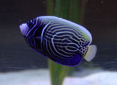

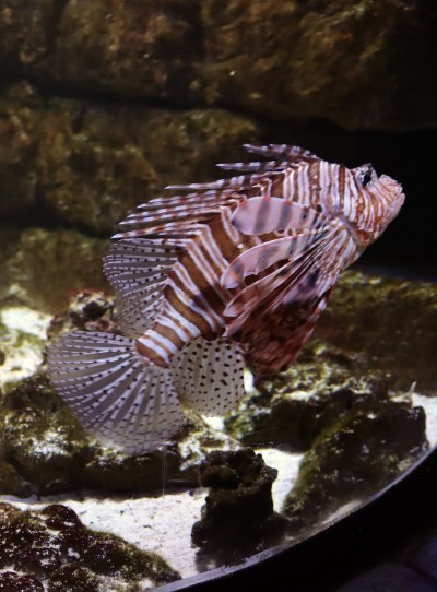
 Blue Planet was easy to find, clearly signposted with brown signs from the M53. When you reach it, you find yourself confronted with a series of car dealerships, and cars parked all along the approach road, but the aquarium is the big silver building on the left at the end of the approach road, with its own big car park, including disabled parking. For SatNav users, the postcode is CH65 9LF. Bus and other transport info is on the website’s Getting Her page.
 Outside, on the other side of the shop, there is the pelican enclosure (with real, live pelicans), a picnic area, a kid’s play area, and a small wildlife reserve. There are daily talks and events, and you can book special visits, all details available on the website.
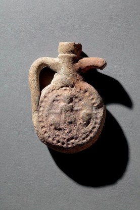


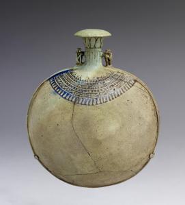


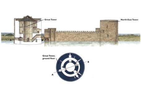
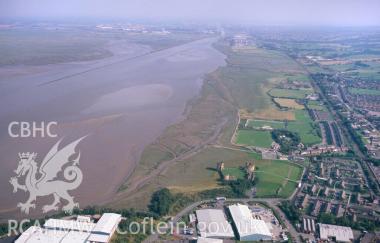


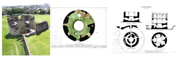


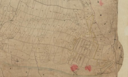


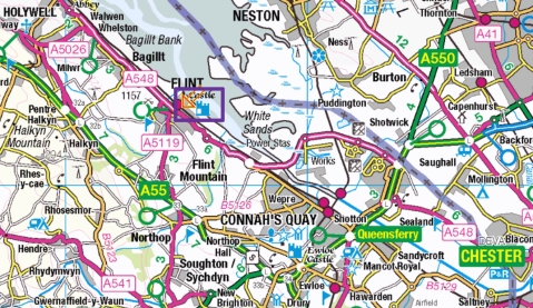
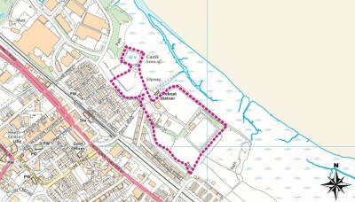


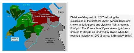
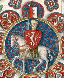
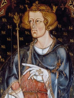


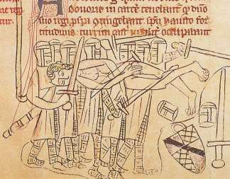
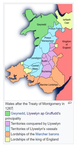

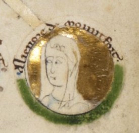


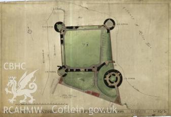
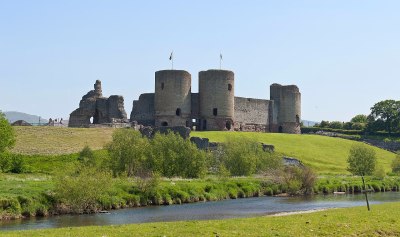

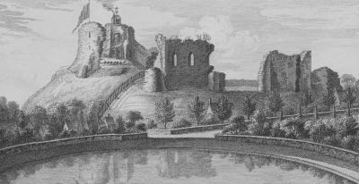

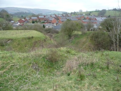
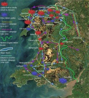
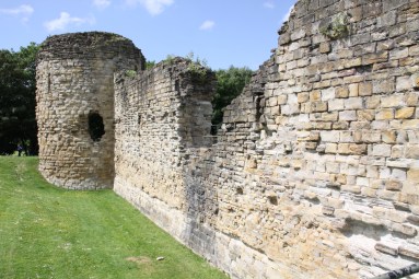


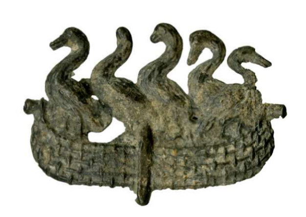

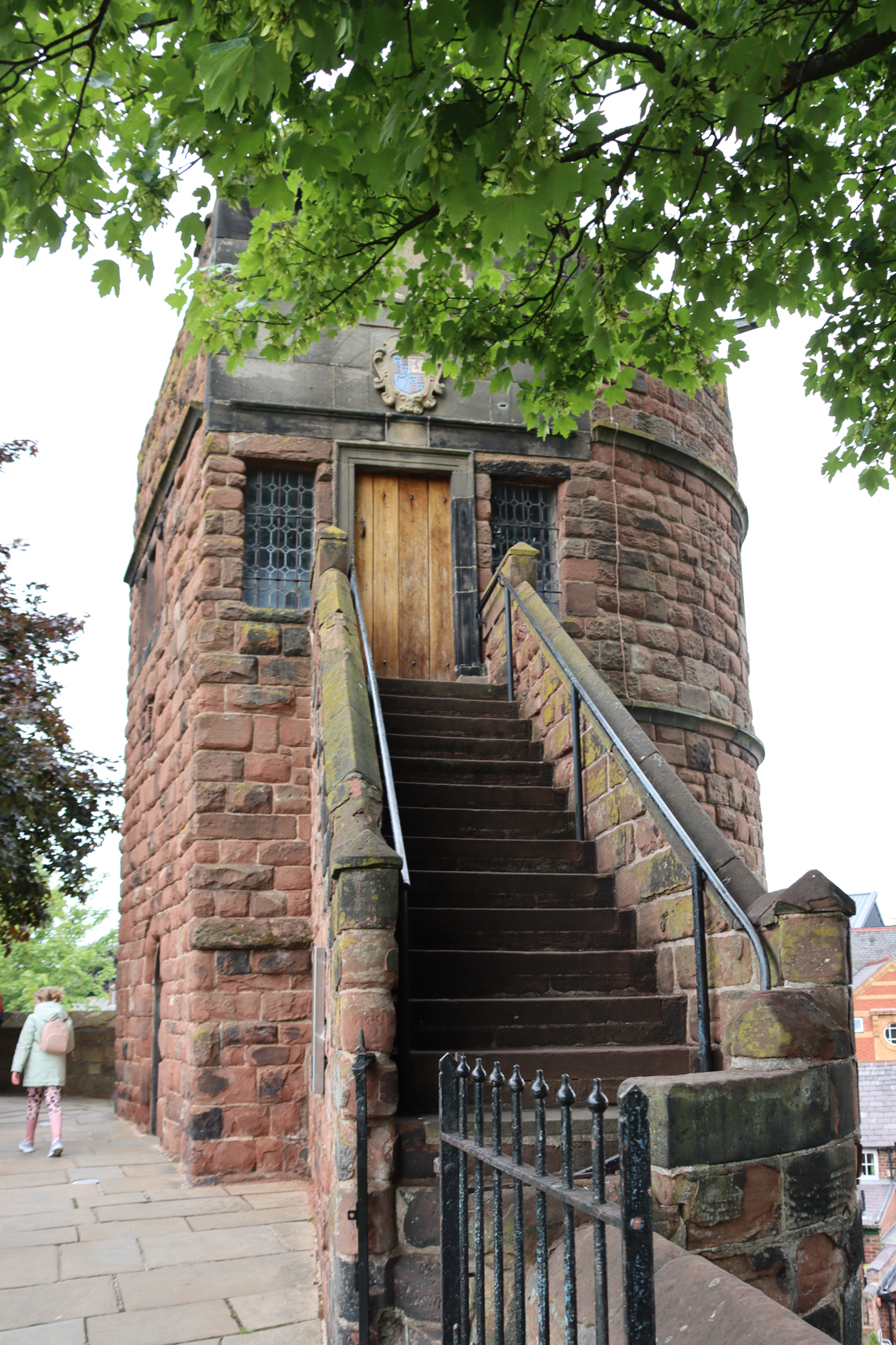


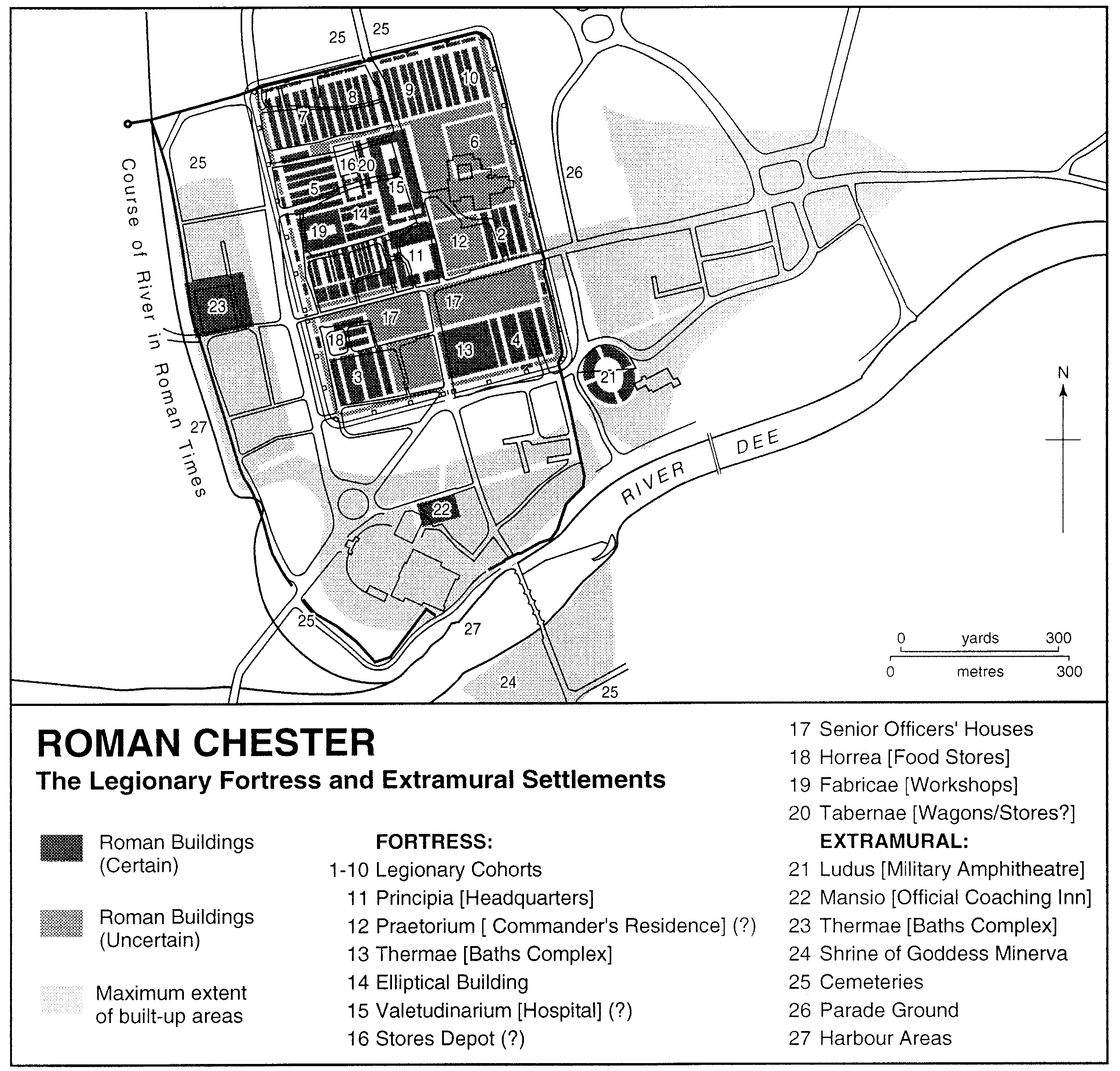
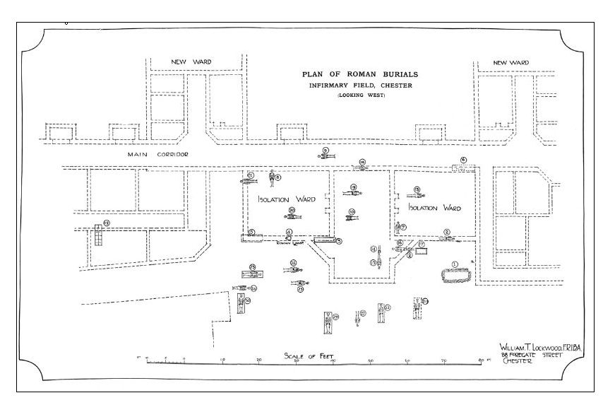


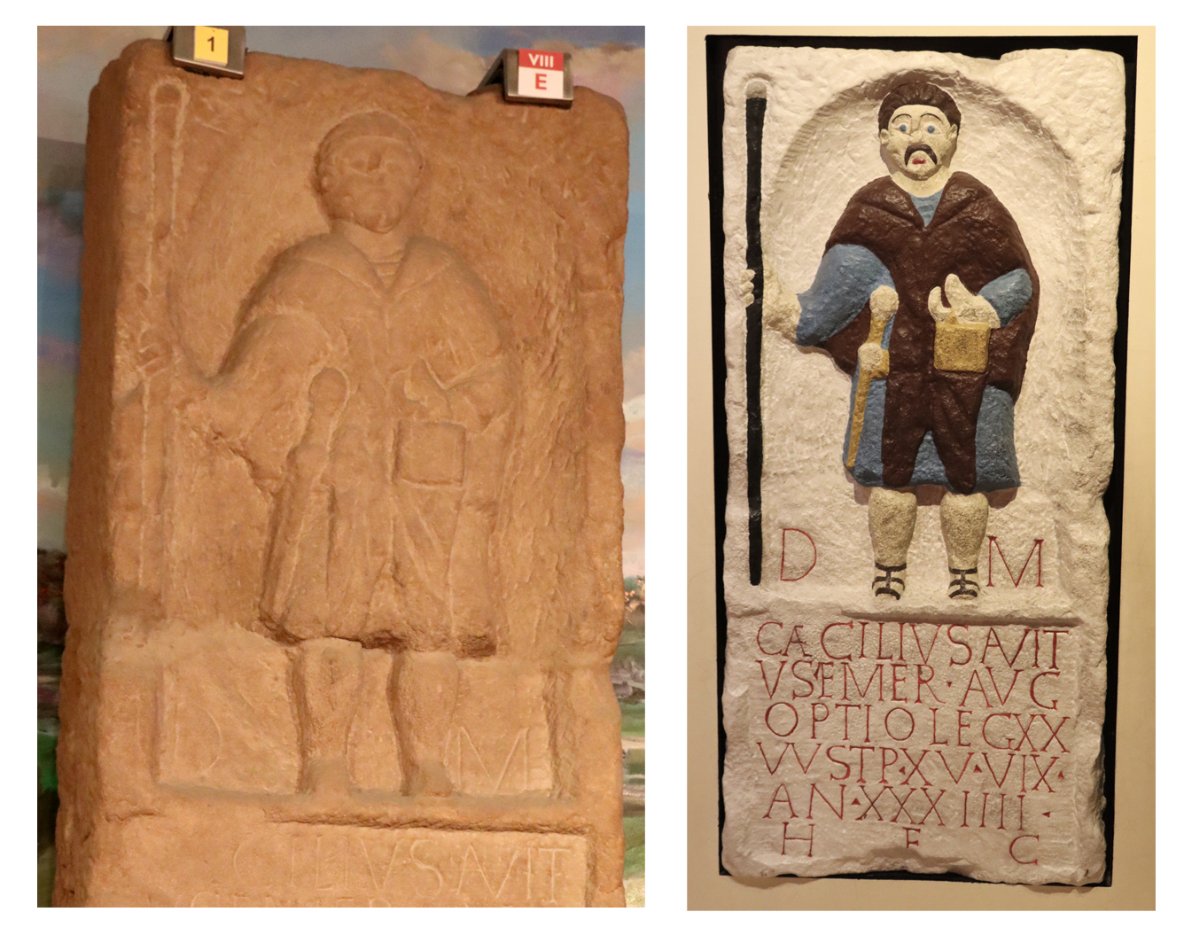








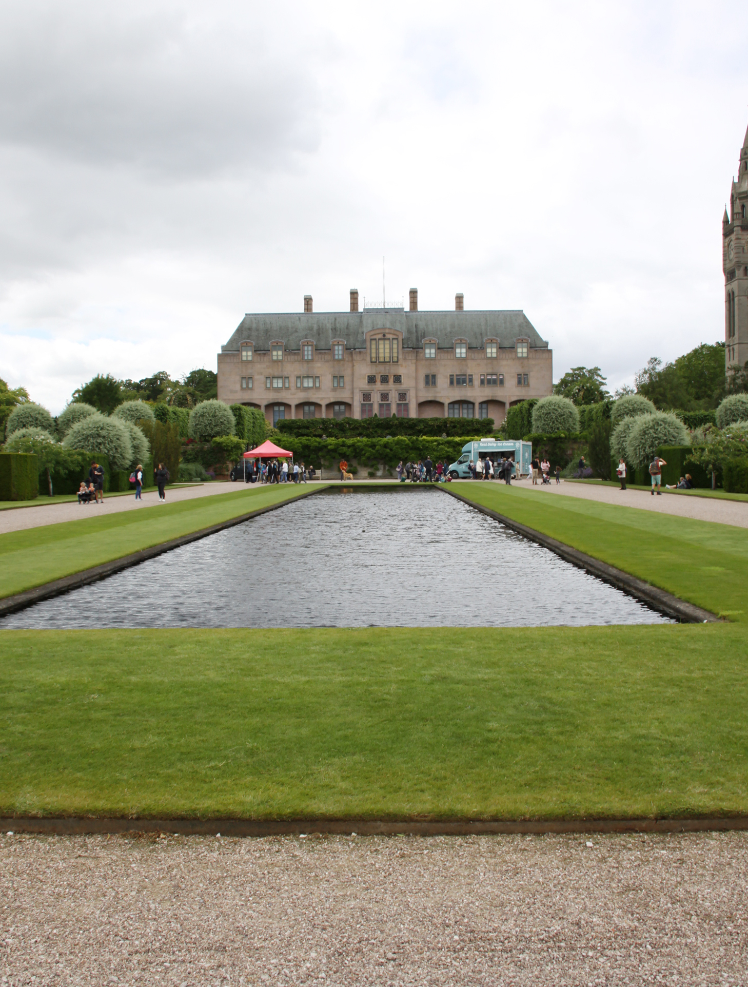


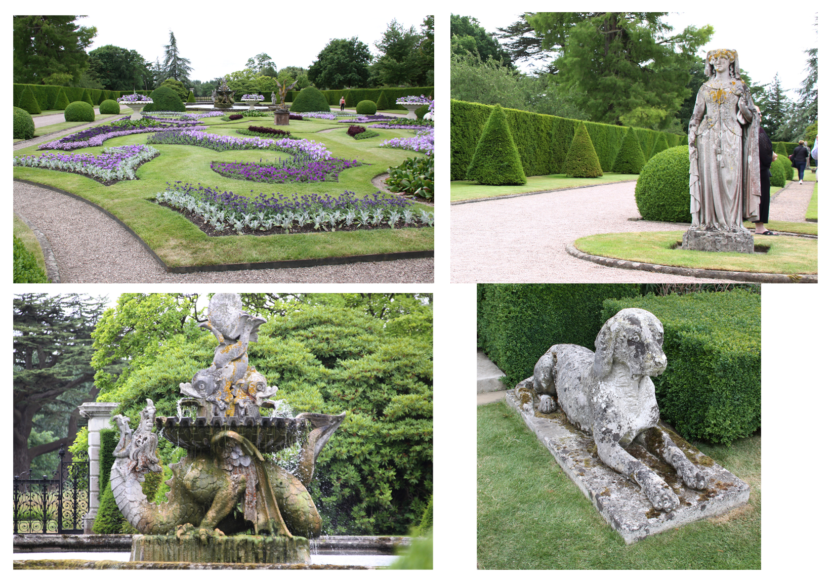


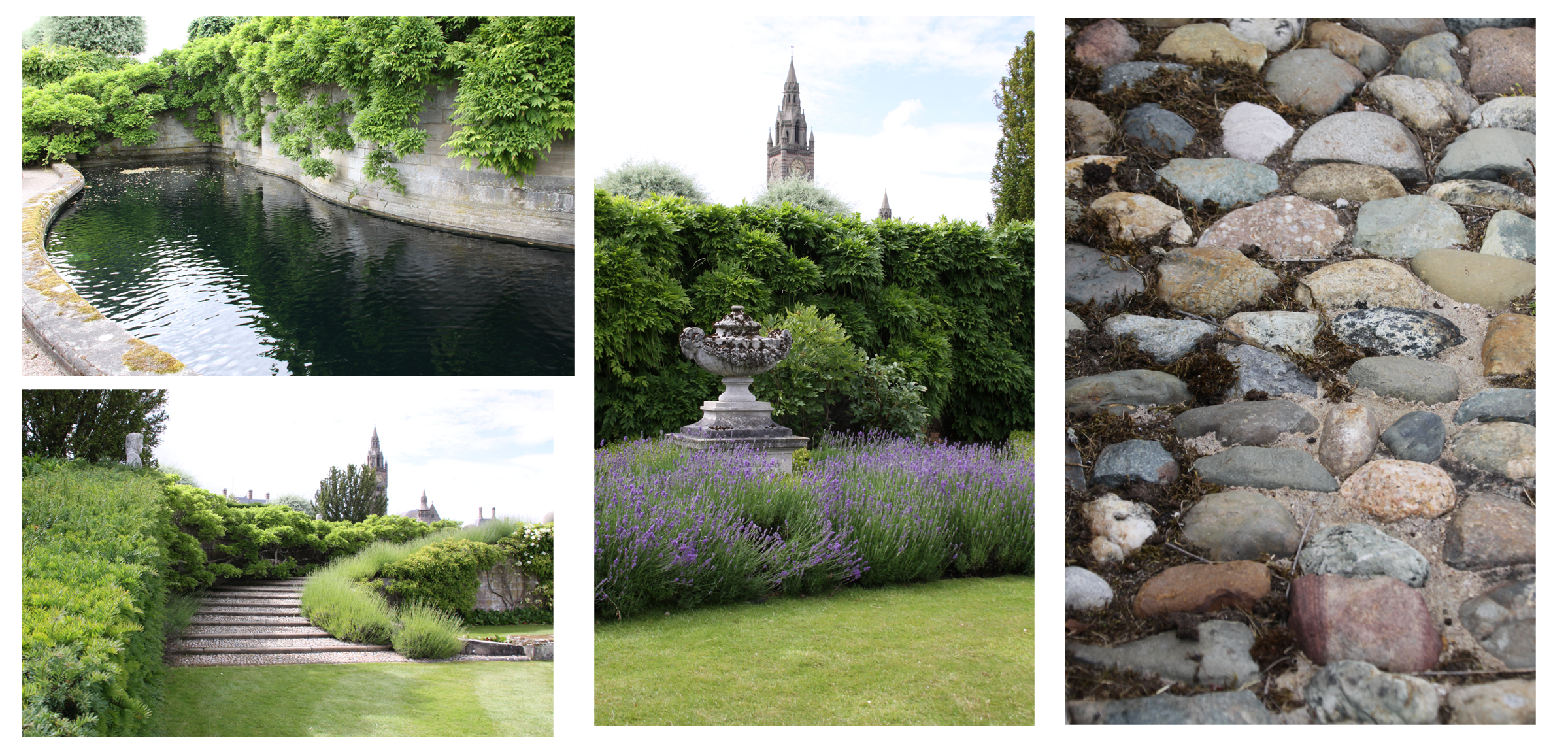











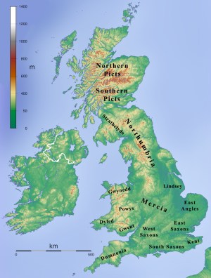


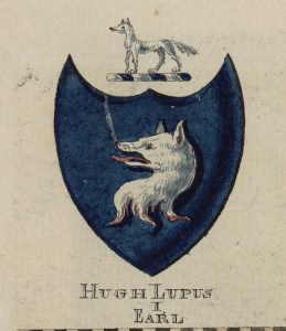


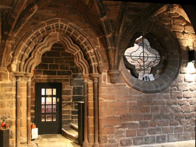


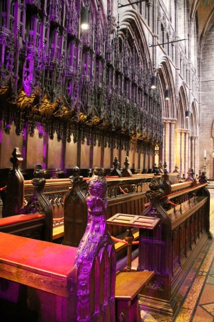
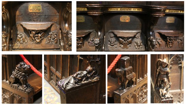

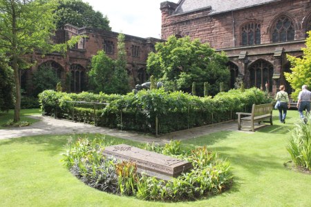


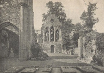

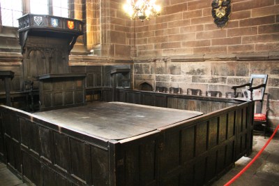
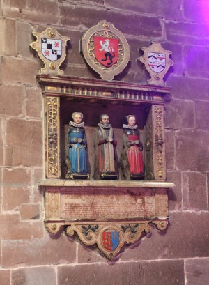












 Based in Churton
.jpg)


.JPG)


