Category Archives: Seasonal weather

A short walk from Waverton towards Chester along the Shropshire Union Canal

I have driven over the canal bridge on Eggbridge Lane in Waverton so many times thinking that I really must take advantage of the little car park just before the bridge to go and take a stroll down the towpath.  Having woken up early on a sunny morning I decided to investigate. Waverton is just off the A41, so very easy to reach. The car park is quite small, but it was not full even on a bright and warm morning.  The What3Words address for the car park is ///fingertip.snored.deals

Victoria Mill, Waverton

Immediately opposite the car park, as you walk to the towpath, is a very attractive canal building, the Grade 2 listed, a mid-19th century Victoria Mill, a former steam-powered canal-side corn mill, with bays for loading and unloading narrowboats, and now converted for modern use. The Historic England description is here.  This is part of the heritage of the Shropshire Union Canal, which if you keep walking north eventually ends up at Ellesmere Port.  To the south, it eventually connects up with the rest of the main canal network at Hurleston Junction.  The Shropshire Union has quite a complicated history, as does Chester’s canal heritage as a whole, and was not completed until 1835.

As with most canal walks, there’s always a choice to turn right or left, and as I had no idea what to expect from either direction I decided to head north, leaving the walk south for another occasion. Out of the car park I turned left under the unprepossessing bridge no.119 and headed up the towpath.  This section is metalled, so it avoided the mud and sludge that I had been half expecting.

If you take this route you find yourself walking along a short row of houses with canal gardens along a metalled pathway.  Canal-side gardens are always fascinating.  I used to live on a narrow boat many years ago, and it is always a lot of fun to see how different minds have dealt with a garden that opens directly on to a canal.  These are always hugely individualistic and personal.  There is always much to see in the way of garden furniture, garden ornaments (someone will always have gnomes, and there is usually at least one example of traditional canal painting), sheds in various states of repair, a wide range of summer houses, varieties of approaches to terracing, often some very interesting specimen trees and shrubs, and different attitudes to garden seclusion, along a spectrum from solid barriers of hedging or fencing to a complete lack of interest in any form of privacy.  A real cultural treat.

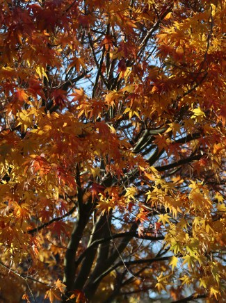
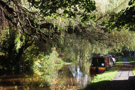
After just a minute or so the towpath enters a more rural section, and in the late season sun it was a real pleasure to take in all the autumnal colours on trees and shrubs that flank the canal.  I’ve posted some of the photos below. It’s a well-used section of towpath, with joggers, cyclists and plenty of dog walkers, but everyone is very civilized about moving over to make passing easy.  There was not much in the way of canal traffic, with just two narrowboats on the move, but I expect that it is much busier in summer.

Keep an eye out on your left as you leave the housing on your right and reach the more rural section.  Partly concealed by the grass next to the towpath, there is a short inscribed red sandstone Parish Boundary Marker. This section of the canal passes through the parish of Rowton, famous for the Civil War Battle of Rowton Heath (see the Wikipedia entry on the subject and a more detailed analysis by Historic England).  King Charles I is said to have watched his army lose that battle from the Phoenix Tower that still stands on Chester’s city walls. The stone marks the boundary between the parishes of Christleton (CP on the stone) and Rowton (RT).  The date commemorates the date of the battle in 1645 and, below the level of the grass, 1995, the 250th anniversary of the battle.
===

After this more countrified section there are more houses, all interesting, with some lovely weeping willows and other water-loving species, and a very attractive hump-backed bridge, that I have since discovered carries Rowton Bridge Road into Christleton.  I walked up as far as The Cheshire Cat, which sensibly has a gate onto the towpath, and carried on just a short way beyond it, but at that point the canal converges closely with the A41 (Whitchurch Road) and it becomes quite a noisy experience with the unremitting traffic, especially during the week.

Checking the map later (for example see the plotaroute.com website), I note that by coming off the towpath at Rowton Bridge it is possible to walk into the attractive village of Christleton, with its marvellous pond, and I would have done this had I realized.  Another time.  had to be somewhere else in the afternoon, so it was a short walk, probably an hour and a bit there and back at strolling pace, with pauses to let bicycles pass, and to take photographs.

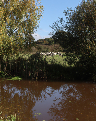
For those with unwilling legs (see the blog’s Introduction for details about what this refers to), the towpath heading north from Waverton is metalled, but quite uneven.  No problem for most people, I would have thought but do keep an eye on it.  There are places where the edges of the surface are particularly uneven, but this just means that if you are with someone else you need to go in single file for short sections.  Otherwise, it’s on the flat and very enjoyable.

On the way back I followed the towpath beyond the car park for a few minutes to see how far the housing that backs onto the canal extended.  This part of the towpath is not metalled, was muddy and is single-track.  These houses and gardens are another interesting mixture – each of the sections of housing and gardens has its own personality, presumably reflecting both when it was built and the pricing.  These look as though the garden-canal margins were all designed with narrowboats or other canal vessels in mind. There was indeed one narrowboat moored up at a garden.  The housing stops after a couple of minutes and the towpath reverts to a far more rural appearance.  I’ll investigate further on another day.

A very autumnal walk taking in Churton fields, Townfield Lane, the speedy Dee – and a cormorant.

After all the rain last night, which was truly torrential, I was somewhat surprised to wake up to bright sunshine and a topaz sky this morning.  A treat for mid November. Planning to walk through the fields behind Churton towards Farndon, before turning right down Townfield Lane to the Dee, I decided that it was a moment for seriously waterproof footwear.  Not walking boots but welly boots.  It was a good instinct.  The fields were sodden and marshy, the tracks muddy and mired due to tractors, and the picturesque but unadopted Townfield Lane was a series of lane-wide pools.  The short section of footpath leading north from the lane along the river bank to the field next to the river was only just clear of the flood waters, which were moving fast and forming fascinating eddies.

I always like the Churton-to-Farndon fields following harvest, because of the linear stubble that draws the eye into the distance and focuses attention on individual trees that, at this time of year, are full of bright warm colours.  The deep chestnut brown of the fields provides a beautiful foil for the silvery stubble, the blue skies and the autumnal leaves.  The mirror-like reflections in the standing water were a pleasure in their own right.  Today really was a water walk.

The biggest surprise was spotting a cormorant (or is it a shag?) at the very top of a tall tree by the side of the river (see photo at end of post).  Cormorants and shags are right at home on the coastal estuaries of mid-Wales, and are frequent visitors to the Thames and its former docks in London, both places where I used to live, but I never did learn to tell the difference between them, and I have never seen one this far inland.  It seemed right at home.
……..
………

……..
—–

View from the Dee at the end of Townfield Lane across the fields to the Barnston Memorial.

It would have been good to turn this into a circular walk by continuing north along the side of the Dee and taking the footpath from the Dee straight through the plantation onto the track extending directly from Hob Lane in Churton, but the footpath back to Hob Lane through the plantation of trees is usually bad news in even averagely showery weather, with seriously thick, sometimes impassable mud, so I simply retraced my steps on this occasion.  The circular walk is very much a summer activity after a period of very dry weather.

If you don’t like squelching through wet mud and soggy grass, or paddling through big areas of standing water, this is not a good walk following heavy rainfall, even on a beautiful day.  On the other hand, it cast a very familiar local walk in an entirely new light.  After heavy rainfall I would advise that this is not a walk for those with unwilling legs, although my father (he of a notably unwilling leg) had no problems with it in dry periods in the spring and summer.  Today it was far too slippery and sludgy.


Terrific scenery and views from Waun y Llyn Country Park, near Caergwrle

I had been visiting Caergwrle Castle on a bright, sunny, perfect autumnal day, and was actually heading elsewhere for a much longer walk when I noticed on my O/S map that there was a country park a short drive away, and went there on a whim.  I’ll write up Caergwrle Castle later but here is some visiting information accompanied by some photos of the country park walk for those of you who are, like me, addicted to lovely views.  It is certainly worth making the most of these occasional very beautiful days while we have them.  Waun y Llyn Country Park sits on a hilltop with views over the local hillsides and and over the Dee floodplain into Merseyside.

Waun y Llyn is about half an hour’s drive from Churton, probably (I’m guessing) a bit less from Wrexham and a bit more from Chester.  It is reached from all directions by single-track roads.  Do note that if you or your driver is not keen on reversing, this is not the place to go.  Access is via single track roads with passing places, and it is a popular destination with hikers and dog-walkers and is frequented by farm vehicles, so you will need to be prepared to reverse around very bendy bits as well as straight bits.

Location of Waun y Llyn, above Caergwrle (near Llay).

There is a warning on one of the information boards in the car park that there is livestock within the country park, and that you should keep dogs under control.  I had assumed that it would be sheep, but the very fresh cow-pats made it clear that there was cattle up there.  I didn’t see any, and much to their irritation neither did the two farmers who were looking for them!  As one of them said, when he asked me if I had seen them, there are 70 acres for them to hide in.

I believe that Waun y Llyn means moorland by the lake (but do feel free to correct me). It is indeed a type of moorland, with copper-coloured bracken at this time of year, and bright yellow gorse in flower.  There are only few trees, but there are young silver birch,some young oaks and small holly bushes, some of which are currently festooned with bright red berries.

There is also, as the name implies, small lake surrounded by boggy margins, with permanent water-loving plant species underfoot if you follow the watery marshland tracks.  You can skirt the marsh and head towards the higher green ground, which provides a good viewpoint, but be aware that the whole area around the lake, linking one footpath to another is fairly damp.
———
——–

If you go when there has been rainfall, do wear water-resistant footwear.  In spite of the glorious sunshine today, it rained all day yesterday, and although there are grassy footpaths, most of the the footpaths furthest from the car park were very muddy underfoot with large pools of water, and there are also places where small streams cross paths that require either jumping over or skirting around.  Water loves an easy route, and some of the smaller footpaths had become tiny streams in their own right.  All absolutely fine with suitably water-resistant footwear.

I would advise those of you with unwilling legs to avoid it at this time of year.  There are no steep slopes or steps, but there are seasonally related challenges.  I’ll give it another go in the summer and report back, but at this time of year the mud is very slippery, there is a lot of wet bedrock showing through on some of the narrower footpaths.  One lady who had a bad leg was managing fine with two sticks along the grassy footpath, but had to turn back when the going became too muddy and rocky underfoot.

There is no archaeological site recorded at the country park, which seems almost counter-intuitive given the views.  Both silica sandstone and millstone grit were quarried from the hill in the late 19th century, the latter for housing in the Alyn valley below, and the walk to the hilltop was a favourite destination of visitors to a spa in Caergwrle, contemporary with the quarry.

This  walk took me about 45 minutes, so it was a short one but a good one.  You can make it shorter or longer by following the different footpaths on the noticeboard by the car park, and you can turn it into a serious hike by including other local footpaths as well.  There’s no hyperlink to the Country Park’s official website, because there does not appear to be one.  Let me know if you find one.  If you give Waun y Llyn Country Park a go, do enjoy!
The metalled approach from the car park to the entrance to the country park. The metalled surface goes onwards for a short way to the viewing point.

Entrance to the car park

A winter walk through the fields from Churton to Farndon

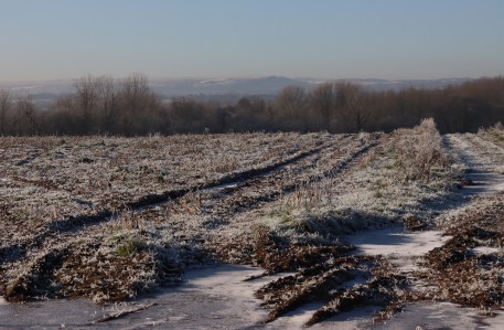
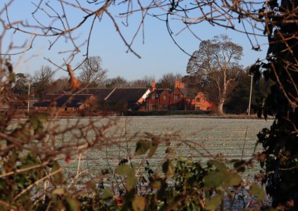
The walk through the fields from Churton to Farndon and back again is always enjoyable, taking about an hour for the full circuit, or less if you don’t pause for photos.  It always varies enormously by season, but was quite spectacularly distinctive yesterday, glazed in frost under a bright blue sunny sky. Where the tractors had been out, during wet weather the deep tracks along some of the footpaths had filled with rainwater and frozen solid, but the ridges between were ice-free.  Literally freezing in the shade, it was actually quite warm in the sun.  A splendid walk, all colour and light.


The route taken from Churton to Farndon along official footpaths (in bright pink). The return route takes the pink footpath that starts in Brewery Lane.  The red blobs are the approximate locations of two possible prehistoric sites, now ploughed out. Source of map: The Public Map Viewer.


December frost in Churton

A beautiful day all day yesterday, and it was lovely today too, right up until the skies opened.  Fortunately, by that time the chilli con carne was in the slow cooker and the log fire was doing its stuff most effectively.

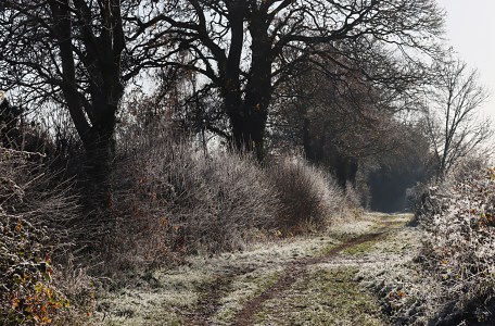
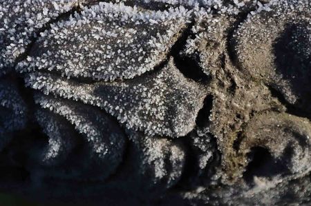
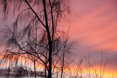
Just a few snaps from the garden, capturing some of that crisp contrast between the white lace of the frost, with all its snowflake complexity, and the autumnal shades and shapes, framed, captured and transformed.

As soon as the sun crept around the corner of the house, the frost started to melt, its drips capturing a myriad of colours.  For the first time since I put them out a couple of weeks ago, the bird feeders were a hub of activity, a reflection of just how hard the ground is.


A year in the life of a single tree in Churton

The tree in early April 2021, still rather bare of leaves.

Just for fun, since April 2021 I have been photographing the deciduous tree that I can see from the window in my home office.  It stands in the middle of a rather untidy fence, completely dwarfing it, but finds itself in arboreal isolation, between two fields that belong to the Churton Hall / Barnston Estate dairy farm.  On the far, eastern side of the hedge, the field was eventually ploughed.

On the western side, cows grazed all summer during the day, vanishing at speed from time to time, presumably for milking and feeding.  Most of the time the cows ignored the tree, but on hot sunny days often gravitated towards it, even though it is not very large, and never offers much shade.

The same tree a few weeks later in mid-June 2021

The cows have surprised me.  Not dull, static, plodding things but always on the move, pushing one another out of the way for that special patch of grass, often cantering around together, and frequently departing back to their barn at a serious gallop, presumably for food.  The fresh air certainly seemed to agree with them.  The cattle vanished at some point during the late summer or autumn and the field remained empty of livestock, but reappeared in early April, making me smile when I saw them first exploring their fresh environment, rushing around and bumping into each other in something resembling excitement.


The tree, the backdrop to all this bovine activity, was ever-changing.  The time between bare branches in April and richly new light green leaves in June, a complete metamorphosis, was a mere six weeks.  Extraordinary.

This post is simply a set of photos of bits of a year in the tree’s life.  One or two of the photographs look as though the colours have been messed with in Photoshop to make them more interesting, but there would have been no fun in that.

I am too far away to know for sure what specie it may be.  I suspect from the shape that it is an oak, but I need to see the leaves, and the longest lens on my camera cannot get me close enough.
fdfasdf


An amazing sunset on 16th March 2022, when even my house, which is painted white, was peach-coloured. No Photoshop employed.

Snow on the 31st March 2022

Early April 2022, with the cows returned to the field

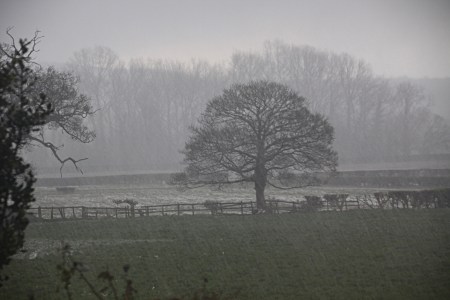
Mid April 2022, with leaves arriving on branches and a doom-laden sky in the background

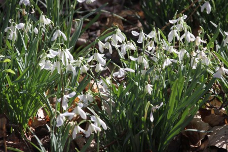
A visit to Chirk Castle yesterday for the snowdrops and daffodils

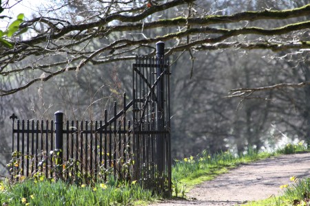
It was such a gloriously sunny day yesterday that even though I had marked today for giving the house a much-need top-to-toe clean, I abandoned the whole project, jumped in the car, and  stopped off to pick up my Dad before driving down to Chirk Castle to enjoy the pristine garden and the walks in the small woodland.  It is a great time of year for it.  The castle, the only one of Edward I’s Marcher fortresses still inhabited today, always a little intimidating in its block-like immobility, is far less bellicose in the bright sun.

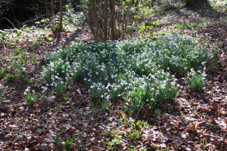
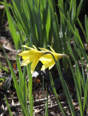
The topiary is great at any time of year, and the colours of new foliage and bright heather give a real lift to everything, whilst the daffodils and snowdrops, popping up everywhere but particularly good in the woodland, are a joy.  The snowdrops are all in full swing, but although a lot of daffodils are out and looking terrific, there are still more to break out of their buds.  We stopped off on a perfectly placed bench for a blissful half hour in the sun to look out beyond the ha-ha over the rolling hillside towards the view below.  It’s only a short outing, but a very agreeable one.   I’ll let the pictures speak for themselves.


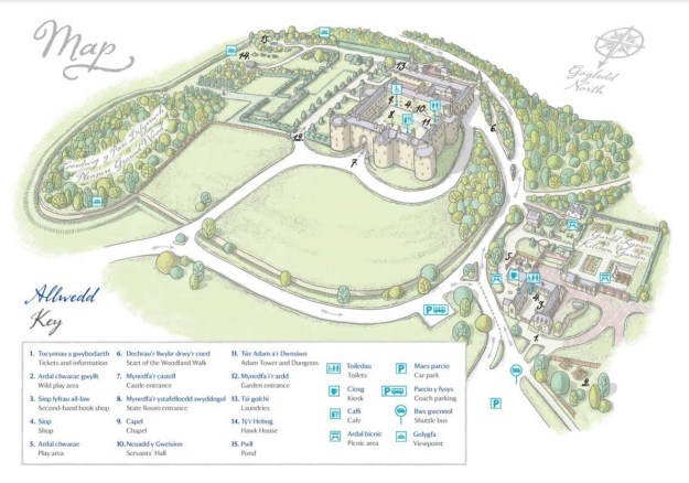
Plan of Chirk Castle grounds. Most of the snowdrops are in the Pleasure Ground Wood, but the daffodils are everywhere.  Source:  Chirk Castle, National Trust (website and free leaflet available in the ticket office)

Details of visiting are on the Chirk Castle website (National Trust).  Regarding my usual comment on access, a wheelchair user might be able to see some of the gardens, but the woodland is probably not advisable.  As for unwilling legs, yes if you keep in mind that the ground is uneven.  There is a shuttle from the car park to the castle entrance, as the walk up can be challenging for unwilling legs.


A short walk along the Dee at Holt, taking in Holt Castle

Holt Castle

After a morning of shifting logs, the sad remnants of an enormous fallen tree, from one end of the garden to the other and stacking them in the shed, I was fairly stiff and very bored.  It was a lovely day, so even though there is an immense pile still sitting there, I put the wheelbarrow back in the garage and decided to go and walk along the river, taking in Holt Castle.

A number of people have asked me if I’ve visited the castle yet, and my answer that the last time I saw it was probably 30 years ago always seems a tad lame, given how close it is.  I will talk about the castle on another post, but it was interesting today to see how much it has changed.  When I was last there, it was inaccessible and covered in ivy.  I remember the doorway hanging in the side of the wall, and remembered that it was built on a sandstone base, and that local sandstone was quarried from around the castle to provide building material and form a moat, but I had forgotten anything else that I knew about it.  Today, I was so pleased to see how well it has been served since I last saw it.  There is now a staircase leading to the top of the castle, from which the views of the Dee and the fields beyond are excellent, and there is plenty of signage to explain all the features remaining, and to show what existed in the Middle Ages.  I must try to find the photographs I took 30 years ago for comparison.

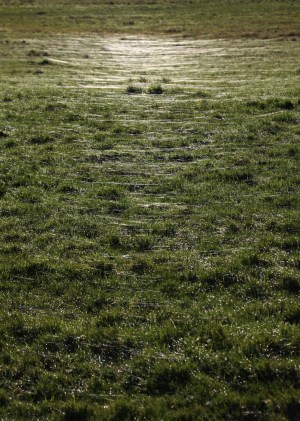
I was walking straight into the sun, which was beautiful but blinding, so after visiting the castle I retraced my steps and headed instead towards the bridge, crossed the road just before it, and went through the gate into the grass field that flanks the Dee to its west, heading north in the direction of Chester.  It was only a short walk.  I did not pass out of the field onto the track, which was covered with deep pools of muddy water, but the sun on the grass made it glow, the reflections in the river were lovely, and the cobwebs forming silver nets on the ground were glorious, and all in all it was a really rewarding stroll.


Visiting and accessibility notes

There is no carpark for the castle, but during the week there is plenty of on-road parking.  The footpath leading down to the Dee is well maintained, but as it opens into the open grass it is muddy and a little slippery after rainfall.  That is true for the worn footpaths around the castle too, so suitable footwear is required.  The path leading up to the top of the castle is gravel set into a plastic matrix, and felt very safe underfoot.  The metal staircase up tot he top of the castle is also well-textured underfoot, with a good handrail.  It’s only a short flight.  Do note that the noise from the bypass is considerable, so if you were thinking of carrying on along the Dee to the south after seeing the castle, do bear that in mind.

The walk along the Dee has no car park on the Holt side, but cross the bridge and there is a small car park on the Farndon side, to the south of the river (to the right as you cross from Holt into Farndon).  You can then return across the bridge on the narrow footpath to do the walk on the west of the river heading north.  As you open the gate, you may again find that the converging feet and paws have muddied the approach from the field, making it slippery.  The rest of the walk through the field is slip-free, and on the flat.