On a recent visit to Birkenhead Priory, which I am still writing up, I arrived some time before the Priory opened, and went for a wander. There are some great things to see in the area, but this combined monument and street light really drew the eye. I decided not to risk life and limb by flinging myself across the very busy road to read the inscription at its base, so did a web search when I returned home. It is a monument to the building of the Queensway Tunnel under the Mersey. It is Grade II listed (1217871), was designed by Herbert Rowse and erected in 1934. It was shifted from its original position in 1970 due to changes in the road layout at the tunnel approach, but originally illuminated the first concourse / plaza.
The monument has the fluted elements of a Doric column clad in impressive black granite, hints at ancient Egyptian lotus-top capitals, has a light on top, and simply yells Art Deco creativity and optimism, with a touch of eccentricity. It is such a hybrid of different ideas, incorporating ancient art and contemporary technology, and happily combining the functions of both monument and lighthouse that it has no chance of being rationally categorized. Like Greek and Roman columns or ancient Egyptian obelisks, it looks as though it ought to be in company, not standing all on its own.
The monument did in fact have a twin, but instead of standing alongside its sibling was erected over the river in Liverpool, lighting the other entrance to the tunnel.Sadly this was taken down in the 1960s, a period when so many bad decisions were made regarding architectural heritage. There was some talk in the media this time last year about erecting a replica, but I don’t know if that plan went anywhere or has been abandoned.
The inscriptions on the bronze plaques on the base display the names of the engineer responsible for the civil engineering of the tunnel, Sir Basil Mott J.A. Brodie and the architect Herbert Rowse, as well as the names of the team who built the bridge and the construction teams and committee members who oversaw proceedings. The commemorative declaration reads:
Queensway, opened by His Majesty King George V, 18th July 1934 accompanied by Her Majesty Queen Mary. The work on this tunnel was commenced on 16th December by Her Royal Highness Princess Mary Viscountess Lascelles, who started the pneumatic boring drills at St George’s Dock Liverpool MCMXXXIV
I love the monument. It has a real sense of joie de vivre. It is a shame that it is no longer located closer to its original position as part of the tunnel’s original architectural vision. On the upside, at least it has been preserved and not demolished like its twin. Other aspects of the original Art Deco vision do survive insitu at the tunnel entrance, shown above right.
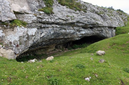
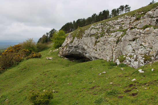
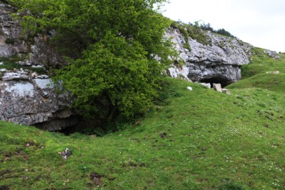
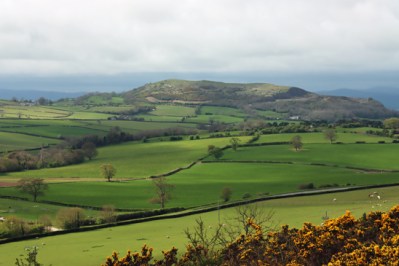
The cairn rising above the tree tops on Gop hill, with the cave visible as a dark line in the light limestone ridge below. Source: Coflein
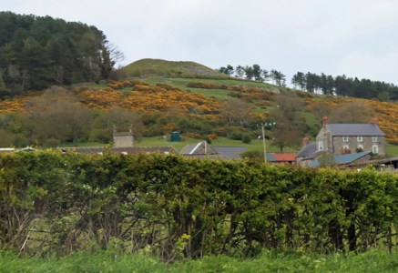
Gop Cairn is at an elevation of 250m (c.820ft) above sea level on the prow of a hill overlooking the Vale of Clwyd, just outside the village of Trelawnyd (formerly known as Newmarket). It is oval rather than round, and measures roughly 101m x 78m (331 x 255ft). It is the biggest man-made prehistoric mound in Wales, and in Britain as a whole it is second only to Silbury Hill in Wiltshire.
The cave has already been discussed in part 1(Pleistocene and Mesolithic) and part 2 (Neolithic burials).
The Excavation
The plan of the cairn and excavations by Boyd Dawkins. Source: Boyd Dawkins 1901
Sir William Boyd Dawkins was hired by the landowner to excavate the cairn. Boyd Dawkins had a simple, though labour-intensive strategy. The plan that Boyd Dawkins made of the cairn shows the dip in the top that remains today. Boyd Dawkins speculates that this could have been caused when the cairn was later used as a source of raw materials for local drystone walling, or alternatively by subsidence due to the collapse of an underlying chamber.
Although there is a thin covering of vegetation today, the cairn was found to be built of chunks of limestone. Around the base of the cairn there seems to have been a more organized and well presented kerb of drystone walling. Ian Brown suggests that when first built, and during the period when it still retained importance, it may have “shown a dramatic whiteness set against a blue or darkening site.” The limestone ridge below, in which the cave is located and shown at the top of this post, certainly seems almost white in the sunshine, and the cairn may have had a similarly noticeable appearance, particularly given its great size.
Boyd Dawkins sunk a shaft (6ft 6 ins by 4ft / c.2m x 1.22m) vertically from the top of the cairn, which had to be shored up with timber to allow work to proceed safely. The shaft reached the former ground surface, which was formed of bedrock. A main “drift” (a mining term for a horizontal subterranean tunnel) was then tunnelled running 30ft (c.9m) to the northeast from the bottom of the vertical shaft towards the edge, followed by two shorter drifts. The hope was to find a burial chamber at the centre. It was not unreasonable to assume that there would be a burial chamber of some description. Although Neolithic chambered cairns are not common in northeast Wales (examples are Tyddyn Bleiddyn near St Asaph and Tan y Coed in the Dee valley), there are many Early Bronze Age round barrows with cists, and there are several stone-built burial sites and a stone row on the Great Orme to the west.
Unfortunately, in spite of all the hard work, all that Boyd Dawkins and his team found were fragmented animal bones, which in spite of his considerable experience identifying animal remains, Boyd Dawkins was unable to identify with certainty: “hog, sheep or goat, and ox or horse, too fragmentary to be accurately determined.” Overall, the suggestion is that these were domesticated species that could have been herded or penned in the area.
No artefacts were found.
Conditions were obviously very difficult, as Boyd Dawkins states: “The timbering necessary for our work was not only very costly, but rendered it very difficult to observe the condition of the interior even in the small space which was excavated.” It is possible that the chamber, if there is one, is off-centre, and that any passage leading to it is in a different direction. Until further survey or excavation work is carried out, there is no means of telling what lies beneath the surface.
Dating the Cairn
Neolithic arrowheads found on Gop Hill. Source: Glenn 1935
Data for the dating of the cairn is circumstantial. Although domesticated animal species were found within the cairn, these could have been deposited at an any time from the Neolithic onwards. On the other hand, arrowheads and other Neolithic stone tools have been found on Gop Hill. According to T. Allen Glenn in 1935, Gop Hill was known locally as Bryn-y-Saethau, the Hill of Arrows, due to the large number of Neolithic arrowheads found there over the decades. Just below the cairn, just 43m (141ft) away, shown in the above photograph, is a shallow cave in the limestone ridge that contained Neolithic burials. There are ephemeral Neolithic sites nearby, identified by T. Allen Glenn during field walking during the 1920s, and there are other Neolithic cave sites in northeast Wales. At the same time, nothing significant relating to the Bronze Age has been found in the immediate area. Although Iron Age and Roman sites have been found in the area, Gop Cairn is not an Iron Age or Roman form of site, and there is no record of a medieval motte and bailey castle up on the hill. On balance, accepting that it remains speculative, it seems probable that it will turn out to be a Neolithic site if it is ever properly investigated.
Myth: “Baseless Theories”
A local writer named Edward Parry, author of Royal Visits and Progresses into Wales, written in 1851, propagated the idea that Gop Hill and its cairn were connected with the battle between Boudicca and Suetonius Pauluins in A.D. 61. It is a bizarre theory, that Ellis Davies, under the subheading “Baseless Theories” says in 1949 was a “false derivation” based on one of the names of the Gop, Cop Paulini. It is otherwise incomprehensible why Parry should have come up with the theory, but it found its way into other pamphlets and local accounts. As Davies points out in a rather aggrieved tone, “It would not be necessary to refer to these absurd stories about the association of Boudicca with Gop and neighbourhood were it not for the fact that locally they still persist!”
The Beacon
In his 1949 book “The Prehistoric and Roman Remains of Flintshire,” Ellis Davies notes that in the 17th century there was a beacon on Gop Hill, the purpose of which was to send up an alarm, when necessary, should pirates be spotted off the coast. A small hut was built at the bottom of the cairn to store the combustible materials with which the fire would be lit.
Final Comments
It is a little ironic that there is such a lot to say about a rather small cave, and not a great deal to say about an absolutely enormous cairn on the prow of a hill that dominates the surrounding landscape. It seems clear from the burials in the cave beneath the cairn, dated by association with distinctive artefacts, and supported by stone tools found on the hill, that this was an important location during the Neolithic. It seems likely that the cairn could have belonged to the same period, but it is also possible that it could belong to the following earlier Bronze Age. Further investigation will be required to nail down the date of the site, and to establish if there are any additional structures, such as burial chambers, contained within.
Suggestions for the derivation of the name Gop. Source: Ellis Davies 1949, p.159
In Part 1 I looked at the excavations carried out at Gop Cave in 1886-7, 1908-14, 1920-21 and 1956-57 and talked about the pre-glacial levels of Gop Cave, with its finds of woolly rhino, hyaena and wild horse, and the Mesolithic tools found outside the cave mouth.
In this second part, the cave is still the topic under discussion, with a shift in focus to the Neolithic layers, whilst the cairn on top of Gop Hill is tackled in part 3. During the Neolithic, the cave was used to deposit a number of burials, two thirds of which were contained within a walled-off section of the cave, and the rest within a narrow passage that linked two parts of the cave. These burials are the subject of this post. References used for all three parts are listed in part 1, together with visiting details.
Just to recap briefly on the details from part 1, the earliest excavations in the cave were carried out by Sir William Boyd Dawkins, a well known and respected early archaeologist who excavated the cave site over two seasons in 1887 and 1887, having originally been asked to assess the cairn on top of the hill. The lowest level was barren , but the next contained numerous bones of Pleistocene animals, many of them now extinct. The top two layers contained mainly Neolithic material including human skeletal remains.
In 1908 John H. Morris began digging at the cave, and was joined by T. Allen Glenn, who took systematic notes and made a plan of the newly uncovered sections of the cave. They opened up a passage missed by Boyd Dawkins, referred to as the northwest passage, which linked to a very small opening just to the east of the main cave entrance. During these excavations a further six partial skeletons were found, two of them children. The skeletal remains in both cases were associated with artefacts and animal bones.
Most of the bone collection collected by Boyd Dawkins, and stored in a pigeon house at Gop Farm, were disposed of in 1913 by the tenant of Gop Farm, who threw them down a local mine shaft – which is particularly sad as Glenn had just received permission to take charge of them. Most of the Morris and Glenn finds, both bones and objects, were sent to the National Museum of Wales. Some finds from Gop Cave are also retained by Manchester Museum and Aura Museum Services, and possibly by the Grosvenor Museum in Chester.
The Neolithic burials at Gop Cave
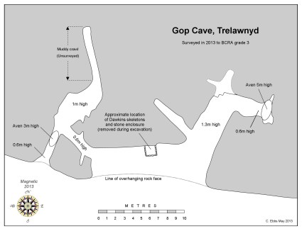
In total, at least 20 individuals were recorded in Gop Cave. The 14 found by Boyd Dawkins and the 6 found by Morris and Glenn may have been deposited at slightly different times, due to the different character of the deposition. Whereas the individuals discovered by Boyd-Dawkins seem to have been buried whole, Glenn is fairly confident that the ones discovered by himself and Morris in a different part of the cave were only partial when they were interred.
Boyd-Dawkins excavations showing the chamber (feature B) above layer 3 and abutting layer 4, which contained skeletal remains of humans with artefacts. Source: Boyd Dawkins 1901. See other cave plans in part 1.
Dawkins describes how he found a thick layer of charcoal over slabs of limestone at a depth of 4ft (c.1.2m) from the surface, which formed an old hearth. Blackened slabs were found throughout the area excavated, and there were also burnt and broken bones of domestic animals and fragments of pottery. “Intermingled with these were a large quantity of human bones of various ages, lying under slabs of limestone, which formed a continuous packing up to the roof. On removing these a rubble wall became visible, regularly built of courses of limestone.” These limestone blocks made up walls on three sides, with the cave wall itself making up the fourth wall, to form a chamber 4ft 6 by 5ft 4 (c.1.4m x 1.65m). Inside the chamber was what Dawkins describes as “a mass of human skeletons of various ages, more than fourteen in number, closely packed together, and obviously interred at successive times.” Individuals were deposited in a crouched position, “with arms and legs drawn together and folded.” His assessment was that the bodies were buried whole. When the chamber became full, another area of the cave was used as an overflow for new burials, identified on the section plan above as area A. Because layer 3 was found beneath the burial chamber, as well as beneath layer 4, Boyd Dawkins concluded that layer 3 had formed a habitation area prior to the burials, in a similar way to two other cave sites in north Wales.
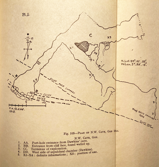
Glenn’s plan of the 1912 excavations. Source: Davies 1949
When Morris and Glenn opened up another passage, and found another six individuals, Although the view was confused by rock fall and a very uneven floor, it was thought that limestone slabs may have been used to create a wall around some of the skeletons. Glenn describes the bones as fragmented and partial. Glenn ascribes this to the remains having been brought from somewhere else, rather than having been depleted due to roof fall damage of fragile bones, or the work of the “burrowing animals” that caused disruption in the stratification within the passage. He was methodical and a good observer, so presumably had good grounds for suggesting this, and it is certainly in keeping with other, more recent archaeological evidence for Neolithic burials where partial skeletons are found, apparently due to having died elsewhere and been moved to a particular site for burial. Another possibility is that the body had been excarnated, a practice involving the ceremonial placement of a body in the open air to allow it to be processed naturally so that it was defleshed and partially disarticulated before being collected for interment, which often resulted in the bigger longbones and crania being collected whilst finger and foot bones were left behind.
Having opened the cave out and discovered the second entrance, Morris and Glenn found that it was blocked with limestone slabs, apparently deliberately, although it is by no means certain when this was done. It is not unlike the blocking of entrances to Neolithic burial monuments towards the end of the Neolithic period.
The artefacts associated with the burials
Polished blade found by Boyd Dawkins in Gop Cave. Source: Dawkins 1901
The artefacts associated with both sets of skeletons are all Neolithic in date. Boyd Dawkins assigned them to the Bronze Age on the basis of the pottery, but this has since been re-dated. Both the Boyd Dawkins and the Morris and Glenn excavations produced stone tools, most of which are fairly generic but can be assigned to the Neolithic. One of the Boyd Dawkins discoveries was a long, curved blade, very carefully carved and polished to provide it with smooth surfaces, and showing no signs of usage. He also identified quart pebbles, which he refers to as “luck stones.” Another notable stone tool, this time found by Harris and Glenn in the part of the cave undiscovered by Boyd Dawkins, was a bifacially worked axe head made from Graig Lywyd stone from the well-known Neolithic stone mines at Penmaenmawr, which was apparently unused.
Objects found by Harris and Allen in Gob Cave, including the Graig Lwyd axe at top. Source: Davies 1949.
The pottery was Peterborough ware, and it has been determined that the Gop Cave type was the Mortlake variant of Peterborough ware, which dates to between about 3350 and 2850 BC. All were fragments, and were either grey or black or burnt red.
Pottery found in association with the skeletons by Boyd Dawkins, since identified as Mortlake Ware. Source: Boyd Dawkins 1901
Kimmeridge sliders. Source: Boyd Dawkins 1901
Two unusual items were referred to by Boyd Dawkins as “links,” which he thought were proably used to fasten clothing, and are referred to by some others as belt-sliders. He described them as being made of “jet or Kimmeridge coal,” or “Kimmeridge shale.” As these items are now lost, they cannot be tested (they were last known to be in Manchester Museum, but now cannot be found). He gives the measurements as 54mm L x 22m W and 16mm H; and 70mm L, 22mm W and 27mm H. Boyd Dawkins says that they showed no signs of any usage, and according to Alison Sheriden’s analysis of these object types, this is typical. They appear to have been kept for show rather than being attached to clothing or employed in some other everyday capacity, much like the curved blade and the Graig Lwyd axe head. As jet and Kimmeridge coal come from Yorkshire, and a third of all known sliders have been found in and around Yorkshire, they are certainly exotic goods in northeast Wales, and the rarity of the substance may have endowed it with a particular cachet. Jet has the very unusual property of being electrostatic, so that when it is rubbed it can make one’s hair stand on end! If it was jet, this would certainly have added to its novelty value. 29 of them were known when Sheriden was surveying them in 2012, of which only 6 were certainly of jet, one of which was found in Wales. 12 or 13 were from burial contexts and distribution showed “a marked tendency towards coastal and riverine finds” that are a reminder of the extensive networks that operated in the Neolithic.
Although the objects in the cave are few and far between, some were unused suggesting that they highly valued and retained for special occasions or as prestige items. It is unclear whether any artefacts were associated with any particular individuals, although Boyd-Dawkins describes the the jet sliders and the polished flint flake forming one group together.
Animal remains
Although he does not list numbers, Boyd Dawkins says that the remains of the domesticated species “were greatly in excess of those of the wild animals, and the most abundant were those of sheep.” He also comments that the horse listed under wild fauna may actually be domesticated, and that foxes were using the vicinity of the cave area at the time of the excavation. All bones were found in what he describes as “prehistoric refuse heaps and that nearly all were broken and burnt.
As all the bones were discarded in 1913, none of the identifications can be checked, but Boyd Dawkins was very experienced in the identification of animal remains, giving some confidence that his work reflected the reality of the situation. Sheep and goat are notoriously difficult to tell part, so the question-mark against goat is not surprising. That sheep are dominant is not a surprise, as the area around Gop would be ideal grazing for them. The valley bottom would have been well-suited for cattle and horse.
Dating the skeletons
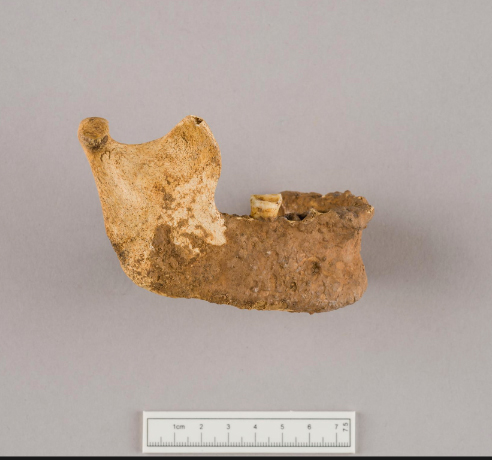
Mandibles used in radiocarbon dating of Gop Cave skeletons. Source: Schulting 2020
Although the artefacts found in the cave, loosely associated with the skeletal remains, are indicators of a mid-Neolithic date, as described above, in 2020 Rick Schulting was able to pull together 23 samples from a number of caves for radiocarbon dating, including three samples from Gop Cave, comprising two mandibles and one cranium. Although some samples had been tested previously, an error in the sampling method had led to them being withdrawn in 2007. For Gop, the new dates lie firmly with the Middle-Late Neolithic range, tending towards the middle of the Neolithic (between c.3100 and 2900 BC).
This date range backs up the findings of the Mortlake variants of the Peterborough ware, the jet sliders and the Graig Lwyd axe.
The practice of non-monumental burials
The main form of burial recognized throughout most of the Neolithic Britain is the long barrow or cairn, or the round passage grave. In each case, there was usually an accumulation of burials over time, referred to as collective burials. These were not, however, the only forms of burial during the Neolithic. Although less often found, because of the lack of monumental marker, flat interment cemeteries are known, burials in the ditches of the so-called causewayed enclosures are often recorded and there is some, uncertain data that there may have been burials in rivers. During the later Neolithic, cremation became the norm.
Jawbone of skeleton from Gop Cave. Source: National Museum of Wales (47.97/104)
By far the most common non-monumental form of burial, however, is deposition within a cave. Cave burials of various dates are known from all over Britain. In his survey of cave burials in 2020, Rick Schulting noted examples from the Palaeolithic through to the Anglo-Saxon period. From the Neolithic in north Wales, contemporary with Gop Cave, nearby Nanty-Fuach rock shelter above Dyserth produced five burials, all contracted, and without grave goods. Outside the cave there were fragments of Neolithic pottery, a large barbed and tanged arrowhead and, nearby, some Peterborough ware. In the Alyn valley 16 burials were deposited within Perthi Cawarae, and 6 within Rhos Ddigre, the latter associated with a Graig Lwyd axe and pottery fragments, both in the Alyn valley. Other examples are known from Loggerheads and Mostyn with Neolithic flint implements. It is clear that Gop Cave is by no means an isolated example, although the precise arrangement of the skeletal remains within containing walls may be unusual. As many caves were excavated in the late 19th and early 20th centuries, when excavations lacked today’s precision, it is impossible to know what was missed by excavators. Finally, Schulting notes that there is a gap of “several millennia” between the last Mesolithic cave burial and the first Neolithic ones, indicating that there is no continuity of burial tradition in caves between the two periods.
Meaning in collective burial
Frances Lynch suggests that the use of caves for burial, occurring in many areas at different periods “seems to be a matter of convenience rather than cultural preference” but there are alternative views on the matter. In his book on the materiality of stone – Christopher Tilley does not discuss caves, but he references almost every other aspect of stone as a natural material that becomes objectified by human uses and actions. He comments that social identity requires “specific concrete material points of reference in the form of landscapes, places, artefacts and other persons.” Topographic and other natural features are often used by humans to anchor and fix memory and establish places of meaning in landscapes. Carole Crumley highlights the phenomenological experience of features like caves, mountains and springs, and their role in connecting the mental with the material to create both individual and social identity. In their chapter on the uses of landscape features like caves and springs by the Maya in Mesoamerica, James Brady and Wendy Ashmore describe how caves, eternally damp and dripping water, were connected with the sacred and the ritualization of water. By appropriating and modifying such natural features, people have embedded them with meaning to form bridges between the natural, supernatural and the manufactured, blurring the differences to confer special status on these dark places where the dead might be deposited safely.
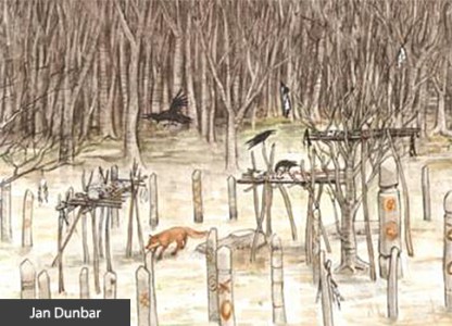
Artist’s impression of what an excarnation platform might look like. By Jan Dunbar. Source: BBC
A number of authors have suggested that collective burial of humans, and in particular the mingling of bones rather than maintaining skeletons as delineated individuals, is an indication of the individual being subsumed into a collective identity, privileging the group identity over the authority or status of any one individual. Of course, these collective burials, whether in monument or cave, are representatives of much larger communities, and the criteria used for selecting one person for burial over another are lost. It is possible that in order to transform an individual into a representative of the community, a two-stage process was undertaken whereby an individual is excarnated or buried elsewhere, and then moved to a collective burial site, a transformative process during which the individual member of the community loses their individuality and becomes representative of a communal and ancestral link between the past and the present. With the addition of each new individual to the cemetery, another layer of communal meaning was added to the cave, reinforcing the message that the existing burials already encapsulated.
In the contrast between the brightness of the light-coloured limestone reflecting in the sun, and the darkness of the hidden, secret interior there is a resemblance between the relationship between the visually striking chambered tomb and the sepulchre within. Not forgetting, of course, that there is an enormous cairn on top of the hill, just 43m (141ft) away from the cave, which may in itself have been a marker rather than a grave. The cairn is discussed in part 3.
Final Comments
Neolithic stone implements found in and near Gop Cave. Source: Davies 1949, p.283
Gop Cave is often left out of accounts of the Neolithic in Wales, or merely mentioned in passing, which is surprising given both the number of its human occupants and the unusual combination of artefacts found within the cave. Cave burials are given secondary status to monumental constructions, but given the number of them in Wales, it is good to see that they are now being researched as valid contributors to the corpus of knowledge about the Neolithic both in Wales and the rest of Britain.
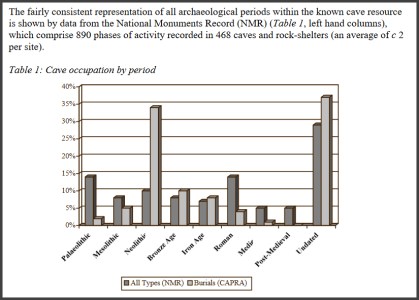
Graph from Jonathan Last showing the usage of caves at different periods in England (The Archaeology of English Caves and Rock-Shelters: A Strategy Document. Centre for Archaeology Report 2003)
Gop Hill in northeast Wales, a few miles southeast of Prestatyn, and just above the village of Trelawnyd (formerly Newmarket from 1710 to 1954) is home to Gop Cave and Gop Cairn, just a few minutes apart from one another. Gop Cairn has the distinction of being the largest man-made prehistoric mound in Wales, and when approached from a distance, its size really is impressive. Although the cairn was investigated in the 19th century, with a vertical shaft sunk from the top to the level of the floor, and a “drift” tunnelled outward from the base of the shaft, no burial chamber or human remains were found.
The south-facing limestone cave was also investigated, producing Pleistocene zoological remains, Mesolithic stone tools and Neolithic human burials and contemporary artefacts and the bones of both domesticated and wild animals. In 1868 Boyd Dawkins excavated pre-glacial animal species such as woolly rhino and steppe bison in the cave deposits, which provided significant data about local ecological conditions. Excavations by T. Allen Glenn in the early 1920s discovered Mesolithic remains on the platform outside the cave. Although this was a small assemblage, it is an important contributor of knowledge about the poorly understood North Wales Mesolithic. The Boyd Dawkins excavations also produced an unusual and very important Neolithic burial chamber. It was found in one of the upper layers, with walls made of layers of stone containing at least 14 burials. Pottery and stone tools found with them were sufficiently distinctive to provide a chronological range, placing the burials within the Neolithic period. Excavations conducted by John H. Morris and T.A. Glenn between 1908 and 1914 found another six burials in a previously undiscovered passageway, including two children as well as a Neolithic axe-head from the nearby Graig Lywyd axe factory and are considered to lie within the same date range as those found by Boyd Dawkins, taking the total count of individuals found up to 20. It did not take a great leap of imagination to speculate that the Neolithic date for the cave could suggest a similar date for the cairn, although this remains unverified.
Over three posts, the Gop Hill sites are described and the work carried out summarized. This post, Part 1, looks at the 19th century excavation of Gop Cave by Sir William Boyd Dawkins, a really rather remarkable early investigator of prehistoric habitats and fauna as well as archaeological remains. Visiting details are provided towards the end of Part 1, after which there is a list of references. Part 2 looks in detail at the Neolithic burial within the cave, and part 3 looks at the cairn.
Sir William Boyd Dawkins, excavating 1886-1887
When I was working in caves with archaeological deposits in the mid- to late-1980s, 100 years after William Boyd Dawkins was excavating at Gop Cave, he was a very well-known name, and a respected one. It is easy to be frustrated with the quality of the work carried out in those early investigations, some of which were far from systematic, and caves have some particular quirks of their own to contend with, but a few of these early investigators were impressive and Sir William Boyd Dawkins was one of them.
Born near Welshpool in 1837 Sir Wiliam Boyd Dawkins (1837-1929), developed a keen interest as a child in collecting fossils.His initial field of interest was primarily geology, natural history and palaeontology, all of which have in common with archaeology a focus on stratified sequences and the relative positioning of fossils, bones and objects within those sequences. Just as early archaeologists were interested in building up sequences of artefacts so that they could understand how human technology developed, early palaeontologists were interested in the developmental sequence of prehistoric animal and plant species. In 1860 he graduated in Natural Sciences and Classics from Oxford and in 1861 he was appointed to the Geological Survey of Great Britain. Fortunately, because Sir William found many archaeological remains during his investigations, he treated these more recent discoveries with equal interest and respect. His earliest archaeological excavations were at Wookey Hole in Somerset where he discovered some of the first evidence of Palaeolithic (Old Stone Age) occupation. These discoveries helped him to develop methodologies for excavating cave sites and to build up a good understanding of the type of environmental and human data that he was likely to encounter within particular geological and geomorphological contexts. He wrote a number of important articles about extinct sub-species of rhinoceros that had once inhabited Britain. He became the first President of the Lancashire and Cheshire Antiquarian Society and President of the Cambrian Archaeological Association. He excavated at a number of cave sites in north Wales, and his 1874 book “Cave Hunting: researches on the evidence of caves respecting the early inhabitants of Europe” became a classic.
The four phases of Gop Cave deposits
Figure 5 from Boyd Dawkins 1901, p.327 (the cavity marked as B was the Neolithic burial chamber)
When Boyd Dawkins first encountered Gop Cave, it was full to the brim with glacial, post-glacial and more recent debris and rock fall:
While the cairn was being explored my attention was attracted to a fox-earth at the base of a low scarp of limestone 141 feet to the south-west of the cairn. It occupied a position which I have almost invariably found to indicate the presence of a cavern used by foxes, badgers, and rabbits as a place for shelter. I therefore resolved to explore this, with the assistance of Mr. P. G. Pochin. The fox-earth led us into a cave completely blocked up at the entrance by earth and stones and large masses of limestone, which had fallen from the ledge of rock above. This accumulation of debris occupied a space 19 feet in width, and extended along the whole front of the cavern
Nothing loth, he set about clearing it in a top-down methodical way that would allow him to assess the chronological composition of the deposits. It was a remarkable achievement, given the incredibly limited head space and the absence of more than a thin envelope of natural light.
Figure 4 showing the excavations of the cave in horizontal plan, with the sections through the deposits both outside and within the cave. Feature B is the Neolithic burial chamber. Source: Boyd Dawkins 1901, p.325
Boyd Dawkins identified four distinct phases within the cave. These are shown in the table below and discussed beneath. The terms Pleistocene and Holocene used in the table below refer to consecutive periods in the geological timescale. The Pleistocene begins at around c.2.8 million years ago, covering the most recent period of repeated periods of major glaciation to 11,700 years ago, when the last glacier retreated and the planet entered its present inter-glacial phase, the Holocene. The Holocene levels at Gop Cave, which include the 14 burials (thought by Boyd Dawkins to be Bronze Age but now reassigned to the earlier Neolithic), will be discussed in Part 2. Below is a discussion of the Pleistocene levels.
Boyd Dawkins noted that the layers were not as they would have been originally deposited: “They appear to have been washed out of the original hyaena floors by the action of water, and to have been redeposited at a time later than the occupation of the cave by hyaenas.” The presence of stone of non-local origin also argues for different phases of water and glacial activity entering the cave, scouring the deposits and replacing them.
Boy Dawkins identified the Pleistocene fauna from the surviving bones and antlers found in the cave as follows.
Woolly rhino (now designated Coelodonta antiquitatis), cave hyaena (now referred to as Crocuta crocuta , and sometimes Crocuta crocuta spelaea) and Bison priscus (steppe bison) are now extinct. The steppe bison was the species painted in famous Upper Palaeolithic caves like Lascaux in France and Altamira in France. Although Boyd Dawkins identified horse as Equus caballus, if the identification of horse was correct, it would probably have been the wild ancestor of caballus, Equus ferus. Reindeer are no longer found wild in Britain. Of the species on his list, red deer and roe deer and horse are the only wild species that remain in Britain. Boyd Dawkins observed that some of the remains, and particularly the antlers of “the reindeer, bore the teeth marks of hyaenas, and had evidently belonged to animals which had fallen victims to those bone-eating carnivores.”
20th Century Excavations
Glenn’s fold-out plan of the 1912 excavations. Source: Davies 1949
Further excavations took place during the earlier part of the 20th Century, contributing more information.
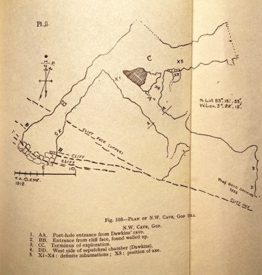
Between 1908 and 1914 John H. Morris and T. Allen Glenn investigated the northwest passage of the cave system, sometimes. This was missed by Boyd Dawkins because it was hidden behind a blockage of clay and stalagmite. This passage produced an additional six skeletons, two of which were children. Glenn describes an excavation “carried out with extreme care and by modern methods” but says that due to burrowing animals there was no recognizable stratification byond determining Pleistocene and Neolithic levels. The floor was covered to a depth of between 18 inches and 2ft “with cave earth and pieces of limestone over a hard floor of clay mixed with stalactite fragments and limestone rubble” over bedrock. There is some indication that limestone slabs had been used to build low walls around some of these skeletons. Finds within the cave, at the new entrance and near the cave between 1911 and 1917 were collected by Morris. Neolithic human remains and artefacts were found, and will be discussed in Part 2. Animal remains found were horse, sheep/goat, ox, pig, wolf, fox, bear, lynx, badger, fowl, hare, rabbit, frog, watervole, mole, stoat and fieldmouse. The mixture of Pleistocene and Holocene species suggests that these were highly disturbed layers, probably due to the activity of burrowing animals mentioned by Allen.
The excavations linked the passage in which they were working to the second entrance, the very small opening for which is a little further along the ridge to the west, and shown on the plan at the top of this post. This is sometimes referred to as the North-West Cave, although it is part of the same cave system as the main Gop Cave.
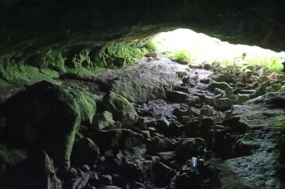
Both cave entrances in the limestone ridge.
T. Allen Glenn returned to the site between 1920 and 1921, funded by the National Museum of Wales. He excavated the platform in front of the cave, which was largely untouched by Boyd Dawkins and found more human and animal remains, as well as Mesolithic stone tools, described below. Glenn wrote up both his own and Morris’s excavations in one 1935 report.
In 1956 William H. Stead excavated at the site and amongst other animal remains found a lion tibia. The reports are in the Proceedings of the Prehistoric Society, nos 23 (1957), 28 (1958) and 29 (1960). Although I have listed them in the bibliography, I don’t have access online via the University of Chester, and the library does not have these volumes on the shelves, so I have been unable to read up on the findings. If I get hold of them (please give me a yell if you have access to them!), I’ll update this section.
Dating the animal remains in the Pleistocene cave
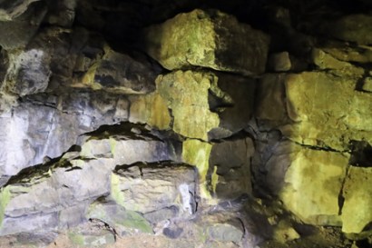
Gop Cairn with the cave entrance visible on the limestone ridge just below.
There were only certain periods when Britain was actually habitable. One reason is that harsh climatic conditions during glacial periods forced most life to leave all but the most southern areas. For example, between c.160,00 and 80, 000 years ago the environment was too hostile for human occupation and for most animals. Another reason is that, after 130,000 years ago the permanent chalk land-bridge between Britain and Europe was destroyed, and after this time Britain and Europe were only connected during glacial periods when the water level dropped sufficiently for land-bridges to be revealed, which enabled animal and human migratory movement. Modern research into the climatic and environmental past has helped to clarify when land bridges between Europe and Britain enabled animals and humans to wander freely. With the final retreat of the ice sheets at around 10,000 BC the land bridges were permanently submerged. De Groote et al explain this very clearly:
Generalised reconstruction of the land surface and the extent of ice sheets of the British Isles. Source: De Groote et al 2017, fig.1 p.3
From the early Pleistocene, Britain was connected to main-land Europe by a land-bridge that enabled humans and fauna to migrate in and out (Fig. 1A). Until about 130,000 years ago, this narrow chalk isthmus, separating the north (North Sea) and southwest (English Channel) marine embayments, kept Britain connected to varying extents even when sea-levels were high during the warm interglacial periods; the eventual complete breaching of this chalk barrier was crucial in forming the island and the Dover Strait. During glacial periods, much of the earth’s water would have been trapped in the ice caps and when, during the later Pleistocene, the bed of the North Sea was exposed, a large land area known as Doggerland, created by geological uplift and sedimentation from rivers, also provided a route into the British Isles and fauna, including hominins, would have entered this way. The flooding of the shallow shelf areas of the English Channel and the North Sea are the consequence of the current high interglacial sea levels.
Even without modern scientific dating methods, reliable time-ranges can be assigned to animal bone assemblages on the basis of which species were found together in a certain place during a certain period. Boyd Dawkins had already assembled a considerable amount of data on the subject, some of which was published in his earlier work Early Man in Britain published in 1880.
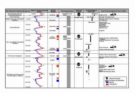
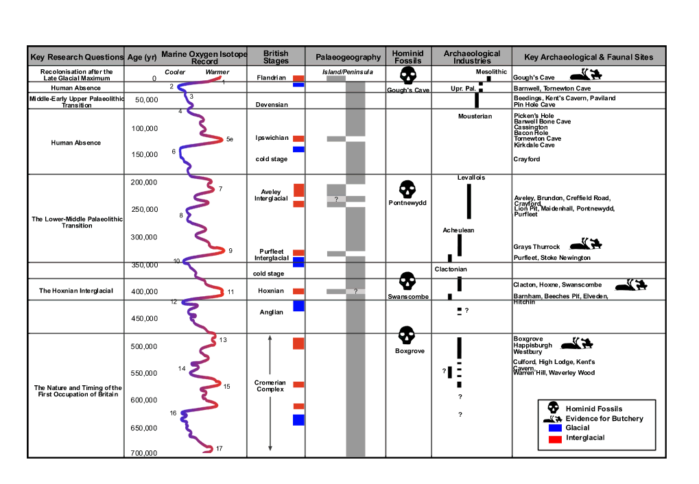
AHOB time chart showing periods of human absence and occupation. Click to enlarge or see original on the AHOB website
Improvements in palaeo-zoology have helped to clarify which species were present during which periods. Some animals that are now either completely extinct or permanently migrated out of Britain provide a latest possible date for their presence. Studies of prehistoric assemblages of fauna have also helped to fix date ranges for the presence of certain species, assigning them to marine isotope stages (also known as oxygen isotope stages). Marine isotope stages measure oxygen isotopes in sea water that is absorbed into the skeletons of tiny single-celled organisms called foraminifera, which are preserved in sediments on the sea floor. The oxygen isotopes contain information about the volume of ice present globally, and therefore provide a record of alternating glacial and interglacial periods. The faunal assemblage corresponds well to MIS 3, which falls into the Middle Palaeolithic archaeological period. Woolly rhino, for example, had left Britain by around 30,000 years ago. The entire assemblage probably puts Gop Cave in Marine isotope stage 3 (MIS 3). MIS 3 lasts from between 60,000 and 25,000 years ago. The conditions were ideal for woolly rhinoceros, horse, bison, hyaena, and reindeer, which inhabited temperate but cold semi-arid steppe-like conditions with often hot summers and very cold winters. Steppes are characterized by wide open treeless grasslands, with small shrubs, ideal for grazing species, and for carnivores preying on the grass-loving herbivores.
Even though the idea of woolly rhino, bison and hyaena roaming the hills of north Wales, all of them now extinct, may seem distinctly exotic, these time ranges are not particularly early for Britain. Not far away, near St Asaph, the cave site of Pontnewydd produced stone tools and human remains in association with animal species for which sound scientific dates were obtained during modern excavations. The human remains found in association with stone tools belonged to the branch of hominin known as Neanderthal (Homo neanderthalensis, named for the type site in the Neander Valley in Germany) and the dates cluster around 225,000 years ago. If correct, the Gop Cave date ranges are relatively recent by comparison.
Although MIS 3 corresponds to periods of human occupation in Britain during the Middle Palaeolithic there was no human habitation identified within the Pleistocene levels of the cave. Boyd Dawkins was experienced at identifying human artefacts and would almost certainly have recognized them had any been there to be found. a number of brief occupations of the country, Britain would have been occupied intermittently during this time, depending on the environmental conditions, and probably only by small groups. The most probably candidate for any humans dodging lions and woolly rhinos and competing with hyaenas for dining on deer, may have been Homo Neanderthalensis (Neanderthals). The oldest Neanderthal find in Britain was from Swanscombe in Kent, where a skull dates to c.400,000 years ago, a warm interglacial period. Neanderthals left and re-entered Britain numerous times, their movements determined by glacial and interglacial conditions, until around 40,000 years ago when the Neanderthals became extinct.
The Mesolithic
Microliths from Gop Cave, excavated by Glenn in 1920-21. Source: Wainwright 1961
The Mesolithic, corresponding to the geological Holocene, represents settlement during the earliest post-glacial period. Although the site was small, the Gop artefacts are very typical of Mesolithic finds in the area. The stone tools found included 6 microliths (tiny stone tools usually 3cm or less long), a scraper, two other tools of undetermined types, possibly waste flakes, and twenty three microlith and blade cores. A core is the original piece of stone after it has been worked. When microliths, flakes and blades have been struck from it it is discarded, but still bears the marks of the tools that were removed from it. Of the microliths, Geoffrey Wainwright describes two were obliquely blunted, two lanceolate, and four scalene triangles. There was also one broad point retouched on both sides and a section of a bone pin.
Distribution of Mesolithic sites in Wales. Source: Heneb Dyfed
The earliest known Mesolithic site in Wales dates to c.8600 BC (some 10,500 years ago) at The Nab Head in southwest Wales (no.5 on the map to the right). In 2021 a 9000 year old site was found on Castle Hill, off Hylas Lane in Rhuddlan, where over 13,000 stone tools and five decorated stone pebbles were found. Another well known site is at Trwyn Du on Anglesey where a Mesolithic occupation dates to between 8,000- 9,000 years ago, and was preserved beneath Bronze Age burial mound excavated when it was threatened by coastal erosion in 1974 (no.9 on the map).
With the withdrawal of the ice sheets, vegetation re-established itself, and whilst the land-bridge remained in tact, animals once again drifted across the land, with humans in their wake. Once the ice had fully retreated, the land-bridge was submerged and Britain and Ireland became separated both from the continent and from each other. The island was soon occupied by many small groups exploiting inland and coastal resources, hunting, collecting plant resources, fishing and collecting shellfish.
Decorated stone pebble from the Mesolithic deposits at Rhuddlan. Source: Dyfed Archaeology
Warmer and wetter than today, with a deciduous woodland landscape, the environment favoured different wild animal populations from the pre-glacial period, which required different hunting techniques. Particularly characteristic of the Mesolithic toolkit was the microlith, a catch-all term for a large number of varieties of tiny stone artefact that could have been hafted into wood, bone or antler to make arrows, spears, harpoons and scythes. Many Mesolithic communities were located on or near the the seashore. The seashore was a movable feast at this time as a) the ice continued to melt, raising sea levels, and b) land, which had been compressed under the pressure of the ice, began to rise. The exploitation of marine resources included both fish and shellfish. It was these settlers who, stranded on an island when the land-bridge was lost, were sufficiently stable and persistent to contribute to modern DNA.
Although permanent amelioration of the climate provided the ability to develop new patterns of living eventually lead to the expansion of populations and the modification of landscape, sites are difficult to locate, some were submerged during rising sea levels, and many are often highly disturbed, meaning that the period is still poorly understood. Each new site therefore contributes important data to the overall picture, and Gop Cave contributes information about where such sites were to be found in north Wales and what sort of activities were pursued.
The location of the finds today
Neolithic stone implements found in and near Gop Cave. Source: Davies 1949, p.283
Davies, writing in 1949, says that most of the animal and human bones from the Dawkins excavations were stored at the pigeon house belonging to Gop Farm, but that some of these were sold in around 1912 to an archaeologist in Wrexham. Davies himself saw “great quantities of bone” in the pigeon house in 1913 but in the same year, although T. Allen Glenn, who had excavated at the cave, had received permission from the estate manager to remove the archaeological remains, the tenant threw all of it “down an open mine-shaft nearby.” He goes on: “In a letter dated, ‘The Manchester museum, The University, Nov.19, 1937,’ the keeper, Mr. R.U. Sayce, M.A., supplied the information that there were in the museum several of the remains from the cave; they included animal bones, human skulls, and limb bones; also some sherds of Neolithic ‘B’ pottery. The long flint implement and the Kimmeridge clay links have not been traced.” The pottery, the flint implement and the Kimmeridge objects relate to the cairn and will be discussed in part 2. Davies also says that the finds from the objects retained by Morris at his home in Rhyl (where Davies was able to inspect them) were bequeathed to the National Museum of Wales. Those from the subsequent Glenn excavations in 1920-21 were also deposited in the National Museum of Wales, who had funded Glenn’s work.
Although there were no human remains in the Pleistocene levels of Gop Cave, the faunal remains provide a fascinating insight of their own into the environmental conditions of north Wales, suggesting that a steppe environment prevailed, possibly at some stage between 60,000 and 30,000 years ago. Understanding of the palaeozoology, palaeoecoloy and archaeology of the Pleistocene are all dependent on the work of palaeanthropologists, geologists, geomorphologists and climatologists, and many other specialists, all contributing very specialized research about how and when animals and humans would have been able to migrate to and from what is today an island.
The Mesolithic remains are the earliest evidence of human settlement in the immediate vicinity of the cave. Although they represent a small group of people probably passing through, with no signs of seasonal returns to the site, this helps to contribute to the fragmentary picture of what was happening in Wales in the post-glacial period. Both tools and tool cores were found, suggesting that tools were manufactured during the short stay at the site.
Visiting Details
When packing your rucksack or stuffing your pockets, do be sure to take a torch with a good, strong beam, and wear some solid footwear that will cope both with slippery mud and some very irregular stones and sharp rocks underfoot in the cave itself. Caves are nearly always dripping with water, so unless it has been a very dry period, you may want to have a waterproof ready to drag on. You cannot stand upright in the entrance of the cave, so you enter bent over, but it does open out so that you can explore some of the cave upright. It is a good idea to get a sense of the internal plan before you go, because the dark is very disorientating and it is quite difficult to make out what is where.
The village of Trelawnyd showing the locations of the car park (red rectangle), and the small lane that leads to the footpath (red arrow). Click to expand. Courtesy Apple Maps.
Gop Cave is a short walk from the village of Trelawnyd on the A5151 (itself a short drive from junction 31 on the A55). It is a two-for-one scenario, as immediately above Gop Cave and only a minute or two away, and visible for miles around, is Gop Cairn. I forgot to to take a What3Words reading for the cave, but the cairn is at ///searcher.sprint.wins, Both are on public footpaths and are free of charge to access. There is a car park on the little High Street in Trelawnyd, just off the A5151, or there is a limited amount of on-street parking a bit closer to the start of the small lane that leads to the footpath on the hillside, just up the slope from the car park. The footpath is clearly marked, as shown in the photograph below.
The first part of the footpath is a small lane that takes you past a couple of houses, until it reaches a narrow path that makes its way along the side of a tall garden fence to your right. This turns abruptly right and slightly uphill, leading to a low stone-built stile which takes you on to the hillside. I was with Helen Anderson (well-known on Twitter as @Helenus_) and we were busy nattering and wild-flower spotting (complete with wild orchids) so weren’t paying too much attention to the pathway markers, but they are there if you keep an eye open.
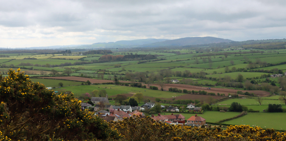
We followed the well-worn track, which leads at this time of year, late April / early May, through bright yellow gorse until it opens onto higher ground, which is completely open, with stunning views over the surrounding valley to Iron Age hillforts on the Clwydian range and to the sea to the west. You need to turn left beneath a shallow pale grey limestone ridge to reach the main cave entrance. A very tiny secondary entrance is a little further along. Retrace your steps to go up to the cairn, through a gate in a drystone wall. For anyone wanting to stop for a breather, there’s a bench near the gate, somewhat bizarrely looking like an escapee from a Victorian arcade or promenade.
Moel Hiraddug
Although the walk is slightly steep for a short section, it is a mellow walk, and far from strenuous and there are some great views across the valley. It took perhaps 10 minutes from the road to the cave, 15 minutes maximum, and another five minutes or so from the cave to the cairn. The cave itself requires you to duck down and be very careful both to watch your footing on a very uneven and rocky surface, and to mind your head. Best to leave your rucksack outside after liberating your torch.
If you are interested in the Iron Age heritage of the Clwydian Range, Moel Hiraddug is beautifully clear to the southwest, and other hillforts of the Clwydian Range, fading into the distance when we were there, are easily visible on a clear day,
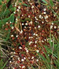
The wildflowers were an added bonus, with a classical karst mix of tiny hardy species clinging to the almost non-existent topsoil above the limestone bedrock, including some really pretty succulents and lichens. The Early Purple Orchids (Orchis mascula) were a particular bonus, and apparently fairly common in early spring in the general area. As well as the miniature slipper-orchid shaped flowers clustering at the top of the stems, their long pointed green leaves often have dark aubergine-coloured spots along them. Read more about them on the Woodland Trust website.
Having visited, there’s the option of a very good lunch at The Crown Inn in Trelawnyd, which was filling up rapidly during our visit. After lunch we went on to see the gorgeous Dyserth waterfall only a few miles away, which is very close to the road (a 50p honesty fee was required for access), and then went on to visit the small but fascinating Prestatyn Roman bath-house, which was again nearby. I have posted about the bath-house here.
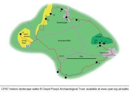
If you want to incorporate Gop Hill into a much longer walk (4-7 hours over 5miles / 10.5 kilometers) the Clwyd and Powys Archaeologial Trust has published what looks like an excellent one: https://www.cpat.org.uk/walks/gopcairn.pdf
Sources for parts 1 – 3
Books and Papers
N.B. The reports by Stead and Bridgewood in theProceedings of the Prehistoric Society are highlighted in green because although they are the record of the 1950s excavations, I have been unable to get access to them so I have not actually used them in this post. I have included them for the sake of completeness. If you do have access to them and don’t mind scanning them, I’d be really grateful so that I can add them to the post!
Barton, Nicholas 1997. Stone Age Britain. English Heritage / B.T, Batsford.
Brady, James E. and Wendy Ashmore 1999. Mountains, Caves and Water: Ideational Landscapes of the Ancient Maya. In (eds.) Wendy Ashmore and A. Bernard Knapp. Archaeologies of Landscape. Contemporary Perspectives. Blackwell Publishers.,. p.124-145
Britnell, William J. 1991. The Neolithic. In (eds.) John Manley, Stephen Grenter and Fiona Gale. The Archaeology of Clwyd, 9.55-64
Brown, Ian. 2004. Discovering a Welsh Landscape. Archaeology in the Clwydian Range. Windgather Press
Burrow, Steve. 2011. Shadowland. Wales 3000-1500BC. Oxbow / National Museum of Wales
Crumley, Carole, L. 1999. Sacred Landscapes: Constructed and Conceptualized. In (eds.) Wendy Ashmore and A. Bernard Knapp. Archaeologies of Landscape. Contemporary Perspectives. Blackwell Publishers., p.269-276
Davies, Ellis. 1925. Hut circles and ossiferous cave on Gop Farm, Gwaunysgor, Flintshire. Archaeologia Cambrensis, 7th series, vol.5, p.436-438
Davies, Ellis 1949. The Prehistoric and Roman Remains of Flintshire with a Short Appendix to “The Prehistoric and Roman Remains of Denbighshire” (1929). Cardiff
Lynch, Frances 2000. The Earlier Neolithic. In (eds) Frances Lynch and Stephen Aldhous-Green. Prehistoric Wales, Sutton Publishing, p.42-78
Marsolier-Kergoat M-C, Palacio P, Berthonaud V, Maksud F, Stafford T, Bégouën R, et al. 2015. Hunting the Extinct Steppe Bison (Bison priscus) Mitochondrial Genome in the Trois-Frères Paleolithic Painted Cave. PLoS ONE 10(6) https://journals.plos.org/plosone/article?id=10.1371%2Fjournal.pone.0128267
Parker-Person, Mike 1999, 2000. The Archaeology of Death and Burial. Texas A&M University Press
Ray, Keith and Julian Thomas. 2018. Neolithic Britain. The Transformation of Social Worlds. Oxford University Press
Schulting, Rick J. 2007. Non-monumental burial in Britain: a (largely) cavernous view. In L. Larsson,
F. Lüth and T. Terberger (eds), Non-megalithic Practices in the Baltic: New methods and
research into the development of Stone Age society, 581–603. Bericht der Römisch-
Germanischen Kommission 88, Schwerin
Schulting, Rick J 2020. Claddedigaethau mewn ogofâu: Mesolithic to Romano-British human remains (mainly) from the caves of Wales. Proceedings of the University of Bristol Spelaeological Society, 28 (2), p.185-219
Shanks, Michael and Christopher Tilley 1982. Ideology, symbolic power and ritual communication: a reinterpretation of Neolithic mortuary practices. In (ed.) Ian Hodder, Symbolic and Structural Archaeology. Cambridge University Press, p.129-50
Sheriden, Alison 2012. The jet belt slider, Movers Lane. In E. Stafford, D. Goodburn and M. Bates, Landscape and Prehistory of the East London Wetlands. Investigations Along the A13 DBFO Roadscheme, Tower Hamlets, Newham and Barking and Dagenham, 2000–2003, 192–202. Oxford: Oxford Archaeology (Monograph 17)
Sheriden, J.A. and Davis, M. 1998. The Welsh Jest Set in Prehistory: A case of keeping up with the Joneses? In (eds.) Gibson, Alex and Derek Simpson. Prehistoric Ritual and Religion. Sutton Publishing, p.148-162.
Stead, W.H., and Bridgewood, R., 1957. Gop Cave, Newmarket and Nant-y-fuach, Dyserth, Flintshire, Proceedings of the Prehistoric Society, 23, p.228
Stead, W.H., and Bridgewood, R., 1958. Gop Cave, Newmarket and Nant-y-fuach, Dyserth, Flintshire, Proceedings of the Prehistoric Society, 24, p.219
Stead, W.H., and Bridgewood, R., 1959. Gop Cave, Newmarket and Nant-y-fuach, Dyserth, Flintshire, Proceedings of the Prehistoric Society, 25, p.280
Tilley, Christopher 2004. The Materiality of Stone: Explorations in Landscape Phenomenology: 1. Berg
Westbury, Michael V. et al. 2020. Hyena paleogenomes reveal a complex evolutionary history of cross-continental gene flow between spotted and cave hyena. Science. Vol.6, No.11. https://www.science.org/doi/10.1126/sciadv.aay0456
White, Mark J. and Paul B. Pettitt 2011. The British Late Middle Palaeolithic: An Interpretative Synthesis of Neanderthal Occupation at the Northwest Edge of the Pleistocene World. Journal of World Prehistory 24, p.25-97
Wymer, John. (ed.) 1977. Gazetteer of Mesolithic Sites in England and Wales. CBA Research Report no.20. GeoAbstracts and The Council for British Archaeology.
A Maritime Archaeological Research Agenda for England
The Mesolithic. By Martin Bell and Graeme Warren with Hannah Cobb, Simon Fitch, Antony J Long, Garry Momber, Rick J Schulting, Penny Spikins, and Fraser Sturt https://researchframeworks.org/maritime/the-mesolithic/
Fieldwalking in Churton, supervised by Phllip Miles in 2006.
With many thanks to my friend Helen, who is shown second from the left in the very blurred image at the top of this 2006 article, for sending me a copy of this. Phillip Miles , for the Chester Archaeological Society, supervised a field-walking expedition to two of the fields behind Churton, just north of Farndon, and made some very significant discoveries.
Aerial survey and metal detecting had already identified some interesting features in the fields above and to the east of the River Dee (see photos below), thought to belong to Neolithic, Bronze Age and Romano-British periods. The fieldwork, carried out with permission from the landowner, confirmed that the land has a lot more prehistoric data to offer.
Although the Late Neolithic and Early Bronze Age in northeast Wales and the borders along the Dee are most noticeably represented in the landscape by burial and ceremonial monuments, the narrative of everyday working life in prehistory is embedded in the surface scatters of stone tools that remain in fields and on hillsides. These were the tools that people used every day in their subsistence strategies, and are the intimate toolkits of their livelihoods.
The analysis of the findings was underway at the time of the article, so no findings were reported, and it will be interesting to follow up on this to see what was concluded (if the analysis was published). It was also suggested in the article that there could be scope for future work in Churton, although it is unclear at the moment if this took place.
Possible Neolithic enclosure in the fields behind Churton
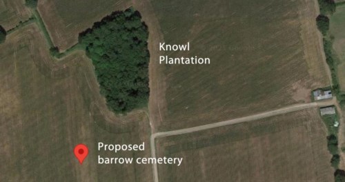
Possible barrow cemetery near Knowl Plantation to the west of Churton
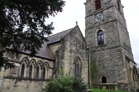
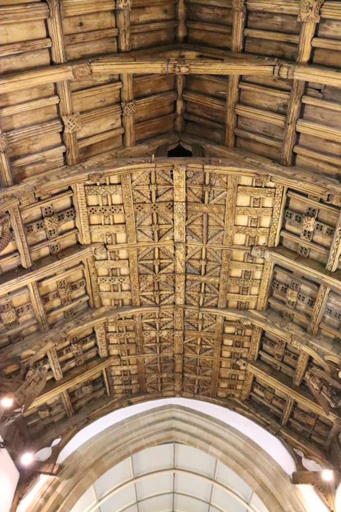
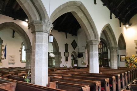
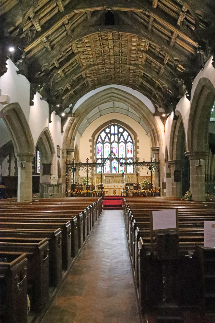
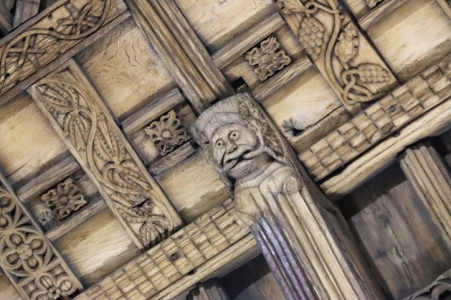
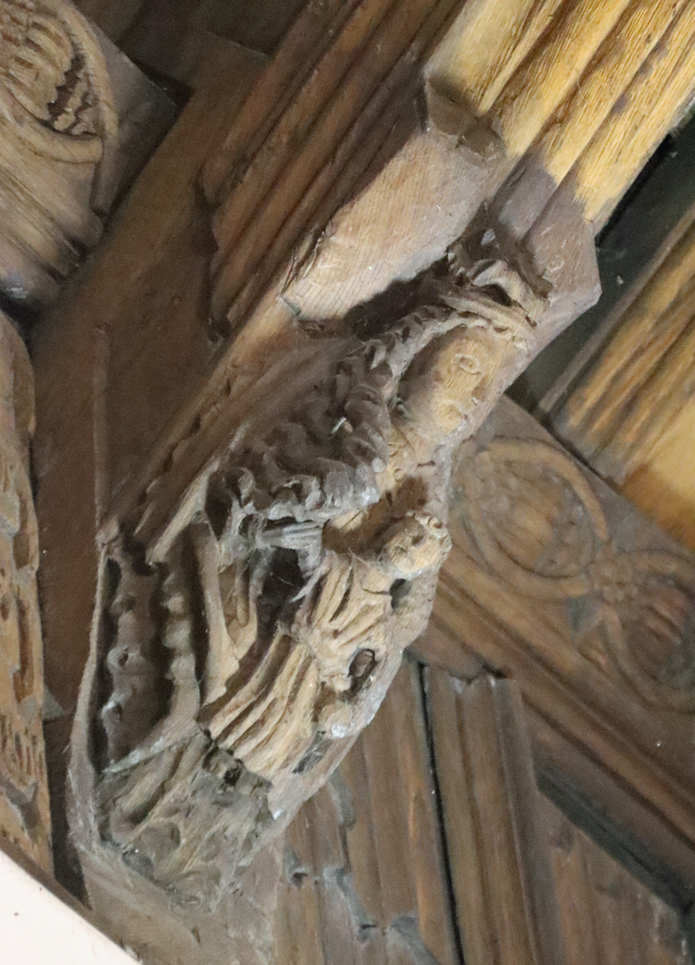
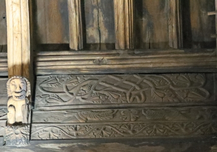
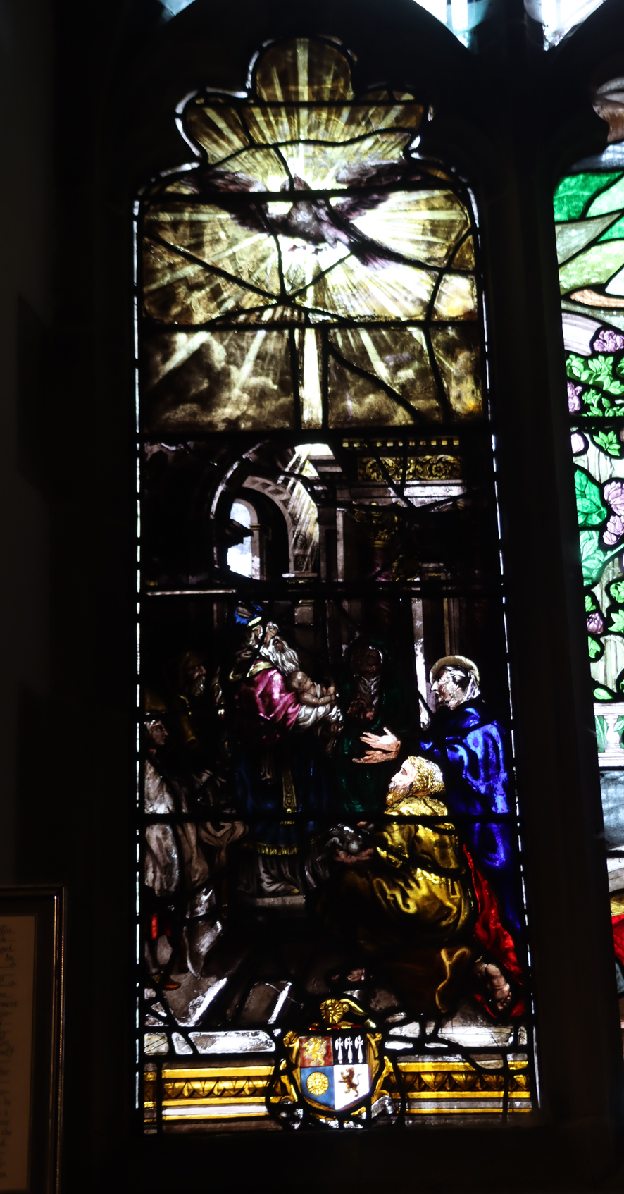
The Chester Archaeological Society 2024 season of excursions started excellently today with the CAS visit to the Church of St Collen, who gave his name to Llangollen. It is the only church in Wales to have taken the saint’s name. Like most Medieval churches in Wales, St Collen’s has undergone considerable alterations, including an 18thcentury tower and a 19th century chancel, vestry and south nave, but there are some very fine 13th century features to be seen, in the Perpendicular Gothic style, including an impressive shrine canopy and mason’s marks. There are also intriguing signs that a Lady Chapel was once incorporated into north aisle. The most remarkable feature of the church is a really superb hammerbeam roof bedecked with ornamental sculptures, both religious and secular, from the early 16th century.
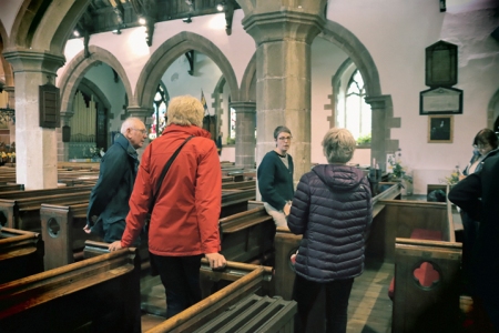
Today, to ensure the survival of the church as a living and breathing community asset, it is undergoing extensive but very sympathetic re-forming. Suzanne Evans is the Project Manager of this massive task, and was our superb guide today. Suzanne described how the reinvented church will be fully inclusive, not only of the existing congregation who are much-attached to the church, but of the wider community as well, taking into account the needs of those currently unable to make the most of what St Collen’s has to offer. At the same time, the exciting opportunity will be taken to investigate as much of the church’s architectural and funerary history as possible, adding to the community’s understanding of this important contributor to the town’s impressive ecclesiastical heritage.
Suzanne guided us around both the key features and recent discoveries, explaining all the steps to be taken in the upcoming weeks and years. As well as replacement glass doors and the opening up of the nave to enable the interior to be visible by passers-by, there will be new lighting, heating, kitchen and toilet facilities, as well as a large stage, which will all contribute to enhancing the value of the space and improving the visibility of the superb architecture. All archaeological and architectural discoveries will be professionally recorded and published.
After a very welcome cup of tea, there was a round of applause as we thanked both Suzanne for being our terrific guide and Pauline for making all the arrangements. It was great to meet some of the other CAS members, and to hear all the questions and observations. There was a lot of information sharing, which is exactly what one expects of CAS members. What a great start to the year’s excursions! Many thanks again Suzanne and Pauline.
Whilst looking for something else, I stumbled across the following page on the Cambrian Archaeological Association website, which has some impressive videos from the Darganfod-Discovery Conference 2021, some of which are relevant to North Wales and the Marches. https://cambrians.org.uk/talks/darganfod-discovery-2021-talks/
Presentations from Darganfod-Discovery 2021 – a day dedicated to fascinating recent work on the archaeology of Wales and the Marches, held in conjunction with Cardiff University on 10th April 2021. This online conference is the first of a new series that showcases work supported by the Cambrian Archaeological Association Research Fund as well as providing an opportunity for early career academic and independent researchers to present research on Wales and the Marches.
Lectures on the above page include:
Prof Gary Lock of Kellogg College, Oxfor
‘Moel y Gaer, Bodfari, a small hillfort in the Clwydians, Denbighshire’. (CAA Research Fund project)
Eirini Konstantinidi, PhD researcher at Cardiff University
‘If the dead could talk: a taphonomic approach to Neolithic mortuary treatment in the caves of Wales’.
Adelle Bricking, PhD researcher at Cardiff University
‘Life and death in Iron Age Wales: preliminary results from histological and stable isotope analysis from Dinorben and RAF St Athan’. (CAA Research Fund project)
Dr Rachel Swallow, Honorary Research Fellow at University of Liverpool
‘A square peg in a round hole: new interpretations for the eleventh-century northern Anglo-Welsh border, as told by the misfit Dodleston Castle in Cheshire’.
There are other great lectures too, but those listed above are specific to north Wales and Cheshire.
Whether the visitor is an adult or a child, the prehistoric copper mine on the Great Orme’s Head next to Llandudno in northwest Wales is one of the best days out in Wales, and not only for those with a love of prehistory. A visit carries with it a real sense of adventure and discovery, and it is an almost unique experience.
The Great Orme mines, which became one of the most successful mining operations in Bronze Age Britain, were worked at the mine-face by both adults and children. Metallurgy revolutionized many aspects of industry and society in later prehistory before the arrival of the Romans. As the use of bronze (a mixture of copper and tin) spread throughout Britain and Europe the Great Orme became part of a European network of metal distribution. Objects made with raw materials from the site were found not merely in Britain but as far away as the Netherlands, Sweden, Poland and France, indicating how important this supply of copper became be when combined with tin from southwest England to make bronze.
Some prehistoric copper mines in Britain have only been recognized in the last few decades, partly because they were worked in more recent times, disguising earlier mining operations, and partly because they do not stand out as obviously as other archaeological sites. By contrast, the most familiar Bronze Age sites in north Wales are those that stand out clearly in the landscape, including round barrows (earth mounds) and cairns (stone mounds) in their 100s. Stone circles, stone rows and menhirs (standing stones) are also found, and occasionally a lucky find will produce a settlement site. Thanks to a number of research projects, four major concentrations of copper mines have now been identified, one of which is in Ireland, two of which are in Wales, and one in northwest England. These are now adding to the body of data not merely about copper mining but about the Bronze Age as a whole. Many are still the subject of ongoing investigation.
The Great Orme. Llandudno is clearly visible where the Great Orme begins, forming a crescent, the end of which is marked by the Little Orme to the east. On the right, heading west, is the opening of the river Conwy. By Jay-Jerry. Source: Wikimedia Commons, CC_2.0_Generic.
The Great Orme mining enterprise, which operated from around 1700-900BC (Early Bronze Age to Early Iron Age), was at its busiest for a period of over 200 years between 1600 and 1400 BC (c.3600 to 3400 years ago). In order to sustain itself for that long, the mines required, as an absolute minimum: a) a food-producing economy that could sustain a large group of miners on a permanent or semi-permanent basis, b) the knowledge, technical ability, and labour to tunnel through limestone, c) the technical ability and skills to process the ore, d) a long-term supply of wood for fire-setting and furnaces, e) a market for its products, and f) the development of long-distance connections to acquire the tin that was needed to make bronze and to distribute the finished product to its purchasers. There was also certainly a requirement amongst the miners and smelters, just as there were amongst other members of society, to address their religious needs and their sense of identity. These issues will all be touched on briefly below.
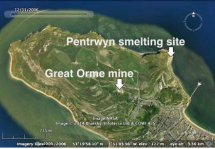
Location of the Great Orme’s Head. Courtesy Google Maps
This post will cover the following topics, all very briefly
Vital Statistics
The earliest British copper mining
Discovery and excavation at the Great Orme
Why copper and bronze?
The geological source of the Great Orme copper
Mining the ore
Processing the ore
Manufacture of copper and bronze tools
The development of the Great Orme Copper mines over time
The miners of the Great Orme
The copper and bronze trade in Britain
The end of Bronze Age copper mining in Britain
Final comments
Visiting
Sources
Some of the vital statistics
Part of the opencast mines and, at the base of the steps, access into the tunnels of the underground mines
The vital statistics for the Great Orme copper mines are sufficiently eye-popping to give a sense of how remarkable the mines were during the 500 years in which they were operational. Bearing in mind that they are still under investigation, and will be for years to come, the following figures, summarized by Steve Burrow of the National Museum of Wales in 2011, are merely guidelines, as they will have shifted upwards since then. Burrow refers to the development of the bronze industry out of the beginnings of the copper industry “the first Industrial revolution,” and when you consider the figures for the Great Orme alone you can see why this claim can be made, as they represent a considerable demand for a new product.
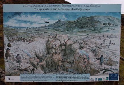
The opencast mines were dug from above, top-down, rather than horizontally through tunnels. This left great upright remnants of hard rock behind, now rather eerily resembling some devastated dystopian city. The soft rock could be removed with simple bone picks and hand-held hammers and it is estimated that using this tools the mine eventually covered an area 55m long, 23m wide and 8m deep. It has been estimated that 28,000 tonnes of rock had been removed from it, in order to gather the copper ore it contained, before it was exhausted.
A simplified plan of the mines in 1992, before further investigations took place. Source: Burrow 2011, p.86
In the underground mines where miners tunnelled through the rock horizontally following seams of ore, 6.5km of tunnels had been investigated by 2011, with 8-10km more anticipated, and it had been discovered that the mines reached a depth of 70m over 9 separate levels. An estimated 12,600 tonnes of ore-bearing rock were removed from them (on top of that removed from the opencast mines). The illustration on the right provides an impression of how the mines were understood in 1992 and although this picture has been considerably expanded in the last 32 years, it demonstrates very nicely how the vertical shafts and horizontal tunnels were connected and how ambitious the tunneling was.
Of the tools found, over 33,00 either whole or fragmentary bone objects were found, used as picks and shovels, and over 2400 stone hand-hammers and mauls were discovered, some of which can be seen on display at the site in the Archaeology Store. The smallest of these could be hand-held, but the largest at over 20kg would have to have been incorporated into some sort of swinging device in order to smack it into the rock. See below for details of these and other tools.
The magnificence of these numbers becomes entirely plausible on a visit to the mine when something of the extent of both opencast and underground mining operations can be experienced in person.
The earliest British copper mining
Neal Johnson’s useful visual timeline of the Early Metal Age, showing how bringing together excavated data can help archaeologists to understand when and how technological, economic and social changes occurred. Source: Neal Johnson 2017, p.7, fig.2 (in Sources at the end of Part 1). Click to enlarge and read clearly.
In the 19th century Three Age system, the Stone Age is followed by the Bronze Age, which is followed in turn by the Iron Age. The Three-Age System was devised in 1836 by Christian Thomsen, Danish archaeologist and curator of the National Museum of Denmark who developed the scheme for his guidebook to the museum’s archaeology collection. The scheme was very influential, and Thomsen can be commended for attempting to make chronological sense of an archaeological record that had was poorly understood at this time. Although these are now recognized as very crude categorizations, which exclude certain vital components of material data, they continue to be used and do represent the basic chronological truth that for hundreds of thousands of years utilitarian tools were made of stone and only then, in quick succession, by copper, bronze and iron.
Richard Bradley’s dating of the Chalcolithic and Bronze Age
In more recent systems, a Copper Age, or Chalcolithic, is inserted between the Neolithic (New Stone Age) and the Early Bronze Age and as Neal Johnson’s helpful timeline above shows, a far more nuanced understanding of this period of prehistory is now possible, incorporating pottery and the soft metals gold and silver. There has also been a shift away from materials and objects towards understanding the people and the behaviours that they they help to represent. The Bronze Age itself has been subdivided into three main phases, which reflects social and economic differences as well as changes in raw material usage and tool types. Richard Bradley assigns the dates shown in the table to the right, above, to the various sub-periods of the Bronze Age, and in regional schemes these can be modified to suit local findings.
The Moel Arthur axehead hoard. Source: Frances Lynch, The Later Neolithic and Earlier Bronze Age in Prehistoric Wales, p. 101, figure 3.7
Copper mining was introduced from Europe. Two possible sources are viable for its arrival in Ireland and England. One is central Europe which was a major early producer, and the other is the Atlantic coast, with Iberia a plausible source of copper working to Killarney in southwest Ireland, where the earliest Irish and Britsh mines are found. The early Ross Island copper mine was in use from around 2400BC, and is the earliest of the Irish and British copper mines, whilst Mount Gabriel was in use from around 1700BC.
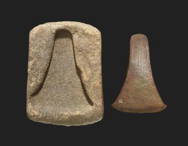
In Wales the earliest copper objects to be found in Britain are axes, but they were not made in Wales. A broken copper axe thought to be from south Gwynedd, and a collection of three copper axes from Moel Arthur are well known examples. On the basis of metallurgical analysis they are thought to have been imported from southwest Ireland. Copper axes were modelled on stone tools but were soon followed by an entirely new form, for which no precedent in stone is known, called a halberd. It is thought that it may have been designed as a weapon, either actual or symbolic, but what is of primary interest here is that the value of copper for inventing new and special designs was being recognized at this time.
Chronology for Bronze Age mines in Britain. Source: Williams and de Veslud, 2019. Click image to enlarge to read more clearly
Dates for the Great Orme extend from c.1900 to 400 BC (Early Bronze age to Early Iron Age) but the main activity took place towards from the middle of the Early Bronze Age until towards the end of the Middle Bronze Age. The phases described by R.Alan Williams in 2019 identify a main period of activity between c.1600 and 1400BC. This “mining boom” peak coincides with the well-known Acton Park phase of metal production, first identified at Acton Park in Wrexham, which will be discussed on a future post. The decline of metal working at Great Orme began to take place between 1400 and 1300 BC. A “twilight period” lasted into the Early Iron Age. Note that that Ross Island had already gone out of use by the time the Great Orme was opened, and that many of the other Early Bronze Age mines in mid-Wales and northwest England were also coming to an end by this time. Some of the Irish mines survived into the Middle Bronze Age, but the Great Orme was he only site to continue into the Late Bronze Age.
Discovery and excavation of the Great Orme mines
Today it is recognized that Welsh copper mines are to be found concentrated in mid- and north Wales, the biggest of which were the Great Orme and Parys (Anglesey) mines, just 20 km apart. Both were exploited for copper during the 18th and 19th centuries, and it is at this time, both in Wales and at Alderley Edge in Cheshire, that the earlier mines were first recognized and recorded when the miners found that their new shafts were colliding with pre-existing ones. Antiquarian interest in some of these much earlier mine shafts resulted in some speculative reports about how old they might be.
In the case of the Great Orme, the first modern excavations took place in 1938-1939when Oliver Davies, an expert on Roman mining in Europe, headed up a committee for The British Association for the Advancement of Science. The remit of the committee was to investigate early metal mining. In mid and north Wales it investigated mines on Parys (Anglesey), Cwmystwyth (Ceredigion), Nantyreira (Gwynedd) and the Great Orme’s Head. Although their attempts to date the mines assumed that they were probably “Celtic” (i.e. more recent than they actually are) the project successfully raised an awareness of prehistoric copper mining in Wales.
Building on this initial research, the amateur archaeologist Duncan James carried out some excavations in the Great Orme area in the 1970s, and was able to obtain an radiocarbon date that indicated a Bronze Age date. In the 1980s Andrew Lewis for the Great Orme Exploration Society and Andrew Dutton for the Gwynedd Archaeological Trust both undertook survey and excavation work that made considerable advances in knowledge about the copper mines. Work by Simon Timberlake and the Early Mines Research Group greatly expanded knowledge of copper mining in the north- and mid-Wales area as a whole. Since the 1980s work has continued to be carried out at the Great Orme and elsewhere, and a number of post-graduate research projects, some of which are available for download on the Research page of the Great Orme official website, have focused on particular aspects of the mines and related topics. Most recently, the important PhD research undertaken by R. Alan Williams at the Great Orme was published by Archaeopress in 2023, and contains the most up to date information.
Why copper and bronze?
Simple stone reduction process from core to tool. Source: Grace 1997
Before the introduction of copper, the main materials for making tools were stone, wood and bone. Whereas these were worked by reduction (knapping pieces of stone off a core or carving wood and bone to make shaped tools), copper was created by melting well-ground malachite using a pestle and mortar until it underwent a process of change, becoming molten. This was poured into a mould to cool and create an object. This is discussed further below. It was not an entirely alien production process, having something in common with kiln-fired pottery, which had been made since the Neolithic, but it was a new approach to tools-making.
Copper was not as strong or resilient as stone, and its primary value was the production of a particularly thin and very sharp blade. Although stone tools could be very sharp, it was impossible to achieve the thin edge of a cast metal. This edge was particularly useful for tree felling and branch cutting, as well as the shaping of wood. Although it would blunt quickly, because the metal was so soft, the blade could be easily sharpened after use. When damaged, it could be recast with other broken objects and used to create new tools. However, because of its softens its uses continued to be limited. In some cases, its value as a prestige item may have exceeded its value as a functional tool.
Group of damaged bronze objects probably originally destined for recycling.
Copper came into its own when blended with 10% tin to make bronze, which represented a new world of possibility and innovation. By lowering the melting point of copper, the addition of tin made copper easier to handle and the resulting bronze was harder and stronger than copper, just as sharp, and less prone to damage. Although the earliest bronze forms copied copper objects, designs soon emerged that represented significant departures from stone and copper antecedents, including adzes, halberds, knives, pins, ornaments and in the later Bronze Age swords and shields. Like copper it could be recast and moulded into new shapes, providing them with a very long-term life cycle that outlived the lives of individual tools, conferring a particular and unique value on metal tools. Where a stone tool would be reworked so many times that it had to be discarded, and a pot once broken could not be safely mended, metal could achieve a form of eternal life. Many of the hoards of broken tools that have been found in Britain were clearly grouped together and retained in order to be recycled in this way, although others were clearly deposited in special locations for more spiritual purposes, perhaps partly because of this unique quality.
Bronze Age stone arrowheads from Merthyr Mawr Warren, Bridgend, Wales. Source: National Museum of Wales
Stone, wood and bone continued to be important in the Bronze Age. Stone tools in particular, became the heavy-duty implements that complemented the new metal equipment. Pestles and mortars continued to have an important role in the processing of cereals, pigments and ores, and small arrowheads continued to have a value in hunting during the Early Bronze Age. Bone was still used for small, thin needles and pins, and wood was still vital for hafting tools of bone and stone. In the longer term, although stone retained a role in many parts of life, copper and bronze took over many of the roles that many organic materials had previous had for the manufacture of tools.
The source of the Great Orme copper
The Great Orme is a grey limestone promontory surrounded on three sides by the sea. It emerges from the main coastline of north Wales at Llandudno, and is the same rock system that sits so dramatically along the western edge of the Clwydian Range above Llangollen. In a paper on the Great Orme research page, Cathy Hollis and Alanna Juerges explain some of the processes that took place to produce the mines on the Great Orme, of which the following summary is a much-simplified version. Go to the above link to see the detailed overview.
The Great Orme limestone is a sedimentary rock formed of the accumulated remains of billions of calcium carbonate-secreting organic sea creatures that died and were laid down with rock salts in warm, shallow tropical seas during the Lower Carboniferous (c.335-330 million years ago). These include shellfish, foraminifera and corals, some of which can be seen as fossils in sections of the limestone on the Great Orme. There are multiple layers of the limestone on the Great Orme, often clearly visible, and each represents different phases of sediments as they were laid down. Around 330 million years ago this deposition of carbonates stopped, and the landmass of which the Great Orme was a part was eventually buried beneath a kilometer of other materials. In the late Carboniferous and early Permian periods, a collision between two shifting tectonic plates lead to folding and uplift of the landscape in north Wales, with faults torn across the Great Orme.
The faults allowed molten rocks, minerals and gases to escape. Amongst these escapees was dolostone, which in some places on the Great Orme altered the character of the limestone, becoming dolomite,or dolomitic limestone. The copper ores for which the miners were searching were found in veins that cross-cut the dolostone, meaning that they formed after it. This formation probably occurred during a new period of tectonic activity that was responsible for the uplift of The Alps and other European landmasses, including the Great Orme. The ores found their way into these new faults, and as this period of tectonic activity ended, and the atmosphere began to cool the molten materials, they slowly solidified where they lay. On the Great Orme, chalcopyrite was the copper ore that had inserted itself into seams of the limestone, and this was oxidized and became malachite. It was the malachite that was used for the manufacture of copper objects. Because much, but by no means all, of the limestone on the Great Orme was dolomitized, this created conditions that were favourable for mining. This new rock was much softer than the parent rock and some of it was highly friable and quite easily removed by bone tools.
The extent of the Devensian ice sheets. Source: Nicholas Flemming 2002
A further relevant process was the geomorphological activity that took place during the last Ice Age, the Devensian. The Irish Sea ice sheet that covered North Wales during the Devensian dragged down the surface of the Great Orme’s Head, scouring it of its upper surfaces as the ice sheet made its relentless way south. When the ice sheets finally retreated at around 11,000 years ago, Wales had been reshaped and re-profiled, and the the copper-bearing seams of the Great Orme had been exposed. The horizontal and vertical cracks in and fissures the limestone were further expanded by the subsequent action of rainwater erosion, groundwater and ice as the rock was subject to continual weathering.
For anyone interested in a full understanding of the geology, there are references at the end of this post in Sources.
Mining the ore
The copper mining process on Mount Gabriel at a similar date, by William O’Brien 1996, p.32 (see Sources at end).
As an industrial process, malachite had to be extracted first and then processed. Malachite is not the only ore that can be used to make copper metalwork and bronze, but is one of the simpler ones to process. As William O’Brien discusses, following his excavations at the Mount Gabriel copper mine in southwest Ireland, this requires prospecting, organizing mining teams, collecting raw materials and applying existing skills for the manufacture of tools to enable the extraction of ore and the specialized conversion of that ore to metal. O’Brien has put some elements of these workstreams into a diagram shown right, which gives a good sense of some of the processes involved (click image to enlarge). Although there are differences at the Great Orme, what this demonstrates very effectively is that there are three connected flows involved. The first, on the left of the diagram, is the collection of raw materials and the preparation and manufacture of tools and equipment. The second is the extraction cycle, and the third, in two stages, is the processing of ore.
Mining tools
The tools left behind in the Great Orme mines were mainly made of bone and stone, but there is evidence in the form of markings in the stone of bronze picks and chisels. Metals were almost certainly recycled rather than abandoned. Pottery was probably used for some tasks, although not much evidence of it is found at the mines, which suggests that other, more lightweight, less fragile and larger forms of carrier were preferred, made of basketry, leather or textile (such as sacking). All organic materials that are vulnerable to decay over time and are only very rarely found on archaeological sites and usually only in exceptional environmental conditions.
By far the greatest number of tools, over 33,000 of whole and fragmentary pieces, were made of bone. Over half of these were cattle bone, and the rest were a mix of sheep, goat, deer and wild boar or pig, mainly ribs, limbs and shoulder blades. The long thin bones were used as picks, whilst the wide-based shoulder blades were used as shovels. Many of them were bright green when they were found, stained by the malachite.
Some of the stone hammers and mauls used in the mines, held today in the archaeological store on the site.
The majority of the stone tool collection is represented by over 2400 vast stone hammers with have been battered into their present shape by usage. At least some of them were thought to have fallen from nearby harder outcrops that were more durable than the softer local sedimentary rocks. Many of these were found on the local beaches, where they had been rolled and rounded. They varied in size from pieces that could be held by hand to enormous “mauls” that could be up to 20lbs in weight and would have been employed using some form of sling so that the stone could be swung into the rock face.
Possible reconstruction of the hafting of a Copa Hill maul from mid Wales showing how it may have been used in a sling. Source: Burrow 2011, p.90
Opencast shaft mining
Helpful artist’s impression from the Great Orme mines of what the opencast mine would have looked like.
The earliest phase of Great Orme mining was opencast mining that took place in the Pyllau valley, as shown in the artist’s reconstruction left, on one of the information boards. The scoured landscape that the retreating ice-sheets had revealed permitted the prospectors to recognize the malachite-rich seams in the limestone, and to access it with relative ease by open cast mining. The techniques was to mine from the top down, removing the soft dolomitic limestone from in between the pieces of harder original limestone, creating the bizarre-looking landscape that remains today. This could be done using picks and shovels manufactured from bone, aided with hand-held hammerstones. A series of ladders, lifts and pulleys were probably required as the mines shafts became deeper, ready for copper processing on the surface. Eventually these stone shafts were exhausted and if the mines were to continue to provide copper, underground mining was the only solution.
Underground tunnel mining
“Deads” in one of the galleries on the tour
Underground mining would have been very hard. Over the centuries eventually nine levels were excavated out of the limestone (of which two are included on the visit).
Some of the tunnels, like most of those shown in this post were tall and thin, allowing people to move down them upright in single-file. Some were significantly smaller, long and thin that could only be mined lying down by the smallest members of society – perhaps women and certainly, given how tiny the passages were, children. Others were opened out into large galleries like caverns, one of which is thought to be the largest surviving prehistoric man-made underground excavation in the world. One of the hollowed out galleries on the visit is filled with what are known as “deads,” the large fragments of waste rock left behind after ore had been extracted. It made more sense to backfill exhausted tunnels and galleries with waste then to remove it laboriously to the surface, where disposal would still have been a problem.
There were three methods of excavating malachite in the underground mines. The first continued to be bone picks for softer rock, the dolomitic limestones, but harder rocks eventually had to be mined as well. Harder rocks were excavated by a combination of fire-setting and stone tools. Stone tools, described above, included hand-held hammers and large mauls that would have been fixed in a sling in order to swing it at the mine face, both requiring the the input of energy and strength in a very difficult environment filled with stone dust and sharp fragments.
Simulation of a fire in one of the narrow shafts that head off horizontally from the bigger tunnels, thankfully without the smoke
Fire-setting added to the discomfort and raised the risk of serious injury. It consists of gathering a large pile of dead wood, which was placed against rock faces to be mined in order to make them more brittle and easier to work. Sometimes water could be added to the hot rock to help with the fragmentation process. The smoke created by the fire in such small spaces with no ventilation carried the risk of suffocating anyone in the vicinity, as well as the possibility of lung disease. Presumably the mines were vacated during this process, but the risk must still have been high for those who set the fires. In the long term, lung damage both from the smoke and the dust and fragments of stone must have been an ongoing problem.
Processing the ore
Cleaning the ore
The site of the ore cleaning site at Ffynnon Rhufeinig. Source: Wager and Ottaway 2018
In order to ensure that few impurities entered the smelting process, and that a good quality copper was obtained, the ore mined from the Great Orme had to be separated from the general waste material around it, called gangue. This stage in copper manufacturing is called beneficiation. When an ore was mined it was still attached to bits of rock and dust, and this had to be removed. This involved grinding, cleaning and sorting. Pestles and mortars were used to grind down the ore, and examples have been found at the Great Orme. Once it had been reduced, the mixture of rock and ore had to be sorted both by hand and eye, and usually by straining through running water. Once the cleaning process had been completed, it might be re-ground into a powder that could then be smelted. On the Great Orme a cleaning site was discovered and excavated at Ffynnon Rhufeinig, a natural spring that was run into a series of channels and ponds. the site was a kilometer away from the mines themselves, and it is suggested that the wider landscape was used during the Early Bronze Age phase of the site for processes connected with the mines, other than mining itself.
Copper smelting
Location of copper smelting site at Pentrwyn, Great Orme. Source: Williams 2014
Once the ore was sorted and cleaned, it underwent a process called smelting. Smelting is a term that refers to an ore being converted to a metal by the application of heat up to and beyond melting point. This took place above ground, and required specialized skills and equipment. So far only one smelting site has been identified at the Great Orme, dating to around 900BC, well after the copper mine’s main period of maximum exploitation, at a location some distance from the mine itself at Pentrwyn on the coast. Copper can be found in a number of different forms, some more difficult to process than others, but the malachite (copper carbonate) at the Great Orme required a relatively simple production methodology.
Display of prehistoric smelting equipment in a shelter on the pathway at the top of the opencast mine at the Great Orme.
After the ore had been cleaned, a furnace had to be built and prepared. The furnace was often formed by a pit with short walls. To this a clay tuyère was fitted, which was a tube that interfaced between the furnace and a pair of bellows. The bellows helped to raise the heat by blowing oxygen to feed the flames. This was an important factor because malachite needs to be between heated to between 1100 and 1200ºC before it will become molten. It runs the risk of mixing with the copper ore to become copper oxide, which cannot be used for metal production, so charcoal was also added into the furnace. The charcoal burns much hotter than wood, so contributed additional aid to the heating process but at the same time releases carbon dioxide as it burns, which helps to neutralize the impact of the oxygen on the ore, enabling it to become copper. The ore was heated in the furnace within a crucible, which is a vessel that will handle the high temperatures required for melting metals. The melted metal was then poured into a mould made of stone, pottery or bronze.
Bronze smelting
Bronze was a transformation of copper and tin into something entirely stronger and more resilient than either. It usually consisted of 90% copper and 10% tin, although later cocktails produced slightly different results. Tin lowers the melting point of copper, making it easier to convert the copper ore to liquid form. There were two methods used at the Great Orme. The first was by combining both copper and tin ore in a single smelting process. The second was adding tin or or to copper that had already been melted. As with copper, the Bronze was then moulded to form different tools and weapons.
The excellent video below shows a copper palstave under construction from the crushing of the ore using a pestle and mortar, via the smelting of the ore, to the moulding of the molten metal to the trimming of the final tool.
The manufacture of metal tools
Copper axe and stone mould from Durham. British Museum WG.2267. Source: British Museum
The earliest casting moulds in which the tools were formed were made of stone, and were open, with no top half. An example of an open stone mould from north Wales was found at Betws y Coed. The making of moulds became in itself a skilled task, creating the exact shape in stone that was required in the finished metal object, and they could create much more complex forms. Later,moulds could be made of clay or bronze. Once the copper or bronze had been poured into the mold and allowed to cool slowly, the object hardened and could be removed from the mould, to be finished by breaking off any excess metal and sharpening the blade. Initially only solid items like flat axes and more complex palstaves (such as the one shown below) were made.
A palstave found at the Little Orme
Two parts of moulds for a palstave were found in three miles from the Great Orme in 2017 by a metal detectorist, shown below
Palstave moulds found near the Great Orme in 2017. Source: BBC News
Soon hollow or socketed objects were made as well, with the use of double-moulds and by inserting cores made of clay or other materials, which created a new way of hafting tools. and as these and the the socketed axe below shows, additional features like functional loops and decorative components could be added if required.
Bronze socketed axe head from Pydew, in the hills above Llandudno Junction, to the southeast of the Great Orme north Wales.
Socketed axe head on a haft, found at Must Farm, Cambridge. Source: Cambridge Archaeological Unit
The copper miners
An opening into one of the tiny shafts that only children would have been small enough to work
The early opencast miners would have been fit enough to undertake physical labour, and the first open cast mining required both knowledge and some basic skills, but once the knowledge was acquired, the rest would have been well within the capability of a farming or herding community. The veins of malachite sandwiched within soft limestone had to be recognized, and a strategy for extracting it and processing it had to be learned, but the ores could be excavated from soft dolomitized limestone using bone picks. The use of bone for tools rather than stone means that although it would have been a laborious task, it was not as back-breaking as tunnelling through solid rock.
This clearly changed. As the mining activities plunged underground and tunnels had to be excavated in the limestone to give access to the malachite, the miners must have been selected for more than merely strength and fitness. As stated above, it is entirely likely that women were employed in the task, being smaller than most men, and it is unquestionable that children were employed to excavate the slender warrens that only such small bodies could excavate and navigate. The community must have been in a position to replace its miners, because this was not merely back-breaking work, but dangerous too.
Damaged vertebra from the skeleton of an 18-year old found in a cave burial on the Little Orme. Source: John Blore 2012.
The risk to lungs and life from smoke, dust and rock particles has already been mentioned. Other dangers potentially included the collapse of walls and roofs, poor ventilation and the difficulties of lighting. No evidence has been found so far to show how the mines were illuminated, although there are a number of alternatives possible. As the mine went deeper, nearing the groundwater level, there may also have been danger of flooding. Wet stone from constant dripping in rainy and weather and falling rock must have been responsible for their fair share of bruises, cuts, head injuries and bone breaks, a potential problem where minimal medical knowledge was available and when infections could result in serious difficulty.
Long-term repetitive strain and stress injuries must have been common as well, leading to defects, as well as certain debilities and disabilities. A burial of four skeletons in the North Face Cave on the Little Orme, contemporary with the mines, shows that one of the individuals had sustained serious compression damage to his vertebrae, perhaps a result of extensive mining activity over a long period.
Visitor centre reconstruction of one of the Great Orme settlements.
Although a number of settlement sites have been recognized on the Great Orme, not all of them were necessarily associated with the mines, although the characteristic round houses would have been the type of settlement familiar to the miners. It has been suggested that the mines may only have been worked on a seasonal basis, at least in the first decades, and that the miners belonged to farming communities whose main settlement sites were elsewhere, or that they were nomadic pastoralist who were either fully mobile or transhumant. Later on, when the mines were more intensively worked, more permanent lodgings may have been required. It is also possible that over the entire span of time during which the mines were used, settlements shifted positions.
Visual representation of domesticate bone elements found in the mine. Source: James 2011.
The miners were not ill-fed, if the available evidence represents ongoing dietary possibilities, and there is nothing to suggest that there is any reason why they would not have been well sustained for the hard work undertaken, although conditions were certainly unpleasant. Sîan James has carried out post-graduate analysis of the bones found at the mines, which give some insight into what types of meat were consumed there. Sîan James’s research carried out at the Great Orme on the animal bones indicates that over cattle, which represent over 50% of the faunal remains, were butchered elsewhere and were brought to the site in manageable joints or portions. Sheep/goat (difficult to distinguish from one another in the archaeological record) and pig are also represented, making up the other half of the domestic species. No fish bones were found and only a handful of shellfish remains were discovered. Coastal resources were obviously not much used, if at all, at least at the mine itself. The picture that emerges is that the miners, at least whilst they were at the mines, relied on animal husbandry. They either maintained their own herds, were provided meat by their communities or acquired it by exchange with other groups.
Mining is an extreme form of landscape modification and management that impacted not only the immediate area of the mines themselves, but the surrounding landscape. Fire-setting and smelting would have required trees for burning on a much larger scale than previously known, and the miners would have required livestock in the vicinity for both food and raw materials. There can be little doubt that just as humans modified the Great Orme, the miners and their surroundings became entangled with the identity of the mining community and those connected with it. Although settlement and associated community activities may have been mobile, the mines were a fixed point on the Great Orme and an anchor that remained the same over multiple generations. The transmission of specialized craft knowledge from one generation to another may have differentiated the miners and smelters as a group apart, in either a good way, as valued contributors to the local wealth, or in a negative way, as an isolated minority alienated from normal community living. There is no way of knowing.
Drilled amber bead from the North Face Cave burial on the Little Orme (from one of the visitor information signs).
Although it is beyond the scope of this post, understanding who the miners were is a matter of looking not only at the mines and the resources that supported them but at the burial sites and other monuments in the surrounding landscape that incorporated their ideas and beliefs. Their own burial monuments inhabited this space. On the Great Orme there are Bronze Age round cairns as well as a stone row and a possible stone circle. On the Little Orme the North Face Cave revealed the remains of four individuals buried at the time that the mines were worked, aged from 4 to 18 years old. A drilled amber bead was found with one of the burials. The Great Orme is dotted with the sites of those who came before. Neolithic sites and earlier Bronze Age sites are common here and throughout the uplands of north Wales, and the miners would have been aware of them. The landscape was inhabited not merely by the miners and by pastoralist herders but by their distant and recent ancestors, making this a spiritual as well as an economic landscape.
The Little Orme to the east of the Great Orme, seen from the Great Orme just above the copper mines. Llandudno follows the crescent of the bay between the two promontories.
From left to right. The Mold Cape superimposed on a digital sketch, which could be man or woman (Source: British Museum Partnership Programme); Photograph of the Wrexham County Borough Museum hologram of the reconstructed head of Brymbo Man (my photo); The recreated grave and capstone with original skeleton and grave goods of Brymbo Man in the Wrexham County Borough Museum (my photo).
There is a potential link between the Little Orme North Face Cave with the Bryn yr Ellyllon cairn. As well as the gold cape and other fine objects, numerous amber beads were found. One of the Little Orme burials was also accompanied by an amber bead, shown above. Amber beads are in themselves evidence of communications over long distances as amber was not available locally. It was sometimes washed up on beaches of northeast England, but otherwise had to be sourced from the Balkans and central Europe.My earlier series about two burial monuments in northeast Wales at Bryn yr Ffynnon (containing the remains of “Brymbo man” and a very fine Beaker) and Bryn yr Ellyllon (containing the Mold gold cape and other luxury objects) touches on some of these ideas.
The copper trade – selling and travelling
Trade and/or exchange
From a visitor centre sign showing the Voorhout hoard of bronze metalwork found in the Netherlands. 13 out of 17 of the objects were made with materials from the Great Orme
At the Great Orme the movement of goods falls into two parts. The first concerns the acquisition of tin for the manufacture of bronze from southwest England. The second concerns the distribution of metal or metalwork overseas.
The distribution of raw materials and tools in Britain was not unprecedented, and was a well known aspect of the Late Neolithic, where good quality flint from southern England (the uber-workable material for making small stone tools), and completed stone axe heads from Cumbria and north Wales, for example, had been conveyed from their geological sources to areas where they were unavailable. However, the linkages formed during the copper trade were new.
The copper trade probably started in response to local need, but by 1600BC it had upped its game to meet both a national and international need for bronze, which is made by the addition of tin. Tin is only available in a very small number of locations in southwest England, and the two, copper and tin, had to be brought together. Because the proportions of bronze were usually 90% copper to 10% tin, it made sense for the tin to be brought to the copper mining operation to be worked, and as a base for bronze mining the Great Orme became particularly successful. Given the relative locations of southwest England and the Great Orme, is is probable that the trade in tin was sea-based.
River routes showing how Group I shield-patterned palstaves made of Great Orme ores may have been distributed throughout Britain. Source: Williams and de Veslud 2019. Enlarge to see more detail
There is a question about why, at 1600BC the Great Orme was suddenly more productive than it had been before. One possibility is that other mines were exhausted at this time, some having been worked since the Chalcolithic and throughout most of the Early Bronze Age, but more data is required on this subject. Another is that It also needed a market for its products, and the development of the Acton Park industry (dating to around 1500-1400BC) created sufficient demand to sustain a well-placed mine with good connections to other areas.
As an economic enterprise, the Great Orme needed to ensure that its product arrived in the areas where there was demand. Using two types of data, a 2019 study investigated how Great Orme metals reached other parts of Britain and the continent. First, the researchers, Williams and Le Carlier de Veslud identified that a metalwork tradition known as Acton Park (named for its type site in Wrexham), made of Great Orme metals, was found in particular concentration in both the Fenlands of southeast England and in northeast Wales as far as its borders with England. The Fenlands help to demonstrate the reach of Great Orme metalwork to the east coast, whist the industry in northeast Wales presumably benefited from its relative proximity to the mine. A second object type, the Group I shield-pattern palstave, has also been used to help determine other locations where Great Orme metals were found, together with the routes that distributed them. The palstaves were found throughout most of Wales and southern Britain, as well as overseas, and the main concentrations seem to align with river systems, suggesting that the palstaves were distributed either by boat or by pack animals along river valleys.
Map at the visitor centre showing some of the European areas to which the Great Orme copper was sent
The presence of Great Orme copper and bronze overseas is particularly good evidence of sea-borne trade or exchange. Items such as the Voorhaut hoard from the Netherlands have been found as far away as Denmark and Sweden in the northeast, Poland in the east and in France, perhaps taken along the rivers Seine and the Loire in France.
In archaeology it is often unclear how both sides of an exchange may have operated. It is clear that metals were being manufactured and traded, but it is not quite as clear what the Great Orme miners were receiving in return. One possibility is that they were receiving livestock and cereals, but although this is certainly viable as one income stream, it seems to understate the value of the products being sold. Another option, which does not rule out the first, is that jet and amber, both of which are found in graves in north Wales were being sent west into Wales from the east coast, where these raw materials can be found, as prestige goods in return for Great Orme metals.
The only remaining bead, out of around 300, of a necklace of amber beads from the Mold Cape burial Bryn yr Ellyllon. British Museum 1852,0615.1. Source: British Museum
People are also often a little difficult to see clearly in archaeological data, but the metalwork industry of the Great Orme must have had more than miners and metallurgists to sustain it. It seems likely that when the processed metal and the finished artefacts were sent overseas, this must have involved middle-men who were not responsible for digging out the mines and smelting the ores, but were concerned with securing the tin from the southwest and sending the required products to wherever there was demand and payment. It has been suggested that the owner of the Mold Cape at Bryn yr Ellyllon near Mold, which included amber as well as gold, may have benefited from the wealth of the copper trade in order to be in a position to be buried with such luxurious objects, removing them from circulation in the living world.
As well as miners and middle-men there must have been additional people involved in the network who carried the metalwork from the Great Orme to where they were needed, perhaps returning with scrap metal for recasting. Although these people are usually, if not always impossible to identify with any confidence, they certainly existed. Some of them may have carried goods by pack animal, others by inland boats and coast-huggers, still others by vessels that were capable of crossing between England and the continent.
The end of copper mining in Britain
After the Early Bronze Age most of the copper mines went out of use in Britain and Ireland at around 1500-1600BC. The Great Orme was the exception, lasting until c.1300BC. As Richard Bradley says, it is not well understood why this and other changes in British mining occurred, “but they form part of a more general development in the distribution of metalwork which saw quite rapid oscillations between the use of insular copper and a greater dependence on Continental sources of supply.” A possibility suggested by Timberlake and Marshall in 2013 is that the decline in production, if not associated with the exhaustion of British mines, may have been the arrival of plenty of recycled metal from the continent, and particularly from The Alps at around 1400BC.
Final Comments
The above account is a description of the Bronze Age mines, and it was marvelous to read up about them. The copper mines at the Great Orme are one of the most vibrant places in Britain for getting a sense of people and their activities in our prehistoric past. Assuming that you are not claustrophobic and don’t mind being underground (about which more in “Visiting” below), this is a superb and revelatory experience. There is a strong sense of the lengths to which people in the Middle Bronze Age would go to supply the demand for copper. The sheer scale of the enterprise, as you literally rub shoulders with the past, is astounding. There is real feel of intimacy about the experience that is difficult to replicate at most other prehistoric sites in the UK. A visit is a powerful way of connecting with the miners, and a nearly unique insight into at least one aspect of Bronze Age living. Fabulous. Don’t miss it.
Visting
The beginning of Marine Drive, seen from the Llandudno pleasure pier
The Great Orme is one of a great many places of substantial interest in the area, and is easily fitted into a visit to the Llandudno and Conwy areas. Don’t miss Marine Drive, the road that runs around the Great Orme and allows you to get up close and personal with both the geology and the coastal scenery. If you like walking, the Great Orme has many footpaths, some of which take in other prehistoric sites as well as the nice little church of St Tudno, and if you like Medieval history the nearby Conwy Castle and the city walls along which you can walk, are simply brilliant. Conwy’s Elizabethan town-house Plas Mawr is one of Britain’s most remarkable Elizabethan survivors and is absolutely superb.
One of the Great Orme trams, also showing one of the cable car towers too. Photo taken just above the copper mine.
There is plenty of parking at the mines, but if you fancy taking the tram from Llandudno, which is a great option, the half way station is a five minute walk away. The mines are closed off-season so check the website for when they re-open. This year, 2024,they opened for the season on 16th March.
I visited at the end of March, not a peak time of year for visitors, and at 9.30am, which was opening time. I was literally there alone. By the time I returned to my car at 11.30am, having gone after my visit for a short walk to find a Neolithic burial site, it was beginning to get quite busy. There was what was a long stream of children being herded by adults headed for the visitor centre as I was driving away, and although I am sure that they had a splendid time, I’m very glad that I had made it out before they had made it in! If you don’t like crowds, I would suggest that avoiding school holidays and weekends would probably be a good idea.
Initially you go in via the visitor centre. The Visitor Centre is small but provides a very good introduction to the mines. There are information boards that do not go into great detail but still do an excellent job of introducing a complex subject, and there is a small cinema with a video running on a loop, which is a very helpful introduction to the mines. There are also relevant objects on display that provide a good insight into the job of the copper mines.
The visit to the mines is a circular route that includes both the inner mines and a walk above the open cast mines. In total, inside and out, it takes about 40 minutes. Initially the visit takes you underground, along the narrow horizontal shafts that were dug during the Bronze Age, with even smaller and narrower tunnels visible along the route, which would have been too small for adults to work.
A note on claustrophobia and people with uncertain footing. If you are not good in confined spaces, read on. When they give you a non-optional adjustable hard hat to take in this is not a silly precaution to make you feel like an explorer – the head shield is very necessary. I bumped my hard-hatted head several times against the tunnel tops, and was very glad of the protection. The photo on the left is Mum in 2005, (not the most flattering view) and you can see that her red hard hat was necessary in one of the shorter stretches of tunnel. Underfoot you can be confident of a good, even surface, but it can be wet because limestone drips continually after rain. Sensible footwear is required. There are help buttons positioned around the walk, so there is the ability to call for help in an emergency, but this is not a place for someone who dislikes confined spaces or is worried about underfoot conditions. There is a flight of around 35 steps at both start and finish.
When you emerge from the tunnels, you follow the wide path that takes you above the opencast mines where there are more information boards and videos to see about both the Bronze Age mines and the 19th century mining works that first discovered the evidence of the prehistoric mining works, and this gives you an insight into a completely different type of mining.
The route takes you back to the car park via the archaeological stores and the small gift shop. There was no information booklet for sale when I was there, and there were no general background books for sale either (unless my truffle-hound ability to sniff out books failed me). For anyone wanting to read up in advance, see my “Quick Wins” recommendations at the top of my list of Sources, just under the video below.
Sources
Quick wins
The list of books, papers and websites below shows the references that were used for this post, but that was a matter of cobbling together the story from many different sources. The official website for the Great Orme mines is a great resource for some very specific research papers but there is not a lot of background information.
If you want to read up about Bronze Age mining and the Great Orme’s Head in advance and don’t have the time or inclination to your own cobbling, here are a couple of recommendations. Shire always does a good job of finding authors who can present a lot of information succinctly and informatively, and William O’Brien’s Bronze Age Copper Mining in Britain and Ireland is no exception, being both short and stuffed full of very digestible information about the Great Orme and several other mines, although just a little out of date having been published in 1996. There is a very good summary of the Great Orme mines in Steve Burrow’s well-illustrated and informative 2011 book Shadowlands, an introduction to Wales for the period 3000-1500BC (don’t be put off by the silly title – it is a National Museum of Wales publication, excellently researched, well written and well worth reading from beginning to end). Another good summary of the Great Orme can be found in Frances Lynch’s chapter in Prehistoric Wales published in 2000. The best detailed single reference for anyone who has academic leanings is the really excellent but seriously expensive Boom and Bust in Bronze Age Britain: The Great Orme Copper Mine and European Trade by R. Alan Williams (Archaeopress 2023), based on his PhD research at the Great Orme, but you can get the gist of some of his ideas in the 2019 Antiquity paper, Boom and bust in Bronze Age Britain by R. Alan Williams and Cécile Le Carlier de Veslud, which is currently available to read online free of charge: https://tinyurl.com/2d54yhax. Full details of all the above are shown below, in alphabetical order by author’s surname.
Books and papers
Where publications are available to read free of charge online I have provided the URL but do bear in mind the web address can change and that sometimes papers are taken down, so if you want to keep a copy of any paper, I recommend that you download and save it.
James, Sîan E. 2011. The economic, social and environmental implications of faunal remains from the Bronze Age Copper Mines at Great Orme, North Wales. Unpublished PhD Thesis, University of Liverpool, March 2011. Great Orme research page https://www.greatormemines.info/wp-content/uploads/2022/12/Sian-James.pdf
Johnson, Neal. 2017. Early Bronze Age Barrows of the Anglo-Welsh Border. BAR British Series 632
Johnston, Robert. 2008. Later Prehistoric Landscapes and Inhabitation. In (ed.) Pollard, Joshua. Prehistoric Britain. Blackwell, p.268-287
Lynch, F. 2000. The Later Neolithic and Earlier Bronze Age. In. Lynch, F., Aldhouse-Green, S., and Davies, J.L. (eds.) Prehistoric Wales. Sutton Publishing, p.79-138
O’Brien, William. 1996. Bronze Age Copper Mining in Britain and Ireland. Shire Archaeology. [Concentrates mainly on the site of Mount Gabriel, southwest Ireland]
Wager, Emma and Ottaway, Barbara 2019. Optimal versus minimal preservation: two case studies of Bronze Age ore processing sites. Historical Metallurgy 52(1) for 2018 (published 2019) p.22–32 https://hmsjournal.org/index.php/home/article/download/31/29/29
Williams, Alan R. 2023. Boom and Bust in Bronze Age Britain. The Great Orme Copper Mine and the European Trade. Archaeopress
Williams, C.J. 1995, A History of the Great Orme Mines from the Bronze Age to the Victorian Age. A Monograph of British Mining no.52. Northern Mine Research Society
On a recent visit to the National Waterways Museum at Ellesmere Port on the Wirral, I noticed a long, dusty glass cabinet with what looked like a big length of seriously traumatized tree trunk inside. Having seen pictures of logboats that looked just like this, but never having seen one on display, I went to have a closer look. Sure enough, it was the Baddiley Mere logboat. In its presumably temporary display position it was hemmed in by other objects and difficult to reach and the cabinet was seriously dusty making it difficult to view properly. Happily an information poster was clearly displayed explaining that this is a nationally important piece of English heritage.
Baddiley Mere Log Boat at the National Waterways Museum, Ellesemere Port, not really living up to its full potential as an exhibit and an artefact of national importance.
Finds of logboats or dugout canoes (properly known as monoxylous crafts) are comparatively rare, and their survival is always due to environmental conditions that favour their unexpected preservation. The Baddiley Mere log boat is one of a short list of survivors to have been found in the boggy conditions of Cheshire, all of which are discussed below. In western Europe, log boats have been found in the Netherlands, Germany, Switzerland, France and Scandinavia as well as Britain and Ireland. In Britain, many were found at the end of the 19th century and the beginning of the 20th century, often due to land drainage and water cleaning activities, including all of the Cheshire examples. This post lists the Cheshire logboats, and puts them into the context of British logboats in general.
The environments that preserved the logboat
Artist’s reconstruction of the Poole Harbour logboat, which dates to the Iron Age. Source: Wessex Museums
The relatively small number of logboats discovered relates partly to accidents of survival and partly to accidents of discovery. If you were to look at a distribution map of logboat locations (had I been able to find one), you will be looking at where logboats were found, not the full geographical range over which they were used. Organic remains like bone, wood, leather and reed are so much less commonly preserved than the durable tools made from stone, ceramic and metal that Linda Hurcombe refers to organic objects that must have dominated the human toolkit throughout prehistory as “the missing majority.” Differential conditions of preservation for organic remains means that logboats are only found in very specific environmental conditions.
It is almost certain that logboats were a standard part of the riparian kit during later prehistory, if not before. The waterways were an important communication network over considerable distances, but even when used for purely local activities, boats would have been useful for getting around, crossing rivers and for fishing and capturing wildfowl. The remarkable example of eight logboats found at Must Farm in Cambridgeshire near contemporary eel-traps and hurdle weirs creates a picture of experiments with slightly different forms of boat, in use for everyday activities in the fenland area.
The Carpow logboat in Perth, Scotland, as it was found.
The distribution of logboat finds is confined in Britain to waterlogged environments where oxygen, which enables decay, has been eliminated, and where these waterlogged environments have been preserved for 100s, sometimes 1000s of years. These anaerobic conditions only exist under certain conditions but may be found in meres, swamps, marshes, fens, carrs, riverbanks and deeply silted river and lake beds. Peat deposits, especially waterlogged ones, may be acidic, which hinders bacterial decay and helps to preserve organic remains. Waterlogged acidic conditions are ideal for preservation of wood and plant remains. As organic remains decay rapidly, even something as large as a log boat would have to be buried with anaerobic sediments very quickly, making preservation even more of a challenge.
Discovery is always by accident, at times when activities are taking place to drain or clean waterlogged environments, to dredge silt, to dig up peat, or where hot summers or longer-term climate change desiccates waterlogged areas, exposing wooden items. Other organic items that are found preserved include trackways, platforms for buildings, tools and objects made of bone, wood, leather and reed, and even fabrics.
Cheshire Logboats
The short list below shows the Cheshire logboats, prehistoric and early medieval that I have been able to find information about.
Table of logboats from Cheshire. Click to expand to read more clearly
The Baddiley Mere logboat, now in the National Waterways Museum in Ellesmere Port (and formerly in the Grosvenor Museum, Chester), can be visited. The Ciss Green example has been in the Congleton Museum from the museum’s opening in 2002. I have been unable to find if the others are still preserved.
Baddiley Mere
The log boat was found in Baddiley Mere (about 15 miles south west of Nantwich) in 1911, when the water quality in the mere, a glacial lake, was being improved for supply to Nantwich. Baddiley Mere is part of a group of wetlands in the south-west of Cheshire, that lies between between Cholmondeley and the Shropshire border, and they can be associated with areas of peat and other waterlogged deposits.
It was found in peat deposits at around 6ft c.1.83m) beneath the surface, embedded in the anaerobic conditions that ensured its preservation. It is formed of a single piece of oak and is nearly 18ft (5.5m) long by just under 3.3ft (c.1m) wide. It weighs 458kg. Its slightly distorted shape is due to shrinkage after it was removed from the waterlogged conditions. In 1929 a preserved paddle, about 4ft long (1.21m) was found near the findspot and may (or may not) have been associated with the boat. Rust was found in a hole in the boat, thought to be from a nail. A vertical hole at one end is thought to have been for a mooring rope or for fastening a pole into position.
The Iron Age date suggested by a piece of rust in a nail hole may be indicate that the boat does not predate the Iron Age. There was not a lot to rule out a later date in terms of the features of the logboat itself, but a radiocarbon date suggested a late prehistoric date.
The Baddiley Mere logboat was apparently on display in the Grosvenor Museum until at least 1974, so must have been moved to the National Waterways Museum at Ellesmere Port sometime after that date. See the end of this post, just before Sources, for a link to a TikTok video of Professor Howard Williams talking about the Baddiley Mere logboat.
Warrington 1 and 2, Arpley Meadows
Arpley Meadow Logboat March 1884 by Charles Madeley. Source: Madeley 1894
In 1894, just a year after the discovery, Charles Madeley wrote about the discovery of two logboats during the construction of the Manchester Ship Canal:
The construction of the Manchester Ship Canal has been, in one respect, a great disappointment to those who dwell upon its banks. It was only natural to expect that the excavation of so great a cutting for thirty-six miles, through the soil of the Mersey valley, could not fail to result in large discoveries of relics of the former inhabitants of the district, and numerous additions to the contents of our museums. But these anticipations were speedily relinquished on the advent of the steam navvy, whose rapid evolutions and wholesale manner of procedure obviously offered little prospect of the preservation of any but the largest objects which might be in its way. Of such large objects, however, two very interesting examples were the two canoes which were found, not in the course of the canal itself, but on the banks of the Mersey, during certain subsidiary operations at Arpley, in the township of Warrington. . . .
Early in September, 1893, during the completion of the new course for the Mersey which was cut across the Arpley meadows, the dredger came upon an obstruction, which proved to be a dug-out canoe, over ten feet in length. Later, on the 28th March, 1894, another and larger canoe was discovered, at a point 600 yards further east and close to the west end of the present Walton Lock. Each canoe lay 20 to 25 yards north of the former bank of the River Mersey, and at a depth of about eighteen feet below the surface of the ground. On their discovery both canoes were carefully removed and preserved, under the direction of Mr. William Burch, C.E., the Ship Canal Co.’s engineer for this section, and Mr. H. Davenport, who was in charge of the dredging operations when the first discovery was made. The canoes were eventually presented by the Canal Company to the Warrington Museum.
Arpley Meadow logboat September 1893. Source: Charles Madeley 1894
The 1893 logboat (Warrington 1) was the bigger of the two (shown above right), and shows a number of interesting features, described in detail by Madeley. Its length was unbroken and measured 12 feet 4 inches (c.3.8m) long. The width was irregular, 2ft10ins (c.87cm) at the stern and ; the greatest width, near the stern, was about 2ft3 1/2 ins (69cm) from midsection to bow. The depth was also slightly irregular, at around 15ins (38cm) at the stern and 12ins (31cm) at the bow. The timber of the base is around 2ins (c.6cm). Two internal ribs remain on the floor of the boat, as shown in the above diagram. The ends of the boat are rounded, inside and out, both in plan and section, but it not known whether there was what Madeley refers to as “a projecting nose,” like that on the smaller canoe. At each end there is a section of gunwale and at the stern end some timber waling fastened down with four trenails an inch (c.2.5cm) in diameter. Indentations in the stern suggests the presence of a plank perhaps serving as a seat or a standing platform at the stern end, clearly visible in the top of the sketches.
The 1894 Walton Lock logboat (Warrington 2) was discovered (shown above left) and this was smaller and of a slightly different form. It measures 10 feet 8 1/2 ins (c.3.30m) in length and was probably about 2ft 9ins (c.84cm). Its depth was about 14 inches (c.36cm) and the rounded bottom was in places as much as 4 inches (c.11cm) thick. It features “an overhanging nose or prow, the remains of which project some three inches beyond the stem.” The bow has a vertical auger-hole on the starboard side, which may suggest a waling-piece similar to that other logboat. The timber was oak and “very free from knots.”
Radiocarbon dates listed by Switsur suggest that they are Anglo-Saxon, placing them in the second half of the first millennium A.D.
One of the Warrington logboats found at Arpley, although it is unclear which one. Source: Festival of Archaeology 2022
The Heritage Gateway entry record is as follows:
Logboat found in dredging the Mersey opposite the Corporation Electric Works in 1908. It is 10 ft 3 inches long (3.14m) x 2 ft 8 ins (0.80 metres) wide and 1 ft 7 inches (0.48 metres) deep ). One side and some of the bottom have been lost. Made from oak it has a radiocarbon date of around 875 AD.
Logboat found in 1922 in works on the north bank of the Mersey at the Corporation Electric Works. Boat is 11 ft 6 ins (3.5 metres) long with part of the bow broken off. 2 ft 11 ins (89 cm) wide and 20 ins (50 cm) deep. It was covered by 20 ft (6 metres) of river sand, mud and earth. Found in association were two rows of alder stakes forming a fore-runner of the later ‘fish-yards’ or traps It has a radiocarbon date of around 1072 AD.
Warrington Logboat 5, Arpley
The Heritage Gateway entry record is as follows:
Logboat dredged from the old river channel near its junction with the diversion at Arpley in 1929.It is 11 ft long (3.35metres) x 2 ft 4 ins wide (71 cm) and 22 ins deep (56 cm).It is damaged and may have been longer.The find spot is only a few yards to the east of the find spot of Warrington logboat 2. It is made of oak and has a radiocarbon date of 958AD.
Warrington Logboat 7, Walton Arches
The Heritage Gateway entry record is as follows:
Logboat dredged from the Mersey, west of the central pier of Walton Arches in 1931 though it probably came from the vicinity of the junction of the river diversion where other logboats have been found. It is 13ft 6ins long (4.11 m) x 2ft wide (61 cm). Made of oak it dates to 1090 AD.
Warrington Logboat 11, Gateworth
Piece of the Gateworth logboat. Source: Festival of Archaeology 2022
The Heritage Gateway entry records this piece of a logboat as follows:
Logboat found in 1971 at Gateworth sewerage works, near Sankey Bridges. The boat is made from elm and was found at a depth of 3.3 metres in coarse sand. The end is rounded and has a protruding ‘beak’ through which there is a horizontal hole. A radio carbon date of 1000AD has been given.
Cholmondeley 1 and 2
The discovery of the logboat found in a peat bog below Cholmondeley Castle was found in 1819 and published in the Chester Chronicle in the same year. It was reported to be 11ft c.3.35cm) long and 30 inches (c.76.2cm) wide, but very little additional information is available on the subject other than that it was hollowed out of the trunk of a single tree. Although initially believed to be Iron Age in date, it is more likely to be of a similar date to other Cheshire logboats that lie in the date range from the eighth to thirteenth centuries AD. A second Cholmondeley logboat is mentioned on the Heritage Gateway website, but the link to it is broken (SMR/HER 525/2).
Ciss Green Farm, Astbury, near Congleton
The Ciss Green Farm, Astbury logboat on display at the Congleton Museum. Source: Wikipedia. Photograph by Ian Dougherty ex oficio Chairman of the Board of Trustees Congleton Museum
Found in 1923 by farmer Charles Ball during gravel digging near the source of Dairy Brook, the Ciss Green logboat was found near Asbtury, and was stored in the basement of the Manchester Museum until it was eventually moved to the new Congleton Museum in time for the museum opening in June 2002, where it was one of the star attractions. The Museum website does not appear to mention it, so I do not know if it is still there.
Its original measurements are unknown because one end was broken off, but it was made of oak and was nearly 12ft long (c.3.66cm) when found It had a square cross-section with vertical sides. Two holes in the boat have have held oars. Although it was assumed to be prehistoric when it was found, Switsur’s radiocarbon dating puts it in the Anglo-Saxon period at around 1000BC.
Oakmere, near Delamere
In September 1935 an oak logboat was discovered by during extraction of water from Oakmere in September 1935, which lowered the level of the mere. Frank Latham’s local history book on Delamere happily contains a first hand account of the discovery by the gamekeeper George Rock, who had lived there since 1910. Rock noticed what was the prow sticking up out of the shallow water and recognized that it was something man-made. He reported it to his employer, and in due course Professor Robert Newstead of Liverpool University was brought in to supervise excavations.
The Oakmere logboat at the time of its discovery. Source: Cheshire Archaeology News, Issue 4, Spring 1997, p.2
The logboat was found to be lying on a bed of glacial gravel and silt. At that time it survived to its full length of c.3.6m (dsfdsfds) with a width of 0.79m (sdfsdf) but following removal from its waterlogged habitat, which had preserved it, it became fragmentary. Newstead published a paper about it stating his opinion that it was at least 2,000 years old, probably associated with the nearby Oakmere Iron Age hillfort. Eventually radiocarbon dating carried out by Professor Sean McGrail provided a date range between 1395 and 1470 AD.
A site visit described on the Heritage Gateway website found that both the vegetation and the shoreline had altered considerably since discovery and it was therefore impossible to identify the exact find site. Apparently the landowner Captain Ferguson, who had photographs of the boat as it was found, “waded into the lake and endeavoured to identify the site by means of photographs of the boat in situ. He used detail which was between 250 and 600 metres distant, and was identifiable on the ground and on the photograph. He estimated that the find site was at SJ 5731 6768.”
The canoe was sent on loan to the Grosvenor Museum and then in 1979 or 1980 it was sent on loan to the Maritime Museum at Greenwich. The National Museums Greenwich Collection Search website confesses to owning a piece of logboat from Llyn Llydaw, but makes no mention of one from Cheshire, so its current location remains unknown.
Other submerged wooden constructions
Other significant constructions made of wood have been found in Cheshire in waterlogged environments such as at Lindow Moss in Wilmslow and Marbury Meres near Great Budworth, both of which produced evidence of prehistoric trackways, another important means of communication and local resource exploitation. At Warrington, during the works for the Manchester Ship Canal, pilings were found that suggested the presence of a wharf, although it is unclear if these were contemporary with the logboats found.
—-
Dates
List of radiocarbon dates from the north of England. I have highlighted those from Cheshire in pink. Source: Switsur 1989, p.1014. N.B. Switsur also gives dates for the rest of England, Wales and Scotland on subsequent pages.
Although their simple design and overall similarity of appearance often lead to the assumption that the logboats are prehistoric, it has been demonstrated by radiocarbon dating that log boats were far more common during the Anglo-Saxon and later Medieval periods, whilst in Scotland they may have been in use as late as the 18th century.
In his 1989 paper on the dating of British logboats, from which a table of the logboats from the north of England is shown right, Roy Switsur comments:
The general condition of the vessels together with lack of bark or sapwood seems to make dendrochronology [tree ring dating] of less practical use for these objects than at first imagined, so that, thus far, the chronology for the boats has depended on radiocarbon measurements. 14C determinations of several early craft from England and other regions of Europe have been published and reviewed . . . and these have shown that some of the boats originate as late as the Medieval period.
Graph showing the distribution of radiocarbon dates for British logboats of all periods. Source: Lanting 1998, p.631
An additional difficulty with logboat dating is that early attempts to preserve boats that were taken out of bogs and meres in the late 19th century and early 20th century used substances that changed the composition of the wood and made radiocarbon dating difficult if not impossible.
The earliest example is not a boat but a paddle made of Betula (birch) that would have accompanied a boat, found in 8th millennium BC contexts in the Mesolithic environs of Star Carr. In his 1998 survey of logboat dates in Europe Lanting estimates between 350 and 400 recorded logboats in Britain and Ireland, but of these the prehistoric examples are a very small minority, with the majority of the earliest dating to no earlier than the Neolithic, most appearing in the Middle Neolithic to the Early Bronze Age (dates in the 4th millennium BC).
——–
The manufacture of a logboat
A reconstruction of how the Poole logboat may have been built. Source: Berry et al 2019 e-book
Most surviving logboats were constructed from the trunks of the oak, probably because of the hardness and enduring properties of the wood. However, it is probable that many other types of tree were also used for boat construction, as suggested by the elm example from Warrington. Even though softer woods would have been less durable and more prone to damage, they would have been easier to hollow out and carve into shape. Unfortunately softwoods are much less likely than hardwoods to survive as well after deposition.
The skills required for the hollowing out of tree trunks would have represented a fairly mundane activity, although the cutting down of a live tree for use of a whole trunk would have meant different things at different times. A paddle dating to the 8th millennium BC at Star Carr in the Mesolithic was made at a time when wood was plentiful and had not yet been cleared for agricultural activities. By the later Bronze Age and Iron Age the use of a whole live tree for a single boat would have represented more of a pause for thought. Cut marks are preserved on some boats, suggesting how they were carved and what sort of tools might have been used.
A logboat from Must Farm Cambridgeshire, showing features within the hollowed out section. Source: Must Farm Flickr page
All of the boats described as log boats are carved from a single piece of wood, which in Britain is usually oak. Some may have been burned to assist the shaping processes. Although many were not elaborated any further, some were carefully shaped to improve their movement through the water, and some were provided with additional features to improve the usability of the logboats. Even those of a similar date may have very different features in terms of bow and stern shape, holes and fittings. Most have been found in association with inland waterways, lakes, meres, marshes and estuaries, where the shallow and calm waters were suitable for such vessels, and were almost certainly fabricated as near to the shoreline as possible to prevent the very heavy boat having to be dragged too far.
The means for propulsion would have been made at the same time. Logboats could have been either rowed, punted with a pole, or paddled, and a small number of paddles have indeed been found, but not in unambiguous association with logboats. The annual lighter (unpowered barge) races on the Thames show the power of using a combination of oars to row with a paddle at the rear to steer.
It would be surprising if an enterprising person or group had not made the attempt to manufacture a copy of one of these boats, and sure enough The Promethsud Project at Butser Experimental Farm made a logboat using a tree that had come down in the 1987 storms. More recently, the BBC in October 2023 reported that an experimental build was underway in Northamptonshire, part of a £250,000 Heritage Lottery project. Replicas of traditional Bronze Age tools and techniques are being used, including fire, and it is hoped that the two logboats will launched later in 2024.
Experimental reconstruction of a Bronze Age logboat. Source: BBC News
In his book Making, Tim Ingold draws attention to the creation of objects and built environments as a process in which people become involved with materials,during which objects become part of a seamless relationship with their makers. As cultural items, fully integrated both into ways of thinking as well as ways of doing during manufacture, lifetime and at the point of disposal, logboats would have been tied in to perceptions about materials, landscapes, waterscapes and the ability to travel.
Potential uses of logboats in daily life
The uses to which the logboats were put were central to livelihood management, such as fishing, traversing rivers, and travelling over short distances. As mentioned above, the Must Farm Bronze Age logboats were associated with eel traps and river captures, demonstrating how the management of waterways was incorporated into resource management techniques.
The truly remarkable state of preservation of fish traps found in association with logboats in Must Farm, Cambridgeshire. Source: Excavator Francis Pryor’s “In The Long Run” blog.
It has been calculated that the well known Carpow logboat could have carried up to fourteen people, or with a crew of two, around one tonne of cargo. The Brigg logboat was found in an estuary inlet in the river Humber (Hull) where it has been suggested that it could have been employed in carrying heavy cargoes such as grain, wood and perhaps iron ore, as well as having a capacity for up to twenty-eight people. These figures give a good indication that log boats really could make a difference for communities that, as well as fishing, wanted to move resources around including, for example, foodstuffs, ceramics, construction materials and people.
Major riparian connections showing how the river network links from Wessex, the Thames valley and the Humber estuary. These are just as valid for prehistoric, Saxon and Medieval periods. Source: Bradley 2019, p.20
More ambitiously, logboats could have been used for longer distance travel, forging and maintaining links between communities in different areas, exchanging gifts or commodities like salt, heavy objects like stone querns, or exotics (items not available locally), or helping to reach valley-based livestock herds, or move communities to new habitats as part of a mobile livelihood system.
There are independent measures of the value of log boats to communities. Even in some prehistoric periods, sacrificing an entire tree for one vessel would have represented something of a commitment, if not a sacrifice. Most communities would prefer to use branches from slow-growing live trees like sturdy wide-beamed oaks for construction work, only killing off the whole tree if it was necessary for particularly large buildings and other important structures. This suggests that the logboat was deemed to be of sufficient value for the sacrifice of a mature live tree to be worthwhile.
That logboats were valued on an ongoing basis has been demonstrated by the extensive repairs that were made to them. Prior to conservation the Carpow logboat was carefully recorded, including taking an inventory of all its features, including the repairs that had been carried out on it.
Repairs that had been made to the Carpow logboat were carefully recorded during conservation. Source: Woolmer-White and Strachan (ScARF)
Bob Holtzman’s tabulation of all the known repairs of logboats, published in 2021, and his analysis of these findings, has recently highlighted that repairs are another lens through which logboats can be understood. He identifies 73 repaired logboats incorporating 128 repairs, dating from the Middle Bronze Age to the post-medieval period. His typology of repairs clearly indicates that every form of damage that could be imposed on a logboat had a corresponding solution, and that considerable trouble was taken to ensure the longevity of these vessels, some repairs being rather ad hoc, whilst others were far more skilled and permanent. You can read his paper online for his full analysis (see Sources below).
Preserving and conserving logboats
Removing sugar crystals from the logboat following preservation. Source: Wessex Museums
Not only do waterlogged conditions make the discovery of logboat and other large wooden items difficult, but ongoing preservation becomes tricky once the item is removed from the waterlogged conditions that preserved it. Many early logboat finds were removed from their waterlogged contexts and put proudly on display, but began to dry out. Cracks formed and fragmentation began to occur, as well as decay. Attempts at preservation were often unsuccessful, and where successful changed the chemical makeup of the vessel, and made radiocarbon dating difficult if not impossible.
Items have to receive special treatment in order to remain above ground. Decisions have to be made about whether it is best to treat the item in order to retain it in for display in a museum, which can be costly, or to return it to the waterlogged conditions in which it was found. Various techniques have been tried. The Carpow boat from Scotland was kept wet as it was recorded but another solution was needed for long-term display It was decided to use a waxy polymer called polyethylene glycol (PEG) which would replace the water in the wood. The boat was submerged in the solution, in three pieces, in a specially made tank, after which it was freeze-dried, which converted the water turning into ice enabling its removal as a vapour. Prior to these measures, the logboat and its contemporary repairs had been recorded in detail using high-resolution digital photography and 3D scanning. The Poole Harbour logboat was also initially kept in water to prevent it drying out and disintegrating, but in the 1990s conservators from York Archaeological Trust came up with the idea of preserving it in over six tons of sugar solution before being dried out in a sealed chamber. The excess white sugar crystals that covered the boat had to be removed manually.
The Medieval Giggleswick Tarn logboat. Source: Leeds.gov.uk
A rather different problem was presented by the Medieval Giggleswick Tarn logboat (North Yorkshire), originally discovered during drainage works in 1863, “which was blown to pieces during a Second World War air raid” in 1941. It was not until 1974 that the fragments of the ash-built vessel were sent to the National Maritime Museum at Greenwich where they were examined and partially re-assembled, and dated to c.1335AD. The Giggleswick Tarn boat was luckier than the Brigg (Hull) logboat which was destroyed in the bombing of the museum where it was on display, suspended from the ceiling, in 1943. In the latter case, all that survives of the boat is the information that was recorded before it went on display.
Prehistoric logboats as special objects
One of eight Bronze Age boats found at Must Farm in Cambridgeshire was decorated, suggesting that particular care was given to the appearance of the boat. Logboats that were used for longer distance journeys and the forging of new connections with other communities have had a special status. Some boats may have been specially created for this purpose, giving them additional prestige and kudos.
Decorated Bronze Age logboat from Must Farm in Cambridgeshire. Source: Must Farm Flickr page
Normally objects that are found isolated and abandoned were discarded at their place of use when no longer needed. They might be deliberately disposed of in middens, broken and swept to the edges of settlements, could be lost to flood or fire or simply dropped by accident and never recovered by their owners. However the deposition of hoards of Late Bronze Age and Iron Age metalwork, like that in Llyn Cerig Bach (Anglesey), and the discovery of an Iron Age preserved body in Lindow Marsh, are associated with the idea of ritual deposition (i.e. deposition of bodies and items connected with specific rites of passage and religious ceremonies). In later prehistory there is often a connection with lakes, rivers and bogs.
The idea that some of the prehistoric logboats might belong to this latter category has been explored by a number of writers, including Joanna Brück, who describes them as objects that had crossed boundaries, and entered liminal spaces, becoming associated with ideas of transformation in the process. In this they might have required a special “ritual decommissioning” process to ensure that any embedded danger or risk associated with the places through which it had past was neutralized, transforming it from active to inert. Logboats may therefore have equally have been lost by accident, or deposited deliberately when, for whatever reason, they went out of use. It is not always easy to tell which was which, but Panagiota Markoulaki makes the attempt in her 2014 PhD thesis (see Sources below), which is available online for anyone wishing to pursue this subject further.
There is a possibility that a small number of prehistoric the logboats discovered were used mainly or exclusively for ceremonial purposes. A logboat from Lurgan in Co. Galway which is over 46ft (c.14m) in length was far too long for practical purposes, being almost impossible to navigate, and may have been used in ceremonial contexts.
Other logboats may have been used as models for burials, or even incorporated into such burials. Boat-shaped burial mounds are known in Britain, and some burials appear to emulate the shape of logboats, with one from Oban (Scotland) apparently having a re-used logboat at its centre. These date to between 2200 and 1700 BC.
Final Comments
Artist’s impression of the Carpow logboat transporting people across the river Tay. Source: Woolmer-White and Strachan (ScARF)
I started this piece after seeing the Baddiley Mere boat knowing almost nothing about logboats, and certainly nothing helpful. It was fairly slow going without access to an academic library, but thanks to some good some excellent papers shared online, some very useful online articles and the occasional references in books hanging around the house, I have finished up with a real appreciation for what is still a developing field of research.
The 19th and early 20th century discoveries, although marked by enthusiasm and good intentions, were often problematic. Many did not think to consider the context within which objects were found, meaning that logboats were often divorced from any associated objects or structures. A failure to understand the likely outcome of removing logboats from their waterlogged environments led to fragmentation of the wood, and sometimes complete disintegration. Attempts at preservation were variable in their success rate, and some altered the wood so profoundly that later scientific techniques like radiocarbon dating could not be employed. Still, they are to be commended for their appreciation of what they found, and their attempts to preserve both the objects and, in various publications, the knowledge that they had of the objects.
The Carprow (Perth, Scotland) logboat, which dates to around 1000BC, showing the well-sculpted interior. Source: Perth Museum and Gallery
It is a common misconception that most logboats are prehistoric. The same basic manufacturing method, using a hollowed out tree trunk, gives the illusion of contemporaneity, but the similarities are misleading. Although many of the 19th and 20th century discoveries of logboats were simply assumed to be prehistoric, radiocarbon dating, and some dendrochronological determinations have indicated that most of them are more recent and prehistoric logboats are in fact rare. The small number of Cheshire examples were early and later Medieval, with only one lying in the realms of later prehistory. In other areas the date range can extend as late as the early 18th century, although these very recent examples are also uncommon. As a whole, the small number of prehistoric logboats do not provide a sufficient sample to lend themselves conveniently to statistical sampling, and this applies even to the somewhat larger of Anglo-Saxon and Medieval examples.
Possible catamaran-style arrangement of two logboats, suggested by researchers working on the Medieval River Conon logboat. Source: AOC Archaeology Group
Although they look the superficially same, the tools with which they were made and with which they were associated will have differed considerably over time, and no two boats were the same. Even during the Bronze Age at Must Farm, the designs changed and new features were added whilst others were discarded, demonstrating that over time there was no generic logboat, and each had its own shape, features and fittings. Whilst some of the underlying considerations will have remained the same from one century to the next, the skills and tools available will have moved on, and in some cases the underlying needs for logboats and how they were thought about will have been very different. Landscapes and population densities, economic opportunities, social hierarchies and belief systems will have born little resemblance from one period to the next, and it as well to remember that similarities in appearance of logboats disguise huge discrepancies of lived experience. This pull and push between similarities and differences over very long periods is part of what makes the logboat so interesting.
Types of repairs to logboats, by Bob Holtzman 2021
It is good to see a number of publications tackling some of the complexities head on, both for academic and public consumption. The excellent book and e-book The Poole Iron Age Logboatedited by Jessica Berry, David Parham and Catriona Appleby is, for example, a fine example of a publication dedicated to a single example, using all the data available to follow, where possible, the life history of the object from tree to discard.
Technological advances are helping studies. For example, improvements in lighting, laser scanning and new photographic techniques have enabled more accurate capture of surface details, which in turn is helping researchers to understand how different types of tools and techniques were employed in the making and maintenance of logboats, enabling past methodologies to be recreated.
New academic studies are beginning to move beyond the vital building blocks of logboats as typologies and tables of dates to build on this work and consider logboats as integral to both economic and social activity, involved in different levels of livelihood and experience. Looking at how logboats are built has emphasised the role of communities in securing the wood and forming it into the correct shape, creating a communal resource and a shared experience in the process. Some researchers have considered how log boats may be involved not only in everyday activities but as components of mobile livelihood patterns and cross-community contacts. Some researchers have considered logboats in terms of their role in ceremonial and funerary activities, demonstrating that the same themes involved in the humdrum of everyday life are woven into the more esoteric aspects of self-identity and awareness. Others are looking at the significance and social context of repairs or the types of decision and activity required in the final discard of a logboat. Each new thread of research contributes not only to what is known about logboats, but to what is known about the societies and communities that produced them.
Although many of these studies focus on prehistoric examples, there is no reason why the same questions and approaches should not be applied to early and later medieval examples. Instead of being isolated from their contemporary economic and social contexts as something exceptional that requires special explanation, logboats are being repositioned at the heart of our understanding of different periods of the past and the reasons why such boats may have continued to be so attractive. Although the Cheshire logboats represent only a small part of the jigsaw, each one is unique. Both as a group and as individual activists, they too have much to contribute to the overall picture.
Hurcombe, L.M. 2014. Perishable Material Culture in Prehistory. Investigating the Missing Majority. Routledge
Ingold, Tim 2013. Making. Anthropology, archaeology, art and architecture. Routledge
Kröger, Lars 2018. Within the network of Fluvial ports. In: L. Werther / H. Müller / M. Foucher (ed.), European Harbour Data Repository, vol. 01 (Jena 2018)
McGrail, S. 1978. Logboats of England and Wales. National Maritime Museum Archaeological Series 2, British Archaeological Reports, British Series 51 (volumes I and ii), National Maritime Museum Archaeological Series 2. Archaeopress
McGrail, S. 2010. An introduction to logboats. In D. Strachan (ed) Carpow in Context. Society of Antiquaries of Scotland, p.1-8.
Mowat, Robert J. C., Cowie; Trevor; Crone Anne and Cavers, Graeme 2015. A medieval logboat from the River Conon: towards an understanding of riverine transport in Highland Scotland
Proc. Soc. Antiq. Scot. 145 (2015), p.307–340
This is a slight departure for this blog, the usual premise of which is that every visit can be accomplished in a day, there and back, from where I live in Churton. The visit to Peterborough required a stop overnight. I have always wanted to see the Romanesque cathedral at Peterborough, which is a former Benedictine abbey. I set out by car early on a Wednesday in November 2023 and stayed one night in Peterborough near the town centre, visiting the cathedral both on the Wednesday afternoon and again on the Thursday morning. On my way home on Thursday afternoon I visited the lovely Normanton Church. The routes taken and other visiting details are at the end.
Peterborough Cathedral is covered in part 1 (here) and a very brief snapshot of Normanton Church on its custom-made plinth on Rutland Water is in part 2. Needless to say, I have barely skimmed the surface of the cathedral’s history.
Introduction
South transept
Peterborough Cathedral is somewhere I have wanted to visit from the moment that I laid eyes on photos of it in a book. It has an almost split personality with its magnificent and unique 3-bay Gothic frontage, its sublime Norman-Romanesque interior, the stunning painted nave ceiling and the almost organic delicacy of the fan vaulting in the date eastern extension.
The abbey was terminated in Henry VIII’s dissolution of all the monasteries, but like Chester Cathedral was fortunate to escape some of the indignities of this process when it was converted to a cathedral. The building that visitors see today, dedicated to St Peter with St Paul and St Andrew, is the third abbey. The first abbey, Medeshamstede, was destroyed by Danish invaders. The second abbey church, built over a century after the demolition of the first, burned down by accident although the cloisters survived. The third abbey church was started from scratch, and is remarkable for the survival of the magnificent Romanesque vision. All three abbeys were built on the same site, and there is some evidence for a Roman building beneath them. The three phases are described very briefly below. For detailed descriptions see one of the guide books available, or the cathedral website’s History page (details in Sources at the end). If you go in person, I recommend the guided tour.
The 7th Century Abbey – Medeshamstede
Artist’s impression of Medhamstede, shown on an information poster in the cathedral
Bede’s 8th century Ecclesiastical History says that the first abbey on the site, Medehamstede, was established in the 7th century, and it is now thought that it was founded in around 654, and was probably built of wood. A later phase may have seen the rebuild of the wooden walls in stone, imported from a quarry to the west. Very little is known about the building and its phases, although the artist’s impression to the right is a useful suggestion of what might have been on the site. The first abbey was very isolated, deliberately divorced from human settlement to provide a suitable environment for contemplation and prayer.
The River Nene in Peterborough
Perched on the side of the River Nene and on the edge of the marshlands and mudflats of the Fens, it was an ideal location for peaceful contemplation and prayer. For this and subsequent abbeys on the site the nearby marshy Fenlands provided one of the best resources for freshwater fish in England, offered a rich habitat for wildfowl and supported reed beds that provided the raw materials for thatching roofs. The land also had the farming potential required for an expanding self-sufficient and isolationist community, providing summer pasture for livestock, and later on, when improved techniques of land drainage were mastered, the opportunity for agricultural development. Communication links were provided by the River Nene and the nearby Roman road.
The monastic community would have been organized along very austere lines adhering to the so-called Celtic tradition of monasticism. The abbey became an important early religious centre, and founded a number of daughter houses in Leicestershire, Northamptonshire, Kent, Surrey, and Bermondsey (now in southeast London), which were important vanguards of the spread of Christianity. I
The Hedda Stone
Housed today in the cathedral chancel / presbytery is the Hedda Stone shown above, a large and beautifully sculpted piece of limestone belonging to this period of the abbey’s history, showing Christ, Mary and the Apostles. It is carved on both sides and pierced with holes that have no generally agreed purpose. It is quite easy to miss, so do make a point of finding it, as it is delightful.
In 870 the abbey was plundered and destroyed during a Danish attack on the east coast, and the site, now abandoned, became part of the Danelaw territory.
The 10th Century Abbey – Gildenburgh
Plan of Saxon and Medieval Peterborough showing the outline of the second church. F is the site of the gate stormed by Hereward and the Danes. It is thought that E is the old marketplace, replaced by the new town in 1133-1155. The motte is thought today to have been built by Abbot Thorold. Source: Current Archaeology 89, 1983
In the 10th century, Æthelwold of Winchester had a vision of Christ in which he was instructed to rebuild the abbey of St Peter. He was assisted in this challenge by Dunstan of Canterbury and by King Edgar and Queen Ælfthryth. It was consecrated in the early 970s by Dunstan as a Benedictine monastery (i.e. one following the guidelines for monastic life developed in the 6th century by St Bendict of Nursia, Italy). From fairly early on it was decided to provide it with a defensive wall, making it a fortified settlement or “burgh.” The church was laid out along traditional lines with a nave, two transepts and a chancel at its east end. It must have been provided with a belfry, because Æthelwold provided 10 bells for the church. Although there were no sources of stone and wood close to the site, these were imported from Barnack and Rockingham Forest respectively.
The prestige of the monastery rose when it acquired an important relic, the right arm of Oswald, a Saxon king and saint who was noted for his kindness to the poor and whose arm, with which he handed out so many alms, survived, perfectly preserved, after he was killed in battle. The monastery’s position was again strengthened in 1041 when one of the monks, Æthelric, was chosen as Bishop of Durham. The selection of the abbey as the final resting place for Ælfric Puttoc and subsequently Cynesige, both archbishops of York was an indication of how well regarded the abbey was in the 11th century. Like many Benedictine monasteries, it became a major landowner, becoming wealthy and both economically and architecturally ambitious, accumulating books for a library, and fine objects for its ceremonies and liturgies. It was so rich that it became known as the golden burgh, Gildenburgh.
Reconstruction of the abbey precinct at the time of Hereward’s attack. Source: Peterborough Abbey
The second abbey was still standing proud when William the Conqueror landed in England. Its abbot, Leofric, died in the Battle of Hastings. Abbot Brand, who followed him, was also Saxon and supported opposition to the Norman invasion. This opposition was punished with heavy taxation, and when Brand died in 1069 the abbey was put into the hands of an abbot, Thorold, loyal to William. In the event, a local Saxon rebel, Hereward, had found an ally in King Swein of Denmark, and in 1070 the Saxons and the Danes marched on Peterborough and plundered it. Although the arm of St Oswald was saved by the prior (second in command) the rest of the treasure vanished with the rebels. The abbey itself was badly damaged, and what survived was occupied by the abbot and sixty knights and significant portions of land that had once formed the basis of the abbey’s wealth was now allocated to many of those knights, filling the formerly rebellious countryside with loyal Normans.
When Thorold died in 1098 he was replaced by two successive abbots who had very little impact, but the third abbot to be appointed, in 1107, was Ernulf who was prior of Canterbury, a scholar with a good understanding of political manoeuvring, who had plenty of ambition for his new posting. He began by rebuilding the damage to the cloister buildings that had been largely destroyed by Hereward. In 1114 Ernulf moved on to Rochester and was replaced by Abbot John de Séez.
In early August 1116 when a fire broke out in the bakery and took most of what remained of the abbey church with it, although Ernulf’s new claustral buildings survived beyond the abbey church. A new church was now not only desirable but necessary.
Today’s abbey, established in the 12th Century
The Romanesque architecture
Plan of Peterborough Cathedral. Click to expand. NB – the “sanctuary” is referred to in most of the Peterborough Abbey literature as “presbytery” so I have stuck with the latter throughout. Source: Sweeting 1899, Project Gutenberg
Abbot John de Séez oversaw the construction of a stunning new Romanesque building, complete with a vast vaulted presbytery. The scale of his ambition saddled the abbey with such an enormous financial and logistical commitment that it took 120 years to complete. Masons who had worked at Durham were brought in to ensure that the most up to date civil engineering techniques were employed, and what unfolded was a mixture of magnificent vision and superb skills. The church was laid out on the usual cross-shape, with a long nave, side transepts (containing chapels) and a shorter east end. The south wall of the church (the righ thand side of the plan) made up the north wall of the cloisters, the administrative and domestic buildings were located, arranged around a square garden called the garth.
Entering the nave, the interior is light-filled and breathtaking. With windows on three levels, light pours in. Cromwell’s soldiers destroyed the medieval stained glass, and the plain replacement glass allows in much more light than the stained glass would have permitted. Of course it does help that the cathedral has installed artificial lighting, but even allowing for the changes, the layers of window and the soft, faintly reflective pallor of the Barnack limestone walls must have provided a degree of light that was remarkable in the Middle Ages.
View from just inside the west entrance to the end of the presbytery, with the pulpit in the foreground, and the modern rood (crucifix) hanging over the entrance to the Victorian choir
Because there is no surviving pulpitum (a stone division between nave and choir in monastic churches) or rood screen (again, between nave and choir), there is a very rare almost uninterrupted view from the west end entrance to the restored stained glass windows at the east end. In spite of the 19th century marble edifice that sticks up in the middle of the presbytery, the impression of a vanishing point is dramatic and gives a real sense of the length of the building. The walls soar upwards too, meeting a unique and fabulous painted ceiling.
On the death of Abbot John, the new Abbot Benedict, from Canterbury, persisted with the same vision. This is interesting because at Canterbury new ideas from France, captured in the Gothic style, were being implemented, but for whatever long-lost reason, Benedict retained the Romanesque plan that Abbot John had initiated, including semi-circular apses at the east end, one of which survives within the rectangular “New Building” that surrounds it. This apse is a rare survivor as most British churches had their apses removed for replacement by rectangular extensions such as Lady Chapels and similarly prestigious expansion projects. Benedict extended the original design west by two bays, and if you stand at the west end and look at the arches of the aisles you can clearly see the difference.
Blind arcading in the north aisle beneath the great arches of the windows
The nave and the two transepts contain the bulk of the easily visible Romanesque architecture. That within the east end presbytery is more difficult to view. The long nave with its side aisles is monumental. The massive arches of the aisles, with characteristic geometric decoration, are supported on vast octagonal piers. They are topped with another set of arches, each of which contains twin arches separated by slender columns topped with square capitals. The top level features rather smaller central arches, each flanked by even smaller blind arcades. The transept ends are simpler, each with three levels of of arches, each of the same size, with unpainted roof panels in the same lozenge shapes as those in the nave.
The lost cloister and infirmary
Artist’s impression of the cloister on an information board in the remains of the abbey cloisters.
Today’s cathedral was once the abbey church, and is a wonderful survival, but it was only one part of the monastic establishment. A cloister was always an integral part of the monastic establishment, with buildings along three sides of a courtyard or garden, with the church making up the fourth side. This cloister was usually on the south side of the church, sheltering it from the worst weather and providing it with seasonal sun. The central part of it was often a garden of some description, called the garth. The buildings arranged along the three sides included the refectory, where the monks ate, the dormitory where they slept and the chapter house where they held daily meetings. Some of these buildings could be very elaborate and ornate, particularly the chapter house.
If you leave through a door in the south side of the cathedral (on the right as you head from the entrance towards the end of the nave) or turn right in front of the cathedral and head down a narrow pathway, you will find yourself in what remains of the cloister. There is some very fine stonework left behind, giving a hint at the magnificent buildings that once stood here, and many of the changes that the buildings clearly underwent. The buildings were robbed for building materials following the Civil War.
Cloister wall, where it meets the abbey church
Beyond the cloister was the infirmary. Many monastic establishments were furnished with an infirmary, mainly to take care of the elderly and unwell within the monastic community, but most of these are long gone, and again there is some attractive gothic arcading that indicates where the monastic ifirmary was located, to the east of the cloister. It was built by Abbot John de Caux in around 1250. It is worth mentioning, because it gives some idea of the scale of the monastic operation at Peterborough.
Relics
The 12th century Becket Casket (Height 29.5cm; Width 34.4cm; Depth 12.4cm). Source: V&A Museum
No important abbey was viable without relics of saints, which gave it great spiritual credibility, prestige and integrity. Amongst the valuable relics collected were the arm of the Saxon saint Oswald of Northumbria. More prestigious by the 12th century were the bloodstained objects directly connected to the murder on 29th December 1170 of St Thomas Becket of Canterbury (the reliquary for which survives in the V&A museum). A 12th century genuine British martyr, canonized in 1173, was a remarkable thing, and the snaffling of authenticated relics for Peterborough was a real coup. Benedict did not witness the martyrdom, but he became an ardent collector and collator of Becket miracles. Becket had actually been to Peterborough, visiting with King Henry II in 1154. A chapel was built to St Thomas at the abbey gate in 1174 to hold this and other relics, allowing pilgrims access to monastic relics without permitting them to disrupt the abbey church itself.
Painted walls and woodwork
Romanesque cathedrals in Europe often preserve painted decorative patterns on walls and ceilings, some emulating red mortar, but only faint hints survive in Britain. Fortunately, some very delicate paintwork in Peterborough survives. As well as imitation mortar, and some lovely swirling curves, there is a truly charming section on the ceiling with tiny red flowers that may have been intended to evoke the Virgin Mary, who is often associated with red and white roses.
Within the apse, at the rear of the Presybytery, accessible from the New Building ambulatory, there are coats of arms painted on the white walls. Given that the eye is inevitably drawn first to the Hedda stone and the enormous marble high altar, it is easy not to notice the paintings. I have been unable to find out anything about them either in the literature I have to hand or on the Peterborough Cathedral website, but they probably belonged to wealthy benefactors of the abbey or the later cathedral.
The chapels in the south transept were provided with wooden screens to provide access and entry, and provide privacy. Remarkably, some of the decorative painting on these also survives.
The west front, the porch and the Lady Chapel
The Romanesque building did not escape the fashion for Gothic style embellishments. Tracery in the window arches, for example, is Gothic, and the Romanesque interior was topped and tailed with a remarkable Early English west front and a stunning fan-vaulted rectangular ambulatory around the central semi-circular apse at the east end.
The unique 3-bay frontage was started in 1195 but progress was halted when King John, and England as a whole, were excommunicated from the Catholic church in 1209. When the crisis was over, building resumed under Abbot Hugh, and it is thought that he made some changes the original design. The result is three 29m high arches at the front, the central one narrower than the two flanking ones. Inset into these are further arches. Flanking the arche tops and and built into the triangular gables above were a total of 22 figures looking out from the front, although many have crumbled and have now replaced. The three at the top of the gables are Saints Paul, Peter and Andrew. The figure at the very top of the central gable is St Peter, overlooking the entrance, and marking the transition from the impure outdoor world to the heavenly space within.
Following the 13th century fashion for adding a Lady Chapel to a church, dedicated to the Virgin Mary, one was built at Peterborough 1272-1286 to the north of the presbytery, accessed from the north transept, and was still standing by the 17th century, when it was taken down during the Civil War. It was in the Gothic style and was probably elaborately decorated and furnished.
A later Gothic porch, dating to 1375, protrudes from the middle of the west front. I was inclined to be more than a little judgmental about the porch, which looked like a very misguided vanity project, but I stand corrected. It was found that the central arch of the west front was beginning to tip forward, and the engineering solution was to create a wedge to prop it up. The structurally necessary wedge was designed as a Gothic style galilee porch with perpendicular windows, and although it breaks up the magnificent frontage, has done a great job of preventing its collapse.
The 15th century “New Building”
The so-called “New Building,” a sublime gothic vision, is in fact an eastward extension of the Romanesque cathedral. The New Building was probably built between 1496 and 1508 by star architect John Wastell of Bury St Edmunds (later responsible for the fan vaulting at Westminster Abbe, under the abbey’s superior, Abbot Robert Kirkton. This was no mere add-on, but a fabulously imagined and beautifully crafted piece of fan-vaulted delight. The abbot who took the gamble of gluing on an extension to a perfectly conceived Romanesque delight lived up to the legacy of his predecessors. The ceiling bosses, some of which are shown in the above photograph, were carved with both secular and religious themes showing coats of arms, symbols of the saints, and other familiar subjects. The job of the extension was to enclose the central semi-circular apse within a rectangular extension, providing a low-level ambulatory around the inner sanctum, which rises above it, for ceremonial processions. Ambulatories often contain additional chapels, but the cathedral’s architecture remains largely uninterrupted and therefore retains the impact of the fabulous fan-vaulting, which is one of the largest examples in England.
Ceiling boss showing the instruments of the passion
The New Building also, of course, delivered some fairly glossy feathers to the cap of the abbot who was so pleased with himself that he incorporated his name, a partial rebus, into the building itself. Abbot Robert Kirkton was not a self-effacing man – his initials are also conspicuous in the elaborate Prior’s Gate that he built and which celebrated key royal figures in the form of their heraldry, and ornamented with Marian roses, managing to be both obsequious and self-congratulatory.
Prior’s Gate by Abbot Kirkham
The unique 13th century painted ceiling
Magnificent painted ceiling of the nave
Deserving a post in its own right, the wooden ceiling is a marvel. Unique, it was started in around 1238 and was finsihed sometime in the 1240s. It is made up of a series of lozenge-shaped panels, which one painted either with a small scene or with leaf and floral motifs. The repeating pattern of the lozenges is dramatic from below. Interpretation of the scenes has established that the individual subjects are arranged into a series of core themes, but there is much that it still unclear. Obvioulsy religious scenes like the Creation, The Lamb of God, Saints Peter and Paul and the Anti-Christ are accompanied by historical clerics and kings, music, astronomy and the liberal arts. A scene showing a money riding backwards on a galloping goat whilst holding an owl is a representation of folly. John Foyles dedicates several pages to the ceiling in his book and there is a book about it by Jackie Hall and Susan Wright for those who want to delve deeper (see sources at the end).
Unpainted wooden ceilings over the apses are also arranged in lozenges, and are very fine in their own right.
Lozenge-shaped framed painting on the ceiling of the nave., showing St Paul holding a sword in his right hand and a book in his left (panel C7). The sword evokes the means of his martyrdom (beheading) and the book represents his epistles.
The Tudors before the Dissolution
The main contribution of the Tudors to the cathedral are the tombs of Katherine of Aragon, who died in 1536 and Mary Queen of Scots in 1587.
Katharine of Aragon had been married to the heir to the English throne, Arthur, elder brother of the future Henry VIII. When Arthur died, Henry VIII married his widowed sister-in-law. When the marriage failed to produce the necessary male heir, Henry decided to annul the marriage. Unable to obtain papal permission to do so, he split from the papacy and established the Church of England. Katherine was shuffled off to Kimbolton Castle, where Henry hoped that if she was out of sight of the public, she would also be out of mind. When she died she provided, on Henry’s orders, with a tomb in Peterborough Abbey, the nearest important ecclesiastical building to Kimbolton. Here she was identified as the widow of Henry’s brother Arthur. This was presumably Henry’s excuse for not granting her a place in Westminster Abbey. Deposited under the floor up against the south side of the presbytery, where she would be close to God, she was provided with a monument above the grave. This was destroyed in the Civil War, but the grave beneath remainsin situ, marked by a stone slab and gold lettering.
The Dissolution
The opening page of the Valor Ecclesiasticus (the survey of monastic establishments that paved the way to the Dissolution), showing Henry VIII. Source: Wikipedia
The New Building had only just been finished in the first years of the 1500s when Henry VIII fell out with the Catholic papacy. Henry, having found a way to both dissolve a marriage that produced a daughter but no male heir to his throne, and simultaneously remove papal authority over both his personal affairs and the management of the church, also found that being the head of his own Church of England enabled him to raise substantial funds by laying claim to all the properties and goods of the monasteries, priories and friaries, by simply denying their ongoing right to exist. The Dissolution caught up with Peterborough abbey in 1539, which had survived the first round of closures that took place in 1536. The abbot at the time was John Chambers, and he was unusually fortunate. He took no part in the protests in Lincoln or the Pilgrimage of Grace, and although initially pensioned off his meek resignation to the inevitable was rewarded. Whether it was because of the creation of new dioceses at this time, or because Henry VIII’s first wife Katherine of Aragon was buried here in 1536, the abbey escaped demolition and was converted instead to a cathedral in 1541 with John Chambers as its first bishop. Of all the 100s of abbeys, priories and friaries that were dissolved by Henry VIII, only a handful were converted to cathedrals, of which Chester Cathedral is another example.
Fifty years later Peterborough was again the royal choice of burial place for an embarrassing queen. Executed in 1587, Mary Queen of Scots was buried on the opposite side of the presbytery from Queen Katharine. She remained there for 25 years until her son, James I, removed her remains to Westminster Abbey.
The Civil War
Peterborough, from Speed’s 1610 map, shortly before the Civil War. Source: Sweeting 1899, Project Gutenberg
During the English Civil War of 22 August 1642 – 3 September 1651, each side attempted to use the medieval castles to gain advantage. The result was that many 13th century castles were slighted (demolished) to prevent re-use at the end of the Civil War. Castles were fair game, but religious institutions were also targeted because they represented a different threat – the challenge to Puritan religious belief. Henry VIII had rejected Catholic authority, but his Church of England was established for convenience, and the Church of England contained many lingering aspects of its Catholic ancestry. Oliver Cromwell’s soldiers were given free reign to obliterate any of the artistic signs of lingering tendencies to papism to force through reform. What they could reach they either maimed or destroyed. What they could not reach they sometimes hit with musket fire.
One of three surviving misericords at Peterborough Cathedral
At Peterborough, as in so many places, the medieval stained glass was demolished. Some of the stained glass windows at the east end today was formed of the fragments that people picked up and saved after the Puritans had left. The painted ceiling over the east end apse was shot with muskets, but somehow the ceiling over the nave was missed. The choir stalls, together with the misericords (the so-called mercy seats once in the choir stalls, all of which were carved with fascinating scenes on their undersides) were also destroyed at this time. Only three of the misericords survive (at Chester there are 48 misericords, which gives some idea of the level of destruction at Peterborough). The survivors are preserved in a chapel on the south side of the nave near the entrance, a sad reminder that something quite spectacular has been lost. The high altar was also destroyed. The cloister buildings were used as the raw materials for nearby Thorpe Hall.
The 17th and 18th centuries
This sub-heading would normally be an exercise in naming and shaming, but, amazingly, the abbey has not suffered the usual indignities of an important ecclesiastical building during this period. There are no 17th and 18th century monuments jostling for position on the walls to undermine the sense of coherence and uniform splendour. The soaring nave in Westminster Abbey, utterly spoiled by truly awful funerary memorials, is a good example of how badly a beautiful building can be dramatically undermined by later insensitivities. Although some of the monuments in Peterborough Cathedral were damaged during the Reformation, there seem to have been restrictions on the number permitted.
The biggest surviving monument is baroque, dedicated to wool merchant Thomas Deacon, former high sheriff of Northamptonshire and founder of a charity school for 20 boys. He died in 1730. His wife, who died 10 years later, is also commemorated on the monument. I would much rather that it had not been built in the cathedral, at the entrance to the New Building, because it is such an alien presence, but it is a particularly fine example of its type.
The Victorians
Two of the most active restorers of the Victorian period were Sir George Gilbert Scott and John L. Pearson. Unfortunately, although their ideas of restoration included the valuable rescue and repair of serious damage and decay, it also involved what they clearly thought of as improvements to the original vision of earlier architects and artists. Enthusiasts of Chester Cathedral and Valle Crucis Abbey in Llangollen will probably have Gilbert Scott’s name ringing in their ears.
The crossing
In the late 1800s the tower was on the verge of collapse and it was Pearson who was responsible for dismantling and rebuilding it, a massive undertaking that saved the cathedral from irreparable harm. His work altered the 14th century tower but was done to blend in with the existing architecture. The twin sets of choir stalls, to the east of where the originals were located, the cathedra (bishop’s throne) and the pulpit are also Pearson’s work, and although clearly not medieval, are a skilled emulation of a medieval style quire. Pearson’s, however, was the evil genius that created the temple-like marble high altar within the presbytery as well as the cosmati floor leading up to it.
Cosmati floor
Gilbert Scott was responsible for the painted ceiling over the apse, which he claimed at the time was based on the damaged example that he was replacing. It is unmistakeably Victorian in its rendition and colouring.
Gilbert Scott’s ceiling in the apse
In this period the circular cast iron Gurney stoves were added, manufactured by The London Warming and Ventilating Company who bought the patent registered in 1856 by Goldsworth Gurney, surgeon turned engineer. The stove looks like the filter in my wet-and-dry vacuum cleaner, with ribs standing out from a central cylinder, distributing heat in a full circle. It was fired by anthracite, and the entire thing sat in a trough of water, helping to add humidity to the air. Peterborough cathedral retains several of them, and they are in many other cathedrals too. The Peterborough ones are powered by either as or oil, and they do a stunning job.
Modern additions
There has been some restoration work in the last few decades, but the emphasis has generally been on preservation rather than modernization. For example, many of the badly decaying figures on the west front were replaced by Alan Durst between 1949 and 1975.
A particularly noticeable modern addition is a hanging rood – a red crucifix with Christ in gold affixed to it, suspended from the ceiling at the east end of the nave, added in 1975. This hangs above the line that the rood screen would have taken across the nave. Up against the south side of the presbytery some very fine gold lettering, was put in place to mark the burial place of Mary Queen of Scots, which works well. In the New Building, someone has seen fit to place framed photographs on the walls between the fan-vaulting columns, which really doesn’t do the architecture any favours. The entrance to the west end has automated glass doors, which add to the light, and there is of course the inevitable gift shop on your left as you enter. Outside, Thomas Becket’s chapel is now a tea room.
Final Comments
The Romanesque is so comparatively rare in Britain, that this stunningly coherent and unfettered example is a particularly amazing treat. When the decision was made to extend the east end in a contrasting style, the slender, delicate columns and fan-vaulting of the New Building provided contrasting but additional brilliance. Moving through the building from the Norman to gothic gives the sense of being in an ecclesiastical time machine, a transition from one perfect world to another.
There is so much more to be said about the abbey and its features, inside and out, so much that has been missed out here. If you decide to visit, you won’t be disappointed.
Visiting
View from the choir to the east end
I am accustomed to driving to southeast London, so rather than looking at other options I took was my usual route, zipping down the A41, the M54, the M6 and the A14. From the A14 the A605 goes straight to Peterborough and I was there, end to end with no delays, in just over three hours. The A41 is always the joker in the pack because it is a long way from Chester to the M54, there are very few sections of dual carriageway and it can be difficult to overtake if you find yourself behind something slow. The A5 to Shrewsbury and the M54 is sometimes quicker.
The cathedral opening times are on the website, where any special events and closures are shown. Although I had done some top-level background reading I was lucky enough to arrive half an hour before a Highlights Tour was due to start, so I had a wander around on my own and then returned to the entrance for the tour. I failed to get my guide’s name, which is particularly sad as I had her to myself, November being a quiet time of year, and we had a great chat. She was splendidly knowledgable, encouraged my stream of questions and added multiple layers of detail and interpretation to my visit.
There was full-on white frost resembling snow over the days that I visited, and it was exceedingly cold, but thanks to the deployment of multiple Gurney stoves in the cathedral (fabulous heat-generating monsters like the ones in Chester Cathedral), I actually had to take off my top layer. It is the first cathedral I’ve ever visited that actually felt cosy!
For those who are dealing with unwilling legs, Peterborough as a whole is on the flat. The cathedral has very few steps to negotiate, automated doors provide access to the cathedral, a ramp is provided to get into the chancel from the New Building to visit the Hedda stone, and there are a great many places to sit down even beyond the nave.
I returned home via Normanton Church (see my short post with photos), for no better reason than it looked pretty and I do love a well-proportioned Georgian church, so my return journey was different, following the A606 to Melton Mowbray (I didn’t stop but it looks interesting), the A6006 and the A50 to Stoke on Trent and Nantwich, and the A534 home. Thanks to a convoy of lorries on the A6006 it was slow going but it was a spectacularly beautiful day and the unfamiliar landscape showed to terrific advantage in the sunshine. The A50 is dual carriageway, very unlovely but a smooth run. The drive from Peterborough to Churton, via Normanton Church, took me just over four hours (not including the time wandering around at Normanton).
Sources
Books and papers
Pair of figures believed to be Roman, possibly late 2nd century. In the west wall of the south transept
Biddick, Kathleen. 1992. The Other Economy: Pastoral Husbandry on a Medieval Estate. University of California Press
Foyle, Jonathan. 2018. Peterborough Cathedral. A Glimpse of Heaven. Scala
Higham, Jack (Revd. Canon). 2001. Peterborough Cathedral. The Pitkin Guide. Pitkin
Selkirk, Andrew and Selkirk, Wendy 1983. Peterborough. Current Archaeology, no.89, vol.VIII, October 1983, p.182-183
Sweeting, W.D. (Revd.) 1899 (second edition). The Cathedral Church of Peterborough. A Description of its fabric and a Brief History of the Episcopal See. G. Bell and Sons Ltd. https://www.gutenberg.org/files/13618/13618-h/13618-h.htm
Book about the nave’s painted ceiling (which I have not read, but is listed here for those who would like to find out more)
Jackie Hall and Susan Wright (eds.) 2015. Conservation & Discovery: Peterborough Cathedral Nave Ceiling and Related Structures. MOLA———


 The inscriptions on the bronze plaques on the base display the names of the engineer responsible for the civil engineering of the tunnel, Sir Basil Mott J.A. Brodie and the architect Herbert Rowse, as well as the names of the team who built the bridge and the construction teams and committee members who oversaw proceedings. The commemorative declaration reads: