 In part 1 of this series on Overleigh Cemetery the economic background to Overleigh Old Cemetery was introduced briefly, and details of the reasons and execution of the foundation of Overleigh Old and New Cemeteries were discussed. Here, in part 2, both Overleigh Old and New Cemeteries are explored in a little more depth. There are a great many components that contribute to how a gravestone looks, what it says, and what it meant to the bereaved. Between the sculptural forms, the symbols used on headstones and the inscriptions, as well as the design of the the cemetery itself and the ways in which it evolved and was used and perceived at different times in the past, Overleigh has a lot to contribute to how we think about Chester and its occupants.

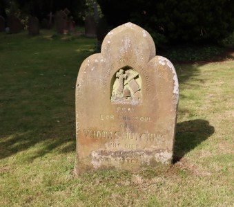
Eliza Margaret Wall, died 1899, aged 30. Other family members were added in future years up to 1936
As a starting point, it is useful to look at who the main users of the cemetery were and are, both living and deceased, before moving on to a general guide to what to look out for if you are a visitor interested in learning about what the cemetery has to offer.
As in part 1, where I have included a photograph of a grave and there is information about it on the Find A Grave website, I have added a link. For anyone using the database for their own investigations, note that Find A Grave treats Overleigh Old and New cemeteries as two different entities and you have to search under the correct one.
I have stuffed this full of photographs to help explain some of my points, so Part 2 looks bigger than it actually is. You can click on any of the images to see a bigger version.
With many thanks again to Christine Kemp (Friends of Overleigh Cemetery) for her much-appreciated ongoing help.
====
People
Graves represent people, the living and the dead, both entangled in the complexities of funerary rites.
The bereaved

A funeral at Overleigh Old Cemetery. Detail of 19th century engraving of Overleigh Cemetery. Source: Wikipedia
Although this post is about a burial ground and its graves, funerary traditions and practices are all as much, if not infinitely more, about the living. The need to recognize and commemorate loss, not merely at the funeral but prior to it and after it are essential to people, even today when the traumas associated with death tend to be handled in more internalized ways than in the pre-war periods.

Gravestone of Geoffrey Mascie Taylor, died 1879. If anyone has any idea what the symbol represents at the top of the gravestone, please let me know.
During the Victorian period there was an elaborate process of marking a death, a tradition of precise convention and ritual, expressed both within the family and communally. When someone dies the living are left behind to handle a loss as best they can, and cemeteries and memorials are only one one part of that process. The end to end process from death to mourning is all a part of the Victorian experience of bereavement. Visiting and tending the grave, bringing flowers for the deceased, was part of this process, in which women had a key role, and demonstrating bereavement in public essentially brought the grave into the domestic sphere. Several of the books listed in the references, go into some detail about the Victorian expressions of mourning, and books by James Stevens Curl in 1972 and Judith Flanders in her recent overview provide great insights, but if you want a much shorter book with a still very comprehensive and well written overview, Helen Frisby’s Traditions of Death and Burial offers an excellent overview of Victorian and later bereavement ceremonies.

John Owens JP, died 1853, age 72. “A Merciful Man Whose /
Righteousness Shall / Not Be Forgotten.” There are no additional inscriptions on this impressive headstone
In the Victorian period it has been argued that the lead-up to a funeral, the funeral itself and its aftermath were all components of an intention to promote social status, wealth and the knowledge of and participation in deeply embedded social conventions that specified in detail how death should be handled and how mourning should take place. The Industrial Revolution had created a new type of middle class, many of whom were making livings based on manufacturing and commerce, as well as roles in the growing legal, medical, administrative, banking, and similar sectors. Even though there were more opportunities for social mobility, and the ability for individuals to define themselves in new terms, the aristocracy still provided a model for those with social ambitions. Conspicuous displays of personal and family identity and wealth had become fundamentally important in this need to establish a dignified and self-important identity at a location between the upper and working classes. It was also important for the lower middle classes to distinguish themselves from those who were less financially robust, doing what was perceived as more menial work, defining themselves as socially distinct from the working class. Hierarchy, with all its subtleties during the Victorian period, was important, deeply-felt, and complex, and much of this is reflected in funerary rituals.
 More recently it has also been recognized that elaborate Victorian and early Edwardian funerary ceremonies were not merely social devices but reflected the great trauma associated with loss in a world where medicine was in its infancy and where where the middle class was defining itself within often smaller families than previously. Sickness and death could be both frequent by comparison to today, and was often profoundly distressing. At the same time, sanitation and health were slowly improving in the second half of the century, meaning that once childbirth and infancy had been survived, people physically lasted longer than they had done in the past, building relationships but more frequently succumbing to old-age problems, becoming invalids who were cared for within the home. National and community diseases were frequent, some of them long-lasting, and the role of women in nursing their relatives became increasingly important where professional standards of nursing were, just as much as the professionalization of medicine, in their earliest incarnation. Middle class family ties, and the Victorian and Edwardian sense of moral responsibility to relatives, ensured that sickness was a very frequent component of family life.

TThe monumental grave shrine of Henry Raikes, died 1854, aged 72, Chancellor of the Chester Diocese and one of the founders of the Chester “Ragged Schools.” Overleigh Old Cemetery..
Relatively recent research has also suggested that working class people felt no less strongly about the loss of their partners, siblings and children. Many working class families were crowded into insanitary areas all over in Britain, and notable areas have been identified in Chester, forcing people into much closer proximity, and this promoted the transmission of sickness and disease with a consequent cost in terms of poor health. Sickness was handled within families, which caused many problems in household management, where women frequently worked for a living, often in domestic capacities. This resulted in the occasional recourse to a new breed of hospitals as well as a frequently dubious type of pre-professional paid nursing care. The ease of disease transmission meant that those living so close together and in such insanitary conditions were most at risk of epidemics, and the mortality rate was much higher than in middle class households. There were clubs into which people could pay a subscription to save up for funerals, just as there were clubs to save up for Christmas, and there are several pauper graves at Overleigh. But for some the costs were too high, so many graves were unmarked, and the grief of some families was never recorded meaning that these losses are not captured.
The monument for Joseph Randles, died 1917, aged 65-66. Note the partially veiled urn, which will be mentioned later.
It is easy to forget that until the NHS was established in 1948, most people still died at home rather than in hospitals, hospices or nursing homes, and that families housed the deceased, until burial, within their homes, and those deceased, laid out in front parlours in their coffins, were visited by friends and families. The introduction of the funerary Chapel of Rest in the later Victorian period helped to reduce the time when the deceased remained in the house, but it was still a common part of a death that the dead remained amongst the living until the funeral well into the 20th century.
The focus on ceremony and ritual altered over time, with a considerable change of direction from the elaborate ceremonies of the Victorians to the minimalist approaches taken today. This does not mean a growth of indifference to death, but it does indicate changes within society. The beginnings of this are to be found in the Edwardian period, particularly during and after the First World War, when the nation’s horses that traditionally pulled hearses were required for the war effort. Funerals became even less demonstrative after World War 2. This will be discussed a little more in Part 3.

On this Armstrong family cenotaph and headstone in the Overleigh New Cemetery, three sons predeceased their parents aged 32 in 1917, 22 in 1918, and 39 in 1927, the first two of them at war, all of which must have been a shocking loss. Their parents are commemorated here too.
In the cemetery itself, the most obvious incorporation of gravestones into the world of the living is the highly visible custom of flowers and other gifts having been left in front of a headstone. Fresh flowers in particular give the sense of a grave being regularly tended but artificial flowers and other items also serve to mark the continued attention to a grave by those who wish to indicate their recognition and care. My father, who was born in 1936 and grew up on the Wirral, says that when he was a small boy he was taken regularly to the graves of his relatives in Liverpool, where there was a flower shop outside the gates, and flowers were purchased, a visit was made to family graves, and a picnic was enjoyed nearby. It was a visit of celebration, continuity and memory, a positive occasion.
The other most obvious indication of a gravestone continuing to have a role is the presence of multiple inscriptions on many memorials, as individual family members are lost and the living are compelled to update the inscriptions. Many of these gravestones capture this passage of time and accumulated loss very effectively, telling long narratives of family loss, sometimes covering several decades, and suggesting multi-generational involvement with funerary activities and commemoration, the sense of a continuum between the past, the present and the potential future.
The Deceased
 The deceased may seem to be passive and inanimate, but they have voices in at least three ways. First, they may have had input into their own graves, including its location, its design and its use as a single plot or a family plot. In this sense they are very much agents of their own burials. Second, the very process of memorialization, whether by family or friends, gives the departed an enduring presence that lasts into the modern world, a very material presence. Some of those who died may also have obituaries to be found in newspaper archives, and accounts of inquests into their deaths, filling out a much richer picture of former lives, and those who were in positions of influence will have had much more information captured in official documents and even preserved journals. In this way they can contribute very significantly to modern research projects, as much as that may have surprised them. Third, they occupy the living landscape of cemeteries, spaces that occupy often new places in modern life and that are valued today. At Overleigh I have seen people walking from one end to the other pause to read an inscription, and dog walkers wandering around, pausing to take note of a particular grave. The dead area still amongst the living, even when they are not even slightly connected today with their ancestors. Those who care for their graves, and tours that bring visitors, all do their essential bit to keep the deceased amongst the living.
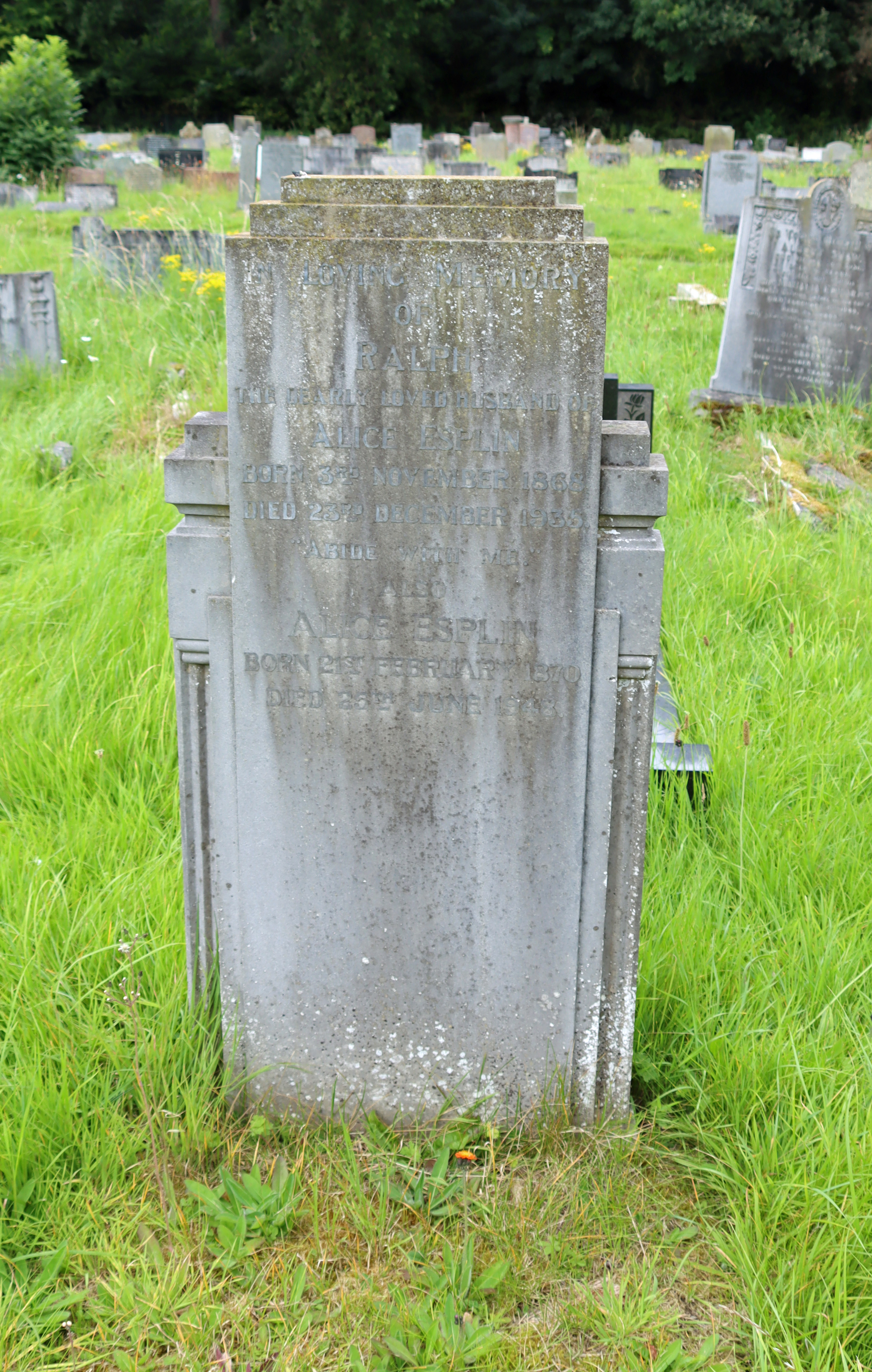
Art Deco style headstone of Ralph Esplin, died 1935, aged 67
It has been the experience of cemeteries since the beginning of the 17th century in Britain that graves are tended for perhaps three generations after which they fall out of use, as families move away or simply move on. Genealogy makes some of them briefly relevant, but the funerary landscape is a strange mixture of the abandoned and the perpetuated. Local authorities and Friends societies contribute to the task of caring for abandoned graves, but this is a very different relationship from those that are still visited by family members. In Victorian cemeteries, there is always a rather strange dynamic between the historical sections and those that are still the essence of loss, bereavement and and ongoing engagement.
The deceased in the early periods of the cemetery capture something of Chester’s evolving social, economic and cultural endeavors, as it attempted to secure its future and create a stable and prosperous community. Those who are represented in the cemetery are largely those who were either already successful in establishing themselves within this community or were making the attempt to improve themselves and gain status; the unmarked pauper and cholera graves are amongst the hidden histories of Overleigh and of Chester itself. There is time-depth here too, as we can track changes from 1848, when the Old cemetery was established, through the Edwardian period and both World Wars, and the changes during the post-war period up until the present day. I have been learning how much work it takes to see beyond the sea of graves and to read history captured in the cemetery landscape and monuments, and it is all there to be found, the world of the dead contributing to an understanding of the transforming past and how society’s views on death and commemoration changed. Parts 3 and 4 will go into this in more detail.
===
Visiting Overleigh for the first time – what to look out for

The central monument, in rose granite, is a truncated obelisk, indicating a life cut short and usually associated with the loss of younger people, although not invariably. In this case, Harry MacCabe who died aged 26.
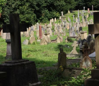
I have started here with the most obvious way of getting to grips with a cemetery – how things look when you walk through for the first time. This is about shapes, materials and the visual cues that you can pick up at first glance to give an indication of what the casual visitor may want to focus on during a first visit.
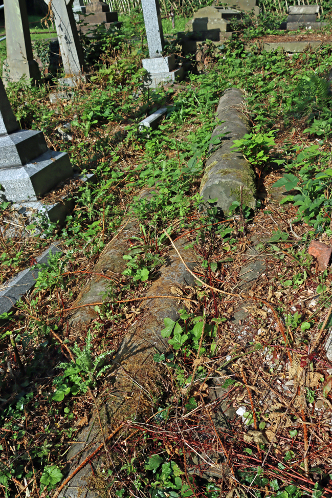
The majority of monuments at Overleigh are vertical, unlike the variety seen in local churchyards that include a variety of other horizontal and chest-type forms, as discussed in connection with the churchyard at Gresford, some 10 miles south of Chester. The example below shows one of the horizontal representations, which are less numerous, although of course by being less visible are more likely to be overlooked.
Although I discuss Overleigh as a site that helps us to connect with history, it is important to remember that both Old and New parts of Overleigh are still in use for new interments and cremation memorials, and that families and friends are still regular visitors to visit their departed and tend their plots. All visits by those of us who are not connected with family or friends interred in the cemetery need to explore with respect and care for those other visitors who are at the cemetery for the purpose of connecting with the departed.

The horizontal gravestone of Major Richard Cecil Davies is one of the relatively few gravestones that are not vertical. Some, of course, have fallen over and are now just as horizontal as this one, but this was always intended to lie over the grave and face upwards. These are always vulnerable to being taken over by grass and weeds, and need an eye kept on them.
Themes and symbols

Author James Curl (1975) found this advert in an 1860s guide to Highgate Cemetery in London, showing a range of grave monuments available for purchase. Most of these have equivalents at Overleigh.
How were headstones and monuments chosen? From the 1830s onward stonemasons had catalogues from which headstones could be chosen, just as there are today. Today there are also catalogues from which to choose, many of them online and offering a wide range of alternatives. At the same time, some families might prefer a grave that is similar to that of other family members, and some might want to emulate styles admired in a local cemetery. The imagery on the graves during the Victorian and Edwardian periods formed a rich language of meaning that is understood by all, including the illiterate. Sometimes the imagery used on a gravestone may say as much if not more about the emotional relationship between the living and the deceased than the text inscription, including the hopes that the living had for their dearly departed.

Headstone of George Henry, with a lily, the symbol of mourning, purity and peace
When you are walking around, you will notice that certain themes are recurring in the designs of the gravestones in both halves of the cemetery. These represent specific choices that people have made and the ideas that they wish to communicate. These can either be sculptural memorials or more modest headstones that incorporate carved imagery. Sometimes headstones just include text, and sometimes there is just a kerb with no headstone which usually lacks imagery, but the symbolic medium is often an important part of the message that a gravestone communicates, imparting a different type of information from the text, often rather more subtle and conceptual than what is written, sometimes capturing emotions and ideas rather more effectively than words. There is a usually a minimalist formality in what is written, but this does not extend to imagery and symbols, which can be far more expressive. The themes and symbols mentioned below are just examples that I have found in Overleigh Cemetery.
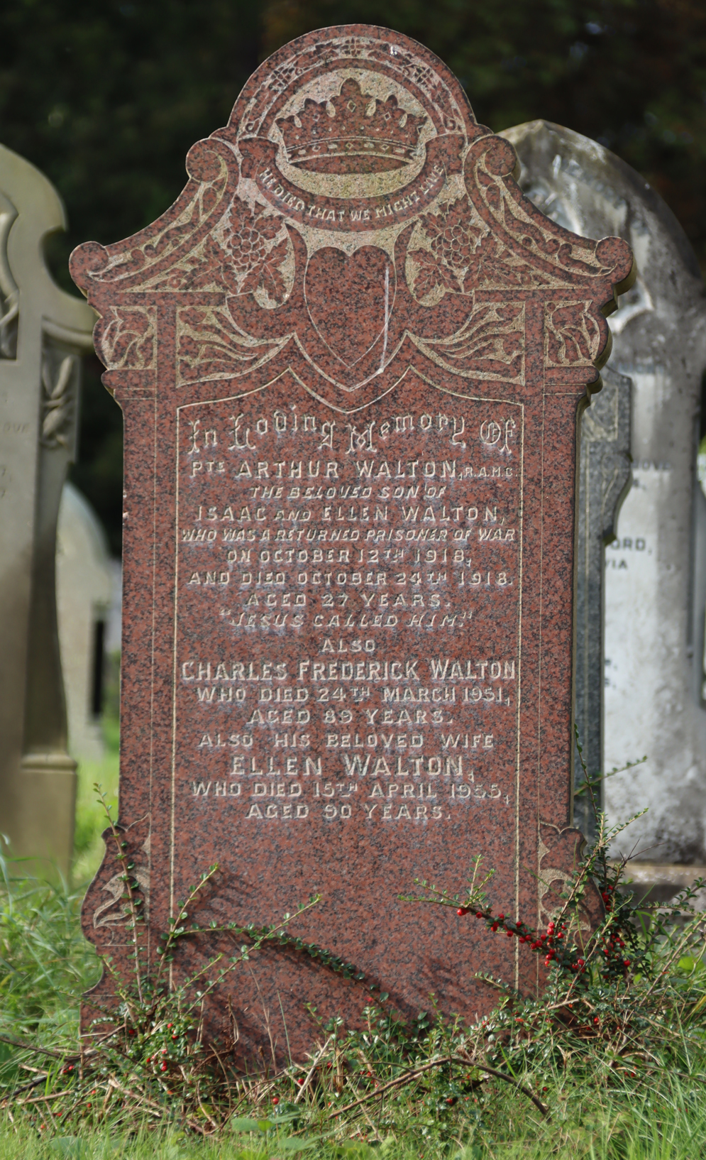
In the memorial to Private Arthur Walton shown left, the overall language of the iconography, seems to reflect the concepts of Christianity and the life of Jesus in response to the loss of a much-loved son in the First World War. The crown can symbolize victory but is also the emblem of Jesus and Christian immortality. Beneath it, the Biblical quote “He died that we might live” refers to Jesus, but might also refer to the sacrifice of Arthur Walton himself. The heart is a symbol of everlasting love of Christ and also of the charity espoused by St Paul, but also captures personal love. The grapes and vine-leaves are usually related to themes connected with Jesus including the blood of Christ, the Last Supper and the Holy Sacrament. Overall the iconography of the grave is probably one of personal sacrifice and its association with Christian values and the sacrifice of Christ himself, whilst at the same time demonstrating very deep personal loss. As well as being very moving, this is a good example of how the imagery can contribute to the overall narrative of a headstone or memorial.

Hester Ann Clemence, died 1914, aged 62, with other members of the family commemorated on the pedestal steps beneath the floral Celtic style cross. The steps often represent the steps representing Christ’s climb to Calvary. All of the creativity and suggestion of emotion in the monument is in the design; the inscription is minimalist. Although the encircled cross was originally associated with Irish graves, it became popular throughout Britain during the 19th century.
Of the overtly Christian-themed grave markers the dominant shapes are the crosses that re-appear for the first time since the Reformation during the 19th century, symbols both of Christ’s sacrifice and of resurrection, and proliferate at Overleigh, from the very simple to the seriously elaborate. Crosses carved with decorated themes are widespread through the cemetery. Although there had been very few crosses before the Victorian period, due to fear of association with papism. A popular choice at Overleigh was the so-called Celtic cross, with Celtic-style designs covering the surface. A popular variant has the top of the cross contained within a stone circle. Although originally associated with Irish and Scottish graves, after 1890s in particular, when a Celtic cross was chosen by the celebrated art critic John Ruskin for his own memorial in Coniston, it became popular for burials of all religious persuasion. A cross on a set of steps is often intended to represent the steps the Christ climbed to Calvary, but they might also simply be chosen for their monumental impact. Flowers on a cross are indicative of immortality. There are quite a few angels, messengers of God and the guardians of the dead who also transport the soul to heaven. The letters IHS often occur on graves in both urban and rural cemeteries and represent a Christogram, the three letters of the name of Jesus in Greek (iota, eta, sigma).

The truncated obelisk erected in memory of Francis Aylmer Frost. This photograph was taken by Christine Kemp when this area was not the overgrown jungle that it is now (you can see another photograph of this column, as it is today just below. Copyright Christine Kemp.
Many emblems are appropriated from earlier periods. Pagan themes include the many Egyptian-style obelisks (more about which you can read on my post about the Barnston memorial in Farndon). A splendid fluted truncated Doric column, a not uncommon cemetery icon but in this particular case perhaps a nod to Chester’s Roman past, is located just inside the River Lane gate to the Old Cemetery, its truncation indicating a life cut short, and generally indicating someone who died young, although in this case Francis Aylmer Frost was 68; another truncated column was dedicated to Harry MacCabe who was 26. It is not the only one in the Old and New cemeteries, but it is by far the most impressive, shown at far left in the image below. Its base is so badly overgrown with viciously thorny brambles that I couldn’t begin to find an engraving without losing half my hands and arms, and so remain ignorant as to who it commemorated. I need some garden shears next time!

Truncated column; weeping woman; angel; Celtic crosses, temple-style gravestone. Click to enlarge

Floral themes on the grave of Thomas George Crocombe, died 1913 aged 20, the eldest of 9 children. Overleigh Old Cemetery.
Flowers are a popular carved theme on headstones. Some have specific associations, such as the lily, standing for purity and a return to innocence; the rose, which indicates love (different coloured roses mean slightly different things), lilies of the valley, with connotations of innocence and renewal; daffodils that, flowering in spring, represent rebirth; and daisies, which symbolize innocence and were a popular choice for child graves. A sprig of wheat often indicated someone who had lived to a good age. Ivy, ironically, is representative of life everlasting and due to its enduring character. It is often show winding its way around cross headstones; today rampant ivy is one of the greatest causes of damage to graves in cemeteries and churchyards. The most popular of birds shown on graves were doves, symbolizing either the Holy Spirit guiding the deceased to heaven, or general values of spirituality, hope and peace. There are several at Overleigh.

Detail of the headstone of Harriett Garner and other family members with clasped hand motif. in this case it perhaps suggests father and daughter. Harriett’s father, who gave evidence at the inquest into her suicide, was certainly very distressed by the loss of his daughter. They are usually quite common in cemeteries, I have noticed only a few at Overleigh.
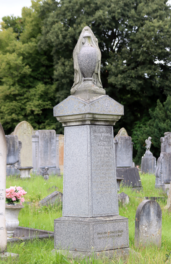
An urn is a very well represented motif, quite often topping a headstone as a sculptural component, and indicating the soul of the deceased; when draped with a veil they may indicate the soul departing or represent grief of mourners. Angels are popular sculptural elements at Overleigh, indicating the soul of the deceased being accompanied to heaven. Much less frequently shown than angels, but popular in many cemeteries, are images is that of a weeping woman, representing the loss of a person and the mourning of the bereaved. Small statues of children often indicate the grave of a young child. Clasped hands, common at some cemeteries but apparently not as well represented at Overleigh, indicate unity and may suggest the bonds of husband and wife, or of friendship or the hope to be reunited with loved ones; some have been carved to show the clothing and character of the hands as distinctly male or female. An anchor may show that the deceased was professionally connected with the sea, but may also represent hope; a variation is the anchor with a woman, the embodiment of hope, although I have not seen an example of the latter at Overleigh. Books may have many meanings – sometimes they are associated with the Bible of the clergy or the work of scholars, whilst others may mean knowledge or wisdom, or may simply represent chapters in life.
On the left, the headstone of Arthur Davies. The text wrapped around the anchor reads “Hope is the Anchor of the Soul.” The inscription contains other commemorations. The headstone of Florence Taylor Battersby and other family members in the middle, topped with a dove. The grave at far right shows the Christogram IHS, an abbreviation of the name of Jesus in Greek and Latin. Click to enlarge
===

The child grave of Violet Patterson, died 1929, as well as other members of her family, one of whom, Edward Andrew Patterson, who died and was cremated in 2007, is inscribed on one page of the book. This is one of the longer enduring of the graves at Overleigh, in use for 78 years.
A book included on a gravestone may indicate any of a number of ideas. Prosaically, the grave’s owner might be involved in the printing, publishing or book-selling trades. Alternatively they might be a scholar or, if the book is intended to be a Bible, a cleric or someone particularly devout. In cemeteries one side of an open book often has the name of the husband or wife, whilst the other side remains blank until the other partner has also died, when the blank page can be completed. Sometimes the blank page is left incomplete, possibly because the former partner has remarried or moved out of the area, or has left no provision for the disposal of his or her remains.
There are also more modern emblems and themes that people have incorporated into grave carvings. In the Overleigh New Cemetery in particular there are Art Deco, Arts and Crafts and Art Nouveau themes. Although often contained within crosses, the Art Nouveau decorations seem otherwise celebratory of life. The combination of Christian crosses with modern themes perhaps positions religion within a modern context where there is no need to refer back to much older historical values in order legitimize Christian beliefs. One of them, dedicated to Anna Maria Meredith, has a Biblical quote on it (fourth from the left, a most unusual headstone, although there is a second example in the cemetery). The memorial to Frederick Coplestone, third from left, shows St Francis of Assisi. It will be discussed further in Part 4.

Click to enlarge

Memorial in the cremation Garden of Reflection showing a locomotive. Roy Douggie, died 2010 aged 77, and his wife Beryl, died 2016, aged 79. That sycamore is going to need weeding out if it is not going to do permanent damage!
As can be seen on more modern gravestones and memorials, most of which can be seen in the Garden of Reflection in Overleigh Old Cemetery and at the very far end of Overleigh New Cemetery and even more dramatically at the post-war cemetery at Blacon, gravestone types and materials have become standardized, and the rich visual language of symbols and icons employed became much less varied over time, and are now often eliminated entirely, although secular themes are sometimes chosen instead. In modern cemeteries, regulations about the nature of grave markers limit potential for developing new monumental statements, but the decline in religious involvement in everyday life is also a part of this trend. The language of religious imagery to convey complex values (semiotics) now takes a back seat, even where commemoration is required, with modern secular images often chosen instead of Christian ones. There are exceptions, and Roman Catholic memorials can still be quite elaborate. Today modern gravestones and memorials can be less about choosing the perfect message for eternity than creating an appropriate personal message and style for the here and now, which is an attractive feature of many modern memorials.
====
There are many more symbols and themes on gravestones than those covered in my brief overview above, some quite common at cemeteries, some unique, and it is worth looking out for some interesting examples.
===
Inscriptions

Alice Maud Gwynne, died 1921 at the age of 42 which bears the inscription “There’s no pain in the homeland,” the monument topped with an urn
Inscriptions can be presented using various different fonts, sizes and colours all on the same monument, which creates a sense of texture. Inscriptions are often filled with colour to make the text stand out from the background stone and make it easier to read. Lead lettering was occasionally inset into stone to achieve the same impact. The different styles of text create a great deal of variety in the visual impact of the cemetery.
Headstones in Overleigh tend to be fairly minimalist in terms of the information they provide, many simply naming family members and providing a date of birth and death, perhaps a note about the role of the deceased, particularly where this was a high status position. Most contain some sort of affectionate phrase or such as “In loving memory of,” “in affectionate remembrance of,” “beloved wife,” “dear husband,” etc. Others may contain a little more information. Some may state the town or village name of the village, or even the property, where the deceased was resident.

The commemoration to 9 year old Walter Crocombe, his mother Sarah, 68, her husband George, 88, and their 4 year old grandson Eric.
Multiple dedications following the initial interment help to give a sense of the family context of both the first and and subsequent family members, and the longer they were in use, the more resonance they had for the family as successive generations interacted with the monument not merely to a single person but to a family commitment and tradition. The child grave of Violet Patterson, died 1929, includes dedications to other members of her family, and was in use for 78 years, with the latest inscription dedicated to a family member who died and was cremated in 2007.
Only war graves tend to give details of how death happened, such as “killed in action” or “killed in flying accident,” although there are never any details. A great many refer to the deceased having fallen asleep, a euphemism for having died that skirts around and sometimes deliberately disguises how the death occurred. Occasionally a grave will refer to the suffering of an individual, although I have seen fewer at Overleigh than in churchyards. The commemoration of Sarah Crocombe at Overleigh reads “Her pain was great / She murmured not / But hung on to / Our Saviour’s cross.” The monument to Alice Maud Gwynne comments “There’s no pain in the homeland,” which implies that she may have experienced some suffering towards the end of her life.
For obvious reasons, child graves can be more expressive than others about personal feelings of grief and loss. The grave of 2-3 year old Josephine Enid Whitlow in Overleigh New Cemetery, for example, shown towards the top of this post, has a statue of a small child labled “JOSIE” (Josephine Enid Whitlow) accompanied by the the inscription “Jesus Walked Down The Path One Day / And Glanced At Josie On His Way / Come With Me He Softly Said / And On His Bosom Laid Her Head.” She died in an isolation hospital in 1938. The grave of the Crocombe family shown above records the loss of 9 year old Walter: “Little Walter was our darling / Pride of all the hearts at home / But the breezes floating lightly / Came and whispered Walter come.”
A few graves have Latin inscriptions. Latin is often used on Roman Catholic graves, and the letters RIP often indicate a Catholic grave, standing for the words “requiescat in pace,” meaning “rest in peace”, part of a prayer for the dead. A nice little gravestone commemorating Thomas Hutchins, near the entrance on Overleigh Road has the legend “stabat mater dolorosa” inscribed along the line of the arch, meaning “the sorrowful mother was standing,” a reference to the Virgin Mary’s vigil during the crucifixion. It is one of a number that ask the reader to pray for the soul of the deceased.
The small, relatively isolated gravestone of Thomas Hutchins, died 1879, aged 39–40
Perhaps the most minimalist of all the inscriptions, in terms of information imparted, is this curious woodland-style headstone topped with a downward-facing dove, shown below: “With Sweet Thoughts of Phyllis from Mother and Father and Aubrey.” Given the lack of any useful information it is not surprising that there is no information on the entry for it on the Find A Grave website, but the headstone has charm, and the lack of data is really intriguing, because this was not an inexpensive monument. Chris tells me that her last name was Elias. There must have been a story here, but how to find it would need some extensive research that would require access to the original stonemason’s records.

“With Sweet Thoughts of Phyllis from Mother and Father and Aubrey,” Overleigh New Cemetery
Although it might be expected that headstones would give a wealth of information, this is rarely the case at Overleigh, although names, dates of birth and death and place names are a good place to begin with additional research.
There are several books and websites that list some of the most common cemetery themes and symbols, which are very helpful for decoding some gravestones and memorials.
===
Visually personalized headstones

Memorial to Richard Price, Dee salmon fisher, who died in 1960 aged 59. Overleigh Old Cemetery
Personally commissioned scenes, where they are shown, are very specific. One of the most evocative is the gravestone that has a white marble section showing the Grosvenor Bridge, flanking trees on the river banks and a solitary, empty rowing boat moored in the middle of the river. It is dedicated to Richard Price, salmon fisherman, who died in 1960 aged 59. Salmon fishing on the Dee has its own history, well worth exploring, and Richard Price was one of the last to make a living from it. With Art Deco style wings either side, and an urn within the kerb, which could have been added at any time but appears to be in the same stone as the rest of the monument, it is an attractive and very personal dedication, becoming a little overgrown. Richard’s wife Rose, who died in 1987 aged 81, is also commemorated on the stone.
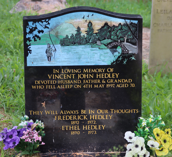
One of the more startling graves when seen from a distance, but completely charming and evocative when seen up close, is the full-colour section of a headstone to Vincent John Hedley, with a scene showing a fly-fisherman in a river or estuary with a rural scene, a rustic bridge, flying geese, an evergreen woodland, a bare hillside and a sunset or sunrise. It seems probable that Vincent John Hedley was a keen fly fisherman.

Small section of an elaborate grave to Annie Myfanwy Roberts, died 1986, aged 73-74, showing photographs of family members.
A very well-tended grave in Overleigh New Cemetery is extremely monumental in its scope and intention, and includes photographs of the deceased, far more elaborate than the Anglican tradition but in keeping with the idea of the personalized scenes above that include visual as well as textual references to the personal. Whereas the two headstones above show evocative and nuanced scenes that suggest how lives were lived, the photographs of lost people show nothing of the lives that the people lived but are instant reminders of the faces of the departed, instantly emotive for the living, indicating a different way of thinking about and representing those who have been lost and are grieved for.
Materials
 Although the most obvious thing about a grave is its shape, together with its ornamental elements, the choice of materials is also an essential part of the design of a monument, and helps to determine its appearance. As Historic England pointed out in their report Paradise Preserved, “the rich variety of stone within cemeteries represents a valued resource for the understanding and appreciation of geology.” The good news is that in 2012 Cheshire RIGS and the Northwest Geodiversity Partnership produced a five-page leaflet, Walking Through the Past: Overleigh Cemetery Geodiversity that describes some of the geological background to stone types used on gravestones at Overleigh Old Cemetery, which you can download as a PDF by clicking here.

Some of the many different stone types at Overleigh
Local red sandstone was a popular choice, the same material used to build Chester Cathedral. Yellow sandstone, presumably much of which came from the Cefn quarries in northeast Wales, is finer-grained and often easier to sculpt, but is very vulnerable to pollution and, as a result, de-lamination. Pale limestone and granite are available from British sources, and are scattered throughout the cemetery. Limestone is a sedimentary stone like the sandstones, and relatively soft and easy to sculpt, whereas granite is an igneous rock, very hard and enduring, often with a very attractive flecked texture, but far more difficult to shape. Imports from overseas include marble and various exotic granites, which are higher-status materials with smooth surfaces that lend themselves well to sculptural memorials. Rose granite, so beloved of the ancient Egyptians, is well represented, usually polished to a high gloss. The majority of modern headstones are in highly polished black granite. Local schools would probably welcome a geology trail through the cemetery.

Cross made of a composite of two different materials, with pieces of stone inserted rather coarsely into what looks like concrete and was probably a low-cost solution to a burial memorial.
As the 19th century rolled into the 20th century and transportation costs declined, imported stones became more common, particularly marbles and coloured granites. Closer to home, reconstituted (powdered and reformed) stone became a lower cost alternative to real stone, a common type of which was called coade stone. At first this resulted in an increased diversity of materials, forms and styles, but as the 20th century advanced, the whole business of burials became far more standardized. This is not a reflection of falling standards, but it is an indication of cultural change in general, where Anglican Christianity in particular is of less importance in Britain and where society tends to internalize loss rather than expressing it.
The only grave marker that I have spotted so far that is neither stone nor pseudo-stone is a single metal cross in Overleigh New Cemetery, shown just below, although I am sure that there must be others.

Lead lettering on the fallen headstone of Harriet Benson, died 1909 aged 63
Some graves have inscriptions formed of lead letters, which makes them stand out to ensure that they are easy to read, but they have a very poor survival rate, with letters falling out, and only the pin-holes where they were affixed surviving. This can be sufficient to work out the original inscription, but makes some of the the headstones look rather derelict. In the example shown left, the lettering under the missing lead can still be made out, but this is rarely the case.
Combined, these different materials, with their very contrasting textures and colours, offer a far more diverse visual fare than the modern cemetery areas in both Overleigh and elsewhere, which are usually glossy black granite. They help to contribute to the sense of individuality and personal expression in the cemetery.

Black-painted metal memorial to Frederick, aged 66-77, and Alice Wynne, John Meacock and Robert and Alice Taylor.
Memorabilia and gifts
A gravestone was a fixed point, although not invulnerable, whilst gift of flowers, immortelles and other objects are the ore transient but personal markers of ongoing memories or the establishment of new connections between people and graves. As well as demonstrating a personal connection between the living and the dead, the offerings of all types help to keep the sense that the cemetery is still a place of relevance, where narratives continue to be written and rewritten, sometimes only in people’s individual minds, and sometimes shared amongst families and even amongst sections of specific communities.
In the next section, below, is a photograph of Mabel Francis Ireland-Blackburn, showing a three year old child lying in a bed. It is surrounded by modern memorabilia, including flowers (fresh and everlasting) and a variety of toys and other items.
Although it does not attract the same devotion as Mabel, the grave of the suicide Harriett Garner features a charming little bird, probably a robin, on a thoughtful makeshift stand accompanying the grave. It gives the grave a personal touch, something more intimate than the headstone itself, suggesting a sense of ongoing empathy and regret.
In the baby cemetery area and the cremation Garden of Reflection in Overleigh Old Cemetery and in the area of recent graves in Overleigh New Cemetery there are many graves with personal memorabilia and gifts from the living to the departed, and these speak to the realities of grief and the importance of reinforcing memory through small gifts and commemorations.
Examples that are cared for by today’s cemetery regulars
Not all graves are appreciated exclusively by their families and descendants. Others have become interesting or even important to people who otherwise have no connections to the deceased. Some graves have attained something of a celebrity status, either because of their visual appeal or because of the reputation or story of their owners, and are particularly cared for by local people as well as by the Friends of Overleigh Cemetery. These graves form a sense of how modern minds can connect on a personal and private level with graves with which they have no familial connection.

Grimsby News, September 11th 1908, reporting the coffin of William Biddulph Cross (The British Newspaper Archive)
The nicely shaped but otherwise unremarkable headstone of electrical engineer William Biddulph Cross, who died in 1908, conceals an amusing story of a coffin made entirely of matchboxes, thousands of them, by William himself over a ten year period, a fact mentioned on the gravestone: “WILLIAM BIDDULPH CROSS / Who Passed Away September 5th 1908 / Aged 85 Years / Known By His Galvanic Cures / And The Maker Of His Own Coffin.” The “galvanic cures” refer to a somewhat scary electrical therapy device thought to be a cure-all for numerous ailments. You can read more about the device and the theory behind it on the National Archives website. The coffin became something of a local tourist attraction in its own right before William was laid to rest, and was widely reported in newspapers all over Britain. The newspaper paragraph to the right, for example, was reported in the Grimsby News. It has been suggested that the electrical fittings were for lighting, but interment before death was a fear throughout the entire Victorian period, and there are some examples of coffins being fitted with devices to allow those who had been mistakenly certified dead to be given a means of raising the alarm, and perhaps this is an alternative explanation. The grave also commemorates six other members of the family who died between 1870 and 1904. It is something of a puzzle to me as to why William BIddulph Cross was the first of these to be named but the last to die.
A particularly notable example is “chewing-gum girl,” which is a rather frightful name for a clearly much-loved grave, explained in Part 4. The grave is a very good example of a modern phenomenon where people feel a strong connection to a grave in the past and demonstrate their sense of affinity and empathy by visiting the grave and leaving items to keep the deceased company. The three year old girl, Mabel Francis Ireland-Blackburn, is represented in stone as a child lying in a bed, and is today surrounded by flowers (cut and artificial), small stone statuettes, toys, a teddy bear by her head, and other small gifts. She died of whooping cough, but was reputed to have suffocated on chewing-gum, becoming a warning anecdote told by parents to their children, in the form of a poem, of the dangers of following in her footsteps. Child grave memorials are discussed more in Part 4. The visual impact of this grave, with the sleeping or dead girl lying in her small bed, propped up on a pillow, is clearly the impetus for the gifts, demonstrating the power of the sculptural funerary image, but also the connection that adults feel for deceased children.
Whilst some graves attract particular attention and are well cared for, The Friends of Overleigh Cemetery are trying to look after the cemetery as a whole, tackling individual problems as they identify them and attempting to rescue stones that can be freed from vegetation without doing them damage.
Cemeteries and the bereaved today
 The only new interments in the Old Cemetery are baby burials, segregated with respect and sorrow in a separate garden of their own, or where rights are retained to be interred in a family plot. The attractive cremation Garden of Reflection, with its hedges emulating ripples on the former lake, is also still in use, and it is possible that it will be extended. Both are clearly distinguished from the majority of graves of the previous two centuries by virtue of the fresh flowers and other gifts that are regularly provided. In the New Cemetery, the buildings are no longer in use for funerary activities, and the older part of the cemetery to a great extent resembles many parts of the Old Cemetery, but walk beyond these features and you will find yourself in a far more modern cemetery area, which is clearly frequently visited by family and friends. This is the newer style lawn cemetery where a compromise has been sought between the needs of relatives and the problems of maintenance. This will be discussed in Part 3.
Modern cemeteries issue rules and guidelines about the size and type of grave and grave marking permitted, in order to ensure that cemeteries are as easy to maintain as possible, whilst at the same time providing the bereaved with a place to visit and connect with their lost loved ones. This is a very difficult balance to strike, and local authorities who find themselves with the costly task of maintaining old cemeteries as well as modern ones, have the unenviable task of finding cost-effective ways of caring for these important sites of both past and present commemoration and memorialization. This is discussed further in Part 5.
Part 2 Final Thoughts

Yellow sandstone headstone of George Hamilton, son of Alexander and Mary, suffering from rather surrealistic de-lamination that looks like melting ice-cream, as well as a colonization of lichen. (Overleigh New Cemetery)
A graveyard is less about a place of the dead than a place of commemoration, the formation of individual, family and collective memories and the ongoing reinvention of ideas about how to deal with death. Those who have gone before us are still part of our lives, still form part of our physical landscape and can contribute to our inner ideas about mortality and the future. It is possible to get to know the dead than it is the living via their gravestones, their epitaphs and their stories. Individually these are interesting but collectively they combine with other buildings and institutions to contribute to our understanding of the Victorian period and changing funerary traditions thereafter. These changing fashions in funerary practice from the mid-19th century to the present day will be discussed in part 3.
Cemeteries have visitors who come to see particular graves, either due to regular tending of the grave and communion with the deceased, or to find a grave as part of genealogical research, or as for general or more formal interest into social history, art history and archaeological interest in death and memory.
Many of these graves, suffering from de-laminating or eroded inscriptions, and the invasion of ivy, as well as fallen headstones, highlight the importance not only of maintenance activities but of recording as many of the details on gravestones as possible in online, freely available databases.

Gothic style memorial to Thomas Ernest Hales, died 1906 aged 69. In the background are obelisks in rose granite, made popular when the antiquities of Egypt were first published
Cemeteries are fascinating places, and although modern sections are certainly rather understated and somber because of the signs of recent loss and sadness, older sections are very positive keepers of social history and human endeavor, reflecting choices and decisions by both the living and the deceased, in a wonderful arboretum of multiple tree species. These grave monuments lend themselves to close inspection and appreciation not just of the materials, shapes and symbols, but of the stories that they capture about past lives and how we learn about a city’s past through both the material and conceptual cues that cemeteries retain. The information on headstones can be a good place to start with an investigation in archives. This type of information gives a sense both of the communal identity of a provincial town, and the individual identities that make up that community. Of course, those who could not afford graves or were buried in communal graves that were the result of epidemics, are lost from this commemoration of the individual.
As before, my many thanks to Christine Kemp (Friends of Overleigh Cemetery) for all her practical help, her encyclopedic knowledge, and for checking over my facts. Any/all mistakes are my own. Do give me a yell if you find any.
I have quadruple-checked for typos etc, but some always get past me, for which my apologies.
References for all five parts are on a separate page on the blog here.


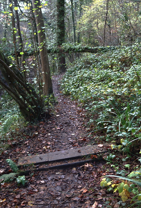
 There are a number of routes through the park. From the car park, the Main Trail is a wide metalled track that leads from the car park past the visitor centre nearly as far as the castle (after which there are wooden steps leading up to the castle). It follows the line of the brook, which drifts in and out of sight and is constantly audible. The most notable feature on the Main Trail, apart from the lovely woodland, are the outcrops of Hollin Rock, a 320 million year old red sandstone, popular as a building material. Towards the end of the trail is a small and attractive bridge, Pont Aber, that was once located further upstream but was moved here in 1800 to improve access to Wepre Hall. There is a delightful small waterfall on the other side, which used to be the location of the Castle Hill Brewery that used the water from a natural spring.


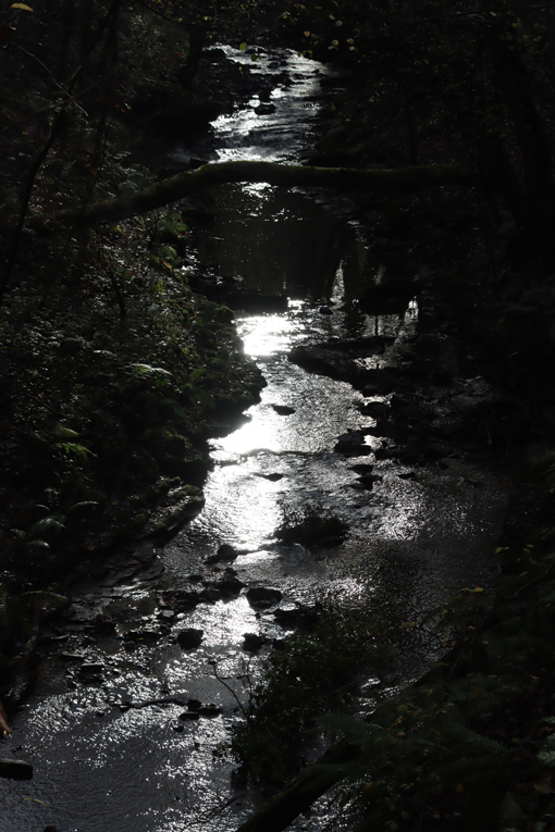
 The second significant route is a boardwalk, which leads from the car park along the brook and connects to the Main Trail about half way way along. The main feature of the Boardwalk route is the waterfall, actually built as a weir to power a small hydroelectric plant, but it is a very attractive feature. The plant used to provide electricity to the Hall before mains electricity arrived in the area in 1925. There is a variety of aquatic vegetation flanking the boardwalk, and information boards indicate the different wildlife, including birds, that can be spotted on a walk. The boardwalk follows the brook closely until it slopes up slightly to meet the Main Trail, and the “bubbling brook” phrase never seemed more apt. This is a very audio-visual walk.


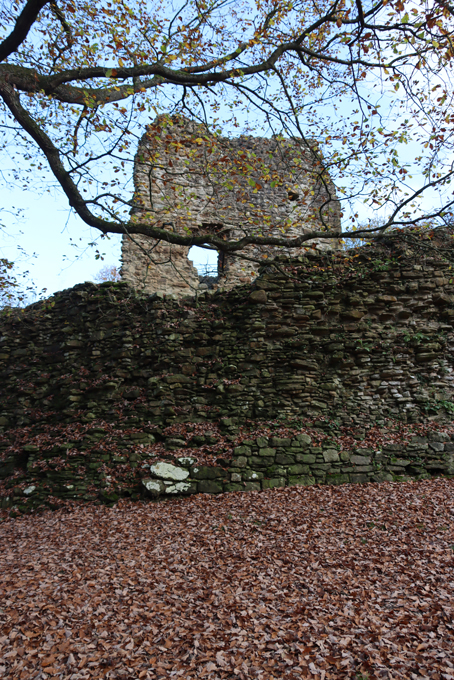
 The keep sits within a small upper ward. A larger lower ward was added, possibly at a later date, with a tower at its furthest extent from the upper ward and both were provided with curtain walls, some of which remain. The D-shaped (or apsidal) keep has a small footprint with its semi-circular end overlooking the defences, whilst the tower in the lower keep overlooks both the southern aspect and the valley below. The lower ward would have been provided with timber buildings for domestic functions and storage.
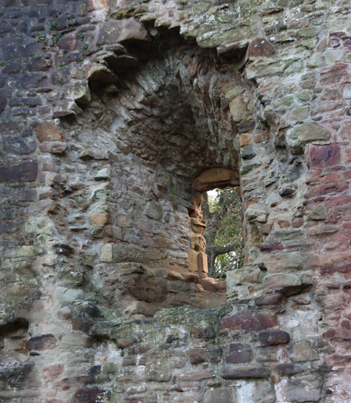


 The problem of the poor strategic location could be explained by suggesting a different intention for the castle as more of a political statement than a fully functional military outpost. Its location on the edges of disputed territory, not far from older English castles and the site of Owain Gwynedd’s defeat of Henry II may simply have been a statement of a Welsh return to land that they claimed as their own, and a useful staging point for any future negotiations, given its proximity to the Anglo-Welsh border. This is supported by its probable use first in November 1259 and again in December 1260 when English ambassadors were sent to meet with Llywelyn at a place identified as Wepre, which must have been the castle. There is no record of the castle’s involvement in 1276 and 1277, when war between England and Wales reignited, which may give added weight to this castle being a political gesture rather than a strictly military base, but could also reflect the necessity of Welsh retreat to safer ground.
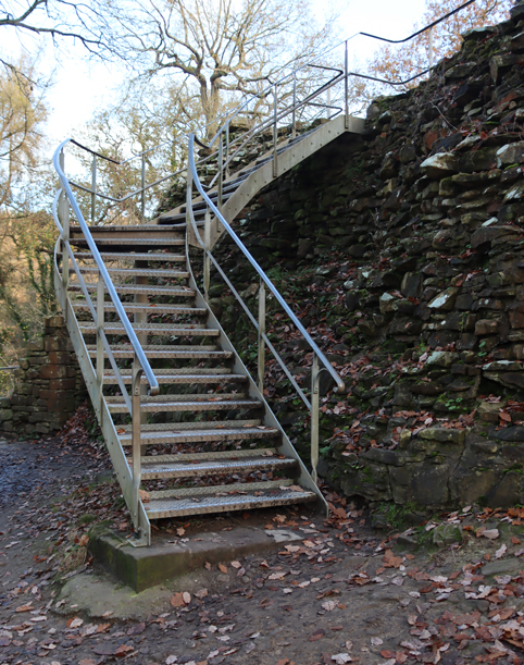
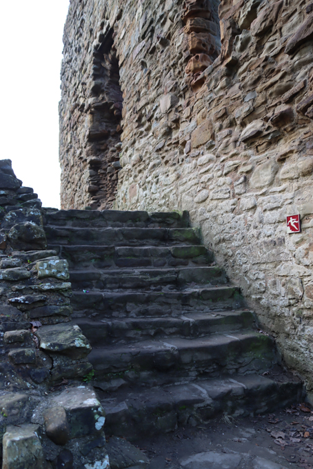
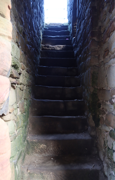
 Access to the castle, managed by Cadw, is free of charge and open all year round, as is the entire park, but you will need to be confident with stairs, as they are the only way in and out of the castle. There are new metal stair cases with handrails, and original stone ones, including a small flight in a stairwell in the keep leading up to a viewing platform at the top. None of the stone staircases have handrails.
 Parking is straight forward for both castle and park. If you only want to see the castle there is a lay-by on the side of the B5125 that looks as though it will take about 8 cars, maybe a couple more. I didn’t try the route from there to the castle so have no idea what the footpath is like underfoot, but the What3Words address for the lay-by parking is ///follow.beauty.mistaking. The official car park is a large one near the visitor centre on Wepre Drive. Ewloe Castle is about a mile away from this car park along a very easy and attractive trail. The What3Words address is for the main car park is ///contrived.writing.mailers
 The visitor centre is closed at this time of year (November) but its cafe was open on my visit. The public toilets are also open nearby. There’s a substantial play area on the edge of the car park. There are a small number of good information boards throughout the park, including one at the castle, but the Cadw official guide to Flint Castle also has a section on Ewloe Castle. Other sources are listed below, including castle information and an excellent guide to the park, together with a footpath map.


