

The official 10-page Bishop Bennet Way leaflet can be downloaded at the end of this post
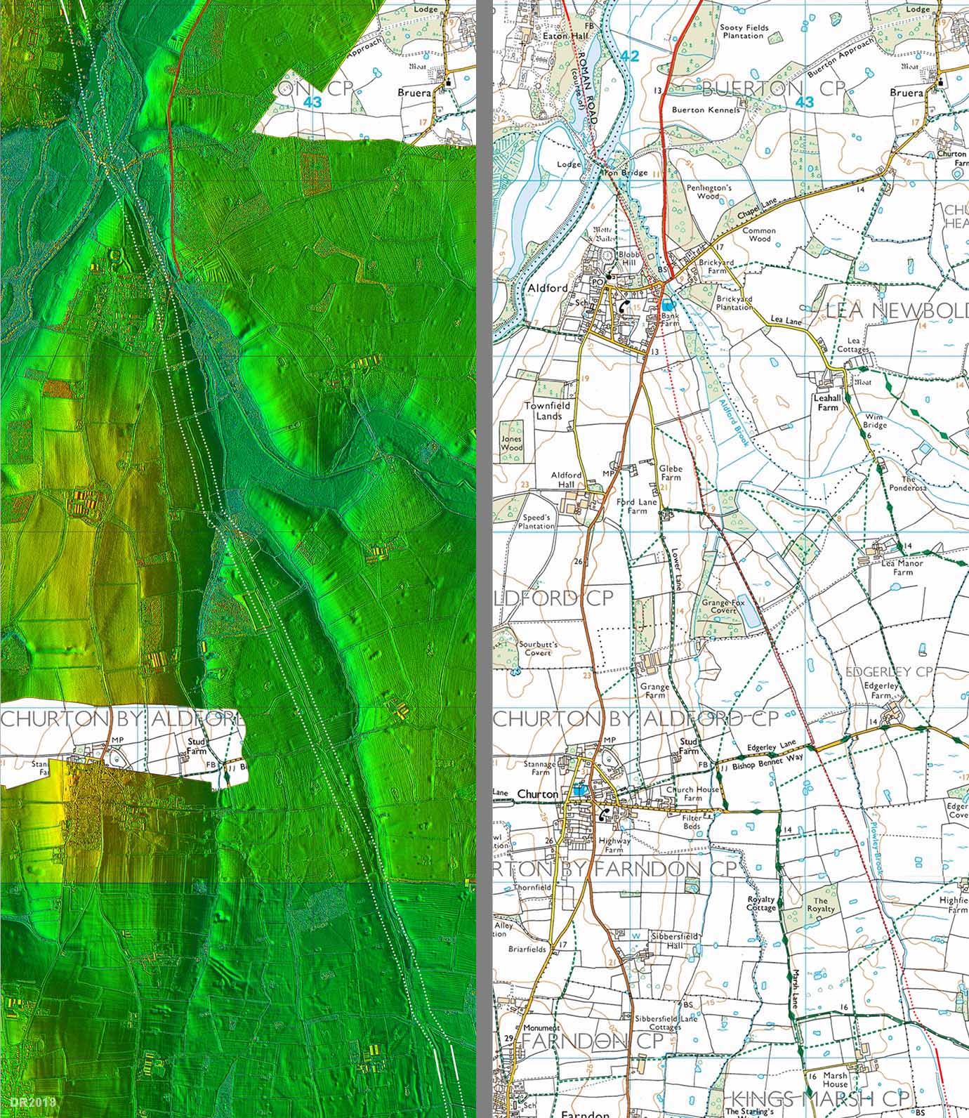
Threading its way all around the immediate area is the Bishop Bennet Way. It is completely unavoidable on maps of the area, picked out in the lines of green horizontal triangles that mark a “Recreational Route” on the OS map, or the pink diamonds on the Public Map Viewer.
The Bishop Bennet Way follows a most circuitous route incorporating both roads and footpaths, and has been established mainly for the benefit of horse riders and mountain bike riders, but is very also popular with walkers.

Section of the Bishop Bennet Way near Churton. Cheshire West and Chester Public Map Viewer.
I first noticed it when walking down Pump Lane in Churton. Where the road takes an abrupt turn to the north, there are small brown signposts pointing north, along Edgerley Lane and east along Marsh Lane to something called the Bishop Bennet Way. Whichever of the two options it takes, it loops and switches in all sorts of crazy directions, a diabolically inefficient way of getting from A to B, and eventually it falls off the edges of my OS map, still going. Once you’ve noticed the little brown Bishop Bennet Way signposts, they seem to pop up all over the area. So who was Bishop Bennet, where does the Bishop Bennet Way go and why, for that matter, has that route been so carefully preserved in maps and on signposts?

A signed letter from Bishop Bennet to his friend the Reverend Maurice
The first thing to establish was whether Bishop Bennet was a real person rather than a fictional character, and indeed he was. William Bennet was a “prelate of high character and estimation.” He was born, according to the Dictionary of National Biography, in the Tower of London on 4th March 1745. Clergymen were usually very well educated with a good academic knowledge of both Classical and British history, and many doubled up as antiquarians, explorers of all things ancient. Although some of their excavations were distressingly destructive, their surveys often provided invaluable foundations for future work. Bishop Bennet conformed to this model. He was educated at Harrow School and then went on to study at Emanuel College, Cambridge, where he later became a fellow and tutor and “distinguished himself by his compositions in Latin, as well as in English, in which he discovered not only great fluency , but a lofty taste, both in prose and verse.”

Episcopal Palace, Cloyne in Cork, Ireland. Photograph by colin.boyle4.
Source: Flickr Photos.
One of his students, in whom he took a particular interest, was John Fane, the 10th Earl of Westmoreland. The Earl went on to become Viceroy of Ireland and remembered his former mentor by appointing him first as chaplain, then promoted him to Bishop of Cork and Ross from 1790–1794 and finally Bishop of Cloyne from 1794–1820, resident in the Episcopal Palace of Cloyne. The episcopal see (jurisdiction) of Cloyne eventually became united with that of Cork and Ross in 1835, after which the Palace was leased to a private tenant.
Bishop Bennet was a member of the House of Lords, was elected Fellow of the Society of Antiquaries in 1790 and married the daughter of a fellow clergyman in 1791. He died in London in 1820. In his lovely, deeply affectionate and appreciative eulogy, his friend Dr Parr commented on this career path: “From the retirement of a college he stepped at once in the circle of a court; but has not been dazzled by its glory nor tainted by its corruptions.”

One of Bishop Bennet’s contributions to Magna Britannia, volume 2, part 2.
None of this, of course, explains what the Bishop Bennet Way was all about. After some hunting around, I found that Bishop Bennet was a very early driving force behind the investigation and publication of some of England’s Roman roads, something that became his own personal mission, all carried out in his summer vacations. He contributed valuable work on the subject to published histories, of various areas including those of Lincolnshire and Cornwall. He also contributed to the multi-volume work produced by the Lysons brothers, Magna Britannia, in which they set out to explore most of England’s counties in a series of dedicated volumes. In West Cheshire, one of the roads that he had surveyed was the path now taken by the A41, from Chester (Roman Deva) to Whitchurch (Roman Mediolanum), and his investigations were incorporated into the Roman section of the history of the Palatine City of Chester published in Magna Britannia volume 2, part 2, 1810.

Map from the official 10-page Bishop Bennet Way leaflet that can be downloaded at the end of this post
The Bishop Bennet Way was officially opened in May 1998 incorporating restored byways and bridleways, and includes sections of country roads. It is of course very popular with walkers too. Cheshire Live says that it was the inspiration of Bernadette Harden who was working on a temporary basis at Beeston Castle and began to take an interest in Bishop Bennet and his exploration of the area. It took her the best part of twenty years to campaign for the restoration of bridle paths and byways, but the Bishop Bennet Way is a very suitable reward for all her hard work.
 The Way starts near Beeston Castle and finishes near Wirswall on the Cheshire–Shropshire border, just to the north of Whitchurch, although it might be extended in the future. The route covers 55km/34 miles, and 27km of that route are on minor roads, only some of which have pavements and verges. If you are a walker trying to avoid traffic, it is worth checking the Ordnance Survey map for public footpaths along the route that bypass road. There is often another route possible for those of us on two legs rather than four, albeit rather more circuitous. The official route crosses some seriously busy roads, like the A41 at Milton Green, and anyone planning to do the whole route is advised to plot their track on OS Map Explorer 257. In 2006 Bishop Bennet Way was linked to Jack Mytton Way in Shropshire, between them creating a 125km/78 mile route.
The official 10-page Bishop Bennet Way leaflet can be downloaded by clicking here (but do check for updates on the Visit Cheshire website if you are reading this after summer 2021, in case a new edition is issued).

Section of the Bishop Bennet Way as it heads north along the edge of Middle Beachin Farm, part way between Churton and Coddington.
Sources:
Books and Papers:
The Annual Biography and Obituary for the Year 1821
No.XVI. The Right Reverend Father in God, William Bennett, D.D. MRIA. Lord Bishop of Cloyne. , Volume V, p.263-266. Longman, Hurst, Rees, Orme and Brown
tinyurl.com/3vr2y4fh
Codrington, C. 1919. Roman Roads in Britain. Society for Promoting Christian Knowledge.
Lysons, D., and Lysons, S. (eds.) 1810. Cambridgeshire and the County Palatine of Chester.
Magna Britannia, being a concise topographical account of several counties of Britain, Vol 2, Part 2.
https://archive.org/details/magnabrittanicab02lyso/page/n3/mode/2up?view=theater
https://ia802608.us.archive.org/27/items/magnabrittanicab02lyso/magnabrittanicab02lyso.pdf
Websites:
Cheshire Live
Walker turns trail-blazer in route revamp
https://www.cheshire-live.co.uk/news/chester-cheshire-news/walker-turns-trail-blazer-route-revamp-5246941
Dictionary of National Biography
William Bennet
https://en.wikisource.org/wiki/Dictionary_of_National_Biography,_1885-1900/Bennet,_William_(1746-1820)
Fastest Known Time
Bishop Bennet Way
https://fastestknowntime.com/route/bishop-bennet-way-united-kingdom
Historical Autographs
William Bennet, Bishop of Cloyne
https://www.historicalautographs.co.uk/autographs/bennet-william-bishop-of-cloyne-17093/
North Wales Live
Campaign uncovers long lost bridleway
https://www.dailypost.co.uk/news/local-news/campaign-uncovers-long-lost-bridleway-2898100
Visit Cheshire
Bishop Bennet Way
https://www.visitcheshire.com/things-to-do/bishop-bennet-way-p176521


