Category Archives: Industrial history

Tŷ Mawr Country Park, including the Cefn viaduct, the Pontcysyllte aqueduct and some lovely walks


The Tŷ Mawr Country Park, just ten minutes south of Ruabon (LL14 3PE / What3Words ///disprove.dart.isolated) in the Vale of Llangollen, consists of walks through fenced fields, woodland tracks and views over the river Dee and the surrounding countryside.  Most spectacularly, its starting point lies almost underneath the monumental stone-built Cefn railway viaduct, from where a circular walk begins, whilst a less formal there-and-back branch off a circular walk takes in the iron-built Pontcysyllte aqueduct.

Map on the outside of the visitor centre showing all the route options (click to enlarge). At far left is the Cefn viaduct and at far right is the Pontcysyllte aqueduct.

The circular walk begins and ends at the Tŷ Mawr car park (pay and display, but only £1.00 for the day at time of writing, and with two power points for electric cars), visitor centre and café (both closed when I visited yesterday, Wednesday 6th September), and toilets (which were open).

Behind the visitor centre there is a picnic area with excellent views over the countryside and the Cefn viaduct.   There is also a small children’s farm with chickens, goats and other farmyard animals, and a children’s play area.  The circular walk is a metalled pathway through small fields and woodland, which takes in the river Dee, with a small picnic area near a tiny “beach” and has a number of picnic areas. I haven’t found an online PDF of the map above, but you can download my photograph of it as a PDF here (sorry that the text is not particularly clear).

You can go either way around the walk, but the recommended route on the map fixed to the outside of the visitor centre is anticlockwise, which finishes at the Cefn viaduct and the memorial dovecot.  Although there are some inclines, I would suggest that it is entirely suitable for those with unwilling legs.  It was certainly okay for a group of women with pushchairs.  It probably takes no more than half an hour to 40 minutes to walk, with stops to admire the river and the viaduct.  There are occasional benches, a picnic area by the Dee and further picnic areas with lovely views at the top of the walk behind the visitor centre.

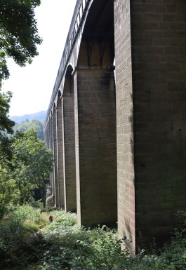
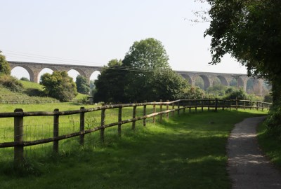
The real star of the circular walk, missing off the leg to Pontcysyllte, is the Grade II listed Cefn viaduct, which can be seen around much of the circular walk.  The walk goes right up to and along the base of the viaduct, which really is an awesome sight as you approach it and begin to get a sense of its scale.  The Cefn viaduct was designed by civil engineer Henry Robertson, who had purchased the Brymbo Ironworks, and was built in yellow Cefn sandstone and red brick by contractor Thomas Brassey (to whom there is a chapel dedicated in Chester Cathedral). It was built surprisingly quickly over a two year period to carry the Shrewsbury and Chester Railway over the Dee valley.  It opened in 1848, 43 years after the opening of Pontcysyllte, at a cost of £72,346.  It has twenty one arches, nineteen of which are 60ft (18m) wide, and two of which, one at either end, are 30ft (9m) wide.  If you approach the country park from the Ruabon direction, you will pass under one of the two narrow ones.  The arches span 1508ft (466m) and at their most dizzying tower 147ft (45m) above the level of the river. 

The additional leg of the walk to the Pontcysyllte aqueduct along the path of the Dee is not suitable for anyone who cannot handle steps, as there is a flight down from the circular walk to near the level of the river, with no handrail.  There is a signpost and small Pontcysyllte-themed bench indicating where you have to turn off the path down the stairs to a more informal section towards the aqueduct.


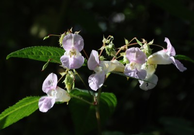
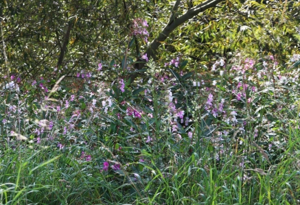
I enjoyed this more informal section, which after a wending track following the path of the Dee through woodland and open field leads to steps at the other end that take the walker to the level of the aqueduct and the Trevor Basin, with fully open visitor centre and other facilities (including boat trips across the aqueduct).  The section along the river to Pontcysyllte will be highly seasonal, with different vegetation allowing or blocking views to the river, offering seasonally variable wildlife.  Yesterday it was very attractive, with glimpses of the river through the tall plant life, and occasional tracks through the vegetation to get down to admire the river itself, much-used by dog walkers whose canine friends were doing a lot of swimming.  The dominant floral element was Himalayan balsam, with orchid-like flowers in pinks and pinkish whites, which is terminally invasive, a complete monster which, given half a chance, takes over its entire environment, but is endlessly pretty and no bother at all in the massive acreage of the park.


Viewing point for the Pontcysyllte aqueduct

The narrow track follow a well sign-posted route, although there are only a few places where choices are required.  When you reach the aqueduct viewing-point that is marked by a metal sculpture of a camera (which acts as a frame for taking photographs of Pontcysyllte) there is a choice to go straight on to the main steps, or turn right to approach the aqueduct from a different angle.  If you are not interested in going up to the canal and aqueduct level but are happy to enjoy some terrific views of the remarkable structure from below, by the side of the river, go straight on.  You can still change your mind and walk up to canal aqueduct level, but be warned that it’s a fairly long and steep flight.  You can always drive back via the Trevor Basin, at the beginning of the aqueduct, where you can park up at the level of the aqueduct.  A better option when you reach the “camera” is to turn right to go up a much shorter and less strenuous flight of steps, which brings you out onto a wooded path that both includes a viewing point and  then delivers you to the canal, Trevor Basin and the aqueduct. You can then then return to Tŷ Mawr via the steeper staircase which is a lot easier going down than up, turning this final section into a circular walk.

The glorious aqueduct, built by Thomas Telford and opened in 1805, is always a joy.  I have written up a summary of Pontcysyllte’s history and visitor information on a previous post.  It is worth going on a bright, cloud-free day, because the views from the aqueduct down to the Dee valley are enhanced by the sun glinting off the water, and by the brightness of the green fields and trees that flank the river.  The towpath along the aqueduct trough is quite narrow, but wide enough for people to pass one another.  The iron railings are high to prevent accidental falls, but not so high that you cannot see over them.  This really is one of the highlights of the area for visitors.

Once done with the aqueduct and Trevor Basin and the visitor centre, going down the longer set of steps to return back to Tŷ Mawr is a great option, walking down the side of the aqueduct and getting a real sense of its scale.  The Dee is particularly delectable here too, bubbling over shallows and glistening in the sun.  A great place to plonk down on the river bank and enjoy an ice cream.

Having retraced your steps, and once back on the more formal circular walk, the star of the show is the Cefn viaduct that looms every close.  There is an option to stop at a picnic area where a small beach is a great spot for admiring the river.  There are tracks that let you walk just a little bit further along the river before heading back to the circular walk, or you can simply pause on the path, admire the view, and keep going up the slope towards the base of the viaduct.  The viaduct is amazing.  You can see it for most of the circular walk.  At first just a few arches appear, and then gradually the entire 19-arch run of the stunning structure is revealed until you arrive at the top of the slope and at the foot of one of its enormous columns.  Look up.  Wow!  At the very top of the arch at the top of the yellow stone-faced columns, the underside of the arches are formed of red brick-built, providing a contrast with the yellow Cefn sandstone.

There is a bench where you reach the viaduct, and a signpost.  The left option continues the circular walk along the foot of the viaduct, which you will have to do anyway to return to the car park.  The right option requires you to cross a stile, and allows you to walk just a few metres in order to see down to the feet of some of the arches in the river, albeit through the vegetation, and to stand right under one of the arches and get up close and personal with the stone work.

When you return to the last stretch of the circular walk, following the viaduct along its base, you eventually reach the attractive dovecot.  This looks much older older than it is, rather like the 18th century example at Erddig, but it is modern, built in 1993 as a memorial.

It’s a short and largely undemanding but seriously enjoyable walk.  Including the walk to Pontcysyllte, the walk only took about two hours to and from Tŷ Mawr car park, with lots of stops for photos and 10 minutes sitting overlooking the river at the foot of the aqueduct with a much-appreciated ice cream.  Apart from the steps, it’s an easy walk, and there is much to see.  I arrived at Tŷ Mawr at 11 and left shortly after 1pm, so it’s not a day-eater.  A great place for a stroll, rather than a hike.  Up-to-date visitor information is available on the Wrexham County Borough Council website.

The name Tŷ Mawr translates as “big house” or “great house.”  There’s no sign of a house, and no mention of one on any of the websites that talk about the country park.  Many old houses have been lost, but I can find no mention of one associated with the country park.  Does anyone know if there was once a property associated with the site?


The 1991 discovery of an important Roman inscription in Holt

By Andie Byrnes and Helen Anderson, August 4th 2023

The discovery in 1991

The Holt inscribed fragment, now in the Grosvenor Museum. Photograph by Dr Roger Tomlin, University of Oxford, with many thanks for allowing Helen to use it.

In 1991 artist and archaeology enthusiast Helen Anderson was driving over the Farndon-Holt bridge, about 11 miles (c.18km) south of Chester, when she noticed some activity and bare soil surfaces in the normally grassy nearby field associated with the Roman tile-works and its ancillary buildings overlooking the Dee.   She had recently started to focus on Roman archaeology and to visit Roman sites, and although she had spent her childhood locally in Churton, she had only recently been reading about the Holt tileworks site for the first time.  She had been intending to go and look at the site but hadn’t yet done so, and thought this might be an interesting opportunity to go and see it. She received permission from the landowner to walk over the newly-stripped surface of the field.

On the  recently exposed soil surface that day, as well as sundry fragments of imbrex and tegula (roofing tiles), two of which were marked with cat and dog paw-prints and one with a finger print, she found the wonderful piece of inscribed brick shown in the photograph above right. Here is Helen talking about discovering the piece:

As I was walking through the field, which had been stripped for turf that was still being rolled and loaded, I saw a large piece of orange tile lying on the muddy surface, picked it up, turned it over and found what appeared to be writing on the underside.  I could hardly believe my eyes – it was an extraordinary and quite eerie moment!  My immediate thought was who I should tell about it.  Later, gently cleaning it in the kitchen sink, the excitement of the incised letters appearing clearly as the soil washed out of them was something I will never forget. It felt a bit like time travel.

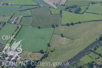
Aerial view of the farmland at Holt next to the River Dee where the tile-works were located

The piece was clearly broken, with a bit of the inscription missing.  Helen returned to Holt a few days later, to show it the to the farmer and to see if the rest of the fragment was lying about in the field, but by then it had all been rotovated – if she hadn’t picked up the brick it probably would have been further damaged. She reckons the gods must have been with her that day!

This was six years before the establishment of the Portable Antiquities Scheme, so after after showing the find to the landowner, who gave Helen permission to keep the object, Helen sent photographs to the British Museum.  The resulting correspondence offers a terrific insight into how an understanding of the significance of the object was reached. It emerged that the fragment of Helen’s brick on which the inscription was made was re-used as a form of notepad to make a quick record.  At first it was thought that the fragment was a tile, but it is more likely to be a piece of lydion or sesquipedalis; these look rather like tiles because they are very thin compared with modern brickwork.  Some of the letters have been sliced off at the far right, but what we are looking at is part of a coherent piece of text, a list with signatures.  It was a small-sized record, containing only a few details.  It measures 32cms, by 30cms, and is around 6mm thick.

Helen hard at work at the Rossett Roman Villa excavation in 2021. Photograph courtesy of Dr Caroline Pudney, University of Chester

The inscription is now recorded in various books and papers contributing to knowledge about Roman activities and everyday life in the Chester area.  Although Holt is just over the Welsh border, the tiles and bricks were created for the Roman occupation in Chester.

Following very fine lunches at Pant Yr Ochain near Gresford and the White Horse in Churton, where we pored over both the artefacts and documents that Helen has assembled, including her original correspondence with Catherine John and Roger Tomlin, we decided to write a post about the inscribed fragment.  Helen has now been investigating the Romans in the Chester area for three decades, and as her knowledge has grown she has excavated as a volunteer at Chester amphitheatre, the Heronbridge Roman settlement, and most recently the Rossett villa.  All the documentation cited here has been provided by Helen.

First, a quick look at the Holt tile-works, which produced the inscribed brick.

The early 20th century discovery of the Holt Tile-works

The Holt brick and tile works site was recognized in the early 1600s when landowner Thomas Crue of Holt Hill suffered repeated damage to his plough and was forced to investigate.  He discovered that his plough was encountering a series of fifty 2ft-tall posts, and his finding found its way into the book Roman Cheshire by W. Thompson Watkins (1886).  This was noted by retired chemist and keen amateur historian Alfred Neobard Palmer who, in 1905, decided to hunt for the remains that Crue had found, accompanied by local vicar Jenkyn Jones, having sought permission from the landowner.  A series of field-walking expeditions followed, uncovering plentiful fragments of Roman brick, roof tile and pottery over an area of some 20 acres.

Fold-out plan of the kilns at Holt, published by Grimes in 1930. (Scanned from my copy of “Holt, Denbighshire”)

Palmer was not an archaeologist, and the task of excavating the site was taken on by Wrexham solicitor and amateur archaeologist Arthur Acton.  Work began in 1907 and continued until 1915.  Although he delivered numerous lectures about the site, Acton never published his work.  Fortunately a portion of his records survived, and he sold the excavation finds to the National Museum of Wales, where William F. Grimes used the data to compile a comprehensive report, complete with site plans, photographs and object illustrations.  Work did not stop there, and during the 1970s Geoffrey Bevan conducted both field walking activities and an excavation, finding Roman material that filled dozens of boxes, which were donated, this time, to the Grosvenor Museum in Chester.  Helen’s field-walking in 1991 added the inscription to the list of important finds, and in 2018 Holt Local History Society commissioned Archaeological Survey West to carry out a geophysical survey of the site, to fix the positions of the known buildings and, with luck, to identify any unexcavated and previously unknown structures.  This demonstrated that the Holt complex was even bigger and more complex than Grimes, via Acton, had been able to determine.  There is, of course, the potential for future field research, and recent work in Farndon, summarized on local historian Mike Royden’s website is beginning to expand the story over to the other side of the Dee.

What was the Holt tile-works like?

Site plan of the Roman tile and pottery work displayed in the Hidden Holt exhibition. Also in the excellent booklet accompanying the exhibition, full details in Sources below. The features shown in blue are unrecorded / unexcavated.  Those in dark brown are the building locations fixed in 2018, and those in paler brown those estimated by Grimes based on Acton’s work.  Click to see a bigger version with fully legible text.  Source: Wrexham Heritage Service, 2021

The 20th Legion, Valeria Victrix, of the Roman army, was stationed at Chester, Roman Deva, from AD87, and the Holt works appears to have been established shortly afterwards to supply the fort and settlement at the legionary fortress.  Holt’s industrial activities reaching their peak output at around AD135, and began falling out of use in the mid 3rd Century.  The site was clearly a fully integrated operation combining industrial, public and domestic components.

A senior manager had his own house, complete with hypocaust (under-floor central heating), there was a public bath house, a series of kilns for the manufacture of tiles, bricks and pottery, and a barracks that may have housed workers, or alternatively a detachment of the Roman army based at Chester at this time.

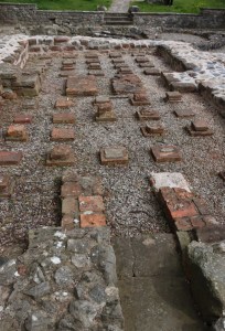
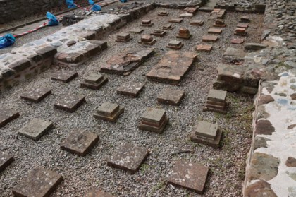
The hypocaust below the drying shed. Source: National Museum of Wales

The main kiln plant at Holt, published by William Grimes in 1930.

The kilns formed two main units, a larger (139ft / 52m long, consisting of a row of six kilns) and smaller twin-kiln built on the natural bed-rock.  Each kiln was rectangular and tile-lined with an arched stoke-hole for access.  A round pottery kiln was also located on the edge of the main kiln complex.  The oven floor consisted of a raised floor of tiles plastered with clay that were pierced with holes that acted as vents.  The drying shed was provided with a hypocaust, of the same sort used in villas and bath houses.  These, like the kilns, were stoked and kept hot to ensure that the tiles, pottery and bricks were dried through after firing.

Map marked by Helen to show the approximate findspot of the inscribed fragment

All of the output manufactured at the works was sent by boat downriver to Chester on the river Dee.  It provided direct access to Chester, 12 miles / 19km away, passing the civic settlement at Heronbridge.  The generally flat environment meant that building of roads, where needed, was not exceptionally laborious.
—–

Corresponding about the tile in 1991

The imposing facade of the British Museum. Source: Wikimedia Commons by Paasikivi

Helen wrote to the British Museum in April 1991 describing how she had found the fragment, and enclosing a high resolution photo in which the inscription could be seen clearly.  The first person to reply to Helen’s letter to the British Museum was Catherine Johns F.S.A., at the time Curator of Roman Britain in the Department of Prehistoric and Romano-British Antiquities in the British Museum in London.  In a letter dated 18th June 1991, Catherine Johns begins “Thank you for your letter and the excellent photographs and drawing of the inscribed tile from Holt in your possession.  This is an interesting and important find.”  She goes on to explain that the inscription is in cursive Latin, “that it is to say, it is handwriting rather than formal lettering.”  She was unable to translate the text, which is a specialist task, and sent it to Dr Roger Tomlin of Wolfson College, University of Oxford.  She warned Helen that the fragmentary nature of the text might impede translation.  She finished by suggesting that Helen might consider presenting the piece to the National Museum of Wales, where most of the Holt material excavated in the early 20th century is held.

Helen then received a letter dated 25th June 1991, only a week after the letter written by Catherine Johns, from Dr Roger Tomlin.  Dr Tomlin explained that it was by no means straightforward to decipher and transcribe the fragment, partly because of the several examples of handwriting inscribed, and the fact that it was clearly incomplete.  He suggested that this was a record of expenses, with the star symbol indicating the unit of payment in denarii, and that several individuals were involved. He referred to the inscribed brick as “a welcome addition” to the corpus of Roman inscriptions in Britain. In a later letter, dated 1st July 1991, he thanked Helen for offering to take the the object to him in Oxford, for translation, whilst on a family break, and expressed the hope to meet up with Helen to discuss it.  He suggested that the fragment was probably part of a lydion (or sesquipedalis), rather than a tile, a brick used for bonding-courses.  When Helen met Dr Tomlin for coffee, he departed on his bicycle, in typical Oxford style, with the inscription propped up in the bicycle’s basket.  ———

The inscription

The same photo of the inscribed tile found by Helen Anderson in Holt in 1996 as above, shown again so that you can review the cursive text Copyright Helen Anderson

The brick was inscribed in the still-soft surface of the wet clay before firing.  The translation of the inscription by Dr Tomlin is a great example of the sort of scholarship and academic detective work that go into understanding a single object.  The inscription was abbreviated, typical for this sort of note, where space was limited and standardized abbreviations were recognizable to all.  As already noted, the slab was broken, possibly by ploughing, so parts of the inscription are missing, but this apparently presented few problems for Dr Roger Tomlin.

Just by looking at it, you can see that there is more than one person’s handwriting, and that’s because each person wrote his own signature.  All three were men, named  1) Junius, 2) Maternus and 3) Bellettus.  The final s is missing in each case due to the break.  In the official transcription below, Tomlin has completed words where he knows them.  The slab is a record of expenses they had incurred, but does not say how they were incurred.  Junius was paid at least 4 denarii, probably more, but the break carried the other details away.

Notes about the inscription on the left, on the back of the photo above, followed ultimately by the publication of the inscription in Tomlin 2018, p.290

Front cover of Tomlin’s 2018 “Britannia Romana. Roman Inscriptions and Roman Britain.” Oxbow Books (see Sources below)

Dr Tomlin wrote about the inscription in the journal Britannia, vol.26, 1995, p.387, where it is numbered no.28 (and Helen’s role in the discovery is referenced in the footnotes).  It was later included in Tomlin’s comprehensive Britannia Romana, published in 2018, which lists over 400 epigraphic inscriptions from Roman Britain.  The inscription is listed on page 290 as number 11.14.  Dr Tomlin observed that the three men listed were probably legionaries (although he does not rule out in the 1995 publication that they may have been auxiliaries).  He says that two of the three names were commonplace Roman names, and the third, Bellettus, may have been a variant on the name Bellicus, which he describes as “popular in Celtic-speaking provinces.”  All three signed their own names, meaning that they were literate.

Tomlin is particularly interested in the word sumtuaria, which is missing its p, and is the plural of the noun sumptuarium.  The word is very rare, with the only example known by Tomlin appearing on a legionary pay-sheet in Masada, Israel, where it refers to food expenses.  Tomlin speculates that this was a record of expenses that were to be reimbursed by headquarters at a later date, but he does question how this was supposed to work when the record took the form of a brick (which, after all, could not be divided between the three men!)

Roman soldier’s payslip from Masada, Israel. Source: Arkeonews.net

This find, recording something of the lives of three men who lived in Roman Holt, has something of the air of the Vindolanda tablets.  The thin leaves of wood used at Vindolanda on Hadrian’s Wall recorded many aspects of everyday life, also written in cursive.  A selection of them are on display in London’s British Museum.  One of them had a similar content to the Holt example, showing a list of people who owe money.  Although it is incomplete and undated, it was possible to identify Vitalis the balniator or bath house keeper and Tagomas, one of a number of cavalrymen from northern Spain who appear on the list (also mentioning the latter’s contubernalis, or unofficial wife).

Text from vindolanda showing a list of people who owe money. Source: Vindolanda.com

————–

Publications mentioning the brick

The inscription became something of an emblem of local Roman social history, being referred to not only in academic publication, but also heritage newsletters and leaflets in Chester.  Dr Tomlin suggested that it be included on the Roman Inscriptions of Britain website, and it has very recently been added to the site here, where it has been given the identifier Brit.26.28.

Here are two examples of publications aimed at the general public, collected by Helen, that mention the find and give a good idea of how it was regarded:

Source: Revealing Cheshire’s Past series: From Farms to Fortress leaflet, page 6 Industrial Activity. Cheshire County Council

Connecting with the past

The inscribed brick in the Grosvenor Museum, Chester. Copyright Helen Anderson

You can see the inscribed fragment today in the Grosvenor Museum in Chester, where it is on display in the ground floor Newstead Roman gallery, thanks to Helen requesting that it be displayed locally rather than in the National Museum of Wales in Cardiff.  Not only would it have been difficult for local people to visit it easily in Cardiff, but the tile-works were directly connected with the legionary fortress in Chester, so this seemed like the perfect home for the inscription.  Generations of local schoolchildren can have their imaginations fired by seeing the handwriting of several different Romans who lived here nearly 2000 years ago.

Helen explains that her own children were so excited and proud of her discovery of this piece of heritage that they persuaded her that it should be on loan to the museum rather than donated.  Her children are now grown up with families of their own, and she has since donated it outright, deciding that it’s a piece of history that belongs to everyone.

If anyone wants to chat with Helen about the find, you can contact her via Twitter: @Helenus_.  You can also contact Andie on the Contacts Page, via Twitter @BasedInChurton, or leave a comment (the Leave a Reply link is immediately under the title of the post).

Other posts on this blog about Roman Chester and Holt can be found here.
———-

Final Comments

The object that Helen found in a field in Holt, during a short window between when turf was removed and new grass sown, has multiple identities.  Archaeologically and historically, it is one of a number of records of Roman Britain that together provide insights into Roman settlement and industry and particularly contribute to the narrative about the Holt tile-works.  At another level it is both a clue about record keeping in Roman Holt, and an ephemeral glimpse into the everyday life of three literate Roman men who were working at the tile-works and were claiming expenses.  Today, as well being a significant part of the Roman display in the Grosvenor Museum in Chester, it has made a claim for a position in Helen’s own family history.  Not a bad set of achievements for one inscribed object found lost in a field.  One wonders if the three soldiers ever did receive their expenses?———————

Sources:

Letters (in the private archive of Helen Anderson)

From Catherine Johns, Curator, Department of Prehistoric and Romano-British Antiquities, British Museum. To Helen Anderson, dated 18th June 1991

From Dr Roger Tomlin, Wolfson College, University of Oxford.  To Helen Anderson, dated 25th June 1991

From Dr Roger Tomlin, Wolfson College, University of Oxford.  To Helen Anderson, dated 10th July 1991

Books and papers:

Grimes, W.F. 1930.  Holt, Denbighshire:  Twentieth Legion at Castle Lyons.  Y Cymmrodor.  Society of Cymmrodorion.

Tomlin, R.S.O. 1995. 11.14 Holt (? Bovium), in (eds.) B. C. Burnham, L. J. F. Keppie, A. S. Esmonde Cleary, M. W. C. Hassall, and R. S. O. Tomlin Roman Britain in 1994. Britannia, Vol. 26 (1995), p. 325-390

Tomlin, R.S.O. 2018.  Britannia Romana. Roman Inscriptions and Roman Britain. Oxbow Books (Chapter 11, no.14, p.290-1)

Leaflets and newsletters:

The Past Uncovered, Autumn 1996
http://www.cheshirearchaeology.org.uk/wp-content/uploads/The-Past-Uncovered-Autumn-1996.pdf

Revealing Cheshire’s Past series: From Farms to Fortress leaflet, page 6 Industrial Activity.  Cheshire County Council

Holt: Legacy of the Legions, available from the museum, or can be downloaded.
http://old.wrexham.gov.uk/assets/pdfs/heritage/holt_castle/holt_legacy.pdf

Websites:

Coflein
Holt Roman Site NPRN 307201
https://coflein.gov.uk/en/site/307201?term=holt&pg=2

National Museum of Wales
Request for Information – Freedom of Information Request Relating to Collections – Reference 17-002, 14th February 2017
amgueddfa.cymru/media/41203/response-web-17-002.pdf

Roman Inscriptions of Britain Online
https://romaninscriptionsofbritain.org/
The Holt inscribed brick now has its own page at:
https://romaninscriptionsofbritain.org/inscriptions/Brit.26.28

Vindolanda Charitable Trust
Writing Tablets
https://www.vindolanda.com/blog/fact-file-writing-tablets

Vindolanda Tablets Online
http://vindolanda.csad.ox.ac.uk/


A great visit to the working Stretton Water Mill

The Grade 2 listed Stretton Water Mill is recorded from the 14th century, and was in almost continuous use until 1959.  It was restored by Cheshire Council in 1975 and became a museum in 1977.  It is located not far from Farndon and Holt, in Cheshire, very near to the villages of Stretton and Tilston.  Today it is a museum, with working water wheel, gears and related machinery, looking like an enormous clockwork toy, but powered wholly by water.  The mill still produces flour, but this cannot be purchased because the methods used, which are entirely authentic, contravene modern health and safety regulations.  However, flour from Walk Mill, near Chester, is sold in the shop.

This tiny vernacular cottage-type building, part red sandstone, part weather-board, is approached down a single track road (lots of passing places) and sits in an attractive rural setting.  It lies to the east of the well-manicured village of Stretton and its rural environs.

As well as the mill building, the two water wheels and the mill machinery, there is a big millpond, a picnic area, a car park (in a small field), and access via both external steps and disabled-friendly slopes between the two floors.  There is more visitor information at the end of this post.  

Stretton Mill is is a splendid remnant of rural architecture and at the same time tells a story about the industrial importance of water power in the lives of rural areas from the Middle Ages into the 20th Century, working around the clock during the Second World War.

—–
Getting your bearings: The waterworks

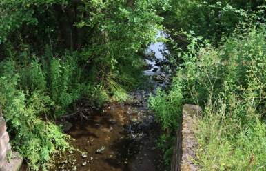
If you find that the tour is already in progress when you arrive (the tour is obligatory due to health and safety considerations) it would be a good use of the waiting time to get your bearings.  If you go straight into the tour, don’t forget to have a look around afterwards.  Simply walk up the short footpath from the car park towards the first storey of the mill, and look at the large, motionless expanse of water behind the building.  This is the millpond, which is fed by the Carden brook.  The brook is out of sight, but can be seen running under the road just a little further up the road towards Carden from the mill.

Sluice from the millpond into the by-wash

The job of the millpond is to feed the two water wheels.  The mill pond’s level can be controlled by a sluice into a wide by-wash,which drains the water into a tail-race or escape channel that eventually meets up with the main stream.  On the other side of the mill is a short flight of steps leading up to the other side of the mill, with some picnic tables.  Sluice equipment also controls the volume of water reaching the wheels from the millpond by raising or lowering the paddles (rectangular pieces of wood that can be dropped to stop water flow or raised to allow it).  When the wheels are out of use, for example when the mill is closed to visitors or to permit repairs to be carried out, the paddles can be dropped to stop the water entirely.

A typical watercourse layout. Source: Traditional Corn Milling Windmills by Nigel S. Harris, drawings by John Brandrick, fig. 12, p.9


A Short History of British Milling

Grinding grain

Roman water wheel replica in the grounds of the Museum of London (at its Barbican location). Source:  Geograph, by Martin Addison CC BY-SA 2-0

Harvested grains of wheat and barley are rock solid on the outside, and there is very little that one could imagine doing with them for nutritional purposes, except perhaps soaking and fermenting them.  The prehistoric solution, and one that was followed by subsequent millers, was to break them up and reduce them to powder by grinding them between stones, by hand.  By the Roman period, water wheels had been invented, and in the Medieval period, when Stretton Mill was built, these had been turned into both an industry and an art form, using vast carved stone wheels driven by water and a series of gears in an end to end process that introduced grain at one end and produced flour at the other.

Medieval mills

The mill at Stretton dates at least to 1350.  Water-powered mills were the dominant industrial mechanism during the Middle Ages, and were widespread, rescuing householders from the time-consuming, back-breaking and tedious task of grinding corn by hand.

A mill with an overshot wheel like the one at Stretton, and mill race.  Further up the stream there are eel traps, shown in the 14th century Luttrell Psalter (Add MS 42130, British Library).  Source: Wikipedia

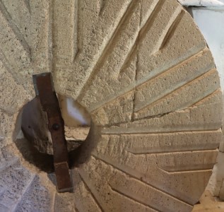
The millstones in a watermill, one set over the top of the other, were coarse.  They were carefully and skilfully carved with a set of precise grooves called furrows that helped not only to grind the grain but to move it from the centre of the millstone to the exterior.  The coarse stone cracks open the seed grains to allow the release of the kernel, and the grooves allow it to escape down a chute to be collected in bags below. 

Millstones were sourced both from within Britain and beyond, with imports of millstones made from particularly desirable stone areas overseas recorded at ports around the coast.  The cost of the millstone itself could be considerable, and the additional expenses of transportation and fitting meant that these were high value items that were carefully maintained.   

Millstones, laid in pairs, one over the top of the other, contain a complex series of grooves, called furrows, that grind the grain and move it towards the edge.  This is one of a former pair on display at Stretton.

Some mills with twin wheels would operate different milling activities simultaneously, such as corn processing and wool processing (known as fulling).  A mill was built by the lord of the manor (the term manor referring to the estate rather than just the house), who charged tolls called soke rights for its use.  Initially this was in form of a share of the corn and later was on a cash basis. Corn mills were used for reducing grains into products suitable for human and livestock consumption.  The term “corn,” which is generally used in conjunction with mills, refers not to the New World corn but was used as a generic term for wheat, barley, oats and rye.  The soke rights paid for the initial capital outlay and maintenance costs, and provided an income for the manor.  The use of the mill by manor tenants was not optional.  Manual milling at home was banned and anyone owning private milling equipment could be fined.  It is estimated that estates could extract as much as 5% of the estate’s total income from watermills.

Run-off channel (tail race) from the overshot wheel

In the mid 14th century after a period of severe famine, the Black Death arrived and obliterated around 25% of the population.  Once recovery was underway with a much smaller population, there was competition for labour and a rise of wages.  Instead of operating mills themselves, lords of manors often leased out their mills to private tenants such as the minor gentry, merchants and specialist millers and craftsmen who found themselves in a world of expanding opportunity.   At the same time, the abrupt decline in population meant that many other mills were abandoned, and fell into disrepair before either being revived at a later date or being allowed to decay.  In the case of Stretton it is not known precisely what happened, but subsequent records indicate that enough of the local population survived to either maintain or restore that the mill after the traumas of the 14th century.  Indeed, the use of the mill to save on manual flour processing during a population crisis would probably have assisted economic recovery.
———

Stretton Mill

The Medieval and Early Tudor Mill

Carden Brook, which supplies the water for the millpond and waterwheels

From 1281 the manor (estate) of Stretton was owned by the Warren family, who held it until the 15th century. The mill at Stretton dates at least to 1350, when it is first recorded in a transfer deed, meaning that it was built before this date.  Given that the Black Death was sweeping through Britain in 1348, it was probably built before that date.  It is not known exactly what the mill would have looked like before the 17th century.  The mechanism in the mid 14th century would have been very much the same as the one still working today, with the waterwheel operating via gears to turn the millstones.  There was only one waterwheel until the 18th century, positioned to the left as you face the mill, and this would have been on the outside, and was not incorporated into the interior of the building until the 19th century.

Stretton was dedicated to the processing of grain, mainly barley, oats and rye with some wheat.  Wheat bread was the most expensive, and used only for bread for the better off.  Barley could be used for an inferior bread, oats could be used to make porridge and oat cakes and rye was used bread and beer.   Barley, oats and rye could all be used for animal fodder too.

In the 1500s, Stretton Mill was purchased by the Leche family of Carden Hall.

Stretton Mill 1600-1900

Stretton Mill as it would have looked in the 1600s. Source: Author Uncredited – West Cheshire Museums

The oldest part of the mill dates to 1630.  In the 17th century the building is thought to have been made of a timber framework, filled with wattle and daub.  Wattle and daub is a mixture of thin wooden strips woven like basketry to form into a lattice, which provides a base to which a material can be added to create panels that form the walls of the building between the timber frames.  The mill was almost certainly thatched, the materials for which were easy to source in a rural agricultural location.  The fixtures that attached the wattle and daub to the frame can still be seen at the mill, and an example was pointed out on the guided tour. The windows, vital not only for visibility but to allow the flour-filled air to clear, would have been provided with shutters.  The water wheel was known as a breast-shot, and was located on the east end of the mill, to the left as you face it from the road.

The main types of waterwheel. Source: Guide to Ford End Watermill

There are four main categories of water wheel, the undershot, pitchback, overshot, and breast-shot. The main difference between them is how water is fed to the wheel, how the wheel uses this water to turn, and what sort of power this delivers to the machinery.  Each has benefits depending on a number of factors.  The overshot wheel is fed from an overhead channel, requiring a water source that is at least as high as the top of the wheel, runs counter clockwise and is the most efficient when plenty of water is available.  It is also an  expensive solution, requiring extensive installation work.  The undershot is powered by a low level water source that works by capturing the water between the wheel and the wheel pit, and is the least efficient.

The breast-shot wheel when it was under repair

The breast-shot design sits between the overshot and undershot, receiving water from a higher level than the undershot but a lower level than an overshot.  The main advantage of the breast-shot over the overshot is that it can use lower levels of water, allowing a mill to continue output even during periods of drought.

The breast-shot wheel at Stretton is unusual in that the sluice controlling access of water to the wheel has three paddles, each of which can be operated to let water into the waterwheel’s buckets at different levels.  This makes it very flexible when the water level of the millpond changes.

The water for the breast-shot wheel vanishes under the east wall of the building’s extension, into the wheel-housing, shown to the right.  Look out for this feature when you are outside at the level of the millpond’s surface.

The oldest local extant contemporary buildings in the area are Stretton Lower Hall, which was built in 1660 on a site that had been apparently been moated, and Stretton Old Hall, built in the 17th century and extended in the 19th century. 

By the 18th century, Stretton was one of a great many watermills and several windmills dotted throughout Cheshire and the Wirral.  As the map below shows, water power dominated in Cheshire whereas on the Wirral wind power was source of power for milling.  As the Industrial Revolution began to gain momentum, mechanization, mainly dependent on a water source, spread rapidly.

Map of water mills and wind mills in the 1770s. Source: Phillips and Phillips 2002, p.67

At Stretton there is an inscription commemorating major structural changes to the mill in 1770.  Improvements included a sandstone base, topped with weatherboard and finished off with a slate roof, still with a new overshot wheel added to the west end, together with a window overlooking it, on the right as you face the mill.  The breast-shot wheel at the east end was still on the outside.

Stretton Mill in 1770. Source: Author Uncredited – West Cheshire Museums

The addition of the overshot wheel was an important one.  The breast-shot wheel has been explained above.  The overshot wheel, which delivered water directly to the top of the wheel via a trough, was far more efficient when the millpond was full.  There is considerable drop from the millpond to the trough in which the overshot wheel sits.  This drop is known as the head.  The higher the head, the more powerful the potential of the waterwheel.

The water is taken away from the mill after passing through the wheels. Each has a tailrace that takes the spent water under the road, and if you cross the road you can see it leaving via small natural-looking channels that wend through the fields to re-join the Carden Brook.

The overshot wheel

The combination of the two wheels gave the mill the ability to function at maximum efficiency when rainfall provided a healthy supply of water, allowing both wheels to be operated, with the overshot wheel being particularly productive.  At the same time, when drought lowered the level of the millpond, putting the overshot wheel out of action, the breast-shot would still be viable.  The combination of two wheels was a very good risk-management strategy.

Contemporary with the mill at this period is Stretton Hall, brick-built in 1763 for John Leche (1704 – 1765) of Carden.  There were actually nineteen men at the head of the Leche family named John, and this was the fourteenth of them.

In the early 19th century the building was extended to the east to incorporate the breast-shot wheel, which could be inspected from the small arched window shown in the illustration below, and which survives today.

Stretton Mill in 1819. Source: Author Uncredited – West Cheshire Museums

The extension was built of red sandstone, but the weather-board was retained on the older section of the mill.  This is very like the mill building that survives today, albeit with less  red sandstone and more weatherboard than today’s building.  As well as the original wooden shutters, glass was probably fitted into the windows at this time.

The 1940s

The watermill was in 24 hour use during the Second World War, milling grains for both bread and animal feeds. It was in continuous use until 1959, when its last miller died, and it fell into disrepair.

The modern era

Millstone leaning against a wall in the stone room of Stretton Mill

The mill was acquired in 1975 by Cheshire County Council and was renovated in 1977 and given Grade 1 listing.  Stretton Mill as it stands today is part red sandstone, part weatherboard, and has a brick-built extension.  The fact that it incorporates earlier features of the mill building is a particularly attractive aspect of the mill that helps its history to be recreated, and apart from repairs it has changed very little since the 19th Century.  It is still fully functional, and produces flour which, unfortunately, does not conform to modern health and safety standards so cannot be purchased from the shop.
—–

What you see today

The exterior

Much of what can be seen of the building’s exterior today has been described above, but there are two notable exceptions.  One is the red sandstone-built chimney at far right, which connects to the hearth on the ground floor of the mill.  The hearth is a particular mystery given the risk of fire in an environment in which dry goods were being milled and could fill the atmosphere with combustible material.  The other is the brick-built extension in the middle of the three photographs above. The dates of both are unknown.  The use of brick does indicate a date after the mid 1700s, but is likely to be much later.

The water wheels

You can see both the overshot wheel on the outside, at the west end, and the breastshot wheel on the inside at the opposite end.  Of the two water wheels, only the overshot water wheel was working in late summer 2022, and was doing a great job.  The other was under repair but in June 2023, when I drove past, was not operating although the mill was open at the time, although the overshot wheel was trundling away.

The machinery

Stretton’s purpose was to grind grain.  The internal gearing translated the power of the big water wheel, via a series of interconnected wheels to turn the millstones.

The ground floor (meal floor)

If you look at the wall opposite the doorway, you will see that it is damp.  This is because the millpond is on the other side, and in the ground floor room you are well below the surface of the pond, as you can see when you walk up to the first floor level.

Spurwheel drive for two pairs of millstones. The vertically mounted pitwheel is connected to the waterwheel outside, and translates the power of the waterwheel to the smaller horizontal wallower above, and the large horizontal spurwheel above that.

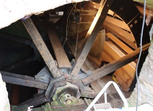
The ground floor contains the drive machinery for both wheels, and on the tour the machinery for the overshot wheel is clearly visible.  When you enter the ground floor, you can see how the water wheels connect to the rest of the machinery that drives the mill via a series of toothed wheels, which interlock with one another to send power to the millstones above.  The Stretton arrangement is known as an underdriven spurwheel arrangement, where the water wheel links to a much smaller vertical pitwheel wheel that is fitted on the same axis and turns at the same rate.  This has teeth that interlock with a small horizontal wallower wheel, above which is the spur wheel, all of which can be seen in the above photograph.

This is also the room into which the processed grain falls from the stone room, so it both begins the process and ends it.

The top (bin room) and middle (stone room) floors

We were able to visit two floors, but originally three floors were in use, which is the usual arrangement for a watermill.  The top floor, the bin floor, is inaccessible to visitors, located in the eaves of the roof, and reached by a stepladder.  This is where grain was stored before being tipped into a grain bin that released the grain into a chute that entered the hoppers of the stone room below.

Source: Medieval Technology and American History

The stone floor, which is at the level of the mill pond surface houses the machinery and devices for funnelling grain.  It feels rather like being inside an enormous clockwork toy, with interlocking cogs and gears controlling the turning of the millstones and the grinding of grain, as well as the lowering and raising of the top millstone (the runner) and the raising and lowering of sacks.  With hindsight it seems extraordinary that so much equipment could be fitted into such a small space.

The meal floor gearing enters the stone floor and interlocks with two pinions called stone nuts, which turn the millstones.  There are two pairs of millstones at Stretton, each pair driven by its own wheel. The stones are contained within wooden containers called tuns.  There is a small gap between the upper millstone, the runner, millstone and the lower millstone, bedstone.  This gap is called the nip.  The nip was adjusted by the miller in response to the type of grain being processed and the fineness required.  According to the West Cheshire Museums Booklet about the mill, the breas-tshot stones are currently French burr stone from the Paris Basin and the overshot stones are millstone grit from the Peak District.

The millstones are contained within the octagonal tun. Above it, the square-mouthed hopper sits on a frame and feeds grain into the millstones

The grain falls from the bin floor, into a large wooden funnel on the stone floor called a hopper, which sits on a horizontal wooden frame called a horse.  It is funnelled down a chute called a meal ark into the millstones where it is ground before being forced down the to the edge of the millstones where it is funnelled down a meal spout into a meal bin or ark on the meal floor.

Visiting details

It is a short drive from Farndon and is shown on brown heritage signs from the main roads in the vicinity.  If you are relying on the brown signs, look out for them carefully, as some of those closest to the mill are often partly concealed behind foliage.  The postcode for satnav systems is SY14 7JA.  The road to the mill, from either direction, is single track but has plenty of passing places.

Do check out the opening times on the Chester and Cheshire West web page for Stretton Mill before visiting because the mill is only open in afternoons and only on certain days of the week.   There is a small entrance fee, £3.70 at the time of writing.  Please note that it is cash-only.  Here’s the web address:
https://strettonwatermill.westcheshiremuseums.co.uk/visit-us/

The by-wash

The site is partially suitable for those with mobility issues.  There is a footpath that winds very gently up the slope that leads to the upper level of the mill, avoiding stairs, but this would probably be a struggle for wheelchair users during or after wet weather.  There are seats at all key points for those who are mobile but need to rest legs.

Because of very valid health and safety issues, you will need to be accompanied around the interior of the building on a guided tour (see below).  You can walk around the exterior without a chaperon, and there is step-free access, as well as some nicely located picnic areas for those who wish to linger and enjoy the view over the mill pond.  It is a really lovely location.  There is a gift shop, selling postcards, books, posters, and flour (milled at Walk Mill, not far from Chester because Stretton Mill is not a commercial milling enterprise and falls below rigorous modern health and safety standards).

Walking further along the road in the opposite direction from Stretton village, approaching Carden, the rural scene gives way to golf, as you find yourself around the back of the Carden Park Hotel and its immense golf course, which spans both sides of the road.


The guided tour

Steplader leading to the top, bin floor

The guide on the day provided us with a creative version of the birth of agriculture in the Near East.  If you want to prime yourself beforehand with the basics of the spread of agriculture from the Near East through Europe to and throughout Britain see the Britannica’s Origins of Agriculture web pages, if you can put up with the adverts.

At the end of this talk our guide gave us some hard wheat grains to hold and examine.  The inner kernel is contained within a hard husk that protects it, and the husks demonstrate unambiguously why processing is so necessary.  They are extremely tough.  We were then taken on a fascinating tour of the building, starting with the water wheels. Only the overshot wheel was working when we visited, due to repairs on the breast-shot wheel.  Next, we proceeded to the first floor “stone room” to look at where the milling happens. There is a long curving ramp that enables those who cannot manage steps to reach the top floor.  We then returned downstairs to look at where the external overshot wheel meets the internal gears, and to see where the milled flour was collected.

The tour of the mill equipment was very informative and extremely useful.  Unless you are familiar with how all the pieces fit together, it is helpful to have an explanation of the entire process as it would have happened in real time.

Final Comments

The video below was taken during our first visit in summer 2022.  I drove past in June 2023 and had a look to see if the breast-shot wheel, which had been under repair in 2022, was running again, but it was not.  The overshot wheel, however, is terrific, issuing a rhythmic rumbling noise that it is difficult to describe, but can be heard in the video.

It was an absolute treat to see a working watermill, and this one is a particularly engaging example in a lovely location.


Sources:

Books, booklets and papers

The by-wash, which can be used to lower the level of the millpond

Author uncredited.  Historical Background to Stretton Watermill and the Milling Process. West Cheshire Museums.

Dyer, C. 2005.  An Age of Transition?  Economy and Society in England in the Later Middle Ages.  Oxford University Press

Harris, N.S. Traditional Corn Milling Watermills, with drawings by John Brandrick. Written and published by Nigel Harris

Phillips, A.D.M. and Phillips, C.B. 2002. A New Historical Atlas of Cheshire. Cheshire County Council and Cheshire Community Council Publications Trust

Singleton, William, A. 1952. The Traditional House-Types in Rural Lancashire and Cheshire, off-print from The Transactions of the Historic Society of Lancashire and Cheshire, Volume 104, p. 75-91.

Watts, M. 2000.  Water and Wind Power.  Shire Publications

Watts, M. 2006. Watermills. Shire Library

Wenham, P. 1989. Watermills. Robert Hale

Websites

British Listed Buildings
Stretton Mill and Steps, Millrace and Sluice Adjoining
https://britishlistedbuildings.co.uk/101279423-stretton-mill-and-steps-millrace-and-sluice-adjoining-stretton

Cheshire Live
The 700-year-old ‘idyllic’ Cheshire watermill that’s like stepping back in time by Angela Ferguson, 12th March 2023
https://www.cheshire-live.co.uk/whats-on/700-year-old-idyllic-cheshire-26422639

Geni
Carden Hall, Cheshire (for details of the Leche family)
https://www.geni.com/projects/Carden-Hall-Cheshire-England/27610

Mills Archive
https://catalogue.millsarchive.org

Stretton Mill at West Cheshire Museums
Stretton Mill – Visits
https://strettonwatermill.westcheshiremuseums.co.uk/visit-us/

Wikipedia
Listed Buildings in Stretton, West Cheshire and Chester
https://en.wikipedia.org/wiki/Listed_buildings_in_Stretton,_Cheshire_West_and_Chester

Part 4: Who was Brymbo Man, what was the Mold Cape and why do they matter?

Part 4: Pulling together some of the threads

This is the last in a 4-part series about the Late Neolithic – Early Bronze Age in northeast Wales, with special reference to Bryn y Ffynnon, Brymbo (where Brymbo Man and a very fine Beaker were located) and Bryn yr Ellyllon, Mold (where the gold Mold Cape/s and accompanying artefacts of bronze, copper and amber were found).  The Introduction and an overview of how the two sites were found are in Part 1.  Discussions of Bryn y Ffynnon and Bryn yr Ellyllon are in Part 2 and Part 3 respectively.

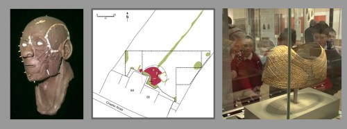
Left to right: The process of the reconstruction of the face of Brymbo Man from the Bryn y Ffynnon grave. Source: Wrexham Borough Museum. One of the geophysical surveys from the field in which Bryn yr Ellyllon was found. Source: Tim Young 2013. Screen-grab from British Museum video showing school children looking at the Mold cape. Source: British Museum video at the end of this post

This final part, Part 4, takes a closer look at some of the themes touched on in the previous discussions.  I have not attempted to provide a summary of the Early Bronze Age, which is done very well in numerous books, a number of which are recommended in Final Comments, the rest listed in the Sources in Part 1.  Here I have cherry-picked key issues that are relevant to discussions about the Early Bronze Age in northeast Wales.

  • Introduction to Part 4
  • Other types of site
  • The arrival of the Beaker phenomenon
  • Negotiating the role of the dead in the world of the living
  • Copper and gold in northeast Wales
  • Lost Data, Missing Data
  • Why do these sites and their associated ideas matter?
  • Wrapping Up
    • Final comments
    • Visiting
    • Useful videos
  • The sources for all four parts are listed at the end of Part 1

Introduction to Part 4

The Late Neolithic and Early Bronze Age, c.2900-1400BC, are usually discussed together due to their similarities.  The Bryn yr Fynnon site that was found in Brymbo, and the Bryn yr Ellyllon site found near Mold both belong to this period, but each represents different approaches to the same tradition of burying the dead with or without barrows or cairns and in stone cists with grave goods.  In northeast Wales the archaeological remnants that define aspects of Late Neolithic and Early Bronze Age life are largely funerary, with very little in the way of settlement data, which provides a distinctly lop-sided view of livelihoods.  There are only a small number of other site types in northeast Wales and these are very rare.

Other types of site

As explained in Part 1, so much data about the Late Neolithic – Early Bronze Age of northeast Wales comes from round barrows and cairns.  Although they are easily dominant, they are not the only types of sites belonging to the period.  A wide variety of site  types are found in other parts of Britain, although funerary data dominates everywhere.  There are isolated examples of some of these other types of site in northeast Wales.

Penbedw stone circle to the northwest of Mold, off the A541. Not open to the public. Source: Coflein

Stone circles are dotted throughout north Wales, but are concentrated mainly in the northwest and are rare in northeast Wales.  Timber circles are now being recognized throughout Britain, but they are rare in Wales and none have so far been identified in northeast Wales.  Timber rots in our damp climate, so stone circles are better represented but it is becoming clear that timber circles were just as prevalent, if not more so, in areas where wood was readily available.  Dating of stone and timber circles is uncertain but they were built somewhere in the 3000-2000BC range, may be large or small and are thought to have served a ceremonial role. 

Henges are rare throughout Wales.  They consist of circular spaces contained by outer banks and inner ditches with entrances, and were sometimes used to enclose earlier sites like stone and timber circles.  Dating is uncertain here too, but they span the period of somewhere around 2600-1750BC.

Settlements are only rarely identified and are usually very ephemeral, usually consisting of little more than scatters of domestic debris including pottery sherds, stone tools, small pits and some signs of hearths.  Only very occasionally does an excavation produce signs of a structure, which are often circular or broadly oval.

Stone cists (stone-line graves) without round barrows or cairns are by no means unknown.  Although in some cases the barrows and cairns have been removed in modern times, there is some evidence to suggest that in some cases the cist was never provided with a mound.  Brymbo could fall into either category.

Round barrows without burials are also found.  This implies that although the two sites discussed here have a funerary component, the barrow might have an important role of its own too, perhaps indicating territory, ancestral links with the landscape or an affinity with a broad set of ideas connected with how humans lived in and used the landscape, and built up relationships with the landscape and environment.

Cremation is the dominant funerary tradition in the latter part of the Early Bronze Age, from around 1850 to around 1500BC.  Secondary depositions in earlier round barrows, such as the one in Bryn yr Ellyllon are common, but cremations may be unassociated with any enduring monument.

There are several other types of site in Britain during this period but so far none of them have been identified in northeast Wales.

The arrival and spread of the Beaker phenomenon

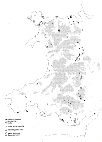
Map of findspots of, amongst other things, Beaker burials, showing how they were largely confined to lowland positions in northeast Wales. Source: Lynch 2000, fig. 3.2, p.86

The skeleton found in the Bryn y Ffynnon burial in Brymbo was interred with two objects.  One was an undistinguished flint tool, lightly worked on both sides.  The other object was a very fine Beaker, a style of pottery that was introduced from Europe and began to spread throughout Britain as part of a new  tradition that initially included not merely a single burials under round barrows, but also came with distinctive, new types of grave good. This new funerary convention clearly represented very different ideas to those in the previous periods.  The Brymbo Beaker itself was discussed in Part 2. The entire Beaker period is sometimes referred to as the Chalcolithic (copper-stone age).

As Frances Lynch’s 2020 map (right) demonstrates, Beaker sites cluster along the borders and coastal areas, but do not penetrate the inner areas of Wales, although Wales is smothered with round barrows and cairns, as shown on one of the maps in Part 1.

The earliest European Beakers and associated objects appeared in Britain during the Late Neolithic – Early Bronze Age and were very distinctively shaped and last between around 2500 and 2200BC.   It is now generally agreed that Beakers mark the arrival of people from various parts of western Europe, who brought their own distinctive traditions with them.  This European origin for the Beaker tradition has been researched by a number of multidisciplinary groups including the Beaker People Project and the Beakers and Bodies Project. These research projects have used conventional analysis supplemented by radiocarbon dating and by strontium and oxygen isotope analysis on human bones, the latter discussed briefly in Part 2, to help investigate the origins and spread of the Beaker phenomenon.

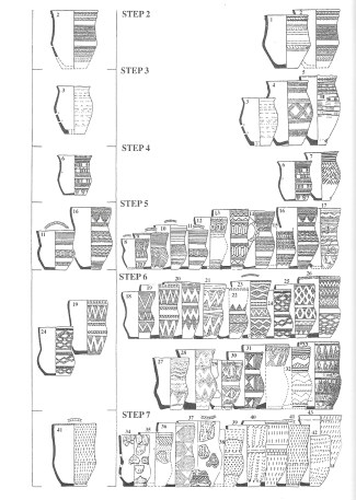
All known Beakers in Wales in 2000. The Brymbo Beaker is number 14 (Step 5). Source:  Lynch 2000, fig.3.13, p.116-7, based on a 1972 scheme by Lanting and Van der Waals.

Why did these European visitors or migrants come to Britain?  There are two popular arguments, which are not mutually exclusive.  The first is that already peripatetic  individuals, perhaps traders, were attracted by the news of the ceremonial centres of Wessex, such as Avebury and Stonehenge, which have no exact parallels in western Europe.  On the other hand, it is possible that these vast monuments were a response to the incursion, rather than a reason for it.  A second is that individuals came either to sell copper objects to indigenous groups, impressing them with the sharpness of blades and the durability of tools that could be recast when exhausted, or to search for new sources of copper.

Whatever motivated people to venture from Europe into Britain, bringing new burial approaches and ideas with them, the consensus is that the Beaker phenomenon spread through Britain after what archaeologist Stuart Needham refers to as the “Fission Horizon” at 2200BC.  Perhaps these early metal users impressed indigenous people with both the utility and magic of early metalwork and different ways of conceptualizing life and death, and the transition from one to the other.  The widespread dissemination through Britain produced geographical clusters such as those in northeast England and Scotland, but the new burial tradition became ubiquitous everywhere.  As Beaker style burials found their way into new areas, communities  demonstrated their own interpretations, cherry-picking what they wanted from the European tradition until it had become something adapted for local needs, preferences and beliefs.

The spread of the tradition is usually, although not exclusively, thought to have been by emulation rather than ongoing immigration.  The reasons for the adoption and spread of these novel approaches to funerary practice and the ideas that produced them, is still poorly understood, but may have much to do with personal identity and how it is received by the dead, and conferred by the living. In northeast Wales burials were usually isolated or in pairs, rather than in the clusters that can be found elsewhere.

Negotiating the role of the dead in the world of the living

Cairns and barrows just to the north of Llangollen in the Eglwyseg range. Source: The excellent Megalithic Portal website (search term “Llangollen”)

As prehistorian Richard Bradley points out, using a handful of remarkable graves containing exceptional artefacts cannot be taken as representative of the greater majority of sites that have either more modest grave goods or no objects at all, but although they are untypical, the burials at Brymbo and Mold illustrate a point about all funerary sites of the period, which is that no two round barrow burials is the same. Although there are recognizable similarities between most sites (such as round barrows or cairns, central stone-built cists, crouched skeletons, grave-goods and secondary burials), the objects accompanying the dead represent multiple ideas and choices.  The perception of objects as mediators of human activity is well attested in all areas of modern, historical and prehistoric lives, and the selection of objects, or the absence of them, represents choices being made within broader funerary traditions.  When a living person dies, they still have a presence and a role until they have undergone some sort of transformation process, to mark the change of status.  A family, group or community may find itself trying to redefine itself in relation to the loss, even if they believe that the deceased is headed for an afterlife, and the objects deposited with the dead may have been part of that process.

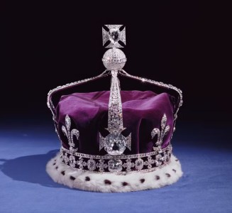
The crown of the Queen Mother, 1937. Source: Historic Royal Palaces

Because of our own hierarchical society it is easy but not always wise to assume that the burial of a single person in a marked grave reflects a clearly delineated social role, such as king, queen, chieftain or priest.  When a grave is accompanied by something as rich as the Mold cape, that can be a challenging idea, because it feels instinctively as though the cape and the person belong together, the one conferring status on the other, both reflecting the dead person’s position in life.  On the other hand, what would it say about our own society if the Queen had been buried with the Crown Jewels?  It would certainly suggest that something startling was happening within the royal family, the monarchy and the nation.

Tutankhamen. Photo by Jon Bodworth.

In Part 3, Bryn yr Ellyllon and the Mold cape were compared to the burial of  the Egyptian pharaoh Tutankhamen, as an analogy.  The burial of valuable objects may sometimes be more about disposing of earlier ideas than celebrating the them.  The Tutankhamen burial illustrates how it is the living who bury the dead, and the living may have firm views on what aspects of the living world should be disposed of at the same time.  A burial may reflect a lot of complicated ideas that may therefore have very little to do with an individual’s status in life, and the role of someone in death may be very different from the position or status, if any, that they held in life.

There are many different models of appropriate funerary behaviour.  In the Medieval period, for example, Jewish communities often adhered to the Old Testament’s view that “the rich and poor meet together in death,” indicating that material goods were only valuable to the living, often resulting in few if any grave goods and minimalist grave markers.

In the case of the Late Neolithic – Early Bronze Age, although a specific burial rite and the objects interred with the dead represent conscious choice based on the meaning of that object both in terms of a living community and in terms of how that community re-positions itself after a death, it is very difficult to know whether it is the identity of the living or the dead or the relationship between the two that is being worked through.

None of this directly addresses the questions of what the Beaker meant in one grave, or why such a remarkable collection of items was buried in another, but it does suggest there are many ways of understanding what objects are doing in graves in prehistory.  Whatever the value and meaning of the objects chosen to accompany the dead, both resided not in the material alone but in how the material had been modified and objectified to become embedded with ideas that were connected to the identity of the dead, or to the object’s role as a link between the living and the dead, and to the ideas of physical and spiritual transformation.

Copper, bronze and gold in northeast Wales

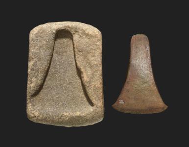
The Moel Arthur axehead hoard. Source: Frances Lynch, The Later Neolithic and Earlier Bronze Age in Prehistoric Wales, p. 101, figure 3.7

Because the copper mines of the Great Orme were referred to with reference to Bryn yr Ellyllon, and because the cape was made of gold, and other objects of copper and bronze were present in the grave, a brief overview of how metals were acquired in northeast Wales seems pertinent. The earliest known worked source of copper within easy reach of Wales is in southwest Ireland at Ross Island at around 2400BC, associated with European Beaker pottery, and possibly the result of one group’s prospecting activities.  The earliest Bronze Age (often referred to as the Chalcolithic) is represented in northeast Wales mainly by finds of thick-butted flat axe heads with high copper content in non-funerary contexts, including those from Halkyn, Moel Arthur, Iscoed Park and Caerwys, dating to between 2500 and 2300BC some of which, such as the Moel Arthur hoard, were probably from Ireland.  Later examples were made locally.

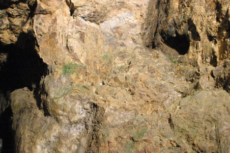
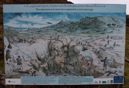
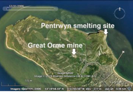
In northwest Wales the most important copper mine was Parys Mountain on Anglesey, which is better known for being worked extensively in the 18th and 19th centuries.  On the western edge of northeast Wales, on the coast just west of Llandudno, were the Great Orme opencast and underground mines, radiocarbon dated to between 1700 and c.900BC, still operating several centuries after other copper mines in Britain had closed.  There is an overlap here between the earliest phases of  the Great Orme mine and Bryn yr Ellyllon, Mold.  The opencast mines, where the copper was clearly identifiable green seams of the mineral malachite and relatively easy to access.  The  doleritized limestone and shales, surrounding the ore were soft and easily removed with bone tools. More resistant stone could be detached from outcrops by setting fires against the stone, causing it to crack it into manageable chunks.  The fire-setting would have required large quantities of wood, and may have had an impact on the local environment.

Archaeological exploration at the Great Orme. Source: Great Orme Bronze Age Copper Mines

Opencast mining was followed later by underground tunnelling of galleries for more difficult to reach seams, with galleries so narrow and low (some of which were no larger than 0.3m wide and 0.7m high) that it is thought that only child labour could have been used to work them.  Tools from the Great Orme mines included hammer-stones and cattle bone tools (leg and rib bones used as pickaxes and shoulder blades as shovels) were found in their thousands, together with bronze fragments.  The tunnelling probably coincided with advances in bronze, dependent on the knowledge of how tin could strengthen tools when added to copper (ideally with 10% tin to 90% copper).  The tin was presumably sourced from Cornwall, although evidence remains elusive.

At the Great Orme there are no traces of a settlement or even a domestic refuse site, meaning that there are no clues available about how the mining activities fitted into other livelihood activities.  It is not known, for example, whether specialized teams worked the early mines, or if all suitable members the community were leveraged.  Nor is it known if this was, at least early on, a seasonal activity that was fitted in around other economic pursuits, or whether even when mining first began it was a year-round occupation.  Later, as the mines went underground, the tunnelling alone would have been very labour-intensive, implying full-time operating, but at the time of the Bryn yr Ellyllon site, matters remain opaque.

The Caergwrle Bowl, found in Caergwrle, northeast Wales. Source: National Museum of Wales

Gold was not adopted until a requirement emerged for objects of beauty and prestige rather than everyday functionality.  Gold is too soft to be of any practical use.  Only stray items survive, presumably because terminally damaged items were melted down and worked into new objects.  Several early examples are from Ireland and southwest England.  Examples of Bronze Age goldwork from northeast Wales include the Mold cape(s), the Caergwrle bowl, and an object from Ysceifiog described as a waist tore.  Gold could be found in mid and north Wales, and could be sourced from local streams in northeast Wales, with a possible source for the Mold cape gold mentioned in Part 3.

Lost Data, Missing Data

In the case of Bryn yr Ellyllon, by virtue of the fact that it was plundered rather than excavated, the site stands out as a one of Britain’s most hair-raising examples of how important formal, systematic excavation really is.  The gold cape is lovely, but it is only part of a story that has so many missing components, including both skeletal remains and textiles that were mentioned in the contemporary correspondence but were not retained.  It is agony to know that prior to 1833 the site was undisturbed and could have imparted so much valuable information about the Early Bronze Age in northeast Wales.

This issue is as relevant today as it was in 1833.  Metal detectorists and archaeologists have been working much more efficiently together over the last two decades, and the Portable Antiquities Scheme works with the public to help map object findspots and identify potential sites, but damage to a site to locate objects may be irreversible.  As the British Museum’s Neil MacGregor says

It’s why archaeologists get so agitated about illicit excavations today.  For although precious finds will usually survive, the context which explains them will be lost, and it’s the context of the material -often financially worthless- that turns treasure into history.

It is even worse when formal excavations are not published.  Even the most professionally conducted excavation is an act of destruction, and the precise recording of the site and subsequent publication are the only means by which the site can contribute to research.  The site of Llong near Bryn yr Ellyllon, which produced a jet bead necklace, was the subject of an official excavation in the 1950s but was never published.  This represents an unforgivable archaeological failing.  it was left to Frances Lynch, some 30 years later in the 1980s, to try to pull together the essentials, but even given her excellent attempt to reconstruct the findings, the gaps are sad.

The Whitehorse Hill burial bracelet made of cattle hair and studded with tin. Source: Dartmoor National Park

Data is also lost thanks to the British climate and its destructive effects on perishable items, referred to by archaeologist Linda Hurcome as “the missing majority” on the grounds that by far the greater number of structures and objects in prehistory would have been made of perishable materials that decayed centuries ago.  The textile at Bryn yr Ellyllon is one example, but a more vivid illustration is a burial on Dartmoor in Devon called Whitehorse Hill.  At that site burnt bones were wrapped in a bear pelt and were accompanied by remnants of textile attached to calf skin, a basket, a cattle hair arm band and wooden studs.

Why do these sites and their associated ideas matter?

I started off asking why the burials containing Brymbo Man and the Mold Cape and their Early Bronze Age neighbours might matter.  There are many answers to that question, and you may have a few of your own to add.  

Recreating the past: adding to the bigger picture

Our knowledge of prehistory is fluid.  The idea that the past is static is challenged every time a new site or object is found and explored in detail, and  our understanding grows as new sites and objects contribute to the picture, and new research programmes examine whatever remains poorly understood and under-investigated.  Sites and objects only really start to matter when they are put together with other sites dating to the same period to get to grips with the contemporary social and economic context, which can in turn be compared and contrasted with those of different periods to enable a better understanding of how change happens.

Neal Johnson’s useful visual timeline of the Early Metal Age, showing how bringing together excavated data can help archaeologists to understand when and how technological, economic and social changes occurred. Source: Neal Johnson 2017, p.7, fig.2 (in Sources at the end of Part 1). Click to enlarge and read clearly.

Change is one of the special domains of prehistoric archaeology, because prehistoric research deals in multiple decades and centuries rather than months and years.  Archaeological research into livelihood management and change helps to offer ideas about what drives people to make changes in economic dimensions of their lives, and how this happens.  It also helps us to understand how economic changes and the adoption of ideas, whether local innovations or arrivals from Ireland and Europe, can impact cultural changes (changes in the material record), which in turn reflect how people think, how they translate ideas and beliefs into new actions, monuments and objects.  How these differ from one area to another, and across different topographical landscapes, is another line of inquiry, helping archaeologists to piece together regional identities.

Getting to know people who were rather like us

The separation of Britain from Europe at the end of the last Ice Age. Source: Richard Bradley 2019, p.10. fig1.5

Now that chronological frameworks for different regions in Britain are being refined it is possible to take up the challenge of learning how people lived their lives and expressed their ideas.  Fully modern people, Homo sapiens sapiens, arrived in Europe some 40,000 years ago.  When the ice melted following the last Ice Age completely severed Britain from the European mainland at around 6,500 BC.  Although initially characterized by livelihoods based on hunting, foraging and fishing, with different phases marked by new tool technologies, the introduction of cereals and livestock that had originally been domesticated in the Near East provided British communities with additional means for differentiating themselves from their European neighbours.  Even so, it is clear that by the Late Neolithic, cross-channel connections had been established and continued to be maintained throughout the Bronze Age and later prehistory.

Everyday lives during the Late Neolithic and Early Bronze Age were confronted with hurdles far more difficult than ours to overcome with the unsophisticated technologies available, and people had very little in the way of medicinal resources to treat injuries and health problems.   Lifespans were shorter, options more limited, and ideologies and beliefs were different, but families and communities had the same problem-solving abilities, tackled daunting decisions about risks and opportunities, and had their own traditions about how to behave under any given circumstances.  The objects that they made and modified might be simple tools for specific tasks but they might also have important roles a heirlooms, in creating identity, building up memories and negotiating the difficulties of rites of passage, including death.  The people who buried the individuals in Brymbo and Mold and their contemporaries are recognizable versions of ourselves, and they have left a rich legacy of their past presence both on and under the landscape.

Fairy Mount round barrow in Wrexham. Source: Geograph, by Geoff Evans

Almost wherever you go in northeast Wales, you are sharing the landscape with the prehistoric people who worked the land, engaged in long-distance trade, designed and manufactured both beautiful and utilitarian objects and built round barrows and other monuments, a surprising number of which have withstood the ever expanding agricultural and urban dimensions of modern life.  The round barrows are very easy to find, even in Wrexham itself.  This makes for a rich experience, with round barrows providing a real sense of how Bronze Age family groups or communities put their stamp ubiquitously on the uplands and lowlands of northeast Wales.  Sharing the past in the present is an opportunity to hear and respect the many hundreds of prehistoric voices can be heard if we take the time to listen. The fact that the past requires quite a lot of unravelling is just part of the ongoing enjoyment.

Connecting with the interested public

Brymbo’s Bryn y Ffynnon and its occupant have become more important than the sum of their parts by helping to explain prehistory to the public in the Wrexham County Borough Museum.  Both adults and children may be interested in prehistory but find it very difficult to find a way of approaching it.  By reconstructing the tomb in the museum itself, and by giving the partial skeleton a moniker, “Brymbo Man,” and commissioning a specialist to give him a face based on what remains of his cranium, the museum has used the grave to form a bridge between the present visitor and the past world of Beaker burials.  Videos and information boards, and exhibits with contemporary objects help to bring the Early Bronze Age of northeast Wales to life.  It really is terribly well done.

Screengrab from a British Museum video about the Mold Cape, shown at the end of this post.

The Mold Cape is also great PR for the Early Bronze Age in Wales.  It is a huge draw for tourists worldwide in the British Museum, and the source of fascination for British school children, as shown in the video at the end of this post.  A single piece of truly remarkable bling is not representative of this or any other period, but if it draws attention and results in questions to be asked, and children wanting to know more, it is doing a very good job for raising an awareness of prehistory and its complexities in the here and now.

Final Comments 

Frances Lynch, writing in 2004, commented: “It is difficult to clothe the bones of prehistory in flesh and blood, to provide people with a picture of society to which they can relate,” and this is clearly the case here.  By choosing two remarkable sites, a Beaker burial that is right on the edge of northeast Wales and the Mold cape assemblage, I have picked two sites that are anything but typical.  However, I hope that these two sites, each containing different levels of data preservation and each exemplifying different archaeological problems, have gone some way to explaining how fascinating prehistoric sites can be, both individually and as representatives of a bigger picture.

Two palstave axehead moulds found by a metal detectorist on Conwy Mountain near the Great Orme, and declared Treasure. Now in the collection of the National Museum of Wales. Source: National Museum of Wales, via the BBC News website

Prehistory often feels elusive, intangible, and really quite difficult to grasp, but as archaeologists employ increasingly sophisticated survey, excavation and post-excavation methodologies and approaches, and bring more  scientific techniques to bear, prehistoric livelihoods and worldviews become infinitely more accessible.  Well-presented museum displays, television productions and publications aimed at wide audiences help to support the public, of all ages, as they begin to discover not only what remarkable objects survive from prehistory, but to understand how they may help to tell us about the surprising complexities incorporated into prehistoric livelihoods.  These exist in a past that is distant, but in which people are still easy to recognize, and whose livelihoods, interests, hopes, concerns and losses may be readily identified with today.

Further reading
The full set of sources (books, academic papers and websites) that I have used for all four parts are listed at the end of Part 1.  If you are interested in learning more about the Late Neolithic – Early Bronze Age in Wales, Frances Lynch’s chapter The Later Neolithic and Earlier Bronze Age in the 2000 book Prehistoric Wales by Frances Lynch, Stephen Aldhouse-Green and Jeffrey L. Davies is a very useful introduction.  Steve Burrow’s 2011 book Shadowland, Wales 3000 – 1500BC about Welsh prehistory published by the National Museum of Wales includes good digestible accounts of the period.  Neal Johnson’s 2017 academic monograph Early Bronze Age Round Barrows of the Anglo-Welsh Border has some very good background information but focuses on round barrow clusters that are rarely found in northeast Wales.  For a comprehensive academic overview on Britain’s prehistory, Richard Bradley’s 2019 wide-ranging The Prehistory of Britain and Ireland provides an excellent foundation course.  All can be found in Sources at the end of Part 1.


Visiting

Both sites have been destroyed, so neither can be visited in the field, which underlines the importance of publishing what remains of known sites.  We are fortunate that in both cases the objects from the site were preserved and can be visited in museums.

The Brymbo cist and capstone, the skeleton found within the cist and the objects that accompanied the dead are preserved at the Wrexham County Borough Museum.  The Mold cape and associated objects are now held in the British Museum in London, and the cape has a prominent position in Gallery 51.  Details of both museums are as follows:

Wrexham County Borough Museum. Source: Wrexham Heritage and Archives Service

Wrexham County Borough Museum
The excellent Brymbo Man display in the Wrexham County Borough Museum is free of charge to visit, as is the rest of the permanent museum display.   The display includes some really good videos and information about the reconstruction of the Brymbo Man head and face, together with a holographic representation of the head. There is plenty of parking in Wrexham, and the museum is a short walk from the bus station. Hot and cold drinks, and some great cakes, snacks and lunches are available in the museum’s very attractive conservatory café.  See the Wrexham County Borough Museum website for visiting details: https://www.wrexhamheritage.wales

British Museum, London
The Mold Cape is in Gallery 51.  The British Museum’s permanent galleries are free to enter.  Parking is well nigh impossible.  The nearest Underground station is a 10-15 minute walk away, but there are plenty of buses that go past the front and back doors, and in London there are always taxis.  Within the museum, coffees and lunches are available in the cafés and the upstairs Great Court Restaurant (expensive but good, often with exhibition-themed special menus), and there are plenty of pubs, cafés and restaurants nearby.  The further afield you go from the tourist hot-spots, of course, the lower the prices become 🙂  For visiting details see the British Museum website for more  information. https://www.britishmuseum.org/


Helpful videos
dfsd


Objects from my Garden #12: Maker’s mark on a piece of flow blue ware by S.W. Dean, Burslem

Both sides of the broken sherd

For anyone new to this occasional series on objects extracted from my garden during everyday gardening activities, see the History in Garden Finds page.  These are not objects used in the garden, but objects, usually fragments, lost or disposed of in the garden and found during digging, troweling and planting.

This maker’s mark, crossing all three sherds, was a happy find for me, because although we have dug up tons of broken china from the garden (which is in Churton, a few miles south of Chester), all of it interesting in its own way, few of the manufacturers can be identified.  This piece, with a company trademark on one side and part of the pattern on the other, contains the name both of the manufacturer and the design.

Re-assembled, the original sherd is 9cm long and 3.5cm wide.  The potter’s mark is split over three broken pieces.  The clean breaks and pure what fabric that divided the sherd into three means that it was broken when one of us found it whilst gardening, with spade or pick-axe, straight through the middle.  Fitting the three pieces together to form a single piece leaves the much grubbier original break around the former edges.  The spidery cracks in the glaze, called crazing, have also allowed the garden earth to seep into the fabric.

Flip it over, and there are parts of the floral pattern on the reverse, a deliberately blurred design referred to as “flow blue,” about which more below.  Interestingly, the other images I have seen of this particular design, “Forget Me Not,” are not in flow, but are very clearly delineated, as shown in the example further below, where the design is in green.

What are we looking at in the manufacturer’s mark?  Starting at the top is a crown sitting over the top of a Staffordshire Knot.  This knot is a traditional symbol of Staffordshire and the town of Stafford, first used by the Stafford family in the 15th century.  The words within the circle read “England’s S.W. Dean Burslem,” which encircle a seated greyhound, part of the company’s trademark, and damaged with dark scratches in this piece.  In the banner (or swag) below this, and illegible here, this clearly reads on other examples “Royal Semi China” and beneath that is the design name “FORGET-ME-NOT” and the manufacturer’s registration number:  RºNº350600.  This mark is much clearer in the example shown below, which shows the same design applied using a different technique.

Green version of the S.W. Dean Forget-Me-Not pattern and trademark. Photos by Letsgoexplorin64 Source: Etsy.

S.W. Dean of the Newport Pottery, Burslem, in Staffordshire was the manufacturer.  Samuel Webster Dean had been the chairman of ceramics manufacturer in Edge, Malkin & Co., which started life as Cork and Edge in Burslem, making teapots and operated from 1846 to 60) before going through various changes in partnership.  When it closed in 1906, Dean declared an interest, and eventually took over the company in 1909, renaming it S.W. Dean. The greyhound at the heart of the maker’s mark was carried over from Edge & Malkin & Co, which had used it between 1873 and 1903.   The new company still operated out of Burselm at the Newport Works, and its products were probably sold in a number of retail outlets.  The company also appointed agents to sell its products at sales events in hotels in major cities, probably for bulk sales into retail and export.  In the advert below an event at the Holborn Viaduct Hotel in London as announced.  There are examples of the type of products that the company produced on the A-Z of Stoke on Trent Potters website.  S.W. Dean ran into financial problems very quickly, and Samuel Dean was declared bankrupt in June 1910.  Although the advert below mentions an export market, it seems unlikely that there was sufficient time for this to get fully underway before the company closed.

Advert from the Pottery Gazette of October 1908. Source: A-Z of Stoke On Trent Potters

Later in 1910, S.W. Dean was in turn purchased, and a new company was registered by J.D. Kerr.  Kerr clearly thought that the Dean name had enough brand recognition amongst potential purchasers of the ceramics to retain the name, because the new company became Deans (1910) Ltd.  A greyhound was retained in the log, but was on all fours, instead of seated, and was shown standing on an open crown.

The pattern side, showing the Forget-Me-Not design

The style and technique used on this pottery is called flow  blue, and is a form of transferware.  Transferware is a very swift way of transferring a design to the surface of an object. A copperplate engraved with the required design was inked, in this case with deep blue cobalt oxide, and pressed on to paper that, while still wet, was in turn pressed on to a ceramic surface.  The design left on the piece of pottery is the transfer.  With a complete object, the overlap between the transfers is usually visible as a seam, but this piece is too small to show this.  The process speeded up the process of decorating ceramics, making them much less expensive to produce than hand-painted wares, permitting mass production, and creating cost-savings that were passed on to the customer.  

The particular characteristic of flow blue is the appearance of blurred edges, giving them a soft and blousy look, quite unlike the precision of the green example of the same design above.  When the pot was ready for a second firing, after the transfer design had been fixed into place, a flow-powder was added to the kiln.  A typical mixture was 22% salt, 40% white lead, 30% calcium carbonate, and 8% borax, but there were variants.  This gave off a chlorine gas which caused the cobalt in the transfer to diffuse into the glaze, creating the flow effect and the intense blue glow.

The Newport Works in Burslem, Staffordshire, where S.W. Dean’s pottery production was based. Source: A-Z of Stoke On Trent Potters

Flow blue appears from about 1830.  Whether the effect was originally accidental or deliberate, it soon became very popular, first in the U.S., exported from Staffordshire factories, and later in Britain’s own households.  During the Napoleonic Wars of 1803-15, the U.S. had become Britain’s most important export market until the onset of the American Civil War in 1860.  The Registration of Design Act of 1842, which prevented factories from copying each others patterns without permission, resulted in new patterns, and sometimes specialization in particular types of design. By the mid 1800s British manufacturers were producing a variety of different genres, including more traditionally Victorian rural, garden and specifically floral designs, many of them very romanticized.  The forget-me-not is a good example of a flower chosen because of its popularity in Victorian gardens and poems.

Flow blue from the garden, with the forget-me-not sherd both centre bottom on the plate, and on its own on the right

A lot of flow blue has come out of the garden, but nearly all of it in very small pieces.  A sort through them has only found one piece that is consistent with the Forget-Me-Knot design, a very thin rim piece, much thinner than the pieces shown above.  It may or may not come from the same item, perhaps thinning towards the edge, but it could also be a sherd from a different part of the same set.  Some of the other pieces of flow blue display a characteristic feathering along the rims of ceramics, none of these gilded, although many feathered edges were.  Those shown here are a selection of the bits pulled out of the garden, including the Forget-Me-Not rim piece.

Other object histories from my garden can be found 
on the History in Garden Objects page


Sources:

Books and papers

Neale, G. 2005. Encyclopedia of British Transfer-Printed Pottery Patterns 1790-1930.  Miller’s

Websites

The A-Z of Stoke On Trent Potteries
S.W. Dean

http://www.thepotteries.org/allpotters/347a.htm

The Glossop Cabinet of Curiosities
The Rough Guide to Pottery Pt.5 – Blue and White Bits.
https://glossopcuriosities.wordpress.com/2022/09/15/the-rough-guide-to-pottery-pt-5-blue-and-white-bits/

HobbyLark
Flow Blue: History and Value of Blue-and-White Antique China, by Dolores Monet, December 23rd 2022
https://hobbylark.com/collecting/FlowBlueHowtoIDandValuetheCollectibleBlueandWhiteAntiqueChina

House of Brinson
Transferware and Flow Blue
https://houseofbrinson.com/2021/04/28/thoughts-on-transferware-and-flow-blue/#:~:text=If%20you%20see%20a%20blue,were%20widely%20sold%20in%20America.


A great day out at Greenfield Valley Park, Holywell

On visit to Basingwerk Abbey a few months ago, we noticed signage indicating that the abbey was at the south end of the Greenfield Valley Park, the north end of which is Holywell just to the south of Holywell town centre.  The Greenfield Valley Park had been on my to-do list for ages, but it was my friend Katie’s suggestion that we go today, and she brought David Berry’s guide book with her, which included a map that we followed to make the most of the park (details below).

Map from Greenfield Valley Visitor Centre

The park, which includes the ruined abbey and St Winifred / Winefrede’s Well follows both the line of the Holywell Stream that erupts in bubbles at St Winifred’s Well, as well as the line of a former railway track that ran from Holywell to Greenfield Dock.  It is one and a half miles as the crow flies from north to south, but covers 70 acres and consists of a network of metalled paths (marked on the map) and tracks, beautifully maintained, connecting some remarkably preserved industrial heritage.  Each one of these buildings was accompanied by large tracts of water that were used to power water wheels that were built in the late 18th century and continued to be used well into the 19th century.

As well as being fascinating, the tree-filled park is a lovely place to walk, particularly appealing in its multi-coloured autumnal garb.  In the summer there are birds and butterflies, and even at this time of year there was the occasional woodland flower.  There is also the little Bakehouse café in Basingwerk House at the  south end of the park, next to Basingwerk  Abbey, which serves good coffee, cake and a small, imaginative menu of nicely presented and very enjoyable food.

This post is confined to the really gripping industrial heritage.  I’ll talk about Basingwerk Abbey on another post, and St Winifred’s well, both of which we visited on the same day, will also be dealt with separately.  The following highlights of the walk start in the north and head south ending at Greenfield Dock.  The numbers in the text refer to the map above.
sdafasdfas

The Holywell Rail Line and bridge

The wide metalled footpath that links Holywell in the north with the A548 to the south follows the line of a standard gauge railway built in 1868.  Its purpose was to carry minerals from the Greenfield Wharf, now known as Greenfield Dock, and to ship products made at Greenfield Valley to Liverpool for sending further afield. In 1912 it was converted to carry passengers, and became known as the Little Train.   It claims to have been the steepest conventional passenger railway line in Britain, with a 1:27 gradient.  At the top of the path, near Holywell, there is a massively constructed railway bridge (10) with two wide arches.  Today, charmingly, it is a footpath, leading from Tesco to a housing estate.
asfasdfsd

Greenfield Valley 1792. Source: Davies and Williams 1986

Battery Works

Established in 1776, the Battery Works (8), also known as Greenfield Mills, was built to manufacture pots and pans from brass sheets.  Davies and Williams describe the process (p.28-9):  Each of the four copper and brass battery mills “consisted of large hammers raised by a cog on a rotating beam.  The beam extended from the axle of the waterwheel so that each waterwheel worked up to six hammers.  Once the cog had passed, the hammer fell, striking an anvil.  Workmen would hold sheets of plates of metal on the anvils and as the hammer hit them, shape them into pans, bowls and other articles.”

fdfdsfsd
The troughs that held the water to turn the wheels can still be seen.  One of the pits where the waterwheel turned can still be seen in the photograph below, together with a section of wall with a circular hole where the wheel once turned. Like all the main industrial operations along the river, it was backed with a large body of water at its northern (upriver) side.  The water is now full of bull rushes.  Even though it is impossible, just by looking at the ruined remains, to see exactly how all the different elements fitted together, this is a massively impressive piece of the Greenfield site.  The finished products were shipped to  Africa via Liverpool and exchanged for West African slaves.  

Meadow Mill

In 1787, eleven years after the Battery Works, a new mill (7) was built by the Greenfield Copper and Brass Company to produce rolled copper sheets, and to make copper rollers for printing patterns on to cloth.  The main building was a sizeable affair, 86 x 69ft (26 x 21m), with two pillars 11.5ft (3.5m) apart supporting a roof made of copper sheet.  It was  fitted with three cast iron wheels, each 20ft (6m) in diameter.  Copper ingots were melted and moulded into plates 3 (0.9m) x 4ft (1.2m) and about 1/2 inch (1.27cm) thick, which were cut into strips, that were in turn fed between pairs of rollers to create sheets of various thicknesses.   These could be turned into wire or other products.  When this work came to a close, the site was used by a number of other smaller-scale industries, including a tin plate works.

Meadow Mill  is backed by a basin of water that fed the water wheel that powered the mill.  It is now marshy and full of algae, making life rather interesting for the moorhens, and the surrounding foliage is now home to several species of butterfly. On the other side of the water wheel, the water was taken down to the next level of the valley down a purpose-built run-off.  

In the 1850s it was taken over by Newton Keates as a lead works.  This was followed by a tinplate works, then a brass rolling and wire works, and in 1890 was leased to William Eyre for rubber grinding and processing.

Lower Cotton Mill

There were a number of cotton mills along the Greenfield Valley, built for the manufacture of cotton textiles, all water-powered, in a period when cotton was one of Britain’s primary exports. John Smalley, one of the backers of Richard’s Arkwright’s ground-breaking spinning frame, established a mill with his colleague John Chambers. Their company was the Cotton Twist Company.  The earliest mill was built from stones taken from the nearby Basingwerk Abbey, and was called the Yellow Mill.  The business was declared bankrupt in 1780 and Smalley died in 1782, but Smalley’s window Elizabeth was able to find partners to push the business forward, and the business went from strength to strength.  Upper Mill was built inn 1983, Lower Mill (6) In 1785 (in just 10 weeks) and Crescent Mill in 1790.  All were fitted with Arkwright’s spinning frames and were worked by many local people, including young children.  The six-storey mill that survives today is the Lower Cotton Mill, its spinning frame once powered by a waterwheel 18ft high (5.5m) and 7ft (2.1m) wide with a 16ft (4.8m)  fall of water.  You can see the culverts that were built to carry the water beneath the buildings and feed them further down the valley.

From where we were walking, on the upper path, we could look down into the ruined warehouse’s, which was impressive.   In the 1850s it was taken over by a flour merchang and renamed the Victorian Corn Mill; the water basin is still called the Flour Mill Pond. Later it was the premises of a wheelwright and a brickworks.

If you were on the lower path, one of the buildings (which we did not know about) has apparently been restored and now houses a steam bottling plant, a railway museum and an exhibition on the industries of the Valley.  It was something of an omission that we missed this!  A good excuse to go back.  At the time of writing, admission is free.

Abbey Wire Mill

The Abbey Wire Mill overshot waterwheel in pit. Source: Chris Allen, Geograph

The site of the former copper and brass wire factory (5), the main output of which was  pins and bolts, has little to see.  It originally covered about an acre, and was the site of the wire mills of the Parys Mine Company, where rods of copper and brass were pulled through a series of holdes of decreasing size and then heated and cooled until wire was produced.  The site does contain an original waterwheel pit in which a waterwheel is still located, now renovated and capable of producing electricity for the museum.

In 1856, Newton Keates and Co leased the site and raised the level of the dam to create a larger pool.  This was a mistake.  Water broke through and flooded in 1857 and 1858, so the height of the water behind the dam had to be lowered.  The works closed in 1894 and the machinery was auctioned off.

Apparently, at a later date in the early 20th century, a small soap-works was built on the site which produced, presumably amongst other themes, soap imprinted with images of St Winifred, the first batch of which were sent to the Pope.  The mind boggles.  Today there is a small bandstand at its edge.

Further down the path, and the Bakehouse Café is located in Basingwerk House, a fine 1930s building.   We had a very good lunch there.  Beyond that is Basingwerk Abbey (about which more on another post) and beyond that is a car park and the A458, which you need to cross to reach Greenfield Dock, which is off the above map.

Greenfield Dock

Greenfield Dock is beyond the Green Valley Park, but is only a short walk away, reached by going through the car park beneath the abbey, crossing the main road, heading left for a short distance and taking the first on the right.  This is Dock Lane, which takes you to Greenfield Dock and the Wales Coast Path.  There’s not a lot to see, just a couple of tiny fishing boats in an inlet, and views (on a less grey day) across to the Wirral, but the dock was an important contributor to the Green Valley industries, linking with the Holywell Rail Line.

The Wales Coast Path, however, looks excellent in both directions, and a great destination for a sunny day.  It starts in Chester, and can be followed continuously around the entire Welsh coastline, but can be done in short chunks.  From here, for example, one could head upriver to Flint along the Path, and visit Flint Castle (which I have written about here), which is a walk of 4.3 miles (6.9 km) from Greenfield Dock to Flint Castle, but don’t forget the return journey.
——-

Wales Coast Path: Flint to Holywell. Source: Wales Coast Path

Visitor Information:

This is an excellent place to visit, with stacks to see.  If you are interested in industrial archaeology, wildlife on land and water, and woodland walks, you will not be disappointed.

To give some idea of how long it took us, we started out from Churton (about 15 minutes drive south of Chester) at 1030, arriving in Holywell at about 1115, having taken the most direct route along the A55, and we left at 1530, with a short stop for coffee and a snack in the park.  This is a dry-day walk, because there is nowhere to shelter.

In the Greenfield Valley everything is open and free to see other than the Green Valley Park Museum and St Winifred’s Well and Chapel.  We didn’t visit the museum, which is behind the visitor centre but details are available here.  Details for St Winifred’s Well can be found here.  The museum and visitor centre are closed from the end of October onwards.  There are also details about children’s activities on the Greenland Valley website here.

From a mobility point of view, a number of tracks, including the one that follows the line of the old railway are wide and metalled, but there is a distinct downhill gradient from Holywell to the abbey, and of course there’s the uphill gradient on the return journey.

Sources:

Berry, David, 2012. Walks around Chester and the Dee Estuary.  Kittiwake Books

Davies, K. and Williams, C.J., 1986. The Greenfield Valley. An Introduction to the History and Industrial Archaeology of the Greenfield Valley, Holywell, North Wales.  Holywell Town Centre

Greenfield Valley visitor’s Guide and Map (A3 fold-out)

The Industrial Heritage of Greenfield Valley. KS2 and KS3 Teaching Resource
cadw.gov.wales/sites/default/files/2022-02/Industrial%20Heritage%20-%20Greenfield%20valley%20resource%20-%20English.pdf

Greenfield Valley Park:  www.greenfieldvalley.com

A terrific visit to the Lion Salt Works in Northwich

The Pump House

What a brilliant place! The Lion Salt Works in Northwich is not only the last open-pan salt works in Cheshire but one of only four remaining in the world.  I had really very little idea of what to expect, but of all the places I have visited, this one most resembles an industrial time capsule.  It is as though things were left just as they were when the Works closed, which is more or less what happened.  The biggest market for Lion Works salt was West Africa, but when the Nigerian Civil War broke out in the late 1960s, and the political situation that followed it failed to improve matters, the Lion Salt Works struggled to survive, and the business closed in 1986.  The decision was made to convert the Works into a museum of salt working, and what a good decision that was.  There are lots of information boards, models and sound effects, all excellent, but what really grips is the sense that this could all start up again tomorrow.

Roman and Medieval salt pans

Another extraordinary aspect to the place is how for just under a century, between 1894 and 1986, the method of making salt from brine hardly changed.  In fact, the method used was pretty much the same as that employed by the Romans in the same area.  Open-pan salt manufacturing is just what it says – the salt-carrying water, brine, was pumped up from two levels of rock-bearing beds from below the surface and then fed into huge rectangular iron pans, which were heated from below to drive off the water, and then dragged to the side of the pan to help them drain

Salt beds beneath the Lion Salt Works

The Cheshire salt was once suspended in sea water.  In the Triassic Period, c.220 million years go, the Cheshire Basin was a tropical lagoon in which seawater became trapped.  As the water evaporated from the lagoon, it left behind a rock salt known as halite (Sodium Chloride).  Two bands of of salt lie under Northwich and were tapped by the Lion Salt Works.  The first is 40m (131ft) down and is 20m thick (65ft), then there is a 10m (33ft) layer of marlstone and then a second, 30m (90ft) layer of salt.  When rainfall entered the water table and washed over the salt layers, it dissolved the salt again, and created subterranean streams of highly salted water known as brine.  Natural forces pushed these salty streams to the surface in the form of natural springs, but the streams themselves could be tapped by drilling down to them and pumping the brine out at the pump house.

Inside the Pump House

The pump house is a good place to start your visit on the way from the car park to buy your ticket in the former Stove House, now containing a brightly modern shop and café.  The brine, once extracted from the borehole,  was stored first in a tank and from there it was distributed to the salt pans for processing.  A steam engine powered the pump, and both the engine and its boiler are still visible in the pump house.  The pump was known as the “nodding donkey” due to the motion of the overhead beam as it rose and fell.

Once beyond the ticket office, you follow the signs to enjoy a self-guided tour.  There are plenty of disabled elevators for the leg-challenged and for wheelchair users, which you can operate yourself.

The first building that you come to is a former terraced house, the Red Lion Inn.  The original Red Lion Hotel was knocked down in order to expand the mining operation, so two terraced houses were purchased in order to give the workers somewhere to relax after the heavy labour in the stove and pan houses.  This building is now used to show Roman and Medieval versions of the pans (just smaller, not actually any different in how they were used) and to show a reconstruction of the works office, complete with clocking-in machine, and the Red Lion bar.

Indoor salt pan on the first floor

It is difficult to get one’s head around the salt pans.  The concept is childishly simple, but the sheer hands-on labour involved even as late as the 1980s is truly remarkable.  There are displays showing the role of each of the workers.  The Lion Works was set up and run by six generations of the Thompson family, and the workers were all local people.   At first both men and women were employed in the heavy duty work of the Works, but later women were confined to the less strenuous work of packing up the salt and carrying out administrative tasks.

The two main initial tasks were to rake up the salt in the pans once the water had been evaporated off (creating steam-heavy rooms), and to feed the fires in the stove houses.  Here’s a somewhat eye-popping excerpt from the guide book:

Salt-making was a ‘dark art’ and the salt workers would add all sorts of things to make the salt crystals form.  These included strong ale, bullock’s blood and eggs, but these were replaced by soft soap and glue

First floor stove room

Workers known as wallers worked in the outdoor pans, pulling the salt along the edges of the pan to form large walls to drain it.  Inside, lumpers worked on smaller (but still huge) pans to rake the salt to the sides where it drained, before pacing it into blocks or lumps. The lumps were taken on barrows to the stove rooms to dry out.  From here they went through a crushing mill, a splendid piece machinery that was steam-powered until the 1950s when it was converted to electricity.  The resulting salt grains were graded from fine to coarse before being packed up in bags or small plastic packs.

The salt that was processed outside was inferior to that made inside, not due to the original brine or the work of the crushing machine, but due to the temperature at which it was heated in the pans.  This is because of the multiple uses of salt, from fine-dining to packing fish caught at sea.  The Trent and Mersey Canal runs alongside the works.  Coal to power the engines and to heat the pans was delivered by narrowboat and the packaged salt was also sent out by narrowboat.  The canal network was huge, and even though canal travel was slow compared to the railways that eventually replaced them, was well equipped for transporting heavy, bulk products reliably to towns, cities and ports.

The mining works had a dramatic knock-on effect on the structural stability of the town of Northwich.  The story of the subsidence caused by the mining is another aspect to the story that is truly compelling.  On the approach to the Lion Works, one of the mines subsided so thoroughly in 1928 that two flashes now flank the road.   The subsidence had a truly transformative impact on buildings and infrastructure, and not in a good way.  Buildings shifted, some tilting backwards or forwards, others dividing slowly into two, the brickwork forming great fissures as the subsiding and pulled them in opposite directions.  The solution was to go back to Medieval domestic building traditions, creating light-weight frames and building in jacks points into which levers could be inserted, in order to persuade buildings back into position.  Other buildings, like the Bridge Inn, could simply be moved in their entirety.  This gives the town today a half-timbered look.  It is an astonishing idea that to respond to the conditions, buildings became just as shiftable as furniture. Roads too subsided, and one collapse caused a major breach in the neighbouring canal.

Left: The Bridge Inn in Northwich on the move, giving new meaning to nomadic settlement strategies. Middle: The Marston Hall mine collapse caused part of the canal to subside in 1907. Right: Warrington Road frequently sank and 1000s of tons of salt pan cinders were used to build it up again.

There is lots more to find out at the museum, and I recommend it for anyone interested in industrial heritage.  As well as the Works themselves, there are plenty of really excellent information boards, some interactive displays aimed mainly at children, and some absolutely splendid photographs.

Visiting

We piled out to Northwich along the M56, and it was easy to find the Lion Alt Works by leaving at Junction 10, but we had intended to return via the A51, taking in the Anderton Boat Lift on our way back.  In our dreams.  At the time of writing (September 2022) Northwich is up in extensive roadworks, and the diversion signs must lead somewhere, but heaven knows where.  A sign half-buried in an overgrown verge directed wannabe Boat Lift visitors to follow the diversion signs, which was hysterically funny as the diversion signs were, as stated,completely unfathomable.  We just about found our way to the A51 to Chester (although not by following the diversion signs), but we never did find the Boat Lift, in spite of several attempts, both with and without the SatNav.

At the museum there is a car park, café and shop.  A free map is given out, but a really useful guide is available for purchase too.  The opening times on the website state that the museum is closed on Mondays except bank holidays, and there is an entrance fee.  For up to date information check out their website.
https://lionsaltworks.westcheshiremuseums.co.uk/

The smithy

The staff at the museum were friendly and helpful.  We were chatting to one of them at the end of our visit when we were sitting in the café.  His knowledge was immense, and he knew the answers to all the questions that we fired at him.  I failed to catch his name, but my sincere thanks.

The coffee came from a push-button machine, but was absolutely fine, and the tea was served in a lovely little pot.  The coffee was a particularly nice surprise after the undrinkable swill that was being served with breakfast in the Novotel in Greenwich (London), where I was staying recently!

For disabled and mobility-challenged visitors, there are wheel-chair friendly lifts to the upper floors, and you can operate these yourself.   The whole museum is intended to be disabled friendly, and at least to my eyes, looked very well thought out.

Feeding the ovens beneath salt pan 3

I wanted to see if there was any edible (as opposed to ornamental) local salt for sale, but forgot.  I am real salt enthusiast and always have several types at home for both cooking and seasoning at the table, so I am a tad miffed that I forgot to look!  If you go, do let me know if they were selling any.  There were blocks of ornamental salt for sale, in beautiful shades of pink, but I have no idea if it was edible too.

Manager’s house

Northwich town itself looks as though it will be well worth visiting after all the roadworks have come to a close, particularly if you are a fan of inland waterways and the architecture and civil engineering that goes with them (which I am).  Make sure that the Anderton Boat Lift is open if you want to see it, as its opening times seem to be something of a movable feast.


The crushing mill

Interior of the smithy


A walk from Telford’s Horseshoe Falls to the outskirts of Llangollen

Photograph taken from the top of the path leading from the car park, looking down at the Horseshoe Falls

The Horseshoe Falls are just outside Llangollen, a remarkable and lovely feature developed by Thomas Telford as part of his solution for supplying the Llangollen canal with water.  As the name suggests, it is a semi-circle of falling water, actually a man-made weir, which combines human symmetry with the natural beauty of water.  It looked spectacular in the sun, more art than engineering.

I usually make my comments about accessibility for people with uncooperative legs at the end, but in case the above photo makes you think I have lost my mind to categorize it as suitable , this is because there are other ways to approach the falls than from the top of the hill, approaches that are completely on the flat along the canal towpath.  Bear with me; clarity will emerge 🙂

Map of the Horse Falls area. Source: Pontcysyllte Aqueduct website

I had not set out to do this walk yesterday (Friday), and was actually on my way back from Valle Crucis (open once again to the public, but closed Tuesday and Wednesday each week), and was not ready to go home, so decided to drive down the road to the car park for the Falls, which is clearly signposted, and do a short walk to find out what it was like with a view to returning for a longer walk on another day.  The car park is pay-and-display but it is only a pound for the entire day, payable by cash or by swiping your debit card.  There are also public toilets.  I imagine that it gets quite busy at the weekends.

It is a short walk from there up a very slight slope along a metalled path to the top of the hill, from which the valley unfolds below.  There is an information sign here too.

I covered the basics of the building of the canal on earlier my post about the fabulous Pontcysyllte aqueduct, which you can find here, so won’t repeat that on this post, but the Horseshoe Falls deserve an explanation in its own right.  To secure water from the Dee, which ultimately comes from Lake Tegid at Bala, Telford gained permission from the owner of the lake to take off water  from the Dee for the new canal. The water had to be diverted from the Dee into the Llangollen canal by means of a feeder channel, some 1.8 miles long.  The distinctively shaped weir helps create a pool of water that can be pumped into the feeder channel. 

This link between the river and the canal required the installation of a pumping station by the side of the pool below the weir.  It was replaced by a new  Meter House or “valve house” in 1947, which still stands.  A massive pipe, 20ft long and 3ft in diameter runs 8ft below the ground to supply the Dee water to the Llangollen canal feeder.  This flow is released and slowed by means of guillotine valves which are controlled from the valve house.  By using the water of the Dee as it fell from Snowndonia via Lake Tegid, over 11 million gallons of Dee water a day, is fed into the Llangollen canal, eventually emptying into Hurleston reservoir, just north of Nantwich, where the Llangollen Canal meets the Shropshire Union Canal and contributing to the greater canal network. It was completed in 1808.

asfafas
It is a short and not particularly steep walk down to the falls from the car park, and the hillside is, at the moment a sheer delight, with the slopes covered in giant buttercups, purple thistles and daisies, with a few blue speedwells dotted in amongst them.  Once down at the falls, you are at the source of the Llangollen canal, a remarkable thought.   The valve house for the canal is at your left, and the footpath runs both left (east) and right (west).

I cannot yet comment on the footpath heading west, but if you head left, towards Llangollen, you find yourself immediately on a wide, level path, the towpath, which runs deliciously between the canal on your left and the Dee on the right.  The canal is very narrow at this stage, just a feeder, and not navigable.  The Dee too changes character, from a wide, deep run of uninterrupted river to fast, impressive rapids channelling itself through large slabs of natural rock.  Although the towpath runs above the level of the Dee, there are paths down to the river, and people were sunbathing on the huge slabs and paddling in the water.

The sound of the river coursing over the rocks is glorious, and a fabulous contrast to the peaceful, mirror-surfaced channel of canal that runs along the base of a solid wall of local rock, infiltrated by all sorts of rock-loving plant species and overhung by trees.  The canal widens as it goes, but remains un-navigable because, even where the canal is sufficiently wide and deep, there is no winding point (an indent where narrow-boats can turn around.  Long, sinuous weeds signal the direction of flow in the apparently motionless water, and fish, swimming against the current, hold a stationary position.  With the sun on it, when not mirroring the vegetation and sky above, it appears gold and velvet brown.  There are bridges all the way along, some modern and metal, but there are also traditional stone canal bridges, clearly numbered, with ramps for horses.  There is also an impressively substantial bridge spanning both the canal and the river.

One bridge is a delightful exception, and very unexpected.  The Chain Bridge Hotel contains within its Dee frontage, access to a small but perfect suspension bridge that provides access from the tow path to the railway station on the other side of the river, and some height above.   There is a small car park at the hotel, which can be used by the public.  I didn’t stop for a for a drink or a bite to eat, but the views from the terrace, over the bridge and the Dee rapids, are excellent.  This would probably be a good place to start and end your walk (particularly if the food is any good) if your legs like things simple, because the whole walk is on the flat.

I didn’t go much further because it was already getting rather late and I had other things to do.  I suppose I must have walked for about half an hour, with breaks to take photos, and then turned and walked back. Another way of tackling the walk would be to start in Llangollen and walk out towards the Horseshoe Falls.  This would be a much longer walk, and one for another day,  and again on the flat all the way along the towpath.  I am looking forward to it.

I went some way past the Motor Museum, which was to the right and below the level of the towpath.  The walk was particularly good on a day like yesterday, with hot sun and a light breeze.  At this time of year, with leaves on the trees, the towpath is in dappled shade, perfectly warm but not too hot.

Here are the rest of the photos:
dafsdfds

Exhibition: “Tales from Terracottapolis” at Tŷ Pawb gallery, Wrexham

Tŷ Pawb, meaning “Everyone’s House,” is a small but well thought out community and arts hub in the heart of Wrexham.  I had never been to Tŷ Pawb before, simply because I didn’t know of its existence.  Although I have been permanently installed in Churton for over a year now, I am still finding my way around.  The photographs below are my own unless otherwise stated in the caption.

Ty Pawb in Wrexham. Source: Wrexham Leader

For those who have never encountered Tŷ Pawb, it was formerly a covered market with a car park on top.  Apparently the market was hanging on to life by a thread before it was closed and as usual with this sort of change, the plans unsurprisingly met with some resistance. Often, the words “arts” and “community” when put together in the same sentence are enough to set any number of warning bells ringing, but in this particular case, there has been a strong dose of common sense and a real feel for the town thrown into the mix. The car park and the open space occupied by the market are still there, but the exterior and the former market space have been given a very smart and modern facelift.  Small retail units and a food hall and modern benches and chairs making it an an excellent place to meet and grab a bite.  It is an impressive initiative, and looking at it today, it seems to be working very well.

Source: Ty Pawb

The  gallery fits in very nicely into this arrangement.  The market space with its creatively designed modern signage and bright frontages and furnishings give the whole place a contemporary edge, which segues nicely with the inclusion of the gallery, which is so well blended into the space that at first we couldn’t see it.

We were there to see Tales from Terracottapolis.  It is on until 4th June (open Monday to Saturday, 10-4, free of charge), and I recommend it wholeheartedly.  It is a small exhibit, a single gallery, but makes brilliant use of the space with its excellent light.  Using objects from the Wrexham Museum and elsewhere, together with art works from a number of local artists, it combines 19th Century with 21st Century ideas to explore the local production of architectural flourishes and glazed tiles that formed the character of an older, more confident and prosperous Wrexham.  Some of the decorative twiddles, like capitals, finials and long decorative panels, could be ordered from catalogues, but others were custom made.

There is an excellent video that provides the background to the industry, and explains how the terracotta was made, from kneading the clay by hand via being formed into moulds before firing, a highly skilled process from beginning to end.  It would have been really great to be able to re-see the video online.
asfsdfsdfsd

The front part of the gallery, where you walk in, is dominated by the modern pieces, many of which are very striking and engaging, and which aim to complement the story of Wrexham’s brick, tile and terracotta industry by offering new responses to it.

The first thing that draws the eye is The Brick Man by Antony Gormley, best known for his Angel of the North. It is (or would have been) one of his most tactile pieces, and a true celebration of brick.  This is a scale model of a piece that was originally planned as a 120ft (36.5m) monument in the run down Holbrook area of Leeds, near the Leeds City Station.  There was some public outcry against it, which is such a shame, as it resulted in the planning application being rejected by city planners.  As well as the scale model, itself a solidly impressive celebration of brickwork, there is an archive of documentation following the sources of the statue, from the original proposal to the official rejection of the the proposal.

There is a fascinating letter from the Partnership Manager of the British Railways Board, who supported the idea of the project, to a disgruntled objector, which really hits the nail on the head for me.  You can click on the image to see a legible version.  I am often amongst the first to grumble about inappropriate and poorly thought out modern sculpture installed in urban or rural locations as some form of random art statement, because such initiatives can actually alienate people from art and frequently undermine the impact of the heritage in which they are being installed.  By contrast, The Brick Man actually had real merit (originally, I typed “legs”), not only as an art work, but as a way of contributing to urban regeneration, both by drawing attention to the monument and the area, and by attracting visitors.  It is also a good piece of art, which is important.  I was previously unaware of The Brick Man, and it was a really good opportunity to see the scale model and some of Gormley’s original plans.

Display of pottery sherds by Paul Eastwood

Immediately on the right as you walk in to the gallery is a section of wall covered by rows of ceramic sherds that the artist, Paul Eastwood, had collected from riverside locations during lockdown.  It was so familiar, looking eerily like some of the stuff I have been collecting from my garden, and posing exactly the same sort of questions.  Eastwood, based in Wales, specializes in capturing how memory is created through objects and language and, in this case, what abandoned sherds tell us about the people who discarded them and the places they were found.  There were other pieces of his work on the same wall.

A set of large stand-alone pieces in the main space of the gallery, hanging panels and tall curving sections, captured the images of walls and arches, surface-traced like brass-rubbings from the derelict walls of buildings that had produced the bricks, moulded works and tiles.  I had not worked my way round to these Lesley James pieces when I was welcomed to the exhibit by one of the curators, who pointed them out to me, and I was glad she had as I would certainly have missed their textural connection with the 19th century manufacturers:

Lesley James surfaces traces

At the far end of the gallery is a floor-to-ceiling map showing the location of all the major brickworks.  It is an excellent way of showing just how important the area was for the production of bricks, tiles and terracotta.

In this section of the gallery, the focus shifts from present to past, and some of the marvellous tiles and moulded terracotta pieces are located here, together with the video.  This is where the exhibition makes a slight gear change from modern art gallery to beautifully displayed items of heritage.  Both flanking the map and at its foot, are examples of locally made bricks, each one marked with the name of the works that produced it, with a key to identify which name related to which manufacturing works.  In Farndon, on Brewery Lane, there is a Llay Hall brick more or less randomly incorporated into the left side of the road, all on its own, face up.  I have no idea what it is doing there, but it was great to see two of its relatives on display, from Llay Hall Brickworks in Sydallt.

sdfsadfasdf

J.C. Edwards ceramic tiles, rescued from a condemned property on the Air Products factory site in 1989, and restored and reconstructed in 1993.

The main manufacturers represented at the exhibition are Dennis Ruabon Ltd and  J.C. Edwards of Ruabon, both important local producers of bricks, tiles and terracotta.

J.C. Edwards tiles were particularly valued and were installed locally at Liverpool’s Pier Head, and at the Lever Brothers village Port Sunlight on the Wirral, and were bought from as far away as Singapore, Egypt, Panama and India.  Edwards also provided the floor tiles for the kitchens on the Titanic. There is at least one of his tiles in the British Museum, designed by Lewis Foreman Day.

Examples of Dennis Ruabon Ltd terracotta work can be seen locally in Chester at the Westminster Motor Car and Coach Works and the Central Arcade in Hope Street, Wrexham.  Further afield, the Grand Metropole Hotel in Blackpool and Wellington House, at Buckingham Gate in London are high profile examples of  Dennis Ruabon Ltd work.  Whilst Edwards specialized in brickworks based on the Etruria Marl unique to the area, Dennis had interests in a variety of industries, including  quarries, coal pits, waterworks, brickworks and a tramway.

Tiles by J.C. Edwards

Tiles by J.C. Edwards, Henry Dennis, Monk and Newell and the Pant Works

The use of clay pressed into moulds was an excellent way of enlivening buildings, giving them celebratory flourishes without all the costs involved in stone masonry.  The use of moulds that could be re-used many times, enabled manufacturers to produce catalogues for architects, from which their customers could choose appropriate features, which not only made decorative flourishes affordable, but resulted in their proliferation, particularly on roofs.  Once you have seen the items on display, as well as those more elaborate versions shown in the video, it encourages you to look up in places like Wrexham and surrounding villages to spot the terracotta work that gave many local towns a real sense of pride.

Dennis Ruabon Ltd chimney

The layout of the works was elegant and well thought out, with each item widely spaced from the next, allowing it to be appreciated without distraction.  The combination of modern art works and 19th century heritage objects worked beautifully.

All the signage was in Welsh and English, and there was a  handout introducing the modern artists whose works were on display, together with  the 19th century manufacturers J.C. Edwards and Dennis Ruabon Ltd.  I picked up the Welsh version, assuming that it was bilingual; presumably there was an English version as well, so if you don’t read Welsh, look out for it.  I was rescued by Google Translate 🙂

The friendly and helpful curator of the exhibition, whose name I failed to catch, told me that over 2000 people had visited since the exhibition opened in March, with a number of them either former workers or their families sharing experiences.  Certainly, from my own perspective of things I have found in my garden, the Llay Hall brick randomly set into the side of a lane in Farndon, and my enormous affection for 19th century tiles in general and the Westminster Car and Coachworks (now the public library) in Chester in particular, it was very easy to relate to this exhibition.  The modern art pieces also work really well, balancing the older pieces and offering a new way of looking at this type of heritage, as well as engaging the visitor in their own right with thoughts about how heritage can be remembered, explored and, when necessary, lamented.

There was a school party arriving as we left, and on the table by the door I noticed that there was a pile of A4 sheets showing illustrations of three different statues, with an empty space for children to add their ideas for a monumental work.  We flipped through the completed sheets, and they were brilliantly inventive.  They made me remember what it was like to be a child with all that flying, chaotic, no-holds-barred imagination.  I particularly liked the giant robin with a big mouth in its side were its wing should be, complete with a healthy set of teeth.  The giant jelly fish statue was also rather terrific, but they all had something to offer.  Some were surprisingly very abstract.  It was a marvellous idea.

The gallery is a welcoming place, completely unintimidating. I both admired and enjoyed the entire feel of the place.  My only actual grumble about  it is that apart from seating for watching the video there was no seating in the gallery for those who have less than perfectly functioning legs, or who just want to sit and soak up the exhibits.

Practicalities:

The gallery is open 10-4, Monday to Saturday and the exhibition is free to visit.  We didn’t investigate what else the gallery has to offer, so it would be worth checking what else is available and whether there is a ticket charge if you want to visit anything other than the exhibition space (Gallery 1).  Full details for visitors and future exhibits are at https://www.typawb.wales/plan-your-visit.  You can also follow them on Twitter at https://twitter.com/TyPawb

We parked in the multi-storey carpark on Market Street, which has lifts down to the ground floor where the gallery and the food /retail space are located.  It was easy to find, and unlike some multi-storeys, the spaces were generous.  Do not leave your carpark ticket in the car – the pay station is on the ground floor outside the doors to the elevators, and access to the elevators requires you to put your car park ticket into a ticket reader by the side of the door.

Tŷ Pawb has been shortlisted for Art Fund Museum of the Year, the winner of which will be announced in July 2022.  Here’s hoping!
afadfs

Source: Ty Pawb

Sources:

Ty Pawb
Exhibition: Tales from Terracottapolis
www.typawb.wales/tales-from-terracottapolis

Exhibition handout in Welsh:  Chwedlau o Terracottapolis 19/03/22 – 11/06/22


More re Wrexham’s brick, tile and terracotta manufacturing history:

Wrexham Leader
There was gold in the red of Dennis Ruabon
https://www.leaderlive.co.uk/news/20131331.gold-red-dennis-ruabon/

Old Bricks – History at your feet
Ruabon Area
https://www.brocross.com/Bricks/Penmorfa/Pages/ruabon1.htm

Coflein
Hafod Red Brick Works; Dennis Ruabon Brickworks, Rhosllanerchrugog
https://coflein.gov.uk/en/site/40776/

Wrexham History
Henry Dyke Dennis and the Red Works, by John Davies
https://www.wrexham-history.com/henry-dyke-dennis-red-works/

Pontcysyllte
Brickworks
https://www.pontcysyllte-aqueduct.co.uk/object/brickworks/

Hansard 1803 – 2005
Brick and Tile Industry, Wrexham Area: Motion made, and Question proposed, That this House do now adjourn.—[Colonel J. H. Harrison.] – Mr. J. Idwal Jones (Wrexham)
https://api.parliament.uk/historic-hansard/commons/1958/jun/10/brick-and-tile-industry-wrexham-area


More on Ty Pawb:

Ty Pawb
“About” page
https://www.typawb.wales/about/

The Guardian
Tŷ Pawb review – an art gallery that truly is everybody’s house. By Rowan Moore
https://www.theguardian.com/artanddesign/2018/sep/01/ty-pawb-review-art-gallery-everybodys-house-wrexham-market

Architect’s Journal
Something for everybody: Ty Pawb art gallery by Featherstone Young
https://www.architectsjournal.co.uk/buildings/something-for-everybody-ty-pawb-art-gallery-by-featherstone-young

Wrexham Leader
Ty Pawb, Wrexham, shortlisted for Art Fund museum of the year
https://www.leaderlive.co.uk/news/20126804.ty-pawb-shortlisted-museum-year/


More on artists in the exhibition mentioned in this post

Paul Eastwood
https://www.paul-eastwood.net/

Lesley James
https://www.lesley-james.com/

Antony Gormley
https://www.antonygormley.com/


A stroll through Marford Quarry (source of the Mersey Tunnel cement) on a cold but sunny day

Last week we went to Marford Quarry, just off the Chester-Wrexham road just south of Rossett.  I had never visited before, but it has been open to the public for walking and cycling for decades and has had a lot of work invested in it to make it a great place to walk dogs and stretch legs.  Bigger and smaller footpaths and trails make for a lot of variation, as do the multiple facets of the quarry and its surroundings, with different types of plantation and wildlife providing a lot to see.  Some of it looked almost like a desert landscape, whilst other parts were thick with shrubs and trees.  Although trees dominate even the sparsely covered areas, particularly silver birch and conifers, and the bird song is fabulous, there is a lot more going on at ground level, with wild flowers clustering in favoured spots and the rustle of birds turning over the leaves.  We saw a wren, long-tailed tits, blue tits, great tits, blackbirds and plenty of robins bouncing fearlessly near the paths.  The heart of the quarry a deep bowl with a slight rise in the centre with a single tree on top, is a dramatic sight, like an enormous amphitheatre.

Marford smithy on the left, with the glacial moraine like a giant wall in the background, now quarried away. Source: Essentials Magazine https://www.essentialsmag.co.uk/features/the-last-icesheet

Marford Hill, climbing from Rossett towards Wrexham, is what remains of a glacial moraine.  An article, The Last Ice Sheet by Pam Gibbons in Essentials magazine, has a photograph of the quarry before it began to be quarried for sand and gravel to make cement.  It is shown right, around 130ft high and up to 25,000 years old, dumped by the glacier as it melted, and the ice retreated north.  The former smithy, used by ATS for so long, and recently replaced by two modern houses, is clearly visible on the left at the foot of the hill.  A marvellous photograph, with thanks to Pam Gibbons for recognizing its significance when she saw it.

There was originally a motte and bailey castle at the top of Marford, called Rofft.  I’ll see what I can find out about it, but the quarrying destroyed it, which surprises me given how aware people were of the value of historical sites by the 1930s.  It is such a shame.

Here’s the original caption from the Wonders of World Engineering website: “BUILDING THE ROADWAY through the Mersey Tunnel. Made of reinforced concrete, the roadway is supported by two intermediate walls, 12 inches thick and 21 feet apart, and is anchored to the cast-iron lining. The finished road in the main tunnel has a width of 36 feet between the kerbs. The tunnel has a capacity of 4,150 vehicles an hour, with cars 100 feet apart and moving at twenty miles an hour. The space beneath the roadway acts as the duct for fresh air and is sufficiently large to provide a second road or railway should they be necessary.” Source: Wonders of World Engineering

The quarry opened in 1927 and closed in 1971.  Its biggest claim to fame is the it supplied material for the Mersey Tunnel.  The Mersey Ferry and the railway tunnel, between them doing a good job of carrying passengers to and fro, could not cope with the growing demands of road traffic.  Initially a bridge was proposed, but the engineering wisdom came down in favour of a tunnel, which required a lot of aggregate.  Work on the tunnel started on December 19th 1925.  Today, the former Birkenhead to Wrexham railway, following the river valley, still runs between Chester and Wrexham and runs immediately to the west of Marford Quarry, with the A483 bypass now running between them.  The railway enabled the quarried materials to be loaded directly on to the train and carried to Birkenhead, a super-efficient and cost effective way of acquiring the building materials for the tunnel project.  For a good article on the building of the Mersey Tunnel, with some great pictures, see the Wonders of World Engineering website, which gives the following details “On July 18, 1934, the Mersey Tunnel was opened to traffic by His Majesty King George V. The main tunnel has a length of 3,751 yards, from the Old Haymarket, Liverpool, to King’s Square, Birkenhead. The branch tunnels which lead to the docks on either side of the river bring the total length of roadway to 5,064 yards, or nearly three miles.”  Funny to think of Marford’s glacial moraine holding it all together.  For more about the history of the quarry and its ownership, see the Maes y Pant website.

The main bowl of the quarry, a single tree standing on a slight rise, the rest of the quarry edges rising like an amphitheatre all around it. When I first rounded a corner and saw it, completely empty of people, I found it distinctly eerie.

The 39 acre site was designated a Site of Special Scientific Interest in 1989 and the following year 26 acres of it were bought by the North Wales Wildlife Trust.  As the North Wales Wildlife Trust puts it “The reserve is especially important for a specialised group of invertebrates, aculeate Hymenoptera (bees, ants and wasps), with an astounding 171 different species recorded (2018). Ants, in particular, are an important source of food for green woodpeckers.” In 2011 the site was split into two, and one section of the site is now owned by the Maes-y–Pant Action Group Ltd.

Sadly, the photos taken with the emergency back-up camera that I carry in my handbag did not come out as well as I hoped, but hopefully give some sense of what is there to be seen.  There was a bit that we missed, where there is apparently a viewing point and an outdoor gym, but we figured out where they were so will visit them next time.


Visiting:
There were all age groups present, and several of the unwilling-leg variety who were doing very nicely on the nicely maintained paths, making good use of plenty of benches dotted around (and lots of fallen logs to sit on).  There are some gradients, but not many severe ones, and it is very easy to avoid them.

There are two places to park, one on Springfield Lane just below the Trevor Arms in Marford, with spaces on the side of the road, and a small but proper car park on Pant Lane just beyond (heading north) the Co-op at the top of the hill.  We parked in Springfield Lane and walked along the quarry footpaths to Grove Street, and I walked back to retrieve the car to collect Dad.  It’s about a 15 minute fast walk from one to the other.

Sources

Gibbon, P. The Last Ice Age.  Essentials Magazine
https://www.essentialsmag.co.uk/features/the-last-icesheet

Maes y Pant
Site History by Trevor Britton
http://maes-y-pant.com/site-history.html

Marford Conservation Area Assessment and Management Plan
https://coflein.gov.uk/media/305/417/640273.pdf

Twentieth Century Society
Of the Month: Building of the month – October 2006 – The Mersey Tunnel
https://c20society.org.uk/building-of-the-month/the-mersey-tunnel

Wonders of World Engineering
The Mersey Tunnel
https://wondersofworldengineering.com/merseytunnel.html