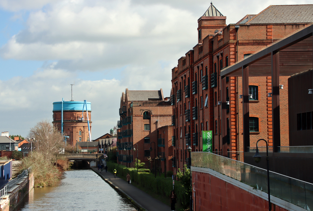
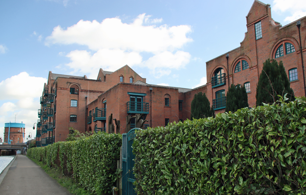
Category Archives: Walks suitable for unwilling legs

Walking the history of Chester’s canals, from the river Dee to Boughton #2 – The Walk

This post has been divided into two. Part 1, already posted here, looks at some of the history of the Chester city canals, in brief. Part 2 is a mainly photographic account following a walk along the canals from the point where the river Dee connects to the canal network to just beyond Tarvin Bridge.  Part of this was once the Chester Canal, which then became the Ellesmere and Chester Canal, as two different systems joined up with the rest of the canal network, and finally became the Shropshire Union Canal, the name by which it is known today.

Map of the first part of the canal route

Map of the first part of the canal route. The start point is marked by the red dot.  The rest of the route follows the canal as far as the Chester Boughton Hall Cricket Club

Map of the entire route from the Dee to Chester Boughton Hall Cricket Club

Map of the entire route, with the orange arrows showing the route from the Dee to Chester Boughton Hall Cricket Club. The pink arrows are the route I took from the Little Roodee car park to the start of the canal.  The darker purple arrow marks the arch beneath the railway viaduct that continues the river walk.

Detail of Tollemache Terrace

The walk begins at the point where the canal meets the river Dee, at the red dot (What3Words ///golf.finishing.upset).  It follows the tiny section of the old Chester Canal around the corner into the Dee Branch, which was created to allow access from the Wirral Line to the Dee.  The walk then crosses the roving-bridge with views up along the Wirral Line, across to the boatyard and down Tower Wharf Basin towards the main line of the canal to the east.  The walk then proceeds between Tower Wharf Basin and the Dee Branch, round the corner into the turning basin and along the rest of the canal, without any additional complications.  You can, of course, do as much or as little as you like. There is much more to see than included here – it’s a terrific walk.  I went as far as the Chester Boughton Hall Cricket Club, and the photographs go that far, but of course you can walk on as far as Wolverhampton if you have the time and stamina!

The return route is slightly different.  I parked in the long-term Little Roodee car park, which is under the city walls, so on the return route along the canal walked up onto the city walls (What3Words ///gone.dome.paths) and followed the walls back to the car park.

Map of the return route via the city walls

The slightly different return leg of the route, which leaves the main line of the canal and goes up on to the city walls looking down on the canal before heading, still on the city walls, towards the Little Roodee long term car park

There is plenty of parking in Chester, but I chose to park in the Little Roodee (What3Words ///helps.going.budget) because I was not sure how long I would take, and this is a long-term fixed-fee car park.  In the event, with plenty of stops to take photographs, it took around two and a half hours in total, two hours out (with lots of stops to take photos) and then an hour back to the Little Roodee via the City Walls, coming off the canal and walking above it from near to the King Charles Tower.  There are plenty of places to stop for drinks and a bite to eat.

The starting point

The starting point, where the canal tips water into the river Dee. The lock gates are long vanished, buy you can see where they once were.

The two main points to make at the beginning of the walk at the lock between the canal network into the Dee are that 1) this is obviously derelict and no longer usable, meaning that the canal network is now divorced from the river; and 2) this is one of the earliest parts of the Chester system, a legacy of the first Chester Canal, which went from Chester to Nantwich.  The connection with the river authorities had not been agreed before work began on the canal, and it took a number of years before the essential link between the Port of Chester and the Chester Canal were negotiated.

The walk continues over the road, from where this photograph was taken. Note that the canal passes under the road bridge.  Although this is now a fixed bridge, it was once a swing bridge to allow vessels of all heights to enter and leave the canal system.

Over the road (cross with care as it is on a blind corner) you continue along the canal, staying to its left.  This is the final set of locks as you come from the west and south, or the first as you begin to proceed up the canal system towards Nantwich, the source of the water.

Beginning to explore the Chester leg of the canal system

Beginning to explore the Chester leg of the canal system

On your left is a housing development with retail at its base.  This marks the site of the old Dee Basin which is where, after coming down a flight of five locks, narrowboats and wide barges would enter a holding area to await the tide.

The former Dee Basin

The former Dee Basin


The former Dee Basin

The former Dee Basin, shown on signage in the Tower Wharf Basin

When the Chester Canal was first built this was a tidal basin, but when the Chester Canal and the Ellesmere Canal merged, the water level was controlled by locks.  Continuing on, and staying left of the modern lift bridge, the bridge ahead of you leads you into the opening of the so-called Dee branch and on to Tower Wharf and the heart of the Chester canal system.   To proceed, do not go under the bridge (the footpath ends here) but go up the flight of steps to its left, turn right and cross the road and enter the Tower Wharf basin via the white gates.  On your right is the main line and Tower Wharf.  On your left, at a much lower level, is the Dee Branch, a requirement after the Wirral Line was added by the Ellesmere Canal (see an explanation of this in Part 1).  A lock was added to allow access to this lower section that flows out to the former Dee Basin and the river lock.

The Dee Branch

The Dee branch, with the main line up the bank at a higher level.

Tower Wharf basin

Tower Wharf basin


Telford's Warehouse

Telford’s Warehouse

There are some terrific features to look out for in the Tower Wharf Basin.  When the Wirral Line was built a new boatyard was added with a graving dock, both still in situ, and the boatyard not only survives but has been in continuous use since it was built.  Immediately on your right, at the far southern end of the basin, is a late 18th century building called Telford’s Warehouse (now a pub), designed by Thomas Telford with the open arches allowing vessels to load and unload under cover.  Running along the side of the Dee branch is an attractive row of Victorian brick-built terraced housing on Whipcord Lane, post-dating the canal.

Straight ahead is what is known as Taylor’s Boatyard after a former owner, complete with the graving dock.  The graving dock is a dry dock into which ships can be floated, and then the lock emptied so that hulls can be worked on.  Sadly it is surrounded, for safety reasons, by ugly metal fencing, but it is a lovely feature.  The boatyard lies beyond.

Looking down from the roving-bridge into the graving dock

Attractive iron column in the graving dock

In 1802 business in the Basin had not only picked up but was doing so well that its capacity was considerably over-stretched and a new basin was required, named North Basin, which was surrounded by more warehousing.  An absolutely delightful roving-bridge or snake/turnover bridge connects Tower Wharf with North Basin, an innovation that allowed horses pulling boats to cross the canal without being unhooked from the vessel.

North Basin

North Basin

The roving bridge

The roving bridge

If you have crossed the bridge, re-cross it to return to the central section of the basin, between the Tower Wharf Basin and the Dee Branch and retrace your steps.  Instead of going back up to the road where you entered, go under the bridge, following the towpath.  From here on, the route simply follows the towpath.  There are too many sights and sites to describe in detail, but here are some of the most interesting features contemporary with the working canal, with links to more information where I have found it.

As you leave the Tower Wharf Basin complex, you walk under the railway bridge and turn left into a section known as the Turning Basin, made particularly wide to enable horse-drawn vessels to negotiate the sharp turn into the basin.  There is a turning hook on the wall just under the Raymond Street Bridge that was also there to help vessels make the turn.  If you look up to the south (or your right, heading out along the canal) note that the canal follows the line of the city walls.

Looking back at the turning basin at the entrance to Tower Wharf Basin

The other end of the basin, leading to the locks

The other end of the basin, leading to the locks

Before the Ellesmere Canal Company introduced the Wirral Branch, there used to five locks that went all the way up to the Dee Basin, which has now largely been filled in and used for modern housing.  When the new branch was added, the bottom two locks were demolished and the canal diverted north.  The three remaining locks are still fully functional today and allow vessels to navigate a 33ft (10m) drop/rise.  At the top of the locks is a square house with a prominently overhanging roof eave, again one of Telford’s designs.  At this point today the canal runs under the St Martin’s Way ring road before carrying on along the foot of the northern stretch of the city walls.

After passing a row of modern house on your left you will notice two bridges overhead, the first tiny.  This is the somewhat battered-looking Grade II listed Bridge of Sighs, probably built in the 18th century. Although it is named after the magnificent one in Venice, the similarity lies in the fact that both were used for carrying prisoners, in this case from the prison to the chapel in the Bluecoast School to receive their last rites prior to execution.  The next bridge carries Upper Northgate Street over the canal, some sdfdsf ft / sdfsd m above.


The tiny Bridge of Sighs over the canal, followed by the Northgate Street bridge

Bridge of Sighs

Bridge of Sighs, Chester, shown from Upper Northgate Street

Triassic sandstone through which the canal was cut

Triassic sandstone through which the canal was cut, allegedly following the line of a Roman ditch

The canal passes the King Charles Tower as the canal and city walls part company, the canal briefly heading southeast and then due east.


The back of the Memorial Chapel next to Abakhan on Gorse Stacks

The back of the Penri Chapel next to Abakhan on Gorse Stacks. The Iceland on Frodsham Street is on the right

Looking back to the city walls and the King Charles tower above the canal. It is at this point on the reverse leg of the walk that there is a path up to the walls, which leads back to the Little Roodee car park.


Signage at Cow Lane Bridge


Queen's Place

Queen’s Place


This unexpected structure at the end of Queen’s Place is just a facade with no building behind it, the remnant of a lecture hall once attached to the 1777 Independent Chapel

The original Griffiths Corn Mill is now the Mill Hotel and Spa

The original Griffiths Corn Mill is now the Mill Hotel and Spa

Footbridge

Covered footbridge linking two parts of the hotel, with the Hoole water tower beyond


Steam Mill

The Grade II-listed Steam Mill building was built in 1786 as one of Britain’s first steam-powered flour mills. The listing details can be found on the Historic England website

This canalside building near the Union Canal Bridge is in a very sorry state.

This was a busy area, with industrial and commercial enterprises moving in to take advantage of the proximity of the canal.  There are a number of very fine buildings to spot here, and if you follow Stuart Shuttleworth’s walk (see video below) he takes you into some of the surrounding streets to explore some of the relevant buildings behind the canal.

Union Canal Bridge. Details are available on the Grace’s Guide industrial history website.

One of the protective iron uprights on the Union Bridge stonework, with rope markings from the barges pulled by horses

City Road Bridge (1863) by J. Mowle and Co.

Replica Spitfire, apparently once used as a raft

Replica Spitfire, apparently once used in a raft race

Old Harker's Arms

Looking back to the Old Harker’s Arms


Moxy Hotel with Waitrose beyond

The Chester leadworks shot tower. Information about the works and the tower on the Historic England website

Signage along the canal showing original photograph of the leadworks

Sign on the edge of the canal, and in front of a building site for “luxury retirement apartments”

Wharton Court

Wharton Court

Hoole Lane Bridge, 123A

Hoole Lane Bridge, 123A

Hoole Lane Lock

Hoole Lane Lock

Hoole Lane Lock

Hoole Lane Mission Hall. Information at Hoole History and Heritage Society

Tollemache Terrace

Tollemache Terrace

Chemistry Lock and sluice, Grade II listed. More information on the Historic England website

Towards the Bridge Inn (the white building)

Towards the Bridge Inn (the white building)

Tarvin Lock

Tarvin Bridge Lock

Chester and Boughton Hall Cricket Club

The view of the canal as it moves out of Chester towards Waverton and beyond


Starting the return leg of the walk at Tarvin Bridge Lock, next to the cricket club

Walking back into Chester, past the Boughton water tower.  See details on the Historic England website.

The point on the towpath at which I walked up to the flight of steps to go up to the city walls and turn right to return to the car park.


Sources

The full list of sources are in Part 1


Walking the history of Chester’s canals, from the river Dee to Boughton #1 – Short History

This post is divided into two. Part 1 (this part) looks in brief at some of the history of the Chester city canals, mainly to untangle the complicated story of what is happening at the Tower Wharf Basin, where the Chester and Ellesmere Canals came together.  Part 2 is a mainly photographic account of the walk along the canals from the river Dee to the Chester Boughton Hall Cricket Club, just beyond Tarvin Bridge.

The pink arrows are my route from the Little Roodee car park to the start of the canal. The orange arrows are the route taken from the start of the canal at the river Dee to Chester Boughton Hall Cricket Club. Details of the walk are in Part 2.

Cow Lane Bridge 1880s

Cow Lane Bridge in the 1880s. Source: chesterwallsinfo

This post begins with a short description of the history of the Shropshire Union Canal, describes why the intersections just beyond the Northgate staircase lock is so complicated, and goes on to describe the walk.

The Shropshire Union Canal runs today from the Mersey and the Manchester Ship Canal at Ellesmere Port, to Autherley Junction near Wolverhampton on the Staffordshire and Worcestershire Canal over a distance of 66.5 miles (107km).  Because it runs beyond the city walls, only making its presence felt to tourists where it crosses Northgate and along the base of the city walls, it does not feature on the city’s usual tourist routes.  Unlike Chester’s well known medieval, Georgian and Victorian architectural attractions, the canal is more directly a component part of the city’s industrial past, but is just as essential in the city’s story.

The history of the Shropshire Union Canal

During the 18th century civil engineer James Brindley (1716-1772) was responsible for building over 365 miles of canals.  Brindely realized that any inland waterway network would need to connect to all the great navigable rivers that connected to the sea, including the Thames, the Mersey, the Severn and the Trent, incorporating other important navigable rivers like the the Avon and the Dee.  The network was a sprawling affair, but it revolutionized transport, avoiding roads that would become mired and impassable in winter, as well as unnavigable sections of rivers, and the riverine problems of tides, drought and flood.  Water into and out of the canal system was regulated and therefore predictable, and allowed year-round transport.  The advantages became very clear very quickly, and manufacturing and trading businesses began to locate themselves at critical points on the canal network.  Eagerness to invest in infrastructure resulted in a canal boom in the mid to late 1700s.  Each new section of canal required an Act of Parliament, subject to Royal Assent, and Act after Act was passed as the network expanded.

The Chester Canal. Source: Shearing 1985, p.150

The  execution of the canal project for Chester was deeply flawed.  Jumping on the canal bandwagon, entrepreneurs and investors envisaged a money-making venture that would bring Shropshire and Cheshire into the mainstream trade network with Birmingham, the nation’s canal hub and centre of industry, via a junction at Middlewich with the 1777 Trent and Mersey Canal.  Unfortunately, the builders of the Chester Canal did not have agreements in place to connect their new Chester Canal either to the Trent and Mersey Canal, which denied them permission to build a junction, or with the River Dee Company, which also put barriers in their way leading to several years of negotiation before a satisfactory solution was reached.  The Chester Canal, opening in 1779, was not built to Middlewich, where it had been planned for the Chester to join the Trent and Mersey, and instead stopped at Nantwich, segregated from the rest of the national canal network.  With little traffic carrying low-value cargoes, as well as a packet boat service, the canal was a fairly substantial failure.  In 1787 the Beeston staircase locks collapsed and there were insufficient funds to pay for repairs.  The Chester Canal hovered on the verge of bankruptcy.

The complex arrangement of the Ellesmere Canal

The complex arrangement of the Ellesmere Canal and its branches is shown as thin blue winding lines. The thick blue line from Chester is the Dee. The yellow lines are roads. Click to see a bigger version. Source: Wikipedia

If it had not been for the 1791 Ellesmere Canal project, the Chester Canal would not have managed to limp on much longer.  The proposal for sections of canal to link the Mersey at Netherpool (now Ellesmere Port) to both the river Dee at Chester and the Severn at Shrewsbury was ambitious, but attracted sufficient support for a surveyor to be hired and possible routes to be explored.  The Ellesmere Canal proposal was presented to parliament and received its Royal Assent in April 1793.   Although shortages in funding prevented the realization of the full vision, shown right, Chester was at last brought into the national canal network. Part of this necessitated the addition of a new branch of canal from Chester to Ellesmere Port, which connected with the Chester Canal in what is now the Tower Wharf Basin.  The two companies merged in 1813, becoming the Ellesmere and Chester Canal Companh.  In 1833 the Middlewich branch was added, as the Chester Canal company had originally planned, and was connected to the rest of the network via the Trent and Mersey.

Hunter 1782 map with canal

Hunter 1782 map with the canal before the basins were added for the Wirral Line

These changes required major infrastructure changes in Chester itself that are still clearly visible today.  Starting from the former interface between the river and the canal, just off Sealand Road, the derelict remains of the river-canal lock are clearly visible as industrial archaeology.  The gates have long gone and this section of the lock and the branch that once lead into the Dee Basin, along Tower Road on the map below, on its way to the Dee Branch, is full of aquatic plant life.  As you walk along towards the Dee Branch, rounding the corner and passing under the bridge, you find yourself in the basin complex, the Ellesmere Canal Company’s solution to how best to incorporate the Wirral Line north to Ellesmere Port.  However before the Ellesmere Canal Company was involved, the Chester Canal simply ran straight ahead, running directly along the Dee Basin into a set of five staircase locks before heading east towards Boughton.

Canal and River Trust map of the basin and wharves, showing the complex arrangement of locks and basins required to incorporate the Wirral branch of the canal to Ellesmere Port.


Map from the 1858 Roberts Chester Guide

Map from the 1858 Roberts Chester Guide, showing the big Dee Basin at the far end where locks connected it to the Dee. Click image to enlarge

The set of basins and wharves that became necessary when the Chester Canal was incorporated into the Ellesmere Canal Company’s plans capture the fascinating history of how the area’s canal system was forced to evolve.  Three different sections of the canal are involved in this complex arrangement, shown above.  The earliest of these phases belongs to the original Chester Canal, which begins at the river Dee and once headed straight along into a series of five locks that climbed the hill to the dramatic sandstone cut and onwards to Hoole and Boughton before turning south to Christleton and beyond.  The second phase is the Ellesmere Canal Company’s civil engineering work to incorporate the new “Wirral Line,” which headed in a roughly northerly direction out of Chester.  This now chopped off the Chester Canal at the base of the locks, demolishing two of the five locks, to create the Tower Wharf Basin.  The new arrangement cut off the canal from the river, meaning that another section of canal, called the Dee Branch, had to be created parallel to the main basin and accessed via a lock, to allow vessels to travel between the main line, the Wirral line and the Dee.  It is not an elegant solution, but it worked.  The rest of the canal is very straight forward as you walk towards Hoole, Boughton and beyond.  The historical interest in those sections of the canal is more about the bridges and the flanking architecture that grew up around the canal.

The docks at Ellesmere Port during the 19th century

The docks and wharves at Ellesmere Port during the 19th century, from the Ellesmere Port canal museum archives

In 1846 the decision was made to bring together the various canal and railway interests together under one umbrella organization, the Shropshire Union Railways and Canals Company, providing the different sections of canal from Ellesmere Port to Wolverhampton with a single name:  the Shropshire Union Canal.  In 1894 the Manchester Ship Canal opened, and the Ellesmere Port access to the Mersey was now via the new shipping channel.

In spite of canalization of the Dee in the 1730s was intended to make the rapidly silting river navigable and to make Chester competitive once again with Liverpool, but in spite of these measures silting continued and the river became impractical for serious commercial shipping and shipbuilding, particularly in the face of Liverpool’s rapid expansion.  The last ships were built on the Dee in the early 20th century, ending a centuries old industry, and the connection between the Shropshire Union and the river went out of use.

Chester Railway Station

Chester Railway Station 1848. Source: Hoole History and Heritage Society

The railway came to Chester in 1840, picking up some of the slack, but Chester’s days as a centre for trade and industry were over and the main financial opportunity that the railway brought was tourism.  The canal, however, continued to be used as part of the canal network, connecting to maritime trade via the Mersey.  Eventually, as rail replaced the canals, many of them became derelict, only reviving as leisure resources in the later 20th century.

The canal attracted many businesses along its edges, and today the canal preserves a considerable amount of commercial and industrial heritage, adding a welcome extra dimension to Chester’s historic legacy.  The canal network today is used for pleasure, mainly in the form of cruising, walking and cycling.  It still covers a vast region of England and Wales and is managed by a mixture of state organizations and by both regional and local charities.

Schematic map showing how Chester relates to the canal network

Schematic map showing how Chester relates to the canal network today. Source: Swanley Bridge Marina

As canals have become attractive for residential development, new housing has also been erected, some developments more sympathetic than others, but all interesting.  The mixture is captured in the walk in Part 2. Apart from a few isolated examples, most of the warehousing that once flanked the basins and the canal has long gone, replaced by modern apartments, including student accommodation and retail outlets.

The Dee no longer connects to the canal network.  The lock between the river and the Dee Branch of the canal, lying just over Sealand Road, is completely derelict.  One of the locks further along is padlocked shut. The old swing bridge that had allowed vessels to interrupt road traffic to enter the canal network was replaced by the fixed road bridge in the 1960s.   Today the leg of the Dee branch of the canal running parallel to the Basin, once used for access to the river, is used for mooring privately owned narrowboats.

Signage at the canal basin showing information about Telford's Warehouse

Signage at the canal basin showing information about Telford’s Warehouse

I have kept this history brief, merely to introduce the walk.  Rather than reinventing the wheel, please see the Sources below, which contain much more information.  The three video links also provide an excellent overview, between them, of the canal, its history, and some of the buildings and businesses associated with it.  The first is by John Herson, one of whose guided canal walks I have done and thoroughly enjoyed, which focuses on Tower Wharf, the Canal Basin and the relationship of the canal with the Dee.  The second is by Stuart Shuttleworth and looks at the main line of the canal as it passes through Chester.  Together they form a brilliant introduction to the subject, showing the key places to visit.  At the end, underneath Sources, there is another video by “Pastfinder,” which is longer and explores what remains today in more depth, walking and talking at the same time, making it quite easy to retrace his footsteps.  There are some fascinating additional pieces of information in this.

John Herson:

Stuart Shuttleworth:


Sources:

A lot of information is contained in the two videos above and the one at the end of the post.

Other sources of information are as follows:

Books and papers

Carrington, Peter 1994. English Heritage Book of Chester.  Batsford / English Heritage

Martin, Richard 2018. Ships of the Chester Rivers.  Shipbuilding on the Dee from Chester to the Point of Ayr 1800-1942. Bridge Books

Mosse, J., David Lobband and Judith Pile 2023 (9th edition).  Collins Nicholson Waterways Guide 4. Four Counties and the Welsh Canals.  HarperCollins

Nicholson, R. 1989 (4th edition). Nicholson/Ordnance Survey Guide to the Waterways 2: Central. Robert Nicholson Publications and Ordnance Survey

Shearing, Edwin A. 1985. Chester Canal Projects: Part I. Journal of the Railway and Canal Historical Society. Vol XXVIII, no.3, November 1984. p.98-103

Shearing, Edwin A. 1985. Chester Canal Projects: Part II. Journal of the Railway and Canal Historical Society. Vol XXVIII, no.4, March 1985. p.146-154

Ward, Simon 2013 (2nd edition). Chester. A History. The History Press

Websites

Canal and River Trust
Welcome to Chester. Escape the city on this tranquil waterway (PDF)
https://canalrivertrust.org.uk/media/document/0z8YCnXdfYHg_am-LmUGSg/p22Wl115w_dWrQTRa-XYJd5Q5nl2UR6N17EY2G1JFyc/aHR0cHM6Ly9jcnRwcm9kY21zdWtzMDEuYmxvYi5jb3JlLndpbmRvd3MubmV0L2RvY3VtZW50Lw/0192bddd-4001-76ad-a95b-0ad3662ccdcc.pdf

Canal Routes
Chester Canal History
https://www.canalroutes.net/Chester-Canal.html
Chester Canal Route
https://www.canalroutes.net/Shropshire-Union-Canal.html#Chester-Canal-Route
Ellesmere Canal – Wirral Line
https://www.canalroutes.net/Shropshire-Union-Canal.html#Ellesmere-Canal-Wirral-Line
Shropshire Union Canal
https://www.canalroutes.net/Shropshire-Union-Canal.html

Cheshire West and Cheshire
Chester Canal Conservation Area Character Appraisal Ellesmere Port to Nantwich (PDF)
https://www.cheshirewestandchester.gov.uk/documents/planning-and-building-consultancy/total-environment/conservation-and-design/conservation-area-appraisals/canal-conservation-area-elesmere-port-to-nantwich-latest-version-261118.pdf
Chester Characterization Study
https://www.cheshirewestandchester.gov.uk/your-council/policies-and-performance/council-plans-policies-and-strategies/planning-policy/chester-characterisation-study

chesterwalls.info
Photographs of the Chester Canal Old and New, parts 1-5
https://chesterwalls.info/gallery/canalgallery.html

Chesterwiki
(with a lot of adverts interspersed)
Canalside
https://chester.shoutwiki.com/wiki/Canalside
Canal and Boatyard
https://chester.shoutwiki.com/wiki/Canal_and_Boatyard

Grace’s Guide to British Industrial History
James Brindley
https://www.gracesguide.co.uk/James_Brindley
William Jessop
https://www.gracesguide.co.uk/William_Jessop

Heritage Chester
Bite-Sized Wonder – The Lead Shot Tower
YouTube video

Historic England
Bridge of Sighs, Upper Northgate Street
https://historicengland.org.uk/listing/the-list/list-entry/1375967
Telfords Warehouse, Raymond Street

https://historicengland.org.uk/listing/the-list/list-entry/1375919?section=official-list-entry

Inland Waterways Association, Chester and Merseyside Branch
Chester Heritage Port Designation Document (PDF)
https://70cf2f03-3eb2-43c8-889f-b8f841fc3757.usrfiles.com/ugd/70cf2f_64e6633c34b9420f8c06a368857d1a42.pdf

UK Waterways Guide
Map of the Shropshire Union Canal
https://www.ukwaterwaysguide.co.uk/map/shropshire-union-canal/all-branches

“Pastfinder”:

A very beautiful autumnal sunshine walk along the Wirral estuary from Burton to Parkgate

Bird of prey, Burton, Wirral

Beautiful feathers on a bird of prey at Burton, Wirral

Yesterday seemed, at first, to have been doomed from the start.  I was supposed to be driving to Aberdyfi in mid-Wales to do something specific, but 20 minutes from home, already running very late, realized that I had left two components essential to the task on the kitchen table.  Having returned home and collected the required items, I was leaving the house and went to take a quick snapshot in my garden of a squirrel running upside down along a power line and rapidly closing on an oblivious turtle dove, and found to my dismay that the camera couldn’t read the SD card. Nooooooo!  I knew I had a spare somewhere, but where?  Ridiculous to go to Aberdyfi on a sunny blue-skied day like this without a camera.  After half an hour of fruitless searching I picked up the phone and cancelled my visit.  Twenty minutes later I had found the wretched thing.  Instead of the planned expedition, I found myself grabbing the camera and car keys before heading up the Wirral to Burton to park up along the estuary and go for a very fine walk along part of the Wirral section of the King Charles III England Coast Path.  I hadn’t even got out of the car when I saw the above bird of prey, which politely held position whilst I scrambled out of the car.  A perfect way to turn around a very unpromising start to the day.

I have made a short visit to the estuary cycle track and walk in the past, simply to get a good look at the purported Iron Age promontory fort on Burton Point, but although it was enjoyable, it was a short stroll because the skies opened and I got drenched.  Today, with no risk of rain, I decided to walk from Burton towards Parkgate, which I guessed to be about an hour’s walk each way.  When I reached the “You are Here” board (with which the walk is dotted at key points) at Moorside, alongside Parkgate Spring and on the very edge of Parkgate, this was a full hour.

Parking is easy along the section of Station Road that lies along the estuary for the Burton to Moorside (near Parkgate) section of the "King Charles III England Coast Path"

Parking is easy along the section of Station Road that lies along the estuary for the Burton to Moorside (near Parkgate) section of the “King Charles III England Coast Path” (What3Words: ///glows.lung.headsets). Source: Google Maps

Parking for this particular walk is along the section of Station Road that runs along the side of the estuary, indicated by the red circle on the map.

The walk itself begins along the section of Denhall Lane that turns along the side of the estuary and passes a café, as indicated by the black arrow on the map.  Although vehicles are permitted as far as the café (just beyond the left edge of the map), they are banned beyond this point.

This first stretch of metalled lane is dominated by dog walkers and cyclists. Do keep an ear open for the cyclists as they can pick up a lot of speed along the lane and don’t always give a lot of notice of their impending arrival.  The path goes through various changes.  After some time it parts from the lane and becomes much more of a footpath with rough stone underfoot, which probably accounts for why the cyclists vanish from the scene at this point.  At one stage it becomes a track across a field, although there is a route around this in wet weather that diverts inland for a while.  The entire walk is well maintained with pedestrian gates and bridges where needed.  One field had horses in it, so do take care if you are walking dogs.

Scenically, the walk is always split between two different experiences to left and right.  The views across both wetlands and former wetlands to the Welsh foothills to the southwest are lovely on a sunny day, and you can keep an eye open for bird life.  On the other side of the path, immediately hugging its edges, there is an almost uninterrupted run of very fine hedgerows and trees.  At this time of year there is not a great deal to see on the estuary, although I was delighted to see lovely white egrets in a distant blue pool, as well as a couple of birds of prey hovering splendidly overhead. Most of the flowers in the estuary have gone over, but the autumnal leaves, berries, rose-hips and other fruits of the shrubs and hedges and the multiple colours of the changing leaves on trees along the paths were endless and superb, really gorgeous against a blue sky with the sun shining on them.

xxx

Nearing Neston I spotted a line of vast red sandstone blocks extending out into the estuary vegetation, and a small spur of land also extends out at this point.  An information board explains that this is part of the Neston Colliery, Denhall Quay.  There is a particularly good book about the collieries, The Neston Collieries, 1759–1855: An Industrial Revolution in Rural Cheshire (Anthony Annakin-Smith, second edition), published by the University of Chester, which I read and enjoyed a few years ago.  The sandstone blocks are massive, and as well as retaining original metalwork, one of them has become a memorial stone, as has one of the trees on the small spur of land.  The line of sandstone, now a piece of industrial archaeology, is a very small hint of the extensive work that once took place here, but is an important one.  The author of the above-mentioned book refers to it in a short online page here, from which the following is taken:

There are still some signs today of the old mining operations. Most prominent is Denhall Quay, the remains of which still jut out into the Dee Estuary. This was built in 1791 and was used to ship coal to North Wales, Ireland and occasionally to foreign countries, as well as inland via newly-built canals.  Also, if you know where to look it is possible to trace the location of many of the shafts that were once in use, including one hidden behind a brick wall in Riverside Walk. Easier and arguably more rewarding to find is The Harp Inn! The building was standing in the mines’ earliest days and records show it was a public house for the miners no later than 1813 and probably much earlier. It has several photos on its walls from the mines’ later days.


This is the point that I turned around and walked back. The image immediately above the  map shows point where the Parkgate Spring emerges, very audible but  not actually visible.


xxx

There are very few places to sit down along the walk, so I would recommend that if you need to rest your legs occasionally, you take your own portable seating.  Regarding refreshments, I have mentioned Net’s Café, near the Burton end.  I haven’t visited and apparently there’s no website, but it is just off Denhall Lane and it is listed on Trip Advisor here.  There is also a very good pub called The Harp, which I actually have visited, with outdoor tables immediately overlooking the wetlands towards the Welsh hills, just outside Little Neston.  The food being served there looked excellent, and I can give a solid thumbs-up for the cider.  The pub was particularly well situated for my return from Parkgate as the zoom lens on my camera, a particular beauty that has been worryingly on the twitch for weeks, suddenly stopped working and was now, just to ram home the overall message, rattling.  A glass of cider and a seat in the sun were perfect for jury-rigging the wretched thing so that the zoom now worked like an old-fashioned telescope and the camera’s autofocus, which was refusing point-blank to engage in conversation with the lens, could be operated manually on the lens itself.  Sigh.  New lens on order.

If you can do this walk in September when the berries are at their best, do take the opportunity, because it is stunning, particularly on a sunny day.  And all on the flat too, so entirely appropriate for unwilling legs.
xxx


A guided walk to learn about the distinctive architectural creativity of John Douglas in Chester

John Douglas. A photograph that apparently first appeared in “Building News” in 1890. Source: Wikipedia

For those who are interested in local heritage, it is probably not possible to live in or near Chester without knowing the name of the architect John Douglas.  John Douglas (1830-1911) was a prolific architect, working right at the end of the Victorian era but demonstrating a fundamental affiliation with Victorian architectural ideals.  According to Chantal’s research, between the buildings he built and those that he renovated and adapted, he contributed to over 500 buildings in Britain.  Not much is known about him, but he trained in Lancashire where a new middle class, rising in both wealth and influence, was creating an unprecedented demand for domestic, commercial and civic architecture.  His are some of the most imaginative and and engaging of Chester’s Victorian buildings, providing the city with an important additional layer of interest and texture.  He was also responsible for other local buildings at Eaton Hall (including Eccleston), Aldford and Port Sunlight, as well as many other UK locations.  Although never bowing to the past in his architectural inventions, Douglas incorporated elements of Chester’s earlier architectural styles into his unique creations, remaining sensitive to the original city whilst leaving a highly distinctive and creative legacy of his own.

Grosvenor Park Street

Our guide on the Heritage Open Day walk was Chantal Bradburn, art historian and head of Outreach at the University of Chester, who had done such a splendid job several days previously, introducing a large group of us to the Western Command at the Churchill Building.  Called “John Douglas in Chester,” this was a brand new walk, and a great idea to add it to the many events offered last week.  Instead of taking us on a route-march of every building that Douglas built in Chester, Chantal selected a representative few, which both captured different aspects of his work and at the same time demonstrated an underlying thread between them all.  By choosing a careful sample of Douglas’s total Chester output, she was able to impart far more knowledge about both Douglas and the individual buildings than if she had tried to include more, although she did finish up the tour with recommendations for other buildings to inspect nearby.  As with her Churchill Building talk, and perhaps even more so, it is impossible to do any sort of justice to all the facts that she imparted, and particularly to do any justice at all to her ability to contextualise the architecture within its social and economic environment, as well as discussing it in art-historical terms, so this is just a short taster of a really great guided walk.

We started at the lodge in the Grosvenor Park, an obviously Victorian take on the Tudor half-timbered buildings that partly define Chester’s heritage, commissioned by the Grosvenor estate to provide a touch of additional elegance to the second Marquess of Westminster’s 1867 philanthropic donation of the land to create a park.

Grosvenor Park Lodge, Chester

Grosvenor Park Lodge

The Grosvenor Park Lodge by John Douglas

Grosvenor Park Lodge from the rear

Grosvenor Park Lodge from the rear

xxx

Grosvenor Park Lodge

Detail of carved woodwork on the Grosvenor Park Lodge: “Nobilitatis virtus non stemma character”

With Ruabon brick at its base and half-timbering at first floor level, it features sculptural elements and carvings that provide it with real charm.  Douglas apparently thought it entirely appropriate to add a medieval-style sandstone extension to his building, which as Chantal pointed out, reflects the multi-period character of many of Chester’s buildings.

It became clear as we proceeded on the walk that this willingness to go with the flow of Chester architecture by echoing some of its variety and diversity, without ever trying to replicate it, was a key characteristic of Douglas’s approach. He always preferred local materials, and this too indicates a real wish to connect with Chester’s earlier architectural heritage.  It’s great to see it being used as a café, providing a useful service on the edge of the park.

xxx


xxx

Our next stop was just over the road, on Grosvenor Park Street.  The 1872 Grade II* listed houses, numbers 6-11 on Grosvenor Park Street make up of a row of terraced houses and a Zion Chapel have long been a favourite of mine.  Together they are a fabulous, wildly imaginative mixture of different elements all of Ruabon red brick, including gothic style features, turrets, and a dozen other twiddly bits.  It is always wonderful to see how brick can be used to create elements that are more conventionally associated with stonework in this country.  Whether the mullioned windows, some with original leading, let in a lot of light I doubt, but they are wonderfully ornamental.  It was particularly interesting that Douglas built these houses on land that he owned, renting them out afterwards.  He did not skimp on materials or architectural design in order to make a bigger profit.  This set of buildings argues that he really cared about not only the quality of his own work, but about what he as an individual could contribute to Chester.FULL RUN HERE

xxx

Perhaps one of his best known buildings in this part of extramural Chester is quite unlike either his lodge or his fantastic domestic extravaganza.  However, as Chantal pointed out, the Chester Public Baths are still in proportion, a good fit with the domestic buildings in this part of Chester in spite of its being a public leisure facility.  Chantal positioned the idea of swimming and the provision of a public baths in the social context of Victorian values and ideals, but made it clear that Douglas had put his own particular spin on the resulting building.  Both practical and decorative, it is a very fine example of a building that is at once distinctively Victorian but also takes admired aspects from Chester’s past.


xxx

Further down Bath Street, I would not have guessed at first sight that the Grade II listed buildings on the right were another Douglas innovation, but the signs are there when you pause to look more closely, and particularly when you have Chantal’s expertise to provide detailed knowledge and insights.  Except for the building at the far south, nearest to the Baths, which is more typical of other Douglas buildings nearby, the main run of houses is built of buff sandstone, quite different in material, colour, and texture from other Douglas buildings and, for that matter, from anything else that I recall seeing in Chester.  It dates to 1903, quite late in Douglas’s life, and perhaps this accounts for some of the distinctive features discussed by Chantal.  There is an echo of the buildings on Grosvenor Park Street, but this has a much more monumental feeling to it and even with the decorative features and the short spires, seems less light-hearted and, in spite of the ornamental features, a little more monumental in feel.


If you follow the building all the way round the corner you will see that the houses link to a building built by Douglas to house Prudential Assurance.  It’s name today, Lombard House, reflects a later use by the eponymous bank.  To the left of the entrance, just around the corner, there is a charming female statue inset into a niche holding a snake and book.  This is Prudence, one of the four cardinal virtues (the others being Justice, Fortitude and Temperance), adopted by Prudential Assurance as their emblem in 1848 for her qualities of foresight, intelligence, thoughtfulness and knowledge.  Although more traditionally shown with a mirror representing self-awareness, a book is also part of her iconography, representing knowledge, wisdom and and good judgement.
xxx

xxx
Our final stop for the day took in two architectural features, bringing us into the city within the walls – the wrought iron extravaganza that sits on top of the Georgian East Gate, with its splendid clock, and the former Grosvenor Club building immediately to its west.  These both speak of late Victorian Chester’s ambition and its delight in ornament and display, giving an unmistakeably Victorian sparkle to this part of the city.  Chantal gave us details about the clock that I hadn’t heard before concerning its construction, as well as an entertaining factoid about the date of construction, reminding me that it is very easy to become complacent about even such a dominant landmark.  I had known nothing about the Grosvenor Club (including its name and purpose) so this too was a learning curve.

The Grosvenor Club by John Douglas

The Grosvenor Club

Grosvenor Club and Eastgate St

The Grosvenor Club on the right with the rest of Eastgate Street taken from the top of the East Gate bridge, under the clock.

When the tour was over, and Chantal had pointed us at other Douglas buildings in the vicinity so that we could investigate further on our own, she was still surrounded by a group of people asking many questions, and this had been the trend of the entire walk, with tons of information being imparted and lots of questions following.  Keep an eye open for this walk being offered in the future.  It’s a good one!

The nearby Parker’s Buildings

xxx

Grosvenor Park Lodge

Grosvenor Park Lodge detail

Thinking about John Douglas and his work over the following few days, and looking up other examples of his work, his buildings generally aim to provide an attractive environment of well-being, based on the idea that past and present reinforce one another in a very comfortable and attractive way.  Although many of the John Douglas buildings were impressive, and some of them were intended to be imposing, others were homes along streets that made use of vernacular features both from Chester, with inspiration taken from European cities, and from the medieval period onwards.  His preference for local materials is clearly demonstrated, and his love of decorative features is a real celebration of life.  He took a modern approach to architecture, incorporating traditional styles into his new interpretive schemes, as well as Germanic and French ideas that gave his work a rather more cosmopolitan edge than other architecture in the city, and in doing so added real value to Chester.  The best of the Victorian architecture of Chester simply oozes a sense of excitement and self-confidence about their lived present and their anticipated future, and John Douglas reflects this unfurling era with real exuberance.   His contributions to places like wealthy Eccleston and Aldford are also attractive, but perhaps Douglas is at his most appealing when contributing to Port Sunlight, the village built in the late 1880s by Lord Lever for his factory workers, contributing his skills with around 30 other architects, to create a very different type of community.  It must have been a real pleasure to live in one of his remarkable houses.  It is very nice to see that the ones that I have found to date seem to be very well maintained.  It is only a shame that subsequent architectural projects in Chester have only occasionally managed to live up to both his high standards and his creativity.


A revealing talk and guided tour: The Churchill Building and the Western Command 1937 – Today

The Churchill Building portico dates from 1997, but the original Neo-Georgian military Western Command building can be seen behind it.

The portico dates from 1997, but the original Neo-Georgian military Western Command building can be seen behind it.

With many thanks to Chantal Bradburn for an excellent lecture in the Churchill Building in the University of Chester’s Queen’s Campus.   Chantal is the University’s Outreach representative, with a strong background in art history and a particular interest in architecture in its social context.  Her talk, entitled “Western Command (Churchill Building),” covered the design and original purpose of the building as the headquarters of the Western Command, including the fascinating underground bunkers, and the building’s subsequent phases of use.  The presentation and the subsequent walk around the building’s exterior brought the Western Command to life.  Chantal’s ability to convey an impression of the building as it was in military times, based partly on her research and partly on feedback from people who have attended the talk or contacted her over the years, was of critical importance, because the interior had been completely re-envisioned in grandiose style by the subsequent bank, and converted once again in more pragmatic terms into the University of Chester’s Business School.  Only the exterior retains the essential character of the Western Command building.

The eastern wing of the Western Command (Churchill Building) gives a good impression of how the building appeared when it was first built

The eastern wing of the Western Command (Churchill Building) gives a good impression of how the building appeared when it was first built

The building, then known as Capital House, was completed in around 1938, almost certainly in response to the threat of war.  Neo-Georgian is not my favourite of the various architectural experiments in Chester.  I have grumbled on and off about the Wheeler Building on the blog for years, and there are a number of more modest buildings dotting the streets of the historic city whose architects seem to believe that slapping some symmetrical rectangular windows into plain blocks of undifferentiated brickwork will do the trick nicely, completely missing the point of refined elegance and delicate embellishments that characterized Georgian harmonies.  On the other hand, as Chantal pointed out, at least in the case of the Churchill Building there are good reasons for this style, which is better than most of its siblings, relating not merely to the practicalities of budget constraints for such a large building.

The eastern entrance to the Churchill Building with subtle nods to Art Deco 

The eastern entrance to the Churchill Building with subtle nods to Art Deco

The importance of establishing a dignified military presence referenced the power and prestige of the city’s Georgian predecessors, which were themselves influenced by Classical architecture, whilst some low-key features nod to both the medieval military past and, in an even more subtle way, other contemporary styles.  I would not have noticed these had Chantal not pointed them out.  Although the subsequent Northwest Securities bank slapped a gigantic Classical-style portico on the front, the original building consisted of flat-roofed blocks that provided an impressive frontage, which relies for its impact on the size of its footprint rather than the height of its two-storey walls.  Chantal pointed out that the position of the building was strategically very fine, with its views over the river and the city beyond, only matched in its vantage points by the site chosen for the castle.

As the northwest HQ for intelligence on what was quite literally Britain’s western front during the war, the personnel serving in the Western Command building had a critical role not only leading up to and during the war, but for a surprising amount of time after it.  Chantal told us a great many stories about the role of the building and the people who worked there, highlighting the complexities that different levels of security caused for both employees and contractors, and emphasizing the degree of secrecy that was associated with the activities that took place within the Churchill Building.

Bunkers excavated into the sandstone at the Churchill Building. Source: 28DaysLater

To the east of the building, up-river, the remarkable and extensive underground bunkers were built to provide shelter and a command centre should it become necessary, both during and after the Second World War.  They extend from the level of the building down towards the river.  It is reputed that Churchill, who is known to have visited the building, may have met there with President Dwight D. Eisenhower and General Charles de Gaulle.  No documentation supports this view, but there are apparently anecdotal accounts that support the possibility.  The bunkers are now too dangerous to visit (see a photograph of a point of collapse on the 28DaysLater website).  The sandstone through which former miners in the army excavated to create the bunkers is sponge-like, attracting damp that is not helping with the stability of the underground structures.  Chantal showed photographs and explained past survey work and future plans (dependent as always on funding).

The building passed to the Royal Army Pay Corps in 1972, and from 1972 it was taken over as offices for a banking corporation.  The presentation took place in a huge room with an enormous table, all very glossy and highly polished, and heavily influence by Art Deco designs.  This was part of the bank’s improbable legacy.  It is quite staggering how the bank took over a military building and turned it into an extrovert and financially corrosive expression of self-indulgent excess.  Where these details have survived, the legacy is huge fun, but quite mad.  The bank’s vast portico, converting the Neo-Georgian blocks into a pseudo Classical temple, is equally pretentious. I am very fond of the University, having had a great time doing some post-graduate research there a couple of years back, but it really does seem to have saddled itself with buildings that for all their scale and practicality are amongst the least aesthetically charming of the various Cestrian styles.  In their favour, the University does make the most of them.

The opening of the Churchill Building by John Spencer Churchill (centre in grey suit), when it became part of the University of Chester in October 2015. Source: Cheshire Live

It is interesting to note that in the case of both military base and commercial bank, the building was off-limits to the public, not only physically but visually.  The arrangement of buildings at the time meant that the view through the gates, then in a different position, blocked any view of the heart of the complex.  It has been particularly interesting for local people who have lived in the area for a number of decades to have access to the building at last, and to be able to see what was so long hidden from view, perhaps particularly when family members and friends worked there.

The building had been out of use for a decade when the University took it over in 2015 to make it the centre for their Business School, with most of the building adapted to this task with the usual collection of teaching, research and computer rooms, areas for socializing and a café.  Wisely, the decision was made to preserve some of the more elaborate flourishes of the bank’s idea of good taste, and there are some distinctly New York style decorative features in the foyer.  More to the point, the building’s foundation stone and its frame, appropriately made of carved stone rather than the less expensive brick, has been preserved and is now installed above the reception desk as a very welcome piece of the building’s material heritage.  The exterior, now sporting a leaded dormer roof, still retains the essence of its stern and uncompromising military purpose, but its survival first as a bank and then as a major component of a university campus is a testimony to its durability.

It is impossible to do justice to Chantal’s talk, which was stuffed full of information.  Chantal does these talks quite frequently, and I do recommend that you keep an eye open for her next ones, because she provides a vivid insight into a world that is not normally associated with Chester, and which was clearly a very important part of the city’s social and economic profile from the 1930s onwards.  More than any other talk that I have attended since moving to the area, this is the one that surprised me most, and left me with a new set of insights into Chester’s less publicized wartime and post-war history.  Splendid.

North-facing aspect of the Churchill Building

The fabulous nature reserve at the RSPB’s Burton Mere Wetlands

Flying Canada Geese at the RSPB's Burton Mere wildlife reserveWhen I got up this morning and saw what a beautiful day awaited, I decided on the spur of the moment to go to the RSPB nature reserve on the Dee estuary at Burton.

Burton village, well-kept and firmly manicured, is located on the southwest of the Wirral, about 20 minutes drive out of Chester, an area now better known for giving its name to the nearby wetlands.  The wetlands are divided into two separate entities.  The first is the splendidly well organized and laid out nature reserve operated by the Royal Society for the Protection of Birds (the RSPB) which was specially set up for the benefit of birds and bird watchers, but accommodates general visitors too.  There is also a route through the wetlands on the far side of the RSPB reserve, and extending well beyond it, which is the Sustrans route number 568, developed for cyclists but welcoming walkers. It crosses the wetlands from Connah’s Quay, meeting the Wirral peninsula at just above Burton Point, and continuing on to Neston.  They provide two very different but both marvellous experiences of the wetland scenery.  I have already posted a short piece about my short visit to the Sustrans cycle and walking route in the Burton Point area, although I want to walk the whole thing eventually.

Greylag goose at the RSPB's Burton Mere wildlife reserve


A lapwing stretching its wings, whilst a common sandpiper stands by unimpressed

A lapwing stretching its wings, whilst a common sandpiper stands by unimpressed

The RSPB wetland reserve

Greylag geese with their bright orange beaks at the RSPB's Burton Mere

Greylag geese with their bright orange beaks at the RSPB’s Burton Mere

Several miles of wetland are enclosed within the RSPB reserve, which attract thousands of birds of many different species, with the river Dee invisible along the far edge of north Wales. The canalization of the Dee, completed in 1737, completely changed the environmental conditions of this part of the estuary, forcing the river to run along the Welsh edge of the estuary.  The canalized channel of the Dee is not visible from the nature reserve, but the miles of wetland are lovely.  There are huge expanses of pond and small lake, as well as flooded wetlands in the distance.  On a bright day with blue skies overhead it is gorgeous.  The reserve backs on to farmland at the rear, includes a woodland walk, and has a very attractive red sandstone railway bridge crossing the tracks below and even boasts the remains of an Iron Age hillfort which, if somewhat puzzling as an archaeological entity, has lovely views along the estuary towards Hilbre Island and across to north Wales.


xxx

For bird watchers there is an enclosed viewing room where the ticket office is located, and throughout the reserve there are coverts and hides like the one above, all of them with benches, and all with windows suitable for both seated and standing visitors, and there are also viewing screens  and viewing platforms dotted throughout.

For less specialist visitors there are some splendid wending walks through the reserve, where water-loving plant and tree species abound, many in flower or producing berries at this time of year, and all providing a myriad of colours and textures over a base of deep greens and rich browns, which provide excellent resources for insect life.  The plants are so dense that where there is water running beneath boardwalks the water is scarcely visible.


The walks are all nice and even underfoot, many of the boardwalks coated in wire mesh to prevent them becoming slippery, and it is all beautifully maintained.  Being located on the side of the estuary, the nature reserve is nearly all on the flat.  All the main walks are wheelchair friendly, as are the hides and coverts.  There are actually four miles of signposted walks, as well as the woodland walk, which takes about half an hour.  There are plenty of benches dotted around for a moment of relaxation and contemplation.  Burton Point, at the furthest end of the nature reserve, is a tiny headland, which involves walking a short way up a slight slope and an informal footpath, and offers some great views along the estuary.  It is supposed to be the site of a small Iron Age promontory hillfort, but the evidence for this is difficult to see, although an interpretation sign does its best to offer a visualization of how it may have looked.

Even if you are not a regular bird watcher, the water birds are fascinating.  There are plenty of information boards showing what you are likely to see, and there is a whiteboard in the reception area showing a list of what has been spotted on a given and previous days.  Binoculars and cameras with enormous lenses (one of them in camouflage colours!) were very much in evidence and I soon found at why – my nice all-round lens, a 28-300mm zoom, was struggling desperately at its top end, and something much more powerful would have been helpful.  Do note that you can hire or buy binoculars from the reception area to get a better view of what birdlife is spending its time on the wetlands.   At this time of year the geese dominate, both in numbers and in voice.  Their honking can be heard wherever you are in the reserve, even when you can’t see them, There were Canada and greylag geese in great numbers, and a handful of Egyptian geese sunbathing on the far side of one of the stretches of open water, but there are plenty of other species too.

Greylag geese at the RSPB's Burton Mere nature reserve

There was something distinctly conversational, and rather cross, going on here, and you should have heard the honking!

Of the smaller water birds, as well as the familiar moorhens, coots and mallards, there were gorgeous lapwings and a variety of small wading birds, with slender legs and long beaks, including a common sandpiper that was distinguished by its rusty coloured plumage.  There were multiple grey herons looking like statues, waiting patiently for unsuspecting fish to swim by, and I spotted some tiny little fish in one of the ponds near the cafe which are presumably a popular part of the herons’ dietary intake.  There must be lots of reed-loving birds hidden in the wetlands, successfully shielding themselves from prying eyes.  There was apparently a spotted redshank, which was causing some excitement among the better informed bird watchers in one covert, but although I followed the directions that a father was giving his son (along the lines of – left of that greylag goose walking in front of that moorhen and then two back and one over) I was unable to spot it.  Bird feeders dotted around were attracting blue tits and great tits in great numbers and there were pied wagtails in some of the many trees that line the edges of some of the paths.  There’s an A-Z of bird species on the RSPB website.

One of many grey herons, on the hunt for unsuspecting fish at RSPB's Burton Mere

One of many grey herons, on the hunt for unsuspecting fish

This is a super place to visit, and seasonal changes in bird and plant life mean that there will always be something new to see, and there are plenty of butterflies, bees, dragonflies, damsonfiles and other insects to observe if you look carefully.  The grasshopper in the image below was particularly well camouflaged, and apparently there are sometimes lizards sunbathing in the sunnier patches.  On Burton Point there are rabbit warrens, and according to some of the signage (much of it directed at children, but still informative to older visitors) the local animals have a vibrant night life.

Spot the grasshopper

Regarding the hillfort on the promontory, Burton Point, there are websites that say that the small headland on which the site is located is privately owned and should not be entered without permission, but this is in fact now included in the RSPB reserve and is served by good footpaths and includes interpretation signage to give visitors some idea of what was here.  I’ll talk more about this site on a separate post.

Burton Point, a low promontory that overlooks the Dee estuary and is the possible site of an Iron Age Hillfort. In this photograph the footpath at far right leads into the woodland, where a vantage point looks down on the fortifications, but you can also see what remains of the fortifications at the far left of the photo where an earthwork is clearly visible

xxx

Visiting the RSPB reserve

Meadow Brown butterfly beautifully camouflaged at the RSPB Burton Mere nature reserve

Meadow Brown butterfly beautifully camouflaged

The RSPB reserve is very easy to find, although if you rely on that Google SatNav, please note that mine, having been asked to find “RSPB Burton” informed us we had reached our destination before we had actually arrived.  Fortunately, if you use the What3Words smartphone ap, which is stupendous (narrowing locations down to metre-sized locations) you can find it at ///readings.sideburns.handicaps.  Other details can be found on the RSPB website which includes the address, postcode, as well as details of the current ticket price and full details about what the nature reserve offers the visitor: https://www.rspb.org.uk/days-out/reserves/dee-estuary-burton-mere-wetlands.

The RSPB site has been very well thought out, and is very welcoming.  A single lane road from Puddington Lane has speed bumps and plenty of passing places, leading to a well-sized car park.  Entrance is via a building with a look-out over the estuary.  The entrance fee is £7.00 at the time of writing (July 2025), which helps to support the charity. There is a nice modern cafe on site, which sells tea, very good coffee, cold drinks and snacks. This is also where the toilets are located.  There is a small shop next to the ticket desk that sells gifts, books and bird food.

I have been following the RSPB Burton reserve on Twitter for a couple of years, without ever having managed to get there, and every day they take a photograph of their whiteboard to give you an idea of what species have been observed recently so that you know what to look out for.  You can find this at https://x.com/RSPB_BurtonMere.  There is a placeholder for them on Bluesky but no content just yet.

I rarely give an opinion about wheelchair use, but there were actually several wheelchairs users out and about today.  It would not be possible to get wheelchairs up to the Burton Point hill fort, or navigate them down one or two of the little tracks that run at the back of the reserve, but all of the coverts and hides are wheelchair friendly and, for both wheelchair users and children, the viewing windows extend from low to high for both seated and standing visitors.  The same comments go for those with unwilling legs.

Dogs are not permitted, and nor are drones.

Excerpt from the RSPB's leaflet about Burton Mere

Excerpt from the RSPB’s leaflet about Burton Mere, showing the top things to do on a seasonal basis


The Burton Marsh cycle and walking route 568 along the Dee estuary, Wirral

In 2013 a track across the wetlands from Connah’s Quay via Burton Point to Neston was opened.  As part of the Sustrans cycle network it is known as Route 568 or The Burton Marsh Greenway, and an information board at the point where the route meets Station Road (see map at end) says that this section is now also part of the “King Charles III England Coast Path.”  This section of the route, Burton Marsh, is partly made up of metalled lane, and partly boardwalk, and is a terrific walk.  I had never heard of it until I was standing in what remains of the hillfort on Burton Point headland, part of the RSPB reserve, and saw it passing almost at our feet and beyond into the distance.  It is an extraordinary sight, a mainly straight track across the landscape, and such a brilliant idea.

I parked on the section of Station Road that runs parallel to the estuary, which is part of the cycle route to Chester, and is separated from the rest of the Burton Marsh stretch of track by a gate to keep the sheep in.  There’s a map showing where the parking is located towards the end of this post.  This walks is all particularly beautiful on a sunny day with a blue sky stretching to the horizon. A shifting sky, which one moment produced sun and the next light shade, brought out the textures and colours for miles around.  Because the estuary is so flat and vast it can be very breezy or windy, which was no bad thing on a particularly sticky July day!


I headed through the gate in the Chester direction.  Starting out from this point you are on a metalled lane and have fields rising on your left, currently planted with palest yellow barley, whilst on your right are marshland habitats stretching all the way to the river Dee running along the Welsh side of the estuary, with every shade of green you can imagine, dotted with bright clumps of flowering plants and layer upon layer of different textures.

The barley fields are soon replaced by a fairly short red sandstone cliff edge, which has been heavily quarried over the centuries.  Where this red sandstone becomes much more uneven and comes out towards the lane, there is a sign on your right that explains that here are the remains of an Iron Age hillfort at the top of this small headland.  This is fenced off, as it is RSPB land.

Burton Point

The lane pulls away from the headland heading out into the wetlands, and soon you find yourself on a long section of boardwalk, which rattles splendidly when cyclists come along, with the marsh habitats either side of you.


On a clear day the views seem endless as far as the way to the Clwydian Range of Wales.  The track gives a sense of how big that landscape actually is, and why it is such a special environment for wildlife, with aquatic plant life as far as the eye can see, and bird life launching itself in and out at surprising and random moments.  As well as plenty of Canada and greylag geese, both on the ground and in the air, there were dozens of skylarks, terns flying overhead and birds of prey too high to identify.  Unsurprisingly there were plenty of seagulls too.  Beneath the surface, there must be an awful lot more going on.

The intention was to walk for an hour and a half, see where that took me, and then turn back to retrieve the car, but the sudden onset of fairly heavy rain both greyed out the landscape and blocked the view so I only walked for around half an hour before turning around.  Even during that short walk, the views were superb and the environment absorbing, and one of the nice things about this is that however far you want to go, and from wherever you start, it lends itself to any length of walk.  I was chatting to a man on a bike who had stopped to watch a group of greylag geese, who had cycled from the middle of Chester and was going to visit his father in Neston before turning around and coming back, and by contrast there were a couple who were just out walking a short way with their dog and a child in a pushchair.  All very civilized and a great way of introducing a wide range of people to an entirely new environment in a very easy way.


xxx

Visiting from near Burton Point

You can access the track free of charge from anywhere along its route.  Because it is all on the flat, it is suitable not only for walkers and cyclists but those with pushchairs, buggies, and wheelchairs.  There was even a man on one of those push-it-with-one-leg adult scooters.  There are gates at interfaces with roads because of the sheep.  Also because of the sheep there are frequent signs asking owners to keep dogs on short leads.   Having been followed for about half a mile by one particular sheep, which stopped and looked fixedly at me every time I turned around to see if it was still following me, I can confirm that sheep are a very likely to be encountered.

I have only done this from just north of Burton Point so far, a short drive from the A540 via the village of Burton, and you can park on the straight section of Station Road that runs along the estuary, and where there is plenty of room to park along the road (what3words: ///recur.films.dream if you have the Google-compatible app on your smartphone).  Station Road, as it leads back inland, also has some parking along its edges near to the estuary.  I have highlighted the main parking-friendly area on Station Road in the pink box below.

Convenient road-side parking near Burton Point marked in pink. Source: Streetmap.co.uk

If you fancy starting in Chester, you can set off from the Little Roodee car park, go around the Roodee itself, and then follow the track to Connah’s Quay and go from there.  Fortunately you don’t have to depend on my finger-in-the-air directions, because Sustrans has its own website with full details for Route 568, which you can find here.  It shows the sections where the route meets roads, and where it intersects with other routes in the network.


Medieval ambition and Civil War musket ball holes at the Church of St Chad’s in Holt (Grade 1 listed)

Introduction

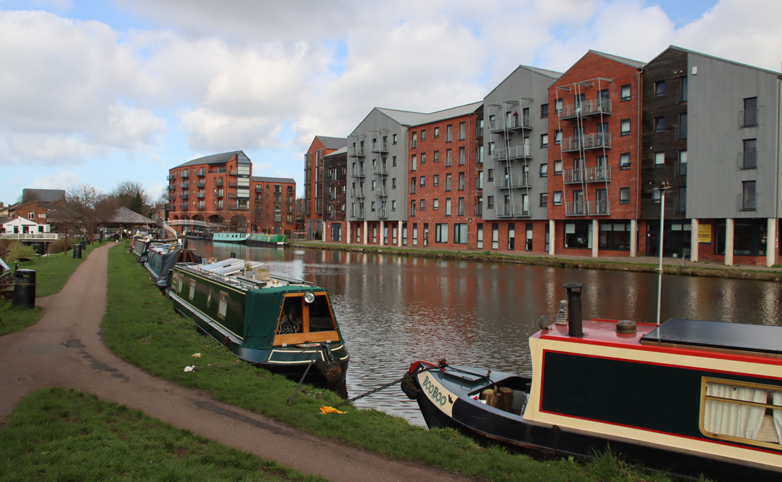
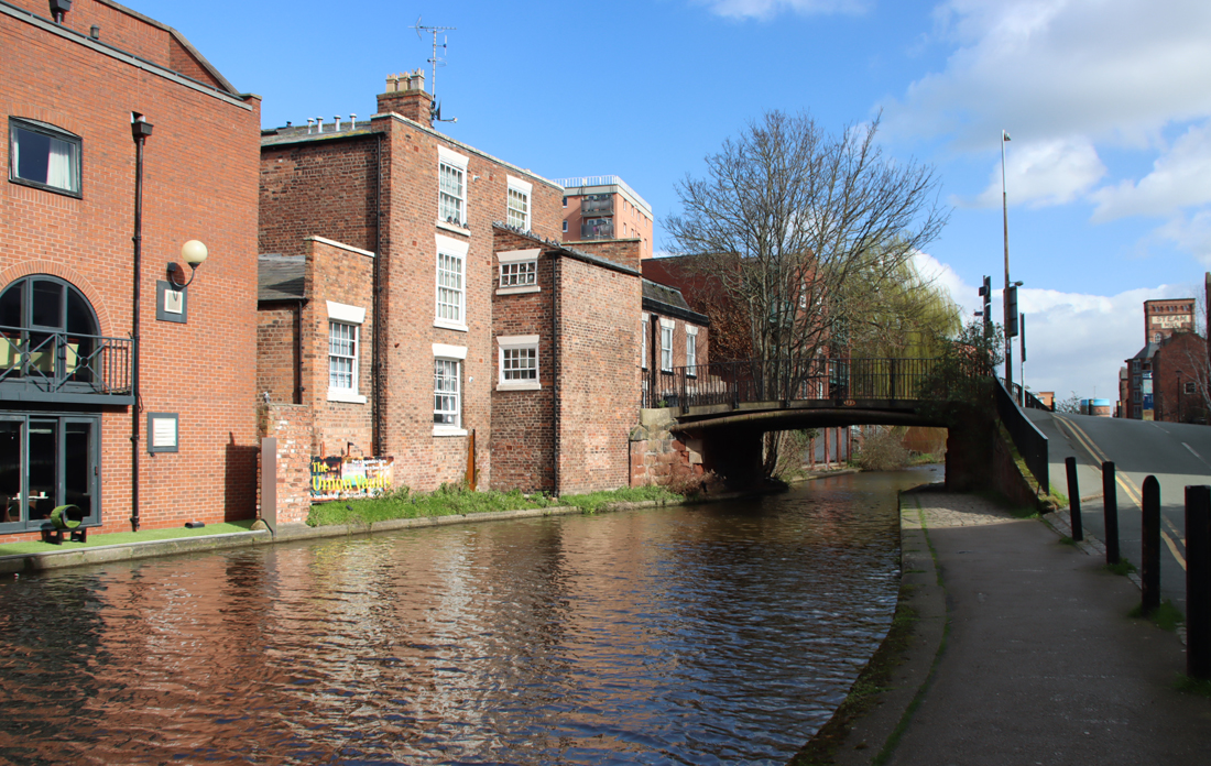
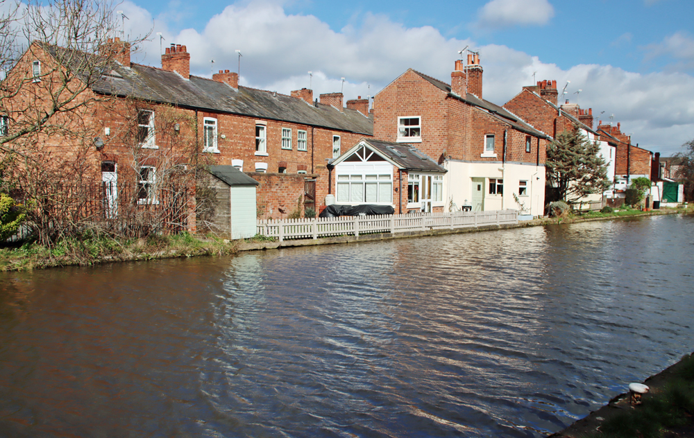
Either side of the River Dee, and linked by the lovely late medieval red sandstone bridge, are the villages of Holt on the Welsh side and Farndon on the English side, each with its own substantial red sandstone church, both of which are dedicated to St Chad and both of which have well-populated churchyards.  Each has its own very particular character and personality, and as well as being the centres of Christian devotion and burial, seamlessly blending life and death, both have Civil War stories and scars and both continue to function as places of worship today.  This post is about the Grade-1 listed St Chad’s in Holt.

Map showing the location of Mercia and the line of the Anglo-Welsh border. Source: Wikipedia

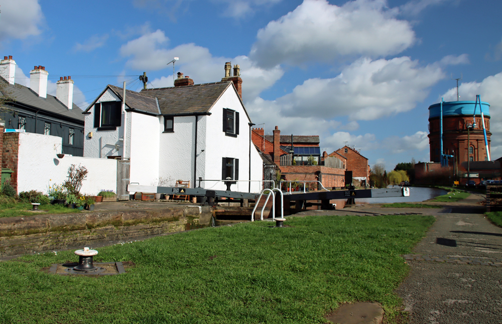
The church is located at the top of the slope that runs down to the river crossing, precisely where Bridge Street meets Church Street, opposite the small rectangular green.  An attractive wrought iron gateway is set between a house on one side and the Peal O’ Bells pub on the other, and opens onto a path flanked by red sandstone garden walls leading to the church and churchyard.  The church is light-filled with a peaceful atmosphere and some notable features, some of them very unusual. The overall effect of St Chad’s is welcoming and combines a sense of heritage with contemporary relevance.  For details about visiting, see Visiting Details at the end.

According to Bede (in the 8th century) St Chad, who died in AD 672, was a leading light in the Anglo-Saxon church, rising through the ecclesiastical ranks in the kingdoms of Northumbria and Mercia and under King Wulfhere, one of the earliest Christian kings, became the first Bishop of Lichfield in the new diocese of Lichfield, at the heart of Mercia.  Mercia was one of seven British kingdoms of 7th century Britain and occupied most of central England, with much of the border with Wales, always a movable feast, somewhat further to the west.  Regarded as a pioneer who helped to spread Christianity in and beyond Mercia, he became popular during the Middle Ages in the Midlands and its borders.

The following details are just the edited highlights. For a more technical architectural description see the Wrexham Churches Survey (see Sources at the end).  The church very much rewards a visit.
xxx

Exterior

South side of St Chad’s Church, Holt

The church is approached through a pair of wrought iron gates that were made in 1816 and replaced the former lychgate.  As you approach the church and walk around to find the carvings around the south door, you will notice a change underfoot because in the immediate vicinity of the church the path is composed of horizontal ledger grave stones and vertical headstones laid flat (distinguished by chisel marks at the bases, which would have been underground), all forming huge paving slabs, some from the 18th century.

Path made up of grave markers

The exterior of the church is built of local red sandstone, the older parts badly eroded on the exterior, probably as a result of traffic pollution.  Sandstone, being soft, lends itself to graffiti and there is quite a lot of it dotted around the building, dating from the 18th century.  The roof of the rectangular nave and chancel is made of copper, which accounts for its green colour.  Copper was more expensive than the more usual lead, and is both fire resistant and more enduring, as well as a gesture of status.

A curious feature of the church and its roof-level features is the presence of crocketed pinnacles, each with twin gargoyles on the north sides and the absence of them on the south side.  I only noticed because I love gargoyles and go looking for them.  This is due to the removal of the pinnacles on the south side during 1732, one of the periods of redesign and alteration.

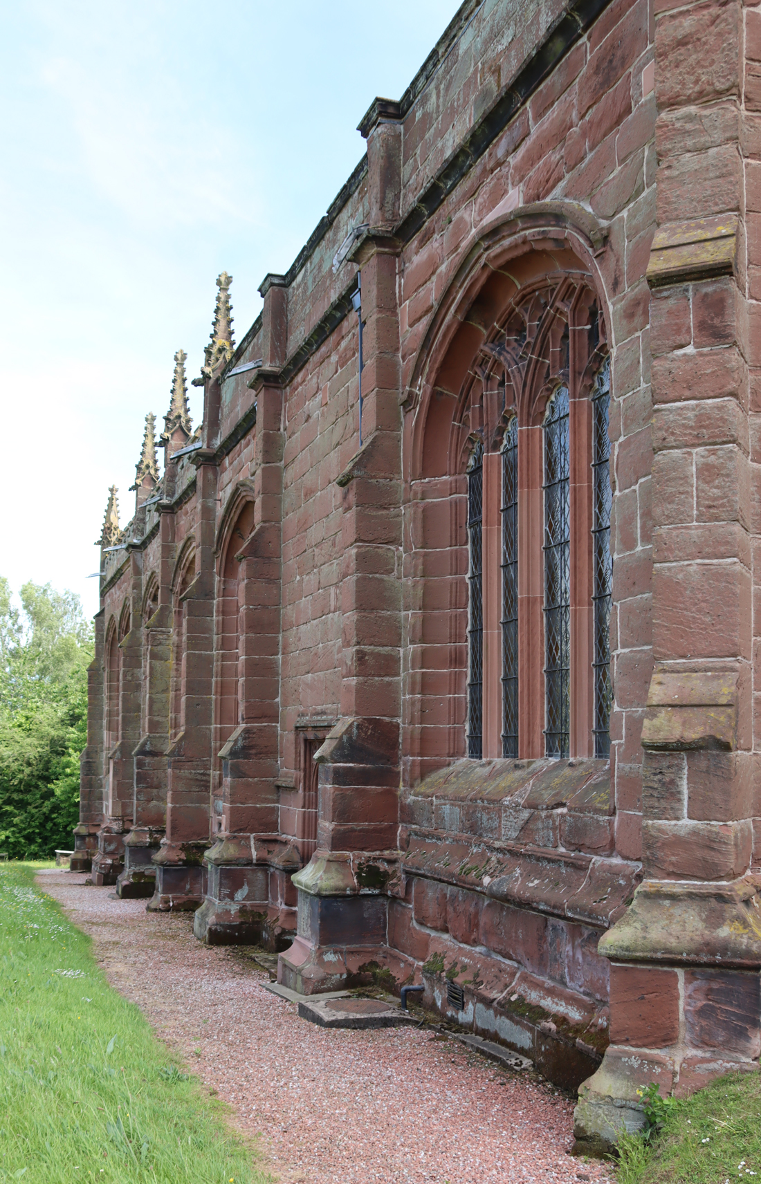
North side of the church, showing four pinnacles, each of which is adorned with small gargoyles. Photograph taken from the west, just next to the tower.

The tower features four gargoyles on the corners at the very top of the tower, and a string-course just below that level marked by floral ornamental motifs and small grotesques, very similar to the sculpted string-course that you can see here at Gresford All Saints’.  The 18th century bells are referred to below.  The top of the tower has gargoyles at its corners and the roof of the tower appears to be leaded.

The string course of grotesques, flowers and other motifs near the top of the tower.


A circuit of the exterior reveals that there are three doorways.  The studded west door, through which visitors enter today, is impressively large, but has no notable features.

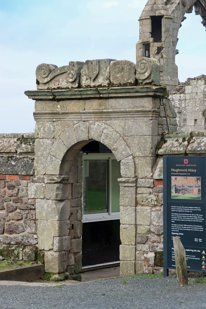
The earliest entrance is the south door, with some lovely, albeit very eroded ornamental carvings. This would have been the main access from the castle, which is why it was so ornate.  As well as decorative motifs, there is a central panel showing the Annunciation set over the top of the arch and carvings in the spandrels (the three-sided sections between the arch and the square frame).  The spandrel on the right as you face the door shows the arms of Henry VII, together with a figure wearing a mitre; the other side is very worn. Above the door and its surround is a carved band of small quatrefoil motifs, each arranged in patterns of four. xxx

The door that opens into the north aisle of the church (round to the left of the tower as you face it) has nice carved details in the spandrels between the arch and the square frame.  Most fascinatingly, it has a line of three holes in it plugged with wooden stoppers.  These holes are called loopholes and were used for firing muskets from inside, much like arrow-slits in medieval castles.

The north entrance with the “loop holes.”

At the east end, under the central window, is an unusual little memorial built into the wall to Jasper Peck Esq and his wife Amy, died 1712 and 1740 respectively, the latter the daughter of Sir Kenrick Eyton.

At the east end of the church, built into the external wall beneath the central window, is an 18th century memorial

A memorial in the churchyard of St Chad’s, Holt

The churchyard contains plenty of grave stones and memorials.  The earliest, now moved for its protection inside the church (about which more below) dates to either the late 17th or early 18th century.  Although there are many from the 18th century, the majority of graves and their memorials date to the 19th century, with a range of fairly typical shapes and symbols.  Most of the memorials accompanying the graves are headstones, but earlier chest-style memorials and ledgers (inscribed horizontal slabs) are also represented, together with more obviously monumental types.  The cemetery was later extended east, possibly in an effort to avoid the north side of the church, which only has one gravestone, and even that is at the far east end.  The north side of a churchyard, in the shadow of the church, was often reserved either for burials that had to be buried in unconsecrated ground, such as suicides or babies who had died before baptism, but might also contain pauper and unmarked graves.  The monument known as the Roman Pillar, shown further down the page, may or may not have originally been a Roman column from the nearby tileworks, but in the churchyard performed the role of a sundial, now without a dial, with an octagonal top with the engraving TP WR CW 1766.

xxx

Interior

The plan of St Chad’s is simple, with the tower at the west end, and the chancel (where the high altar is located) at the east end as usual.  The nave, where the congregation sits, is flanked by two aisles.  The chancel is flanked by two chapels for private prayer.

The roof looks as though it belongs to the Perpendicular period, but is belongs to the restoration of 1871-3

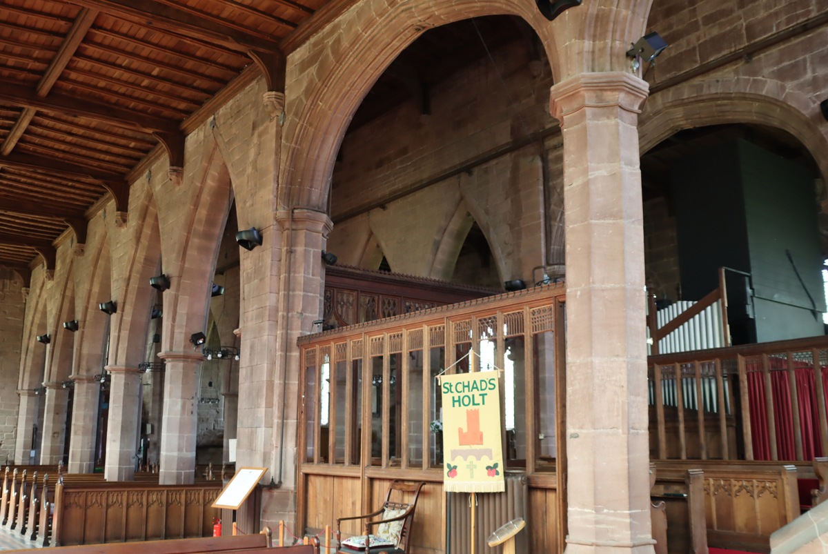
Heading through the impressive main door, set into the base of the tower, and through the glass-panelled doors into the nave, you are immediately presented with an uninterrupted view down the full length of the tall nave towards the east end.  The multiple large windows, only one of which has stained glass (dating to the early 1900s), provide the interior with a lot of natural light, even in the absence of clerestories. The arcades are made of a fine yellow sandstone, much better than red sandstone for creating a light space, and much more refined in appearance. The warm, light reddish wood of the relatively modern pews helps to add to avoid any sense of dourness.  The walls lack the usual distracting and overblown clutter of highly ornamental wall memorials.  Looking up, the wooden ceiling looks as though it belongs to the Perpendicular period, but is belongs to the restoration of 1871-3.

Inevitably there is a bank of 1910 organ pipes blocking the south aisle, shutting out light and preventing direct access from the north aisle to the north chapel, but this is entirely typical, echoing the same scheme in both Gresford and Malpas churches, amongst many others.  Similarly, the south aisle is truncated at the western end of the aisle by a small room presumably used as a vestry.

The 13th and 14th Centuries

Holt Castle by Peter Mazell in 1779. Source: Castle Studies Trust

There is no evidence of a church prior to the 13th century.  The village of Holt was built in the early 1280s, probably as a bastide by John de Warenne, the 7th Earl of Surrey under a charter from Edward I.  A bastide was a newly laid out pioneer town built around a castle on the edge of potentially hostile territory.  Edward I imported the idea imported from Gascony where he had founded a number of new defended towns, and used it as a model for Flint Castle and its bastide town, as well as subsequent castles in his circle of defences in north Wales.  Defensive walls may have been planned for the town but were never built.  The foundations of the first church were probably included in the plan for the border colony, along with a former marketplace (where the village square is located today).

The earliest remaining components of the present church belong to the 13th -14th century.  The nave arcades (arches that divide the nave from the aisles) feature five bays of lancet-shaped pointed arches that date to this period and indicate either that the original church of c.1280 was aisled, or that aisles were a later 14th century addition.  The aisles were widened in the 15th century, removing the older aisle outer walls, but the original ones almost certainly featured lancet-shaped windows of the earlier gothic “Decorated” style.

The earliest of the aisle arches are pointed (or lancet) shaped, unlike the later Perpendicular arches that flank the chancel.

An attractive 14th century “credence table,” looking like a small shrine, was built into the south wall of the Lady Chapel at the east end of the south aisle, moved into this position in Sir William Stanley’s alterations in the late 15th century.  This was used for accessories used to celebrate Holy Mass.  The underside, completely hidden when looking down onto the small platform, has a marvellous grotesque face flanked by two faces, one human and one animal, looking very like a misericord.  If there were misericords in the late medieval choir, like the lovely ones at Gresford, these are long gone.   A mirror leans against the wall but can be laid flat for those who want to see the underside without kneeling down.

Unexpected underside of the credence table, looking very like a misericord

Late 15th Century

In 1483 Richard III granted the Lordship of Bromfield and Yale to Sir William Stanley, which incorporated both Holt Castle and the church.  Stanley made significant changes to the church, removing and replacing the outer walls of the original aisles to widen them, providing them with the Perpendicular style windows, and extended the arcade at the east end.  For reasons unknown, the north aisle is wider than the south aisle. The south aisle chapel is a Lady Chapel. The little leaflet that the church provides suggests, with reservations, that that the chancel, which is slightly out of alignment with the nave, may have been a so-called “weeping chancel,” deliberately and symbolically echoing the images of the crucifixion where Christ’s head is tiltee down to his right.

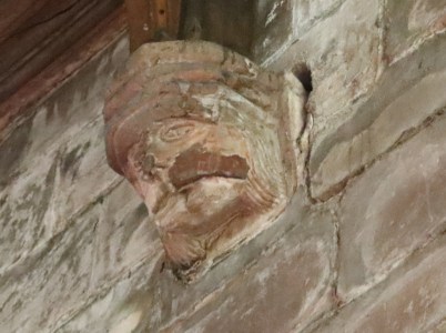
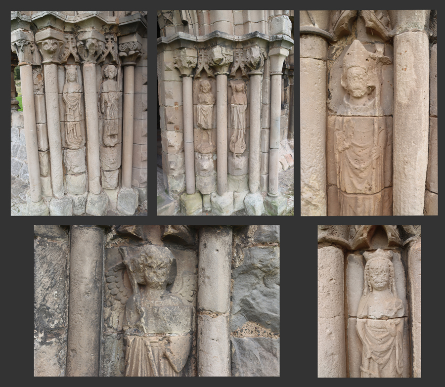
At the chancel, the two bays of arcades flanking the chancel (the choir and high altar), have much wider four-centred (flattened) arches, providing a very fine contrast to the earlier lancet-shaped arches.  The new arcades were fitted with carved stone heads at the tops of the east and west walls, all but three undetermined male heads.  The other three consist of one male head that is crowned and is probably a king, another depicting a dog and another a grotesque face. 

There were apparently problems with the civil engineering of the new east arcade. The last of the free-standing arcade pillars in the south aisle is at a distinct angle, and there is a pillar at the east end, against the wall, which does not reach the roof, as described on the Clwyd Powys Archaeological Trust / Heneb website: “To explain anomalies at the east end of the south aisle it has been suggested that because the east window of the aisle was too large for the wall to support, an external buttress had to be placed nearer to this window than was planned. An internal pillar was then constructed where the exterior buttress should have been sited.”  

Mitred figure at St Chad’s, Holt

The tower at the west end, through which you enter the church, has a spiral stair case to the bell tower (closed to the public).  As you go into the nave from the tower, look right.  There is a carving of a figure wearing a mitre, which is a fragment of a medieval bench-end of the sort that you can see in the choirs at Chester Cathedral and Gresford All Saints’, and suggests that there was once some very interesting Gothic wood carving here.  The mitre is consistent with it representing St Chad, but other candidates are also entirely plausible.  During 19th century restoration work the head was removed from the church and for reasons unknown found itself at Holt Hall, where its dignity was severely undermined, having been employed as a newel post. Holt Hall was one of the many of the fine buildings that failed to survive the early 20th century, and when it was taken down in the 1940s the head was returned to St Chad’s.

Also at the west end to the right as you enter the church, in the south aisle, is the wonderful font, elaborately and deeply carved and dated by Edward Hubbard to c.1493 on the basis of the heraldry that appears in amongst the other carved panels.  It is a truly remarkable object, featuring the above-mentioned heraldic emblems, religious symbols and even a number of grotesques.  The heraldic symbols include a stag’s head, which is one of the emblems of Sir William Stanley and the others are the arms of previous lords of Bromfield, the Warenne and Fitzalan families as well as the heraldic shield of King Richard II (reigned 1452-85).   Others are religious symbols showing emblems of Saints Matthew, Mark, Luke and John, the Lamb of God, the “pelican in her piety,” highly stylized roses representing the Virgin Mary and the ubiquitous gothic acanthus leaves.

The late 15th century font with a reconstruction from one of the interpretation boards showing how the shields may have been coloured

Sir William’s modifications represent a major investment and suggest enormous personal ambition, a desire to put his stamp on the biggest community asset in late medieval Holt.  It did not save him from political manoeuvring.  Although one of the richest men in England, Sir William Stanley was executed for suspected treason by Henry VII in 1495 and the Lordship of Bromfield and Yale reverted to the crown. 

The 17th Century

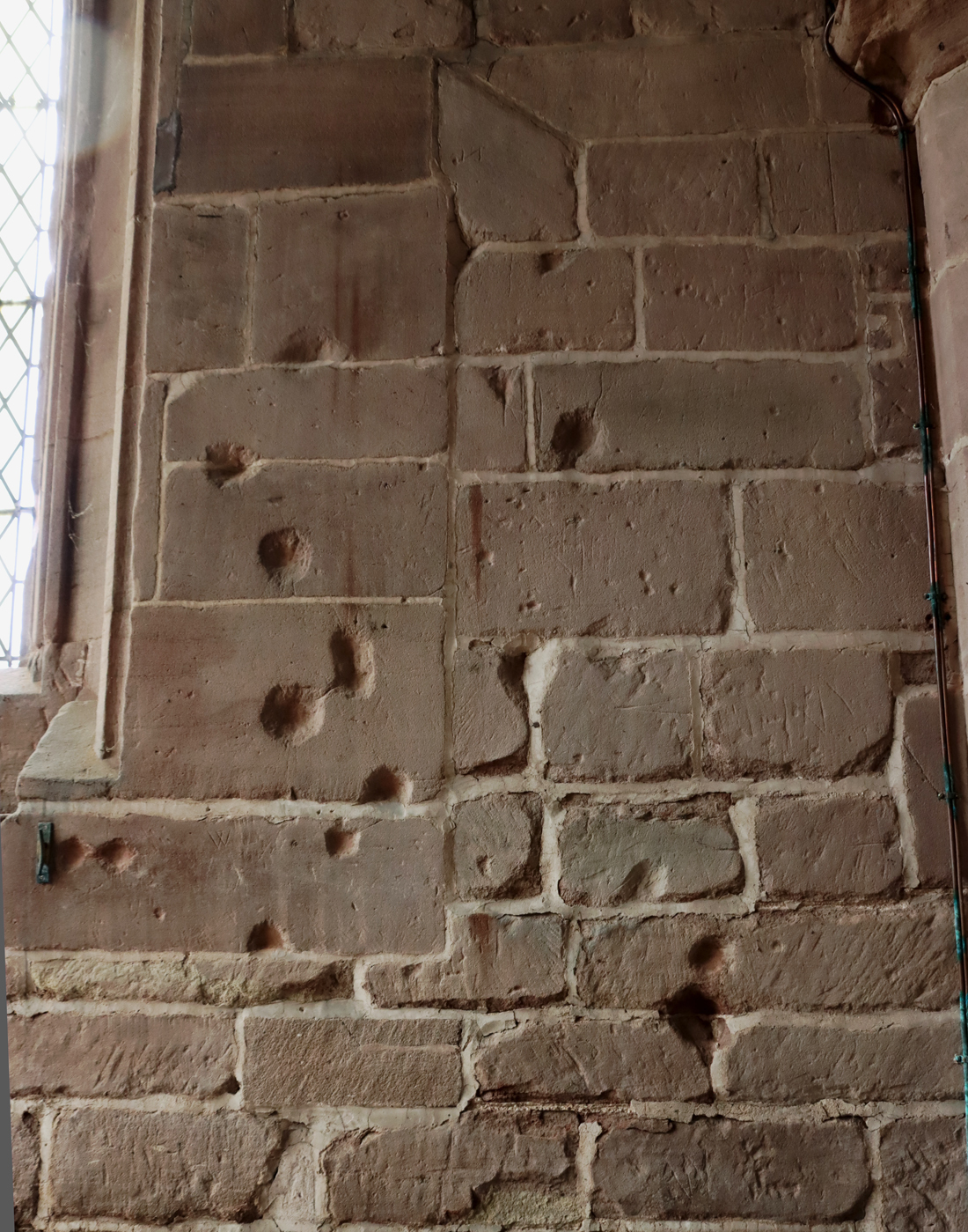
Musket ball holes in the west wall, south aisle of st Chad’s Church, Holt

The Civil War took place between 22nd August 1642 and 3rd September 1651, and had a massive impact on the Chester area, with opposing forces occupying Holt and Farndon at the strategic river crossing.  Frank Latham sets the scene as it was in 1643: “Because of its prominence on a hilltop overlooking the river the parish church of Farndon was garrisoned by Roundhead troops from 1643 to 1645 which enabled watch to be kept on the Welsh village of Holt and particularly on the castle there which was occupied by the enemy.” With Farndon in the hands of the Parliamentarians and Holt in the hands of the Royalists, armed conflict was almost inevitable, and the Battle of Farndon Bridge in November 1643 appears to have been the beginning of a number of skirmishes.  The castle was taken by the Parliamentarians, but in 1644 was retaken by the Royalists.  In 1647 it was besieged for 9 months. 

Fascinatingly, impact marks of musket balls scar the wall and pillars inside the west end of St Chad’s, which are an evocative reminder of the area’s troubled history at that time, when Royalist soldiers defended the church against the Parliamentarians, with hand-to-hand fighting taking place within the church itself.  You can find these mainly on the west wall of the south aisle (turn right as you walk in from the tower and they are on your right), with a few on the other side as well.  Don’t forget that the north aisle has a doorway with three “loop holes” through which weapons could be fired, only one of these can be seen from the interior, but there are also some marvellous lock fittings. 

Finally, a very small and beautifully decorated late brass plaque in the north aisle chapel should not be missed. Its beautifully reflective surface made it impossible to photograph nicely.  It is dedicated to Thomas Crue, who died in 1666.  The plaque was provided by his brother Silvanus Crue.  All of the imagery, with a skeleton flanked by skulls at its base, columns supporting sundials and hour glasses all reference time, death and the transition of the soul.  On the columns the words FUGIT HORA also reference the passing of time: “time flies.”  At the top, in the centre, a lion rampant stands over a grotesque head.  As well as some lovely engraved mortuary-themed decoration, it contains an acrostic; when read vertically, the first letter of each new line makes up one or more words.  In this case the vertical reading over two verses is THOMAS CRUE, and the full text is as follows (having performed some serious gymnastics to read it against the light):

The life of man incessantly from the womb
Hastneth both day and night unto the tomb
Of mortal life when once the thread is spunne
Man has a life immortal then begunne
A wise man dying lives; and living dies
Such was the main that here intombed lies

Carefull he liv’d gods secret laws to keep
Religiously until to Death or Sleepe
Unto a happy life his soule did bring
Ending this life to live with Christ our King

At the base it reads STIPENDIUM PECCATI MORS EST is a Latin phrase that translates as “The reward of sin is death,” and with dry humour typical of the 18th century, HODIE MIHI CRAS TIBI  translated as “Me today, you tomorrow”.  All of this may sound a little gloomy and morbid, but this was the era of John Donne and equally articulate metaphysical poets who engaged with satire, dark humour and word play, balancing the reality of time and its inevitable consequences with a strong sense of irony and flamboyant wit.

The 18th Century

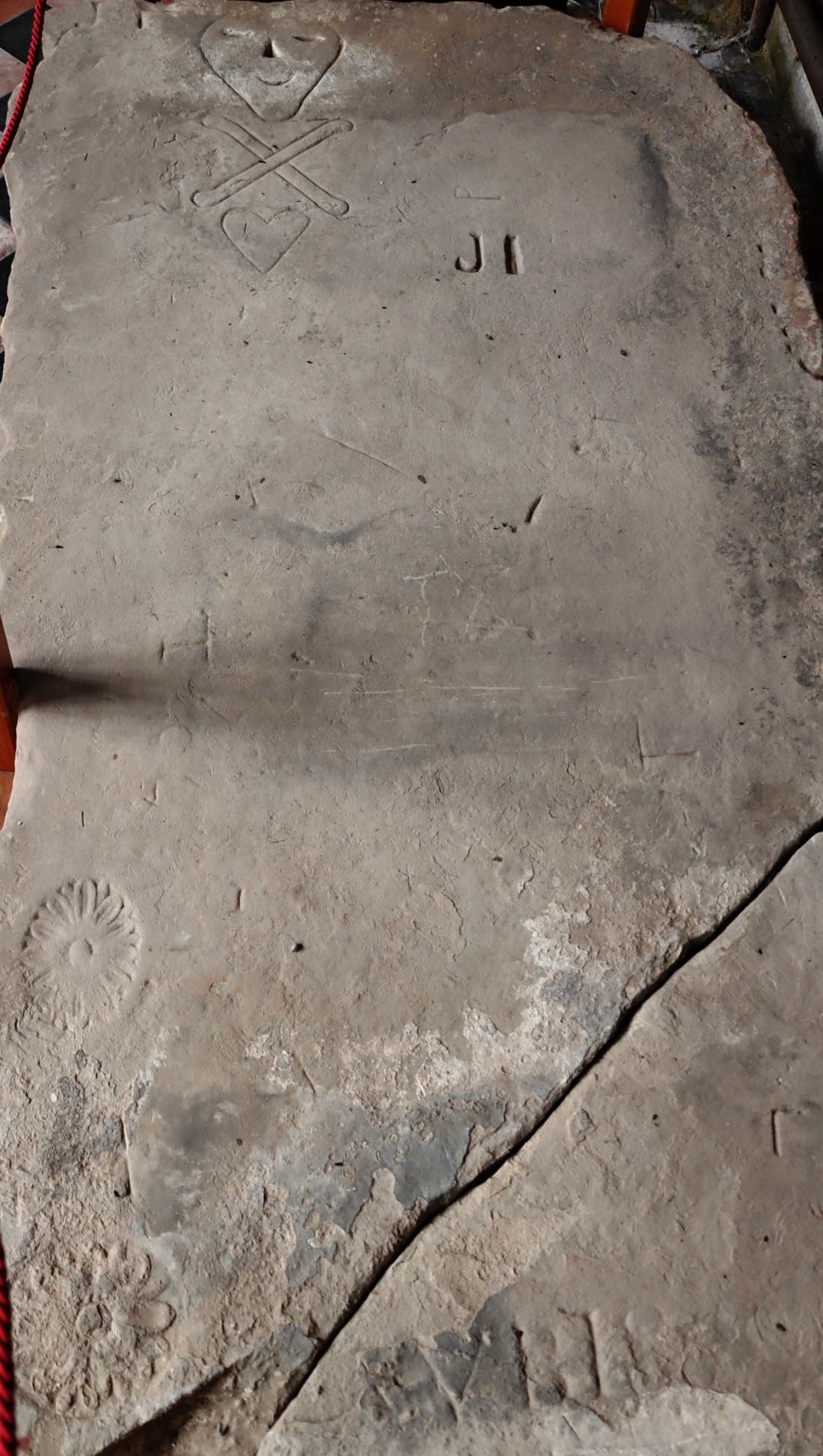
In the south aisle, heading towards the chancel and on your left, there is a super grave slab that was moved in from the churchyard to protect it. It is a marvellous piece, with a skull and crossed bones, the skull having a somewhat surprisingly beatific smile on its face.  There are also some flowers at its base.  The flowers at bottom left were apparently typical of the 18th century, but the skull and crossed bones were better known from plague graves of the 17th century, and are known as memento mori stones, indicating the inevitability of death.

It is in this period that six bells were added to the tower, made by Rudhalls of Gloucester in 1714.  Presumably, if there had been any misericords these would have been removed either during the 17th century purge of medieval religious motifs, or at this time, although at least parts of the choir stalls were reported to be preserved in 1853, but were stripped out in the 1870s.  In 1720 the church was presented with a clock, which stayed in position until 1901.  This was followed by significant renovation of the church in 1732, during which, very sadly, the the rood loft and screens were removed.  This renovation also accounts for the parapet that replaced the pinnacles, gargoyles and battlements on the south side, although some were left in position on the north side.

A lovely engraved brass plaque near the entrance, on the west wall on the north side is worth looking out for, dedicated to John Lloyd and dating to 1784.

19th – 20th Century

The 19th century restoration between 1871 and 1873 was responsible for adding some of the ornamental features, such as the new seating in the nave and oak screens to separate the chancel from the side chapels, but also removed some of the memorial tablets from the walls.  Restoration work included including the renewal of the camber-beam oak panelled roof of the nave and the sanctuary at the far end of the chancel, re-laying of the floors and repairs to the window tracery.  Interestingly, many memorial tablets were removed during the renovation of the interior, which almost certainly improved it no end, but whatever remained of the rood screen and choir stalls were also stripped out.  It is possible that choir stalls and some stained glass were removed at this time, as they were mentioned by a visitor in the early 1850s. 

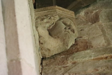
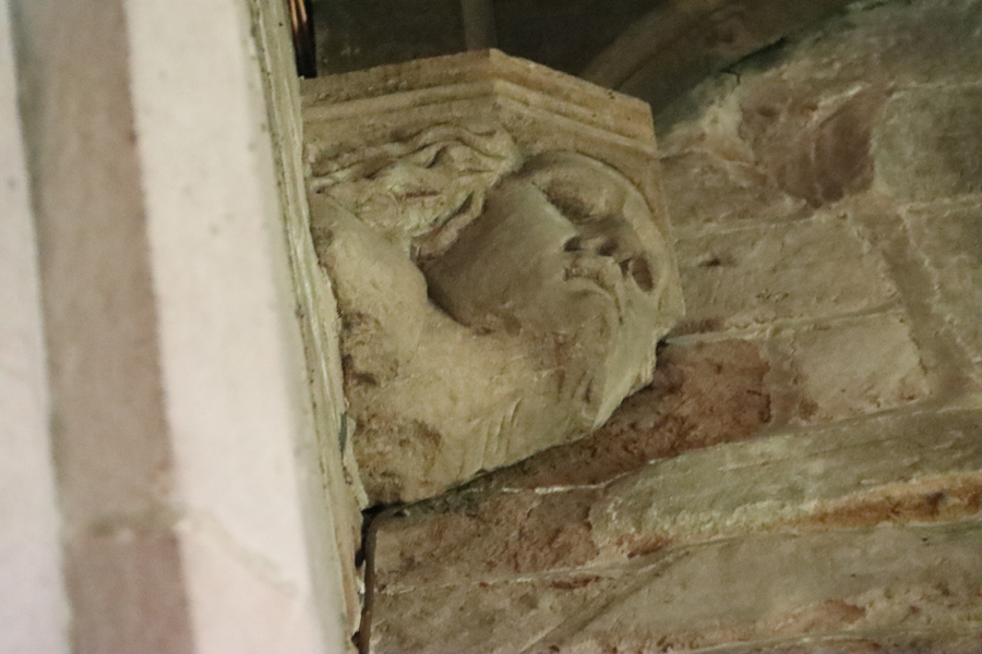
The interior ceiling corbels that support the camber beams were provided with sculptural elements, all human heads.  You will need binoculars or a long camera lens to see them, high up and in shadow, but a couple of examples are shown here.  There is no mention of them in any of the texts, so it is unclear if this dates to the major reworking during the 15th century, or to the 19th century restoration and reconstruction of the ceiling.

Nineteenth century restoration activities can often result in some hair-raising alterations, but St Chad’s seems to have got off quite lightly, retaining some fine original features.  The attempts to restore some of the original ambience were fairly sympathetic, and the new features were not unattractive.  As nineteenth century restorations go, it was not unsuccessful.

In 1896 the bells were provided with a new iron frame and the following year a weathervane was added.

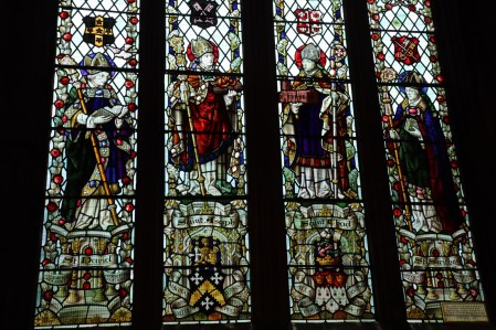
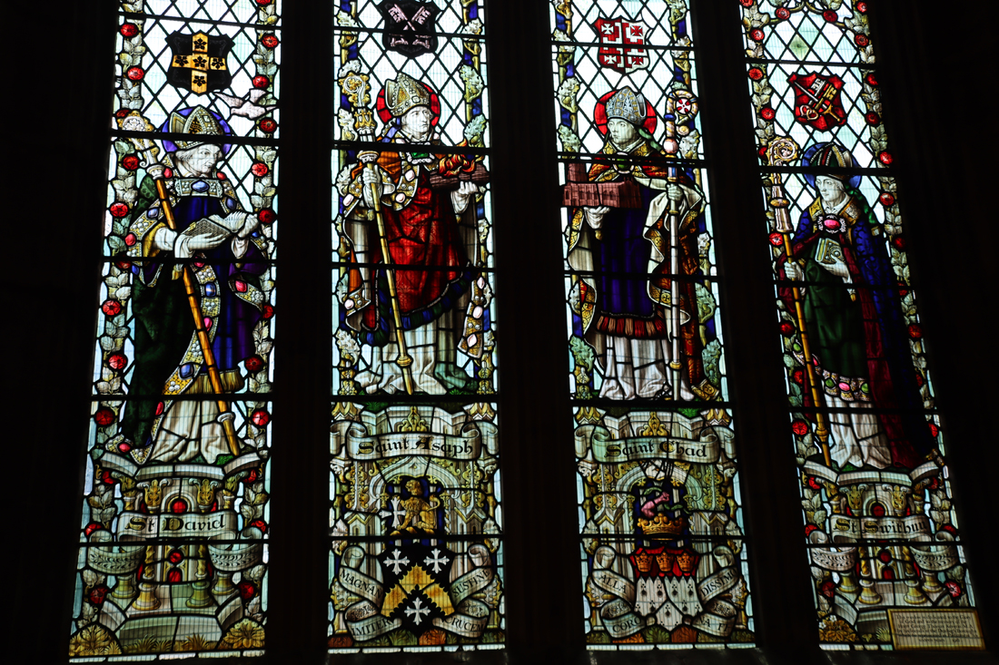
The single stained glass window in St Chad’s, Holt. Early 20th century.

Since then, the main additions to the church have been the new clock in 1902 and a stained glass window later in the early 20th century. The new clock and chimes were fitted to commemorate the coronation of King Edward VIII and Queen Alexandra in 1902.  The stained glass window consists of four panels depicting saints.  The two central panels show St Chad holding an image of the church in his hand, and St Asaph (the church is in the diocese of St Asaph). The outer panels show St David, the patron saint of Wales and St Swithin, reflecting an older connection with Winchester Cathedral in 1547.  It is very nicely done for a 20th century window, emulating the gothic and works well with the rest of the church’s features.

In the 1960s the lighting and heating were improved and the roof coverings were restored.

Detail of Victorian pulpit, St Chad’s Holt

Uncertain dates

It is not known for sure when the tower was built.  One authority puts it in the 17th century, but it is more likely that is is much earlier, probably late 15th century.

Probably late medieval, but not officially dated, are consecration crosses, one of which is next to the radiator to the right of the credence table, and there are other similar consecration crosses marking places that have been consecrated by a member of the clergy elsewhere in the church.

There is a magnificent chest not far from the west end, which had four locks, each representing a keyholder who had to be present when the chest was opened.  This has not been dated, but realistically looks as though it could date to any time between the late 15th to the 17th century.
xxx

Chest in St Chad’s, Holt


Today

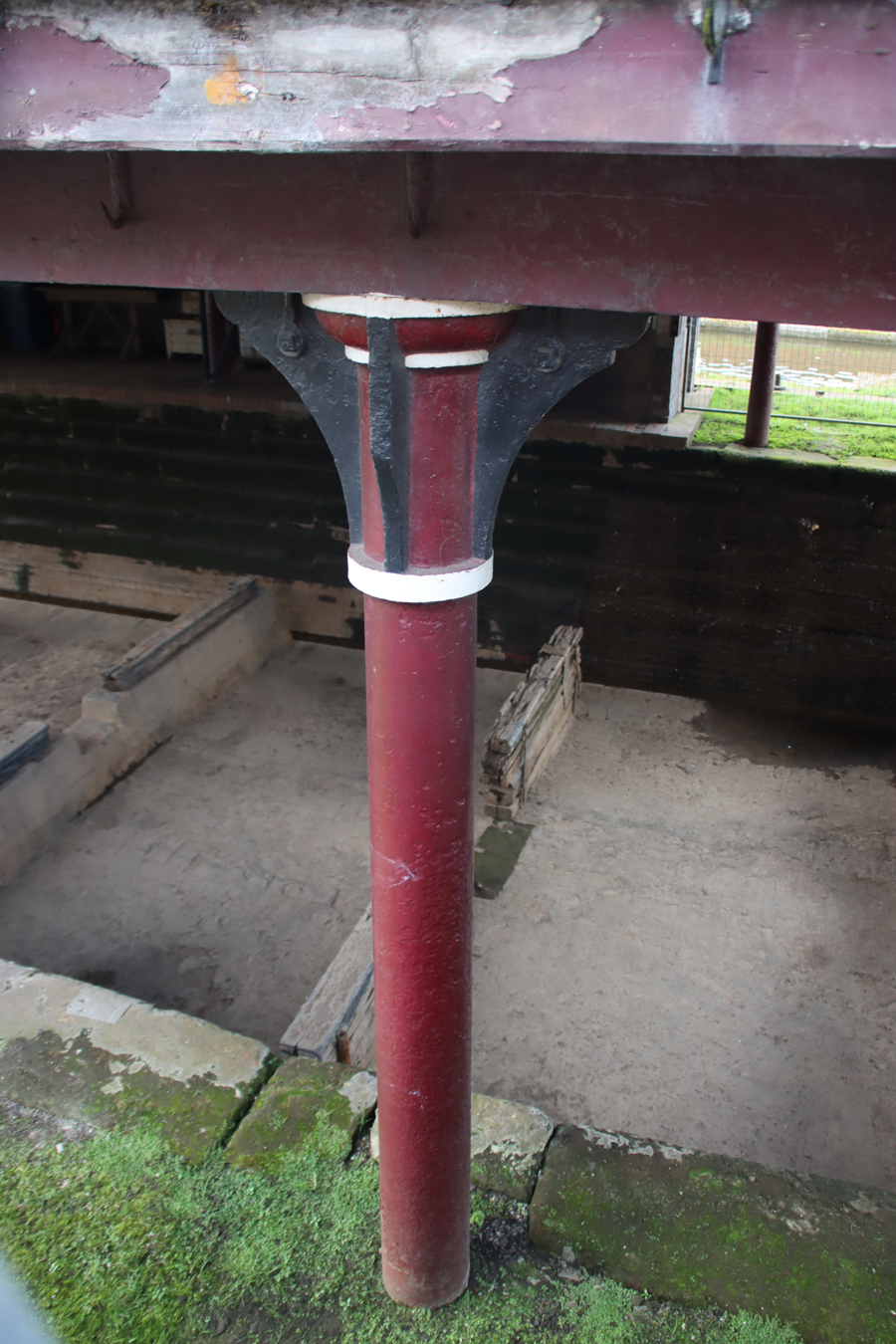
There has also been some modernization to improve lighting and heating, which were probably much-needed.  The pipework for the heating system is fantastic – a remarkable feature in its own right, just as the heating system in Chester Cathedral makes its own contribution to domestic-industrial history.

A replacement sandstone block interrupting some engraved text on an external wall of the church

Obviously the church requires ongoing maintenance.  Sandstone is very vulnerable to pollution, and some of the blocks have had to be repaired using modern sandstone, but thanks to the church being set back from the road this is minor work.  It also looks as though some of the four gargoyles on the tower have experienced some damage, but that too is inevitable.  Overall, St Chad’s seems to be in really excellent condition and is clearly well cared for and appreciated.

The church organizers seem to be doing a very good job of balancing the contrasting demands on St Chad’s.  As well as the provision of plenty of information for visitors about the history and heritage of the church as a tourist attraction, the church is managed as a community asset for services, weddings, funerals and community activities.  Reflecting a concern with modern global issues, there are four “millennium banners,” made by members of the congregation to welcome in the year 2000, which capture local scenes but represent the universal ideas of love, hope, peace and faith.


Visiting St Chad’s, Holt

The “Roman pillar”

There is currently no dedicated website, so there is no generally available online information about opening times.  I was able to walk in during the day one bank holiday Monday on a whim, and found it open. On the other hand, I was there some months later at around 1230 on a Wednesday and it was closed, but I found that it had opened later in the afternoon.  There is a Facebook page but it has no details about opening times and contact details.  Please note that the email address on the National Churches Trust page bounces (i.e. it is defunct).  This is a living church, with Sunday services, weddings and funerals, so even if you do find out what the opening times may be, there will be times when it is not possible to gain access.

There is plenty of parking along the road, but there is also a public car park just a few minutes walk away on the other side of the rectangular grass area, Church Green, on the other side of the road from the church.  There is a car park next to the Dee on the Farndon side, but this is very small and fills up quickly at the weekend and during the school holidays, and floods when the river is up.

One of the bilingual interpretation panels in the church, describing the early development of the town

Information boards and circular panels on short pedestals explain the heritage of the church and are nicely done and for the most part do not intrude on the look and feel of the church.  A small black and white leaflet was available on the table to the right in the tower as you walk in, consisting of two sides of A4, folded, that lists the key features to see in the church.

For those worried about steps and accessibility, the church can be visited without having to negotiate any obstacles, as there is a ramp from the tower into the nave.  There are plenty of pews for giving irritable legs a rest.  Outside, there is a  wide path that runs along the south side of the church and a narrower one along the north side and these both felt safe underfoot. There are also tracks through the churchyard, but if you are looking for a particular grave, note that the grassy spaces between graves are very uneven and you need to take seriously good care where you place your feet.  I suspect that it gets very muddy during rainy periods, so appropriate footwear is recommended.

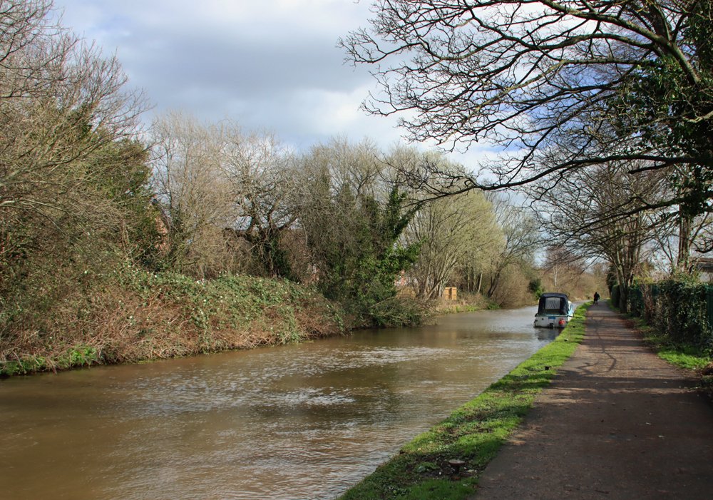
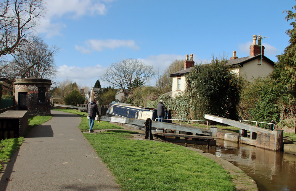
This would make an excellent start or finish to a walk along the River Dee, which has footpaths on both sides of the river.  The late medieval bridge is itself a joy.  On the Holt side a visit could easily take in Holt Castle as well and on the Farndon side there is, of course, the other St Chad’s.  There’s a pub next door to the Holt church that advertises food and a garden, which I haven’t yet tried, but might be handy for the end of a walk.  There are other pubs and coffee shops on both sides of the river, all serving food.


————-

Sources:

Visitor information in St Chad’s, Holt

Interpretation boards and panels

Free leaflet:  20 Minutes of Discovery Around St Chad’s Church Holt


Books and papers:

Farmer, David 2011 (5th edition).  Oxford Dictionary of Saints. Oxford University Press

Hubbard, Edward 1986.  The Buildings of Wales.  Clwyd (Denbighshire and Flintshire). Penguin Books and University of Wales Press

Latham, Frank. 1981.  Farndon: the History of a Cheshire Village. Farndon Local History Society


Websites:

Archaeodeath 
Skulls in Stone and Brass: Inside Holt Church
https://howardwilliamsblog.wordpress.com/2015/08/25/skulls-in-stone-and-brass-inside-holt-church/
Masters of Holt
https://howardwilliamsblog.wordpress.com/2015/10/09/masters-of-holt/

Based In Churton
Big and bold: All Saints’ Church in the small village of Gresford
https://wp.me/pcZwQK-43a
Gresford All Saints’ Church – exterior gargoyles and grotesques
https://wp.me/pcZwQK-498
Gresford All Saints’ Church – a beginner’s guide to funerary monuments
https://wp.me/pcZwQK-49Z
Miracles, myths, demons and the occasional grin: Misericords in the Chester-Wrexham area #2:  The churches of Gresford All Saints’, Malpas St Oswald’s and Bebington St Andrew’s
https://wp.me/pcZwQK-4Ey

British Listed Buildings
The Parish Church of St Chad, Holt
https://britishlistedbuildings.co.uk/300001596-parish-church-of-st-chad-holt

Cadw
The Parish Church of St Chad, reference 1596
https://cadwpublic-api.azurewebsites.net/reports/listedbuilding/FullReport?lang=en&id=1596

Coflein
St Chad’s, Holt
https://coflein.gov.uk/en/site/165283/?term=holt&pg=2
(images at https://coflein.gov.uk/en/site/165283/images?term=holt)
Holt Bridge; Farndon Bridge, Holt, Wrexham

https://coflein.gov.uk/en/site/24043/

Early Tourists in Wales
North side of the churchyard
https://sublimewales.wordpress.com/material-culture/buildings/churchyards/special-graves/north-side-of-the-churchyard/

CPAT / HENEB – Wrexham Churches Survey
Church of St Chad, Holt
https://heneb.org.uk/archive/cpat/Archive/churches/wrexham/16796.htm
or https://cpat.org.uk/Archive/churches/wrexham/16796.htm 

National Churches Trust
St Chad’s, Holt
https://www.nationalchurchestrust.org/church/st-chad-holt

Peoples Collection Wales
St Chad’s Church, Holt
https://www.peoplescollection.wales/items/435519#?xywh=0%2C-55%2C799%2C642

St Chad’s, Holt – Facebook page
https://www.facebook.com/pages/St-Chads-Church-Holt/102667013120267

xxx

One of the many heads at the tops of the aisle walls


A thoroughly enjoyable visit to a splendidly sunny Chester Zoo

I’ve been a member of Chester Zoo for years, although I cannot remember the last time I got around to visiting.  It is a super place to visit at this time of year, because although there are plenty of people around, and quite a few young kids, it is anything but crowded and there’s no queueing or having to wait in turn for a good view. I was supposed to be doing good works in my garden today, but looking at the sun, and considering my options, it suddenly seemed like a good idea to abandon the weeds and go and inspect the baby elephant in person.

Last time I was there I was really impressed with some of the innovative changes, not only to the animal houses and paddocks but to the walkways between enclosures, which included boardwalks and raised walkways, with a growing emphasis on flora as well as fauna.  All of the walkways are lined with what are now increasingly mature trees and shrubs, many of them specimen pieces, and lots of them labelled with their species name and additional information.  This lavish plant life extends into many of the animal enclosures.  There is a sense of everywhere being green and floral wherever you look, and this is really impressive.  The new zone based around a wending water feature is particular lavish in this respect, giving a real sense of being out of the busy world beyond the zoo.  All of the green and water areas support not only the official zoo residents but the local wildlife too, including water birds, garden birds and insect life, both of the crawling and flying varieties.  Plant species have been selected, for example, to encourage bees, and the lowly mallards looked very much at home.

As ever at Chester Zoo the emphasis is on conservation and their breeding programme, and there were plenty of babies around to demonstrate their successes, as well as multiple  information boards dotted around that explain not only the zoo’s residents and their habitats but also how the zoo itself is helping to promote their survival worldwide, with partnerships with other organizations.

It was far from hot today, although the spring sun was lovely, but it was terrific to see many of the animals enjoying their water features.  There were notable exceptions, including the giant otters who were having a marvellous time sunbathing, a seriously mellow lioness and a very lazy cheetah who seemed to melting into the sunshine.  There was a lot of very contented laziness on display!  At the same time, it is always superb to see various different monkey and apes enjoying their enclosures inside and out, with a lot of energy on display.

The new “pink zone” which has a southeast Asian theme and is organized around a winding circular waterway is excellent, with some great features and, should you be hungry, a southeast Asian-style fast food restaurant.  I had just stuffed myself with an enormous Mr Whippy or I would have gone for it, as that sort of cuisine is just up my street.

The monorail has been taken down, but this has lead to an expansion of the walkways.  At the moment the Heart of Africa section is being reconfigured, meaning that much of that area is not accessible, so the giraffe house is not available, and the zebras were not visible, but this should change by the summer.  At the moment some of the bird venues are closed due to bird flu, a very good precaution.


And it did!

Opening times and prices are on the Chester Zoo website here. You can download the map from the Zoo’s website here, or you can pay a £1.00 for a printed version at the ticket office.   All the Chester Zoo people, whether you are having your bag checked at the security desk, buying an ice cream or asking directions are super-friendly and really helpful.

A great day out. It is super to see how the zoo continues to innovate and to extend its offering.


Day Trip: The elegant Augustinian Haughmond Abbey near Shrewsbury

Interpretation board at Haughmond Abbey.  The “You Are Here” text at far right (the south end of the site) marks the location of the interpretation board. The church remains only as a few courses of stone at far left (north) but leaves a clear footprint of its layout.

One of the fascinating ruined monastic buildings that I visited during my October 2024 trip to Shropshire, was the sprawling Haughmond Abbey, just a few miles northeast of Shrewsbury, and very easy to reach.  The Romanesque survivors at the site are particularly delightful, giving the site a charm and subtle glamour that is largely missing from most of the somewhat repetitive gothic establishments that followed.

Haughmond was the first Augustinian monastery that I have visited, and it is unusual in being so large for an Augustinian establishment.  The followers of St Augustine of Hippo, also known as Austins or Black Canons, followed a rather different set of guidelines from those of the Benedictines, Cluniacs and Cistercians and others who followed the Rule of St Benedict, of which more below.  Most Augustinian monasteries were priories, but Haughmond was raised from a priory to an abbey in the mid-12th century, one of only 9 in England to do so, and its ground plan is extensive.  Its design borrows extensively from its St Benedict-inspired predecessors, but there are notable differences too.

The visible remains of Haughmond relate to the buildings founded as an Augustinian abbey in the 1130s, dedicated to St John the Evangelist.  Some documentary evidence is supplied by what remains of its cartularies (collection of charters) assembled between 1478-1487 as well as records of leasing agreements from the 14th to the 16th century, both of which provide information about its economic activities from the 12 century onward.  Further information was provided by excavations. The first of these were carried out by William St John Hope and Harold Brakspear in 1907, and were interestingly financed mainly by public subscription, reflecting local interest in the site.  Part of this was clearance of debris but they found the remains of the 11th century church and  revealed many of the remains of the early church and priory.  When the Ministry of Works in 1933  took over the site they too undertook clearance works and further excavations, at the south end of the site, took place in 1958 . In the 1970s, Jeffrey West and Nicholas Palmer concentrated on the various phases of the abbey church and and surveyed the abbey’s surviving walls.  In 2002 a survey by English Heritage not only found the location of the original gatehouse but located the abbey precinct’s boundaries and many of the features that lay within those boundaries, including important aspects of the drainage system.
====

The Augustinians

The earliest known representation of St Augustine from the 6th Century in the Lateran, Rome. Source: Wikipedia

The Augustinian order, like the traditional medieval monasticism that subscribed to the ideas of 6th century St Benedict, looked to an earlier time and an earlier authority on which to base their own approach to monastic living.  St Augustine (354–430) was born in Roman North Africa in 345. Before a visit to Milan he had been closely associated with the Manichean religion before meeting Christian intellectuals in Milan.  On his return to North Africa his own inclination as a Christian was to embrace the monastic life, but he was persuaded to take orders as an ordained priest, partly because Christianity was a minority religion in the area at that time, and although he accepted this role, he also received permission from the bishop of Hippo (now Annaba in Algeria) to create a community of Christian men and women who renounced wealth in favour of a communal life of religious service.  He later became the bishop of Hippo himself.

Augustine’s guidelines were not written down as a single set of rules like those of St Benedict, but were assembled from a letter to his sister a nun, which offered thoughts on how a monastic establishment should be run.  These had no influence on the development of monastic life until the 11th century and it is not known whether the rule itself was rediscovered or whether Augustine’s ideas were simply adopted from his other extensive writings to create a rule carrying the saint’s authority, applicable not only to monasteries but other religious communities, including hospitals.  

The Augustinian monastic organization was founded in the 11th century, with papal approval.  Its monks were popularly known as the Black Canons, canons being members of a monastic community of priests.  Unlike those monastic orders based on the Rule of St Benedict, the Augustinians, or Austins, were ordained priests and were able to leave their monastery to work in the community to carry out pastoral work. The foundation of hospitals was also an integral part of many of the Augustinian establishments.

The central ideas of the rule by the 12th century were that canons should emulate the apostles, abandoning their possessions, leading a celibate, contemplative life that included prayer, in which personal poverty, self-discipline, mutual responsibility and charitable generosity were more important than austerity and seclusion. Augustinian canons could spend time in the community and conduct services in churches.  The maximum number of canons permitted in a single establishment was 24, and at the time of the Dissolution there was half this number at Haughmond.  No two establishments necessarily operated in the same way, although many of the monasteries shared the basic Benedictine layout of the main buildings gathered around cloisters.  Many were very small, usually holding the status of priory, but Haughmond was promoted to an abbey early in its history.  It was unusually large, and was gathered around two cloisters, as well as an infirmary, now lost.
==

Entering the site today – orienting yourself

Haughmond Site Plan. Source: Iain Ferris 2010 (see sources at end)

The site is entered from the south where the Abbot’s Hall, private rooms and reredorter (latrine block) are located (at the bottom of the plan at left).  In the medieval period all visitors would only have entered at the opposite end of the site, to the north, where the remains of the church and its two transepts are to be found.  The monastic complex is an integrated whole, incorporating both domestic and religious functions in a single unit, although it grew up over time, advancing from north to south, beginning with the church, in the opposite direction from which you enter.  Repairs and reinventions mean that there are many layers to understand within the abbey complex.

Sandwiched between the Abbot’s Hall at the south end of the monastery and the church at the north end are two cloisters (square arrangements of buildings, each around a central green area).  The two cloisters are separated by the frater (refectory) that makes up the north wall of the southern cloister and the south wall of the northern one.

The official guidebook has a recommended circular route either straight ahead from the entrance, via the Abbot’s Hall, or via the reredorter (latrine block) to the right.  It does help to have a site plan to walk with, either in the guide book or printed out, particularly given that even with experience of previous monasteries, it’s a complex site with some features only surviving to the height of a few courses of stone.
==

The development of Haughmond Abbey

A splendid reconstruction of Haughmond Abbey by Josep Casals for English Heritage / Historic England. Source: English Heritage. My annotations based on the plan shown in the Haughmond Abbey guidebook. North is to the left, where the church is located. Click to enlarge

Like most high-status buildings, Haughmond changed considerably over time.  It began in the 11th century as an isolated community. The reasons for the location have not been recorded but the English Heritage survey of the site suggests the following:

[T]he comparative remoteness of the area on the woodland fringe, the shelter provided by the slope and the ready availability of building stone are all valid explanations. However, these conditions apply widely along the foot of Haughmond Hill and so it was probably the occurrence of a number of springs along this particular section of the escarpment which was the determining factor. The need for a reliable water supply for drinking, washing and carrying away waste hardly needs stating but there is also the possibility that the first community chose to settle here because the springs already had an established spiritual significance. (Pearson et al 2003)

Small entrance to Haughmond Abbey from the south, now the entrance for visitors.  The main gateway was at the north.

One of the important achievements of the combined excavations was to establish that an earlier abbey had preceded the 12th century Augustinian priory.  The remains of a  small cruciform stone church were found beneath the south transept and the northeast cloister and it is suggested that it may have been built by an eremetical community, either in the late Saxon or early Norman period. A small cemetery of 24 graves that was found immediately to the west of that church included child burials, suggesting that it was serving the community at large, not merely the monastery.

The monastery was later re-established by the FitzAlan family under William FitzAlan I in the 1130s as a priory using the Rule St Augustine to guide its activities.  This included rebuilding of the church and cloister that provided the Augustinian priory an integral part of its later identity.  It was so richly endowed that it was soon given abbey status.  The FitzAlan family continued to be patrons of the abbey and were buried at the site until the mid-14th century.  They eventually transferred their loyalties to another establishment when the Lestrange family took over as primary patrons, their endowments allowing further expansion.  During the 13th and 14th centuries further elaborations were made, and in the early 16th century it underwent remodeling, just in time for the Dissolution in 1535.

Information panel at Haughmond showing the daily liturgy followed by the Black Canons. Click to enlarge

As a wealthy abbey, Haughmond was not amongst the first to be closed down, and lasted until 1539, at which time the remaining community members were pensioned off.  After it had been plundered for its treasures for Henry VIII’s coffers the abbot’s quarters were converted to a country home for Sir Edward Littleton, with some of the other buildings remaining in use.  It continued to be a home until the Civil War when a fire put an end to its residential use. It was eventually handed over to the Office of Works in 1933.  The 2002 survey by English Heritage established the extent of the abbey precinct and identified its water management systems, neither of which had been fully understood before.  The excavations found numerous objects, Romanesque architectural stonework, human remains, animal bones, pottery and metalwork all dating to the abbey’s occupation.
==

The Abbey Layout

The preservation of the buildings is very variable, with the abbot’s residence and hall and chapter house being the main and very impressive survivors.  The inner wall of the west range survives, and there are some fascinating architectural details dotted around, but most of the site is represented by low courses of stone that reach only a few feet high.  This does not undermine the visit, because these lower courses preserve the layout of a complex site, which offers a great many insights into life at Haughmond.

The monastic precinct

Plan of the abbey in the 2002 survey. Source: Pearson et al survey report 2003, English Heritage (see Sources at end).

The site is large, but only represents the core buildings.  The monastic precinct was much bigger.  Access to the monastic precinct would have been via the main gatehouse.  The remains of this was found in the 2002 survey, to the west of the church.  The boundaries of the monastic precinct were not found in 1907, but were revealed by the 2002 English Heritage survey.  This provided a good idea of the full extent of the site, making it easier to visualize it beyond its current footprint, and at the same time offered an entirely new interpretation of the site’s drainage management, always an important aspect of monastic establishments which, as well as requiring fresh water, had waste management and other drainage requirements.

The church

Haughmond Abbey Church interpretation panel. The sacred east end with the presbytery/chancel is on the left, with the nave to the west on the right, and a dividing screen between them. Click to enlarge.

Although there is nothing left to give an idea of how the interior would have looked, the very lowest courses of the church retain its footprint, and excavations have provided some more information, derived from the masonry of the site.  The church had the usual cruciform plan of a long nave, short chancel,  two side transepts, 60m (200ft) long in total, with a short tower over the crossing.   Visitors would have entered into the nave of the church via the north porch, penetrating no further than the church nave.  The nave was divided from the sacred east end of the church by a stone screen.  The cloister and the rest of the monastic establishment would have been completely out of bounds for ordinary visitors.  The canons would enter from the cloister side.  Interestingly, the site is terraced beneath the line of the church, meaning that the altar would have been physically higher than the transepts, involving a great many steps to reach the high altar, which would have been higher than the nave, emphasizing the hierarchy of the church from sacred east to secular west.  The transepts would have contained chapels where the ordained priests could say masses to the dead.  There were also altars, other than the main altar, to St Andrew and St Anne.  An aisle was added to the north side of the nave, the pier bases of which were found during the 1907 excavations.

Looking down the terraced profile of what remains of the church

The main cloister

The processional doorway

The church makes up the north side of the cloister, offering it some protection from the elements and allowing in the sun, which helped to light both the church and the cloister buildings.  The main cloister was rectangular and the other three sides were made up of three ranges of buildings with a green, the garth, at its centre. Nothing remains of the walkway that would have connected these four ranges of buildings.

Connecting the cloister or the nave was the processional doorway, a magnificent 12th century feature through which the monks could carry reliquaries, saint images and portable shrines on days of particular religious significance.  Like the chapter house, it has elaborate patterning on the out of the recessed arches and is flanked by two statues representing St Peter (left) and St Paul (right).

The facade of the Chapter House

The most important building in the east range, which is partly made up by the north transept of the church, is the chapter house, where the daily business of the monastery was discussed. Its  lovely facade includes the entrance flanked by two windows, all with receding layers of arching featuring decorative patterns, and featuring eight statues showing saints between the slender columns.  Although the arches belong to the 12th century, the statues were added in the 14th.  Some are in rather better condition than others, but include St Augustine, a female saint who perhaps represents St Winifred of Shrewsbury Abbey, St Thomas Becket, St Catherine of Alexandria, St John the Evangelist, St John the Baptist, and St Margaret of Antioch.  The building underwent further changes at the beginning of the 16th century, probably including the addition of a wooden ceiling.  The tombstones and the font were probably moved here from the church after the monastery went out of use.

Interpretation board discussing the chapter house saints


Interior of the chapter house

Detail of one of the interpretation panels

The remains of the west range.

Opposite the chapter house is what remains of the western range.  The inner wall survives, with two tall arched recesses, which  probably contained a laver, a basin that the monks used for washing before eating.  Further along at the northern end adjacent to the processional doorway an entrance lead into the western range, with decorated capitals at the top of the columns.  The outer walls have been lost.  The western range was used differently from one establishment to another, and it is not known how this example was used.

Gateway into the western cloister, showing multiple levels of structural change

The southern range was made up of the refectory (dining hall) with an undercroft (storage area) below.  The floor of the dining hall is long gone, but some decorative features remain in the walls, and it once had a great window over a central pointed arch.  The undercroft opened out into the monastic precinct via an arched entrance and and two flanking windows.  The remains of the pillars that supported the refectory wall remain, together with a drain running towards the north.  The full length of the refectory was 30ft 6ins (c.9m) wide by c.81ft (c.25m) long.

The refectory undercroft with pillars and drain

Interpretation panel showing the refectory and its undercroft

Behind the chapter house and overlapping with half of the dormitory is what is known as the Longnor’s Garden, now an empty space with a wall behind it, established in the mid-15th century for Abbot Longor.  As well as a dovecote it was presumably used to grow herbs, for both cooking and medicinal use.

The little cloister

Kitchen ovens

A narrow gap at the east end of the refectory allowed access from the main cloister into the little cloister.  A low line of stone marks the line of the former walkway that surrounded the little cloister. This contained another four ranges, the northernmost of which was made up by the refectory.  The entrance to the refectory was probably originally from the main cloister, but once the little cloister was established, the entrance was on this side, which makes sense as the early 14th century western range consists of a surprisingly large kitchen area with two giant ovens and chimneys.  The 1332 document by Abbot Longnor that permitted this survives, stating that the prior and monastic community “may have from henceforth a new kitchen assigned for the frater, which we will cause to be built with all speed ; in which they may cause to be prepared by their special cook such food as pertains to the kitchen of that which shall be served to them, every day, by the canons and ministers appointed to that end by them by leave of the abbot.”

The kitchen and refectory, side by side. To the left of the refectory wall, and in front of the ovens is the line of little cloister’s walkway.

Opposite the kitchens were the two-storey dormitory and its undercroft, set at an angle to the little cloister and terminating at the south side with an entrance into the reredorter (latrine block), which was set at an angle to the dormitory. The undercroft survives, but the upper levels that made up the dormitory are now lost. The building is 125 ft long by 27 ft wide, with a row of columns along the centre, dividing it into eleven bays.  The remaining stonework preserves indications of doorways, windows and fireplaces.  In the mid-15th century the north end of the dormitory was divided off to provide private space for the quarter’s of the abbot’s second in command, the prior.

View part-way along the dormitory, looking towards the chapter house

The drain of the reredorter

At the southern end of the little cloister were the abbot’s apartments, consisting of a hall and private rooms.  The remains of an earlier and much smaller set of13th century apartments survives at the east, but was replaced by the much more ambitious, decorated 14th century buildings that partly survive today.  The main feature of the hall is an enormous pointed window, with fragments of stone tracery remaining, set over twin pointed arches, and flanked by two small towers.  Three sets of windows, with tracery, let light in on either side, and again provide the rooms with gothic flair. The Abbot’s private rooms feature a distinctive 5-sided oriel window with distinctive decorative elements.

The abbot’s private rooms on the right, and his hall to the left

The abbot’s hall

The fireplace in the abbot’s hall


Interpretation panel for the abbot’s hall

The oriel window in the abbot’s private rooms

Some of the decorative features in the abbot’s private rooms

=
Records mention an infirmary at Haughmond, as well as a library.  The library would usually be closely associated with the chapter house, but there is no sign of one today.  In early 20th century plans the infirmary is marked where the abbot’s hall is now located, and the infirmary has not actually been located.  The consensus is that the local topography means that it could not have been to the east of the site.  Two fishponds were not far away, and others were associated with mills.
====

Economic activities

View of the western side of the monastery from the outside

Although patrons were important for establishing monastic establishments and continuing to support them, many of the endowments took the form of land, and the success of a monastery was largely dependent on how well that land and other assets were managed.  There were two main models for making an income from these assets – either by the owners working it themselves or by leasing it out.  In the case of Haughmond the assets included considerable amounts of farmed land, as well as fulling (wool processing) and corn mills.  Although lying within a royal forest, the abbey was given limited permission to assart land (clear woodland and shrubs for farming), and also acquired newly assarted lands in the area.  It owned land under cultivation but also established cattle farming on higher ground.  Lands were not only in Shropshire but from the late 12th century it also owned land in Cheshire, Worcestershire, Wales, Sussex and Norfolk.  Fishing rights were also important, and the abbey had its own fishponds, as well as fishing rights both nearby and from the river Dee at Chester, the latter doubtlessly annoying the Benedictine monks of St Werburgh’s in Chester.  It also received income from six churches that had been passed to its control, including Hanmer in Flintshire, the only one outside Shropshire; it had properties in Shrewsbury that it rented out; and was granted the rights to and a one half salt-pan in Nantwich.

Many small bequests were made to secure prayers, to assist the infirmary and to provide for the poor who came to the monastery gate for alms.  The monastery also sold corrodies, which were substantial gifts made to the monastery in return for food and housing, a form of pension. On the other hand, corrodies were also provided to loyal servants, in which case they represented an outlay rather than an income.

Farming land just beyond Haughmond Abbey

It is thought that between the 13th and early 14th centuries the abbey restructured in order to consolidate the dispersed properties to make them easier to manage, something that happened at a lot of other monastic establishments that found themselves in this situation, causing real management difficulties.  By selling some lands and acquiring others in more suitable locations, consolidation made management much easier and less costly.  At least some of the land was leased out, but other lands were worked directly,  However the surviving records are insufficient to allow a clear view of how well the abbey managed its assets, how all of its lands were used and what sort of activity provided the most income.

In spite of the recorded assets, in the early 16th century the abbey clearly experienced difficulties, both in the management of its estates and in the internal discipline of the monastery itself.  This is put down to poor management by two of its abbots.  Under its final abbot, Thomas Corveser, it began to recover and it was still sufficiently wealthy to avoid immediate closure in 1535, surviving another four years, and the surviving personnel were provided with generous pensions.
==

Final Comments

This is a very quiet site, and because it feels so peaceful and retains some lovely features of its 12th century Romanesque origins, has a particular charm to it.  I particularly like that some of the domestic buildings that rarely survive at other sites, including the vast hearths in the former kitchen, and the reredorters connected to the dormitory, can be clearly made out.  I was expecting the Augustinian arrangement to have significant differences from Benedictine prototypes, but there was nothing much on the ground to differentiate them.  The decorative features certainly mark them out as less austere than, for example, the Cistercians, but otherwise the architectural concept of a monastery in the medieval period is impressively uniform.
==

Visiting

Haughmond Abbey is an English Heritage site.  It was open free of charge when I was there in October 2024, but its opening times and ticket prices may vary with the season.  See details on the English Heritage website here.  The postcode for those of you with SatNav is SY4 4RW.  The guide book, published in 2000, claims that the little building on the left as you enter is a museum, but this was very firmly closed when I visited. Perhaps it is open during the summer, or it may have shut down for good by now.  Please let me know if you find out!

There are interpretation boards throughout the site, which help to explain it.  The helpful guide booklet by Iain Ferris is available from online retailers, but may also be available from English Heritage sites with gift shops in the area.  It combines Haughmond, Lilleshall and Moreton Corbet Castle in the same 24-page booklet, with 14 pages dedicated to Haughmond and the Augustinians, 8 pages to Lilleshall and 2 to Moreton Corbet Castle.  It includes the ever-essential site layouts of Haughmond and Lilleshall.  There are also very useful details about the history of the site on the English Heritage’s Haughmond Abbey History page here.  If you are interested in following a trail of some of the Shropshire abbeys including Haughmond, Mike Salter’s booklet “A Shropshire Abbeys Trail” is a good place to start, available to purchase online.

Other sites in the area, a selection of which would help to make up a good day out include Wroxeter Roman City (about which I have posted here), the Cluniac Order’s Wenlock Priory at Much Wenlock (posted about here), another Augustinian abbey at Lilleshall, Moreton Corbet Castle, and of course the town of Shrewsbury itself, with its lovely architecture, terrific abbey church (within the outskirts of the town) and the excellent Shrewsbury Museum and Art Gallery. with its modern displays connecting different periods of the history of both town and area.

The abbot’s hall, with the remains of its predecessor in the foreground


Sources

Books and Papers

Angold, M.J. Angold, George C. Baugh, Marjorie M. Chibnall, D.C. Cox, D.T.W. Price, Margaret Tomlinson, B.S. Trinder 1973.  Houses of Augustinian canons: Abbey of Haughmond, in (eds.) A.T. Gaydon, and R.B. Pugh.  A History of the County of Shropshire: Volume 2. London.
British History Online: https://www.british-history.ac.uk/vch/salop/vol2/pp62-70 

Burton, Janet 1994. Monastic and Religious Orders in Britain. Cambridge University Press

Chadwick, Peter 1986. Augustine. A Very Short Introduction. Oxford University Press

Levitan, Bruce 1989.  Ancient Monuments Laboratory Report 118/89. Vertebrate Remains from Haughmond Abbey, Shropshire. English Heritage
https://historicengland.org.uk/research/results/reports/3917/VERTEBRATEREMAINSFROMHAUGHMONDABBEYSHROPSHIRE

Pearson, Trevor, Stuart Ainsworth and Graham Brown 2003.  Haughmond Abbey, Shropshire: Survey Report Archaeological Investigation Report Series AI/10/2003. English Heritage
https://archaeologydataservice.ac.uk/archiveDS/archiveDownload?t=arch-1893-1/dissemination/pdf/englishh2-349481_1.pdf

Salter, Mike 2009.  A Shropshire Abbeys Trail. Folly Publications

St John Hope, William H. and Harold Brakspear 1909. Haughmond Abbey, Shropshire Archaeological Journal, 66 (1909), p.281–310
https://archaeologydataservice.ac.uk/archiveDS/archiveDownload?t=arch-1132-1/dissemination/pdf/066/066_281_310.pdf

White, Carolinne 2008. The Rule of St Benedict. Penguin

Ferris, Iain 2000. Haughmond Abbey, Lilleshall Abbey, Moreton Corbet Castle. English Heritage

West, Jeffrey J. and Nicholas Palmer 2014. Haughmond Abbey. Excavation of a 12th-century cloister in its historical and landscape context. English Heritage


Websites

ArchaeoDeath
Identities in Stone: Haughmond Abbey’s Saints and Spolia. By Prof. Howard M. R. Williams,
October 17th 2016
https://howardwilliamsblog.wordpress.com/2016/10/17/identities-in-stone-haughmond-abbeys-saints-and-spolia/

English Heritage
Haughmond Abbey
https://www.english-heritage.org.uk/visit/places/haughmond-abbey/
History of Haughmond Abbey
https://www.english-heritage.org.uk/visit/places/haughmond-abbey/history/
Medieval Women and Haughmond Abbey
https://www.english-heritage.org.uk/visit/places/haughmond-abbey/history/women-at-haughmond/

Historic England
Haughmond Abbey: an Augustinian monastery on the site of an earlier religious foundation, a post-Dissolution residence and garden remains
https://historicengland.org.uk/listing/the-list/list-entry/1021364?section=official-list-entry