J.C. Bridge’s proverb 241 on page 93 is enjoyable as much for Bridge’s closing comment as it is for the content of the proverb itself:
Living at the best end of the pig-trough “Shropshire farmers who lived well on beef and beer, used to say this of the Cheshire farmers, who had to be satisfied with buttermilk and potatoes. Things have changed in this respect.”
Things certainly have changed in this respect, and had done so a long time before Bridge’s book was published. Bridge was writing in 1917, but he was often referencing much earlier sayings that he was intending to preserve in his publication. This proverb speaks eloquently of regional competition, and a distinct sense of superiority from the Shropshire side 🙂 The poor pig had always been compared unfavourably with cattle and sheep due to its preference for soggy, muddy conditions, leading to a perception of being dirty, and because of its voracious appetite. They had undoubted value for their multiple large litters, omnivorous and virtually indiscriminate appetite enabling them to be fed on kitchen waste, and the high fat and protein value of their meat, making them a constant, if sometimes socially inferior, component of the diet from the Neolithic onwards.
There’s an excellent 6-page PDF available from the Tatton Hall website about early 20th century pig keeping on the estate, focusing on Isaac Davies, who went to work as Pigman on the Tatton
Estate with his family in 1906, which you can view and download here.
Men knocking down acorns to feed swine, from the 14th century English Queen Mary Psalter, MS. Royal 2 B VII f.81v. Source: British Library via Wikipedia
For more about J.C. Bridge and this Cheshire Proverbs series, see Cheshire Proverbs 1.
For the other proverbs in the series, click on the Cheshire Proverbs label in the right hand margin, or see the end of the Archaeology, Heritage and Art page, where they are listed.
Interpretation board at Haughmond Abbey. The “You Are Here” text at far right (the south end of the site) marks the location of the interpretation board. The church remains only as a few courses of stone at far left (north) but leaves a clear footprint of its layout.
One of the fascinating ruined monastic buildings that I visited during my October 2024 trip to Shropshire, was the sprawling Haughmond Abbey, just a few miles northeast of Shrewsbury, and very easy to reach. The Romanesque survivors at the site are particularly delightful, giving the site a charm and subtle glamour that is largely missing from most of the somewhat repetitive gothic establishments that followed.
Haughmond was the first Augustinian monastery that I have visited, and it is unusual in being so large for an Augustinian establishment. The followers of St Augustine of Hippo, also known as Austins or Black Canons, followed a rather different set of guidelines from those of the Benedictines, Cluniacs and Cistercians and others who followed the Rule of St Benedict, of which more below. Most Augustinian monasteries were priories, but Haughmond was raised from a priory to an abbey in the mid-12th century, one of only 9 in England to do so, and its ground plan is extensive. Its design borrows extensively from its St Benedict-inspired predecessors, but there are notable differences too.
The visible remains of Haughmond relate to the buildings founded as an Augustinian abbey in the 1130s, dedicated to St John the Evangelist. Some documentary evidence is supplied by what remains of its cartularies (collection of charters) assembled between 1478-1487 as well as records of leasing agreements from the 14th to the 16th century, both of which provide information about its economic activities from the 12 century onward. Further information was provided by excavations. The first of these were carried out by William St John Hope and Harold Brakspear in 1907, and were interestingly financed mainly by public subscription, reflecting local interest in the site. Part of this was clearance of debris but they found the remains of the 11th century church and revealed many of the remains of the early church and priory. When the Ministry of Works in 1933 took over the site they too undertook clearance works and further excavations, at the south end of the site, took place in 1958 . In the 1970s, Jeffrey West and Nicholas Palmer concentrated on the various phases of the abbey church and and surveyed the abbey’s surviving walls. In 2002 a survey by English Heritage not only found the location of the original gatehouse but located the abbey precinct’s boundaries and many of the features that lay within those boundaries, including important aspects of the drainage system. ====
The Augustinians
The earliest known representation of St Augustine from the 6th Century in the Lateran, Rome. Source: Wikipedia
The Augustinian order, like the traditional medieval monasticism that subscribed to the ideas of 6th century St Benedict, looked to an earlier time and an earlier authority on which to base their own approach to monastic living. St Augustine (354–430) was born in Roman North Africa in 345. Before a visit to Milan he had been closely associated with the Manichean religion before meeting Christian intellectuals in Milan. On his return to North Africa his own inclination as a Christian was to embrace the monastic life, but he was persuaded to take orders as an ordained priest, partly because Christianity was a minority religion in the area at that time, and although he accepted this role, he also received permission from the bishop of Hippo (now Annaba in Algeria) to create a community of Christian men and women who renounced wealth in favour of a communal life of religious service. He later became the bishop of Hippo himself.
Augustine’s guidelines were not written down as a single set of rules like those of St Benedict, but were assembled from a letter to his sister a nun, which offered thoughts on how a monastic establishment should be run. These had no influence on the development of monastic life until the 11th century and it is not known whether the rule itself was rediscovered or whether Augustine’s ideas were simply adopted from his other extensive writings to create a rule carrying the saint’s authority, applicable not only to monasteries but other religious communities, including hospitals.
The Augustinian monastic organization was founded in the 11th century, with papal approval. Its monks were popularly known as the Black Canons, canons being members of a monastic community of priests. Unlike those monastic orders based on the Rule of St Benedict, the Augustinians, or Austins, were ordained priests and were able to leave their monastery to work in the community to carry out pastoral work. The foundation of hospitals was also an integral part of many of the Augustinian establishments.
The central ideas of the rule by the 12th century were that canons should emulate the apostles, abandoning their possessions, leading a celibate, contemplative life that included prayer, in which personal poverty, self-discipline, mutual responsibility and charitable generosity were more important than austerity and seclusion. Augustinian canons could spend time in the community and conduct services in churches. The maximum number of canons permitted in a single establishment was 24, and at the time of the Dissolution there was half this number at Haughmond. No two establishments necessarily operated in the same way, although many of the monasteries shared the basic Benedictine layout of the main buildings gathered around cloisters. Many were very small, usually holding the status of priory, but Haughmond was promoted to an abbey early in its history. It was unusually large, and was gathered around two cloisters, as well as an infirmary, now lost. ==
Entering the site today – orienting yourself
Haughmond Site Plan. Source: Iain Ferris 2010 (see sources at end)
The site is entered from the south where the Abbot’s Hall, private rooms and reredorter (latrine block) are located (at the bottom of the plan at left). In the medieval period all visitors would only have entered at the opposite end of the site, to the north, where the remains of the church and its two transepts are to be found. The monastic complex is an integrated whole, incorporating both domestic and religious functions in a single unit, although it grew up over time, advancing from north to south, beginning with the church, in the opposite direction from which you enter. Repairs and reinventions mean that there are many layers to understand within the abbey complex.
Sandwiched between the Abbot’s Hall at the south end of the monastery and the church at the north end are two cloisters (square arrangements of buildings, each around a central green area). The two cloisters are separated by the frater (refectory) that makes up the north wall of the southern cloister and the south wall of the northern one.
The official guidebook has a recommended circular route either straight ahead from the entrance, via the Abbot’s Hall, or via the reredorter (latrine block) to the right. It does help to have a site plan to walk with, either in the guide book or printed out, particularly given that even with experience of previous monasteries, it’s a complex site with some features only surviving to the height of a few courses of stone. ==
The development of Haughmond Abbey
A splendid reconstruction of Haughmond Abbey by Josep Casals for English Heritage / Historic England. Source: English Heritage. My annotations based on the plan shown in the Haughmond Abbey guidebook. North is to the left, where the church is located. Click to enlarge
Like most high-status buildings, Haughmond changed considerably over time. It began in the 11th century as an isolated community. The reasons for the location have not been recorded but the English Heritage survey of the site suggests the following:
[T]he comparative remoteness of the area on the woodland fringe, the shelter provided by the slope and the ready availability of building stone are all valid explanations. However, these conditions apply widely along the foot of Haughmond Hill and so it was probably the occurrence of a number of springs along this particular section of the escarpment which was the determining factor. The need for a reliable water supply for drinking, washing and carrying away waste hardly needs stating but there is also the possibility that the first community chose to settle here because the springs already had an established spiritual significance. (Pearson et al 2003)
Small entrance to Haughmond Abbey from the south, now the entrance for visitors. The main gateway was at the north.
One of the important achievements of the combined excavations was to establish that an earlier abbey had preceded the 12th century Augustinian priory. The remains of a small cruciform stone church were found beneath the south transept and the northeast cloister and it is suggested that it may have been built by an eremetical community, either in the late Saxon or early Norman period. A small cemetery of 24 graves that was found immediately to the west of that church included child burials, suggesting that it was serving the community at large, not merely the monastery.
The monastery was later re-established by the FitzAlan family under William FitzAlan I in the 1130s as a priory using the Rule St Augustine to guide its activities. This included rebuilding of the church and cloister that provided the Augustinian priory an integral part of its later identity. It was so richly endowed that it was soon given abbey status. The FitzAlan family continued to be patrons of the abbey and were buried at the site until the mid-14th century. They eventually transferred their loyalties to another establishment when the Lestrange family took over as primary patrons, their endowments allowing further expansion. During the 13th and 14th centuries further elaborations were made, and in the early 16th century it underwent remodeling, just in time for the Dissolution in 1535.
Information panel at Haughmond showing the daily liturgy followed by the Black Canons. Click to enlarge
As a wealthy abbey, Haughmond was not amongst the first to be closed down, and lasted until 1539, at which time the remaining community members were pensioned off. After it had been plundered for its treasures for Henry VIII’s coffers the abbot’s quarters were converted to a country home for Sir Edward Littleton, with some of the other buildings remaining in use. It continued to be a home until the Civil War when a fire put an end to its residential use. It was eventually handed over to the Office of Works in 1933. The 2002 survey by English Heritage established the extent of the abbey precinct and identified its water management systems, neither of which had been fully understood before. The excavations found numerous objects, Romanesque architectural stonework, human remains, animal bones, pottery and metalwork all dating to the abbey’s occupation. ==
The Abbey Layout
The preservation of the buildings is very variable, with the abbot’s residence and hall and chapter house being the main and very impressive survivors. The inner wall of the west range survives, and there are some fascinating architectural details dotted around, but most of the site is represented by low courses of stone that reach only a few feet high. This does not undermine the visit, because these lower courses preserve the layout of a complex site, which offers a great many insights into life at Haughmond.
The site is large, but only represents the core buildings. The monastic precinct was much bigger. Access to the monastic precinct would have been via the main gatehouse. The remains of this was found in the 2002 survey, to the west of the church. The boundaries of the monastic precinct were not found in 1907, but were revealed by the 2002 English Heritage survey. This provided a good idea of the full extent of the site, making it easier to visualize it beyond its current footprint, and at the same time offered an entirely new interpretation of the site’s drainage management, always an important aspect of monastic establishments which, as well as requiring fresh water, had waste management and other drainage requirements.
The church
Haughmond Abbey Church interpretation panel. The sacred east end with the presbytery/chancel is on the left, with the nave to the west on the right, and a dividing screen between them. Click to enlarge.
Although there is nothing left to give an idea of how the interior would have looked, the very lowest courses of the church retain its footprint, and excavations have provided some more information, derived from the masonry of the site. The church had the usual cruciform plan of a long nave, short chancel, two side transepts, 60m (200ft) long in total, with a short tower over the crossing. Visitors would have entered into the nave of the church via the north porch, penetrating no further than the church nave. The nave was divided from the sacred east end of the church by a stone screen. The cloister and the rest of the monastic establishment would have been completely out of bounds for ordinary visitors. The canons would enter from the cloister side. Interestingly, the site is terraced beneath the line of the church, meaning that the altar would have been physically higher than the transepts, involving a great many steps to reach the high altar, which would have been higher than the nave, emphasizing the hierarchy of the church from sacred east to secular west. The transepts would have contained chapels where the ordained priests could say masses to the dead. There were also altars, other than the main altar, to St Andrew and St Anne. An aisle was added to the north side of the nave, the pier bases of which were found during the 1907 excavations.
Looking down the terraced profile of what remains of the church
The main cloister
The processional doorway
The church makes up the north side of the cloister, offering it some protection from the elements and allowing in the sun, which helped to light both the church and the cloister buildings. The main cloister was rectangular and the other three sides were made up of three ranges of buildings with a green, the garth, at its centre. Nothing remains of the walkway that would have connected these four ranges of buildings.
Connecting the cloister or the nave was the processional doorway, a magnificent 12th century feature through which the monks could carry reliquaries, saint images and portable shrines on days of particular religious significance. Like the chapter house, it has elaborate patterning on the out of the recessed arches and is flanked by two statues representing St Peter (left) and St Paul (right).
The facade of the Chapter House
The most important building in the east range, which is partly made up by the north transept of the church, is the chapter house, where the daily business of the monastery was discussed. Its lovely facade includes the entrance flanked by two windows, all with receding layers of arching featuring decorative patterns, and featuring eight statues showing saints between the slender columns. Although the arches belong to the 12th century, the statues were added in the 14th. Some are in rather better condition than others, but include St Augustine, a female saint who perhaps represents St Winifred of Shrewsbury Abbey, St Thomas Becket, St Catherine of Alexandria, St John the Evangelist, St John the Baptist, and St Margaret of Antioch. The building underwent further changes at the beginning of the 16th century, probably including the addition of a wooden ceiling. The tombstones and the font were probably moved here from the church after the monastery went out of use.
Interpretation board discussing the chapter house saints
Interior of the chapter house
Detail of one of the interpretation panels
The remains of the west range.
Opposite the chapter house is what remains of the western range. The inner wall survives, with two tall arched recesses, which probably contained a laver, a basin that the monks used for washing before eating. Further along at the northern end adjacent to the processional doorway an entrance lead into the western range, with decorated capitals at the top of the columns. The outer walls have been lost. The western range was used differently from one establishment to another, and it is not known how this example was used.
Gateway into the western cloister, showing multiple levels of structural change
The southern range was made up of the refectory (dining hall) with an undercroft (storage area) below. The floor of the dining hall is long gone, but some decorative features remain in the walls, and it once had a great window over a central pointed arch. The undercroft opened out into the monastic precinct via an arched entrance and and two flanking windows. The remains of the pillars that supported the refectory wall remain, together with a drain running towards the north. The full length of the refectory was 30ft 6ins (c.9m) wide by c.81ft (c.25m) long.
The refectory undercroft with pillars and drain
Interpretation panel showing the refectory and its undercroft
Behind the chapter house and overlapping with half of the dormitory is what is known as the Longnor’s Garden, now an empty space with a wall behind it, established in the mid-15th century for Abbot Longor. As well as a dovecote it was presumably used to grow herbs, for both cooking and medicinal use.
The little cloister
Kitchen ovens
A narrow gap at the east end of the refectory allowed access from the main cloister into the little cloister. A low line of stone marks the line of the former walkway that surrounded the little cloister. This contained another four ranges, the northernmost of which was made up by the refectory. The entrance to the refectory was probably originally from the main cloister, but once the little cloister was established, the entrance was on this side, which makes sense as the early 14th century western range consists of a surprisingly large kitchen area with two giant ovens and chimneys. The 1332 document by Abbot Longnor that permitted this survives, stating that the prior and monastic community “may have from henceforth a new kitchen assigned for the frater, which we will cause to be built with all speed ; in which they may cause to be prepared by their special cook such food as pertains to the kitchen of that which shall be served to them, every day, by the canons and ministers appointed to that end by them by leave of the abbot.”
The kitchen and refectory, side by side. To the left of the refectory wall, and in front of the ovens is the line of little cloister’s walkway.
Opposite the kitchens were the two-storey dormitory and its undercroft, set at an angle to the little cloister and terminating at the south side with an entrance into the reredorter (latrine block), which was set at an angle to the dormitory. The undercroft survives, but the upper levels that made up the dormitory are now lost. The building is 125 ft long by 27 ft wide, with a row of columns along the centre, dividing it into eleven bays. The remaining stonework preserves indications of doorways, windows and fireplaces. In the mid-15th century the north end of the dormitory was divided off to provide private space for the quarter’s of the abbot’s second in command, the prior.
View part-way along the dormitory, looking towards the chapter house
The drain of the reredorter
At the southern end of the little cloister were the abbot’s apartments, consisting of a halland private rooms. The remains of an earlier and much smaller set of13th century apartments survives at the east, but was replaced by the much more ambitious, decorated 14th century buildings that partly survive today. The main feature of the hall is an enormous pointed window, with fragments of stone tracery remaining, set over twin pointed arches, and flanked by two small towers. Three sets of windows, with tracery, let light in on either side, and again provide the rooms with gothic flair. The Abbot’s private rooms feature a distinctive 5-sided oriel window with distinctive decorative elements.
The abbot’s private rooms on the right, and his hall to the left
The abbot’s hall
The fireplace in the abbot’s hall
Interpretation panel for the abbot’s hall
The oriel window in the abbot’s private rooms
Some of the decorative features in the abbot’s private rooms
= Records mention an infirmary at Haughmond, as well as a library. The library would usually be closely associated with the chapter house, but there is no sign of one today. In early 20th century plans the infirmary is marked where the abbot’s hall is now located, and the infirmary has not actually been located. The consensus is that the local topography means that it could not have been to the east of the site. Two fishponds were not far away, and others were associated with mills. ====
Economic activities
View of the western side of the monastery from the outside
Although patrons were important for establishing monastic establishments and continuing to support them, many of the endowments took the form of land, and the success of a monastery was largely dependent on how well that land and other assets were managed. There were two main models for making an income from these assets – either by the owners working it themselves or by leasing it out. In the case of Haughmond the assets included considerable amounts of farmed land, as well as fulling (wool processing) and corn mills. Although lying within a royal forest, the abbey was given limited permission to assart land (clear woodland and shrubs for farming), and also acquired newly assarted lands in the area. It owned land under cultivation but also established cattle farming on higher ground. Lands were not only in Shropshire but from the late 12th century it also owned land in Cheshire, Worcestershire, Wales, Sussex and Norfolk. Fishing rights were also important, and the abbey had its own fishponds, as well as fishing rights both nearby and from the river Dee at Chester, the latter doubtlessly annoying the Benedictine monks of St Werburgh’s in Chester. It also received income from six churches that had been passed to its control, including Hanmer in Flintshire, the only one outside Shropshire; it had properties in Shrewsbury that it rented out; and was granted the rights to and a one half salt-pan in Nantwich.
Many small bequests were made to secure prayers, to assist the infirmary and to provide for the poor who came to the monastery gate for alms. The monastery also sold corrodies, which were substantial gifts made to the monastery in return for food and housing, a form of pension. On the other hand, corrodies were also provided to loyal servants, in which case they represented an outlay rather than an income.
Farming land just beyond Haughmond Abbey
It is thought that between the 13th and early 14th centuries the abbey restructured in order to consolidate the dispersed properties to make them easier to manage, something that happened at a lot of other monastic establishments that found themselves in this situation, causing real management difficulties. By selling some lands and acquiring others in more suitable locations, consolidation made management much easier and less costly. At least some of the land was leased out, but other lands were worked directly, However the surviving records are insufficient to allow a clear view of how well the abbey managed its assets, how all of its lands were used and what sort of activity provided the most income.
In spite of the recorded assets, in the early 16th century the abbey clearly experienced difficulties, both in the management of its estates and in the internal discipline of the monastery itself. This is put down to poor management by two of its abbots. Under its final abbot, Thomas Corveser, it began to recover and it was still sufficiently wealthy to avoid immediate closure in 1535, surviving another four years, and the surviving personnel were provided with generous pensions. ==
Final Comments
This is a very quiet site, and because it feels so peaceful and retains some lovely features of its 12th century Romanesque origins, has a particular charm to it. I particularly like that some of the domestic buildings that rarely survive at other sites, including the vast hearths in the former kitchen, and the reredorters connected to the dormitory, can be clearly made out. I was expecting the Augustinian arrangement to have significant differences from Benedictine prototypes, but there was nothing much on the ground to differentiate them. The decorative features certainly mark them out as less austere than, for example, the Cistercians, but otherwise the architectural concept of a monastery in the medieval period is impressively uniform. ==
Visiting
Haughmond Abbey is an English Heritage site. It was open free of charge when I was there in October 2024, but its opening times and ticket prices may vary with the season. See details on the English Heritage website here. The postcode for those of you with SatNav is SY4 4RW. The guide book, published in 2000, claims that the little building on the left as you enter is a museum, but this was very firmly closed when I visited. Perhaps it is open during the summer, or it may have shut down for good by now. Please let me know if you find out!
There are interpretation boards throughout the site, which help to explain it. The helpful guide booklet by Iain Ferris is available from online retailers, but may also be available from English Heritage sites with gift shops in the area. It combines Haughmond, Lilleshall and Moreton Corbet Castle in the same 24-page booklet, with 14 pages dedicated to Haughmond and the Augustinians, 8 pages to Lilleshall and 2 to Moreton Corbet Castle. It includes the ever-essential site layouts of Haughmond and Lilleshall. There are also very useful details about the history of the site on the English Heritage’s Haughmond Abbey History page here. If you are interested in following a trail of some of the Shropshire abbeys including Haughmond, Mike Salter’s booklet “A Shropshire Abbeys Trail” is a good place to start, available to purchase online.
Other sites in the area, a selection of which would help to make up a good day out include Wroxeter Roman City (about which I have posted here), the Cluniac Order’s Wenlock Priory at Much Wenlock (posted about here), another Augustinian abbey at Lilleshall, Moreton Corbet Castle, and of course the town of Shrewsbury itself, with its lovely architecture, terrific abbey church (within the outskirts of the town) and the excellent Shrewsbury Museum and Art Gallery. with its modern displays connecting different periods of the history of both town and area.
The abbot’s hall, with the remains of its predecessor in the foreground
Sources
Books and Papers
Angold, M.J. Angold, George C. Baugh, Marjorie M. Chibnall, D.C. Cox, D.T.W. Price, Margaret Tomlinson, B.S. Trinder 1973. Houses of Augustinian canons: Abbey of Haughmond, in (eds.) A.T. Gaydon, and R.B. Pugh. A History of the County of Shropshire: Volume 2. London.
British History Online: https://www.british-history.ac.uk/vch/salop/vol2/pp62-70
Burton, Janet 1994. Monastic and Religious Orders in Britain. Cambridge University Press
Chadwick, Peter 1986. Augustine. A Very Short Introduction. Oxford University Press
West, Jeffrey J. and Nicholas Palmer 2014. Haughmond Abbey. Excavation of a 12th-century cloister in its historical and landscape context. English Heritage
Because there is no sense of a physical division between the remains of Cluniac Wenlock Priory and the very picturesque village of Much Wenlock, the one blending into the other, the village and the priory make up a terrific visit between them. The little museum was closed when I was there, but this too is apparently well worth a visit.
The post-Conquest priory was established in the 11th century, at around 1082 by Roger de Montgomery. The term “priory” often denotes a smaller subset of a more impressive substantial abbey, but this is misleading here. Wenlock Priory is considerably substantial and its remains continue to impress. The term “priory” in this case refers to its status as a foundation belonging to the Cluniac order’s founding monastery at in France, discussed further below.
The ground plans of monastic establishments in Britain all conform to a basic formula, first established by the Benedictine order, and because most are ruined it is sometimes easy to miss the considerable variations that were built into the architecture by the different monastic orders that followed the Benedictines. This is clearly seen at Wenlock, where specific architectural features reflect a very different ideology from many of its competitors. These differentiating features are highlighted below.
Artist’s reconstruction of Wenlock Priory in the mid 15th century. My annotations, based on the above English Heritage site plan. There’s a nifty feature on the English Heritage site that allows you to overlay an aeriel photograph over this image by dragging it, to show how present and past related. Source: English Heritage
The original arrangement of the most important monastic buildings followed the Benedictine interpretation of their founder, the 6th century St Benedict of Nursia, in Italy. The formula required that the first building to be built was a church. This formed one side of a square cloister of essential buildings, all connected by a walkway that surrounded a green square, the garth. Other buildings would be erected later in a monastic establishment’s history, often around secondary and tertiary cloisters.
This basic layout is demonstrated at Wenlock Priory. The church was normally on the north side of the cloister, to protect the rest of the buildings from the worst of the weather and to provide light to the garth, and this is also true at Wenlock.
The rest of the cloister, main shown on the left in the reconstruction, consists of three ranges connected by a walkway. The east range essential administrative buildings: the chapter house and the book room a door leading up to the dormitory. The dormitory extended from the east range out to the south to become one side of a secondary cloister. The south range usually incorporated the refectory, as it does here, where the monks ate all their meals, as well as the kitchen and the warming room. The use of the west range varied from one order to another, and at Wenlock its use is uncertain.
Blind arcading in the Chapter House
Subsequent buildings, such as an infirmary, the prior’s lodging and land set aside for a cemetery, are often lost in ruined cemeteries, but thanks to the conversion of the prior’s lodging and infirmary into a private residence, these have been preserved (although are not open to visitors). This enables the larger layout of Wenlock to be understood, where this information has been lost in many other ruined sites. Other elements, such as boundary markers, and a gate-house are no longer visible, but the sites of tow important fishponds have been located. ==
The Cluniacs
A model representing the vast headquarters of the Cluniac order at Cluny in France as it was at its height. Source: Wikipedia, by Hannes72 CC BY-SA 3.0
The Cluniac Order was founded in 909 in the southern Burgundy area of France by the Duke of Aquitaine with the Abbey of Cluny. The new order was created partly as a response to the belief that the earlier Benedictine order had become lax in its monastic practices and also the belief that its senior personnel were frequently corrupt. However, although they took St Benedict’s Rules as their guideline, the Cluniac order did not follow the letter of St Benedict’s vision.
St Benedict had divided the workload of his monastic community into “ora et labora” (prayer and work). Different monastic orders each put different emphasis on these components. Work for the Cistercians, for example, meant both physical labour and time spent both learning and copying religious texts and religious law. For the Cluniacs, manual labour was not considered relevant, and study was rarely as significant as in other orders. Instead, their emphasis was on glorifying God and Christ via an emphasis on liturgy and displays of material wealth. Their elaborate architecture, stained glass, paintwork, artworks, rich vestments, priceless relics and other valuable objects, attracted wealthy patrons who related to this rich environment.
Early in its history the Cluniac order had secured independence from the local bishopric, which usually oversaw monastic establishments, and became answerable only to the papacy. This direct attachment to the ultimate divine authority on earth and the emphasis on liturgy and prayer were particularly attractive to endowments. The order’s rules laid down that those who granted endowments to the order were not permitted to dictate Cluniac management of their own houses. The Cluniacs became politically influential in France.
La Charité-sur-Loire, Burgundy, the mother house of Wenlock Priory. Photograph by Rolf Kranz. Source: Wikipedia CC BY-SA 4_0
All this ostentatious display of piety impressed patrons, but one shudders to think what St Benedict would have made of it all. The Cistercians, Savignacs and Carthusians all responded to the increasing materiality and conspicuous displays of wealth of both Cluniac and Benedictine orders with a different ideological and procedural way of life, already discussed on the blog in connection withValle Crucis Abbey (Llangollen) and Basingwerk Abbey (Holywell). It was the Cluniac model that particularly repelled the break-away orders who sought isolation, humility and hard work as more appropriate ways of honouring their Christian beliefs. On the other hand, the Cluniac system of making all subsequent houses accountable to the mother house introduced an element of governance, together with the insistance of rule enforcement, that was not required by the Benedictines, and which helped to give the Cluniacs real cohesion, a system imitated and enforced in particular by the Cistercians.
Throughout England, following the Norman invasion and mainly between 1075 and 1175, the order began to spread throughout England, amounting to 36 new foundations, many of them very ambitious. The first was established in Lewes in Sussex in 1077 by William de Warenne. Bermondsey, now a part of southeast London followed soon afterwards. Wenlock was one of the next to be established in 1180, by Roger de Montgomery. The Cluniac order continued to be very successful, particularly in France.
The bronze effigy of Edward III in Westminster Cathedral
Because the priory it was subject to its mother abbey of Cluny in France, Wenlock was one of many French monasteries in Englan termed an “alien priory.” This became particularly relevant during the Hundred Years War under Edward III, which broke out in 1337. Alien priories were suspected of representing French interests in England. King Edward III (reigned 1327 – 1377) saw these alien priories not only as a political threat, but also as a source of income. Some were suppressed, with Edward confiscating their properties and lands, and others were ordered to pay an often crippling annual fee for survival. Wenlock was able to pull together the funds to pay, amounting to more than half of the priory’s total annual income, and in the late 13th century, took the decision to cut its links with its mother house, La Charité, to swear loyalty as English nationals to the Crown, and to pay a massive one-off fee to secure this new “denizen status.” Tensions remained, as La Charité was by no means ready to accept the situation, and the connection was not fully terminated until the end of the 15th century.
The Anglo-Saxon Monastery dedicated to St Milberga
Excavations have established that the Cluniac Wenlock Priory was established on the site of a much earlier monastery that had been established in around AD 675, closing in around the 10th century. Both monks and nuns worshiped at the monastery, with each having their set of buildings including their own churches. The monastery was dedicated to St Milburga, the patron saint of the original 7th century abbey, who continued to be venerated in the 12th century priory, just as at Chester the Anglo-Saxon St Werburgh was venerated in the Anglo-Norman Abbey of St Werburgh, now Chester Cathedral. As with most Anglo-Saxon saints, not a great deal is known about St Milburga. She was the eldest daughter of the King of Mercia, Merewalh, and was sent to be educated near Paris. She arrived at Wenlock in 687 to succeed the presiding abbess of the nunnery, where she remained for three decades. She became renowned for the miracles that she performed whilst at Wenlock. She was supposed to have resurrected a dead child, to have banished geese that devastated the region’s cultivated fields, but she is best known for having floated her veil on a sunbeam.
Entering the site today – orienting yourself
Entering the nave from the west, with the piers running from west to east, the outline of the porch on your left, and the north and south transepts either side
Today you enter the priory from the west end, where the grand entrance would have stood. This entrance was reserved for ceremonial occasions. The public would normally have entered via a stone porch on the north side of the nave, whereas the monks would have entered via one of two entrances opening into the south side. Entering from the west end gives you an excellent view of the church. In front of you are the bases of piers (multi-shafted columns), flanked by twin side aisles.
Next, you see two tall opposing stone constructions to left and right, the north and south transepts. Looking beyond the transepts, the church continues with a vast east end, with what would have been the choir, the presbytery and high altar and probably the shrine of st Mildeburge. Beyond this, in the 14th century, a small Lady Chapel was added. Although some publications refer to a “traditional cruciform shape,” referring to the cross-shape created by the east end, the west end and protruding transepts, most monastic churches have an east end much shorter than the nave, giving it more of the shape of the crucifix; the church at Wenlock is therefore not entirely traditional.
Chapter House
The nave of the church makes up the north wall of the main cloister, which lies to its south, so if you look to your right, you will see an archway leading through to the cloister. Buildings further along the line of the church, also to the right, are buildings that were built after the main cloister was established, including the infirmary and the prior’s lodging.
I started with a walk from one end of the church to the other, taking in both transepts, came back to the main cloister and then later went and had a look at the remains of the secondary cloister. I’ve used that visiting order in the description below.
The Church
A multi-phase construction
The location, next to Farley Brook, which runs into the Severn four miles to the south, was important for supplying water to the fish ponds and for the monastery’s own water supply and drainage system. The Anglo-Saxon church seems to have formed the foundations for Roger de Montgomery’s 1180 monastic church, after which a number of phases of construction can be identified.
The plan of Wenlock Priory. Source: McNeill 2020, English Heritage
The West End – the Nave, the Porch and the Upper Chamber
Entering from the west, you are following the approximate approach of the monks through their grand entrance, used only on special days of the religious calendar and for processions. The long 8-bay nave with its octagonal plinths, probably built during the mid-13th century, was used by visitors to the priory and provided a suitably impression processional space. Along the north wall, midway between the entrance and the crypt, was a porch that gave public access to the nave (the bottom courses of which mark its position), whilst the monks would usually enter from the cloister. The nave was divided from the crossing and the east end presbytery, which were confined to the monks, by a stone screen that no longer remains.
One of the pier bases in the nave of the priory church at the west end of the church, with the garth on the other sideof the ruined wall, the cloister visible to the left
A very unusual architectural feature is found at the south side of the nave next to the west entrance. A chamber sits over part of the south aisle, which is particularly low to accommodate the chamber above. It is not recorded what this chamber was for, and although there are several ideas about its possible use, there is nothing to help choose between them. The chamber is not open to the public.
The Upper Chamber, seen from the Cloister
Medieval tiles gathered together from around the site in the south aisle of the west transept.
Medieval tiles
The 3-storey Transepts and the Crypt
Flanking the crossing were two transepts, which give the priory its cruciform appearance. These were used for chapels on the ground floor, where masses were held for the deceased. There were three chapels in each transept.
The south transept
South Transept
The best preserved of the two transepts is the south transept, which was built in the 1230s and retains some attractive features of the 13th century church. The archers are supported on massive columns, each consisting of eight vertical shafts, themselves supported on plinths. The side walls seem massive and the reason is that above the level of the chapel arches they contained an internal passage, the triforium, and supported windows above, the clerestory, which allowed light into the south transept. The end wall at the south has two decorative blind arches.
The west wall has one of the special features of the priory: a set of narrow, pointed blind arches with two tiny blind arches between them, to hold candles. A channel carved into the stone of the central arch indicates that this once held a water pipe, and was probably used as part of the monks’ ritual cleansing prior to liturgies.
Unique feature in the west wall of the south transept
The north transept
Opposite the south transept, the north transept is less well preserved, but reflects the south transept. One of the chapels was excavated and revealed a skeleton accompanied by a ceramic chalice, thought to have been a medieval monk.
The crypt and possible sacristy
In the west wall there is a blocked entrance that once opened into a two-storey building, the remains of which can still be seen. The upper level shares a wall with the south transept and retains three arched recesses, possibly the sacristy. The lower level of was a vaulted crypt whose function remains unknown.
The possible sacristy, backing on to the north transept
The crypt below the possible sacristy
The East End, the Treasury and the Lady Chapel
By 1320 the church was 105m long. Divided from the west end of the church by a stone screen, the holy east end consists of 7 bays and was confined to the monks, and was where the high altar was located and where liturgies, masses for the souls of the dead and the Eucharist were performed. Behind the high altar it is thought that the shrine of St Milburga was probably retained. All that remains of the east end are the lowest tiers of wall and the plinths for the piers, but these manage to contribute to the sense of the sheer scale of the church as you look from one end to the other.
The Treasury
Just to the south of the presbytery was a seven-sided building now referred to as The Treasury, which is thought to have been built in the 15th century and was probably used to store valuable ritual items associated with special days in the religious calendar and the associated processions.
The Lady Chapel was a particular feature of 13th century churches when dedication to the Virgin Mary became an important feature of Christianity, and was frequently a somewhat untidy bolt-on to an existing arrangement. This is the case at Wenlock, where a small protrusion was added to the east end.
The Main Cloister
The Garth with the walkway and lavabo
Lavabo in the foreground, looking towards the south transept and the Upper Chamber
The garth, the central green around which the main cloister walkway (which does not survive) and the cloister buildings were arranged would have been the centre of the most important part of the priory in the medieval period. It could have served as a herb garden or as a peaceful area for contemplation. One of the oddities about the layout of the cloister at Wenlock, which is easier to see on the plan that it is on the ground, is that it is not a perfect square or rectangle. The refectory cuts across the south end of the garth at a distinct angle, which is out of keeping with the line of the church or with the other two ranges that make up the cloister buildings.
Artist’s reconstruction of the lavabo. Source: information board at Wenlock Priory
Today the main feature of the garth that survives in ruined form, but was once a magnificent feature unparalleled in England, is the late 12th century lavabo. Its remains were found during the 19th century, and although only a few elements were preserved intact, they give a good idea of how the lavabo would have appeared. It consisted of a fountain arrangement of two upper bowls and a lower basin all of which sat within an arched octagonal structure. It was decorated with carved panels whoing religious themes, two of which are now in the Much Wenlock Museum. This is where the monks washed before eating.
The garth’s modern topiary bushes were established in the 19th century. Opinion is divided about whether this is a positive addition or not, but it has become a component part of the site’s history.
Lavabo carving of Christ with St Peter and St Andrew on the Sea of Galilee. Source: English Heritage
The covered walkway, with open arches that offered light and views of the garth, provided a link between all the cloister buildings that formed the heart of the monastic establishment, where most of the monks spent most of their lives. The walkway no longer survives. On three sides of the cloister, these are referred to as ranges. Part of the church nave made up the fourth side.
The East Range
The magnificent Chapter House
The Chapter House, dating from the 12th century, is the jewel in the crown of the abbey. Considerable investment was usually made in any order’s chapter house, where the community met daily to discuss the business of the monastery, but Cluniac chapter houses are characterized by their particularly elaborate architectural detail, which would have been picked out in full colour. The blind arcading, a decorative feature emulating window arches, is particularly characteristic of Cluniac sites, although it appears in the architecture of other orders too. Philip Wilkinson suggests that it was probably “one of the most magnificent rooms in Norman England” (p.35).
Entrance to the chapter house from the cloister
The Chapter House
Blind arcading in the Chapter House
Decorative features in the Chapter House
Romanesque lintel over blocked door in the Chapter House, probably moved here from a different part of the abbey
Decorative touches in the Chapter House
Imaginative reconstruction of how the Chapter House, with its painted arcading, might have looked. Source: English Heritage. See video at the end of the post.
The library with medieval floor tiles
The library on the left, with the Chapter House to its right
Although many monasteries had a book cupboard, the book room at Wenlcock is particularly generous. The library dates to the 13th century, as does the central arch, but the other arches were added later. Thanks to pigeons, it has been necessary to put up netting to protect this space, but this also protects the tiles from other general wear and tear.
13th century tiles from around the site have been gathered together here, and laid down at random in order both to preserve them under a roof, and to display them to advantage. There are also two tombstones, also moved here from elsewhere, but their owners have not been identified.
Medieval tiles and tombstone, seen through netting that protects the tiles from pigeons
The South Range – the refectory
The south range was entirely taken up by the refectory, although only one wall survives. Sometimes refectories were built perpendicular to the cloister to allow inclusion of other buildings, but others were like this one, running along the side of the cloister with room at each end for a kitchen and a warming house (the latter a small heated room where the monks could spend a little time to warm through during harsh winters). An oddity is that the line of the refectory runs at an angle (see site plan above), meaning that the garth is not the conventional square or rectangle.
The West Range
The west range, which has now been lost, was used differently from one monastery to another, and could have been used for storage, for visitors, including pilgrims, and could also have been used as the prior’s quarters before a large dedicated building was completed in the 15th century to house the prior and infirmerer.
The Secondary Cloister and beyond
All of the extant buildings that make up the remaining secondary cloister are off-limits to the public, having been sold off after the Dissolution closed it in 1540 but the exterior of the infirmary and prior’s lodging ranges are visible from the east end of the church. These are considerably modified from their 13th century origins, but are in the original positions of those buildings. Both are now part of a private residence.
Once the main cloister had been built in stone, further wooden buildings could be replaced by new stone versions. At Wenlock a secondary cloister was made up by another four ranges. On the north side was the Infirmary and the Infirmarer’s lodging. On the east side was a chapel and the prior’s lodging, the latrines were on the south side and on the west was the continuation of the dormitory that also overlapped with the main cloister as part of the latter’s east range.
At the end of the monks’ dormitory was also a non-standard building that is now known as the Chamber Block and Hall. The role of this is speculative but it is thought that it may have been reserved for high status visitors like the king, who is known to have visited the priory six times during his reign.
Further to the south and southwest there would also have been subsidiary service buildings including the brewery, bakery, stores and the buildings of the home farm.
Final Comments
It is fairly unusual to have so much of the original site plan preserved in the remaining architecture, even where this only survives as a few courses of stonework. Wenlock Priory gives a much better idea of the complexity of well-endowed monastic establishments that many others around the country. In addition, the extravagance of the Cluniac Order is clearly visible in both the size and the architectural detail of Wenlock Priory.
At the same time, much of the understanding of Wenlock Priory and its Early Medieval predecessor comes from excavations, which were carried out in 1901, the early 1960s and during the 1980s, and these findings survive mainly in the form of excavation reports.
This mixture of what can be observed on the ground and what derives from excavations is typical of medieval monastic sites.
Visiting
Entrance to the cloister
The Wenlock Priory is an attractive site beautifully maintained by English Heritage. The former Prior’s Lodging and the Infirmary are privately owned and cannot be visited but are but visible from the English Heritage site. There is a large car park. Details of ticket prices and parking fees are on the English Heritage website. The most recent version of the English Heritage guidebook (by John McNeill, 2020) has some excellent site plans, an artist’s reconstruction and photographs, available from the nice little gift shop, but also available through online retailers if you want to read up the full details in advance of a visit. The site is mainly all the level, and should be fully suitable for those with unwilliing legs. with a wary eye out for underfoot masonry.
Its postcode is TF13 6HS. Don’t forget to check the opening days and times of the Much Wenlock Museum, which is a separate entity, and located within the village itself.
The site is near to other attractions, making it a great visit for a day out. I visited Haughmond Abbey (built by Augustinian monks) and Wroxeter Roman City (posted about here) on the same day, and Ironbridge Gorge is a short drive away (although Ironbridge and its museums, posted about here, really take up a whole day in their own right). For those with time on their hands, a nice-looking walk in reasonable weather, recommended by English Heritage, takes you from Much Wenlock to the Ironbridge.
Angold, M.J., George C. Baugh, Marjorie M. Chibnall, D.C. Cox, D.T.W.Price, Margaret Tomlinson, B.S. Trinder 1973, ‘Houses of Cluniac monks: Abbey, later Priory, of Wenlock‘, in A History of the County of Shropshire: Volume 2, ed. A T Gaydon, R B Pugh (London, 1973), British History Online https://www.british-history.ac.uk/vch/salop/vol2/pp38-47
Burton, Janet 1994. Monastic and Religious Orders in Britain. Cambridge University Press
McNeill, John 2020. Wenlock Priory. English Heritage
Pinnell, Julie 1999. Wenlock Priory. English Heritage
Platt, Colin 1995 (2nd edition). The Abbeys and Priories of Medieval England. Chancellor Press
White, Carolinne 2008. The Rule of St Benedict. Penguin.
Wilkinson, Philip 2006. England’s Abbeys. Monastic Buildings and Culture. English Heritage
This time last year I wrote a short 3-part series about misericords in the Chester-Wrexham area, at St Werburgh’s Abbey (now Chester Cathedral), St Andrew’s Church in Bebbington and All Saints in Gresford. These are all terrific examples of misericords, in really excellent architectural contexts. On my way back from a short break in Shropshire in October I passed Tong, which I have been meaning to visit for years, so dropped in. Tong is on the A41, just where the road meets the M54, and the church, St Bartholomew’s is literally a couple of seconds off the A41. It is about an hour’s drive from the Chester area. It’s a very small, pretty village, and the collegiate church seems disproportionately large, but there was an inhabited castle here, and it was well used in both medieval and Tudor times. The unusual name Tong appears in Domesday as “Tuange.” Although there is no consensus on the subject, it may derive from a word meaning “fork in the river,” referring to a meeting place of two streams near the former castle.
Lady Isobel and Sir Fulke Pembrugge. Lady Isobel founded the church in 1409 on the death of her husband.
St Bartholomew’s is thought to have been the third church on the site. It was built by Royal License from 1409, the year of the death of crusader Sir Fulke de Pembrugge, by Lady Isabel Pembrugge, his second wife. It was finished by about 1430. Lady Isabel established it as a collegiate church, meaning that as well as the church there was a separate building that housed a small community of secular (non-monastic) priests. There were five at Tong, plus one or two clerks, who were employed to say masses for the soul of Sir Fulke de Pembrugge, in order to reduce his time in Purgatory, as well as prayers for other deceased souls. The priests also ran a school for village children and a hospital for the elderly and sick, slight ruins of which still survive. Both Sir Fulke and Lady Isabel are buried in the church in an elaborate tomb, shown above.
The style of the church is Perpendicular Gothic, with the Golden Chapel added 100 years later as an extension in 1510. It is possible that the arcading in the south side of the nave dated to an earlier, perhaps 13th century church, because the style is different, and could have been incorporated into the new church. Quite unusually, there are no projecting transepts, so the footprint of the church is not cruciform. An original porch projects from the nave, whilst on the opposite side a large vestry projects from the chancel. The rest of the church and its history will be discussed on a future post.
Misericords are “mercy seats,” first employed in monastic establishments, and carved onto the underside of hinged seats in choir stalls. When the seat is down, it can be sat on as normal, but when leaning up against the back of the choir stall it has a little protrusion on which a monk or nun could prop themselves during some of the long daily offices that were typical of monastic and collegiate life. Many of these feature elaborate carved decoration. The earliest ones in Britain were carved in monasteries in the 13th century, and later on they found their way into collegiate establishments, cathedrals and, later still, parish churches. Whether in monastery, cathedral or church, they could include a variety of subjects, religious, classical, pagan, chivalric and naturalistic. You can read much more about them on my introductory post on the subject here and my round-up post here, looking at who might have been responsible for the themes chosen, who may have paid for the misericords, why they were contained within the most sacred part of the church and how they might be understood. ==
The misericords at St Bartholomew’s, Tong
The stone elements of the St Bartholomew’s choir, including the piscina (shallow basin used for cleaning communion and other vessels) in the sanctuary or chancel and sedilia (stone seat), also in the sanctuary all date to between 1410 and 1430. The oak choir stalls would have been inserted only after the stonework had been completed, probably towards the end of the 1420s.
There are two sets of L-shaped eight choir stalls, facing each other with the entrance to the choir separating them. Originally each would have had a misericord and today there is only apparently one missing, with no subsequent replacements, with only some slight restoration work carried out. There are also with three-light traceried back panels, carved frieze, and desks, as well as carved bench ends, desk ends and carved poppy-heads, all dating to the early 15th century. The published guide to St Bartholomew’s adds that one of the bench-ends seems to be a much simpler and less skilled example, and was probably a later replacement for one that was damaged.
Most of the misericords are botanical, but there are other themes, some of them natural and some of them apparently pagan, such as the face above. Pagan faces, or grotesques, are not unusual, but although they are often difficult to interpret. Two show winged angels, one apparently in armour holding a shield, the other holding a book or coat of arms, and another apparently depicts a castle. These may be references to the family who built the church. Sir Fulke de Pembrugge, for example, was a crusader, and the family lived in the nearby castle.
It is sod’s law that the last of the misericords shown above is the one most discussed in books and is the one that I took three attempts to photograph and still came out dismally. This is the only one that represents a specific scene: the New Testament story of the Annunciation. In the middle is a lily growing in a vessel with two blooms and, at its centre, Christ on the cross. This arrangement is flanked on one side by the Angel Gabriel and on the other by the Virgin Mary, each of whom hold pieces of a scroll that records the Angel’s greeting and Mary’s reply. The supporters may either represent doves of peace or the Holy Spirit.
Details of poppy heads (on the tops of bench ends and desk ends). Click to enlarge
There are numerous churches in the Midlands that could have provided the general idea for misericords at St Bartholomew’s. For a list of misericords elsewhere in the Midlands see Misericords of Midlands Churches page on the misericords.co.uk website. It is probable that many other misericords were lost when Henry VIII dissolved the monasteries.
===
Visiting
Check the St Bartholomew’s Church website for up-to-date opening hours and events that may close it to the public, but at the time of writing it is open daily, and in the summer months runs heritage tours that do not need to be booked in advance. The church’s post code is TF11 8PW but Tong is almost impossible to miss, just seconds away from the A41 immediately before the M54 roundabout.
When there are no events, it is easy to park on the quiet road outside the church.
There is absolutely tons to see at the church, which is a feast for the eyes. The 1515 Golden Chapel alone is a remarkable thing with its fan vaulting, but the many other early Tudor monuments are also spectacular. See the church’s Heritage links on the above site to explore what it has to offer the visitor. There is also a guide book that you can purchase at the church for £2.00 (cash into an honesty box), at the time of writing, which is great value with excellent photographs and good explanatory text, although it skims over the choir carvings.
See the end of Part 3 of my original series on misericords for sources on the general subject of medieval misericords.
The St Bartholemew’s misericords are referenced in the following works:
Books and papers
Anderson, M.D. 1954. Misericords. Medieval Life in English Woodcarving. Penguin Books
Anon, 2002. St Bartholomew’s Church, Tong, Shropshire. ISBN 1 872665 59 4.
(Almost no information about the misericords but some background information about the medieval church, to which the misericords date)
Grössinger, Christa. 2007. The World Upside-Down. English Misericords. Harvey Miller Publishers
The Medieval Bestiary Excerpts from Francis Bond, Wood Carvings in English Churches: Misericords (pages 208-214). This text is believed to be in the public domain. CHAPTER XVII: ON THE USE OF MISERICORDS – NOMENCLATURE https://bestiary.ca/prisources/pstexts4837.htm
The Iron Bridge is the star attraction of the Ironbridge area, the focal point of the UNESCO World Heritage Site (awarded in 1986), and managed since 1991 by the Severn Gorge Countryside Trust, which includes 52 sites, 60 historic structures, 230 hectares of woodland, 25 acres of wild flower meadow, 26kms of paths and 8 kms of bridleways. This includes at least twelve museums and managed sites, some of which are open all year round, others only seasonally. This makes the Ironbridge Gorge a splendid place for an extended visit as well as for day trips to selected destinations.
It can be easy to come away with a fragmented view of Ironbridge Gorge whilst driving between the bridge and the different museums and villages. Once known collectively as Coalbrookdale, the immediate valley area is now divided into Ironbridge, Jackfield, Coalport and Coalbrookdale with outlying attractions in the surrounding area. However, all areas are united by the underlying geology that was revealed by glacial action and became the source of raw materials for manufacturing in the area, both of ironworks that produced industrial scale projects like the bridge itself as well as decorative objects for home and office; and clay-based household objects such as tiles, and finer decorative china.
The first engineer and entrepreneur to exploit the full potential of the Ironbridge area’s geology for industry was Abraham Darby I who had a small furnace in the area and who in 1709 successfully experimented with carbonized coal, called coke, as fuel instead of charcoal that depended on less volumes of mature woodlands and required much less labour. Abraham Darby I’s formula for iron was a ratio of 600kg coke to 600kg of ironstone and 250g limestone, all of which were available locally, and produced 250kg iron. Efficiencies in the iron manufacturing industry were further improved with refinement of coke production and the introduction of steam-powered engines later in the 18th century. ==
From the leaflet “Exploring Ironbridge Gorge” showing the key components of the visitor attractions today
The other essential geographical feature was the river Severn, which flows through the Ironbridge Gorge. The gorge was itself formed by the pressure from a glacier, that sat over much of Shropshire, on the underlying trapped water. This water, with nowhere else to go, forced itself out from under the glacier through the soft limestone of what are now named Benthall Edge and Lincoln Hill, forming the steep-sided channel that the river occupies today. In the 18th and 19th centuries the water from the Severn provided both power, first to water wheels and then steam engines, as well as cooling for many of the machines and as part of many of the industrial processes. It was also a major transport link between the Ironbridge area, the Bristol Channel and the rest of the world. Looking at the river today in its wildlife and heritage setting, it is difficult to imagine how much pollution there must have been both in the air and in the water, produced by the furnaces, forges and kilns, as well as the chemical waste.
Source: The Iron Trail, Ironbridge Gorge (leaflet), Severn Gorge Countryside Trust
The Iron Bridge
The building of a cast-iron bridge was proposed by Thomas Farnolls Pritchard 1723-1777), who also designed the prototype. Up until the building of the bridge, which opened in 1781, most of the traffic across the river was by ferry; the nearest bridge was the medieval Buildwas bridge next to Buildwas abbey, 3.8km upstream from the site of the new Iron Bridge. The connection between the north and south sides of the river was essential, allowing the movement of raw materials, people and supplies. The bridge was an obvious solution to the problem of a river that was vulnerable to changing levels and seasonal weather extremes such as low levels, floods and high winds.
Thomas Farnollis Pritchard by C. Blackberd c.1765
Thomas Farnolls Pritchard specialized in the restoration of prestigious houses. Although he had built bridges in wood and stone, none had been as ambitious as his Ironbridge proposal, and this was the first attempt to use cast iron to span a gap this wide. the idea was to use a single arch to span the widest section of the river, avoiding piers that would impede navigation. He sent his proposal for a cast iron bridge to John “Iron-Mad” Wilkinson, an obvious sponsor for this type of innovative project. Wilkinson in turn discussed the matter with Abraham Darby III, who instantly saw the potential for the bridge not merely as a means of spanning the river, but of marketing his company and the benefits of the Ironbridge area as a whole, at that time known collectively as Coalbrookdale. A committee was formed to take the project forward.
The only known image of the bridge under construction, by Elias Martin (1739-1818) painted in the summer of 1779
An Act of Parliament was granted in 1776, and shares were soon issued to raise funds. Work began in 1777. The iron for the bridge was cast by Darby at his works, but there is no record as to which of his three furnace sites was responsible. It is probable that the work was shared out to all three, spreading the load to ensure that existing and new commercial contracts continued to be delivered. It is known that wooden scaffolding was employed in the construction of the iron bridge, but the exact process of construction is unrecorded. The painted inscription on the ironwork that spans the top of the bridge reads “This bridge was cast at Coalbrook-Dale and erected in the year MXDCCLXXIX [1779].” Ribs were cast in two pieces and joined in the middle. Observation of the bridge’s construction shows that it was assembled using both metalwork techniques and joinery techniques such as mortise and tenon joints and dovetailing. The ironwork was flanked by and set into stone abutments.
Once the basic frame was built, spanning 100ft 6ins (c.31m) the scaffolding was removed in 1779 and a road was constructed over the top and a small toll-house added on the southern side. The bridge eventually opened in 1781, on New Year’s Day. Although it was built closely in the spirit of Pritchard’s original plan, several changes were made. Pritchard did not live to see the bridge completed but his family were duly paid for his contribution.
The bridge had cost a massive £6000, twice the estimate. Darby had taken on the bulk of this financial burden. Although he was quick to use the marketing potential of the bridge deploying it as an advertising emblem, and visitors came from all over the world to see it, neither this nor the tolls for use of the bridge were able to make up the substantial shortfall. Darby was unable to make up his losses and the bridge left him in debt for the rest of his life, with both business and properties mortgaged.
Unlike Buildwas and other Severn bridges, the Iron Bridge survived the Great Flood of 1795, unlike the medieval stone Buildwas Bridge, proving the durability of a cast iron bridge. Thomas Telford had repaired the Buildwas bridge in 1779 but during 1795 it was damaged beyond repair and, taking Ironbridge as his model, Telford replaced it with his own iron bridge.
Over the following century repairs were carried out as required, but during the early 20th century its stability was questioned and its demolition was suggested in 1926. Fortunately, it was decided to save the bridge and was limited to pedestrian use from 1934, and was listed as a National Monument. In 1950 it passed into the hands of Shropshire County Council. Substantial restoration work has been carried out since 1972 to stabilize and reinforce the bridge. It is now in the care of English Heritage.
A footpath runs under the bridge on the Ironbridge village side, allowing a good view of some of the metalwork.
The small town of Ironbridge began to develop in the later 18th century. Today Ironbridge village is small but attractive, with a row of shops, cafes and pubs lining the road that runs along Severn between Ironbridge and Coalbrookdale, with houses, a massive church and other community buildings climbing the hill above the river in Ironbridge. I can recommend the ice cream 🙂
The Museums
I have already posted about the glorious Jackfield Tile Museum here, with lots of photos, but there are at least total of twelve museums and related visitor attractions in the Ironbridge area, and I will post about the other four museums that I visited on future posts. I would have visited the Broseley Pipeworks and the Tar Tunnel, but neither were open, so I plan to visit those when they re-open. The Darby Houses were also closed. Nor did I visit Enginuity, which appears to be geared towards children, but actually looks like a lot of fun, if you are child-friendly, with plenty of interactive activities demonstrating engineering principals. Blist’s Hill Victorian Town just wasn’t my cup of tea, but the recreation of everyday life in 1900 Shropshire sounds like a good initiative.
From the “Ironbridge Valley of Invention” leaflet, 2024
==
A have talked about the Jackfield Tile Museumin detail on a previous post. Don’t miss it. In the world of museums, this is a rock star.
Part of the Coalbrook China Museum
The Coalport China Museum to the east of of Ironbridge and Jackfield consists of two areas of interest – the displays of decorated china ware made in the local area, and the surviving furnaces in which many of them were made, which you can enter and walk around. Although the china is worth seeing, partly because it demonstrates the many shapes, textures and patterns that were produced, I found the splendid industrial heritage of this site the most evocative and engaging part of the experience, bringing the sheer vast materiality of these enterprises to life. This part of the Severn valley would have been full of these furnaces. There is good car parking. Ticket prices are on the Ironbridge website, and don’t forget to ask for an English Heritage discount if you are a member.
The Toll House, free of charge, is set just to the south of the Ironbridge near to the car park, is now a museum of the bridge, telling it story. This is mainly a matter of information boards rather than objects on display, but is very informative. It also serves as a ticket office for those wishing to buy family tickets and day passes (although you can also buy tickets on an ad hoc basis when you visit individual museums).
To the east, easily reached by walking along the wide pathway that follows the Severn, is the Museum of the Gorge, also free of charge. There is a small car park next to it. The exterior of the building is fabulous, and there are some great internal features, and there are information boards about the history of the building and the conservation work, as well as a selection of reproductions of historic maps of Shropshire.
The Old Furnace at the Iron Museum
Up the hill is the splendid Coalbrookdale Museum of Iron. The museum captures the essence of the area’s iron production output, from geology and early history via the bridge itself, including some excellent original images of the Ironbridge, via civil engineering equipment to a surprising and elaborate array of domestic items. On the museum site is also the substantial and impressive remains of the the Old Furnace, some of which has been turned into an indoor feature. Like the China Museum, this is a splendid mix of museum displays and well preserved and explained industrial archaeology.
Not shown on the above map is the Bedlam furnace, half way between Jackfield and Iron bridge on the north side of the river, which can be viewed from the laybay in front of it and is well worth visiting, partly because although there is little of it left, it was the subject of Philip de Loutherberg’s famous 1801 painting.
“Coalbrookdale by Night” by Philippe Jacques de Loutherbourg, 1801. Open coke hearths give off vivid flames and smoke. Archetypal image of the Industrial Revolution. From a colour transparency in the Science Museum Photographic Archive, CC BY-NC-SA 4.0 Licence.
Visiting
Wherever you are, keep an eye open for leaflets, as some of these have some very helpful information, including chronological charts, maps and self-guided trails to some of the features that are beyond the museums.
The bridge
The bridge is open to visitors all year round, assuming that no restoration or repair work is taking place. The opening times for the toll house, which acts as a museum for the bridge, can be found on the Ironbridge Gorge website. Extensive pay and display parking for Ironbridge is available on the south side of the river, which allows you to choose how long you are going to stay. This is handy if you just want to spend a short time looking at the bridge and browsing in the village but also allows you to stay longer if you want to walk along to to Coalbrookdale to visit the Museum of the Gorge museum and up the shallow hill to visit Enginuity and the Coalbrookdale Museum of Iron.
The museums
The Iron musuem
All the Ironbridge Gorge museums are covered on one website – Ironbrige Valley of Invention. This inexplicably has very few images of what’s on display, and suffers from Russian doll syndrome, with pages buried within pages, but the information on days when the museums are open and closed (changes seasonally) and the opening times are there if you look for them. Some of the museums are closed completely at certain times of the year (such as the Tar Tunnel and the Broseley Tobacco Pipe Works).
Note that if you are a member of English Heritage there is a discount on ticket prices, but you will need to ask for it.
Other sites to visit in the area
This is a rich area for destinations to visit, including five medieval abbeys a relatively short drive away, a number of National Trust properties and only a little further afield, Shrewsbury makes for a rewarding day out with the abbey church, the excellent Shrewsbury Museum and Art Gallery and the attractive medieval and Georgian architecture. Not far away is the RAF Museum at Cosford, just outside Telford (my post about it is here), and whilst there, the Church of St Bartholemew at Tong with its lovely medieval choir, its elaborate tombs and the remarkable Tudor chapel and is crammed full of interest and just a 10 minute drive away.
St Bartholemew’s Church, Tong
Sources:
Books, booklets and papers
2019 edition (no author or reference number). Exploring Ironbridge Gorge (booklet). The Ironbridge Gorge Museum Trust Ltd.
Jones, C. 1989. Coal, Gas and Electricity. In (ed.) Pope, R. Atlas of British Social and Economic History Since c.1700. Routledge
Mathias, P. 2001 (second edition). The First Industrial Nation. The Economic History of Britain 1700-1914. Routledge.
Mokyr, Joel 1981 (2nd edition). Technological change 1700-1830. In (eds.) Roderick Floud and Deidre McCloskey, The Economic History of Britain since 1700. Volume 1: 1700-1860. Cambridge University Press
Osborne, R. 2013. Iron, Steam and Money. The Making of the Industrial Revolution. The Bodley Head.
Leaflets
Undated leaflet (no reference number). The Ironbridge and Town. The Ironbridge Gorge Museum Trust Ltd.
Undated leaflet (no reference number). The Iron Trail, Ironbridge Gorge. Severn Gorge Countryside Trust
2024 leaflet (no reference number). Ironbridge Valley of Invention. The Ironbrige Gorge Museum Trust Ltd.
Experience life in Shropshire between 4500 and 2000 years ago. That’s roughly the time from 2500 BCE until the Romans invaded Britain in 43 CE.
Before the Romans came, people in Britain didn’t use writing. That means there’s a lot we don’t know about them. But they left many objects and other traces in the Shropshire landscape and by examining these closely, we can try to work out what their lives were like. Come and see how we can tell that heat was vital to them. Find out how they used fire to make beautiful and useful objects, to cook and to cremate their dead.
Explore our interactive exhibition and learn how we once celebrated the sun with huge stone circles and bright gold objects. We can’t be sure why they did some of these things. We can only guess what they thought and believed. But we do know that in lots of ways these people were like us, with bodies and senses like ours. They felt the heat of flames on their skin and the sun’s warmth on their faces. Their lives were full of sensations, sights, sounds and scents.
At the top of my to-do list for my short break to Shropshire in October was the Jackfield Tile Museum. I wanted to see all the Ironbridge area museums themed around the Industrial Revolution, and managed to do so, but I have a great love of tiles, and since I moved up to this area have been dying to visit the museum in the village of Jackfield, next to the river Severn. It was even better than I had expected. To get the most out of this museum, you have to really love Victorian and Edwardian design, because this is a celebration of the tiles produced during the late 18th, 19th and early 20th centuries, but if you do, it is a superb experience.
The museum is beautifully thought out, very well lit, and the tiles are presented in a way that allows them to be appreciated and understood not only as designs, but as the products of specific manufacturing processes, as the result of industrial innovation and as the output of very proficient commercial drive. It is amazing what went in to making tiles and mosaics and turning them into a commercially viable product for both private homes and public buildings.
Craven Dunnill and Co
As well as original display cases and tile arrangements that show how the tiles were arranged to show to potential buyers, there are rooms showing development in artistic and craft styles (the Style Gallery) and reconstructions of entire rooms that used tiles as the major component of their decorative schemes. There are also reminders that the tile-works also made plates, vases and other decorative items. The museum also holds the John Scott Collection of tiles.
The impressively long 1872 building, the original Craven Dunnill and Co tile-works, is occupied partly by the museum and partly by a working tile-works. Today’s Craven Dunnill is a successful commercial venture building on the successes of its 19th century predecessors, a very nice link between the building’s heritage and its present manufacturing activities.
Craven Dunnill and Co
Apologies for some of the photographs. There is excellent lighting in the museum, but this sometimes makes it difficult to photograph without reflections, and many of the photographs have big patches of bright light on them. Some of the angles are a bit odd too, as I tried to lean away from the reflections. It didn’t help that I was in a bright fuchsia-pink coat, which reflected in the display cabinet glass!
Visiting details (with links to opening times, ticket prices, and parking details etc) are at the end of the post, as usual.
The length of the building reflects the way in which tiles were produced via a series of stages from east to west, from preparation of the clay to the finished product
The museum is arranged into different themed areas, which explain both different aspects of the Jackfield tile-works itself and the development in the 19th century of tiles and how they were marketed and sold, and what sort domestic, commercial and public locations they adorned.
Entrance, showing replica of one of the Craven, Dunnill and Co commissions
Introductory Gallery
One of the original 19th century floors of the Craven Dunnill and Co tile-works, where prospective customers entered to view tiles in the trade showroom.
The self-guided tour starts with information boards describing the background to the tile industry and its commercial development from the 17th century, when the area was famous for its clay tobacco pipe manufacturing works at Broseley. By the 1720s there were several small potteries in Jackfield, taking advantage of locally available raw materials and the proximity of the river for power and transportation. There had been a pottery on the Craven and Dunnill site since 1728. The railway arrived in the valley in 1862, with a siding for Jackfield and stops at Coalport and Ironbridge, improving connections and the speed with which products could be shifted to market. The expansion of local industries followed, and two of the largest Victorian tile factories in the world were built next to the railway: Craven, Dunnill and Co in 1875 and Maw and Co in 1883. Tiles were valued not only for their decorative value but, in a period that was just getting to grips with the importance of hygiene, were easy to clean. By 1881 Craven Dunnill and Co had 94 workers including 53 men, 15 women and 25 youths.
Craven Dunnill and Co
Mosaics on the stairway up to the the trade showroom, displaying the skills of the tile-works
Craven Dunnill and Co
Craven Dunnill and Co
The Trade Showroom
The first gallery, The Trade Showroom, is the display area of the Craven Dunnill and Co. tile-works, where architects, interior decorators and their customers could view catalogues, but could also see samples of the company’s tiles wherever they looked. Today’s layout preserves one of the company’s original display cabinets, and the tiles on the walls, including floor and wall tiles, are based on images of this room as it was in the 19th century. Display cabinets in the middle of the room show other aspects of the company’s operations. On this floor there are also reconstructions of the offices that would have existed in the building in the Victorian period, with recordings that you can listen to, capturing accounts of personal memories of the tile-works in the past.
On of the original display cabinets
A design book by Owen Gibbons from 1881. Gibbons and his brother taught at the Coalbrookdale School of Art, producing many tile designs
Mosaic cutter
Style Gallery
The Style Gallery offers a eye-dazzling view of the sheer number of fashions in tile design that trended during the Victorian period. It is a reflection not only of how the Victorians were interested both in referring to and interpreting the familiar past, and reinventing the present but of how some of these styles employed imagery from the Far East and and the Middle East.
Both companies used well-known designers for some of their output, but much of the design work was done by in-house designers, some of whom were secured from the Coalbrookdale School of Art. This was a rare opportunity for women to enter industry as skilled artisans.
William de Morgan
Examples from a series of 7 Art Pottery vases by Walter Crane for Maw and Co, 1889
Tiles in Everyday Spaces
This area of the museum is superb, recreating some of the real-world contexts in which tiles manufactured were employed. It was great to see the Covent Garden tube station recreation, because that was my tube station for several years when I worked for a company on Long Acre. And if I could have had a glass or two at that wonderful tiled bar, what a great destination that would have been!
Butcher’s shop, Ripon by Alfred Potter for Maw and Co
Washstand by Maw and Co., c.1883
Long Gallery
The Long Gallery is elegantly displayed and beautifully designed, showing both sides of individual tiles, and demonstrating the variety of methods and techniques as well as styles and designs manufactured locally. Each of the displays shows a different decorating technique accompanied by tiles, with both front and back display, that illustrate that particular technique or method.
From the Long Gallery to the John Scott Gallery
Between the Long Gallery and the John Scott Gallery is a corridor with views into the historic mould store, and a panel on the corridor wall consisting of more historic moulds. These all have relief patterns that were drawn on and then hand-carved. To make the tile, the clay was pressed or poured into the mould, and then fired. Once it had cooled it could be glazed, before being fired again. The ones stored here are part of the commercial and industrial heritage of Maw and Co and Dunnill Craven and Co.
John Scott Gallery
Part of a six-tile panel showing a peony design, attributed to Kate Faulkner, Morris and Co., 1880s
Slightly anomalous, because this is a collection that does not relate specifically to the Ironbridge area, this gallery displays the collection of John Scott, who began collecting tiles in 1968 and continued until he died in 2020. His collection, gifted to the museum in 2013, includes over 1700 pieces, of which an elegant portion are displayed here. I really liked his statement, shown on one of the information panels, that he collected only what he both liked and could afford. He was collecting for his own pleasure, not to build an illustrious collection. By the time he died, his collection had become a remarkable reflection of the history of tile design and manufacturing. ===
Uroboros, sometimes signifying eternity. By C.F.A Voysey. Pilkington
William de Morgan
One of six panels designed for Membland Hall, Devon. William Morris and William de Morgan 1876
Fish and water lilies. Relief-moulded tile panel design by C.F.A. Voysey, Pilkington
Art Nouveau tile panel by John Wadsworth. Minton Works c.1910. The repeat is achieved with just one tile.
Exterior buildings
Once you leave the museum, you will walk out through some of the original buildings that supported the works, including the massive kilns and storage facilities. From here, you can re-enter the museum to visit the gift shop and the cafe before leaving.
When you leave, the church next to the tile-works is well worth a look, with a partially tiled interior.
Final Comments
All of the museums in the immediate Ironbridge area are well thought out and beautifully presented, and I enjoyed them all enormously. The Jackfield Tile Museum was the one that most closely demonstrated domestic and commercial artistic tastes throughout England.
The museum offers an impressively detailed insight into multiple aesthetic tastes captured by Victorian tiles and mosaics, showing dozens of them to ensure that visitors are able to appreciate the sheer versatility and exuberance of Victorian taste. Seeing the tiles built into pieces of furniture, and used to create entire spaces like churches, bars, bathrooms and the Covent Garden tube station brought the tiles to life, showing them both as aesthetic decisions and practical architectural applications.
Even though the visual impact of the tiles was always going to steal the show, the museum does not neglect explanations of the really fascinating history of the local tile-works, the development of the manufacturing technologies that went into creating tiles and mosaics, and details about the commercial challenges involved in the marketing and sale of both.
I really loved it.
Visiting
Be careful with the opening days, because when I visited it was closed on Monday and Tuesday, but these days, and the times, change depending on the time of year. If you are intending to visit other museums too, it is worth checking out if they are open at the time of year of your visit. The Broseley clay tobacco pipe works, for example, was closed for the autumn-winter season, which was disappointing. You can find prices and opening times on the museum website here, and if you want to see other museums too there is a page with all the opening times in the related museums here.
If you are a member of English Heritage be sure to hand over your card, whether asked for it or not, to obtain a 15% discount.
There’s no guide book, which is a shame.
Jackfield Museum has a car park, which is chargeable via some sort of online arrangement that is loosely described on the website here. I was staying nearby so walked down to the museum and didn’t need to get to grips with the parking system, but I suggest asking at the ticket desk if you have trouble with it.
Nearby there’s an excellent pub called the Black Swan with tables overlooking the Severn outside, and a cosy, friendly interior with excellent pub food. It has a really super, mellow atmosphere and is a two-minute drive away, with plenty of free parking. It has no website but it has a Facebook page and if you Google it, the phone number will come up. It is quite small, so best to book by phone or in person.
Even if aircraft and aviation history are not really the first things that spring to your mind when you are looking for a museum to visit on a day out in the general area, the RAF Museum at Cosford offers a thoroughly absorbing experience. Aeronautical development has progressed so rapidly since the early 20th century that the first engineers and pilots might well find all the new innovations, capabilities and capacities that are on display at the museum fairly miraculous, and these have been significantly surpassed by much newer models.
This was my third visit. The first visit was with my father who as a school boy at Calday Grammar on the Wirral had loved being in the Air Cadets, and went on to do his National Service in the RAF. The second was with a friend whose father had served as a Flight Engineer from before his 20th birthday during the Second World War, working and flying on Avro Lancasters. Both my father and my friend brought away very personal experiences of the museum, but even without these intimate connections, the RAF museum at Cosford is a rich journey into aeronautical history. There is splendid innovation, superb technology, surprisingly aesthetic appeal and, in some cases, the sheer immensity of some of these vast monsters. The full-life biographies of the aircraft themselves are themselves compelling, but the museum also tells dozens of stories about the people whose lives were embedded in the RAF, as well as in commercial travel, both in times of war and peace.=== ===
=== ===
Hangar 4. Mikoyan-Guevich “MiG” 15bis. Single seater jet intercept fighter, Russian-designed and notable for its use in Korea where its superior performance came as a shock to American pilots. Maximum speed 688 mph. 1949-1970s
The aircraft are not exclusively British. There are American, German and Russian planes, as well as those built as joint enterprises. The information boards compare and contrast them with contemporary British aircraft that they came up against, in terms of maneuverability, speed and technical specifications. As well as planes there are also a couple of helicopters, staggeringly massive things that don’t seem even remotely aerodynamic, as well as some supporting ground vehicles including tanks, cars and aircraft tugs. Although less obviously comprehensible, the range of aircraft engines on display also contributes to the story of aviation and its development, with information panels explaining how the engines improved the viability of aircraft.
Hangar 4. Hawker Siddley Vulcan in the foreground. A fabulous-looking long-range medium delta-wing bomber that was eventually converted for use as an air-to-air refuelling tanker
The focus on aircraft is not exclusively military. Although there are a lot of those, several of the planes on display were commercial airliners of different sizes, built for carrying passengers, and the history of some of these early pioneers is well explained.
The museum is immense, taking up four gigantic hangars, each one with its own particular themes. Although each of the Hangars is themed, there are some aircraft that don’t fit neatly into the themes, allowing for the inclusion of a lot of variety throughout all the hangars.
Bristol Britannia 312 turboprop aircraft known as The Whispering Giant due to is comparatively quiet engines. It first flew in August 1952. Due problems with the turbine engine less than 90 were made and sold to both civilian airlines, like the now defunct BOAC passenger carrier, and the RAF.
The Hangars
It is worth taking some time before you start your tour to have a look at the wall maps in the reception area, which provide details of how the different hangars connect. The numbering of the hangars is a little counter intuitive, because the first of the four that you visit is Hangar 2 (H2), then Hangar 3 (H3), then Hangar 4 (H4) and the last hangar that you visit is Hangar 1 (H1). The maps are dotted throughout the hangars but in order not to miss anything it is a good idea to sort it all out in your head in advance. It is easy, for example, to completely miss the second hangar on your visit, because it is connected to the first hangar that you reach via two small doors that are relatively unobtrusive. There is a guide book that has a copy of this map, copied below. More visiting details are at the end as usual.
The site map from the Souvenir Guide (2024, Royal Air Force Museum), page 72
Hangars 2 and 3
The first hangar that you visit is Hangar 2, or H2. To reach Hangar 2 the route takes visitors outside, passing between three magnificent aircraft, each with information boards, before passing a fourth, the innovative, versatile and very successful PBY Catalina flying boat and amphibious aircraft, at the entrance into Hangar 2.
On the other side of the door is a gallery dedicated to stories about RAF experiences between 1918 and 2018, before you pass into the hangar itself.
1940 wooden emergency exit hatch from the cockpit of Hawker Hurricane P2798 showing the cartoon cat Figaro, the personal marking of Wing Commander Ian Gleed, pilot and Second World War fighter ace
The function of the RAF, the world’s first independent air farce, remains unchanged across a hundred years: its mission is to defend the UK, to attack if required, to support in times of humanitarian crisis and to move people and equipment quickly across the world.
Like the other small galleries in the four hangars, this displays information about the immense variety of men and women who have served and continue to serve, with the vast range of skills that are required to make this military machine function. They also display the objects that related to those people, both formal and very personal. This is an excellent way of using objects to connect people to their personal biographies and their official careers and the honours they were awarded. Be sure to enter H3 from one door and return to H2 via the other so that you visit both galleries.
Page from the Souvenir Guide (Royal Air Force Museum 2024, p.32) talking about some of the highly personal measures that RAF personnel took to help them face the tasks before them. Objects like these are just as much a part of RAF history as the aircraft in the museum
The main hangars in H2 and H3 focus on War in the Air and Test Flight, a mix of wartime and post-war aircraft. Some of those on display are such icons that it is almost impossible not to reach out and touch. In the First and Second World Wars, many planes were employed before it was possible to put them through their paces before they were needed in combat, and they were essentially put to the test in active service.
==
The iconic Spitfire MK1, the oldest surviving example
The Boulton Paul Defiant was vulnerable to Luftwaffe fighters. Instead of being withdrawn from service, these were painted black and moved to night operations, although they were eventually withdrawn altogether.
TheGerman Junkers JU-88R-I
Although it is not possible to convey the sheer immensity of the Avro Lincoln, it is an absolute giant of a thing. Its design was based on the Lancaster, but although it was too late for a combat role in the Second World War, it served the RAF until 1963, long after the first jet engines had come into use. Cosford doesn’t have a Lancaster, but this is an imposing creation in its own right.
An Avro Lincoln, giving no impression in this photograph of how massive it truly is
After the Second World War significant investment was made in developing technologies to provide specialized requirements, and testing became increasingly important. Whilst some aircraft took on important roles in the RAF, others either failed to make it into production or were significantly modified before they were adopted. The history of aircraft is as much about those that failed, or were not entirely successful, as it is about those that became either fundamental icons or invaluable workhorses of aviation history. It is this mixture of aircraft biographies and narratives that define Hangars 2 and 3.
British Aircraft Corporation TSR2, Combat Prototype
Details of the British Aircraft Corporation TSR2, Combat Prototype
BAe Experimental Aircraft Project
Hangar 4
H4 is next, a soaring modern building themed around The Cold War. It is a truly spectacular building in its own right, both outside and in, a functional and striking space for displaying a huge number of aircraft to best advantage. This is all about a new generation of fighter and surveillance aircraft, missiles and drones, as well as support vehicles. Entered from H2 at ground level, you find yourself confronting aircraft overhead, on the same level and below, with lifts as well as stairs to get down to the the lower level. One of the novelties, apart from the aircraft overhead, is being able to walk along the gallery and view some of the vast machines that are sitting on the lower level face to face.
It is a magnificent visual display but as in the other hangars also has plenty of information about why each type of aircraft was built, and what makes them unique, plus information about the men and women who worked in these different contexts. At the same time, it addresses the important and often vexed subject of conflicting ideologies and why such ideologies erupt into military action, making military assets a necessary aspect of modern life. The focus is, as the name of the hangar indicates, the Cold War, and the opposing ideologies that resulted not merely in defensive strategies but also in both armed conflict and, in an attempt to reduce the likelihood of war, such initiatives as the North Atlantic Treaty Organization (NATO). === ===
The Vickers Valiant of 1955, designed for nuclear strikes, and withdrawn form service in 1965. Group Captain Ken Hubbard, caption if Vickers Valiant XD818 remembers its first drop of a British thermonuclear bomb with the resulting mushroom cloud “a sight of such majesty and grotesque beauty that it defies description.”
==
Douglas Dakota
The Lightning, the first RAF fighter capable of flying at twice the speed of sound, but with short operational range
Details of a personalized Handley Page Victor, which entered service in 1958
Sikorsky MH53 Pave Low long range combat, search and rescue helicopter
Sikorsky MH53 Pave Low interior
==
Scottish Aviation Twin Pioneer light transport
Hangar 1
The last of the hangars, H1, is themed along the lines of Transport and Training. Transport of equipment, personnel and supplies is a major element of airforce logistics, and aircraft designed specifically for these tasks may be either passenger carriers or sometimes gigantic warehouses on wings designed to carry whole platoons or heavy armoured vehicles and armaments. Training aircraft may be tiny by comparison with some of the vast aircraft in tis hangar, used for acclimatizing trainee pilots and building up the skills of both trainee pilots and other air and ground crew, including engineers. This hangar also has an excellent display of engines, which also required the training of aircraft engineers, giving insights into the anatomy of these power houses propel aircraft off the ground and keep them in the air.
Fairchild Argus II light transport, which entered service in 1932
Hawker Siddeley Andover E.3A. Originally designed as a transport aircraft, it was converted to carry out calibration duties on radar and radio navigation aids
Percival Pembroke, which entered service in 1953 for light transport and communications and was withdrawn only in 1988
Hawker Siddeley Harrier GR.3
If the size of the Lincoln was the first of the aircraft to blow my mind, the Armstrong Whitworth Argosy is seriously humongous. It is impossible to convey its scale, with its twin tails and its enormous wing span. It entered service in 1962 and could carry up to 69 troops or 13,000kg of equipment including armoured vehicles. It is two storeys tall from ground level to the cockpit. The lens on my camera couldn’t fit anything like the whole thing in, and gives no sense of what this aircraft actually looks like, so see the image below the one in the museum of one of these crazy-looking things in flight.
Rolls Royce RB211 22C engine used in the Lockheed Tristar, and the Boeing 747 and 767. Compare with the size of the edge of the doorway immediately to its right. Huge!
Vickers VC10 C1K long range transport
Final Comments
My father in typically mellow mode after he chose the RAF for his National Service, looking awfully youthful.
Anyone who visits will take something different away from Cosford, depending on their interests and their personal connections with aircraft. We left the UK when I was a child, returning in late 1979, and part of my experience of living overseas was flying to and from Britain to visit family, first as an “unaccompanied minor” and then on my own, making it a routine form of travel. Once, flying from Heathrow to Liverpool with my father in a propeller plane, he warned me about coming in to land and the noise and vibration that I, having only flown in jets, would probably find startling. I did, but what fun! Years later, in a passenger plane taxiing down a Heathrow runway, the captain told those of us on the right side of the plane to look out of the window to see a Harrier jump-jet do a vertical take-off. Fantastic. Twenty or so years ago I saw a Vulcan flying at the Farnborough Air Show and have never forgotten it, and at the same show saw a vast commercial passenger plane being put through extraordinarily acrobatic paces, and that too remains in my mind as a very different but remarkable sight. Two years ago I was at RAF Duxford with my father, and was lucky enough to be there just as a whole series of vintage biplanes were taxiing down the field and taking to the sky. Magical. Aircraft do have their own special sorts of aura, some darker and some brighter than others.
The aircraft at Cosford are beautifully displayed, and while you can just stand and admire the sheer magnificence of these astonishing beasts, the signage is all thoroughly educational without in any way talking down to the visitor. The sheer amount of information delivered in a digestible way is genuinely impressive.
Visiting
The museum is free of charge, but parking is charged (at the time of writing) at £7.50. You can check for updates on charges and opening times on the museum’s website here. The museum hosts a number of events throughout the year, including an air show and corporate events, so do make sure that the entire museum is open on the day you want to go, and that none of the hangars are closed for any reason.
The car park is huge, and payment of the set fee is via machines that are dotted around. There is a really nice cafe in the reception area, which offers drinks, snacks and lunches, and everything is bright, clean and modern. You will need to stop at what looks like a ticket stand to confirm that you have paid for parking, and so that you can be counted, because the museum’s funding depends on the volume of footfall.
The museum’s shop is in the third hangar, with some fun stuff for sale, but you can buy a souvenir guide in the reception area. I did buy this, with some considerable doubt in my mind because anything that refers to itself as a souvenir doesn’t inspire confidence, but this 73-page booklet, full of great photos and information, was really enjoyable and when I arrived home I read it cover to cover. Just like the museum itself, this mixes stories of planes and people, and the result is admirable.
The museum recommends that you allow four hours to get around all four hangars, including walking around the outside aeroplanes. Not being an expert, and not stopping to listen to the many audio recordings or watch the video displays, I did it in a leisurely two and a half hours, stopping to read a lot of the excellent signage and to take photographs. I took an additional half hour afterwards to consume a heavenly coffee and a bite to eat. So for me, including my snack break, it was a three hour visit, which I enjoyed phenomenally.
Lockheed Hurcules C Mk 3P medium-range tactical transport aircraft that could operate from short runways.
If it looks like rain take a brolly or a raincoat with a hood, because you will have to walk from the reception area outside to the first hangar, and there are aeroplanes to see in the grounds as well. The first two hangars, 2 and 3, are physically linked, but it is easy to miss that there are doors letting you through. From there, it is a matter of going outside again, into Hangar 4, and again across a small access road into Hangar 1. If you want a coffee or something to eat afterwards, it’s few minutes to walk back to the reception area via another two outdoor planes.
There is disabled access throughout, including H3’s viewing gallery, lower level and shop. Signage is all at a level that can be read by wheelchair users.
Museum Ground Crew
Only one of the aircraft, at least on my three visits, allows visitor access, and this was a guided tour for a fee at restricted times, so experiencing the planes is a matter of viewing either from the floor or, in the third hangar, from both floor level and via a viewing gallery.
If you don’t want to be inundated with children, avoid weekends and school holidays. School trips mean that they are not completely avoidable, but you stand half a chance.
Every time I have been there, especially last month (October) when I turned up at opening time, there were volunteers everywhere who are there to offer knowledge and help you with any visiting information. They are a hugely knowledgeable and friendly bunch.
If you have even a marginal interest in aircraft or the history of technology, this makes for a very rewarding day out.
Hypocaust in the foreground with, in the background, the wall known as the Old Work, making one side of the former basilica.
Founded in the mid-1st century AD next to the point of the river Severn where it could be forded, Wroxeter (Viriconium) was built on land farmed by the Iron Age Cornovii. It became a legionary fortress with the capacity to hold 5500 men in the 50s, becoming an urban centre towards the end of the 1st century, eventually becoming Britain’s fourth largest town, four times larger than the the legionary fortress. The remains of the site lie in a rural landscape to the east of Shrewsbury and is managed by Historic England. There is an imaginary reconstruction of a Roman villa. Indoors there is a very nicely presented Visitor Centre with exhibits and displays, as well as a small shop. Visiting details are at the end of this post.
Display in the Visitor Centre
There is little point repeating everything that the fact-filled guide book has to say about Wroxeter and its history, so this is just a short summary of what you can expect to see on a visit.
What remains of the site is a very small section of the original 192 acre (78 hectare) city, consisting of the lowest courses and foundations of the bath-house, part of a market-place and a row of column bases that marks one site of the forum. The road that carries visitors into the town follows the line of the Roman road, Watling Street. The city was surrounded by a 3-mile long circuit of ditches and banks originally topped with a timber palisade, now on farm land and not accessible to the public, but still visible on aerial photographs.
Information board in the Visitor Centre at Wroxeter
Unlike Chester, York, London and many other Roman urban developments that survived the departure of Rome, Viriconium was one of the Roman towns that were completely abandoned, beginning in the mid-3rd century. Looking out over the surrounding fields towards the Wrekin, after which Viriconium may have been named, it is difficult to imagine a thriving urban mass of public and private buildings connected by a maze of roadways and alleys. A series of archaeological excavations, however, have provided insights into what used to be here, and the visitor centre and guide book do a good job of explaining it.
The town was divided by the mighty Watling Street that connected it to London in the south, and to Whitchurch to the north, where the road forked with one branch going to Chester and the other towards the northeast, York and beyond.
Artistic reconstruction of the basilica on an outdoor information board
The most conspicuous feature of the site is the single piece of surviving wall, known as the Old Work, shown at the top of this post, which is what remains of what was one of the walls of the basilica, which was shared with the rest of the bath-house. The big opening in the wall marks where there were once double doors. The layers of brick-like stone blocks and tile work were covered in pink plaster, some of which would have been painted with decorative scenes.
Information board showing the main architectural features at the site with the basilica shaded in blue, the shops and marketplace side by side in the foreground and the bath-house taking up the rest of the space.
Changing rooms at the end of the basilica
The bath-house, which has been excavated in its entirety, is the most complete part of the site, with remains of one wall, sections of the the hypocaust (raised heated floor) and the footprint of the baths’ basilica, giving a clear indication of the scale of the original complex. Bath-houses were an important part of Roman life, a component of civilized living and a good place to socialize and network. Even the small industrial base at Prestatyn had a tiny bath-house (posted about here). The Roman visitor to a big bath complex would usually begin in the basilica, a long thin space flanked by columns, where exercise and sports could be carried out in the central area, whilst the side aisles could have been used for personal care activities like massages and hair dressing. At the end of the basilica were two changing rooms.
The outdoor plunge pool
Then bathers moved through the baths in a sequence from an outdoor cold water plunge pool (heaven help them in this climate!) to an indoor cold water pool (natatio), an unheated room (frigidarium), a warm room (tepidarium), and a number of both wet and dry hot rooms (an alveus, caldarium, and sudatorium). Heat was provided in the warm and hot rooms via a hypocaust, consisting of regularly placed pillars of tiles that once supported a raised floor about 1 metre high, through which hot air was directed from three furnaces. Hollow box-like flue tiles were used to capture the hot air as it rose from below. A piece of decorated ceiling plaster from the hot room has been reconstructed, and copies are kept in both the Visitor Centre and the Shrewsbury Museum and Art Gallery.
Hot room
Reconstruction of ceiling plaster of the frigidarium in the Visitor Centre
Part of the western extension of the baths
Water from the baths was drained away beneath the bath-house and was used to flush out the latrines, the lower courses of which survive.
One of the shops that fronted onto Watling Street
Although the rest of the remains today lack the impact of the basilica wall section, mainly consisting of no more than two or three courses of stonework, these too were important parts of the civic quarter of the city, and there are explanatory information boards all over the site that explain what you are looking at and showing helpful artists’ reconstructions of how buildings may have been experienced by the Roman inhabitants.
Part of an information board showing the market place used by wealthy residents
Next to the bath-house is what remains of a market hall, with two storeys surrounding a central courtyard, containing shops that sold high quality food goods to the wealthy. This building survived into the fifth century AD. Nearby were other shops with open fronts overlooking Watling Street, which may have included food and drink for those using the baths, like modern take-away outlets or bars.
One of the ground floor shops in the marketplace
Colonnade of the forum, facing Watling Street
Over the road there is a line of column bases that are the remains of what must have been a very impressive forum, which was once covered 2.5 acres (1 hectare) and measured 80m x 120m (262 x 393ft). This consisted of covered buildings arranged in a square around an open courtyard. The buildings served administrative, legal and mercantile functions, and the ruins represent a colonnade that faced onto Watling Street. The central area was for an open market where stalls could be rented by local traders.
The reconstructed Roman house, a simplified version of excavated building “Site 6,” had a shop facing onto the street with accommodation at the rear. It was built in 2010 for a television programme and provides a good way of visualizing what Watling Street and other areas of Viriconium may have looked like.
The forum
The reconstructed Roman house
A room in the villa
Next to the house, but not open to the public, is the model farm built in the mid 19th century by Lord Barnard, and incorporates considerable amounts of Roman stonework in its construction. The farm is no longer in use but is maintained by Historic England.
The visitor centre and the lavishly illustrated guide book provide an excellent overview of the entire city’s history and what was found in archaeological excavations, with more information provided in the Shrewsbury Museum and Art Gallery.
Visiting
Prices and opening times can be found on the English Heritage website here. There is plenty of parking. The visit begins at the visitor centre, where tickets are purchased and you are given the option of taking an audio guide. I didn’t take one, but plenty of people were using them. There is a small shop where you can purchase a detailed guide book, and although it is impractical to read this as you go around the site, there is a site plan and an aerial photograph with all key features marked, both of which great to have as you walk around. The Visitor Centre is small but excellent, with plenty of helpful information boards and attractive displays of objects found at the site. There is no cafe but there is a picnic area with a few benches.
1st century harness mount showing Bacchus
The site itself is mostly on the flat, with pathways between all the main buildings and information boards explaining what you are looking at. There was a coach-load of children there at the time I visited and it is clear that for children, the villa was easier to get to grips with than the ruins themselves.
Nearby is St Andrew’s Church, which I very annoyingly missed but is widely recommended with some attractive and unusual features, some dating back to the Norman period. Both the church and the model farm, the latter not open to the public, are described in English Heritage’s Wroxeter guide book.
St Bartholemew’s, Tong
If you are driving via the A41, both Lilleshall Abbey and Tong’s St Bartholemew’s Church are well worth the visit. Tong is right on the A41, very convenient for a visit en route.
Near to Wroxeter is the 18th century National Trust Attingham Park property. Shrewsbury is not far, and has a really excellent museum and art gallery with a super Roman gallery with finds from Wroxeter. Shrewsbury itself is a lovely and apparently thriving town with a good mixture of architectural styles from the Medieval period onwards, including the vast church of the former Shrewsbury Abbey, some lovely half-timbered buildings and some fine Georgian architecture, as well as some great places to find lunch!
Sources
White, Roger H. 2023. Wroxeter Roman City. English Heritage (also includes St Andrew’s Church, the Victorian model farm and the reconstructed house)
Information displayed in the Wroxeter Visitor Centre
A photograph of the collection of clay pipe pieces from the garden
Clay pipes are ubiquitous in Britain. The small collection from my garden, extracted from all over the garden over several months, is meagre but the fact that those bits were there at all is still interesting. Like willow pattern ceramics, I would be very surprised if there are not clay pipe pieces scattered in almost every garden in Churton, Aldford, Farndon and Holt.
For anyone new to this occasional series on objects extracted from my garden during everyday gardening activities, see the History in Garden Finds page. These are not objects used in the garden, but objects, usually fragments, lost or disposed of in the garden and found during digging, troweling and planting.
The pieces of clay pipe found in my garden are shown in the photo above left. I suspect that we missed quite a lot when we first started digging out old beds and introducing new beds. The stem fragments, which survive better than the more fragile pipe bowls (see diagram below right for terminology), are far easier to spot on a river bank where they have been washed back to their original white, than in gardens. In fields and gardens, they are earth-encrusted and the broken pieces of shaft look almost no different from short pieces of twig. I was used to looking for pipe pieces on the Thames foreshore, so at first did not notice them in the garden. After I spotted a broken pipe bowl in the garden, I realized that they were there to be found and started looking for them. Several more emerged, all pieces of stem, one including a mouthpiece. Most of the rest of the photos in this post are taken from elsewhere to illustrate the points made in the text. I found the Thames foreshore examples shown below when I lived in London.
A clay pipe consists of a long tube of white clay, which makes up the shaft, finishing in a bowl, which often has a small heel (also known as a spur) to keep it upright when placed on a table. As clay pipes were prone to snapping and could be easily replaced, their remains are littered throughout the country, turning up in fields, gardens, rivers and on building sites. When I lived in London I found many decorated pieces on the Thames foreshore, including two complete short pipes, but all of the bits I’ve found in the garden have been completely unmarked by either decoration or manufacturers’ marks.
Clay pipes first started being produced at the end of the 16th century, in the wake of Walter Raleigh’s introduction of tobacco as a luxury item from Virginia. Although tobacco was new in English society, it had been adopted on ships and was known in many parts of western Europe. Its rapid success after Walter Raleigh introduced it was due to his launch of it into the upper echelons of society. Much the same happened with Chinese tea in the late 17th Century. The Worshipful Company of Tobacco Pipe Makers and Tobacco Blenders was granted a charter by King James I in 1619 and although a duty on the sale of tobacco pipes imposed between 1695 and 1699 appears to have lead to a hiatus in clay pipe manufacturing, this did not prevent its success spreading. It rapidly found its way from the wealthiest to less privileged households.
Decorated bowl from the Thames foreshore with spur and floral decoration down the seam and on the bowl
The pipe making industry had spread throughout England by the end of the 17th Century, when there were very few towns without at least one pipe maker, and there were over 1000 clay pipe makers in London alone. As prices of tobacco fell and consumption expanded, the size of the pipe bowl increased. There was another hiatus in pipe manufacturing around in the 18th Century, this time due to interruption of tobacco imports during the American War of Independence. They came back into fashion in the 19th Century, when all sorts of decorations were applied, some of them real works of art. These more rarefied pipes became more collectable and less disposable, although plain, unmarked pipes still dominated in the less wealthy echelons of society. For many more examples of the sort of decoration that was fairly common, see the What The Victorians Threw Away website.
Makers’ marks. The two at the top are a single stem, with the name H. Dudnam from Plumstead clearly shown. At the bottom is a maker’s mark, EW, on the heel of a clay pipe bowl. All found on the Thames foreshore.
Some pipes were marked with the maker’s stamp, either on the shaft or on the base of the heel, enabling the manufacturer to be identified and a date to be assigned. Some manufacturers became particularly popular, their names a guarantee of quality, and their pipes were priced accordingly. Pipe-making dynasties sometimes emerged, with the skills being passed from one generation to another. There’s more about pipe marking on the National Pipe Archive website.
Longer pipes were more expensive than shorter pipes, because they more were difficult to make, and used more clay, although the shorter types were more practical, were easier to smoke without holding up, and were less prone to breakage. However, longer pipes were preferred by connoisseurs as they cooled the smoke as it travelled from the bowl. Other factors that commanded a higher price include the above-mentioned decorative embellishments, which became particularly popular during the 19th Century. Some very special ones had elaborate sculptural elements, but are very unlikely to be found in agricultural village gardens. A far greater number are unmarked in any way and are found everywhere, rural and urban. Of course, where only small pieces are found, it is entirely possible that a different portion of the same shaft would have been marked and its bowl decorated; there is no way of knowing.
Clay pipes began to be replaced by wooden ones in the early 20th Century, and all were largely replaced by cigarettes in the mid 20th Century.
Clay pipes were made in moulds, although they had to be pierced with a long metal rod before being fired. Any decoration or manufacturer mark was incorporated into the mould. The mould seam can usually be seen on the pipe’s underside and the front and back of the bowl. Often, the seam is disguised by being incorporated into a decorative motif, as shown in the thorn pipe photograph below where the seam becomes the stem of a plant and is flanked by leaves (click to expand to see the decoration on the bowl).
A short pipe that has little decorative bumps on the bowl and stem called “thorns” (pipes featuring this are referred to as thorn pipes). This one also has a button mouth piece and decorative leaf motifs along the mould seam at the front of the bowl. Found on the Thames foreshore.
The pipes were then left to dry before being fired in a kiln. Before being shipped, the mouth piece, the very end of which was often defined by an additional ring of clay, was painted with red or, less usually, yellow wax to prevent the smoker’s lips sticking to the clay. The wax, which presumably wore off quite quickly, didn’t do much to prevent damage to the teeth. Habitual pipe-smoking led to damage to the teeth, as well as the lungs. A Museum of London study of skeletal remains excavated from a Victorian cemetery in Whitechapel found that in many cases teeth had been worn down by pipe-smoking, with some having a circular hole when the jaws were closed, formed in two or four teeth.
The oldest objects to emerge from the garden so far have been later 19th Century, and that seems a probable date for these pieces too. It is impossible to extrapolate from a single pipe bowl, but that one example is so simple and basic, that it was not something that would have been singled out by someone wealthy. This was an everyday item, nothing special, like a lot of the decorated ceramics and embossed glass found in this garden.
Piece of a bowl with spur, and piece of a stem with button mouthpiece. From my garden in Churton
Having found many really fascinating examples on the Thames foreshore, the small crop of unmarked clay pipe remains from my garden seem a little underwhelming by comparison, but the pipe pieces tell a more localized story of their own. Without a maker’s mark to work with, there’s not a lot to be said about these specific examples, and that’s rather frustrating because there has been a lot of great research that has helped to develop clay pipes as archaeological tools to understand the pipe-making industry, the tobacco industry, and how both shed light on economic and social history over the centuries of their usage. Even simple questions of source and distribution are unanswerable when the maker cannot be identified. On the other hand, these pieces fit in with the general theme of the 19th century objects from my garden, which all of which are nicely made and look good, are robustly made and standardized, and fairly low cost. Still, they were nice-to-have, not must-have items and suggest that the people who lived in the house were sufficiently well off to indulge themselves from time to time.
I initially thought that at least some of the pipes from which the pieces came could have been made in Chester, where there were multiple pipe-makers, some of them producing pipes of very high quality that were in demand both within and outside the immediate area. Many were exported in great volume up until the 18th Century. An example is the clay pipe works where the Roman Gardens now stand, with the kilns lined up along the side of the city walls. It turns out, however, that by the early 19th Century the manufacture of clay tobacco pipes in Chester had collapsed. The main source of clay pipes in the general area in the 19th Century was Broseley in Shropshire, a few miles to the south of Telford, which had been producing clay pipes since the 18th Century. The Broseley Pipeworks, for example, was established late in pipe-making history, in 1881, and only closed in 1957, now a small museum. Realistically, unless I find something more diagnostic, there’s no way of knowing where these odds and ends originally came from.
The National Pipe Archive website has some great resources for finding out more about clay pipes and finding out date ranges for anything you may find with diagnostic markings: http://www.pipearchive.co.uk/index.html. They have a “how to date” web page, on which they provide links to a range of typologies (images of clay pipes and their key characteristics with date ranges) at http://www.pipearchive.co.uk/howto/date.html.
For those in the Chester /northwest area, their typology for the northwest, which is impressively comprehensive, is at http://www.pipearchive.co.uk/pdfs/howto/Typologies/LIVNP_2014_01_100_CHESTER.pdf. The same website also provides recommended resources for Cheshire pipe studies, which you may be able to find through a library or the Chester Archives, and some may be available online if you do a Google search on the name of the title:
If you are in the Churton, Aldford, Farndon and Holt general area, and you have found clay pipe remains in your garden, especially if there are any type of markings at all, it would be great to hear from you.
Davey, P. 1985. Clay pipes from Norton Priory, Cheshire. In (ed. Davey, P.) The Archaeology of the Clay Tobacco Pipe IX. More Pipes from the Midlands and Southern England British Archaeological Reports British Series 146i and ii. p.157-236.
Pearce, J. 2007. Living in Victorian London: The Clay Pipe Evidence.
Part of an Arts and Humanities Research Council funded study ‘Living in Victorian London: Material Histories of Everyday Life in the Nineteenth-Century Metropolis’ Award Number AH/E002285/1 led by Dr Alastair Owens in the Department of Geography at Queen Mary, University of London https://www.academia.edu/737367/Living_in_Victorian_London_The_Clay_Pipe_Evidence
Victoria County History 2003. Late Georgian and Victorian Chester 1762-1914: The economy, 1762-1840, the demise of old Chester. A History of the County of Chester: Volume 5 Part 1, the City of Chester: General History and Topography. Originally published by Victoria County History, London, 2003, p.172-177.

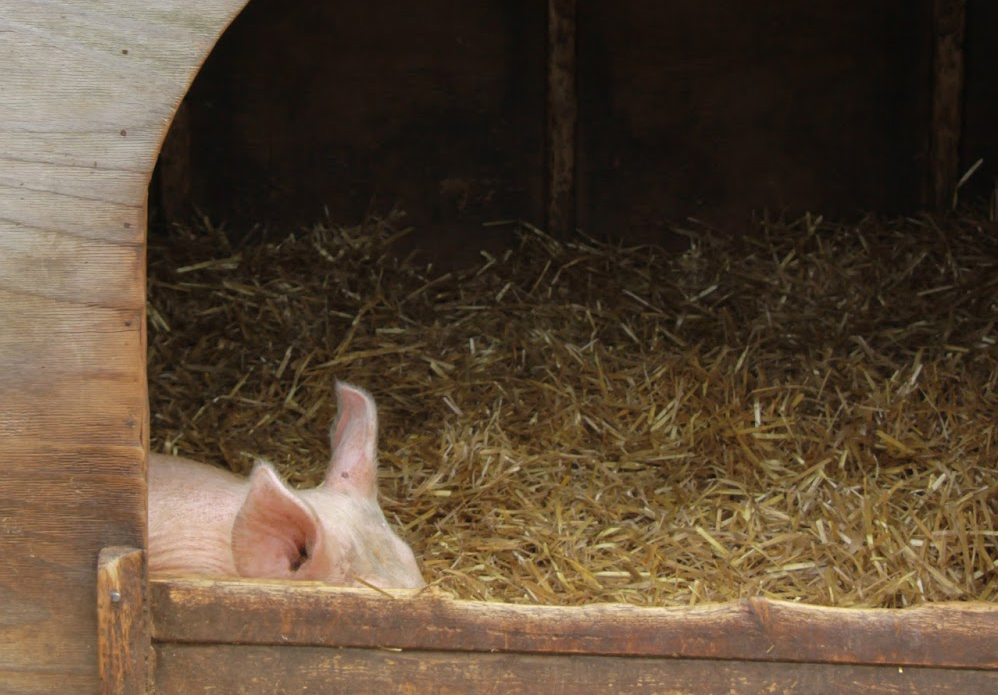

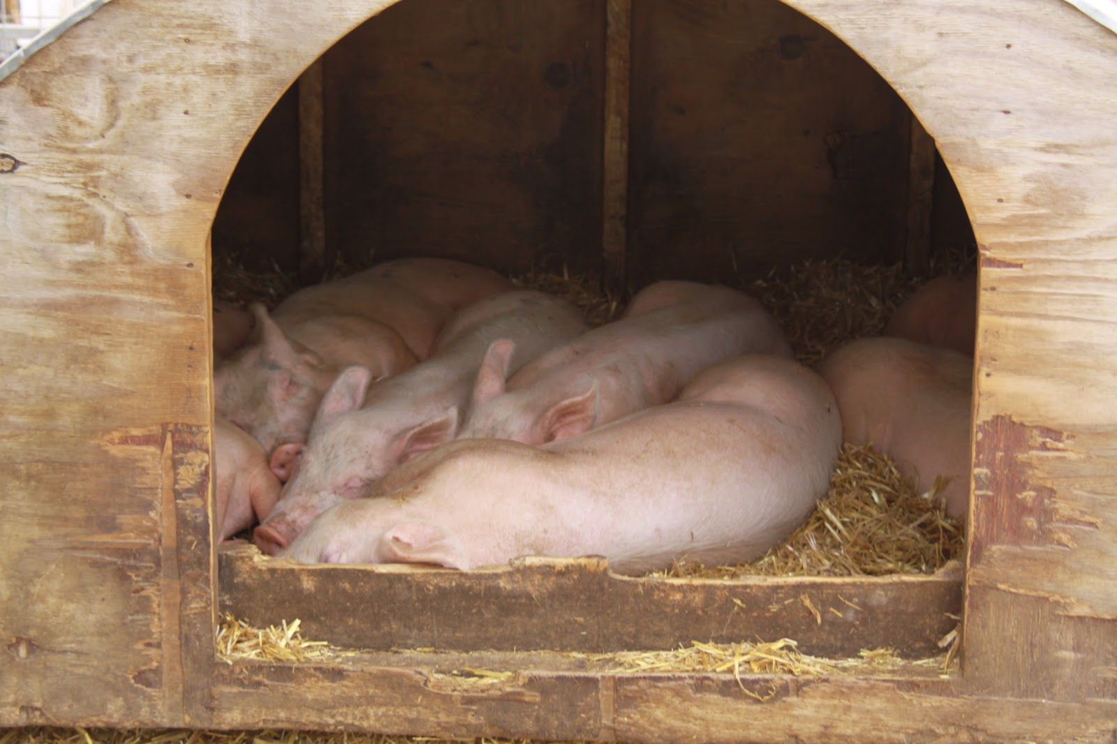


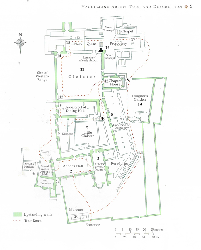

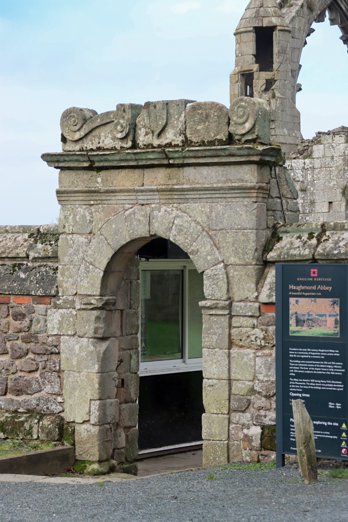

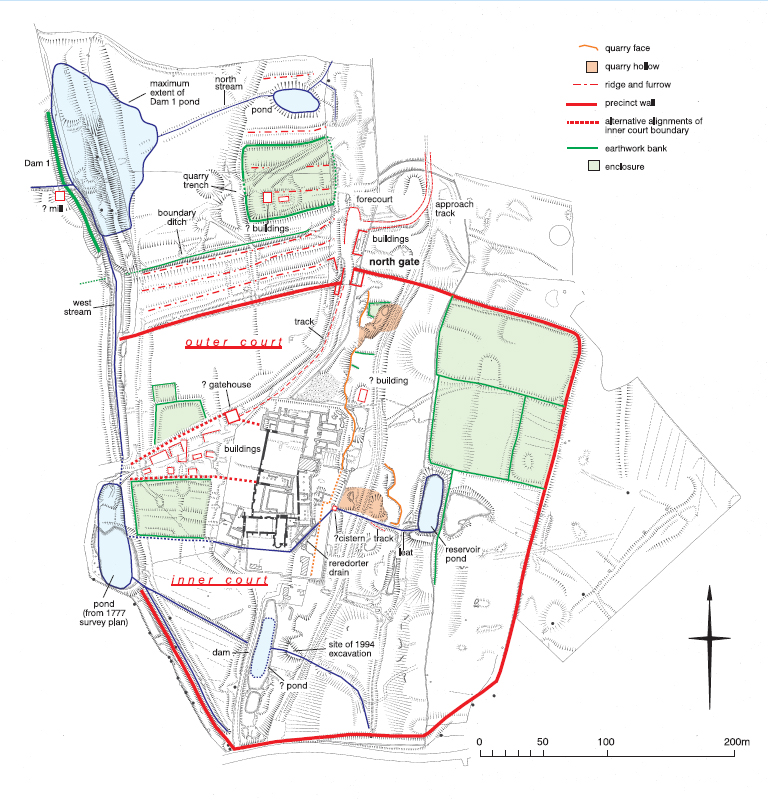


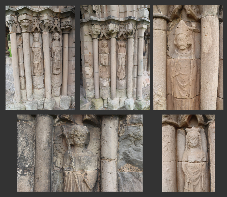


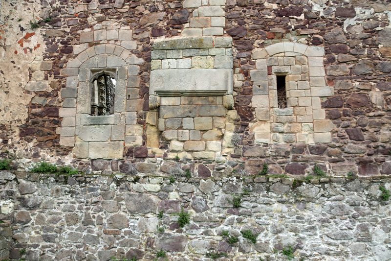
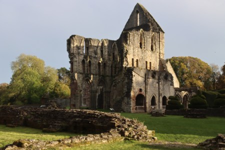


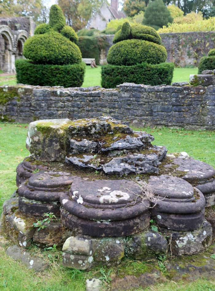


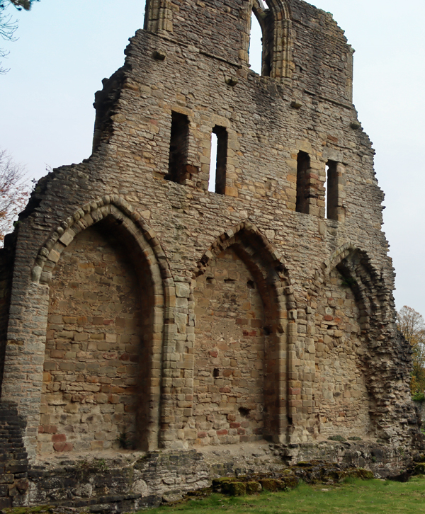


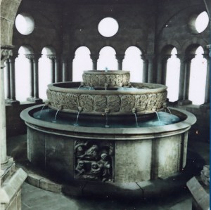
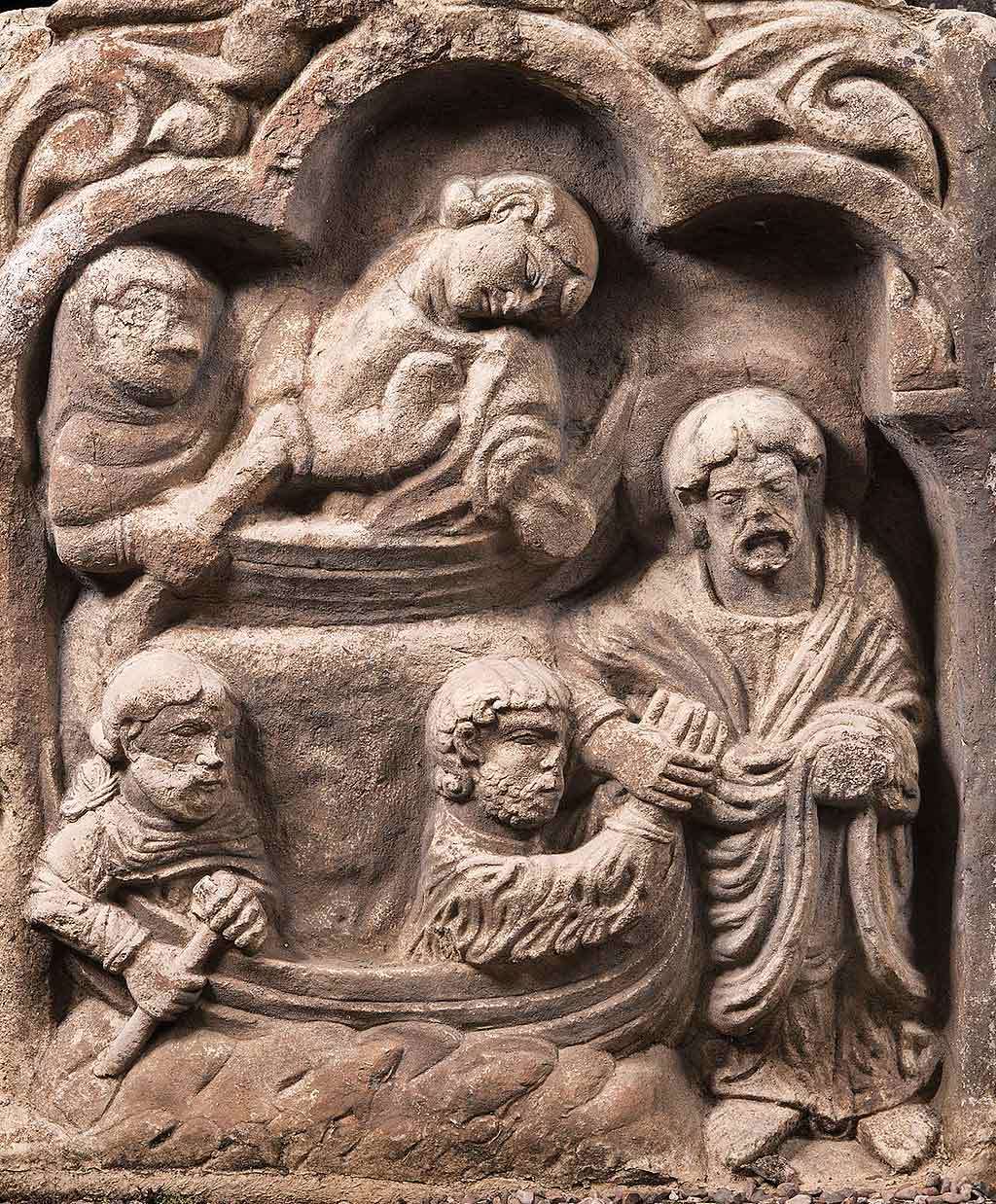


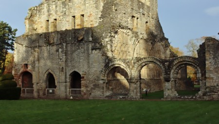


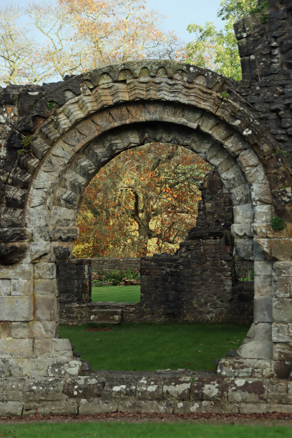


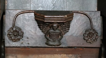


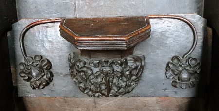


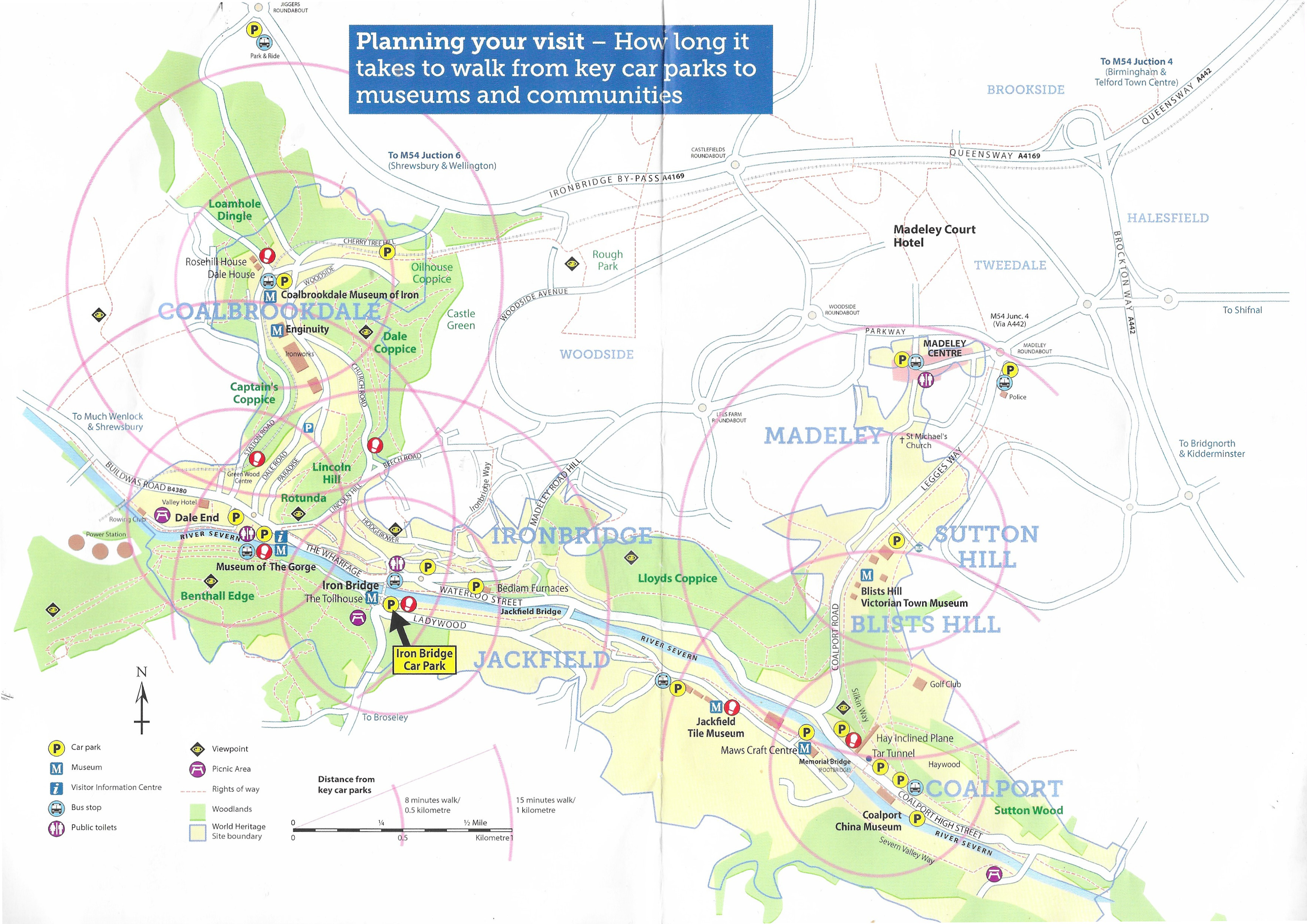


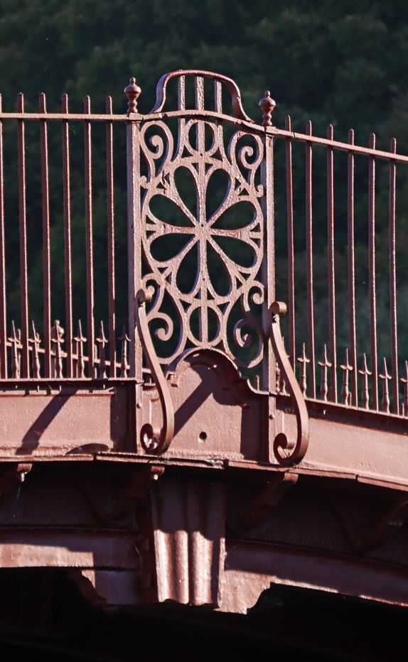


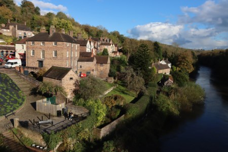


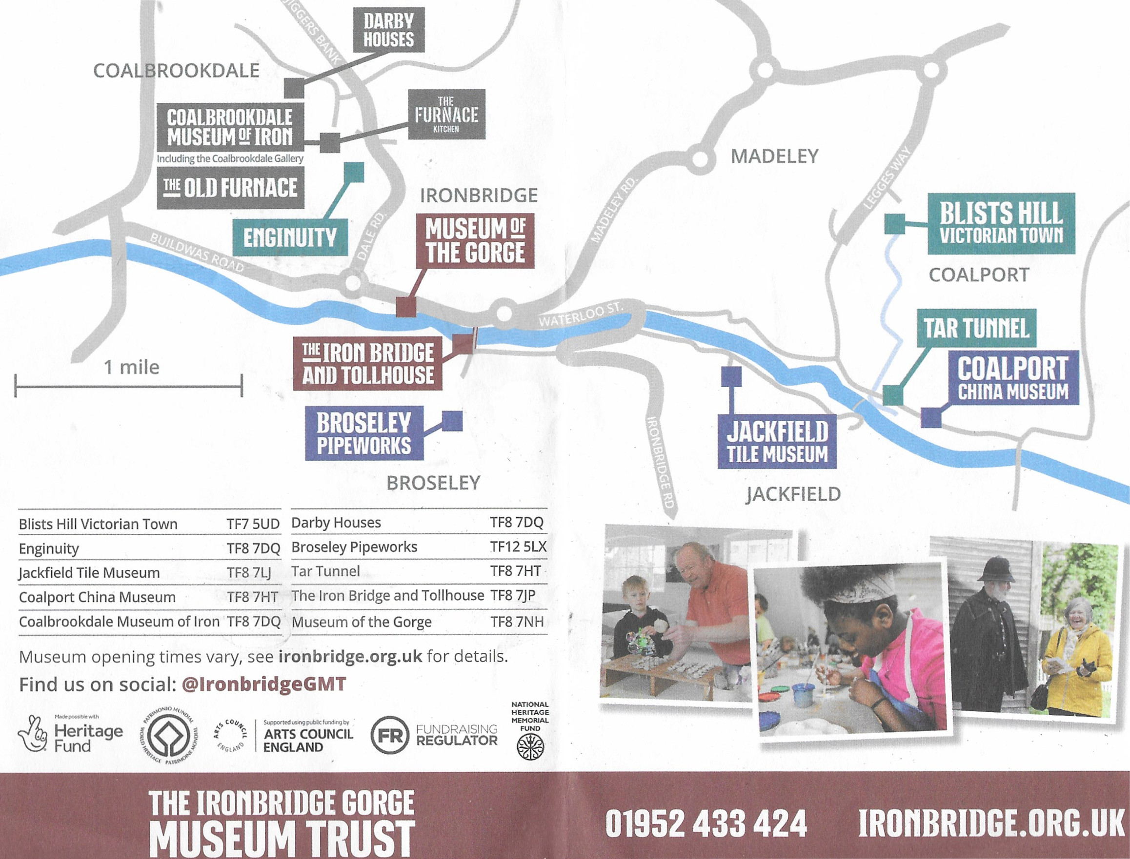


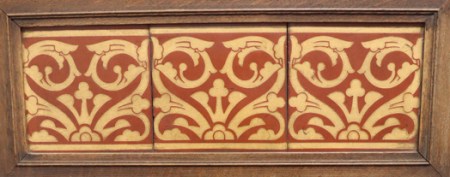


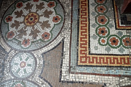


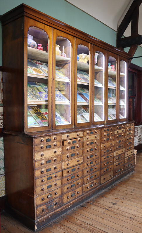


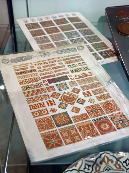
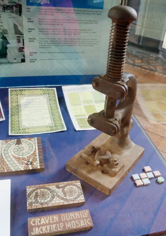


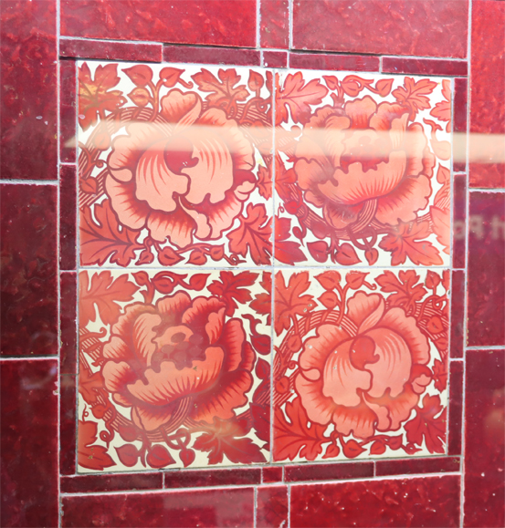

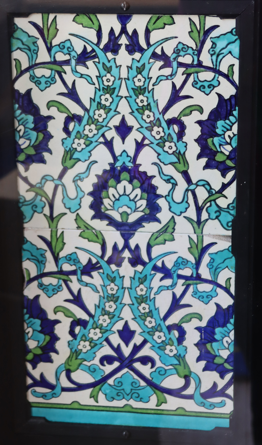


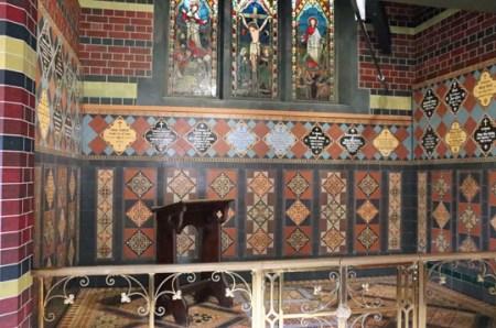


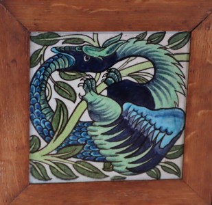


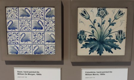


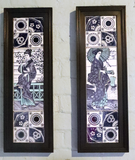


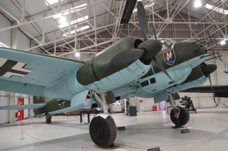

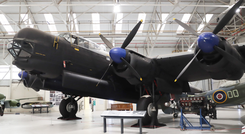


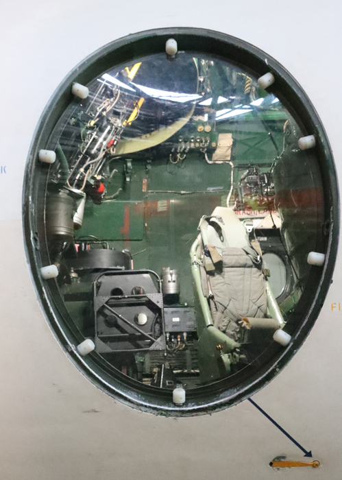


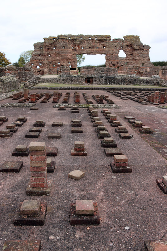

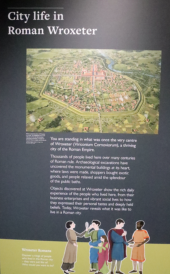
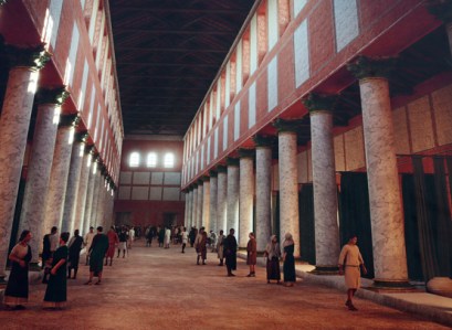


