Category Archives: Heritage

The 1854 turnpike from Chester to Worthenbury via Churton, with a branch to Farndon – Part 2: The Turnpike

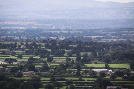
View west from the turnpike.

This is part 2 of the story about the Chester to Worthenbury turnpike, a rural toll road that ran peacefully through Huntington, Aldford, Churton (with a branch to Farndon), Crewe-by-Farndon, and Shocklach before terminating at lovely Worthenbury.   Part 1, posted the day before yesterday, looked at the background to turnpikes (toll roads) in the 17th to 19th Centuries, and their roles in everyday life as a setting for the Chester to Worthenbury turnpike.  Part 2 looks at the turnpike itself.  As I said in Part 1, the reason for splitting the post into two is that it turned out to be a fairly mammoth topic.  If you prefer to read it as a PDF or print it, you download the PDF by clicking here.

Most former turnpikes are still busy.  For example, when you wait patiently at Milton Green to turn on to the A41 that runs from Chester to Whitchurch, the thundering HGVs that happily ignore the “please drive carefully through our village” signs make it is difficult to imagine it populated with quietly plodding horses and carts.  It is a different story once you have driven from Crewe-By-Farndon via Shocklach to Worthenbury, because an entirely different leap of the imagination is required.  This time, it’s a case of wondering why such a quiet and rural stretch of road could ever have been sufficiently busy to require turnpiking.  Churton, Shocklach and Worthenbury are all well-defined villages, but other places marked on the map, such as Crewe-by-Farndon, Castletown and Caldecott Green are little more than a single big house and/or farm with a couple of associated buildings.

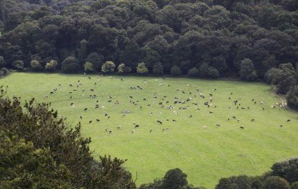
Scenery flanking the road that was turnpiked in 1854.


The route of the Chester to Worthenbury turnpike

In many areas, the presence of a Roman road dictated the line of Medieval and later roads, but the Roman road that once ran from Chester through Aldford fell out of use.  As you head south from Aldford, a small lane to the left, Lower Lane, indicates where the path of the Roman road splits from the B5130 and thereafter becomes a series of farm tracks and footpaths, its route sitting in between today’s A41 (Chester to Whitchurch) and A483 (Chester to Wrexham).  This Roman road, known today as Watling Street West (or more prosaically 6A), passed through Ecclestone, Heronbridge and Aldford then veered to the east of Churton, bypassing both Churton and Farndon  (I have written about the Roman road in an earlier post, here).  

The bending course of the road that was turnpiked in 1854. My photograph CC BY-NC-ND 4.0

Later, however, the establishment of Farndon as an important crossing to Holt and the rest of north and mid Wales meant that the path of the Roman road southeast of Aldford, was abandoned during the Middle Ages, and the line of the road shifted instead west towards the Dee, passing through what is now Churton before reaching Farndon.  This route was established at least during the reign of Edward I, (reigned 1272-1307), who followed it on one of his peripatetic Royal Itineraries, heading south from Chester through Ecclestone and Malpas.  Rachel Swallow says that a toll gate was documented at Shocklach at around 1291, all traces now vanished. 

The Chester to Worthenbury turnpike followed a path from Chester through Huntington, Aldford and Churton before heading down what is now Sibbersfield Lane and across the modern bypass before vanishing down the quiet, wending country B-road to Worthenbury.  As with every turnpike, an Act of Parliament was required before Trustees could be appointed, and this was the Chester, Farndon and Worthenbury Turnpike Road Act 1854, “An Act for making a Turnpike Road from Chester, by Farndon, to Worthenbury, with a Branch therefrom to the Village of Farndon,” which passed into law on 3rd July of that year.  The exact wording of the first part of the Act is shown below the bibliography, Sources, right at the end of this post.  It was the last road in Cheshire to be turnpiked.  Here is the description of the route from the 1854 Act:

A Turnpike Road to commence in Boughton in the Parishes of Saint Oswald and Saint John the Baptist, or One of them, within the Parliamentary Borough of Chester, by a Junction with the Road leading from the City of Chester to Whitchurch opposite and near to a Public House called the “Jolly Gardener,” and to terminate in the Township and Parish of Worthenbury in the County of Flint by Two Junctions with the Whitchurch and Marchwiel Turnpike Road, one thereof at or near to a certain Farm House called “Broughton Lodge,” and the other thereof at or near the Finger Post at the Junction of the present Highway from Shocklach with the Whitchurch and Marchwiel Turnpike Road : A- Branch Turnpike Road to commence from and out of the said intended Turnpike Road in the Township of Churton, by Farndon and Parish of Farndon, at or near the Point where the existing Highways leading from Churton to Farndon and from Churton by Crewe and Shocklach to Worthenbury respectively diverge, and to terminate in the Village, Township, and Parish of Farndon by a Junction with the Turnpike Road leading from Wrexham to Barnhill near to the Raven Inn, all in the County of Chester.

A court case that followed the demise of the turnpike is useful for describing the state of the road before it was turnpiked

“Before and until the passing of the Chester, Farndon and Worthenbury Turnpike Road act of 1854, it consisted of an ordinary fenced road, varying in width from about 20-30ft, of which nine feet wide only was paved with stones along the centre;  the sides not being metalled were of grass or earth.  The stone of which the pavement was formed was got in the township from the lands alleged in the indictment . . . . The road, which was an ordinary carriage highway was at that time repaired by John Brock Wood, the owner of the said lands.”

The stones of the old pavement were used in the construction and macadam was brought from Penmaenmawr to lay along its surface.  The width was not expanded beyond the original fences that flanked it.

The Chester to Worthenbury turnpike trust

The sheer number of trustees appointed in the 1854 Act staggered me, as I had been imagining something in the region of ten or twenty responsible dignitaries.  There were 66 (give or take – I may have lost one or two in the process of counting).  After including “All Her Majesty’s Justices of the Peace for the Time being acting for the County of Chester, for the County of the City of Chester, and for the County of Flint respectively” the Act goes on to name individual trustees, and here they all are:

Sir Richard Puleston of Emral Hall. Source: Puleston Ancestry.

The Honourable Hugh Lupus Grosvenor commonly called Earl Grosvenor, the Honourable Richard de Aquila Grosvenor commonly called Lord Richard de Aquila Grosvenor, the Honourable Henry Cholmondeley commonly called Lord Henry Cholmondeley, Sir Robert Henry Cunlife Baronet, Robert Ellis Cunliffe, Sir Watkin Williams Wynn Baronet, Sir Philip de Malpas Grey Egerton Baronet, Philip Le Bel- ward Egerton, Samuel Aldersey, Thomas Aldersey, the Rector of Aldford for the Time being, Roger Barnston, Harry Barnston, Thomas Boyden Clerk, Richard Barker, Francis Henry Barker, Thomas Chorlton Glutton, Charles Colley, Hugh Colley, Henry Crane, Tanat Wynne Denton, Thomas Dixon, Thomas Dixon the younger, James Dixon, the Minister of Farndon for the Time being, William Wynne Ffoulkes, Edward Francis French, Alexander Price French, Philip Stapleton Humberston, Thomas Cowper Hincks, Thomas Cowper Hincks the younger, Thomas Hignett, John Hignett, Robert Broadhurst Hill, the Minister of Holt for the Time being, Robert Howard, Francis James Hughes, Townsend Ince, Thomas Jones, John Hurleston Leche, Sir William Lloyd, Richard Massie, John Finchett Maddock, Thomas Finchett Maddock, Townshend Mainwaring, Henry Water Meredith, Robert Buckley Orton, Sir Richard Puleston Baronet, Francis Richard Puleston, Theophilus Puleston, Charles Potts, Henry Potts, Charles William Potts, William Parker, John Parker, Richard Powdrell, William Rowe, Samuel Rowe, John Rogers, Thomas Vernon Royle; Joseph Sparkes, John Townshend, Charles Townshend, John Williams, Edward Tilston, John Brock Wood, William Henry Wood, the Rector of Worthenbuiy

Pratt’s 1912 study offered the following comment on the sheer number of trustees that could be in charge of a turnpike:

One result of the excessive localisation of the turnpike system was that trusts of absurdly large proportions were created to look after absurdly small stretches of road. “The fundamental principle,” says a writer in the “Edinburgh Review” for October, 1819, “is always to vest the whole management in the hands of the country gentlemen; and, as they act gratuitously, it has been the policy of the law to appoint in each act a prodigious number of commissioners—frequently from one hundred to two hundred, for the care of ten or fifteen miles of road; and thus a business of art and science is committed to a promiscuous mob of peers, squires, farmers and shopkeepers, who are chosen, not for their fitness to discharge the duties of commissioners, but from the sole qualification of residence within a short distance from the road to be made or repaired. . . .

The whole time of the meetings of turnpike trusts was “occupied in tumultuous and unprofitable discussions, and in resolving on things at one meeting which run a good chance of being reversed at the next; that the well informed and civilized commissioners become very soon disgusted with the disorderly uproar, or the want of sense, temper or honesty of some of their companions; and that the management finally falls into the hands of a few busy, bustling, interested persons of low condition, who attend the meetings with no idea of performing a public duty, but for the purpose of turning their powers, by some device or other, to the profit of themselves or of their friends or relations.

Scenery flanking the road that was turnpiked in 1854. My photograph CC BY-NC-ND 4.0

Local landowners could invest their own funds to improve a road, but generally loans were taken out to meet the initial set-up costs, with the interest theoretically being paid back from the income derived from tolls, or at least that left over after paying salaried staff and carrying out frequent repairs.  Even where the accounts tallied, which they often did not, huge debts were accrued.  The Select Committee on Turnpike Trusts in 1839 reported that eighty four trusts had paid no interest in years, and that the total estimated debt of English and Welsh turnpike trusts together exceeded £9,000,000, a staggering sum in those days. It seems remarkable, under these conditions, that a new turnpike Act was passed in favour of the Chester to Worthenbury turnpike so late in the turnpike era.

The reasoning behind the creation of the turnpike

One of the many farms that lines the turnpike’s route. My photograph CC BY-NC-ND 4.0

The Chester to Worthenbury road wended its bendy way at its own leisure through agricultural land, connecting a number of villages, including Churton, Crewe-by-Farndon and Shocklach.  A drive down that section of the road south of Sibbersfield Lane confirms it as a winding, rural road with a few farm buildings along its routes, the few villages very small and quiet.  A branch ran from Churton into Farndon.   Worthenbury, a rural village that has changed very little since the 19th Century, was not an obvious destination for traders, merchants, carriers or passenger vehicles, traditionally the main users of turnpikes.   The destructive impact of the transportation of heavy loads of cheese was given as a primary reason for the creation of a turnpike between Chester and Whitchurch.  The production of Cheshire cheese was certainly of great importance to the county, as Defoe explains in 1725:

This county, however remote from London, is one of those which contributes most to its support, as well as to several other parts of England, and that is by its excellent cheese, which they make here in such quantities, and so exceeding good, that as I am told from very good authority, the city of London only take off 14000 ton every year; besides 8000 ton which they say goes every year down the Rivers Severn and Trent, the former to Bristol, and the latter to York; including all the towns on both these large rivers: And besides the quantity ship’d both here, and at Leverpool [Liverpool], to go to Ireland, and Scotland. So that the quantity of cheese made in this country, must be prodigious great. Indeed, the whole county is employ’d in it, and part of its neighbourhood too.

However, this situation was over a century before the Chester to Worthenbury turnpike was mooted and there’s no indication either in contemporary newspapers or in the Act itself whether the carriage of Cheshire cheese or any other particular problem was a reason why the Chester to Worthenbury turnpike was deemed worth the cost and effort.  The Act merely says that the turnpike “would be of great public value,” which is somewhat unhelpful.  Crosby suggests “the rather remote possibility of abstracting traffic from the Chester-Wrexham and Chester-Wrexham roads,” but the encyclopaedic New Historical Atlas of Cheshire (2002) is silent on the subject, as is Latham’s Farndon

Scan of map showing turnpike roads in Cheshire, from the New Atlas of Cheshire (Phillips and Phillips 2002, p.77).  The Chester to Worthenbury turnpike is shown in green at the far left, crossing the Broxton to Wrexham Turnpike (in yellow).

Perhaps the object of the exercise was to improve the quality of the road network in this part of West Cheshire. This area was rather isolated.  The canal network bypassed the Dee, south of Chester, with the 1772 Chester Canal (now part of the Shropshire Union) heading southeast from Chester via Beeston to Nantwich to Birmingham, linking into other parts of the canal and turnpike networks as it went, and the Dee itself was only navigable by very light traffic. By the end of the 18th Century there were already serviceable turnpikes between Chester and Whitchurch and Chester and Wrexham, which accounted for most of the market-bound and commercial traffic.   

The turnpike  linked up with Whitchurch after passing through Worthenbury, but it was a very rambling route, and the Chester to Whitchurch turnpike would have been a much better option unless you were starting from somewhere like Churton, Farndon or Holt.  The New Atlas shows an intersection with the Wrexham to Broxton turnpike (now the A534), which was opened in the period 1760-1789, linking the Chester to Wrexham and Chester to Whitchurch roads.  There was a turnpike between Bangor On Dee and Malpas, which opened in 1767.  Although the road between Worthenbury and Bangor on Dee (the B5069) does not appear to have been turnpiked, it was a short stretch and would have been easy enough to maintain in good condition if there was sufficient motivation.

Emral Hall, Worthenbury.  The lower photo shows the ballroom, now preserved (thank goodness) in the Town Hall at Portmeirion.  Source: Wrexham Online.

A number of large estates and prosperous farms were located along the route of the turnpike.  The largest of these were Crewe Hill in Crewe-by-Farndon, Boughton Hall near Threapwood and the magnificent Emral Hall just to the south of Worthenbury.  Crewe Hill was the principal home of the Barnston family, and the base of their wide-ranging and profitable estate that included land in and around Farndon and extending north to the middle of Churton.  The lovely half-timbered Broughton Hall was sadly demolished in 1961, but at the time was the home of the Howards.  Emral Hall also tragically demolished in the 1930s, was the home and estate of the Pulestons throughout the 18th and 19th Centuries.  Others along the route, from north to south, are Aldford Hall, Churton Hall, Sibbersfield Hall, Crewe Hall, Shocklach Hall,  Kingslee and Caldecott Hall.  Trustees included community members from all areas through which the turnpike passed, so members of the family present on the trustees list does not prove that they were driving forces behind the turnpike, but it is still interesting to see (where these family names can be traced) which estates provided family members as trustees.  

  • Broughton Hall, demolished 1961. Source: Threapwood History Group.

    • Aldford Hall:  The Earl of Westminster and Lord Richard de Aquila Grosvenor
    • Churton Hall:  Roger Barnston and Harry Barnston
    • Sibbersfield Hall:  William Rowe and Samuel Rowe
    • Crewe Hill:  Roger Barnston and Harry Barnston
    • Caldecott Hall:  Philip Stapleton Humberston
    • Broughton Hall:  Robert Howard
    • Emral Hall: Sir Richard Puleston (baronet), Francis Richard Puleston, and Theophilus Puleston


Sibbersfield Hall, just outside Churton. Ordnance Survey 1888-1913.  Source: National Library of Scotland

Other trustees on the above list with a vested interest in being able to get around were the Rectors of Aldford and Worthenbury and the Ministers of Farndon and Holt.  Trustees Samuel Aldersey and Thomas Aldersey of Aldersey Hall, would also have benefitted from the tunrpike road, to which the road on which Aldersey Hall was located was linked.  And so it goes on.

There are apparently some omissions and question marks too.  Although a large building is shown on the site of Churton Lodge, no details are available on the Tithe map.  Shocklach Hall was only built in the 1850s, so was perhaps itself under construction at the time, or built partly because the turnpike was there.  In the 1840s tithe maps the land on which it as located was owned by Emral Hall.  Crewe Hall (as opposed to Crewe Hill) was owned and occupied by the Bennion family when the 1838 tithe map was published, but they do not appear as trustees.  

Crewe Hill from the garden. Source: Landed Families of Britain and Ireland website

Some of the very few buildings along the turnpike route at Crewe-by-Farndon and Shocklach.  From left: Crewe Hall, one of the buildings in the village of Shocklach, the Bull in Shocklach and Kingslee.  My photograph CC BY-NC-ND 4.0

Toll cottages along the route

The tollgate was usually accompanied by a toll cottage.  The Grade-2 listed, two-storey brick-built Cross Cottage in Churton is built across the junction between Chester Road and Pump Lane and, by virtue of the fact that it was built to serve the turnpike, must have been built at around 1854.  It is strategically located just to the north of where the road splits into two, one road going into Farndon and the other proceeding via Stannage Lane, to Crewe-by-Farndon and on to Worthenbury.  Both roads were part of the turnpike, with the Farndon section a branch of the main turnpike to Worthenbury.  The attractive recessed arch, which is at both front and rear, was once centred in the middle of the building, and was provided with a slender band of sandstone between the upper and lower floors.  An extension of uncertain date, possibly the 1930s, breaks down this symmetry, although it was done sympathetically using almost identical bricks to the originals but does not repeat the sandstone band.

The rear view of Cross Cottage. Source: mylisting365.

The roof is currently hipped (converging in from four sides onto a central ridge), but before the addition of the extension, the roof was probably pyramidal, converging from four sides onto a single point.  The original roof was probably also made of slate, as today.  There are two chimneys today, but there will only have been the one in the 19th Century, with a central flue.  Although it was Grade II listed in 1984, there are no details on the Historic England website about the interior, and whether any of the 19th Century interior survives in tact.

The listing details are as follows:

  • NGR 4180856444
  • List number 1228714
  • First listed 28th December 1984

Toll collectors could improve their wellbeing by keeping livestock and growing fruit and vegetables in the confines of their properties, and some toll cottages were provided with a small amount of land that could be used for either the keeping of livestock or the development of small horticultural plots.   Cross Cottage was provided with a large garden that could have been used for either.

The bridge at Worthenbury. My photograph CC BY-NC-ND 4.0

I went looking for any other toll cottages that might have been built along the road.  On some turnpikes additional toll gates were added as a way of trusts earning more revenue, but there was nothing that looked remotely like a toll cottage.  There should have been one at Worthenbury, the end of the turnpike.  In cases where a river crossing was present, toll gates were often set up against a bridge, making it more difficult to evade, but although there is a beautiful old bridge in Worthenbury, the western side of it is open fields, and the eastern side is now the site of a modern home, part of a housing estate.  The bridge replaces one that was damaged by floods in 1872, and was built in 1872-3.  This was the period when the Chester-Worthenbury turnpike was amalgamated with the Chester-Whitchurch.  Still, tolls would have required ongoing collection, and if there was a toll gate here, there’s no sign of it now.

The toll collectors

There is a toll-house at Churton so it of course follows that there must have been at least one toll collector, possibly accompanied by his family.  Regrettably, I have not yet worked out who he/they might have been, because the commercial directories available online don’t mention a Churton toll collector during this period (the1857 Post Office Directory of Cheshire and the 1864 Morris & Co.’s Directory of Cheshire).  Whilst the Delta variant of Covid is still at large, it’s probably not a good idea to start hitting the record offices, but perhaps someone who has checked into the available resources can illuminate me.  Speculating, this absence from the directories may be because although early turnpikes were manned by manor employees and then by specially hired toll collectors, the appointment of later collectors was given into the hands of specialist contractors, who would bid for the lease at auction.  It may be that under such conditions, the toll collectors were deemed to be transient members of the community.

Toll collectors had an ambivalent position in local society.  Because toll charges were lengthy and complex, incorporating a large number of variables, a toll collector needed to be both literate and numerate, and hopefully (but not always) trustworthy. As people of responsibility, often living in custom-built homes with their families, toll collectors might be people of high status within a community.  Although in many ways, toll collectors were about as popular as tax collectors are today, they provided a vital role.  A toll house could bring prestige to an otherwise fairly nondescript community, even attracting the building of inns where passengers could purchase refreshments and where carriage horses could be rested or changed, meaning that gentry and clergy could be regular visitors, raising the status of an entire village.  

The 1898 mile post at Shocklach. My photograph CC BY-NC-ND 4.0

The toll charges for Chester-Worthenbury are probably described in the 1854 Act, but this too is not available without tramping the real-world archive trail, and I will update this post when I have the chance to check this out, as a copy is apparently available locally.  Each turnpike Act set out the maximum toll chargeable for each animal and category and size of vehicle, and all the multiple variables of each.

As I said in Part 1, the mile posts that dot the western verges of the former turnpike post-date the end of the Cheshire turnpikes.  Disturnpiked in the 1870s, there must have been mile posts because they were a legal requirement, but when Chester County Council was created on 1st January 1889 and was given the job of maintaining highways, it presumably replaced the original milestones with its own iron ones, all dating to 1898.  I have found some of these, marked on the Ordnance Survey map, but not others.  The one shown in Part 1 is in Churton and the one shown above is in Shocklach.

The final days of the Chester to Worthenbury turnpike

The lovely Georgian St Deiniol’s Church in Worthenbury. My photograph CC BY-NC-ND 4.0

The Chester-Worthenbury turnpike was never much of a success and was amalgamated with the Whitchurch Trust in 1871.  The joint body expired in 1877.  Presumably, and not very surprisingly, the Worthenbury turnpike failed to justify its costs, and the Whitchurch turnpike was probably put out of business by the London and North Western Railway.  The railway’s important route to London via Crewe had opened by 1840, and the branch that ran from Chester to Whitchurch opened between 1870 and 1879.

An indictment concerning repairs to the road following the lapse of the Act

Rural landscape to the east of the once-turnpiked stretch of road that passes through Churton. My photograph CC BY-NC-ND 4.0

The most interesting part of the turnpike’s history, or at least the most interesting bit to survive, refers to what happened when the Act for the Chester to Worthenbury section had been disturnpiked, and a question arose over responsibility for its ongoing care arose.  In 1890 an indictment was raised in Crown Court for failure to repair a highway.  The issue was by no means straightforward.  The law stated that responsibility for repair of a road that had formerly come under a turnpike trust would revert to common law liability on the lapse of the trust, but only if “the highway remains similar in character to what it was up to the time of the passing of the Turnpike Act.”  For those roads that were significantly altered, “as to destroy what was the old highway, the common law liability is put to an end by operation of the law.”  In addition, there were ambiguities about the responsibilities for occupiers versus mere owners, where roads were concerned.

The indictment covered several stretches of road that had become “miry, deep, broken and in great decay,” due to “such want of due reparation and amendment.”   This included the stretch from Huntington to Farndon.  The same allegation was made against stretch from Chester to Saighton.  The text from the court case is damning.

“The liege subjects of the Queen could not and still could not go, return, pass, repass, ride or labour on foot with their horses, coaches, carts and other carriages in, through, and along the said public highway aforesaid as they ought and were wont and accustomed to do, without great danger and common nuisance of all the liege subjects of our said Lady the Queen, her crown and dignity, and that the defendant, by reason of his tenure of certain lands and tenements situate in the said township of Huntington, ought to repair and mend the same.”

It goes on:

“As to the road mentioned in the first count [Saighton was the second] it was proved that before and until the passing of the Chester, Farndon and Worthenbury Turnpike Road Act of 1854, it consisted of an ordinary fenced road.”

The individual who had taken responsibility for repairing the road before it was converted to a turnpike was John Brock Wood, who is recorded in the list of trustees for the turnpike.  The record of the indictment states that there was no evidence that he had contributed to its maintenance during the continuance of the Act, but on its expiry in 1876 he resumed repair work, continuing to do so until his death in 1888.  The person who inherited John Brock Wood’s responsibilities “the devisee in trust of the said lands” continued to repair the road in the belief that he was legally liable.  He provided proof that he had expended £155, £224 and £206 in 1887, 1888 and 1889 respectively.

View from the former turnpike over the fields to Worthenbury

The prosecution (Tatham and Proctor for Carrington and Baker, Chester) claimed that as John Brock Wood had accepted responsibility before the establishment of the Trust, it was now the devisee in trust’s responsibility following the expiry of the Act.  However, the law stated that if significant alternation had taken place during the conversion of a road to a turnpike, the original owner was no longer responsible for maintenance.  In fact, Chester County Council had been approached with a view to taking on responsibility for the road, but they had refused to do so under Section 97 of the Local Government Act 1888.   The estimated costs were in excess of £400 and may have been as much as 1000.

The defense (the company Cunliffe and Dawn for Churton, Chester) claimed that the alternations to the road when it was converted to  a turnpike were so extensive as to destroy any liability that either he, or for that matter John Brock Wood, should have had.  In response, the prosecution argued that by repairing the road, the defendant had acknowledged the liability and could be indicted for non-repair.

The judge overseeing the proceedings, Lord Coleridge C.J. ruled in favour of the defendant.  In his view, citing Rolle’s Abridgement from the reign of Charles I, the occupier and not the owner is the person responsible for repairs, and the defendant was the owner but not the occupier.   In addition, he found that the road had been significantly altered, and therefore liability for the repairs should not fall on the original owner or occupier.  The indictment was quashed.  The judge was concerned that under these circumstances, the “graver question” was if any person was actually liable to repair the road.  He does not, however, come to any conclusion about how to resolve the problem.

In the end, Chester County Council must have adopted the road, but this may have been at a much later date.  Section 97, “Saving as to liability for main roads,” which they used to avoid the responsibility, falls within Sections 92-98 “Savings.”  It reads “Nothing in this Act with respect to main roads shall alter the liability of any person or body of persons, corporate or unincoprorate, not being a highway authority, to maintain and repair any road or part of a road.”

As always, please let me know if you have any questions
or have some more information to contribute


Sources for parts 1 and 2:

Books and papers:

An Act for making a Turnpike Road from Chester, by Farndon, to Worthenbury, with a Branch therefrom to the Village of Farndon, 1854

Benford, M. 2002. Milestones.  Shire Publications

Crane, N. 2016.  The Making of the British Landscape.  From Ice Age to the Present.  Weidenfeld and Nicholson

Crosby, A.G. 2012.  New Roads for Old. Cheshire Turnpikes in the Landscape 1700-1850.  In (eds.) Varey, S.M. and White, G.J. Landscape History Discoveries in the North West.  University of Chester Press, p.190-223.

Cunningham Glen, R. 1895. Indictment presented before Lord Coleridge, C.J.  Reg. vs. Barker.  Reports of Cases in Criminal Law argued and determined in the courts of England and Ireland, vol.XVII, 1890-1895. Reported by R. Cunnigham Glen Esq., Barrister at Law. Horace Cox

Defoe, D. 1724–1726 (Rogers, P. ed.). A Tour Through the Whole Island of Great Britain Penguin (particularly, Volume II, 1725, and its appendix).

Harvie, C. and Matthew, H.C.G.  1984, 2000.  Nineteenth Century Britain. Oxford University Press

Hindle, P. 1998 (3rd edition).  Medieval Roads and Tracks.  Shire Publications Ltd

Keys, D. 2016. Discovery of huge Bronze Age wheel sheds light on transport in prehistoric Britain.  The Independent, Friday 19th February 2016
https://www.independent.co.uk/news/science/archaeology/prehistoric-britain-discovery-bronze-age-wheel-archaeology-a6882671.html

Langford, P. 1984, 2000. Eighteenth Century Britain.  Oxford University Press

Latham, F.A. 1981.  Farndon. The History of a Cheshire Village.  Local History Group.

Local Government Act 1888 (51 and 52 Vict. c.41). Section 97, Saving as to liability for main roads.

OS Landranger map 117 2016.  Chester and Wrexham.  Ordnance Survey

Phillips, A.D.M. and Phillips, C.B. 2002.  A New Historical Atlas of Cheshire. Cheshire County Council and Cheshire Community Council Publications Trust.

Pratt, E.A. 1912.  A History of Inland Transport and Communication in England. Kegan Paul, Trench, Trübner and Co Ltd.
Project Gutenburg: https://www.gutenberg.org/files/52087/52087-h/52087-h.htm

Pryor, F. 2010.  The Making of the British Landscape.  How We Have Transformed the Land from Prehistory to Today.  Allen Lane

Swallow, R. 2013-14. Two For One:  the Archaeological Survey of Shocklach, Castle, Cheshire. Cheshire History Journal, No.53, 2013-4
https://www.academia.edu/4577267/Two_for_One_The_Archaeological_Survey_of_Shocklach_Castle_Cheshire_in_Cheshire_History_Journal_No_53_2013_4_Cheshire_Local_History_Association_2013_

Wright, G. N. 1992. Turnpike Roads. Shire Publications Ltd.

Websites

A Collection of Directories for Cheshire
Cheshire County Council
http://cheshiredirectories.manuscripteye.com/index.htm

British Listed Buildings
Cross Cottage, Churton
https://britishlistedbuildings.co.uk/101228714-cross-cottage-churton

Broughton Hall, Threapwood
Threapwood History Group
http://www.threapwoodhistory.org/broughtonhall.html

Cheshire Tithe Maps Online
Cheshire Archives and Local Studies
https://maps.cheshireeast.gov.uk/tithemaps/

Emral Hall, Worthenbury
Wrexham Online
https://www.wrexham-history.com/emral-hall-worthenbury/ 

Historic England
Cross Cottage, Churton
https://historicengland.org.uk/listing/the-list/list-entry/1228714

Dig Diary 19: Discovering Britain’s Oldest, Complete Wheel
February 29, 2016
Must Farm Dig Diaries
http://www.mustfarm.com/progress/site-diary-19-discovering-britains-oldest-complete-wheel/

National Archives
Chester and Whitchurch Turnpikes Trust
https://discovery.nationalarchives.gov.uk/details/r/11e8a8d6-43c5-4704-a93b-58fe6d0444a6

National Library of Scotland Mapfinder
OS 6-inch map, 1888-1913
https://maps.nls.uk/geo/explore/#zoom=15&lat=53.09734&lon=-2.86868&layers=6&b=1

Peterborough Archaeology
Must Farm Bronze Age Settlement
https://peterborougharchaeology.org/peterborough-archaeological-sites/must-farm/

Turnpike Roads in England and Wales
Turnpikes.org.uk
http://www.turnpikes.org.uk/Tollhouse%20design.htm

The 1854 Act (excerpt)

Most of the Act is in big undifferentiated chunks, so the paragraphs in the following excerpt are mine, simply to aid with digestion.  The URL of the source of this excerpt is at the end, but if you want to see the entire Act, paid subscription is required.

[3rd July 1854]
Chester, Farndon and Worthenbury Turnpike Road Act 1854
(17 & 18 Vict.) c. lxxxvi
An Act for making a Turnpike Road from Chester, by Farndon, to Worthenbury, with a Branch therefrom to the Village of Farndon.

ANNO DECIMO SEPTIMO & DECIMO OCTAVO VICTORIA REGINA. ********.*****************.********************* Cap. lxxxvi. An Act for making a Turnpike Road from Chester, by Farndon, to Worthenbury, with a Branch therefrom to the Village of Farndon. [3d July 1854.]

WHEREAS the Formation and Maintenance of a Turnpike Road from Chester, by Farndon in the County of Chester, to Worthenbury in the County of Flint, with a Branch therefrom to the Village of Farndon in the said County of Chester, would be of great public Advantage: And whereas certain of the Highways in the Line of the said intended Road and Branch, or Portions thereof, might advantageously be made available for the Purposes of such Road and Branch ; but the same cannot be effected without the Aid and Authority of Parliament : May it therefore please Your Majesty that it may be enacted ; and be it enacted by the Queen’s most Excellent Majesty, by and with the Advice and Consent of the Lords Spiritual and Temporal, and Commons, in this present Parliament assembled, and by the Authority of the same.

That in citing this Act for any Purpose whatsoever it shall be Short Title. sufficient to use the Expression ” The Chester, Farndon, and Worthenbury Turnpike Road Act, 1854.” H. That in this Act the following Words and Expressions shall Interpreta have the several Meanings hereby assigned to them, unless there be tion of [Local.] 15 D something Terms. 1302 Appointment of Trustees. Power to appoint additional Trustees. 17 & 18 VICTORUE, Cap.lxxxvi. 171e Chester, Farndon, and Worthenbury Turnpike Road Act,1854. Something in the Subject or Context repugnant to such Construction ; (that is to say,) The Expression ” the Trustees,” or ” the said Trustees,” shall respectively mean the Trustees for the Time being acting in the Execution of this Act : The Word Lands ” shall include Messuages, Tenements, and Hereditaments of any Tenure : The Expression ” Toll Gate ” or ” Toll Gates” shall respectively include Turnpikes, Bars, and Chains. III.

That all Her Majesty’s Justices of the Peace for the Time being acting for the County of Chester, for the County of the City of Chester, and for the County of Flint respectively, together with the Honourable Hugh Lupus Grosvenor commonly called Earl Grosvenor, the Honourable Richard de Aquila Grosvenor commonly called Lord Richard de Aquila Grosvenor, the Honourable Henry Cholmondeley commonly called Lord Henry Cholmondeley, Sir Robert Henry Cunlife Baronet, Robert Ellis Cunliffe, Sir Watkin Williams Wynn Baronet, Sir Philip de Malpas Grey Egerton Baronet, Philip Le Bel- ward Egerton, Samuel Aldersey, Thomas Aldersey, the Rector of Aldford for the Time being, Roger Barnston, Harry Barnston, Thomas Boyden Clerk, Richard Barker, Francis Henry Barker, Thomas Chorlton Glutton, Charles Colley, Hugh Colley, Henry Crane, Tanat Wynne Denton, Thomas Dixon, Thomas Dixon the younger, James Dixon, the Minister of Farndon for the Time being, William Wynne Ffoulkes, Edward Francis French, Alexander Price French, Philip Stapleton Humberston, Thomas Cowper Hincks, Thomas Cowper Hincks the younger, Thomas Hignett, John Hignett, Robert Broadhurst Hill, the Minister of Holt for the Time being, Robert Howard, Francis James Hughes, Townsend Ince, Thomas Jones, John Hurleston Leche, Sir William Lloyd, Richard Massie, John Finchett Maddock, Thomas Finchett Maddock, Townshend Mainwaring, Henry Water Meredith, Robert Buckley Orton, Sir Richard Puleston Baronet, Francis Richard Puleston, Tlieophilus Puleston, Charles Potts, Henry Potts, Charles William Potts, William Parker, John Parker, Richard Powdrell, William Rowe, Samuel Rowe, John Rogers, Thomas Vernon Royle; Joseph Sparkes, John Townshend, Charles Townshend, John Williams, Edward Tilston, John Brock Wood, William Henry Wood, the Rector of Worthenbuiy for the Time being, and their Successors, being duly qualified to act as Trustees of Turnpike Roads in England, shall be Trustees for putting this Act into execution.

That it shall be lawful for the said Trustees, at any Meeting under this Act, to elect any Number of Persons, duly qualified to act as Trustees of Turnpike Roads in England, not exceeding Three in the whole, to be Trustees for, the Purposes of this Act, in addition to the 17 & 18 VICTORIAE, Cap.lxxxvi. 1303 The Chester, Farndon, and Worthenbury Turnpike Road Act, 1854. the Trustees hereby nominated, and such Trustees so elected shall have the same Powers and Authorities for executing this Act as if they had been hereby appointed. V. That the said Trustees shall meet together on the Twenty-first Meetings of Day after the passing of this Act, or as soon after as conveniently Trustees. may be, at the Exchange in the City of Chester aforesaid, or at some other convenient Place in Chester, and shall then and from Time to Time afterwards adjourn to and meet at such Times, and at such Places on or near to the said Roads, as they shall think proper. VI.

That the said Trustees may appoint Committees out of their Power to take the Care and Management of any particular Part point Committees. of the Roads, or to execute any of the other Purposes of this Act, according to such Instructions and Regulations as shall be laid down by the said Trustees at any General or Special Meeting ; and the said Committees and their Officers may proceed and act according to such Appointment, but subject always to the Authority and Control of the said Trustees. VII. That this Act shall be put into execution for the Purpose of Roads to making and maintaining, according to the Provisions of this Act, the which Act is applicable. Turnpike Road and Branch herein-after mentioned ; (that is to say,) A Turnpike Road to commence in Boughton in the Parishes of Saint Oswald and Saint John the Baptist, or One of them, within the Parliamentary Borough of Chester, by a Junction with the Road leading from the City of Chester to Whitchurch opposite and near to a Public House called the “Jolly Gardener,” and to terminate in the Township and Parish of Worthenbury in the County of Flint by Two Junctions with the Whitchurch and Marchwiel Turnpike Road, one thereof at or near to a certain Farm House called “Broughton Lodge,” and the other thereof at or near the Finger Post at the Junction of the present Highway from Shocklach with the Whitchurch and Marchwiel Turnpike Road : A- Branch Turnpike Road to commence from and out of the said intended Turnpike Road in the Township of Churton, by Farndon and Parish of Farndon, at or near the Point where the existing Highways leading from Churton to Farndon and from Churton by Crewe and Shocklach to Worthenbury respectively diverge, and to terminate in the Village, Township, and Parish of Farndon by a Junction with the Turnpike Road leading from Wrexham to Barnhill near to the Raven Inn, all in the County of Chester. VIII. And whereas Plans and Sections describing the Lines and Power to Levels of the said intended Roads, and the Lands through which the make Roads &c. according to deposited Plan, &c. Power to deviate from Plan to a certain Extent. 17 & 18 VICTORIAE, Cap.lxxxvi.

The Chester, Farndon, and Worthenbury Turnpike Road Act, 1854. Same are to be carried, together with Books of Reference containing the Names of the Owners or reputed Owners, Lessees or reputed Lessees, and Occupiers of such Lands, have been deposited with the Clerk of the Peace for the County of Chester, with the Clerk of the Peace for the County of the City of Chester, and with the Clerk of the Peace for the County of Flint respectively : Be it therefore enacted, That it shall be lawful for the Trustees to make and maintain the intended Turnpike Roads.

https://vlex.co.uk/vid/chester-farndon-and-worthenbury-808261441

The 1854 turnpike from Chester to Worthenbury via Churton, with a branch to Farndon – Part 1, Background

Every now and again one of my posts turns into something that needs to be split into  two or more parts.  This is one of them.  I found the subject so gripping that the post acquired a momentum all of its own and has grown into something of a monster, more diplodocus than tyrannosaurus, but still a bit of a beast.  I have therefore divided it into two.

Former toll cottage, Cross Cottage, on the corner of Pump Lane and Chester Road (my photograph, CC BY-NC-ND 4.0)

This first part looks  at turnpikes (toll roads) in general, as a background to the Chester to Worthenbury turnpike.  If you wish to save or print this as a PDF, please click here.

The second part looks at the turnpike itself, which ran from Chester through Huntington, Aldford, Churton, Crewe By Farndon and south through the villages along that road to Worthenbury, with a branch that ran from Churton to Farndon.

Anyone pausing to look at Cross Cottage on the corner of Chester Road and Pump Lane in Churton might wonder why it was located with its façade facing diagonally across the corner of these two roads.  This diagonal aspect is typical of many toll-houses, some of which were hexagonal in other parts of the country, in order to provide the toll collector with the best view of the approaching traffic.  The rest of the building does not immediately suggest its role as a toll-house to anyone more familiar with the single-storey Welsh ones, which are generally tiny, charming and fairly easy to spot.  Cross Cottage is brick-built, has two storeys, and is a substantial albeit rather bijou structure (more about it below).  It was built on the turnpike (or toll road) that was established by an 1854 Act of Parliament to run between Chester and Worthenbury, via Aldford, Churton and Shocklach, with a branch to Farndon.

Turnpikes and tolls from the 17th to 19th Centuries

Although the wheel had been known from around 1000 BC during the later Bronze Age, for much of British prehistory and early history the easiest means of transporting goods was by water, either coastal or riverine.  Travel over land was much more challenging until at least the 16th Century, even though the Romans, with their superior planning and engineering, may appear to give lie to that statement.  Prior to Roman roads and once again following the withdrawal of Rome in the 5th Century, the condition of tracks and roads was fairly grim.

From Tudor and Stuart times the responsibility for roads had fallen on the parish or township.  The Highways Act of 1555 set this down in law.  Members of the parish were obliged to contribute labour and equipment for repairs, in batches of consecutive days.  For parishes in rural areas with no major byways this was not necessarily a problem, but parishes that hosted major routes were victim to very unfair financial burdens and the condition of roads from one parish to another became very inconsistent. During the 16th  and 17th Centuries matters deteriorated as oxen- and horse-drawn waggons and carts replaced packhorses, and carriages capable of travelling longer distances became more common.  In the first half of the 16th century the long wheelbase waggon had been introduced, which allowed much heavier cargoes to be carried.  The Highways Act of 1662 included measures to try to reduce the damage to major highways by prohibiting the use of more than 7 horse teams to pull vehicles, and by banning the use of wagons with wheel widths that were in excess of 4 inches.

The London to Birmingham Stage Coach by John Cordrey, 1801. Source: Birmingham in the 18th Century

Carriages and coaches were a particular phenomenon of the late 18th and early 19th Centuries, when improvements in design, particularly improving ride by use of spring-loaded, shock-absorbing suspension and much better reliability via improved wheel design meant that both public and private transportation was much more common, faster, and could be pulled by more horses, all of which inflicted damage on roads.  Post, mail coaches and stage coaches began to offer a network of passenger travel across Britain.  Pratt gives the following statistics:

Over 3000 coaches were then on the road, and half of these began or ended their journeys in London. Some 150,000 horses were employed in running them, and there were about 30,000 coachmen, guards, horse-keepers and hostlers, while many hundreds of taverns, in town or country, prospered on the patronage the coaches brought them. From one London tavern alone there went every day over eighty coaches to destinations in the north. From another there went fifty-three coaches and fifty-one waggons, chiefly to the west of England. Altogether coaches or waggons were going from over one hundred taverns in the City or in the Borough.

The development of the turnpike network from 1741 to 1770. Source: Langford 2000, p.34-5

The state of roads in England and Wales became so poor that some were almost impassable in the winter.  Connections between villages and market towns were threatened, some becoming virtually cut off in bad weather.  Collection of rents became difficult and long distance trade was always in jeopardy in some regions.  This situation was aggravated during the 18th Century as the population expanded, and the demand for goods and produce increased.  As the Industrial Revolution gained momentum and coal, building materials, textiles and more food began to be needed all over the country as well as for export markets, cargoes were moved both locally to town markets, and then on to river and canal wharves and coastal ports and for transport over long distances and people travelled far more widely on business.

To take control of important routes, and place the cost of maintenance on the users rather than the parish through which they passed, turnpike trusts were set up to manage the rebuilding of existing bits of the road network and to construct new linking sections of road.  An initial experiment was set up in Lincolnshire in 1663, and in 1706 an Act of Parliament established a turnpike along a stretch of the A5, that became a model for future turnpikes.  The first of these turnpikes, or toll roads, were rolled out during the 18th and early 19th centuries, peaking in the early 1800s.  The Acts of Parliament that were required to establish a turnpike endured for a fixed period, initially of 21 years.  When this period expired, the Act could be renewed or permitted to lapse (“disturnpiked”).  In 1741 new legislation gave trustees the right to install weigh-bridges, and any load over 3 tons carried a surcharge.

The Rebecca Riots. Illustrated London News 1843

Tolls were payable by users of the turnpikes to foot the bill for them in the long term, with toll rates based on usage of the road.  This meant that the cost of maintaining the road fell on those who used it, much like modern road tax, rather than on the often landless and impoverished members of the parish.  A single person on horseback would pay much less than someone taking animals or a cart of goods for sale at market.  Again, it’s a bit like modern road tax where a four-wheel-drive or a van is charged at a higher rate than a small runabout.  Some people were exempt from tolls, including those attending church on a Sunday, clergymen, voters attending elections, mail coaches and funerals.  Local gentry were not exempt, and nor was farm traffic.  Although often very unpopular, penalties for damaging turnpikes began as whippings and up to three months imprisonment but were escalated, as protests increased, to include the possibility of deportation.  This did not prevent a number of protests and even riots being organized, mostly by farmers.  The best known of these are the Welsh Rebecca Riots of 1839-1843, when farmers dressed up as women to avoid identification, but there had been many earlier examples too. Most everyday personal protests took the form of attempting to cheat the toll or evade it entirely, rather than inflicting any physical damage.  Toll cheating was a favourite pastime.

Others, however, were much more enthusiastic.  Daniel Defoe, writing in 1725, was a fan.  Travelling around Britain and writing his “A Tour Through the Whole Island of Great Britain” he described one section along Watling Street in ecstatic terms:  “The bottom is not only repaired, but the narrow places are widened, hills levelled, bottoms raised and the ascents and descents made easy.”

Each new turnpike trust was authorized by an individual Act of Parliament, which initially lasted for 21 years, after which they could be renewed until the decision was made after the first half of the 19th Century to allow all turnpikes Acts to expire.   The turnpike trusts were composed of local landowners and dignitaries, including clergy and the new class of professional men that included ambitious local merchants and manufacturers.  Although the trustees were not paid, it was absolutely in their interests to improve the economic infrastructure of their particular areas.

The trustees in turn appointed salaried officers, such as solicitors and bankers, to do the actual work of building and maintaining the road and managing the collection of tolls.  Turnpikes helped to establish reliable timetables and improved the dependability of the mail.  Ribbon developments grew up along them, particularly as they headed out of a town, or passed through a major intersection, and new coaching inns were established to meet the needs of passengers, horses and carriage crew.   In 1745 it had taken a fortnight to reach Edinburgh from London, but by 1796 this had been reduced to two and a half days, and by 1830 just 36 hours.  By the end of 1750 there were 166 turnpike trusts covering 3400 miles / 5500km.  By the 1870s turnpikes covered 19,000 road miles (30,000km).

Most turnpikes simply repaired existing roads and others reinvented existing roads in terms of their construction, sometimes rerouting them.  Only occasionally were entirely new roads were built.  The Chester to Worthenbury stretch was somewhere between the first two of these, improving the road surface and drainage whilst maintaining the original width and route of the old road.

The main activities required for the establishment of a turnpike were hard-surfacing and draining as well as signposting.  The surfacing was required to prevent animals and cart and carriage wheels from carving up the roads, and drainage, as the Romans had discovered, was required to maintain the surface and prevent it reverting to deeply indented mud.  Edwin Pratt’s 1912 study of inland transport (an invaluable source of information for this post), was most unflattering about the quality of the turnpikes before Thomas Telford and particularly John Loudon MacAdam began to standardize a better, reliable way of surfacing roads:

Although a vast amount of road-making or road-repairing was going on, at the very considerable expense of the road users, and to the advantage of a small army of attorneys, officials and labourers, it was not road-making of a scientific kind, but merely amateur work, done at excessive cost, either with unintelligent zeal or in slovenly style, and yielding results which mostly failed to give the country the type of road it required for the ever-increasing traffic to which expanding trade, greater travel, and heavier and more numerous waggons and coaches were leading. Before the adoption of scientific road-making, the usual way of forming a new road was, first to lay along it a collection of large stones, and then to heap up thereon small stones and road dirt in such a way that the road assumed the shape of the upper half of an orange, the convexity often being so pronounced that vehicles kept along the summit of the eminence because it was dangerous for them, especially in rainy weather, to go along the slope on either side.

John McAdam. Engraving by Charles Turner. Courtesy of the Trustees of the British Museum

This was probably not true of all turnpikes, but was clearly valid in a daunting number of cases.  In the early 19th Century McAdam’s first insight was that road surfaces needed to be impermeable so that water did not pass through to the soil beneath and begin to run away, collapse and otherwise undermine the road above.  His second insight was that stones laid as road surfaces should be  broken and angular, not rounded, so that when subjected to the weight of traffic they would consolidate, compact and bear weight.  He ran successful experiments to test his ideas.  This was the first strategic and standardized approach to road building in Britain since the Romans left.

Signage, much like the M6 Toll today, advertized the presence of a turnpike, and promoted its use, but also showed routes to villages along roads with which it intersected.  A gate was set up and a toll cottage or at the very least a hut was usually built.

Milestones

1898 milepost, just to the north of Churton (my photo, CC BY-NC-ND 4.0)

Milestones or mileposts were set from the first half of the 17th Century onwards, starting in southeast England, mainly for the benefit of mail coaches and other passenger vehicles.  Turnpikes were encouraged to install them from the 1740s and in 1766 became obligatory when it was found that as well as being useful for coachmen and passengers, it enabled accurate measuring of distances for the pricing of different routes.  It also helped to improve improved the reliability of timetables, something to which the turnpikes themselves, had enabled, particularly relevant in bad weather.

There are some very fine milestones dotted along the road along the line of the old Chester to Worthenbury turnpike, but all are dated to 1898, two decades after the expiration date of the 1854 Act.  They were erected by Chester County Council after it had accepted responsibility for the road.  A forthcoming post will talk about the milestones.  Sadly, if there were original milestones belonging to the 1854-1876 Chestser to Worthenbury turnpike, which in theory there should have been, none remain.  They may have been removed when the 1898 ones were put in place.  Looking around online for earlier mileposts in Cheshire, they were all made of stone, some of sandstone, engraved with the mileage details, and some are badly eroded.  Perhaps some fallen and lost ones will eventually turn up.

I am keeping a record of all the surviving 1898 mileposts, as I find them, and the condition that they are in on another post, here.

The end of the turnpikes

Arguments that turnpikes were an impediment to free trade were also beginning to be heard, and national infrastructure was gradually coming under more active government control.  The Local Government Act of 1888 put responsibility of roads into the hands of local councils, at which point many of the turnpikes became redundant, although sections 92-98 of the 1888 Act provided for some exclusions.

Railways of England and Wales 1825-1914. Source: Harvie and Matthew 2000

According to Crosby, by the mid 19th Century the network of turnpikes in Cheshire covered around 590 miles.  As the the railways began to cover more parts of the country, far more efficient at transporting both people and cargoes, including livestock, turnpikes were no longer as important.  In the 1840s, as railways took off, income from tolls fell dramatically.  From this time forward, and particularly from the 1860s, as turnpikes came up for renewal most were allowed to lapse, and the government decided to referred to as “disturnpiked.” In 1895 the last of the turnpikes closed down.

Some villages that had been bypassed by a major turnpike, suddenly became economically prosperous when railways were run through them.  For example, Aberdovey, a small but important port for the coastal trade in mid-West Wales (known to many of today’s West Cheshire residents for its golf course), was bypassed when an east-west turnpike was built following the Merioneth Turnpike Act of 1775, but when the railway arrived in the middle of the 19th Century it became an increasingly important port for the transportation of Irish livestock, and became a popular destination for tourists.  Rail fares began to undercut stagecoaches and were faster, and the stagecoaches rapidly went out of business as the reach of the railway network grew.  Most of the last turnpike survivors had become feeders to the railways.

However, one of the major reasons for turnpikes being disturnpiked was that they were always something of a headache.  Construction methods were not standardized until very late (and then only if the trust chose to go down that particular path), and care was highly variable.  Pratt puts this down in part to the way in which labour was sourced:

Managed or directed by trustees and surveyors . . .  the actual work on the turnpike roads was mainly carried out by statute labour, pauper labour or labour paid for out of the tolls, out of the receipts from the composition for statute duty, or, as a last resource, at the direct cost of the ratepayers, who were thus made responsible for the turnpike as well as for the parish roads.  Statute labour was a positive burlesque of English local government. Archdeacon Plymley says in his “General View of the Agriculture of Shropshire” (1803): “There is no trick, evasion or idleness that shall be deemed too mean to avoid working on the road: sometimes the worst horses are sent; at others a broken cart, or a boy, or an old man past labour, to fill: they are sometimes sent an hour or two too late in the morning, or they leave off much sooner than the proper time, unless the surveyor watch the whole day.

The milestone outside Glebe Farm, part way between Churton and Aldford

The piecemeal organization of the turnpikes meant that they served local interests but only sometimes contributed to long-distance travel and communication.  Even on a region by region basis, there were big gaps in good quality road infrastructure because a county as a whole was not of much interest to local trusts.  This significant failing in centralized strategy for inland communications was something that the government knew it needed to address, particularly as manufacturing became increasingly industrialized, demand grew and merchants wanted better access to a much wider geographical choice of markets.  In a period of expanding opportunities and spending power, turnpikes had helped to improve conditions for the economy and for passengers, but they had simply never been able to meet the needs imposed on them by the late 19th Century.

For two centuries turnpikes had been essential to the support of local links and longer distant trade and travel.  The toll houses established were usually added at each end of a turnpike and  sometimes in between, and some of those remain dotted around this and neighbouring counties.  Some of the mileposts and signposts also continue to be dotted around the modern rural landscape.  When Cheshire County Council was formed on 1st January 1889, it inherited an excellent network of roads linking all its key towns and villages, most of which had been turnpikes and soon began to position its own mileposts on major highways, many of them former turnpikes.

As always, please let me know if you have any questions
or if you have additional information to contribute

Part 2 can be found here

Sources for Parts 1 and 2:

Books and papers:

An Act for making a Turnpike Road from Chester, by Farndon, to Worthenbury, with a Branch therefrom to the Village of Farndon, 1854

Benford, M. 2002. Milestones.  Shire Publications

Crane, N. 2016.  The Making of the British Landscape.  From Ice Age to the Present.  Weidenfeld and Nicholson

Crosby, A.G. 2012.  New Roads for Old. Cheshire Turnpikes in the Landscape 1700-1850.  In (eds.) Varey, S.M. and White, G.J. Landscape History Discoveries in the North West.  University of Chester Press, p.190-223.

Cunningham Glen, R. 1895. Indictment presented before Lord Coleridge, C.J.  Reg. vs. Barker.  Reports of Cases in Criminal Law argued and determined in the courts of England and Ireland, vol.XVII, 1890-1895. Reported by R. Cunnigham Glen Esq., Barrister at Law. Horace Cox

Defoe, D. 1724–1726 (Rogers, P. ed.). A Tour Through the Whole Island of Great Britain Penguin (particularly, Volume II, 1725, and its appendix).

Harvie, C. and Matthew, H.C.G.  1984, 2000.  Nineteenth Century Britain. Oxford University Press

Hindle, P. 1998 (3rd edition).  Medieval Roads and Tracks.  Shire Publications Ltd

Keys, D. 2016. Discovery of huge Bronze Age wheel sheds light on transport in prehistoric Britain.  The Independent, Friday 19th February 2016
https://www.independent.co.uk/news/science/archaeology/prehistoric-britain-discovery-bronze-age-wheel-archaeology-a6882671.html

Langford, P. 1984, 2000. Eighteenth Century Britain.  Oxford University Press

Latham, F.A. 1981.  Farndon. The History of a Cheshire Village.  Local History Group.

Local Government Act 1888 (51 and 52 Vict. c.41). Section 97, Saving as to liability for main roads.

OS Landranger map 117 2016.  Chester and Wrexham.  Ordnance Survey

Phillips, A.D.M. and Phillips, C.B. 2002.  A New Historical Atlas of Cheshire. Cheshire County Council and Cheshire Community Council Publications Trust.

Pratt, E.A. 1912.  A History of Inland Transport and Communication in England. Kegan Paul, Trench, Trübner and Co Ltd.
Project Gutenburg: https://www.gutenberg.org/files/52087/52087-h/52087-h.htm

Pryor, F. 2010.  The Making of the British Landscape.  How We Have Transformed the Land from Prehistory to Today.  Allen Lane

Wright, G. N. 1992. Turnpike Roads. Shire Publications Ltd.

Websites

A Collection of Directories for Cheshire
Cheshire County Council
http://cheshiredirectories.manuscripteye.com/index.htm

British Listed Buildings
Cross Cottage, Churton
https://britishlistedbuildings.co.uk/101228714-cross-cottage-churton

Broughton Hall, Threapwood
Threapwood History Group
http://www.threapwoodhistory.org/broughtonhall.html

Cheshire Tithe Maps Online
Cheshire Archives and Local Studies
https://maps.cheshireeast.gov.uk/tithemaps/

Emral Hall, Worthenbury
Wrexham Online
https://www.wrexham-history.com/emral-hall-worthenbury/ 

Historic England
Cross Cottage, Churton
https://historicengland.org.uk/listing/the-list/list-entry/1228714

Dig Diary 19: Discovering Britain’s Oldest, Complete Wheel
February 29, 2016
Must Farm Dig Diaries
http://www.mustfarm.com/progress/site-diary-19-discovering-britains-oldest-complete-wheel/

National Archives
Chester and Whitchurch Turnpikes Trust
https://discovery.nationalarchives.gov.uk/details/r/11e8a8d6-43c5-4704-a93b-58fe6d0444a6

National Library of Scotland Mapfinder
OS 6-inch map, 1888-1913
https://maps.nls.uk/geo/explore/#zoom=15&lat=53.09734&lon=-2.86868&layers=6&b=1

Peterborough Archaeology
Must Farm Bronze Age Settlement
https://peterborougharchaeology.org/peterborough-archaeological-sites/must-farm/

Turnpike Roads in England and Wales
Turnpikes.org.uk
http://www.turnpikes.org.uk/Tollhouse%20design.htm


Churton residents in 19th and early 20th Century directories

Commercial Directories, much like the telephone directories that most over-50s remember, list the names of people and their roles, organized by village or town name.  There are limitations to how useful the information contained in the directories actually are.  They do not, for example, provide the actual postal addresses such as house or road names.  Nor do they contain a complete listing of residents, just those who were deemed to be most relevant to community, commerce and local government.  In villages, these included, for example, gentry, clergy, businesses (including shops, joiners, wheelwrights, carriers and farms) and Post Offices.

To actually make use of such information, directory information needs to be tied into data supplied by other resources such as the national census, registers of births and deaths,  property deeds, local newspapers (both articles and adverts) and any surviving relevant accounting records.  But it seems worth including it here as a resource for anyone who, like me, is just starting out with research into the area, as well as for those trying to trace ancestors.

This is a copy-and-paste job, but  I did visit St Chad’s Church in Farndon and St John the Baptist Church in Aldford to see if I could match up any names in the directories with gravestones, and was able to find a few,  some of which are shown here.

I’ve had to cram in rather a lot of images, so I’ve kept them smallish, but you can click on any to expand them and read the text.

The directories used are  exclusively the ones listed on the Cheshire Directories website, and are as follows:

  • 1789 Cowdroy’s Directory of Cheshire
  • 1822-3 Pigot’s Directory of Cheshire
  • 1857 Post Office Directory of Cheshire
  • 1864 Morris & Co.’s Directory of Cheshire
  • 1871 Worrall’s Directory of Warrington
  • 1878 Post Office Directory of Cheshire
  • 1883 Slater’s Directory of Cheshire and Liverpool
  • 1902 Kelly’s Directory of Cheshire
  • 1906 Kelly’s Directory of Cheshire
  • 1910 Kelly’s Directory of Cheshire

The relevant details from each of the directories are listed below, in chronological order from earliest (1789) to latest (1910).

Cowdroy’s Directory of Cheshire 1789

N/A.  Churton (Churton by Aldford / Churton by Farndon) is not included.  Nor are Aldford or Farndon.

It is, however, an utterly fascinating read it its own right, which as usual contains a history of Cheshire (for f read s):  “THE magnitude and importance of this county will not be difputed, when the reader is told that its circumference is more than ‘200’ miles: To give an idea of its form, Speed has not unaptly compared it to the right wing of an eagle, ftretched forth from the furtheft point of Wirral hundred, and touching, with her firft feather, upon the confines of Yorkfhjre. – In the unhappy days of civil contention when England felt all the: horrors; of internefine feuds and domestic warfare (in the garb of religion) ftlalked over the face of the kingdom, this county was not without its share of the general calamity.”

Pigot’s Directory of Cheshire 1822-3

N/A.  Churton (Churton by Aldford / Churton by Farndon) is not included.  Nor are Aldford or Farndon.

Post Office Directory of Cheshire 1857

p.8
Aldford is a parish, comprising the townships of ALDFORD and CHURTON, and CHURTON HEATH, or BRUERA, BUERTON, and EDGERLEY.
CHURTON-BY-ALDFORD is a township, 2 miles southwest, with 251 inhabitants and an area of 572 acres

p.116-117
CHURTON-BY-FARNDON is a township and small village, partly in the parish of Famdon and partly in that of Aldford, distant 7 miles south-by-east from Chester and 1½ north Farndon; it consists principally of one long straggling street.  The remains of an ancient cross mark the boundary of the two parishes. The population, in 1851, was 148; the acreage, about 430. Major Barnston is lord of the manor; and he, and the Marquis of Westminster, and C. Galley, Esq. of Churton, are the chief landowners.

Private residents

  • Calley John, esq. Churton lodge
  • Parker Mr. William

Commercial

  • Baker James, farmer
  • Baker Moses, beer retailer
  • Barlow Geo, shoemaker & shopkeeper
  • Brown Mary (Mrs.), farmer
  • Clubbe George, wheelwright
  • Harrison Charles, shopkeeper
  • Huxley Joseph, farmer
  • Lawrence Peter, farmer
  • Letsom William, Red Lion
  • Nevell James, shoemaker
  • Parker John, farmer
  • Thomas William, blacksmith

Letters through Chester

Morris & Co.’s Directory of Cheshire 1864

p.45.
CHURTON-by-ALDFORD, is a township in Aldford parish, Great Boughton union containing, by the census of 1861, 217, inhabitants, and 572 acres; in the hundred of Broxton, South Cheshire, 7 miles south from Chester, adjoining Cllurton-by-Farndon, of which manor it forms a part. The Primitive Methodists have a chapel here. The Marquis of Westminster is lord of the manor.

Clergy and Gentry

  • Finley Hugh, Esq., The Lodge
  • Grace Mrs. Ann
  • Shankling Mr. Thomas

Trades and Professions.

  • Baker James, farmer,
  • Baker Moses, beer retailer
  • Ball Thomas, farmer
  • Brown George, farmer
  • Clubbe William, joiner
  • Logan Mr., Inland Revenue officer
  • Nevitt James, shopkeeper
  • Parker William, jun., farmer, The Grange
  • Thomas William, blacksmith
  • Warburton Samuel, baker and shopkeeper

The grave of Churton resident James Nevitt’s wife Mary, who died at the age of 39 in 1846, in the cemetery of St John the Baptist Church, Aldford

p.53.
CHURTON-by. FARNDON is a township in the parishes of Farndon and Aldford, the boundaries of which are marked by the remains of an ancient cross; 1½ miles north from Farndon, and 7 miles south-east from Chester, in Great Boughton union; containing, by the census of 1861, 128 inhabitants, and 432 acres. Major Barnston is lord of the manor.

Gentry

  • Parker John, Esq. Churton Hall
  • Parker, Mr William, Grange

Trade and Professions

  • Baker James, farmer
  • Baker Moses, beer retailer
  • Ball Thomas, farmer
  • Brown George, farmer
  • Clubbe George, wheelwright
  • Lawrence Peter, farmer
  • Nevitt James, shoemaker
  • Parker John, farmer
  • Thomas William, blacksmith
  • Williams Richard, Red Lion Inn

Letters through Chester.

Post Office Directory of Cheshire 1878

p.3. “The following is a list of Poor Law Unions . . .” Tarvin Union, (including):

  • Aldford
  • Churton-by-Aldford
  • Churton-by- Farndon
  • Farndon

p.3. “The following is a list of the hundreds, with the places contained In each:—
Hundred of Broxton (Higher division).— Aldersey, Aldford, Barton, Bickerton, Broxton, Bulkeley, Burwardsley, Caldecott, Garden, Cholmondeley, Chowley, Churton-by-Aldford, Churton-by-Farndon, Clutton, Coddington, Crewe, Egerton, Farndon, Grafton, Handley. Harthill, Horton-by-Malpas, Kingsmarsh, Stretton, and Tilston.”

p.14. Churton-By-Aldford is a township, 2 miles southwest. The Duke of Westminster is lord of the manor and principal landowner. The area is 672 acres; rateable value £935 ; the population in 1871 was 274. POST OFFICE.—Mrs. Hannah Clubb, receiver. Letters through Chester arrive at 7.30 a.m.; dispatched at 5.25 p.m. Farndon is the nearest money order office
Infant School, Miss Annie Jones, mistress

  • Maylor John, Churton lodge
  • Parker Henry, The Grange
  • Parker Thomas
  • Ball Thomas, farmer
  • Brown George, farmer
  • Hughes William ,shopkeeper
  • Parker John, farmer, beer retailer
  • Warburton Samuel, shopkeeper

p.186
FARNDON is a parish, comprising the townships of Barton, Churton-by-Farndon, Clutton, Crewe, King’s Marsh, and Farndon . . .

Churton is a township and small village, in the parishes of Farndon and Aldford, part called Churtonby-Farndon and part called Churton-by-Aldford, 7 miles south-by-east from Chester, a mile and a half north from Farndon and 5 west from Broxton railway station on the east bank of the Dee; it consists principally of one long straggling street. The remains of an ancient cross mark the boundary of the two parishes; the Primitive Methodists have a chapel here. Harry Barnston, esq. is lord of tbe manor for Churton-by-Farndon, and the Duke of Westminster of that of Churton-by-Aldford; the Duke of Westminster, Harry Barnston, esq. and John Maylor, esq. of Churton, are the chief landowners. The area is 432 acres; rateable value for Churton-by-Aldford £1,296 ; rateable value for Churton-by-Farndon £935; the population in 1871 was 123.

Letters through Chester. The nearest money order office is at Farndon INSURANCE AGENT.—Liverpool and London and Globe, Joseph Ball.

p.187

  • Maylor John, Churton lodge
  • Parker Thomas, sea. Churton house

Commercial

  • Ball Thomas, farmer
  • Brown George, farmer
  • Clubbe George, jun. Red Lion
  • Clubbe George, sen. wheelwright
  • Dutton John, joiner
  • Hawkes William, shopkeeper
  • Nevett James, shoe maker
  • Parker Henry, farmer, Grange
  • Parker John, farmer and beer retailer
  • Parker Thomas, farmer, Churton hall
  • Thomas William, blacksmith
  • Warburton Samuel, shopkeeper
  • Williamson Richard, farmer
  • Woolley Thomas, farmer

Slater’s Directory of Cheshire and Liverpool 1883

Churton by Aldford

Post Office, CHURTON-BY-ALDFORD, William Clube, Post Master.-Letters arrive from all parts (via Chester) at eleven morning, and are despatched at six evening.

Alphabetical Directory

  • Brown George, farmer, Churton by Aldford
  • Parker Henry, farmer, Churton, by Aldford
  • Thomas Lawrence, White Horse, Churton, by Aldford
  • Warburton Samuel, shopkeeper, Churton, by Aldford
  • Williamson Richard, farmer, Churton, by Aldford

Farmers

  • Ball Thomas
  • Brown George
  • Maylor John
  • Parker Henry
  • Parker Thomas
  • Williams Richd.

Lawrance Thomas of Churton, who died 15th December 1881, aged 23.  It is impossible to know, at this time, whether this was the Lawrance Thomas who is listed as being based at the White Horse, or a father or son.  At the age of 23 he seems young to have been the pub landlord.

Shopkeepers

  • Clube, Wm.

Taverns and Public Houses

  • White Horse, Lawrance Thomas

Dissenting Chapels

  • Methodist (primitive)


Churton by Farndon

Nobility, Gentry and Clergy

  • Maylor William, Esq. Churton lodge, Churton

Grocers and dealers in sundries

  • Warburton Samuel, Churton

Farmers

  • Ball Thomas
  • Brown George
  • Clubbe Thomas
  • Clubbe Williams
  • Parker Henry
  • Parker Thos. Junr.
  • Thomas Abraham
  • Williamson Richd.

p.216:  “Farndon comprises the townships of Barton, Churton by Farndon, Clutton and Crew and Farndon township.


Kelly’s Directory of Cheshire 1902

CHURTON-BY-ALDFORD is a township, on the road from Chester to Malpas, 5 miles south from Waverton station and 5 north-west from Broxton station, both on the Shrewsbury and Crewe section of the London and North Western railway. The Duke of Westminster is lord of the manor and principal landowner.  The area is 558 acres; rateable value, £928 ; the population in 1901 was 223.
Public Elementary School (infants), built in 1864 by Richard, and Marquess of Westminster, for 48 children ; average attendance, 20; Miss Mary Meredith, mistress; the school is in part supported by the Duke of Westminster
Post Office.—Joseph Smith, sub-postmaster. Letters through Chester arrive in summer at 7 a.m.; winter, 7.30 a.m. and dispatched at 6.10 p.m.  Postal orders are issued here, but not paid.  Farndon is the nearest money order and telegraph office, 2 miles distant.

  • Maylor, Mrs., Churton Lodge
  • Parker Thomas
  • Alwood John Farmer
  • Barlow Charles Shopkeeper
  • Parker James Beer Retailer
  • Smith Joseph Shopkeeper, Post Office
  • Warburton, Miss, Shopkeeper

George Clubbe died in 1841 and was buried in the cemetery of St Chad’s in Farndon. In the 1910 directory he is listed as a shopkeeper.  Edward Clubbe, presumably a close relative, is listed as a farmer.  The Clubbes appear in directory after directory for Churton, the earliest (from 1857) being William Clubbe, wheelwright.

CHURTON is a township and small village, on the east bank of the river Dee, in the parishes of Farndon and Aldford, of which part is called Churton-by-Farndon and the rest Churton-by-Aldford; it is 5 miles west from Broxton railway station, on the Shrewsbury and Chester section of the London and North Western railway, 7 south-by-east from Chester and a mile and a half north from Farndon. The village consists principally of one Iong straggling street. There is a Primitive Methodist chapel here, erected in 1833. Harry Barnston esq. M.P. who is lord of the manor of Churton-by-Farndon, the Duke of Westminster G.C.V.O. and Mrs. Maylor, of Churton, are the chief landowners.

The gravestone of Joseph Bartlem Edwards, who died in 1915 at age 54, and his wife Mary Elizabeth who died in 1958, age 84. The directory lists Joseph as simply Joseph B. St John the Baptist, Aldford

The area of Churton-by-Farndon is 445 acres; rateable value, £928; the population in 1901 was 126. Churton-by-Aldford township is given with Aldford.

  • Jackson Thomas Sibbersfield Hall

Commercial

  • Bellis bros farmers and fruit growers, Churton Hall and Farndon
  • Clubbe Edward, farmer
  • Clubbe George, Shopkeeper
  • Dutton Joshua, Joiner
  • Edwards Joseph B. farmer
  • Williamson Richard farmer
  • Williamson Samuel Holland farmer

Kelly’s Directory of Cheshire 1906

A sad gravestone. The children of beer retailer James and Martha Parker died in succession, Amy aged 16 in 1913, Elizabeth aged 32 in 1919 and Norman in 1922 aged 26. James and Martha themselves died in 1922 and 1928.

CHURTON-BY-ALDFORD is a township, on the road from Chester to Malpas, 5 miles south from Waverton station and 5 north-west from Broxton station, both on the Shrewsbury and Crewe section of the London and North Western railway. The Duke of Westminster is lord of the manor and principal landowner. The area is 574 acres; rateable value, ;£928 ; the population in 1901 was 223.

Public Elementary School (infants), built in 1864 by Richard, and Marquess of Westminster, for 48 children ; average attendance, 20; Miss Elizabeth Draper, mistress; the school is in part supported by the Duke of Westminster

Post Office.—Joseph Smith, sub-postmaster. Letters through Chester arrive in summer at 7 a.m.; winter, 7.30 a.m. and dispatched at 6.10 p.m. Farndon, 2 miles distant, is the nearest money order and telegraph office

  • McKindlay Andrew
  • Maylor Mrs. Churton lodge
  • Parker William,
  • Alwood John, farmer
  • Lawrence Thomas, shopkeeper
  • Lewis Edwin, farmer
  • Parker James, beer retailer
  • Powell Samuel, shopkeeper
  • Smith Joseph, shopkeeper. Post office

Gravestone (at St Chad’s Farndon) of Richard and Elizabeth Williamson. Richard, a farmer, is listed in the 1906 Kelly’s Directory of Cheshire.

CHURTON is a township and small village, on the east bank of the river Dee, in the parishes of Farndon and Aldford, of which part is caUed Churton-by-Farndon and the rest Churton-by-Aldford; it is 5 miles west from Broxton railway station, on the Shrewsbury and Chester section of the London and North Western railway, 7 south-by east from Chester and a mile and a half north from Farndon. The village consists principally of one long straggling street. There is a Primitive Methodist chapel here, erected in 1833. Harry Barnston esq. is lord of the manor of Churton-by-Farndon, and the Duke of Westminster, Harry Barnston esq. and Mrs. Maylor, of Churton, are the chief landowners. The area of Churton-by- Farndon is 445 acres; rateable value, £928; the population in 1901 was 126. Churton-by-Aldford township is given with Aldford.

  • Grossmann Alex, Sibbersfield Hall

Commercial

  • Bellis Bros, farmers & fruit growers, Churton Hall and at Farndon
  • Clubbe Edward, farmer
  • Clubbe George, shopkeeper
  • Dutton Joshua, joiner
  • Edwards Joseph B. farmer
  • Williamson Richard, farmer
  • Williamson Samuel Holland, Red Lion P.H

Kelly’s Directory of Cheshire 1910

CHURTON-BY-ALDFORD is a township, on the road from Chester to Malpas, 5 miles south from Waverton station and 5 north-west from Broxton station, both on the Shrewsbury and Crewe section of the London and North Western railway. The Duke of Westminster is lord of the manor and principal landowner. The area is 574 acres; rateable value, £928 ; the population in 1901 was 223.
Public Elementary School (infants), built in 1864 by Richard, and Marquess of Westminster, for 48 children ; average attendance, 26; Miss Elizabeth Draper, mistress; the school is in part supported by the Duke of Westminster
Post Office.—Joseph Smith, sub-postmaster. Letters through arrive at 7.15 a.m. ; sunday, callers only & dispatched at 7.40 p.m.; Sunday, 7.40 p.m. Farndon, 1¼  miles distant, is the nearest money order and telegraph office

  • Carr Austin Cooper, Kingsmead
  • McKindlay Andrew, Churton house
  • Maylor Mrs. Churton lodge
  • Allwood John, farmer
  • Lewis Annie (Mrs.), farmer
  • Parker James, beer retailer
  • Powell Margaret (Mrs.), shopkeeper
  • Smith Joseph, shopkeeper. Post office
  • Thomas Lawrence, shopkeeper
  • Thomas William, blacksmith

CHURTON is a township and small village, on the east bank of the river Dee, in the parishes of Farndon and Aldford, of which part is called Churton-by-Farndon and the rest Churton-by-Aldford; it is 5 miles west from Broxton railway station, on the Shrewsbury and Chester section of the London and North Western railway, 7 south-by-east from Chester and a mile and a half north from Farndon. The village consists principally of one Iong straggling street. There is a Primitive Methodist chapel here, erected in 1833. Harry Barnston esq. M.P. who is lord of the manor of Churton-by-Farndon, the Duke of Westminster G.C.V.O. and Mrs. Maylor, of Churton, are the chief landowners. The area of Churton-by-Farndon is 445 acres; rateable value, £928; the population in 1901 was 126. Churton-by-Aldford township is given with Aldford.

  • Bellis Brothers Limited, farmers and fruit growers, Churton hall; and at Farndon
  • Clubbe Edward, farmer
  • Clubbe George, shopkeeper
  • Dutton Joshua, joiner
  • Edwards Joseph B. farmer
  • Williamson Richard, farmer
  • Williamson Samuel Holland, Red Lion P.H.

Source:

Cheshire Directories. Working in Partnership. Cheshire East / Cheshire West and Chester
http://cheshiredirectories.manuscripteye.com/index.htm

Aldford and Churton-by-Aldford: The Talbot Hound and the Wheatsheaf

Wandering around Churton when I first arrived in the area, I was surprised to see the Talbot Hound on a number plaques.  In the village of Aldford to the north the Talbot hound is a very familiar character, shown on signage all over the village of Aldford, as it has been a symbol of the Grosvenor estates, of which the Eaton Hall estate is the family seat, since the late 16th Century.

In Churton, several examples of Talbot Hounds are to be found on the Churton-by-Aldford side of the village.  Churton-by-Aldford was affiliated to Aldford and the Eaton Hall estate.  At the same time, both the hound and a wheatsheaf can be seen incorporated into the the old school house wall, carved out of red sandstone in high relief.  The school house,  at the top end of Stannage Lane, was built in 1864 and paid for by the Eaton Hall estate,.

The boundary between Churton by Aldford to the north and Churton by Farndon to the south..  Click to enlarge the image.

So why was an Aldford emblem dotted around Churton?  Up until 2015 Churton was split into two townships, with Churton-by-Aldford to the north of Hob Lane and Pump Lane, and Churton-by-Farndon to the south of that line.  I will be posting about how this division arose shortly, looking at what it meant in everyday terms and how it is visible on maps and on the ground, but the short version is that Churton-by-Aldford was once a part of the Eaton Hall estate (some parts still are) and Churton-by-Farndon was not.  The Talbot hounds are one of the easily identifiable differentiators between the two halves of the village.

Talbot hounds are now extinct.  The hounds  were white, and characterized by large paws and a tail curled over the lower back.   They were used as hunting dogs, but is unclear exactly what prey they were employed to retrieve.  There is a lot of speculation about whether or not they were introduced by the Normans, where the name originated and whether they may have contributed some genetic material to modern hunting breeds, but most of this appears to lack any supporting data.  What seems to be without dispute is that the Talbot hound first appears on the Grosvenor family’s coat of arms in 1597.

The school was donated to the village by Robert Grosvenor, first Marquess of Westminster, 1767-1845 as a gift from the Eaton Hall estate.

The legend/text around the Talbot hound is centred within an oval frame that is sculpted into a garter with a buckle at its base, the Order of the Garter, which always reads HONI SOIT QUI MAL Y PENSE,.  This is Old French.  Broken down, the text can be translated as follows:

  • Honi – Old French conjugation of modern honnir, to shame, or to be contemptuous of
  • Soit – subjunctive of être, “be”
  • Qui – relative pronoun, “who”
  • Y – adverbial pronoun, “it”

the sense of which can be roughly translated as “shame on whoever thinks bad/evil here/there”  The Order of the Garter dates to Edward III (1327-77).   The Order was created when Edward III founded the college of St George at Windsor, reputedly modelled on the legend of King Arthur and his knights of the round table.  The new Order was associated with a small group of 25 knights headed by the king, each of whom was provided with a stall in the chapel, entitled the Order of the Garter.  It is unclear what the garter actually was, but one theory is that it was a device used to connect pieces of armour, and it was worn by all the knights concerned. The order is headed by the current sovereign (Sovereign of the Garter) who, since 1946, personally selects Knights of the Garter to honour those who have contributed to the nation or who have performed a particular personal service for the Sovereign.

The Talbot hound and the emblem of the Order of the Garter are topped with an earl’s coronet, showing four strawberry leaves and four silver balls or pearls above the rim, clear representatives of which are shown on the carving shown above.

The  Grosvenor family coat of arms already included a wheat-sheaf or Garf prior to the addition of the Talbot hound, probably from the 14th Century.  The Grosvenor family shares the wheatsheaf  symbol with the City/Palatine of Chester, where it refers to the Earls of Chester and to Cheshire.  It does not, as far as I know, appear on any other Churton buildings.

Sources:

Websites

Churton Parish Newsletter, September 2019
http://www.churtonparishcouncil.co.uk/Newsletter%20Sept%2019%202-3%20(1).pdf

College of St George, Windsor
https://www.stgeorges-windsor.org/about-st-georges/history/the-order-of-the-garter/

Grosvenor Estate
History Timeline – 1385-1390, 1597
https://www.grosvenorestate.com/about-us/heritage/history-timeline.aspx

Internet Archive
The institution, laws & ceremonies of the most noble Order of the Garter : work furnished with variety of matter, relating to honor and noblesse by Ashmole, Elias, 1617-1692
https://archive.org/details/gri_33125012878183/page/n9/mode/2up

Lawless French
https://www.lawlessfrench.com/expressions/honi-soit-qui-mal-y-pense/

London Remembers
Statue: Robert Grosvenor statue
https://www.londonremembers.com/memorials/robert-grosvenor-statue

Royal.uk
Order of the Garter
https://www.royal.uk/order-garter


Cheshire Proverbs 1, Introduction: “Old proverbs are the children of truth”

Frank Latham’s 1981 book Farndon mentions a Cheshire proverb about local place-names that he said was quoted in Joseph C. Bridge’s Cheshire Proverbs and Other Sayings and Rhymes Connected with the City an County Palatine of Chester, published by Phillipson and Golder (Chester) 1917.   That sounded like a great book  to have on hand, so I checked online.  It cost next to nothing, so I ordered one.  It has been a lot of fun since it arrived, although I continue to puzzle over what some of the proverbs and sayings actually mean.  Most of the proverbs are English, but as Bridge points out, the border along the Welsh Marches was fluid, and language, including proverbs and sayings, passed seamlessly between England and Wales in both directions.

Most of the proverbs have nothing to do with the Churton/Farndon/Holt/Aldford area, of course, but they are all fascinating and I thought that it would be fun to include some of them here from time to time.  In the subject heading I will number them in the order in which I post them but I will also include Bridge’s numbering and the page numbers on which they appear.   

Joseph C. Bridges was a conscientious researcher.  Professor of music at the University of Durham and organist of Chester Cathedral, he was anxious to preserve traditional aspects of rural language in Cheshire: 

“The spread of education in our country districts is very rapid, and the rustic population is undoubtedly ceasing to use homely dialect and wise saws.  It seems to me, therefore, that it is desirable, before it is too late, to collect together in handy form the concentrated shrewdness and sit of old Cheshire, especially as many of the sayings are merely colloquial, while others are scattered among books, some of which are out of print and difficult to obtain.”

He not only worked rigorously through previous books of English and Cheshire proverbs and glossaries to find local words and terms, but reviewed them in detail in the introduction to Cheshire Proverbs and Other Sayings, giving appreciative credit where it was due, while annihilating others.  Of the four main glossaries that he uses, he comments approvingly that they are “a perfect crescendo of good things” but of Robert Nixon’s Sayings and Prophecies he states curtly “I do not believe in them, and we have no proof that any such person ever existed.”  Some of his sources are remarkably early, including Heywood’s Dialogue of 1562 and Camden’s Britannia of 1586, both broadly contemporary with the very earliest buildings in Churton and Farndon.  Throughout the book Bridge refers back to those sources in which he has confidence for additional details and clarification.  At the end of the book the proverbs are listed in alphabetical order, by first word.  There is also an index of place names at the end.

The saying in the title of the post, “Old proverbs are the children of truth,” is from the Welsh “Plant gwirionedd yw hen diarebion“, and appears on one of the title pages, page viii.  The saying is one of those that is thankfully fully self-explanatory.  It is a rather nice one to start with here, particularly as Bridge used it to kick off his book. 

In another publication, an edition of the 19th Century journal Cambro-Briton dating to 1820, an anonymous author used the same proverb as a title for his thoughts on the role of proverbs:

Among the literary stores, so various and interesting, with which the Welsh language abounds, it cannot be deemed surprising that it should contain a valuable collection of proverbs.  This is a species of learning, which must have taken early root in most countries;  and it may be considered as embodying the most approved and current wisdom of the various nations, where it is found to prevail.  Its concise and sententious method of conveying instruction was also peculiarly adapted to that channel of oral tradition, by which it was anciently retained.

The study of proverbs is paremiology, a field of endeavour that was a new one on me:

The problem of defining a proverb appears to be as old as man’s interest in them. People who consciously used them or began to collect them in antiquity obviously needed to differentiate proverbs from other gnomic devices such as apothegms, maxims, aphorisms, quotations, etc. Not only did such great minds as Aristotle and Plato occupy themselves with the question of what constitutes a proverb, but early Greek paremiographers in particular wrestled with this seemingly insurmountable task as well. (Wolfgang Mieder).

Bridge clearly believes that some of the proverbs and sayings speak for themselves, but I really cannot make any sense at all of some of them.  I am hoping that others out there will have something to offer on the origin and meaning of some of these sayings when I post them.

To see the other proverbs in the series, which will be ongoing, you can click on the Cheshire Proverbs category in the right-hand margin.

Sources

Anonymous, 1820.  Plant gwirionedd yw hen diarebion. Welsh Proverbs.  The Cambro-Briton and General Celtic Repository, volume 1, p.130-131

Bridge, J.C. 1917,  Cheshire Proverbs and Other Sayings and Rhymes Connected with the City an County Palatine of Chester Phillipson and Golder (Chester)

Latham, F.A.  1981.  Farndon. The History of a Cheshire Village. Local History Group

Mieder, W. Popular Views of the Proverb. De Proverbio
https://deproverbio.com/popular-views-of-the-proverb/

The 1858 Barnston Memorial, incorporating more than a hint of ancient Egypt

There is a lot of information about the Barnston Memorial, both in print and online, and writing about it here might have been redundant given that every historical fact has already been squeezed out of it, but I haven’t yet seen anything that tackles the ancient Egyptian component that defines the memorial.

Before exploring the ancient Egyptian aspect, I should mention that I have a long-standing affection for the memorial, and would consider the blog incomplete without giving it a post to itself.   I first saw it a couple of decades ago.  I was living in London, but my parents lived not far away and we must have passed it on the way to somewhere else.  That first sight remains with me.  I was struck then, and still am whenever I pass it, by the sense of grief and loss that this soaring, lonely monument imparts in its isolated position on the edge of the empty field that stretches behind it.

The monument was erected in 1858 as a memorial to Lieutenant Colonel Roger Barnston Esq (1826-1857) who was just 31 He was one of Roger Harry Barnston’s seven children, three of of whom went into the army.  He was brought up at Crewe Hall in Crewe-by-Farndon.  He served in the 90th Light Infantry and was fatally  injured in one of the sieges of Lucknow during the Indian Mutiny in 1857, a horror story, and he died of his injuries at the garrison town of Cawnpore (Kanpur).  Kanpur, on the River Ganges, was a major crossing point on which a number of important roads converged.  It was defended by sepoys (Indian soldiers employed by the army to reinforce garrisons) but in June 1857 the sepoys rebelled and attacked the British garrison. It was carnage.  By then, Roger Barnston had already survived the Crimean War, seeing action at Sebastapol.  He must have seen some appalling horrors during his short life.  He was recognized as a Knight of the Legion of Honour and was awarded the Order of Medjidie.  He was buried at Kanpur.

The memorial stands just outside Farndon on the Churton Road, overlooking the Welsh foothills to the west.  It is on the edge of a field that still belongs to the Barnston Estate.  A competition was organized to attract design ideas, and the memorial was paid for by public subscription, a common way of securing public monuments and buildings.  The competiton was won by Edward Arthur Heffer (1836-1914) at a cost of £400.  This equates to around  £32,074 today according to the National Archive currency convertor, a sum that could also buy you 26 horses, 74 heads of cattle or 2000 days of wages for a skilled tradesman. 

The memorial consists of an obelisk (tall tapering four-sided column terminating in a pyramid-shaped top called a pyramidion) that stands on a plinth, surrounded by four recumbent lions.  A plaque on the south face of the obelisk commemorates Roger Barnston. The corresponding panel on the east, facing the road, consists of an ornamental swag and blank medallions.  The other two faces are plain.  The wall once had iron railings, which have since been removed, set into a short kerb that surrounds the base.   The memorial is made of yellow sandstone, which Latham says was from Cefn, presumably Cefn Mawr.  Although usually vulnerable to erosion, the Cefn Mawr sandstone is fine-grained and well cemented and has proved to be very resilient.  Much of the monumental architecture in Wrexham and its environs are built of yellow sandstone quarried from Cefn Mawr, including Wrexham’s Catholic cathedral.  The Barnston Memorial is still in excellent condition as a result, its edges still clearly defined.  It is rather greyed due to traffic emissions, but would have been a clean and attractive pale yellow when first erected.  

Front page of Description de l’Egypte. Source: Wikimedia

A few years ago I visited the memorial to take photographs when writing an article for an Egyptology magazine about the use of ancient Egyptian themes in Victorian monuments and buildings.  Following Napoleon’s invasion of Egypt in 1798, 19th Century Britain became obelisk-obsessed.  Driving past Toxteth Park Cemetery in Liverpool not long ago, hopelessly lost as it happens, I was absolutely staggered at the number of obelisks that dotted the place, rising well above the level of the other memorials.  They combine to provide something of a memorial to the British Egyptian Revival, which manifested itself in a variety of interesting ways, some more successful than others, but became dominant in cemeteries and as memorials.   

Any wealthy traveller and his mentors undertaking the Grand Tour in the 18th Century might have seen the obelisks imported into Rome and elsewhere by Roman emoerirs following their invasion of Egypt, but Egypt first fully imprinted itself on western European imagination following the publication of  Baron Dominique Vivant-Denon’s 1802 “Voyage dans la Basse et Haute-Egypte” (Travels in Lower and Upper Egypt), translated into English in 1803, and Napoleon Bonaparte’s infinitely more remarkable “Description de l’Egypte” of 1809-1829. Universally referred to today as “Description“, it was published in several volumes.  One has to hand it to Napoleon for having had such a classy attitude to war.  When he took an invasion force to Egypt, he also equipped it with 178 scholars, scientists, engineers and artists and  called “savants,” who were given the job of capturing every aspect of Egypt in word and illustration.  

“Vue de Obélisque dite de Cléopatre à Alexandrie,” by Vivant-Denon 1798. The upright obelisk is now in New York’s Central Park.  The fallen obelisk at its feet was transported to England and now stands on the Thames Embankment, where it was installed in 1878. Generally known as Cleopatra’s Needle, it was actually erected by Thutmose III.  Source:  V&A Museum.

Vivant-Denon was one of those savants sent by Napoleon to Egypt, employed as an artist for the expedition, and pipped Napoleon to the post with a much shorter, punchier and very popular book of his own story about the campaign and his experiences in Egypt, published seven years before Napoleon’s first volume, first in French in 1802 and then translated into English in 1803.  Between them, these two publications spread widely, and found a particular following in Britain, where numerous Egyptian motifs found their way into art and architecture.  

European scholars began to arrive in Egypt as soon as Napoleon departed in 1801, but it was not until 1922 in the reign of King George V that archaeologist Howard Carter found the tomb of Tutankhamun, 65 years after the erection of the Barnston Memorial.

Of course, Napoleon’s savants and troops also ransacked the art works of the countries occupied by Napoleon for French museums and universities.  In 1803, the Louvre in Paris, the main recipient of this policy, was renamed the Napoleon Museum.  Britain was not innocent of this practice either, as a trip around the British Museum would confirm.  The British Museum was perfectly happy to purchase objects from men who were very little better than legitimized tomb robbers, such as former circus strongman Giovanni Belzoni.  One of the British Museum’s prizes, the Rosetta Stone, was transferred from Napoleon’s cache of Egyptian heritage to British possession when Nelson triumphed at the Battle of the Nile.  This transfer of big chunks of Egypt’s heritage was formalized in articles of the Treaty of Alexandria, 1801.  Amongst the confiscated pieces now at the British Museum were also two obelisks dating to the reign of Nectanebo II.

Obelisks at the New Kingdom temple of Karnak in Luxor, Egypt.

Certain motifs seemed to resonate with Victorian sentiments, and obelisks became particularly popular, especially in cemeteries.  This is perhaps because they were so easy to replicate, but I suspect that it also had a lot to do with the sense that obelisks reached for the heavens, something to which the ancient Egyptians also aspired.  Although the term “obelisk” derives from Greek and unimaginatively means “pointed implement or pillar,” the ancient Egyptian word was “tekhen,” meaning “sunbeam.”  In ancient Egypt, the whole thing was quarried out of fine southern Egyptian granite as a single piece .  The tip of the obelisk, the pyramidion, was often encased in gold or the gold-silver alloy “electrum” to capture and reflect the early morning sunrays.  Each face was carved with hieroglyphic inscriptions giving the name and titles of the king who had erected it within a temple precinct, and was often dedicated to a particular deity, usually the state deity Amen (or Amun).  None of these characteristics were translated into the Victorian version of the obelisk, which was usually made of soft stone, in this case yellow sandstone, and was unadorned with either hieroglyphs or gold.  Larger obelisks like the Barnston Memorial were composed of blocks, not made of a single piece, and the pyramidion was unadorned with any form of metal casing.

Very few Victorians were able to resist the impulse to provide decorative settings for obelisks, even original ones imported from Egypt, because they are otherwise rather plain.  The Barnston Memorial is no exception.  The result is a cornucopia of different cultural motifs.  The lions that surround the base of the Barnston Memorial are nothing to do with Egypt.  Lions, as a traditional symbol of England first adopted by royalty in the Middle Ages, became associated with ideals of courage, strength, loyalty, military domination, patriotism and justice.  It is a powerful emblem.  In the setting of this and other funerary memorials, the lion also suggests protection.

The Victorians were enthusiastic appropriators of other motifs from other periods.  Other themes, mainly derived from Classical contexts that had become standard features of English architecture, are the oak leaf swag with decorative ribbons and the oval motif on the east side.  A  simplified version of egg-and-dart moulding and a twisted rope effect (with acanthus leaves at each corner) circle the base of the obelisk Oak has much in common with lions as a symbol, incorporating ideas of strength, and endurance.  Acanthus was a dominant and powerful theme in Classical architecture, symbolizing healing, long life and long life, immortality and rebirth.  It was popular for Victorian tomb decoration, where it is directly associated with mourning.  Each lion rests on a false chest-type tomb that was particularly in vogue in cemeteries during the Victorian period.  The memorial is a characteristic Victorian combination of motifs from ancient cultures with traditional British themes.

There is something inevitably colonial about the memorial.  It is a grandiose statement, a chaotic mix of poorly understood imagery from different cultures all plonked with considerable ceremony into a rural context for which it is really rather ill-suited, and carried out with the solidly unassailable self-confidence and sense of entitlement of the era.  It carries with it echoes of the chutzpah that drove the East India Company’s systematic annexation of India.  But it still pulls firmly at the heart strings, and those lions are absolutely wonderful.

The inscription of the memorial reads:

Erected in memory of
ROGER BARNSTON ESQ
of Crewe Hill, Major and Brevet Lieut. Colonel
of Her Majesty’s 90th Light Infantry C.D.
and Knight of the Legion of Honor and of the Order of the Medjidie:
by his tenants and friends.

He served in the Crimean War from the 5th December 1854,
and was present at the siege and fall of Sebastopol,
and also in the Indian Mutiny Campaign in 1857
in which he received a severe wound whilst gallantly leading an assault
at the relief of Lucknow on the 16th November 1857
from the effects of which he died at Cawnpore on the 23rd December 1857

aged 31 years.
and was interred in the military cemetery at that station.

In ancient Egypt, commemorative inscriptions were important because it was believed that as long as the name of the dead continued to be spoken by the living, they would live on in eternity.  Memorials serve a similar function, preserving the memory of the dead amongst the living.  The memorial to Roger Barnston has secured him a place in the communal heritage of the area.

Latham gives its vital statistics as follows: “Greatest diameter, 23 ft.; length of needle, 40 ft.; width at top, 2 ft. 3 ins.; at bottom next pedestal, 3 ft. 9 ins. The width of the base for pedestal is 9 ft. The lions are 6 ft. long, and the total height of the memorial from the ground is 55 ft.”  It has been Grade II listed since 1984, list number 1279425.  It bears a bears an Ordnance Survey bench-mark, 96 ft above sea level, and a white lightning conductor runs up the west face.  The view over the Welsh foothills to the west was probably uninterrupted when the memorial was built.

Work has now begun on a “natural burial ground” on the land immediately to the south of the memorial, Monument Meadow, which belongs to the Barnston Estate:

Design of the natural burial ground by Land Studio. Source: Chester Standard

“Monument Meadow Natural Burial Ground, which will be built on one of the estate’s fields, will replace the burial ground at St Chad’s in Farndon village. It will also be made available for residents of surrounding villages. Designed by Chester-based Land Studio, a specialist landscape architect, the Barnston Estate says the environment will be kept as natural as possible with a wildflower meadow and ornamental trees. With its timber framed pavilion, circular layout and views stretching across the Clwydian Range, it has been designed to be a peaceful and beautiful place to visit, they add. . . . the burial ground is intended to be a natural one with caskets made of natural materials with no formal markers.” (Chester Standard).

It seems a very suitable use for a field that might, otherwise, have been used for housing development.  The timber pavilion has been erected and the car park laid out, surrounded by saplings, at the time of writing.

Details of the lion stonework


SOURCES

Books

Curl, J.S. 1982. The Egyptian Revival. George, Allen and Unwin.

Elliott, C. 2012. Egypt in England. English Heritage

Latham, F.A.  1981. Farndon. The History of a Cheshire Village. Local History Group

Morris, E. and  Roberts, E. 2012, Public Sculpture of Cheshire and Merseyside (excluding Liverpool). Public Sculpture of Britain. Liverpool University Press, p.112–113

Taylor, R.2004.  How to Read a Church.  Random House.

Websites

BuildingConservation.com
Churchyard chest tombs by John Taylor
https://www.buildingconservation.com/articles/chesttombs/chesttombs.htm

Chester Standard
Barnston Estate near Farndon to build burial ground
https://www.chesterstandard.co.uk/news/18611529.barnston-estate-near-farndon-build-burial-ground/

Historic England
Barnston Memorial
https://historicengland.org.uk/listing/the-list/list-entry/1279425

Landed Families of Britain and Ireland
Barnston of Churton Hall and Crewe Hill
https://landedfamilies.blogspot.com/2020/01/403-barnston-of-churton-hall-and-crewe.html

National Army Museum
‘The Chamber of Blood’, Cawnpore, 1857
https://collection.nam.ac.uk/detail.php?acc=1992-10-18-1

Royden History
Farndon Local History
http://www.roydenhistory.co.uk/farndon/buildings/barnston/barnston.htm

Vivant-Denon, D. 1803 (in translation and without the illustrations from the French editions)
Travels in Upper and Lower Egypt: During the Campaigns of General Bonaparte in that Country; and Published Under His Immediate Patronage
Volume 1
https://books.google.co.uk/books?id=M2kTAAAAYAAJ&pg=PR71&redir_esc=y#v=onepage&q&f=false
Volume 2
https://books.google.co.uk/books?id=imUTAAAAYAAJ&pg=PA131&redir_esc=y#v=onepage&q&f=false 

Wrexham County Borough Council
Cefn Mawr
http://old.wrexham.gov.uk/assets/pdfs/planning/landmap/7b.pdf

Object Histories in my garden #2: A bottle by J.F. Edisbury and Co. Ltd. (Wrexham)

Damaged J.F. Edisbury bottle found in my garden

Last week I posted about a Chester Lion Brewery Co. bottle that we found in the garden, dating to the final years of the 19th Century, one of two bottles that were found in a part of the garden that was completely invisible beneath a tangle of dead trees, shrubs and weeds.  On the right is the second one that we found, labelled J.F. Edisbury and Co. Limited, Wrexham.

The J.F. Edisbury and Co. Ltd bottle is made of clear green-tinted glass, with seam lines running up each side.  The text “J.F. EDISBURY & CO. LIMITED WREXHAM is embossed in raised glass on one side of the bottle, as is the trademark, consisting of two crossed foxes within a frame in the shape of a shield.  The shield shape was a traditional frame for displaying the name of ingredients on jars that lined the shelves of pharmacy shop interiors.  The base has some slight damage, obscuring some raised text, but appears to end in the numbers 80 (or to start with the numbers 08).  Opposite it, on an undamaged section of the base, more raised text is clearly visible, and appears to read, C.S. and Co. Ltd. on one side of the base, about which more later.  Unlike the Chester Lion Brewery bottle, for which I could find no duplicate online, there are plenty of examples of Edisbury bottles of this type, with the same long necks.

James Edisbury , father of James Fisher Edisbury

The Edisbury family has a long connection with the Wrexham area, and the name pops up repeatedly, mainly because of Josiah / Joshua Edisbury, High Sheriff of Denbighshire, who was responsible for building the earliest version of Erddig Hall c.1684 overlooking the river Clywedog.  He went bankrupt in the process of building it.   The Dictionary of Welsh Biography says that Edisbury’s brother John Edisbury (c.1646 – 1713), ruined himself by misappropriating funds to help his brother. In 1716 Erddig was sold to a successful London lawyer Sir John Meller who bought out the mortgage and debts that Edisbury had incurred, finished the work and added two wings that remain today.

Bersham Hall, Wrexham, which is still standing. Source: Francis Frith Collection

The owner of J.F. Edisbury Co. Ltd., to whom the bottle belonged, was James Fisher Edisbury,  born in 1837.  His father James was very commercially successful first as a retailer in Holywell and then in Wrexham as an auctioneer.  James Edisbury senior was born in 1803, and in 1829 married Elizabeth Walker Ratcliffe, eldest daughter of the late Henry Walker Ratcliff, a grocer.  She died in 1832 and James was remarried in 1834 to Sarah Ratcliffe.  In the 1835 North Wales Directory for the Holywell & Bagillt areas,  James Edisbury is listed as “High St. Grocer &/or dealer in sundries, and tobacconist:  Tallow Chandler, Wine and Spirit merchant.”  A daughter, Emily Walker Edisbury, was born in 1834  and James Fisher Edisbury was born in 1837.  Emily died in 1839  and Sarah died a year later in 1840.  James Edisbury had more than his fair share of loss.  At some point before 1855, when he is next recorded, he made the decision to move to the outskirts of Wrexham, purchasing Bersham Hall, which sat in 11 acres of land.  In 1857 he decided to move into the town for business reasons, letting out Bersham Hall. He appears to have had a major career change, becoming an auctioneer and appraiser, living and working at Brook Street in Wrexham.  He died on 21st September 1859, leaving Bersham Hall to his son James Fisher Edisbury.

The pharmacy business in the 19th Century

Jacob Bell, founder of the Pharmaceutical Society in 1841. Source: Pharmaceutical Journal.

Pharmacies began to rise in importance in local communities as scientific research into the relationship between diseases, ailments and potential treatments began to make real improvements to medical knowledge in 19th century Europe.  The Pharmaceutical Society was established in 1841, which moved to establish schools to standardize training and to regulate the sale of pharmaceuticals, but apprenticeship remained the principal form of learning until the end of the century.  Synthetic drugs were being developed, but traditional remedies based on herbal preparations were still dominant.

Pharmacists combined the roles of chemists, health consultants and dispensaries.  They worked alongside and often in competition with physicians to develop treatments for an enormous range of real and imagined conditions, frequently undercutting their more formally trained and qualified colleagues.  As the adverts on this page demonstrate, the public were becoming increasingly interested in their own symptoms and any treatments that might alleviate them.  Ailments at all levels of society represented lucrative business opportunities.

A recreation of a 19th Century chemist at the York Castle Museum’s “Kirkgate Victorian Street,” York. Source and copyright: Crinoline Robot, Miriam McDonald

Every town had at least one pharmacy, sometimes more.  For example, as well as J.F. Edisbury and Co., another Wrexham pharmacy Francis and Co., with premises at 53 Hope Street and 22 Town Hill in Wrexham.   The shops were lined with shelves and cabinets that held clearly labelled glass and ceramic jars full of the raw materials for the manufacture of pills, potions, gels, ointments and medicines, looking much like a traditional sweet shop.  A workshop in the rear usually contained the equipment for assembling these products.  The above photograph by Miriam McDonald shows a recreation of an actual pharmacy in contemporary York, giving an excellent idea of what sort of experience a customer would have had when they walked through the door of a British pharmacy in the 19th Century.

James Fisher Edisbury, chemist and pharmacist 

In this 1916 family photograph published in the Wrexham Leader, James Fisher Edisbury is at far right, four years before his death. Source: Wrexham History website

Top: 3 High St, Wrexham. Bottom: 4 Grosvenor Road. Source: Google Maps.

James Fisher Edisbury established himself as a pharmacist at 3 High Street, Wrexham.  The building is a remarkable survivor sandwiched between two deeply unattractive modern buildings.  By 1861 he is recorded as a master chemist and pharmacist in Wrexham.  James Fisher Edisbury married Harriet Jones in 1863.  She gave birth to a stillborn child in May 1864 and died herself two weeks later.  James Fisher remarried, to Minnie Jones, in 1867 and the couple lived in Bersham Hall, now sitting in only in 4.5 acres of land.  Like James Senior, they moved their home to Wrexham for business reasons, letting out Bersham Hall and settling at 4 Grosvenor Road.   In total they had seven children, one of whom died, and Minnie herself died at the age of 35 in 1882.   

These two generations of family history highlight the risk of death for mother and child during childbirth, as well as the high ongoing risk for babies and toddlers, demonstrating one aspect of how improved medical assistance was very much required.  For a long time the medical profession had been little better than the provision of quackery, but during the second half of the 19th Century health care was beginning to develop in new and eventually more scientifically exacting directions.

(Thanks to Annette Edwards for her article on the Wrexham History website for the information about two generations of the family’s history – please see that page for more James Fisher Edisbury’s family details).

James Fisher Edisbury’s business interests were embedded in the pharmaceutical industry, and he was a Member of the Pharmaceutical Society, (M.P.S.). The fascinating advert to the left gives a very comprehensive idea not just of the products that he was selling but the high quality of customer service that he offered to his valued customers.   The pharmacy offered a 24 hour service.  Although the shop was shut at night, those in need could obtain the services of the pharmacist by ringing the doorbell.  I don’t know what Chinese Floating Soap might be, but I want some!

According to his advertising, at some point in the late 1870s or early 1880s J.F. Fisher  and Co. became the proprietors of the North Wales Mineral Water Factory at Horse Market, Wrexham and seem to have owned the Penadur Spring Works also in Wrexham, perhaps towards the end of the century.   The company may  have bought the business from R. Evans and Co., as one advert refers to “J.F. Fisher and Co. (Late R. Evans and Co.)”.

By 1881 the company was producing mineral waters in Llangollen in a building adjoining the Cambrian Hotel, a coaching house in Berwyn Street, called the Mineral Water Manufactory.  Late Victorian Llangollen was enjoying an economic boom building on its existing stone and slate quarrying, manufacture of woollens and fabrics and tourist industry.  The canal network, the arrival of the railway and the construction of Telford’s Holyhead road all contributed to the success story, The Mineral Water Manufactory was a soft drinks business, which produced  aerated (fizzy) versions that were something of a late 19th Century novelty.  Edisbury bought the mineral drinks operation from Zoedone, together with nine vans, which delivered throughout Wales and had depots at Chester, Oswestry, and Birmingham.  In 1903 the Cambrian Hotel, Cambrian House and the mineral water factory premises were sold at auction in Llangollen but I do not know what happened to the drinks business, which may have moved elsewhere or have been absorbed into one or other of the Wrexham operations.

Back in Wrexham, adverts placed in various newspapers indicate that James Fisher Edisbury had a cure for just about every ailment from corns, warts and bunions to shortness of breath, bronchial problems, nervous afflictions and neuralgia.  An advert dating to 1883 indicates that he had also diversified into animal cures as the agent for a farm suppliers:  “IMPORTANT TO FARMERS. -J. F. EDISBURY is the authorised agent for the Pix Compo, Down’s Farmer’s Friend, and manufactures the celebrated Wheat Dressing for destroying slug, grub, and wire worm, and preventing the ravages of birds, 3, High-street, Wrexham.”  He also sold personal grooming and bathing products, such as hair brushes, tooth brushes, nail brushes, sponges and sponge-bags.  In one 1885 advert advertising sponges and gloves, there was also the mention of Cyprus Insect Powder as “the best exterminator of moths, beetles, fleas, &c.-non- poisonous and effectual, in Id, 2d, and 3d, packets, 6d and 9d tins.”  Another advert lists the “paints, oils, colours and varnishes” available to purchase from 3 High Street.

In 1887 J.F. Edisbury and Co. purchased a ginger beer company, A1 Stone Ginger Beer.  On last week’s post about the Chester Lion Brewery the topic of trademark infringement came up in connection with beer sales, and here is a similar example, with the company placing a notice in a local newspaper warning that the firm’s bottles were being used to pas off “very feeble and unpalatable imitations.”  A reward was offered to anyone bringing examples of such fraudulent products to the factory for testing.

In 1895 Ellis and Son from Ruthin ran a large advert in the Wrexham Advertiser and North Wales News advertising their own mineral waters.  They were mainly advertising their own operation in Ruthin, but in smaller letters also featured J.F. Fisher and Co. as an outlet for their products.  In the same newspaper, and next to the Ellis and Son advert, J.F. Fisher and Co. also had a large advert, focusing on their North Wales Mineral Water Co, which sold Penadur Spring Waters.  The latter advert mentions that the water had been exhibited in the Paris Exhibition and the London International Exhibition of 1891, reinforcing the sense of high-tech novelty.  At the same time, it emphasizes that this new product was very accessible, available not only via retail outlets, but also at railway station buffets at Chester, Birkenhead, Chester and Ruabon.  By diversifying, Edisbury may have been looking for a competitive edge to consolidate his position as he was not the only pharmacist operating in Wrexham in the late 19th Century.

Edisbury was also involved in the Aerated Water Manufacturing Company, which appears to have been another profitable Wrexham-based business.  The company’s Third Ordinary General Meeting in 1891 was held at the Wynnstay Arms, a few doors down from Edisbury’s premises at 3 High Street, and was reported in the Wrexham and Denbighshire Advertiser and Cheshire Shropshire and North Wales Register.  It was announced that the company was doing well. “On the year there was an increase, and due care having been exercised in the matter of expenses the net profit had proved to be in excess of what was stated in the prospectus. . . . That would be satisfactory to the shareholder.”  At the same time, it was revealed that “the Company had commenced the manufacture of British wines under Mr Hutchinson, who had special experience in the work, and he thought the wines produced were of high quality.”  These wines were medicinal rather than epicurean.  By 1895 James was selling the wines in his Wrexham premises:  “MEDICATED WINES.  J. F. Edisbury, M.P.S., 3, High-street, Wrexham. Coca Wine @ 2s 6d per bottle; Extract of Meat. and Malt Wine, ls 6d per bottle.”

James Fisher had a very strict record system for the supply of bottles of his products to customers, some of which were very expensive to manufacture, as explained in the second page below, taken from a J.F. Edisbury Co “pass book.”  The first and last pages of the pass book provided details of some of the company’s products, and the rest of it was a record of a customer’s account, tracking product deliveries and returns. You can flip through the pages of the book on the Internet Archive website here.  The outer envelope and cover of beautifully preserved pass book from the National Trust’s Erddig is shown below.

This sort of bottle return policy operated by Edisbury and other drinks suppliers probably accounts for why only two 19th Century bottles have so far been unearthed in my garden.

Green leatherette account book in a red leather-covered cardboard case. The account book is marked dated on the first page 1871.  Source: National Trust Collections

There are plenty of references to James Fisher Edisbury in the Wrexham local newspapers in the context of a number of civic activities.  He was a Justice of the Peace, was on a committee to organize the planning and building of a new retail arcade, which still stands, and was a Provincial Grand Officer of the Freemasons.   As well as a successful business entrepreneur and a Member of the Pharmaceutical Society, (M.P.S.), with fingers in several pies, he was clearly a solid and influential pillar of the Wrexham community.  James Fisher Edisbury died on 20th October 1920 at the age of 83.

Back to the bottle

J.F. Edisbury and Co trademark.

The bottle from my garden was unlikely to have been used for one of the aerated drinks, because these, being fizzy, had special storage requirements.  They were delivered in bottles with pointed bases that had to be laid horizontally, ensuring that the liquid inside would prevent the cork from drying out, ensuring that the gas was retained in the bottle.

This bottle, with its flat base, was not one of those  and could have contained any number of other J.F Edisbury products.  A the moment there it has not possible to narrow down which of the various wines, oils, medicines, tonics, and other potions that it may have contained.  Nor has it been possible to narrow down a date for the bottle.
Markings on the base of the bottle

The crossed foxes trademark is very distinctive and appears on many of J.F. Edisbury and Co. bottles and jars.  I was unable to find out where it came from or what, if anything, it refers to, but Adam Mercer, from the Wrexham Antique Bottles website (which launched in spring 2022) suggests that the crossed foxes were derived from the family crest of the Williams-Wynn family of the Wynnstay Estate, with the cross foxes coming from the Williams side.  I was also unable when I first posted this to discover what the markings on the base might refer to.  My guess that it was a bottle manufacturer was turns out to be correct.  My thanks to both Adam and to Maurice Handley for letting me know that C.S. and Co on the base stands for Cannington Shaw of St Helens.  Malcolm says that this was, at the time, the world’s largest makers of bottles during the late nineteenth century.  It as established in 1866 and amalgamated with other bottle makers to form United Glass Bottles or UGB.  For more about Cannington Shaw see https://www.canningtonshaw.org.uk.

The shape of the bottle, the presence of the cross-foxes trademark and the quality of the glass itself might help to narrow down a more specific date range for the bottle.  I do hope that some of these details will eventually emerge, and if you are reading this and have more information please get in touch.

Final Comments

This is a rather different story from the one I told last week about the Chester Lion Brewery bottle, and not merely because of the contrast between health drinks and beer.  Last week’s bottle was the story of big factory-style breweries, big investments in future technologies and large ambitions, and even a case of minor trademark fraud.  The Edisbury bottle, by contrast is the story of high street retail where success was achieved by offering wide product ranges and providing excellent customer service.  James Fisher Edisbury’s advertising speaks of a man who was highly organized, ambitious and driven to look for new ways to use his skills to find new markets, or to find new products for existing markets.  Where expedient he joined forces with other companies to retail their products and he invested in new infrastructure when required.  He saw the potential for health drinks and invested heavily in providing this to families who wanted to improve the quality of their lives and their overall well-being, and were attracted by novelty.  Looking around today at the proliferation of health-food stores and the growing interest in vegan diets, it is a far from unfamiliar story.

For other objects in the series,
see the History in Garden Objects page

Sources:

Books and papers

Robinson, J. 2016. Looking back at 175 years of the Royal Pharmaceutical Society. The Pharmaceutical Journal April 15th 2016, Vol. 296, No.7888, p.296
https://pharmaceutical-journal.com/article/feature/looking-back-at-175-years-of-the-royal-pharmaceutical-society

Wilson’s Trades Directory of Wales, 1885. William Wilson & Sons.
https://www.jstor.org/stable/10.2307/community.30136288

Cadw 2016. Llangollen. Understanding Urban Character.

Websites

Wrexham History, founded by Graham Floyd
James Fisher Edisbury, by Annette Edwards, August 2019
https://www.wrexham-history.com/james-fisher-edisbury-2/ 
Francis The Chemist by Annette Edwards, October 2018
https://www.wrexham-history.com/francis-chemist/ 

The Internet Archive
The North Wales Mineral Company. Pass Book
https://archive.org/details/b3047775x/mode/2up

The National Trust
Erddig, The Whole Story
https://www.nationaltrust.org.uk/erddig/features/erddig-the-whole-story

Welsh Newspapers Online.  National Library of Wales
https://newspapers.library.wales/

History Points
Former Cambrian Hotel, Berwyn Street, Llangollen
https://historypoints.org/index.php?page=former-cambrian-hotel-llangollen

The Dictionary of Welsh Biography
EDISBURY family, of Bedwal, Marchwiel, Pentre-clawdd, and Erddig (Denbighshire)
https://biography.wales/

Gravestones.info
J.F. Edisbury and Co.
https://www.gravestones.info/data/edisbury-j-f-co/ 

Center for the History of Medicine
Jars of “Art and Mystery”:  Pharmacists and Their Tools in the Mid-Nineteenth Century 
https://collections.countway.harvard.edu/onview/exhibits/show/apothecary-jars


Objects in my garden #1: A late 19th Century Chester Lion Brewery Co bottle.

It has been a family tradition to collect bits of broken china, metal and glass that have turned up in our various gardens over the years.  Since buying the house in Churton, which included a large and very neglected garden, we have done a massive amount of digging, resulting in the excavation of staggering amounts of rubble and general rubbish.  As well as all the stuff that was thrown in a large skip, fragments of pottery, glass and metal were retrieved and retained.  This little collection consists mainly of little sherds of blue and white china in all sorts of designs, but there are other fun odds and ends too. I’ve written more about these fragments and why I collect them on the Garden page.  Most of them are too uninformative to talk about, but one or two objects are worth comment, of which a broken green bottle is one example, shown to the right.

This green bottle (found by my gardener Joe, who manages to dig astoundingly large holes in my garden in a matter of minutes), is a remnant of the “Chester Lion Brewery Company”  The bottle is made of thick-walled green glass, and the text is picked out in raised lettering, reading “This Bottle [missing text] . . . Chester Lion Brewery Company of Chester and Seacombe.”  There are no markings on the base.  The other half of the bottle was not found, but this piece contains all the information needed to pin down a date range for its production, and the story has a nice link to the former brewery on Churton Road in Farndon, now Brewery Motors.

The fabulous Lion Brewery Co trademark lion, before it was removed from the Lions Brewery building in 1968, immediately prior to the demolition of the building.

The Lion Brewery Company was located at no.26 Pepper Street in Chester, with entrances  opening on to Park Street, very near to the Newgate, just within the city walls.  It was demolished in 1968 to make way for a particularly nasty multi-storey carpark, one of  a number of unfortunate architectural monstrosities imposed on Chester at that time.  Today, the building’s exterior would probably have been preserved and the interior converted into high-end apartments, which would have been a rather better use of it.  The trademark of the brewery was a lion, and a stone lion stood at the top of the brewery’s tower, now on top of the multi-storey carpark’s stairwell tower.  It makes my teeth itch to see it in such an inappropriate context, particularly as most people don’t even know that it is there, but at least it is relatively safe.

The Lion Brewery until 1893

John Lightfoot Walker, who owned the brewery in the 1880s, claimed that the brewery was founded in 1642, but what grounds he had for this belief is unclear.  The BreweryPedia page for the Lion Brewery states that in 1768 a Mrs Wilbraham took over the business following the death of her husband.  Paul Hurley in his book Cheshire Brewing adds that it was run by the partnership Whittle and Jones in 1846 and was sold to another partnership, Walton and Clare, in 1873.  It is unclear where these details come from, as neither source provides references.

By the late 19th Century there was certainly a brewery of this name on the site.  From contemporary advertising for the brewery it seems to have been in the hands of a G.F. Clough, who entered into partnership with Liverpool architect Thomas Henry William Walker, an architect from Liverpool, and his brother John Lightfoot Walker sometime around 1882 . In 1885 G. F. Clough withdrew from the partnership.  In December 1888 the Liverpool Mercury reported that the remaining partnership in The Lion Brewery was dissolved when Thomas Walker retired and John Lightfoot Walker (1851-1925) was left in sole charge.  

Chapter heading from Alfred Barnard’s “Noted Breweries of Great Britain and Ireland” volume IV, 1891

In 1891, volume 4 of Alfred Barnard’s Noted Breweries of Great Britain and Ireland was produced, and he describes the brewery in great detail, an invaluable source of information.   He himself describes his four volumes as “a tourist’s description” (his italics) but he was obviously highly knowledgeable and having produced three previous volumes was very familiar with all aspects of the brewing process.  Barnard visited when the brewery was owned by John Lightfoot Walker, whose grandfather, according to Barnard, had been an eminent brewer.   The date of 1642 for the establishment of a brewery on this spot clearly comes from Walker, because he included the date on his adverts, and this is repeated by Barnard.

Barnard describes the guided tour of the brewery on a floor by floor basis, and it is a real insight into late 19th Century brewing to follow his journey.  The brewery had been substantially rebuilt in 1875, when it was provided with a state-of-the-art tower brewhouse.  Tower breweries were innovated in Germany, combining the benefits of well ventilated higher floors, the use of gravity to move liquid between processes, and a cost-saving smaller geographical footprint.  Accompanying the tower, which was “fully equipped with modern plant” and new offices, were various ancillary buildings arranged around a courtyard approached through an arch onto Pepper Street, at the centre of which was a well with a pumphouse over the top, which took water into the brewery.  An even deeper well was being planned to ensure a “practically inexhaustible” supply.  Barnard was greatly impressed by the modern features and fittings, the cleanliness, comfort and the fireproofing of the building and the personal interest that Walker took in his employees and their welfare.

Etching of the Lion Brewery from Alfred Barnard’s noted Breweries of Great Britain and Ireland volume IV, 1891 (p.262)

Walker started Barnard’s tour at the top of the five storey brewhouse, where there were malt stores and two cast iron tanks for storing 2000 gallons of brewing water that was supplied by the well in the yard.  The first part of the brewing process, taking place in the well ventilated top of the tower, was to soak barley grains to start germination.  They were then dried  a kiln to prevent further growth and to add flavour and colour, a process known as malting.  On the same floor there was a steam hoist for loading grain from the yard, and in the floor was a hopper for feeding the mill below.  The mill itself and the steam engine that drove the mill machinery were on the fourth floor.  The mill was fitted with a patent malt screen “for thoroughly cleaning the malt before it reaches a pair of steel rollers, which crush it at the rate of fifteen quarters per hour.”  The result was grist, which went on to be mixed with water.  On the third storey was the head brewer’s shiny new office, next to the mashing room, which contained a 12ft diameter oak mash tun fitted with draining plates.  Grains were taken away by means of a chute into the yard, where it was taken away by farm wagon.  The liquid extracted from the mashing process, called the wort, was run through copper pipes heated by steam coils into the “copper” or brew kettle for heating.  The wort was then cooled, having been delivered via other filters and presses, in a horizontal refrigerator and run into “capacious fermenting squares, the newest among them being made of white cedar wood and fitted with tinned copper attenuators and patent rousing apparatus.”  The rousing apparatus helped to suspend the yeast and improve the  rate of fermentation and was driven by “a wheel of great diameter” housed in the cellar, itself driven by waste water from other parts of the brewing process.  From there the beer was carried by copper pipes to the racking house, a paved room some 50ft long, where it was stored in kegs.  There’s an excellent animated graphic of a similar operation on the Hook Norton Brewery website: https://www.hooky.co.uk/our-beers/brewing-process/

Barnard describes how various cellars and ground level storage rooms contained different beers (stout, porter and public house ales) at different stages of readiness.  The yard contained stables, harness rooms, hay and corn lofts, dray sheds, a cask-washing shed and a repairing cooperage.  The obligatory sampling produced positive remarks about the bitter ales, the brewery’s speciality (“a bright and nourishing drink”) and the tenpenny ale (“a delicious beverage, clean to the palette and well hopped.”   As well as the brewery itself, the company owned more than 20 public houses, and they made an additional, important income from supplying hotels and private families in the city and suburbs. Barnard concluded that “it is quite evident that Mr Walker means to wipe out the opprobrium attached some time ago to ‘local ales’,” and predicted that the Lion Brewery would become “one of the largest and best patronized breweries in this part of the country.”

1882 and 1885 adverts for the Lion Brewery Co.

There are a number of adverts for the Lion Brewery under John Lightfoot Walker, describing the company as a “Brewers and Maltsters.”  The adverts say that the company sold ales, stouts and porters.  As well as brewing their own beers, they were agents for other breweries as well.  The adverts above, both of which state “families supplied” corroborates Barnard’s comment that the Lion Brewery supplied private homes as well as public houses and hotels.

Thomas Montgomery, the Chester Lion Brewery and the Joseph Salmon Brewery in Farndon, 1893 – 1902

The brewery prior to its demolition in 1968/9. Source: A Virtual Stroll Around the Walls of Chester website

The brewery changed hands in 1893, with the appearance on the scene of entrepreneur Thomas Montgomery of Liverpool, who purchased the Lion Brewery in July of that year and incorporated it as The Chester Lion Brewery Co. Ltd in 1896.  It seems surprising that John Lightfoot Walker sold the business, as he was still investing in new equipment in the late 1880s, and Barnard gives the impression that he had ambitions to continue growing the business.  Perhaps he over-extended himself with his programme of modernization, as well as his architectural projects in Hoole in Chester.  He was only 42 at the time, so was not yet due for retirement, and did not die until 1925.

Thomas Montgomery seems to have made his fortune as a house painter and licensed victualler before diversifying and purchasing several public houses, as well as the New Brewery in Stone in the Midlands. Thomas Montgomery was clearly no angel and was taken to court for trademark infringement, attempting to pass his own beers off as  those produced by well-regarded Stone brewers John Joules and Sons.

According to Paul Hurley, the Chester Lion Brewery purchased the Joseph Salmon Brewery in Farndon in 1898, which is during the period when the Chester Lion Brewery was still owned by Montgomery.  The Joseph Salmon Brewery, on Churton Road, a converted red sandstone tithe barn shown on the 1735 tithe map, is today the garage Brewery Motors.

In 1902 the New Brewery in Stone the Chester Lion Brewery and the Joseph Salmon Brewery in Farndon were bought from Montgomery by Bent’s Brewery, a Liverpool-based company established in the 1790s.  The Stone brewery continued to operate but the Chester brewery closed shortly afterwards, perhaps because it was purchased as part of a job lot of Montgomery’s holdings but was unwanted.  After being offloaded by Bent’s, the building was used for other purposes.

The Seacombe connection

Grosvenor Brewery, Seacombe. Source: CAMRA What Pub? website

The reference to Seacombe on the bottle’s raised script was something of a puzzle at first, but provides an interesting narrowing of the date to within a year-long period.  Seacombe is a district of Wallasey on the Wirral, overlooking the river Mersey.  The former Grosvenor Brewery on Victoria Road (now Borough Road) at Seacombe was purchased by Montgomery in 1889, although the previous ownership is a bit of a tangle and it is unclear if he bought the business as a going concern, or whether it had ceased operating for a period.  Here’s what CAMRA’s What Pub website has to say on the subject:

“The brewery was owned/ operated by John Hall Wright & co in 1860 with various owners over the years (P Evans & Co, then with Octavius Leatham as a partner, Hamer & Co, John Cattle, Leatham & co, Montgomery & Co). Enlarged and rebuilt in 1876 by its then owner, Paul Evans. In 1883 it had 11 pubs. Aldous & Bedford were registered owners from May 1895 but the company wound up in December 1897 at which time the brewer appeared to be John W. D. King.”

Thomas Montgomery business card. Source: BreweryPedia

The brewery’s 1876 make-over in had transformed it into a state of the art operation, something that seems to echo the investment made at Lion Brewery in Chester.  Montgomery appears to have had a particular interest in businesses that had invested in modern infrastructure.  Even 15 years on, this brewery was probably still a desirable purchase, even if just to obtain the equipment.  Surprisingly, Montgomery sold the Grosvenor Brewery at auction in 1899, just a year after purchasing it, for reasons unknown.

The decline of brewing in Chester

According to Lewis and Thacker, brewing almost disappeared from Chester in the late 19th century.  In 1871 there were thirteen breweries in Chester, of which seven appear to have been public-house breweries but most had closed by 1892 and only one, the Northgate Brewery, survived beyond 1914.  They put this decline down to “the elimination of public-house breweries and the concentration of ownership among the commercial brewery companies.” The three largest commercial breweries were Edward Russell Seller & Co. (sold to the Albion brewery in 1889 and closed shortly afterwards), the Lion Brewery (sold to bent’s in 1892, closing in c.1902-1903), and the Northgate Brewery.  The authors conclude that the history of brewing  in Chester “illustrates a wider transition in the economy from small-scale production to business concentration and industrialized methods. The trend weakened the city’s manufacturing base and was only partly offset by developments in the limited number of modern industrial concerns.”

Back to the bottle

The bottle clearly belongs to that short period when Montgomery held the Lion Brewery in Chester, 1893-1902, because the bottle is clearly marked The Chester Lion Brewery Co, rather than simply The Lion Brewery.  However, the Seacombe connection narrows the date even further to between 1889 and 1899, the brief period during which The Chester Lion Brewery owned the Grosvenor Brewery at Seacombe.  It is rare to be able to obtain a date so precise for a piece of garden refuse, and that’s really rather fun.  At this time, Montgomery’s Chester Lion Brewery apparently owned the Joseph Salmon Brewery in Farndon, so this bottle may have been purchased from there.

It would be fascinating to know which company made these thick-walled bottles and where that factory was located.  Perhaps those details will eventually come to light.  Only two 19th century bottles have come to light in the garden to date, both broken.  I wonder whether the bottle deposit scheme applied to many local bottles at this time, a system whereby the price of a bottle containing a drink included a deposit, which was returned to the customer when the bottle was returned to the point of purchase.  There are many examples of this during the 19th Century.  This would account both for the low number of bottles in my garden and the fact that the only two so far found were broken; Broken bottles could not be returned.

This broken bottle has taken me on a splendid journey.  The people who lived in my house at the turn of the 19th/20th Centuries will have bought the bottle for its contents, probably with no knowledge of the complex network of activities and commercial deals that produced it, much as I have no idea what sort of commercial history and technical innovation has gone into a bottle of Aspall dry cider.  Once simply a vessel for a drink, my broken green bottle has become a piece of data, a footprint of history found discarded as rubbish in my back garden.  If the bottle was capable of having a viewpoint on the subject, I am sure it would be very surprised to find itself featuring as the star attraction on a blog post.  A very happy find.

A second late 19th Century bottle was also found in the garden, and is described here, this time from a Wrexham pharmaceutical company called J.F. Edisbury and Co. Ltd.

Post URL: https://basedinchurton.co.uk/2021/05/05/a-late-19th-century-bottle-in-the-garden-the-chester-lion-brewery-co/

For other objects in the series,
see the History in Garden Objects page

Sources

Books and papers:

Barnard, A. 1891. The Noted Breweries of Great Britain and Ireland, volume IV, p.264-267. Sir Joseph Caston and Sons
https://babel.hathitrust.org/cgi/pt?id=nnc1.0035544031&view=1up&seq=272&q1=lion

Hurley, P.  2016. Brewing in Cheshire. Amberley Publishing.

Latham, F.A.  1981. Farndon. The History of a Cheshire Village. Local History Group

Lewis, C.P. and Thacker, A.T. (eds.) 2003.  Late Georgian and Victorian Chester 1762-1914: The economy, 1871-1914, the limits of reorientation. In A History of the County of Chester: vol.5 part 1, the City of Chester: General History and Topography, p. 185-199.  Available at British History Online:
http://www.british-history.ac.uk/vch/ches/vol5/pt1/pp185-199

Pearson, L. 2019. The Brewing Industry.  A report by the Brewery History Society for English Heritage, February 2010. Historic England
https://historicengland.org.uk/images-books/publications/brewing-industry/bhs-brewing-ind-shier

Websites:

A Virtual Stroll Around the Walls
Vanished Pubs of Chester, by Steve Howe
https://chesterwalls.info/lionbrewery.html

BreweryPedia
History of Bent’s and Montgomery’s Breweries, Stone
http://breweryhistory.com/wiki/index.php?title=History_of_Bent%27s_and_Montgomery%27s_Breweries,_Stone
Montgomery and Co.
http://breweryhistory.com/wiki/index.php?title=Montgomery_%26_Co
Montgomery’s Brewery Company and Bent’s Brewery Co. Ltd. of Stone, Staffordshire, by Philip A Talbot

http://breweryhistory.com/wiki/index.php?title=History_of_Bent%27s_and_Montgomery%27s_Breweries,_Stone
Chester Lion Brewery Co. Ltd.
http://breweryhistory.com/wiki/index.php?title=Chester_Lion_Brewery_Co._Ltd

Liverpool Mercury, Friday, 17th December, 1875:
New Grosvenor Brewery, Seacombe
http://hiddenwirral.blogspot.com/2013/09/wallasey-news-19th-century.html

WhatPub?
Grosvenor Brewery, Seacombe
https://whatpub.com/pubs/WIR/831/grosvenor-brewery-seacombe

Hoole Road – South Side
Hoole History and Heritage Society
http://www.hoolehistorysoc.btck.co.uk/StreetsofHooleNewton/HooleRoad-LightfootStreettoShellGarage

Eaton Hall Bridge (Iron Bridge) at Aldford, built by William Hazledine to a Thomas Telford design

An idyllic section of the river Dee passes through the Eaton Hall estate, itself part of the Grosvenor estate, with Eaton Hall one side of the river and Aldford on the other.  Connecting the two parts of the estate across the river is the Grade-1 listed Eaton Hall Bridge (otherwise known as Iron Bridge), built in cast iron by William Hazledine (1763–1840) to a design by Thomas Telford (1757–1834).  Like Aldford village itself, also part of the Eaton Hall estate, the bridge and its immediate surroundings are manicured, coiffured, and meticulously polished.  Funny to think of the gracefully decorative bridge as a direct outcome of the innovative Industrial Revolution, one of the dirtiest, noisiest and most polluting episodes in history.  

The first Marquis of Westminster, Robert Grosvenor.  Source:  Wikipedia

A public footpath crosses the bridge from the south and continues to follow the river north on the western bank towards Chester (a few days ago, I described a walk to the bridge along the footpath from Churton, heading north along the eastern bank of the Dee). The bridge is still used for road traffic today, but because it is on a private estate, the daily load has always been very limited, and the bridge had remained in good condition since it was completed in 1824.  Repairs were required in 1980, when some of the iron struts (load-bearing beams) were replaced with steel.

The Eaton Hall Bridge was commissioned by the Marquis of Westminster, Robert Grosvenor who reinvented Eton Hall in an imitation and extravagant Gothic style (by William Porden) and simultaneously restored the gardens and driveways.  It seems surprising that he chose a traditional aesthetic for his house but a modern iron bridge to connect the two parts of the estate, and that may account for the ecclesiastical-style ornamental flourishes that embellish the bridge’s design, also derived from Gothic architecture.

Model of Craigelachie Bridge at the National Museum of Scotland, Source: Grace’s Guide

The Eaton Hall bridge was modelled not on Thomas Telford’s more ambitious suspension bridge projects over the Menai Straits and Conwy river, but on his earlier Bonar (completed 1812) and Craigellachie (completed 1815)  bridges.  It was a formula that worked, and was used again after Eaton Hall Bridge had been completed, with Telford’s Mythe and Holt Fleet bridges.

Like its predecessors, Eaton Hall Bridge was made of cast iron that was produced in William Hazledine’s iron foundry at Plas Kynaston at Cefn Mawr before being sent by canal to Chester and down the Dee to Eaton Hall.  Hazledine and Telford had met when Hazledine had a small foundry in Shrewsbury.  Telford arrived in Shrewsbury to become county surveyor for Shropshire, responsible for all public building works, and the two men, both Freemasons, became friends and professional collaborators.  Hazledine trained as a millwright, but  his family owned a small foundry  and Hazeldine went on to grow his iron casting business with the large Coleham Foundry at Shrewsbury.  He established the Plas Kynaston foundry to service the construction of the Pontcysyllte aqueduct (1794-1805), thereafter taking advantage of the canal network to carry his cast iron in segments to be transhipped by river or sea to where it was needed.  The civil engineer and surveyor for the Eaton Hall Bridge job was William Crosley (b.1802-d.1838), a well-respected canal and railway engineer who is not recorded as a contributor in previous Telford-related projects. The construction of Eaton Hall Bridge was supervised by Hazledine’s right hand man, William Stuttle, who implemented most, if not all, of Hazledine’s works on behalf of Telford.

The bridge consists of a single 150ft (46m) arched span, the same as that of the Bonar and Craigellachie bridges, formed of four ribs (30 x 2 ft / 9.15m x 62cm) that were cast in seven sections.  The ribs are connected with wrought iron bolts and braced by transverse plates.  It has open spandrels (the roughly triangular sections between arch and bridge top) featuring lattice bracing.  Over the top of the arch, the bridge is fitted with cast iron deck plates, which support the metalled roadway.  These are bolted together and lie over the full width of the bridge, 17ft (5.2m) wide.

The stone abutments at either end are made of plain, pale yellow ashlar sandstone, and curve outwards to meet the river bank. At the entrance to the bridge at either end, and on both sides, are short octagonal posts.   These posts are consistent with other Telford bridges, most of which have some sort of carved stonework detail flanking each end of the bridge, usually considerably more elaborate.

The Bonar, Craigellachie and the later but very similar Mythe and Holt Fleet bridges were elegant but rather plain.  At Eaton Hall bridge a lively ornamental element was added.   The spandrels, spandrel struts and outer arch ribs were provided with decorative cast iron motifs that give it a slightly frivolous edge, consisting of trefoils, quatrefoils and mouchettes.  Cast iron fretwork  (a repeating design of interlaced linear elements) is also bolted to the outer bracings, something that was done at other bridges but generally with a much simpler motif.   I don’t know what the original colour arrangement was supposed to be, but today it looks excellent in light blue and white.  The build date is cast into a the crown of the arch on the south side.  

None of Telford’s earlier or later bridges have this delicate ornamentation.  The only exception of which I am aware is Waterloo Bridge at Betws y Coed (1815), which has themed ornamental components in its large corner panels, as well as a bold statement spanning the full arch, commemorating the defeat of Napoleon at Waterloo.

The gently arching road crossing the bridge is flanked with lovely white cast iron railings with short “dogbar” intervals between  decorative features and decorative details beneath the rail adding real elegance to the overall impact.  At the apex of the bridge are a pair of cast iron double gates made to the same design, that today are usually kept open.  The railings terminate in the octagonal sandstone pillars.

Gates at the crown of the bridge.

It seems clear that although it was built to a Telford design, Telford himself was so busy with other projects that he was not involved with the contract.  William Hazledine presumably took responsibility for the job, using the designs for Bonar and Craigellachie bridges, for which Hazledine had cast the iron and implemented the build.  Hazledine himself was probably also rather busy on Telford projects at this time, and the work itself seems to have been carried out by the civil engineer William Crosley, who performed the essential survey work, with William Stuttle, Hazledine’s trusted Clerk of Works and Stuttle’s son William Westaby Stuttle helping to implement the build. Being  experienced in the building of this type of bridge, Hazledine and the Stuttles would have needed minimal input from Telford.  

Telford’s workload was certainly immense at this time.  Just a few of these projects include ongoing on the Mythe Bridge over the Severn at Tewkesbury (started 1823 and completed 1826), the reinvented 3000 yard / 2743m Harecastle canal tunnel (started 1822 and completed 1827) and the Holyhead road (started 1810 and completed 1829) that included Holyhead harbour and two fabulous suspension bridges crossing the Conwy and Menai Straits.  He was also involved in a number or road and railway surveys.  Hazledine’s foundry provided the cast iron and the construction expertise for these as well.  This probably accounts for the presence of William Crosley, who was not usually employed by Hazledine and seems to have been brought in specially for this job.

By this point in both Telford’s and Hazledine’s careers, Eaton Hall Bridge was a very small  private project, but its decorative flourishes means that it stands out from other Telford and Hazledine bridges for its fragile beauty.  That it was the subject of much pride by those most closely involved with its construction is indicated by the incorporation of the names of its key builders  into the bridge’s design, preserved in raised cast iron lettering in the far corners of the delicate ironwork:  “William Hazledine Contractor” (in the northwest corner), “William Stuttle, Founder” (in the southwest corner), “William Crosley Surveyor” (at the northeastern corner) and “William Stuttle Junior Founder” (southeastern corner).  Unfortunately, apart from one corner that is clearly visible from the footpath (William Stuttle Junior), the other three are partially concealed by tree branches, so I was unable to get clear photographs.  The absence of Telford’s name in these credits also suggests that Telford was not directly involved in the construction of the bridge.

Next to the bridge and to its south, on the west bank of the river is Iron Bridge Lodge, a typically polished Grosvenor Estate building.  It was commissioned by the first Duke of Westminster, designed by the Chester firm of architects Douglas and Fordham and completed in 1895.  The plastic-topped black shed next to it doesn’t contribute anything positive to the aesthetic, but I assume that it is only temporary, and the Lodge is an otherwise very attractive addition to the bridge and its surrounding scenery.  There is a full description of it on the Historic England website.

View from the bridge to the north


Sources: 

Books and articles

Ching, F.D.K. 1995. A Visual Dictionary of Architecture. John Wiley and Sons Ltd.

Glover, J.  2017.  Man Of Iron.  Thomas Telford and the Building of Britain. Bloomsbury

Rolt, L.T.C. 1958, 2007.  Thomas Telford. The History Press.

Pattison, A.  n.d. William Hazledine (1763-1840): A Pioneering Shropshire Ironmaster.  West Midlands History https://historywm.com/articles/william-hazeldine-1763-1840  (Pattison’s full 278-page M.Phil, on which the article is based, is available here: https://etheses.bham.ac.uk/id/eprint/3358/1/Pattison12MPhil.pdf )

Website resources

Grace’s Guide
Eaton Hall Bridge https://www.gracesguide.co.uk/Eaton_Hall_Bridge
William Hazledine https://www.gracesguide.co.uk/William_Crosley_(1802-1838)

Historic England
Eaton Hall Bridge
https://historicengland.org.uk/listing/the-list/list-entry/1129943 
Iron Bridge Lodge
https://historicengland.org.uk/listing/the-list/list-entry/1138387

Engineering Timelines
Eaton Hall Iron Bridge
http://www.engineering-timelines.com/scripts/engineeringItem.asp?id=785

A walk along the Dee from Churton to the fabulous Eaton Hall Bridge at Aldford

Ordnance Survey Landranger 117, annotated with route details.

On yet another lovely spring day I again neglected the garden in favour of discovering one of the local walks, again from Churton to Aldford, but via a much longer route and this time to the west of the villages.  A couple of weeks ago I described short a walk from Churton towards the Dee, actually my first walk from Churton, but on that occasion I stopped short of actually reaching the river.  On Saturday I walked down the same track to the  Dee and headed north as far as Thomas Telford’s wonderful 1824 iron-built Eaton Hall Bridge at Aldford, before walking back through Aldford, over the B5130 and across the fields to Churton.

I’ll talk about the bridge on a separate post because it deserves some special attention, but here are details of the walk, which took over 3.5 hours at a fairly fast pace, but with stops to take photographs, chat to others and drop in at the Aldford village shop.  Although it is a short 45 minute walk by the shortest route across the fields from Churton to Aldford, the path along the Dee takes over twice as long to walk because it follows all the bends in the river.  The footpath numbers quoted throughout are derived from the Cheshire West and Cheshire Public Map Viewer.

The walk is very straightforward.  The start is reached by walking down the footpath that runs in a straight line from Hob Lane in Churton is “Churton by Aldford FP2.”  The track is wide and inviting, heading downhill as Hob Lane itself vanishes round a corner.  The hedges that flank the track are full of interest, but they form a fairly solid wall, so there’s not much else to see beyond.  The footpath simply follows the course of the river until Aldford comes into view on the right, and shortly afterwards the Eaton Hall Bridge becomes visible through the trees to the left.  The OS map (Landranger 117, the relevant section of which is shown above) indicates a short cut just north of the woodland section, eliminating a somewhat angular bend in the river, but I didn’t follow it.  In the future, given that it would cut out most of the less scenic portion of the river, I would take this short cut.

It is a nice walk from Churton to the Dee and as on my previous walk a couple of weeks ago, the high hedges largely block views of the fields but are very beautiful in their own right, with an increasing number of bluebells and campions at their feet.  By the Dee itself, there are dense zones of wild garlic, which is delicious.

Wild garlic, which will produce lovely star-like white flowers soon.

This less scenic section is immediately visible when you emerge from the track beyond Hobs Lane and turn right along the Dee.  It is really rather dispiriting.  There is a lot of flood damage in the form of fallen trees, branches and washed up debris, but rather more off-putting is on the opposite of the river, a stretch characterized by small chalets, many of them in a poor state of repair or completely derelict, with a series of messy landing stages made of pieces of scaffolding.  Not a promising start, but once that stretch ends, the rest of the walk is thoroughly enjoyable.  As I said above, there is a short cut that eliminates some of this section.

It is not always possible to see the river, because the footpath is set back from the edge and after the recent dry weather, the river is currently sitting rather low in its river bed, a couple of metres below the riverbank.  There are a lot of trees and shrubs growing on the bank, all now coming into leaf, and these hide the river from view along some sections, but where the river is visible it is very fine.  The riverbank trees are lovely in their own right, the spring leaves and catkins picked out in the sunshine.  The views across the well-maintained fields and hedgerows to the east give a sense of openness and order, the dark green crops a contrast to every light spring colour surrounding them.


Most of the footpath is very open, and there were a lot of butterflies, mainly red admiral, small tortoiseshell, painted lady and peacocks, although most refused to sit still long enough to be photographed.  There are also some small tracts of attractive woodland clearly marked on the Ordnance Survey map, one of which, just outside Aldford, is absolutely carpeted with more delicious Ramsons (wild garlic) that is just about to come into flower, after which it should be a spectacular sea of white blooms.  


A 10-year scrub clearance  and tree replacement scheme managed by the Eaton Estate along the banks of the Dee, which is a Site of Special Scientific Interest (SSSI), has resulted in the planting of very young saplings supported in green tubes flanking the path in single, double or triple rows like a very short guard of honour.   The clearing of scrub, as well as flood damage, should considerably improve the river bank.  It will be interesting to see how it develops in the future. 


The Eaton Hall bridge just outside Aldford (discussed here) is an absolute treat.  It first emerges as brief glimpses through the trees before its fully glory becomes apparent, a thing of industry and restrained fantasy, solid and intricate, functional and decorative.  Above all, with ironwork picked out in pale blue and white, and with smart, narrow railings along the top of the bridge, it achieves an most refined elegance.  It spans a particularly well-manicured section of the Dee, linking two highly-polished parts of the Eaton Estate, itself part of the Grosvenor Estate.

Map and overlays copied from the Cheshire West and Cheshire Public Map Viewer. Poulton FP4 is the Telford bridge and the black dot in Aldford is the church.

Again using the online map viewer, the footpath (Aldford FP13) leaves the bridge road and crosses a field diagonally, heading for the impressive remains of a motte and bailey castle (of which more on a future post) and, just beyond, Aldford’s distinctive St John the Baptist church.  I walked from there along School Lane and turned left into Rushmere Lane, which flows into Green Lake Lane.  There, I paused to buy a few supplies from the well-stocked Aldford village shop before heading over the B5130 and threading my way through the fields, along footpaths Aldford FP6, Aldford FP4 and Churton By Aldford FP7 to Churton, swinging a particularly divine brown cob loaf for which there was no room in my rucksack.

It is an excellent circular walk if you have a few hours to spare.  In total, it will take about 3.5 to 4 hours depending on how fast you walk. It took me about 3.5 hours, but even pausing to photograph and chat, I’m a bit of a route-marcher.  If you prefer to stroll, it will take longer.

After having spent a winter in semi-hibernation (I truly hate the cold), by the time Churton was in sight my poor legs felt like a pair of old dogs that just wanted to curl up and sleep in front of the fire.  On the back of that thought, I remembered that on my way back from the Roman road last week, I was walking along Edgerley Road and ahead of me saw a man and a golden Labrador.  They were standing in the middle of the road engaged in an obviously fraught dialogue.  The dog, not old but clearly miffed about something, was refusing to move.  All four feet were glued firmly to the floor, and he was deaf to argument, persuasion and entreaty alike.  He simply wasn’t moving any further.  I did grin.  After giving the dog the usual ear massage and some general fuss, which was rewarded with soft eyes and a wagging tail, I offered commiserations to his owner and moved on.  My amused sympathies were with the owner at the time, but after today’s walk I have switched allegiances, and my empathy is now firmly the Labrador who didn’t want to move one more step.