It was something of a surprise when I walked up to the top of Moel Famau during the week and found myself face to face with a building that was clearly based on an ancient Egyptian temple, the Grade II listed Jubilee Tower. People talk about the views, the hillforts, the heather, the bilberries and the bird life, but no-one had mentioned that there was a rather unexpected slice of Egyptomania on the peak. One would certainly, thankfully, not be permitted to build on a national beauty spot these days, but I suppose that it could be a lot worse, like the hideous, overpriced café on Snowdon. The Jubilee Tower is not elegant, it is not authentic, and it is anything but pretty, but it did make me smile, and other walkers were clearly enjoying it too. Heritage comes in various forms, some of them most unexpected. The Egyptian Revival produced some splendid buildings and monuments, and although this one is not amongst the most accomplished, its location singles it out as a fairly remarkable example, a genuine curiosity.
Map of Moel Famau footpaths, as well as the locations of Moel y Gaer and Foel Fenlli hillforts. Source: Nearly Uphill
Moel Famau, on the Clwydian Range, is lovely. It is the highest peak on the Clwydians and a very popular destination for hikers and dog walkers alike. I don’t really remember my first visit, so it was very much like visiting for the first time. There are a number of different approaches to the peak. I went along the Bwlch Pen Barras road, a pass through the Clwydian Range where there are two official starting points with car parks. one of which takes you through the coed (wood), but it was far too gloriously sunny to be under cover, which means that that the best starting point was the large amount of lay-by parking (which I believe is free) or the Bwlch Pen Barras car park (payment required) . The What3Words address for the Bwlch Pen Barras car park is ///hobble.passwords.device. You are already very high up at this point, with terrific views over the Vale of Clwyd before you even start, and the footpath that I took (the purple track at far left of the above map) provides superb views over the Vale of Clwyd.
The walk, along a wide, well maintained path, starts very gently and for the first 20 minutes or so is very easy. It becomes much steeper for a fairly short section leading up to the peak, but people of all levels of fitness seemed to be tackling it, some stopping frequently for a breather. It’s worth that last push because the 360º views are breathtaking.
If you climb up the steps to the top of the Egyptian Revival “temple” there are metal plaques explaining the building. It turns out that what we see today is just the stump of a much more ambitious project, the Jubilee Tower, which included an obelisk. It was designed by architect Thomas Harrison, and was built to celebrate the Golden Jubilee of George III in 1810, paid for by public subscription, with Flintshire magistrate Lord Kenyon laying the foundation stone in October of that year. Harrison’s buildings in Chester are far less frivolous, with most of his work in the Neoclassical style, including the Grosvenor Bridge and the Propylaeum (monumental gateway) into Chester Castle and the Neoclassical building that is now owned by the university but was previously occupied by the council as its Shire Hall. The building materials were taken up by horse and cart. The design of the obelisk was modified during construction, with a shorter and stumpier version being completed in about 1817 after a break in work due to financial difficulties and a dispute between Harrison and the builder. Unfortunately the obelisk soon started to deteriorate, and eventually collapsed in a storm in 1862. The rest of the structure continued to decay until 1970 when it underwent restoration, and in 2013 it again required significant restoration work. Here’s the Coflein description of the Jubilee Tower:
The Jubilee Tower in the Edwardian period. Source: BBC News
The monument now survives as a battered plinth, 12-15m diameter, of roughly coursed rubble stone. Located on a mound which may be artificial. Each face has a central blind doorway of dressed stone, in simple Egyptian style, under a roll-moulded lintel; roughly hewn cornice or hoodmould. Above these blind openings are broad rectangular panels of dressed freestone with roll-moulded surrounds. The corners of the monument have stone and concrete steps, starting from low square projections, which lead to the centre of the monument. Inside are the circular rubble stone footings of a former higher section of tower, 6m in diameter. Around the outside of the monument is a renewed retaining wall 0.5-1m high, open at the corners. A plaque reads ‘Cefn Gwlad award 1970’, with Prince of Wales emblems.
The Egyptian Revival followed Napoleon’s invasion of Egypt in 1798. He took with him over 100 specialists, the “savants,” amongst whom were artists and draughtsmen who recorded the ancient Egyptian temples.
One of the first and very popular books to publish these images was Dominique Vivant-Denon’s “Journeys in Upper and Lower Egypt” published in 1802. Even before Jean-François Champollion’s translation of hieroglyphs in 1822, and over a century before Howard Carter’s discovery of the tomb of Tutankhamen in 1922, Egypt had wriggled its way firmly into the British imagination. Even so, I would love to have been at the meeting where plonking a pseudo-Egyptian monument on the top of a remote beauty spot in honour of the king’s jubilee was presented as a such a good idea that people invested in it.
Also on the top of the temple are plaques showing the names of the hills all around, with Cadair Idris and Snowdonia visible as silvery silhouettes through the slight haze, and the Moel Arthur hillfort next along on the Clwydian Range.
Looking northeast towards Prestatyn across Moel Arthur and Penycloddiau hillforts from the top of Jubilee Tower
Moel y Gaer hillfort
If you are a fan of the Iron Age this is a terrific walk. The path passes Moel y Gaer, which sits on a spur of the hillside, and is a piece of absolute perfection. It is not on a public footpath, but it is clearly visible from the main route up Moel Famau. Its banks and ditches form an elegant tiara, and its position overlooking the Vale of Clwyd is superb. Once you have reached the peak of Moel Famau, the hill housing the Moel Arthur hillfort is clearly visible, with Penycloddiau beyond. Foel Fenlli is a walk in its own right, but it is an important part of the walk back down from Moel Famau, because its vast banks and ditches are clearly outlined against a bright sky, yelling its late prehistoric credentials, a far more aggressive and prominent statement than Moel y Gaer.
The impressive fortifications of Foel Fenlli, as seen from the Moel y Gaer path
Apart from the acres of dark brown heather and the bright spring green of the valley below, there is not a lot of plant life to see at this time of year, although it is very striking without a floral contribution. The heather, dark chestnut brown and lifeless at this time of year, has been cut into a peculiar pattern of rectangles to encourage new growth, apparently for the benefit of wildlife. There is not much in the way of shrubs and the trees in the wood are conifer plantations. There are plenty of birds of prey if you have equipped yourself with binoculars. I look forward to visiting again when the heather is in flower in late summer, which should be stunning.
It is about a 40 minute walk up, although I forgot to take a note of the times in either direction and have the impression that it took me only about half an hour back down, with extra time added for pausing to enjoy the views and for lazy mellowing and exploring the monument at the top. I am something of a route-marcher, so that needs to be taken into account. You can walk on beyond Moel Famau in various directions on public footpaths. Most obviously the path continues, in a much narrower form, across the Clwydian Range, which looks like an absolutely splendid option. If you have the energy, you can walk to the village of Bodfari, in another pass through the Clwydian Range, whilst the Offa’s Dyke Trail goes all the way to Prestatyn. In the opposite direction, you can follow the route over Foel Fenlli all the way to Chirk, skirting the dramatic Eglyseg Mountain and passing Castell Dinas Bran and the Pontcysyllte aqueduct.
It was one of those spring days when everyone looked as though they had been released from a cage, shedding winter like a bad memory. Super. To read more about the environment and archaeology of the Clwydian Range and Llantysilio Mountains see the PDF produced by the Heather and Hillforts project.
Aerial view of the Clwydian Range. Coflein image 662395. Source: Coflein
Plan of the Bryn Celli Ddu Neolithic tomb on Anglesey, by Steve Burrows, showing a section through the tomb and marking the line of the mid-summer solstice (typically on or around the 21st June), the longest day of the year, with the sun rising to filter through the passage, lighting up the chamber (see video at end). Image source: medievalheritage.eu
Today, 20th March 2026, is the Vernal Equinox which, astronomically speaking, is the first day of spring in the northern hemisphere. As my birthday, which falls towards the end of March, is usually accompanied by wind, rain and, on one memorable day on the M25, a snow blizzard that stopped traffic in its tracks, it usually takes me a while to accept that the longed-for spring really has actually arrived, in whatever guise it chooses to present itself. Fortunately, this year we have had some glorious spring days, two of which were spent with a happy heart at Little Moreton Hall and Moel Fammau, and the daffodils and hyacinths are fabulous.
Although there is plenty of evidence of archaeological sites being aligned to take advantage of specific astronomical events in Britain, particularly during the Neolithic and Early Bronze Age, most notoriously aligned to the mid-summer solstice, the phenological signs will have been of greater significance for the annual cyclical activities of hunters, farmers and traders, a period of evaluation and preparation following the completion of the winter’s work-streams. Marking multi-textured passages and cycles of time at different scales would have been of critical importance for making decisions and minimizing risk in seasonal livelihood management, but it was clearly incorporated into more spiritual and funerary aspects of life.
Section of the Iron Age hillfort Moel y Gaer Rhosesmor, on the Clwydian Range in northeast Wales, showing the orientation of roundhouses in Phase 1, with the majority of entrances with porches facing to the southeast. Although this orientation could be due to avoidance of prevailing winds, or to permit views across to the main hillfort entrance, it has been suggested that southeast roundhouse entrances may have allowed early morning entry of the sun into the house, moving around the interior to mark the passage of time throughout the day. Image source: Guilbert 2018
I have been reading throughout the winter about Britain’s Iron Age and, as always with archaeology and early history, the sense of different perceptions and experiences of linear, cyclical and punctuated time all working in complex relationships with one another, has been striking. The Iron Age does not provide as many hints about the ways in which communities connected with the cosmos as earlier periods, particularly in the Late Neolithic and Early Bronze Age. In spite of the lack of funerary and ceremonial data, however, in many parts of Iron Age Britain indications can be found that mark the passage of time. The agricultural basis of its livelihoods and the ideological and religious ideas that flowed around seasonal variations suggest two of probably multiple temporal schemes, the cyclical arrival and departure of seasons and the more cumulative course of those cyclical seasons every successive year as one generation eventually succeeded the next. More punctuated events are captured too, in the form of individual acts captured in the archaeological record, which themselves become part of how life was experienced.
Alternative theories of roundhouse use by Parker Pearson and Sharpies 1999: “Interpretations of the use of space in British Iron Age roundhouses: (a) Fitzpatrick’s sunwise scheme (Fitzpatrick 1994); (b) an extension of Fitzpatrick’s scheme in the light of wheelhouse layout; (c) the sunwise pattern of movement within the house, including the metaphor of the human life cycle round the house; (d) the organization of seniority around the central hearth).” Source: Parker Pearson and Sharpies 1999, image drawn by Adrian Chadwick)
The farming year: a reconst5rcution based on evidence from settlements at Iron Age Danebury and region. Source: Cunliffe 2005, p.419, fig.16.5
There are three ways of defining seasons that are officially recognized as valid measurements of seasonal episodes: astronomical, meteorological and phenological. The technical, astronomical measurement of the seasons, based on and solstices. The equinoxes are the times of year when the sun appears directly over the equator, resulting in nearly equal proportions of day to night, and during the March equinox the sun appears to rise precisely in the east.
Where astronomical seasons are based on the strict observation of the arrival of equinoxes and solstices, meteorological seasons simply divide the year into four handy chunks of three months each, with spring occupying March, April and May. This means that whilst astronomical spring begins on 20th March, meteorological spring starts even earlier, on the 1st March, which seems ridiculously counter-intuitive, given that many of us are still shuddering from February’s machinations in spite of some of the pioneering courage of the brave early spring bulbs.
Phenological seasons are far more a matter of the senses, based on the observation of the natural world, with new shoots and bright new leaves accompanying bluebells, camellias and early blossom to give a finger-in-the-air impression of seasonal transformation. This year my early-flowering dwarf daffodils, crocuses and dwarf irises were even earlier than usual, arriving at the same time as the snowdrops in mid February, but all of them looked a little self-conscious and rather put out, surrounded by the decaying brown stems of last summer’s offerings, left as they were to shelter insect life. Spring felt more present when the camellias came into flower, and the rest of the daffodils decided to join their tiny relatives. The feeling that spring has or has not arrived is a phenological response to the eventual arrival of spring, and in the past had a direct impact on how people responded in every aspect of their lives.
It is interesting (and rather a relief) that even today in the modern west, where so many aspects of our existence are so standardized, regulated and thoroughly systematized we have three officially recognized ways of marking seasonal transitions, acknowledging their essentially liminal character.
The orientation of Iron Age roundhouses, showing that the majority are orientated between the east and southeast. Source: Oswald 1997
Sources:
Books and papers:
Cunliffe, Barry 2005 (4th edition). Iron Age Communities in Britain. Routledge
Fitzpatrick, A., 1994. Outside in: the structure of an Early Iron Age house at Dunston Park, Thatcham, Berkshire. In Fitzpatrick and Morris (eds.), p.68-72.
Fitzpatrick, A. and E. Morris (eds.) 1994. The Iron Age in Wessex: Recent Work. Trust for Wessex
Archaeology.
Oswald, A., 1997. A doorway on the past: practical and mystic concerns in the orientation of roundhouse doorways. In Gwilt, A. and Haselgrove, C. (eds.), Reconstructing Iron Age Societies: New Approaches to the British Iron Age. Oxbow Monograph 71, p.87-95
Parker Pearson, Mike 1999. Food, Sex and Death: Cosmologies in the British Iron Age with Particular Reference to East Yorkshire. Cambridge Archaeological Journal 9:1, p.43-69
Parker Pearson, Mike and N. Sharpies, with J. Mulville and H. Smith, 1999. Between Land and Sea: Excavations at Dun Vulan. Sheffield Academic Press
It is not much of a surprise that the pyramids of Egypt, together with the later obelisks, were pointing unambiguously at the sun, whatever the time of year.
Button with an emblem of a crown at the top, little stars flanking it and elsewhere around the circuit, and text at the base
Not only have I never done any metal detecting myself, but I have never seen it being carried out either. I was lucky enough to have my first exposure to this activity with Rob Jones, famous in these parts for finding the superb Roman lead ingot near Rossett, now in the Wrexham Museum, which lead to the discovery of the Rossett Villa (being excavated late this year by DigVentures after initial work was completed at the site in 2021). With Helen Anderson, who organized the day with Rob and very kindly invited me along, we met at the field near Churton which is owned by Helen’s family, so we had no problem with obtaining permission. Rob did all the hard work, whilst Helen and I basked in the sunshine, diligently dry-brushing the thick red earth off anything that Rob found, irrespective of how old or recent it might be.
The other side of the button above
Rob Jones in situ at the field, very kindly agreeing to pose!
Rob has been a metal detectorist since 1996, and in 2020 was awarded the The Searcher Magazine‘s ‘Most Significant Find Wales’ award for his discovery of the Rossett Roman ingot. He works closely with the Portable Antiquities Scheme, reporting all his finds so that they can be included in the PAS database, and (with luck) helping to identify previously unidentified sites. He has worked as an on-site expert with archaeological projects at, for example, the Rossett villa and Basingwerk Abbey in Holywell, supplementing archaeological survey and excavation activities and helping to identify potentially rewarding places to investigate.
The field near Churton was naturally less promising than either, not having been home to either Roman or Medieval buildings, but it had the merit of being virgin territory, never having been built on or investigated before. Although under ridge and furrow in the Middle Ages, it has been largely unused for the last few decades. We had no real idea what the field might reveal, but it turned out to be a right old mix, even though the field was, in Rob’s terms fairly “quiet.”
17th century musket and pistol balls
We were all delighted by two lead musket balls and a smaller pistol ball (above), probably dating to the 17th century, all of them found in one small patch of the field in quick succession. Even though they are small, the little spheres are noticeably heavy in the palm of the hand. Both the local churches in Farndon and Holt, on opposite sides of the river, both named for St Chad, have musket ball shots in the masonry due to the offensives of the opposing forces that used the churches as their bases. I have posted about both – the post on the Grade-II* St Chad’s in Farndon (5 minutes down the road from Churton) here, and the one on the Grade-1 listed St Chad’s in Holt here.
A very intriguing object was what appeared to be a very small pouch, with holes at the top, perhaps for attaching to clothing. It would be good to know more about what this was used for.
One of the most entertaining of the finds was a piece of a toy gun, nicely made and originally painted blue, with the words RUSTLER GEM clearly visible.
A small button with four holes, the shape of a flying saucer, was surrounded by lettering, the bottom half of which clearly states “Chester,” with the rest too worn to be read, apart from a possible M. at the start (an initial?) and a clear DY at the end, perhaps preceded by an E. A brief lurch around the Internet suggests that these are typical on suits and waistcoats of the late nineteenth and early 20th centuries, and are marked with the name of the tailor.
Another button with a metal loop has a crown engraved on the loop side, together with other emblems and some indecipherable text, and is perfectly plain on the other.
A broken pair of cufflinks, with only one face remaining, was rather charming, and a piece of thimble was the sort of thing that only an experienced detectorist would have recognized.
The oldest coin we found was a penny dating to 1861, and there was also a 2003 five pence piece!
The Rustler after cleaning
The other side of the Rustler Gem
The pouch with two holes at the top, function unknown.
Top left is the half cufflink. Bottom right is the piece of thimble.
Other bits and pieces were a mixture of broken bits of modern equipment and pieces that were largely unidentifiable but, as they were found, each piece was welcomed back into the world with equal enthusiasm, brushed free of damp earth, photographed and bagged up for further examination. There was almost nothing else other than metal, although we did poke around in the holes made, and kicked out all the available mole hills to see if there was anything non-metallic. It was remnant, random stuff of everyday life, but no less rewarding for that.
The other side of the cufflink, showing the lightly ornamented face
The four-holed button showing “Chester” at the bottom and indecipherable text at the top, possibly a tailor’s name, apparently beginning with an M. and ending with DY (perhaps preceded by an E).
Many sincere thanks to Rob for taking the time to spend the day with us, and also for showing us how a metal detector functions, with different fittings available to improve sensitivity, and how a separate pointer probe helps to focus in on the object that the detector has identified after the hole has been dug. Rob even has a special customized spade for making small holes, not unlike a long-handled bulb planter but far more robust. The metal detector is a far more subtle piece of equipment than I had anticipated, and it was an education to see it in action. And many thanks to Helen for inviting me! Truly fascinating, and such a fun and mellow day.
A recent Bluesky post by Nina Willburger (drnwillburger.bsky.social) about a 1st century AD Samian ware vessel found in Ladenburg, Germany, repaired in antiquity with lead rivets, reminded me of one of my favourite objects in the Grosvenor Museum in Chester.
Repaired Roman vessel from Chester in the Newgate Room in the Grosvenor Museum, Chester
It is always a good moment in a museum, especially a small local one, when one looks into a display cabinet and finds something completely unexpected. In the Grosvenor Museum in Chester, there is a high quality Samian bowl that was reconstructed in modern times with deliberately lighter pieces of matt clay added to make it perfectly clear what is old and what is new. What is more interesting is that this elegantly decorated bowl was originally repaired in the Roman period with lead rivets, and this really seizes the attention. It has no label, so there are no details about its date, provenance, history or subject matter, but it appears to show two hunting dogs facing towards each other with a stylized floral motif between them, with other stylized floral and animal forms circling the bowl beneath them. This is a common type of subject matter for Samian ware. Samian (terra sigillata) was the prestige table-ware of the Roman world. It was manufactured between the 1st and 3rd centuries, mainly in Gaul (today parts of France, Belgium and western Germany), and has a distinctive reddish-orange and glossy surface, with a very fine fabric texture. Although Samian could be undecorated, the most prestigious examples featured raised decoration, sometimes showing animal and floral motifs drawn from nature with more elaborate items representing gladiatorial events and simplified narratives drawn from Classical mythology.
Samian sherds from Silchester, a few of dozens rejected by Victorian excavators and thrown onto their spoil heap
Often all that is left of pottery at Roman sites are broken sherds that had been disposed of when a pot was broken. It is a fact of archaeological work that during excavations archaeologists are always in the position of finding the component parts of objects, the broken pieces that once made up a whole item. Today the majority of these are collected and weighed as a source of data about site usage, but in earlier periods of archaeological exploration, smaller and unremarkable sherds were often discarded. More remarkable sherds have always been privileged for collection and recording, as demonstrated by the pages from the excavation report of the Holt tileworks shown below. Where it is clear that sherds belonged to a single vessel attempts might be made to reconstruct the entire vessel, enabling the original appearance of an item to be understood by attempting to restore it to something resembling its original condition. Because of its inherent beauty and complexity, Samian pottery is often the recipient of modern reconstructions. Professor Robert Newstead (1859-1947), curator of the the Grosvenor Museum, was responsible for many of the museum’s reconstructions, using a lighter shade of clay to make it clear that modern repairs had been made.
Samian pottery found at the Chester tileworks at Holt. Source: Grimes 1930
Fascinatingly, in several parts of the world high value vessels were often repaired during antiquity, enabling broken items to continue in use, although perhaps for a new purpose. In recent years archaeologists and conservationists have shown considerable interest in preserving ancient repairs, recognising them as part of the life-history of an object, and an indication of how such objects were perceived and valued in the past.
In some parts of the world ancient repairs may date back to prehistoric periods. In around 4400-4000 BC, for example, repairs of bowls of Egyptian prehistoric Badarian ware, a very finely made ceramic belonging to nomadic sheep herders, were often achieved by drilling broken pieces to provide holes that could then bound together with cord, sinew or strips of leather. The Badarian pottery was some of the finest quality ware ever produced in Egypt, requiring considerable artistic flair and manufacturing skill, and was therefore certainly worth repairing.
A ceramic vessel may be broken in many ways at any point during its lifecycle from kiln, via transportation to purchase and usage and finally to breakage. As Angelika Kuettner (Chipstone Foundation) explains:
The Samian bowl in the Grosvenor Museum, clearly showing the lead rivets
Whether broken by shipment, cataclysmic weather event, a clumsy servant, a rowdy guest, unsupervised children or animals, or impassioned religious or political zealots, the owner of the ill-fated ceramic object then had to decide whether to repair the dish or dispose of it as waste, as something devalued to the point where it was completely worthless.
The reasons for repairing an item may depend on a number of variables, including such practical considerations as income and geography. Perhaps the owner of the bowl could not afford to purchase a replacement, or there was nowhere nearby to purchase anything similar at the particular time of its breakage. Perhaps the theme had particular significance and nothing equivalent was available locally. As well as practical reasons for a repair, there may have been sentimental reasons attached to a vessel, either because it was connected with a special person or event, perhaps because it was a gift or a family heirloom. It is even possible that the item was discarded by its owner when broken and retrieved by a servant in the household who took the opportunity to repair and own a luxury item. There is no way of knowing what motives were involved in this or any other ancient repair, each one having its own story. In this and other cases it is curious that the repair was so conspicuous, with no attempt at disguise, leading to the appearance of a luxury item being severely compromised.
Lead ingot from a river jetty site at the edge of Chester racecourse dating to 74AD. Source: David Mason’s “Roman Chester. The City of the Eagles,” p.45
The repaired pieces of Samian in the Grosvenor Museum were joined together using lead staples or rivets. As with the Badarian example shown above, the Samian repair technique required holes to be drilled into the object concerned before the rivet or staple could be applied. There is a video at the end that shows how this may have been achieved. Lead was used as a standard building material in Chester, for pipes and as waterproof lining for cisterns and reservoirs, and was mined from places like Halkyn mountain and Meliden near Flint, both in northeast Wales. David Mason estimates that 39 tons or 50 wagon-loads for water pipes, and 34 tons or 43 wagon-loads for reservoir linings were used during the building of Chester. Lead was readily available and would not have been difficult to source for the repair. Research has demonstrated that decorated platters, dishes and bowls are by the the most frequently repaired pieces of Samian in Britain, at both military and civil centres. Unsurprisingly, the number of repairs are highest in remote and upland areas
Bronze cauldron at the Grosvenor Museum
Another example of Roman repair work in the Grosvenor Museum is is a particularly nice bronze cauldron in the Newstead Gallery, shown right. According to the accompanying label, it was found in Chester’s Roman barracks by Professor Newstead, squashed almost flat, and was found to be made of a single sheet of bronze. Fascinatingly, it had been repaired 14 times during the period of its use, indicating how much it was valued. It was conserved and remounted by York Archaeological Trust in 2009, and looks stunning. As well as this story of ancient repairs this demonstrates a very imaginative and evocative approach to using the remaining parts discovered in an excavation to provide a very evocative reconstruction of the original form.
Repairs of favoured objects have continued to be made throughout history, still to be found sometimes centuries later in people’s homes. Stapling was common in the 19th century for the repair of valued ceramic items like the ornamental dish shown below. Cleverly, the rivets are clearly visible on the underside but do not actually pierce the main surface when turned over.
Repaired 19th century dish
A more extreme example is this piece of Kutani, obviously very much-loved by its owner judging from the number of rivets used to repair it.
The left hand image shows the multiple staples used in the repair of a Kutani cup, preserving the vessel so that the main design, right, can still be displayed. Photograph by Helen Anderson, with thanks
Interestingly, in spite of easy access to endless retail products at relatively low cost today, we often choose to repair items that we hold dear or which would cost too much to replace, rather than purchasing new versions. Ceramics are stapled or glued together, like the 19th century dish above, and the now international fashion for a technique called kintsugi (“golden joinery”) pioneered in Japan has given new life to broken objects by combining gold with an adhesive agent to provide a vessel with an entirely new life-force whilst retaining something of its original essence. This has become a skilled craft in its own right, and some kintsugi items now have a unique and precious value of their own. Having had a go at this with a lovely but broken dish that I found in my parents’ loft, I can attest to how much skill is required to produce something both beautiful and functional, skills that I apparently don’t have in any abundance 🙂
The Samian bowl in the Grosvenor Museum, showing both ancient repairs and modern repairs to allow reconstruction and provide a good sense of the original object
The repaired Samian bowl in the Grosvenor Museum, reveals both ancient repairs and modern reconstruction work. Both are part of its life history. There are just as many stories to be found in repaired items as in perfect ones, perhaps more. Although we are often accustomed to seeing only the brightest, best and most complete objects in museum collections, sometimes it is those that were broken and then repaired or otherwise curated by their owners that give us a personal sense of a connection with the past. Archaeology always includes unknowns, and there is never going to be an answer as to why this particular bowl was repaired, but it evokes a sense of the personal in a way that more perfect, undamaged objects in museum collections may not.
Vessels that had been repaired, whether lashed, stapled and/or glued would probably never be able to carry liquids without at least some leakage, but they could happily carry dried goods, continue to have decorative and sentimental and even prestige value and to be considered by their owners to retain a useful life.
Just as interesting as all the Samian items that have been repaired, is a single remarkable case of disposal from Vindolanda, which engagingly provides evidence of one of the biggest temper-tantrums recorded in British archaeology. The Vindolanda Charitable Trust website explains:
In our Museum at Vindolanda we have an almost complete dinner set of Samian Ware which was imported from the famous La Graufesenque potteries (near the modern French town of Millau at the southern end of the Gorges du Tarn). Using the potters stamps we have dated this collection to the late AD80s. The pottery had been broken in transit and was thrown, unused, into the ditch of the fort. . . . Imagine how disappointing it would be to finally get your delivery only for it to be broken!
It puts breakages received from Amazon into perspective. xxx
Professor Newstead and some of his restored Samian items, in the Newstead Gallery of the Grosvenor Museum.
At the end of the post see a nice video by Guy de la Bédoyère who, amongst other things, discusses the variable quality of Samian found in Britain and elsewhere; and another one that shows how, in the Roman period, mending holes may have been made in Samian using a manual drill that uses a simple but effective technology deriving from the use of spindle whorls.
Sources:
Books and papers
Albert, Kasi 2012. Ceramic rivet repair: History, technology, and conservation approaches. Studies in Conservation, 57(sup1), S1–S8.
Hsieh, Julia 2016. The Practice of Repairing Vessels in Ancient Egypt. Methods of Repair and Anthropological Implications. Near Eastern Archaeology, Vol. 79, No. 4 (December 2016), pp. 280-283
Dooijes, Renske and Olivier Nieuwenhuyse 2007. Ancient Repairs: Techniques and Social Meaning. In (eds): M. Benz and U. Kästner (red.), Konservieren oder restaurieren, die Restaurierung griechischer Vasen von der Antike bis heute (3rd suppl. to the CVA Germany), Beck Publishers, 15-20 https://www.academia.edu/13881341/Ancient_repairs_techniques_and_social_meaning
Gosden, Chris and Yvonne Marshall 1999. The Cultural Biography of Objects. World Archaeology 31(2), October 1999, p.169-178
Grimes, W.F. 1930. Holt, Denbighshire: Twentieth Legion at Castle Lyons. Y Cymmrodor. Society of Cymmrodorion.
Kopytoff, Igor 1986. The cultural biography of things: commoditization as process. In (ed.) Arjun Appadurai. The Social Life of Things. Commodities in cultural perspective. Cambridge University Press
Mason, David J.P. 2001, 2007. Roman Chester. The City of the Eagles. Tempus Publishing
Artist’s imaginative interpretation of how Maiden Castle may have looked, based on information from both the site itself as well as from other excavated hillforts. As no excavations have taken place in the interior beyond the entrance area, the roundhouses and accompanying square structures are largely speculative. Produced by the Habitats and Hillforts Project 2008-2012. Source: Sandstone Ridge Trust
Further to last week’s walk on Bickerton Hill, Maiden Castle sits on the route of the Sandstone Trail, on the northeast edge of Bickerton Hill (once known as Birds Hill), which is one of the Triassic red sandstone outcrops that make up the mid-Cheshire Sandstone Ridge. It is the southernmost of six hillforts along the ridge (see topographical map below). A visit to the hillfort makes for a great walk with lovely views over the Cheshire Plain.
Traditionally hillforts were associated with the Iron Age, and in general the early and mid Iron Age periods, but modern excavations have revealed that many had their origins in the Late Bronze Age, that not all of them were contemporary, and some were re-used in the post-Roman period. Some have a long sequence of occupation and abandonment, and many may have performed different functions, both in terms of geographical distinctions and even within localized areas.
Chronology of Sandstone Ridge hillforts. Source: Garner 2012, p.9
All hillforts make use of the natural topography in order to provide their enclosures with good defensive potential, including good views over the landscape. Many strategic locations are also shared, either actually or conceptually, by medieval castles.
Some hillforts surround the very top of a hilltop, such as Beeston Castle on the Sandstone Ridge to the north (a location used by Ranulph III, 6th Earl of Chester, for his medieval castle), but others like Maiden Castle are located to take advantage of a natural drop on one or more sides to provide some of the defences. These are usually referred to as promontory hillforts, and Maiden Castle is a good example. The built defences form a dog-leg curve that meets on either side of a slight projection over the steep drop of the Sandstone Ridge where it plunges down to the Cheshire Plain. As well as reducing the amount of work required to provide defences for the site, promontory forts could be just as visible as those that circled hilltops. In the case of Maiden Castle, the height of the site (c. 698ft/212m AOD) and the views from its banks at the east of the hillfort also provide good views to the east. Although it is at the highest point of Bickerton Hill, Maiden Castle only occupies a part of the high ground, presumably its size, smaller than most of its neighbours, sufficient for its needs.
Google Map of Bickerton Hill and Maiden Castle. The purple marker shows the centre of the hillfort. The ditches between banks are visible as the darker arcing lines
Maiden Castle, in common with other hillforts, had no obvious source of water, and could not therefore withstand a prolonged siege, assuming that it had a defensive role. In addition, any livestock herded on the outcrop would need to be returned to a water source. Springs were available along other parts of the sandstone trail, many of which are now dry, and some wells mark access to water today, including Droppingstone Well at Raw Head, under 3km away, and the medieval well at Beeston Castle (now dry), but there were no rivers or streams nearby. The nearest is Bickley Brook, around 2km to the east. However, it is likely that there was a lot of standing water and ponds as well as a diversity of small and possibly seasonal wetland habitats that supported different types of wildlife, with a strong avian component. It is interesting that of all the hillforts on the Sandstone Ridge, only Maiden Castle did not neighbour a river or well-sized mere, nor a well-fed stream or small mere.
Topographical map of the Cheshire Sandstone Ridge, showing Maiden Castle at the south end. Source: Garner et al 2012
The question of a water supply draws attention to the fact that the exact role of hillforts in this part of the country is not fully understood. The often massive ditches and banks, the latter supporting additional structures such as palisades, were quite clearly intended to keep one set of people (and their possessions) in, and presumably another set of people out. Specialized entrance designs reinforce this idea of controlled and limited access. At some hillforts slingshot stones, usually interpreted as evidence of warfare, have been found including at the Sandstone Ridge hillforts Woodhouse and Eddibsury, made of rounded sandstone pebbles. However, whether warfare is the correct model for the role of Cheshire hillforts is by no means clear. Localized disputes such as cattle and grain raiding might be a more plausible scenario than all-out warfare, with the hillforts perhaps (speculatively) providing places of retreat from farmsteads dotted around the surrounding plains at times of threat. The scale of investment in these structures certainly suggests that whatever their role, they were seen as necessary for local security, and probably for conveying territorial ownership and status as well. An experiment to test inter-visibility between hillforts in northeast Wales and Cheshire, called the Hillfort Glow was undertaken in 2011 by the former Habitats and Hillforts. Sadly, the Habitats and Hillforts website is no longer available, but the experiment was reported on the BBC News website. Ten Iron Age hillfort sites were included (on the Clwydian Range, Halkyn Mountain, the mid-Cheshire Sandstone Ridge, and at Burton Point on the Wirral). It suggests that if allied groups wanted to communicate a threat to neighbours, they could do so quite easily, with Burton Point on the Wirral, for example, visible as far always as Maiden Castle 25km (15.5 miles) away, as well as nearer sites on the Clwydian Range.
Maiden Castle defences as they look today, at the far south of the hillfort, seen from near the edge of the ridge, with the dark shadow marking the ditch, facing roughly to the east.
If you visit Maiden Castle in person (see Visiting details at the end for how best to locate it), you will find that the enclosure ditch between the two lines of rampart is clearly visible, although considerably less impressive than it would have been in the Iron Age, and you can walk along it very easily. The photograph here shows it in late autumn afternoon light, with the ditch clearly marked by the line of shadow.
Excavations and surveys
Varley 1940, Maiden Castle schematic plans, showing Varley’s illustrations of the defences, the entrance and the construction of the banks, showing the stone facings, figs.11 and 12, p.70-71
The Maiden Castle hillfort was first excavated by William Varley, (a geography lecturer at the University of Liverpool) and J.P. Droop (who was also involved in the Chester Amphitheatre excavations) over two seasons between 1934 and 1935, published promptly by Varley over two years in 1935 and 1936, after which Varley moved on to Eddisbury Hillfort near Frodsham. In 1940, as the first of a new series of history books, The Handbooks to the History of Cheshire, he co-authored Prehistoric Cheshire with John Jackson, with illustrations, photographs, fold-out maps and a bibliography organized by archaeological period.
Varley’s published excavations at Maiden Castle were carried out to a very high standard. As with the later book, he included plans and photographs of the entire site with particular emphasis on his excavations, which were focused on the northern end and included the entrance, and both outer and inner ramparts.
Maiden Castle, showing how the inner bank was turned inwards to form a corridor entrance. Source: Varley 1936
The excavations were very informative, confirming that there were two ramparts separated by a ditch and suggesting an additional ditch surrounding the entire defences. A possible palisade trench under the outer of the two Iron Age ramparts is the only indication that he found of a possible pre-Iron Age line of defences. The inner rampart was built using timber and sand, and was faced with stone on both sides. The outer rampart was formed of sand and rubble, with the outer side also faced with stone. The inner rampart enclosed an area of around 0.7ha, with an entrance at the northeast formed by turning both sides of part of the inner rampart inwards, to form a corridor c.17m long and 0.8m wide. A pair of postholes set within the entrance area may have been gate posts. The entrance in the outer rampart was a simple gap, lined up with the inner rampart entrance. Varley believed that so-called guard chambers (by then identified at some other hillforts) once flanked the entrance, marked by archaeological surfaces, one of which produced a piece of Iron Age pottery. However, no structural remains survived to substantiate this interpretation. The ditch between the two ramparts is clearly visible today, particularly at the south end, but Varley also identified another ditch on the far side of the outer rampart, which appears to have been confirmed by the LiDAR survey carried out in 2010. Varley’s plans and photographs have contributed to more recent research and remain a useful resource.
William Varley’s photograph of the entrance of Maiden Castle. Source: Varley 1940, Plate VIII
xxx
Although no further excavations were carried out until 1980, a number of topographical surveys were undertaken in an attempt to clarify matters. The 1980 excavation, published by Joan Taylor (University of Liverpool) in 1981, was undertaken in response to damage unintentionally inflicted on part of the ramparts by walkers, which revealed some of the internal burnt wooden construction material. This was an opportunity to re-examine the construction methods and to send some of the charred wood for radiocarbon dating, which produced dates in two clusters, which were later calibrated (a form of correction) by Keith Matthews, then with the Chester Archaeology Service. The results indicated that Varley’s instincts that the inner rampart predated the outer one were correct, producing a set around 860-330 cal.BC for the inner rampart and a set of 380-310 cal.BC on the outer rampart.
LiDAR clearly shows not only the banks and ditches but also the damage inflicted by stone quarrying both within and beyond the hillfort enclosure. Source: Garner 2012, p.50
No further excavations have taken place at the site, but a the Habitats and Hillforts project undertook a number of non-invasive surveys of the site, reported in Garner’s 2016 publication. The results of a LiDAR survey were reported, revealing that considerable damaged from later stone quarrying to the ramparts and the interior, as well as across the rest of the hill. It additionally confirmed that there were trenches from when the army had a training base and firing range at the site in the later 20th century. Finally, geophysical surveys were carried out by Dr Ian Brooks in 2011, again reported in Garner 2016, which included both resistivity and magnetometry surveys, the latter producing signs of three possible roundhouses, one of which made up a full circle, their diameters measuring 6.9m, 7.8m and 9.2m. This is a good indication of the potential of the site for producing further information, even with the probable damage to parts of the archaeological layers from quarrying (marked on the LiDAR image below as irregularly shaped depressions), but not much else can be concluded without excavation.
Possible roundhouses revealed by geophysical survey, shown in red, with irregularly shaped pits produced by later quarrying for stone. Source: Garner 2017, p.58
Summary of the amalgamated data
The structural character of the site
Artist’s impression of how ta simple inturned entrance may have looked, with a palisade on what remains of the ramparts and a walkway over the gateway, with roundhouses just visible in the interior. Source: Sandstone Ridge – Maiden Castle heritage leaflet
The site is defined by an interior sub-rectangular space enclosed on the east by a pair of ramparts, each with an external ditch, and on the west by an angled section of the precipice that once met up with either end of the ramparts, creating a complete defensible boundary. There are good indications that when it was first built there was only one rampart. A stone-faced entrance penetrated the ramparts at the northern end, with a corridor-style inturned section of the inner boundary, with postholes flanking the entrance suggesting that the interior was protected by gates. Although the interior has been badly damaged by quarrying for stone, geophysical investigations have suggested that roundhouses were present within the enclosure. The site had immensely clear views to the west, and good views to the east.
This is quite a small site compared to others nearby. For example, it is around half the size of Helsby hillfort to which it is otherwise similar in appearance. One suggestion is that it is more akin to an enclosed farmstead than a place for community aggregation and defence. Having stone-lined ramparts, the site would have been both visible and impressive, perhaps a statement about social identity and affiliation with the land around the hill. Still, the addition of a second rampart argues that defence was an important aspect of the design.
Chronology
Walking along the ditch between the ramparts at Maiden Castle
There is only faint evidence of a Late Bronze Age predecessor for the Iron Age hillfort, although this might be expected because Beeston Castle demonstrated clear Late Bronze Age structural features, and Woodhouse, Kelsborrow and Helsby all produced possible evidence of Late Bronze Age construction. The only evidence is a possible palisade slot under the outer of the two Iron Age ramparts. However, the level of disturbance created by stone quarrying in the interior may well have eliminated earlier data. Unfortunately there were no diagnostic artefacts to assist with the question of dating but radiocarbon dates obtained during the excavations during the 1980s suggest that the inner rampart predates the outer rampart, with three radiocarbon dates from the inner rampart spanning 860 to 330 BC whilst those from the outer rampart included one of 380-10 BC.
Economic resources
There are few sites in the immediate area that provide insights into the economic activities in which the local communities were engaged, and what the local land might have supported, both in terms of lowland and upland exploitation of domesticated and wild resources. The soil surrounding the outcrop was generally poorly drained leading to damp, sometimes seasonally waterlogged conditions. That on the outcrop itself was shrubby heathland, good for livestock grazing but not for cultivation.
Beeston Castle as it might have appeared in late prehistory. Source: Sandstone Ridge leaflet
There is no data about livelihood management and farming activity available from Maiden Castle, and it is anyway most likely that economic activity took place in the fields below, although it is possible that a site like Maiden Castle would be used to store edible and other resources.
A good idea of what might have been available to the occupants of all the hillforts on the Sandstone Ridge comes from excavations at Beeston Castle, the next hillfort to the north. Between 1980 and 1985 soil samples were taken during the excavations, focusing on areas most likely to provide information about the use of structures. 60,000 cereal items were recovered. Emmer and spelt wheat dominated. Spelt is more tolerant of poor growing conditions, requires less nitrogen to grow, has better resistance to disease and pests, is more competitive against weeds, more tolerant of damp soil conditions, including waterlogging, and can be used to make bread without yeast. On the other hand, the processing stage is very labour intensive. Emmer wheat is only reasonably tolerant of damp growing conditions, makes a denser bread that is higher in protein, and is a lot easier to process. They can be grown separately or as a mixed crop. Grains of hulled barley were also found at Beeston, but in smaller numbers, possibly due to it being much less tolerant than either emmer or spelt to damp conditions. Oat was found in the samples, although it is not know whether this was a domesticated or wild crop. Wild species in the samples that could have been used as a food source were hazelnuts and fruits of the Rubus genus (blackberry, raspberry and/or damsons) and fruits of the Prunus genus (sloe, cheery, and/or plum) and elder berry.
View towards the Clwydian Range across the Cheshire Plain
There is a dearth of lowland sites known in the area. Standing on the top of Maiden Castle’s ramparts and looking to the east and west, with views across both the flat stretches of the western part of the Cheshire Plain and the more undulating topography to the east, it is not difficult to imagine Iron Age farmsteads dotting the landscape in a similar way to modern farms today, either enclosed in a ditch and bank arrangement, or simply unenclosed. Even so, a number of such farmstead settlements are known to the west of the Cheshire Ridge as far as (and including) the Wirral, together with some very rare examples of field systems.
The nearest lowland site is Brook House Farm, Bruen Stapleford, around 11km (c.7 miles) away as the crow flies. Very little animal bone was found, probably due to the acidic soil, but included a pig tooth, a piece of sheep/goat/roe deer-sized animal bone, and a few fragments of cow teeth. The poorly drained damp plain would not have been suitable for sheep, although entirely suitable for cattle and pigs. It is worth bearing in mind that the sort of higher ground represented by Bickerton Hill would have been ideal for allowing sheep to roam and feed off upland grasses and shrubs, representing a rare opportunity in Cheshire, should it have been required, for this type of economic diversification, but they would have required access to water when feeding lambs or if used for milk production. Lowland conditions would also have favoured the herding of livestock, and would have been suitable too for raising pigs and horses.
Brook House Farm. Structures 3 and 4. Fairburn et al 2002, p.14, fig. III II.4
Just as today, the underlying geology and soils would have placed limits on what could be grown agriculturally on the Cheshire Plain. At Brook House Farm plant remains included bread-type wheat emmer or spelt, and some hulled barley. There was a relatively high proportion of grassland species, suggesting that damp slow-draining grassland may have dominated in the area, which would be more suitable for hay production and livestock grazing than crop cultivation.
The combination of crops and livestock using both lowland and upland areas would have been a good way of diversifying economic output, making the most of the environment, and spreading the risk that subsistence strategies would have faced, even when planning on creating a certain amount of surplus for over-wintering and for trade. It has often been suggested that hillforts may have had multiple roles either simultaneously or consecutively over time, and one of those roles may have been storage of surplus grains, preserved meats, salt and items for trade.
Assuming that those sites to the west of Maiden Castle (and the other west-facing Sandstone Ridge hillforts) had clear lines of visibility to the lowland sites on the Cheshire Plain, and vice versa, it would have been just as straight forward to establish visual communication between the lowland sites and the hillfort, as it was between contemporary hillforts.
Final comments
View across to the east from the outer rampart
At the moment, hillforts and lowland settlements during later prehistory are not well understood in the Cheshire area. This is partly because relatively few have been comprehensively excavated, but also because lowland sites are particularly difficult to locate. Where sites are excavated, local conditions are not favourable to the preservation of organic materials, and most of them produce few artefacts.
The relationship between hillforts and lowland settlements is also poorly understood. As more of these small farmsteads are identified and excavated, the picture should eventually become a lot clearer, but a number of sites have been identified to date not by crop marks but by accidental discovery during construction works such as pipe and cable laying and housing developments. It could be a long haul.
In the meantime, sites like Maiden Castle, with their earthworks dating back over 2000 years, are a pleasure to visit and to get to grips with. When there are stunning views into the bargain, there is a lot to love!
Visiting
Google Map of Bickerton Hill and Maiden Castle approached from the Goldford Lane car park.
This is a very enjoyable and popular place to visit, managed by the National Trust, and provided with two car parks, one on each side of the hill. Although not well sign-posted, there is plenty of parking provided by the National Trust. I used the Goldford Lane car park, which is well-sized (copy over from my walk). The hillfort can be incorporated into a circular walk that includes Brown Knowle. The views from the top of the ridge are superb. See full details, including the leaflet that describes the route for the Brown Knowle walk at the end of my previous post about walking on Bickerton Hill, including a What3Words address for the car park.
Information panel at the site about Maiden Castle and the heathland in which it sits. Click to enlarge.
Finding the hillfort is a matter of keeping your eyes open for the information plinth where the footpath opens into in a wide clearing with a bench and terrific views, at the highest point of the hill. It can be seen in the Google satellite photograph above as the scuffed area to the bottom left of the picture. If you take the lower of the two paths from the car park, skirting the bottom of the hillfort, you will see the information board easily, but if you take the upper path along the ridge, it is actually facing away from you downhill and is easy to miss.
Walking the ditch between the ramparts is easy enough, but note that the banks are covered in low shrubs and brambles that make it quite hard going underfoot, as the ground is completely invisible and very densely covered in a tight network of shrubby material. However, the views to the east are impressive from the outer rampart. The same can be said for the interior, which is also covered with dense low shrubs and bracken. The thought of excavating it makes me ache all over!
You can read much more about Maiden Castle and other archaeology, geology and landscape on the Sandstone Ridge in the sources below.
Sources
Books and Papers
Driver, Toby 2013. Architecture Regional Identity and Power in the Iron Age Landscapes of Mid Wales: The Hillforts of North Ceredigion. BAR British Series 583
Garner, D. (and contributors) 2012. Hillforts of the Cheshire Sandstone Ridge. Habitats and Hillforts Landscape Partnership Scheme. Cheshire West and Chester Council. https://www.sandstoneridge.org.uk/lib/file-234636.pdf
Smith, M., Russell, M., and Cheetham, P.2025.Fraught with high tragedy: A contextual and chronological reconsideration of the Maiden Castle Iron Age ‘War Cemetery’ (England). Oxford Journal of Archaeology, 44: p.270–295 N.B. – This refers to Maiden Castle in Dorset. Internet Archive: https://onlinelibrary.wiley.com/doi/epdf/10.1111/ojoa.12324
Taylor, Joan. 1981. Maiden Castle, Bickerton Hill, Interim Report. Cheshire Archaeological Bulletin 7, p.34-6
The new Gladiators of Britain exhibition at the Grosvenor Museum fits the archaeology of a huge story very cleverly into a relatively small space, with a great many remarkable objects that have been very well chosen to illustrate the topic.
Thanks to Chester Archaeological Society I was lucky enough to be one of a group who were invited to a guided preview of the exhibition in late September 2025, just as it was opening. Many thanks to Pauline Clarke (Excursions Officer at Chester Archaeological Society) and Elizabeth Montgomery (Grosvenor Museum) for organizing our visit. Liz took us around the exhibit in two groups, and explained how the original exhibition had been organized by Glynn Davis, Senior Collections & Learning Curator from Colchester and Ipswich Museums, who had arranged for the loan of objects from both Chester’s Grosvenor Museum and London’s British Museum, partly to contextualize the remarkable and substantially important find of the Colchester Vase, shown both in the above poster and in photographs below. When this exhibition had closed, the various parties who had contributed to the Colchester exhibition were approached with a view to loaning the same objects to enable a travelling exhibition, which is what we see at the Grosvenor today, using objects and interpretation boards to introduce gladiatorial contests in Britain. xxx
The Chester Amphitheatre
Before talking about the exhibition I though that it might be useful to put it into the context of the Chester amphitheatre. For those completely happy with the history of the Chester amphitheatre, what amphitheatres were for and the roles they performed, do skip ahead.
Rome’s Colosseum, which opened in AD 80, shown on a sestertius coin, on display at the Gladiators of Britain exhibition
Gladiatorial conquests took place in amphitheatres. The best known amphitheatre in Europe is Rome’s own stone-built Colosseum, which remains even today a stunning piece of architectural ambition, remarkably preserved and awe-inspiringly vast. The exhibition has a video running on a small tablet that shows a super 3-D reconstructionof what the Colosseum may have looked like in the past (by Aleksander Ilic). It provides a sense not only of an amphitheatre’s structural components but also of its monumental grandeur, reflecting its importance to Roman ideas of the necessities of urban infrastructure and social identity.
Like all other Roman military centres and towns, Chester (Roman Deva), established c.AD 74/75 was provided with an amphitheatre, currently the largest known in Britain. As the museum curator, Elizabeth Montgomery, made clear when guiding us around the exhibit, that statement comes with the caveat that at the important northern centre of York (Eboracum) the amphitheatre has not yet been located, but the scale of the Chester amphitheatre is a very impressive feather in Deva’s cap. Located just beyond the southeast corner of the fortification, just beyond the city walls and the New Gate (formerly the Wolf Gate) on Little St John’s Street.
The Chester amphitheatre as it is today, showing the small room that housed the shrine to Nemesis at bottom right
Britain was attractive to Rome as a target for invasion partly because, at the edge of the known world, it was an quick win for both Julius Caesar and then Claudius. It was far more prestigious to expand the Empire to its geographical limit than to merely curate its existing holdings. It is clear too that by the first century AD the Romans stationed on the Rhine had begun to become materially aware of Britain via her trading relationship with Gaul, benefitting from her produce, raising an awareness of her resources, and providing a strong secondary reason both for the Claudian invasion and for sustained occupation. Although Britain remained a peripheral province in a world where Rome was the centre of the geographical and cultural universe, the province had successive governors who were responsible for maintaining Britain as a component part of the Empire, with most of the infrastructure to mark it out as Roman territory. Every major fortress and town boasted an amphitheatre and Chester had one from shortly after the establishment of the legionary fortress in the first century AD.
A wall map from the exhibition showing the location of 17 known amphitheatre or amphitheatre-like structures in Britain
An amphitheatre such as the one we have in Chester was multi-functional. Although usually exclusively associated in people’s mind with spectacular and often gory action, where trained gladiators fought both other humans and wild animals, it was also used to execute criminals, to host military displays, to offer less lethal forms of entertainment and to display religious ceremonies and rituals. It also doubled up as an additional training space for the military, only a very short march from the parade ground that was on today’s Frodsham Street, where training and drilling, manoeuvres and tactics, to prepare soldiers for the realities of military engagement against a potentially fractious population; and at the same time kept large numbers of men sufficiently busy to minimize the disputes that might break out.
Because many of the activities, particularly the gladiatorial events, attracted large audiences (in their 1000s), they had in common with football stadiums that they were designed to accommodate a large number of spectators, funnelling them via staircases and ramps to the raked seating, providing them with ease of access and clear visibility of the spectacle that unfolded below, a major task of civil engineering based on an understanding of crowd control. The large number of entrances at the Chester amphitheatre is indicative of this understanding of how people flowed into a central location.
Gladiatorial event shown on a 2nd century slate found in Chester, on display at the exhibition
Sadly, although the Chester amphitheatre may have been used following the abandonment of Britain in AD 410 as a local defensive enclosure, the amphitheatre’s vast walls were subsequently robbed for building materials so thoroughly that it was reduced to it to nothing more than its foundations and the arena floor. This denuded space was subsequently used as a dump, slowly filling in, and eventually becoming completely covered over and forgotten. Buildings and gardens obliterated all evidence, with only Little St John’s Street, bending in a puzzling way, following the old line of the amphitheatre walls. Perhaps the first hint that an amphitheatre may have been part of the Roman footprint of Chester was a slate plaque found in 1738 that showed a gladiatorial scene.
The Chester amphitheatre was rediscovered in 1929 when a new extension to the the Georgian and Victorian Dee House Ursuline Convent School, still sitting over the southern part of the amphitheatre, (and now known simply as Dee House), required a new basement for heating equipment, and the works that followed encountered Roman remains. These were quickly recognised by W.J. Williams of the Chester Archaeological Society, who knew of the slate plaque, and shortly afterwards trial trenches were excavated by the Grosvenor Professor Robert Newstead of the Grosvenor Museum and Professor J.P. Droop, confirming that this was indeed the Roman city’s amphitheatre.
Detail of John McGahey’s 1852 painting of Chester from an air balloon (with my rough indicator of location of amphitheatre in red show how completely the amphitheatre area was covered over). Source: Ainsworth and Wilmott 2005 / Chester City Council
The site was already under threat from a new road, preparatory work for which had already taken place to run it across the centre of what was now known to be the amphitheatre. The public and heritage organizations instantly responded, and different sources of pressure caused the plan to be cancelled. Chester Archaeological Society (C.A.S.) took the lead in raising funds to clear the site and enable access for further excavations. Although these plans were interrupted by the Second World War (during which air raid shelters were dug into the amphitheatre, destroying archaeological material), these excavations took place in the 1960s, lead by F. Hugh Thompson, who proposed a phased build for the amphitheatre. In the 1990s a proposal to develop the site as a heritage destination led to planning permission for the Grade II listed Dee House to be knocked down to enable the excavation of the land beneath, but this met with financial problems, the plans faded and the planning permission lapsed in 1995 (a real lost opportunity). In 2000 the site was again excavated, this time by Keith Matthews of Chester Archaeology, who revealed more data and came to different conclusions about the phasing the amphitheatre.
In January 2003 Chester City Council joined forces with English Heritage to initiate the Chester Amphitheatre Project, covering both the amphitheatre and flanking areas. Objectives included non-invasive survey, excavation where appropriate and publication of the findings. The work took place between 2004 and 2007, led by Dan Garner (Chester City Council) and Tony Wilmott (English Heritage). The survey and excavations between 2005-2006 led by Tony Wilmott and Dan Garner, published in 2018, were particularly informative. The presence of the listed building Dee House on the other side of the site, although derelict, has prevented any further progress being made.
Phasing of the amphitheatre shown in blue (first amphitheatre) and orange (second amphitheatre). Source: Ainsworth and Wilmott 2005, p.23
The outcome of all this work has been a narrative of the large oval (rather than elliptical) amphitheatre’s two-phase construction. The first phase was erected early in the fortress’s history probably shortly after the establishment of the legionary fortress after AD 74/75. The early date of the amphitheatre at around AD80 is not unusual, with other early examples known from, for example, Dorchester, Silchester, Cirencester and Caerleon. The second amphitheatre has destroyed some of the evidence of the first. The first amphitheatre was built in more than one phase, but it appears to have matured as a wooden scaffold holding seating, with a wall at its back, and another wall separating the seating from the arena. The access to upper levels was via an external staircase, an arrangement that is otherwise only known from Pompeii at a similar date. An interesting feature of the early amphitheatre phase is a small painted shrine dedicated to the deity Nemesis, which was retained in the second amphitheatre.
The second main phase of amphitheatre construction resulted in Britain’s biggest example of this type of building. A new outer wall was built following the line of the earlier amphitheatre, a vast 2m (6ft 7ins) thick and 1.8m (5ft 11in) outside the outer wall of the first structure. The original four entrances identified in the first amphitheatre were retained but new entrances were added that lead to the interior (vomitoria) to allow access to upper seating, suggsting that the outer wall was much higher than the earlier amphitheatre, an impression that is reinforced by the sheer size of the new outer wall. As Willmot and Garner say (2018) “its size; the number, complexity and organization of entrances and the treatment of the exterior facade all place it in an architectural class beyond that of the other amphitheatres in the province.” It is estimated that the new amphitheatre could have accommodated up to between 7500-8000 spectators. It is to this phase that the tethering stone belongs, as well as a coping stone (rounded stone topping for a wall) that contains the inscription “SERANO LOCUS” (see photo of both at the end of the post).
Julian Baum’s incredibly life-like reconstruction of Roman Chester, showing the dominance of the amphitheatre, with the parade ground to its north. See more details of the amphitheatre on Julian Baum’s site at https://jbt27.artstation.com/projects/bKDayr?album_id=332464 Copyright Julian Baum, used with kind permission (click to expand)
As well as being essentially a part of the urban townscape, albeit excluded from the fortress, the tall, impressive structure that would have made an impression far beyond the immediate environs of the city. The surrounding landscape would have been in no doubt that the Ro mans had arrived, settled, and were here to stay, their amphitheatre not unlike a medieval cathedral in its powerful messaging. This is abundantly clear in Julian Baum’s reconstructions, such as the one here, demonstrating how the amphitheatre could act as a symbol of Roman presence, sophistication and power. Another of Julian’s reconstructions, showing the city at sunset, is on display in the exhibition, and both clearly demonstrate how dominant a feature the amphitheatre must have been and how important it was to the inhabitants of the fortress. xxx
The Gladiators of Britain Exhibition
As there are no written records of the events that took place in Britain’s amphitheatres, the focus of the exhibition is on archaeological data and its interpretation. There are some very short inscriptions in stone that hint at the importance of the gladiatorial events, but the bulk of the data that informs ideas of what remains are the amphitheatres of Britain themselves, and the objects that record the spectacles that people attended. The exhibition has brought together some very evocative pieces. All the photos below are from the exhibition.
The exhibition does not attempt to analyse the Chester amphitheatre and nor does it set out to answer the bigger questions about how gladiators were trained, where they came from, or how they were deployed. What it does superbly well is demonstrate how the gladiatorial spectacle was captured both in massive architectural endeavour and in material remains preserved in the archaeological record.
The Colchester Vase
The exhibition opens with some details about the amphitheatres in which gladiatorial confrontations took place. Not only is there a video by Alexander Illci showing a reconstruction of Rome’s magnificent Colosseum, but there is a fabulous, splendidly detailed coin showing the amphitheatre in raised relief, dating from AD 80. The exhibition then goes on to explore the world of gladiators via specially chosen objects that reflect the impact how amphitheatres and gladiators contributed to o Roman urban life, even far from the heartland of the Roman Empire.
The Colchester Vase, being perhaps the key object that inspired the exhibition, is worth taking time over when you visit. Apart from the fact that it is superbly well crafted, a piece of real excellence, it tells more than one story, with each component moulded in high relief. To ensure that the vessel can be appreciated in its entirety, a mirror has been placed behind it, and the lighting highlights the relief figures very clearly. It shows a gladiator versus another gladiator, a gladiator versus a beast, and beasts chasing beasts.
Gladiatorial Helmet from Hawkedon, Suffolk
Another key object in the exhibition is the helmet from Hawkedon in Suffolk, one of the most important objects to be found in connection with the history of gladiators in Britain. Unlike the Colchester Vase, or any of the other objects depicting gladiatorial action discussed below, this was design to participate in the action, worn to protect the gladiator and give him the best chance of survival. The frontpiece is modern, added to give a complete impression of what the original item looked like. Analysis of the metal suggests that it was made on the continent and hints that both it and perhaps its owenr may have travelled to Britain for participation in the amphtheatre.
Amongst many other discoveries during the excavations , the one that confirms that gladiatorial bouts undoubtedly took place in the Chester amphitheatre was a huge sandstone tethering stone, which tied animals and some human contestants alike to a central point to prevent them seeking refuge at the sidelines where they could not be viewed by the full circle of spectators (shown at the end of the post). This somewhat daunting object is on display in the exhibition. Although by far the crudest of the many lovely objects on view, it is the one that moves the exhibition from art-works to action, forcing the visitor to engage with the the very savage and bloody nature of the contests. It is one thing to look at a pretty scene on a vase or stone; it is quite another to be confronted with the block that physically chained the victim to its unavoidable fate.
Second century pottery lamp from Italy in the Gladiators of Britain exhibition
Although the gladiators were the stars of the events, the members of the audience were just as important for the success and ambience of the amphitheatres, and many of the other objects in the exhibition reflect the sense of involvement and enjoyment that individuals took from amphitheatre events. One item that clearly demonstrates this sense of involvement is A coping stone, inscribed SERANO LOCUS (shown at the very end of this post), may have been part of the arena wall, perhaps marking the place (“locus”) of a spectator named Seranus. Although the more remarkable of the items in the exhibition, such as the Colchester Vase, were probably specially commissioned, other items are far less prestigious. The many oil lamps in the exhibition, showing scenes of gladiators in action, were probably purchased like souvenirs when peformances were taking place. It is thought that traces of outer buildings and the remains of food items at Chester represent snack stalls, and it is entirely likely that souvenirs could also have been sold in the same vicinity, or after the event in marketplaces.
Altar dedicated to Nemesis by Sextius Marcianus, found in a shrine at the amphitheatre.
Also on display is the shrine to the goddess Nemesis, apparently retained in the second amphitheatre after being built for the first one, adds a religious dimension to proceedings, a feature known from other amphitheatres in the Empire as well. Representing fate, Nemesis was appropriate to the prospective fortunes of both winner and loser. Nemesis was particularly appropriate for a gladiatorial outlook, whether winner or loser, representing fate. It was dedicated by the centurion Sextius Marcianus who had it made after experiencing a vision.
There are a great many more objects in the exhibition. Each has been well chosen to show different aspects of the gladiatorial experience, and each is well explained in the labelling. A wide variety of materials are represented, including stone, metals, wood and pottery, and many are decorated with great imagination. Some were component parts of the amphitheatres themselves. Others were items used in the arena, whilst a wide range of items were designed for the home. Most of these were the objects that people chose to commission or purchase, took into their homes and cared for, maintaining them in beautiful condition. As the exhibition demostrates so clearly, when they were buried, broken or lost in transit, they became archaeological remnants, and in doing so became threads of several different lines of investigation that continue to feed into broader research about the Roman occupation of Britain.
As well as the objects themselves, the information labels and interpretation boards not only inform, but create an all-encompassing experience that helps visitors to get to grips with a fascinating if gory subject matter. The interpretation boards are beautifully designed, giving the exhibition a good sense of coherence. Fortunately there is no gore on show, so this is entirely child-friendly (with games and dress-up outfits available for children) and whilst the exhibition does not judge, it leaves visitors in little doubt that this was a form of entertainment that potentially had a life or death outcome, whether for human or animal.
The exhibition may be small but it makes a terrific impact, making superb use of the space available, and seeking at every turn to inform and involve. The art work on the interpretation boards is attractive, and there is a lightness of touch to the whole presentation and the delicate artwork that manages to complement rather than overwhelm the exhibits and the themes. It is really well done. Don’t miss it!
With many thanks to the Grosvenor Museum’s Liz Montgomery for a really engaging guided tour of the exhibition.
The exhibition is free of charge to enter, and the museum opening times are shown on its website: https://grosvenormuseum.westcheshiremuseums.co.uk/visit-us/. Do note, as shown above, that group tours are available on Mondays, and you can phone up to arrange them. The exhibition is on in Chester until January 25th 2026.
Enjoy!
For anyone wanting to gain an impression of what the Chester amphitheatre may have looked like, the following YouTube video by 3-D modeller Julian Baum in collaboration with archaeologist Tony Willmot may help to visualize the building:
Sources and further reading:
Books and Papers
Hunt cup from Colchester
Ainsworth, Stewart and Tony Wilmott 2005. Chester Amphitheatre. From Gladiators to Gardens. Chester City Council and English Heritage
de la Bédoyère, Guy 2001. The Buildings of Roman Britain. Tempus
de la Bédoyère, Guy 2013. Roman Britain: A New History. Thames and Hudson
Carrington, Peter1994. Chester. B.T. Batsford / English Heritage
Wilmott, Tony and Dan Garner 2018. The Roman Amphitheatre of Chester. Volume 1, The Prehistoric and Roman Archaeology. Oxbow (also available on Kindle, although not all of the tables are fully legible)
Based in Churton Peter Carrington’s excellent guided walk of Roman Chester during the Festival of Ideas. Andie Byrnes, July 6th 2025 https://wp.me/pcZwQK-7OD
What a thoroughly enjoyable afternoon on Saturday 16th August organized by the Landscape of Neolithic Axes project, part of the Carneddau Landscape Partnership. The subject matter, “Landscape of Neolithic Axes,” focused on the production, distribution and role of axeheads made on stone sourced above Llanfairfechan and Penmaenmawr. These shaped and polished axeheads were distributed to locations all over Britain.
Penmaenmawr, which hosted the event, is a lively little village perched above the north Wales coast, with fabulous views out to the sea, which was particularly jewel-like on the sunny day of our visit. The sense of seascape and landscape merging almost seamlessly into one another, only faintly interrupted by the line of the village, was remarkable. Brown signposts to “Druid’s Circle” (Cefn Coch prehistoric stone circle) and the immediacy of the rocky hills just above were incredibly tempting, but we were headed for the Community Hall that was hosting a series of public lectures.
It was a very well attended event. The same three talks took place first in the morning starting at 10am, and then again in the afternoon at 2pm. That was extremely generous as it gave those of us coming from further away the chance to leave home at a reasonable time, and the afternoon talks sounded just as fresh as if they were being delivered for the first time.
A map of the area, showing all the key sites. From the temporary exhibition at Penmaenmawr Museum (click to enlarge)
Although outside visitors were invited to attend, the event was clearly organized, at least in part, in recognition of the volunteers and the community for all their support. Many of the attendees had been volunteers on the extensive survey and excavation work that took place not only on Graig Lwyd itself but on nearby outcrops formed of the same intrusive rock. The talks were designed to be fully accessible to all levels of familiarity with the subject, and were based not only on the latest local research, which has been conducted to the highest standards, but also on the most up to date academic findings in the rest of Britain and in Europe. It was a genuinely impressive and thoroughly riveting trio of talks.
Apologies for the quality of the photos that I took on my smartphone at the exhibition, and which are dotted throughout this post – I have been unable to improve them much, in spite of tinkering in Photoshop.
A quick note on Neolithic axeheads
Polished Graig Lwyd Neolithic axehead. Photograph and copyright David Longley. Source: Carneddau Partnership
Just a quick note on the manufacture of axeheads for anyone reading this who is unfamiliar with the subject. The Neolithic spans the time period from around 6000-4500BC and in part of this period axeheads made of particular types of stone, found only in certain geographic areas, became an important type of commodity, traded throughout Britain. The stone axes made from the outcrops at Penmaenmawr and Llanfairfechan, a stone valued both for its durability and workability has been found all over Britain. The working of the stone and the networks that distributed them were complex, not only logistically but in terms of inter-community co-operation and the development of relationships. Axeheads, hafted on to wooden handles, were highly valued items, presumably not merely because of their value as utility tools, but as prestige items that were often difficult to obtain. This idea is reinforced by finds of axeheads that were never used, and by the fact that some were apparently deliberately broken to take them out of circulation.
Digitized image of a drawing of Graig Lwyd axeheads as published in RCAHMW Caernarvonshire Inventory Volume I : East, Figure 10, 1956. Source: RCAHMW
xxx xxx
The talks
There is, of course, no possibility of doing justice to the talks, and I have not tried to capture everything that was covered. I hope that I have managed to capture just a little flavour of some aspects of the research discussed by the three speakers in the very short sketches below. Thanks very much to the the three presenters who provided such a good summary of their work, the directions that their research is taking and how it all relates to the Penmaenmawr area. xxx
Jane Kenney (Landscape of Neolithic Axes Project and Heneb) About “The Landscape of Neolithic Axes Project”
Roughouts (part-completed axeheads) from the Graig Lwyd area. Photographed in the temporary exhibition at the Penmaenmawr Museum
Dr Kenney, who has been running the project, explained that this is the 6th and final year of the project that is part of the part of the Carneddau Landscape Partnership Scheme, the overarching objectives of which are to protect and conserve natural and cultural heritage, engaging local people and visitors with that heritage.
The project covers the important period 4000-2500BC that sees the arrival of the earliest farmers, pottery and new funerary monuments, who began to move into the territories of Mesolithic groups who hunted, collected plant foods and fished. Polished stone axe-heads were part of the new material assemblage that was required by these innovators. Although wooden handles rarely survive, it is clear from the few that do that axe and adze heads were intended to be hafted. The example on the poster at the top of the page, and also shown further down the page, is from Cumbria and is now at the British Museum. There were a number of places from which suitable stones were sourced and worked, and Graig Lwyd behind Penmaenmawr was one of these. The wide distribution of axe heads throughout Britain and Ireland reflects not only the functional value of this type of tool, but their social significance too.
William Hazzledine Warren, who first discovered the Graig Lwyd site in 1821. Source: Peoples Collection Wales
Graig Lywyd was first discovered by Samuel Hazzledine Warren, who was both geologist and prehistorian, in 1919. He found literally tons of worked material at the outcrop known as Graig Lwyd, made on an igneous microdiorite called augite granophyre, a type of rock formed of liquid magma intrusions that has the combined virtues of being hard enough to use for chopping wood, but also has a structure suitable for knapping into the required shapes. He published his findings, starting over two centuries of archaeological research in the area.
Stone sources from around Penmaenmawr. From the temporary exhibition at the Penmaenmawr Museum. Click to enlarge.
The whole of Penmaenmawr is made out of this, with the rock around the exposed edges of Graig Lwyd and nearby outcrops, Dinas and Garreg Fawr, being the most suitable, precisely because they were so exposed, and after repeated freezing and thawing developed fractures that become scree that can be easily exploited. Graig Lwyd, Dinas and Garreg Fawr became a very important source with examples distributed all the across England and Wales with at least one present in Scotland too. Warren’s work was built upon by other independent local researchers, including David T. Jones with whom Kenney worked in the initial stages of the project to identify several possible sources of axe manufacturing.
As this became a wide-ranging landscape project, the team involved an army of volunteers to do the hard work, as well as children from local schools. Different approaches were taken to excavation, beginning with 1m sq test pits, with everything bagged by layer and pit. Even at this early stage trend became noticeable, with flakes dominating and roughouts being found but later stages of manufacture, including completed objects, absent. This was a pattern that was repeated at different outcrops. Bigger trenches were opened that provided more detailed information, some of it near the outcrops themselves but others further down slopes where material had travelled over the centuries. At the same time, more test pits were opened in newly identified areas. The test pits, which investigated below the surface, supplemented the surface finds and showed that there was much more to be found. As well as roughouts and waste materials, manufacturing tools like hammerstones were also found, helping to provide a more complete understanding of the manufacturing process.
Image showing the excavation of test pits forming part of the Carneddau Scheme. The workings were previously thought to be focussed only on the area of Graiglwyd axe factory but are now known to extend over a much wider area. Source: RCAHMW
Flint tool and flakes (waste materials from tool making) found at Maes-y- . Photographed at the temporary exhibition at the Penmaenmawr Museum
An exciting find above a a marshy area near Dinas that produced lots of axe-working debris and some finished axes may have been a settlement area, now called Maes y Bryn, where different activities took place. As well as axe debris, scattered over a wide area, there were lots of flint flakes scattered over the area, which are entirely consistent with a settlement site. The flints were mainly flakes, the waste from domestic tool manufacture, which were probably domestic.
As well as the Neolithic findings, there were Bronze Age and Iron Age discoveries as well. For example, not only has the Dinas outcrop produced plenty of Neolithic axe production data, but it has a very nice Iron Age hillfort on top, and there are plenty of Iron Age field systems in the area. The early and later medieval use of the land is also of considerable interest. The area clearly has a considerable amount of future potential, but for the immediate future the focus has to be on post-excavation work, with the challenge of dealing with the huge quantities of axe-making debris that was found: 163 buckets as of last year, and yet more of it this year!
The next talk, by PhD student Becky Vickers was a fascinating insight into how these 163+ buckets are beginning to be assessed.
Investigating a test pit in the Penmaenmawr-Llanfairfechan area. Source: RCAHMW
Becky Vickers (PhD candidate, University of Sheffield) New research on Axe-Making
Poster from the exhibition at the Penmaenmawr Museum showing some of the varieties of tool found on the outcrops on the Penmaenmawr mountain
The moment I saw that this talk was on the programme I was looking forward to it. There are dozens of studies looking at flint and chert tool analysis and reconstruction, including how the waste flakes inform about the manufacturing process. The essence of the approach is to look at how basic raw materials undergo a process of reduction, using stone and organic tools (wood, bone, antler etc) to strike a stone directly or indirectly (e.g. hitting an antler-made tool with a hammer stone to create a particular form). It is a lot less common for other types of stone tools to be analyzed using similar methods and perspectives, gaining an understanding of them from raw material to finished product and, beyond manufacturing, how they were used.
This was the main thrust of the first part of the presentation by Becky Vickers, and it was immensely informative. She first took us through the anatomy of a tool and flakes, identifying key factors that indicate how the tools were made and how waste flakes can be distinguished from loose scree. Three main stages of reduction were identified after the raw material had been sourced, which represent a process from rough-out (rough shaping of a piece of stone), through clearly identifiable shape, to final product. Part of the research has been to study the waste flakes from the production process and the pieces of stone that were flaked away from what would become finished (or abandoned) tools. Waste flakes can be just as informative as roughouts and finished products about the manufacturing process, an essential part of the production process, helping to answer questions about how flakes changed through various stages and where these stages took place.
Not only axes were made at the sites. From an interpretation board at the temporary exhibition.
Similarly, one of the many interesting points picked out here (amongst far too many to list in this post) is that not all of the axes produced in the Graig Lwyd and related areas were of the most traditional axe form. Others were carved into shapes that could be used as both small and large general-purpose tools, as well as scrapers and picks. These give a sense of the versatility and different scales of the production process. The hammerstones that would have assisted with the reduction of the stone to form tools are very rare, suggesting that they were valued items that were carried from the site when the work was done.
The analysis of the objects found suggests that these different processes took place at different locations. Some of the initial work to create a tool from the raw material was found at the source of the stone. Roughouts, the initial shaping of the stone into a piece that resembles the final tool, were also found at the source of the stone, but after that further refinement took place elsewhere, perhaps initially in at temporary, seasonal settlement sites that may also have been used as bases for pastoral activities, and were perhaps finished in specialized workshop areas.
A few of the 163 tubs of artefacts and waste flakes found during the project. From the temporary exhibition at the Penmaenmawr Museum.
Another aspect of Becky Vickers’s work is experimental archaeology. She has been working with experimental archaeologists Dr James Dilley and videographer and photographer Emma Jones, who have all worked together to carry out, record and understand the implications of end-to-end production processes. See the video at the very end of this post. Attempting to reproduce the original methodology to complete a final tool have been of real value to Becky Vickers. enabling her to to adapt her ideas. Experiments showed that 1700-3000 small flakes could be produced from one tool, depending on the reduction process chosen. Interestingly, this is not at all well represented in the archaeological assemblage. Many of the smaller flakes are now missing, either washed away by the weather or missed in the archaeological process. Although she has over 163 huge tubs of finds to wade through, the job could have been much more challenging if all the very small waste flakes that must have been produced in the Neolithic had also been found!
Detail from an interpretation panel at the temporary exhibition
Sometimes is is clear that part-made axes deliberately destroyed, intentionally putting them out of action. This aspect of the research suggests that choices were being made about the suitability of a tool during the manufacturing process and, where an item was found to be wanting, it had to be disposed of in a particular way.
The analysis is to finish in spring 2016, and it will be very interesting to see some of the results.
We broke at this point for more tea and coffee. Following both of the above lectures, a variety of questions were posed by the audience, and it was interesting to note that many of them centred on how the axeheads fitted into not only industrial and economic aspects of life, but on the wider question of how they were involved in how societies and individuals defined themselves and how such objects became culturally embedded with their own particular signficance. It was handy, then, that the afternoon was wrapped up with the Headline Talk by one of Britain’s best known Neolithic specialists, Dr Alison Sheridan, who tackled these and other wide-ranging topics about axe manufacturing and the axe trade in Europe, Britain and Ireland.
Headline Talk: Alison Sheridan (Associate Researcher, National Museums of Scotland) About the Wider World of the Axes
After hearing about the Penmaenmawr landscape, and its role in the axe trade, Dr Sheridan introduced the wider picture, and offering insights into the social importance of axes in Britain and Europe.
On a practical front, the axehead is an essential component of the toolkit for land clearance and for cutting and shaping wood for making houses, boats, other tools and weapons. However, they were not all put to work. Some were not destined to chop anything. Both haft and axehead of the Shulishader axe, for example,found on the Isle of Lewis and dating c.3300-3000BC were beautifully shaped and seem to have been less for everyday use and more for display. Whether valued for their utilitarian use or for the prestigious character of the item itself, they demonstrated a high level of interconnection between communities. Some types of stone were obviously preferred and even when it was logistically challenging, items made of these preferred raw materials travelled over long networks. The Irish Stone Axe Project, for example, has found at least 9000 porcellanite axes in Ireland. The networks that distributed these tools presumably also helped to maintain social ties so that communities could support each other in times of need, for finding marriage partners, for exchanging ideas and for a great many other interconnections.
The distribution of axeheads from Penmaenmawr and Llanfairfechan across Britain. From the temporary exhibition at the Penmaenmawr Museum. Apologies that it is so lop-sided!
Dr Sheridan described how since the mid 1900s thin sections taken of rocks used for tool manufacture has enabled the study of mineral composition, helping to create a picture not only where these have been sourced, but how far these tools have travelled. Although there were a number of quarries in Wales, axes were also imported from elsewhere, including one in southwest Wales from the Italian Alps. The extent and complexity of these networks suggests that this was not just a case of economic models of supply and demand and factory-type production line manufacturing. Instead, Dr Sheridan argues that something more complicated was happening, with social and ideological factors driving production and movement.
In order to contextualize the axe trade, Dr Sheridan gave an overview of the establishment of farming and its associated new traditions with the arrival from Europe of livestock and crops. Much of her work has been informed by DNA analysis of human remains, which suggests several periods of migration, resulting in the widespread adoption of pioneering new methods of farming by indigenous hunting populations. Two strands in particular impacted Wales, one responsible for the types of megalithic tombs found on the west coasts of England, Wales and Scotland, and in Ireland and another responsible for the those who introduced the Carinated Bowl tradition. They brought with them not only new economic activities, pottery and funerary traditions, but new domestic architecture based on farmsteads and new tool types.
One of the remarkable aspects of the network of European trade, exchange and communication that grew up around axeheads is the arrival of polished green Jadeitite axeheads from high in the Italian Alps, which have been found as far away as the Scottish borders, County Mayo in Ireland, the Black Sea and Morocco. These were special purpose objects that were never intended to be used. The edges can be translucent when ground thin, so that when held up to the light the edges display a halo, and they can be polished to an almost mirror-like surface. They were the subject of the pan-European Projet JADE headed by Professor Pierre Pétrequin, a three year project from 2007-2010 that has produced four volumes of findings. Dr Sheridan described how a strand of interesting ethnoarchaeological work has been carried out in Papua New Guinea to gain insights into axe productions, where the highest mountains, being closest to the Gods, were seen as the ideal source of rocks for tool manufacture. As Dr Sheridan said, every single axehead had an amazing biographical tale to tell, based on its perceived value as a prestige item.
One of the best-known sites for accessing the raw material for axeheads in Britain is Great Langdale in Cumbria, where a greenish rock was sought out. Dr Sheridan suggested that both the choice of stone and its treatment were influenced by Alpine axeheads in terms of colour, shape, aesthetic beauty as well as its ability to take polish. These were circulated long distance Britain and Ireland, with some performing a functional role whilst others seem to have performed a more ceremonial role. The Great Langdale quarries were very heard to reach. As with the Papua New Guinea example, the social value lies in the difficulty of obtaining stone in first place.
Dr Sheridan went on to describe other examples of British axehead finds, including the working of blue-green igneous riebeckite-felsite axeheads on Shetland, where people were making more axeheads than they could possibly use. One site alone, a Neolithic house, produced a very unusual find of 12 axeheads, perhaps amassed as wealth to be exchanged with other communities.
The obvious question in discussion of exchange networks, is what Neolithic axeheads were exchanged for. Dr Sheridan suggested that on the basis of evidence of extensive saltern production (salt made by evaporating sea water or brine from inland springs) axeheads could have been exchanged for salt. Salt has always been a trade commodity, and although it can be difficult to detect archaeologically, it is a very intriguing line of potential research.
Seen in the context of Dr Sheridan’s talk, the Penmaenmawr axeheads are part of a much wider series of Neolithic networks that produced and distributed not only utilitarian tools, but items of status and prestige that could be preserved and curated to become components of more esoteric value systems.
xxx
The Exhibition at the Penmaenmawr Museum
An incredibly helpful portion of an interpretation panel at the temporary exhibition in the museum explaining the geology of the Penmaenmawr and Llanfairfechan outcrops. Click to enlarge.
We had intended to arrive early enough to see the small exhibition on the same theme in the Penmaenmawr Museum, but the A55 crawled along at 30mph nearly the entire way, so we had arrived just in time to sit down with a complementary coffee and utterly delicious chocolate Hobnob. Fortunately we were fabulously lucky that some of the museum personnel were packing up at the end of the day, and one of their number generously allowed us in to see the exhibition after they should have closed for the day. Thank you Suryiah for letting us in! The exhibition was beautifully done. Seven interpretation boards covered the geology, the process of axe production on Graig Lwyd and other outcrops, the types of tool found, and provided a cabinet full of axes in various stages of construction, waste flakes and some flint implements to provide an excellent idea of the range of items that were being found on the mountain. Photographs of the interpretation boards and their beautiful photographs and illustrations have been used throughout this post. It will be good to go back and see the entire museum on another day. xxx
Final Comments
The Graig Lwyd stone quarry as it looks today. Source: RCAHMW
It was a splendid afternoon of talks. If you have the chance to hear any of the researchers speak in the future, do take advantage of the opportunity! The lectures were being filmed, so hopefully they will become available online at some stage.
The sheer number of logos referencing so many organizations on the poster and on presentations says an awful lot about the complexities of funding and organizing something this complex, particularly in the long-term. Thanks so much not only to the funders, organizers and speakers, but to the volunteers who provided cups of tea and coffee (life-saving), glasses of water and luxury biscuits, and to all the people who enabled the exhibition to happen, including the museum staff. It was so well done. The long round of applause at the end of the event said it all, but it was also great to see people queuing up to thank the organisers on the way out.
My thanks also to Helen Anderson not only for driving us, but for letting me know that the event was taking place.
A few selected pieces of further reading
These are bits and pieces from my own reading, not anything recommended by the organizers of the event.
Sheridan, Alison and Gabriel Cooney, Eoin Grogan 1992. Stone Axe Studies in Ireland. Proceedings of the Prehistoric Society 58, 1992, p.389-416 https://core.ac.uk/reader/325992590
Walker, Katherine 2015. Axe-heads and Identity: an investigation into the roles of imported axe-heads in identity formation in Neolithic Britain. Unpublished PhD. University of Southampton, Faculty of Humanities (Archaeology), Volume 1 of 2 https://eprints.soton.ac.uk/383149/1/K.Walker%2520-%2520PhD%2520thesis.pdf
Williams, J.Ll.W. and Jane Kenney 2009. Graig Lwyd (Group VII) Lithic Assemblages from the Excavations at Parc Bryn Cegin, Llandygai, Gwynedd, Wales – Analysis and Interpretation. Internet Archaeology 26 https://intarch.ac.uk/journal/issue26/williams_index.html
Carneddau Landscape Partnership Conserving and celebrating the landscape of the Carneddau
(The Carneddau landscape is an area stretching across almost 220 square kilometres in Northen Snowdonia. Its mountain uplands are dominated by Carnedd Llywelyn and Carnedd Dafydd – two of Wales’ five 1,000m peaks) https://carneddaupartnership.wales/ Landscape of Neolithic Axes https://carneddaupartnership.wales/project/landscape-of-neolithic-axes/
Many thanks to the Clwydian Range Archaeology Group (CRAG) for organizing an Open Day to the Bryneglwys excavations on 9th August 2025, and to Dr Ian Brooks of Engineering Archaeological Services (EAS), who is consulting for CRAG, for an excellent guided tour of the Bryneglwys archaeological site. The volunteer excavators, all CRAG members, were remarkably tolerant of us peering into their trenches as they worked. Thanks are due too to Dr Pauline Clarke for arranging for Chester Archaeological Society members to visit. The site is on private land, so visits are by invitation only, and it was a great opportunity to get a feel not only for the pioneering nature of the excavations, but also for the way in which that particular landscape has been used over long periods of time. I attended with another CAS member, Helen Anderson, and we both enjoyed it enormously.
The site sits on the west-facing lower slopes of the Llantysilio mountain near Bryneglwys, with views both across the valley and down the valley towards the southwest. Unlike the Clwydian range, which runs broadly north to south, with a tilt towards the east, the main line of the Llantysilio mountain runs roughly northeast to southwest, with the valley of Afon Morwynion along its western edge, crossing below the end of the Clwydian Range. It is now followed by the A5104 from Llandegla to Corwen, with the A494 picking up the route of the River Dee, and following it to Bala and Lake Tegid, and beyond into midwest Wales. This has almost certainly been an important route connecting northern and middle parts of Wales with the English northwest at least since the end of the last Ice Age, with Iron Age hillforts standing prominent guard over much of the route.
The undulating Llantisylio mountain rising above the village and site of Bryneglwys, its ridge marked by a prominent modern trackway
Research goals
When it was established, the remit of the Bryneglwys project was partly to investigate potential sites identified by the landowner, a keen supporter of the excavations. It was thought that at least one of the sites might be an early-mid Bronze Age cairn. As sites from the period are an important aspect of northeast Wales, and there are very few known from the Llantysilio mountain, this was an opportunity to improve knowledge on the subject and extend an understanding of how these sites were distributed both locally and in northeast Wales. Given the relative proximity of two Iron Age hillforts. Given the proximity of an Iron Age hillfort, it was not out of the question that Iron Age data might be recovered.
View to the west of the lower Bryneglwys excavation area
The medieval history of the area was also taken into account. Bryneglwys village is first mentioned by name in documents in 1284. Its church, which dates to the late 15th or early 16th century, contains a 14th century slab. Not far away, just outside Llangollen are the ruins of the 1201 the Cistercian abbey of Valle Crucis, established in 1201 and forced to close in 1537, which may have owned farm property in this location. The economic activities of Valle Crucis Cistercian monastery near Llangollen are not well documented and any archaeological evidence contributing information would obviously be useful. The Clwyd and Powys Archaeological Trust (CPAT) report on the subject of granges in northeast Wales collated the information available, but is far from definitive on the subject, and it would be very useful to know if a grange had indeed been established in the Bryneglwys area.
Finally, as usual in rural landscape investigations, seeing what else turned up in the process, including far more recent use of the landscape, was very much part of project scope and has produced some interesting results about changes agricultural land use and the challenges of dealing with drought conditions. xxx
Survey and excavations
Initial surveys
The Bryneglwys project has produced some revealing results touching on some if not all of these areas of interest. The initial investigation focused on non-invasive topographical and geophysical surveys, the combination of which determined where the initial excavations should take place. The topographical investigations located areas where potential archaeological and historical features are visible to the eye, including field boundaries, trackways, a natural spring uphill from the known archaeological features, and evidence of ridge-and-furrow agriculture. The online resource Archwilio was employed to supplement ground-level observations by providing a birds-eye view of the location. The geophysical surveys, allowing the team to assess what might lie beneath the surface level, identified features that seemed non-natural and might be man-made. The excavations have been following up on some of these initial investigations.
Like the Clwydian Range, the Llantisylio mountain has a ridge that is now covered in moorland scrub, although the remains ridge and furrow ploughing show that it was cultivated during the Middle Ages. The lower slopes at Bryneglwys, having been cultivated and/or grazed for centuries, are largely fee of moorland scrub. The geological bedrock over which all the Bryneglwys excavations are located is composed of the same cleaved Silurian siltstones that I mentioned on my Dinas Bran post, and look horrendous to excavate. The current excavations have been taking place either side of a boundary marked by a low turfed stone wall topped with shrubs dating from at least 1740, fields that are now used for herding sheep, although they were ploughed in the past. Although there were findings of a few Mesolithic tools, which are often found in the area, the main discoveries were far more substantial.
On the upper side of the boundary wall, the furthest away from the valley floor, the most exciting find to date has been the discovery of a Bronze Age ring cairn, the diameter of which was around 7m. All four quadrants were excavated over two seasons,
It is thought that the monument probably started life as a small stone circle with upright stones, some modified, and that the structure was later adapted into a banked ring into which the cremated bones and artefacts were deposited on a clay base before being topped with a low cairn. There were four other deposits of cremated bone and charcoal. The repeated use of cairns is a normal for the period, indicating the importance of these sites from one generation to the next.
The cremated human remains were found together with some pieces of pottery. One of these was a large but very poorly fired piece around 120mm in diameter, found upright in the ground just outside the main ring of boulders. The rim was missing, probably due to plough activity.
Although this poorly fired vessel with the rim missing does not look particularly exceptional today, it must have been an important contribution to the ring cairn
There were also around 40 sherds of other pottery in the cairn accompanying the cremated remains, some with attractive cord-impressed designs that were perhaps intended emulate basketry.
xxx One of the cremations was deposited in a circle of stones, which was deposited with a quartz crystal and one of two flint arrowheads found at the site. There were a number of tools made on flint and chert, including two barbed and tanged arrowheads, thumbnail scrapers and a small knife blade. The flint was very fine and may have been imported. Tools made on chert were also found. As well as those in the ring cairn itself, there was also a flint scatter which is at present focused around the ring cairn. The amount of flint has been unusual for the area, and is of particular interest. xxx
Remarkably, over 150 pieces of quartz were found in and around the circle, and include a range of different forms and types.
A sample of some of the quarts items found in the ring cairn. Source: Clwydian Range Archaeology Group
There were also a large number of other more general-purpose but important tools like hammer stones and shale disk-shaped items, the function of which is uncertain but look rather like lids. Most of the finds from the site are currently on show at a temporary exhibition in the Llangollen Museum but some were on display on a table in the field serving as a car park, together with photographs of those on loan to the exhibition.
The volume of finds in the site has clearly been both rewarding and very informative, providing new insights into the funerary and ceremonial tradition in the area. The site has now been refilled.
Standing on the refilled excavation of the ring cairn, looking towards the southwest
As ring cairns are rarely found in isolation, the team immediately went looking for similar sites, and a little to the south opened a sample trench, which has unearthed the foundations of another circular cairn which needs to be fully excavated in order to reveal more details.
Lines of sight are an important element of landscape archaeology. Because so little is known about what, if any, contemporary sites may have been located in the vicinity, this cannot yet be achieved. Another reason for its position, however, may have been the views from across the valley to the west and down the valley towards Rhug, with distant hilltops figuring as prominent markers not only as landmarks in their own right but also as markers of important routes below that ultimately lead to northwest and midwest Wales, including the Cadair Idris and Snowdonia areas respectively. The later hillforts, dating to the late Bronze Age and Iron Age that adorn some of these hilltops are indications of the importance of these routes and of the need to protect resources.
The horseshoe feature
The horse-shoe shaped feature, with boulders along one of the banks. Excavated but not yet understood, radiocarbon dates should at least help to establish when it was constructed
Another site that was excavated and has now been refilled was a horse-shoe shaped feature defined by a bank with what looked like an entrance interrupting it on its western side. Apart from a small group of stones, a large one of which seems to have a cup mark, and some evidence of burning on the flat floor of the feature, this nearly sterile. Sufficient burnt debris has survived to be sent for radiocarbon dating. Photographs of the cup-marked surface have been sent to an expert on the subject and it seems probable that this is indeed an example of a form of stone marking common to upland areas during the Bronze Age.
The horse-shoe shaped site produced what is probably a cup-marked stone. Source: CRAG Facebook page
The other excavated areas
In the final days of this year’s work, during which further geophysical survey has been carried out, three excavated areas were opened on the basis of previous geophysical survey results, and were being worked on by volunteers during our visit. At the moment it is not at all clear what the features uncovered represent, and nor is it known when they may date to. A piece of medieval pottery from one of the trenches is not particularly informative.
Although it would be very nice if some information about land management during prehistoric and medieval periods became available, this is clearly some way off at the moment, but by no means out of the scope of the project should it gain future funding. xxx
General Context
There is no mention of the Llantysilio mountain in my fairly thorough collection of books about prehistoric Wales, and looking at the Ordnance Survey map, there are only two archaeological sites marked in the vicinity, both Iron Age hillforts. One of these is Moel y Gaer, about 2km as the crow flies, but uphill all the way, roughly east from Bryneglwys village (not to be confused with either of the two of the same name on the Clwydian Range). The other is Caer Drewyn (about which I have posted here) and is around 7km to the southwest. The usually helpful Megalithic Portal had nothing else to add. Archwilio is somewhat more informative, but makes it clear that this is still an area that is surprisingly short on recorded prehistoric data when compared with, for example, the Clwydian Range or the nearby Eglwyseg mountain. Further information is provided by Heneb, which comments that there are “Bronze Age hilltop burial monuments on Moel y Gamelin and Gribin Oernant” (on their Llantysilio Mountain HLCA 1142 page).
The Archwilio website shows possible sites (unexcavated) in the Bryneglwys area, as well as the Iron Age hillfort Moel y Gaer (not to be confused with those of the same name on the Clywdian Range)
This emphasis on the survival of cairns and ceremonial sites in the archaeological record is typical. Settlement data is very thin on the ground anywhere in Britain, because having been built in perishable materials, they have decayed into the ground. Archaeological data is therefore skewed towards funerary sites, which probably also double as statements of identity and territorial affiliation. Ceremonial sites are known throughout Wales, although in northeast Wales these are rarely found. The function of henges (banked and ditched enclosures, with ditches on the inside) and stone or timber circles seems, in northeast Wales, to have been either irrelevant or was incorporated into cairn designs, like ring cairns, that combined funerary and ceremonial functions.
Distribution of round barrows and cairns in Wales after c.2100BC – c.1600BC. Source: Burrow 2011, p.106
Looking in general terms at the early to mid Bronze Age of northeast Wales, beginning a little before 2100BC and lasting to around 1600BC, there are plenty of round cairns on the Clwydian range, the Eglwyseg range, and Ruabon mountain, apparently coinciding with improvement in climatic conditions. Writing in 2004 Steve Burrows noted that a survey by Cadw had identified 17 cairns on the Clwydian Range alone; and more have been identified since then. These are just a small sample of the 1000s that have been found throughout Wales as a whole. It is interesting to note that most of these are on, rather than above, worked land. Although most of those remaining are on uplands, the presence of lowland and valley bottom locations indicates that even though many of those on land attractive to more recent farmers may have been ploughed out, they were certainly there. On the least attractive land for cultivation, pastoral herding was probably favoured, requiring smaller groups and greater mobility for at least part of the year.
Most of the remains interred in cairns are cremated, and represent a tiny proportion of the population, indicating that communities were singling out particular individuals for burial. Where sufficient bone has been preserved amongst the cremated remains, it has been determined that these may be adults, children or infants, male and female. The presence of children may or may not suggest that a sense of family lineage was involved. Unfortunately DNA testing techniques are problematic and so far no familial connections have been proved within Bronze Age cairns in Britain.
Grave goods accompanied many, but not all of the interments. The Bryneglwys ring cairn burials were accompanied, probably added at different times, with pottery and flint tools and flakes, but some sites have produced no objects, whilst others contained more elaborate items. The single most famous example of a grave object dominating the narrative is the Mold Cape (about which I have posted previously here) but less remarkable sites include some well preserved pottery, quantities of well-crafted stone tools and some objects made of copper and bronze. Flint tools may seem more mundane, but many were beautifully crafted and, in the case of flint, the material itself may have had a certain amount of status. Some raw flint can be found on beaches and in glacial deposits, it is only rarely of high quality, suggesting that where fine flint is found, like the Bryneglwys flint used for tool manufacture, it could have been imported.
In terms of landscape use in northeast Wales the proliferation of cairns suggests there was a requirement for display of belief and ideology, and perhaps identity or territoriality, in the positioning of highly visible funerary monuments in land that could also be employed for either crop growing or pastoral herding. Although the western valley, slopes and heights of the Llantysilio mountain have not revealed much information about land use in the Bronze Age, the Bryneglwys excavations are beginning to add to this wider regional knowledge base of information.
xxx
Final Comments
The mapped Llantysilio site data suggest that although the current Bryneglwys excavations by CRAG are not in completely virgin territory, there are considerable gaps in knowledge and the work is pioneering in terms of starting to do a professional job of opening up the landscape archaeology of the Llantysilio mountain area. There’s real knowledge buried in them there hills.
For those interested in exploring further, the Bryneglwys excavations are being carried out on private land, but to get a sense of the landscape there is a track across the Llantysilion mountain, taking in Moel y Gaer hillfort and offering wide views of the surrounding hills and valleys, which can be approached from the Horseshoe Pass. Bryneglwys itself is bisected by the Welsh Cistercian Way, a modern creation, but an interesting one that focuses on monastic sites in Wales and is featured by the British Pilgrimage Trust. The site is also located just south of the line of the 122 mile (196km) Clwydian Way, a long-distance walking trail that was established by members of the Ramblers’ Association as a Millennium Project in 2000. Website links below.
Thanks again to the team for a great visit. xxx
Sources
The guided tour by Dr Ian Brooks (Engineering Archaeological Services on behalf of CRAG) on 9th August 2025 was the primary source of information about the excavations, with particular thanks to Dr Brooks for taking time out of his busy life to go over my first draft and suggest corrections, and for forwarding CRAG suggestions regarding my account of the ring cairn excavation. Much appreciated!
The Ordnance Survey map for this area is the Explorer 256, Wrexham and Llangollen
Books and papers
Brown, Ian. 2004. Discovering a Welsh Landscape. Archaeology in the Clwydian Range. Windgather Press
Burrow, Steve. 2011. Shadowland. Wales 3000-1500BC. Oxbow / National Museum of Wales
Jenkins, David A. 1991. The Environment: Past and Present. In (eds.) John Manley, Stephen Grenter and Fiona Gale. The Archaeology of Clwyd. Clwyd County Council
Jones, Glanville 1991. Medieval Settlement. In (eds.) John Manley, Stephen Grenter and Fiona Gale. The Archaeology of Clwyd. Clwyd County Council
Lynch, Frances, 2000. The Later Neolithic and Earlier Bronze Age. In (eds.) Frances Lynch, Stephen Aldhouse-Green and Jeffrey L. Davies. Sutton, p.79-138.
Pratt, D., 2011. Valle Crucis abbey: lands and charters. Transactions of the Denbighshire Historical Society 59, p.9-55
Williams, D.H., 1990. Atlas of Cistercian Lands. University of Wales Press xxx
Clwyd and Powys Archaeological Trust (CPAT) CPAT Report No. 1340. The Monastic Granges of East Wales. A Scheduling Enhancement Project. By R.J. Silvester and R. Hankinson, March 2015 https://coflein.gov.uk/media/241/979/652240.pdf
Historic Settlements in Denbighshire. CPAT Report no.1257. By R.J. Silvester, C.H.R. Martin and S.E. Watson, March 2014, p.14-15 https://coflein.gov.uk/media/287/517/652224.pdf
The Clwydian Way This area lies in section 9, but note that to follow the trail requires a paid subscription to the Ordnance Survey online. https://www.clwydianway.co.uk/
The site of the ring cairn, refilled after the excavation
Thanks to Helen Anderson for this photograph of the 11am Open Day group standing by the ring cairn and the scene towards the southwest in the distance (copyright Helen Anderson)
Many thanks to professional visual effects and 3-D graphics modeller and independent researcher Julian Baum for a really fascinating presentation about new research into the River Dee.
One of Julian Baum’s beautiful reconstructions of Deva and its outer buildings in the mid 3rd Century, based on data from archaeological excavations, showing the Roman town in the context of the river and the widening estuary beyond.
The talk focused on how the Dee’s formation, archaeology and several historic maps have raised a number of questions about the Roman river. Julian made it very clear that the presentation would consist of a number of hypothetical scenarios based on observable features, none of which can yet be fully supported by the available data. He and his fellow investigators Rod Hobbs and Peter France have been compiling their data for the last six years, and have produced a 17,000 word paper that has been sent out to experts on Roman stonework and hydraulic engineering for consideration. As they continue to assemble responses to their proposals, the team are also looking for opportunities to work with other specialists to extract more data from the field. So, accepting that these ideas need more data to test the hypotheses presented today, what are the questions being asked?
The presentation followed the formation of a new research group, which met in June for the first time and included specialists in a number of relevant fields. A great many questions were asked at that meeting, but the two overarching research questions are as follows:
1) What do we know about the geology and geomorphology of the Dee valley in the Chester area? Although multiple glaciations impacted the underlying geology of Britain, it was the impact of the last glaciation that is of most interest for the second question.
2) What do we know about Chester and the nearby archaeology, from the prehistoric to early Medieval periods, with particular focus, initially, on the Roman period?
Julian Baum’s presentation then went on to introduce the geology and glacial history of the Dee valley before going on to describe three key archaeological questions.
The Chester weir
First, how old is Chester’s remarkable weir? Traditionally it has been dated to the Norman period when the notorious Hugh d’Avranches, better known as Hugh Lupus, began to introduce substantial architectural and civil engineering works to develop a strong economic, religious and social foundation for Chester. There can be no doubt that Hugh Lupus undertook works on the weir. What is less certain is if he was the first to establish a weir here. The proposal by Julian Baum, Rod Hobbs and Peter France, just an intriguing theory at this stage, is that the weir may have been a Roman innovation, mirroring hydraulic works elsewhere in the empire, required to raise the level of the river upstream to enable the vast barges carrying essential building materials from Holt. The initial round of research described in the presentation has produced considerable quantities of data about the river bed, about post-glacial sea levels and tidal information, as well as looking at all the available archaeological data published to date. Divers have been consulted and the river boat captains have provided invaluable information about their own experiences with the river depth today, as well as seasonal variations in the navigability of the river. As the presentation emphasized, much more research is required to test this proposal. An academic paper has been written by the three researchers and is currently being circulated amongst specialist in the field, who have all expressed an interest in assessing the hypothesis.
The Braun map of 1571
The second question concerns two 16th century maps of the Roodee that show that the north western edge was an almost straight line. How can this straight line be explained? Building on earlier archaeological discoveries the same researchers propose that this edge may have marked the position of a very long Roman timber jetty. The line of wall usually identified as the old Roman quay near the modern HQ building at the east of the Roodee has been widely discredited, so the question of where the Roman quay was located remains open. This proposal makes a great deal of sense, but it too needs testing, and Julian Baum proposed a number of ways in which this could be done using specialist equipment and taking advantage of the upcoming building works at the Roodee. An interesting corollary to the proposal is that if there was indeed a jetty there, supported on presumably vast timbers, and of a width to enable wheeled vehicles and horses to reach ships moored up along its length, its collapse would have created a major disruption to river flow, and could have had a considerable impact on the silting of the river.
Chester amphitheatre
The third question concerns the archaeology of Chester and its environs prior to the arrival of the Romans. Iron Age remains were found during the amphitheatre excavations of the 1980s, and there are other indications that there was a healthy Iron Age presence in the area before (and when) the Romans arrived. This data needs to be collated before it can be assessed, and this is another aim of the research group.
All findings will be made available online on a dedicated website that is currently being built. The website address will be made available as soon as it is launched.
With many thanks to Julian Baum and other team members, who were present on the day, for such a fascinating presentation.
Dr Peter Carrington, an experienced archaeologist specializing in Roman history, author of the English Heritage book Chester, and editor of the Journal of the Chester Archaeological Society always heads a guided walk as part of the city’s two annual festivals. This year he introduced a large group of us to what remains of Roman Deva. We had all received an introductory handout beforehand by email, which as well as outlining the history of the city, included maps and images of aspects of Roman Chester that could only be represented visually. We met up at the canal bridge just outside the Northgate, so that we could look back towards the stretch of city wall that extends east, high above the bedrock channel that contains the 18th century canal.
Here, just on the other side of the bridge over the canal, a line of Roman wall is still clearly visible, originally topped by an ornamental cornice, the remains of which still survive, bizarrely incorporated into the later walls. It is thought that the wall originally stood to around 15ft (c.4.5m). It was news to me that the original defences had been turf-built, and that single layers of stone walling, leaning up against the turf wall, were subject to subsidence and patches of collapse. The inward-leaning profile of that surviving section above the canal may be explained by that process of subsidence, and this is probably responsible for much of the rebuilding necessary around the walls. We went up on to the walls and as we proceeded clockwise towards the cathedral, looking over the edge at key points along the way, some of the complexity of the original Roman design was explained.
Walks around the walls are always popular with tourists and residents alike, but sometimes it is what we can see at the base of the walls that tell us most about the Roman past. When we left the walkway along the top of the walls to examine sections of Roman wall at the foot of the later walls, in Northgate gardens and the Kaleyard and opposite the amphitheatre we learned about the difference between the massive, uncompromising blocks of Roman stonework and the later medieval and Victorian sections of much smaller, sometimes rounded stonework.
The amphitheatre itself is one of Chester’s most well-known tourist attractions but because nearly half of it remains buried under a hideously decaying eyesore of a building, part of which is Georgian and all of which has been abandoned (shocking tourists), the story is only partially told. Even so, two sets of excavations have revealed an enormous amount of details about the chronological history of the site, which was the biggest Roman amphitheatre built in Britain, with clearly visible phases of enlargement preserved in what remains today. Peter talked us through the different phases, and explained how the interior would have looked and how the timber sections of seating would have been built and arranged, painting a verbal picture of a much more elaborate building than we see today. As Peter pointed out throughout the walk, understanding the vertical past of Chester is far more challenging than getting to grips with its horizontal footprint. It is hoped that the report on the post-Roman history of the site, also of profound interest, will be published in the upcoming months.
The Roman Gardens, which connect the amphitheatre area with The Groves, represent a particularly nice way of bringing together various features of Roman Chester in one place. The signage explains how much of it relates to the original city, and explains how the hypocaust looked and worked and how the reconstructed mosaics were based on those found in excavations.
By the end of the walk the group had been given a great sense of where Deva is still to be found, and what the fragmentary remains represent. Given the importance of the town and the scale of the architecture both within and outside the walls, it is remarkable how completely Medieval and more recent Chester have eliminated Rome’s once considerable footprint.
With many thanks to Peter Carrington for a fascinating introduction to Roman Chester.

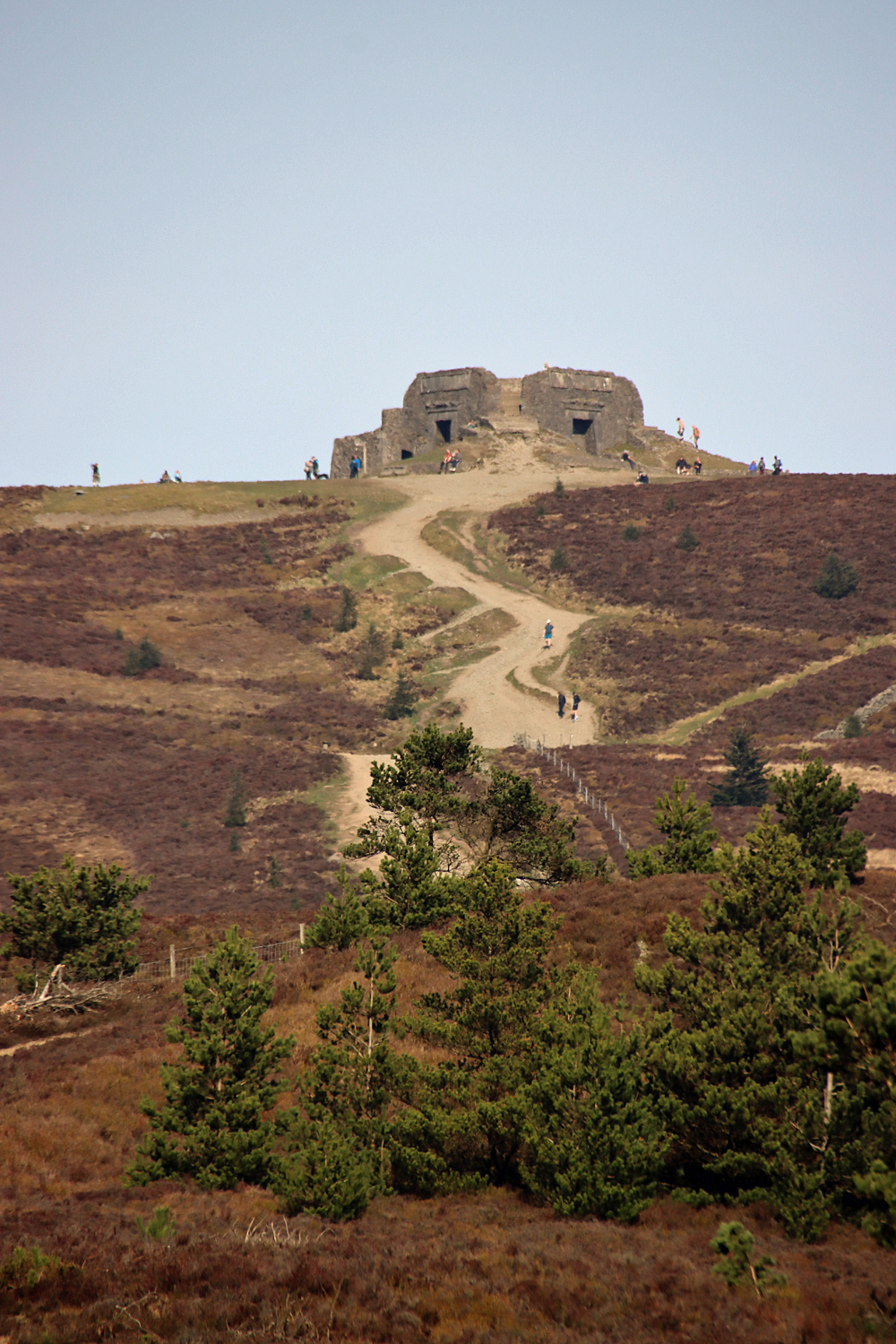
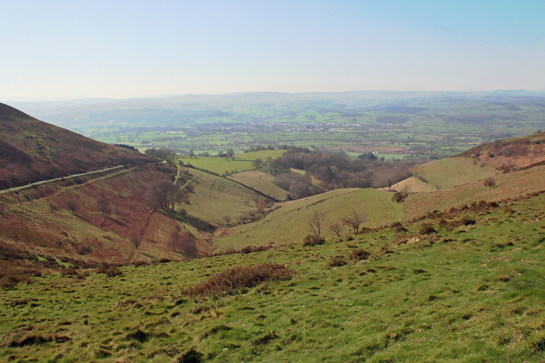
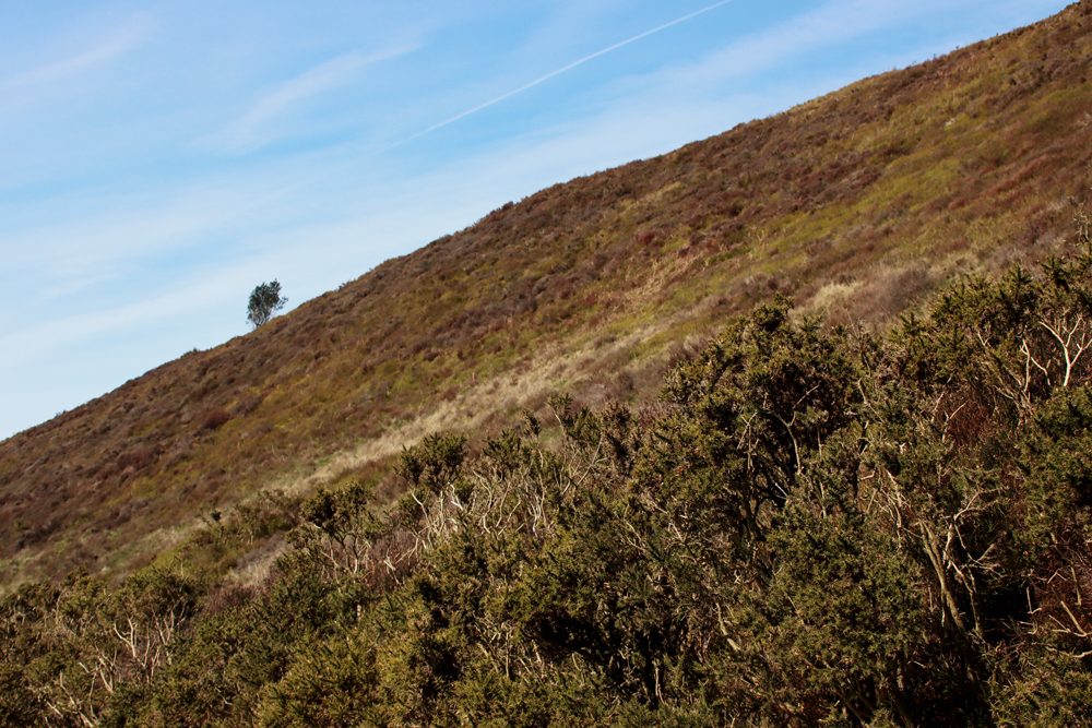
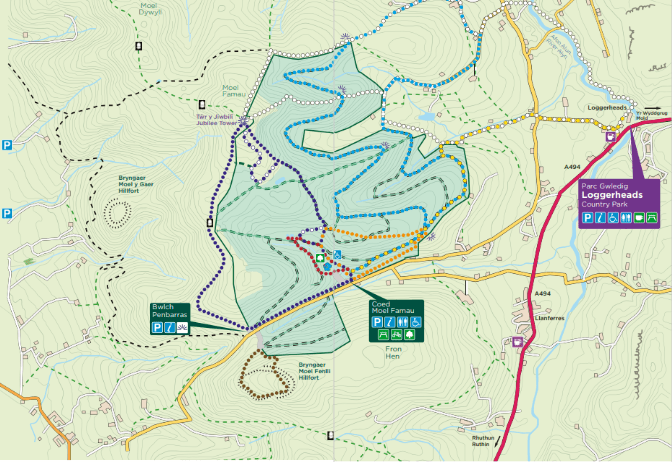
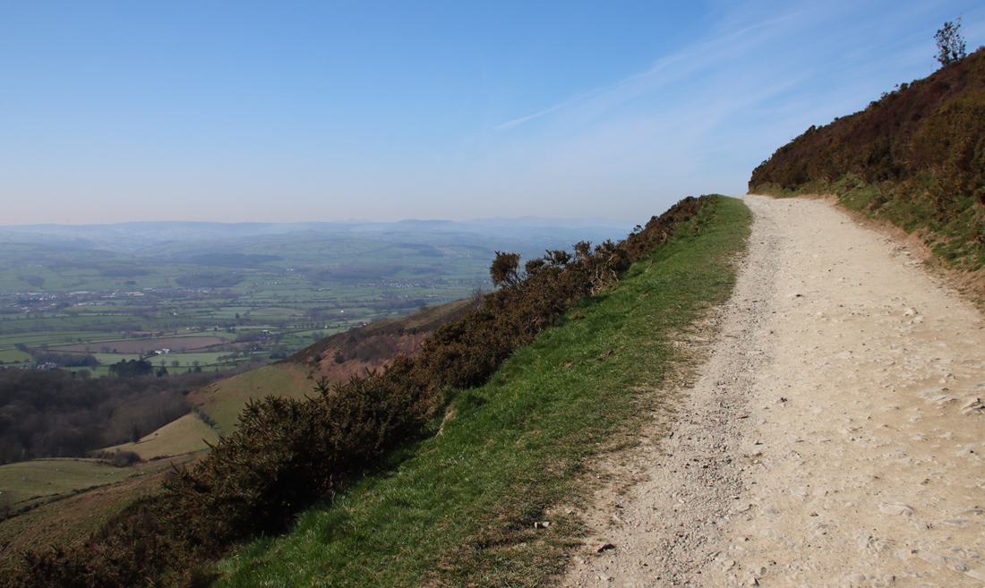 The walk, along a wide, well maintained path, starts very gently and for the first 20 minutes or so is very easy. It becomes much steeper for a fairly short section leading up to the peak, but people of all levels of fitness seemed to be tackling it, some stopping frequently for a breather. It’s worth that last push because the 360º views are breathtaking.
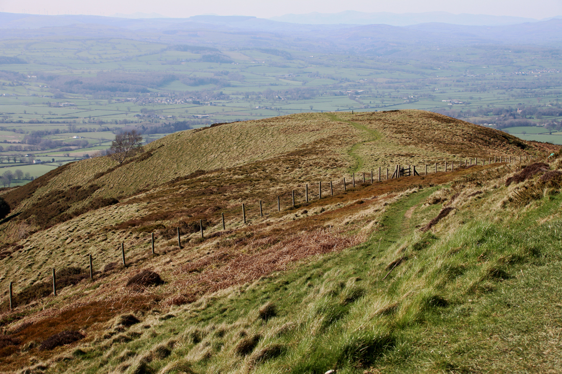
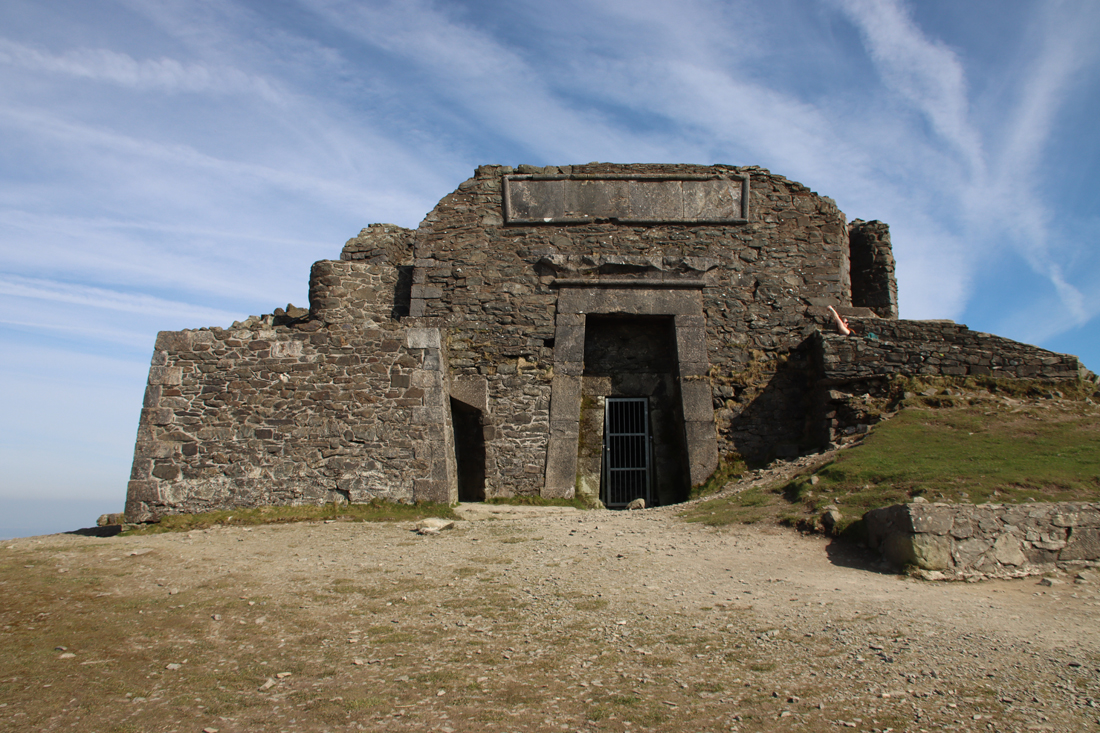 If you climb up the steps to the top of the Egyptian Revival “temple” there are metal plaques explaining the building. It turns out that what we see today is just the stump of a much more ambitious project, the Jubilee Tower, which included an obelisk. It was designed by architect Thomas Harrison, and was built to celebrate the Golden Jubilee of George III in 1810, paid for by public subscription, with Flintshire magistrate Lord Kenyon laying the foundation stone in October of that year. Harrison’s buildings in Chester are far less frivolous, with most of his work in the Neoclassical style, including the Grosvenor Bridge and the Propylaeum (monumental gateway) into Chester Castle and the Neoclassical building that is now owned by the university but was previously occupied by the council as its Shire Hall. The building materials were taken up by horse and cart. The design of the obelisk was modified during construction, with a shorter and stumpier version being completed in about 1817 after a break in work due to financial difficulties and a dispute between Harrison and the builder. Unfortunately the obelisk soon started to deteriorate, and eventually collapsed in a storm in 1862. The rest of the structure continued to decay until 1970 when it underwent restoration, and in 2013 it again required significant restoration work. Here’s the Coflein description of the Jubilee Tower:
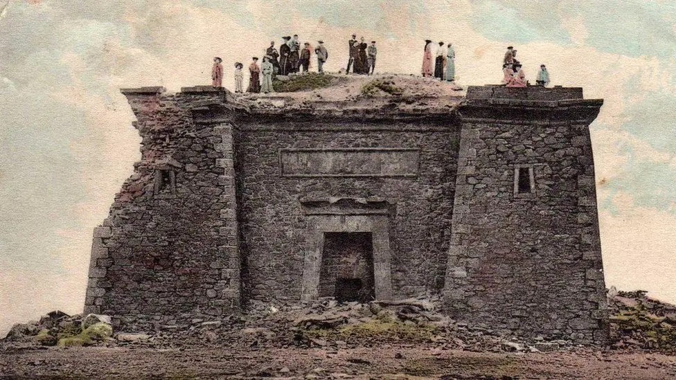
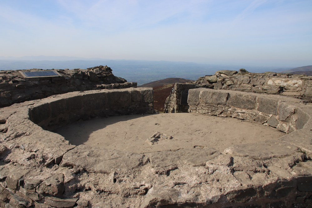 One of the first and very popular books to publish these images was Dominique Vivant-Denon’s “Journeys in Upper and Lower Egypt” published in 1802. Even before Jean-François Champollion’s translation of hieroglyphs in 1822, and over a century before Howard Carter’s discovery of the tomb of Tutankhamen in 1922, Egypt had wriggled its way firmly into the British imagination. Even so, I would love to have been at the meeting where plonking a pseudo-Egyptian monument on the top of a remote beauty spot in honour of the king’s jubilee was presented as a such a good idea that people invested in it.
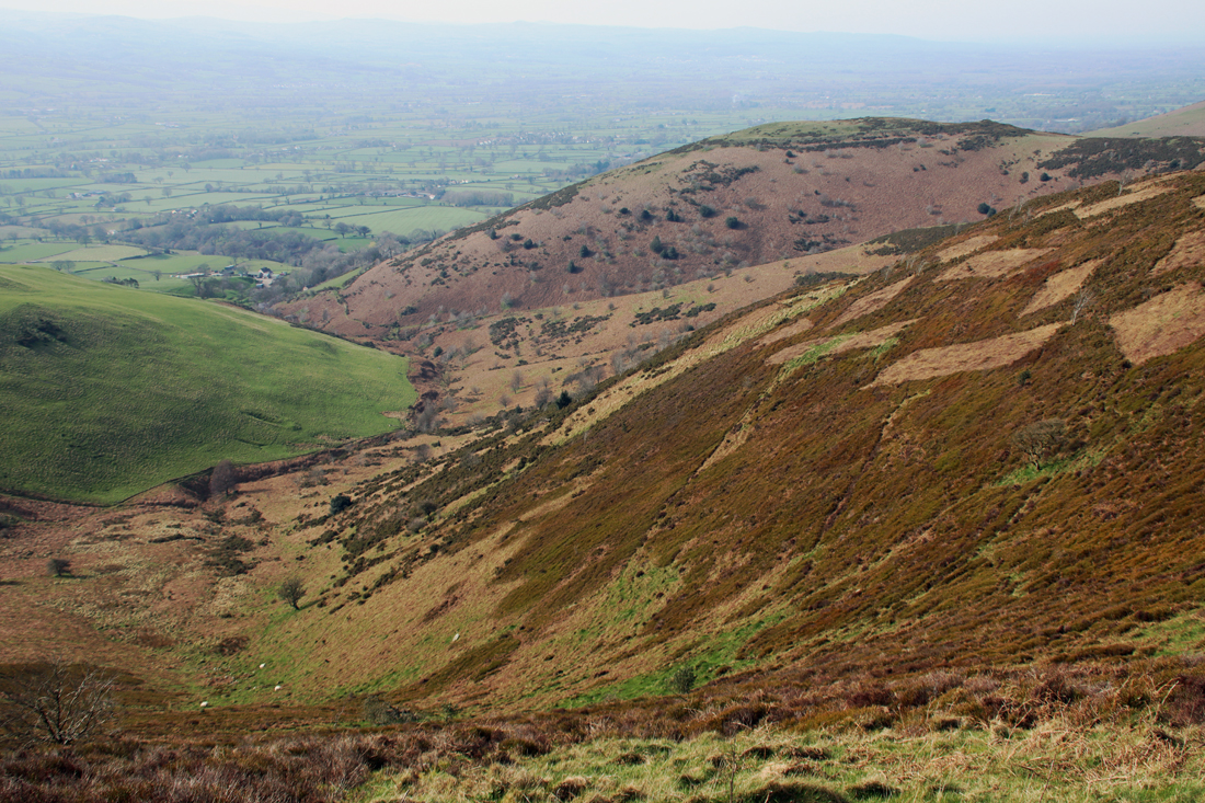
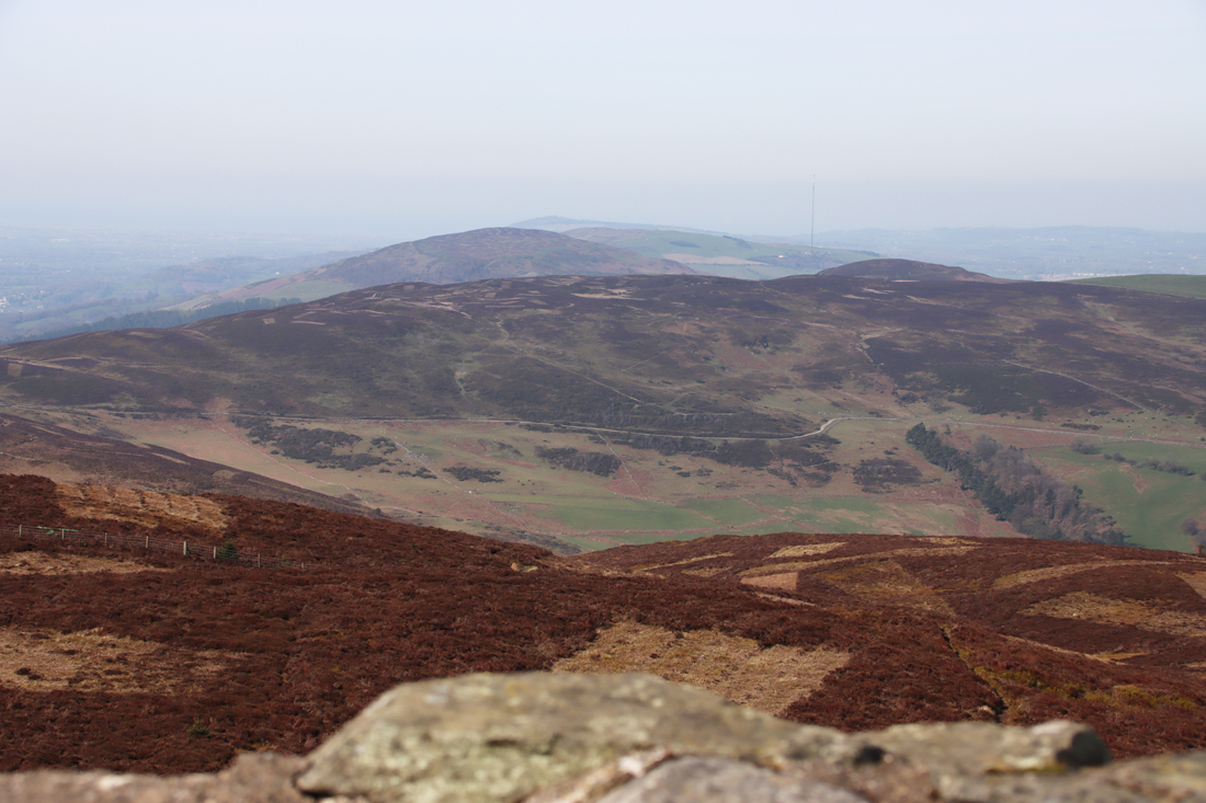
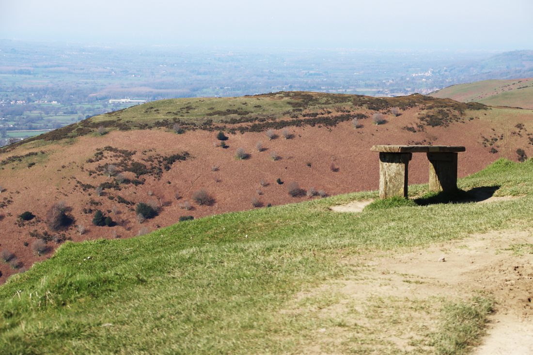
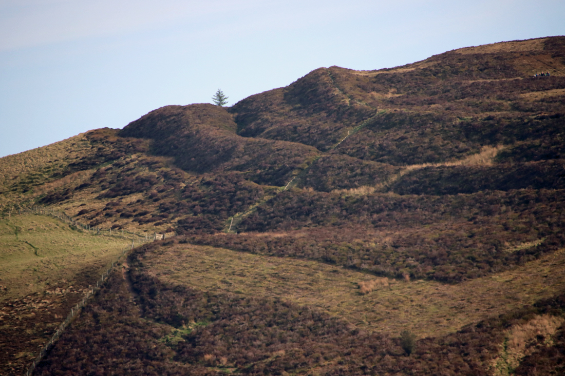
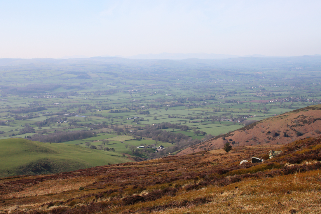 It is about a 40 minute walk up, although I forgot to take a note of the times in either direction and have the impression that it took me only about half an hour back down, with extra time added for pausing to enjoy the views and for lazy mellowing and exploring the monument at the top. I am something of a route-marcher, so that needs to be taken into account. You can walk on beyond Moel Famau in various directions on public footpaths. Most obviously the path continues, in a much narrower form, across the Clwydian Range, which looks like an absolutely splendid option. If you have the energy, you can walk to the village of Bodfari, in another pass through the Clwydian Range, whilst the Offa’s Dyke Trail goes all the way to Prestatyn. In the opposite direction, you can follow the route over Foel Fenlli all the way to Chirk, skirting the dramatic Eglyseg Mountain and passing Castell Dinas Bran and the Pontcysyllte aqueduct.
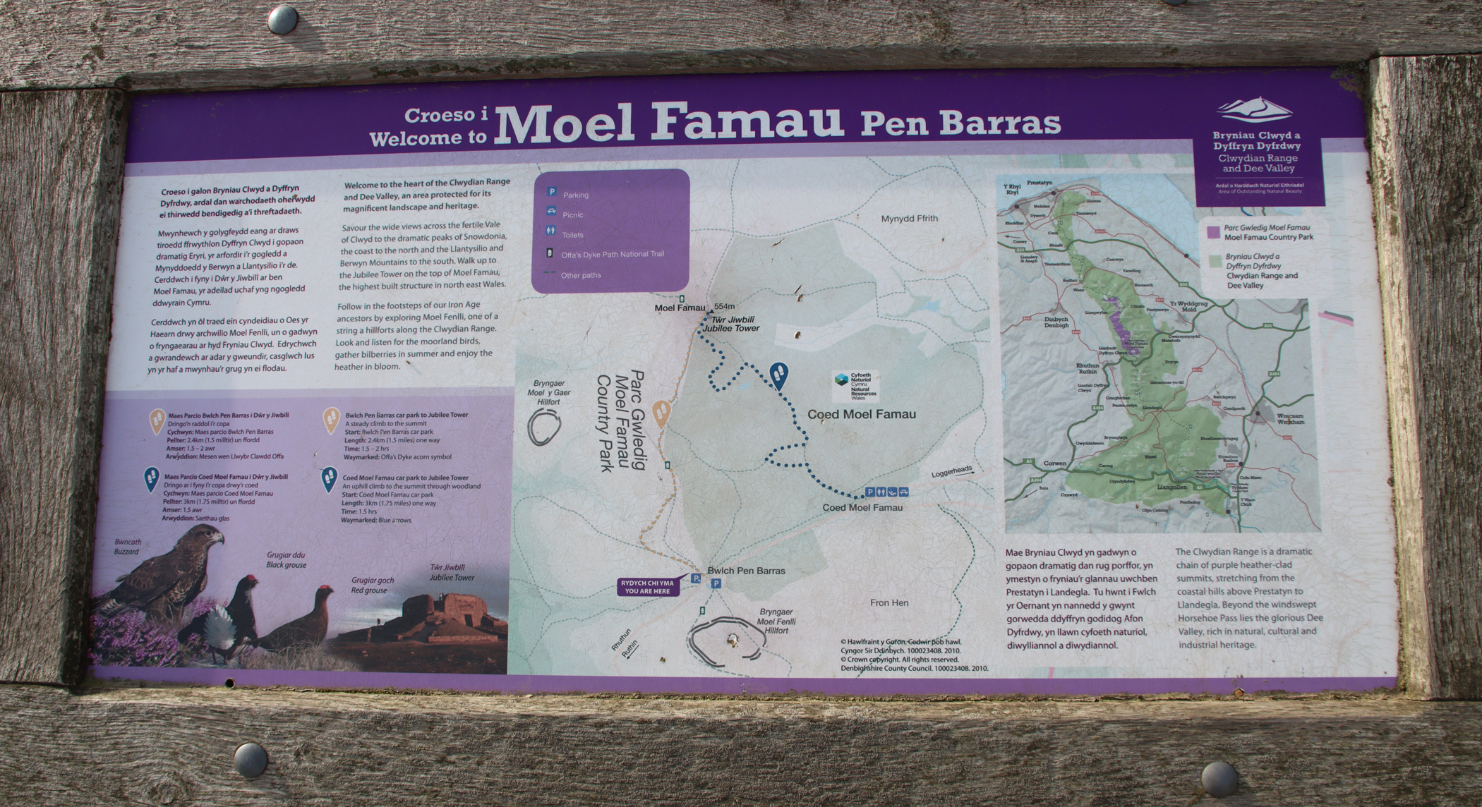
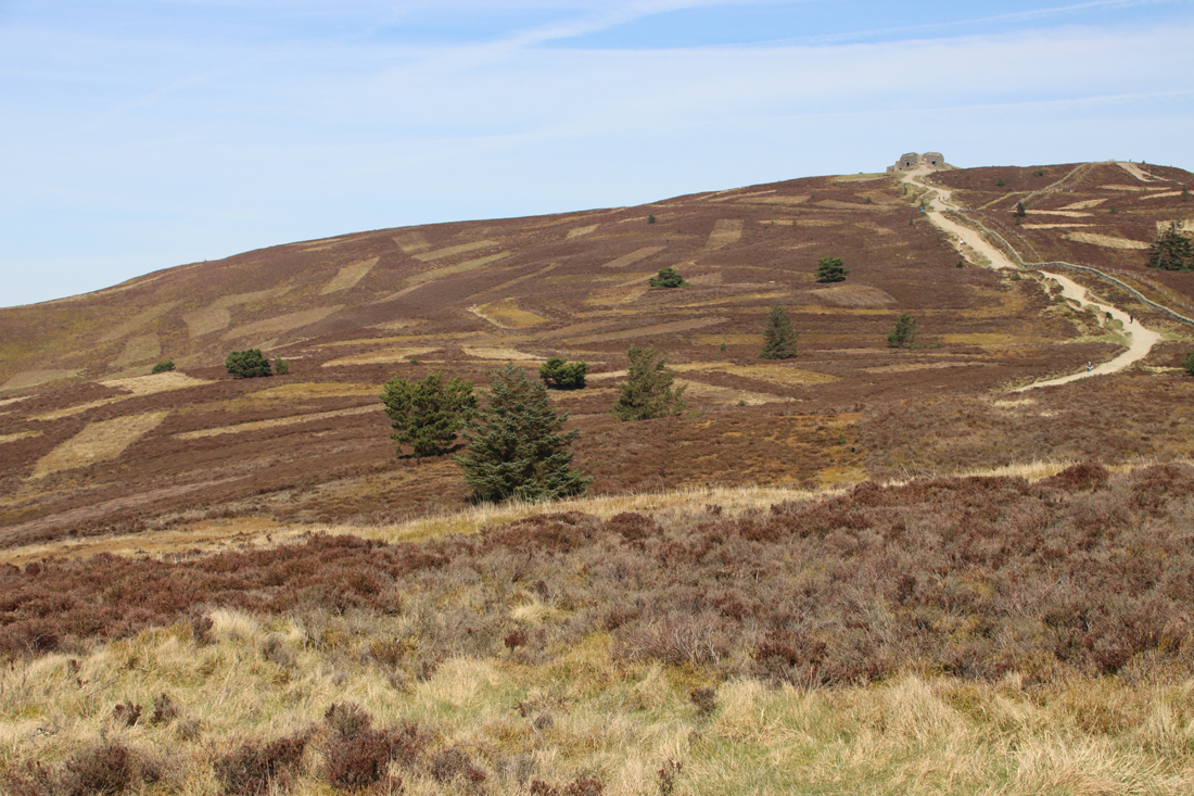
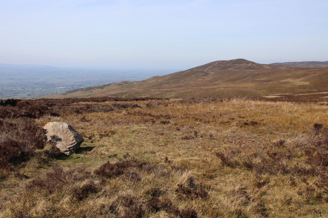
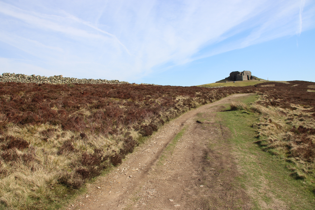
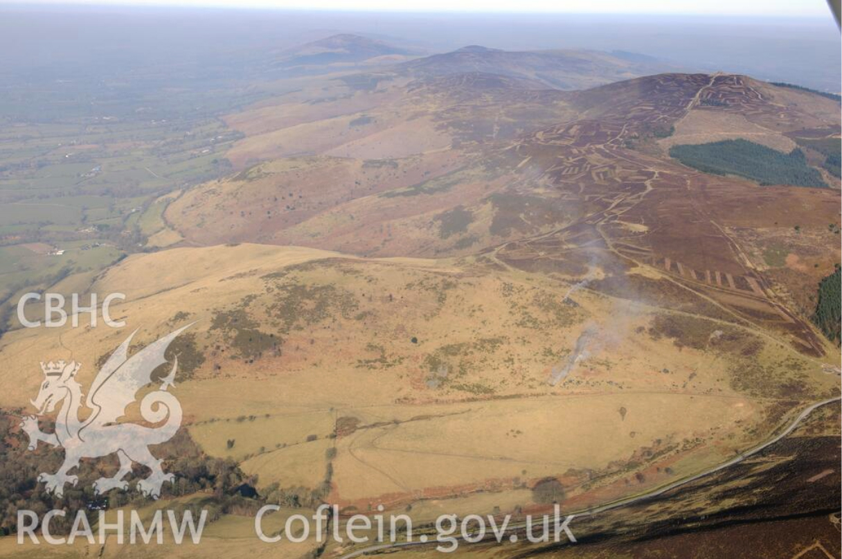
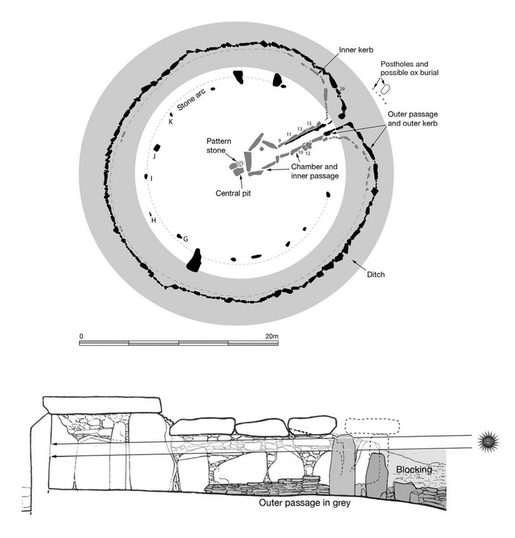
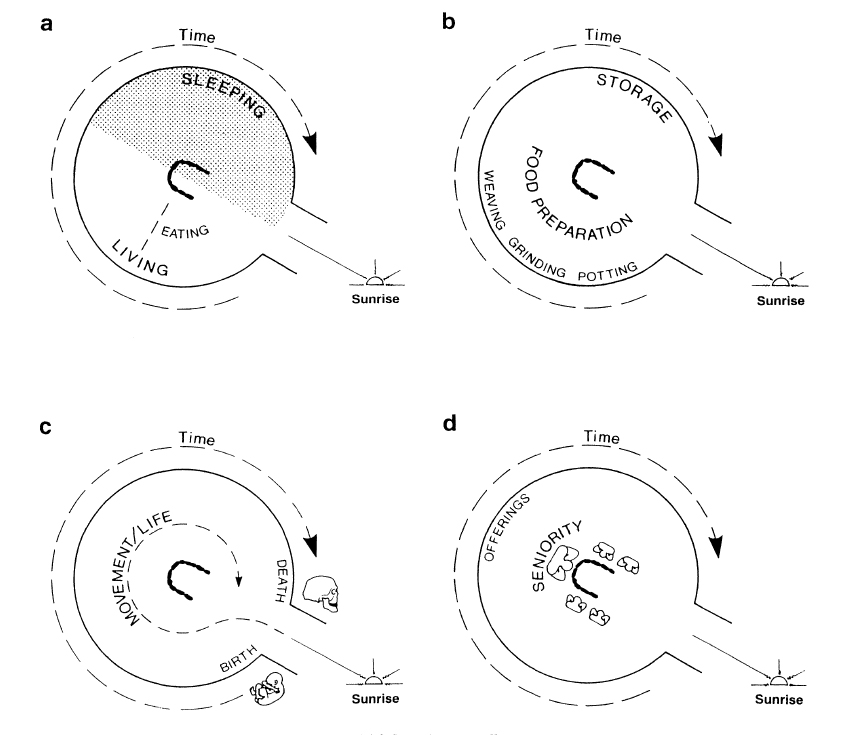

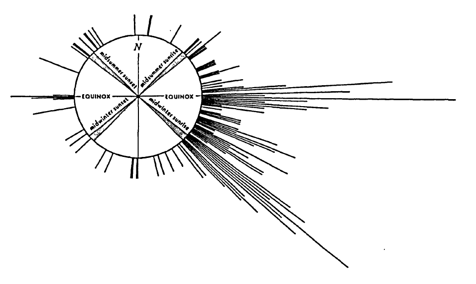
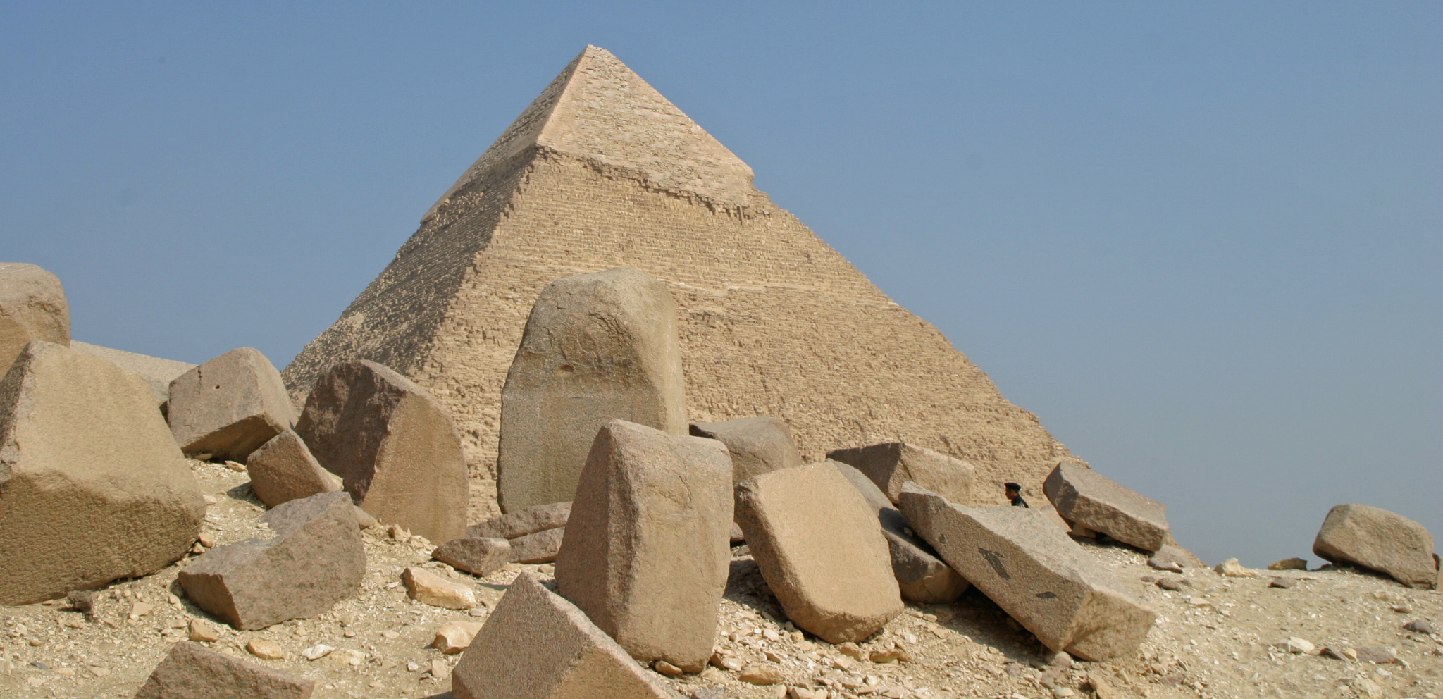
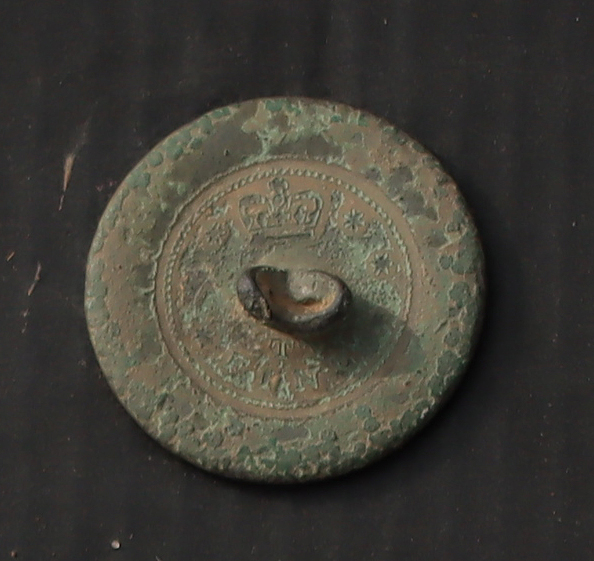
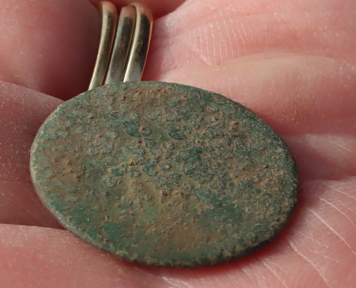
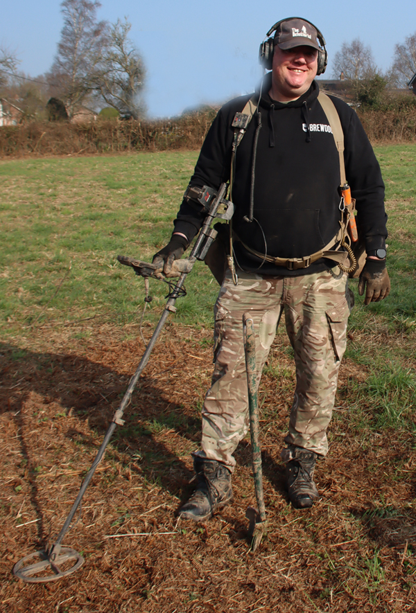
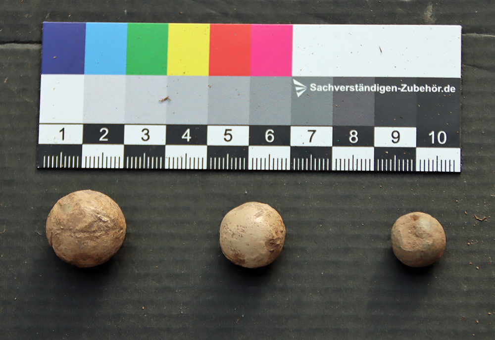
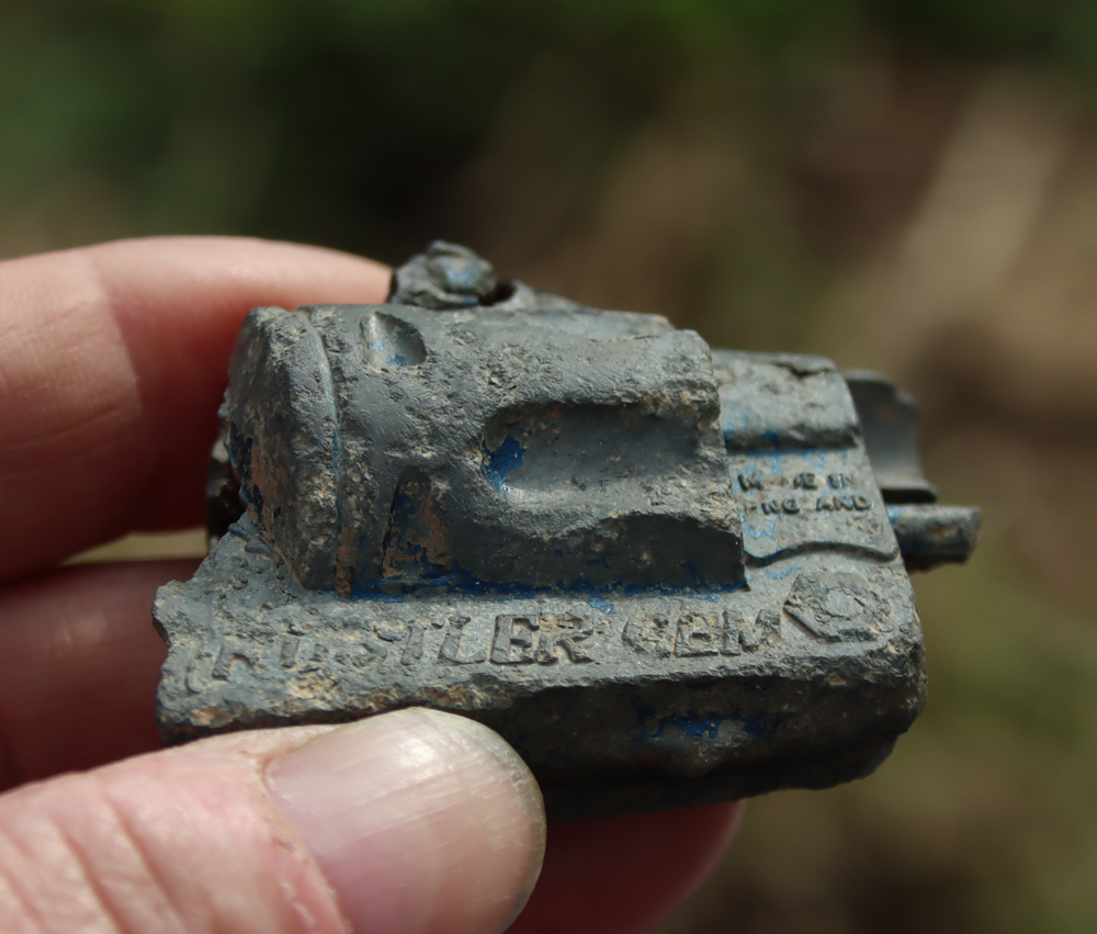
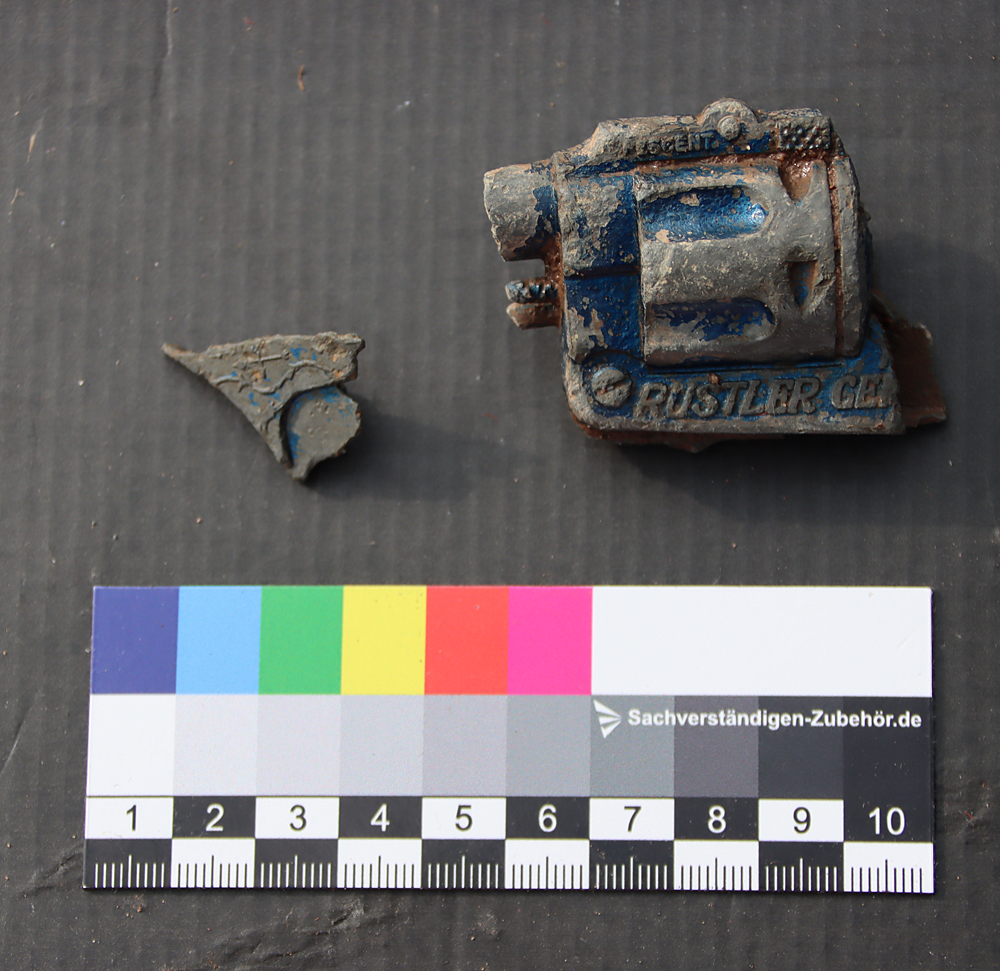
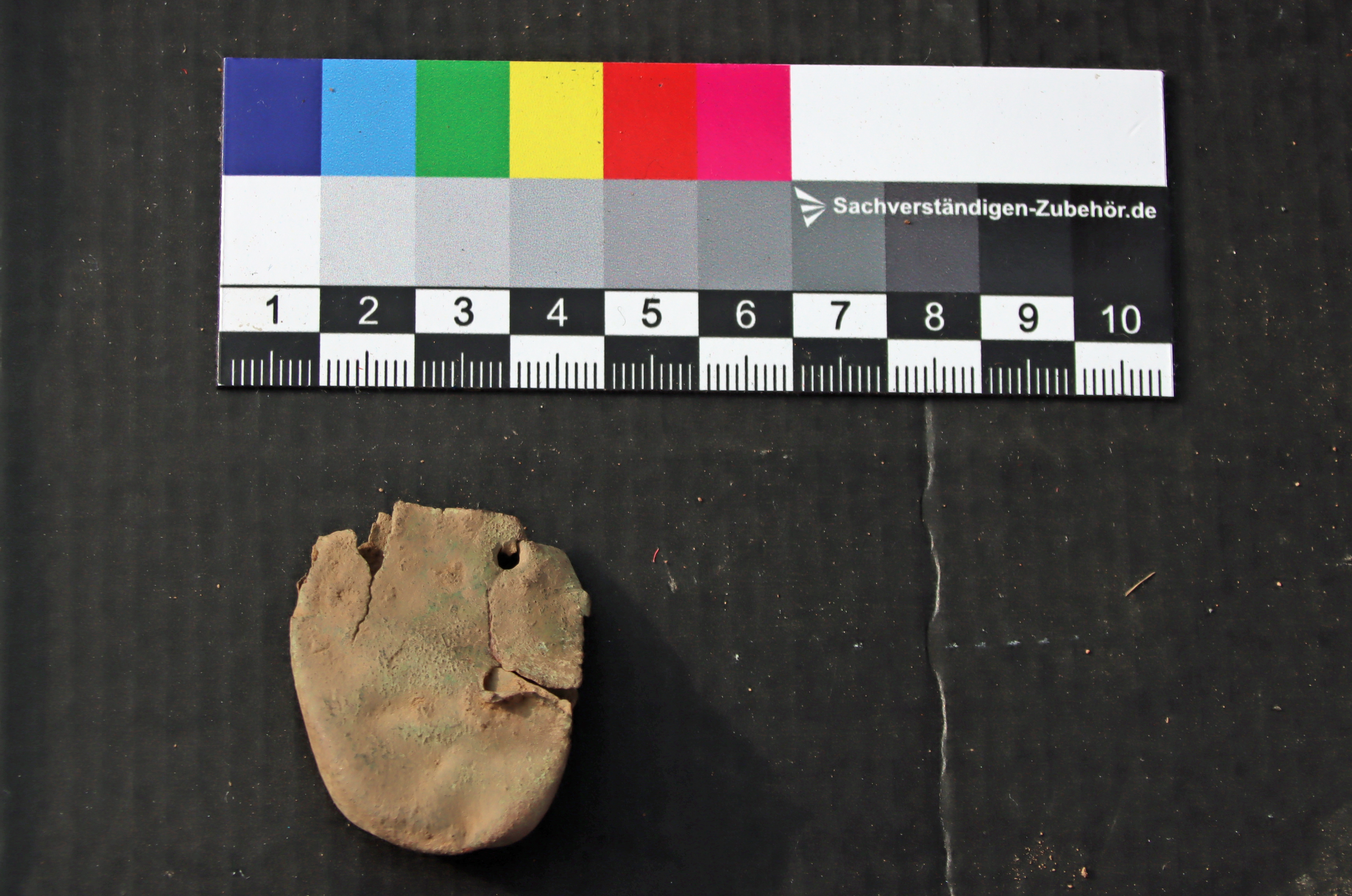
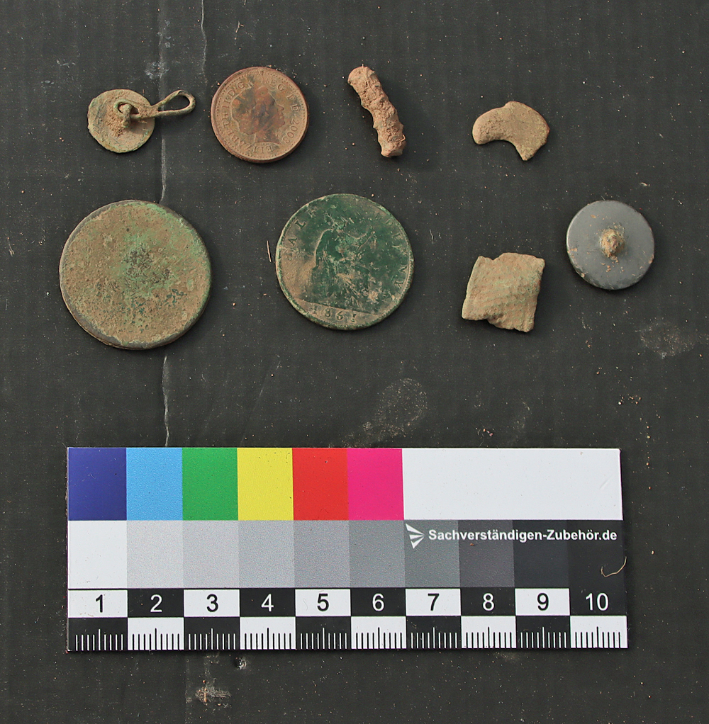
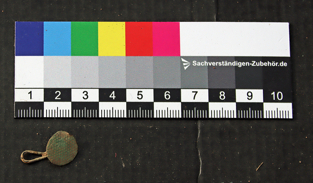
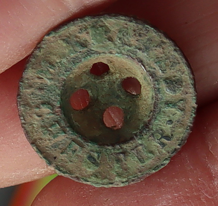
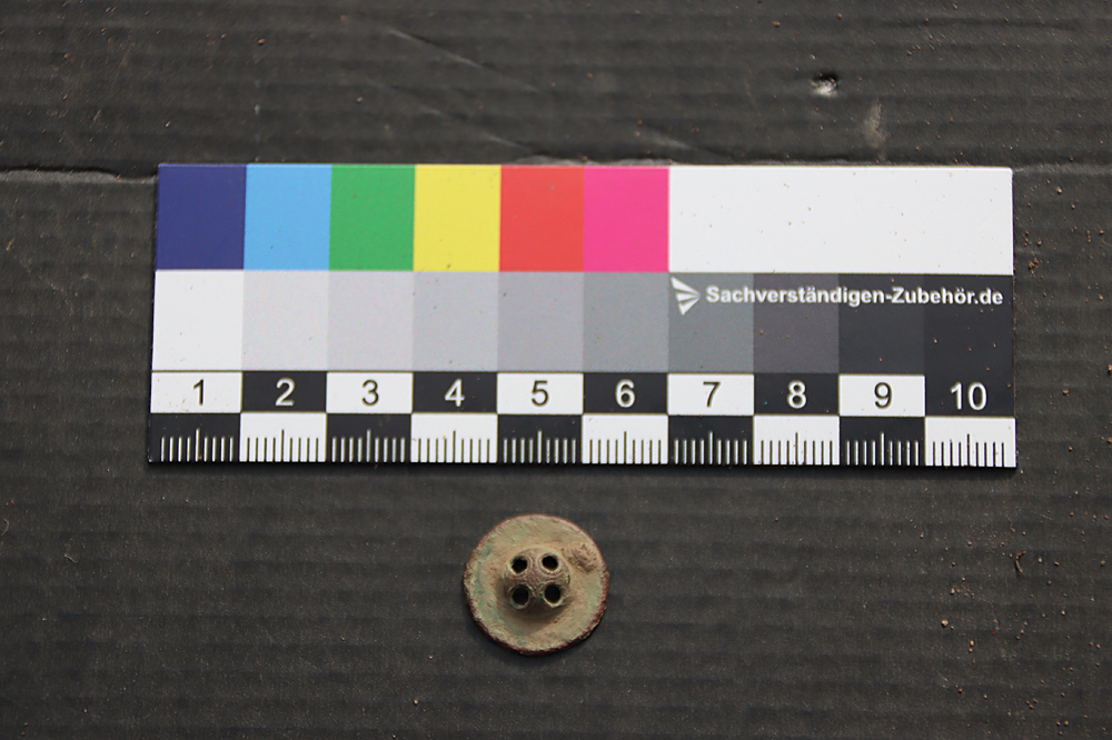
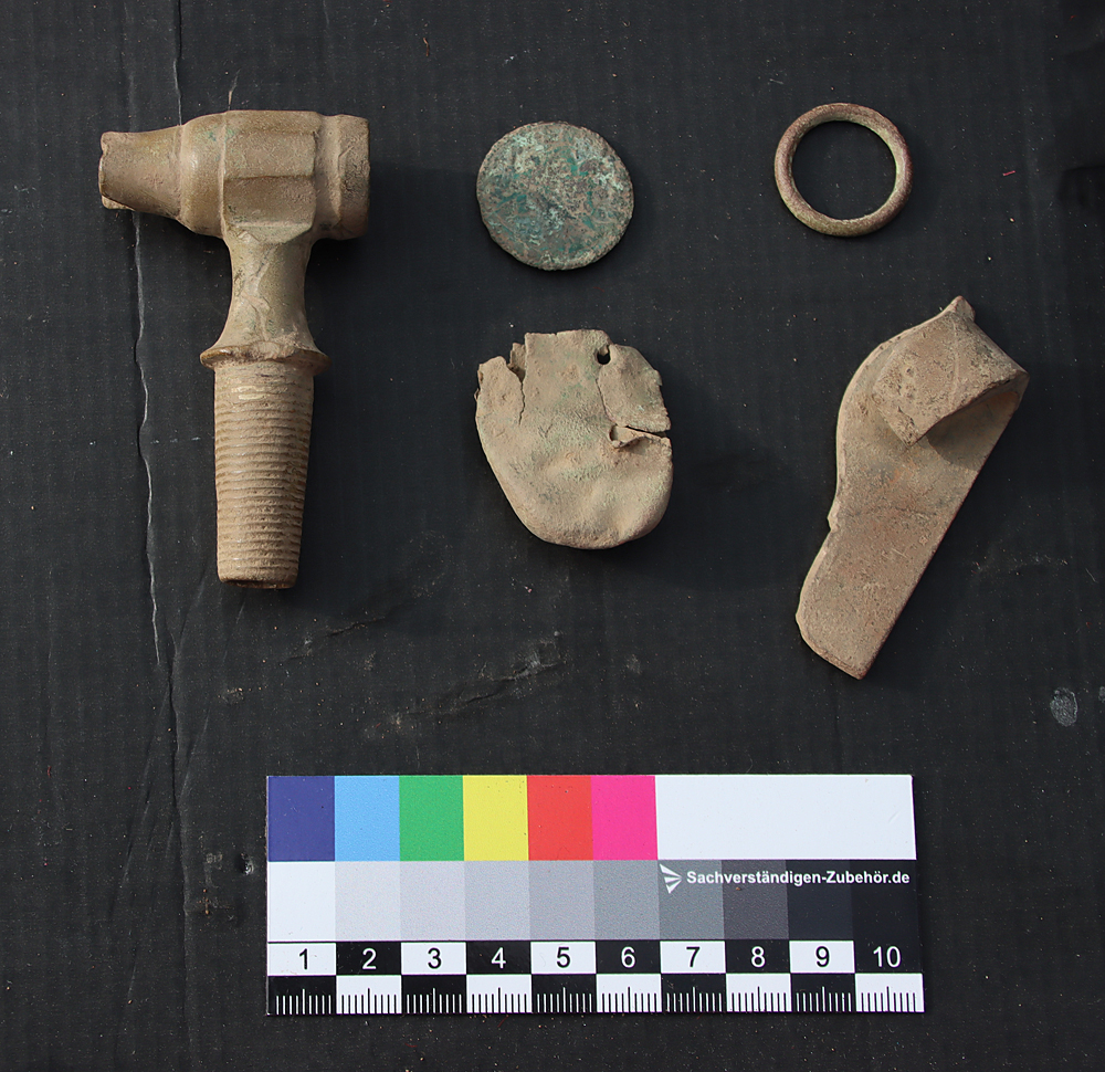
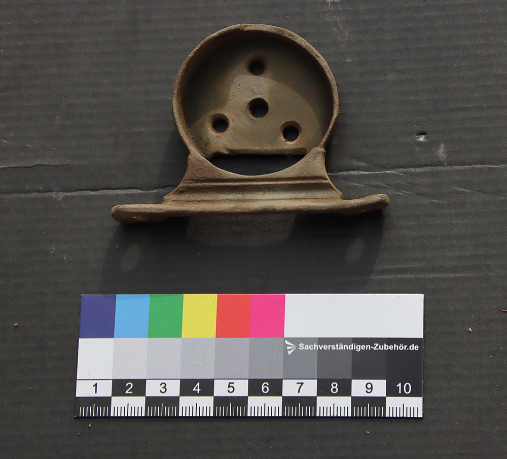
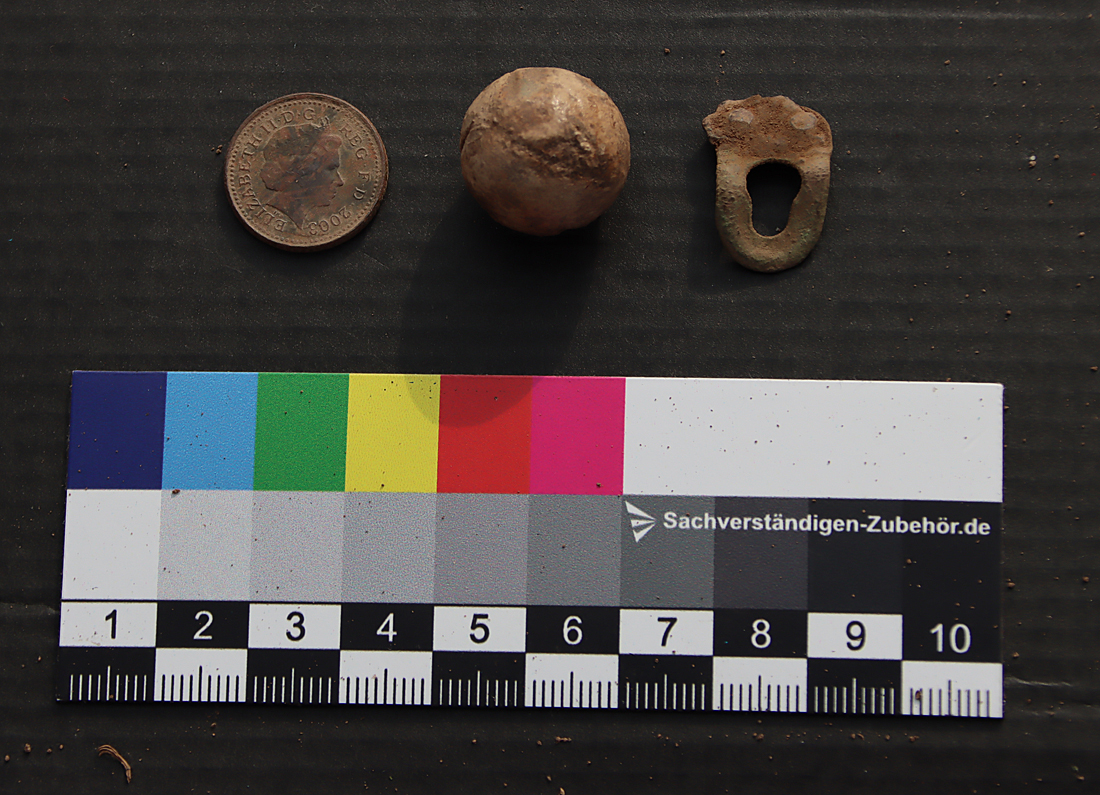
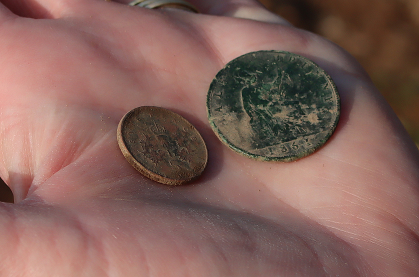
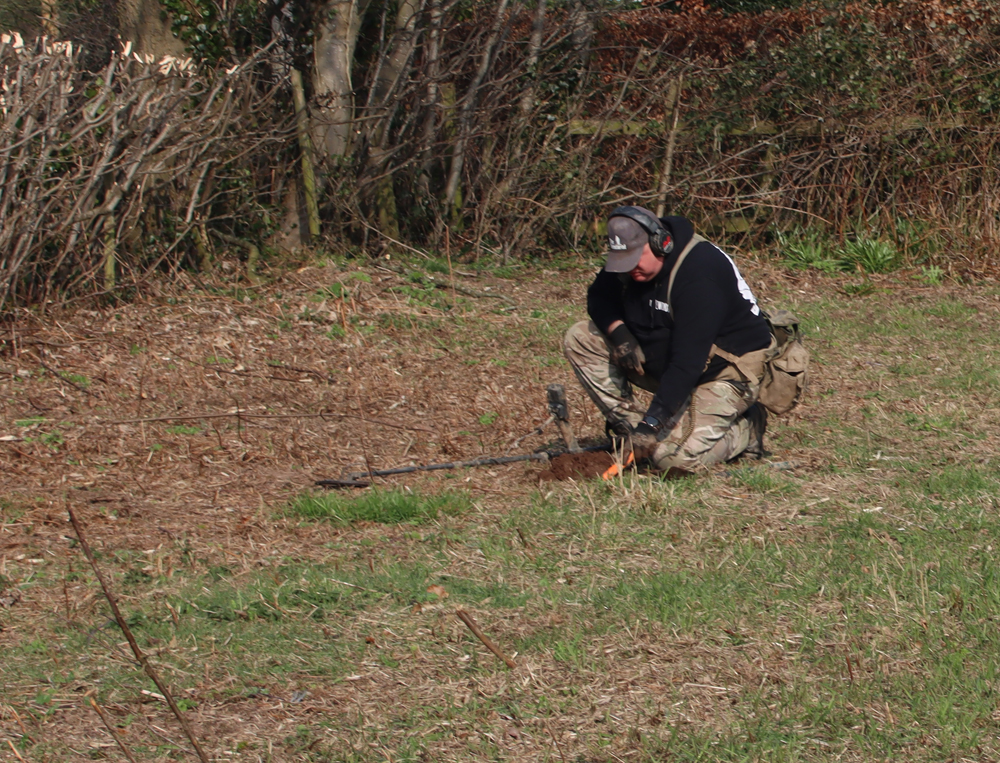


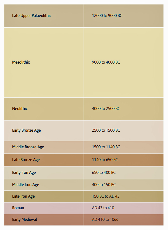
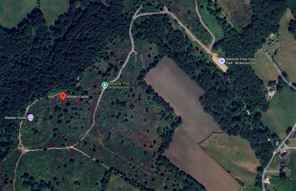


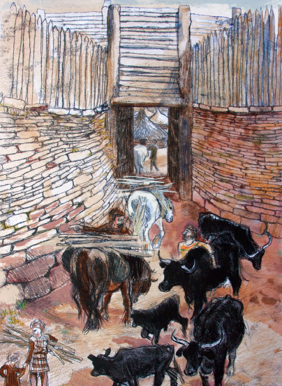


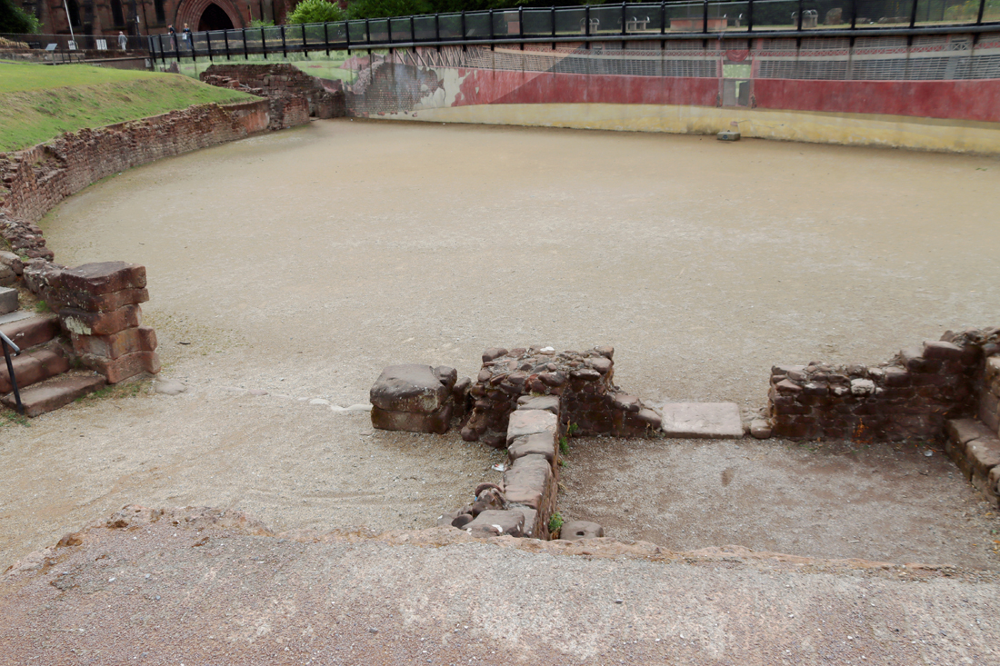


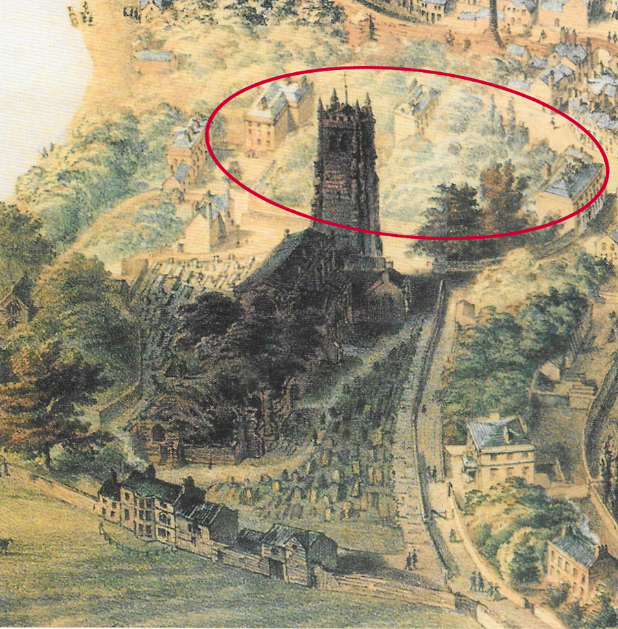


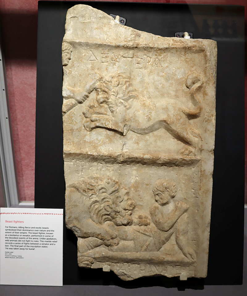


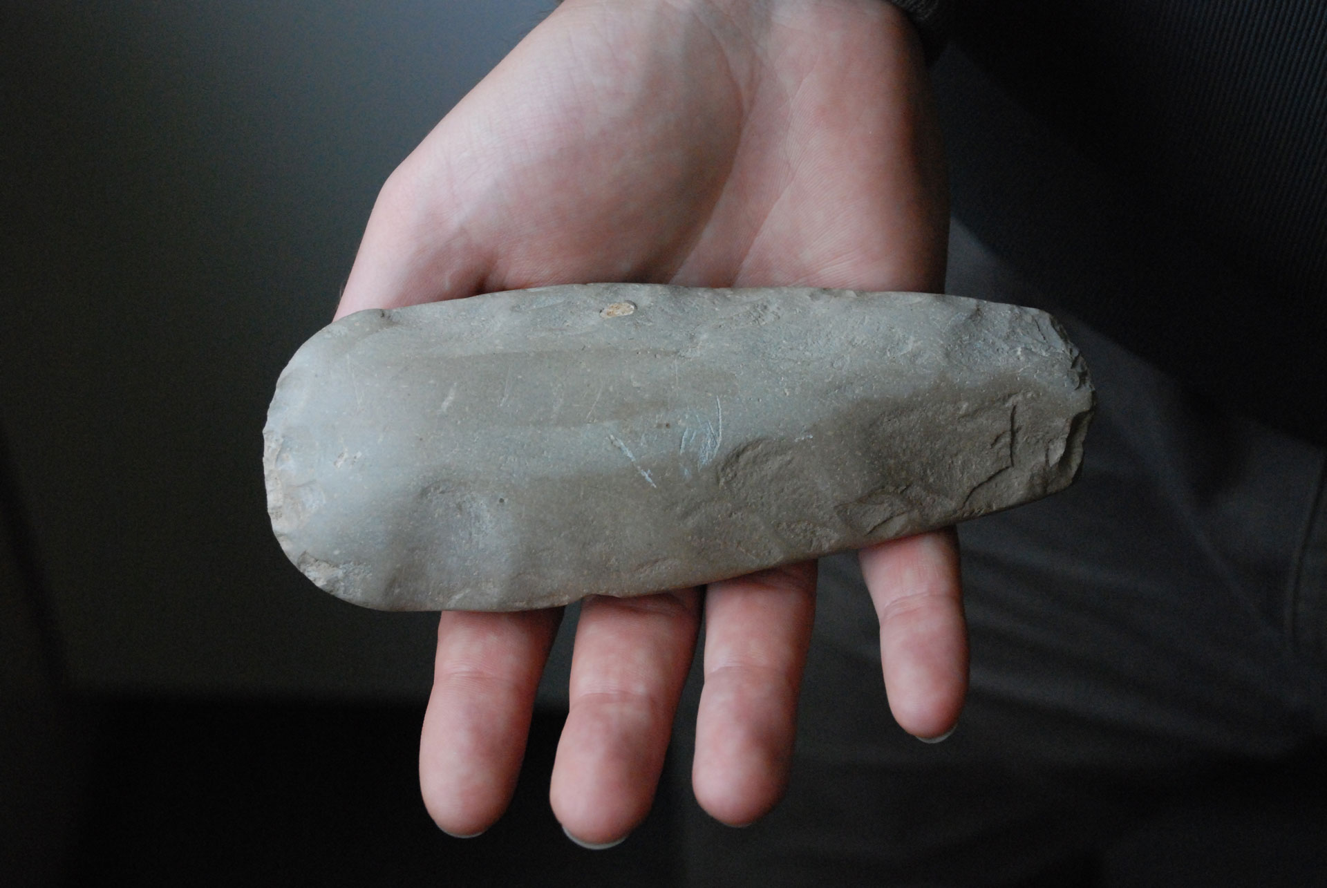


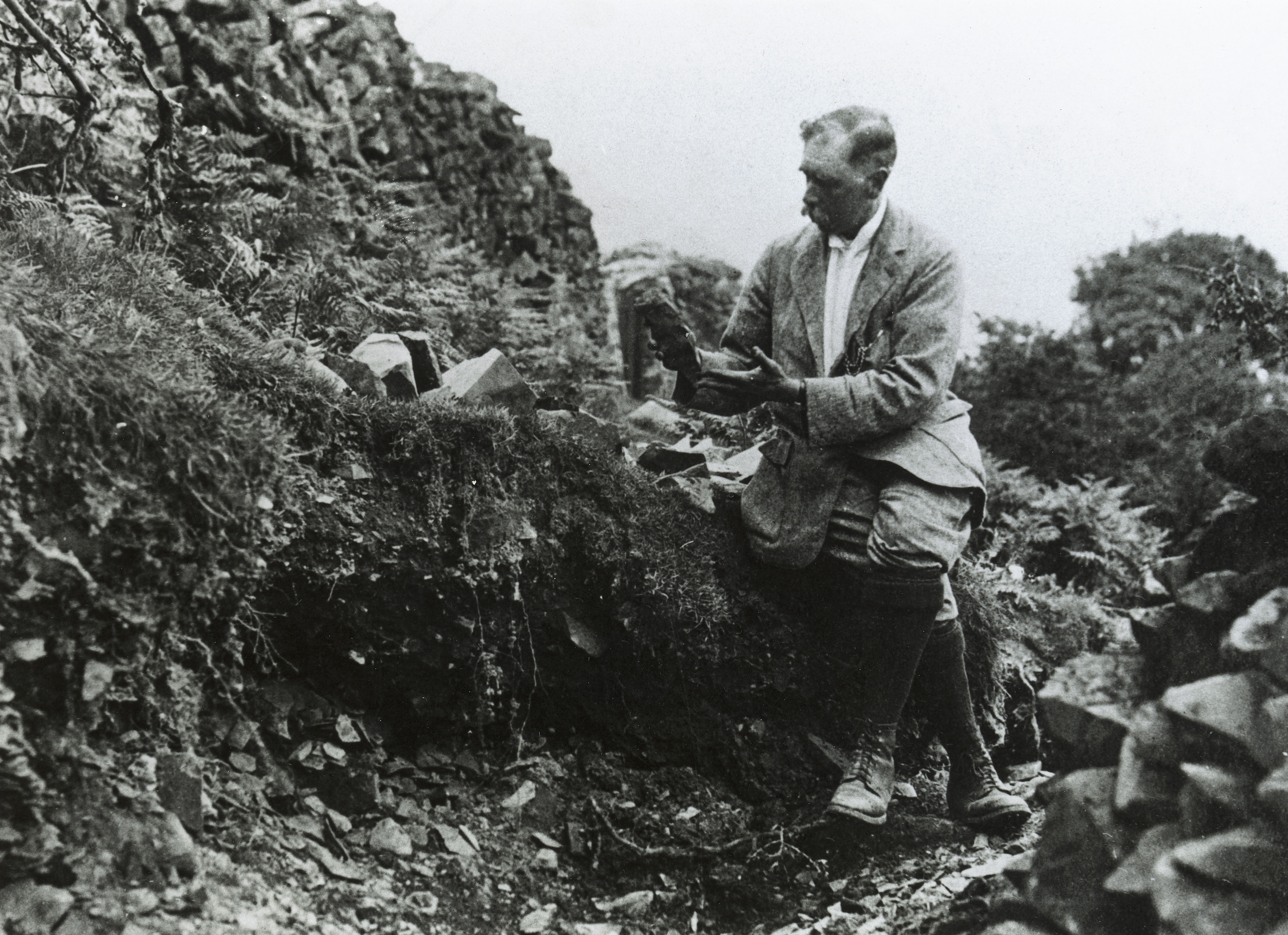


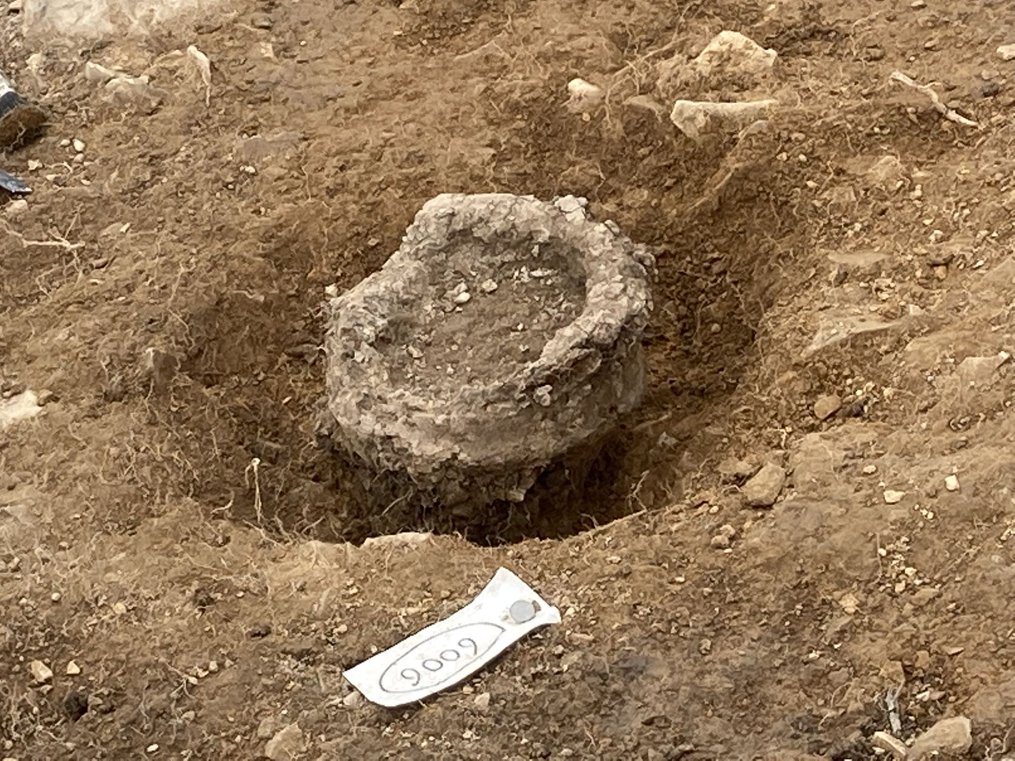
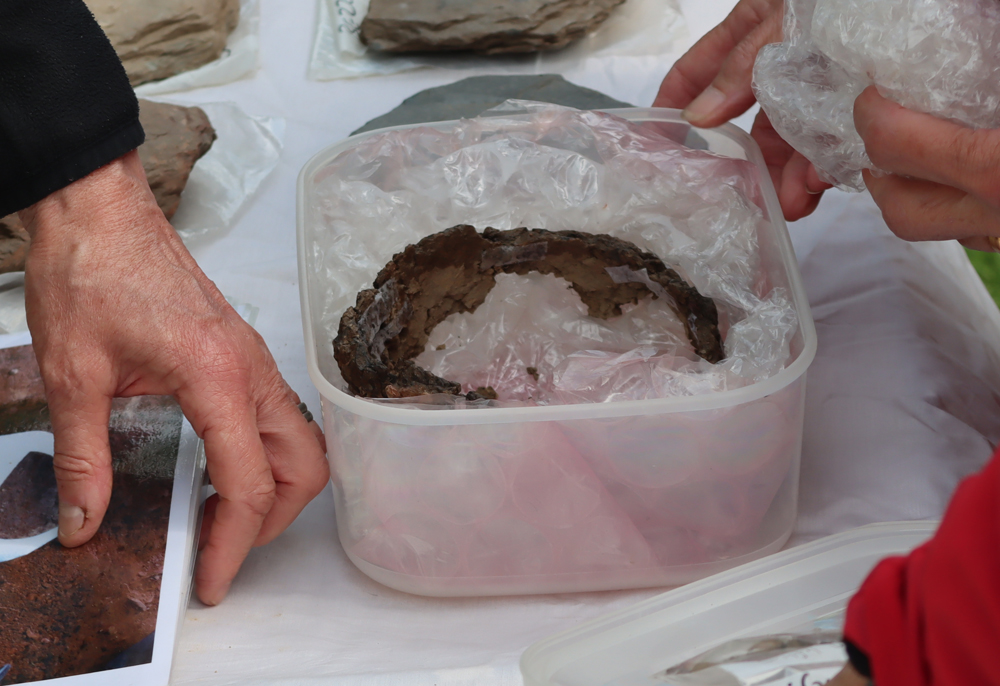


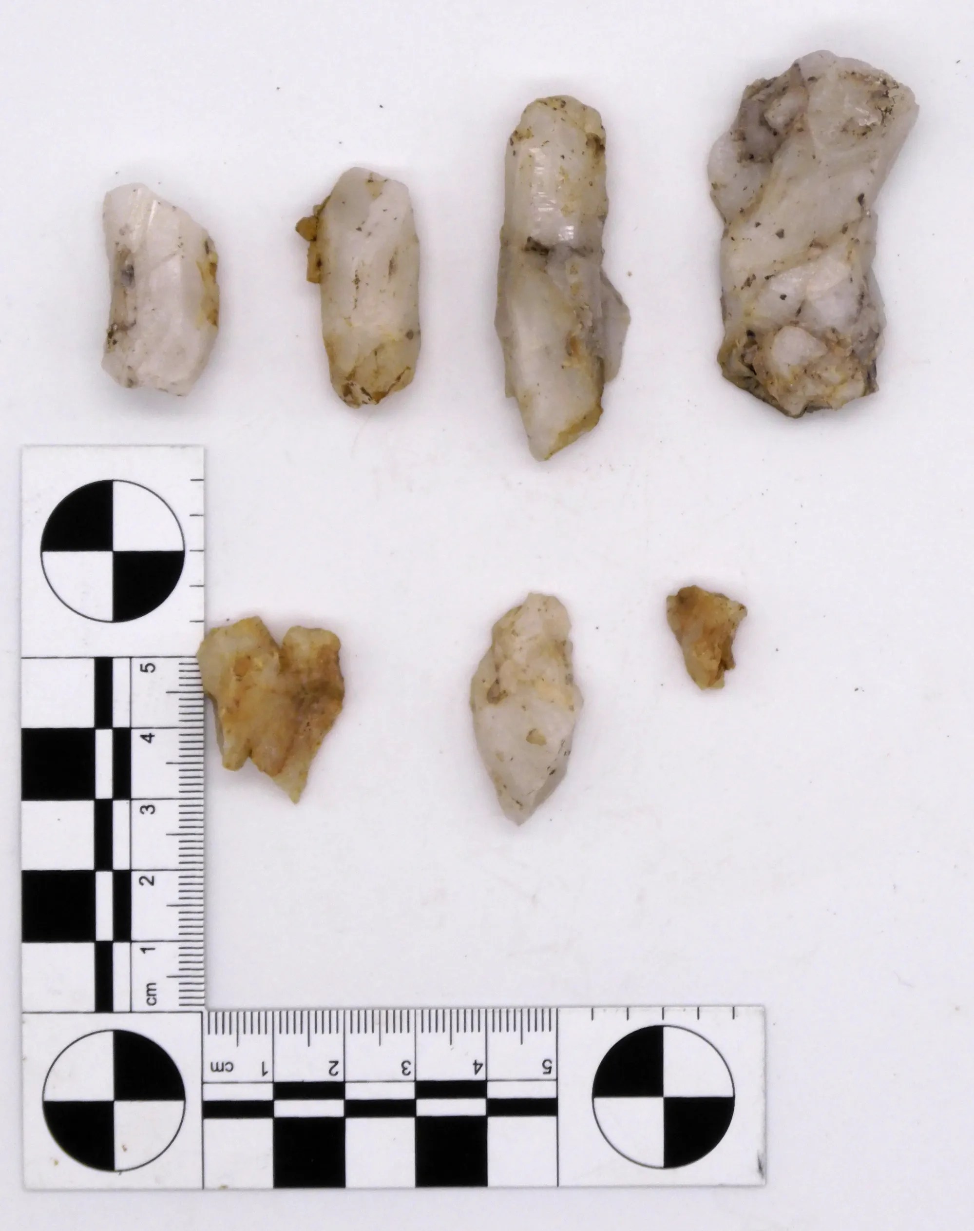

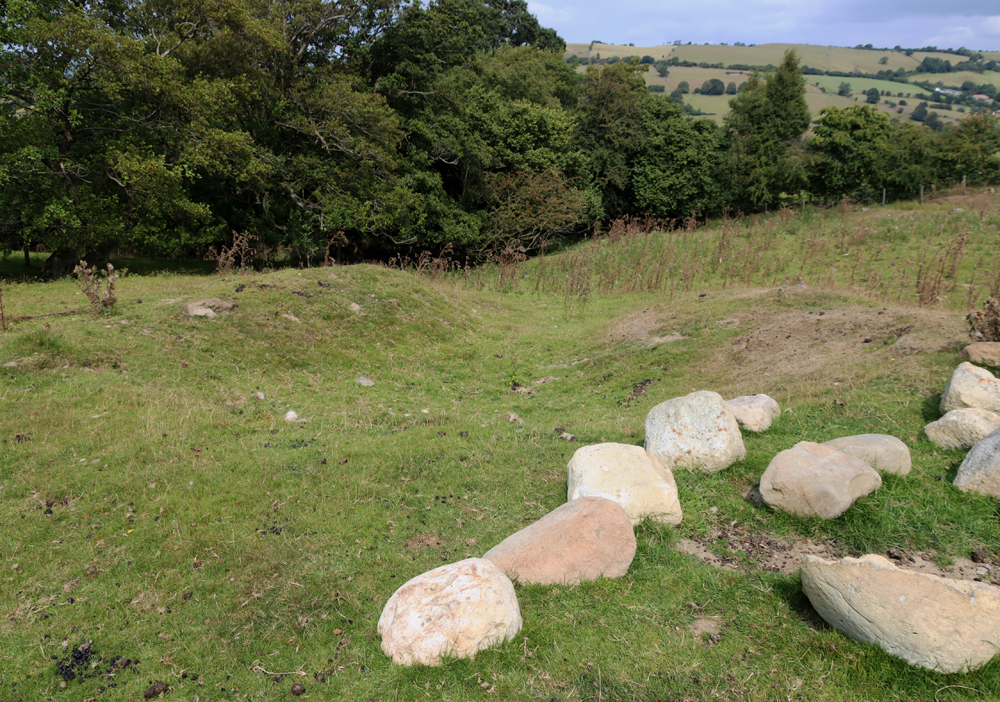


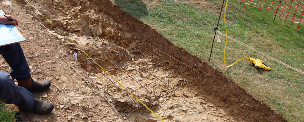


