
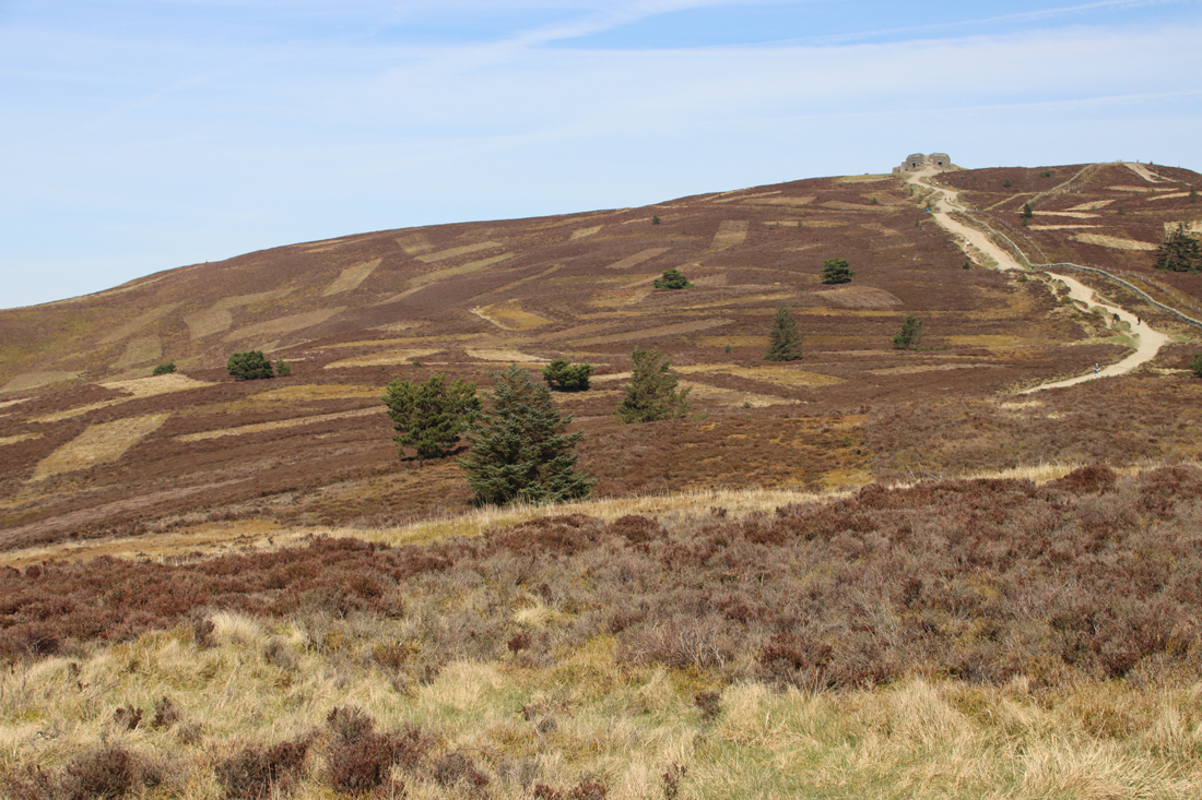
The Jubilee Tower
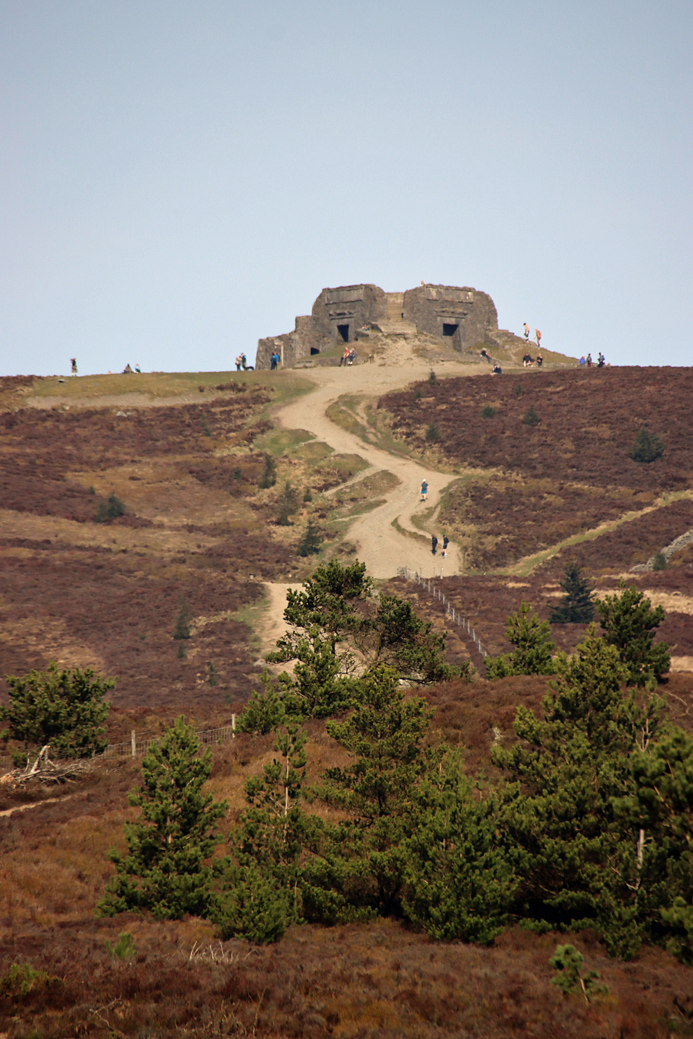
It was something of a surprise when I walked up to the top of Moel Famau during the week and found myself face to face with a building that was clearly based on an ancient Egyptian temple, the Grade II listed Jubilee Tower. People talk about the views, the hillforts, the heather, the bilberries and the bird life, but no-one had mentioned that there was a rather unexpected slice of Egyptomania on the peak. One would certainly, thankfully, not be permitted to build on a national beauty spot these days, but I suppose that it could be a lot worse, like the hideous, overpriced café on Snowdon. The Jubilee Tower is not elegant, it is not authentic, and it is anything but pretty, but it did make me smile, and other walkers were clearly enjoying it too. Heritage comes in various forms, some of them most unexpected. The Egyptian Revival produced some splendid buildings and monuments, and although this one is not amongst the most accomplished, its location singles it out as a fairly remarkable example, a genuine curiosity.
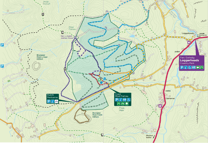
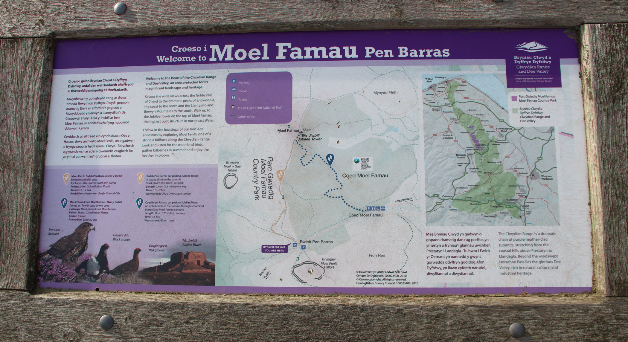
Map of Moel Famau footpaths, as well as the locations of Moel y Gaer and Foel Fenlli hillforts. Source: Nearly Uphill
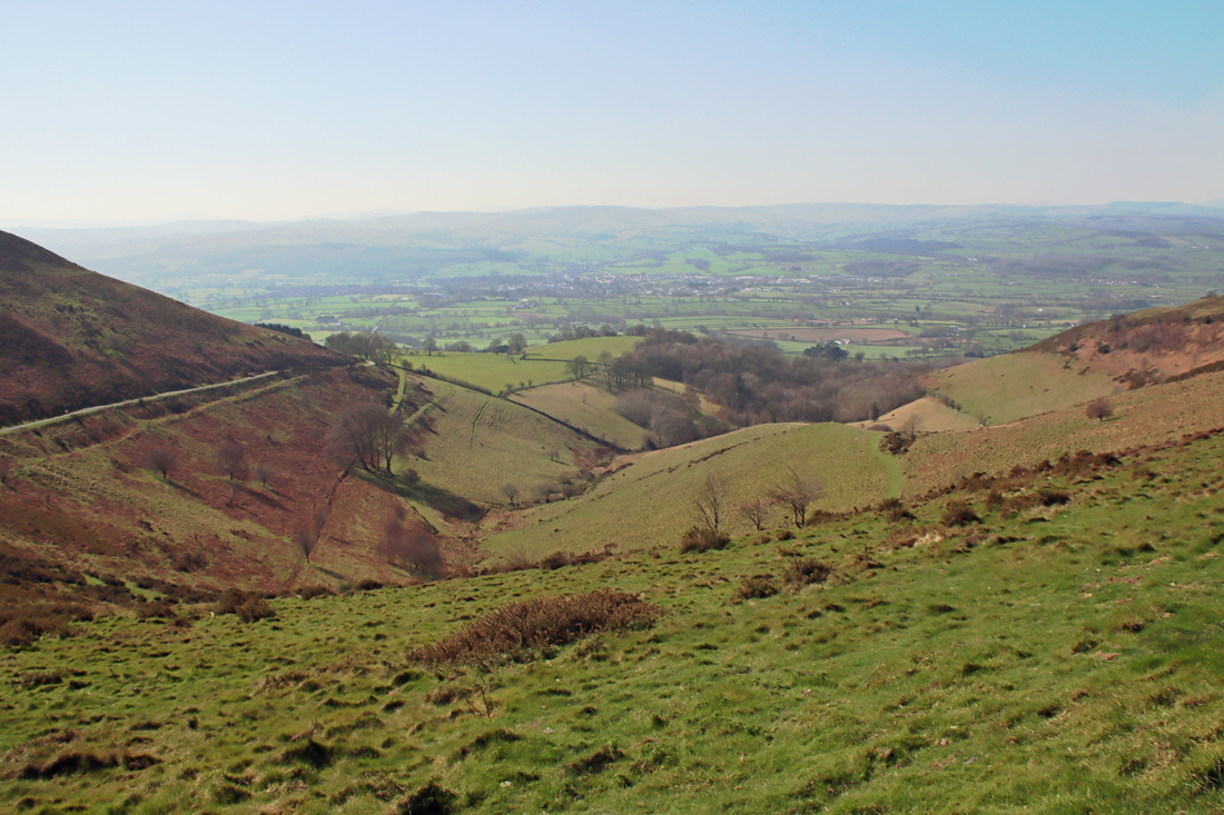
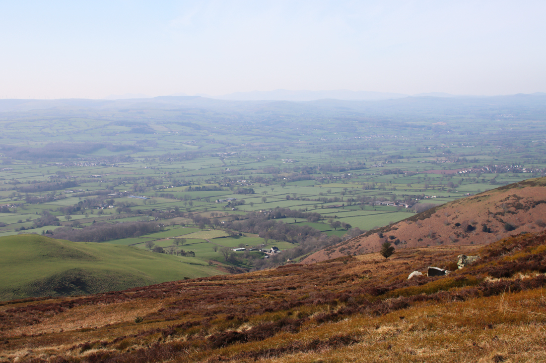
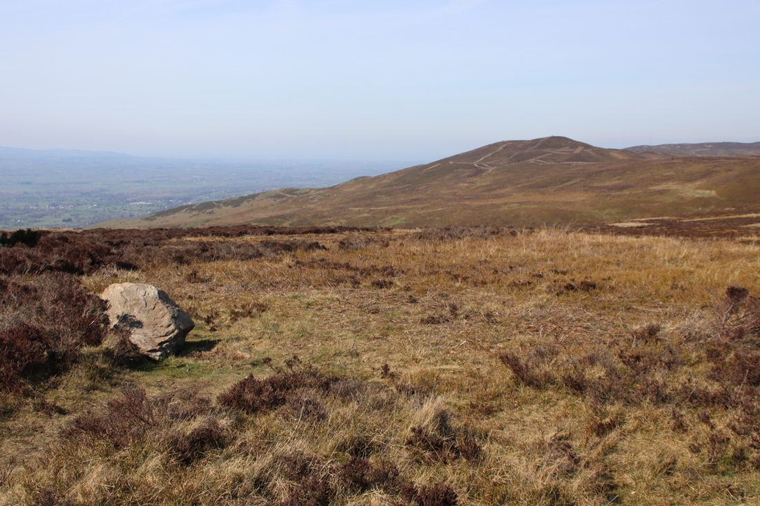
Moel Famau, on the Clwydian Range, is lovely. It is the highest peak on the Clwydians and a very popular destination for hikers and dog walkers alike. I don’t really remember my first visit, so it was very much like visiting for the first time. There are a number of different approaches to the peak. I went along the Bwlch Pen Barras road, a pass through the Clwydian Range where there are two official starting points with car parks. one of which takes you through the coed (wood), but it was far too gloriously sunny to be under cover, which means that that the best starting point was the large amount of lay-by parking (which I believe is free) or the Bwlch Pen Barras car park (payment required) . The What3Words address for the Bwlch Pen Barras car park is ///hobble.passwords.device. You are already very high up at this point, with terrific views over the Vale of Clwyd before you even start, and the footpath that I took (the purple track at far left of the above map) provides superb views over the Vale of Clwyd.
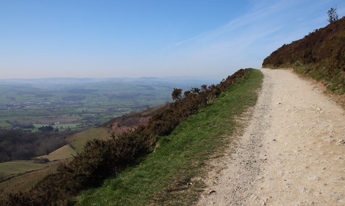 The walk, along a wide, well maintained path, starts very gently and for the first 20 minutes or so is very easy. It becomes much steeper for a fairly short section leading up to the peak, but people of all levels of fitness seemed to be tackling it, some stopping frequently for a breather. It’s worth that last push because the 360º views are breathtaking.
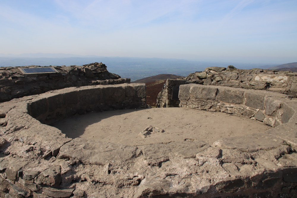
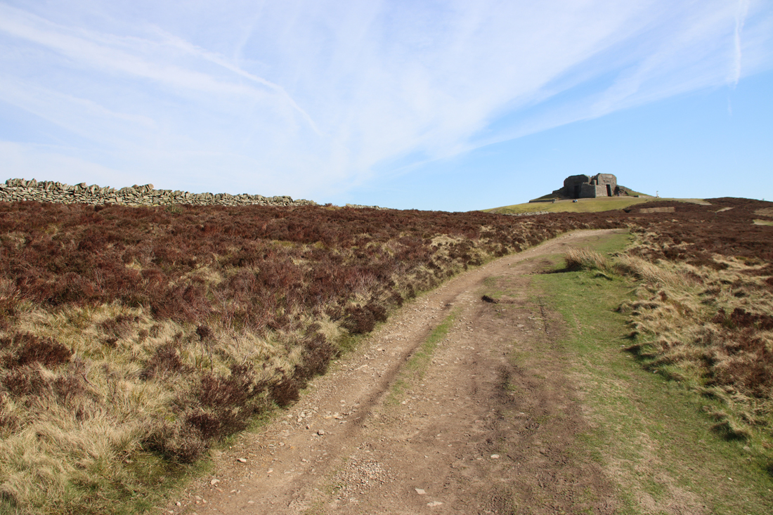
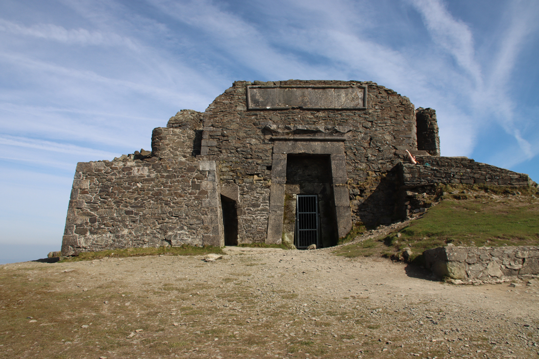 If you climb up the steps to the top of the Egyptian Revival “temple” there are metal plaques explaining the building. It turns out that what we see today is just the stump of a much more ambitious project, the Jubilee Tower, which included an obelisk. It was designed by architect Thomas Harrison, and was built to celebrate the Golden Jubilee of George III in 1810, paid for by public subscription, with Flintshire magistrate Lord Kenyon laying the foundation stone in October of that year. Harrison’s buildings in Chester are far less frivolous, with most of his work in the Neoclassical style, including the Grosvenor Bridge and the Propylaeum (monumental gateway) into Chester Castle and the Neoclassical building that is now owned by the university but was previously occupied by the council as its Shire Hall. The building materials were taken up by horse and cart. The design of the obelisk was modified during construction, with a shorter and stumpier version being completed in about 1817 after a break in work due to financial difficulties and a dispute between Harrison and the builder. Unfortunately the obelisk soon started to deteriorate, and eventually collapsed in a storm in 1862. The rest of the structure continued to decay until 1970 when it underwent restoration, and in 2013 it again required significant restoration work. Here’s the Coflein description of the Jubilee Tower:
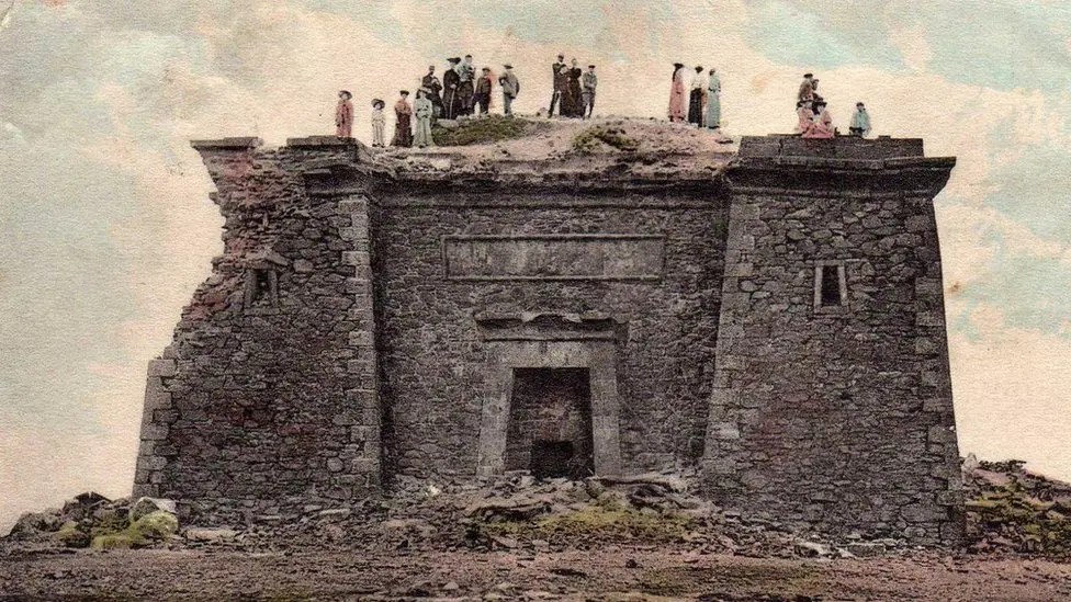
The Jubilee Tower in the Edwardian period. Source: BBC News
The monument now survives as a battered plinth, 12-15m diameter, of roughly coursed rubble stone. Located on a mound which may be artificial. Each face has a central blind doorway of dressed stone, in simple Egyptian style, under a roll-moulded lintel; roughly hewn cornice or hoodmould. Above these blind openings are broad rectangular panels of dressed freestone with roll-moulded surrounds. The corners of the monument have stone and concrete steps, starting from low square projections, which lead to the centre of the monument. Inside are the circular rubble stone footings of a former higher section of tower, 6m in diameter. Around the outside of the monument is a renewed retaining wall 0.5-1m high, open at the corners. A plaque reads ‘Cefn Gwlad award 1970’, with Prince of Wales emblems.
The Egyptian Revival followed Napoleon’s invasion of Egypt in 1798. He took with him over 100 specialists, the “savants,” amongst whom were artists and draughtsmen who recorded the ancient Egyptian temples.
 One of the first and very popular books to publish these images was Dominique Vivant-Denon’s “Journeys in Upper and Lower Egypt” published in 1802. Even before Jean-François Champollion’s translation of hieroglyphs in 1822, and over a century before Howard Carter’s discovery of the tomb of Tutankhamen in 1922, Egypt had wriggled its way firmly into the British imagination. Even so, I would love to have been at the meeting where plonking a pseudo-Egyptian monument on the top of a remote beauty spot in honour of the king’s jubilee was presented as a such a good idea that people invested in it.
Also on the top of the temple are plaques showing the names of the hills all around, with Cadair Idris and Snowdonia visible as silvery silhouettes through the slight haze, and the Moel Arthur hillfort next along on the Clwydian Range.
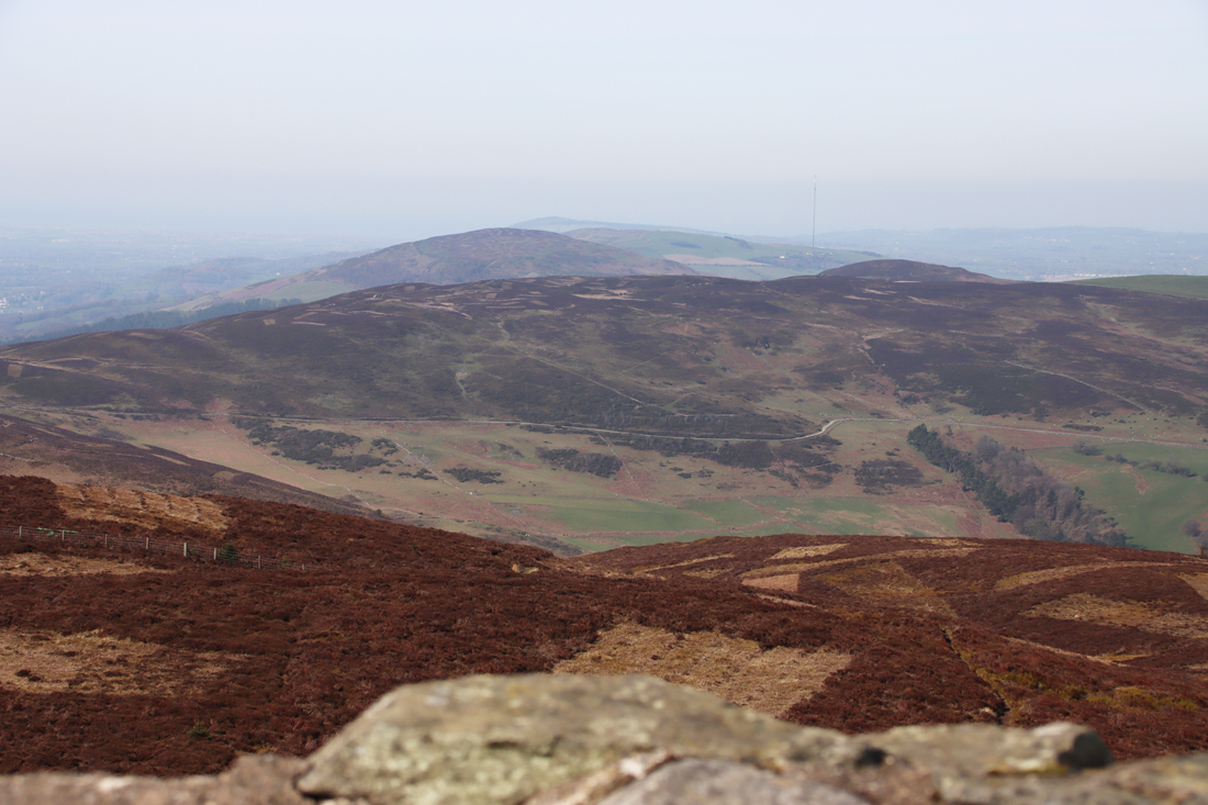
Looking northeast towards Prestatyn across Moel Arthur and Penycloddiau hillforts from the top of Jubilee Tower
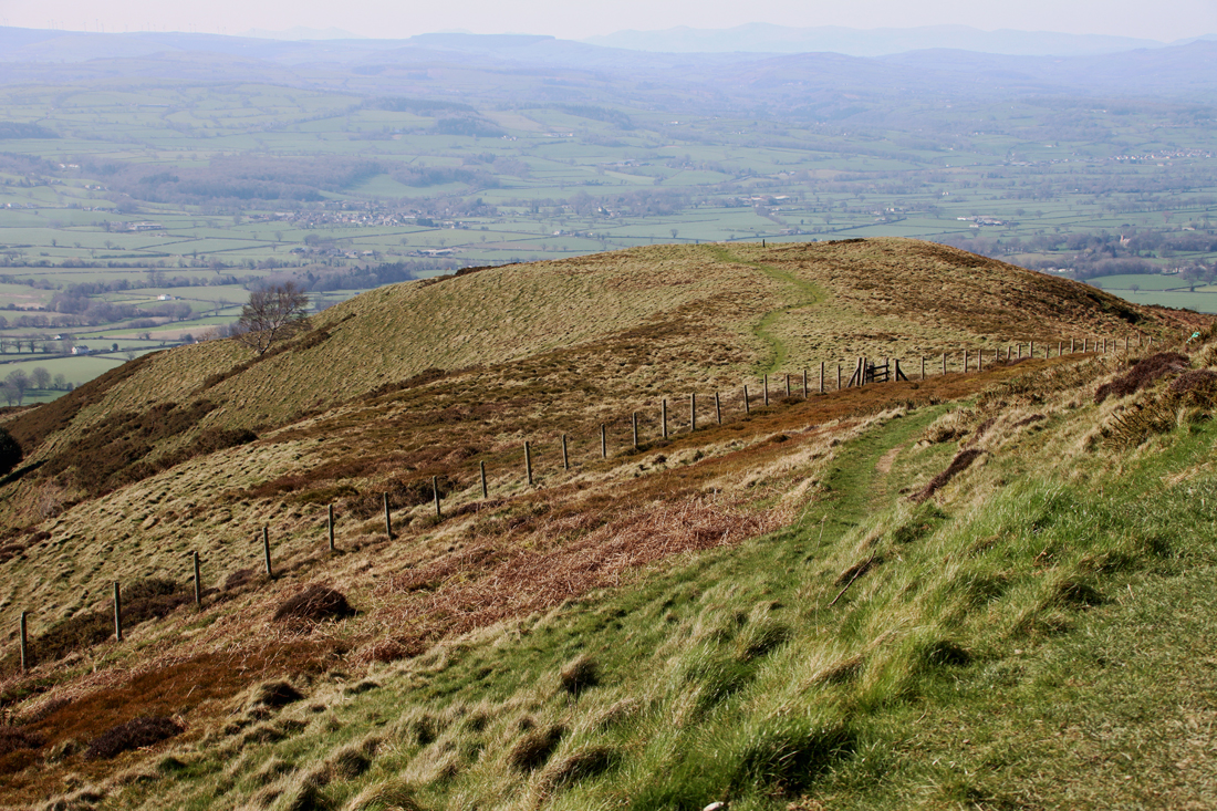
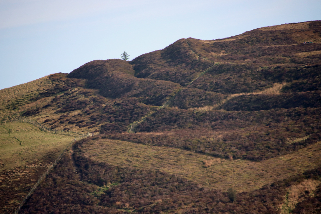
Moel y Gaer hillfort
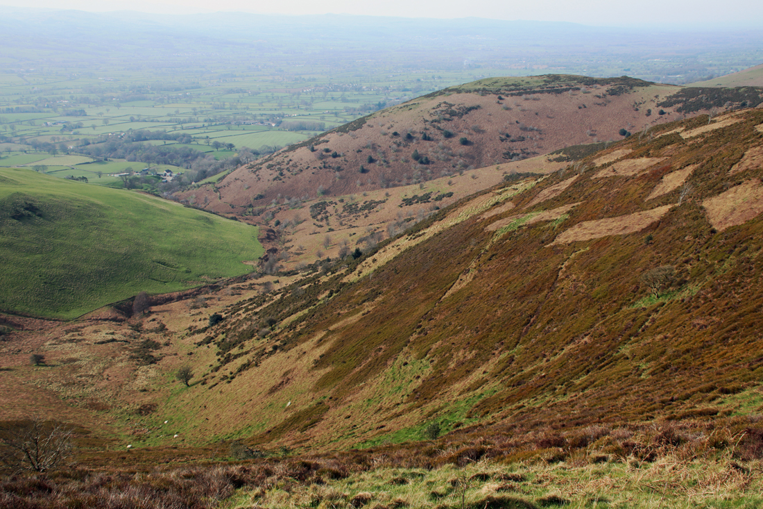
If you are a fan of the Iron Age this is a terrific walk. The path passes Moel y Gaer, which sits on a spur of the hillside, and is a piece of absolute perfection. It is not on a public footpath, but it is clearly visible from the main route up Moel Famau. Its banks and ditches form an elegant tiara, and its position overlooking the Vale of Clwyd is superb. Once you have reached the peak of Moel Famau, the hill housing the Moel Arthur hillfort is clearly visible, with Penycloddiau beyond. Foel Fenlli is a walk in its own right, but it is an important part of the walk back down from Moel Famau, because its vast banks and ditches are clearly outlined against a bright sky, yelling its late prehistoric credentials, a far more aggressive and prominent statement than Moel y Gaer.
The impressive fortifications of Foel Fenlli, as seen from the Moel y Gaer path
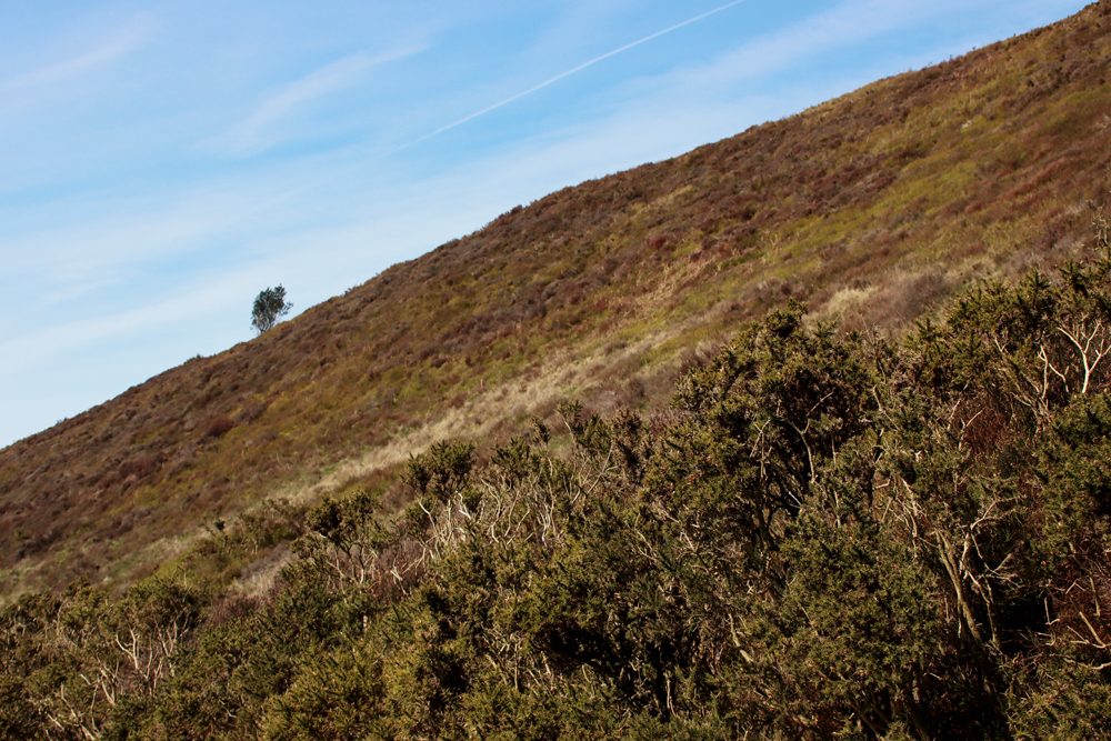
Apart from the acres of dark brown heather and the bright spring green of the valley below, there is not a lot of plant life to see at this time of year, although it is very striking without a floral contribution. The heather, dark chestnut brown and lifeless at this time of year, has been cut into a peculiar pattern of rectangles to encourage new growth, apparently for the benefit of wildlife. There is not much in the way of shrubs and the trees in the wood are conifer plantations. There are plenty of birds of prey if you have equipped yourself with binoculars. I look forward to visiting again when the heather is in flower in late summer, which should be stunning.
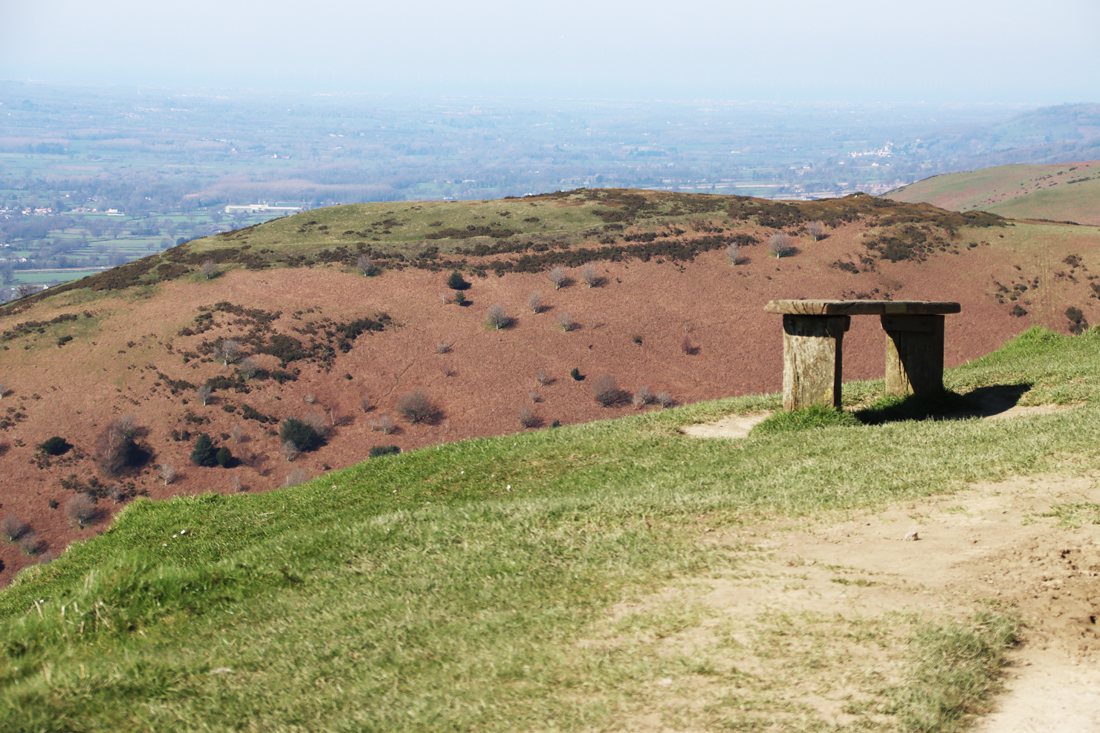
 It is about a 40 minute walk up, although I forgot to take a note of the times in either direction and have the impression that it took me only about half an hour back down, with extra time added for pausing to enjoy the views and for lazy mellowing and exploring the monument at the top. I am something of a route-marcher, so that needs to be taken into account. You can walk on beyond Moel Famau in various directions on public footpaths. Most obviously the path continues, in a much narrower form, across the Clwydian Range, which looks like an absolutely splendid option. If you have the energy, you can walk to the village of Bodfari, in another pass through the Clwydian Range, whilst the Offa’s Dyke Trail goes all the way to Prestatyn. In the opposite direction, you can follow the route over Foel Fenlli all the way to Chirk, skirting the dramatic Eglyseg Mountain and passing Castell Dinas Bran and the Pontcysyllte aqueduct.
It was one of those spring days when everyone looked as though they had been released from a cage, shedding winter like a bad memory. Super. To read more about the environment and archaeology of the Clwydian Range and Llantysilio Mountains see the PDF produced by the Heather and Hillforts project.
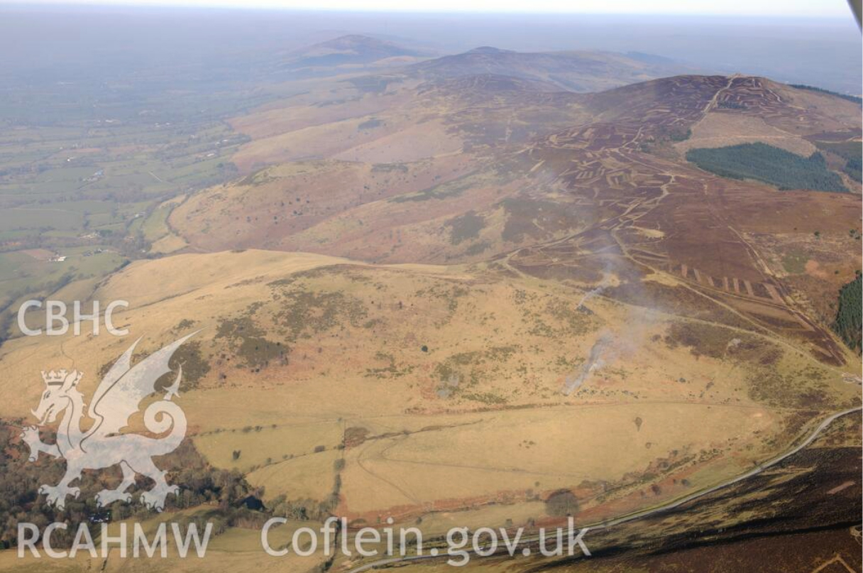
Aerial view of the Clwydian Range. Coflein image 662395. Source: Coflein
