
 In 2013 a track across the wetlands from Connah’s Quay via Burton Point to Neston was opened. As part of the Sustrans cycle network it is known as Route 568 or The Burton Marsh Greenway, and an information board at the point where the route meets Station Road (see map at end) says that this section is now also part of the “King Charles III England Coast Path.” This section of the route, Burton Marsh, is partly made up of metalled lane, and partly boardwalk, and is a terrific walk. I had never heard of it until I was standing in what remains of the hillfort on Burton Point headland, part of the RSPB reserve, and saw it passing almost at our feet and beyond into the distance. It is an extraordinary sight, a mainly straight track across the landscape, and such a brilliant idea.
 I parked on the section of Station Road that runs parallel to the estuary, which is part of the cycle route to Chester, and is separated from the rest of the Burton Marsh stretch of track by a gate to keep the sheep in. There’s a map showing where the parking is located towards the end of this post. This walks is all particularly beautiful on a sunny day with a blue sky stretching to the horizon. A shifting sky, which one moment produced sun and the next light shade, brought out the textures and colours for miles around. Because the estuary is so flat and vast it can be very breezy or windy, which was no bad thing on a particularly sticky July day!

I headed through the gate in the Chester direction. Starting out from this point you are on a metalled lane and have fields rising on your left, currently planted with palest yellow barley, whilst on your right are marshland habitats stretching all the way to the river Dee running along the Welsh side of the estuary, with every shade of green you can imagine, dotted with bright clumps of flowering plants and layer upon layer of different textures.


The barley fields are soon replaced by a fairly short red sandstone cliff edge, which has been heavily quarried over the centuries. Where this red sandstone becomes much more uneven and comes out towards the lane, there is a sign on your right that explains that here are the remains of an Iron Age hillfort at the top of this small headland. This is fenced off, as it is RSPB land.


Burton Point


The lane pulls away from the headland heading out into the wetlands, and soon you find yourself on a long section of boardwalk, which rattles splendidly when cyclists come along, with the marsh habitats either side of you.


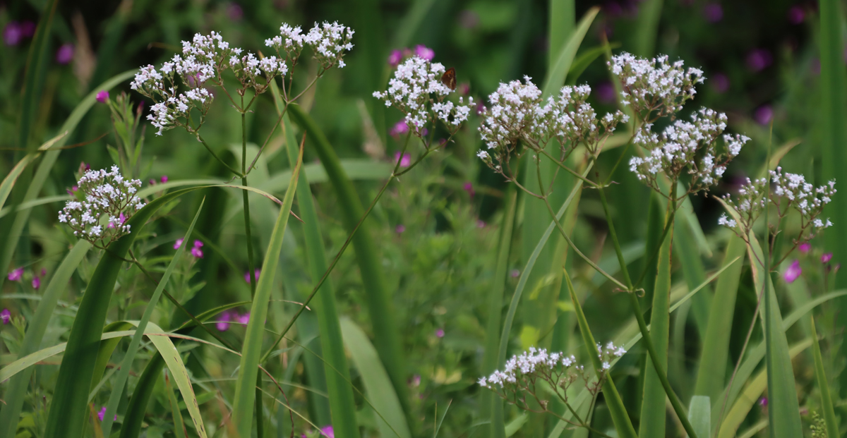


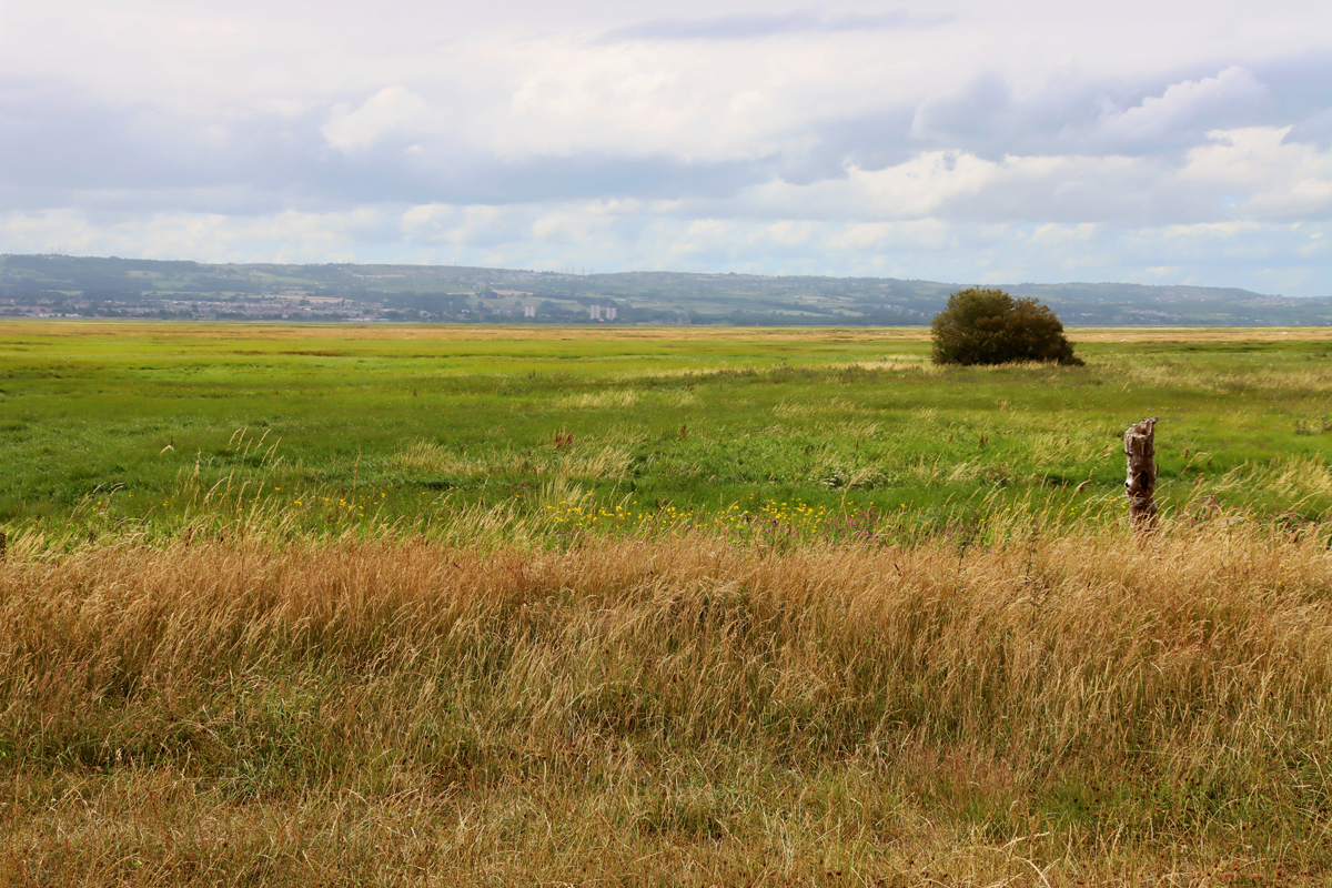
On a clear day the views seem endless as far as the way to the Clwydian Range of Wales. The track gives a sense of how big that landscape actually is, and why it is such a special environment for wildlife, with aquatic plant life as far as the eye can see, and bird life launching itself in and out at surprising and random moments. As well as plenty of Canada and greylag geese, both on the ground and in the air, there were dozens of skylarks, terns flying overhead and birds of prey too high to identify. Unsurprisingly there were plenty of seagulls too. Beneath the surface, there must be an awful lot more going on.


 The intention was to walk for an hour and a half, see where that took me, and then turn back to retrieve the car, but the sudden onset of fairly heavy rain both greyed out the landscape and blocked the view so I only walked for around half an hour before turning around. Even during that short walk, the views were superb and the environment absorbing, and one of the nice things about this is that however far you want to go, and from wherever you start, it lends itself to any length of walk. I was chatting to a man on a bike who had stopped to watch a group of greylag geese, who had cycled from the middle of Chester and was going to visit his father in Neston before turning around and coming back, and by contrast there were a couple who were just out walking a short way with their dog and a child in a pushchair. All very civilized and a great way of introducing a wide range of people to an entirely new environment in a very easy way.


xxx
Visiting from near Burton Point
 You can access the track free of charge from anywhere along its route. Because it is all on the flat, it is suitable not only for walkers and cyclists but those with pushchairs, buggies, and wheelchairs. There was even a man on one of those push-it-with-one-leg adult scooters. There are gates at interfaces with roads because of the sheep. Also because of the sheep there are frequent signs asking owners to keep dogs on short leads. Having been followed for about half a mile by one particular sheep, which stopped and looked fixedly at me every time I turned around to see if it was still following me, I can confirm that sheep are a very likely to be encountered.

I have only done this from just north of Burton Point so far, a short drive from the A540 via the village of Burton, and you can park on the straight section of Station Road that runs along the estuary, and where there is plenty of room to park along the road (what3words: ///recur.films.dream if you have the Google-compatible app on your smartphone). Station Road, as it leads back inland, also has some parking along its edges near to the estuary. I have highlighted the main parking-friendly area on Station Road in the pink box below.

Convenient road-side parking near Burton Point marked in pink. Source: Streetmap.co.uk
If you fancy starting in Chester, you can set off from the Little Roodee car park, go around the Roodee itself, and then follow the track to Connah’s Quay and go from there. Fortunately you don’t have to depend on my finger-in-the-air directions, because Sustrans has its own website with full details for Route 568, which you can find here. It shows the sections where the route meets roads, and where it intersects with other routes in the network.


