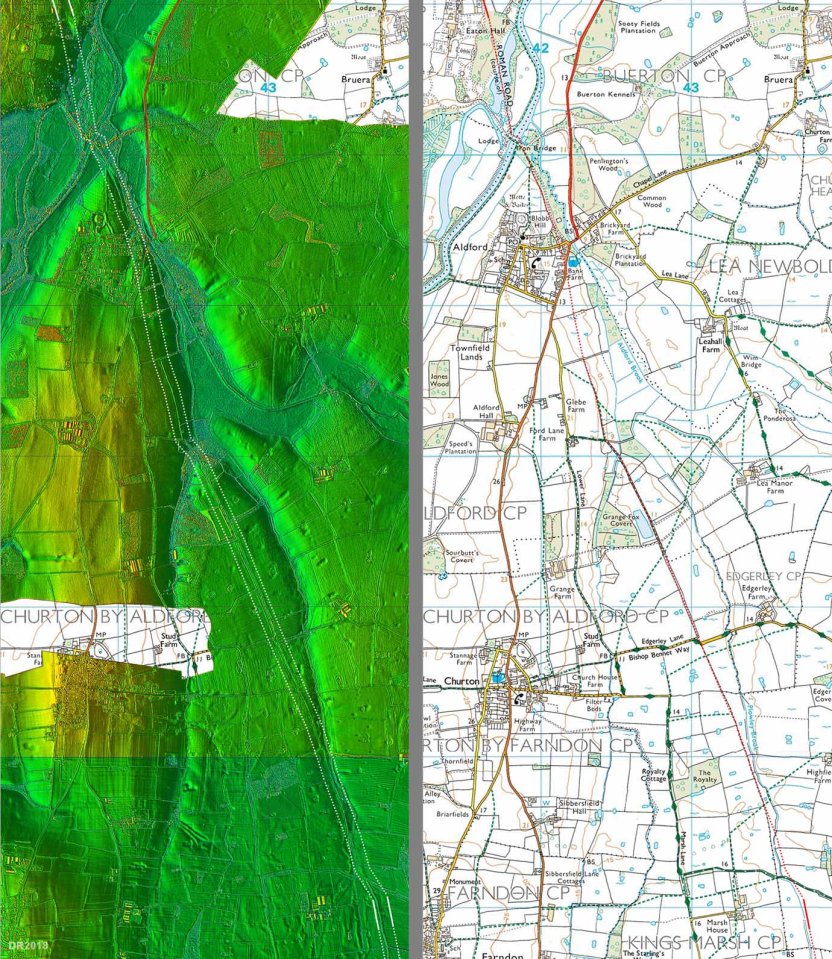
A section of the route of 6a from Aldford to
Churton – LiDAR and Ordnance Survey.
Click to see the bigger image. Source:
Roads of Roman Britain online gazetteer.

A section of the route of 6a from Aldford to
Churton – LiDAR and Ordnance Survey.
Click to see the bigger image. Source:
Roads of Roman Britain online gazetteer.
